Blackhill Range, Canterbury, Neuseeland Sonnenaufgang Sonnenuntergang Zeiten
Location: Neuseeland > Canterbury > Double Hill >
Zeitzone:
Pacific/Auckland
Ortszeit:
2024-05-05 09:30:10
Länge:
171.3958333
Breite:
-43.4216666
Sonnenaufgang Heute:
07:30:41 AM
Sonnenuntergang Heute:
05:31:30 PM
Tageslänge heute:
10h 0m 49s
Sonnenaufgang morgen:
07:31:48 AM
Sonnenuntergang Morgen:
05:30:14 PM
Tageslänge von morgen:
9h 58m 26s
Alle Termine anzeigen
| Datum | Sonnenaufgang | Sonnenuntergang | Tageslänge |
|---|---|---|---|
| 2024-01-01 | 05:56:51 AM | 09:18:08 PM | 15h 21m 17s |
| 2024-01-02 | 05:57:44 AM | 09:18:12 PM | 15h 20m 28s |
| 2024-01-03 | 05:58:38 AM | 09:18:14 PM | 15h 19m 36s |
| 2024-01-04 | 05:59:34 AM | 09:18:13 PM | 15h 18m 39s |
| 2024-01-05 | 06:00:32 AM | 09:18:10 PM | 15h 17m 38s |
| 2024-01-06 | 06:01:32 AM | 09:18:04 PM | 15h 16m 32s |
| 2024-01-07 | 06:02:33 AM | 09:17:56 PM | 15h 15m 23s |
| 2024-01-08 | 06:03:36 AM | 09:17:45 PM | 15h 14m 9s |
| 2024-01-09 | 06:04:41 AM | 09:17:31 PM | 15h 12m 50s |
| 2024-01-10 | 06:05:47 AM | 09:17:15 PM | 15h 11m 28s |
| 2024-01-11 | 06:06:54 AM | 09:16:57 PM | 15h 10m 3s |
| 2024-01-12 | 06:08:03 AM | 09:16:36 PM | 15h 8m 33s |
| 2024-01-13 | 06:09:13 AM | 09:16:12 PM | 15h 6m 59s |
| 2024-01-14 | 06:10:24 AM | 09:15:46 PM | 15h 5m 22s |
| 2024-01-15 | 06:11:36 AM | 09:15:18 PM | 15h 3m 42s |
| 2024-01-16 | 06:12:50 AM | 09:14:47 PM | 15h 1m 57s |
| 2024-01-17 | 06:14:04 AM | 09:14:14 PM | 15h 0m 10s |
| 2024-01-18 | 06:15:20 AM | 09:13:39 PM | 14h 58m 19s |
| 2024-01-19 | 06:16:36 AM | 09:13:01 PM | 14h 56m 25s |
| 2024-01-20 | 06:17:53 AM | 09:12:21 PM | 14h 54m 28s |
| 2024-01-21 | 06:19:11 AM | 09:11:39 PM | 14h 52m 28s |
| 2024-01-22 | 06:20:30 AM | 09:10:54 PM | 14h 50m 24s |
| 2024-01-23 | 06:21:49 AM | 09:10:08 PM | 14h 48m 19s |
| 2024-01-24 | 06:23:09 AM | 09:09:19 PM | 14h 46m 10s |
| 2024-01-25 | 06:24:29 AM | 09:08:28 PM | 14h 43m 59s |
| 2024-01-26 | 06:25:50 AM | 09:07:35 PM | 14h 41m 45s |
| 2024-01-27 | 06:27:12 AM | 09:06:40 PM | 14h 39m 28s |
| 2024-01-28 | 06:28:33 AM | 09:05:43 PM | 14h 37m 10s |
| 2024-01-29 | 06:29:55 AM | 09:04:44 PM | 14h 34m 49s |
| 2024-01-30 | 06:31:18 AM | 09:03:43 PM | 14h 32m 25s |
| 2024-01-31 | 06:32:40 AM | 09:02:40 PM | 14h 30m 0s |
| 2024-02-01 | 06:34:03 AM | 09:01:36 PM | 14h 27m 33s |
| 2024-02-02 | 06:35:26 AM | 09:00:29 PM | 14h 25m 3s |
| 2024-02-03 | 06:36:49 AM | 08:59:21 PM | 14h 22m 32s |
| 2024-02-04 | 06:38:13 AM | 08:58:11 PM | 14h 19m 58s |
| 2024-02-05 | 06:39:36 AM | 08:57:00 PM | 14h 17m 24s |
| 2024-02-06 | 06:40:59 AM | 08:55:46 PM | 14h 14m 47s |
| 2024-02-07 | 06:42:23 AM | 08:54:32 PM | 14h 12m 9s |
| 2024-02-08 | 06:43:46 AM | 08:53:15 PM | 14h 9m 29s |
| 2024-02-09 | 06:45:09 AM | 08:51:57 PM | 14h 6m 48s |
| 2024-02-10 | 06:46:32 AM | 08:50:38 PM | 14h 4m 6s |
| 2024-02-11 | 06:47:55 AM | 08:49:17 PM | 14h 1m 22s |
| 2024-02-12 | 06:49:18 AM | 08:47:55 PM | 13h 58m 37s |
| 2024-02-13 | 06:50:40 AM | 08:46:32 PM | 13h 55m 52s |
| 2024-02-14 | 06:52:03 AM | 08:45:07 PM | 13h 53m 4s |
| 2024-02-15 | 06:53:25 AM | 08:43:41 PM | 13h 50m 16s |
| 2024-02-16 | 06:54:47 AM | 08:42:14 PM | 13h 47m 27s |
| 2024-02-17 | 06:56:08 AM | 08:40:45 PM | 13h 44m 37s |
| 2024-02-18 | 06:57:30 AM | 08:39:16 PM | 13h 41m 46s |
| 2024-02-19 | 06:58:51 AM | 08:37:45 PM | 13h 38m 54s |
| 2024-02-20 | 07:00:12 AM | 08:36:13 PM | 13h 36m 1s |
| 2024-02-21 | 07:01:32 AM | 08:34:40 PM | 13h 33m 8s |
| 2024-02-22 | 07:02:53 AM | 08:33:06 PM | 13h 30m 13s |
| 2024-02-23 | 07:04:12 AM | 08:31:32 PM | 13h 27m 20s |
| 2024-02-24 | 07:05:32 AM | 08:29:56 PM | 13h 24m 24s |
| 2024-02-25 | 07:06:51 AM | 08:28:19 PM | 13h 21m 28s |
| 2024-02-26 | 07:08:10 AM | 08:26:42 PM | 13h 18m 32s |
| 2024-02-27 | 07:09:29 AM | 08:25:04 PM | 13h 15m 35s |
| 2024-02-28 | 07:10:47 AM | 08:23:24 PM | 13h 12m 37s |
| 2024-02-29 | 07:12:05 AM | 08:21:45 PM | 13h 9m 40s |
| 2024-03-01 | 07:13:23 AM | 08:20:04 PM | 13h 6m 41s |
| 2024-03-02 | 07:14:40 AM | 08:18:23 PM | 13h 3m 43s |
| 2024-03-03 | 07:15:57 AM | 08:16:41 PM | 13h 0m 44s |
| 2024-03-04 | 07:17:13 AM | 08:14:59 PM | 12h 57m 46s |
| 2024-03-05 | 07:18:30 AM | 08:13:16 PM | 12h 54m 46s |
| 2024-03-06 | 07:19:46 AM | 08:11:33 PM | 12h 51m 47s |
| 2024-03-07 | 07:21:01 AM | 08:09:49 PM | 12h 48m 48s |
| 2024-03-08 | 07:22:17 AM | 08:08:04 PM | 12h 45m 47s |
| 2024-03-09 | 07:23:32 AM | 08:06:19 PM | 12h 42m 47s |
| 2024-03-10 | 07:24:46 AM | 08:04:34 PM | 12h 39m 48s |
| 2024-03-11 | 07:26:01 AM | 08:02:48 PM | 12h 36m 47s |
| 2024-03-12 | 07:27:15 AM | 08:01:02 PM | 12h 33m 47s |
| 2024-03-13 | 07:28:29 AM | 07:59:16 PM | 12h 30m 47s |
| 2024-03-14 | 07:29:42 AM | 07:57:29 PM | 12h 27m 47s |
| 2024-03-15 | 07:30:56 AM | 07:55:43 PM | 12h 24m 47s |
| 2024-03-16 | 07:32:09 AM | 07:53:56 PM | 12h 21m 47s |
| 2024-03-17 | 07:33:22 AM | 07:52:09 PM | 12h 18m 47s |
| 2024-03-18 | 07:34:34 AM | 07:50:21 PM | 12h 15m 47s |
| 2024-03-19 | 07:35:47 AM | 07:48:34 PM | 12h 12m 47s |
| 2024-03-20 | 07:36:59 AM | 07:46:46 PM | 12h 9m 47s |
| 2024-03-21 | 07:38:11 AM | 07:44:59 PM | 12h 6m 48s |
| 2024-03-22 | 07:39:23 AM | 07:43:11 PM | 12h 3m 48s |
| 2024-03-23 | 07:40:34 AM | 07:41:24 PM | 12h 0m 50s |
| 2024-03-24 | 07:41:46 AM | 07:39:36 PM | 11h 57m 50s |
| 2024-03-25 | 07:42:57 AM | 07:37:49 PM | 11h 54m 52s |
| 2024-03-26 | 07:44:08 AM | 07:36:01 PM | 11h 51m 53s |
| 2024-03-27 | 07:45:19 AM | 07:34:14 PM | 11h 48m 55s |
| 2024-03-28 | 07:46:30 AM | 07:32:27 PM | 11h 45m 57s |
| 2024-03-29 | 07:47:41 AM | 07:30:40 PM | 11h 42m 59s |
| 2024-03-30 | 07:48:51 AM | 07:28:53 PM | 11h 40m 2s |
| 2024-03-31 | 07:50:02 AM | 07:27:07 PM | 11h 37m 5s |
| 2024-04-01 | 07:51:12 AM | 07:25:21 PM | 11h 34m 9s |
| 2024-04-02 | 07:52:23 AM | 07:23:35 PM | 11h 31m 12s |
| 2024-04-03 | 07:53:33 AM | 07:21:50 PM | 11h 28m 17s |
| 2024-04-04 | 07:54:43 AM | 07:20:05 PM | 11h 25m 22s |
| 2024-04-05 | 07:55:53 AM | 07:18:20 PM | 11h 22m 27s |
| 2024-04-06 | 07:57:03 AM | 07:16:36 PM | 11h 19m 33s |
| 2024-04-07 | 06:58:16 AM | 06:14:48 PM | 11h 16m 32s |
| 2024-04-07 | 06:58:16 AM | 06:14:48 PM | 11h 16m 32s |
| 2024-04-08 | 06:59:26 AM | 06:13:04 PM | 11h 13m 38s |
| 2024-04-09 | 07:00:36 AM | 06:11:22 PM | 11h 10m 46s |
| 2024-04-10 | 07:01:46 AM | 06:09:40 PM | 11h 7m 54s |
| 2024-04-11 | 07:02:56 AM | 06:07:58 PM | 11h 5m 2s |
| 2024-04-12 | 07:04:05 AM | 06:06:17 PM | 11h 2m 12s |
| 2024-04-13 | 07:05:15 AM | 06:04:37 PM | 10h 59m 22s |
| 2024-04-14 | 07:06:25 AM | 06:02:57 PM | 10h 56m 32s |
| 2024-04-15 | 07:07:34 AM | 06:01:18 PM | 10h 53m 44s |
| 2024-04-16 | 07:08:44 AM | 05:59:40 PM | 10h 50m 56s |
| 2024-04-17 | 07:09:54 AM | 05:58:03 PM | 10h 48m 9s |
| 2024-04-18 | 07:11:03 AM | 05:56:27 PM | 10h 45m 24s |
| 2024-04-19 | 07:12:13 AM | 05:54:51 PM | 10h 42m 38s |
| 2024-04-20 | 07:13:22 AM | 05:53:16 PM | 10h 39m 54s |
| 2024-04-21 | 07:14:31 AM | 05:51:42 PM | 10h 37m 11s |
| 2024-04-22 | 07:15:41 AM | 05:50:09 PM | 10h 34m 28s |
| 2024-04-23 | 07:16:50 AM | 05:48:38 PM | 10h 31m 48s |
| 2024-04-24 | 07:17:59 AM | 05:47:07 PM | 10h 29m 8s |
| 2024-04-25 | 07:19:08 AM | 05:45:37 PM | 10h 26m 29s |
| 2024-04-26 | 07:20:17 AM | 05:44:08 PM | 10h 23m 51s |
| 2024-04-27 | 07:21:26 AM | 05:42:40 PM | 10h 21m 14s |
| 2024-04-28 | 07:22:35 AM | 05:41:14 PM | 10h 18m 39s |
| 2024-04-29 | 07:23:43 AM | 05:39:49 PM | 10h 16m 6s |
| 2024-04-30 | 07:24:51 AM | 05:38:24 PM | 10h 13m 33s |
| 2024-05-01 | 07:26:00 AM | 05:37:02 PM | 10h 11m 2s |
| 2024-05-02 | 07:27:08 AM | 05:35:40 PM | 10h 8m 32s |
| 2024-05-03 | 07:28:15 AM | 05:34:20 PM | 10h 6m 5s |
| 2024-05-04 | 07:29:23 AM | 05:33:01 PM | 10h 3m 38s |
| 2024-05-05 | 07:30:30 AM | 05:31:43 PM | 10h 1m 13s |
| 2024-05-06 | 07:31:37 AM | 05:30:27 PM | 9h 58m 50s |
| 2024-05-07 | 07:32:44 AM | 05:29:12 PM | 9h 56m 28s |
| 2024-05-08 | 07:33:50 AM | 05:27:59 PM | 9h 54m 9s |
| 2024-05-09 | 07:34:56 AM | 05:26:47 PM | 9h 51m 51s |
| 2024-05-10 | 07:36:02 AM | 05:25:37 PM | 9h 49m 35s |
| 2024-05-11 | 07:37:07 AM | 05:24:28 PM | 9h 47m 21s |
| 2024-05-12 | 07:38:12 AM | 05:23:21 PM | 9h 45m 9s |
| 2024-05-13 | 07:39:16 AM | 05:22:16 PM | 9h 43m 0s |
| 2024-05-14 | 07:40:20 AM | 05:21:12 PM | 9h 40m 52s |
| 2024-05-15 | 07:41:23 AM | 05:20:10 PM | 9h 38m 47s |
| 2024-05-16 | 07:42:25 AM | 05:19:10 PM | 9h 36m 45s |
| 2024-05-17 | 07:43:27 AM | 05:18:11 PM | 9h 34m 44s |
| 2024-05-18 | 07:44:28 AM | 05:17:14 PM | 9h 32m 46s |
| 2024-05-19 | 07:45:29 AM | 05:16:19 PM | 9h 30m 50s |
| 2024-05-20 | 07:46:29 AM | 05:15:26 PM | 9h 28m 57s |
| 2024-05-21 | 07:47:28 AM | 05:14:35 PM | 9h 27m 7s |
| 2024-05-22 | 07:48:26 AM | 05:13:45 PM | 9h 25m 19s |
| 2024-05-23 | 07:49:23 AM | 05:12:58 PM | 9h 23m 35s |
| 2024-05-24 | 07:50:20 AM | 05:12:12 PM | 9h 21m 52s |
| 2024-05-25 | 07:51:15 AM | 05:11:29 PM | 9h 20m 14s |
| 2024-05-26 | 07:52:10 AM | 05:10:47 PM | 9h 18m 37s |
| 2024-05-27 | 07:53:03 AM | 05:10:07 PM | 9h 17m 4s |
| 2024-05-28 | 07:53:56 AM | 05:09:30 PM | 9h 15m 34s |
| 2024-05-29 | 07:54:47 AM | 05:08:54 PM | 9h 14m 7s |
| 2024-05-30 | 07:55:37 AM | 05:08:20 PM | 9h 12m 43s |
| 2024-05-31 | 07:56:26 AM | 05:07:49 PM | 9h 11m 23s |
| 2024-06-01 | 07:57:13 AM | 05:07:19 PM | 9h 10m 6s |
| 2024-06-02 | 07:57:59 AM | 05:06:52 PM | 9h 8m 53s |
| 2024-06-03 | 07:58:44 AM | 05:06:27 PM | 9h 7m 43s |
| 2024-06-04 | 07:59:28 AM | 05:06:04 PM | 9h 6m 36s |
| 2024-06-05 | 08:00:10 AM | 05:05:43 PM | 9h 5m 33s |
| 2024-06-06 | 08:00:51 AM | 05:05:24 PM | 9h 4m 33s |
| 2024-06-07 | 08:01:30 AM | 05:05:07 PM | 9h 3m 37s |
| 2024-06-08 | 08:02:07 AM | 05:04:52 PM | 9h 2m 45s |
| 2024-06-09 | 08:02:43 AM | 05:04:40 PM | 9h 1m 57s |
| 2024-06-10 | 08:03:17 AM | 05:04:30 PM | 9h 1m 13s |
| 2024-06-11 | 08:03:50 AM | 05:04:21 PM | 9h 0m 31s |
| 2024-06-12 | 08:04:21 AM | 05:04:15 PM | 8h 59m 54s |
| 2024-06-13 | 08:04:50 AM | 05:04:11 PM | 8h 59m 21s |
| 2024-06-14 | 08:05:17 AM | 05:04:09 PM | 8h 58m 52s |
| 2024-06-15 | 08:05:42 AM | 05:04:09 PM | 8h 58m 27s |
| 2024-06-16 | 08:06:06 AM | 05:04:12 PM | 8h 58m 6s |
| 2024-06-17 | 08:06:28 AM | 05:04:16 PM | 8h 57m 48s |
| 2024-06-18 | 08:06:47 AM | 05:04:22 PM | 8h 57m 35s |
| 2024-06-19 | 08:07:05 AM | 05:04:31 PM | 8h 57m 26s |
| 2024-06-20 | 08:07:21 AM | 05:04:41 PM | 8h 57m 20s |
| 2024-06-21 | 08:07:35 AM | 05:04:53 PM | 8h 57m 18s |
| 2024-06-22 | 08:07:46 AM | 05:05:08 PM | 8h 57m 22s |
| 2024-06-23 | 08:07:56 AM | 05:05:24 PM | 8h 57m 28s |
| 2024-06-24 | 08:08:04 AM | 05:05:42 PM | 8h 57m 38s |
| 2024-06-25 | 08:08:09 AM | 05:06:02 PM | 8h 57m 53s |
| 2024-06-26 | 08:08:12 AM | 05:06:24 PM | 8h 58m 12s |
| 2024-06-27 | 08:08:14 AM | 05:06:48 PM | 8h 58m 34s |
| 2024-06-28 | 08:08:13 AM | 05:07:14 PM | 8h 59m 1s |
| 2024-06-29 | 08:08:10 AM | 05:07:41 PM | 8h 59m 31s |
| 2024-06-30 | 08:08:05 AM | 05:08:10 PM | 9h 0m 5s |
| 2024-07-01 | 08:07:57 AM | 05:08:41 PM | 9h 0m 44s |
| 2024-07-02 | 08:07:48 AM | 05:09:13 PM | 9h 1m 25s |
| 2024-07-03 | 08:07:36 AM | 05:09:47 PM | 9h 2m 11s |
| 2024-07-04 | 08:07:22 AM | 05:10:22 PM | 9h 3m 0s |
| 2024-07-05 | 08:07:06 AM | 05:10:59 PM | 9h 3m 53s |
| 2024-07-06 | 08:06:48 AM | 05:11:38 PM | 9h 4m 50s |
| 2024-07-07 | 08:06:27 AM | 05:12:18 PM | 9h 5m 51s |
| 2024-07-08 | 08:06:05 AM | 05:12:59 PM | 9h 6m 54s |
| 2024-07-09 | 08:05:40 AM | 05:13:42 PM | 9h 8m 2s |
| 2024-07-10 | 08:05:13 AM | 05:14:26 PM | 9h 9m 13s |
| 2024-07-11 | 08:04:44 AM | 05:15:11 PM | 9h 10m 27s |
| 2024-07-12 | 08:04:13 AM | 05:15:57 PM | 9h 11m 44s |
| 2024-07-13 | 08:03:40 AM | 05:16:45 PM | 9h 13m 5s |
| 2024-07-14 | 08:03:05 AM | 05:17:34 PM | 9h 14m 29s |
| 2024-07-15 | 08:02:28 AM | 05:18:23 PM | 9h 15m 55s |
| 2024-07-16 | 08:01:48 AM | 05:19:14 PM | 9h 17m 26s |
| 2024-07-17 | 08:01:07 AM | 05:20:06 PM | 9h 18m 59s |
| 2024-07-18 | 08:00:23 AM | 05:20:59 PM | 9h 20m 36s |
| 2024-07-19 | 07:59:38 AM | 05:21:52 PM | 9h 22m 14s |
| 2024-07-20 | 07:58:51 AM | 05:22:47 PM | 9h 23m 56s |
| 2024-07-21 | 07:58:01 AM | 05:23:42 PM | 9h 25m 41s |
| 2024-07-22 | 07:57:10 AM | 05:24:38 PM | 9h 27m 28s |
| 2024-07-23 | 07:56:17 AM | 05:25:35 PM | 9h 29m 18s |
| 2024-07-24 | 07:55:22 AM | 05:26:33 PM | 9h 31m 11s |
| 2024-07-25 | 07:54:25 AM | 05:27:31 PM | 9h 33m 6s |
| 2024-07-26 | 07:53:26 AM | 05:28:30 PM | 9h 35m 4s |
| 2024-07-27 | 07:52:26 AM | 05:29:29 PM | 9h 37m 3s |
| 2024-07-28 | 07:51:24 AM | 05:30:29 PM | 9h 39m 5s |
| 2024-07-29 | 07:50:20 AM | 05:31:30 PM | 9h 41m 10s |
| 2024-07-30 | 07:49:14 AM | 05:32:31 PM | 9h 43m 17s |
| 2024-07-31 | 07:48:07 AM | 05:33:32 PM | 9h 45m 25s |
| 2024-08-01 | 07:46:58 AM | 05:34:34 PM | 9h 47m 36s |
| 2024-08-02 | 07:45:48 AM | 05:35:36 PM | 9h 49m 48s |
| 2024-08-03 | 07:44:36 AM | 05:36:39 PM | 9h 52m 3s |
| 2024-08-04 | 07:43:22 AM | 05:37:41 PM | 9h 54m 19s |
| 2024-08-05 | 07:42:07 AM | 05:38:45 PM | 9h 56m 38s |
| 2024-08-06 | 07:40:50 AM | 05:39:48 PM | 9h 58m 58s |
| 2024-08-07 | 07:39:33 AM | 05:40:52 PM | 10h 1m 19s |
| 2024-08-08 | 07:38:13 AM | 05:41:56 PM | 10h 3m 43s |
| 2024-08-09 | 07:36:52 AM | 05:43:00 PM | 10h 6m 8s |
| 2024-08-10 | 07:35:30 AM | 05:44:04 PM | 10h 8m 34s |
| 2024-08-11 | 07:34:07 AM | 05:45:08 PM | 10h 11m 1s |
| 2024-08-12 | 07:32:42 AM | 05:46:13 PM | 10h 13m 31s |
| 2024-08-13 | 07:31:16 AM | 05:47:18 PM | 10h 16m 2s |
| 2024-08-14 | 07:29:49 AM | 05:48:23 PM | 10h 18m 34s |
| 2024-08-15 | 07:28:21 AM | 05:49:28 PM | 10h 21m 7s |
| 2024-08-16 | 07:26:51 AM | 05:50:33 PM | 10h 23m 42s |
| 2024-08-17 | 07:25:21 AM | 05:51:38 PM | 10h 26m 17s |
| 2024-08-18 | 07:23:49 AM | 05:52:43 PM | 10h 28m 54s |
| 2024-08-19 | 07:22:17 AM | 05:53:48 PM | 10h 31m 31s |
| 2024-08-20 | 07:20:43 AM | 05:54:53 PM | 10h 34m 10s |
| 2024-08-21 | 07:19:08 AM | 05:55:59 PM | 10h 36m 51s |
| 2024-08-22 | 07:17:33 AM | 05:57:04 PM | 10h 39m 31s |
| 2024-08-23 | 07:15:56 AM | 05:58:09 PM | 10h 42m 13s |
| 2024-08-24 | 07:14:19 AM | 05:59:15 PM | 10h 44m 56s |
| 2024-08-25 | 07:12:40 AM | 06:00:20 PM | 10h 47m 40s |
| 2024-08-26 | 07:11:01 AM | 06:01:25 PM | 10h 50m 24s |
| 2024-08-27 | 07:09:21 AM | 06:02:31 PM | 10h 53m 10s |
| 2024-08-28 | 07:07:41 AM | 06:03:36 PM | 10h 55m 55s |
| 2024-08-29 | 07:06:00 AM | 06:04:41 PM | 10h 58m 41s |
| 2024-08-30 | 07:04:18 AM | 06:05:47 PM | 11h 1m 29s |
| 2024-08-31 | 07:02:35 AM | 06:06:52 PM | 11h 4m 17s |
| 2024-09-01 | 07:00:52 AM | 06:07:57 PM | 11h 7m 5s |
| 2024-09-02 | 06:59:08 AM | 06:09:03 PM | 11h 9m 55s |
| 2024-09-03 | 06:57:23 AM | 06:10:08 PM | 11h 12m 45s |
| 2024-09-04 | 06:55:38 AM | 06:11:14 PM | 11h 15m 36s |
| 2024-09-05 | 06:53:53 AM | 06:12:19 PM | 11h 18m 26s |
| 2024-09-06 | 06:52:07 AM | 06:13:25 PM | 11h 21m 18s |
| 2024-09-07 | 06:50:20 AM | 06:14:30 PM | 11h 24m 10s |
| 2024-09-08 | 06:48:33 AM | 06:15:36 PM | 11h 27m 3s |
| 2024-09-09 | 06:46:46 AM | 06:16:41 PM | 11h 29m 55s |
| 2024-09-10 | 06:44:58 AM | 06:17:47 PM | 11h 32m 49s |
| 2024-09-11 | 06:43:11 AM | 06:18:53 PM | 11h 35m 42s |
| 2024-09-12 | 06:41:22 AM | 06:19:59 PM | 11h 38m 37s |
| 2024-09-13 | 06:39:34 AM | 06:21:05 PM | 11h 41m 31s |
| 2024-09-14 | 06:37:45 AM | 06:22:11 PM | 11h 44m 26s |
| 2024-09-15 | 06:35:56 AM | 06:23:17 PM | 11h 47m 21s |
| 2024-09-16 | 06:34:07 AM | 06:24:23 PM | 11h 50m 16s |
| 2024-09-17 | 06:32:18 AM | 06:25:29 PM | 11h 53m 11s |
| 2024-09-18 | 06:30:28 AM | 06:26:36 PM | 11h 56m 8s |
| 2024-09-19 | 06:28:39 AM | 06:27:43 PM | 11h 59m 4s |
| 2024-09-20 | 06:26:49 AM | 06:28:49 PM | 12h 2m 0s |
| 2024-09-21 | 06:25:00 AM | 06:29:56 PM | 12h 4m 56s |
| 2024-09-22 | 06:23:10 AM | 06:31:04 PM | 12h 7m 54s |
| 2024-09-23 | 06:21:21 AM | 06:32:11 PM | 12h 10m 50s |
| 2024-09-24 | 06:19:31 AM | 06:33:18 PM | 12h 13m 47s |
| 2024-09-25 | 06:17:42 AM | 06:34:26 PM | 12h 16m 44s |
| 2024-09-26 | 06:15:53 AM | 06:35:34 PM | 12h 19m 41s |
| 2024-09-27 | 06:14:03 AM | 06:36:42 PM | 12h 22m 39s |
| 2024-09-28 | 06:12:15 AM | 06:37:51 PM | 12h 25m 36s |
| 2024-09-30 | 07:08:42 AM | 07:40:06 PM | 12h 31m 24s |
| 2024-10-01 | 07:06:54 AM | 07:41:15 PM | 12h 34m 21s |
| 2024-10-02 | 07:05:06 AM | 07:42:24 PM | 12h 37m 18s |
| 2024-10-03 | 07:03:18 AM | 07:43:34 PM | 12h 40m 16s |
| 2024-10-04 | 07:01:31 AM | 07:44:44 PM | 12h 43m 13s |
| 2024-10-05 | 06:59:44 AM | 07:45:54 PM | 12h 46m 10s |
| 2024-10-06 | 06:57:58 AM | 07:47:05 PM | 12h 49m 7s |
| 2024-10-07 | 06:56:12 AM | 07:48:16 PM | 12h 52m 4s |
| 2024-10-08 | 06:54:27 AM | 07:49:28 PM | 12h 55m 1s |
| 2024-10-09 | 06:52:42 AM | 07:50:39 PM | 12h 57m 57s |
| 2024-10-10 | 06:50:57 AM | 07:51:51 PM | 13h 0m 54s |
| 2024-10-11 | 06:49:14 AM | 07:53:04 PM | 13h 3m 50s |
| 2024-10-12 | 06:47:31 AM | 07:54:16 PM | 13h 6m 45s |
| 2024-10-13 | 06:45:48 AM | 07:55:30 PM | 13h 9m 42s |
| 2024-10-14 | 06:44:07 AM | 07:56:43 PM | 13h 12m 36s |
| 2024-10-15 | 06:42:26 AM | 07:57:57 PM | 13h 15m 31s |
| 2024-10-16 | 06:40:45 AM | 07:59:11 PM | 13h 18m 26s |
| 2024-10-17 | 06:39:06 AM | 08:00:25 PM | 13h 21m 19s |
| 2024-10-18 | 06:37:27 AM | 08:01:40 PM | 13h 24m 13s |
| 2024-10-19 | 06:35:50 AM | 08:02:56 PM | 13h 27m 6s |
| 2024-10-20 | 06:34:13 AM | 08:04:11 PM | 13h 29m 58s |
| 2024-10-21 | 06:32:37 AM | 08:05:27 PM | 13h 32m 50s |
| 2024-10-22 | 06:31:02 AM | 08:06:43 PM | 13h 35m 41s |
| 2024-10-23 | 06:29:28 AM | 08:08:00 PM | 13h 38m 32s |
| 2024-10-24 | 06:27:56 AM | 08:09:17 PM | 13h 41m 21s |
| 2024-10-25 | 06:26:24 AM | 08:10:34 PM | 13h 44m 10s |
| 2024-10-26 | 06:24:53 AM | 08:11:52 PM | 13h 46m 59s |
| 2024-10-27 | 06:23:24 AM | 08:13:10 PM | 13h 49m 46s |
| 2024-10-28 | 06:21:56 AM | 08:14:28 PM | 13h 52m 32s |
| 2024-10-29 | 06:20:29 AM | 08:15:46 PM | 13h 55m 17s |
| 2024-10-30 | 06:19:03 AM | 08:17:05 PM | 13h 58m 2s |
| 2024-10-31 | 06:17:39 AM | 08:18:24 PM | 14h 0m 45s |
| 2024-11-01 | 06:16:16 AM | 08:19:43 PM | 14h 3m 27s |
| 2024-11-02 | 06:14:55 AM | 08:21:02 PM | 14h 6m 7s |
| 2024-11-03 | 06:13:34 AM | 08:22:22 PM | 14h 8m 48s |
| 2024-11-04 | 06:12:16 AM | 08:23:41 PM | 14h 11m 25s |
| 2024-11-05 | 06:10:59 AM | 08:25:01 PM | 14h 14m 2s |
| 2024-11-06 | 06:09:43 AM | 08:26:21 PM | 14h 16m 38s |
| 2024-11-07 | 06:08:30 AM | 08:27:40 PM | 14h 19m 10s |
| 2024-11-08 | 06:07:17 AM | 08:29:00 PM | 14h 21m 43s |
| 2024-11-09 | 06:06:07 AM | 08:30:20 PM | 14h 24m 13s |
| 2024-11-10 | 06:04:58 AM | 08:31:40 PM | 14h 26m 42s |
| 2024-11-11 | 06:03:51 AM | 08:33:00 PM | 14h 29m 9s |
| 2024-11-12 | 06:02:46 AM | 08:34:19 PM | 14h 31m 33s |
| 2024-11-13 | 06:01:43 AM | 08:35:39 PM | 14h 33m 56s |
| 2024-11-14 | 06:00:41 AM | 08:36:58 PM | 14h 36m 17s |
| 2024-11-15 | 05:59:42 AM | 08:38:17 PM | 14h 38m 35s |
| 2024-11-16 | 05:58:45 AM | 08:39:36 PM | 14h 40m 51s |
| 2024-11-17 | 05:57:49 AM | 08:40:54 PM | 14h 43m 5s |
| 2024-11-18 | 05:56:56 AM | 08:42:12 PM | 14h 45m 16s |
| 2024-11-19 | 05:56:05 AM | 08:43:29 PM | 14h 47m 24s |
| 2024-11-20 | 05:55:16 AM | 08:44:46 PM | 14h 49m 30s |
| 2024-11-21 | 05:54:29 AM | 08:46:03 PM | 14h 51m 34s |
| 2024-11-22 | 05:53:44 AM | 08:47:19 PM | 14h 53m 35s |
| 2024-11-23 | 05:53:01 AM | 08:48:34 PM | 14h 55m 33s |
| 2024-11-24 | 05:52:21 AM | 08:49:48 PM | 14h 57m 27s |
| 2024-11-25 | 05:51:43 AM | 08:51:02 PM | 14h 59m 19s |
| 2024-11-26 | 05:51:08 AM | 08:52:15 PM | 15h 1m 7s |
| 2024-11-27 | 05:50:35 AM | 08:53:27 PM | 15h 2m 52s |
| 2024-11-28 | 05:50:04 AM | 08:54:38 PM | 15h 4m 34s |
| 2024-11-29 | 05:49:35 AM | 08:55:47 PM | 15h 6m 12s |
| 2024-11-30 | 05:49:10 AM | 08:56:56 PM | 15h 7m 46s |
| 2024-12-01 | 05:48:46 AM | 08:58:04 PM | 15h 9m 18s |
| 2024-12-02 | 05:48:25 AM | 08:59:10 PM | 15h 10m 45s |
| 2024-12-03 | 05:48:07 AM | 09:00:16 PM | 15h 12m 9s |
| 2024-12-04 | 05:47:51 AM | 09:01:19 PM | 15h 13m 28s |
| 2024-12-05 | 05:47:38 AM | 09:02:22 PM | 15h 14m 44s |
| 2024-12-06 | 05:47:27 AM | 09:03:23 PM | 15h 15m 56s |
| 2024-12-07 | 05:47:19 AM | 09:04:22 PM | 15h 17m 3s |
| 2024-12-08 | 05:47:13 AM | 09:05:20 PM | 15h 18m 7s |
| 2024-12-09 | 05:47:10 AM | 09:06:16 PM | 15h 19m 6s |
| 2024-12-10 | 05:47:10 AM | 09:07:11 PM | 15h 20m 1s |
| 2024-12-11 | 05:47:12 AM | 09:08:03 PM | 15h 20m 51s |
| 2024-12-12 | 05:47:17 AM | 09:08:54 PM | 15h 21m 37s |
| 2024-12-13 | 05:47:25 AM | 09:09:43 PM | 15h 22m 18s |
| 2024-12-14 | 05:47:35 AM | 09:10:30 PM | 15h 22m 55s |
| 2024-12-15 | 05:47:47 AM | 09:11:15 PM | 15h 23m 28s |
| 2024-12-16 | 05:48:02 AM | 09:11:58 PM | 15h 23m 56s |
| 2024-12-17 | 05:48:20 AM | 09:12:38 PM | 15h 24m 18s |
| 2024-12-18 | 05:48:40 AM | 09:13:17 PM | 15h 24m 37s |
| 2024-12-19 | 05:49:03 AM | 09:13:53 PM | 15h 24m 50s |
| 2024-12-20 | 05:49:28 AM | 09:14:28 PM | 15h 25m 0s |
| 2024-12-21 | 05:49:56 AM | 09:15:00 PM | 15h 25m 4s |
| 2024-12-22 | 05:50:26 AM | 09:15:29 PM | 15h 25m 3s |
| 2024-12-23 | 05:50:58 AM | 09:15:56 PM | 15h 24m 58s |
| 2024-12-24 | 05:51:33 AM | 09:16:21 PM | 15h 24m 48s |
| 2024-12-25 | 05:52:10 AM | 09:16:44 PM | 15h 24m 34s |
| 2024-12-26 | 05:52:50 AM | 09:17:04 PM | 15h 24m 14s |
| 2024-12-27 | 05:53:31 AM | 09:17:21 PM | 15h 23m 50s |
| 2024-12-28 | 05:54:15 AM | 09:17:36 PM | 15h 23m 21s |
| 2024-12-29 | 05:55:01 AM | 09:17:49 PM | 15h 22m 48s |
| 2024-12-30 | 05:55:49 AM | 09:17:59 PM | 15h 22m 10s |
Fotos

Lake Coleridge Sunset...

Sunset at the Power Station Intake..
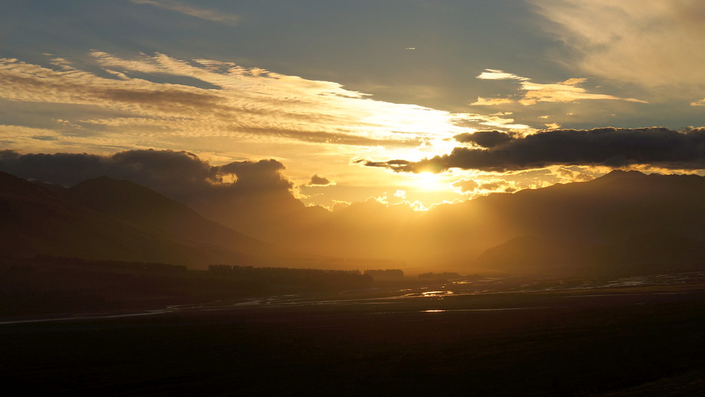
rakai sunset
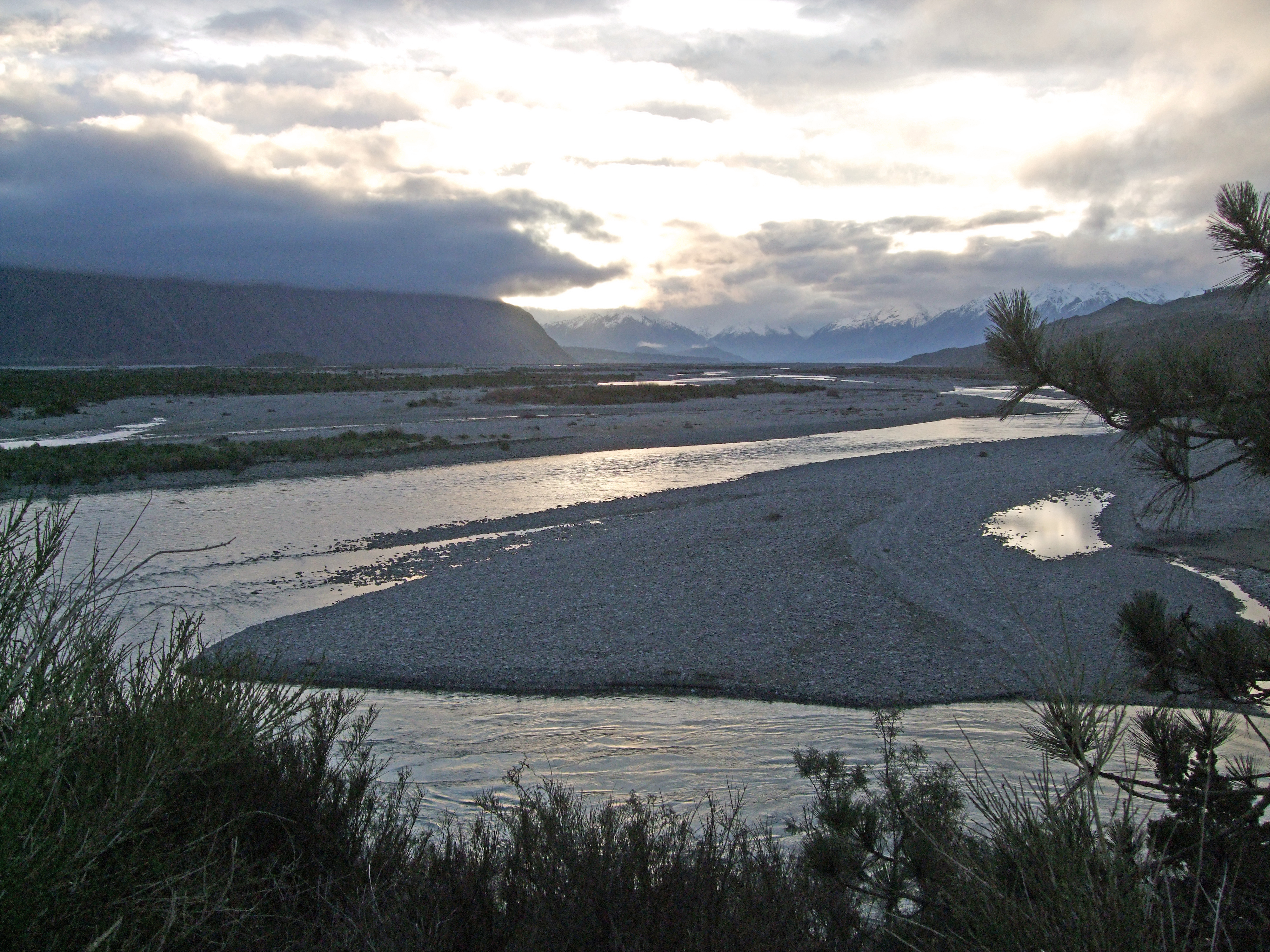
Upper Rakaia River Valley

doogan_110716_2851
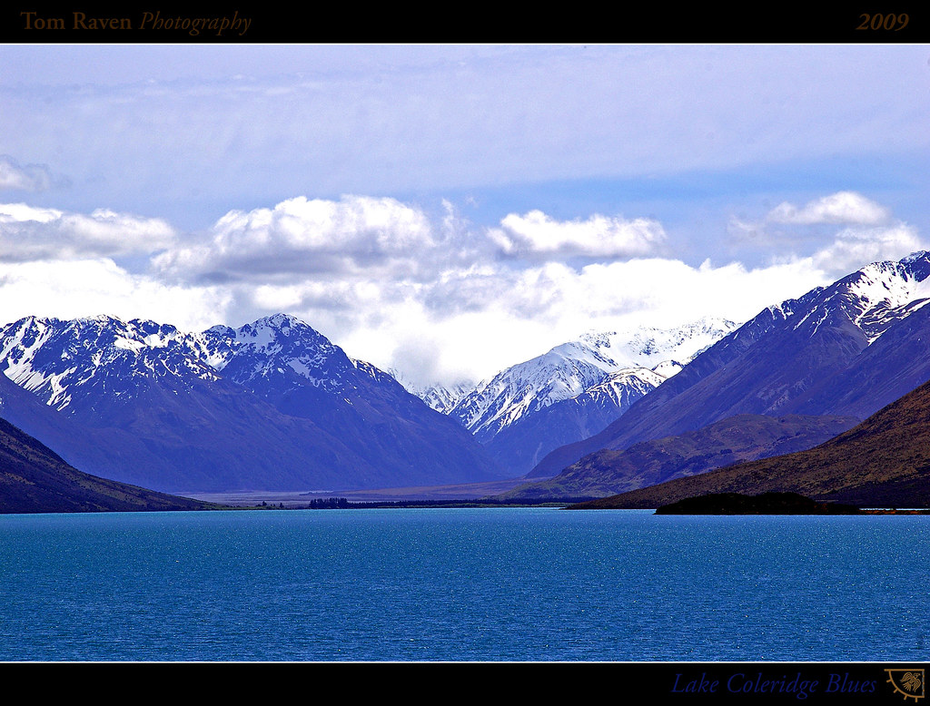
Lake Coleridge Blues

Mt Hutt view (i)

View Of The Ski Lodge At The Bottom From The Top of the Beginners' Hill While Skiing @ Mount Hutt Ski Resort, New Zealand

View from Mt Hutt

Lake Coleridge Intake Road
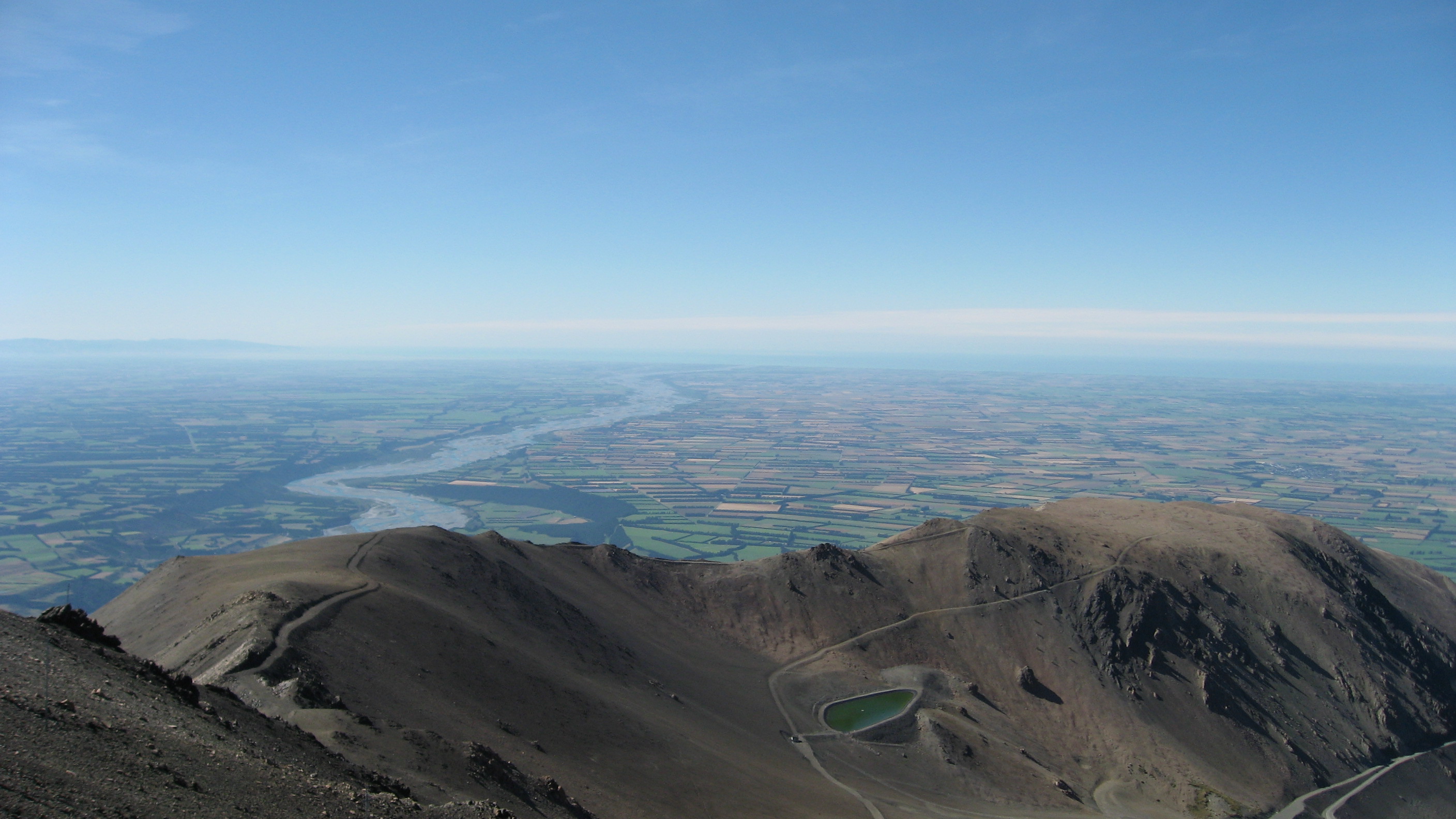
View from Mount Hutt
Blackhill Range, Canterbury, Neuseeland Karte
Suchen Sie einen anderen Ort
Nahe Plätze
Mount Taylor, Canterbury, Neuseeland
Lake Coleridge, Neuseeland
Double Hill, Neuseeland
Mount Oakden, Canterbury, Neuseeland
Rolleston Range, Neuseeland
Ashburton Lakes, Neuseeland
Mount Williams, Canterbury, Neuseeland
Mount Arrowsmith, Canterbury, Neuseeland
Bonds Peak, West Coast, Neuseeland
Arthur's Pass, Neuseeland
Mount Sunday, Canterbury, Neuseeland
Mount Whitcombe, Canterbury, Neuseeland
The Warrior, Canterbury, Neuseeland
Ramsay, Neuseeland
Hokitika, West Coast, Neuseeland
Dorothy Falls Road, Dorothy Falls Rd, Kokatahi, Neuseeland
Dorothy Falls Rd, Kokatahi, Neuseeland
Mantell Street, Mantell St, Kokatahi, Neuseeland
Newton Peak, Canterbury, Neuseeland
Kokatahi, Neuseeland
Letzte Suche
- Mountain View, CA, USA Sonnenaufgang Sonnenuntergang Zeiten
- Road to the sky observatory, Shuenhigashi, Shari, Shari District, Hokkaido -, Japan Sonnenaufgang Sonnenuntergang Zeiten
- 海岸咖啡, No. 31號, Chaishan Ave, Gushan District, Kaohsiung City, Taiwan Sonnenaufgang Sonnenuntergang Zeiten
- Estates Loop, Priest River, ID, USA Sonnenaufgang Sonnenuntergang Zeiten
- Woodland Oak Pl, Thousand Oaks, CA, USA Sonnenaufgang Sonnenuntergang Zeiten
- Sarangdanda, Nepal Sonnenaufgang Sonnenuntergang Zeiten
- Nakanoshima, Shiogama, Miyagi -, Japan Sonnenaufgang Sonnenuntergang Zeiten
- Centre de recherche en astronomie, astrophysique et géophysique, bp - 63 Rte de l'Observatoire, Bouz Sonnenaufgang Sonnenuntergang Zeiten
- Crocker Dr, Vacaville, CA, USA Sonnenaufgang Sonnenuntergang Zeiten
- Pu Ngaol Community Meeting Hall, HWHM+3X7, Krong Saen Monourom, Cambodia Sonnenaufgang Sonnenuntergang Zeiten