Upper San Antonio Valley Rd, Mt Hamilton, CA 美國的日出日落時間表
Location: 美國 > 加利福尼亞州 > 聖塔克拉拉郡 > CA 美國Mount Hamilton >
时区:
America/Los_Angeles
当地时间:
2025-06-26 04:08:57
經度:
-121.464739
緯度:
37.293296
今天日出時間:
05:47:20 AM
今天日落時間:
08:30:29 PM
今天日照時長:
14h 43m 9s
明天日出時間:
05:47:43 AM
明天日落時間:
08:30:31 PM
明天日照時長:
14h 42m 48s
顯示所有日期
| 日期 | 日出 | 日落 | 日照時長 |
|---|---|---|---|
| 2025年01月01日 | 07:20:02 AM | 05:00:07 PM | 9h 40m 5s |
| 2025年01月02日 | 07:20:08 AM | 05:00:57 PM | 9h 40m 49s |
| 2025年01月03日 | 07:20:11 AM | 05:01:48 PM | 9h 41m 37s |
| 2025年01月04日 | 07:20:13 AM | 05:02:40 PM | 9h 42m 27s |
| 2025年01月05日 | 07:20:12 AM | 05:03:33 PM | 9h 43m 21s |
| 2025年01月06日 | 07:20:09 AM | 05:04:28 PM | 9h 44m 19s |
| 2025年01月07日 | 07:20:04 AM | 05:05:23 PM | 9h 45m 19s |
| 2025年01月08日 | 07:19:57 AM | 05:06:19 PM | 9h 46m 22s |
| 2025年01月09日 | 07:19:49 AM | 05:07:17 PM | 9h 47m 28s |
| 2025年01月10日 | 07:19:38 AM | 05:08:15 PM | 9h 48m 37s |
| 2025年01月11日 | 07:19:25 AM | 05:09:14 PM | 9h 49m 49s |
| 2025年01月12日 | 07:19:10 AM | 05:10:13 PM | 9h 51m 3s |
| 2025年01月13日 | 07:18:53 AM | 05:11:14 PM | 9h 52m 21s |
| 2025年01月14日 | 07:18:34 AM | 05:12:15 PM | 9h 53m 41s |
| 2025年01月15日 | 07:18:13 AM | 05:13:17 PM | 9h 55m 4s |
| 2025年01月16日 | 07:17:50 AM | 05:14:19 PM | 9h 56m 29s |
| 2025年01月17日 | 07:17:25 AM | 05:15:22 PM | 9h 57m 57s |
| 2025年01月18日 | 07:16:58 AM | 05:16:25 PM | 9h 59m 27s |
| 2025年01月19日 | 07:16:29 AM | 05:17:29 PM | 10h 1m 0s |
| 2025年01月20日 | 07:15:58 AM | 05:18:33 PM | 10h 2m 35s |
| 2025年01月21日 | 07:15:26 AM | 05:19:38 PM | 10h 4m 12s |
| 2025年01月22日 | 07:14:51 AM | 05:20:43 PM | 10h 5m 52s |
| 2025年01月23日 | 07:14:15 AM | 05:21:48 PM | 10h 7m 33s |
| 2025年01月24日 | 07:13:37 AM | 05:22:53 PM | 10h 9m 16s |
| 2025年01月25日 | 07:12:57 AM | 05:23:59 PM | 10h 11m 2s |
| 2025年01月26日 | 07:12:15 AM | 05:25:04 PM | 10h 12m 49s |
| 2025年01月27日 | 07:11:32 AM | 05:26:10 PM | 10h 14m 38s |
| 2025年01月28日 | 07:10:47 AM | 05:27:16 PM | 10h 16m 29s |
| 2025年01月29日 | 07:10:00 AM | 05:28:22 PM | 10h 18m 22s |
| 2025年01月30日 | 07:09:11 AM | 05:29:28 PM | 10h 20m 17s |
| 2025年01月31日 | 07:08:21 AM | 05:30:34 PM | 10h 22m 13s |
| 2025年02月01日 | 07:07:30 AM | 05:31:40 PM | 10h 24m 10s |
| 2025年02月02日 | 07:06:36 AM | 05:32:46 PM | 10h 26m 10s |
| 2025年02月03日 | 07:05:42 AM | 05:33:51 PM | 10h 28m 9s |
| 2025年02月04日 | 07:04:45 AM | 05:34:57 PM | 10h 30m 12s |
| 2025年02月05日 | 07:03:48 AM | 05:36:03 PM | 10h 32m 15s |
| 2025年02月06日 | 07:02:49 AM | 05:37:08 PM | 10h 34m 19s |
| 2025年02月07日 | 07:01:48 AM | 05:38:13 PM | 10h 36m 25s |
| 2025年02月08日 | 07:00:46 AM | 05:39:18 PM | 10h 38m 32s |
| 2025年02月09日 | 06:59:43 AM | 05:40:23 PM | 10h 40m 40s |
| 2025年02月10日 | 06:58:38 AM | 05:41:27 PM | 10h 42m 49s |
| 2025年02月11日 | 06:57:32 AM | 05:42:31 PM | 10h 44m 59s |
| 2025年02月12日 | 06:56:25 AM | 05:43:35 PM | 10h 47m 10s |
| 2025年02月13日 | 06:55:17 AM | 05:44:39 PM | 10h 49m 22s |
| 2025年02月14日 | 06:54:08 AM | 05:45:43 PM | 10h 51m 35s |
| 2025年02月15日 | 06:52:57 AM | 05:46:46 PM | 10h 53m 49s |
| 2025年02月16日 | 06:51:45 AM | 05:47:49 PM | 10h 56m 4s |
| 2025年02月17日 | 06:50:33 AM | 05:48:51 PM | 10h 58m 18s |
| 2025年02月18日 | 06:49:19 AM | 05:49:54 PM | 11h 0m 35s |
| 2025年02月19日 | 06:48:04 AM | 05:50:55 PM | 11h 2m 51s |
| 2025年02月20日 | 06:46:48 AM | 05:51:57 PM | 11h 5m 9s |
| 2025年02月21日 | 06:45:31 AM | 05:52:58 PM | 11h 7m 27s |
| 2025年02月22日 | 06:44:14 AM | 05:53:59 PM | 11h 9m 45s |
| 2025年02月23日 | 06:42:55 AM | 05:55:00 PM | 11h 12m 5s |
| 2025年02月24日 | 06:41:36 AM | 05:56:00 PM | 11h 14m 24s |
| 2025年02月25日 | 06:40:16 AM | 05:57:00 PM | 11h 16m 44s |
| 2025年02月26日 | 06:38:55 AM | 05:58:00 PM | 11h 19m 5s |
| 2025年02月27日 | 06:37:33 AM | 05:58:59 PM | 11h 21m 26s |
| 2025年02月28日 | 06:36:11 AM | 05:59:58 PM | 11h 23m 47s |
| 2025年03月01日 | 06:34:48 AM | 06:00:57 PM | 11h 26m 9s |
| 2025年03月02日 | 06:33:24 AM | 06:01:56 PM | 11h 28m 32s |
| 2025年03月03日 | 06:32:00 AM | 06:02:54 PM | 11h 30m 54s |
| 2025年03月04日 | 06:30:35 AM | 06:03:52 PM | 11h 33m 17s |
| 2025年03月05日 | 06:29:09 AM | 06:04:49 PM | 11h 35m 40s |
| 2025年03月06日 | 06:27:43 AM | 06:05:46 PM | 11h 38m 3s |
| 2025年03月07日 | 06:26:17 AM | 06:06:43 PM | 11h 40m 26s |
| 2025年03月08日 | 06:24:50 AM | 06:07:40 PM | 11h 42m 50s |
| 2025年03月09日 | 07:23:26 AM | 07:08:34 PM | 11h 45m 8s |
| 2025年03月10日 | 07:21:58 AM | 07:09:31 PM | 11h 47m 33s |
| 2025年03月11日 | 07:20:30 AM | 07:10:27 PM | 11h 49m 57s |
| 2025年03月12日 | 07:19:02 AM | 07:11:23 PM | 11h 52m 21s |
| 2025年03月13日 | 07:17:33 AM | 07:12:18 PM | 11h 54m 45s |
| 2025年03月14日 | 07:16:04 AM | 07:13:13 PM | 11h 57m 9s |
| 2025年03月15日 | 07:14:35 AM | 07:14:09 PM | 11h 59m 34s |
| 2025年03月16日 | 07:13:05 AM | 07:15:04 PM | 12h 1m 59s |
| 2025年03月17日 | 07:11:36 AM | 07:15:59 PM | 12h 4m 23s |
| 2025年03月18日 | 07:10:06 AM | 07:16:53 PM | 12h 6m 47s |
| 2025年03月19日 | 07:08:36 AM | 07:17:48 PM | 12h 9m 12s |
| 2025年03月20日 | 07:07:06 AM | 07:18:42 PM | 12h 11m 36s |
| 2025年03月21日 | 07:05:36 AM | 07:19:36 PM | 12h 14m 0s |
| 2025年03月22日 | 07:04:06 AM | 07:20:30 PM | 12h 16m 24s |
| 2025年03月23日 | 07:02:35 AM | 07:21:25 PM | 12h 18m 50s |
| 2025年03月24日 | 07:01:05 AM | 07:22:18 PM | 12h 21m 13s |
| 2025年03月25日 | 06:59:35 AM | 07:23:12 PM | 12h 23m 37s |
| 2025年03月26日 | 06:58:05 AM | 07:24:06 PM | 12h 26m 1s |
| 2025年03月27日 | 06:56:35 AM | 07:25:00 PM | 12h 28m 25s |
| 2025年03月28日 | 06:55:06 AM | 07:25:53 PM | 12h 30m 47s |
| 2025年03月29日 | 06:53:36 AM | 07:26:47 PM | 12h 33m 11s |
| 2025年03月30日 | 06:52:07 AM | 07:27:40 PM | 12h 35m 33s |
| 2025年03月31日 | 06:50:38 AM | 07:28:34 PM | 12h 37m 56s |
| 2025年04月01日 | 06:49:09 AM | 07:29:27 PM | 12h 40m 18s |
| 2025年04月02日 | 06:47:40 AM | 07:30:21 PM | 12h 42m 41s |
| 2025年04月03日 | 06:46:12 AM | 07:31:14 PM | 12h 45m 2s |
| 2025年04月04日 | 06:44:44 AM | 07:32:08 PM | 12h 47m 24s |
| 2025年04月05日 | 06:43:17 AM | 07:33:01 PM | 12h 49m 44s |
| 2025年04月06日 | 06:41:50 AM | 07:33:55 PM | 12h 52m 5s |
| 2025年04月07日 | 06:40:23 AM | 07:34:48 PM | 12h 54m 25s |
| 2025年04月08日 | 06:38:57 AM | 07:35:42 PM | 12h 56m 45s |
| 2025年04月09日 | 06:37:31 AM | 07:36:36 PM | 12h 59m 5s |
| 2025年04月10日 | 06:36:06 AM | 07:37:29 PM | 13h 1m 23s |
| 2025年04月11日 | 06:34:42 AM | 07:38:23 PM | 13h 3m 41s |
| 2025年04月12日 | 06:33:18 AM | 07:39:17 PM | 13h 5m 59s |
| 2025年04月13日 | 06:31:54 AM | 07:40:10 PM | 13h 8m 16s |
| 2025年04月14日 | 06:30:32 AM | 07:41:04 PM | 13h 10m 32s |
| 2025年04月15日 | 06:29:09 AM | 07:41:58 PM | 13h 12m 49s |
| 2025年04月16日 | 06:27:48 AM | 07:42:52 PM | 13h 15m 4s |
| 2025年04月17日 | 06:26:28 AM | 07:43:46 PM | 13h 17m 18s |
| 2025年04月18日 | 06:25:08 AM | 07:44:40 PM | 13h 19m 32s |
| 2025年04月19日 | 06:23:49 AM | 07:45:34 PM | 13h 21m 45s |
| 2025年04月20日 | 06:22:31 AM | 07:46:28 PM | 13h 23m 57s |
| 2025年04月21日 | 06:21:13 AM | 07:47:22 PM | 13h 26m 9s |
| 2025年04月22日 | 06:19:57 AM | 07:48:16 PM | 13h 28m 19s |
| 2025年04月23日 | 06:18:41 AM | 07:49:10 PM | 13h 30m 29s |
| 2025年04月24日 | 06:17:27 AM | 07:50:04 PM | 13h 32m 37s |
| 2025年04月25日 | 06:16:13 AM | 07:50:58 PM | 13h 34m 45s |
| 2025年04月26日 | 06:15:00 AM | 07:51:52 PM | 13h 36m 52s |
| 2025年04月27日 | 06:13:49 AM | 07:52:47 PM | 13h 38m 58s |
| 2025年04月28日 | 06:12:38 AM | 07:53:41 PM | 13h 41m 3s |
| 2025年04月29日 | 06:11:29 AM | 07:54:35 PM | 13h 43m 6s |
| 2025年04月30日 | 06:10:21 AM | 07:55:29 PM | 13h 45m 8s |
| 2025年05月01日 | 06:09:14 AM | 07:56:23 PM | 13h 47m 9s |
| 2025年05月02日 | 06:08:08 AM | 07:57:16 PM | 13h 49m 8s |
| 2025年05月03日 | 06:07:03 AM | 07:58:10 PM | 13h 51m 7s |
| 2025年05月04日 | 06:05:59 AM | 07:59:04 PM | 13h 53m 5s |
| 2025年05月05日 | 06:04:57 AM | 07:59:57 PM | 13h 55m 0s |
| 2025年05月06日 | 06:03:56 AM | 08:00:50 PM | 13h 56m 54s |
| 2025年05月07日 | 06:02:57 AM | 08:01:44 PM | 13h 58m 47s |
| 2025年05月08日 | 06:01:58 AM | 08:02:36 PM | 14h 0m 38s |
| 2025年05月09日 | 06:01:02 AM | 08:03:29 PM | 14h 2m 27s |
| 2025年05月10日 | 06:00:06 AM | 08:04:22 PM | 14h 4m 16s |
| 2025年05月11日 | 05:59:12 AM | 08:05:14 PM | 14h 6m 2s |
| 2025年05月12日 | 05:58:19 AM | 08:06:06 PM | 14h 7m 47s |
| 2025年05月13日 | 05:57:28 AM | 08:06:57 PM | 14h 9m 29s |
| 2025年05月14日 | 05:56:39 AM | 08:07:48 PM | 14h 11m 9s |
| 2025年05月15日 | 05:55:50 AM | 08:08:39 PM | 14h 12m 49s |
| 2025年05月16日 | 05:55:04 AM | 08:09:29 PM | 14h 14m 25s |
| 2025年05月17日 | 05:54:19 AM | 08:10:19 PM | 14h 16m 0s |
| 2025年05月18日 | 05:53:35 AM | 08:11:09 PM | 14h 17m 34s |
| 2025年05月19日 | 05:52:53 AM | 08:11:57 PM | 14h 19m 4s |
| 2025年05月20日 | 05:52:13 AM | 08:12:46 PM | 14h 20m 33s |
| 2025年05月21日 | 05:51:35 AM | 08:13:33 PM | 14h 21m 58s |
| 2025年05月22日 | 05:50:58 AM | 08:14:21 PM | 14h 23m 23s |
| 2025年05月23日 | 05:50:22 AM | 08:15:07 PM | 14h 24m 45s |
| 2025年05月24日 | 05:49:49 AM | 08:15:53 PM | 14h 26m 4s |
| 2025年05月25日 | 05:49:17 AM | 08:16:38 PM | 14h 27m 21s |
| 2025年05月26日 | 05:48:47 AM | 08:17:22 PM | 14h 28m 35s |
| 2025年05月27日 | 05:48:19 AM | 08:18:05 PM | 14h 29m 46s |
| 2025年05月28日 | 05:47:52 AM | 08:18:48 PM | 14h 30m 56s |
| 2025年05月29日 | 05:47:27 AM | 08:19:30 PM | 14h 32m 3s |
| 2025年05月30日 | 05:47:04 AM | 08:20:10 PM | 14h 33m 6s |
| 2025年05月31日 | 05:46:42 AM | 08:20:50 PM | 14h 34m 8s |
| 2025年06月01日 | 05:46:23 AM | 08:21:29 PM | 14h 35m 6s |
| 2025年06月02日 | 05:46:05 AM | 08:22:07 PM | 14h 36m 2s |
| 2025年06月03日 | 05:45:49 AM | 08:22:44 PM | 14h 36m 55s |
| 2025年06月04日 | 05:45:35 AM | 08:23:19 PM | 14h 37m 44s |
| 2025年06月05日 | 05:45:22 AM | 08:23:54 PM | 14h 38m 32s |
| 2025年06月06日 | 05:45:11 AM | 08:24:27 PM | 14h 39m 16s |
| 2025年06月07日 | 05:45:03 AM | 08:24:59 PM | 14h 39m 56s |
| 2025年06月08日 | 05:44:55 AM | 08:25:30 PM | 14h 40m 35s |
| 2025年06月09日 | 05:44:50 AM | 08:25:59 PM | 14h 41m 9s |
| 2025年06月10日 | 05:44:46 AM | 08:26:27 PM | 14h 41m 41s |
| 2025年06月11日 | 05:44:44 AM | 08:26:54 PM | 14h 42m 10s |
| 2025年06月12日 | 05:44:44 AM | 08:27:19 PM | 14h 42m 35s |
| 2025年06月13日 | 05:44:46 AM | 08:27:43 PM | 14h 42m 57s |
| 2025年06月14日 | 05:44:49 AM | 08:28:05 PM | 14h 43m 16s |
| 2025年06月15日 | 05:44:54 AM | 08:28:26 PM | 14h 43m 32s |
| 2025年06月16日 | 05:45:01 AM | 08:28:46 PM | 14h 43m 45s |
| 2025年06月17日 | 05:45:09 AM | 08:29:04 PM | 14h 43m 55s |
| 2025年06月18日 | 05:45:19 AM | 08:29:20 PM | 14h 44m 1s |
| 2025年06月19日 | 05:45:30 AM | 08:29:35 PM | 14h 44m 5s |
| 2025年06月20日 | 05:45:43 AM | 08:29:48 PM | 14h 44m 5s |
| 2025年06月21日 | 05:45:58 AM | 08:29:59 PM | 14h 44m 1s |
| 2025年06月22日 | 05:46:14 AM | 08:30:09 PM | 14h 43m 55s |
| 2025年06月23日 | 05:46:32 AM | 08:30:17 PM | 14h 43m 45s |
| 2025年06月24日 | 05:46:51 AM | 08:30:23 PM | 14h 43m 32s |
| 2025年06月25日 | 05:47:12 AM | 08:30:27 PM | 14h 43m 15s |
| 2025年06月26日 | 05:47:34 AM | 08:30:30 PM | 14h 42m 56s |
| 2025年06月27日 | 05:47:57 AM | 08:30:31 PM | 14h 42m 34s |
| 2025年06月28日 | 05:48:22 AM | 08:30:30 PM | 14h 42m 8s |
| 2025年06月29日 | 05:48:49 AM | 08:30:28 PM | 14h 41m 39s |
| 2025年06月30日 | 05:49:16 AM | 08:30:24 PM | 14h 41m 8s |
| 2025年07月01日 | 05:49:45 AM | 08:30:17 PM | 14h 40m 32s |
| 2025年07月02日 | 05:50:15 AM | 08:30:09 PM | 14h 39m 54s |
| 2025年07月03日 | 05:50:46 AM | 08:30:00 PM | 14h 39m 14s |
| 2025年07月04日 | 05:51:18 AM | 08:29:48 PM | 14h 38m 30s |
| 2025年07月05日 | 05:51:52 AM | 08:29:35 PM | 14h 37m 43s |
| 2025年07月06日 | 05:52:26 AM | 08:29:19 PM | 14h 36m 53s |
| 2025年07月07日 | 05:53:02 AM | 08:29:02 PM | 14h 36m 0s |
| 2025年07月08日 | 05:53:38 AM | 08:28:43 PM | 14h 35m 5s |
| 2025年07月09日 | 05:54:16 AM | 08:28:23 PM | 14h 34m 7s |
| 2025年07月10日 | 05:54:54 AM | 08:28:00 PM | 14h 33m 6s |
| 2025年07月11日 | 05:55:33 AM | 08:27:36 PM | 14h 32m 3s |
| 2025年07月12日 | 05:56:13 AM | 08:27:10 PM | 14h 30m 57s |
| 2025年07月13日 | 05:56:54 AM | 08:26:42 PM | 14h 29m 48s |
| 2025年07月14日 | 05:57:36 AM | 08:26:12 PM | 14h 28m 36s |
| 2025年07月15日 | 05:58:19 AM | 08:25:41 PM | 14h 27m 22s |
| 2025年07月16日 | 05:59:02 AM | 08:25:08 PM | 14h 26m 6s |
| 2025年07月17日 | 05:59:46 AM | 08:24:33 PM | 14h 24m 47s |
| 2025年07月18日 | 06:00:30 AM | 08:23:56 PM | 14h 23m 26s |
| 2025年07月19日 | 06:01:15 AM | 08:23:18 PM | 14h 22m 3s |
| 2025年07月20日 | 06:02:01 AM | 08:22:38 PM | 14h 20m 37s |
| 2025年07月21日 | 06:02:47 AM | 08:21:57 PM | 14h 19m 10s |
| 2025年07月22日 | 06:03:33 AM | 08:21:13 PM | 14h 17m 40s |
| 2025年07月23日 | 06:04:20 AM | 08:20:28 PM | 14h 16m 8s |
| 2025年07月24日 | 06:05:08 AM | 08:19:42 PM | 14h 14m 34s |
| 2025年07月25日 | 06:05:56 AM | 08:18:54 PM | 14h 12m 58s |
| 2025年07月26日 | 06:06:44 AM | 08:18:04 PM | 14h 11m 20s |
| 2025年07月27日 | 06:07:32 AM | 08:17:13 PM | 14h 9m 41s |
| 2025年07月28日 | 06:08:21 AM | 08:16:20 PM | 14h 7m 59s |
| 2025年07月29日 | 06:09:10 AM | 08:15:26 PM | 14h 6m 16s |
| 2025年07月30日 | 06:09:59 AM | 08:14:31 PM | 14h 4m 32s |
| 2025年07月31日 | 06:10:49 AM | 08:13:33 PM | 14h 2m 44s |
| 2025年08月01日 | 06:11:39 AM | 08:12:35 PM | 14h 0m 56s |
| 2025年08月02日 | 06:12:29 AM | 08:11:35 PM | 13h 59m 6s |
| 2025年08月03日 | 06:13:19 AM | 08:10:34 PM | 13h 57m 15s |
| 2025年08月04日 | 06:14:09 AM | 08:09:31 PM | 13h 55m 22s |
| 2025年08月05日 | 06:14:59 AM | 08:08:27 PM | 13h 53m 28s |
| 2025年08月06日 | 06:15:50 AM | 08:07:22 PM | 13h 51m 32s |
| 2025年08月07日 | 06:16:40 AM | 08:06:16 PM | 13h 49m 36s |
| 2025年08月08日 | 06:17:31 AM | 08:05:08 PM | 13h 47m 37s |
| 2025年08月09日 | 06:18:21 AM | 08:04:00 PM | 13h 45m 39s |
| 2025年08月10日 | 06:19:12 AM | 08:02:50 PM | 13h 43m 38s |
| 2025年08月11日 | 06:20:02 AM | 08:01:39 PM | 13h 41m 37s |
| 2025年08月12日 | 06:20:53 AM | 08:00:26 PM | 13h 39m 33s |
| 2025年08月13日 | 06:21:44 AM | 07:59:13 PM | 13h 37m 29s |
| 2025年08月14日 | 06:22:34 AM | 07:57:59 PM | 13h 35m 25s |
| 2025年08月15日 | 06:23:25 AM | 07:56:44 PM | 13h 33m 19s |
| 2025年08月16日 | 06:24:15 AM | 07:55:27 PM | 13h 31m 12s |
| 2025年08月17日 | 06:25:05 AM | 07:54:10 PM | 13h 29m 5s |
| 2025年08月18日 | 06:25:56 AM | 07:52:52 PM | 13h 26m 56s |
| 2025年08月19日 | 06:26:46 AM | 07:51:33 PM | 13h 24m 47s |
| 2025年08月20日 | 06:27:36 AM | 07:50:13 PM | 13h 22m 37s |
| 2025年08月21日 | 06:28:26 AM | 07:48:52 PM | 13h 20m 26s |
| 2025年08月22日 | 06:29:17 AM | 07:47:30 PM | 13h 18m 13s |
| 2025年08月23日 | 06:30:07 AM | 07:46:08 PM | 13h 16m 1s |
| 2025年08月24日 | 06:30:56 AM | 07:44:45 PM | 13h 13m 49s |
| 2025年08月25日 | 06:31:46 AM | 07:43:21 PM | 13h 11m 35s |
| 2025年08月26日 | 06:32:36 AM | 07:41:56 PM | 13h 9m 20s |
| 2025年08月27日 | 06:33:26 AM | 07:40:31 PM | 13h 7m 5s |
| 2025年08月28日 | 06:34:15 AM | 07:39:05 PM | 13h 4m 50s |
| 2025年08月29日 | 06:35:05 AM | 07:37:39 PM | 13h 2m 34s |
| 2025年08月30日 | 06:35:54 AM | 07:36:12 PM | 13h 0m 18s |
| 2025年08月31日 | 06:36:44 AM | 07:34:44 PM | 12h 58m 0s |
| 2025年09月01日 | 06:37:33 AM | 07:33:16 PM | 12h 55m 43s |
| 2025年09月02日 | 06:38:23 AM | 07:31:48 PM | 12h 53m 25s |
| 2025年09月03日 | 06:39:12 AM | 07:30:19 PM | 12h 51m 7s |
| 2025年09月04日 | 06:40:01 AM | 07:28:49 PM | 12h 48m 48s |
| 2025年09月05日 | 06:40:50 AM | 07:27:19 PM | 12h 46m 29s |
| 2025年09月06日 | 06:41:39 AM | 07:25:49 PM | 12h 44m 10s |
| 2025年09月07日 | 06:42:29 AM | 07:24:19 PM | 12h 41m 50s |
| 2025年09月08日 | 06:43:18 AM | 07:22:48 PM | 12h 39m 30s |
| 2025年09月09日 | 06:44:07 AM | 07:21:17 PM | 12h 37m 10s |
| 2025年09月10日 | 06:44:56 AM | 07:19:45 PM | 12h 34m 49s |
| 2025年09月11日 | 06:45:45 AM | 07:18:14 PM | 12h 32m 29s |
| 2025年09月12日 | 06:46:34 AM | 07:16:42 PM | 12h 30m 8s |
| 2025年09月13日 | 06:47:24 AM | 07:15:10 PM | 12h 27m 46s |
| 2025年09月14日 | 06:48:13 AM | 07:13:38 PM | 12h 25m 25s |
| 2025年09月15日 | 06:49:02 AM | 07:12:05 PM | 12h 23m 3s |
| 2025年09月16日 | 06:49:52 AM | 07:10:33 PM | 12h 20m 41s |
| 2025年09月17日 | 06:50:41 AM | 07:09:01 PM | 12h 18m 20s |
| 2025年09月18日 | 06:51:31 AM | 07:07:28 PM | 12h 15m 57s |
| 2025年09月19日 | 06:52:20 AM | 07:05:56 PM | 12h 13m 36s |
| 2025年09月20日 | 06:53:10 AM | 07:04:24 PM | 12h 11m 14s |
| 2025年09月21日 | 06:54:00 AM | 07:02:51 PM | 12h 8m 51s |
| 2025年09月22日 | 06:54:50 AM | 07:01:19 PM | 12h 6m 29s |
| 2025年09月23日 | 06:55:40 AM | 06:59:47 PM | 12h 4m 7s |
| 2025年09月24日 | 06:56:31 AM | 06:58:15 PM | 12h 1m 44s |
| 2025年09月25日 | 06:57:21 AM | 06:56:44 PM | 11h 59m 23s |
| 2025年09月26日 | 06:58:12 AM | 06:55:12 PM | 11h 57m 0s |
| 2025年09月27日 | 06:59:03 AM | 06:53:41 PM | 11h 54m 38s |
| 2025年09月28日 | 06:59:54 AM | 06:52:10 PM | 11h 52m 16s |
| 2025年09月29日 | 07:00:46 AM | 06:50:39 PM | 11h 49m 53s |
| 2025年09月30日 | 07:01:37 AM | 06:49:09 PM | 11h 47m 32s |
| 2025年10月01日 | 07:02:29 AM | 06:47:39 PM | 11h 45m 10s |
| 2025年10月02日 | 07:03:21 AM | 06:46:09 PM | 11h 42m 48s |
| 2025年10月03日 | 07:04:14 AM | 06:44:40 PM | 11h 40m 26s |
| 2025年10月04日 | 07:05:06 AM | 06:43:11 PM | 11h 38m 5s |
| 2025年10月05日 | 07:05:59 AM | 06:41:43 PM | 11h 35m 44s |
| 2025年10月06日 | 07:06:52 AM | 06:40:15 PM | 11h 33m 23s |
| 2025年10月07日 | 07:07:46 AM | 06:38:48 PM | 11h 31m 2s |
| 2025年10月08日 | 07:08:40 AM | 06:37:21 PM | 11h 28m 41s |
| 2025年10月09日 | 07:09:34 AM | 06:35:55 PM | 11h 26m 21s |
| 2025年10月10日 | 07:10:28 AM | 06:34:30 PM | 11h 24m 2s |
| 2025年10月11日 | 07:11:23 AM | 06:33:05 PM | 11h 21m 42s |
| 2025年10月12日 | 07:12:18 AM | 06:31:41 PM | 11h 19m 23s |
| 2025年10月13日 | 07:13:13 AM | 06:30:18 PM | 11h 17m 5s |
| 2025年10月14日 | 07:14:09 AM | 06:28:56 PM | 11h 14m 47s |
| 2025年10月15日 | 07:15:05 AM | 06:27:34 PM | 11h 12m 29s |
| 2025年10月16日 | 07:16:02 AM | 06:26:13 PM | 11h 10m 11s |
| 2025年10月17日 | 07:16:58 AM | 06:24:53 PM | 11h 7m 55s |
| 2025年10月18日 | 07:17:56 AM | 06:23:34 PM | 11h 5m 38s |
| 2025年10月19日 | 07:18:53 AM | 06:22:16 PM | 11h 3m 23s |
| 2025年10月20日 | 07:19:51 AM | 06:20:59 PM | 11h 1m 8s |
| 2025年10月21日 | 07:20:49 AM | 06:19:42 PM | 10h 58m 53s |
| 2025年10月22日 | 07:21:48 AM | 06:18:27 PM | 10h 56m 39s |
| 2025年10月23日 | 07:22:46 AM | 06:17:13 PM | 10h 54m 27s |
| 2025年10月24日 | 07:23:46 AM | 06:16:00 PM | 10h 52m 14s |
| 2025年10月25日 | 07:24:45 AM | 06:14:48 PM | 10h 50m 3s |
| 2025年10月26日 | 07:25:45 AM | 06:13:37 PM | 10h 47m 52s |
| 2025年10月27日 | 07:26:45 AM | 06:12:28 PM | 10h 45m 43s |
| 2025年10月28日 | 07:27:46 AM | 06:11:19 PM | 10h 43m 33s |
| 2025年10月29日 | 07:28:46 AM | 06:10:12 PM | 10h 41m 26s |
| 2025年10月30日 | 07:29:47 AM | 06:09:06 PM | 10h 39m 19s |
| 2025年10月31日 | 07:30:49 AM | 06:08:02 PM | 10h 37m 13s |
| 2025年11月01日 | 07:31:50 AM | 06:06:59 PM | 10h 35m 9s |
| 2025年11月02日 | 06:32:55 AM | 05:05:55 PM | 10h 33m 0s |
| 2025年11月03日 | 06:33:57 AM | 05:04:54 PM | 10h 30m 57s |
| 2025年11月04日 | 06:34:59 AM | 05:03:55 PM | 10h 28m 56s |
| 2025年11月05日 | 06:36:01 AM | 05:02:58 PM | 10h 26m 57s |
| 2025年11月06日 | 06:37:04 AM | 05:02:02 PM | 10h 24m 58s |
| 2025年11月07日 | 06:38:07 AM | 05:01:08 PM | 10h 23m 1s |
| 2025年11月08日 | 06:39:09 AM | 05:00:15 PM | 10h 21m 6s |
| 2025年11月09日 | 06:40:12 AM | 04:59:24 PM | 10h 19m 12s |
| 2025年11月10日 | 06:41:15 AM | 04:58:35 PM | 10h 17m 20s |
| 2025年11月11日 | 06:42:18 AM | 04:57:47 PM | 10h 15m 29s |
| 2025年11月12日 | 06:43:21 AM | 04:57:01 PM | 10h 13m 40s |
| 2025年11月13日 | 06:44:24 AM | 04:56:17 PM | 10h 11m 53s |
| 2025年11月14日 | 06:45:27 AM | 04:55:34 PM | 10h 10m 7s |
| 2025年11月15日 | 06:46:30 AM | 04:54:54 PM | 10h 8m 24s |
| 2025年11月16日 | 06:47:32 AM | 04:54:15 PM | 10h 6m 43s |
| 2025年11月17日 | 06:48:35 AM | 04:53:37 PM | 10h 5m 2s |
| 2025年11月18日 | 06:49:37 AM | 04:53:02 PM | 10h 3m 25s |
| 2025年11月19日 | 06:50:39 AM | 04:52:29 PM | 10h 1m 50s |
| 2025年11月20日 | 06:51:41 AM | 04:51:57 PM | 10h 0m 16s |
| 2025年11月21日 | 06:52:42 AM | 04:51:28 PM | 9h 58m 46s |
| 2025年11月22日 | 06:53:43 AM | 04:51:00 PM | 9h 57m 17s |
| 2025年11月23日 | 06:54:43 AM | 04:50:35 PM | 9h 55m 52s |
| 2025年11月24日 | 06:55:43 AM | 04:50:11 PM | 9h 54m 28s |
| 2025年11月25日 | 06:56:43 AM | 04:49:50 PM | 9h 53m 7s |
| 2025年11月26日 | 06:57:42 AM | 04:49:30 PM | 9h 51m 48s |
| 2025年11月27日 | 06:58:40 AM | 04:49:12 PM | 9h 50m 32s |
| 2025年11月28日 | 06:59:38 AM | 04:48:57 PM | 9h 49m 19s |
| 2025年11月29日 | 07:00:35 AM | 04:48:44 PM | 9h 48m 9s |
| 2025年11月30日 | 07:01:31 AM | 04:48:32 PM | 9h 47m 1s |
| 2025年12月01日 | 07:02:26 AM | 04:48:23 PM | 9h 45m 57s |
| 2025年12月02日 | 07:03:21 AM | 04:48:16 PM | 9h 44m 55s |
| 2025年12月03日 | 07:04:14 AM | 04:48:11 PM | 9h 43m 57s |
| 2025年12月04日 | 07:05:07 AM | 04:48:08 PM | 9h 43m 1s |
| 2025年12月05日 | 07:05:59 AM | 04:48:07 PM | 9h 42m 8s |
| 2025年12月06日 | 07:06:49 AM | 04:48:08 PM | 9h 41m 19s |
| 2025年12月07日 | 07:07:39 AM | 04:48:11 PM | 9h 40m 32s |
| 2025年12月08日 | 07:08:27 AM | 04:48:17 PM | 9h 39m 50s |
| 2025年12月09日 | 07:09:14 AM | 04:48:24 PM | 9h 39m 10s |
| 2025年12月10日 | 07:10:00 AM | 04:48:33 PM | 9h 38m 33s |
| 2025年12月11日 | 07:10:44 AM | 04:48:45 PM | 9h 38m 1s |
| 2025年12月12日 | 07:11:27 AM | 04:48:58 PM | 9h 37m 31s |
| 2025年12月13日 | 07:12:09 AM | 04:49:14 PM | 9h 37m 5s |
| 2025年12月14日 | 07:12:49 AM | 04:49:31 PM | 9h 36m 42s |
| 2025年12月15日 | 07:13:28 AM | 04:49:51 PM | 9h 36m 23s |
| 2025年12月16日 | 07:14:05 AM | 04:50:12 PM | 9h 36m 7s |
| 2025年12月17日 | 07:14:41 AM | 04:50:36 PM | 9h 35m 55s |
| 2025年12月18日 | 07:15:15 AM | 04:51:01 PM | 9h 35m 46s |
| 2025年12月19日 | 07:15:47 AM | 04:51:28 PM | 9h 35m 41s |
| 2025年12月20日 | 07:16:18 AM | 04:51:57 PM | 9h 35m 39s |
| 2025年12月21日 | 07:16:46 AM | 04:52:28 PM | 9h 35m 42s |
| 2025年12月22日 | 07:17:14 AM | 04:53:01 PM | 9h 35m 47s |
| 2025年12月23日 | 07:17:39 AM | 04:53:35 PM | 9h 35m 56s |
| 2025年12月24日 | 07:18:02 AM | 04:54:11 PM | 9h 36m 9s |
| 2025年12月25日 | 07:18:24 AM | 04:54:49 PM | 9h 36m 25s |
| 2025年12月26日 | 07:18:44 AM | 04:55:28 PM | 9h 36m 44s |
| 2025年12月27日 | 07:19:01 AM | 04:56:09 PM | 9h 37m 8s |
| 2025年12月28日 | 07:19:17 AM | 04:56:51 PM | 9h 37m 34s |
| 2025年12月29日 | 07:19:31 AM | 04:57:35 PM | 9h 38m 4s |
| 2025年12月30日 | 07:19:43 AM | 04:58:21 PM | 9h 38m 38s |
| 2025年12月31日 | 07:19:53 AM | 04:59:07 PM | 9h 39m 14s |
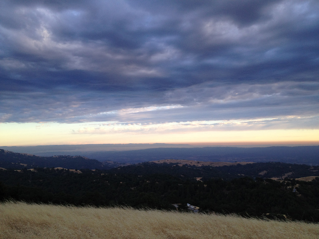
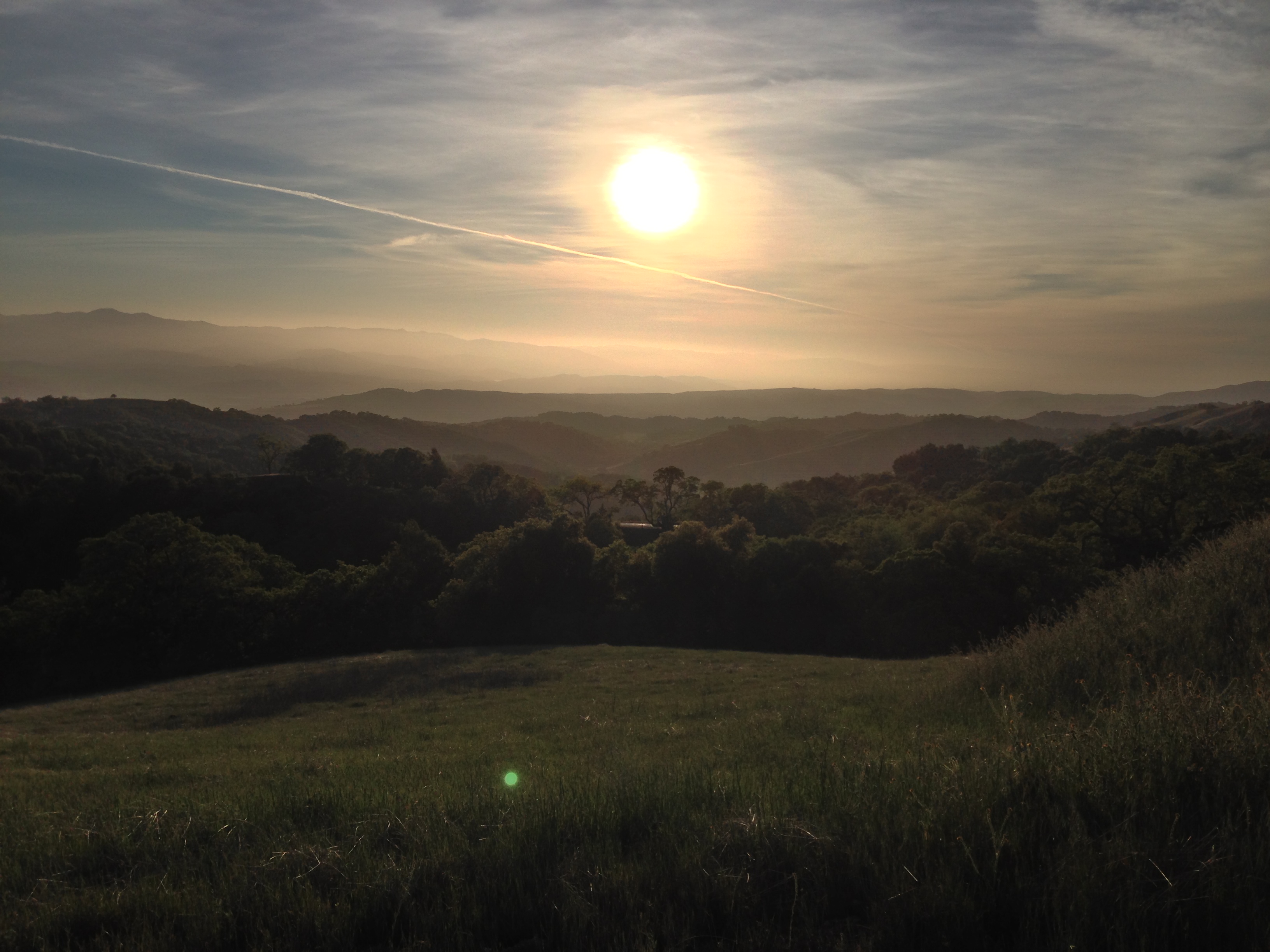
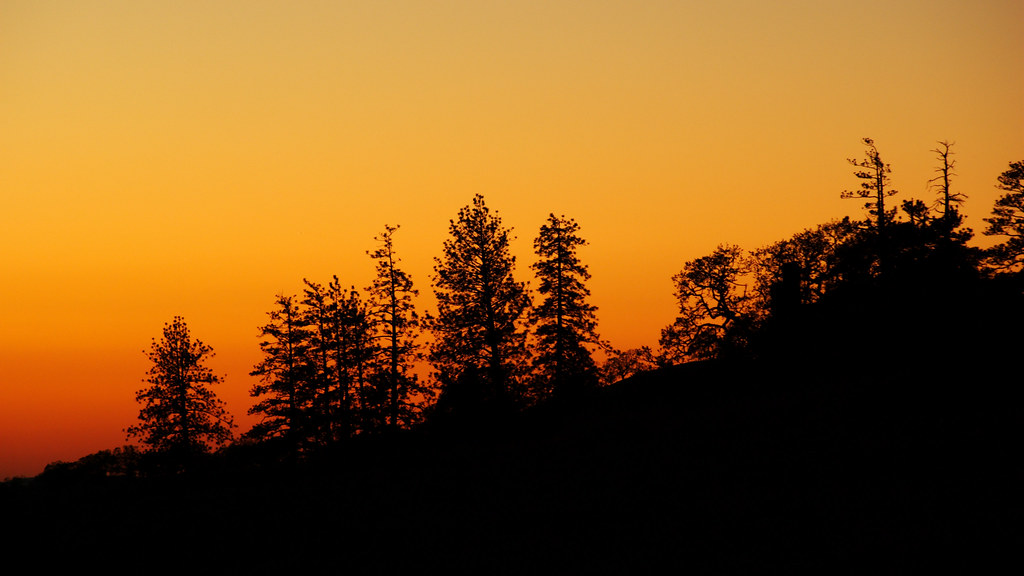
日出日落照片
Sunset at Henry Coe State Park

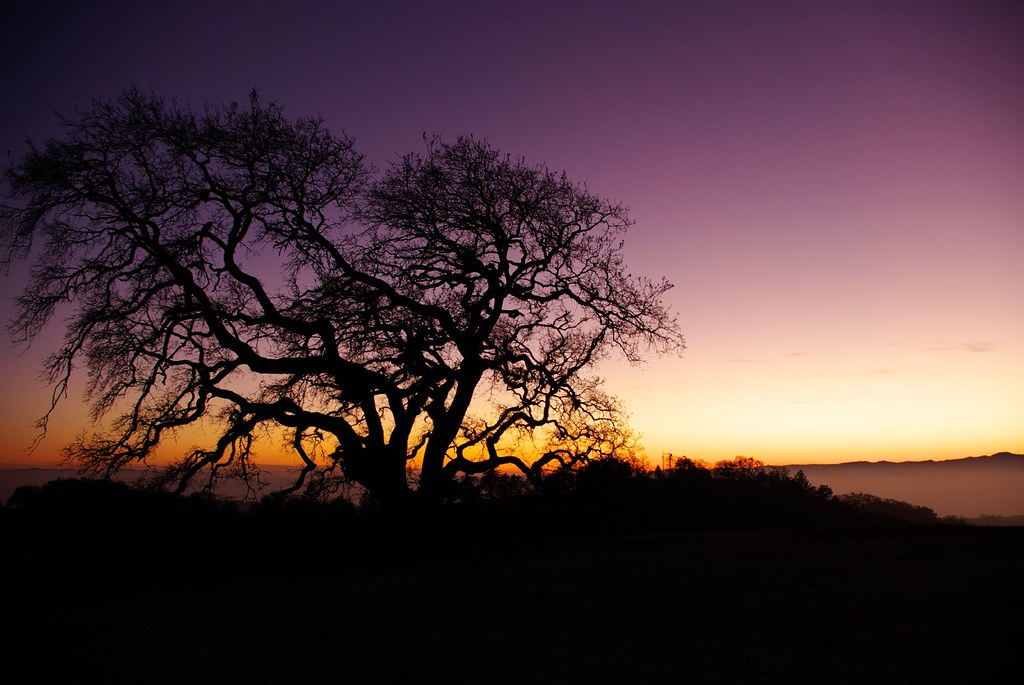
Mt Hamilton sunset
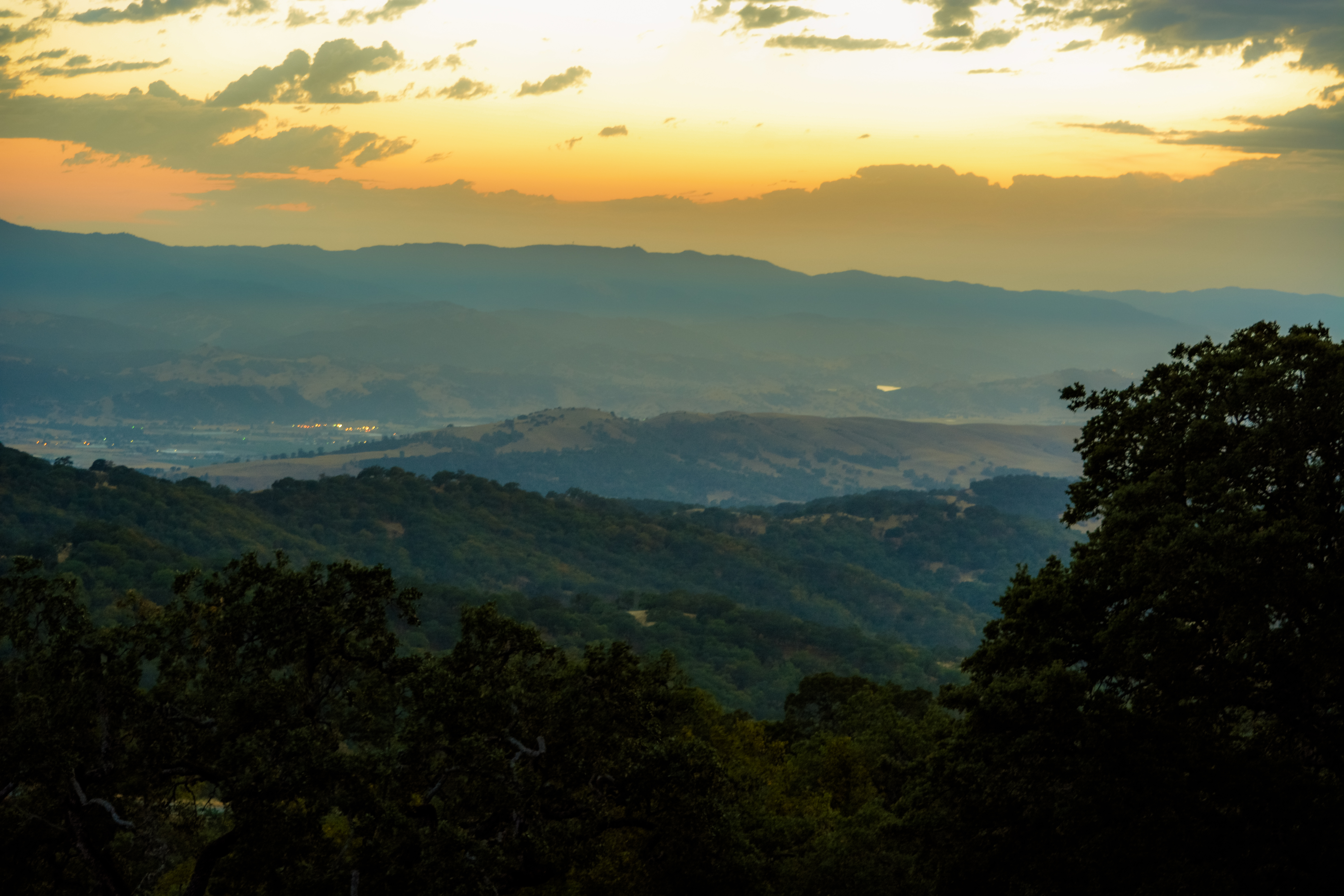
A Valley of Views

Talk About Sun & Sky To Sons & Daughters...And Quench Their Thirst for Knowledge On Creation..&,,, Mystery's Of Nature,,,,

20120714-IMG_7832.jpg
MountHamiltonbush1-25-2015

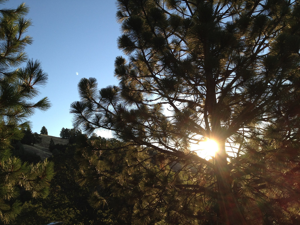
Approaching sunset

20120714-IMG_7809.jpg
Henry Coe State Park

Sunset at Henry W. Coe State Park

Doubletree, Henry W. Coe State Park.
Camping at Coe State Park
Sunset at Henry Coe State Park
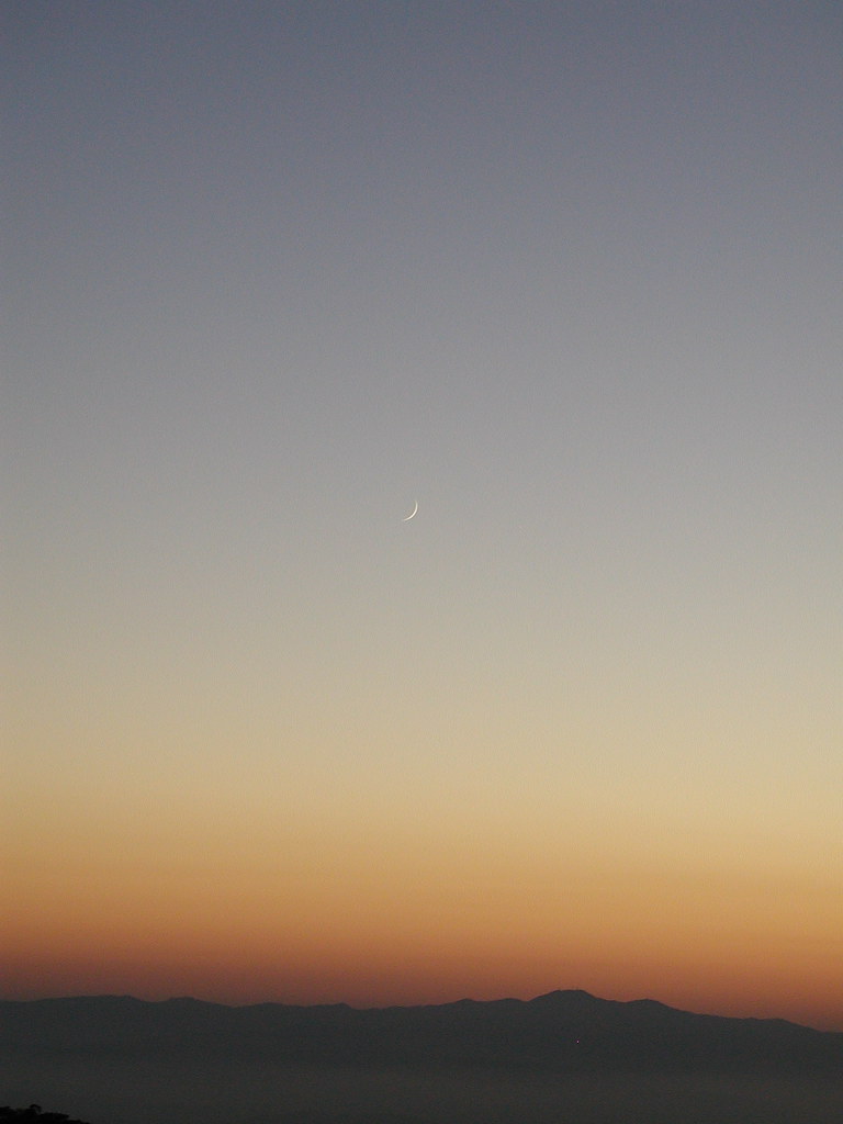
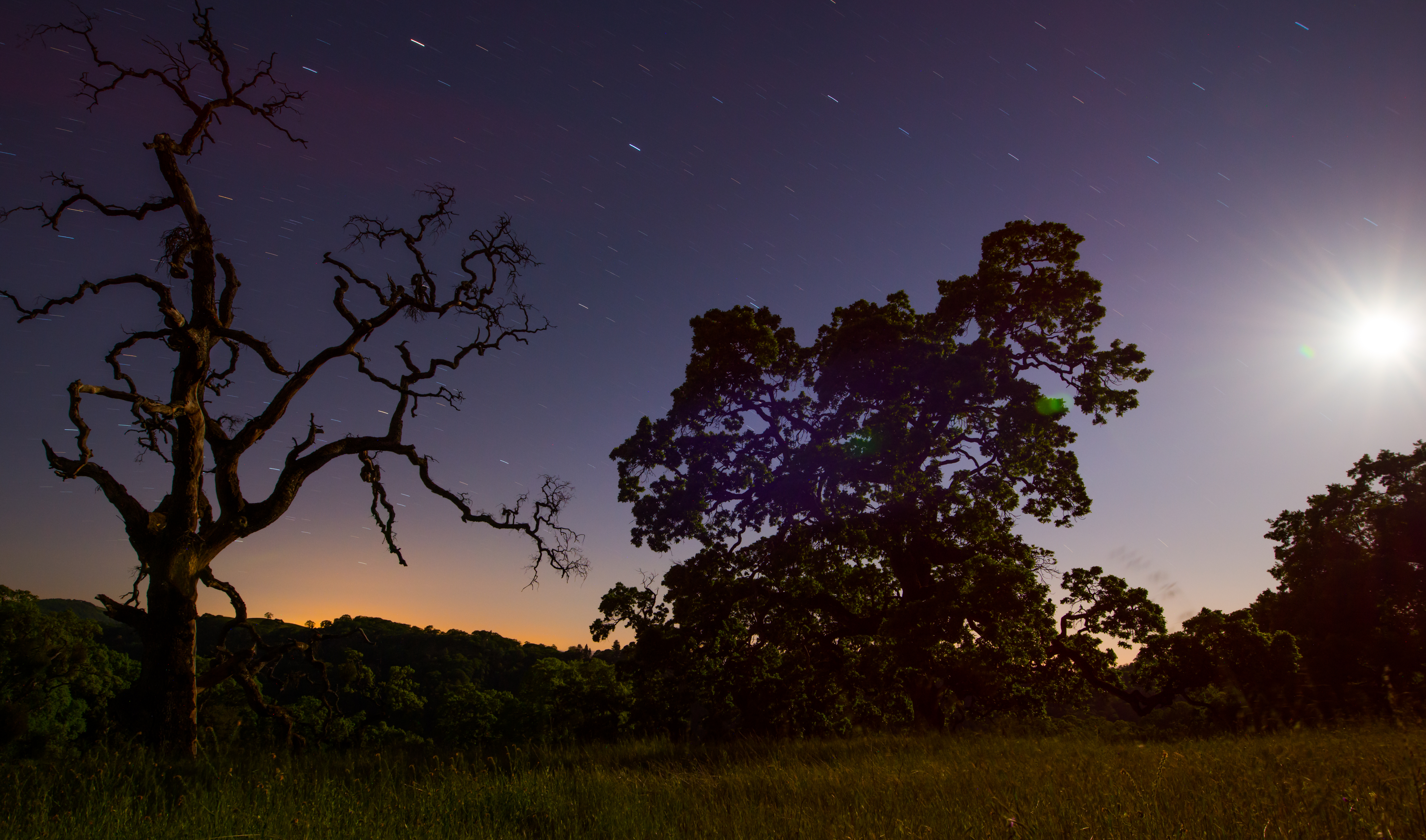
Old Sunset with Young Moon Portrait
Sunset at Henry Coe SP
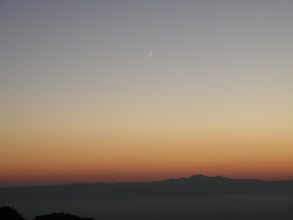
Old Sunset with Young Moon Landscape
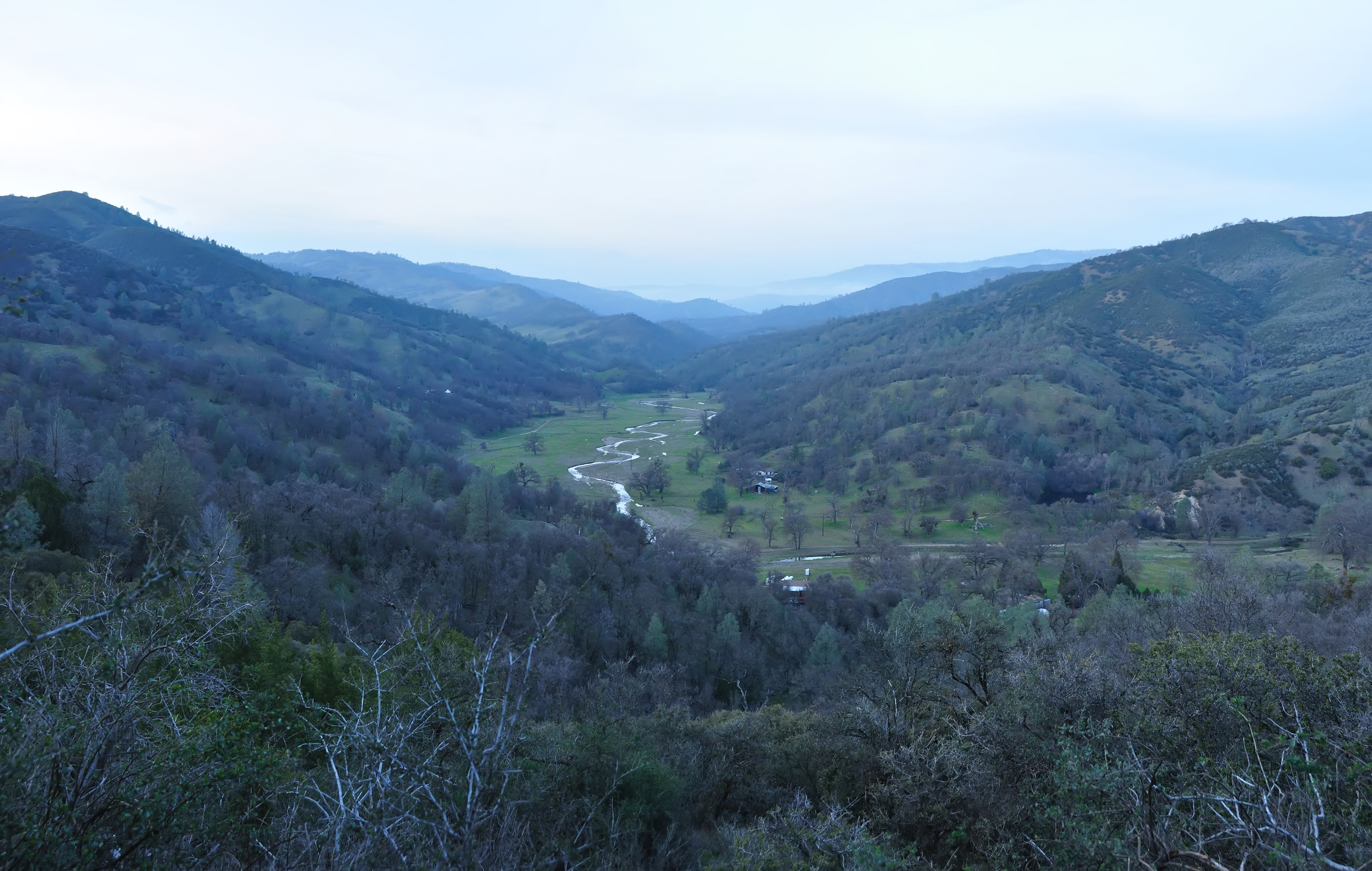
San Antonio Valley Road Vista

Mercury (top) Jupiter and Venus, seen on May 26, 2013 from Henry Coe State Park
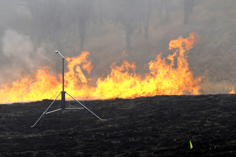
Coe Burn 2011
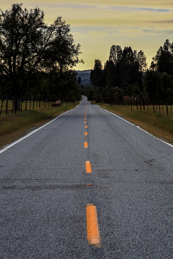
San Antonio Valley Road, Just Past "The Junction".
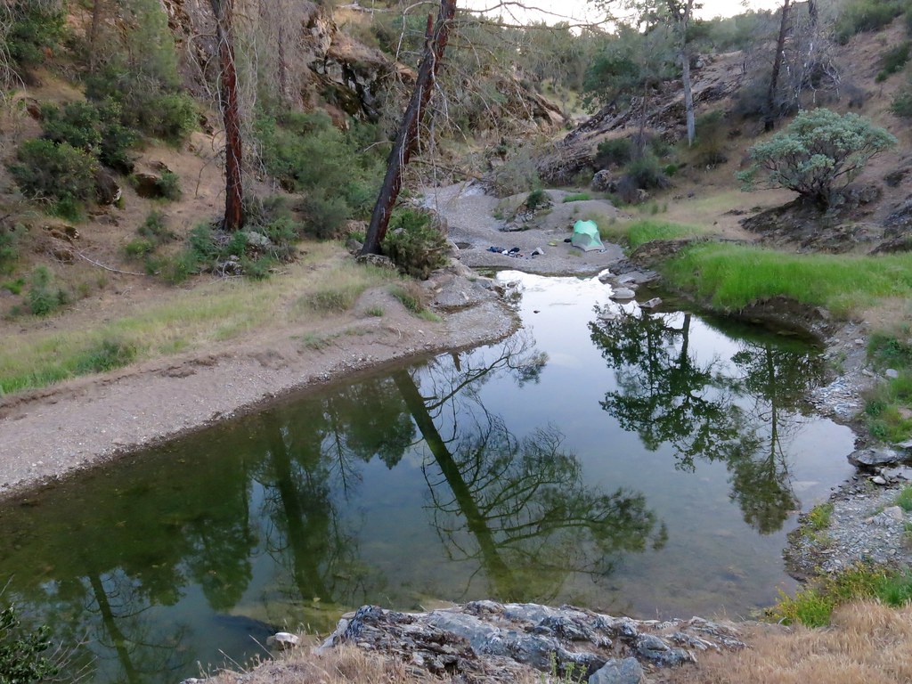
Pool at confluence of Orestimba and Red Creeks
Camping at Coe State Park - Sunrise
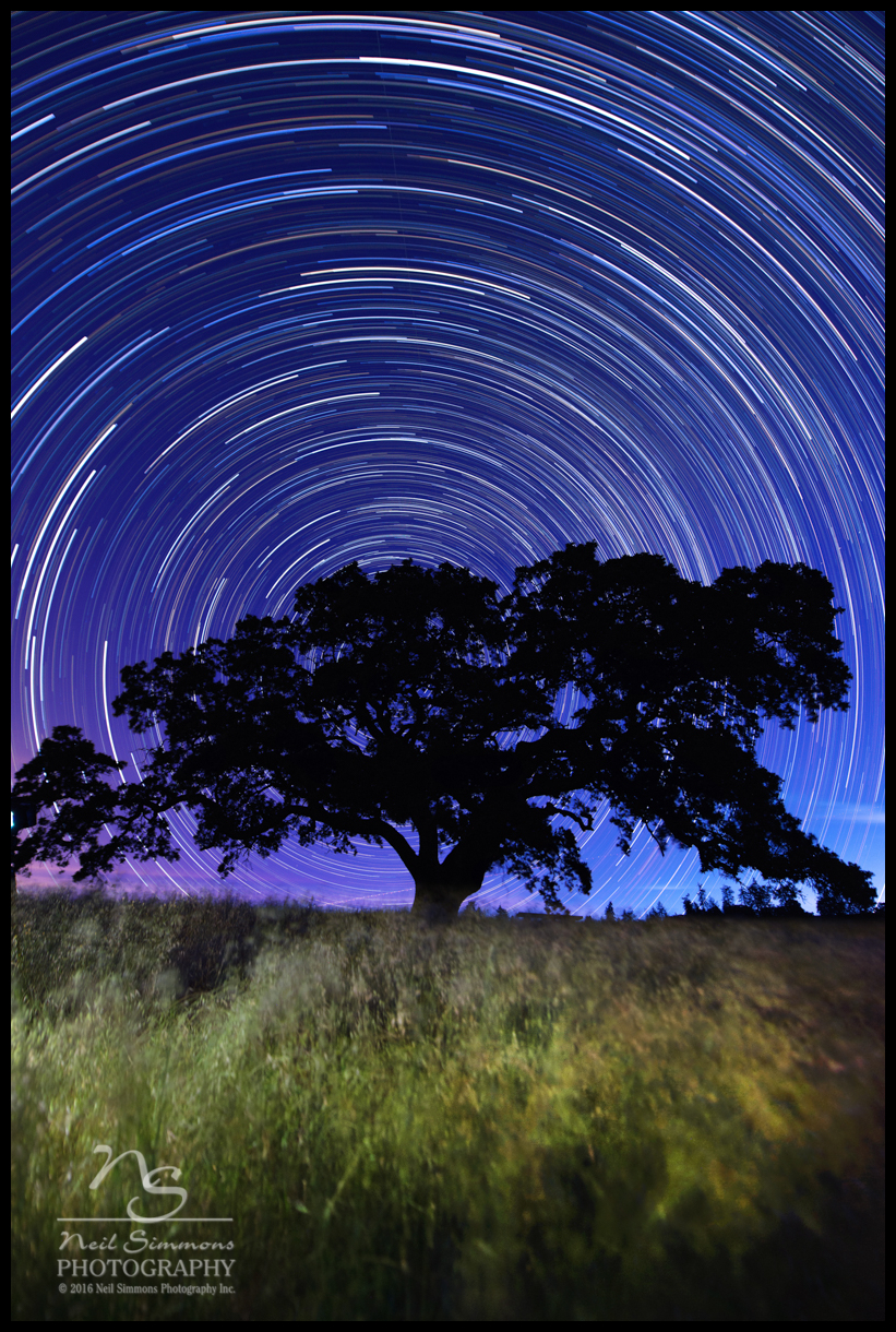
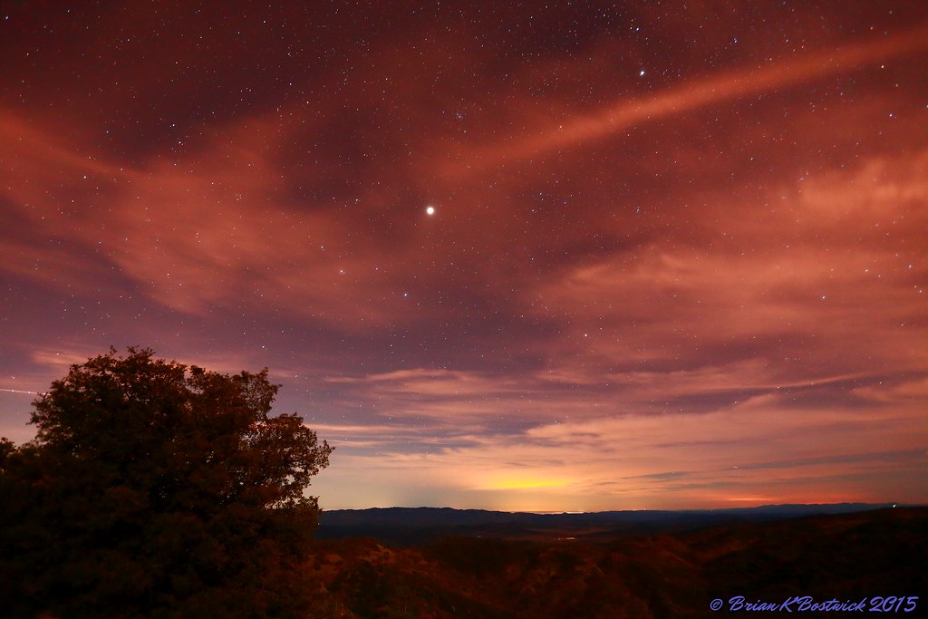
Star Trails Henry Coe State Park
Upper San Antonio Valley Rd, Mt Hamilton, CA 美國的地圖
搜索其他地方的日出日落時間
附近地點
美國加利福尼亚圣安东尼奥
Manzanita Point Camps, California 美國
美國加利福尼亞州摩根山丘
Mt Hamilton, CA 美國Mount Hamilton
Mt Hamilton, CA 美國Mount Hamilton
美國加利福尼亚州 Mt Hamilton, 哈密尔顿山
E Dunne Ave, Morgan Hill, CA 美國
Mt Boardman, California 美國Mount Boardman
San Felipe, CA, 美國
Ridgeview Ct, Morgan Hill, CA 美國
Manzanita Dr, Morgan Hill, CA 美國
Anderson Dam Trail, Morgan Hill, CA 美國
Cimarron Dr, Morgan Hill, CA 美國
San Felipe Rd, San Jose, CA 美國
美國加利福尼亞聖荷西
Morton Davis Dr, Patterson, CA 美國Diablo Grande Golf & Country Club
Cabernet Ct, Patterson, CA 美國
Eagle View Dr, Morgan Hill, CA 美國Eagle View Drive
Center Ave, San Martin, CA 美國
Metcalf Rd, San Jose, CA 美國
最近搜索
- Red Dog Mine, AK, USA的日出日落時間表
- Am bhf, Borken, 德國Am Bahnhof的日出日落時間表
- 4th St E, Sonoma, CA 美國的日出日落時間表
- Oakland Ave, Williamsport, PA 美國的日出日落時間表
- Via Roma, Pieranica CR, 義大利的日出日落時間表
- 克羅埃西亞杜布羅夫尼克 GradClock Tower of Dubrovnik的日出日落時間表
- 阿根廷丘布特省特雷利烏的日出日落時間表
- Hartfords Bluff Cir, Mt Pleasant, SC 美國的日出日落時間表
- 日本熊本縣熊本市北區的日出日落時間表
- 中國福州市平潭縣平潭島的日出日落時間表