Tangier, VA 美國的日出日落時間表
Location: 美國 > 弗吉尼亞州 > 阿可麥克縣 > 美國 >
時區:
America/New_York
當地時間:
2025-07-09 19:27:45
經度:
-75.9916035
緯度:
37.8262373
今天日出時間:
05:51:02 AM
今天日落時間:
08:27:54 PM
今天日照時長:
14h 36m 52s
明天日出時間:
05:51:41 AM
明天日落時間:
08:27:30 PM
明天日照時長:
14h 35m 49s
顯示所有日期
| 日期 | 日出 | 日落 | 日照時長 |
|---|---|---|---|
| 2025年01月01日 | 07:19:35 AM | 04:56:34 PM | 9h 36m 59s |
| 2025年01月02日 | 07:19:41 AM | 04:57:23 PM | 9h 37m 42s |
| 2025年01月03日 | 07:19:44 AM | 04:58:14 PM | 9h 38m 30s |
| 2025年01月04日 | 07:19:45 AM | 04:59:07 PM | 9h 39m 22s |
| 2025年01月05日 | 07:19:45 AM | 05:00:00 PM | 9h 40m 15s |
| 2025年01月06日 | 07:19:42 AM | 05:00:55 PM | 9h 41m 13s |
| 2025年01月07日 | 07:19:37 AM | 05:01:51 PM | 9h 42m 14s |
| 2025年01月08日 | 07:19:30 AM | 05:02:47 PM | 9h 43m 17s |
| 2025年01月09日 | 07:19:21 AM | 05:03:45 PM | 9h 44m 24s |
| 2025年01月10日 | 07:19:10 AM | 05:04:44 PM | 9h 45m 34s |
| 2025年01月11日 | 07:18:56 AM | 05:05:43 PM | 9h 46m 47s |
| 2025年01月12日 | 07:18:41 AM | 05:06:44 PM | 9h 48m 3s |
| 2025年01月13日 | 07:18:24 AM | 05:07:45 PM | 9h 49m 21s |
| 2025年01月14日 | 07:18:04 AM | 05:08:47 PM | 9h 50m 43s |
| 2025年01月15日 | 07:17:43 AM | 05:09:49 PM | 9h 52m 6s |
| 2025年01月16日 | 07:17:20 AM | 05:10:52 PM | 9h 53m 32s |
| 2025年01月17日 | 07:16:54 AM | 05:11:56 PM | 9h 55m 2s |
| 2025年01月18日 | 07:16:27 AM | 05:13:00 PM | 9h 56m 33s |
| 2025年01月19日 | 07:15:58 AM | 05:14:05 PM | 9h 58m 7s |
| 2025年01月20日 | 07:15:26 AM | 05:15:10 PM | 9h 59m 44s |
| 2025年01月21日 | 07:14:53 AM | 05:16:15 PM | 10h 1m 22s |
| 2025年01月22日 | 07:14:18 AM | 05:17:21 PM | 10h 3m 3s |
| 2025年01月23日 | 07:13:41 AM | 05:18:27 PM | 10h 4m 46s |
| 2025年01月24日 | 07:13:03 AM | 05:19:34 PM | 10h 6m 31s |
| 2025年01月25日 | 07:12:22 AM | 05:20:40 PM | 10h 8m 18s |
| 2025年01月26日 | 07:11:40 AM | 05:21:47 PM | 10h 10m 7s |
| 2025年01月27日 | 07:10:56 AM | 05:22:54 PM | 10h 11m 58s |
| 2025年01月28日 | 07:10:10 AM | 05:24:01 PM | 10h 13m 51s |
| 2025年01月29日 | 07:09:22 AM | 05:25:08 PM | 10h 15m 46s |
| 2025年01月30日 | 07:08:33 AM | 05:26:15 PM | 10h 17m 42s |
| 2025年01月31日 | 07:07:42 AM | 05:27:22 PM | 10h 19m 40s |
| 2025年02月01日 | 07:06:50 AM | 05:28:29 PM | 10h 21m 39s |
| 2025年02月02日 | 07:05:56 AM | 05:29:36 PM | 10h 23m 40s |
| 2025年02月03日 | 07:05:00 AM | 05:30:43 PM | 10h 25m 43s |
| 2025年02月04日 | 07:04:03 AM | 05:31:50 PM | 10h 27m 47s |
| 2025年02月05日 | 07:03:04 AM | 05:32:57 PM | 10h 29m 53s |
| 2025年02月06日 | 07:02:04 AM | 05:34:04 PM | 10h 32m 0s |
| 2025年02月07日 | 07:01:03 AM | 05:35:10 PM | 10h 34m 7s |
| 2025年02月08日 | 07:00:00 AM | 05:36:16 PM | 10h 36m 16s |
| 2025年02月09日 | 06:58:56 AM | 05:37:23 PM | 10h 38m 27s |
| 2025年02月10日 | 06:57:50 AM | 05:38:28 PM | 10h 40m 38s |
| 2025年02月11日 | 06:56:43 AM | 05:39:34 PM | 10h 42m 51s |
| 2025年02月12日 | 06:55:35 AM | 05:40:39 PM | 10h 45m 4s |
| 2025年02月13日 | 06:54:26 AM | 05:41:45 PM | 10h 47m 19s |
| 2025年02月14日 | 06:53:15 AM | 05:42:49 PM | 10h 49m 34s |
| 2025年02月15日 | 06:52:04 AM | 05:43:54 PM | 10h 51m 50s |
| 2025年02月16日 | 06:50:51 AM | 05:44:58 PM | 10h 54m 7s |
| 2025年02月17日 | 06:49:37 AM | 05:46:02 PM | 10h 56m 25s |
| 2025年02月18日 | 06:48:22 AM | 05:47:06 PM | 10h 58m 44s |
| 2025年02月19日 | 06:47:06 AM | 05:48:09 PM | 11h 1m 3s |
| 2025年02月20日 | 06:45:49 AM | 05:49:12 PM | 11h 3m 23s |
| 2025年02月21日 | 06:44:32 AM | 05:50:15 PM | 11h 5m 43s |
| 2025年02月22日 | 06:43:13 AM | 05:51:18 PM | 11h 8m 5s |
| 2025年02月23日 | 06:41:53 AM | 05:52:20 PM | 11h 10m 27s |
| 2025年02月24日 | 06:40:33 AM | 05:53:21 PM | 11h 12m 48s |
| 2025年02月25日 | 06:39:11 AM | 05:54:23 PM | 11h 15m 12s |
| 2025年02月26日 | 06:37:49 AM | 05:55:24 PM | 11h 17m 35s |
| 2025年02月27日 | 06:36:26 AM | 05:56:25 PM | 11h 19m 59s |
| 2025年02月28日 | 06:35:03 AM | 05:57:25 PM | 11h 22m 22s |
| 2025年03月01日 | 06:33:38 AM | 05:58:26 PM | 11h 24m 48s |
| 2025年03月02日 | 06:32:13 AM | 05:59:25 PM | 11h 27m 12s |
| 2025年03月03日 | 06:30:48 AM | 06:00:25 PM | 11h 29m 37s |
| 2025年03月04日 | 06:29:22 AM | 06:01:24 PM | 11h 32m 2s |
| 2025年03月05日 | 06:27:55 AM | 06:02:23 PM | 11h 34m 28s |
| 2025年03月06日 | 06:26:28 AM | 06:03:22 PM | 11h 36m 54s |
| 2025年03月07日 | 06:25:00 AM | 06:04:21 PM | 11h 39m 21s |
| 2025年03月08日 | 06:23:32 AM | 06:05:19 PM | 11h 41m 47s |
| 2025年03月09日 | 07:22:07 AM | 07:06:14 PM | 11h 44m 7s |
| 2025年03月10日 | 07:20:38 AM | 07:07:12 PM | 11h 46m 34s |
| 2025年03月11日 | 07:19:08 AM | 07:08:10 PM | 11h 49m 2s |
| 2025年03月12日 | 07:17:39 AM | 07:09:07 PM | 11h 51m 28s |
| 2025年03月13日 | 07:16:08 AM | 07:10:04 PM | 11h 53m 56s |
| 2025年03月14日 | 07:14:38 AM | 07:11:01 PM | 11h 56m 23s |
| 2025年03月15日 | 07:13:08 AM | 07:11:58 PM | 11h 58m 50s |
| 2025年03月16日 | 07:11:37 AM | 07:12:54 PM | 12h 1m 17s |
| 2025年03月17日 | 07:10:06 AM | 07:13:50 PM | 12h 3m 44s |
| 2025年03月18日 | 07:08:34 AM | 07:14:46 PM | 12h 6m 12s |
| 2025年03月19日 | 07:07:03 AM | 07:15:42 PM | 12h 8m 39s |
| 2025年03月20日 | 07:05:32 AM | 07:16:38 PM | 12h 11m 6s |
| 2025年03月21日 | 07:04:00 AM | 07:17:34 PM | 12h 13m 34s |
| 2025年03月22日 | 07:02:29 AM | 07:18:29 PM | 12h 16m 0s |
| 2025年03月23日 | 07:00:57 AM | 07:19:25 PM | 12h 18m 28s |
| 2025年03月24日 | 06:59:26 AM | 07:20:20 PM | 12h 20m 54s |
| 2025年03月25日 | 06:57:54 AM | 07:21:15 PM | 12h 23m 21s |
| 2025年03月26日 | 06:56:23 AM | 07:22:11 PM | 12h 25m 48s |
| 2025年03月27日 | 06:54:51 AM | 07:23:06 PM | 12h 28m 15s |
| 2025年03月28日 | 06:53:20 AM | 07:24:01 PM | 12h 30m 41s |
| 2025年03月29日 | 06:51:49 AM | 07:24:56 PM | 12h 33m 7s |
| 2025年03月30日 | 06:50:19 AM | 07:25:51 PM | 12h 35m 32s |
| 2025年03月31日 | 06:48:48 AM | 07:26:46 PM | 12h 37m 58s |
| 2025年04月01日 | 06:47:18 AM | 07:27:41 PM | 12h 40m 23s |
| 2025年04月02日 | 06:45:48 AM | 07:28:35 PM | 12h 42m 47s |
| 2025年04月03日 | 06:44:18 AM | 07:29:30 PM | 12h 45m 12s |
| 2025年04月04日 | 06:42:49 AM | 07:30:25 PM | 12h 47m 36s |
| 2025年04月05日 | 06:41:20 AM | 07:31:20 PM | 12h 50m 0s |
| 2025年04月06日 | 06:39:51 AM | 07:32:15 PM | 12h 52m 24s |
| 2025年04月07日 | 06:38:23 AM | 07:33:10 PM | 12h 54m 47s |
| 2025年04月08日 | 06:36:55 AM | 07:34:05 PM | 12h 57m 10s |
| 2025年04月09日 | 06:35:28 AM | 07:35:00 PM | 12h 59m 32s |
| 2025年04月10日 | 06:34:01 AM | 07:35:55 PM | 13h 1m 54s |
| 2025年04月11日 | 06:32:35 AM | 07:36:50 PM | 13h 4m 15s |
| 2025年04月12日 | 06:31:10 AM | 07:37:45 PM | 13h 6m 35s |
| 2025年04月13日 | 06:29:45 AM | 07:38:40 PM | 13h 8m 55s |
| 2025年04月14日 | 06:28:21 AM | 07:39:35 PM | 13h 11m 14s |
| 2025年04月15日 | 06:26:57 AM | 07:40:30 PM | 13h 13m 33s |
| 2025年04月16日 | 06:25:34 AM | 07:41:25 PM | 13h 15m 51s |
| 2025年04月17日 | 06:24:12 AM | 07:42:21 PM | 13h 18m 9s |
| 2025年04月18日 | 06:22:51 AM | 07:43:16 PM | 13h 20m 25s |
| 2025年04月19日 | 06:21:30 AM | 07:44:11 PM | 13h 22m 41s |
| 2025年04月20日 | 06:20:11 AM | 07:45:07 PM | 13h 24m 56s |
| 2025年04月21日 | 06:18:52 AM | 07:46:02 PM | 13h 27m 10s |
| 2025年04月22日 | 06:17:34 AM | 07:46:57 PM | 13h 29m 23s |
| 2025年04月23日 | 06:16:17 AM | 07:47:53 PM | 13h 31m 36s |
| 2025年04月24日 | 06:15:01 AM | 07:48:48 PM | 13h 33m 47s |
| 2025年04月25日 | 06:13:45 AM | 07:49:44 PM | 13h 35m 59s |
| 2025年04月26日 | 06:12:31 AM | 07:50:39 PM | 13h 38m 8s |
| 2025年04月27日 | 06:11:18 AM | 07:51:34 PM | 13h 40m 16s |
| 2025年04月28日 | 06:10:06 AM | 07:52:30 PM | 13h 42m 24s |
| 2025年04月29日 | 06:08:55 AM | 07:53:25 PM | 13h 44m 30s |
| 2025年04月30日 | 06:07:45 AM | 07:54:20 PM | 13h 46m 35s |
| 2025年05月01日 | 06:06:37 AM | 07:55:15 PM | 13h 48m 38s |
| 2025年05月02日 | 06:05:29 AM | 07:56:10 PM | 13h 50m 41s |
| 2025年05月03日 | 06:04:23 AM | 07:57:05 PM | 13h 52m 42s |
| 2025年05月04日 | 06:03:18 AM | 07:58:00 PM | 13h 54m 42s |
| 2025年05月05日 | 06:02:14 AM | 07:58:55 PM | 13h 56m 41s |
| 2025年05月06日 | 06:01:12 AM | 07:59:50 PM | 13h 58m 38s |
| 2025年05月07日 | 06:00:11 AM | 08:00:44 PM | 14h 0m 33s |
| 2025年05月08日 | 05:59:11 AM | 08:01:38 PM | 14h 2m 27s |
| 2025年05月09日 | 05:58:13 AM | 08:02:32 PM | 14h 4m 19s |
| 2025年05月10日 | 05:57:16 AM | 08:03:25 PM | 14h 6m 9s |
| 2025年05月11日 | 05:56:20 AM | 08:04:19 PM | 14h 7m 59s |
| 2025年05月12日 | 05:55:26 AM | 08:05:12 PM | 14h 9m 46s |
| 2025年05月13日 | 05:54:33 AM | 08:06:04 PM | 14h 11m 31s |
| 2025年05月14日 | 05:53:42 AM | 08:06:57 PM | 14h 13m 15s |
| 2025年05月15日 | 05:52:53 AM | 08:07:49 PM | 14h 14m 56s |
| 2025年05月16日 | 05:52:05 AM | 08:08:40 PM | 14h 16m 35s |
| 2025年05月17日 | 05:51:18 AM | 08:09:31 PM | 14h 18m 13s |
| 2025年05月18日 | 05:50:33 AM | 08:10:22 PM | 14h 19m 49s |
| 2025年05月19日 | 05:49:50 AM | 08:11:12 PM | 14h 21m 22s |
| 2025年05月20日 | 05:49:09 AM | 08:12:01 PM | 14h 22m 52s |
| 2025年05月21日 | 05:48:29 AM | 08:12:50 PM | 14h 24m 21s |
| 2025年05月22日 | 05:47:51 AM | 08:13:38 PM | 14h 25m 47s |
| 2025年05月23日 | 05:47:14 AM | 08:14:25 PM | 14h 27m 11s |
| 2025年05月24日 | 05:46:39 AM | 08:15:12 PM | 14h 28m 33s |
| 2025年05月25日 | 05:46:06 AM | 08:15:58 PM | 14h 29m 52s |
| 2025年05月26日 | 05:45:35 AM | 08:16:44 PM | 14h 31m 9s |
| 2025年05月27日 | 05:45:05 AM | 08:17:28 PM | 14h 32m 23s |
| 2025年05月28日 | 05:44:37 AM | 08:18:11 PM | 14h 33m 34s |
| 2025年05月29日 | 05:44:11 AM | 08:18:54 PM | 14h 34m 43s |
| 2025年05月30日 | 05:43:47 AM | 08:19:36 PM | 14h 35m 49s |
| 2025年05月31日 | 05:43:24 AM | 08:20:17 PM | 14h 36m 53s |
| 2025年06月01日 | 05:43:04 AM | 08:20:56 PM | 14h 37m 52s |
| 2025年06月02日 | 05:42:45 AM | 08:21:35 PM | 14h 38m 50s |
| 2025年06月03日 | 05:42:28 AM | 08:22:13 PM | 14h 39m 45s |
| 2025年06月04日 | 05:42:12 AM | 08:22:49 PM | 14h 40m 37s |
| 2025年06月05日 | 05:41:59 AM | 08:23:24 PM | 14h 41m 25s |
| 2025年06月06日 | 05:41:47 AM | 08:23:58 PM | 14h 42m 11s |
| 2025年06月07日 | 05:41:37 AM | 08:24:31 PM | 14h 42m 54s |
| 2025年06月08日 | 05:41:29 AM | 08:25:02 PM | 14h 43m 33s |
| 2025年06月09日 | 05:41:23 AM | 08:25:33 PM | 14h 44m 10s |
| 2025年06月10日 | 05:41:19 AM | 08:26:01 PM | 14h 44m 42s |
| 2025年06月11日 | 05:41:16 AM | 08:26:29 PM | 14h 45m 13s |
| 2025年06月12日 | 05:41:15 AM | 08:26:55 PM | 14h 45m 40s |
| 2025年06月13日 | 05:41:16 AM | 08:27:19 PM | 14h 46m 3s |
| 2025年06月14日 | 05:41:19 AM | 08:27:42 PM | 14h 46m 23s |
| 2025年06月15日 | 05:41:23 AM | 08:28:04 PM | 14h 46m 41s |
| 2025年06月16日 | 05:41:29 AM | 08:28:24 PM | 14h 46m 55s |
| 2025年06月17日 | 05:41:37 AM | 08:28:42 PM | 14h 47m 5s |
| 2025年06月18日 | 05:41:46 AM | 08:28:59 PM | 14h 47m 13s |
| 2025年06月19日 | 05:41:57 AM | 08:29:14 PM | 14h 47m 17s |
| 2025年06月20日 | 05:42:10 AM | 08:29:27 PM | 14h 47m 17s |
| 2025年06月21日 | 05:42:24 AM | 08:29:39 PM | 14h 47m 15s |
| 2025年06月22日 | 05:42:40 AM | 08:29:49 PM | 14h 47m 9s |
| 2025年06月23日 | 05:42:58 AM | 08:29:57 PM | 14h 46m 59s |
| 2025年06月24日 | 05:43:17 AM | 08:30:04 PM | 14h 46m 47s |
| 2025年06月25日 | 05:43:37 AM | 08:30:09 PM | 14h 46m 32s |
| 2025年06月26日 | 05:43:59 AM | 08:30:12 PM | 14h 46m 13s |
| 2025年06月27日 | 05:44:22 AM | 08:30:13 PM | 14h 45m 51s |
| 2025年06月28日 | 05:44:47 AM | 08:30:12 PM | 14h 45m 25s |
| 2025年06月29日 | 05:45:13 AM | 08:30:10 PM | 14h 44m 57s |
| 2025年06月30日 | 05:45:41 AM | 08:30:06 PM | 14h 44m 25s |
| 2025年07月01日 | 05:46:10 AM | 08:30:00 PM | 14h 43m 50s |
| 2025年07月02日 | 05:46:40 AM | 08:29:52 PM | 14h 43m 12s |
| 2025年07月03日 | 05:47:11 AM | 08:29:42 PM | 14h 42m 31s |
| 2025年07月04日 | 05:47:43 AM | 08:29:31 PM | 14h 41m 48s |
| 2025年07月05日 | 05:48:17 AM | 08:29:17 PM | 14h 41m 0s |
| 2025年07月06日 | 05:48:52 AM | 08:29:02 PM | 14h 40m 10s |
| 2025年07月07日 | 05:49:28 AM | 08:28:45 PM | 14h 39m 17s |
| 2025年07月08日 | 05:50:05 AM | 08:28:26 PM | 14h 38m 21s |
| 2025年07月09日 | 05:50:42 AM | 08:28:05 PM | 14h 37m 23s |
| 2025年07月10日 | 05:51:21 AM | 08:27:42 PM | 14h 36m 21s |
| 2025年07月11日 | 05:52:01 AM | 08:27:17 PM | 14h 35m 16s |
| 2025年07月12日 | 05:52:42 AM | 08:26:51 PM | 14h 34m 9s |
| 2025年07月13日 | 05:53:23 AM | 08:26:23 PM | 14h 33m 0s |
| 2025年07月14日 | 05:54:05 AM | 08:25:53 PM | 14h 31m 48s |
| 2025年07月15日 | 05:54:49 AM | 08:25:21 PM | 14h 30m 32s |
| 2025年07月16日 | 05:55:32 AM | 08:24:48 PM | 14h 29m 16s |
| 2025年07月17日 | 05:56:17 AM | 08:24:12 PM | 14h 27m 55s |
| 2025年07月18日 | 05:57:02 AM | 08:23:35 PM | 14h 26m 33s |
| 2025年07月19日 | 05:57:48 AM | 08:22:57 PM | 14h 25m 9s |
| 2025年07月20日 | 05:58:34 AM | 08:22:16 PM | 14h 23m 42s |
| 2025年07月21日 | 05:59:21 AM | 08:21:34 PM | 14h 22m 13s |
| 2025年07月22日 | 06:00:08 AM | 08:20:50 PM | 14h 20m 42s |
| 2025年07月23日 | 06:00:56 AM | 08:20:05 PM | 14h 19m 9s |
| 2025年07月24日 | 06:01:45 AM | 08:19:18 PM | 14h 17m 33s |
| 2025年07月25日 | 06:02:33 AM | 08:18:29 PM | 14h 15m 56s |
| 2025年07月26日 | 06:03:22 AM | 08:17:39 PM | 14h 14m 17s |
| 2025年07月27日 | 06:04:12 AM | 08:16:47 PM | 14h 12m 35s |
| 2025年07月28日 | 06:05:02 AM | 08:15:54 PM | 14h 10m 52s |
| 2025年07月29日 | 06:05:52 AM | 08:14:59 PM | 14h 9m 7s |
| 2025年07月30日 | 06:06:42 AM | 08:14:02 PM | 14h 7m 20s |
| 2025年07月31日 | 06:07:33 AM | 08:13:05 PM | 14h 5m 32s |
| 2025年08月01日 | 06:08:24 AM | 08:12:05 PM | 14h 3m 41s |
| 2025年08月02日 | 06:09:15 AM | 08:11:05 PM | 14h 1m 50s |
| 2025年08月03日 | 06:10:06 AM | 08:10:03 PM | 13h 59m 57s |
| 2025年08月04日 | 06:10:57 AM | 08:08:59 PM | 13h 58m 2s |
| 2025年08月05日 | 06:11:49 AM | 08:07:55 PM | 13h 56m 6s |
| 2025年08月06日 | 06:12:40 AM | 08:06:49 PM | 13h 54m 9s |
| 2025年08月07日 | 06:13:32 AM | 08:05:41 PM | 13h 52m 9s |
| 2025年08月08日 | 06:14:23 AM | 08:04:33 PM | 13h 50m 10s |
| 2025年08月09日 | 06:15:15 AM | 08:03:23 PM | 13h 48m 8s |
| 2025年08月10日 | 06:16:07 AM | 08:02:12 PM | 13h 46m 5s |
| 2025年08月11日 | 06:16:59 AM | 08:01:00 PM | 13h 44m 1s |
| 2025年08月12日 | 06:17:51 AM | 07:59:47 PM | 13h 41m 56s |
| 2025年08月13日 | 06:18:42 AM | 07:58:33 PM | 13h 39m 51s |
| 2025年08月14日 | 06:19:34 AM | 07:57:18 PM | 13h 37m 44s |
| 2025年08月15日 | 06:20:26 AM | 07:56:01 PM | 13h 35m 35s |
| 2025年08月16日 | 06:21:18 AM | 07:54:44 PM | 13h 33m 26s |
| 2025年08月17日 | 06:22:10 AM | 07:53:26 PM | 13h 31m 16s |
| 2025年08月18日 | 06:23:01 AM | 07:52:06 PM | 13h 29m 5s |
| 2025年08月19日 | 06:23:53 AM | 07:50:46 PM | 13h 26m 53s |
| 2025年08月20日 | 06:24:44 AM | 07:49:25 PM | 13h 24m 41s |
| 2025年08月21日 | 06:25:36 AM | 07:48:03 PM | 13h 22m 27s |
| 2025年08月22日 | 06:26:27 AM | 07:46:41 PM | 13h 20m 14s |
| 2025年08月23日 | 06:27:19 AM | 07:45:17 PM | 13h 17m 58s |
| 2025年08月24日 | 06:28:10 AM | 07:43:53 PM | 13h 15m 43s |
| 2025年08月25日 | 06:29:01 AM | 07:42:28 PM | 13h 13m 27s |
| 2025年08月26日 | 06:29:52 AM | 07:41:02 PM | 13h 11m 10s |
| 2025年08月27日 | 06:30:43 AM | 07:39:36 PM | 13h 8m 53s |
| 2025年08月28日 | 06:31:34 AM | 07:38:09 PM | 13h 6m 35s |
| 2025年08月29日 | 06:32:25 AM | 07:36:41 PM | 13h 4m 16s |
| 2025年08月30日 | 06:33:16 AM | 07:35:13 PM | 13h 1m 57s |
| 2025年08月31日 | 06:34:07 AM | 07:33:44 PM | 12h 59m 37s |
| 2025年09月01日 | 06:34:58 AM | 07:32:15 PM | 12h 57m 17s |
| 2025年09月02日 | 06:35:48 AM | 07:30:45 PM | 12h 54m 57s |
| 2025年09月03日 | 06:36:39 AM | 07:29:15 PM | 12h 52m 36s |
| 2025年09月04日 | 06:37:29 AM | 07:27:44 PM | 12h 50m 15s |
| 2025年09月05日 | 06:38:20 AM | 07:26:13 PM | 12h 47m 53s |
| 2025年09月06日 | 06:39:11 AM | 07:24:41 PM | 12h 45m 30s |
| 2025年09月07日 | 06:40:01 AM | 07:23:10 PM | 12h 43m 9s |
| 2025年09月08日 | 06:40:52 AM | 07:21:37 PM | 12h 40m 45s |
| 2025年09月09日 | 06:41:42 AM | 07:20:05 PM | 12h 38m 23s |
| 2025年09月10日 | 06:42:33 AM | 07:18:32 PM | 12h 35m 59s |
| 2025年09月11日 | 06:43:23 AM | 07:16:59 PM | 12h 33m 36s |
| 2025年09月12日 | 06:44:14 AM | 07:15:26 PM | 12h 31m 12s |
| 2025年09月13日 | 06:45:04 AM | 07:13:53 PM | 12h 28m 49s |
| 2025年09月14日 | 06:45:55 AM | 07:12:19 PM | 12h 26m 24s |
| 2025年09月15日 | 06:46:46 AM | 07:10:46 PM | 12h 24m 0s |
| 2025年09月16日 | 06:47:36 AM | 07:09:12 PM | 12h 21m 36s |
| 2025年09月17日 | 06:48:27 AM | 07:07:38 PM | 12h 19m 11s |
| 2025年09月18日 | 06:49:18 AM | 07:06:05 PM | 12h 16m 47s |
| 2025年09月19日 | 06:50:09 AM | 07:04:31 PM | 12h 14m 22s |
| 2025年09月20日 | 06:51:00 AM | 07:02:57 PM | 12h 11m 57s |
| 2025年09月21日 | 06:51:52 AM | 07:01:23 PM | 12h 9m 31s |
| 2025年09月22日 | 06:52:43 AM | 06:59:50 PM | 12h 7m 7s |
| 2025年09月23日 | 06:53:35 AM | 06:58:16 PM | 12h 4m 41s |
| 2025年09月24日 | 06:54:26 AM | 06:56:43 PM | 12h 2m 17s |
| 2025年09月25日 | 06:55:18 AM | 06:55:10 PM | 11h 59m 52s |
| 2025年09月26日 | 06:56:10 AM | 06:53:37 PM | 11h 57m 27s |
| 2025年09月27日 | 06:57:03 AM | 06:52:04 PM | 11h 55m 1s |
| 2025年09月28日 | 06:57:55 AM | 06:50:32 PM | 11h 52m 37s |
| 2025年09月29日 | 06:58:48 AM | 06:49:00 PM | 11h 50m 12s |
| 2025年09月30日 | 06:59:41 AM | 06:47:28 PM | 11h 47m 47s |
| 2025年10月01日 | 07:00:34 AM | 06:45:56 PM | 11h 45m 22s |
| 2025年10月02日 | 07:01:27 AM | 06:44:25 PM | 11h 42m 58s |
| 2025年10月03日 | 07:02:21 AM | 06:42:55 PM | 11h 40m 34s |
| 2025年10月04日 | 07:03:15 AM | 06:41:24 PM | 11h 38m 9s |
| 2025年10月05日 | 07:04:09 AM | 06:39:55 PM | 11h 35m 46s |
| 2025年10月06日 | 07:05:04 AM | 06:38:25 PM | 11h 33m 21s |
| 2025年10月07日 | 07:05:58 AM | 06:36:57 PM | 11h 30m 59s |
| 2025年10月08日 | 07:06:54 AM | 06:35:28 PM | 11h 28m 34s |
| 2025年10月09日 | 07:07:49 AM | 06:34:01 PM | 11h 26m 12s |
| 2025年10月10日 | 07:08:45 AM | 06:32:34 PM | 11h 23m 49s |
| 2025年10月11日 | 07:09:41 AM | 06:31:08 PM | 11h 21m 27s |
| 2025年10月12日 | 07:10:37 AM | 06:29:42 PM | 11h 19m 5s |
| 2025年10月13日 | 07:11:34 AM | 06:28:18 PM | 11h 16m 44s |
| 2025年10月14日 | 07:12:31 AM | 06:26:53 PM | 11h 14m 22s |
| 2025年10月15日 | 07:13:28 AM | 06:25:30 PM | 11h 12m 2s |
| 2025年10月16日 | 07:14:26 AM | 06:24:08 PM | 11h 9m 42s |
| 2025年10月17日 | 07:15:24 AM | 06:22:46 PM | 11h 7m 22s |
| 2025年10月18日 | 07:16:22 AM | 06:21:26 PM | 11h 5m 4s |
| 2025年10月19日 | 07:17:21 AM | 06:20:06 PM | 11h 2m 45s |
| 2025年10月20日 | 07:18:20 AM | 06:18:47 PM | 11h 0m 27s |
| 2025年10月21日 | 07:19:20 AM | 06:17:29 PM | 10h 58m 9s |
| 2025年10月22日 | 07:20:19 AM | 06:16:12 PM | 10h 55m 53s |
| 2025年10月23日 | 07:21:20 AM | 06:14:57 PM | 10h 53m 37s |
| 2025年10月24日 | 07:22:20 AM | 06:13:42 PM | 10h 51m 22s |
| 2025年10月25日 | 07:23:21 AM | 06:12:28 PM | 10h 49m 7s |
| 2025年10月26日 | 07:24:22 AM | 06:11:16 PM | 10h 46m 54s |
| 2025年10月27日 | 07:25:23 AM | 06:10:05 PM | 10h 44m 42s |
| 2025年10月28日 | 07:26:25 AM | 06:08:55 PM | 10h 42m 30s |
| 2025年10月29日 | 07:27:27 AM | 06:07:46 PM | 10h 40m 19s |
| 2025年10月30日 | 07:28:29 AM | 06:06:39 PM | 10h 38m 10s |
| 2025年10月31日 | 07:29:32 AM | 06:05:33 PM | 10h 36m 1s |
| 2025年11月01日 | 07:30:34 AM | 06:04:28 PM | 10h 33m 54s |
| 2025年11月02日 | 06:31:40 AM | 05:03:22 PM | 10h 31m 42s |
| 2025年11月03日 | 06:32:43 AM | 05:02:20 PM | 10h 29m 37s |
| 2025年11月04日 | 06:33:47 AM | 05:01:20 PM | 10h 27m 33s |
| 2025年11月05日 | 06:34:50 AM | 05:00:21 PM | 10h 25m 31s |
| 2025年11月06日 | 06:35:54 AM | 04:59:23 PM | 10h 23m 29s |
| 2025年11月07日 | 06:36:58 AM | 04:58:27 PM | 10h 21m 29s |
| 2025年11月08日 | 06:38:02 AM | 04:57:33 PM | 10h 19m 31s |
| 2025年11月09日 | 06:39:06 AM | 04:56:41 PM | 10h 17m 35s |
| 2025年11月10日 | 06:40:10 AM | 04:55:50 PM | 10h 15m 40s |
| 2025年11月11日 | 06:41:14 AM | 04:55:00 PM | 10h 13m 46s |
| 2025年11月12日 | 06:42:18 AM | 04:54:13 PM | 10h 11m 55s |
| 2025年11月13日 | 06:43:22 AM | 04:53:27 PM | 10h 10m 5s |
| 2025年11月14日 | 06:44:26 AM | 04:52:43 PM | 10h 8m 17s |
| 2025年11月15日 | 06:45:30 AM | 04:52:00 PM | 10h 6m 30s |
| 2025年11月16日 | 06:46:34 AM | 04:51:20 PM | 10h 4m 46s |
| 2025年11月17日 | 06:47:37 AM | 04:50:41 PM | 10h 3m 4s |
| 2025年11月18日 | 06:48:40 AM | 04:50:05 PM | 10h 1m 25s |
| 2025年11月19日 | 06:49:44 AM | 04:49:30 PM | 9h 59m 46s |
| 2025年11月20日 | 06:50:46 AM | 04:48:57 PM | 9h 58m 11s |
| 2025年11月21日 | 06:51:49 AM | 04:48:26 PM | 9h 56m 37s |
| 2025年11月22日 | 06:52:51 AM | 04:47:57 PM | 9h 55m 6s |
| 2025年11月23日 | 06:53:52 AM | 04:47:30 PM | 9h 53m 38s |
| 2025年11月24日 | 06:54:53 AM | 04:47:05 PM | 9h 52m 12s |
| 2025年11月25日 | 06:55:54 AM | 04:46:42 PM | 9h 50m 48s |
| 2025年11月26日 | 06:56:54 AM | 04:46:21 PM | 9h 49m 27s |
| 2025年11月27日 | 06:57:53 AM | 04:46:02 PM | 9h 48m 9s |
| 2025年11月28日 | 06:58:52 AM | 04:45:45 PM | 9h 46m 53s |
| 2025年11月29日 | 06:59:49 AM | 04:45:31 PM | 9h 45m 42s |
| 2025年11月30日 | 07:00:47 AM | 04:45:18 PM | 9h 44m 31s |
| 2025年12月01日 | 07:01:43 AM | 04:45:08 PM | 9h 43m 25s |
| 2025年12月02日 | 07:02:38 AM | 04:44:59 PM | 9h 42m 21s |
| 2025年12月03日 | 07:03:33 AM | 04:44:53 PM | 9h 41m 20s |
| 2025年12月04日 | 07:04:26 AM | 04:44:49 PM | 9h 40m 23s |
| 2025年12月05日 | 07:05:19 AM | 04:44:47 PM | 9h 39m 28s |
| 2025年12月06日 | 07:06:10 AM | 04:44:47 PM | 9h 38m 37s |
| 2025年12月07日 | 07:07:00 AM | 04:44:49 PM | 9h 37m 49s |
| 2025年12月08日 | 07:07:49 AM | 04:44:53 PM | 9h 37m 4s |
| 2025年12月09日 | 07:08:37 AM | 04:45:00 PM | 9h 36m 23s |
| 2025年12月10日 | 07:09:24 AM | 04:45:08 PM | 9h 35m 44s |
| 2025年12月11日 | 07:10:09 AM | 04:45:19 PM | 9h 35m 10s |
| 2025年12月12日 | 07:10:53 AM | 04:45:32 PM | 9h 34m 39s |
| 2025年12月13日 | 07:11:35 AM | 04:45:46 PM | 9h 34m 11s |
| 2025年12月14日 | 07:12:16 AM | 04:46:03 PM | 9h 33m 47s |
| 2025年12月15日 | 07:12:55 AM | 04:46:22 PM | 9h 33m 27s |
| 2025年12月16日 | 07:13:33 AM | 04:46:43 PM | 9h 33m 10s |
| 2025年12月17日 | 07:14:09 AM | 04:47:06 PM | 9h 32m 57s |
| 2025年12月18日 | 07:14:43 AM | 04:47:30 PM | 9h 32m 47s |
| 2025年12月19日 | 07:15:16 AM | 04:47:57 PM | 9h 32m 41s |
| 2025年12月20日 | 07:15:47 AM | 04:48:26 PM | 9h 32m 39s |
| 2025年12月21日 | 07:16:17 AM | 04:48:56 PM | 9h 32m 39s |
| 2025年12月22日 | 07:16:44 AM | 04:49:28 PM | 9h 32m 44s |
| 2025年12月23日 | 07:17:10 AM | 04:50:02 PM | 9h 32m 52s |
| 2025年12月24日 | 07:17:33 AM | 04:50:38 PM | 9h 33m 5s |
| 2025年12月25日 | 07:17:55 AM | 04:51:15 PM | 9h 33m 20s |
| 2025年12月26日 | 07:18:15 AM | 04:51:54 PM | 9h 33m 39s |
| 2025年12月27日 | 07:18:33 AM | 04:52:35 PM | 9h 34m 2s |
| 2025年12月28日 | 07:18:49 AM | 04:53:17 PM | 9h 34m 28s |
| 2025年12月29日 | 07:19:03 AM | 04:54:01 PM | 9h 34m 58s |
| 2025年12月30日 | 07:19:15 AM | 04:54:47 PM | 9h 35m 32s |
| 2025年12月31日 | 07:19:25 AM | 04:55:33 PM | 9h 36m 8s |
日出日落照片

Marsh at dusk, Tangier Island

Sunrise over Port Isobel

Port Isobel at sunset

Tangier Sundown

Sunset, Tangier Island 4

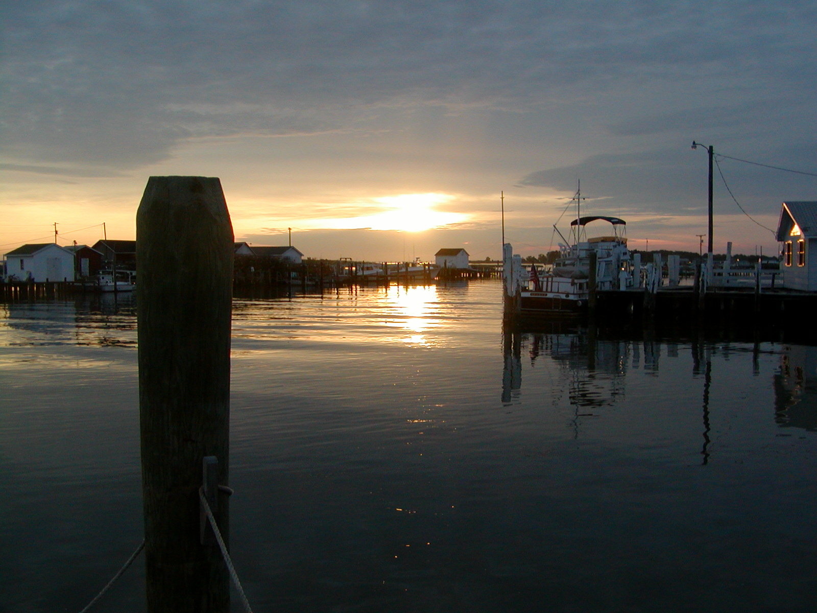
Harbor Sunrise Tangier Island

Sunset, Tangier Island 2

Marsh grass at sunset, Tangier Island

Blurred sunset, Taniger Island

Old bridge through marsh, Tangier Island
#2-Sunrise on Tangiers Island-2003

Sunset, Tangier Island 3

#1-Sunrise on Tangier's Island

Sunset, Port Isobel

Port Isobel, Va.

Port Isobel, Va.
Tangier, VA 美國的地圖
搜索其他地方的日出日落時間
Tangier, VA 美國的其他地方
附近地點
Main Ridge Rd, Tangier, VA 美國Main Ridge Road
Tangier Island, 2, VA, 美國
5, VA, 美國
Smith Point Rd, Reedville, VA 美國
Lighthouse View Dr, Heathsville, VA 美國
Fleeton Rd, Reedville, VA 美國
Menhaden Rd, Reedville, VA 美國
Reedville, VA 美國
55 Edwards Ln, Reedville, VA 美國
Cockrells Creek View Dr, Reedville, VA 美國
Northumberland Hwy, Reedville, VA 美國
Reason Creek, 5, VA 美國
4, VA, 美國
Peaceful Way, 5, VA 美國
Surprise Hill, VA 美國
美國乞沙比克灣
Cloverdale Rd, Kilmarnock, VA 美國Cloverdale Road
Whittington Rd, Exmore, VA 美國
Addies Creek Rd, Kilmarnock, VA 美國Addies Creek Road
Silver Beach, 5, VA 美國
最近搜索
- Red Dog Mine, AK, USA的日出日落時間表
- Am bhf, Borken, 德國Am Bahnhof的日出日落時間表
- 4th St E, Sonoma, CA 美國的日出日落時間表
- Oakland Ave, Williamsport, PA 美國的日出日落時間表
- Via Roma, Pieranica CR, 義大利的日出日落時間表
- 克羅埃西亞杜布羅夫尼克 GradClock Tower of Dubrovnik的日出日落時間表
- 阿根廷丘布特省特雷利烏的日出日落時間表
- Hartfords Bluff Cir, Mt Pleasant, SC 美國的日出日落時間表
- 日本熊本縣熊本市北區的日出日落時間表
- 中國福州市平潭縣平潭島的日出日落時間表