台灣屏東縣里港鄉瀰力路16號的日出日落時間表
Location: 台灣 > 屏東縣 > 里港鄉 > 瀰力村 >
時區:
Asia/Taipei
當地時間:
2025-07-07 14:26:46
經度:
120.4910105
緯度:
22.821284
今天日出時間:
05:18:44 AM
今天日落時間:
06:47:17 PM
今天日照時長:
13h 28m 33s
明天日出時間:
05:19:07 AM
明天日落時間:
06:47:12 PM
明天日照時長:
13h 28m 5s
顯示所有日期
| 日期 | 日出 | 日落 | 日照時長 |
|---|---|---|---|
| 2025年01月01日 | 06:38:38 AM | 05:24:38 PM | 10h 46m 0s |
| 2025年01月02日 | 06:38:56 AM | 05:25:16 PM | 10h 46m 20s |
| 2025年01月03日 | 06:39:12 AM | 05:25:56 PM | 10h 46m 44s |
| 2025年01月04日 | 06:39:27 AM | 05:26:35 PM | 10h 47m 8s |
| 2025年01月05日 | 06:39:41 AM | 05:27:15 PM | 10h 47m 34s |
| 2025年01月06日 | 06:39:53 AM | 05:27:56 PM | 10h 48m 3s |
| 2025年01月07日 | 06:40:04 AM | 05:28:37 PM | 10h 48m 33s |
| 2025年01月08日 | 06:40:14 AM | 05:29:18 PM | 10h 49m 4s |
| 2025年01月09日 | 06:40:22 AM | 05:29:59 PM | 10h 49m 37s |
| 2025年01月10日 | 06:40:29 AM | 05:30:41 PM | 10h 50m 12s |
| 2025年01月11日 | 06:40:35 AM | 05:31:23 PM | 10h 50m 48s |
| 2025年01月12日 | 06:40:39 AM | 05:32:05 PM | 10h 51m 26s |
| 2025年01月13日 | 06:40:42 AM | 05:32:47 PM | 10h 52m 5s |
| 2025年01月14日 | 06:40:43 AM | 05:33:30 PM | 10h 52m 47s |
| 2025年01月15日 | 06:40:44 AM | 05:34:12 PM | 10h 53m 28s |
| 2025年01月16日 | 06:40:42 AM | 05:34:55 PM | 10h 54m 13s |
| 2025年01月17日 | 06:40:40 AM | 05:35:37 PM | 10h 54m 57s |
| 2025年01月18日 | 06:40:36 AM | 05:36:20 PM | 10h 55m 44s |
| 2025年01月19日 | 06:40:30 AM | 05:37:02 PM | 10h 56m 32s |
| 2025年01月20日 | 06:40:23 AM | 05:37:44 PM | 10h 57m 21s |
| 2025年01月21日 | 06:40:15 AM | 05:38:27 PM | 10h 58m 12s |
| 2025年01月22日 | 06:40:05 AM | 05:39:09 PM | 10h 59m 4s |
| 2025年01月23日 | 06:39:54 AM | 05:39:51 PM | 10h 59m 57s |
| 2025年01月24日 | 06:39:42 AM | 05:40:32 PM | 11h 0m 50s |
| 2025年01月25日 | 06:39:28 AM | 05:41:14 PM | 11h 1m 46s |
| 2025年01月26日 | 06:39:13 AM | 05:41:55 PM | 11h 2m 42s |
| 2025年01月27日 | 06:38:57 AM | 05:42:36 PM | 11h 3m 39s |
| 2025年01月28日 | 06:38:39 AM | 05:43:17 PM | 11h 4m 38s |
| 2025年01月29日 | 06:38:20 AM | 05:43:57 PM | 11h 5m 37s |
| 2025年01月30日 | 06:37:59 AM | 05:44:38 PM | 11h 6m 39s |
| 2025年01月31日 | 06:37:37 AM | 05:45:17 PM | 11h 7m 40s |
| 2025年02月01日 | 06:37:14 AM | 05:45:57 PM | 11h 8m 43s |
| 2025年02月02日 | 06:36:50 AM | 05:46:36 PM | 11h 9m 46s |
| 2025年02月03日 | 06:36:25 AM | 05:47:15 PM | 11h 10m 50s |
| 2025年02月04日 | 06:35:58 AM | 05:47:53 PM | 11h 11m 55s |
| 2025年02月05日 | 06:35:30 AM | 05:48:31 PM | 11h 13m 1s |
| 2025年02月06日 | 06:35:01 AM | 05:49:08 PM | 11h 14m 7s |
| 2025年02月07日 | 06:34:31 AM | 05:49:45 PM | 11h 15m 14s |
| 2025年02月08日 | 06:33:59 AM | 05:50:22 PM | 11h 16m 23s |
| 2025年02月09日 | 06:33:26 AM | 05:50:58 PM | 11h 17m 32s |
| 2025年02月10日 | 06:32:53 AM | 05:51:34 PM | 11h 18m 41s |
| 2025年02月11日 | 06:32:18 AM | 05:52:09 PM | 11h 19m 51s |
| 2025年02月12日 | 06:31:42 AM | 05:52:44 PM | 11h 21m 2s |
| 2025年02月13日 | 06:31:05 AM | 05:53:18 PM | 11h 22m 13s |
| 2025年02月14日 | 06:30:27 AM | 05:53:52 PM | 11h 23m 25s |
| 2025年02月15日 | 06:29:48 AM | 05:54:26 PM | 11h 24m 38s |
| 2025年02月16日 | 06:29:08 AM | 05:54:59 PM | 11h 25m 51s |
| 2025年02月17日 | 06:28:27 AM | 05:55:31 PM | 11h 27m 4s |
| 2025年02月18日 | 06:27:46 AM | 05:56:03 PM | 11h 28m 17s |
| 2025年02月19日 | 06:27:03 AM | 05:56:35 PM | 11h 29m 32s |
| 2025年02月20日 | 06:26:19 AM | 05:57:06 PM | 11h 30m 47s |
| 2025年02月21日 | 06:25:35 AM | 05:57:37 PM | 11h 32m 2s |
| 2025年02月22日 | 06:24:50 AM | 05:58:07 PM | 11h 33m 17s |
| 2025年02月23日 | 06:24:03 AM | 05:58:37 PM | 11h 34m 34s |
| 2025年02月24日 | 06:23:17 AM | 05:59:06 PM | 11h 35m 49s |
| 2025年02月25日 | 06:22:29 AM | 05:59:35 PM | 11h 37m 6s |
| 2025年02月26日 | 06:21:41 AM | 06:00:04 PM | 11h 38m 23s |
| 2025年02月27日 | 06:20:52 AM | 06:00:32 PM | 11h 39m 40s |
| 2025年02月28日 | 06:20:02 AM | 06:01:00 PM | 11h 40m 58s |
| 2025年03月01日 | 06:19:12 AM | 06:01:27 PM | 11h 42m 15s |
| 2025年03月02日 | 06:18:21 AM | 06:01:54 PM | 11h 43m 33s |
| 2025年03月03日 | 06:17:29 AM | 06:02:21 PM | 11h 44m 52s |
| 2025年03月04日 | 06:16:37 AM | 06:02:47 PM | 11h 46m 10s |
| 2025年03月05日 | 06:15:44 AM | 06:03:13 PM | 11h 47m 29s |
| 2025年03月06日 | 06:14:51 AM | 06:03:38 PM | 11h 48m 47s |
| 2025年03月07日 | 06:13:57 AM | 06:04:03 PM | 11h 50m 6s |
| 2025年03月08日 | 06:13:03 AM | 06:04:28 PM | 11h 51m 25s |
| 2025年03月09日 | 06:12:09 AM | 06:04:53 PM | 11h 52m 44s |
| 2025年03月10日 | 06:11:14 AM | 06:05:17 PM | 11h 54m 3s |
| 2025年03月11日 | 06:10:18 AM | 06:05:41 PM | 11h 55m 23s |
| 2025年03月12日 | 06:09:23 AM | 06:06:05 PM | 11h 56m 42s |
| 2025年03月13日 | 06:08:27 AM | 06:06:29 PM | 11h 58m 2s |
| 2025年03月14日 | 06:07:30 AM | 06:06:52 PM | 11h 59m 22s |
| 2025年03月15日 | 06:06:34 AM | 06:07:15 PM | 12h 0m 41s |
| 2025年03月16日 | 06:05:37 AM | 06:07:38 PM | 12h 2m 1s |
| 2025年03月17日 | 06:04:40 AM | 06:08:01 PM | 12h 3m 21s |
| 2025年03月18日 | 06:03:42 AM | 06:08:23 PM | 12h 4m 41s |
| 2025年03月19日 | 06:02:45 AM | 06:08:46 PM | 12h 6m 1s |
| 2025年03月20日 | 06:01:47 AM | 06:09:08 PM | 12h 7m 21s |
| 2025年03月21日 | 06:00:50 AM | 06:09:30 PM | 12h 8m 40s |
| 2025年03月22日 | 05:59:52 AM | 06:09:52 PM | 12h 10m 0s |
| 2025年03月23日 | 05:58:54 AM | 06:10:14 PM | 12h 11m 20s |
| 2025年03月24日 | 05:57:56 AM | 06:10:36 PM | 12h 12m 40s |
| 2025年03月25日 | 05:56:58 AM | 06:10:57 PM | 12h 13m 59s |
| 2025年03月26日 | 05:56:00 AM | 06:11:19 PM | 12h 15m 19s |
| 2025年03月27日 | 05:55:03 AM | 06:11:41 PM | 12h 16m 38s |
| 2025年03月28日 | 05:54:05 AM | 06:12:02 PM | 12h 17m 57s |
| 2025年03月29日 | 05:53:07 AM | 06:12:24 PM | 12h 19m 17s |
| 2025年03月30日 | 05:52:10 AM | 06:12:45 PM | 12h 20m 35s |
| 2025年03月31日 | 05:51:12 AM | 06:13:07 PM | 12h 21m 55s |
| 2025年04月01日 | 05:50:15 AM | 06:13:28 PM | 12h 23m 13s |
| 2025年04月02日 | 05:49:18 AM | 06:13:50 PM | 12h 24m 32s |
| 2025年04月03日 | 05:48:21 AM | 06:14:12 PM | 12h 25m 51s |
| 2025年04月04日 | 05:47:25 AM | 06:14:33 PM | 12h 27m 8s |
| 2025年04月05日 | 05:46:29 AM | 06:14:55 PM | 12h 28m 26s |
| 2025年04月06日 | 05:45:33 AM | 06:15:17 PM | 12h 29m 44s |
| 2025年04月07日 | 05:44:37 AM | 06:15:39 PM | 12h 31m 2s |
| 2025年04月08日 | 05:43:42 AM | 06:16:01 PM | 12h 32m 19s |
| 2025年04月09日 | 05:42:47 AM | 06:16:23 PM | 12h 33m 36s |
| 2025年04月10日 | 05:41:52 AM | 06:16:45 PM | 12h 34m 53s |
| 2025年04月11日 | 05:40:58 AM | 06:17:08 PM | 12h 36m 10s |
| 2025年04月12日 | 05:40:05 AM | 06:17:30 PM | 12h 37m 25s |
| 2025年04月13日 | 05:39:11 AM | 06:17:53 PM | 12h 38m 42s |
| 2025年04月14日 | 05:38:19 AM | 06:18:16 PM | 12h 39m 57s |
| 2025年04月15日 | 05:37:27 AM | 06:18:39 PM | 12h 41m 12s |
| 2025年04月16日 | 05:36:35 AM | 06:19:02 PM | 12h 42m 27s |
| 2025年04月17日 | 05:35:44 AM | 06:19:25 PM | 12h 43m 41s |
| 2025年04月18日 | 05:34:54 AM | 06:19:49 PM | 12h 44m 55s |
| 2025年04月19日 | 05:34:04 AM | 06:20:12 PM | 12h 46m 8s |
| 2025年04月20日 | 05:33:15 AM | 06:20:36 PM | 12h 47m 21s |
| 2025年04月21日 | 05:32:26 AM | 06:21:00 PM | 12h 48m 34s |
| 2025年04月22日 | 05:31:38 AM | 06:21:25 PM | 12h 49m 47s |
| 2025年04月23日 | 05:30:51 AM | 06:21:49 PM | 12h 50m 58s |
| 2025年04月24日 | 05:30:05 AM | 06:22:14 PM | 12h 52m 9s |
| 2025年04月25日 | 05:29:19 AM | 06:22:39 PM | 12h 53m 20s |
| 2025年04月26日 | 05:28:34 AM | 06:23:04 PM | 12h 54m 30s |
| 2025年04月27日 | 05:27:50 AM | 06:23:29 PM | 12h 55m 39s |
| 2025年04月28日 | 05:27:07 AM | 06:23:55 PM | 12h 56m 48s |
| 2025年04月29日 | 05:26:25 AM | 06:24:20 PM | 12h 57m 55s |
| 2025年04月30日 | 05:25:43 AM | 06:24:46 PM | 12h 59m 3s |
| 2025年05月01日 | 05:25:02 AM | 06:25:12 PM | 13h 0m 10s |
| 2025年05月02日 | 05:24:22 AM | 06:25:39 PM | 13h 1m 17s |
| 2025年05月03日 | 05:23:44 AM | 06:26:05 PM | 13h 2m 21s |
| 2025年05月04日 | 05:23:06 AM | 06:26:32 PM | 13h 3m 26s |
| 2025年05月05日 | 05:22:29 AM | 06:26:59 PM | 13h 4m 30s |
| 2025年05月06日 | 05:21:52 AM | 06:27:26 PM | 13h 5m 34s |
| 2025年05月07日 | 05:21:17 AM | 06:27:53 PM | 13h 6m 36s |
| 2025年05月08日 | 05:20:43 AM | 06:28:20 PM | 13h 7m 37s |
| 2025年05月09日 | 05:20:10 AM | 06:28:47 PM | 13h 8m 37s |
| 2025年05月10日 | 05:19:38 AM | 06:29:15 PM | 13h 9m 37s |
| 2025年05月11日 | 05:19:07 AM | 06:29:43 PM | 13h 10m 36s |
| 2025年05月12日 | 05:18:37 AM | 06:30:10 PM | 13h 11m 33s |
| 2025年05月13日 | 05:18:08 AM | 06:30:38 PM | 13h 12m 30s |
| 2025年05月14日 | 05:17:40 AM | 06:31:06 PM | 13h 13m 26s |
| 2025年05月15日 | 05:17:13 AM | 06:31:34 PM | 13h 14m 21s |
| 2025年05月16日 | 05:16:48 AM | 06:32:02 PM | 13h 15m 14s |
| 2025年05月17日 | 05:16:23 AM | 06:32:30 PM | 13h 16m 7s |
| 2025年05月18日 | 05:16:00 AM | 06:32:58 PM | 13h 16m 58s |
| 2025年05月19日 | 05:15:37 AM | 06:33:26 PM | 13h 17m 49s |
| 2025年05月20日 | 05:15:16 AM | 06:33:54 PM | 13h 18m 38s |
| 2025年05月21日 | 05:14:56 AM | 06:34:22 PM | 13h 19m 26s |
| 2025年05月22日 | 05:14:37 AM | 06:34:49 PM | 13h 20m 12s |
| 2025年05月23日 | 05:14:19 AM | 06:35:17 PM | 13h 20m 58s |
| 2025年05月24日 | 05:14:03 AM | 06:35:45 PM | 13h 21m 42s |
| 2025年05月25日 | 05:13:47 AM | 06:36:12 PM | 13h 22m 25s |
| 2025年05月26日 | 05:13:33 AM | 06:36:39 PM | 13h 23m 6s |
| 2025年05月27日 | 05:13:20 AM | 06:37:06 PM | 13h 23m 46s |
| 2025年05月28日 | 05:13:08 AM | 06:37:33 PM | 13h 24m 25s |
| 2025年05月29日 | 05:12:57 AM | 06:38:00 PM | 13h 25m 3s |
| 2025年05月30日 | 05:12:47 AM | 06:38:26 PM | 13h 25m 39s |
| 2025年05月31日 | 05:12:38 AM | 06:38:52 PM | 13h 26m 14s |
| 2025年06月01日 | 05:12:31 AM | 06:39:18 PM | 13h 26m 47s |
| 2025年06月02日 | 05:12:25 AM | 06:39:43 PM | 13h 27m 18s |
| 2025年06月03日 | 05:12:19 AM | 06:40:08 PM | 13h 27m 49s |
| 2025年06月04日 | 05:12:15 AM | 06:40:32 PM | 13h 28m 17s |
| 2025年06月05日 | 05:12:12 AM | 06:40:56 PM | 13h 28m 44s |
| 2025年06月06日 | 05:12:10 AM | 06:41:20 PM | 13h 29m 10s |
| 2025年06月07日 | 05:12:10 AM | 06:41:43 PM | 13h 29m 33s |
| 2025年06月08日 | 05:12:10 AM | 06:42:06 PM | 13h 29m 56s |
| 2025年06月09日 | 05:12:11 AM | 06:42:28 PM | 13h 30m 17s |
| 2025年06月10日 | 05:12:14 AM | 06:42:49 PM | 13h 30m 35s |
| 2025年06月11日 | 05:12:17 AM | 06:43:10 PM | 13h 30m 53s |
| 2025年06月12日 | 05:12:22 AM | 06:43:30 PM | 13h 31m 8s |
| 2025年06月13日 | 05:12:27 AM | 06:43:50 PM | 13h 31m 23s |
| 2025年06月14日 | 05:12:34 AM | 06:44:09 PM | 13h 31m 35s |
| 2025年06月15日 | 05:12:41 AM | 06:44:27 PM | 13h 31m 46s |
| 2025年06月16日 | 05:12:50 AM | 06:44:44 PM | 13h 31m 54s |
| 2025年06月17日 | 05:12:59 AM | 06:45:01 PM | 13h 32m 2s |
| 2025年06月18日 | 05:13:09 AM | 06:45:17 PM | 13h 32m 8s |
| 2025年06月19日 | 05:13:20 AM | 06:45:32 PM | 13h 32m 12s |
| 2025年06月20日 | 05:13:32 AM | 06:45:46 PM | 13h 32m 14s |
| 2025年06月21日 | 05:13:45 AM | 06:45:59 PM | 13h 32m 14s |
| 2025年06月22日 | 05:13:59 AM | 06:46:12 PM | 13h 32m 13s |
| 2025年06月23日 | 05:14:13 AM | 06:46:23 PM | 13h 32m 10s |
| 2025年06月24日 | 05:14:29 AM | 06:46:34 PM | 13h 32m 5s |
| 2025年06月25日 | 05:14:45 AM | 06:46:43 PM | 13h 31m 58s |
| 2025年06月26日 | 05:15:01 AM | 06:46:52 PM | 13h 31m 51s |
| 2025年06月27日 | 05:15:19 AM | 06:46:59 PM | 13h 31m 40s |
| 2025年06月28日 | 05:15:37 AM | 06:47:06 PM | 13h 31m 29s |
| 2025年06月29日 | 05:15:55 AM | 06:47:12 PM | 13h 31m 17s |
| 2025年06月30日 | 05:16:15 AM | 06:47:16 PM | 13h 31m 1s |
| 2025年07月01日 | 05:16:35 AM | 06:47:19 PM | 13h 30m 44s |
| 2025年07月02日 | 05:16:55 AM | 06:47:22 PM | 13h 30m 27s |
| 2025年07月03日 | 05:17:16 AM | 06:47:23 PM | 13h 30m 7s |
| 2025年07月04日 | 05:17:37 AM | 06:47:23 PM | 13h 29m 46s |
| 2025年07月05日 | 05:17:59 AM | 06:47:22 PM | 13h 29m 23s |
| 2025年07月06日 | 05:18:22 AM | 06:47:20 PM | 13h 28m 58s |
| 2025年07月07日 | 05:18:44 AM | 06:47:17 PM | 13h 28m 33s |
| 2025年07月08日 | 05:19:07 AM | 06:47:12 PM | 13h 28m 5s |
| 2025年07月09日 | 05:19:31 AM | 06:47:07 PM | 13h 27m 36s |
| 2025年07月10日 | 05:19:55 AM | 06:47:00 PM | 13h 27m 5s |
| 2025年07月11日 | 05:20:19 AM | 06:46:52 PM | 13h 26m 33s |
| 2025年07月12日 | 05:20:43 AM | 06:46:43 PM | 13h 26m 0s |
| 2025年07月13日 | 05:21:08 AM | 06:46:33 PM | 13h 25m 25s |
| 2025年07月14日 | 05:21:33 AM | 06:46:21 PM | 13h 24m 48s |
| 2025年07月15日 | 05:21:58 AM | 06:46:08 PM | 13h 24m 10s |
| 2025年07月16日 | 05:22:23 AM | 06:45:54 PM | 13h 23m 31s |
| 2025年07月17日 | 05:22:49 AM | 06:45:39 PM | 13h 22m 50s |
| 2025年07月18日 | 05:23:14 AM | 06:45:23 PM | 13h 22m 9s |
| 2025年07月19日 | 05:23:40 AM | 06:45:06 PM | 13h 21m 26s |
| 2025年07月20日 | 05:24:05 AM | 06:44:47 PM | 13h 20m 42s |
| 2025年07月21日 | 05:24:31 AM | 06:44:27 PM | 13h 19m 56s |
| 2025年07月22日 | 05:24:57 AM | 06:44:06 PM | 13h 19m 9s |
| 2025年07月23日 | 05:25:23 AM | 06:43:44 PM | 13h 18m 21s |
| 2025年07月24日 | 05:25:49 AM | 06:43:21 PM | 13h 17m 32s |
| 2025年07月25日 | 05:26:14 AM | 06:42:56 PM | 13h 16m 42s |
| 2025年07月26日 | 05:26:40 AM | 06:42:31 PM | 13h 15m 51s |
| 2025年07月27日 | 05:27:06 AM | 06:42:04 PM | 13h 14m 58s |
| 2025年07月28日 | 05:27:31 AM | 06:41:36 PM | 13h 14m 5s |
| 2025年07月29日 | 05:27:57 AM | 06:41:07 PM | 13h 13m 10s |
| 2025年07月30日 | 05:28:22 AM | 06:40:37 PM | 13h 12m 15s |
| 2025年07月31日 | 05:28:48 AM | 06:40:06 PM | 13h 11m 18s |
| 2025年08月01日 | 05:29:13 AM | 06:39:33 PM | 13h 10m 20s |
| 2025年08月02日 | 05:29:38 AM | 06:39:00 PM | 13h 9m 22s |
| 2025年08月03日 | 05:30:03 AM | 06:38:26 PM | 13h 8m 23s |
| 2025年08月04日 | 05:30:27 AM | 06:37:50 PM | 13h 7m 23s |
| 2025年08月05日 | 05:30:52 AM | 06:37:14 PM | 13h 6m 22s |
| 2025年08月06日 | 05:31:16 AM | 06:36:36 PM | 13h 5m 20s |
| 2025年08月07日 | 05:31:40 AM | 06:35:58 PM | 13h 4m 18s |
| 2025年08月08日 | 05:32:04 AM | 06:35:18 PM | 13h 3m 14s |
| 2025年08月09日 | 05:32:28 AM | 06:34:38 PM | 13h 2m 10s |
| 2025年08月10日 | 05:32:51 AM | 06:33:57 PM | 13h 1m 6s |
| 2025年08月11日 | 05:33:14 AM | 06:33:14 PM | 13h 0m 0s |
| 2025年08月12日 | 05:33:37 AM | 06:32:31 PM | 12h 58m 54s |
| 2025年08月13日 | 05:34:00 AM | 06:31:47 PM | 12h 57m 47s |
| 2025年08月14日 | 05:34:22 AM | 06:31:02 PM | 12h 56m 40s |
| 2025年08月15日 | 05:34:45 AM | 06:30:17 PM | 12h 55m 32s |
| 2025年08月16日 | 05:35:07 AM | 06:29:30 PM | 12h 54m 23s |
| 2025年08月17日 | 05:35:29 AM | 06:28:43 PM | 12h 53m 14s |
| 2025年08月18日 | 05:35:50 AM | 06:27:55 PM | 12h 52m 5s |
| 2025年08月19日 | 05:36:11 AM | 06:27:06 PM | 12h 50m 55s |
| 2025年08月20日 | 05:36:33 AM | 06:26:16 PM | 12h 49m 43s |
| 2025年08月21日 | 05:36:53 AM | 06:25:26 PM | 12h 48m 33s |
| 2025年08月22日 | 05:37:14 AM | 06:24:35 PM | 12h 47m 21s |
| 2025年08月23日 | 05:37:34 AM | 06:23:43 PM | 12h 46m 9s |
| 2025年08月24日 | 05:37:55 AM | 06:22:51 PM | 12h 44m 56s |
| 2025年08月25日 | 05:38:15 AM | 06:21:58 PM | 12h 43m 43s |
| 2025年08月26日 | 05:38:34 AM | 06:21:04 PM | 12h 42m 30s |
| 2025年08月27日 | 05:38:54 AM | 06:20:10 PM | 12h 41m 16s |
| 2025年08月28日 | 05:39:13 AM | 06:19:16 PM | 12h 40m 3s |
| 2025年08月29日 | 05:39:33 AM | 06:18:20 PM | 12h 38m 47s |
| 2025年08月30日 | 05:39:52 AM | 06:17:25 PM | 12h 37m 33s |
| 2025年08月31日 | 05:40:10 AM | 06:16:28 PM | 12h 36m 18s |
| 2025年09月01日 | 05:40:29 AM | 06:15:32 PM | 12h 35m 3s |
| 2025年09月02日 | 05:40:48 AM | 06:14:35 PM | 12h 33m 47s |
| 2025年09月03日 | 05:41:06 AM | 06:13:37 PM | 12h 32m 31s |
| 2025年09月04日 | 05:41:24 AM | 06:12:39 PM | 12h 31m 15s |
| 2025年09月05日 | 05:41:42 AM | 06:11:41 PM | 12h 29m 59s |
| 2025年09月06日 | 05:42:01 AM | 06:10:43 PM | 12h 28m 42s |
| 2025年09月07日 | 05:42:18 AM | 06:09:44 PM | 12h 27m 26s |
| 2025年09月08日 | 05:42:36 AM | 06:08:45 PM | 12h 26m 9s |
| 2025年09月09日 | 05:42:54 AM | 06:07:45 PM | 12h 24m 51s |
| 2025年09月10日 | 05:43:12 AM | 06:06:45 PM | 12h 23m 33s |
| 2025年09月11日 | 05:43:29 AM | 06:05:46 PM | 12h 22m 17s |
| 2025年09月12日 | 05:43:47 AM | 06:04:46 PM | 12h 20m 59s |
| 2025年09月13日 | 05:44:05 AM | 06:03:45 PM | 12h 19m 40s |
| 2025年09月14日 | 05:44:22 AM | 06:02:45 PM | 12h 18m 23s |
| 2025年09月15日 | 05:44:40 AM | 06:01:45 PM | 12h 17m 5s |
| 2025年09月16日 | 05:44:58 AM | 06:00:44 PM | 12h 15m 46s |
| 2025年09月17日 | 05:45:15 AM | 05:59:44 PM | 12h 14m 29s |
| 2025年09月18日 | 05:45:33 AM | 05:58:43 PM | 12h 13m 10s |
| 2025年09月19日 | 05:45:51 AM | 05:57:42 PM | 12h 11m 51s |
| 2025年09月20日 | 05:46:09 AM | 05:56:42 PM | 12h 10m 33s |
| 2025年09月21日 | 05:46:27 AM | 05:55:41 PM | 12h 9m 14s |
| 2025年09月22日 | 05:46:45 AM | 05:54:41 PM | 12h 7m 56s |
| 2025年09月23日 | 05:47:03 AM | 05:53:40 PM | 12h 6m 37s |
| 2025年09月24日 | 05:47:21 AM | 05:52:40 PM | 12h 5m 19s |
| 2025年09月25日 | 05:47:40 AM | 05:51:40 PM | 12h 4m 0s |
| 2025年09月26日 | 05:47:58 AM | 05:50:40 PM | 12h 2m 42s |
| 2025年09月27日 | 05:48:17 AM | 05:49:40 PM | 12h 1m 23s |
| 2025年09月28日 | 05:48:36 AM | 05:48:41 PM | 12h 0m 5s |
| 2025年09月29日 | 05:48:56 AM | 05:47:42 PM | 11h 58m 46s |
| 2025年09月30日 | 05:49:15 AM | 05:46:43 PM | 11h 57m 28s |
| 2025年10月01日 | 05:49:35 AM | 05:45:44 PM | 11h 56m 9s |
| 2025年10月02日 | 05:49:55 AM | 05:44:46 PM | 11h 54m 51s |
| 2025年10月03日 | 05:50:15 AM | 05:43:48 PM | 11h 53m 33s |
| 2025年10月04日 | 05:50:35 AM | 05:42:50 PM | 11h 52m 15s |
| 2025年10月05日 | 05:50:56 AM | 05:41:53 PM | 11h 50m 57s |
| 2025年10月06日 | 05:51:17 AM | 05:40:56 PM | 11h 49m 39s |
| 2025年10月07日 | 05:51:39 AM | 05:40:00 PM | 11h 48m 21s |
| 2025年10月08日 | 05:52:01 AM | 05:39:04 PM | 11h 47m 3s |
| 2025年10月09日 | 05:52:23 AM | 05:38:09 PM | 11h 45m 46s |
| 2025年10月10日 | 05:52:45 AM | 05:37:14 PM | 11h 44m 29s |
| 2025年10月11日 | 05:53:08 AM | 05:36:20 PM | 11h 43m 12s |
| 2025年10月12日 | 05:53:31 AM | 05:35:27 PM | 11h 41m 56s |
| 2025年10月13日 | 05:53:55 AM | 05:34:34 PM | 11h 40m 39s |
| 2025年10月14日 | 05:54:19 AM | 05:33:42 PM | 11h 39m 23s |
| 2025年10月15日 | 05:54:44 AM | 05:32:50 PM | 11h 38m 6s |
| 2025年10月16日 | 05:55:09 AM | 05:31:59 PM | 11h 36m 50s |
| 2025年10月17日 | 05:55:34 AM | 05:31:09 PM | 11h 35m 35s |
| 2025年10月18日 | 05:56:00 AM | 05:30:20 PM | 11h 34m 20s |
| 2025年10月19日 | 05:56:26 AM | 05:29:31 PM | 11h 33m 5s |
| 2025年10月20日 | 05:56:53 AM | 05:28:44 PM | 11h 31m 51s |
| 2025年10月21日 | 05:57:20 AM | 05:27:57 PM | 11h 30m 37s |
| 2025年10月22日 | 05:57:47 AM | 05:27:11 PM | 11h 29m 24s |
| 2025年10月23日 | 05:58:15 AM | 05:26:25 PM | 11h 28m 10s |
| 2025年10月24日 | 05:58:44 AM | 05:25:41 PM | 11h 26m 57s |
| 2025年10月25日 | 05:59:13 AM | 05:24:58 PM | 11h 25m 45s |
| 2025年10月26日 | 05:59:43 AM | 05:24:15 PM | 11h 24m 32s |
| 2025年10月27日 | 06:00:13 AM | 05:23:34 PM | 11h 23m 21s |
| 2025年10月28日 | 06:00:43 AM | 05:22:54 PM | 11h 22m 11s |
| 2025年10月29日 | 06:01:14 AM | 05:22:14 PM | 11h 21m 0s |
| 2025年10月30日 | 06:01:46 AM | 05:21:36 PM | 11h 19m 50s |
| 2025年10月31日 | 06:02:18 AM | 05:20:59 PM | 11h 18m 41s |
| 2025年11月01日 | 06:02:50 AM | 05:20:22 PM | 11h 17m 32s |
| 2025年11月02日 | 06:03:23 AM | 05:19:47 PM | 11h 16m 24s |
| 2025年11月03日 | 06:03:57 AM | 05:19:14 PM | 11h 15m 17s |
| 2025年11月04日 | 06:04:31 AM | 05:18:41 PM | 11h 14m 10s |
| 2025年11月05日 | 06:05:05 AM | 05:18:09 PM | 11h 13m 4s |
| 2025年11月06日 | 06:05:40 AM | 05:17:39 PM | 11h 11m 59s |
| 2025年11月07日 | 06:06:15 AM | 05:17:10 PM | 11h 10m 55s |
| 2025年11月08日 | 06:06:51 AM | 05:16:42 PM | 11h 9m 51s |
| 2025年11月09日 | 06:07:27 AM | 05:16:15 PM | 11h 8m 48s |
| 2025年11月10日 | 06:08:04 AM | 05:15:50 PM | 11h 7m 46s |
| 2025年11月11日 | 06:08:41 AM | 05:15:26 PM | 11h 6m 45s |
| 2025年11月12日 | 06:09:18 AM | 05:15:03 PM | 11h 5m 45s |
| 2025年11月13日 | 06:09:56 AM | 05:14:42 PM | 11h 4m 46s |
| 2025年11月14日 | 06:10:34 AM | 05:14:22 PM | 11h 3m 48s |
| 2025年11月15日 | 06:11:12 AM | 05:14:03 PM | 11h 2m 51s |
| 2025年11月16日 | 06:11:51 AM | 05:13:46 PM | 11h 1m 55s |
| 2025年11月17日 | 06:12:30 AM | 05:13:30 PM | 11h 1m 0s |
| 2025年11月18日 | 06:13:09 AM | 05:13:15 PM | 11h 0m 6s |
| 2025年11月19日 | 06:13:49 AM | 05:13:02 PM | 10h 59m 13s |
| 2025年11月20日 | 06:14:29 AM | 05:12:50 PM | 10h 58m 21s |
| 2025年11月21日 | 06:15:09 AM | 05:12:40 PM | 10h 57m 31s |
| 2025年11月22日 | 06:15:49 AM | 05:12:31 PM | 10h 56m 42s |
| 2025年11月23日 | 06:16:29 AM | 05:12:24 PM | 10h 55m 55s |
| 2025年11月24日 | 06:17:10 AM | 05:12:18 PM | 10h 55m 8s |
| 2025年11月25日 | 06:17:50 AM | 05:12:13 PM | 10h 54m 23s |
| 2025年11月26日 | 06:18:31 AM | 05:12:10 PM | 10h 53m 39s |
| 2025年11月27日 | 06:19:11 AM | 05:12:08 PM | 10h 52m 57s |
| 2025年11月28日 | 06:19:52 AM | 05:12:08 PM | 10h 52m 16s |
| 2025年11月29日 | 06:20:33 AM | 05:12:09 PM | 10h 51m 36s |
| 2025年11月30日 | 06:21:13 AM | 05:12:11 PM | 10h 50m 58s |
| 2025年12月01日 | 06:21:54 AM | 05:12:15 PM | 10h 50m 21s |
| 2025年12月02日 | 06:22:34 AM | 05:12:21 PM | 10h 49m 47s |
| 2025年12月03日 | 06:23:14 AM | 05:12:27 PM | 10h 49m 13s |
| 2025年12月04日 | 06:23:54 AM | 05:12:36 PM | 10h 48m 42s |
| 2025年12月05日 | 06:24:34 AM | 05:12:45 PM | 10h 48m 11s |
| 2025年12月06日 | 06:25:13 AM | 05:12:56 PM | 10h 47m 43s |
| 2025年12月07日 | 06:25:52 AM | 05:13:08 PM | 10h 47m 16s |
| 2025年12月08日 | 06:26:31 AM | 05:13:22 PM | 10h 46m 51s |
| 2025年12月09日 | 06:27:09 AM | 05:13:37 PM | 10h 46m 28s |
| 2025年12月10日 | 06:27:47 AM | 05:13:53 PM | 10h 46m 6s |
| 2025年12月11日 | 06:28:25 AM | 05:14:11 PM | 10h 45m 46s |
| 2025年12月12日 | 06:29:02 AM | 05:14:30 PM | 10h 45m 28s |
| 2025年12月13日 | 06:29:38 AM | 05:14:50 PM | 10h 45m 12s |
| 2025年12月14日 | 06:30:14 AM | 05:15:11 PM | 10h 44m 57s |
| 2025年12月15日 | 06:30:49 AM | 05:15:33 PM | 10h 44m 44s |
| 2025年12月16日 | 06:31:23 AM | 05:15:57 PM | 10h 44m 34s |
| 2025年12月17日 | 06:31:57 AM | 05:16:22 PM | 10h 44m 25s |
| 2025年12月18日 | 06:32:30 AM | 05:16:48 PM | 10h 44m 18s |
| 2025年12月19日 | 06:33:02 AM | 05:17:15 PM | 10h 44m 13s |
| 2025年12月20日 | 06:33:34 AM | 05:17:43 PM | 10h 44m 9s |
| 2025年12月21日 | 06:34:04 AM | 05:18:12 PM | 10h 44m 8s |
| 2025年12月22日 | 06:34:34 AM | 05:18:42 PM | 10h 44m 8s |
| 2025年12月23日 | 06:35:02 AM | 05:19:13 PM | 10h 44m 11s |
| 2025年12月24日 | 06:35:30 AM | 05:19:45 PM | 10h 44m 15s |
| 2025年12月25日 | 06:35:57 AM | 05:20:17 PM | 10h 44m 20s |
| 2025年12月26日 | 06:36:23 AM | 05:20:51 PM | 10h 44m 28s |
| 2025年12月27日 | 06:36:47 AM | 05:21:25 PM | 10h 44m 38s |
| 2025年12月28日 | 06:37:11 AM | 05:22:01 PM | 10h 44m 50s |
| 2025年12月29日 | 06:37:33 AM | 05:22:37 PM | 10h 45m 4s |
| 2025年12月30日 | 06:37:55 AM | 05:23:13 PM | 10h 45m 18s |
| 2025年12月31日 | 06:38:15 AM | 05:23:51 PM | 10h 45m 36s |
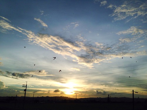
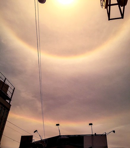
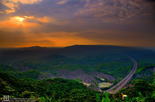
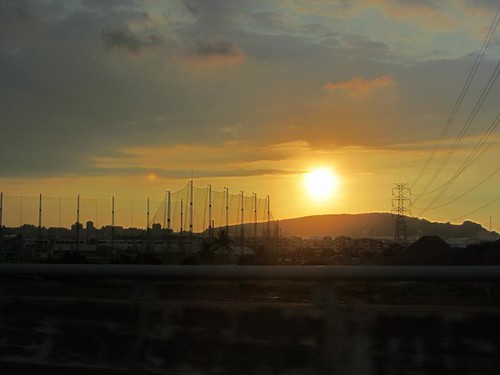
日出日落照片
台灣屏東縣里港鄉瀰力路16號的地圖
搜索其他地方的日出日落時間
附近地點
台灣屏東縣里港鄉瀰力村
台灣屏東縣里港鄉南進路22-10號
台灣屏東縣里港鄉三和路66號
台灣屏東縣里港鄉三廍村
台灣屏東縣里港鄉中和村
台灣高雄市旗山區中興街6號
台灣高雄市旗山區廣福里
台灣高雄市旗山區旗南三路-7號
台灣高雄市美濃區吉洋街18號
台灣高雄市旗山區黃厝巷58號
台灣屏東縣里港鄉
台灣高雄市旗山區旗南三路巷37號
台灣屏東縣里港鄉福興路33號
台灣屏東縣里港鄉永春村
台灣屏東縣里港鄉中山路號
台灣屏東縣里港鄉16-1
台灣屏東縣里港鄉土庫村
台灣高雄市美濃區吉洋里
台灣屏東縣里港鄉茄苳村
台灣屏東縣里港鄉里港
最近搜索
- Red Dog Mine, AK, USA的日出日落時間表
- Am bhf, Borken, 德國Am Bahnhof的日出日落時間表
- 4th St E, Sonoma, CA 美國的日出日落時間表
- Oakland Ave, Williamsport, PA 美國的日出日落時間表
- Via Roma, Pieranica CR, 義大利的日出日落時間表
- 克羅埃西亞杜布羅夫尼克 GradClock Tower of Dubrovnik的日出日落時間表
- 阿根廷丘布特省特雷利烏的日出日落時間表
- Hartfords Bluff Cir, Mt Pleasant, SC 美國的日出日落時間表
- 日本熊本縣熊本市北區的日出日落時間表
- 中國福州市平潭縣平潭島的日出日落時間表

