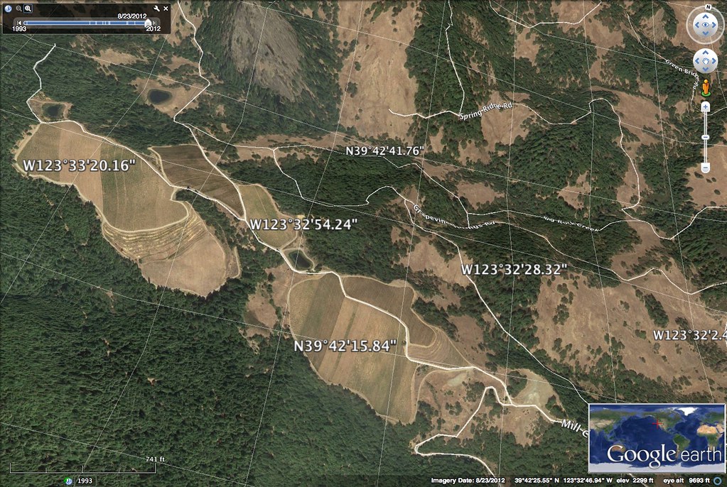
Mulligan Ln, Laytonville, CA 美國的日出日落時間表
Location: 美國 > 加利福尼亞州 > 門多西諾縣 > 美國 >
時區:
America/Los_Angeles
當地時間:
2025-06-18 21:10:39
經度:
-123.486705
緯度:
39.670459
今天日出時間:
05:46:04 AM
今天日落時間:
08:44:55 PM
今天日照時長:
14h 58m 51s
明天日出時間:
05:46:17 AM
明天日落時間:
08:45:09 PM
明天日照時長:
14h 58m 52s
顯示所有日期
| 日期 | 日出 | 日落 | 日照時長 |
|---|---|---|---|
| 2025年01月01日 | 07:34:51 AM | 05:01:29 PM | 9h 26m 38s |
| 2025年01月02日 | 07:34:54 AM | 05:02:21 PM | 9h 27m 27s |
| 2025年01月03日 | 07:34:55 AM | 05:03:15 PM | 9h 28m 20s |
| 2025年01月04日 | 07:34:54 AM | 05:04:09 PM | 9h 29m 15s |
| 2025年01月05日 | 07:34:51 AM | 05:05:05 PM | 9h 30m 14s |
| 2025年01月06日 | 07:34:45 AM | 05:06:02 PM | 9h 31m 17s |
| 2025年01月07日 | 07:34:37 AM | 05:07:01 PM | 9h 32m 24s |
| 2025年01月08日 | 07:34:27 AM | 05:08:00 PM | 9h 33m 33s |
| 2025年01月09日 | 07:34:15 AM | 05:09:01 PM | 9h 34m 46s |
| 2025年01月10日 | 07:34:01 AM | 05:10:02 PM | 9h 36m 1s |
| 2025年01月11日 | 07:33:44 AM | 05:11:05 PM | 9h 37m 21s |
| 2025年01月12日 | 07:33:26 AM | 05:12:08 PM | 9h 38m 42s |
| 2025年01月13日 | 07:33:05 AM | 05:13:12 PM | 9h 40m 7s |
| 2025年01月14日 | 07:32:42 AM | 05:14:17 PM | 9h 41m 35s |
| 2025年01月15日 | 07:32:17 AM | 05:15:23 PM | 9h 43m 6s |
| 2025年01月16日 | 07:31:50 AM | 05:16:30 PM | 9h 44m 40s |
| 2025年01月17日 | 07:31:20 AM | 05:17:37 PM | 9h 46m 17s |
| 2025年01月18日 | 07:30:49 AM | 05:18:45 PM | 9h 47m 56s |
| 2025年01月19日 | 07:30:16 AM | 05:19:53 PM | 9h 49m 37s |
| 2025年01月20日 | 07:29:40 AM | 05:21:02 PM | 9h 51m 22s |
| 2025年01月21日 | 07:29:03 AM | 05:22:11 PM | 9h 53m 8s |
| 2025年01月22日 | 07:28:24 AM | 05:23:21 PM | 9h 54m 57s |
| 2025年01月23日 | 07:27:43 AM | 05:24:31 PM | 9h 56m 48s |
| 2025年01月24日 | 07:27:00 AM | 05:25:41 PM | 9h 58m 41s |
| 2025年01月25日 | 07:26:15 AM | 05:26:52 PM | 10h 0m 37s |
| 2025年01月26日 | 07:25:28 AM | 05:28:02 PM | 10h 2m 34s |
| 2025年01月27日 | 07:24:39 AM | 05:29:13 PM | 10h 4m 34s |
| 2025年01月28日 | 07:23:49 AM | 05:30:25 PM | 10h 6m 36s |
| 2025年01月29日 | 07:22:57 AM | 05:31:36 PM | 10h 8m 39s |
| 2025年01月30日 | 07:22:03 AM | 05:32:47 PM | 10h 10m 44s |
| 2025年01月31日 | 07:21:07 AM | 05:33:59 PM | 10h 12m 52s |
| 2025年02月01日 | 07:20:10 AM | 05:35:10 PM | 10h 15m 0s |
| 2025年02月02日 | 07:19:11 AM | 05:36:22 PM | 10h 17m 11s |
| 2025年02月03日 | 07:18:11 AM | 05:37:33 PM | 10h 19m 22s |
| 2025年02月04日 | 07:17:09 AM | 05:38:44 PM | 10h 21m 35s |
| 2025年02月05日 | 07:16:05 AM | 05:39:56 PM | 10h 23m 51s |
| 2025年02月06日 | 07:15:00 AM | 05:41:07 PM | 10h 26m 7s |
| 2025年02月07日 | 07:13:54 AM | 05:42:18 PM | 10h 28m 24s |
| 2025年02月08日 | 07:12:46 AM | 05:43:29 PM | 10h 30m 43s |
| 2025年02月09日 | 07:11:37 AM | 05:44:39 PM | 10h 33m 2s |
| 2025年02月10日 | 07:10:26 AM | 05:45:50 PM | 10h 35m 24s |
| 2025年02月11日 | 07:09:14 AM | 05:47:00 PM | 10h 37m 46s |
| 2025年02月12日 | 07:08:01 AM | 05:48:10 PM | 10h 40m 9s |
| 2025年02月13日 | 07:06:47 AM | 05:49:20 PM | 10h 42m 33s |
| 2025年02月14日 | 07:05:31 AM | 05:50:29 PM | 10h 44m 58s |
| 2025年02月15日 | 07:04:15 AM | 05:51:39 PM | 10h 47m 24s |
| 2025年02月16日 | 07:02:57 AM | 05:52:48 PM | 10h 49m 51s |
| 2025年02月17日 | 07:01:38 AM | 05:53:56 PM | 10h 52m 18s |
| 2025年02月18日 | 07:00:18 AM | 05:55:05 PM | 10h 54m 47s |
| 2025年02月19日 | 06:58:57 AM | 05:56:13 PM | 10h 57m 16s |
| 2025年02月20日 | 06:57:35 AM | 05:57:21 PM | 10h 59m 46s |
| 2025年02月21日 | 06:56:12 AM | 05:58:29 PM | 11h 2m 17s |
| 2025年02月22日 | 06:54:48 AM | 05:59:36 PM | 11h 4m 48s |
| 2025年02月23日 | 06:53:23 AM | 06:00:43 PM | 11h 7m 20s |
| 2025年02月24日 | 06:51:57 AM | 06:01:49 PM | 11h 9m 52s |
| 2025年02月25日 | 06:50:31 AM | 06:02:56 PM | 11h 12m 25s |
| 2025年02月26日 | 06:49:04 AM | 06:04:02 PM | 11h 14m 58s |
| 2025年02月27日 | 06:47:36 AM | 06:05:07 PM | 11h 17m 31s |
| 2025年02月28日 | 06:46:07 AM | 06:06:13 PM | 11h 20m 6s |
| 2025年03月01日 | 06:44:37 AM | 06:07:18 PM | 11h 22m 41s |
| 2025年03月02日 | 06:43:07 AM | 06:08:23 PM | 11h 25m 16s |
| 2025年03月03日 | 06:41:37 AM | 06:09:27 PM | 11h 27m 50s |
| 2025年03月04日 | 06:40:05 AM | 06:10:32 PM | 11h 30m 27s |
| 2025年03月05日 | 06:38:33 AM | 06:11:35 PM | 11h 33m 2s |
| 2025年03月06日 | 06:37:01 AM | 06:12:39 PM | 11h 35m 38s |
| 2025年03月07日 | 06:35:28 AM | 06:13:43 PM | 11h 38m 15s |
| 2025年03月08日 | 06:33:55 AM | 06:14:46 PM | 11h 40m 51s |
| 2025年03月09日 | 07:32:25 AM | 07:15:46 PM | 11h 43m 21s |
| 2025年03月10日 | 07:30:51 AM | 07:16:49 PM | 11h 45m 58s |
| 2025年03月11日 | 07:29:16 AM | 07:17:51 PM | 11h 48m 35s |
| 2025年03月12日 | 07:27:41 AM | 07:18:53 PM | 11h 51m 12s |
| 2025年03月13日 | 07:26:06 AM | 07:19:55 PM | 11h 53m 49s |
| 2025年03月14日 | 07:24:31 AM | 07:20:57 PM | 11h 56m 26s |
| 2025年03月15日 | 07:22:55 AM | 07:21:59 PM | 11h 59m 4s |
| 2025年03月16日 | 07:21:19 AM | 07:23:00 PM | 12h 1m 41s |
| 2025年03月17日 | 07:19:43 AM | 07:24:02 PM | 12h 4m 19s |
| 2025年03月18日 | 07:18:07 AM | 07:25:03 PM | 12h 6m 56s |
| 2025年03月19日 | 07:16:30 AM | 07:26:04 PM | 12h 9m 34s |
| 2025年03月20日 | 07:14:54 AM | 07:27:04 PM | 12h 12m 10s |
| 2025年03月21日 | 07:13:17 AM | 07:28:05 PM | 12h 14m 48s |
| 2025年03月22日 | 07:11:41 AM | 07:29:06 PM | 12h 17m 25s |
| 2025年03月23日 | 07:10:04 AM | 07:30:06 PM | 12h 20m 2s |
| 2025年03月24日 | 07:08:28 AM | 07:31:06 PM | 12h 22m 38s |
| 2025年03月25日 | 07:06:51 AM | 07:32:07 PM | 12h 25m 16s |
| 2025年03月26日 | 07:05:15 AM | 07:33:07 PM | 12h 27m 52s |
| 2025年03月27日 | 07:03:39 AM | 07:34:07 PM | 12h 30m 28s |
| 2025年03月28日 | 07:02:02 AM | 07:35:07 PM | 12h 33m 5s |
| 2025年03月29日 | 07:00:27 AM | 07:36:07 PM | 12h 35m 40s |
| 2025年03月30日 | 06:58:51 AM | 07:37:07 PM | 12h 38m 16s |
| 2025年03月31日 | 06:57:15 AM | 07:38:07 PM | 12h 40m 52s |
| 2025年04月01日 | 06:55:40 AM | 07:39:07 PM | 12h 43m 27s |
| 2025年04月02日 | 06:54:05 AM | 07:40:06 PM | 12h 46m 1s |
| 2025年04月03日 | 06:52:31 AM | 07:41:06 PM | 12h 48m 35s |
| 2025年04月04日 | 06:50:56 AM | 07:42:06 PM | 12h 51m 10s |
| 2025年04月05日 | 06:49:23 AM | 07:43:06 PM | 12h 53m 43s |
| 2025年04月06日 | 06:47:49 AM | 07:44:06 PM | 12h 56m 17s |
| 2025年04月07日 | 06:46:16 AM | 07:45:06 PM | 12h 58m 50s |
| 2025年04月08日 | 06:44:44 AM | 07:46:05 PM | 13h 1m 21s |
| 2025年04月09日 | 06:43:12 AM | 07:47:05 PM | 13h 3m 53s |
| 2025年04月10日 | 06:41:41 AM | 07:48:05 PM | 13h 6m 24s |
| 2025年04月11日 | 06:40:10 AM | 07:49:05 PM | 13h 8m 55s |
| 2025年04月12日 | 06:38:39 AM | 07:50:05 PM | 13h 11m 26s |
| 2025年04月13日 | 06:37:10 AM | 07:51:05 PM | 13h 13m 55s |
| 2025年04月14日 | 06:35:41 AM | 07:52:05 PM | 13h 16m 24s |
| 2025年04月15日 | 06:34:13 AM | 07:53:05 PM | 13h 18m 52s |
| 2025年04月16日 | 06:32:45 AM | 07:54:05 PM | 13h 21m 20s |
| 2025年04月17日 | 06:31:19 AM | 07:55:05 PM | 13h 23m 46s |
| 2025年04月18日 | 06:29:53 AM | 07:56:05 PM | 13h 26m 12s |
| 2025年04月19日 | 06:28:28 AM | 07:57:05 PM | 13h 28m 37s |
| 2025年04月20日 | 06:27:03 AM | 07:58:05 PM | 13h 31m 2s |
| 2025年04月21日 | 06:25:40 AM | 07:59:06 PM | 13h 33m 26s |
| 2025年04月22日 | 06:24:17 AM | 08:00:06 PM | 13h 35m 49s |
| 2025年04月23日 | 06:22:56 AM | 08:01:06 PM | 13h 38m 10s |
| 2025年04月24日 | 06:21:35 AM | 08:02:06 PM | 13h 40m 31s |
| 2025年04月25日 | 06:20:16 AM | 08:03:06 PM | 13h 42m 50s |
| 2025年04月26日 | 06:18:57 AM | 08:04:06 PM | 13h 45m 9s |
| 2025年04月27日 | 06:17:40 AM | 08:05:06 PM | 13h 47m 26s |
| 2025年04月28日 | 06:16:24 AM | 08:06:06 PM | 13h 49m 42s |
| 2025年04月29日 | 06:15:09 AM | 08:07:06 PM | 13h 51m 57s |
| 2025年04月30日 | 06:13:55 AM | 08:08:05 PM | 13h 54m 10s |
| 2025年05月01日 | 06:12:42 AM | 08:09:05 PM | 13h 56m 23s |
| 2025年05月02日 | 06:11:30 AM | 08:10:04 PM | 13h 58m 34s |
| 2025年05月03日 | 06:10:20 AM | 08:11:04 PM | 14h 0m 44s |
| 2025年05月04日 | 06:09:11 AM | 08:12:03 PM | 14h 2m 52s |
| 2025年05月05日 | 06:08:03 AM | 08:13:02 PM | 14h 4m 59s |
| 2025年05月06日 | 06:06:57 AM | 08:14:00 PM | 14h 7m 3s |
| 2025年05月07日 | 06:05:52 AM | 08:14:59 PM | 14h 9m 7s |
| 2025年05月08日 | 06:04:48 AM | 08:15:57 PM | 14h 11m 9s |
| 2025年05月09日 | 06:03:46 AM | 08:16:55 PM | 14h 13m 9s |
| 2025年05月10日 | 06:02:45 AM | 08:17:53 PM | 14h 15m 8s |
| 2025年05月11日 | 06:01:46 AM | 08:18:50 PM | 14h 17m 4s |
| 2025年05月12日 | 06:00:49 AM | 08:19:47 PM | 14h 18m 58s |
| 2025年05月13日 | 05:59:52 AM | 08:20:43 PM | 14h 20m 51s |
| 2025年05月14日 | 05:58:58 AM | 08:21:39 PM | 14h 22m 41s |
| 2025年05月15日 | 05:58:05 AM | 08:22:35 PM | 14h 24m 30s |
| 2025年05月16日 | 05:57:14 AM | 08:23:30 PM | 14h 26m 16s |
| 2025年05月17日 | 05:56:24 AM | 08:24:24 PM | 14h 28m 0s |
| 2025年05月18日 | 05:55:36 AM | 08:25:18 PM | 14h 29m 42s |
| 2025年05月19日 | 05:54:50 AM | 08:26:12 PM | 14h 31m 22s |
| 2025年05月20日 | 05:54:05 AM | 08:27:04 PM | 14h 32m 59s |
| 2025年05月21日 | 05:53:22 AM | 08:27:56 PM | 14h 34m 34s |
| 2025年05月22日 | 05:52:41 AM | 08:28:47 PM | 14h 36m 6s |
| 2025年05月23日 | 05:52:02 AM | 08:29:38 PM | 14h 37m 36s |
| 2025年05月24日 | 05:51:25 AM | 08:30:28 PM | 14h 39m 3s |
| 2025年05月25日 | 05:50:49 AM | 08:31:16 PM | 14h 40m 27s |
| 2025年05月26日 | 05:50:15 AM | 08:32:04 PM | 14h 41m 49s |
| 2025年05月27日 | 05:49:43 AM | 08:32:51 PM | 14h 43m 8s |
| 2025年05月28日 | 05:49:13 AM | 08:33:37 PM | 14h 44m 24s |
| 2025年05月29日 | 05:48:45 AM | 08:34:22 PM | 14h 45m 37s |
| 2025年05月30日 | 05:48:19 AM | 08:35:06 PM | 14h 46m 47s |
| 2025年05月31日 | 05:47:54 AM | 08:35:49 PM | 14h 47m 55s |
| 2025年06月01日 | 05:47:32 AM | 08:36:31 PM | 14h 48m 59s |
| 2025年06月02日 | 05:47:11 AM | 08:37:12 PM | 14h 50m 1s |
| 2025年06月03日 | 05:46:52 AM | 08:37:51 PM | 14h 50m 59s |
| 2025年06月04日 | 05:46:35 AM | 08:38:29 PM | 14h 51m 54s |
| 2025年06月05日 | 05:46:21 AM | 08:39:06 PM | 14h 52m 45s |
| 2025年06月06日 | 05:46:08 AM | 08:39:41 PM | 14h 53m 33s |
| 2025年06月07日 | 05:45:57 AM | 08:40:15 PM | 14h 54m 18s |
| 2025年06月08日 | 05:45:48 AM | 08:40:48 PM | 14h 55m 0s |
| 2025年06月09日 | 05:45:40 AM | 08:41:19 PM | 14h 55m 39s |
| 2025年06月10日 | 05:45:35 AM | 08:41:49 PM | 14h 56m 14s |
| 2025年06月11日 | 05:45:32 AM | 08:42:17 PM | 14h 56m 45s |
| 2025年06月12日 | 05:45:30 AM | 08:42:44 PM | 14h 57m 14s |
| 2025年06月13日 | 05:45:31 AM | 08:43:09 PM | 14h 57m 38s |
| 2025年06月14日 | 05:45:33 AM | 08:43:32 PM | 14h 57m 59s |
| 2025年06月15日 | 05:45:37 AM | 08:43:54 PM | 14h 58m 17s |
| 2025年06月16日 | 05:45:43 AM | 08:44:14 PM | 14h 58m 31s |
| 2025年06月17日 | 05:45:51 AM | 08:44:32 PM | 14h 58m 41s |
| 2025年06月18日 | 05:46:00 AM | 08:44:49 PM | 14h 58m 49s |
| 2025年06月19日 | 05:46:12 AM | 08:45:04 PM | 14h 58m 52s |
| 2025年06月20日 | 05:46:25 AM | 08:45:17 PM | 14h 58m 52s |
| 2025年06月21日 | 05:46:40 AM | 08:45:28 PM | 14h 58m 48s |
| 2025年06月22日 | 05:46:56 AM | 08:45:37 PM | 14h 58m 41s |
| 2025年06月23日 | 05:47:15 AM | 08:45:45 PM | 14h 58m 30s |
| 2025年06月24日 | 05:47:34 AM | 08:45:50 PM | 14h 58m 16s |
| 2025年06月25日 | 05:47:56 AM | 08:45:54 PM | 14h 57m 58s |
| 2025年06月26日 | 05:48:19 AM | 08:45:56 PM | 14h 57m 37s |
| 2025年06月27日 | 05:48:44 AM | 08:45:56 PM | 14h 57m 12s |
| 2025年06月28日 | 05:49:10 AM | 08:45:54 PM | 14h 56m 44s |
| 2025年06月29日 | 05:49:38 AM | 08:45:50 PM | 14h 56m 12s |
| 2025年06月30日 | 05:50:07 AM | 08:45:44 PM | 14h 55m 37s |
| 2025年07月01日 | 05:50:37 AM | 08:45:36 PM | 14h 54m 59s |
| 2025年07月02日 | 05:51:09 AM | 08:45:26 PM | 14h 54m 17s |
| 2025年07月03日 | 05:51:42 AM | 08:45:14 PM | 14h 53m 32s |
| 2025年07月04日 | 05:52:17 AM | 08:45:00 PM | 14h 52m 43s |
| 2025年07月05日 | 05:52:53 AM | 08:44:44 PM | 14h 51m 51s |
| 2025年07月06日 | 05:53:30 AM | 08:44:26 PM | 14h 50m 56s |
| 2025年07月07日 | 05:54:08 AM | 08:44:07 PM | 14h 49m 59s |
| 2025年07月08日 | 05:54:47 AM | 08:43:45 PM | 14h 48m 58s |
| 2025年07月09日 | 05:55:28 AM | 08:43:21 PM | 14h 47m 53s |
| 2025年07月10日 | 05:56:09 AM | 08:42:56 PM | 14h 46m 47s |
| 2025年07月11日 | 05:56:52 AM | 08:42:28 PM | 14h 45m 36s |
| 2025年07月12日 | 05:57:35 AM | 08:41:59 PM | 14h 44m 24s |
| 2025年07月13日 | 05:58:19 AM | 08:41:28 PM | 14h 43m 9s |
| 2025年07月14日 | 05:59:05 AM | 08:40:54 PM | 14h 41m 49s |
| 2025年07月15日 | 05:59:51 AM | 08:40:19 PM | 14h 40m 28s |
| 2025年07月16日 | 06:00:38 AM | 08:39:42 PM | 14h 39m 4s |
| 2025年07月17日 | 06:01:25 AM | 08:39:04 PM | 14h 37m 39s |
| 2025年07月18日 | 06:02:14 AM | 08:38:23 PM | 14h 36m 9s |
| 2025年07月19日 | 06:03:03 AM | 08:37:41 PM | 14h 34m 38s |
| 2025年07月20日 | 06:03:53 AM | 08:36:56 PM | 14h 33m 3s |
| 2025年07月21日 | 06:04:43 AM | 08:36:11 PM | 14h 31m 28s |
| 2025年07月22日 | 06:05:34 AM | 08:35:23 PM | 14h 29m 49s |
| 2025年07月23日 | 06:06:26 AM | 08:34:33 PM | 14h 28m 7s |
| 2025年07月24日 | 06:07:18 AM | 08:33:42 PM | 14h 26m 24s |
| 2025年07月25日 | 06:08:10 AM | 08:32:50 PM | 14h 24m 40s |
| 2025年07月26日 | 06:09:03 AM | 08:31:55 PM | 14h 22m 52s |
| 2025年07月27日 | 06:09:57 AM | 08:30:59 PM | 14h 21m 2s |
| 2025年07月28日 | 06:10:50 AM | 08:30:02 PM | 14h 19m 12s |
| 2025年07月29日 | 06:11:44 AM | 08:29:02 PM | 14h 17m 18s |
| 2025年07月30日 | 06:12:39 AM | 08:28:02 PM | 14h 15m 23s |
| 2025年07月31日 | 06:13:33 AM | 08:27:00 PM | 14h 13m 27s |
| 2025年08月01日 | 06:14:28 AM | 08:25:56 PM | 14h 11m 28s |
| 2025年08月02日 | 06:15:24 AM | 08:24:51 PM | 14h 9m 27s |
| 2025年08月03日 | 06:16:19 AM | 08:23:44 PM | 14h 7m 25s |
| 2025年08月04日 | 06:17:14 AM | 08:22:36 PM | 14h 5m 22s |
| 2025年08月05日 | 06:18:10 AM | 08:21:27 PM | 14h 3m 17s |
| 2025年08月06日 | 06:19:06 AM | 08:20:16 PM | 14h 1m 10s |
| 2025年08月07日 | 06:20:02 AM | 08:19:05 PM | 13h 59m 3s |
| 2025年08月08日 | 06:20:58 AM | 08:17:51 PM | 13h 56m 53s |
| 2025年08月09日 | 06:21:54 AM | 08:16:37 PM | 13h 54m 43s |
| 2025年08月10日 | 06:22:50 AM | 08:15:21 PM | 13h 52m 31s |
| 2025年08月11日 | 06:23:47 AM | 08:14:05 PM | 13h 50m 18s |
| 2025年08月12日 | 06:24:43 AM | 08:12:47 PM | 13h 48m 4s |
| 2025年08月13日 | 06:25:39 AM | 08:11:28 PM | 13h 45m 49s |
| 2025年08月14日 | 06:26:36 AM | 08:10:08 PM | 13h 43m 32s |
| 2025年08月15日 | 06:27:32 AM | 08:08:46 PM | 13h 41m 14s |
| 2025年08月16日 | 06:28:28 AM | 08:07:24 PM | 13h 38m 56s |
| 2025年08月17日 | 06:29:25 AM | 08:06:01 PM | 13h 36m 36s |
| 2025年08月18日 | 06:30:21 AM | 08:04:37 PM | 13h 34m 16s |
| 2025年08月19日 | 06:31:17 AM | 08:03:12 PM | 13h 31m 55s |
| 2025年08月20日 | 06:32:13 AM | 08:01:46 PM | 13h 29m 33s |
| 2025年08月21日 | 06:33:10 AM | 08:00:19 PM | 13h 27m 9s |
| 2025年08月22日 | 06:34:06 AM | 07:58:52 PM | 13h 24m 46s |
| 2025年08月23日 | 06:35:02 AM | 07:57:23 PM | 13h 22m 21s |
| 2025年08月24日 | 06:35:58 AM | 07:55:54 PM | 13h 19m 56s |
| 2025年08月25日 | 06:36:54 AM | 07:54:24 PM | 13h 17m 30s |
| 2025年08月26日 | 06:37:50 AM | 07:52:53 PM | 13h 15m 3s |
| 2025年08月27日 | 06:38:45 AM | 07:51:22 PM | 13h 12m 37s |
| 2025年08月28日 | 06:39:41 AM | 07:49:50 PM | 13h 10m 9s |
| 2025年08月29日 | 06:40:37 AM | 07:48:17 PM | 13h 7m 40s |
| 2025年08月30日 | 06:41:33 AM | 07:46:44 PM | 13h 5m 11s |
| 2025年08月31日 | 06:42:28 AM | 07:45:10 PM | 13h 2m 42s |
| 2025年09月01日 | 06:43:24 AM | 07:43:36 PM | 13h 0m 12s |
| 2025年09月02日 | 06:44:19 AM | 07:42:01 PM | 12h 57m 42s |
| 2025年09月03日 | 06:45:15 AM | 07:40:26 PM | 12h 55m 11s |
| 2025年09月04日 | 06:46:10 AM | 07:38:50 PM | 12h 52m 40s |
| 2025年09月05日 | 06:47:06 AM | 07:37:14 PM | 12h 50m 8s |
| 2025年09月06日 | 06:48:01 AM | 07:35:38 PM | 12h 47m 37s |
| 2025年09月07日 | 06:48:57 AM | 07:34:01 PM | 12h 45m 4s |
| 2025年09月08日 | 06:49:52 AM | 07:32:24 PM | 12h 42m 32s |
| 2025年09月09日 | 06:50:47 AM | 07:30:47 PM | 12h 40m 0s |
| 2025年09月10日 | 06:51:43 AM | 07:29:09 PM | 12h 37m 26s |
| 2025年09月11日 | 06:52:38 AM | 07:27:31 PM | 12h 34m 53s |
| 2025年09月12日 | 06:53:34 AM | 07:25:53 PM | 12h 32m 19s |
| 2025年09月13日 | 06:54:29 AM | 07:24:15 PM | 12h 29m 46s |
| 2025年09月14日 | 06:55:25 AM | 07:22:36 PM | 12h 27m 11s |
| 2025年09月15日 | 06:56:20 AM | 07:20:58 PM | 12h 24m 38s |
| 2025年09月16日 | 06:57:16 AM | 07:19:19 PM | 12h 22m 3s |
| 2025年09月17日 | 06:58:12 AM | 07:17:40 PM | 12h 19m 28s |
| 2025年09月18日 | 06:59:08 AM | 07:16:02 PM | 12h 16m 54s |
| 2025年09月19日 | 07:00:04 AM | 07:14:23 PM | 12h 14m 19s |
| 2025年09月20日 | 07:01:00 AM | 07:12:44 PM | 12h 11m 44s |
| 2025年09月21日 | 07:01:56 AM | 07:11:06 PM | 12h 9m 10s |
| 2025年09月22日 | 07:02:53 AM | 07:09:27 PM | 12h 6m 34s |
| 2025年09月23日 | 07:03:49 AM | 07:07:49 PM | 12h 4m 0s |
| 2025年09月24日 | 07:04:46 AM | 07:06:10 PM | 12h 1m 24s |
| 2025年09月25日 | 07:05:43 AM | 07:04:32 PM | 11h 58m 49s |
| 2025年09月26日 | 07:06:40 AM | 07:02:55 PM | 11h 56m 15s |
| 2025年09月27日 | 07:07:37 AM | 07:01:17 PM | 11h 53m 40s |
| 2025年09月28日 | 07:08:35 AM | 06:59:40 PM | 11h 51m 5s |
| 2025年09月29日 | 07:09:32 AM | 06:58:03 PM | 11h 48m 31s |
| 2025年09月30日 | 07:10:30 AM | 06:56:26 PM | 11h 45m 56s |
| 2025年10月01日 | 07:11:29 AM | 06:54:50 PM | 11h 43m 21s |
| 2025年10月02日 | 07:12:27 AM | 06:53:14 PM | 11h 40m 47s |
| 2025年10月03日 | 07:13:26 AM | 06:51:38 PM | 11h 38m 12s |
| 2025年10月04日 | 07:14:25 AM | 06:50:03 PM | 11h 35m 38s |
| 2025年10月05日 | 07:15:24 AM | 06:48:29 PM | 11h 33m 5s |
| 2025年10月06日 | 07:16:23 AM | 06:46:55 PM | 11h 30m 32s |
| 2025年10月07日 | 07:17:23 AM | 06:45:21 PM | 11h 27m 58s |
| 2025年10月08日 | 07:18:23 AM | 06:43:48 PM | 11h 25m 25s |
| 2025年10月09日 | 07:19:24 AM | 06:42:16 PM | 11h 22m 52s |
| 2025年10月10日 | 07:20:24 AM | 06:40:44 PM | 11h 20m 20s |
| 2025年10月11日 | 07:21:25 AM | 06:39:13 PM | 11h 17m 48s |
| 2025年10月12日 | 07:22:27 AM | 06:37:43 PM | 11h 15m 16s |
| 2025年10月13日 | 07:23:28 AM | 06:36:14 PM | 11h 12m 46s |
| 2025年10月14日 | 07:24:30 AM | 06:34:45 PM | 11h 10m 15s |
| 2025年10月15日 | 07:25:33 AM | 06:33:17 PM | 11h 7m 44s |
| 2025年10月16日 | 07:26:35 AM | 06:31:50 PM | 11h 5m 15s |
| 2025年10月17日 | 07:27:38 AM | 06:30:24 PM | 11h 2m 46s |
| 2025年10月18日 | 07:28:42 AM | 06:28:58 PM | 11h 0m 16s |
| 2025年10月19日 | 07:29:45 AM | 06:27:34 PM | 10h 57m 49s |
| 2025年10月20日 | 07:30:49 AM | 06:26:11 PM | 10h 55m 22s |
| 2025年10月21日 | 07:31:54 AM | 06:24:48 PM | 10h 52m 54s |
| 2025年10月22日 | 07:32:58 AM | 06:23:27 PM | 10h 50m 29s |
| 2025年10月23日 | 07:34:03 AM | 06:22:07 PM | 10h 48m 4s |
| 2025年10月24日 | 07:35:08 AM | 06:20:48 PM | 10h 45m 40s |
| 2025年10月25日 | 07:36:14 AM | 06:19:30 PM | 10h 43m 16s |
| 2025年10月26日 | 07:37:20 AM | 06:18:13 PM | 10h 40m 53s |
| 2025年10月27日 | 07:38:26 AM | 06:16:57 PM | 10h 38m 31s |
| 2025年10月28日 | 07:39:32 AM | 06:15:43 PM | 10h 36m 11s |
| 2025年10月29日 | 07:40:39 AM | 06:14:30 PM | 10h 33m 51s |
| 2025年10月30日 | 07:41:46 AM | 06:13:18 PM | 10h 31m 32s |
| 2025年10月31日 | 07:42:53 AM | 06:12:08 PM | 10h 29m 15s |
| 2025年11月01日 | 07:44:00 AM | 06:10:59 PM | 10h 26m 59s |
| 2025年11月02日 | 06:45:11 AM | 05:09:49 PM | 10h 24m 38s |
| 2025年11月03日 | 06:46:19 AM | 05:08:43 PM | 10h 22m 24s |
| 2025年11月04日 | 06:47:26 AM | 05:07:39 PM | 10h 20m 13s |
| 2025年11月05日 | 06:48:34 AM | 05:06:36 PM | 10h 18m 2s |
| 2025年11月06日 | 06:49:43 AM | 05:05:34 PM | 10h 15m 51s |
| 2025年11月07日 | 06:50:51 AM | 05:04:34 PM | 10h 13m 43s |
| 2025年11月08日 | 06:51:59 AM | 05:03:36 PM | 10h 11m 37s |
| 2025年11月09日 | 06:53:07 AM | 05:02:40 PM | 10h 9m 33s |
| 2025年11月10日 | 06:54:16 AM | 05:01:45 PM | 10h 7m 29s |
| 2025年11月11日 | 06:55:24 AM | 05:00:52 PM | 10h 5m 28s |
| 2025年11月12日 | 06:56:32 AM | 05:00:01 PM | 10h 3m 29s |
| 2025年11月13日 | 06:57:40 AM | 04:59:12 PM | 10h 1m 32s |
| 2025年11月14日 | 06:58:48 AM | 04:58:24 PM | 9h 59m 36s |
| 2025年11月15日 | 06:59:56 AM | 04:57:38 PM | 9h 57m 42s |
| 2025年11月16日 | 07:01:03 AM | 04:56:54 PM | 9h 55m 51s |
| 2025年11月17日 | 07:02:10 AM | 04:56:13 PM | 9h 54m 3s |
| 2025年11月18日 | 07:03:17 AM | 04:55:33 PM | 9h 52m 16s |
| 2025年11月19日 | 07:04:24 AM | 04:54:55 PM | 9h 50m 31s |
| 2025年11月20日 | 07:05:30 AM | 04:54:19 PM | 9h 48m 49s |
| 2025年11月21日 | 07:06:36 AM | 04:53:45 PM | 9h 47m 9s |
| 2025年11月22日 | 07:07:41 AM | 04:53:13 PM | 9h 45m 32s |
| 2025年11月23日 | 07:08:46 AM | 04:52:43 PM | 9h 43m 57s |
| 2025年11月24日 | 07:09:50 AM | 04:52:15 PM | 9h 42m 25s |
| 2025年11月25日 | 07:10:53 AM | 04:51:50 PM | 9h 40m 57s |
| 2025年11月26日 | 07:11:56 AM | 04:51:27 PM | 9h 39m 31s |
| 2025年11月27日 | 07:12:58 AM | 04:51:05 PM | 9h 38m 7s |
| 2025年11月28日 | 07:13:59 AM | 04:50:46 PM | 9h 36m 47s |
| 2025年11月29日 | 07:15:00 AM | 04:50:29 PM | 9h 35m 29s |
| 2025年11月30日 | 07:15:59 AM | 04:50:15 PM | 9h 34m 16s |
| 2025年12月01日 | 07:16:58 AM | 04:50:02 PM | 9h 33m 4s |
| 2025年12月02日 | 07:17:55 AM | 04:49:52 PM | 9h 31m 57s |
| 2025年12月03日 | 07:18:52 AM | 04:49:44 PM | 9h 30m 52s |
| 2025年12月04日 | 07:19:47 AM | 04:49:38 PM | 9h 29m 51s |
| 2025年12月05日 | 07:20:42 AM | 04:49:35 PM | 9h 28m 53s |
| 2025年12月06日 | 07:21:35 AM | 04:49:33 PM | 9h 27m 58s |
| 2025年12月07日 | 07:22:26 AM | 04:49:34 PM | 9h 27m 8s |
| 2025年12月08日 | 07:23:17 AM | 04:49:38 PM | 9h 26m 21s |
| 2025年12月09日 | 07:24:06 AM | 04:49:43 PM | 9h 25m 37s |
| 2025年12月10日 | 07:24:53 AM | 04:49:51 PM | 9h 24m 58s |
| 2025年12月11日 | 07:25:39 AM | 04:50:00 PM | 9h 24m 21s |
| 2025年12月12日 | 07:26:24 AM | 04:50:12 PM | 9h 23m 48s |
| 2025年12月13日 | 07:27:07 AM | 04:50:27 PM | 9h 23m 20s |
| 2025年12月14日 | 07:27:48 AM | 04:50:43 PM | 9h 22m 55s |
| 2025年12月15日 | 07:28:28 AM | 04:51:02 PM | 9h 22m 34s |
| 2025年12月16日 | 07:29:06 AM | 04:51:22 PM | 9h 22m 16s |
| 2025年12月17日 | 07:29:42 AM | 04:51:45 PM | 9h 22m 3s |
| 2025年12月18日 | 07:30:17 AM | 04:52:10 PM | 9h 21m 53s |
| 2025年12月19日 | 07:30:49 AM | 04:52:37 PM | 9h 21m 48s |
| 2025年12月20日 | 07:31:20 AM | 04:53:06 PM | 9h 21m 46s |
| 2025年12月21日 | 07:31:49 AM | 04:53:37 PM | 9h 21m 48s |
| 2025年12月22日 | 07:32:15 AM | 04:54:10 PM | 9h 21m 55s |
| 2025年12月23日 | 07:32:40 AM | 04:54:44 PM | 9h 22m 4s |
| 2025年12月24日 | 07:33:03 AM | 04:55:21 PM | 9h 22m 18s |
| 2025年12月25日 | 07:33:24 AM | 04:56:00 PM | 9h 22m 36s |
| 2025年12月26日 | 07:33:42 AM | 04:56:40 PM | 9h 22m 58s |
| 2025年12月27日 | 07:33:59 AM | 04:57:22 PM | 9h 23m 23s |
| 2025年12月28日 | 07:34:14 AM | 04:58:06 PM | 9h 23m 52s |
| 2025年12月29日 | 07:34:26 AM | 04:58:51 PM | 9h 24m 25s |
| 2025年12月30日 | 07:34:36 AM | 04:59:38 PM | 9h 25m 2s |
| 2025年12月31日 | 07:34:44 AM | 05:00:27 PM | 9h 25m 43s |
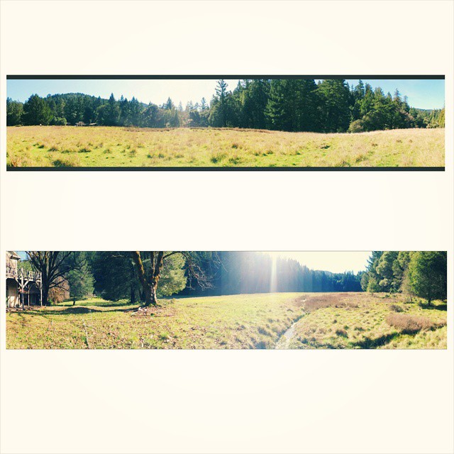
日出日落照片
Mendocino Terraced Farm - h

Driving northbound on 101
#angelo is like #paradise #nature #vscocam

IMG_3764 DESCANSO BILL

Earthdance 2009 058

Earthdance 2009 048

Opening parade

Historic dome and bus

Earthdance 2008 020

Driving northbound on 101

Driving northbound on 101
Mulligan Ln, Laytonville, CA 美國的地圖
搜索其他地方的日出日落時間
附近地點
US-, Laytonville, CA 美國
Laytonville, CA, 美國
Ten Mile Creek Rd, Laytonville, CA 美國
Simmerly Rd, Covelo, CA 美國
美國加利福尼亞州門多西諾縣
Covelo Rd, Willits, CA 美國
Woodman Creek Rd, Covelo, CA 美國
美國加利福尼亚州布兰斯科姆
N Hwy, Laytonville, CA 美國
Covelo Rd, Willits, CA 美國
Sherwood Rd, Willits, CA 美國Sherwood School
Simmerly Rd, Covelo, CA 美國
US-, Laytonville, CA 美國
Simmerly Ranch Rd, Laytonville, CA 美國
US-, Leggett, CA 美國
Timberline Rd, California 美國Timberline Road
Covelo Rdfuse Rd, Covelo, CA 美國
Blue Lake Rd, Willits, CA 美國
CA-, Leggett, CA 美國
Ridge Rd, Willits, CA 美國
最近搜索
- Red Dog Mine, AK, USA的日出日落時間表
- Am bhf, Borken, 德國Am Bahnhof的日出日落時間表
- 4th St E, Sonoma, CA 美國的日出日落時間表
- Oakland Ave, Williamsport, PA 美國的日出日落時間表
- Via Roma, Pieranica CR, 義大利的日出日落時間表
- 克羅埃西亞杜布羅夫尼克 GradClock Tower of Dubrovnik的日出日落時間表
- 阿根廷丘布特省特雷利烏的日出日落時間表
- Hartfords Bluff Cir, Mt Pleasant, SC 美國的日出日落時間表
- 日本熊本縣熊本市北區的日出日落時間表
- 中國福州市平潭縣平潭島的日出日落時間表