Mount McPhail, East Kootenay A, BC V0B加拿大的日出日落時間表
Location: 加拿大 > 英屬哥倫比亞 > 加拿大 > 加拿大 >
時區:
America/Edmonton
當地時間:
2025-07-04 13:36:44
經度:
-114.8616666
緯度:
50.4083333
今天日出時間:
05:36:04 AM
今天日落時間:
09:52:20 PM
今天日照時長:
16h 16m 16s
明天日出時間:
05:36:56 AM
明天日落時間:
09:51:48 PM
明天日照時長:
16h 14m 52s
顯示所有日期
| 日期 | 日出 | 日落 | 日照時長 |
|---|---|---|---|
| 2025年01月01日 | 08:39:29 AM | 04:47:48 PM | 8h 8m 19s |
| 2025年01月02日 | 08:39:18 AM | 04:48:54 PM | 8h 9m 36s |
| 2025年01月03日 | 08:39:04 AM | 04:50:02 PM | 8h 10m 58s |
| 2025年01月04日 | 08:38:47 AM | 04:51:13 PM | 8h 12m 26s |
| 2025年01月05日 | 08:38:27 AM | 04:52:25 PM | 8h 13m 58s |
| 2025年01月06日 | 08:38:04 AM | 04:53:40 PM | 8h 15m 36s |
| 2025年01月07日 | 08:37:37 AM | 04:54:57 PM | 8h 17m 20s |
| 2025年01月08日 | 08:37:08 AM | 04:56:16 PM | 8h 19m 8s |
| 2025年01月09日 | 08:36:35 AM | 04:57:37 PM | 8h 21m 2s |
| 2025年01月10日 | 08:36:00 AM | 04:59:00 PM | 8h 23m 0s |
| 2025年01月11日 | 08:35:22 AM | 05:00:24 PM | 8h 25m 2s |
| 2025年01月12日 | 08:34:40 AM | 05:01:51 PM | 8h 27m 11s |
| 2025年01月13日 | 08:33:56 AM | 05:03:18 PM | 8h 29m 22s |
| 2025年01月14日 | 08:33:09 AM | 05:04:48 PM | 8h 31m 39s |
| 2025年01月15日 | 08:32:19 AM | 05:06:18 PM | 8h 33m 59s |
| 2025年01月16日 | 08:31:26 AM | 05:07:50 PM | 8h 36m 24s |
| 2025年01月17日 | 08:30:31 AM | 05:09:24 PM | 8h 38m 53s |
| 2025年01月18日 | 08:29:33 AM | 05:10:58 PM | 8h 41m 25s |
| 2025年01月19日 | 08:28:32 AM | 05:12:34 PM | 8h 44m 2s |
| 2025年01月20日 | 08:27:29 AM | 05:14:11 PM | 8h 46m 42s |
| 2025年01月21日 | 08:26:23 AM | 05:15:49 PM | 8h 49m 26s |
| 2025年01月22日 | 08:25:15 AM | 05:17:27 PM | 8h 52m 12s |
| 2025年01月23日 | 08:24:05 AM | 05:19:07 PM | 8h 55m 2s |
| 2025年01月24日 | 08:22:52 AM | 05:20:47 PM | 8h 57m 55s |
| 2025年01月25日 | 08:21:36 AM | 05:22:28 PM | 9h 0m 52s |
| 2025年01月26日 | 08:20:19 AM | 05:24:10 PM | 9h 3m 51s |
| 2025年01月27日 | 08:18:59 AM | 05:25:52 PM | 9h 6m 53s |
| 2025年01月28日 | 08:17:37 AM | 05:27:35 PM | 9h 9m 58s |
| 2025年01月29日 | 08:16:13 AM | 05:29:18 PM | 9h 13m 5s |
| 2025年01月30日 | 08:14:47 AM | 05:31:01 PM | 9h 16m 14s |
| 2025年01月31日 | 08:13:20 AM | 05:32:45 PM | 9h 19m 25s |
| 2025年02月01日 | 08:11:50 AM | 05:34:30 PM | 9h 22m 40s |
| 2025年02月02日 | 08:10:18 AM | 05:36:14 PM | 9h 25m 56s |
| 2025年02月03日 | 08:08:44 AM | 05:37:59 PM | 9h 29m 15s |
| 2025年02月04日 | 08:07:09 AM | 05:39:44 PM | 9h 32m 35s |
| 2025年02月05日 | 08:05:31 AM | 05:41:29 PM | 9h 35m 58s |
| 2025年02月06日 | 08:03:53 AM | 05:43:14 PM | 9h 39m 21s |
| 2025年02月07日 | 08:02:12 AM | 05:44:59 PM | 9h 42m 47s |
| 2025年02月08日 | 08:00:30 AM | 05:46:44 PM | 9h 46m 14s |
| 2025年02月09日 | 07:58:46 AM | 05:48:30 PM | 9h 49m 44s |
| 2025年02月10日 | 07:57:01 AM | 05:50:15 PM | 9h 53m 14s |
| 2025年02月11日 | 07:55:15 AM | 05:52:00 PM | 9h 56m 45s |
| 2025年02月12日 | 07:53:27 AM | 05:53:45 PM | 10h 0m 18s |
| 2025年02月13日 | 07:51:37 AM | 05:55:30 PM | 10h 3m 53s |
| 2025年02月14日 | 07:49:47 AM | 05:57:15 PM | 10h 7m 28s |
| 2025年02月15日 | 07:47:55 AM | 05:58:59 PM | 10h 11m 4s |
| 2025年02月16日 | 07:46:02 AM | 06:00:44 PM | 10h 14m 42s |
| 2025年02月17日 | 07:44:07 AM | 06:02:28 PM | 10h 18m 21s |
| 2025年02月18日 | 07:42:12 AM | 06:04:12 PM | 10h 22m 0s |
| 2025年02月19日 | 07:40:15 AM | 06:05:56 PM | 10h 25m 41s |
| 2025年02月20日 | 07:38:18 AM | 06:07:39 PM | 10h 29m 21s |
| 2025年02月21日 | 07:36:19 AM | 06:09:22 PM | 10h 33m 3s |
| 2025年02月22日 | 07:34:19 AM | 06:11:05 PM | 10h 36m 46s |
| 2025年02月23日 | 07:32:19 AM | 06:12:48 PM | 10h 40m 29s |
| 2025年02月24日 | 07:30:17 AM | 06:14:31 PM | 10h 44m 14s |
| 2025年02月25日 | 07:28:15 AM | 06:16:13 PM | 10h 47m 58s |
| 2025年02月26日 | 07:26:12 AM | 06:17:55 PM | 10h 51m 43s |
| 2025年02月27日 | 07:24:08 AM | 06:19:36 PM | 10h 55m 28s |
| 2025年02月28日 | 07:22:03 AM | 06:21:18 PM | 10h 59m 15s |
| 2025年03月01日 | 07:19:58 AM | 06:22:59 PM | 11h 3m 1s |
| 2025年03月02日 | 07:17:52 AM | 06:24:40 PM | 11h 6m 48s |
| 2025年03月03日 | 07:15:45 AM | 06:26:20 PM | 11h 10m 35s |
| 2025年03月04日 | 07:13:38 AM | 06:28:01 PM | 11h 14m 23s |
| 2025年03月05日 | 07:11:30 AM | 06:29:41 PM | 11h 18m 11s |
| 2025年03月06日 | 07:09:22 AM | 06:31:20 PM | 11h 21m 58s |
| 2025年03月07日 | 07:07:13 AM | 06:33:00 PM | 11h 25m 47s |
| 2025年03月08日 | 07:05:03 AM | 06:34:39 PM | 11h 29m 36s |
| 2025年03月09日 | 08:02:59 AM | 07:36:14 PM | 11h 33m 15s |
| 2025年03月10日 | 08:00:49 AM | 07:37:53 PM | 11h 37m 4s |
| 2025年03月11日 | 07:58:38 AM | 07:39:31 PM | 11h 40m 53s |
| 2025年03月12日 | 07:56:27 AM | 07:41:10 PM | 11h 44m 43s |
| 2025年03月13日 | 07:54:16 AM | 07:42:48 PM | 11h 48m 32s |
| 2025年03月14日 | 07:52:05 AM | 07:44:26 PM | 11h 52m 21s |
| 2025年03月15日 | 07:49:53 AM | 07:46:03 PM | 11h 56m 10s |
| 2025年03月16日 | 07:47:41 AM | 07:47:41 PM | 12h 0m 0s |
| 2025年03月17日 | 07:45:29 AM | 07:49:18 PM | 12h 3m 49s |
| 2025年03月18日 | 07:43:17 AM | 07:50:55 PM | 12h 7m 38s |
| 2025年03月19日 | 07:41:04 AM | 07:52:32 PM | 12h 11m 28s |
| 2025年03月20日 | 07:38:52 AM | 07:54:09 PM | 12h 15m 17s |
| 2025年03月21日 | 07:36:39 AM | 07:55:46 PM | 12h 19m 7s |
| 2025年03月22日 | 07:34:26 AM | 07:57:22 PM | 12h 22m 56s |
| 2025年03月23日 | 07:32:14 AM | 07:58:59 PM | 12h 26m 45s |
| 2025年03月24日 | 07:30:01 AM | 08:00:35 PM | 12h 30m 34s |
| 2025年03月25日 | 07:27:49 AM | 08:02:11 PM | 12h 34m 22s |
| 2025年03月26日 | 07:25:36 AM | 08:03:48 PM | 12h 38m 12s |
| 2025年03月27日 | 07:23:24 AM | 08:05:24 PM | 12h 42m 0s |
| 2025年03月28日 | 07:21:12 AM | 08:07:00 PM | 12h 45m 48s |
| 2025年03月29日 | 07:19:00 AM | 08:08:36 PM | 12h 49m 36s |
| 2025年03月30日 | 07:16:49 AM | 08:10:12 PM | 12h 53m 23s |
| 2025年03月31日 | 07:14:37 AM | 08:11:47 PM | 12h 57m 10s |
| 2025年04月01日 | 07:12:26 AM | 08:13:23 PM | 13h 0m 57s |
| 2025年04月02日 | 07:10:15 AM | 08:14:59 PM | 13h 4m 44s |
| 2025年04月03日 | 07:08:05 AM | 08:16:35 PM | 13h 8m 30s |
| 2025年04月04日 | 07:05:54 AM | 08:18:10 PM | 13h 12m 16s |
| 2025年04月05日 | 07:03:45 AM | 08:19:46 PM | 13h 16m 1s |
| 2025年04月06日 | 07:01:35 AM | 08:21:22 PM | 13h 19m 47s |
| 2025年04月07日 | 06:59:27 AM | 08:22:58 PM | 13h 23m 31s |
| 2025年04月08日 | 06:57:18 AM | 08:24:33 PM | 13h 27m 15s |
| 2025年04月09日 | 06:55:10 AM | 08:26:09 PM | 13h 30m 59s |
| 2025年04月10日 | 06:53:03 AM | 08:27:45 PM | 13h 34m 42s |
| 2025年04月11日 | 06:50:57 AM | 08:29:20 PM | 13h 38m 23s |
| 2025年04月12日 | 06:48:51 AM | 08:30:56 PM | 13h 42m 5s |
| 2025年04月13日 | 06:46:45 AM | 08:32:31 PM | 13h 45m 46s |
| 2025年04月14日 | 06:44:41 AM | 08:34:07 PM | 13h 49m 26s |
| 2025年04月15日 | 06:42:37 AM | 08:35:43 PM | 13h 53m 6s |
| 2025年04月16日 | 06:40:34 AM | 08:37:18 PM | 13h 56m 44s |
| 2025年04月17日 | 06:38:32 AM | 08:38:54 PM | 14h 0m 22s |
| 2025年04月18日 | 06:36:30 AM | 08:40:29 PM | 14h 3m 59s |
| 2025年04月19日 | 06:34:30 AM | 08:42:05 PM | 14h 7m 35s |
| 2025年04月20日 | 06:32:30 AM | 08:43:40 PM | 14h 11m 10s |
| 2025年04月21日 | 06:30:32 AM | 08:45:15 PM | 14h 14m 43s |
| 2025年04月22日 | 06:28:34 AM | 08:46:50 PM | 14h 18m 16s |
| 2025年04月23日 | 06:26:38 AM | 08:48:25 PM | 14h 21m 47s |
| 2025年04月24日 | 06:24:42 AM | 08:50:00 PM | 14h 25m 18s |
| 2025年04月25日 | 06:22:48 AM | 08:51:35 PM | 14h 28m 47s |
| 2025年04月26日 | 06:20:55 AM | 08:53:10 PM | 14h 32m 15s |
| 2025年04月27日 | 06:19:03 AM | 08:54:44 PM | 14h 35m 41s |
| 2025年04月28日 | 06:17:12 AM | 08:56:18 PM | 14h 39m 6s |
| 2025年04月29日 | 06:15:23 AM | 08:57:52 PM | 14h 42m 29s |
| 2025年04月30日 | 06:13:35 AM | 08:59:26 PM | 14h 45m 51s |
| 2025年05月01日 | 06:11:48 AM | 09:00:59 PM | 14h 49m 11s |
| 2025年05月02日 | 06:10:03 AM | 09:02:33 PM | 14h 52m 30s |
| 2025年05月03日 | 06:08:19 AM | 09:04:05 PM | 14h 55m 46s |
| 2025年05月04日 | 06:06:37 AM | 09:05:38 PM | 14h 59m 1s |
| 2025年05月05日 | 06:04:56 AM | 09:07:10 PM | 15h 2m 14s |
| 2025年05月06日 | 06:03:17 AM | 09:08:41 PM | 15h 5m 24s |
| 2025年05月07日 | 06:01:39 AM | 09:10:12 PM | 15h 8m 33s |
| 2025年05月08日 | 06:00:03 AM | 09:11:42 PM | 15h 11m 39s |
| 2025年05月09日 | 05:58:29 AM | 09:13:12 PM | 15h 14m 43s |
| 2025年05月10日 | 05:56:57 AM | 09:14:41 PM | 15h 17m 44s |
| 2025年05月11日 | 05:55:26 AM | 09:16:10 PM | 15h 20m 44s |
| 2025年05月12日 | 05:53:58 AM | 09:17:38 PM | 15h 23m 40s |
| 2025年05月13日 | 05:52:31 AM | 09:19:04 PM | 15h 26m 33s |
| 2025年05月14日 | 05:51:06 AM | 09:20:31 PM | 15h 29m 25s |
| 2025年05月15日 | 05:49:44 AM | 09:21:56 PM | 15h 32m 12s |
| 2025年05月16日 | 05:48:23 AM | 09:23:20 PM | 15h 34m 57s |
| 2025年05月17日 | 05:47:05 AM | 09:24:43 PM | 15h 37m 38s |
| 2025年05月18日 | 05:45:48 AM | 09:26:06 PM | 15h 40m 18s |
| 2025年05月19日 | 05:44:34 AM | 09:27:27 PM | 15h 42m 53s |
| 2025年05月20日 | 05:43:22 AM | 09:28:47 PM | 15h 45m 25s |
| 2025年05月21日 | 05:42:13 AM | 09:30:05 PM | 15h 47m 52s |
| 2025年05月22日 | 05:41:05 AM | 09:31:23 PM | 15h 50m 18s |
| 2025年05月23日 | 05:40:00 AM | 09:32:39 PM | 15h 52m 39s |
| 2025年05月24日 | 05:38:58 AM | 09:33:53 PM | 15h 54m 55s |
| 2025年05月25日 | 05:37:58 AM | 09:35:07 PM | 15h 57m 9s |
| 2025年05月26日 | 05:37:00 AM | 09:36:18 PM | 15h 59m 18s |
| 2025年05月27日 | 05:36:05 AM | 09:37:28 PM | 16h 1m 23s |
| 2025年05月28日 | 05:35:13 AM | 09:38:36 PM | 16h 3m 23s |
| 2025年05月29日 | 05:34:23 AM | 09:39:43 PM | 16h 5m 20s |
| 2025年05月30日 | 05:33:36 AM | 09:40:47 PM | 16h 7m 11s |
| 2025年05月31日 | 05:32:52 AM | 09:41:50 PM | 16h 8m 58s |
| 2025年06月01日 | 05:32:10 AM | 09:42:51 PM | 16h 10m 41s |
| 2025年06月02日 | 05:31:31 AM | 09:43:50 PM | 16h 12m 19s |
| 2025年06月03日 | 05:30:55 AM | 09:44:47 PM | 16h 13m 52s |
| 2025年06月04日 | 05:30:22 AM | 09:45:41 PM | 16h 15m 19s |
| 2025年06月05日 | 05:29:52 AM | 09:46:33 PM | 16h 16m 41s |
| 2025年06月06日 | 05:29:24 AM | 09:47:24 PM | 16h 18m 0s |
| 2025年06月07日 | 05:28:59 AM | 09:48:11 PM | 16h 19m 12s |
| 2025年06月08日 | 05:28:37 AM | 09:48:57 PM | 16h 20m 20s |
| 2025年06月09日 | 05:28:18 AM | 09:49:40 PM | 16h 21m 22s |
| 2025年06月10日 | 05:28:02 AM | 09:50:20 PM | 16h 22m 18s |
| 2025年06月11日 | 05:27:49 AM | 09:50:58 PM | 16h 23m 9s |
| 2025年06月12日 | 05:27:39 AM | 09:51:33 PM | 16h 23m 54s |
| 2025年06月13日 | 05:27:32 AM | 09:52:06 PM | 16h 24m 34s |
| 2025年06月14日 | 05:27:27 AM | 09:52:36 PM | 16h 25m 9s |
| 2025年06月15日 | 05:27:26 AM | 09:53:03 PM | 16h 25m 37s |
| 2025年06月16日 | 05:27:27 AM | 09:53:28 PM | 16h 26m 1s |
| 2025年06月17日 | 05:27:32 AM | 09:53:50 PM | 16h 26m 18s |
| 2025年06月18日 | 05:27:39 AM | 09:54:08 PM | 16h 26m 29s |
| 2025年06月19日 | 05:27:49 AM | 09:54:24 PM | 16h 26m 35s |
| 2025年06月20日 | 05:28:02 AM | 09:54:38 PM | 16h 26m 36s |
| 2025年06月21日 | 05:28:18 AM | 09:54:48 PM | 16h 26m 30s |
| 2025年06月22日 | 05:28:37 AM | 09:54:55 PM | 16h 26m 18s |
| 2025年06月23日 | 05:28:58 AM | 09:55:00 PM | 16h 26m 2s |
| 2025年06月24日 | 05:29:22 AM | 09:55:01 PM | 16h 25m 39s |
| 2025年06月25日 | 05:29:49 AM | 09:54:59 PM | 16h 25m 10s |
| 2025年06月26日 | 05:30:18 AM | 09:54:55 PM | 16h 24m 37s |
| 2025年06月27日 | 05:30:50 AM | 09:54:48 PM | 16h 23m 58s |
| 2025年06月28日 | 05:31:25 AM | 09:54:37 PM | 16h 23m 12s |
| 2025年06月29日 | 05:32:02 AM | 09:54:24 PM | 16h 22m 22s |
| 2025年06月30日 | 05:32:41 AM | 09:54:07 PM | 16h 21m 26s |
| 2025年07月01日 | 05:33:23 AM | 09:53:48 PM | 16h 20m 25s |
| 2025年07月02日 | 05:34:08 AM | 09:53:26 PM | 16h 19m 18s |
| 2025年07月03日 | 05:34:54 AM | 09:53:00 PM | 16h 18m 6s |
| 2025年07月04日 | 05:35:43 AM | 09:52:32 PM | 16h 16m 49s |
| 2025年07月05日 | 05:36:34 AM | 09:52:01 PM | 16h 15m 27s |
| 2025年07月06日 | 05:37:27 AM | 09:51:27 PM | 16h 14m 0s |
| 2025年07月07日 | 05:38:23 AM | 09:50:51 PM | 16h 12m 28s |
| 2025年07月08日 | 05:39:20 AM | 09:50:11 PM | 16h 10m 51s |
| 2025年07月09日 | 05:40:19 AM | 09:49:29 PM | 16h 9m 10s |
| 2025年07月10日 | 05:41:20 AM | 09:48:44 PM | 16h 7m 24s |
| 2025年07月11日 | 05:42:23 AM | 09:47:56 PM | 16h 5m 33s |
| 2025年07月12日 | 05:43:27 AM | 09:47:06 PM | 16h 3m 39s |
| 2025年07月13日 | 05:44:34 AM | 09:46:13 PM | 16h 1m 39s |
| 2025年07月14日 | 05:45:42 AM | 09:45:17 PM | 15h 59m 35s |
| 2025年07月15日 | 05:46:51 AM | 09:44:19 PM | 15h 57m 28s |
| 2025年07月16日 | 05:48:02 AM | 09:43:18 PM | 15h 55m 16s |
| 2025年07月17日 | 05:49:14 AM | 09:42:14 PM | 15h 53m 0s |
| 2025年07月18日 | 05:50:28 AM | 09:41:09 PM | 15h 50m 41s |
| 2025年07月19日 | 05:51:43 AM | 09:40:01 PM | 15h 48m 18s |
| 2025年07月20日 | 05:52:59 AM | 09:38:50 PM | 15h 45m 51s |
| 2025年07月21日 | 05:54:16 AM | 09:37:37 PM | 15h 43m 21s |
| 2025年07月22日 | 05:55:34 AM | 09:36:22 PM | 15h 40m 48s |
| 2025年07月23日 | 05:56:54 AM | 09:35:05 PM | 15h 38m 11s |
| 2025年07月24日 | 05:58:14 AM | 09:33:46 PM | 15h 35m 32s |
| 2025年07月25日 | 05:59:36 AM | 09:32:24 PM | 15h 32m 48s |
| 2025年07月26日 | 06:00:58 AM | 09:31:01 PM | 15h 30m 3s |
| 2025年07月27日 | 06:02:21 AM | 09:29:35 PM | 15h 27m 14s |
| 2025年07月28日 | 06:03:45 AM | 09:28:08 PM | 15h 24m 23s |
| 2025年07月29日 | 06:05:09 AM | 09:26:38 PM | 15h 21m 29s |
| 2025年07月30日 | 06:06:34 AM | 09:25:07 PM | 15h 18m 33s |
| 2025年07月31日 | 06:08:00 AM | 09:23:33 PM | 15h 15m 33s |
| 2025年08月01日 | 06:09:26 AM | 09:21:58 PM | 15h 12m 32s |
| 2025年08月02日 | 06:10:53 AM | 09:20:22 PM | 15h 9m 29s |
| 2025年08月03日 | 06:12:21 AM | 09:18:43 PM | 15h 6m 22s |
| 2025年08月04日 | 06:13:49 AM | 09:17:03 PM | 15h 3m 14s |
| 2025年08月05日 | 06:15:17 AM | 09:15:21 PM | 15h 0m 4s |
| 2025年08月06日 | 06:16:45 AM | 09:13:38 PM | 14h 56m 53s |
| 2025年08月07日 | 06:18:14 AM | 09:11:53 PM | 14h 53m 39s |
| 2025年08月08日 | 06:19:44 AM | 09:10:07 PM | 14h 50m 23s |
| 2025年08月09日 | 06:21:13 AM | 09:08:19 PM | 14h 47m 6s |
| 2025年08月10日 | 06:22:43 AM | 09:06:30 PM | 14h 43m 47s |
| 2025年08月11日 | 06:24:13 AM | 09:04:40 PM | 14h 40m 27s |
| 2025年08月12日 | 06:25:43 AM | 09:02:48 PM | 14h 37m 5s |
| 2025年08月13日 | 06:27:13 AM | 09:00:55 PM | 14h 33m 42s |
| 2025年08月14日 | 06:28:44 AM | 08:59:01 PM | 14h 30m 17s |
| 2025年08月15日 | 06:30:14 AM | 08:57:06 PM | 14h 26m 52s |
| 2025年08月16日 | 06:31:45 AM | 08:55:09 PM | 14h 23m 24s |
| 2025年08月17日 | 06:33:16 AM | 08:53:12 PM | 14h 19m 56s |
| 2025年08月18日 | 06:34:47 AM | 08:51:13 PM | 14h 16m 26s |
| 2025年08月19日 | 06:36:18 AM | 08:49:13 PM | 14h 12m 55s |
| 2025年08月20日 | 06:37:49 AM | 08:47:13 PM | 14h 9m 24s |
| 2025年08月21日 | 06:39:20 AM | 08:45:11 PM | 14h 5m 51s |
| 2025年08月22日 | 06:40:51 AM | 08:43:09 PM | 14h 2m 18s |
| 2025年08月23日 | 06:42:22 AM | 08:41:06 PM | 13h 58m 44s |
| 2025年08月24日 | 06:43:53 AM | 08:39:01 PM | 13h 55m 8s |
| 2025年08月25日 | 06:45:24 AM | 08:36:56 PM | 13h 51m 32s |
| 2025年08月26日 | 06:46:55 AM | 08:34:51 PM | 13h 47m 56s |
| 2025年08月27日 | 06:48:25 AM | 08:32:44 PM | 13h 44m 19s |
| 2025年08月28日 | 06:49:56 AM | 08:30:37 PM | 13h 40m 41s |
| 2025年08月29日 | 06:51:27 AM | 08:28:29 PM | 13h 37m 2s |
| 2025年08月30日 | 06:52:58 AM | 08:26:21 PM | 13h 33m 23s |
| 2025年08月31日 | 06:54:29 AM | 08:24:12 PM | 13h 29m 43s |
| 2025年09月01日 | 06:56:00 AM | 08:22:03 PM | 13h 26m 3s |
| 2025年09月02日 | 06:57:31 AM | 08:19:52 PM | 13h 22m 21s |
| 2025年09月03日 | 06:59:02 AM | 08:17:42 PM | 13h 18m 40s |
| 2025年09月04日 | 07:00:32 AM | 08:15:31 PM | 13h 14m 59s |
| 2025年09月05日 | 07:02:03 AM | 08:13:20 PM | 13h 11m 17s |
| 2025年09月06日 | 07:03:34 AM | 08:11:08 PM | 13h 7m 34s |
| 2025年09月07日 | 07:05:05 AM | 08:08:56 PM | 13h 3m 51s |
| 2025年09月08日 | 07:06:36 AM | 08:06:43 PM | 13h 0m 7s |
| 2025年09月09日 | 07:08:06 AM | 08:04:30 PM | 12h 56m 24s |
| 2025年09月10日 | 07:09:37 AM | 08:02:17 PM | 12h 52m 40s |
| 2025年09月11日 | 07:11:08 AM | 08:00:04 PM | 12h 48m 56s |
| 2025年09月12日 | 07:12:39 AM | 07:57:50 PM | 12h 45m 11s |
| 2025年09月13日 | 07:14:10 AM | 07:55:37 PM | 12h 41m 27s |
| 2025年09月14日 | 07:15:41 AM | 07:53:23 PM | 12h 37m 42s |
| 2025年09月15日 | 07:17:12 AM | 07:51:09 PM | 12h 33m 57s |
| 2025年09月16日 | 07:18:43 AM | 07:48:55 PM | 12h 30m 12s |
| 2025年09月17日 | 07:20:15 AM | 07:46:40 PM | 12h 26m 25s |
| 2025年09月18日 | 07:21:46 AM | 07:44:26 PM | 12h 22m 40s |
| 2025年09月19日 | 07:23:17 AM | 07:42:12 PM | 12h 18m 55s |
| 2025年09月20日 | 07:24:49 AM | 07:39:58 PM | 12h 15m 9s |
| 2025年09月21日 | 07:26:21 AM | 07:37:44 PM | 12h 11m 23s |
| 2025年09月22日 | 07:27:53 AM | 07:35:30 PM | 12h 7m 37s |
| 2025年09月23日 | 07:29:25 AM | 07:33:16 PM | 12h 3m 51s |
| 2025年09月24日 | 07:30:57 AM | 07:31:02 PM | 12h 0m 5s |
| 2025年09月25日 | 07:32:29 AM | 07:28:49 PM | 11h 56m 20s |
| 2025年09月26日 | 07:34:02 AM | 07:26:35 PM | 11h 52m 33s |
| 2025年09月27日 | 07:35:35 AM | 07:24:22 PM | 11h 48m 47s |
| 2025年09月28日 | 07:37:08 AM | 07:22:09 PM | 11h 45m 1s |
| 2025年09月29日 | 07:38:41 AM | 07:19:57 PM | 11h 41m 16s |
| 2025年09月30日 | 07:40:14 AM | 07:17:45 PM | 11h 37m 31s |
| 2025年10月01日 | 07:41:48 AM | 07:15:33 PM | 11h 33m 45s |
| 2025年10月02日 | 07:43:22 AM | 07:13:21 PM | 11h 29m 59s |
| 2025年10月03日 | 07:44:56 AM | 07:11:10 PM | 11h 26m 14s |
| 2025年10月04日 | 07:46:30 AM | 07:09:00 PM | 11h 22m 30s |
| 2025年10月05日 | 07:48:05 AM | 07:06:50 PM | 11h 18m 45s |
| 2025年10月06日 | 07:49:40 AM | 07:04:40 PM | 11h 15m 0s |
| 2025年10月07日 | 07:51:15 AM | 07:02:31 PM | 11h 11m 16s |
| 2025年10月08日 | 07:52:51 AM | 07:00:23 PM | 11h 7m 32s |
| 2025年10月09日 | 07:54:27 AM | 06:58:15 PM | 11h 3m 48s |
| 2025年10月10日 | 07:56:03 AM | 06:56:08 PM | 11h 0m 5s |
| 2025年10月11日 | 07:57:39 AM | 06:54:01 PM | 10h 56m 22s |
| 2025年10月12日 | 07:59:16 AM | 06:51:56 PM | 10h 52m 40s |
| 2025年10月13日 | 08:00:53 AM | 06:49:51 PM | 10h 48m 58s |
| 2025年10月14日 | 08:02:30 AM | 06:47:46 PM | 10h 45m 16s |
| 2025年10月15日 | 08:04:08 AM | 06:45:43 PM | 10h 41m 35s |
| 2025年10月16日 | 08:05:46 AM | 06:43:41 PM | 10h 37m 55s |
| 2025年10月17日 | 08:07:24 AM | 06:41:39 PM | 10h 34m 15s |
| 2025年10月18日 | 08:09:03 AM | 06:39:39 PM | 10h 30m 36s |
| 2025年10月19日 | 08:10:42 AM | 06:37:39 PM | 10h 26m 57s |
| 2025年10月20日 | 08:12:21 AM | 06:35:40 PM | 10h 23m 19s |
| 2025年10月21日 | 08:14:00 AM | 06:33:43 PM | 10h 19m 43s |
| 2025年10月22日 | 08:15:40 AM | 06:31:47 PM | 10h 16m 7s |
| 2025年10月23日 | 08:17:20 AM | 06:29:51 PM | 10h 12m 31s |
| 2025年10月24日 | 08:19:00 AM | 06:27:57 PM | 10h 8m 57s |
| 2025年10月25日 | 08:20:40 AM | 06:26:05 PM | 10h 5m 25s |
| 2025年10月26日 | 08:22:20 AM | 06:24:13 PM | 10h 1m 53s |
| 2025年10月27日 | 08:24:01 AM | 06:22:23 PM | 9h 58m 22s |
| 2025年10月28日 | 08:25:42 AM | 06:20:34 PM | 9h 54m 52s |
| 2025年10月29日 | 08:27:23 AM | 06:18:47 PM | 9h 51m 24s |
| 2025年10月30日 | 08:29:04 AM | 06:17:01 PM | 9h 47m 57s |
| 2025年10月31日 | 08:30:45 AM | 06:15:16 PM | 9h 44m 31s |
| 2025年11月01日 | 08:32:26 AM | 06:13:33 PM | 9h 41m 7s |
| 2025年11月02日 | 07:34:12 AM | 05:11:48 PM | 9h 37m 36s |
| 2025年11月03日 | 07:35:53 AM | 05:10:08 PM | 9h 34m 15s |
| 2025年11月04日 | 07:37:34 AM | 05:08:30 PM | 9h 30m 56s |
| 2025年11月05日 | 07:39:15 AM | 05:06:54 PM | 9h 27m 39s |
| 2025年11月06日 | 07:40:56 AM | 05:05:20 PM | 9h 24m 24s |
| 2025年11月07日 | 07:42:37 AM | 05:03:47 PM | 9h 21m 10s |
| 2025年11月08日 | 07:44:18 AM | 05:02:17 PM | 9h 17m 59s |
| 2025年11月09日 | 07:45:58 AM | 05:00:48 PM | 9h 14m 50s |
| 2025年11月10日 | 07:47:38 AM | 04:59:22 PM | 9h 11m 44s |
| 2025年11月11日 | 07:49:18 AM | 04:57:57 PM | 9h 8m 39s |
| 2025年11月12日 | 07:50:57 AM | 04:56:35 PM | 9h 5m 38s |
| 2025年11月13日 | 07:52:36 AM | 04:55:14 PM | 9h 2m 38s |
| 2025年11月14日 | 07:54:14 AM | 04:53:56 PM | 8h 59m 42s |
| 2025年11月15日 | 07:55:52 AM | 04:52:40 PM | 8h 56m 48s |
| 2025年11月16日 | 07:57:29 AM | 04:51:27 PM | 8h 53m 58s |
| 2025年11月17日 | 07:59:05 AM | 04:50:16 PM | 8h 51m 11s |
| 2025年11月18日 | 08:00:41 AM | 04:49:07 PM | 8h 48m 26s |
| 2025年11月19日 | 08:02:16 AM | 04:48:01 PM | 8h 45m 45s |
| 2025年11月20日 | 08:03:49 AM | 04:46:57 PM | 8h 43m 8s |
| 2025年11月21日 | 08:05:22 AM | 04:45:56 PM | 8h 40m 34s |
| 2025年11月22日 | 08:06:54 AM | 04:44:58 PM | 8h 38m 4s |
| 2025年11月23日 | 08:08:25 AM | 04:44:02 PM | 8h 35m 37s |
| 2025年11月24日 | 08:09:54 AM | 04:43:09 PM | 8h 33m 15s |
| 2025年11月25日 | 08:11:22 AM | 04:42:19 PM | 8h 30m 57s |
| 2025年11月26日 | 08:12:49 AM | 04:41:31 PM | 8h 28m 42s |
| 2025年11月27日 | 08:14:14 AM | 04:40:47 PM | 8h 26m 33s |
| 2025年11月28日 | 08:15:38 AM | 04:40:05 PM | 8h 24m 27s |
| 2025年11月29日 | 08:17:00 AM | 04:39:26 PM | 8h 22m 26s |
| 2025年11月30日 | 08:18:21 AM | 04:38:50 PM | 8h 20m 29s |
| 2025年12月01日 | 08:19:39 AM | 04:38:18 PM | 8h 18m 39s |
| 2025年12月02日 | 08:20:56 AM | 04:37:48 PM | 8h 16m 52s |
| 2025年12月03日 | 08:22:11 AM | 04:37:22 PM | 8h 15m 11s |
| 2025年12月04日 | 08:23:24 AM | 04:36:58 PM | 8h 13m 34s |
| 2025年12月05日 | 08:24:35 AM | 04:36:38 PM | 8h 12m 3s |
| 2025年12月06日 | 08:25:44 AM | 04:36:21 PM | 8h 10m 37s |
| 2025年12月07日 | 08:26:50 AM | 04:36:07 PM | 8h 9m 17s |
| 2025年12月08日 | 08:27:54 AM | 04:35:56 PM | 8h 8m 2s |
| 2025年12月09日 | 08:28:56 AM | 04:35:49 PM | 8h 6m 53s |
| 2025年12月10日 | 08:29:55 AM | 04:35:45 PM | 8h 5m 50s |
| 2025年12月11日 | 08:30:52 AM | 04:35:44 PM | 8h 4m 52s |
| 2025年12月12日 | 08:31:46 AM | 04:35:46 PM | 8h 4m 0s |
| 2025年12月13日 | 08:32:38 AM | 04:35:52 PM | 8h 3m 14s |
| 2025年12月14日 | 08:33:27 AM | 04:36:01 PM | 8h 2m 34s |
| 2025年12月15日 | 08:34:13 AM | 04:36:13 PM | 8h 2m 0s |
| 2025年12月16日 | 08:34:56 AM | 04:36:29 PM | 8h 1m 33s |
| 2025年12月17日 | 08:35:36 AM | 04:36:47 PM | 8h 1m 11s |
| 2025年12月18日 | 08:36:14 AM | 04:37:09 PM | 8h 0m 55s |
| 2025年12月19日 | 08:36:48 AM | 04:37:34 PM | 8h 0m 46s |
| 2025年12月20日 | 08:37:19 AM | 04:38:02 PM | 8h 0m 43s |
| 2025年12月21日 | 08:37:48 AM | 04:38:34 PM | 8h 0m 46s |
| 2025年12月22日 | 08:38:13 AM | 04:39:08 PM | 8h 0m 55s |
| 2025年12月23日 | 08:38:35 AM | 04:39:46 PM | 8h 1m 11s |
| 2025年12月24日 | 08:38:54 AM | 04:40:26 PM | 8h 1m 32s |
| 2025年12月25日 | 08:39:10 AM | 04:41:10 PM | 8h 2m 0s |
| 2025年12月26日 | 08:39:22 AM | 04:41:56 PM | 8h 2m 34s |
| 2025年12月27日 | 08:39:32 AM | 04:42:45 PM | 8h 3m 13s |
| 2025年12月28日 | 08:39:38 AM | 04:43:37 PM | 8h 3m 59s |
| 2025年12月29日 | 08:39:41 AM | 04:44:32 PM | 8h 4m 51s |
| 2025年12月30日 | 08:39:41 AM | 04:45:30 PM | 8h 5m 49s |
| 2025年12月31日 | 08:39:37 AM | 04:46:30 PM | 8h 6m 53s |
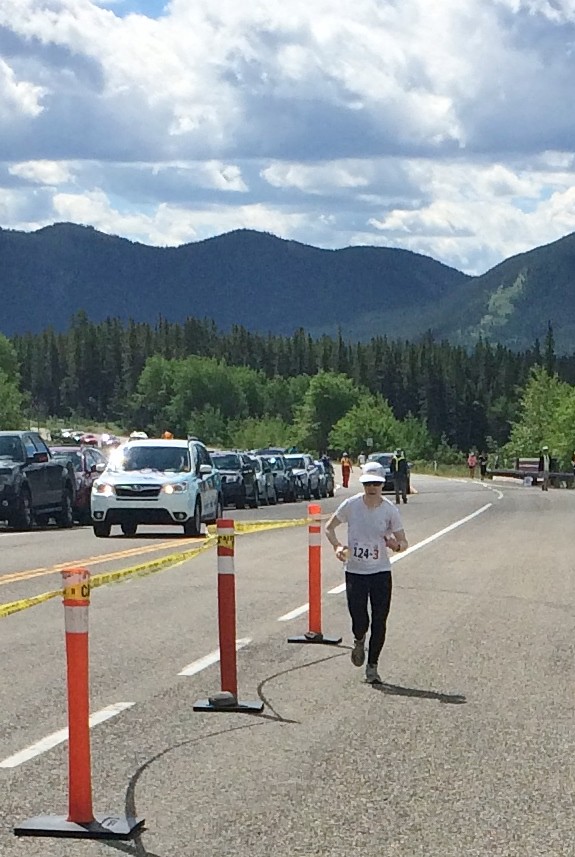
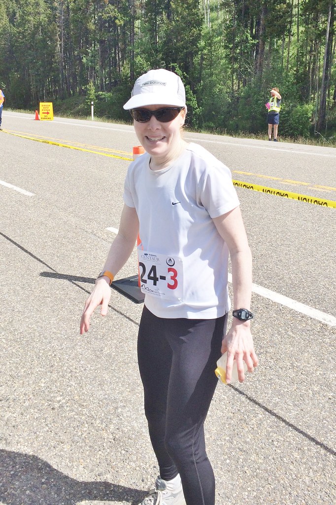
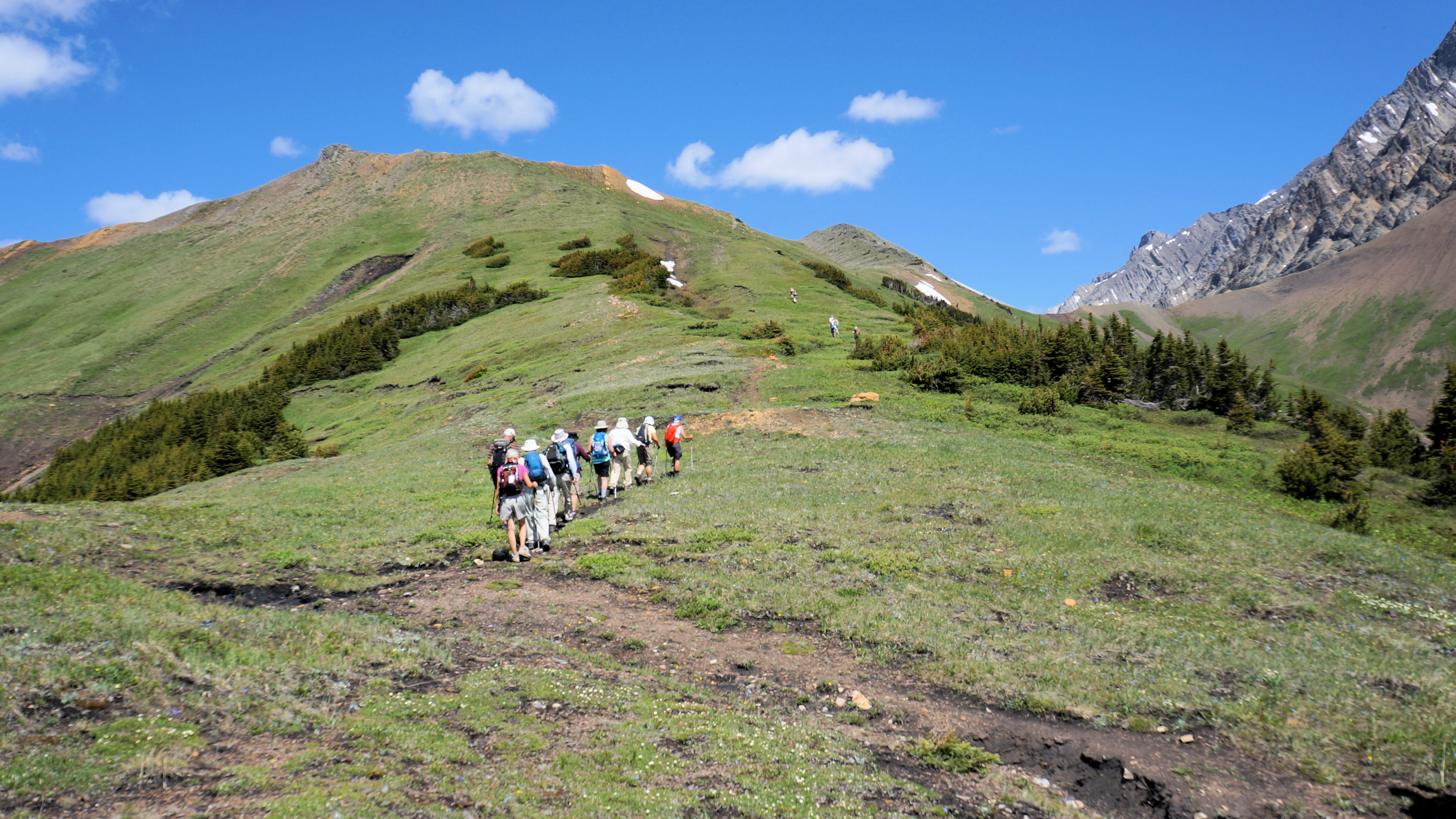
日出日落照片
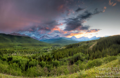
Kananaskis Sunset

Scenic view Hwy 40
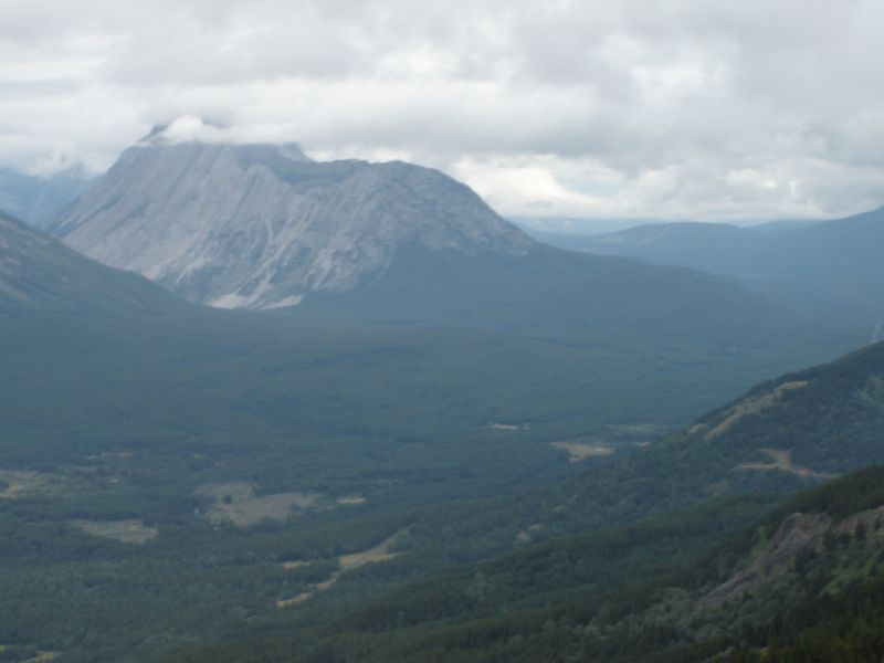
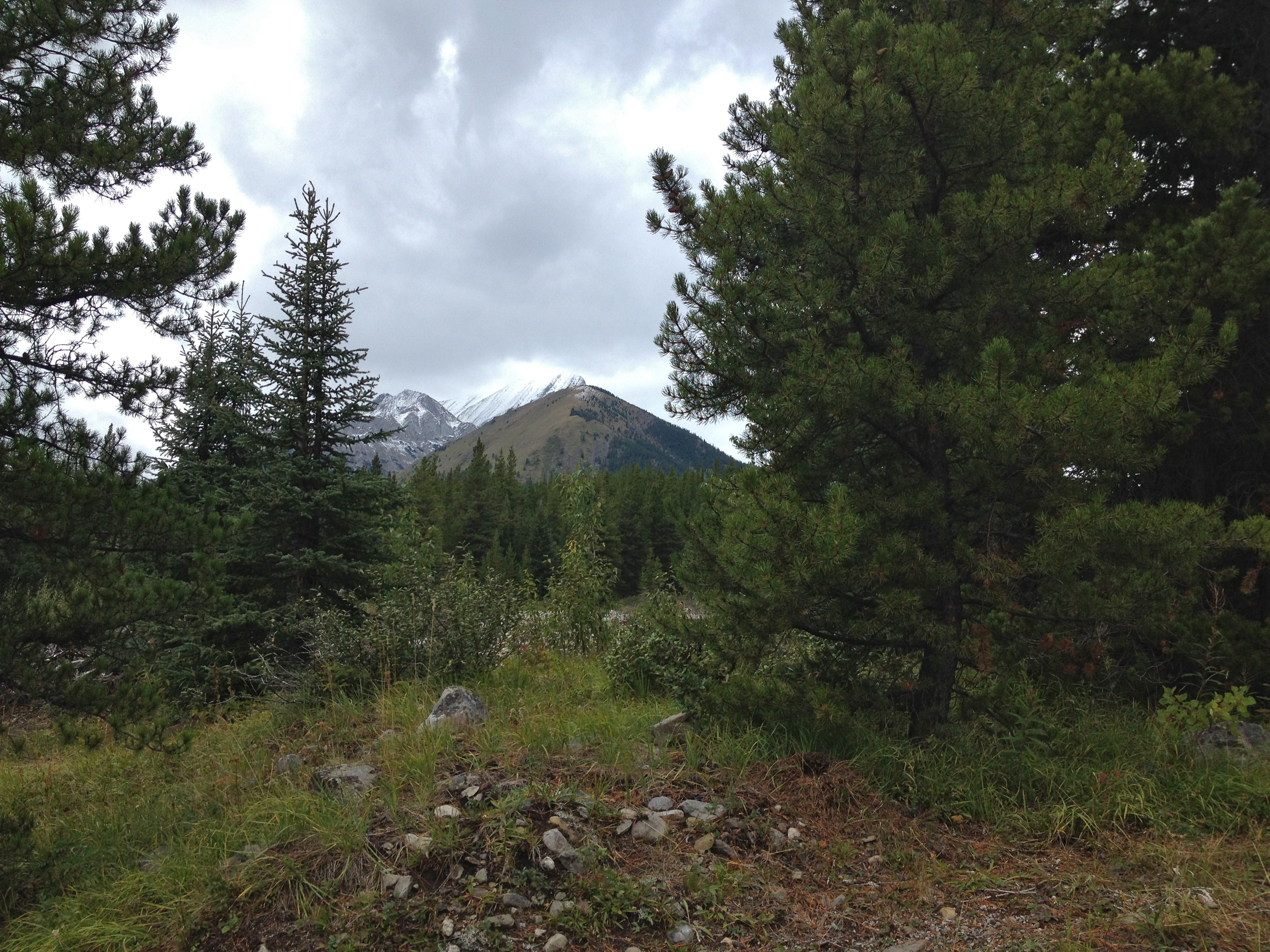
Looking into Aldridge Creek
View North from Big Weary Ridge
Looking at Aldridge and the burning coal seam
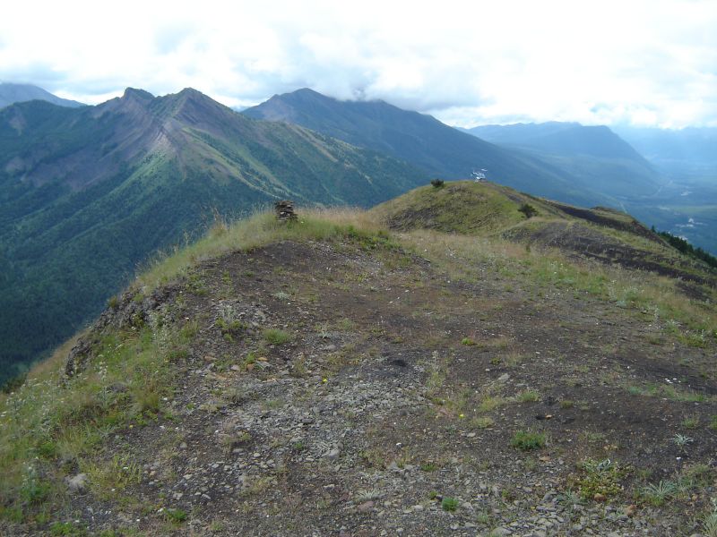
View south from Big Weary
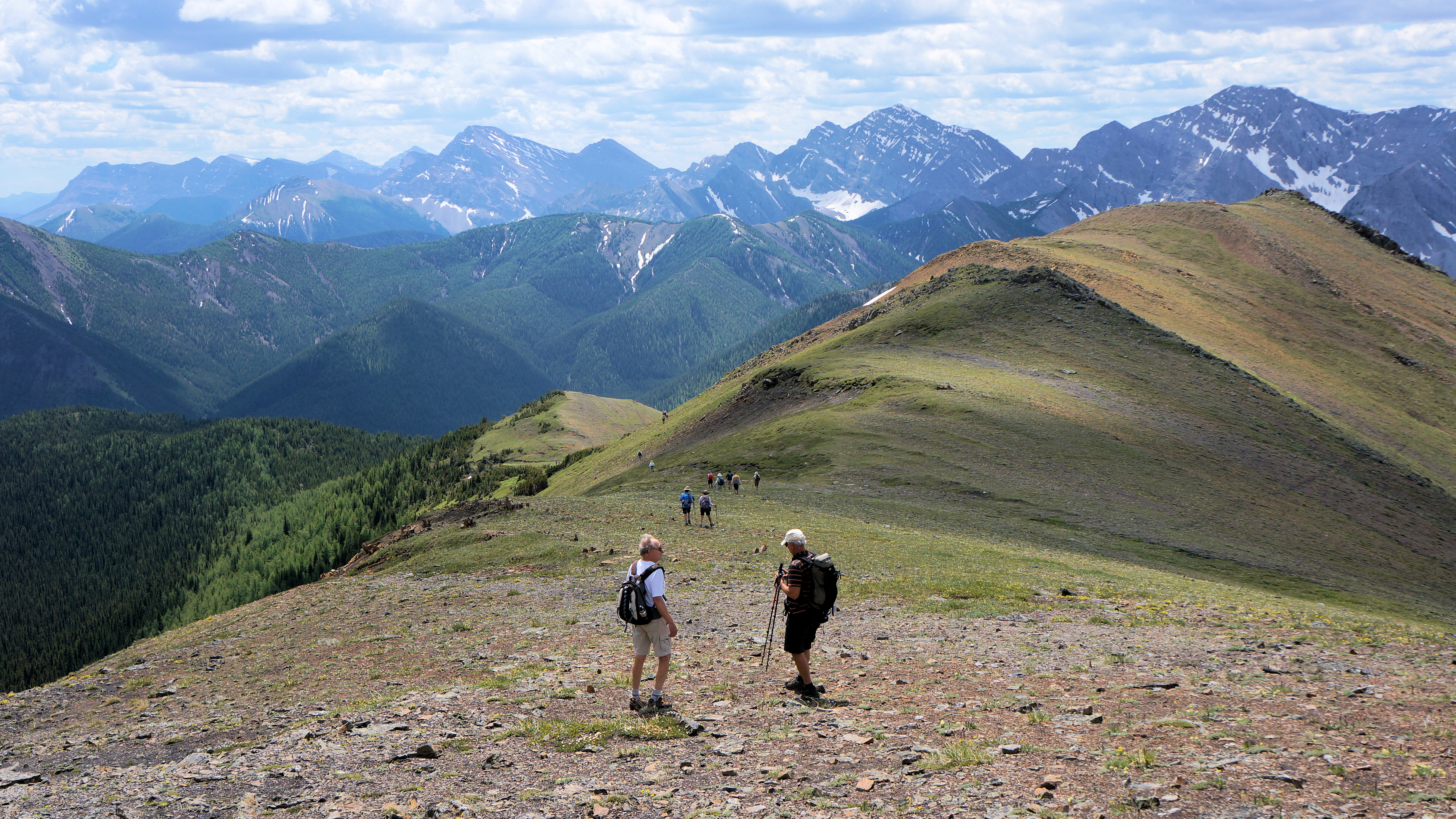
Descent from Mt Lipsett
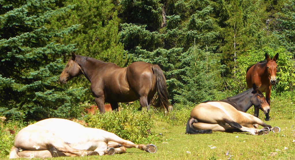
Lazy Horses - Canada

#distantdreams #twotrollsinmiddleearth #longingforsnowymountains and #skitouring on way down from #mtarmstrong #brewsterhut #trolleinmittelerde

_DSC3023-2

Pickeljar lakes
September 7 Labour Day Highway 40 Loop Drive - Highwood Pass area - The view north from Highwood Junction
September 7 Labour Day Highway 40 Loop Drive - Highwood Pass area - The view north from Linehan Creek day use area
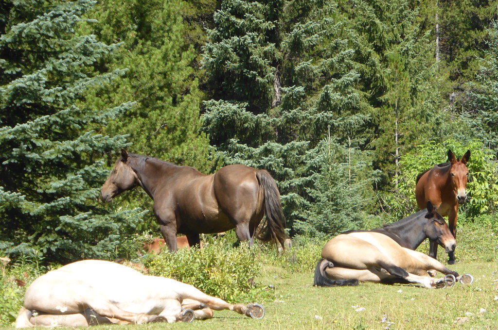
lazy horses
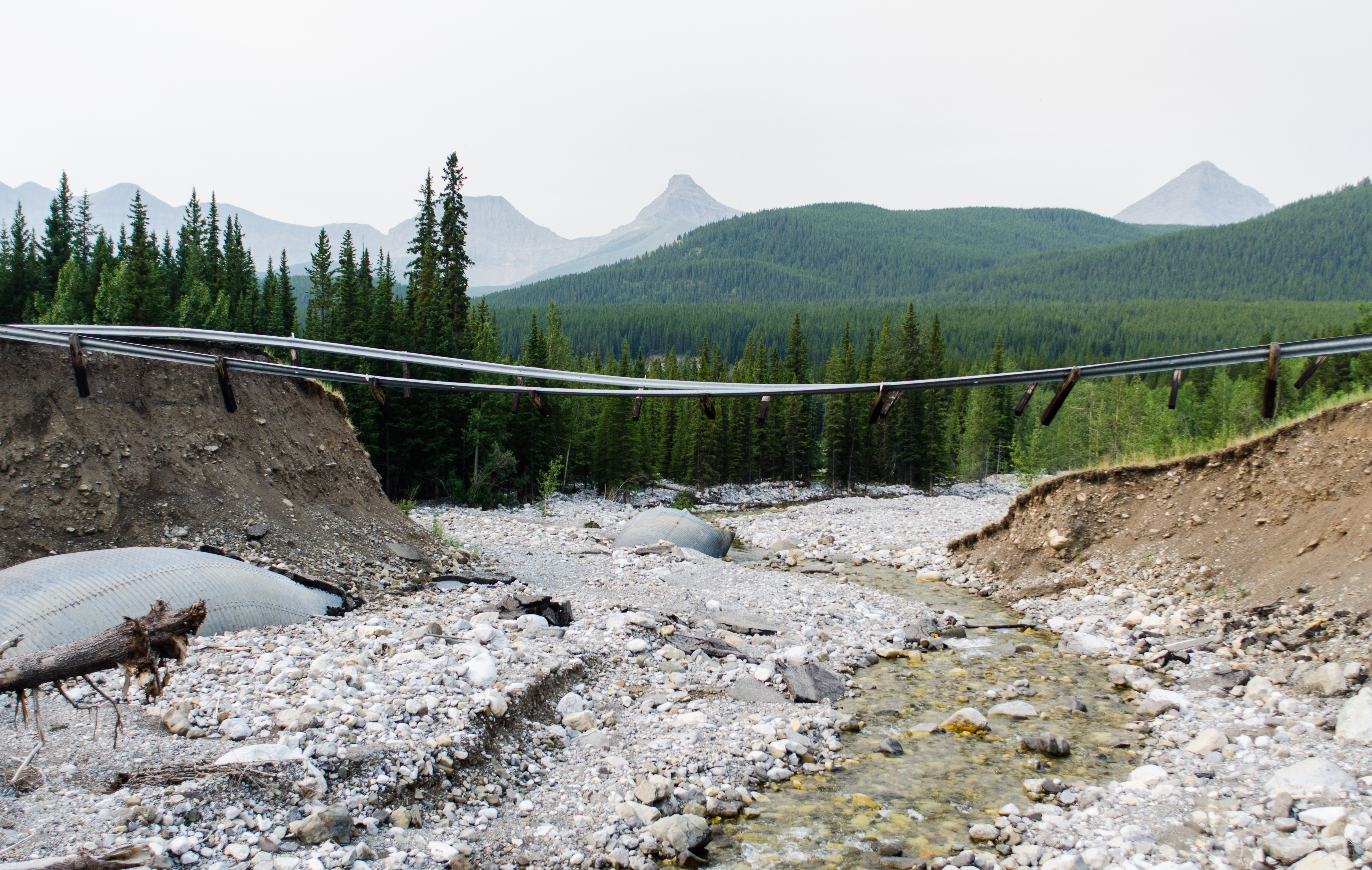
Floating Rail
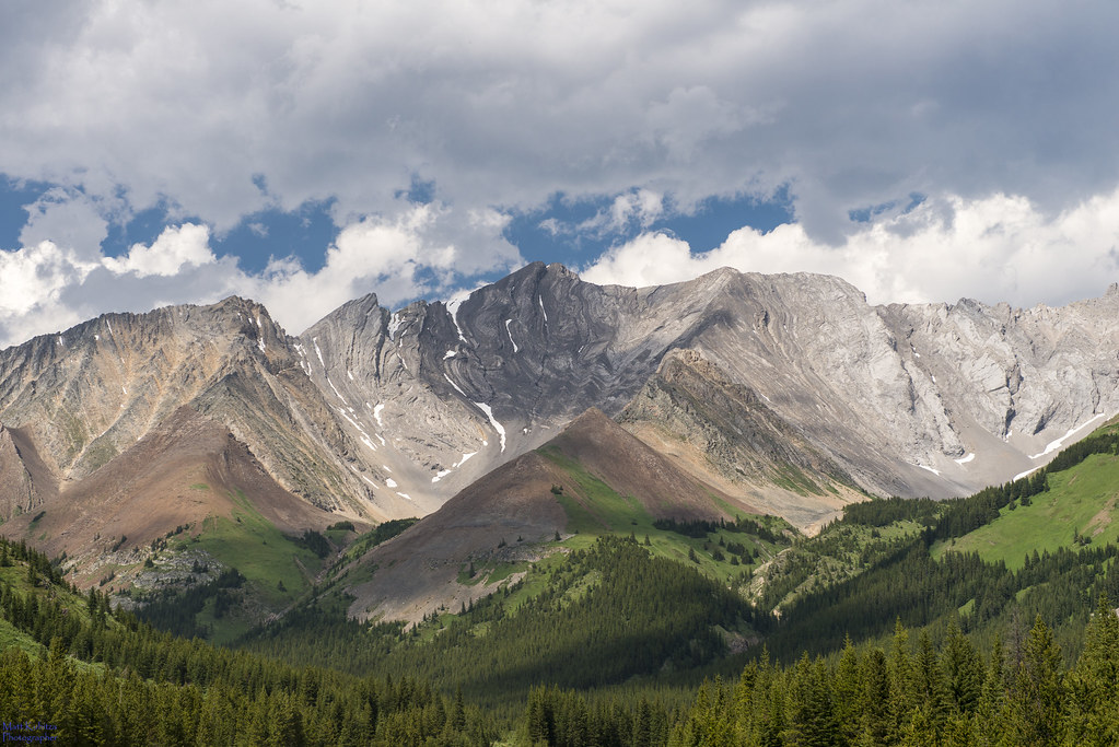
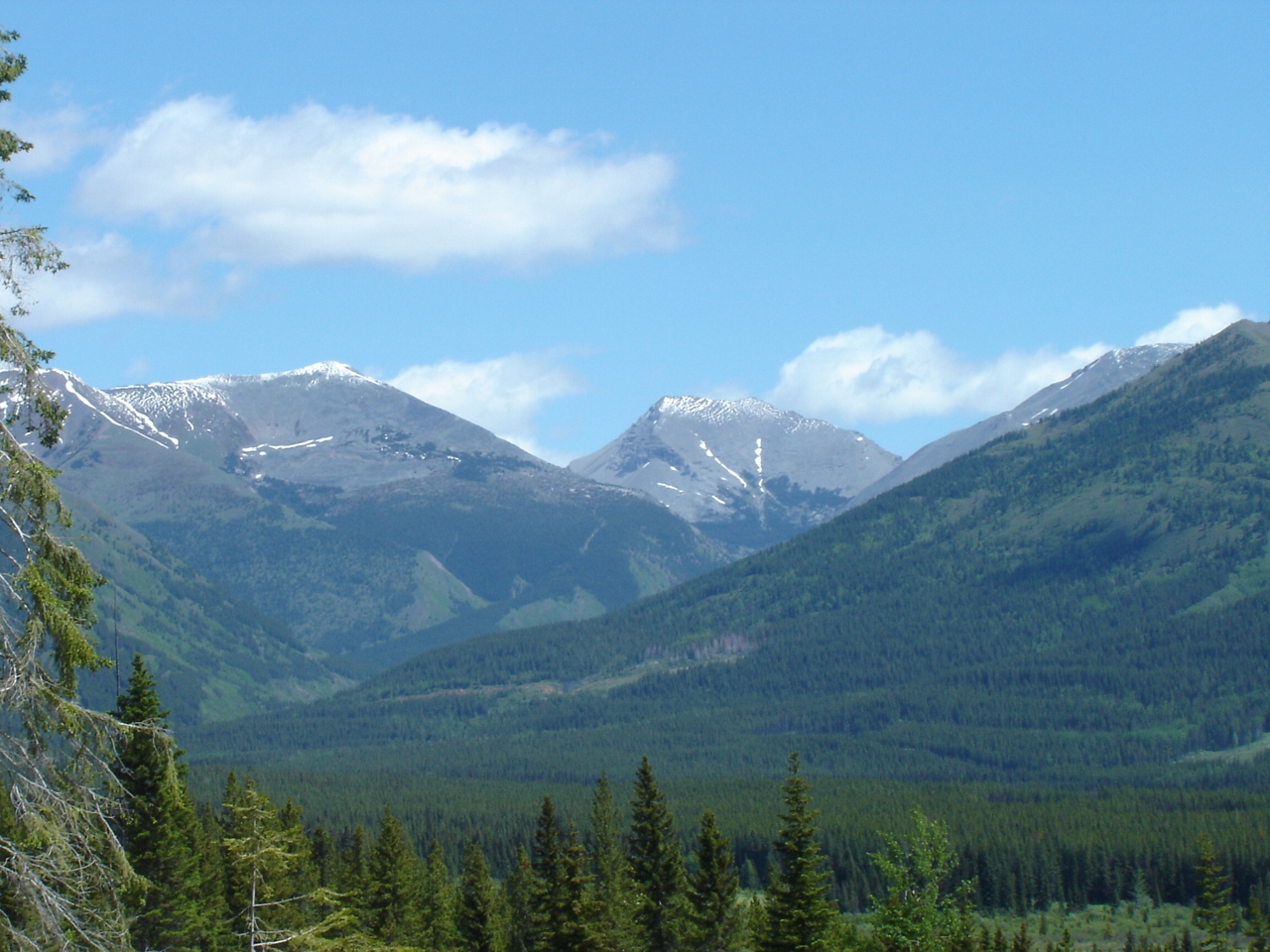
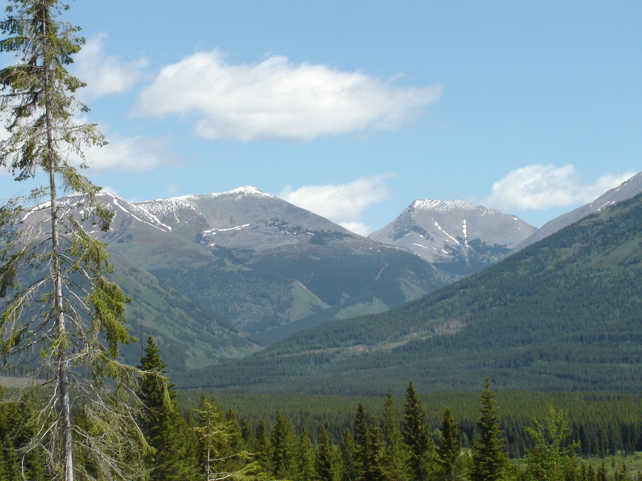
Now those are Mountains

2015-06-20 Andy Gillian a
2015-06-20 Meaghan Leg 3 d
2015-06-20 Meaghan Leg 3 e

A bit of rain won't stop us, but it will stop some forest fires. #blessed
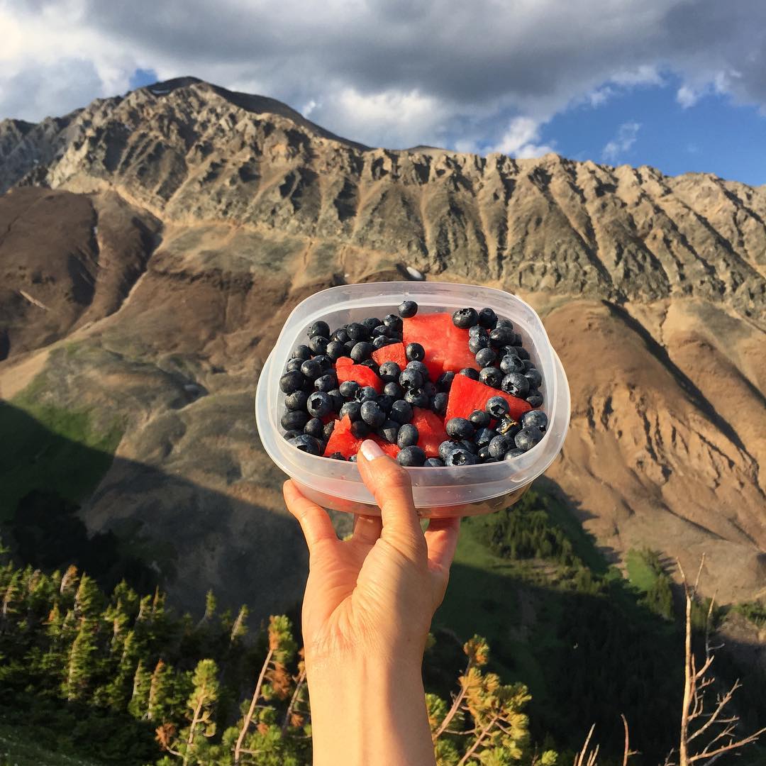
A sneak peek of what we pack in our lunch bags when exploring. Tell us what you bring to stay energized. ????????

On the way to Mt Lipsett
End in sight
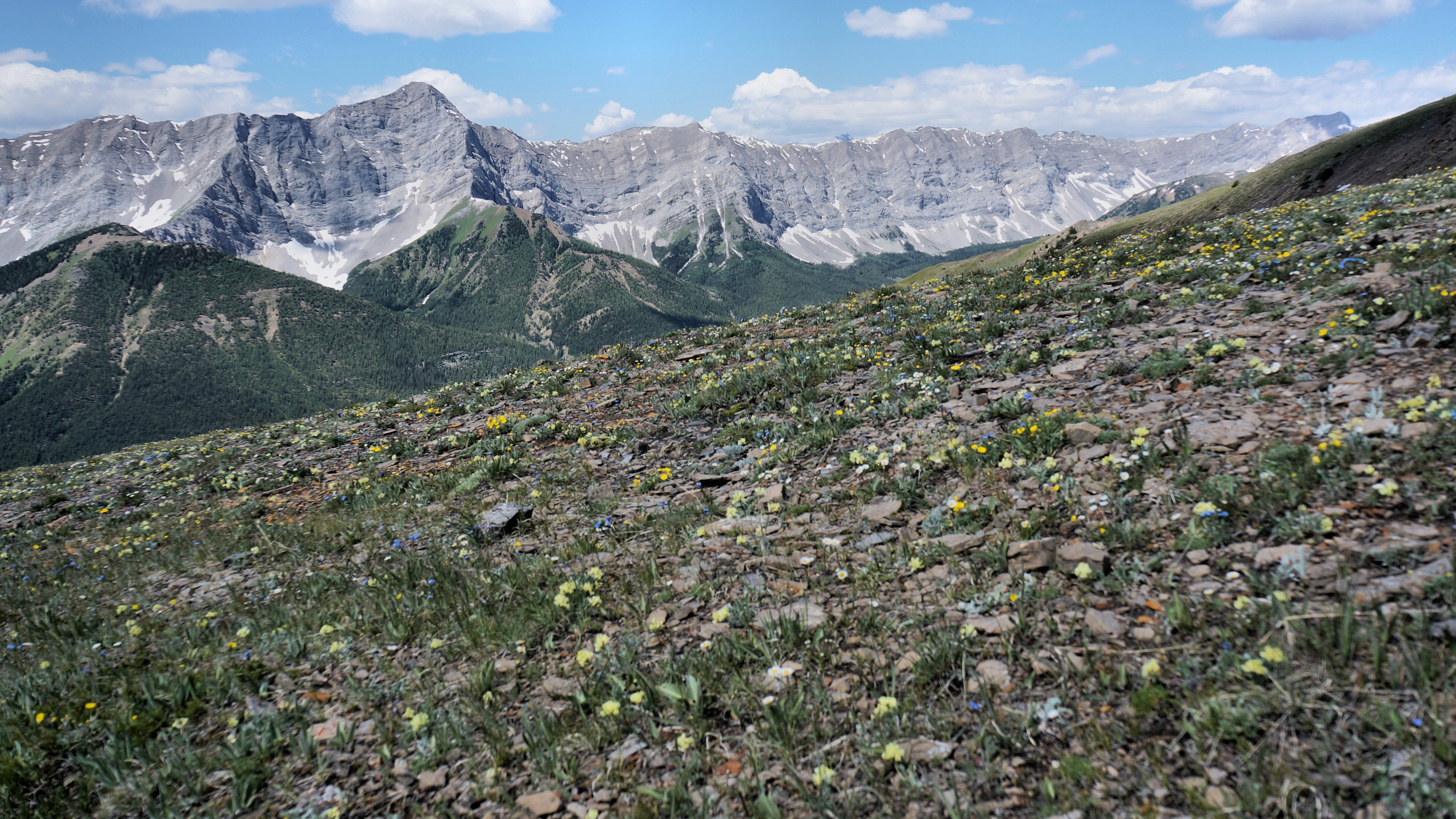
A carpet of wildflowers
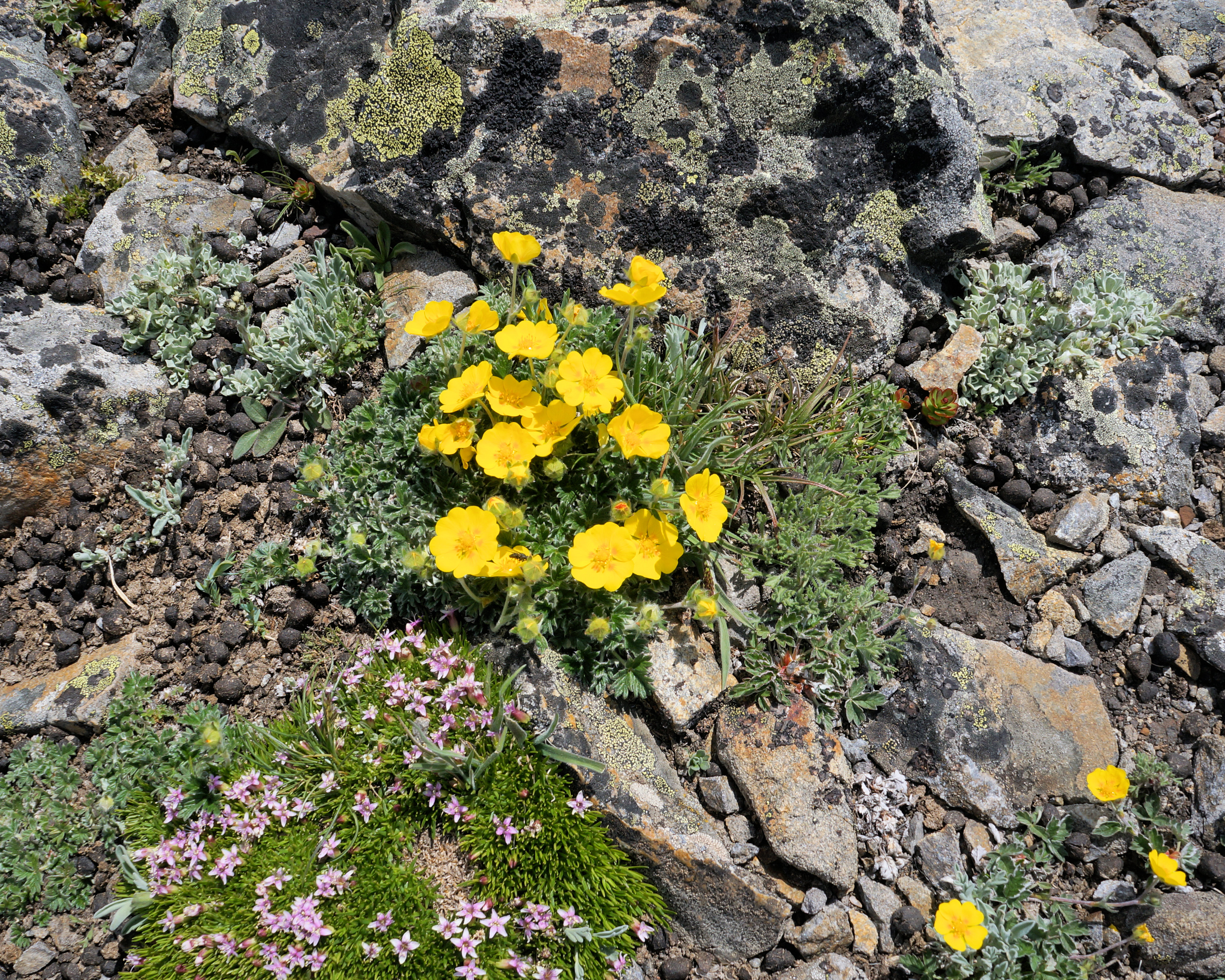
Well fertilized flowers
Mount McPhail, East Kootenay A, BC V0B加拿大的地圖
搜索其他地方的日出日落時間
附近地點
Mount Bishop, Kananaskis, AB T0L加拿大
Muir SW2, East Kootenay A, BC V0B加拿大
Weary Ridge, East Kootenay A, BC V0B加拿大
Mount Strachan, Kananaskis, AB T0L加拿大
Mount Shankland, East Kootenay A, BC V0B加拿大
Mount Loomis, East Kootenay A, BC V0B加拿大
Mount Veits, East Kootenay A, BC V0B加拿大
Mount Maclaren, Kananaskis, AB T0L加拿大
Courcelette NW3, East Kootenay A, BC V0B加拿大
Mount Armstrong, East Kootenay A, BC V0B加拿大
Courcelette NW2, East Kootenay A, BC V0B加拿大
Mount Tuxford, East Kootenay A, BC V0B加拿大
Mount Odlum, East Kootenay A, BC V0B加拿大
Courcelette Peak, East Kootenay A, BC V0B加拿大
Mount Cornwell, East Kootenay A, BC V0B加拿大
Gill Peak, East Kootenay A, BC V0B加拿大
Baril Peak, Kananaskis, AB T0L加拿大
Mount Lipsett, Kananaskis, AB T0L加拿大
Mist Mountain, Kananaskis, AB T0L加拿大
Mount Etherington, East Kootenay A, BC V0B加拿大
最近搜索
- Red Dog Mine, AK, USA的日出日落時間表
- Am bhf, Borken, 德國Am Bahnhof的日出日落時間表
- 4th St E, Sonoma, CA 美國的日出日落時間表
- Oakland Ave, Williamsport, PA 美國的日出日落時間表
- Via Roma, Pieranica CR, 義大利的日出日落時間表
- 克羅埃西亞杜布羅夫尼克 GradClock Tower of Dubrovnik的日出日落時間表
- 阿根廷丘布特省特雷利烏的日出日落時間表
- Hartfords Bluff Cir, Mt Pleasant, SC 美國的日出日落時間表
- 日本熊本縣熊本市北區的日出日落時間表
- 中國福州市平潭縣平潭島的日出日落時間表