Elk Ridge, Montana 美國的日出日落時間表
Location: 美國 > 蒙大拿 > 美國 >
時區:
America/Denver
當地時間:
2025-06-14 11:56:47
經度:
-113.2138888
緯度:
47.9722222
今天日出時間:
05:32:45 AM
今天日落時間:
09:34:18 PM
今天日照時長:
16h 1m 33s
明天日出時間:
05:32:47 AM
明天日落時間:
09:34:42 PM
明天日照時長:
16h 1m 55s
顯示所有日期
| 日期 | 日出 | 日落 | 日照時長 |
|---|---|---|---|
| 2025年01月01日 | 08:22:20 AM | 04:51:45 PM | 8h 29m 25s |
| 2025年01月02日 | 08:22:14 AM | 04:52:47 PM | 8h 30m 33s |
| 2025年01月03日 | 08:22:04 AM | 04:53:51 PM | 8h 31m 47s |
| 2025年01月04日 | 08:21:52 AM | 04:54:57 PM | 8h 33m 5s |
| 2025年01月05日 | 08:21:36 AM | 04:56:05 PM | 8h 34m 29s |
| 2025年01月06日 | 08:21:18 AM | 04:57:15 PM | 8h 35m 57s |
| 2025年01月07日 | 08:20:57 AM | 04:58:26 PM | 8h 37m 29s |
| 2025年01月08日 | 08:20:33 AM | 04:59:40 PM | 8h 39m 7s |
| 2025年01月09日 | 08:20:07 AM | 05:00:55 PM | 8h 40m 48s |
| 2025年01月10日 | 08:19:37 AM | 05:02:12 PM | 8h 42m 35s |
| 2025年01月11日 | 08:19:05 AM | 05:03:30 PM | 8h 44m 25s |
| 2025年01月12日 | 08:18:30 AM | 05:04:50 PM | 8h 46m 20s |
| 2025年01月13日 | 08:17:52 AM | 05:06:11 PM | 8h 48m 19s |
| 2025年01月14日 | 08:17:12 AM | 05:07:33 PM | 8h 50m 21s |
| 2025年01月15日 | 08:16:29 AM | 05:08:57 PM | 8h 52m 28s |
| 2025年01月16日 | 08:15:44 AM | 05:10:22 PM | 8h 54m 38s |
| 2025年01月17日 | 08:14:56 AM | 05:11:48 PM | 8h 56m 52s |
| 2025年01月18日 | 08:14:05 AM | 05:13:15 PM | 8h 59m 10s |
| 2025年01月19日 | 08:13:12 AM | 05:14:43 PM | 9h 1m 31s |
| 2025年01月20日 | 08:12:17 AM | 05:16:12 PM | 9h 3m 55s |
| 2025年01月21日 | 08:11:19 AM | 05:17:42 PM | 9h 6m 23s |
| 2025年01月22日 | 08:10:19 AM | 05:19:12 PM | 9h 8m 53s |
| 2025年01月23日 | 08:09:17 AM | 05:20:44 PM | 9h 11m 27s |
| 2025年01月24日 | 08:08:12 AM | 05:22:16 PM | 9h 14m 4s |
| 2025年01月25日 | 08:07:05 AM | 05:23:48 PM | 9h 16m 43s |
| 2025年01月26日 | 08:05:56 AM | 05:25:21 PM | 9h 19m 25s |
| 2025年01月27日 | 08:04:45 AM | 05:26:55 PM | 9h 22m 10s |
| 2025年01月28日 | 08:03:32 AM | 05:28:29 PM | 9h 24m 57s |
| 2025年01月29日 | 08:02:17 AM | 05:30:03 PM | 9h 27m 46s |
| 2025年01月30日 | 08:01:00 AM | 05:31:38 PM | 9h 30m 38s |
| 2025年01月31日 | 07:59:40 AM | 05:33:13 PM | 9h 33m 33s |
| 2025年02月01日 | 07:58:20 AM | 05:34:49 PM | 9h 36m 29s |
| 2025年02月02日 | 07:56:57 AM | 05:36:24 PM | 9h 39m 27s |
| 2025年02月03日 | 07:55:32 AM | 05:38:00 PM | 9h 42m 28s |
| 2025年02月04日 | 07:54:06 AM | 05:39:36 PM | 9h 45m 30s |
| 2025年02月05日 | 07:52:38 AM | 05:41:12 PM | 9h 48m 34s |
| 2025年02月06日 | 07:51:08 AM | 05:42:48 PM | 9h 51m 40s |
| 2025年02月07日 | 07:49:37 AM | 05:44:24 PM | 9h 54m 47s |
| 2025年02月08日 | 07:48:04 AM | 05:45:59 PM | 9h 57m 55s |
| 2025年02月09日 | 07:46:30 AM | 05:47:35 PM | 10h 1m 5s |
| 2025年02月10日 | 07:44:54 AM | 05:49:11 PM | 10h 4m 17s |
| 2025年02月11日 | 07:43:17 AM | 05:50:47 PM | 10h 7m 30s |
| 2025年02月12日 | 07:41:38 AM | 05:52:23 PM | 10h 10m 45s |
| 2025年02月13日 | 07:39:58 AM | 05:53:58 PM | 10h 14m 0s |
| 2025年02月14日 | 07:38:17 AM | 05:55:33 PM | 10h 17m 16s |
| 2025年02月15日 | 07:36:34 AM | 05:57:09 PM | 10h 20m 35s |
| 2025年02月16日 | 07:34:51 AM | 05:58:44 PM | 10h 23m 53s |
| 2025年02月17日 | 07:33:06 AM | 06:00:18 PM | 10h 27m 12s |
| 2025年02月18日 | 07:31:20 AM | 06:01:53 PM | 10h 30m 33s |
| 2025年02月19日 | 07:29:33 AM | 06:03:27 PM | 10h 33m 54s |
| 2025年02月20日 | 07:27:45 AM | 06:05:01 PM | 10h 37m 16s |
| 2025年02月21日 | 07:25:55 AM | 06:06:35 PM | 10h 40m 40s |
| 2025年02月22日 | 07:24:05 AM | 06:08:09 PM | 10h 44m 4s |
| 2025年02月23日 | 07:22:14 AM | 06:09:42 PM | 10h 47m 28s |
| 2025年02月24日 | 07:20:22 AM | 06:11:15 PM | 10h 50m 53s |
| 2025年02月25日 | 07:18:29 AM | 06:12:48 PM | 10h 54m 19s |
| 2025年02月26日 | 07:16:36 AM | 06:14:20 PM | 10h 57m 44s |
| 2025年02月27日 | 07:14:41 AM | 06:15:52 PM | 11h 1m 11s |
| 2025年02月28日 | 07:12:46 AM | 06:17:24 PM | 11h 4m 38s |
| 2025年03月01日 | 07:10:50 AM | 06:18:56 PM | 11h 8m 6s |
| 2025年03月02日 | 07:08:54 AM | 06:20:27 PM | 11h 11m 33s |
| 2025年03月03日 | 07:06:57 AM | 06:21:58 PM | 11h 15m 1s |
| 2025年03月04日 | 07:04:59 AM | 06:23:29 PM | 11h 18m 30s |
| 2025年03月05日 | 07:03:00 AM | 06:24:59 PM | 11h 21m 59s |
| 2025年03月06日 | 07:01:01 AM | 06:26:30 PM | 11h 25m 29s |
| 2025年03月07日 | 06:59:02 AM | 06:28:00 PM | 11h 28m 58s |
| 2025年03月08日 | 06:57:02 AM | 06:29:30 PM | 11h 32m 28s |
| 2025年03月09日 | 07:55:07 AM | 07:30:55 PM | 11h 35m 48s |
| 2025年03月10日 | 07:53:06 AM | 07:32:25 PM | 11h 39m 19s |
| 2025年03月11日 | 07:51:05 AM | 07:33:54 PM | 11h 42m 49s |
| 2025年03月12日 | 07:49:04 AM | 07:35:23 PM | 11h 46m 19s |
| 2025年03月13日 | 07:47:02 AM | 07:36:51 PM | 11h 49m 49s |
| 2025年03月14日 | 07:45:00 AM | 07:38:20 PM | 11h 53m 20s |
| 2025年03月15日 | 07:42:58 AM | 07:39:48 PM | 11h 56m 50s |
| 2025年03月16日 | 07:40:55 AM | 07:41:16 PM | 12h 0m 21s |
| 2025年03月17日 | 07:38:52 AM | 07:42:44 PM | 12h 3m 52s |
| 2025年03月18日 | 07:36:50 AM | 07:44:11 PM | 12h 7m 21s |
| 2025年03月19日 | 07:34:47 AM | 07:45:39 PM | 12h 10m 52s |
| 2025年03月20日 | 07:32:44 AM | 07:47:06 PM | 12h 14m 22s |
| 2025年03月21日 | 07:30:40 AM | 07:48:34 PM | 12h 17m 54s |
| 2025年03月22日 | 07:28:37 AM | 07:50:01 PM | 12h 21m 24s |
| 2025年03月23日 | 07:26:34 AM | 07:51:28 PM | 12h 24m 54s |
| 2025年03月24日 | 07:24:31 AM | 07:52:55 PM | 12h 28m 24s |
| 2025年03月25日 | 07:22:28 AM | 07:54:21 PM | 12h 31m 53s |
| 2025年03月26日 | 07:20:25 AM | 07:55:48 PM | 12h 35m 23s |
| 2025年03月27日 | 07:18:22 AM | 07:57:15 PM | 12h 38m 53s |
| 2025年03月28日 | 07:16:20 AM | 07:58:41 PM | 12h 42m 21s |
| 2025年03月29日 | 07:14:17 AM | 08:00:08 PM | 12h 45m 51s |
| 2025年03月30日 | 07:12:15 AM | 08:01:34 PM | 12h 49m 19s |
| 2025年03月31日 | 07:10:13 AM | 08:03:01 PM | 12h 52m 48s |
| 2025年04月01日 | 07:08:11 AM | 08:04:27 PM | 12h 56m 16s |
| 2025年04月02日 | 07:06:10 AM | 08:05:53 PM | 12h 59m 43s |
| 2025年04月03日 | 07:04:09 AM | 08:07:20 PM | 13h 3m 11s |
| 2025年04月04日 | 07:02:08 AM | 08:08:46 PM | 13h 6m 38s |
| 2025年04月05日 | 07:00:08 AM | 08:10:12 PM | 13h 10m 4s |
| 2025年04月06日 | 06:58:08 AM | 08:11:38 PM | 13h 13m 30s |
| 2025年04月07日 | 06:56:09 AM | 08:13:04 PM | 13h 16m 55s |
| 2025年04月08日 | 06:54:10 AM | 08:14:31 PM | 13h 20m 21s |
| 2025年04月09日 | 06:52:12 AM | 08:15:57 PM | 13h 23m 45s |
| 2025年04月10日 | 06:50:14 AM | 08:17:23 PM | 13h 27m 9s |
| 2025年04月11日 | 06:48:17 AM | 08:18:49 PM | 13h 30m 32s |
| 2025年04月12日 | 06:46:20 AM | 08:20:15 PM | 13h 33m 55s |
| 2025年04月13日 | 06:44:25 AM | 08:21:41 PM | 13h 37m 16s |
| 2025年04月14日 | 06:42:30 AM | 08:23:07 PM | 13h 40m 37s |
| 2025年04月15日 | 06:40:35 AM | 08:24:34 PM | 13h 43m 59s |
| 2025年04月16日 | 06:38:42 AM | 08:26:00 PM | 13h 47m 18s |
| 2025年04月17日 | 06:36:49 AM | 08:27:26 PM | 13h 50m 37s |
| 2025年04月18日 | 06:34:57 AM | 08:28:52 PM | 13h 53m 55s |
| 2025年04月19日 | 06:33:06 AM | 08:30:18 PM | 13h 57m 12s |
| 2025年04月20日 | 06:31:16 AM | 08:31:43 PM | 14h 0m 27s |
| 2025年04月21日 | 06:29:27 AM | 08:33:09 PM | 14h 3m 42s |
| 2025年04月22日 | 06:27:39 AM | 08:34:35 PM | 14h 6m 56s |
| 2025年04月23日 | 06:25:52 AM | 08:36:01 PM | 14h 10m 9s |
| 2025年04月24日 | 06:24:06 AM | 08:37:26 PM | 14h 13m 20s |
| 2025年04月25日 | 06:22:21 AM | 08:38:52 PM | 14h 16m 31s |
| 2025年04月26日 | 06:20:37 AM | 08:40:17 PM | 14h 19m 40s |
| 2025年04月27日 | 06:18:54 AM | 08:41:42 PM | 14h 22m 48s |
| 2025年04月28日 | 06:17:13 AM | 08:43:07 PM | 14h 25m 54s |
| 2025年04月29日 | 06:15:33 AM | 08:44:31 PM | 14h 28m 58s |
| 2025年04月30日 | 06:13:54 AM | 08:45:56 PM | 14h 32m 2s |
| 2025年05月01日 | 06:12:17 AM | 08:47:20 PM | 14h 35m 3s |
| 2025年05月02日 | 06:10:40 AM | 08:48:44 PM | 14h 38m 4s |
| 2025年05月03日 | 06:09:06 AM | 08:50:07 PM | 14h 41m 1s |
| 2025年05月04日 | 06:07:33 AM | 08:51:31 PM | 14h 43m 58s |
| 2025年05月05日 | 06:06:01 AM | 08:52:54 PM | 14h 46m 53s |
| 2025年05月06日 | 06:04:31 AM | 08:54:16 PM | 14h 49m 45s |
| 2025年05月07日 | 06:03:02 AM | 08:55:38 PM | 14h 52m 36s |
| 2025年05月08日 | 06:01:35 AM | 08:56:59 PM | 14h 55m 24s |
| 2025年05月09日 | 06:00:10 AM | 08:58:20 PM | 14h 58m 10s |
| 2025年05月10日 | 05:58:47 AM | 08:59:41 PM | 15h 0m 54s |
| 2025年05月11日 | 05:57:25 AM | 09:01:01 PM | 15h 3m 36s |
| 2025年05月12日 | 05:56:05 AM | 09:02:20 PM | 15h 6m 15s |
| 2025年05月13日 | 05:54:47 AM | 09:03:38 PM | 15h 8m 51s |
| 2025年05月14日 | 05:53:30 AM | 09:04:56 PM | 15h 11m 26s |
| 2025年05月15日 | 05:52:16 AM | 09:06:13 PM | 15h 13m 57s |
| 2025年05月16日 | 05:51:03 AM | 09:07:29 PM | 15h 16m 26s |
| 2025年05月17日 | 05:49:53 AM | 09:08:44 PM | 15h 18m 51s |
| 2025年05月18日 | 05:48:45 AM | 09:09:58 PM | 15h 21m 13s |
| 2025年05月19日 | 05:47:38 AM | 09:11:12 PM | 15h 23m 34s |
| 2025年05月20日 | 05:46:34 AM | 09:12:24 PM | 15h 25m 50s |
| 2025年05月21日 | 05:45:32 AM | 09:13:35 PM | 15h 28m 3s |
| 2025年05月22日 | 05:44:32 AM | 09:14:45 PM | 15h 30m 13s |
| 2025年05月23日 | 05:43:35 AM | 09:15:54 PM | 15h 32m 19s |
| 2025年05月24日 | 05:42:39 AM | 09:17:01 PM | 15h 34m 22s |
| 2025年05月25日 | 05:41:46 AM | 09:18:07 PM | 15h 36m 21s |
| 2025年05月26日 | 05:40:55 AM | 09:19:12 PM | 15h 38m 17s |
| 2025年05月27日 | 05:40:07 AM | 09:20:16 PM | 15h 40m 9s |
| 2025年05月28日 | 05:39:21 AM | 09:21:18 PM | 15h 41m 57s |
| 2025年05月29日 | 05:38:37 AM | 09:22:18 PM | 15h 43m 41s |
| 2025年05月30日 | 05:37:56 AM | 09:23:17 PM | 15h 45m 21s |
| 2025年05月31日 | 05:37:18 AM | 09:24:14 PM | 15h 46m 56s |
| 2025年06月01日 | 05:36:41 AM | 09:25:09 PM | 15h 48m 28s |
| 2025年06月02日 | 05:36:08 AM | 09:26:02 PM | 15h 49m 54s |
| 2025年06月03日 | 05:35:37 AM | 09:26:54 PM | 15h 51m 17s |
| 2025年06月04日 | 05:35:08 AM | 09:27:44 PM | 15h 52m 36s |
| 2025年06月05日 | 05:34:42 AM | 09:28:32 PM | 15h 53m 50s |
| 2025年06月06日 | 05:34:19 AM | 09:29:18 PM | 15h 54m 59s |
| 2025年06月07日 | 05:33:58 AM | 09:30:02 PM | 15h 56m 4s |
| 2025年06月08日 | 05:33:40 AM | 09:30:43 PM | 15h 57m 3s |
| 2025年06月09日 | 05:33:24 AM | 09:31:23 PM | 15h 57m 59s |
| 2025年06月10日 | 05:33:11 AM | 09:32:00 PM | 15h 58m 49s |
| 2025年06月11日 | 05:33:01 AM | 09:32:35 PM | 15h 59m 34s |
| 2025年06月12日 | 05:32:53 AM | 09:33:08 PM | 16h 0m 15s |
| 2025年06月13日 | 05:32:48 AM | 09:33:39 PM | 16h 0m 51s |
| 2025年06月14日 | 05:32:46 AM | 09:34:07 PM | 16h 1m 21s |
| 2025年06月15日 | 05:32:46 AM | 09:34:32 PM | 16h 1m 46s |
| 2025年06月16日 | 05:32:49 AM | 09:34:56 PM | 16h 2m 7s |
| 2025年06月17日 | 05:32:54 AM | 09:35:16 PM | 16h 2m 22s |
| 2025年06月18日 | 05:33:02 AM | 09:35:35 PM | 16h 2m 33s |
| 2025年06月19日 | 05:33:12 AM | 09:35:50 PM | 16h 2m 38s |
| 2025年06月20日 | 05:33:25 AM | 09:36:04 PM | 16h 2m 39s |
| 2025年06月21日 | 05:33:41 AM | 09:36:14 PM | 16h 2m 33s |
| 2025年06月22日 | 05:33:59 AM | 09:36:22 PM | 16h 2m 23s |
| 2025年06月23日 | 05:34:19 AM | 09:36:27 PM | 16h 2m 8s |
| 2025年06月24日 | 05:34:42 AM | 09:36:30 PM | 16h 1m 48s |
| 2025年06月25日 | 05:35:07 AM | 09:36:30 PM | 16h 1m 23s |
| 2025年06月26日 | 05:35:35 AM | 09:36:28 PM | 16h 0m 53s |
| 2025年06月27日 | 05:36:04 AM | 09:36:22 PM | 16h 0m 18s |
| 2025年06月28日 | 05:36:37 AM | 09:36:14 PM | 15h 59m 37s |
| 2025年06月29日 | 05:37:11 AM | 09:36:04 PM | 15h 58m 53s |
| 2025年06月30日 | 05:37:47 AM | 09:35:50 PM | 15h 58m 3s |
| 2025年07月01日 | 05:38:26 AM | 09:35:34 PM | 15h 57m 8s |
| 2025年07月02日 | 05:39:06 AM | 09:35:16 PM | 15h 56m 10s |
| 2025年07月03日 | 05:39:49 AM | 09:34:55 PM | 15h 55m 6s |
| 2025年07月04日 | 05:40:34 AM | 09:34:31 PM | 15h 53m 57s |
| 2025年07月05日 | 05:41:20 AM | 09:34:04 PM | 15h 52m 44s |
| 2025年07月06日 | 05:42:09 AM | 09:33:35 PM | 15h 51m 26s |
| 2025年07月07日 | 05:42:59 AM | 09:33:03 PM | 15h 50m 4s |
| 2025年07月08日 | 05:43:51 AM | 09:32:29 PM | 15h 48m 38s |
| 2025年07月09日 | 05:44:45 AM | 09:31:52 PM | 15h 47m 7s |
| 2025年07月10日 | 05:45:40 AM | 09:31:13 PM | 15h 45m 33s |
| 2025年07月11日 | 05:46:37 AM | 09:30:31 PM | 15h 43m 54s |
| 2025年07月12日 | 05:47:36 AM | 09:29:46 PM | 15h 42m 10s |
| 2025年07月13日 | 05:48:36 AM | 09:29:00 PM | 15h 40m 24s |
| 2025年07月14日 | 05:49:37 AM | 09:28:11 PM | 15h 38m 34s |
| 2025年07月15日 | 05:50:40 AM | 09:27:19 PM | 15h 36m 39s |
| 2025年07月16日 | 05:51:44 AM | 09:26:25 PM | 15h 34m 41s |
| 2025年07月17日 | 05:52:49 AM | 09:25:29 PM | 15h 32m 40s |
| 2025年07月18日 | 05:53:55 AM | 09:24:30 PM | 15h 30m 35s |
| 2025年07月19日 | 05:55:03 AM | 09:23:30 PM | 15h 28m 27s |
| 2025年07月20日 | 05:56:11 AM | 09:22:27 PM | 15h 26m 16s |
| 2025年07月21日 | 05:57:21 AM | 09:21:21 PM | 15h 24m 0s |
| 2025年07月22日 | 05:58:32 AM | 09:20:14 PM | 15h 21m 42s |
| 2025年07月23日 | 05:59:43 AM | 09:19:05 PM | 15h 19m 22s |
| 2025年07月24日 | 06:00:56 AM | 09:17:53 PM | 15h 16m 57s |
| 2025年07月25日 | 06:02:09 AM | 09:16:40 PM | 15h 14m 31s |
| 2025年07月26日 | 06:03:23 AM | 09:15:25 PM | 15h 12m 2s |
| 2025年07月27日 | 06:04:38 AM | 09:14:07 PM | 15h 9m 29s |
| 2025年07月28日 | 06:05:53 AM | 09:12:48 PM | 15h 6m 55s |
| 2025年07月29日 | 06:07:09 AM | 09:11:27 PM | 15h 4m 18s |
| 2025年07月30日 | 06:08:26 AM | 09:10:05 PM | 15h 1m 39s |
| 2025年07月31日 | 06:09:43 AM | 09:08:40 PM | 14h 58m 57s |
| 2025年08月01日 | 06:11:00 AM | 09:07:14 PM | 14h 56m 14s |
| 2025年08月02日 | 06:12:18 AM | 09:05:46 PM | 14h 53m 28s |
| 2025年08月03日 | 06:13:37 AM | 09:04:16 PM | 14h 50m 39s |
| 2025年08月04日 | 06:14:56 AM | 09:02:45 PM | 14h 47m 49s |
| 2025年08月05日 | 06:16:15 AM | 09:01:12 PM | 14h 44m 57s |
| 2025年08月06日 | 06:17:35 AM | 08:59:38 PM | 14h 42m 3s |
| 2025年08月07日 | 06:18:55 AM | 08:58:02 PM | 14h 39m 7s |
| 2025年08月08日 | 06:20:15 AM | 08:56:25 PM | 14h 36m 10s |
| 2025年08月09日 | 06:21:35 AM | 08:54:46 PM | 14h 33m 11s |
| 2025年08月10日 | 06:22:56 AM | 08:53:07 PM | 14h 30m 11s |
| 2025年08月11日 | 06:24:17 AM | 08:51:25 PM | 14h 27m 8s |
| 2025年08月12日 | 06:25:37 AM | 08:49:43 PM | 14h 24m 6s |
| 2025年08月13日 | 06:26:59 AM | 08:47:59 PM | 14h 21m 0s |
| 2025年08月14日 | 06:28:20 AM | 08:46:14 PM | 14h 17m 54s |
| 2025年08月15日 | 06:29:41 AM | 08:44:28 PM | 14h 14m 47s |
| 2025年08月16日 | 06:31:03 AM | 08:42:41 PM | 14h 11m 38s |
| 2025年08月17日 | 06:32:24 AM | 08:40:53 PM | 14h 8m 29s |
| 2025年08月18日 | 06:33:46 AM | 08:39:03 PM | 14h 5m 17s |
| 2025年08月19日 | 06:35:07 AM | 08:37:13 PM | 14h 2m 6s |
| 2025年08月20日 | 06:36:29 AM | 08:35:22 PM | 13h 58m 53s |
| 2025年08月21日 | 06:37:50 AM | 08:33:30 PM | 13h 55m 40s |
| 2025年08月22日 | 06:39:12 AM | 08:31:37 PM | 13h 52m 25s |
| 2025年08月23日 | 06:40:34 AM | 08:29:43 PM | 13h 49m 9s |
| 2025年08月24日 | 06:41:55 AM | 08:27:48 PM | 13h 45m 53s |
| 2025年08月25日 | 06:43:17 AM | 08:25:52 PM | 13h 42m 35s |
| 2025年08月26日 | 06:44:38 AM | 08:23:56 PM | 13h 39m 18s |
| 2025年08月27日 | 06:46:00 AM | 08:21:59 PM | 13h 35m 59s |
| 2025年08月28日 | 06:47:22 AM | 08:20:01 PM | 13h 32m 39s |
| 2025年08月29日 | 06:48:43 AM | 08:18:03 PM | 13h 29m 20s |
| 2025年08月30日 | 06:50:05 AM | 08:16:04 PM | 13h 25m 59s |
| 2025年08月31日 | 06:51:26 AM | 08:14:04 PM | 13h 22m 38s |
| 2025年09月01日 | 06:52:48 AM | 08:12:04 PM | 13h 19m 16s |
| 2025年09月02日 | 06:54:09 AM | 08:10:03 PM | 13h 15m 54s |
| 2025年09月03日 | 06:55:31 AM | 08:08:02 PM | 13h 12m 31s |
| 2025年09月04日 | 06:56:52 AM | 08:06:00 PM | 13h 9m 8s |
| 2025年09月05日 | 06:58:14 AM | 08:03:58 PM | 13h 5m 44s |
| 2025年09月06日 | 06:59:35 AM | 08:01:56 PM | 13h 2m 21s |
| 2025年09月07日 | 07:00:57 AM | 07:59:53 PM | 12h 58m 56s |
| 2025年09月08日 | 07:02:18 AM | 07:57:50 PM | 12h 55m 32s |
| 2025年09月09日 | 07:03:39 AM | 07:55:46 PM | 12h 52m 7s |
| 2025年09月10日 | 07:05:01 AM | 07:53:43 PM | 12h 48m 42s |
| 2025年09月11日 | 07:06:23 AM | 07:51:39 PM | 12h 45m 16s |
| 2025年09月12日 | 07:07:44 AM | 07:49:34 PM | 12h 41m 50s |
| 2025年09月13日 | 07:09:06 AM | 07:47:30 PM | 12h 38m 24s |
| 2025年09月14日 | 07:10:28 AM | 07:45:25 PM | 12h 34m 57s |
| 2025年09月15日 | 07:11:49 AM | 07:43:21 PM | 12h 31m 32s |
| 2025年09月16日 | 07:13:11 AM | 07:41:16 PM | 12h 28m 5s |
| 2025年09月17日 | 07:14:33 AM | 07:39:11 PM | 12h 24m 38s |
| 2025年09月18日 | 07:15:55 AM | 07:37:06 PM | 12h 21m 11s |
| 2025年09月19日 | 07:17:17 AM | 07:35:01 PM | 12h 17m 44s |
| 2025年09月20日 | 07:18:40 AM | 07:32:57 PM | 12h 14m 17s |
| 2025年09月21日 | 07:20:02 AM | 07:30:52 PM | 12h 10m 50s |
| 2025年09月22日 | 07:21:25 AM | 07:28:47 PM | 12h 7m 22s |
| 2025年09月23日 | 07:22:47 AM | 07:26:43 PM | 12h 3m 56s |
| 2025年09月24日 | 07:24:10 AM | 07:24:38 PM | 12h 0m 28s |
| 2025年09月25日 | 07:25:33 AM | 07:22:34 PM | 11h 57m 1s |
| 2025年09月26日 | 07:26:57 AM | 07:20:30 PM | 11h 53m 33s |
| 2025年09月27日 | 07:28:20 AM | 07:18:26 PM | 11h 50m 6s |
| 2025年09月28日 | 07:29:44 AM | 07:16:22 PM | 11h 46m 38s |
| 2025年09月29日 | 07:31:08 AM | 07:14:19 PM | 11h 43m 11s |
| 2025年09月30日 | 07:32:32 AM | 07:12:16 PM | 11h 39m 44s |
| 2025年10月01日 | 07:33:56 AM | 07:10:14 PM | 11h 36m 18s |
| 2025年10月02日 | 07:35:21 AM | 07:08:12 PM | 11h 32m 51s |
| 2025年10月03日 | 07:36:45 AM | 07:06:10 PM | 11h 29m 25s |
| 2025年10月04日 | 07:38:11 AM | 07:04:09 PM | 11h 25m 58s |
| 2025年10月05日 | 07:39:36 AM | 07:02:08 PM | 11h 22m 32s |
| 2025年10月06日 | 07:41:02 AM | 07:00:08 PM | 11h 19m 6s |
| 2025年10月07日 | 07:42:27 AM | 06:58:08 PM | 11h 15m 41s |
| 2025年10月08日 | 07:43:54 AM | 06:56:09 PM | 11h 12m 15s |
| 2025年10月09日 | 07:45:20 AM | 06:54:11 PM | 11h 8m 51s |
| 2025年10月10日 | 07:46:47 AM | 06:52:13 PM | 11h 5m 26s |
| 2025年10月11日 | 07:48:14 AM | 06:50:16 PM | 11h 2m 2s |
| 2025年10月12日 | 07:49:41 AM | 06:48:19 PM | 10h 58m 38s |
| 2025年10月13日 | 07:51:09 AM | 06:46:24 PM | 10h 55m 15s |
| 2025年10月14日 | 07:52:37 AM | 06:44:29 PM | 10h 51m 52s |
| 2025年10月15日 | 07:54:05 AM | 06:42:35 PM | 10h 48m 30s |
| 2025年10月16日 | 07:55:34 AM | 06:40:42 PM | 10h 45m 8s |
| 2025年10月17日 | 07:57:03 AM | 06:38:50 PM | 10h 41m 47s |
| 2025年10月18日 | 07:58:32 AM | 06:36:58 PM | 10h 38m 26s |
| 2025年10月19日 | 08:00:02 AM | 06:35:08 PM | 10h 35m 6s |
| 2025年10月20日 | 08:01:31 AM | 06:33:19 PM | 10h 31m 48s |
| 2025年10月21日 | 08:03:01 AM | 06:31:31 PM | 10h 28m 30s |
| 2025年10月22日 | 08:04:32 AM | 06:29:44 PM | 10h 25m 12s |
| 2025年10月23日 | 08:06:02 AM | 06:27:58 PM | 10h 21m 56s |
| 2025年10月24日 | 08:07:33 AM | 06:26:13 PM | 10h 18m 40s |
| 2025年10月25日 | 08:09:04 AM | 06:24:30 PM | 10h 15m 26s |
| 2025年10月26日 | 08:10:35 AM | 06:22:47 PM | 10h 12m 12s |
| 2025年10月27日 | 08:12:07 AM | 06:21:06 PM | 10h 8m 59s |
| 2025年10月28日 | 08:13:38 AM | 06:19:27 PM | 10h 5m 49s |
| 2025年10月29日 | 08:15:10 AM | 06:17:49 PM | 10h 2m 39s |
| 2025年10月30日 | 08:16:42 AM | 06:16:12 PM | 9h 59m 30s |
| 2025年10月31日 | 08:18:14 AM | 06:14:37 PM | 9h 56m 23s |
| 2025年11月01日 | 08:19:46 AM | 06:13:03 PM | 9h 53m 17s |
| 2025年11月02日 | 07:21:22 AM | 05:11:27 PM | 9h 50m 5s |
| 2025年11月03日 | 07:22:54 AM | 05:09:56 PM | 9h 47m 2s |
| 2025年11月04日 | 07:24:26 AM | 05:08:28 PM | 9h 44m 2s |
| 2025年11月05日 | 07:25:58 AM | 05:07:00 PM | 9h 41m 2s |
| 2025年11月06日 | 07:27:30 AM | 05:05:35 PM | 9h 38m 5s |
| 2025年11月07日 | 07:29:02 AM | 05:04:11 PM | 9h 35m 9s |
| 2025年11月08日 | 07:30:34 AM | 05:02:50 PM | 9h 32m 16s |
| 2025年11月09日 | 07:32:06 AM | 05:01:30 PM | 9h 29m 24s |
| 2025年11月10日 | 07:33:37 AM | 05:00:12 PM | 9h 26m 35s |
| 2025年11月11日 | 07:35:08 AM | 04:58:56 PM | 9h 23m 48s |
| 2025年11月12日 | 07:36:39 AM | 04:57:42 PM | 9h 21m 3s |
| 2025年11月13日 | 07:38:09 AM | 04:56:30 PM | 9h 18m 21s |
| 2025年11月14日 | 07:39:39 AM | 04:55:20 PM | 9h 15m 41s |
| 2025年11月15日 | 07:41:08 AM | 04:54:13 PM | 9h 13m 5s |
| 2025年11月16日 | 07:42:37 AM | 04:53:08 PM | 9h 10m 31s |
| 2025年11月17日 | 07:44:06 AM | 04:52:04 PM | 9h 7m 58s |
| 2025年11月18日 | 07:45:33 AM | 04:51:04 PM | 9h 5m 31s |
| 2025年11月19日 | 07:47:00 AM | 04:50:05 PM | 9h 3m 5s |
| 2025年11月20日 | 07:48:26 AM | 04:49:09 PM | 9h 0m 43s |
| 2025年11月21日 | 07:49:51 AM | 04:48:16 PM | 8h 58m 25s |
| 2025年11月22日 | 07:51:16 AM | 04:47:25 PM | 8h 56m 9s |
| 2025年11月23日 | 07:52:39 AM | 04:46:36 PM | 8h 53m 57s |
| 2025年11月24日 | 07:54:02 AM | 04:45:50 PM | 8h 51m 48s |
| 2025年11月25日 | 07:55:23 AM | 04:45:07 PM | 8h 49m 44s |
| 2025年11月26日 | 07:56:43 AM | 04:44:26 PM | 8h 47m 43s |
| 2025年11月27日 | 07:58:02 AM | 04:43:48 PM | 8h 45m 46s |
| 2025年11月28日 | 07:59:19 AM | 04:43:13 PM | 8h 43m 54s |
| 2025年11月29日 | 08:00:35 AM | 04:42:40 PM | 8h 42m 5s |
| 2025年11月30日 | 08:01:50 AM | 04:42:10 PM | 8h 40m 20s |
| 2025年12月01日 | 08:03:03 AM | 04:41:43 PM | 8h 38m 40s |
| 2025年12月02日 | 08:04:14 AM | 04:41:19 PM | 8h 37m 5s |
| 2025年12月03日 | 08:05:24 AM | 04:40:58 PM | 8h 35m 34s |
| 2025年12月04日 | 08:06:32 AM | 04:40:39 PM | 8h 34m 7s |
| 2025年12月05日 | 08:07:38 AM | 04:40:24 PM | 8h 32m 46s |
| 2025年12月06日 | 08:08:42 AM | 04:40:11 PM | 8h 31m 29s |
| 2025年12月07日 | 08:09:45 AM | 04:40:01 PM | 8h 30m 16s |
| 2025年12月08日 | 08:10:45 AM | 04:39:55 PM | 8h 29m 10s |
| 2025年12月09日 | 08:11:43 AM | 04:39:51 PM | 8h 28m 8s |
| 2025年12月10日 | 08:12:39 AM | 04:39:50 PM | 8h 27m 11s |
| 2025年12月11日 | 08:13:33 AM | 04:39:52 PM | 8h 26m 19s |
| 2025年12月12日 | 08:14:24 AM | 04:39:57 PM | 8h 25m 33s |
| 2025年12月13日 | 08:15:13 AM | 04:40:05 PM | 8h 24m 52s |
| 2025年12月14日 | 08:16:00 AM | 04:40:16 PM | 8h 24m 16s |
| 2025年12月15日 | 08:16:44 AM | 04:40:30 PM | 8h 23m 46s |
| 2025年12月16日 | 08:17:26 AM | 04:40:47 PM | 8h 23m 21s |
| 2025年12月17日 | 08:18:05 AM | 04:41:07 PM | 8h 23m 2s |
| 2025年12月18日 | 08:18:42 AM | 04:41:30 PM | 8h 22m 48s |
| 2025年12月19日 | 08:19:16 AM | 04:41:55 PM | 8h 22m 39s |
| 2025年12月20日 | 08:19:47 AM | 04:42:24 PM | 8h 22m 37s |
| 2025年12月21日 | 08:20:15 AM | 04:42:55 PM | 8h 22m 40s |
| 2025年12月22日 | 08:20:41 AM | 04:43:29 PM | 8h 22m 48s |
| 2025年12月23日 | 08:21:04 AM | 04:44:05 PM | 8h 23m 1s |
| 2025年12月24日 | 08:21:24 AM | 04:44:45 PM | 8h 23m 21s |
| 2025年12月25日 | 08:21:42 AM | 04:45:27 PM | 8h 23m 45s |
| 2025年12月26日 | 08:21:56 AM | 04:46:11 PM | 8h 24m 15s |
| 2025年12月27日 | 08:22:07 AM | 04:46:59 PM | 8h 24m 52s |
| 2025年12月28日 | 08:22:16 AM | 04:47:48 PM | 8h 25m 32s |
| 2025年12月29日 | 08:22:22 AM | 04:48:40 PM | 8h 26m 18s |
| 2025年12月30日 | 08:22:25 AM | 04:49:35 PM | 8h 27m 10s |
| 2025年12月31日 | 08:22:24 AM | 04:50:32 PM | 8h 28m 8s |
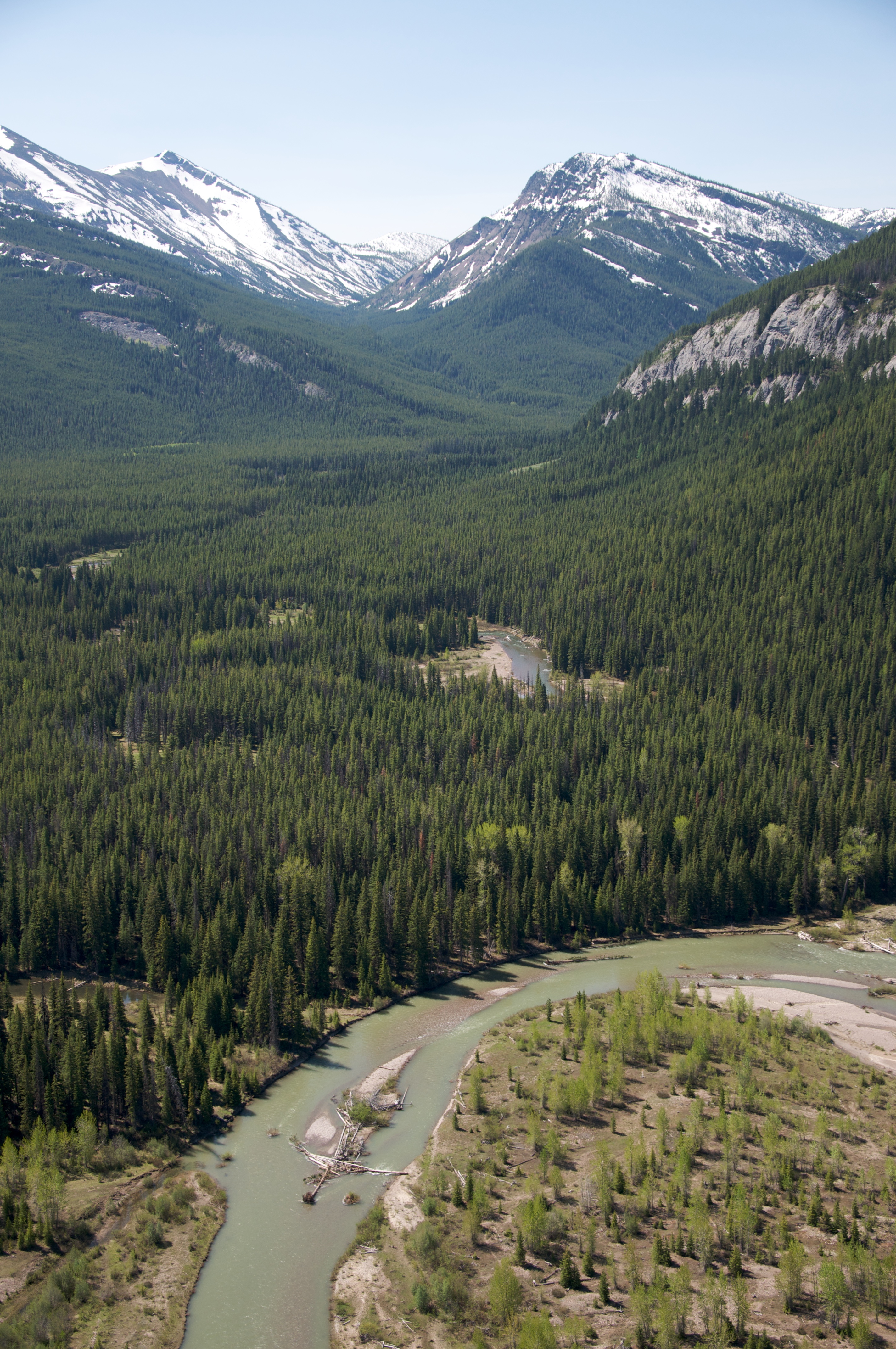
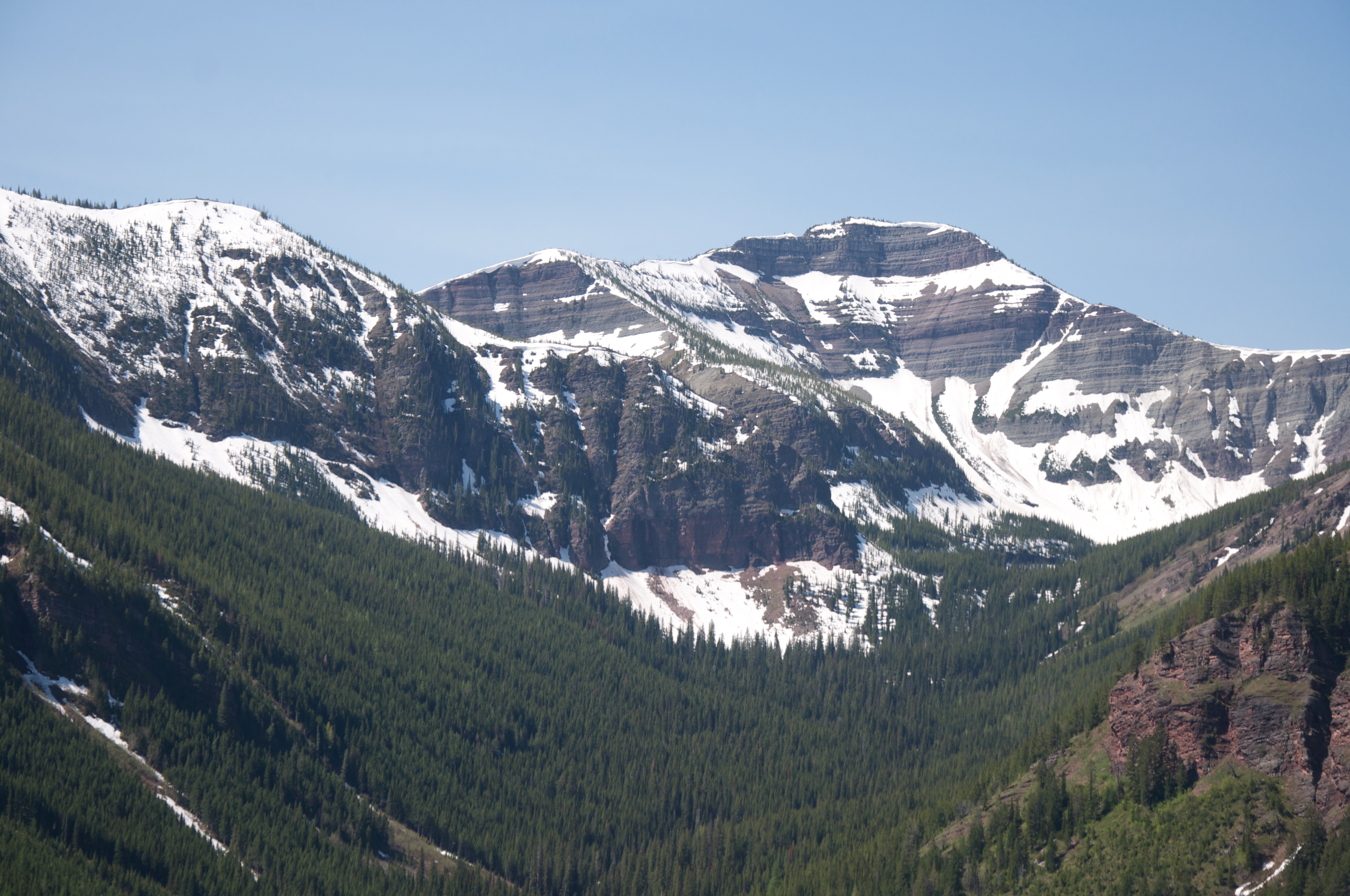
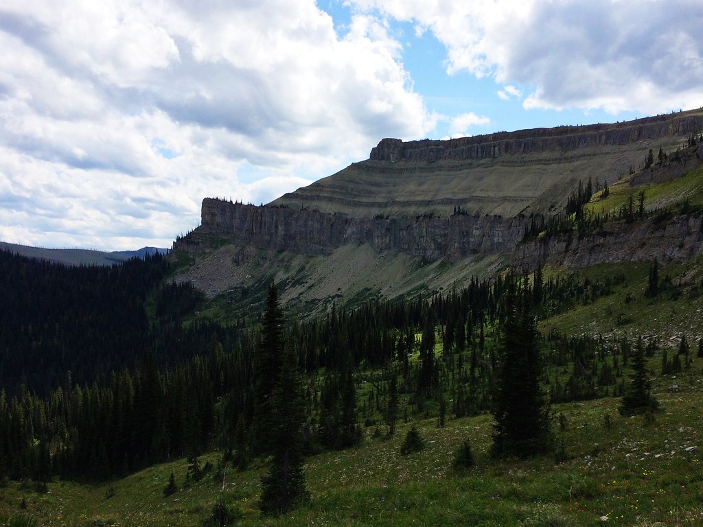
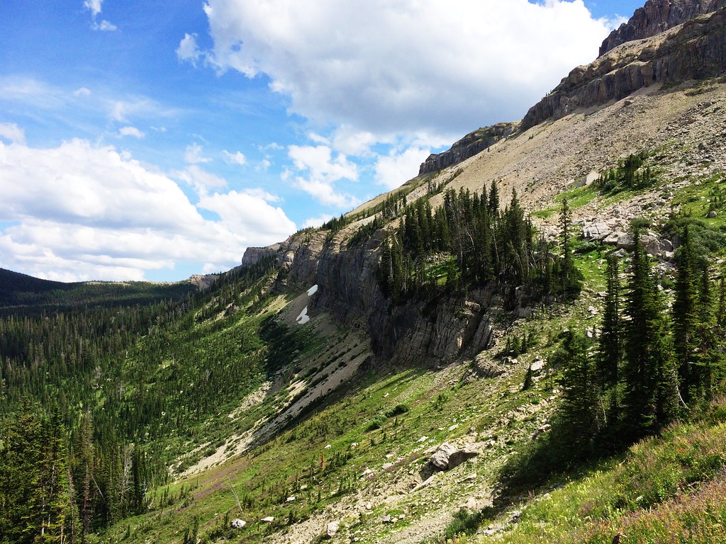
日出日落照片
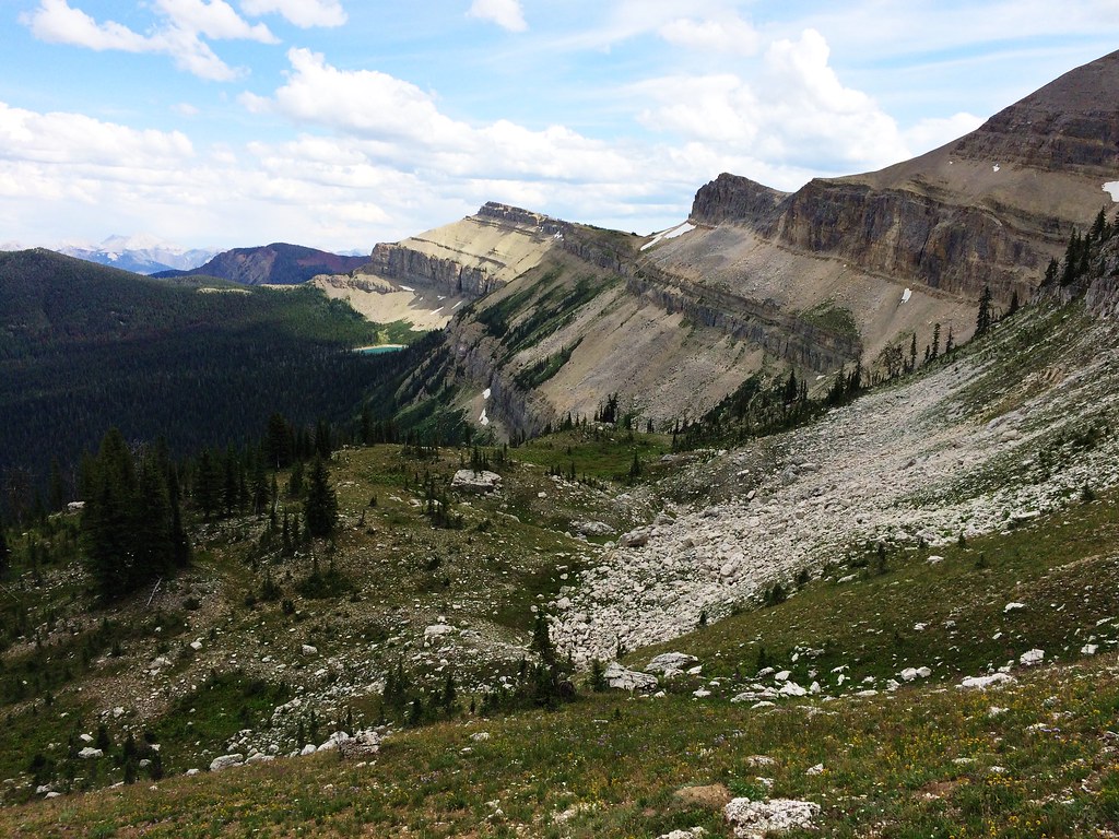
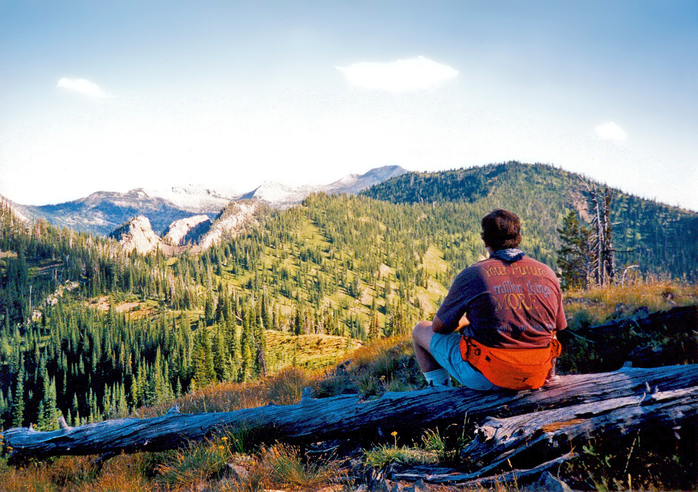
Up Switchback Pass during the 53-mile Run Across The Bob
Up Switchback Pass during the 53-mile Run Across The Bob
Up Switchback Pass during the 53-mile Run Across The Bob
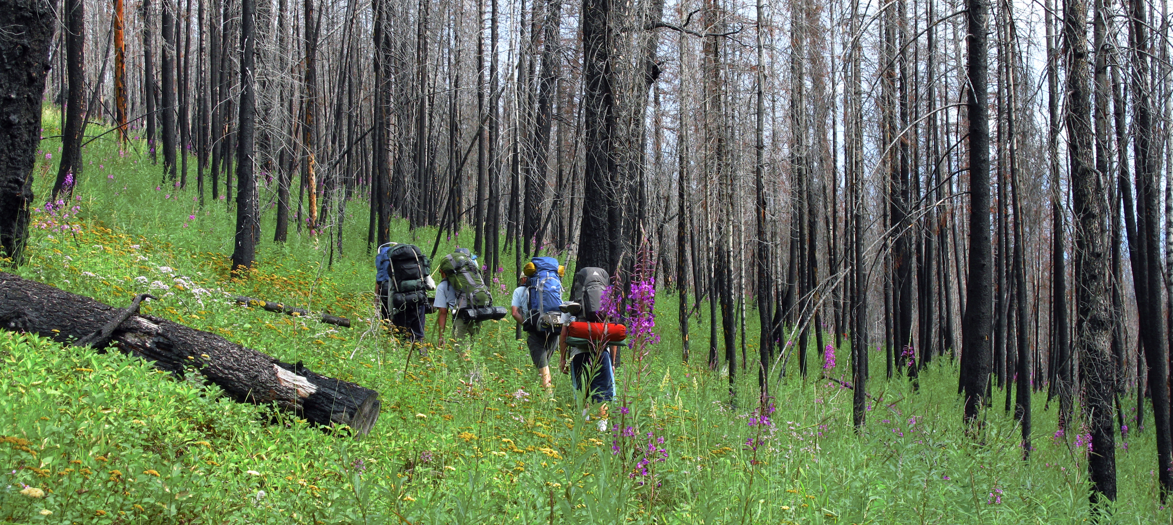
Remnants of the fire

Tent camping on a moonlight night in the Great Bear Wilderness area of Montana. This image was enhanced using Adobe Photoshop Lightroom and Adobe Photoshop CS5.<br/><br/>Learn more about my digital photography field workshops and Adobe Photoshop Lightroo
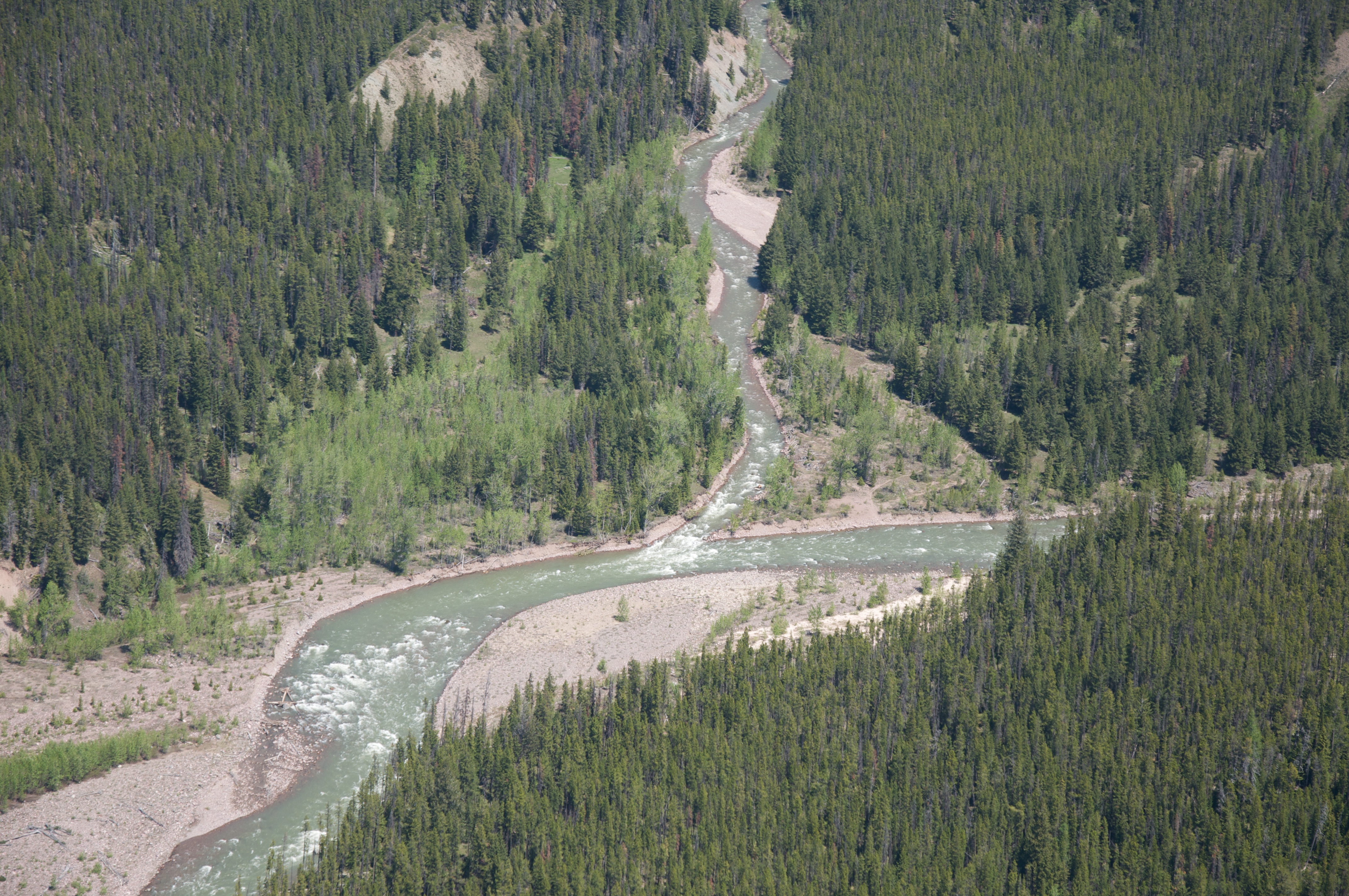
Confluence of Flathead River's North and Middle Fork
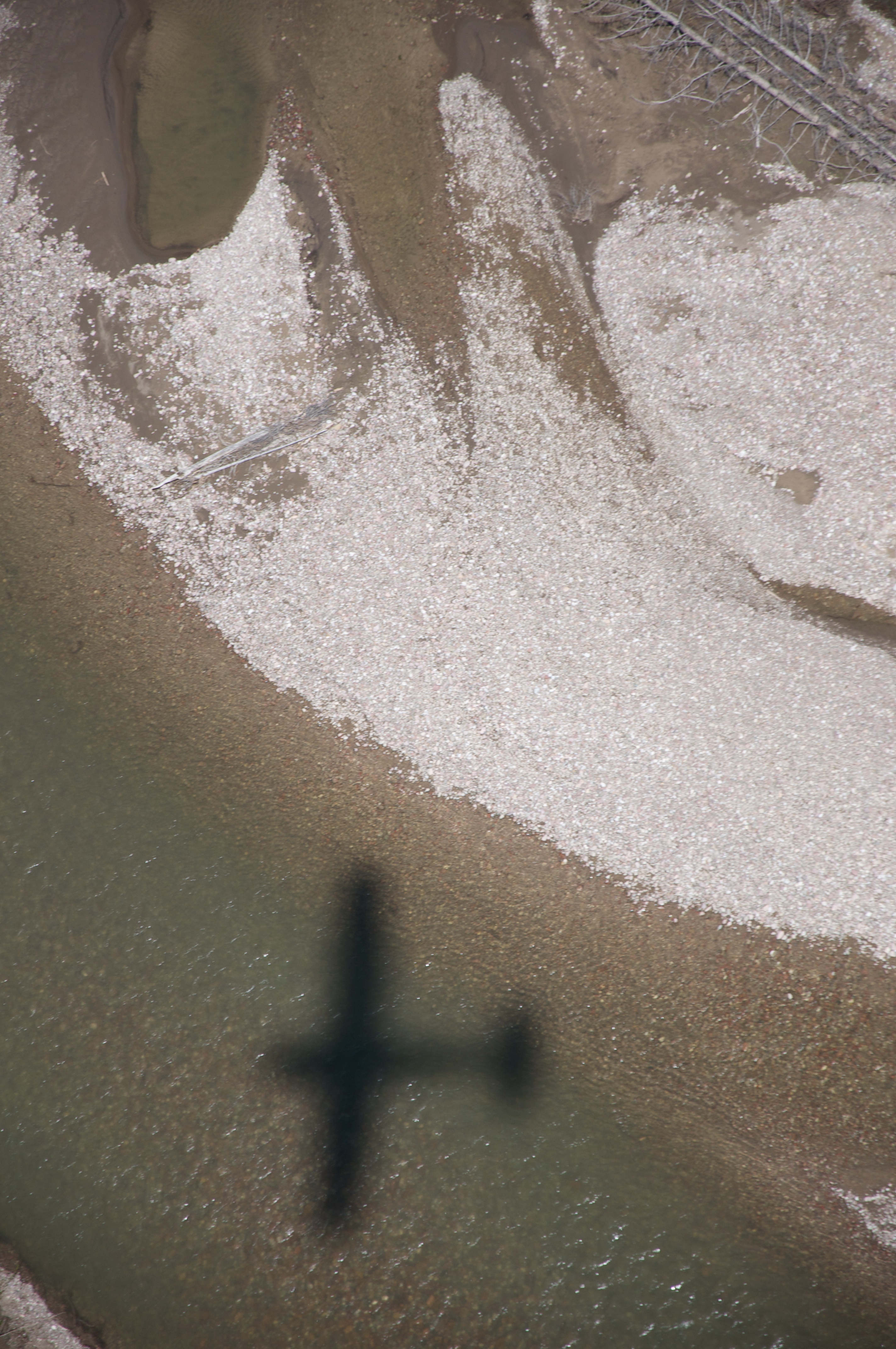
Over the Flathead River
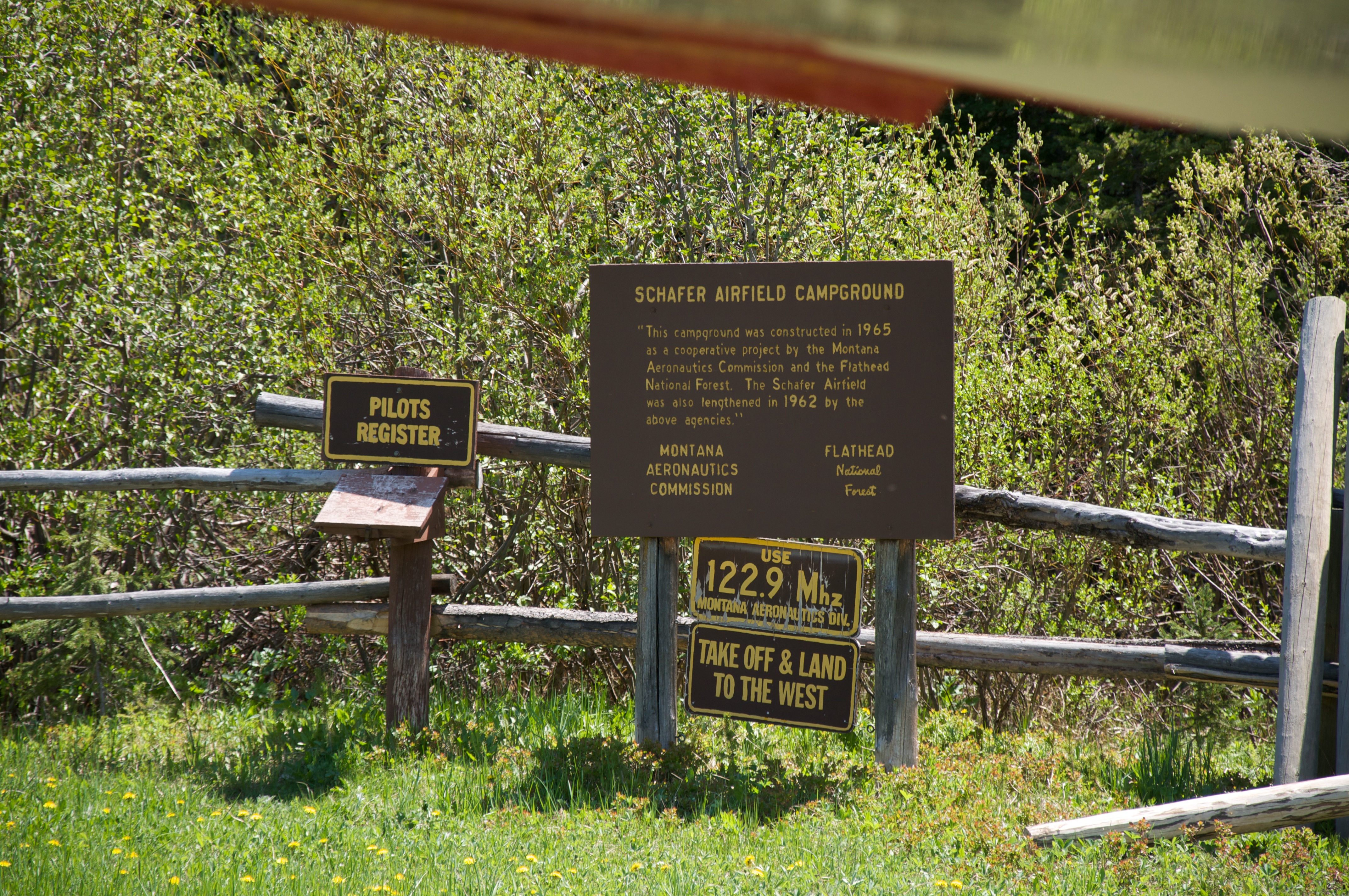
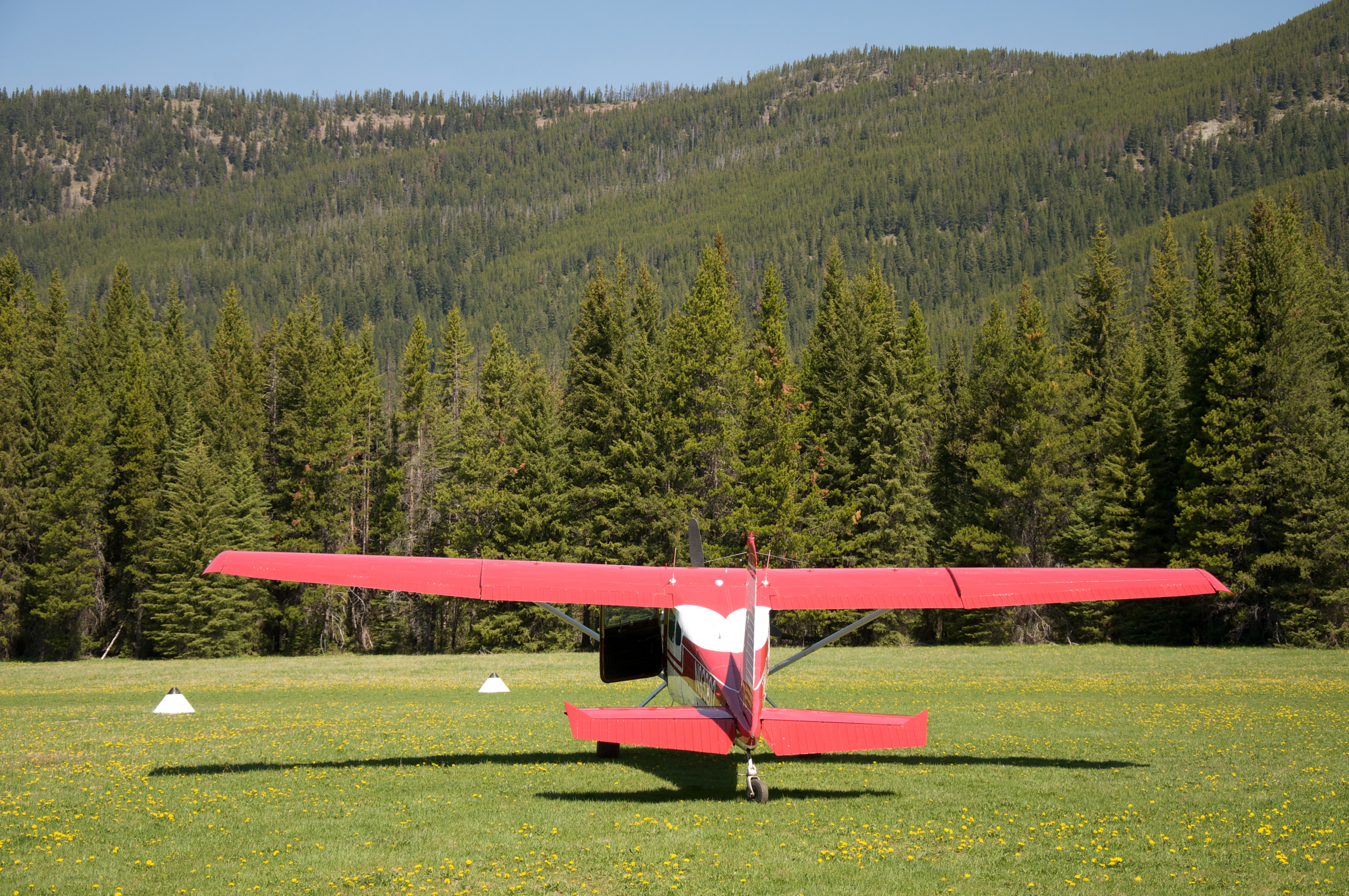
Schafer Airfield
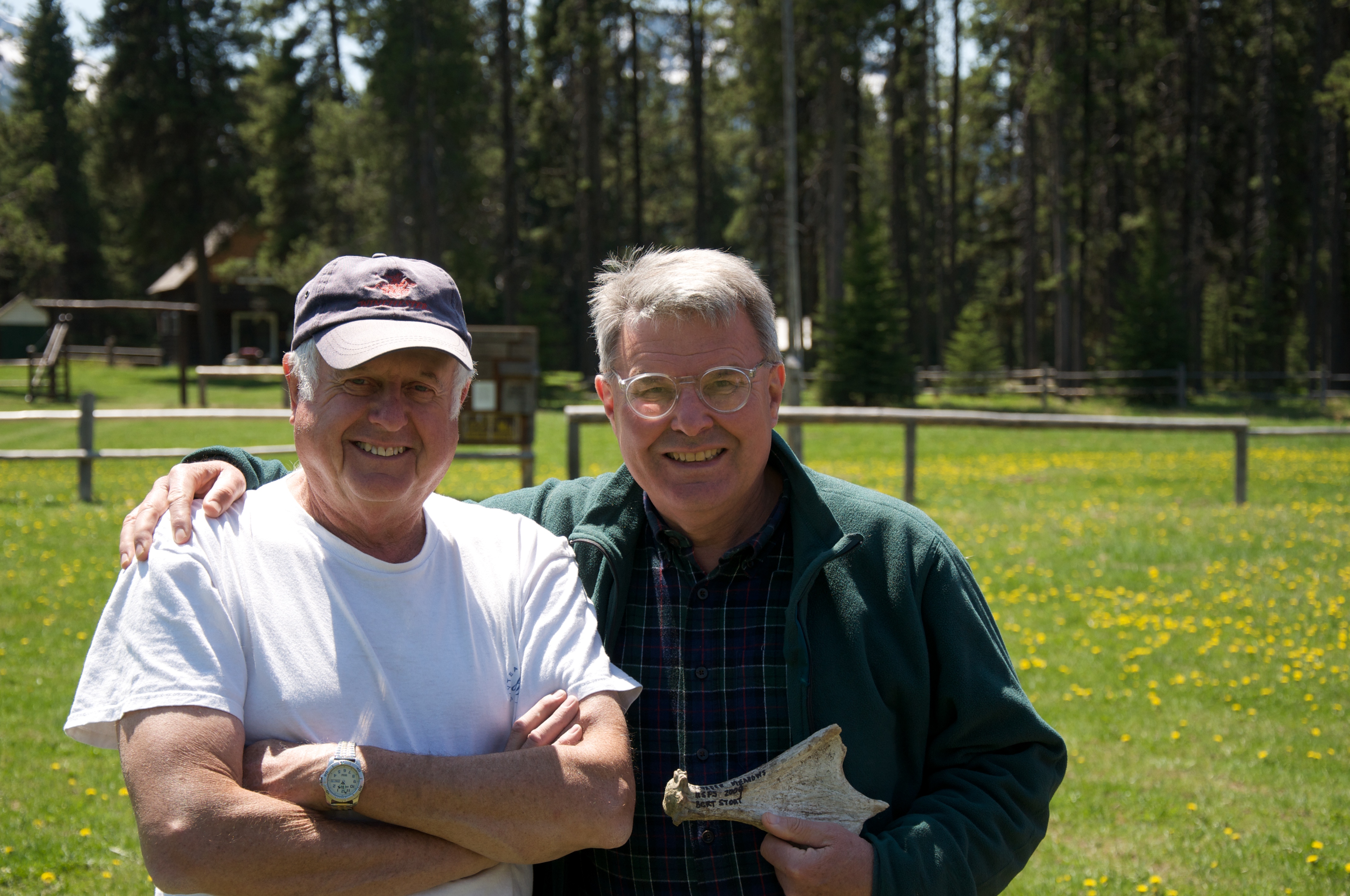
Bert and Dave
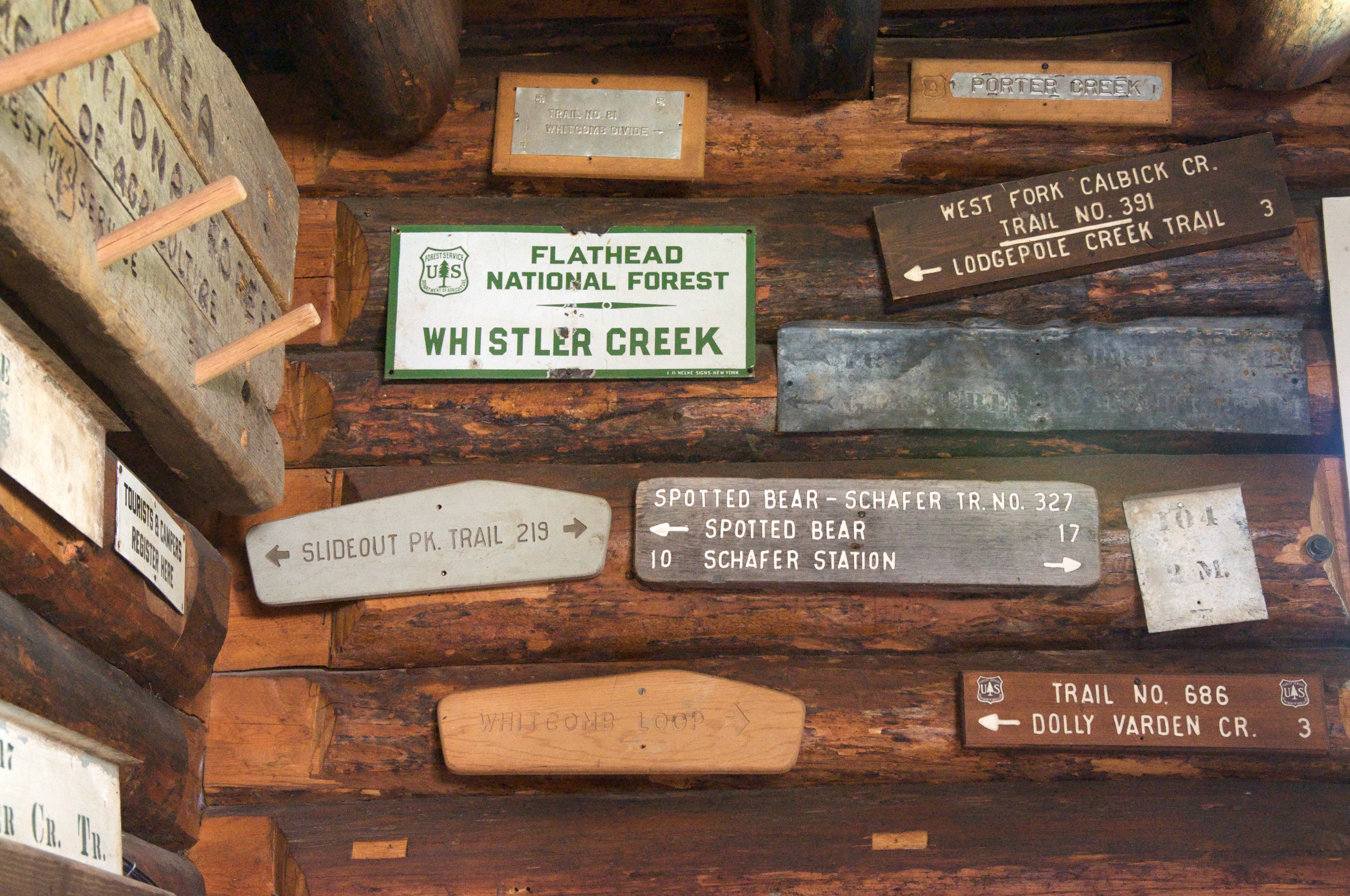
Vintage forest service signs
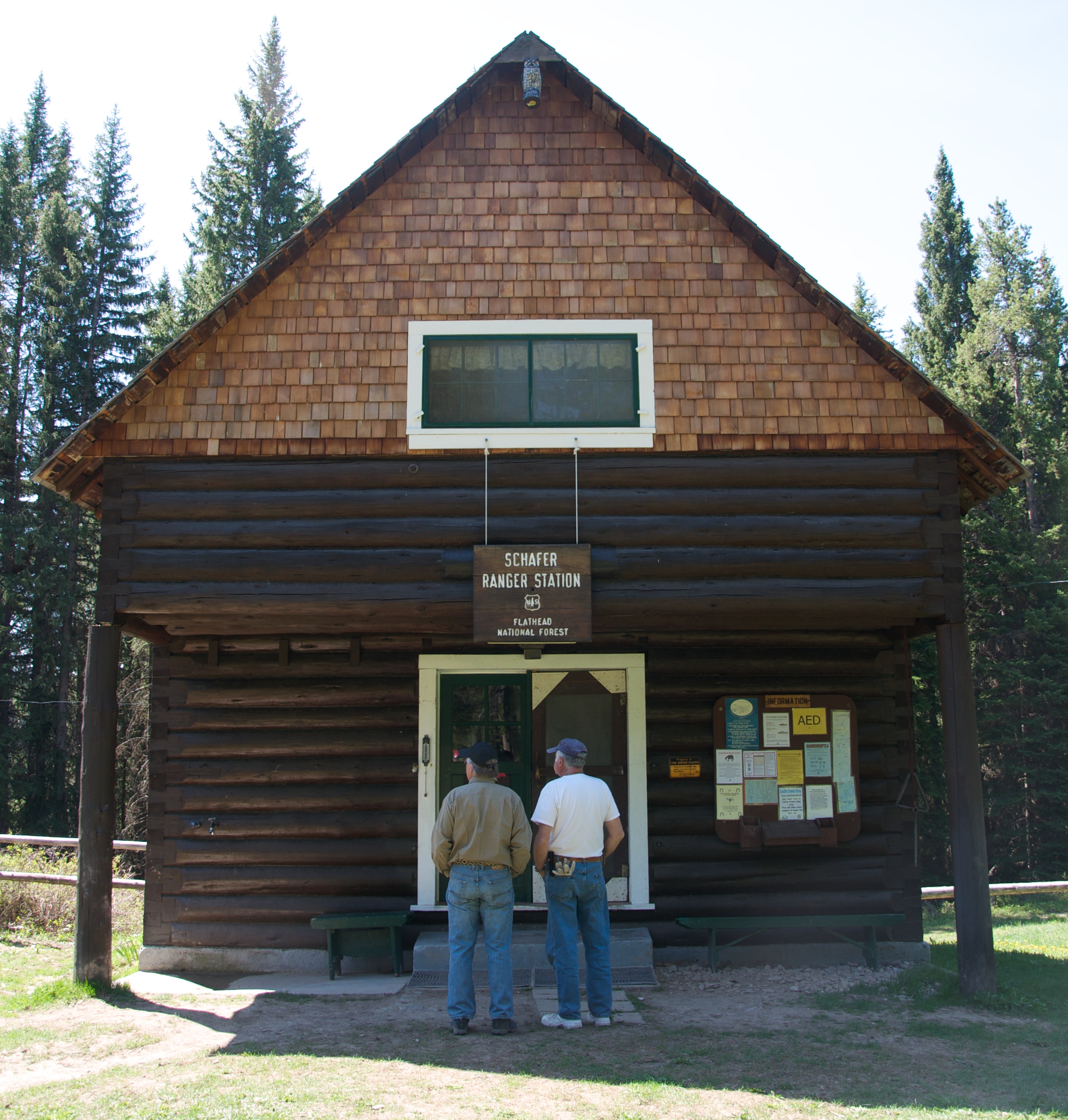
Schafer Ranger Station
Flathead National Forest - Schafer Ranger Station
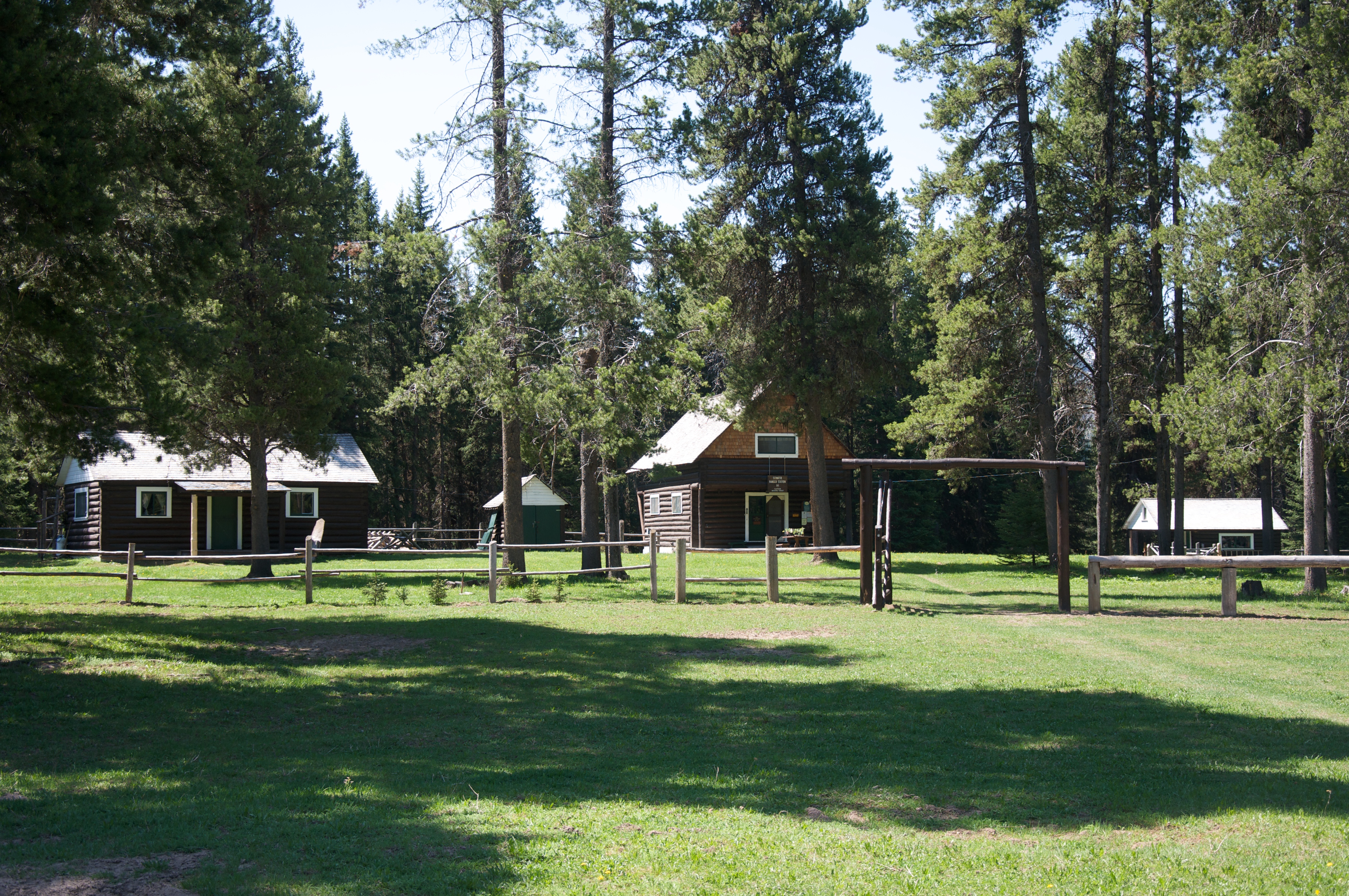
Schafer Meadows
Middle Fork of the Flathead River
Somewhere in the Great Bear Wilderness
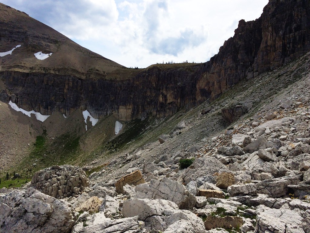
Along the North Wall during the 53-mile Run Across The Bob
Up Switchback Pass during the 53-mile Run Across The Bob

Up Switchback Pass during the 53-mile Run Across The Bob
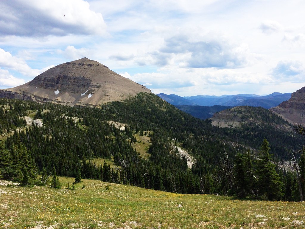
Harrison Ridge, Bob Marshall Wilderness, Montana
Elk Ridge, Montana 美國的地圖
搜索其他地方的日出日落時間
附近地點
Argosy Mountain, Montana 美國
Dean Ridge, Montana 美國
10 Hungry Horse Dr., Hungry Horse, MT 美國SILVERTIP CABIN
Limestone Peak, Montana 美國
Kevan Mountain, Montana 美國
Sergeant Mountain, Montana 美國
Whitcomb Peak, Montana 美國
Bow Mountain, Montana 美國
Angle Point, Montana 美國
Ibex Mountain, Montana 美國
Mid Mountain, Montana 美國
Wildrose Mountain, Montana 美國
Signal Mountain, Montana 美國
Big Lodge Mountain, Montana, 美國
Bent Mountain, Montana 美國
Crescent Cliff, Montana 美國
Red Plume Mountain, Montana 美國
Mt May, Montana 美國Mount May
Hahn Peak, Montana 美國
Moonlight Peak, Montana 美國
最近搜索
- Red Dog Mine, AK, USA的日出日落時間表
- Am bhf, Borken, 德國Am Bahnhof的日出日落時間表
- 4th St E, Sonoma, CA 美國的日出日落時間表
- Oakland Ave, Williamsport, PA 美國的日出日落時間表
- Via Roma, Pieranica CR, 義大利的日出日落時間表
- 克羅埃西亞杜布羅夫尼克 GradClock Tower of Dubrovnik的日出日落時間表
- 阿根廷丘布特省特雷利烏的日出日落時間表
- Hartfords Bluff Cir, Mt Pleasant, SC 美國的日出日落時間表
- 日本熊本縣熊本市北區的日出日落時間表
- 中國福州市平潭縣平潭島的日出日落時間表