Eagle Rock, Washington 美國的日出日落時間表
Location: 美國 > 華盛頓 > WA 美國 >
時區:
America/Los_Angeles
當地時間:
2025-06-22 15:57:09
經度:
-121.355381
緯度:
47.7759405
今天日出時間:
05:07:35 AM
今天日落時間:
09:08:05 PM
今天日照時長:
16h 0m 30s
明天日出時間:
05:07:57 AM
明天日落時間:
09:08:09 PM
明天日照時長:
16h 0m 12s
顯示所有日期
| 日期 | 日出 | 日落 | 日照時長 |
|---|---|---|---|
| 2025年01月01日 | 07:54:06 AM | 04:25:11 PM | 8h 31m 5s |
| 2025年01月02日 | 07:54:00 AM | 04:26:13 PM | 8h 32m 13s |
| 2025年01月03日 | 07:53:50 AM | 04:27:16 PM | 8h 33m 26s |
| 2025年01月04日 | 07:53:38 AM | 04:28:22 PM | 8h 34m 44s |
| 2025年01月05日 | 07:53:23 AM | 04:29:30 PM | 8h 36m 7s |
| 2025年01月06日 | 07:53:05 AM | 04:30:39 PM | 8h 37m 34s |
| 2025年01月07日 | 07:52:44 AM | 04:31:51 PM | 8h 39m 7s |
| 2025年01月08日 | 07:52:20 AM | 04:33:04 PM | 8h 40m 44s |
| 2025年01月09日 | 07:51:54 AM | 04:34:19 PM | 8h 42m 25s |
| 2025年01月10日 | 07:51:25 AM | 04:35:35 PM | 8h 44m 10s |
| 2025年01月11日 | 07:50:53 AM | 04:36:53 PM | 8h 46m 0s |
| 2025年01月12日 | 07:50:18 AM | 04:38:12 PM | 8h 47m 54s |
| 2025年01月13日 | 07:49:41 AM | 04:39:33 PM | 8h 49m 52s |
| 2025年01月14日 | 07:49:01 AM | 04:40:55 PM | 8h 51m 54s |
| 2025年01月15日 | 07:48:19 AM | 04:42:18 PM | 8h 53m 59s |
| 2025年01月16日 | 07:47:33 AM | 04:43:43 PM | 8h 56m 10s |
| 2025年01月17日 | 07:46:46 AM | 04:45:08 PM | 8h 58m 22s |
| 2025年01月18日 | 07:45:56 AM | 04:46:35 PM | 9h 0m 39s |
| 2025年01月19日 | 07:45:03 AM | 04:48:02 PM | 9h 2m 59s |
| 2025年01月20日 | 07:44:08 AM | 04:49:31 PM | 9h 5m 23s |
| 2025年01月21日 | 07:43:11 AM | 04:51:00 PM | 9h 7m 49s |
| 2025年01月22日 | 07:42:11 AM | 04:52:30 PM | 9h 10m 19s |
| 2025年01月23日 | 07:41:09 AM | 04:54:01 PM | 9h 12m 52s |
| 2025年01月24日 | 07:40:05 AM | 04:55:32 PM | 9h 15m 27s |
| 2025年01月25日 | 07:38:59 AM | 04:57:04 PM | 9h 18m 5s |
| 2025年01月26日 | 07:37:50 AM | 04:58:37 PM | 9h 20m 47s |
| 2025年01月27日 | 07:36:40 AM | 05:00:10 PM | 9h 23m 30s |
| 2025年01月28日 | 07:35:27 AM | 05:01:43 PM | 9h 26m 16s |
| 2025年01月29日 | 07:34:12 AM | 05:03:17 PM | 9h 29m 5s |
| 2025年01月30日 | 07:32:56 AM | 05:04:51 PM | 9h 31m 55s |
| 2025年01月31日 | 07:31:37 AM | 05:06:26 PM | 9h 34m 49s |
| 2025年02月01日 | 07:30:17 AM | 05:08:00 PM | 9h 37m 43s |
| 2025年02月02日 | 07:28:54 AM | 05:09:35 PM | 9h 40m 41s |
| 2025年02月03日 | 07:27:30 AM | 05:11:10 PM | 9h 43m 40s |
| 2025年02月04日 | 07:26:05 AM | 05:12:45 PM | 9h 46m 40s |
| 2025年02月05日 | 07:24:37 AM | 05:14:21 PM | 9h 49m 44s |
| 2025年02月06日 | 07:23:08 AM | 05:15:56 PM | 9h 52m 48s |
| 2025年02月07日 | 07:21:38 AM | 05:17:31 PM | 9h 55m 53s |
| 2025年02月08日 | 07:20:05 AM | 05:19:06 PM | 9h 59m 1s |
| 2025年02月09日 | 07:18:32 AM | 05:20:42 PM | 10h 2m 10s |
| 2025年02月10日 | 07:16:56 AM | 05:22:17 PM | 10h 5m 21s |
| 2025年02月11日 | 07:15:20 AM | 05:23:52 PM | 10h 8m 32s |
| 2025年02月12日 | 07:13:42 AM | 05:25:27 PM | 10h 11m 45s |
| 2025年02月13日 | 07:12:02 AM | 05:27:01 PM | 10h 14m 59s |
| 2025年02月14日 | 07:10:22 AM | 05:28:36 PM | 10h 18m 14s |
| 2025年02月15日 | 07:08:40 AM | 05:30:10 PM | 10h 21m 30s |
| 2025年02月16日 | 07:06:57 AM | 05:31:45 PM | 10h 24m 48s |
| 2025年02月17日 | 07:05:13 AM | 05:33:19 PM | 10h 28m 6s |
| 2025年02月18日 | 07:03:27 AM | 05:34:52 PM | 10h 31m 25s |
| 2025年02月19日 | 07:01:41 AM | 05:36:26 PM | 10h 34m 45s |
| 2025年02月20日 | 06:59:53 AM | 05:37:59 PM | 10h 38m 6s |
| 2025年02月21日 | 06:58:05 AM | 05:39:32 PM | 10h 41m 27s |
| 2025年02月22日 | 06:56:15 AM | 05:41:05 PM | 10h 44m 50s |
| 2025年02月23日 | 06:54:25 AM | 05:42:38 PM | 10h 48m 13s |
| 2025年02月24日 | 06:52:34 AM | 05:44:10 PM | 10h 51m 36s |
| 2025年02月25日 | 06:50:42 AM | 05:45:42 PM | 10h 55m 0s |
| 2025年02月26日 | 06:48:49 AM | 05:47:14 PM | 10h 58m 25s |
| 2025年02月27日 | 06:46:55 AM | 05:48:45 PM | 11h 1m 50s |
| 2025年02月28日 | 06:45:00 AM | 05:50:16 PM | 11h 5m 16s |
| 2025年03月01日 | 06:43:05 AM | 05:51:47 PM | 11h 8m 42s |
| 2025年03月02日 | 06:41:09 AM | 05:53:18 PM | 11h 12m 9s |
| 2025年03月03日 | 06:39:13 AM | 05:54:48 PM | 11h 15m 35s |
| 2025年03月04日 | 06:37:16 AM | 05:56:18 PM | 11h 19m 2s |
| 2025年03月05日 | 06:35:18 AM | 05:57:48 PM | 11h 22m 30s |
| 2025年03月06日 | 06:33:20 AM | 05:59:18 PM | 11h 25m 58s |
| 2025年03月07日 | 06:31:21 AM | 06:00:47 PM | 11h 29m 26s |
| 2025年03月08日 | 06:29:22 AM | 06:02:16 PM | 11h 32m 54s |
| 2025年03月09日 | 07:27:27 AM | 07:03:41 PM | 11h 36m 14s |
| 2025年03月10日 | 07:25:27 AM | 07:05:09 PM | 11h 39m 42s |
| 2025年03月11日 | 07:23:27 AM | 07:06:38 PM | 11h 43m 11s |
| 2025年03月12日 | 07:21:26 AM | 07:08:06 PM | 11h 46m 40s |
| 2025年03月13日 | 07:19:25 AM | 07:09:34 PM | 11h 50m 9s |
| 2025年03月14日 | 07:17:24 AM | 07:11:01 PM | 11h 53m 37s |
| 2025年03月15日 | 07:15:22 AM | 07:12:29 PM | 11h 57m 7s |
| 2025年03月16日 | 07:13:20 AM | 07:13:56 PM | 12h 0m 36s |
| 2025年03月17日 | 07:11:18 AM | 07:15:23 PM | 12h 4m 5s |
| 2025年03月18日 | 07:09:16 AM | 07:16:50 PM | 12h 7m 34s |
| 2025年03月19日 | 07:07:14 AM | 07:18:17 PM | 12h 11m 3s |
| 2025年03月20日 | 07:05:12 AM | 07:19:44 PM | 12h 14m 32s |
| 2025年03月21日 | 07:03:09 AM | 07:21:10 PM | 12h 18m 1s |
| 2025年03月22日 | 07:01:07 AM | 07:22:37 PM | 12h 21m 30s |
| 2025年03月23日 | 06:59:04 AM | 07:24:03 PM | 12h 24m 59s |
| 2025年03月24日 | 06:57:02 AM | 07:25:29 PM | 12h 28m 27s |
| 2025年03月25日 | 06:55:00 AM | 07:26:55 PM | 12h 31m 55s |
| 2025年03月26日 | 06:52:58 AM | 07:28:21 PM | 12h 35m 23s |
| 2025年03月27日 | 06:50:56 AM | 07:29:47 PM | 12h 38m 51s |
| 2025年03月28日 | 06:48:54 AM | 07:31:13 PM | 12h 42m 19s |
| 2025年03月29日 | 06:46:52 AM | 07:32:39 PM | 12h 45m 47s |
| 2025年03月30日 | 06:44:50 AM | 07:34:05 PM | 12h 49m 15s |
| 2025年03月31日 | 06:42:49 AM | 07:35:30 PM | 12h 52m 41s |
| 2025年04月01日 | 06:40:48 AM | 07:36:56 PM | 12h 56m 8s |
| 2025年04月02日 | 06:38:48 AM | 07:38:21 PM | 12h 59m 33s |
| 2025年04月03日 | 06:36:47 AM | 07:39:47 PM | 13h 3m 0s |
| 2025年04月04日 | 06:34:47 AM | 07:41:12 PM | 13h 6m 25s |
| 2025年04月05日 | 06:32:48 AM | 07:42:38 PM | 13h 9m 50s |
| 2025年04月06日 | 06:30:49 AM | 07:44:03 PM | 13h 13m 14s |
| 2025年04月07日 | 06:28:50 AM | 07:45:29 PM | 13h 16m 39s |
| 2025年04月08日 | 06:26:52 AM | 07:46:54 PM | 13h 20m 2s |
| 2025年04月09日 | 06:24:55 AM | 07:48:20 PM | 13h 23m 25s |
| 2025年04月10日 | 06:22:58 AM | 07:49:45 PM | 13h 26m 47s |
| 2025年04月11日 | 06:21:01 AM | 07:51:11 PM | 13h 30m 10s |
| 2025年04月12日 | 06:19:06 AM | 07:52:36 PM | 13h 33m 30s |
| 2025年04月13日 | 06:17:11 AM | 07:54:01 PM | 13h 36m 50s |
| 2025年04月14日 | 06:15:16 AM | 07:55:27 PM | 13h 40m 11s |
| 2025年04月15日 | 06:13:23 AM | 07:56:52 PM | 13h 43m 29s |
| 2025年04月16日 | 06:11:30 AM | 07:58:18 PM | 13h 46m 48s |
| 2025年04月17日 | 06:09:38 AM | 07:59:43 PM | 13h 50m 5s |
| 2025年04月18日 | 06:07:47 AM | 08:01:08 PM | 13h 53m 21s |
| 2025年04月19日 | 06:05:57 AM | 08:02:33 PM | 13h 56m 36s |
| 2025年04月20日 | 06:04:07 AM | 08:03:58 PM | 13h 59m 51s |
| 2025年04月21日 | 06:02:19 AM | 08:05:24 PM | 14h 3m 5s |
| 2025年04月22日 | 06:00:32 AM | 08:06:49 PM | 14h 6m 17s |
| 2025年04月23日 | 05:58:45 AM | 08:08:13 PM | 14h 9m 28s |
| 2025年04月24日 | 05:57:00 AM | 08:09:38 PM | 14h 12m 38s |
| 2025年04月25日 | 05:55:16 AM | 08:11:03 PM | 14h 15m 47s |
| 2025年04月26日 | 05:53:33 AM | 08:12:27 PM | 14h 18m 54s |
| 2025年04月27日 | 05:51:51 AM | 08:13:52 PM | 14h 22m 1s |
| 2025年04月28日 | 05:50:11 AM | 08:15:16 PM | 14h 25m 5s |
| 2025年04月29日 | 05:48:31 AM | 08:16:40 PM | 14h 28m 9s |
| 2025年04月30日 | 05:46:53 AM | 08:18:04 PM | 14h 31m 11s |
| 2025年05月01日 | 05:45:16 AM | 08:19:27 PM | 14h 34m 11s |
| 2025年05月02日 | 05:43:41 AM | 08:20:50 PM | 14h 37m 9s |
| 2025年05月03日 | 05:42:07 AM | 08:22:13 PM | 14h 40m 6s |
| 2025年05月04日 | 05:40:35 AM | 08:23:36 PM | 14h 43m 1s |
| 2025年05月05日 | 05:39:04 AM | 08:24:58 PM | 14h 45m 54s |
| 2025年05月06日 | 05:37:35 AM | 08:26:20 PM | 14h 48m 45s |
| 2025年05月07日 | 05:36:07 AM | 08:27:41 PM | 14h 51m 34s |
| 2025年05月08日 | 05:34:41 AM | 08:29:02 PM | 14h 54m 21s |
| 2025年05月09日 | 05:33:16 AM | 08:30:22 PM | 14h 57m 6s |
| 2025年05月10日 | 05:31:53 AM | 08:31:42 PM | 14h 59m 49s |
| 2025年05月11日 | 05:30:32 AM | 08:33:01 PM | 15h 2m 29s |
| 2025年05月12日 | 05:29:13 AM | 08:34:19 PM | 15h 5m 6s |
| 2025年05月13日 | 05:27:56 AM | 08:35:37 PM | 15h 7m 41s |
| 2025年05月14日 | 05:26:40 AM | 08:36:54 PM | 15h 10m 14s |
| 2025年05月15日 | 05:25:27 AM | 08:38:10 PM | 15h 12m 43s |
| 2025年05月16日 | 05:24:15 AM | 08:39:26 PM | 15h 15m 11s |
| 2025年05月17日 | 05:23:05 AM | 08:40:40 PM | 15h 17m 35s |
| 2025年05月18日 | 05:21:57 AM | 08:41:54 PM | 15h 19m 57s |
| 2025年05月19日 | 05:20:52 AM | 08:43:06 PM | 15h 22m 14s |
| 2025年05月20日 | 05:19:48 AM | 08:44:18 PM | 15h 24m 30s |
| 2025年05月21日 | 05:18:47 AM | 08:45:29 PM | 15h 26m 42s |
| 2025年05月22日 | 05:17:48 AM | 08:46:38 PM | 15h 28m 50s |
| 2025年05月23日 | 05:16:51 AM | 08:47:46 PM | 15h 30m 55s |
| 2025年05月24日 | 05:15:56 AM | 08:48:53 PM | 15h 32m 57s |
| 2025年05月25日 | 05:15:04 AM | 08:49:59 PM | 15h 34m 55s |
| 2025年05月26日 | 05:14:14 AM | 08:51:03 PM | 15h 36m 49s |
| 2025年05月27日 | 05:13:26 AM | 08:52:06 PM | 15h 38m 40s |
| 2025年05月28日 | 05:12:40 AM | 08:53:07 PM | 15h 40m 27s |
| 2025年05月29日 | 05:11:58 AM | 08:54:07 PM | 15h 42m 9s |
| 2025年05月30日 | 05:11:17 AM | 08:55:05 PM | 15h 43m 48s |
| 2025年05月31日 | 05:10:39 AM | 08:56:01 PM | 15h 45m 22s |
| 2025年06月01日 | 05:10:03 AM | 08:56:56 PM | 15h 46m 53s |
| 2025年06月02日 | 05:09:30 AM | 08:57:49 PM | 15h 48m 19s |
| 2025年06月03日 | 05:09:00 AM | 08:58:40 PM | 15h 49m 40s |
| 2025年06月04日 | 05:08:32 AM | 08:59:30 PM | 15h 50m 58s |
| 2025年06月05日 | 05:08:06 AM | 09:00:17 PM | 15h 52m 11s |
| 2025年06月06日 | 05:07:43 AM | 09:01:03 PM | 15h 53m 20s |
| 2025年06月07日 | 05:07:23 AM | 09:01:46 PM | 15h 54m 23s |
| 2025年06月08日 | 05:07:05 AM | 09:02:27 PM | 15h 55m 22s |
| 2025年06月09日 | 05:06:50 AM | 09:03:07 PM | 15h 56m 17s |
| 2025年06月10日 | 05:06:37 AM | 09:03:44 PM | 15h 57m 7s |
| 2025年06月11日 | 05:06:27 AM | 09:04:18 PM | 15h 57m 51s |
| 2025年06月12日 | 05:06:20 AM | 09:04:51 PM | 15h 58m 31s |
| 2025年06月13日 | 05:06:15 AM | 09:05:21 PM | 15h 59m 6s |
| 2025年06月14日 | 05:06:13 AM | 09:05:49 PM | 15h 59m 36s |
| 2025年06月15日 | 05:06:14 AM | 09:06:14 PM | 16h 0m 0s |
| 2025年06月16日 | 05:06:17 AM | 09:06:37 PM | 16h 0m 20s |
| 2025年06月17日 | 05:06:22 AM | 09:06:58 PM | 16h 0m 36s |
| 2025年06月18日 | 05:06:30 AM | 09:07:16 PM | 16h 0m 46s |
| 2025年06月19日 | 05:06:41 AM | 09:07:31 PM | 16h 0m 50s |
| 2025年06月20日 | 05:06:54 AM | 09:07:44 PM | 16h 0m 50s |
| 2025年06月21日 | 05:07:10 AM | 09:07:55 PM | 16h 0m 45s |
| 2025年06月22日 | 05:07:28 AM | 09:08:03 PM | 16h 0m 35s |
| 2025年06月23日 | 05:07:48 AM | 09:08:08 PM | 16h 0m 20s |
| 2025年06月24日 | 05:08:11 AM | 09:08:10 PM | 15h 59m 59s |
| 2025年06月25日 | 05:08:36 AM | 09:08:10 PM | 15h 59m 34s |
| 2025年06月26日 | 05:09:04 AM | 09:08:08 PM | 15h 59m 4s |
| 2025年06月27日 | 05:09:34 AM | 09:08:02 PM | 15h 58m 28s |
| 2025年06月28日 | 05:10:06 AM | 09:07:55 PM | 15h 57m 49s |
| 2025年06月29日 | 05:10:40 AM | 09:07:44 PM | 15h 57m 4s |
| 2025年06月30日 | 05:11:16 AM | 09:07:31 PM | 15h 56m 15s |
| 2025年07月01日 | 05:11:55 AM | 09:07:15 PM | 15h 55m 20s |
| 2025年07月02日 | 05:12:35 AM | 09:06:56 PM | 15h 54m 21s |
| 2025年07月03日 | 05:13:18 AM | 09:06:35 PM | 15h 53m 17s |
| 2025年07月04日 | 05:14:02 AM | 09:06:11 PM | 15h 52m 9s |
| 2025年07月05日 | 05:14:49 AM | 09:05:45 PM | 15h 50m 56s |
| 2025年07月06日 | 05:15:37 AM | 09:05:16 PM | 15h 49m 39s |
| 2025年07月07日 | 05:16:27 AM | 09:04:45 PM | 15h 48m 18s |
| 2025年07月08日 | 05:17:19 AM | 09:04:10 PM | 15h 46m 51s |
| 2025年07月09日 | 05:18:12 AM | 09:03:34 PM | 15h 45m 22s |
| 2025年07月10日 | 05:19:07 AM | 09:02:55 PM | 15h 43m 48s |
| 2025年07月11日 | 05:20:04 AM | 09:02:13 PM | 15h 42m 9s |
| 2025年07月12日 | 05:21:02 AM | 09:01:29 PM | 15h 40m 27s |
| 2025年07月13日 | 05:22:01 AM | 09:00:43 PM | 15h 38m 42s |
| 2025年07月14日 | 05:23:02 AM | 08:59:54 PM | 15h 36m 52s |
| 2025年07月15日 | 05:24:05 AM | 08:59:02 PM | 15h 34m 57s |
| 2025年07月16日 | 05:25:08 AM | 08:58:09 PM | 15h 33m 1s |
| 2025年07月17日 | 05:26:13 AM | 08:57:13 PM | 15h 31m 0s |
| 2025年07月18日 | 05:27:19 AM | 08:56:15 PM | 15h 28m 56s |
| 2025年07月19日 | 05:28:26 AM | 08:55:15 PM | 15h 26m 49s |
| 2025年07月20日 | 05:29:34 AM | 08:54:12 PM | 15h 24m 38s |
| 2025年07月21日 | 05:30:43 AM | 08:53:07 PM | 15h 22m 24s |
| 2025年07月22日 | 05:31:53 AM | 08:52:01 PM | 15h 20m 8s |
| 2025年07月23日 | 05:33:05 AM | 08:50:52 PM | 15h 17m 47s |
| 2025年07月24日 | 05:34:16 AM | 08:49:41 PM | 15h 15m 25s |
| 2025年07月25日 | 05:35:29 AM | 08:48:28 PM | 15h 12m 59s |
| 2025年07月26日 | 05:36:42 AM | 08:47:13 PM | 15h 10m 31s |
| 2025年07月27日 | 05:37:57 AM | 08:45:56 PM | 15h 7m 59s |
| 2025年07月28日 | 05:39:11 AM | 08:44:37 PM | 15h 5m 26s |
| 2025年07月29日 | 05:40:27 AM | 08:43:17 PM | 15h 2m 50s |
| 2025年07月30日 | 05:41:43 AM | 08:41:55 PM | 15h 0m 12s |
| 2025年07月31日 | 05:42:59 AM | 08:40:31 PM | 14h 57m 32s |
| 2025年08月01日 | 05:44:16 AM | 08:39:05 PM | 14h 54m 49s |
| 2025年08月02日 | 05:45:34 AM | 08:37:38 PM | 14h 52m 4s |
| 2025年08月03日 | 05:46:52 AM | 08:36:09 PM | 14h 49m 17s |
| 2025年08月04日 | 05:48:10 AM | 08:34:38 PM | 14h 46m 28s |
| 2025年08月05日 | 05:49:29 AM | 08:33:06 PM | 14h 43m 37s |
| 2025年08月06日 | 05:50:48 AM | 08:31:32 PM | 14h 40m 44s |
| 2025年08月07日 | 05:52:07 AM | 08:29:57 PM | 14h 37m 50s |
| 2025年08月08日 | 05:53:26 AM | 08:28:20 PM | 14h 34m 54s |
| 2025年08月09日 | 05:54:46 AM | 08:26:42 PM | 14h 31m 56s |
| 2025年08月10日 | 05:56:06 AM | 08:25:03 PM | 14h 28m 57s |
| 2025年08月11日 | 05:57:26 AM | 08:23:22 PM | 14h 25m 56s |
| 2025年08月12日 | 05:58:46 AM | 08:21:41 PM | 14h 22m 55s |
| 2025年08月13日 | 06:00:07 AM | 08:19:58 PM | 14h 19m 51s |
| 2025年08月14日 | 06:01:27 AM | 08:18:13 PM | 14h 16m 46s |
| 2025年08月15日 | 06:02:48 AM | 08:16:28 PM | 14h 13m 40s |
| 2025年08月16日 | 06:04:09 AM | 08:14:41 PM | 14h 10m 32s |
| 2025年08月17日 | 06:05:29 AM | 08:12:54 PM | 14h 7m 25s |
| 2025年08月18日 | 06:06:50 AM | 08:11:05 PM | 14h 4m 15s |
| 2025年08月19日 | 06:08:11 AM | 08:09:15 PM | 14h 1m 4s |
| 2025年08月20日 | 06:09:32 AM | 08:07:25 PM | 13h 57m 53s |
| 2025年08月21日 | 06:10:53 AM | 08:05:33 PM | 13h 54m 40s |
| 2025年08月22日 | 06:12:14 AM | 08:03:41 PM | 13h 51m 27s |
| 2025年08月23日 | 06:13:35 AM | 08:01:47 PM | 13h 48m 12s |
| 2025年08月24日 | 06:14:56 AM | 07:59:53 PM | 13h 44m 57s |
| 2025年08月25日 | 06:16:17 AM | 07:57:58 PM | 13h 41m 41s |
| 2025年08月26日 | 06:17:37 AM | 07:56:03 PM | 13h 38m 26s |
| 2025年08月27日 | 06:18:58 AM | 07:54:06 PM | 13h 35m 8s |
| 2025年08月28日 | 06:20:19 AM | 07:52:09 PM | 13h 31m 50s |
| 2025年08月29日 | 06:21:40 AM | 07:50:11 PM | 13h 28m 31s |
| 2025年08月30日 | 06:23:01 AM | 07:48:13 PM | 13h 25m 12s |
| 2025年08月31日 | 06:24:22 AM | 07:46:14 PM | 13h 21m 52s |
| 2025年09月01日 | 06:25:42 AM | 07:44:15 PM | 13h 18m 33s |
| 2025年09月02日 | 06:27:03 AM | 07:42:15 PM | 13h 15m 12s |
| 2025年09月03日 | 06:28:24 AM | 07:40:14 PM | 13h 11m 50s |
| 2025年09月04日 | 06:29:45 AM | 07:38:13 PM | 13h 8m 28s |
| 2025年09月05日 | 06:31:05 AM | 07:36:12 PM | 13h 5m 7s |
| 2025年09月06日 | 06:32:26 AM | 07:34:10 PM | 13h 1m 44s |
| 2025年09月07日 | 06:33:47 AM | 07:32:08 PM | 12h 58m 21s |
| 2025年09月08日 | 06:35:08 AM | 07:30:05 PM | 12h 54m 57s |
| 2025年09月09日 | 06:36:28 AM | 07:28:03 PM | 12h 51m 35s |
| 2025年09月10日 | 06:37:49 AM | 07:26:00 PM | 12h 48m 11s |
| 2025年09月11日 | 06:39:10 AM | 07:23:56 PM | 12h 44m 46s |
| 2025年09月12日 | 06:40:31 AM | 07:21:53 PM | 12h 41m 22s |
| 2025年09月13日 | 06:41:52 AM | 07:19:49 PM | 12h 37m 57s |
| 2025年09月14日 | 06:43:13 AM | 07:17:45 PM | 12h 34m 32s |
| 2025年09月15日 | 06:44:34 AM | 07:15:41 PM | 12h 31m 7s |
| 2025年09月16日 | 06:45:55 AM | 07:13:37 PM | 12h 27m 42s |
| 2025年09月17日 | 06:47:16 AM | 07:11:33 PM | 12h 24m 17s |
| 2025年09月18日 | 06:48:38 AM | 07:09:29 PM | 12h 20m 51s |
| 2025年09月19日 | 06:49:59 AM | 07:07:25 PM | 12h 17m 26s |
| 2025年09月20日 | 06:51:21 AM | 07:05:21 PM | 12h 14m 0s |
| 2025年09月21日 | 06:52:43 AM | 07:03:16 PM | 12h 10m 33s |
| 2025年09月22日 | 06:54:04 AM | 07:01:13 PM | 12h 7m 9s |
| 2025年09月23日 | 06:55:26 AM | 06:59:09 PM | 12h 3m 43s |
| 2025年09月24日 | 06:56:49 AM | 06:57:05 PM | 12h 0m 16s |
| 2025年09月25日 | 06:58:11 AM | 06:55:01 PM | 11h 56m 50s |
| 2025年09月26日 | 06:59:34 AM | 06:52:58 PM | 11h 53m 24s |
| 2025年09月27日 | 07:00:56 AM | 06:50:55 PM | 11h 49m 59s |
| 2025年09月28日 | 07:02:19 AM | 06:48:52 PM | 11h 46m 33s |
| 2025年09月29日 | 07:03:42 AM | 06:46:50 PM | 11h 43m 8s |
| 2025年09月30日 | 07:05:06 AM | 06:44:48 PM | 11h 39m 42s |
| 2025年10月01日 | 07:06:30 AM | 06:42:46 PM | 11h 36m 16s |
| 2025年10月02日 | 07:07:53 AM | 06:40:44 PM | 11h 32m 51s |
| 2025年10月03日 | 07:09:18 AM | 06:38:43 PM | 11h 29m 25s |
| 2025年10月04日 | 07:10:42 AM | 06:36:43 PM | 11h 26m 1s |
| 2025年10月05日 | 07:12:07 AM | 06:34:43 PM | 11h 22m 36s |
| 2025年10月06日 | 07:13:32 AM | 06:32:43 PM | 11h 19m 11s |
| 2025年10月07日 | 07:14:57 AM | 06:30:45 PM | 11h 15m 48s |
| 2025年10月08日 | 07:16:22 AM | 06:28:46 PM | 11h 12m 24s |
| 2025年10月09日 | 07:17:48 AM | 06:26:49 PM | 11h 9m 1s |
| 2025年10月10日 | 07:19:14 AM | 06:24:52 PM | 11h 5m 38s |
| 2025年10月11日 | 07:20:41 AM | 06:22:55 PM | 11h 2m 14s |
| 2025年10月12日 | 07:22:07 AM | 06:21:00 PM | 10h 58m 53s |
| 2025年10月13日 | 07:23:34 AM | 06:19:05 PM | 10h 55m 31s |
| 2025年10月14日 | 07:25:02 AM | 06:17:11 PM | 10h 52m 9s |
| 2025年10月15日 | 07:26:29 AM | 06:15:18 PM | 10h 48m 49s |
| 2025年10月16日 | 07:27:57 AM | 06:13:25 PM | 10h 45m 28s |
| 2025年10月17日 | 07:29:25 AM | 06:11:34 PM | 10h 42m 9s |
| 2025年10月18日 | 07:30:54 AM | 06:09:43 PM | 10h 38m 49s |
| 2025年10月19日 | 07:32:23 AM | 06:07:54 PM | 10h 35m 31s |
| 2025年10月20日 | 07:33:52 AM | 06:06:05 PM | 10h 32m 13s |
| 2025年10月21日 | 07:35:21 AM | 06:04:18 PM | 10h 28m 57s |
| 2025年10月22日 | 07:36:51 AM | 06:02:32 PM | 10h 25m 41s |
| 2025年10月23日 | 07:38:20 AM | 06:00:47 PM | 10h 22m 27s |
| 2025年10月24日 | 07:39:50 AM | 05:59:03 PM | 10h 19m 13s |
| 2025年10月25日 | 07:41:21 AM | 05:57:20 PM | 10h 15m 59s |
| 2025年10月26日 | 07:42:51 AM | 05:55:38 PM | 10h 12m 47s |
| 2025年10月27日 | 07:44:22 AM | 05:53:58 PM | 10h 9m 36s |
| 2025年10月28日 | 07:45:53 AM | 05:52:20 PM | 10h 6m 27s |
| 2025年10月29日 | 07:47:24 AM | 05:50:42 PM | 10h 3m 18s |
| 2025年10月30日 | 07:48:55 AM | 05:49:06 PM | 10h 0m 11s |
| 2025年10月31日 | 07:50:27 AM | 05:47:32 PM | 9h 57m 5s |
| 2025年11月01日 | 07:51:58 AM | 05:45:59 PM | 9h 54m 1s |
| 2025年11月02日 | 06:53:33 AM | 04:44:23 PM | 9h 50m 50s |
| 2025年11月03日 | 06:55:05 AM | 04:42:54 PM | 9h 47m 49s |
| 2025年11月04日 | 06:56:36 AM | 04:41:26 PM | 9h 44m 50s |
| 2025年11月05日 | 06:58:08 AM | 04:39:59 PM | 9h 41m 51s |
| 2025年11月06日 | 06:59:39 AM | 04:38:35 PM | 9h 38m 56s |
| 2025年11月07日 | 07:01:10 AM | 04:37:12 PM | 9h 36m 2s |
| 2025年11月08日 | 07:02:41 AM | 04:35:51 PM | 9h 33m 10s |
| 2025年11月09日 | 07:04:12 AM | 04:34:32 PM | 9h 30m 20s |
| 2025年11月10日 | 07:05:43 AM | 04:33:15 PM | 9h 27m 32s |
| 2025年11月11日 | 07:07:13 AM | 04:32:00 PM | 9h 24m 47s |
| 2025年11月12日 | 07:08:43 AM | 04:30:46 PM | 9h 22m 3s |
| 2025年11月13日 | 07:10:13 AM | 04:29:35 PM | 9h 19m 22s |
| 2025年11月14日 | 07:11:42 AM | 04:28:26 PM | 9h 16m 44s |
| 2025年11月15日 | 07:13:11 AM | 04:27:20 PM | 9h 14m 9s |
| 2025年11月16日 | 07:14:39 AM | 04:26:15 PM | 9h 11m 36s |
| 2025年11月17日 | 07:16:07 AM | 04:25:13 PM | 9h 9m 6s |
| 2025年11月18日 | 07:17:34 AM | 04:24:13 PM | 9h 6m 39s |
| 2025年11月19日 | 07:19:00 AM | 04:23:15 PM | 9h 4m 15s |
| 2025年11月20日 | 07:20:26 AM | 04:22:20 PM | 9h 1m 54s |
| 2025年11月21日 | 07:21:50 AM | 04:21:27 PM | 8h 59m 37s |
| 2025年11月22日 | 07:23:14 AM | 04:20:37 PM | 8h 57m 23s |
| 2025年11月23日 | 07:24:37 AM | 04:19:49 PM | 8h 55m 12s |
| 2025年11月24日 | 07:25:59 AM | 04:19:03 PM | 8h 53m 4s |
| 2025年11月25日 | 07:27:19 AM | 04:18:21 PM | 8h 51m 2s |
| 2025年11月26日 | 07:28:39 AM | 04:17:41 PM | 8h 49m 2s |
| 2025年11月27日 | 07:29:57 AM | 04:17:03 PM | 8h 47m 6s |
| 2025年11月28日 | 07:31:14 AM | 04:16:29 PM | 8h 45m 15s |
| 2025年11月29日 | 07:32:29 AM | 04:15:57 PM | 8h 43m 28s |
| 2025年11月30日 | 07:33:43 AM | 04:15:27 PM | 8h 41m 44s |
| 2025年12月01日 | 07:34:56 AM | 04:15:01 PM | 8h 40m 5s |
| 2025年12月02日 | 07:36:07 AM | 04:14:37 PM | 8h 38m 30s |
| 2025年12月03日 | 07:37:16 AM | 04:14:17 PM | 8h 37m 1s |
| 2025年12月04日 | 07:38:24 AM | 04:13:59 PM | 8h 35m 35s |
| 2025年12月05日 | 07:39:29 AM | 04:13:44 PM | 8h 34m 15s |
| 2025年12月06日 | 07:40:33 AM | 04:13:32 PM | 8h 32m 59s |
| 2025年12月07日 | 07:41:35 AM | 04:13:22 PM | 8h 31m 47s |
| 2025年12月08日 | 07:42:35 AM | 04:13:16 PM | 8h 30m 41s |
| 2025年12月09日 | 07:43:33 AM | 04:13:13 PM | 8h 29m 40s |
| 2025年12月10日 | 07:44:28 AM | 04:13:12 PM | 8h 28m 44s |
| 2025年12月11日 | 07:45:22 AM | 04:13:15 PM | 8h 27m 53s |
| 2025年12月12日 | 07:46:13 AM | 04:13:20 PM | 8h 27m 7s |
| 2025年12月13日 | 07:47:01 AM | 04:13:29 PM | 8h 26m 28s |
| 2025年12月14日 | 07:47:48 AM | 04:13:40 PM | 8h 25m 52s |
| 2025年12月15日 | 07:48:32 AM | 04:13:55 PM | 8h 25m 23s |
| 2025年12月16日 | 07:49:13 AM | 04:14:12 PM | 8h 24m 59s |
| 2025年12月17日 | 07:49:52 AM | 04:14:32 PM | 8h 24m 40s |
| 2025年12月18日 | 07:50:29 AM | 04:14:55 PM | 8h 24m 26s |
| 2025年12月19日 | 07:51:02 AM | 04:15:20 PM | 8h 24m 18s |
| 2025年12月20日 | 07:51:33 AM | 04:15:49 PM | 8h 24m 16s |
| 2025年12月21日 | 07:52:02 AM | 04:16:20 PM | 8h 24m 18s |
| 2025年12月22日 | 07:52:27 AM | 04:16:54 PM | 8h 24m 27s |
| 2025年12月23日 | 07:52:50 AM | 04:17:31 PM | 8h 24m 41s |
| 2025年12月24日 | 07:53:10 AM | 04:18:11 PM | 8h 25m 1s |
| 2025年12月25日 | 07:53:27 AM | 04:18:53 PM | 8h 25m 26s |
| 2025年12月26日 | 07:53:42 AM | 04:19:37 PM | 8h 25m 55s |
| 2025年12月27日 | 07:53:53 AM | 04:20:25 PM | 8h 26m 32s |
| 2025年12月28日 | 07:54:02 AM | 04:21:14 PM | 8h 27m 12s |
| 2025年12月29日 | 07:54:07 AM | 04:22:06 PM | 8h 27m 59s |
| 2025年12月30日 | 07:54:10 AM | 04:23:01 PM | 8h 28m 51s |
| 2025年12月31日 | 07:54:10 AM | 04:23:57 PM | 8h 29m 47s |
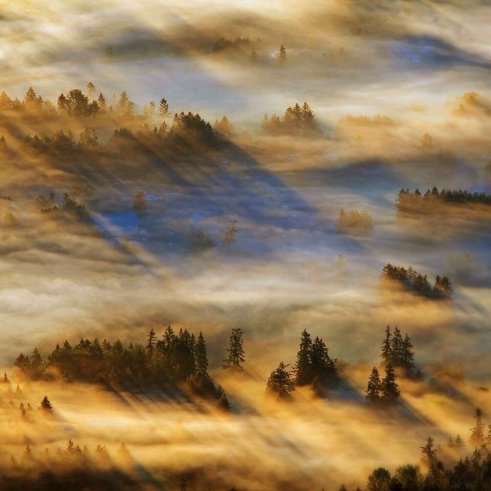
日出日落照片

Sunset From Beckler Peak
Seattle, Wa

sunset at mt index. lake serene. washington. I climbed to the top of the east ridge through the thickest brush for this.

Sunset at Evergreen Mountain Lookout by Michael Matti
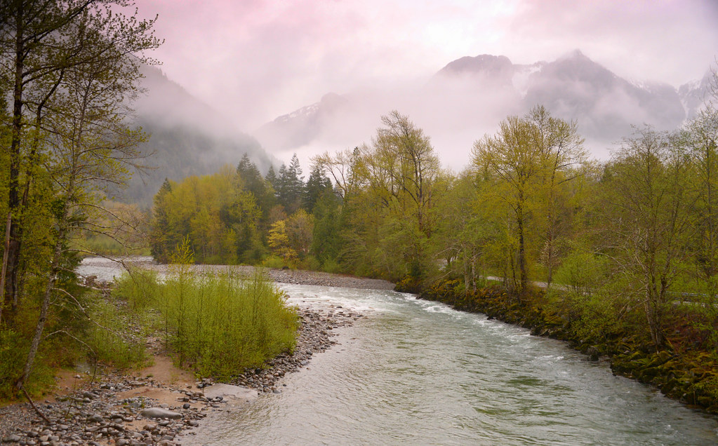
Sunset from Bridge over the north fork Skykomish River, Index, Washington
Skykomish River, site

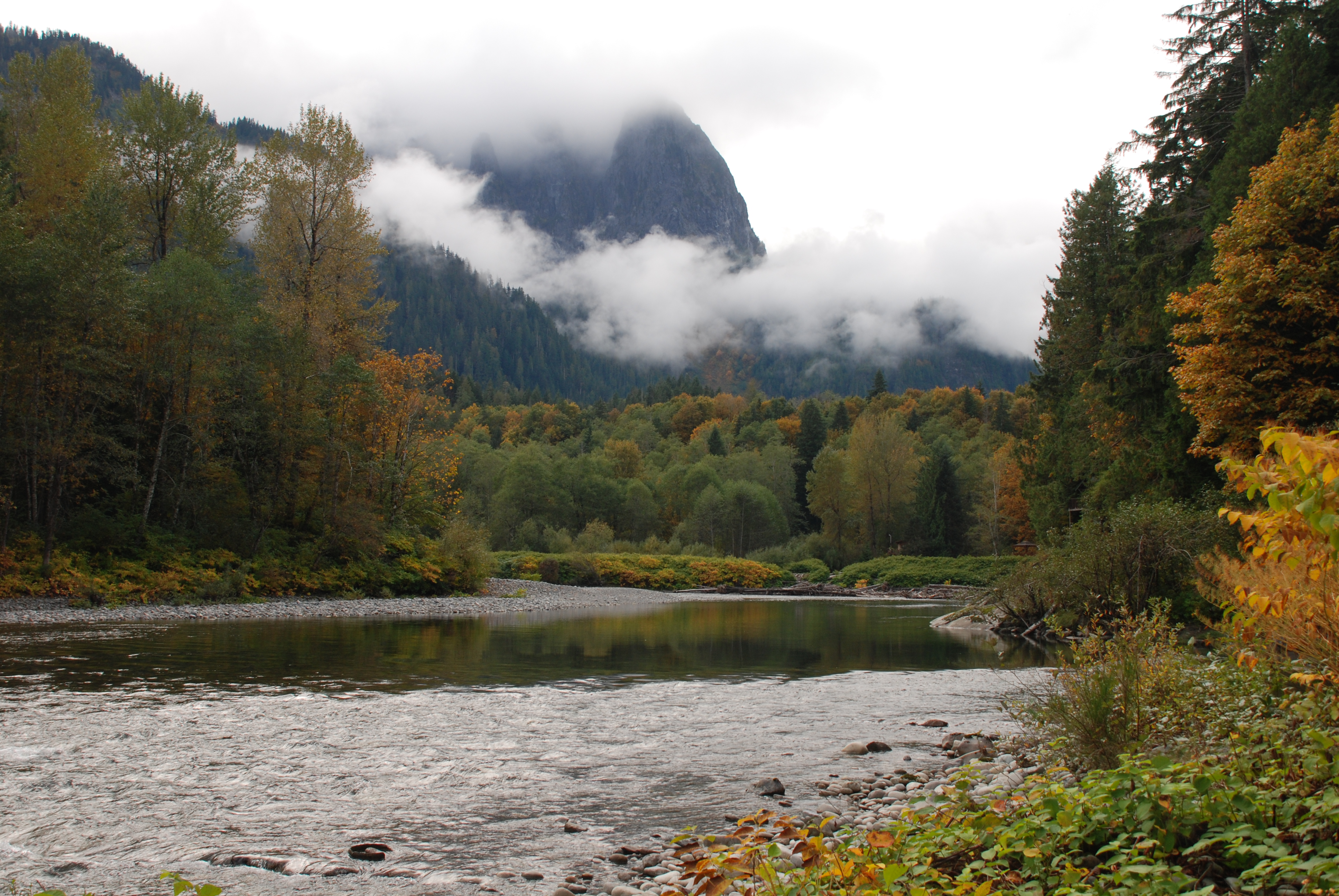
Mount Baring near sunset 36/52
Under the Noon Sun
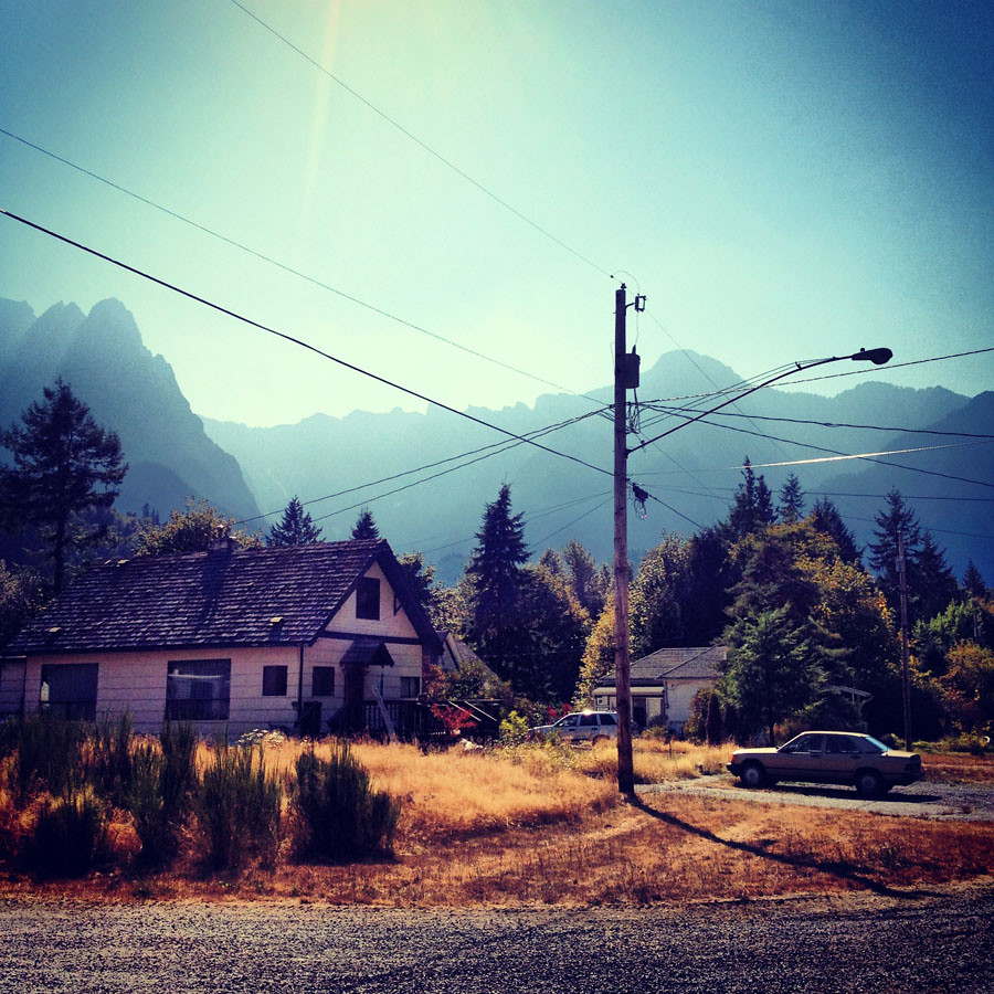
Meet at Skykomish
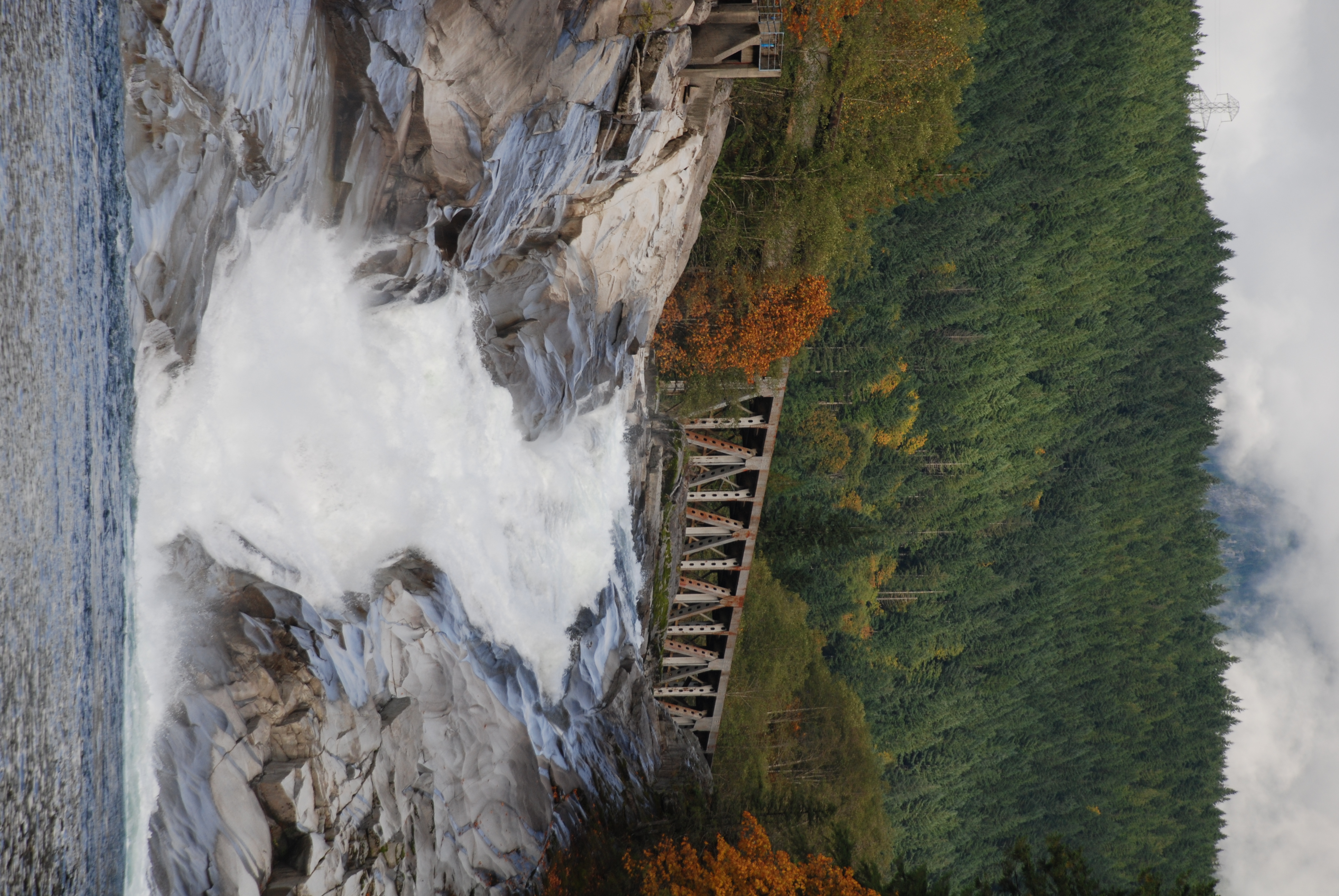
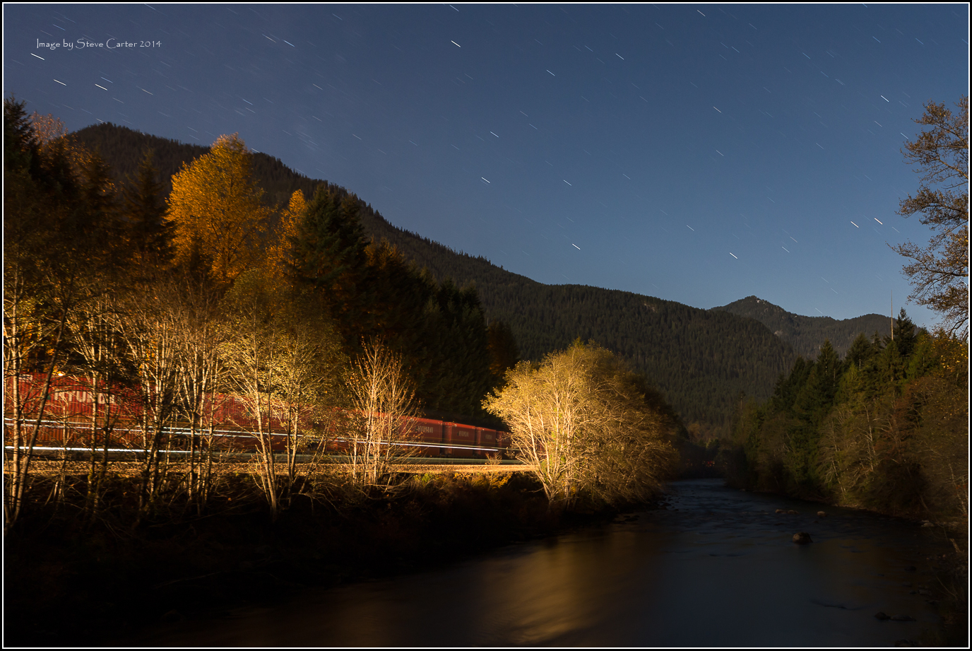
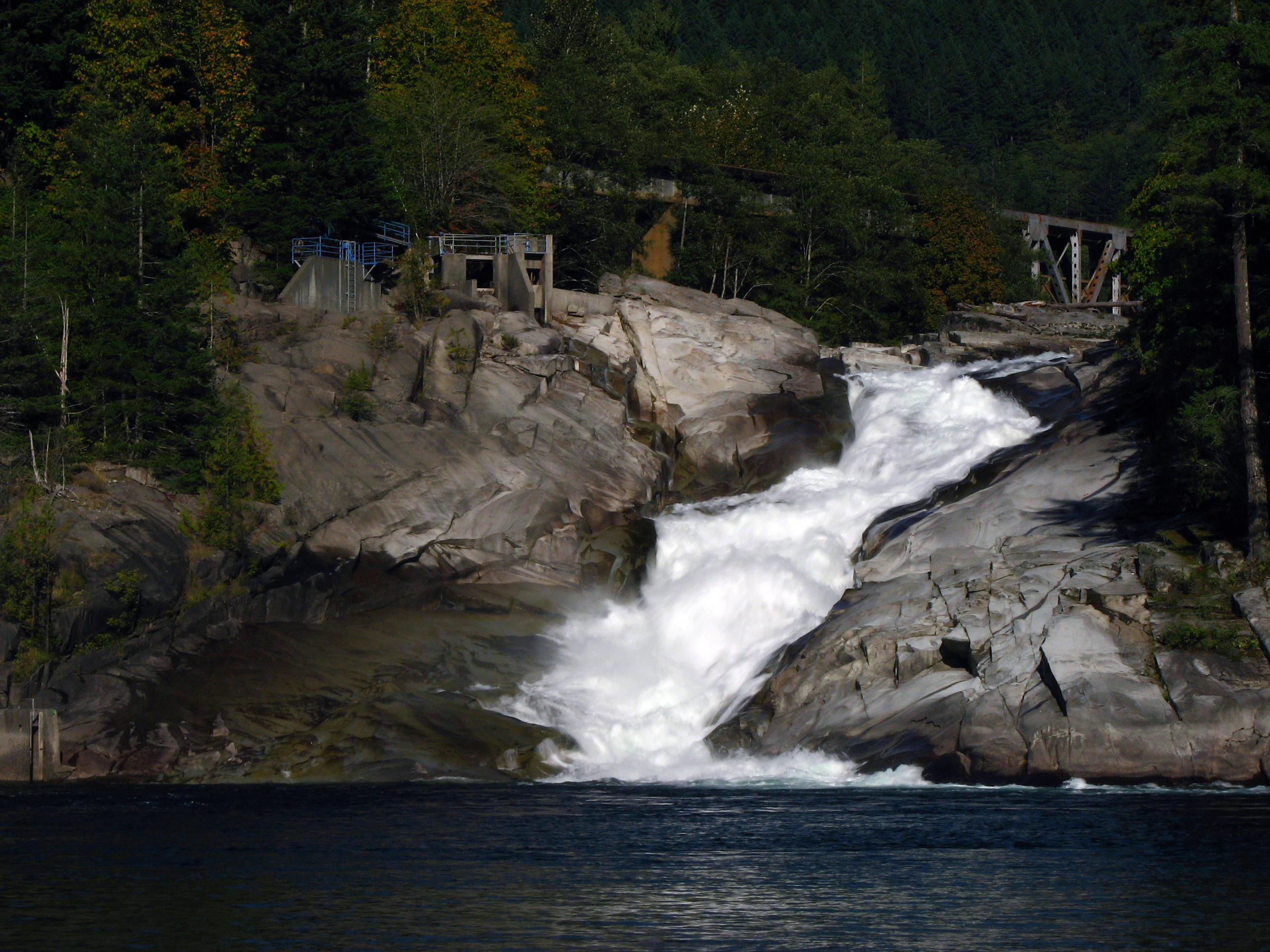
Sunset Falls, Skykomish River
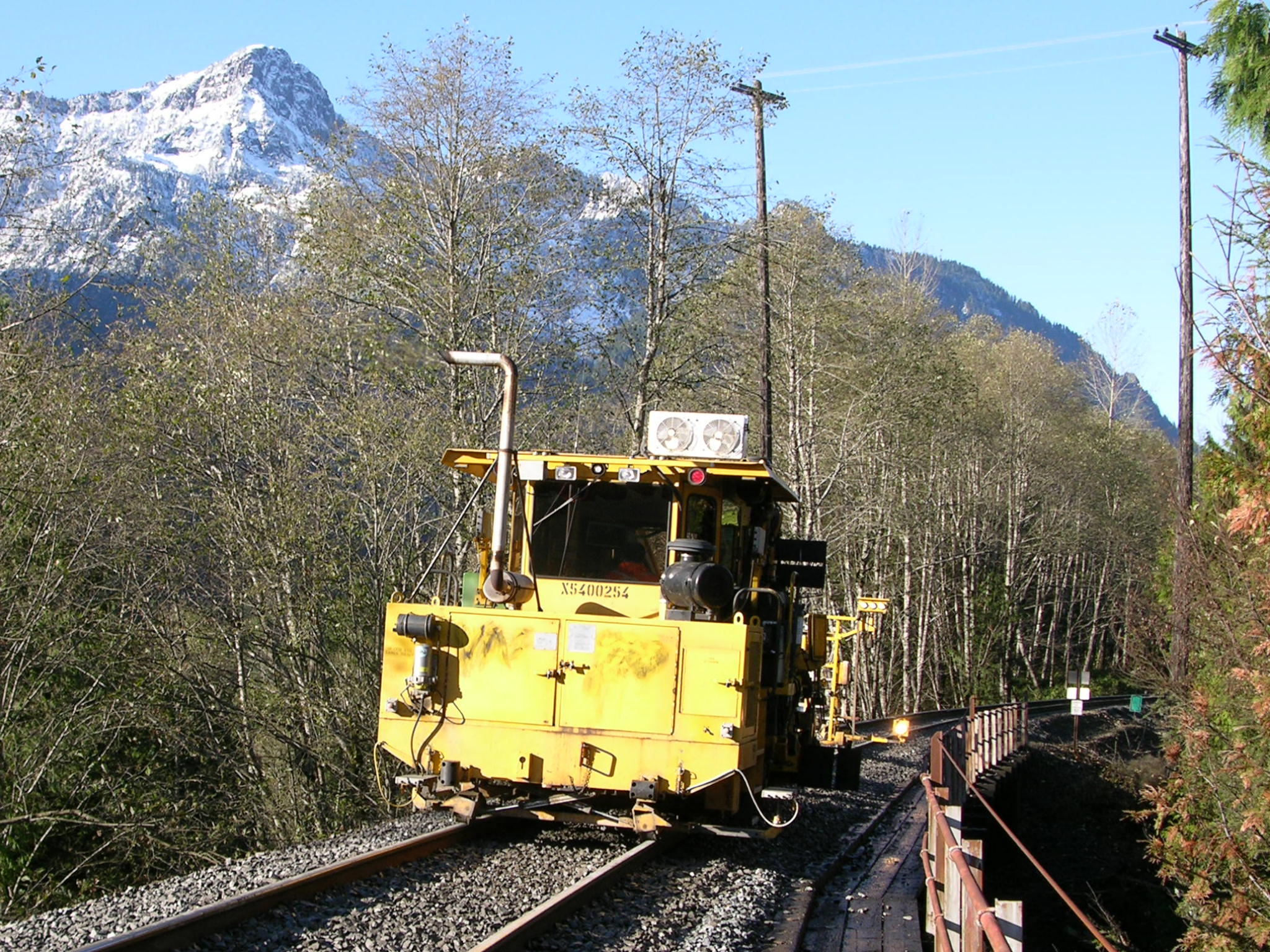
BNSF MOW- Surface Crew

BNSF MOW- Surface Crew
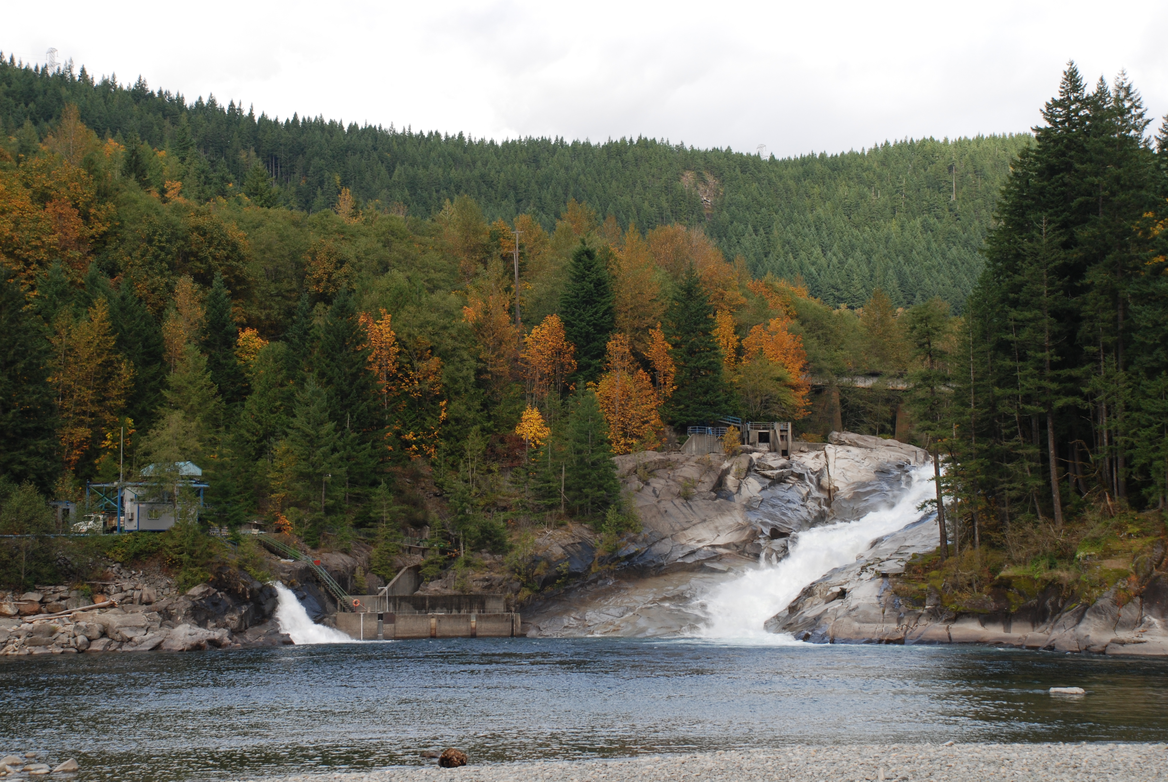
Sunset Falls, Skykomish River
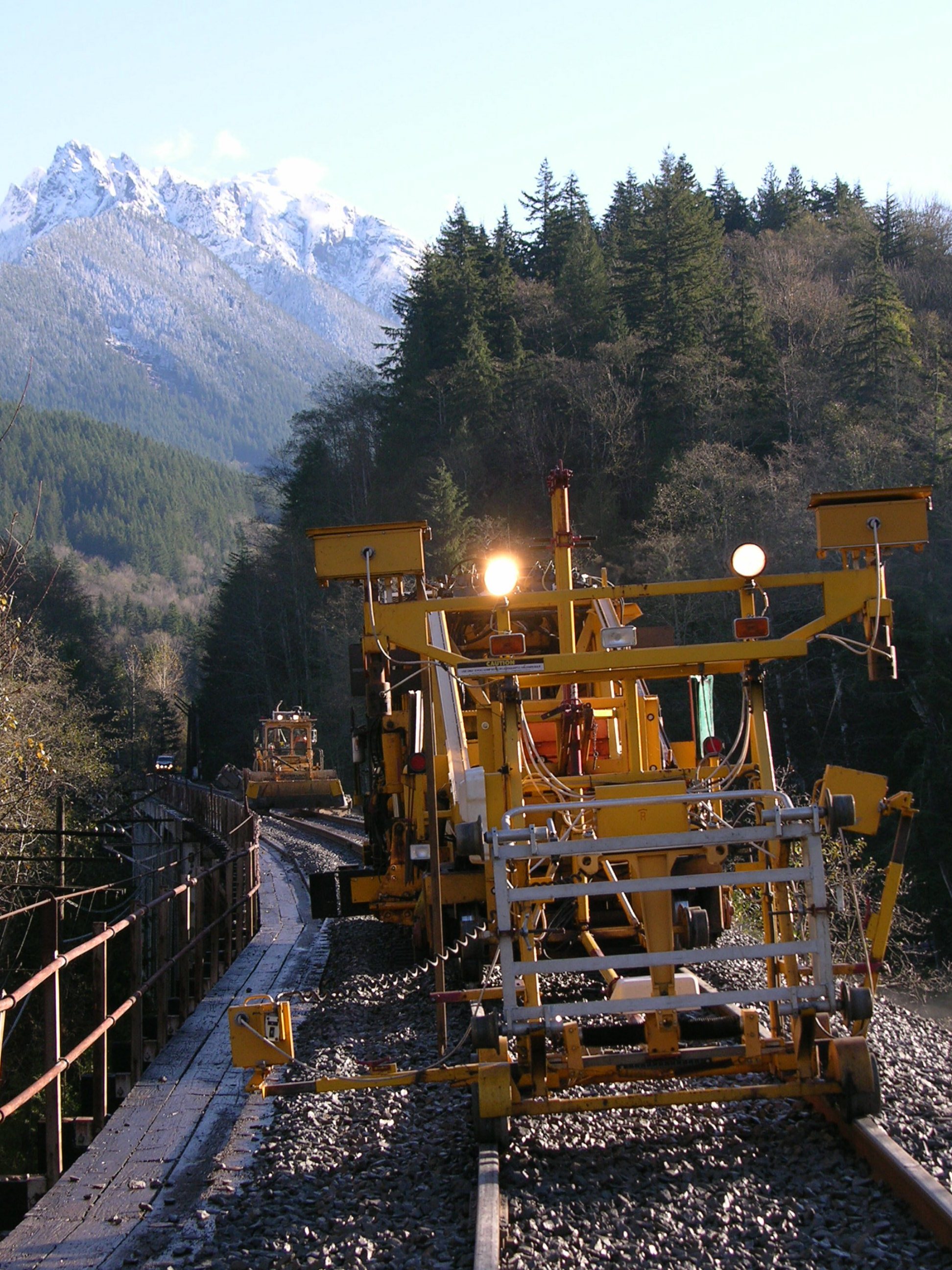
BNSF Surface Crew
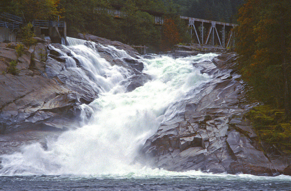
Sunset Falls
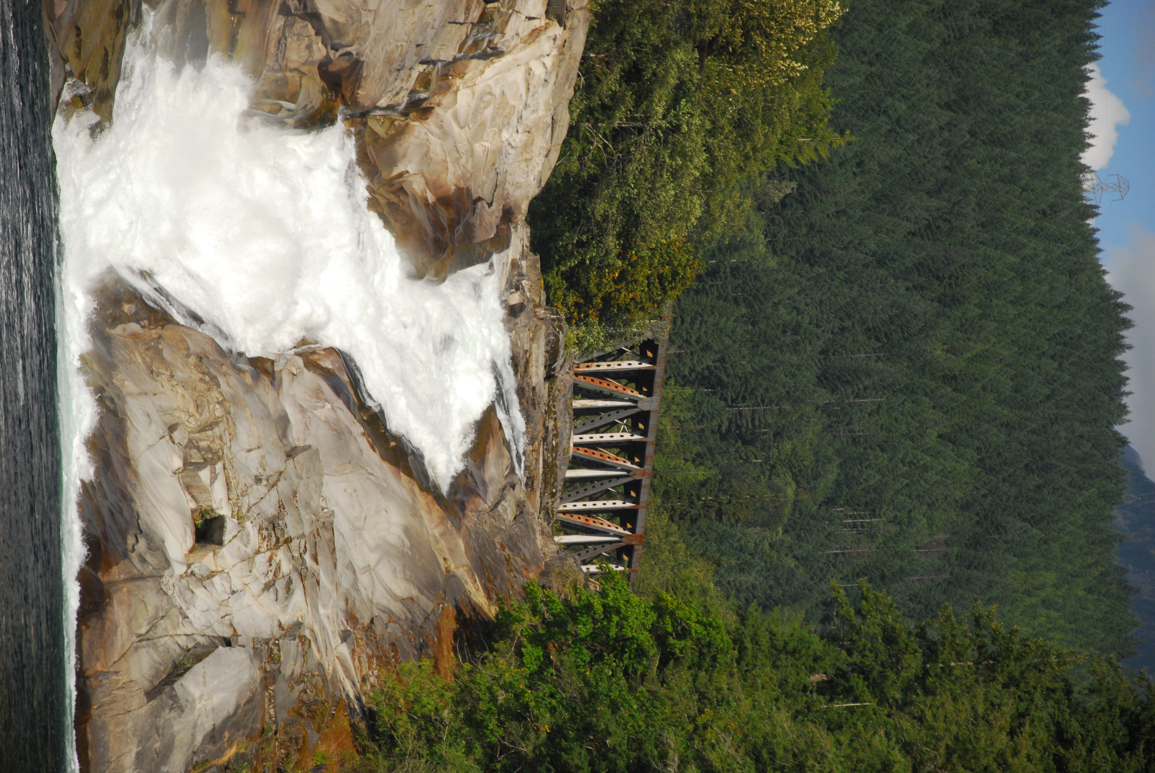
Sunset Falls
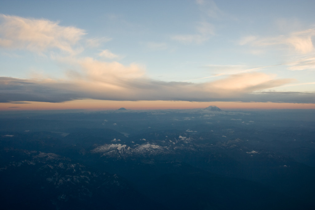
Mt. Rainier

Sunset Falls

Sunset Falls

Gunn Peak Backlight
Sunset Falls
Eagle Rock, Washington 美國的地圖
搜索其他地方的日出日落時間
附近地點
Townsend Mountain, Washington 美國
Skykomish, WA 美國
NE Old Cascade Hwy, Skykomish, WA 美國
Grotto, WA 美國
Baring Mountain, Washington 美國
Baring, WA, 美國
Halford, WA 美國
US-2, Sultan, WA 美國
Tonga Ridge, Washington 美國
Eagle Falls, Washington 美國
Mt Index River Rd, Gold Bar, WA 美國
Scenic, WA 美國
Seattle-Tacoma-Bellevue, WA, WA, 美國
Wellington, WA 美國
US-2, Skykomish, 美國Stevens Pass
Stevens Pass, Washington 美國
NF-, Snoqualmie Pass, WA 美國Snoqualmie Pass Visitor Center
WA-, Snoqualmie Pass, WA 美國
Denny Creek Trail, Washington 美國
WA-, Snoqualmie Pass, WA 美國The Summit at Snoqualmie
最近搜索
- Red Dog Mine, AK, USA的日出日落時間表
- Am bhf, Borken, 德國Am Bahnhof的日出日落時間表
- 4th St E, Sonoma, CA 美國的日出日落時間表
- Oakland Ave, Williamsport, PA 美國的日出日落時間表
- Via Roma, Pieranica CR, 義大利的日出日落時間表
- 克羅埃西亞杜布羅夫尼克 GradClock Tower of Dubrovnik的日出日落時間表
- 阿根廷丘布特省特雷利烏的日出日落時間表
- Hartfords Bluff Cir, Mt Pleasant, SC 美國的日出日落時間表
- 日本熊本縣熊本市北區的日出日落時間表
- 中國福州市平潭縣平潭島的日出日落時間表