| 時區: | 巴西利亞標準時間 |
|---|---|
| 當地時間: | 2026年11月18日星期三 03:54 |
| 經度: | -41.6666669 |
| 緯度: | -20.533333 |
| 今天日出時間: | 04:59:27 |
| 今天日落時間: | 18:07:03 |
| 今天日照時長: | 13h 7m 36s |
| 明天日出時間: | 04:59:16 |
| 明天日落時間: | 18:07:41 |
| 明天日照時長: | 13h 8m 25s |
: 顯示所有日期
| 日期 | 日出 | 日落 | 日照時長 |
|---|---|---|---|
| 2026年1月1日 | 05:10:11 | 18:31:31 | 13h 21m 19s |
| 2026年2月1日 | 05:30:37 | 18:32:02 | 13h 1m 24s |
| 2026年3月1日 | 05:45:04 | 18:16:21 | 12h 31m 16s |
| 2026年4月1日 | 05:54:40 | 17:49:22 | 11h 54m 42s |
| 2026年5月1日 | 06:04:03 | 17:26:08 | 11h 22m 4s |
| 2026年6月1日 | 06:16:34 | 17:15:01 | 10h 58m 26s |
| 2026年7月1日 | 06:24:26 | 17:18:28 | 10h 54m 1s |
| 2026年8月1日 | 06:18:55 | 17:29:37 | 11h 10m 42s |
| 2026年9月1日 | 05:58:02 | 17:39:05 | 11h 41m 3s |
| 2026年10月1日 | 05:30:12 | 17:45:40 | 12h 15m 27s |
| 2026年11月1日 | 05:06:15 | 17:56:46 | 12h 50m 31s |
| 2026年11月18日 | 04:59:39 | 18:06:26 | 13h 6m 46s |
| 2026年11月19日 | 04:59:27 | 18:07:03 | 13h 7m 36s |
| 2026年12月1日 | 04:58:44 | 18:14:50 | 13h 16m 5s |
日出日落照片

Sunrise from the Summit at Pico da Bandeira (Flag Peak) at 2,892 m (9,488 ft) MSL, Caparaó National Park, on the border between the municipalities of Ibitirama (Espírito Santo State) and Alto Caparaó by ER's Eyes - Our planet is so beautiful.

Sete Pilões Waterfall (Seven Pylons) at 1,855 m (6,085 ft) MSL, Acampamento da Macieira (Apple Tree Camp), Caparaó National Park, Alto Caparaó, Minas Gerais State, Brazil. by ER's Eyes - Our planet is so beautiful.

Climbing down Pico do Cristal (Crystal Peak) at 2,770 m (9,087 ft) MSL, Caparaó National Park, Alto Caparaó, Minas Gerais State, Brazil. by ER's Eyes - Our planet is so beautiful.

Camp Casa Queimada at 2,190 m (7,185 ft) MSL, Caparaó National Park, Dores do Rio Preto, Espírito Santo, Brazil. by ER's Eyes - Our planet is so beautiful.

Twilight from the Summit at Pico da Bandeira (Flag Peak) at 2,892 m (9,488 ft) MSL, Caparaó National Park, on the border between the municipalities of Ibitirama (Espírito Santo State) and Alto Caparaó by ER's Eyes - Our planet is so beautiful.

Sunrise from the Summit at Pico da Bandeira (Flag Peak) at 2,892 m (9,488 ft) MSL, Caparaó National Park, on the border between the municipalities of Ibitirama (Espírito Santo State) and Alto Caparaó by ER's Eyes - Our planet is so beautiful.

Sunrise from the Summit at Pico da Bandeira (Flag Peak) at 2,892 m (9,488 ft) MSL, Caparaó National Park, on the border between the municipalities of Ibitirama (Espírito Santo State) and Alto Caparaó by ER's Eyes - Our planet is so beautiful.

Sunrise from the Summit at Pico da Bandeira (Flag Peak) at 2,892 m (9,488 ft) MSL, Caparaó National Park, on the border between the municipalities of Ibitirama (Espírito Santo State) and Alto Caparaó by ER's Eyes - Our planet is so beautiful.

Sunrise from the Summit at Pico da Bandeira (Flag Peak) at 2,892 m (9,488 ft) MSL, Caparaó National Park, on the border between the municipalities of Ibitirama (Espírito Santo State) and Alto Caparaó by ER's Eyes - Our planet is so beautiful.

Twilight from the Summit at Pico da Bandeira (Flag Peak) at 2,892 m (9,488 ft) MSL, Caparaó National Park, on the border between the municipalities of Ibitirama (Espírito Santo State) and Alto Caparaó by ER's Eyes - Our planet is so beautiful.

Pico da Bandeira (Flag Peak) seen from the Summit of Pico do Calçado (Shoe Peak) at 2,849 m (9,347 ft), Caparaó National Park, on the border between the municipalities of Ibitirama (Espírito Santo Sta by ER's Eyes - Our planet is so beautiful.

Sunrise from the Summit at Pico da Bandeira (Flag Peak) at 2,892 m (9,488 ft) MSL, Caparaó National Park, on the border between the municipalities of Ibitirama (Espírito Santo State) and Alto Caparaó by ER's Eyes - Our planet is so beautiful.

Pedra Duas Irmãs (Two Sisters Stone) at 2,390 m (7,841 ft) MSL, Trail by way of Caparaó-Capixaba, Caparaó National Park, Alto Caparaó, Minas Gerais State, Brazil. by ER's Eyes - Our planet is so beautiful.

Sunrise from the Cruzeiro at the Summit at Pico da Bandeira (Flag Peak) at 2,892 m (9,488 ft) MSL, Caparaó National Park, on the border between the municipalities of Ibitirama (Espírito Santo State) a by ER's Eyes - Our planet is so beautiful.

Sunrise from the Summit at Pico da Bandeira (Flag Peak) at 2,892 m (9,488 ft) MSL, Caparaó National Park, on the border between the municipalities of Ibitirama (Espírito Santo State) and Alto Caparaó by ER's Eyes - Our planet is so beautiful.

Sunrise from the Summit at Pico da Bandeira (Flag Peak) at 2,892 m (9,488 ft) MSL, Caparaó National Park, on the border between the municipalities of Ibitirama (Espírito Santo State) and Alto Caparaó by ER's Eyes - Our planet is so beautiful.

Trail by way of Caparaó-Capixaba at 2,480 m (8,136 ft) MSL, Caparaó National Park, Dores do Rio Preto, Espírito Santo State, Brazil. by ER's Eyes - Our planet is so beautiful.

Trail by way of Caparaó-Capixaba at 2,540 m (8,333 ft) MSL, Caparaó National Park, Dores do Rio Preto, Espírito Santo State, Brazil. by ER's Eyes - Our planet is so beautiful.

Casa da Serra Caparaó (Caparao Mountain Range House) at 1,220 m (4,002 ft) MSL, Forquilha do Rio, Minas Gerais State, Brazil. by ER's Eyes - Our planet is so beautiful.

Visitor Center at 1,420 m (4,658 ft) MSL, Caparaó National Park, Pedra Menina, Espírito Santo, Brazil. by ER's Eyes - Our planet is so beautiful.

Casa da Serra Caparaó (Caparao Mountain Range House) at 1,220 m (4,002 ft) MSL, Forquilha do Rio, Minas Gerais State, Brazil. by ER's Eyes - Our planet is so beautiful.

Guest Houses, Casa da Serra Caparaó at 1,220 m (4,002 ft) MSL, Forquilha do Rio, Minas Gerais, Brazil. by ER's Eyes - Our planet is so beautiful.

2010 - Trilha ao Pico da Bandeira, Alto Caparaó e Natividade, Inverno by Wilson Moura

2010 - Trilha ao Pico da Bandeira, Alto Caparaó e Natividade, Inverno by Wilson Moura

Por do Sol by bodimes
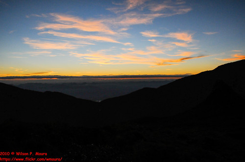
2010 - Trilha ao Pico da Bandeira, Alto Caparaó e Natividade, Inverno by Wilson Moura

2010 - Trilha ao Pico da Bandeira, Alto Caparaó e Natividade, Inverno by Wilson Moura

2010 - Trilha ao Pico da Bandeira, Alto Caparaó e Natividade, Inverno by Wilson Moura

2010 - Trilha ao Pico da Bandeira, Alto Caparaó e Natividade, Inverno by Wilson Moura

2010 - Trilha ao Pico da Bandeira, Alto Caparaó e Natividade, Inverno by Wilson Moura

2010 - Trilha ao Pico da Bandeira, Alto Caparaó e Natividade, Inverno by Wilson Moura

2010 - Trilha ao Pico da Bandeira, Alto Caparaó e Natividade, Inverno by Wilson Moura

2010 - Trilha ao Pico da Bandeira, Alto Caparaó e Natividade, Inverno by Wilson Moura

Sun Rising by OPEN YOUR EYES TO THE WORLD

Sunset in "Dores do Rio Preto" by Helder_Carelli

noite no Pico da Bandeira by André Valério

Sunset by honey&i

foto 3 by Zumerle
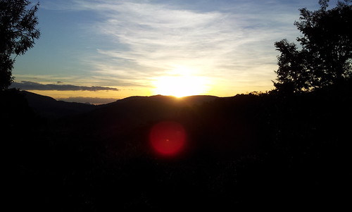
20120907_172709 by hugoloureiro

20120907_172538 by hugoloureiro

20120907_172713 by hugoloureiro