Whitwell, TN 美国的日出日落时间表
Location: 美国 > 田纳西州 > 马里恩 > TN 美国 >
时区:
America/Chicago
当地时间:
2025-06-13 21:51:32
经度:
-85.4788065
纬度:
35.2624058
今天日出时间:
05:26:41 AM
今天日落时间:
07:58:02 PM
今天日照时常:
14h 31m 21s
明天日出时间:
05:26:45 AM
明天日落时间:
07:58:23 PM
明天日照时常:
14h 31m 38s
显示所有日期
| 日期 | 日出 | 日落 | 日照时常 |
|---|---|---|---|
| 2025年01月01日 | 06:50:42 AM | 04:41:25 PM | 9h 50m 43s |
| 2025年01月02日 | 06:50:49 AM | 04:42:12 PM | 9h 51m 23s |
| 2025年01月03日 | 06:50:55 AM | 04:43:01 PM | 9h 52m 6s |
| 2025年01月04日 | 06:50:58 AM | 04:43:51 PM | 9h 52m 53s |
| 2025年01月05日 | 06:51:00 AM | 04:44:42 PM | 9h 53m 42s |
| 2025年01月06日 | 06:51:00 AM | 04:45:34 PM | 9h 54m 34s |
| 2025年01月07日 | 06:50:58 AM | 04:46:27 PM | 9h 55m 29s |
| 2025年01月08日 | 06:50:54 AM | 04:47:21 PM | 9h 56m 27s |
| 2025年01月09日 | 06:50:48 AM | 04:48:15 PM | 9h 57m 27s |
| 2025年01月10日 | 06:50:40 AM | 04:49:10 PM | 9h 58m 30s |
| 2025年01月11日 | 06:50:30 AM | 04:50:06 PM | 9h 59m 36s |
| 2025年01月12日 | 06:50:18 AM | 04:51:03 PM | 10h 0m 45s |
| 2025年01月13日 | 06:50:05 AM | 04:52:01 PM | 10h 1m 56s |
| 2025年01月14日 | 06:49:49 AM | 04:52:58 PM | 10h 3m 9s |
| 2025年01月15日 | 06:49:32 AM | 04:53:57 PM | 10h 4m 25s |
| 2025年01月16日 | 06:49:12 AM | 04:54:56 PM | 10h 5m 44s |
| 2025年01月17日 | 06:48:51 AM | 04:55:55 PM | 10h 7m 4s |
| 2025年01月18日 | 06:48:28 AM | 04:56:55 PM | 10h 8m 27s |
| 2025年01月19日 | 06:48:03 AM | 04:57:55 PM | 10h 9m 52s |
| 2025年01月20日 | 06:47:36 AM | 04:58:56 PM | 10h 11m 20s |
| 2025年01月21日 | 06:47:08 AM | 04:59:57 PM | 10h 12m 49s |
| 2025年01月22日 | 06:46:37 AM | 05:00:58 PM | 10h 14m 21s |
| 2025年01月23日 | 06:46:05 AM | 05:01:59 PM | 10h 15m 54s |
| 2025年01月24日 | 06:45:31 AM | 05:03:00 PM | 10h 17m 29s |
| 2025年01月25日 | 06:44:56 AM | 05:04:02 PM | 10h 19m 6s |
| 2025年01月26日 | 06:44:19 AM | 05:05:03 PM | 10h 20m 44s |
| 2025年01月27日 | 06:43:40 AM | 05:06:05 PM | 10h 22m 25s |
| 2025年01月28日 | 06:42:59 AM | 05:07:07 PM | 10h 24m 8s |
| 2025年01月29日 | 06:42:17 AM | 05:08:08 PM | 10h 25m 51s |
| 2025年01月30日 | 06:41:33 AM | 05:09:10 PM | 10h 27m 37s |
| 2025年01月31日 | 06:40:48 AM | 05:10:12 PM | 10h 29m 24s |
| 2025年02月01日 | 06:40:01 AM | 05:11:13 PM | 10h 31m 12s |
| 2025年02月02日 | 06:39:12 AM | 05:12:15 PM | 10h 33m 3s |
| 2025年02月03日 | 06:38:22 AM | 05:13:16 PM | 10h 34m 54s |
| 2025年02月04日 | 06:37:31 AM | 05:14:17 PM | 10h 36m 46s |
| 2025年02月05日 | 06:36:38 AM | 05:15:18 PM | 10h 38m 40s |
| 2025年02月06日 | 06:35:44 AM | 05:16:19 PM | 10h 40m 35s |
| 2025年02月07日 | 06:34:48 AM | 05:17:19 PM | 10h 42m 31s |
| 2025年02月08日 | 06:33:51 AM | 05:18:19 PM | 10h 44m 28s |
| 2025年02月09日 | 06:32:53 AM | 05:19:19 PM | 10h 46m 26s |
| 2025年02月10日 | 06:31:53 AM | 05:20:19 PM | 10h 48m 26s |
| 2025年02月11日 | 06:30:52 AM | 05:21:19 PM | 10h 50m 27s |
| 2025年02月12日 | 06:29:50 AM | 05:22:18 PM | 10h 52m 28s |
| 2025年02月13日 | 06:28:47 AM | 05:23:17 PM | 10h 54m 30s |
| 2025年02月14日 | 06:27:43 AM | 05:24:16 PM | 10h 56m 33s |
| 2025年02月15日 | 06:26:37 AM | 05:25:14 PM | 10h 58m 37s |
| 2025年02月16日 | 06:25:31 AM | 05:26:12 PM | 11h 0m 41s |
| 2025年02月17日 | 06:24:23 AM | 05:27:10 PM | 11h 2m 47s |
| 2025年02月18日 | 06:23:14 AM | 05:28:07 PM | 11h 4m 53s |
| 2025年02月19日 | 06:22:05 AM | 05:29:04 PM | 11h 6m 59s |
| 2025年02月20日 | 06:20:54 AM | 05:30:01 PM | 11h 9m 7s |
| 2025年02月21日 | 06:19:43 AM | 05:30:57 PM | 11h 11m 14s |
| 2025年02月22日 | 06:18:30 AM | 05:31:53 PM | 11h 13m 23s |
| 2025年02月23日 | 06:17:17 AM | 05:32:49 PM | 11h 15m 32s |
| 2025年02月24日 | 06:16:03 AM | 05:33:44 PM | 11h 17m 41s |
| 2025年02月25日 | 06:14:48 AM | 05:34:39 PM | 11h 19m 51s |
| 2025年02月26日 | 06:13:32 AM | 05:35:33 PM | 11h 22m 1s |
| 2025年02月27日 | 06:12:16 AM | 05:36:28 PM | 11h 24m 12s |
| 2025年02月28日 | 06:10:59 AM | 05:37:22 PM | 11h 26m 23s |
| 2025年03月01日 | 06:09:41 AM | 05:38:15 PM | 11h 28m 34s |
| 2025年03月02日 | 06:08:22 AM | 05:39:09 PM | 11h 30m 47s |
| 2025年03月03日 | 06:07:03 AM | 05:40:02 PM | 11h 32m 59s |
| 2025年03月04日 | 06:05:43 AM | 05:40:55 PM | 11h 35m 12s |
| 2025年03月05日 | 06:04:23 AM | 05:41:47 PM | 11h 37m 24s |
| 2025年03月06日 | 06:03:02 AM | 05:42:39 PM | 11h 39m 37s |
| 2025年03月07日 | 06:01:41 AM | 05:43:31 PM | 11h 41m 50s |
| 2025年03月08日 | 06:00:20 AM | 05:44:23 PM | 11h 44m 3s |
| 2025年03月09日 | 06:59:01 AM | 06:45:12 PM | 11h 46m 11s |
| 2025年03月10日 | 06:57:38 AM | 06:46:03 PM | 11h 48m 25s |
| 2025年03月11日 | 06:56:16 AM | 06:46:54 PM | 11h 50m 38s |
| 2025年03月12日 | 06:54:52 AM | 06:47:45 PM | 11h 52m 53s |
| 2025年03月13日 | 06:53:29 AM | 06:48:35 PM | 11h 55m 6s |
| 2025年03月14日 | 06:52:05 AM | 06:49:26 PM | 11h 57m 21s |
| 2025年03月15日 | 06:50:41 AM | 06:50:16 PM | 11h 59m 35s |
| 2025年03月16日 | 06:49:17 AM | 06:51:06 PM | 12h 1m 49s |
| 2025年03月17日 | 06:47:52 AM | 06:51:55 PM | 12h 4m 3s |
| 2025年03月18日 | 06:46:28 AM | 06:52:45 PM | 12h 6m 17s |
| 2025年03月19日 | 06:45:03 AM | 06:53:34 PM | 12h 8m 31s |
| 2025年03月20日 | 06:43:38 AM | 06:54:23 PM | 12h 10m 45s |
| 2025年03月21日 | 06:42:13 AM | 06:55:12 PM | 12h 12m 59s |
| 2025年03月22日 | 06:40:48 AM | 06:56:01 PM | 12h 15m 13s |
| 2025年03月23日 | 06:39:23 AM | 06:56:50 PM | 12h 17m 27s |
| 2025年03月24日 | 06:37:58 AM | 06:57:39 PM | 12h 19m 41s |
| 2025年03月25日 | 06:36:33 AM | 06:58:28 PM | 12h 21m 55s |
| 2025年03月26日 | 06:35:08 AM | 06:59:16 PM | 12h 24m 8s |
| 2025年03月27日 | 06:33:44 AM | 07:00:05 PM | 12h 26m 21s |
| 2025年03月28日 | 06:32:19 AM | 07:00:53 PM | 12h 28m 34s |
| 2025年03月29日 | 06:30:55 AM | 07:01:42 PM | 12h 30m 47s |
| 2025年03月30日 | 06:29:30 AM | 07:02:30 PM | 12h 33m 0s |
| 2025年03月31日 | 06:28:06 AM | 07:03:19 PM | 12h 35m 13s |
| 2025年04月01日 | 06:26:43 AM | 07:04:07 PM | 12h 37m 24s |
| 2025年04月02日 | 06:25:19 AM | 07:04:55 PM | 12h 39m 36s |
| 2025年04月03日 | 06:23:56 AM | 07:05:44 PM | 12h 41m 48s |
| 2025年04月04日 | 06:22:33 AM | 07:06:32 PM | 12h 43m 59s |
| 2025年04月05日 | 06:21:11 AM | 07:07:21 PM | 12h 46m 10s |
| 2025年04月06日 | 06:19:49 AM | 07:08:09 PM | 12h 48m 20s |
| 2025年04月07日 | 06:18:27 AM | 07:08:57 PM | 12h 50m 30s |
| 2025年04月08日 | 06:17:06 AM | 07:09:46 PM | 12h 52m 40s |
| 2025年04月09日 | 06:15:45 AM | 07:10:34 PM | 12h 54m 49s |
| 2025年04月10日 | 06:14:25 AM | 07:11:23 PM | 12h 56m 58s |
| 2025年04月11日 | 06:13:05 AM | 07:12:12 PM | 12h 59m 7s |
| 2025年04月12日 | 06:11:46 AM | 07:13:00 PM | 13h 1m 14s |
| 2025年04月13日 | 06:10:28 AM | 07:13:49 PM | 13h 3m 21s |
| 2025年04月14日 | 06:09:10 AM | 07:14:38 PM | 13h 5m 28s |
| 2025年04月15日 | 06:07:52 AM | 07:15:27 PM | 13h 7m 35s |
| 2025年04月16日 | 06:06:36 AM | 07:16:16 PM | 13h 9m 40s |
| 2025年04月17日 | 06:05:20 AM | 07:17:05 PM | 13h 11m 45s |
| 2025年04月18日 | 06:04:05 AM | 07:17:54 PM | 13h 13m 49s |
| 2025年04月19日 | 06:02:51 AM | 07:18:43 PM | 13h 15m 52s |
| 2025年04月20日 | 06:01:37 AM | 07:19:32 PM | 13h 17m 55s |
| 2025年04月21日 | 06:00:25 AM | 07:20:21 PM | 13h 19m 56s |
| 2025年04月22日 | 05:59:13 AM | 07:21:11 PM | 13h 21m 58s |
| 2025年04月23日 | 05:58:02 AM | 07:22:00 PM | 13h 23m 58s |
| 2025年04月24日 | 05:56:52 AM | 07:22:49 PM | 13h 25m 57s |
| 2025年04月25日 | 05:55:43 AM | 07:23:39 PM | 13h 27m 56s |
| 2025年04月26日 | 05:54:35 AM | 07:24:28 PM | 13h 29m 53s |
| 2025年04月27日 | 05:53:28 AM | 07:25:18 PM | 13h 31m 50s |
| 2025年04月28日 | 05:52:22 AM | 07:26:07 PM | 13h 33m 45s |
| 2025年04月29日 | 05:51:17 AM | 07:26:56 PM | 13h 35m 39s |
| 2025年04月30日 | 05:50:13 AM | 07:27:46 PM | 13h 37m 33s |
| 2025年05月01日 | 05:49:10 AM | 07:28:35 PM | 13h 39m 25s |
| 2025年05月02日 | 05:48:08 AM | 07:29:25 PM | 13h 41m 17s |
| 2025年05月03日 | 05:47:08 AM | 07:30:14 PM | 13h 43m 6s |
| 2025年05月04日 | 05:46:09 AM | 07:31:03 PM | 13h 44m 54s |
| 2025年05月05日 | 05:45:10 AM | 07:31:52 PM | 13h 46m 42s |
| 2025年05月06日 | 05:44:14 AM | 07:32:41 PM | 13h 48m 27s |
| 2025年05月07日 | 05:43:18 AM | 07:33:30 PM | 13h 50m 12s |
| 2025年05月08日 | 05:42:24 AM | 07:34:19 PM | 13h 51m 55s |
| 2025年05月09日 | 05:41:31 AM | 07:35:07 PM | 13h 53m 36s |
| 2025年05月10日 | 05:40:39 AM | 07:35:56 PM | 13h 55m 17s |
| 2025年05月11日 | 05:39:49 AM | 07:36:44 PM | 13h 56m 55s |
| 2025年05月12日 | 05:39:00 AM | 07:37:32 PM | 13h 58m 32s |
| 2025年05月13日 | 05:38:12 AM | 07:38:19 PM | 14h 0m 7s |
| 2025年05月14日 | 05:37:26 AM | 07:39:07 PM | 14h 1m 41s |
| 2025年05月15日 | 05:36:42 AM | 07:39:54 PM | 14h 3m 12s |
| 2025年05月16日 | 05:35:58 AM | 07:40:41 PM | 14h 4m 43s |
| 2025年05月17日 | 05:35:17 AM | 07:41:27 PM | 14h 6m 10s |
| 2025年05月18日 | 05:34:37 AM | 07:42:13 PM | 14h 7m 36s |
| 2025年05月19日 | 05:33:58 AM | 07:42:58 PM | 14h 9m 0s |
| 2025年05月20日 | 05:33:21 AM | 07:43:43 PM | 14h 10m 22s |
| 2025年05月21日 | 05:32:45 AM | 07:44:28 PM | 14h 11m 43s |
| 2025年05月22日 | 05:32:11 AM | 07:45:12 PM | 14h 13m 1s |
| 2025年05月23日 | 05:31:39 AM | 07:45:55 PM | 14h 14m 16s |
| 2025年05月24日 | 05:31:08 AM | 07:46:38 PM | 14h 15m 30s |
| 2025年05月25日 | 05:30:39 AM | 07:47:20 PM | 14h 16m 41s |
| 2025年05月26日 | 05:30:12 AM | 07:48:01 PM | 14h 17m 49s |
| 2025年05月27日 | 05:29:46 AM | 07:48:42 PM | 14h 18m 56s |
| 2025年05月28日 | 05:29:22 AM | 07:49:22 PM | 14h 20m 0s |
| 2025年05月29日 | 05:28:59 AM | 07:50:01 PM | 14h 21m 2s |
| 2025年05月30日 | 05:28:38 AM | 07:50:40 PM | 14h 22m 2s |
| 2025年05月31日 | 05:28:19 AM | 07:51:17 PM | 14h 22m 58s |
| 2025年06月01日 | 05:28:01 AM | 07:51:54 PM | 14h 23m 53s |
| 2025年06月02日 | 05:27:45 AM | 07:52:30 PM | 14h 24m 45s |
| 2025年06月03日 | 05:27:31 AM | 07:53:05 PM | 14h 25m 34s |
| 2025年06月04日 | 05:27:18 AM | 07:53:38 PM | 14h 26m 20s |
| 2025年06月05日 | 05:27:07 AM | 07:54:11 PM | 14h 27m 4s |
| 2025年06月06日 | 05:26:58 AM | 07:54:43 PM | 14h 27m 45s |
| 2025年06月07日 | 05:26:50 AM | 07:55:13 PM | 14h 28m 23s |
| 2025年06月08日 | 05:26:44 AM | 07:55:43 PM | 14h 28m 59s |
| 2025年06月09日 | 05:26:40 AM | 07:56:11 PM | 14h 29m 31s |
| 2025年06月10日 | 05:26:37 AM | 07:56:38 PM | 14h 30m 1s |
| 2025年06月11日 | 05:26:36 AM | 07:57:04 PM | 14h 30m 28s |
| 2025年06月12日 | 05:26:37 AM | 07:57:29 PM | 14h 30m 52s |
| 2025年06月13日 | 05:26:39 AM | 07:57:52 PM | 14h 31m 13s |
| 2025年06月14日 | 05:26:43 AM | 07:58:14 PM | 14h 31m 31s |
| 2025年06月15日 | 05:26:48 AM | 07:58:34 PM | 14h 31m 46s |
| 2025年06月16日 | 05:26:55 AM | 07:58:53 PM | 14h 31m 58s |
| 2025年06月17日 | 05:27:03 AM | 07:59:11 PM | 14h 32m 8s |
| 2025年06月18日 | 05:27:13 AM | 07:59:27 PM | 14h 32m 14s |
| 2025年06月19日 | 05:27:25 AM | 07:59:42 PM | 14h 32m 17s |
| 2025年06月20日 | 05:27:37 AM | 07:59:56 PM | 14h 32m 19s |
| 2025年06月21日 | 05:27:52 AM | 08:00:07 PM | 14h 32m 15s |
| 2025年06月22日 | 05:28:07 AM | 08:00:18 PM | 14h 32m 11s |
| 2025年06月23日 | 05:28:24 AM | 08:00:26 PM | 14h 32m 2s |
| 2025年06月24日 | 05:28:43 AM | 08:00:33 PM | 14h 31m 50s |
| 2025年06月25日 | 05:29:03 AM | 08:00:39 PM | 14h 31m 36s |
| 2025年06月26日 | 05:29:24 AM | 08:00:43 PM | 14h 31m 19s |
| 2025年06月27日 | 05:29:46 AM | 08:00:45 PM | 14h 30m 59s |
| 2025年06月28日 | 05:30:10 AM | 08:00:45 PM | 14h 30m 35s |
| 2025年06月29日 | 05:30:35 AM | 08:00:44 PM | 14h 30m 9s |
| 2025年06月30日 | 05:31:01 AM | 08:00:41 PM | 14h 29m 40s |
| 2025年07月01日 | 05:31:28 AM | 08:00:37 PM | 14h 29m 9s |
| 2025年07月02日 | 05:31:56 AM | 08:00:31 PM | 14h 28m 35s |
| 2025年07月03日 | 05:32:25 AM | 08:00:23 PM | 14h 27m 58s |
| 2025年07月04日 | 05:32:56 AM | 08:00:13 PM | 14h 27m 17s |
| 2025年07月05日 | 05:33:27 AM | 08:00:02 PM | 14h 26m 35s |
| 2025年07月06日 | 05:33:59 AM | 07:59:49 PM | 14h 25m 50s |
| 2025年07月07日 | 05:34:33 AM | 07:59:35 PM | 14h 25m 2s |
| 2025年07月08日 | 05:35:07 AM | 07:59:18 PM | 14h 24m 11s |
| 2025年07月09日 | 05:35:42 AM | 07:59:00 PM | 14h 23m 18s |
| 2025年07月10日 | 05:36:18 AM | 07:58:40 PM | 14h 22m 22s |
| 2025年07月11日 | 05:36:55 AM | 07:58:19 PM | 14h 21m 24s |
| 2025年07月12日 | 05:37:32 AM | 07:57:56 PM | 14h 20m 24s |
| 2025年07月13日 | 05:38:10 AM | 07:57:31 PM | 14h 19m 21s |
| 2025年07月14日 | 05:38:49 AM | 07:57:04 PM | 14h 18m 15s |
| 2025年07月15日 | 05:39:28 AM | 07:56:36 PM | 14h 17m 8s |
| 2025年07月16日 | 05:40:08 AM | 07:56:06 PM | 14h 15m 58s |
| 2025年07月17日 | 05:40:49 AM | 07:55:35 PM | 14h 14m 46s |
| 2025年07月18日 | 05:41:30 AM | 07:55:02 PM | 14h 13m 32s |
| 2025年07月19日 | 05:42:12 AM | 07:54:27 PM | 14h 12m 15s |
| 2025年07月20日 | 05:42:54 AM | 07:53:50 PM | 14h 10m 56s |
| 2025年07月21日 | 05:43:37 AM | 07:53:12 PM | 14h 9m 35s |
| 2025年07月22日 | 05:44:20 AM | 07:52:33 PM | 14h 8m 13s |
| 2025年07月23日 | 05:45:03 AM | 07:51:52 PM | 14h 6m 49s |
| 2025年07月24日 | 05:45:47 AM | 07:51:09 PM | 14h 5m 22s |
| 2025年07月25日 | 05:46:31 AM | 07:50:25 PM | 14h 3m 54s |
| 2025年07月26日 | 05:47:15 AM | 07:49:40 PM | 14h 2m 25s |
| 2025年07月27日 | 05:48:00 AM | 07:48:52 PM | 14h 0m 52s |
| 2025年07月28日 | 05:48:45 AM | 07:48:04 PM | 13h 59m 19s |
| 2025年07月29日 | 05:49:30 AM | 07:47:14 PM | 13h 57m 44s |
| 2025年07月30日 | 05:50:15 AM | 07:46:23 PM | 13h 56m 8s |
| 2025年07月31日 | 05:51:01 AM | 07:45:30 PM | 13h 54m 29s |
| 2025年08月01日 | 05:51:47 AM | 07:44:36 PM | 13h 52m 49s |
| 2025年08月02日 | 05:52:32 AM | 07:43:40 PM | 13h 51m 8s |
| 2025年08月03日 | 05:53:18 AM | 07:42:43 PM | 13h 49m 25s |
| 2025年08月04日 | 05:54:04 AM | 07:41:45 PM | 13h 47m 41s |
| 2025年08月05日 | 05:54:50 AM | 07:40:46 PM | 13h 45m 56s |
| 2025年08月06日 | 05:55:36 AM | 07:39:45 PM | 13h 44m 9s |
| 2025年08月07日 | 05:56:22 AM | 07:38:44 PM | 13h 42m 22s |
| 2025年08月08日 | 05:57:08 AM | 07:37:41 PM | 13h 40m 33s |
| 2025年08月09日 | 05:57:54 AM | 07:36:37 PM | 13h 38m 43s |
| 2025年08月10日 | 05:58:40 AM | 07:35:31 PM | 13h 36m 51s |
| 2025年08月11日 | 05:59:26 AM | 07:34:25 PM | 13h 34m 59s |
| 2025年08月12日 | 06:00:13 AM | 07:33:18 PM | 13h 33m 5s |
| 2025年08月13日 | 06:00:59 AM | 07:32:09 PM | 13h 31m 10s |
| 2025年08月14日 | 06:01:44 AM | 07:31:00 PM | 13h 29m 16s |
| 2025年08月15日 | 06:02:30 AM | 07:29:49 PM | 13h 27m 19s |
| 2025年08月16日 | 06:03:16 AM | 07:28:38 PM | 13h 25m 22s |
| 2025年08月17日 | 06:04:02 AM | 07:27:25 PM | 13h 23m 23s |
| 2025年08月18日 | 06:04:47 AM | 07:26:12 PM | 13h 21m 25s |
| 2025年08月19日 | 06:05:33 AM | 07:24:58 PM | 13h 19m 25s |
| 2025年08月20日 | 06:06:18 AM | 07:23:43 PM | 13h 17m 25s |
| 2025年08月21日 | 06:07:04 AM | 07:22:27 PM | 13h 15m 23s |
| 2025年08月22日 | 06:07:49 AM | 07:21:10 PM | 13h 13m 21s |
| 2025年08月23日 | 06:08:34 AM | 07:19:53 PM | 13h 11m 19s |
| 2025年08月24日 | 06:09:19 AM | 07:18:35 PM | 13h 9m 16s |
| 2025年08月25日 | 06:10:04 AM | 07:17:16 PM | 13h 7m 12s |
| 2025年08月26日 | 06:10:49 AM | 07:15:56 PM | 13h 5m 7s |
| 2025年08月27日 | 06:11:34 AM | 07:14:36 PM | 13h 3m 2s |
| 2025年08月28日 | 06:12:19 AM | 07:13:16 PM | 13h 0m 57s |
| 2025年08月29日 | 06:13:03 AM | 07:11:54 PM | 12h 58m 51s |
| 2025年08月30日 | 06:13:48 AM | 07:10:32 PM | 12h 56m 44s |
| 2025年08月31日 | 06:14:32 AM | 07:09:10 PM | 12h 54m 38s |
| 2025年09月01日 | 06:15:17 AM | 07:07:47 PM | 12h 52m 30s |
| 2025年09月02日 | 06:16:01 AM | 07:06:23 PM | 12h 50m 22s |
| 2025年09月03日 | 06:16:45 AM | 07:04:59 PM | 12h 48m 14s |
| 2025年09月04日 | 06:17:30 AM | 07:03:35 PM | 12h 46m 5s |
| 2025年09月05日 | 06:18:14 AM | 07:02:10 PM | 12h 43m 56s |
| 2025年09月06日 | 06:18:58 AM | 07:00:45 PM | 12h 41m 47s |
| 2025年09月07日 | 06:19:42 AM | 06:59:19 PM | 12h 39m 37s |
| 2025年09月08日 | 06:20:26 AM | 06:57:54 PM | 12h 37m 28s |
| 2025年09月09日 | 06:21:10 AM | 06:56:28 PM | 12h 35m 18s |
| 2025年09月10日 | 06:21:54 AM | 06:55:01 PM | 12h 33m 7s |
| 2025年09月11日 | 06:22:39 AM | 06:53:35 PM | 12h 30m 56s |
| 2025年09月12日 | 06:23:23 AM | 06:52:08 PM | 12h 28m 45s |
| 2025年09月13日 | 06:24:07 AM | 06:50:41 PM | 12h 26m 34s |
| 2025年09月14日 | 06:24:51 AM | 06:49:14 PM | 12h 24m 23s |
| 2025年09月15日 | 06:25:35 AM | 06:47:47 PM | 12h 22m 12s |
| 2025年09月16日 | 06:26:20 AM | 06:46:20 PM | 12h 20m 0s |
| 2025年09月17日 | 06:27:04 AM | 06:44:53 PM | 12h 17m 49s |
| 2025年09月18日 | 06:27:48 AM | 06:43:25 PM | 12h 15m 37s |
| 2025年09月19日 | 06:28:33 AM | 06:41:58 PM | 12h 13m 25s |
| 2025年09月20日 | 06:29:18 AM | 06:40:31 PM | 12h 11m 13s |
| 2025年09月21日 | 06:30:03 AM | 06:39:03 PM | 12h 9m 0s |
| 2025年09月22日 | 06:30:48 AM | 06:37:36 PM | 12h 6m 48s |
| 2025年09月23日 | 06:31:33 AM | 06:36:09 PM | 12h 4m 36s |
| 2025年09月24日 | 06:32:18 AM | 06:34:43 PM | 12h 2m 25s |
| 2025年09月25日 | 06:33:03 AM | 06:33:16 PM | 12h 0m 13s |
| 2025年09月26日 | 06:33:49 AM | 06:31:49 PM | 11h 58m 0s |
| 2025年09月27日 | 06:34:35 AM | 06:30:23 PM | 11h 55m 48s |
| 2025年09月28日 | 06:35:21 AM | 06:28:57 PM | 11h 53m 36s |
| 2025年09月29日 | 06:36:07 AM | 06:27:32 PM | 11h 51m 25s |
| 2025年09月30日 | 06:36:53 AM | 06:26:06 PM | 11h 49m 13s |
| 2025年10月01日 | 06:37:40 AM | 06:24:41 PM | 11h 47m 1s |
| 2025年10月02日 | 06:38:27 AM | 06:23:17 PM | 11h 44m 50s |
| 2025年10月03日 | 06:39:14 AM | 06:21:53 PM | 11h 42m 39s |
| 2025年10月04日 | 06:40:02 AM | 06:20:29 PM | 11h 40m 27s |
| 2025年10月05日 | 06:40:50 AM | 06:19:06 PM | 11h 38m 16s |
| 2025年10月06日 | 06:41:38 AM | 06:17:43 PM | 11h 36m 5s |
| 2025年10月07日 | 06:42:26 AM | 06:16:21 PM | 11h 33m 55s |
| 2025年10月08日 | 06:43:15 AM | 06:14:59 PM | 11h 31m 44s |
| 2025年10月09日 | 06:44:04 AM | 06:13:38 PM | 11h 29m 34s |
| 2025年10月10日 | 06:44:53 AM | 06:12:17 PM | 11h 27m 24s |
| 2025年10月11日 | 06:45:43 AM | 06:10:58 PM | 11h 25m 15s |
| 2025年10月12日 | 06:46:33 AM | 06:09:39 PM | 11h 23m 6s |
| 2025年10月13日 | 06:47:23 AM | 06:08:20 PM | 11h 20m 57s |
| 2025年10月14日 | 06:48:14 AM | 06:07:03 PM | 11h 18m 49s |
| 2025年10月15日 | 06:49:05 AM | 06:05:46 PM | 11h 16m 41s |
| 2025年10月16日 | 06:49:56 AM | 06:04:30 PM | 11h 14m 34s |
| 2025年10月17日 | 06:50:48 AM | 06:03:15 PM | 11h 12m 27s |
| 2025年10月18日 | 06:51:40 AM | 06:02:00 PM | 11h 10m 20s |
| 2025年10月19日 | 06:52:32 AM | 06:00:47 PM | 11h 8m 15s |
| 2025年10月20日 | 06:53:25 AM | 05:59:34 PM | 11h 6m 9s |
| 2025年10月21日 | 06:54:19 AM | 05:58:23 PM | 11h 4m 4s |
| 2025年10月22日 | 06:55:12 AM | 05:57:12 PM | 11h 2m 0s |
| 2025年10月23日 | 06:56:06 AM | 05:56:03 PM | 10h 59m 57s |
| 2025年10月24日 | 06:57:00 AM | 05:54:55 PM | 10h 57m 55s |
| 2025年10月25日 | 06:57:55 AM | 05:53:47 PM | 10h 55m 52s |
| 2025年10月26日 | 06:58:50 AM | 05:52:41 PM | 10h 53m 51s |
| 2025年10月27日 | 06:59:45 AM | 05:51:36 PM | 10h 51m 51s |
| 2025年10月28日 | 07:00:41 AM | 05:50:32 PM | 10h 49m 51s |
| 2025年10月29日 | 07:01:37 AM | 05:49:30 PM | 10h 47m 53s |
| 2025年10月30日 | 07:02:33 AM | 05:48:28 PM | 10h 45m 55s |
| 2025年10月31日 | 07:03:30 AM | 05:47:28 PM | 10h 43m 58s |
| 2025年11月01日 | 07:04:27 AM | 05:46:29 PM | 10h 42m 2s |
| 2025年11月02日 | 06:05:26 AM | 04:45:30 PM | 10h 40m 4s |
| 2025年11月03日 | 06:06:24 AM | 04:44:34 PM | 10h 38m 10s |
| 2025年11月04日 | 06:07:21 AM | 04:43:39 PM | 10h 36m 18s |
| 2025年11月05日 | 06:08:19 AM | 04:42:46 PM | 10h 34m 27s |
| 2025年11月06日 | 06:09:17 AM | 04:41:54 PM | 10h 32m 37s |
| 2025年11月07日 | 06:10:15 AM | 04:41:04 PM | 10h 30m 49s |
| 2025年11月08日 | 06:11:14 AM | 04:40:16 PM | 10h 29m 2s |
| 2025年11月09日 | 06:12:12 AM | 04:39:29 PM | 10h 27m 17s |
| 2025年11月10日 | 06:13:11 AM | 04:38:43 PM | 10h 25m 32s |
| 2025年11月11日 | 06:14:10 AM | 04:37:59 PM | 10h 23m 49s |
| 2025年11月12日 | 06:15:09 AM | 04:37:17 PM | 10h 22m 8s |
| 2025年11月13日 | 06:16:08 AM | 04:36:36 PM | 10h 20m 28s |
| 2025年11月14日 | 06:17:06 AM | 04:35:58 PM | 10h 18m 52s |
| 2025年11月15日 | 06:18:05 AM | 04:35:20 PM | 10h 17m 15s |
| 2025年11月16日 | 06:19:04 AM | 04:34:45 PM | 10h 15m 41s |
| 2025年11月17日 | 06:20:03 AM | 04:34:11 PM | 10h 14m 8s |
| 2025年11月18日 | 06:21:01 AM | 04:33:40 PM | 10h 12m 39s |
| 2025年11月19日 | 06:22:00 AM | 04:33:10 PM | 10h 11m 10s |
| 2025年11月20日 | 06:22:58 AM | 04:32:41 PM | 10h 9m 43s |
| 2025年11月21日 | 06:23:56 AM | 04:32:15 PM | 10h 8m 19s |
| 2025年11月22日 | 06:24:53 AM | 04:31:50 PM | 10h 6m 57s |
| 2025年11月23日 | 06:25:50 AM | 04:31:28 PM | 10h 5m 38s |
| 2025年11月24日 | 06:26:47 AM | 04:31:07 PM | 10h 4m 20s |
| 2025年11月25日 | 06:27:44 AM | 04:30:48 PM | 10h 3m 4s |
| 2025年11月26日 | 06:28:40 AM | 04:30:31 PM | 10h 1m 51s |
| 2025年11月27日 | 06:29:35 AM | 04:30:17 PM | 10h 0m 42s |
| 2025年11月28日 | 06:30:30 AM | 04:30:04 PM | 9h 59m 34s |
| 2025年11月29日 | 06:31:25 AM | 04:29:53 PM | 9h 58m 28s |
| 2025年11月30日 | 06:32:18 AM | 04:29:43 PM | 9h 57m 25s |
| 2025年12月01日 | 06:33:11 AM | 04:29:36 PM | 9h 56m 25s |
| 2025年12月02日 | 06:34:03 AM | 04:29:31 PM | 9h 55m 28s |
| 2025年12月03日 | 06:34:55 AM | 04:29:28 PM | 9h 54m 33s |
| 2025年12月04日 | 06:35:45 AM | 04:29:27 PM | 9h 53m 42s |
| 2025年12月05日 | 06:36:35 AM | 04:29:28 PM | 9h 52m 53s |
| 2025年12月06日 | 06:37:24 AM | 04:29:30 PM | 9h 52m 6s |
| 2025年12月07日 | 06:38:12 AM | 04:29:35 PM | 9h 51m 23s |
| 2025年12月08日 | 06:38:59 AM | 04:29:42 PM | 9h 50m 43s |
| 2025年12月09日 | 06:39:44 AM | 04:29:50 PM | 9h 50m 6s |
| 2025年12月10日 | 06:40:29 AM | 04:30:01 PM | 9h 49m 32s |
| 2025年12月11日 | 06:41:12 AM | 04:30:13 PM | 9h 49m 1s |
| 2025年12月12日 | 06:41:54 AM | 04:30:28 PM | 9h 48m 34s |
| 2025年12月13日 | 06:42:35 AM | 04:30:44 PM | 9h 48m 9s |
| 2025年12月14日 | 06:43:15 AM | 04:31:02 PM | 9h 47m 47s |
| 2025年12月15日 | 06:43:53 AM | 04:31:22 PM | 9h 47m 29s |
| 2025年12月16日 | 06:44:30 AM | 04:31:44 PM | 9h 47m 14s |
| 2025年12月17日 | 06:45:05 AM | 04:32:07 PM | 9h 47m 2s |
| 2025年12月18日 | 06:45:39 AM | 04:32:33 PM | 9h 46m 54s |
| 2025年12月19日 | 06:46:11 AM | 04:33:00 PM | 9h 46m 49s |
| 2025年12月20日 | 06:46:42 AM | 04:33:28 PM | 9h 46m 46s |
| 2025年12月21日 | 06:47:12 AM | 04:33:59 PM | 9h 46m 47s |
| 2025年12月22日 | 06:47:39 AM | 04:34:31 PM | 9h 46m 52s |
| 2025年12月23日 | 06:48:05 AM | 04:35:05 PM | 9h 47m 0s |
| 2025年12月24日 | 06:48:29 AM | 04:35:40 PM | 9h 47m 11s |
| 2025年12月25日 | 06:48:52 AM | 04:36:17 PM | 9h 47m 25s |
| 2025年12月26日 | 06:49:13 AM | 04:36:55 PM | 9h 47m 42s |
| 2025年12月27日 | 06:49:32 AM | 04:37:35 PM | 9h 48m 3s |
| 2025年12月28日 | 06:49:49 AM | 04:38:16 PM | 9h 48m 27s |
| 2025年12月29日 | 06:50:04 AM | 04:38:58 PM | 9h 48m 54s |
| 2025年12月30日 | 06:50:18 AM | 04:39:42 PM | 9h 49m 24s |
| 2025年12月31日 | 06:50:30 AM | 04:40:27 PM | 9h 49m 57s |
日出日落照片

Sunset in Sequatchie Valley
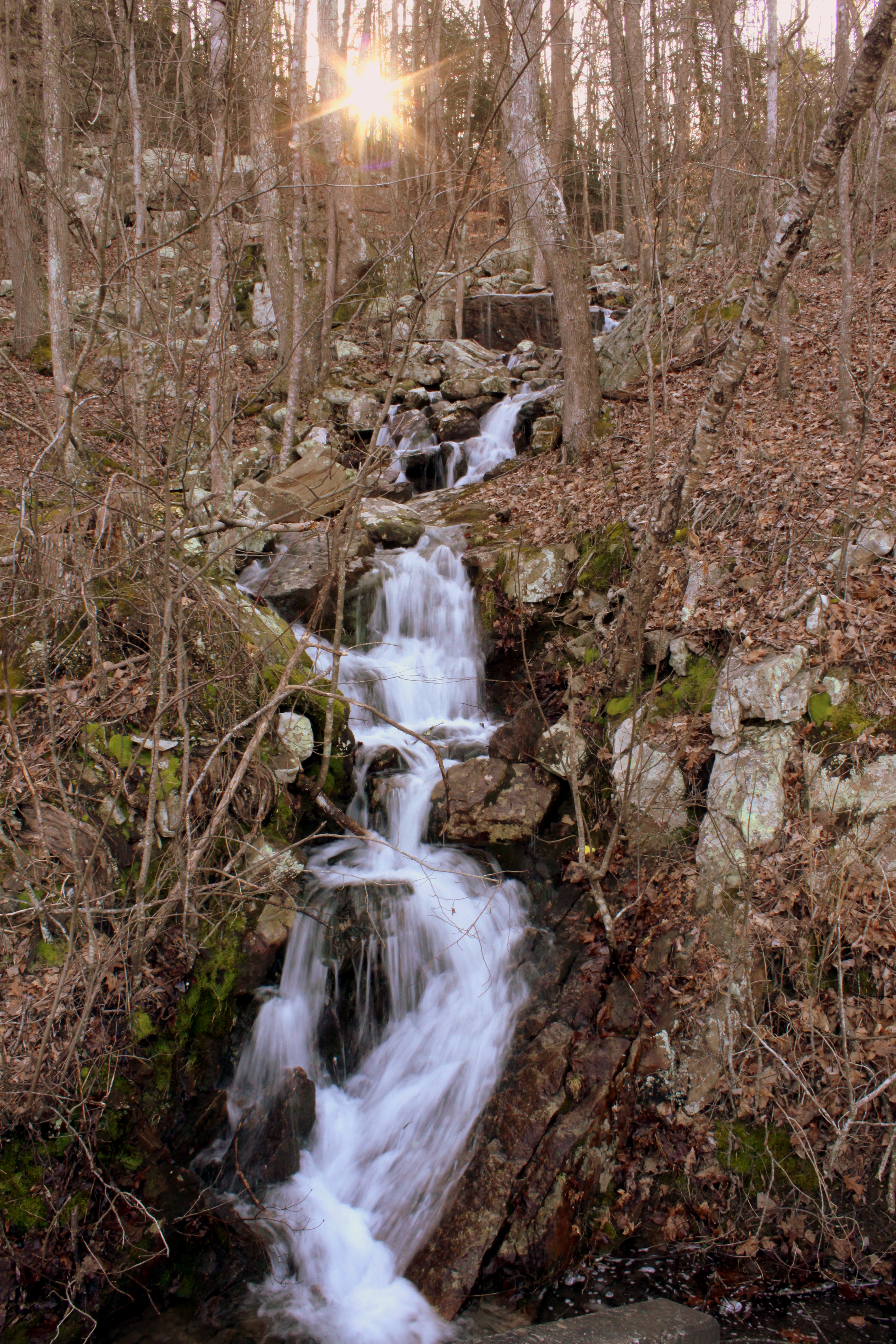
Unnamed waterfall one seen along the old Dixie Highway
On Suck Creek Bridge
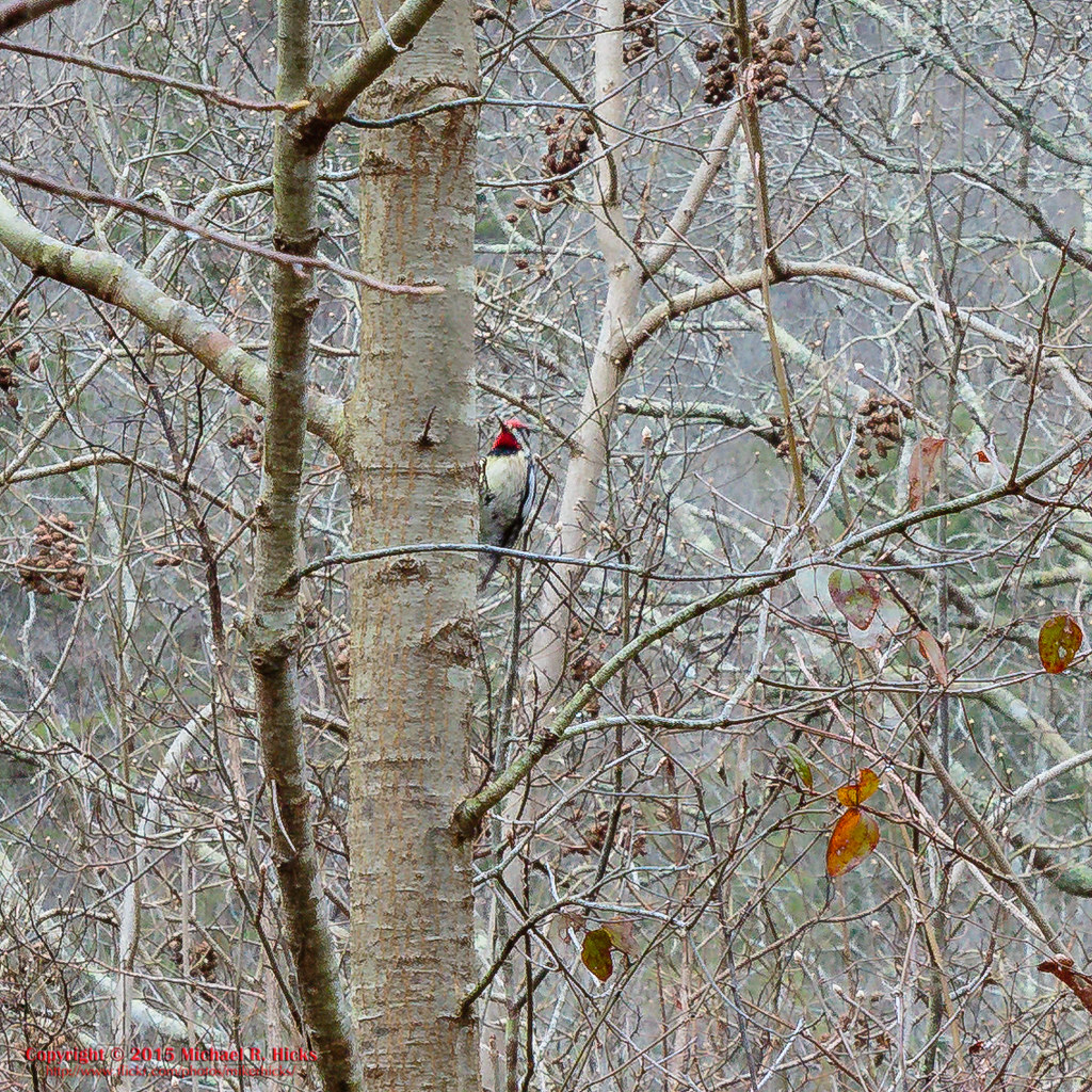
Yellow-bellied Sapsucker
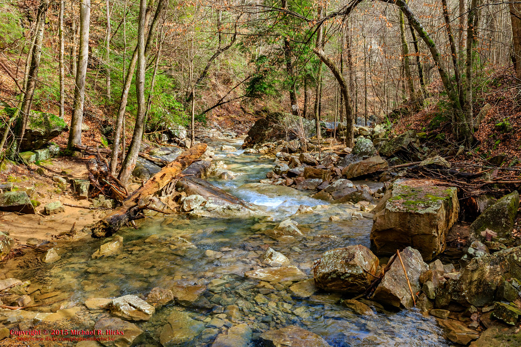
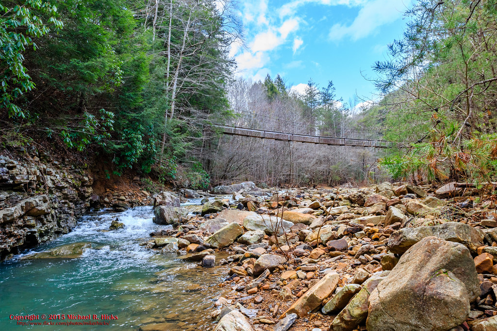
South Suck Creek

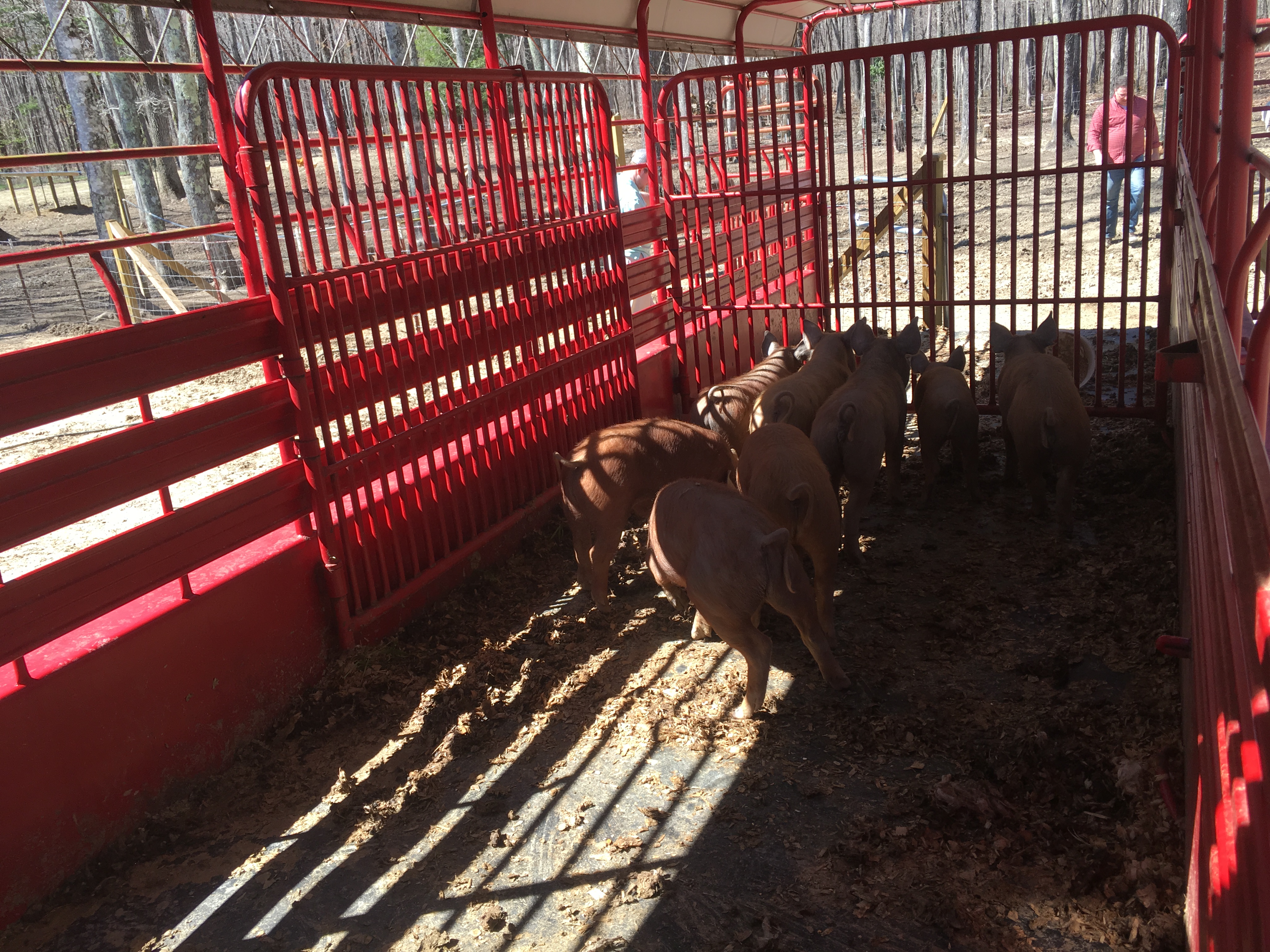
On the Trail

North Suck Creek
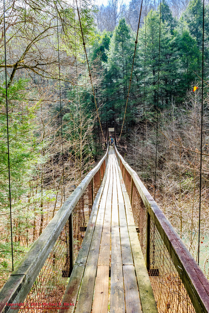
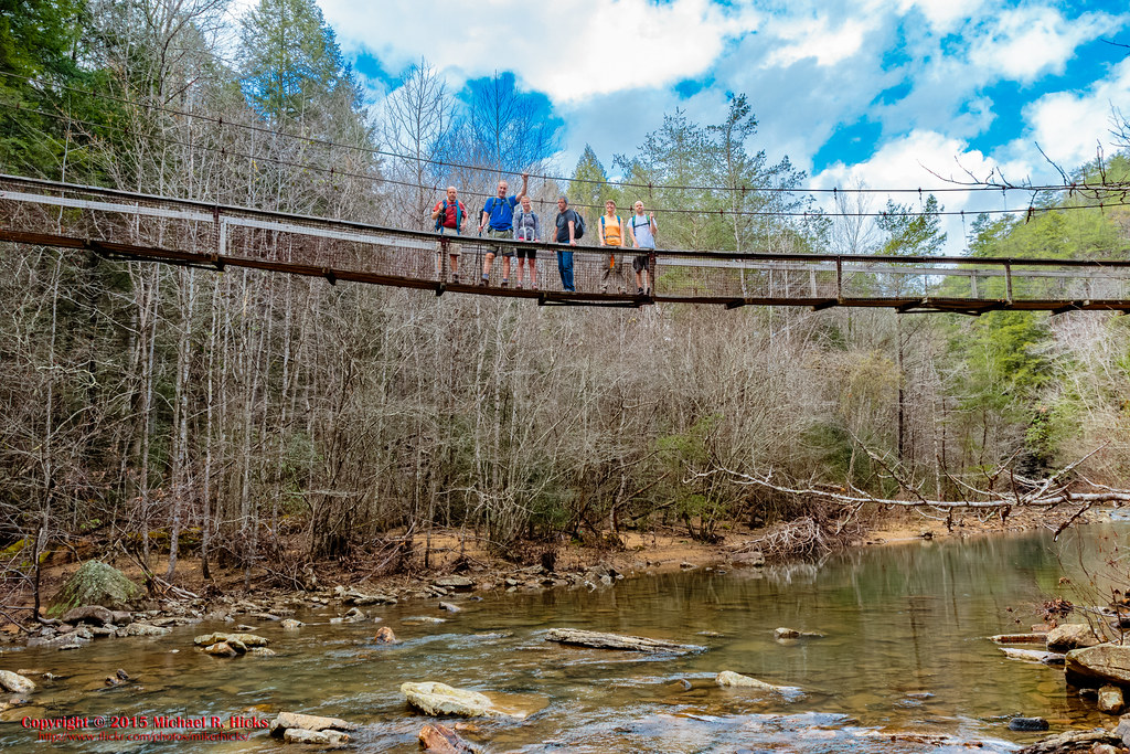
North Suck Creek Bridge
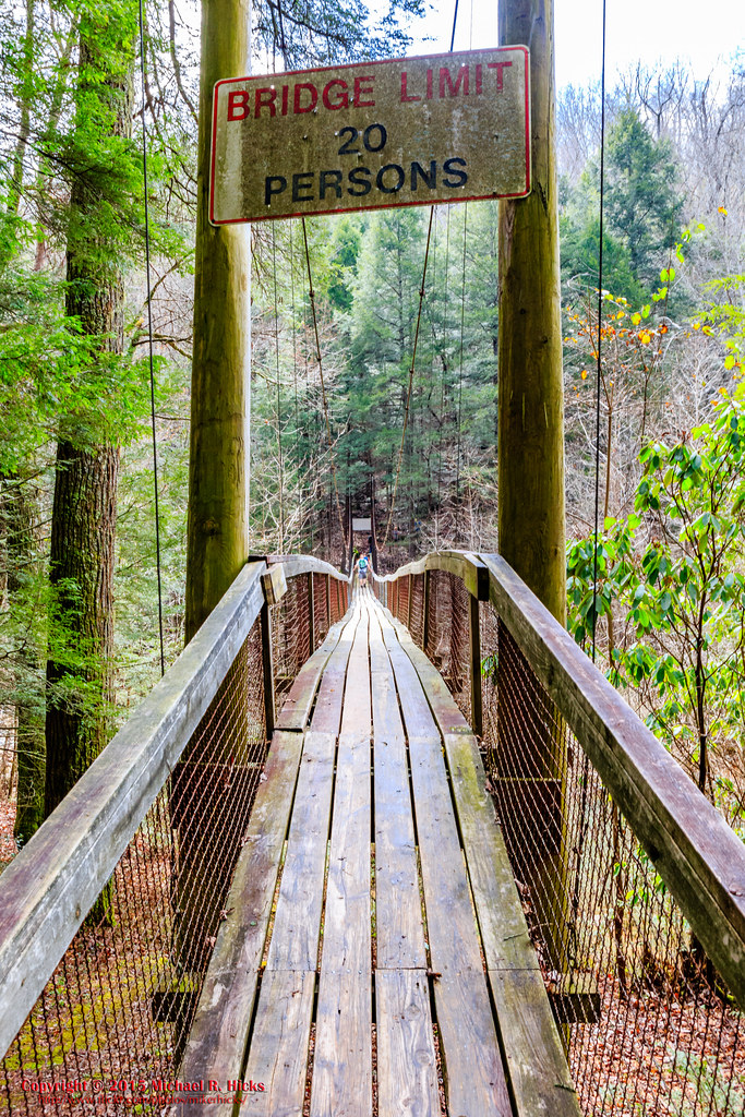
North Suck Creek Bridge
North Suck Creek Bridge
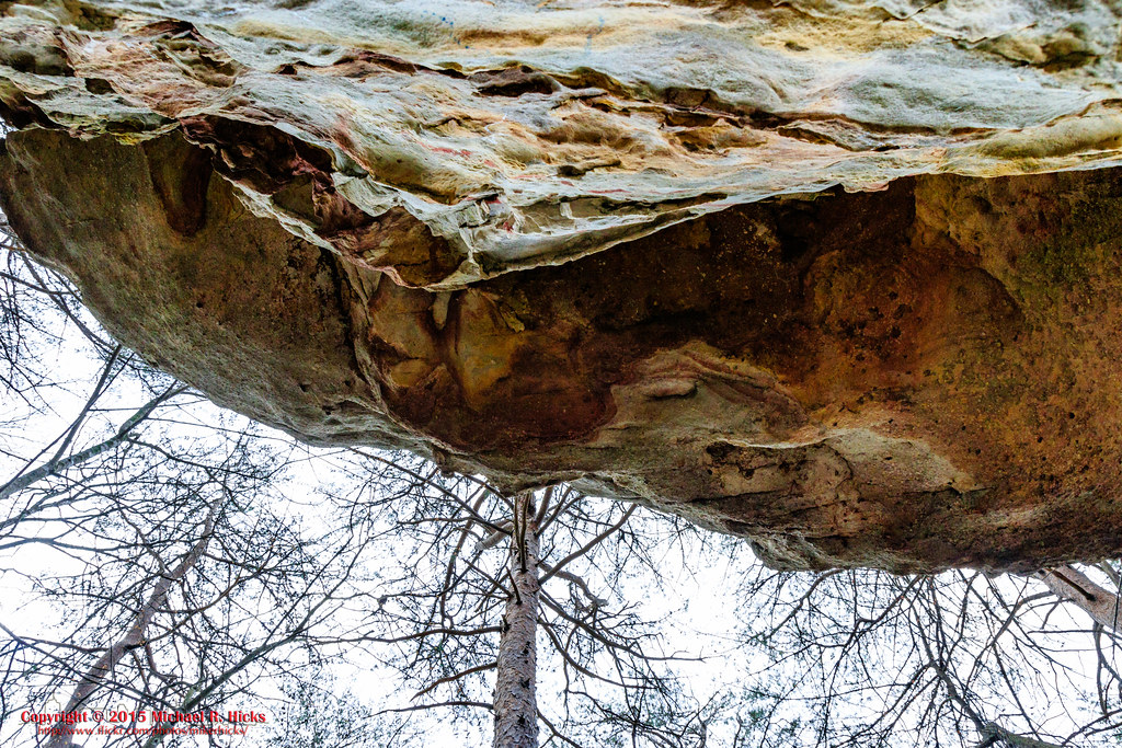
Mushroom Rock
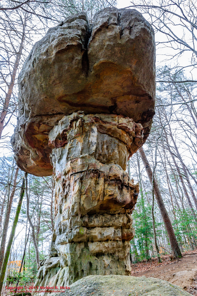
Mushroom Rock
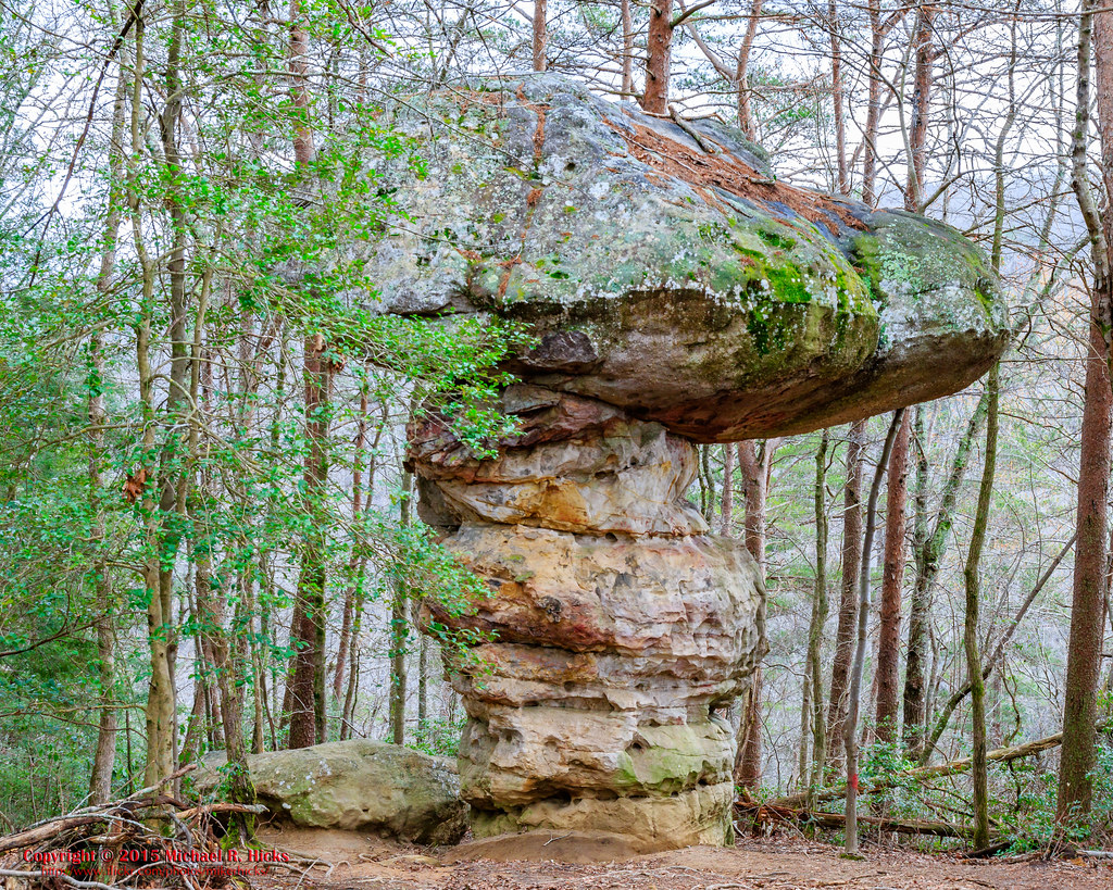
Mushroom Rock
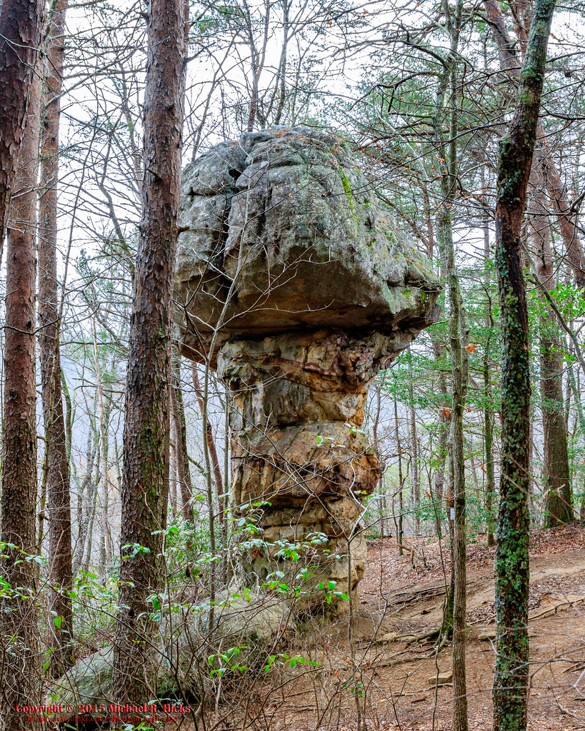
Mushroom Rock
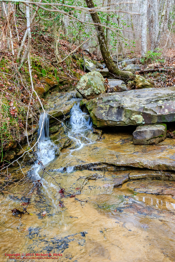
Tributary to Norths Suck Creek
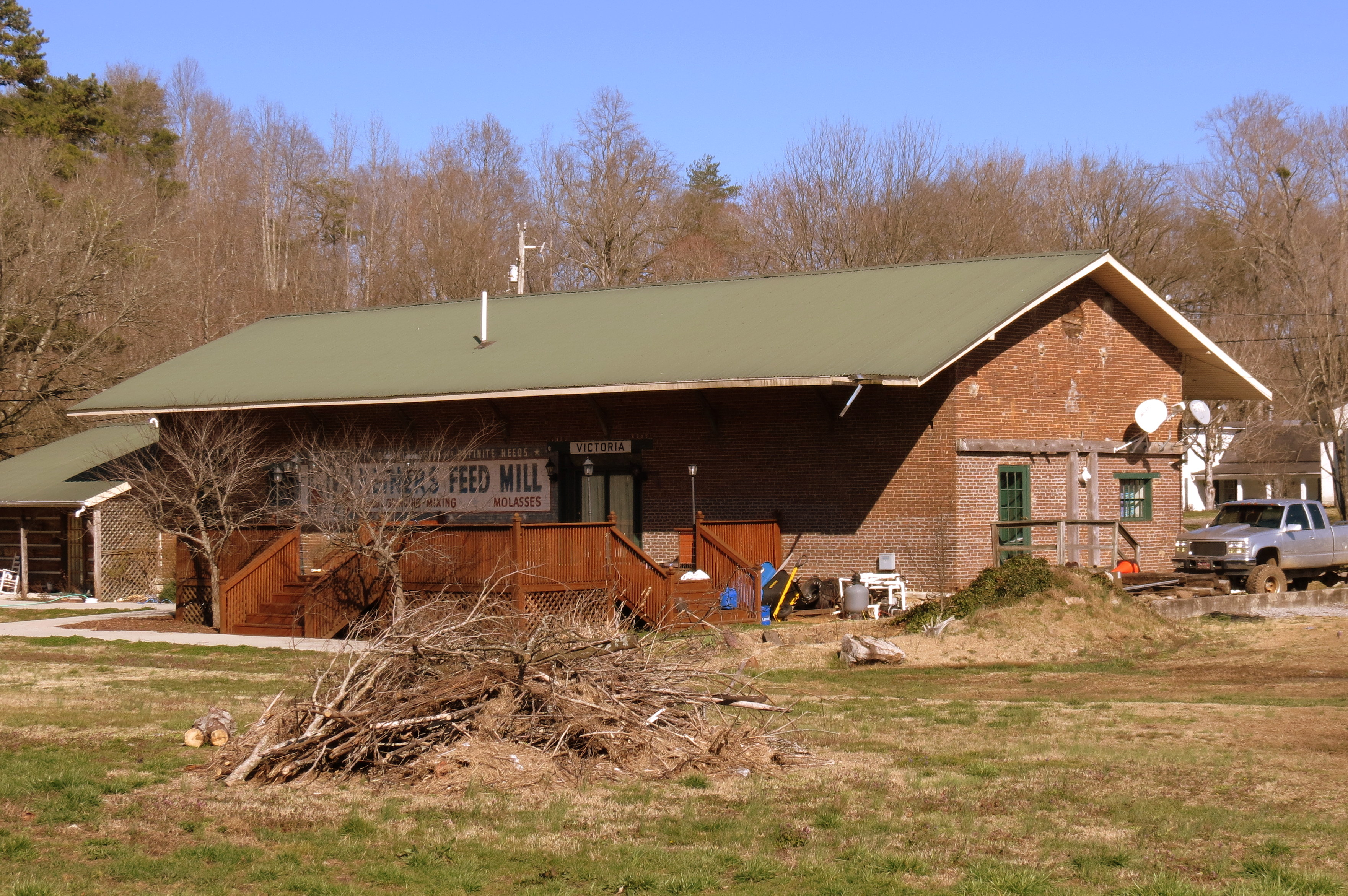
Victoria, TN train depot

Sequatchie County, TN Courthouse - Dunlap, TN
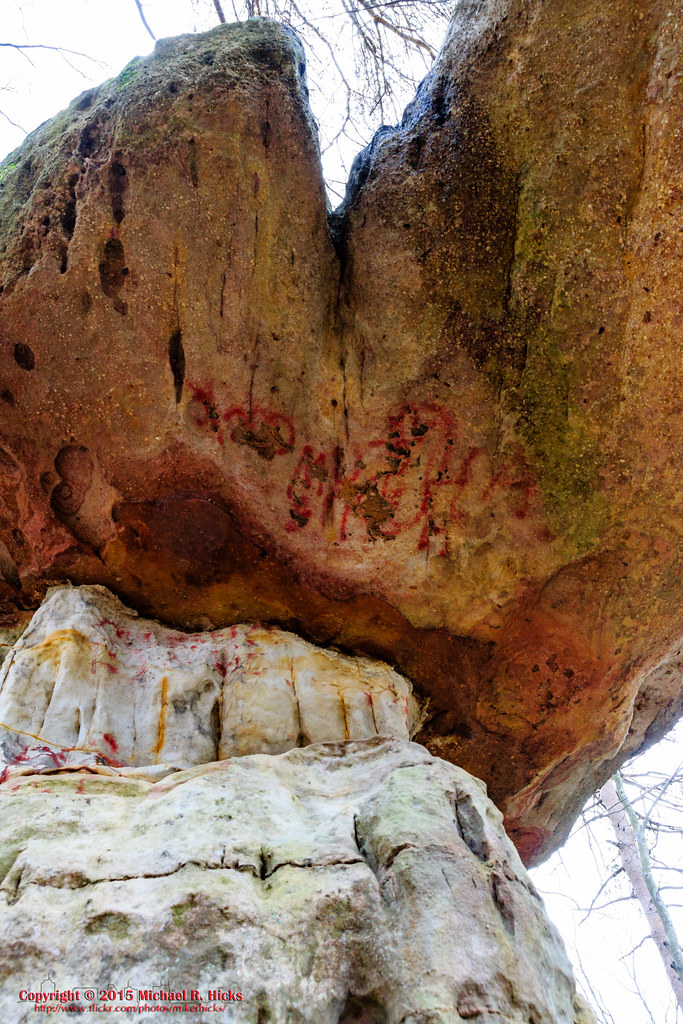
Mushroom Rock

Mountain Dew sign
'G'
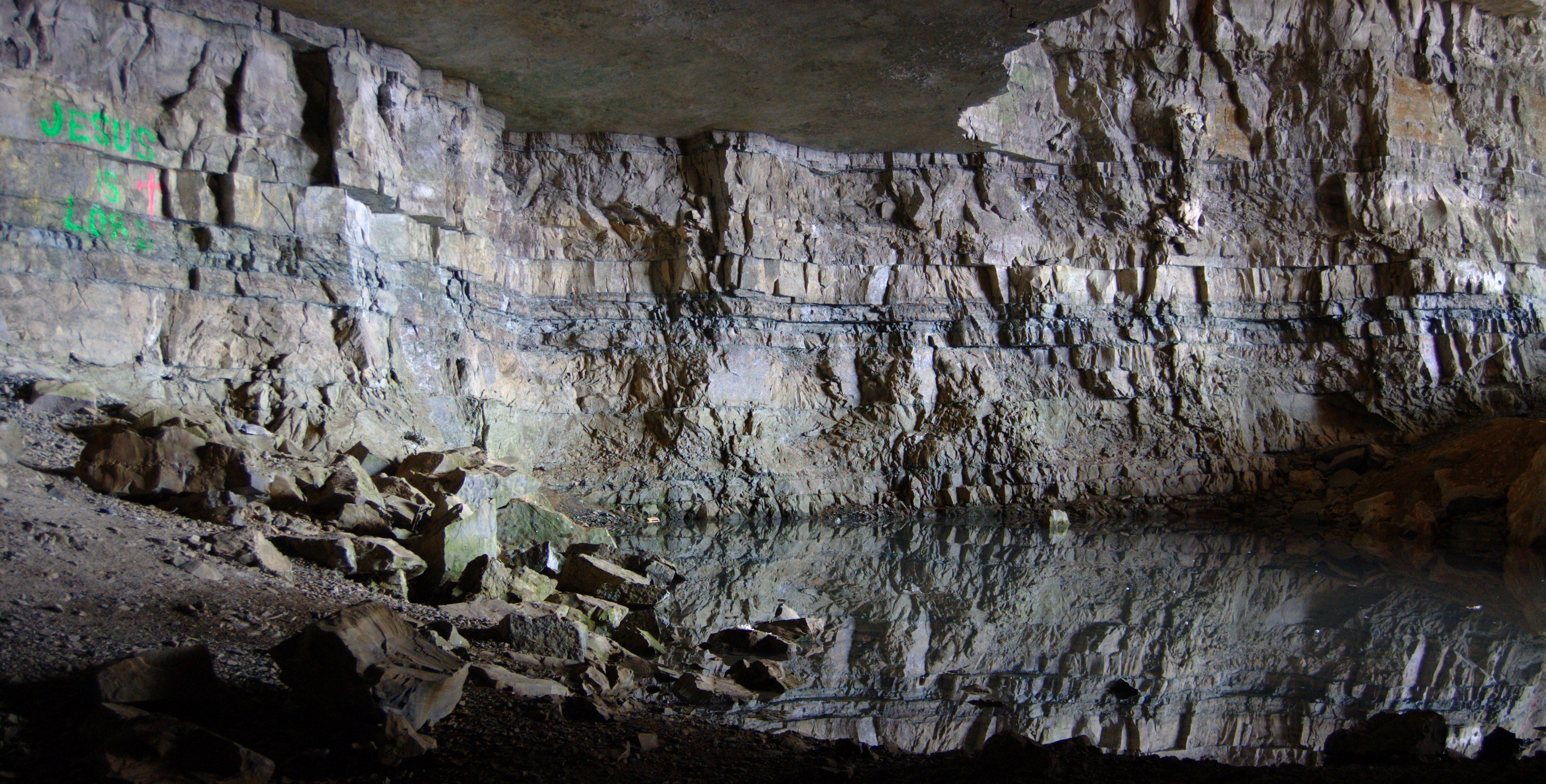
Underground Reflections
New photo added to "All Photos"
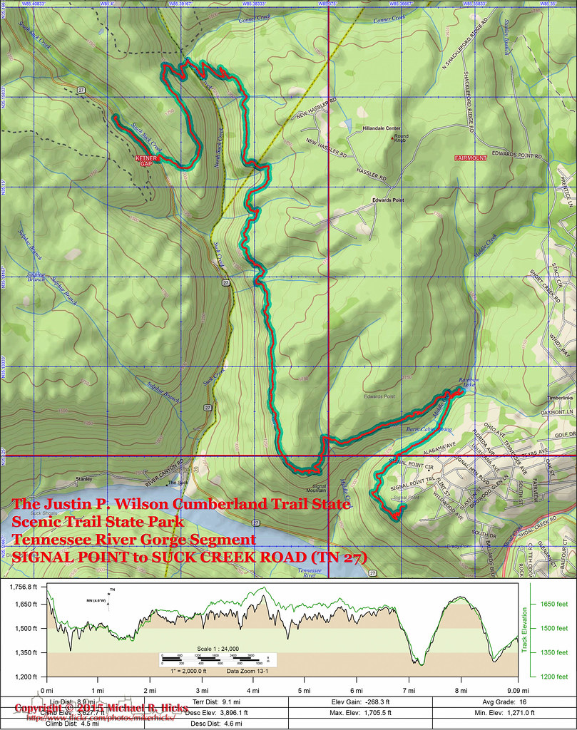
Trail Map and Elevation Profile
Whitwell, TN 美国的地图
查询其他地方的日出日落时间
附近地点
W Valley Rd, Whitwell, TN 美国
TN-, Whitwell, TN 美国
Whitwell, TN 美国
Powells Crossroads, TN 美国
Daus Mill Rd, Dunlap, TN 美国
Daus Mountain Rd, Palmer, TN 美国
Grays Creek Rd, Whitwell, TN 美国
50 Wilderness Way, Dunlap, TN 美国
Farmington Ln, Dunlap, TN 美国
English Cove Rd, Whitwell, TN 美国English Cove Road
Deep Woods Dr, Dunlap, TN 美国
Hidden Ridge Loop, Dunlap, TN 美国
Choctaw Trail, Chattanooga, TN 美国
Choctaw Trail, Chattanooga, TN 美国
Clear Brooks Dr, Signal Mountain, TN 美国
Clear Brooks Dr, Tennessee 美国Clear Brooks Drive
美国田纳西州塞夸奇县
Mirror Lake Rd, Dunlap, TN 美国
美国田纳西州帕默
Airport Ave, Tennessee 美国Airport Avenue
最近搜索
- Red Dog Mine, AK, USA的日出日落时间表
- Am bhf, Borken, 德国Am Bahnhof的日出日落时间表
- 4th St E, Sonoma, CA 美国的日出日落时间表
- Oakland Ave, Williamsport, PA 美国的日出日落时间表
- Via Roma, Pieranica CR, Italy的日出日落时间表
- 克罗地亚杜布罗夫尼克 GradClock Tower of Dubrovnik的日出日落时间表
- 阿根廷丘布特省特雷利乌的日出日落时间表
- Hartfords Bluff Cir, Mt Pleasant, SC 美国的日出日落时间表
- 日本熊本县熊本市北区的日出日落时间表
- 中国福州市平潭县平潭岛的日出日落时间表