W Cedar St, Claremore, OK 美国的日出日落时间表
Location: 美国 > 俄克拉何马 > 罗杰斯 > 美国俄克拉何马克莱尔莫尔 >
时区:
America/Chicago
当地时间:
2025-07-12 08:59:52
经度:
-95.624779
纬度:
36.3085359
今天日出时间:
06:15:03 AM
今天日落时间:
08:41:27 PM
今天日照时常:
14h 26m 24s
明天日出时间:
06:15:42 AM
明天日落时间:
08:41:02 PM
明天日照时常:
14h 25m 20s
显示所有日期
| 日期 | 日出 | 日落 | 日照时常 |
|---|---|---|---|
| 2025年01月01日 | 07:34:01 AM | 05:19:17 PM | 9h 45m 16s |
| 2025年01月02日 | 07:34:07 AM | 05:20:06 PM | 9h 45m 59s |
| 2025年01月03日 | 07:34:12 AM | 05:20:56 PM | 9h 46m 44s |
| 2025年01月04日 | 07:34:15 AM | 05:21:46 PM | 9h 47m 31s |
| 2025年01月05日 | 07:34:15 AM | 05:22:39 PM | 9h 48m 24s |
| 2025年01月06日 | 07:34:14 AM | 05:23:32 PM | 9h 49m 18s |
| 2025年01月07日 | 07:34:11 AM | 05:24:26 PM | 9h 50m 15s |
| 2025年01月08日 | 07:34:05 AM | 05:25:21 PM | 9h 51m 16s |
| 2025年01月09日 | 07:33:58 AM | 05:26:16 PM | 9h 52m 18s |
| 2025年01月10日 | 07:33:49 AM | 05:27:13 PM | 9h 53m 24s |
| 2025年01月11日 | 07:33:37 AM | 05:28:11 PM | 9h 54m 34s |
| 2025年01月12日 | 07:33:24 AM | 05:29:09 PM | 9h 55m 45s |
| 2025年01月13日 | 07:33:09 AM | 05:30:08 PM | 9h 56m 59s |
| 2025年01月14日 | 07:32:52 AM | 05:31:07 PM | 9h 58m 15s |
| 2025年01月15日 | 07:32:33 AM | 05:32:07 PM | 9h 59m 34s |
| 2025年01月16日 | 07:32:12 AM | 05:33:08 PM | 10h 0m 56s |
| 2025年01月17日 | 07:31:49 AM | 05:34:09 PM | 10h 2m 20s |
| 2025年01月18日 | 07:31:24 AM | 05:35:11 PM | 10h 3m 47s |
| 2025年01月19日 | 07:30:57 AM | 05:36:13 PM | 10h 5m 16s |
| 2025年01月20日 | 07:30:28 AM | 05:37:15 PM | 10h 6m 47s |
| 2025年01月21日 | 07:29:58 AM | 05:38:18 PM | 10h 8m 20s |
| 2025年01月22日 | 07:29:25 AM | 05:39:21 PM | 10h 9m 56s |
| 2025年01月23日 | 07:28:51 AM | 05:40:24 PM | 10h 11m 33s |
| 2025年01月24日 | 07:28:15 AM | 05:41:27 PM | 10h 13m 12s |
| 2025年01月25日 | 07:27:38 AM | 05:42:31 PM | 10h 14m 53s |
| 2025年01月26日 | 07:26:58 AM | 05:43:34 PM | 10h 16m 36s |
| 2025年01月27日 | 07:26:17 AM | 05:44:38 PM | 10h 18m 21s |
| 2025年01月28日 | 07:25:35 AM | 05:45:42 PM | 10h 20m 7s |
| 2025年01月29日 | 07:24:50 AM | 05:46:46 PM | 10h 21m 56s |
| 2025年01月30日 | 07:24:04 AM | 05:47:50 PM | 10h 23m 46s |
| 2025年01月31日 | 07:23:16 AM | 05:48:53 PM | 10h 25m 37s |
| 2025年02月01日 | 07:22:27 AM | 05:49:57 PM | 10h 27m 30s |
| 2025年02月02日 | 07:21:36 AM | 05:51:01 PM | 10h 29m 25s |
| 2025年02月03日 | 07:20:44 AM | 05:52:04 PM | 10h 31m 20s |
| 2025年02月04日 | 07:19:50 AM | 05:53:08 PM | 10h 33m 18s |
| 2025年02月05日 | 07:18:55 AM | 05:54:11 PM | 10h 35m 16s |
| 2025年02月06日 | 07:17:58 AM | 05:55:14 PM | 10h 37m 16s |
| 2025年02月07日 | 07:17:00 AM | 05:56:17 PM | 10h 39m 17s |
| 2025年02月08日 | 07:16:01 AM | 05:57:20 PM | 10h 41m 19s |
| 2025年02月09日 | 07:15:00 AM | 05:58:22 PM | 10h 43m 22s |
| 2025年02月10日 | 07:13:58 AM | 05:59:24 PM | 10h 45m 26s |
| 2025年02月11日 | 07:12:55 AM | 06:00:26 PM | 10h 47m 31s |
| 2025年02月12日 | 07:11:50 AM | 06:01:28 PM | 10h 49m 38s |
| 2025年02月13日 | 07:10:45 AM | 06:02:29 PM | 10h 51m 44s |
| 2025年02月14日 | 07:09:38 AM | 06:03:30 PM | 10h 53m 52s |
| 2025年02月15日 | 07:08:30 AM | 06:04:31 PM | 10h 56m 1s |
| 2025年02月16日 | 07:07:21 AM | 06:05:32 PM | 10h 58m 11s |
| 2025年02月17日 | 07:06:11 AM | 06:06:32 PM | 11h 0m 21s |
| 2025年02月18日 | 07:04:59 AM | 06:07:32 PM | 11h 2m 33s |
| 2025年02月19日 | 07:03:47 AM | 06:08:31 PM | 11h 4m 44s |
| 2025年02月20日 | 07:02:34 AM | 06:09:30 PM | 11h 6m 56s |
| 2025年02月21日 | 07:01:20 AM | 06:10:29 PM | 11h 9m 9s |
| 2025年02月22日 | 07:00:05 AM | 06:11:28 PM | 11h 11m 23s |
| 2025年02月23日 | 06:58:49 AM | 06:12:26 PM | 11h 13m 37s |
| 2025年02月24日 | 06:57:32 AM | 06:13:24 PM | 11h 15m 52s |
| 2025年02月25日 | 06:56:15 AM | 06:14:21 PM | 11h 18m 6s |
| 2025年02月26日 | 06:54:56 AM | 06:15:19 PM | 11h 20m 23s |
| 2025年02月27日 | 06:53:37 AM | 06:16:16 PM | 11h 22m 39s |
| 2025年02月28日 | 06:52:18 AM | 06:17:12 PM | 11h 24m 54s |
| 2025年03月01日 | 06:50:57 AM | 06:18:08 PM | 11h 27m 11s |
| 2025年03月02日 | 06:49:36 AM | 06:19:04 PM | 11h 29m 28s |
| 2025年03月03日 | 06:48:14 AM | 06:20:00 PM | 11h 31m 46s |
| 2025年03月04日 | 06:46:52 AM | 06:20:55 PM | 11h 34m 3s |
| 2025年03月05日 | 06:45:29 AM | 06:21:51 PM | 11h 36m 22s |
| 2025年03月06日 | 06:44:06 AM | 06:22:45 PM | 11h 38m 39s |
| 2025年03月07日 | 06:42:42 AM | 06:23:40 PM | 11h 40m 58s |
| 2025年03月08日 | 06:41:18 AM | 06:24:34 PM | 11h 43m 16s |
| 2025年03月09日 | 07:39:56 AM | 07:25:26 PM | 11h 45m 30s |
| 2025年03月10日 | 07:38:31 AM | 07:26:20 PM | 11h 47m 49s |
| 2025年03月11日 | 07:37:06 AM | 07:27:13 PM | 11h 50m 7s |
| 2025年03月12日 | 07:35:40 AM | 07:28:07 PM | 11h 52m 27s |
| 2025年03月13日 | 07:34:14 AM | 07:29:00 PM | 11h 54m 46s |
| 2025年03月14日 | 07:32:47 AM | 07:29:52 PM | 11h 57m 5s |
| 2025年03月15日 | 07:31:21 AM | 07:30:45 PM | 11h 59m 24s |
| 2025年03月16日 | 07:29:54 AM | 07:31:38 PM | 12h 1m 44s |
| 2025年03月17日 | 07:28:26 AM | 07:32:30 PM | 12h 4m 4s |
| 2025年03月18日 | 07:26:59 AM | 07:33:22 PM | 12h 6m 23s |
| 2025年03月19日 | 07:25:32 AM | 07:34:14 PM | 12h 8m 42s |
| 2025年03月20日 | 07:24:04 AM | 07:35:06 PM | 12h 11m 2s |
| 2025年03月21日 | 07:22:37 AM | 07:35:58 PM | 12h 13m 21s |
| 2025年03月22日 | 07:21:09 AM | 07:36:49 PM | 12h 15m 40s |
| 2025年03月23日 | 07:19:42 AM | 07:37:41 PM | 12h 17m 59s |
| 2025年03月24日 | 07:18:14 AM | 07:38:32 PM | 12h 20m 18s |
| 2025年03月25日 | 07:16:46 AM | 07:39:24 PM | 12h 22m 38s |
| 2025年03月26日 | 07:15:19 AM | 07:40:15 PM | 12h 24m 56s |
| 2025年03月27日 | 07:13:52 AM | 07:41:06 PM | 12h 27m 14s |
| 2025年03月28日 | 07:12:24 AM | 07:41:57 PM | 12h 29m 33s |
| 2025年03月29日 | 07:10:57 AM | 07:42:48 PM | 12h 31m 51s |
| 2025年03月30日 | 07:09:31 AM | 07:43:39 PM | 12h 34m 8s |
| 2025年03月31日 | 07:08:04 AM | 07:44:30 PM | 12h 36m 26s |
| 2025年04月01日 | 07:06:38 AM | 07:45:21 PM | 12h 38m 43s |
| 2025年04月02日 | 07:05:12 AM | 07:46:12 PM | 12h 41m 0s |
| 2025年04月03日 | 07:03:46 AM | 07:47:03 PM | 12h 43m 17s |
| 2025年04月04日 | 07:02:20 AM | 07:47:54 PM | 12h 45m 34s |
| 2025年04月05日 | 07:00:55 AM | 07:48:45 PM | 12h 47m 50s |
| 2025年04月06日 | 06:59:31 AM | 07:49:36 PM | 12h 50m 5s |
| 2025年04月07日 | 06:58:06 AM | 07:50:27 PM | 12h 52m 21s |
| 2025年04月08日 | 06:56:43 AM | 07:51:18 PM | 12h 54m 35s |
| 2025年04月09日 | 06:55:19 AM | 07:52:09 PM | 12h 56m 50s |
| 2025年04月10日 | 06:53:57 AM | 07:53:00 PM | 12h 59m 3s |
| 2025年04月11日 | 06:52:34 AM | 07:53:52 PM | 13h 1m 18s |
| 2025年04月12日 | 06:51:13 AM | 07:54:43 PM | 13h 3m 30s |
| 2025年04月13日 | 06:49:52 AM | 07:55:34 PM | 13h 5m 42s |
| 2025年04月14日 | 06:48:31 AM | 07:56:25 PM | 13h 7m 54s |
| 2025年04月15日 | 06:47:12 AM | 07:57:17 PM | 13h 10m 5s |
| 2025年04月16日 | 06:45:53 AM | 07:58:08 PM | 13h 12m 15s |
| 2025年04月17日 | 06:44:34 AM | 07:59:00 PM | 13h 14m 26s |
| 2025年04月18日 | 06:43:17 AM | 07:59:51 PM | 13h 16m 34s |
| 2025年04月19日 | 06:42:00 AM | 08:00:43 PM | 13h 18m 43s |
| 2025年04月20日 | 06:40:44 AM | 08:01:34 PM | 13h 20m 50s |
| 2025年04月21日 | 06:39:29 AM | 08:02:26 PM | 13h 22m 57s |
| 2025年04月22日 | 06:38:15 AM | 08:03:18 PM | 13h 25m 3s |
| 2025年04月23日 | 06:37:02 AM | 08:04:10 PM | 13h 27m 8s |
| 2025年04月24日 | 06:35:49 AM | 08:05:01 PM | 13h 29m 12s |
| 2025年04月25日 | 06:34:38 AM | 08:05:53 PM | 13h 31m 15s |
| 2025年04月26日 | 06:33:27 AM | 08:06:45 PM | 13h 33m 18s |
| 2025年04月27日 | 06:32:18 AM | 08:07:37 PM | 13h 35m 19s |
| 2025年04月28日 | 06:31:10 AM | 08:08:29 PM | 13h 37m 19s |
| 2025年04月29日 | 06:30:02 AM | 08:09:20 PM | 13h 39m 18s |
| 2025年04月30日 | 06:28:56 AM | 08:10:12 PM | 13h 41m 16s |
| 2025年05月01日 | 06:27:51 AM | 08:11:04 PM | 13h 43m 13s |
| 2025年05月02日 | 06:26:47 AM | 08:11:55 PM | 13h 45m 8s |
| 2025年05月03日 | 06:25:44 AM | 08:12:47 PM | 13h 47m 3s |
| 2025年05月04日 | 06:24:43 AM | 08:13:38 PM | 13h 48m 55s |
| 2025年05月05日 | 06:23:43 AM | 08:14:30 PM | 13h 50m 47s |
| 2025年05月06日 | 06:22:44 AM | 08:15:21 PM | 13h 52m 37s |
| 2025年05月07日 | 06:21:46 AM | 08:16:12 PM | 13h 54m 26s |
| 2025年05月08日 | 06:20:50 AM | 08:17:03 PM | 13h 56m 13s |
| 2025年05月09日 | 06:19:54 AM | 08:17:54 PM | 13h 58m 0s |
| 2025年05月10日 | 06:19:01 AM | 08:18:44 PM | 13h 59m 43s |
| 2025年05月11日 | 06:18:08 AM | 08:19:34 PM | 14h 1m 26s |
| 2025年05月12日 | 06:17:18 AM | 08:20:24 PM | 14h 3m 6s |
| 2025年05月13日 | 06:16:28 AM | 08:21:14 PM | 14h 4m 46s |
| 2025年05月14日 | 06:15:40 AM | 08:22:03 PM | 14h 6m 23s |
| 2025年05月15日 | 06:14:54 AM | 08:22:52 PM | 14h 7m 58s |
| 2025年05月16日 | 06:14:09 AM | 08:23:41 PM | 14h 9m 32s |
| 2025年05月17日 | 06:13:25 AM | 08:24:29 PM | 14h 11m 4s |
| 2025年05月18日 | 06:12:43 AM | 08:25:16 PM | 14h 12m 33s |
| 2025年05月19日 | 06:12:03 AM | 08:26:04 PM | 14h 14m 1s |
| 2025年05月20日 | 06:11:24 AM | 08:26:50 PM | 14h 15m 26s |
| 2025年05月21日 | 06:10:47 AM | 08:27:36 PM | 14h 16m 49s |
| 2025年05月22日 | 06:10:11 AM | 08:28:22 PM | 14h 18m 11s |
| 2025年05月23日 | 06:09:37 AM | 08:29:07 PM | 14h 19m 30s |
| 2025年05月24日 | 06:09:05 AM | 08:29:51 PM | 14h 20m 46s |
| 2025年05月25日 | 06:08:35 AM | 08:30:35 PM | 14h 22m 0s |
| 2025年05月26日 | 06:08:06 AM | 08:31:18 PM | 14h 23m 12s |
| 2025年05月27日 | 06:07:38 AM | 08:32:00 PM | 14h 24m 22s |
| 2025年05月28日 | 06:07:13 AM | 08:32:41 PM | 14h 25m 28s |
| 2025年05月29日 | 06:06:49 AM | 08:33:22 PM | 14h 26m 33s |
| 2025年05月30日 | 06:06:27 AM | 08:34:02 PM | 14h 27m 35s |
| 2025年05月31日 | 06:06:06 AM | 08:34:40 PM | 14h 28m 34s |
| 2025年06月01日 | 06:05:47 AM | 08:35:18 PM | 14h 29m 31s |
| 2025年06月02日 | 06:05:30 AM | 08:35:55 PM | 14h 30m 25s |
| 2025年06月03日 | 06:05:15 AM | 08:36:31 PM | 14h 31m 16s |
| 2025年06月04日 | 06:05:02 AM | 08:37:06 PM | 14h 32m 4s |
| 2025年06月05日 | 06:04:50 AM | 08:37:39 PM | 14h 32m 49s |
| 2025年06月06日 | 06:04:40 AM | 08:38:12 PM | 14h 33m 32s |
| 2025年06月07日 | 06:04:31 AM | 08:38:43 PM | 14h 34m 12s |
| 2025年06月08日 | 06:04:25 AM | 08:39:14 PM | 14h 34m 49s |
| 2025年06月09日 | 06:04:20 AM | 08:39:42 PM | 14h 35m 22s |
| 2025年06月10日 | 06:04:16 AM | 08:40:10 PM | 14h 35m 54s |
| 2025年06月11日 | 06:04:15 AM | 08:40:37 PM | 14h 36m 22s |
| 2025年06月12日 | 06:04:15 AM | 08:41:02 PM | 14h 36m 47s |
| 2025年06月13日 | 06:04:16 AM | 08:41:25 PM | 14h 37m 9s |
| 2025年06月14日 | 06:04:20 AM | 08:41:48 PM | 14h 37m 28s |
| 2025年06月15日 | 06:04:25 AM | 08:42:08 PM | 14h 37m 43s |
| 2025年06月16日 | 06:04:31 AM | 08:42:28 PM | 14h 37m 57s |
| 2025年06月17日 | 06:04:40 AM | 08:42:46 PM | 14h 38m 6s |
| 2025年06月18日 | 06:04:49 AM | 08:43:02 PM | 14h 38m 13s |
| 2025年06月19日 | 06:05:01 AM | 08:43:17 PM | 14h 38m 16s |
| 2025年06月20日 | 06:05:14 AM | 08:43:30 PM | 14h 38m 16s |
| 2025年06月21日 | 06:05:28 AM | 08:43:42 PM | 14h 38m 14s |
| 2025年06月22日 | 06:05:44 AM | 08:43:52 PM | 14h 38m 8s |
| 2025年06月23日 | 06:06:01 AM | 08:44:00 PM | 14h 37m 59s |
| 2025年06月24日 | 06:06:20 AM | 08:44:07 PM | 14h 37m 47s |
| 2025年06月25日 | 06:06:40 AM | 08:44:12 PM | 14h 37m 32s |
| 2025年06月26日 | 06:07:02 AM | 08:44:16 PM | 14h 37m 14s |
| 2025年06月27日 | 06:07:24 AM | 08:44:17 PM | 14h 36m 53s |
| 2025年06月28日 | 06:07:49 AM | 08:44:17 PM | 14h 36m 28s |
| 2025年06月29日 | 06:08:14 AM | 08:44:16 PM | 14h 36m 2s |
| 2025年06月30日 | 06:08:41 AM | 08:44:12 PM | 14h 35m 31s |
| 2025年07月01日 | 06:09:09 AM | 08:44:07 PM | 14h 34m 58s |
| 2025年07月02日 | 06:09:38 AM | 08:44:00 PM | 14h 34m 22s |
| 2025年07月03日 | 06:10:08 AM | 08:43:51 PM | 14h 33m 43s |
| 2025年07月04日 | 06:10:39 AM | 08:43:41 PM | 14h 33m 2s |
| 2025年07月05日 | 06:11:11 AM | 08:43:29 PM | 14h 32m 18s |
| 2025年07月06日 | 06:11:45 AM | 08:43:15 PM | 14h 31m 30s |
| 2025年07月07日 | 06:12:19 AM | 08:42:59 PM | 14h 30m 40s |
| 2025年07月08日 | 06:12:54 AM | 08:42:41 PM | 14h 29m 47s |
| 2025年07月09日 | 06:13:31 AM | 08:42:22 PM | 14h 28m 51s |
| 2025年07月10日 | 06:14:08 AM | 08:42:01 PM | 14h 27m 53s |
| 2025年07月11日 | 06:14:46 AM | 08:41:38 PM | 14h 26m 52s |
| 2025年07月12日 | 06:15:24 AM | 08:41:14 PM | 14h 25m 50s |
| 2025年07月13日 | 06:16:04 AM | 08:40:47 PM | 14h 24m 43s |
| 2025年07月14日 | 06:16:44 AM | 08:40:19 PM | 14h 23m 35s |
| 2025年07月15日 | 06:17:25 AM | 08:39:50 PM | 14h 22m 25s |
| 2025年07月16日 | 06:18:07 AM | 08:39:18 PM | 14h 21m 11s |
| 2025年07月17日 | 06:18:49 AM | 08:38:45 PM | 14h 19m 56s |
| 2025年07月18日 | 06:19:32 AM | 08:38:10 PM | 14h 18m 38s |
| 2025年07月19日 | 06:20:15 AM | 08:37:34 PM | 14h 17m 19s |
| 2025年07月20日 | 06:20:59 AM | 08:36:56 PM | 14h 15m 57s |
| 2025年07月21日 | 06:21:43 AM | 08:36:16 PM | 14h 14m 33s |
| 2025年07月22日 | 06:22:28 AM | 08:35:35 PM | 14h 13m 7s |
| 2025年07月23日 | 06:23:13 AM | 08:34:52 PM | 14h 11m 39s |
| 2025年07月24日 | 06:23:59 AM | 08:34:08 PM | 14h 10m 9s |
| 2025年07月25日 | 06:24:45 AM | 08:33:22 PM | 14h 8m 37s |
| 2025年07月26日 | 06:25:31 AM | 08:32:34 PM | 14h 7m 3s |
| 2025年07月27日 | 06:26:18 AM | 08:31:45 PM | 14h 5m 27s |
| 2025年07月28日 | 06:27:04 AM | 08:30:54 PM | 14h 3m 50s |
| 2025年07月29日 | 06:27:52 AM | 08:30:02 PM | 14h 2m 10s |
| 2025年07月30日 | 06:28:39 AM | 08:29:09 PM | 14h 0m 30s |
| 2025年07月31日 | 06:29:26 AM | 08:28:14 PM | 13h 58m 48s |
| 2025年08月01日 | 06:30:14 AM | 08:27:18 PM | 13h 57m 4s |
| 2025年08月02日 | 06:31:02 AM | 08:26:20 PM | 13h 55m 18s |
| 2025年08月03日 | 06:31:50 AM | 08:25:21 PM | 13h 53m 31s |
| 2025年08月04日 | 06:32:38 AM | 08:24:21 PM | 13h 51m 43s |
| 2025年08月05日 | 06:33:26 AM | 08:23:20 PM | 13h 49m 54s |
| 2025年08月06日 | 06:34:14 AM | 08:22:17 PM | 13h 48m 3s |
| 2025年08月07日 | 06:35:03 AM | 08:21:13 PM | 13h 46m 10s |
| 2025年08月08日 | 06:35:51 AM | 08:20:07 PM | 13h 44m 16s |
| 2025年08月09日 | 06:36:39 AM | 08:19:01 PM | 13h 42m 22s |
| 2025年08月10日 | 06:37:28 AM | 08:17:54 PM | 13h 40m 26s |
| 2025年08月11日 | 06:38:16 AM | 08:16:45 PM | 13h 38m 29s |
| 2025年08月12日 | 06:39:05 AM | 08:15:35 PM | 13h 36m 30s |
| 2025年08月13日 | 06:39:53 AM | 08:14:24 PM | 13h 34m 31s |
| 2025年08月14日 | 06:40:41 AM | 08:13:12 PM | 13h 32m 31s |
| 2025年08月15日 | 06:41:29 AM | 08:12:00 PM | 13h 30m 31s |
| 2025年08月16日 | 06:42:18 AM | 08:10:46 PM | 13h 28m 28s |
| 2025年08月17日 | 06:43:06 AM | 08:09:31 PM | 13h 26m 25s |
| 2025年08月18日 | 06:43:54 AM | 08:08:15 PM | 13h 24m 21s |
| 2025年08月19日 | 06:44:42 AM | 08:06:59 PM | 13h 22m 17s |
| 2025年08月20日 | 06:45:30 AM | 08:05:41 PM | 13h 20m 11s |
| 2025年08月21日 | 06:46:17 AM | 08:04:23 PM | 13h 18m 6s |
| 2025年08月22日 | 06:47:05 AM | 08:03:04 PM | 13h 15m 59s |
| 2025年08月23日 | 06:47:53 AM | 08:01:44 PM | 13h 13m 51s |
| 2025年08月24日 | 06:48:40 AM | 08:00:23 PM | 13h 11m 43s |
| 2025年08月25日 | 06:49:28 AM | 07:59:02 PM | 13h 9m 34s |
| 2025年08月26日 | 06:50:15 AM | 07:57:40 PM | 13h 7m 25s |
| 2025年08月27日 | 06:51:02 AM | 07:56:17 PM | 13h 5m 15s |
| 2025年08月28日 | 06:51:50 AM | 07:54:54 PM | 13h 3m 4s |
| 2025年08月29日 | 06:52:37 AM | 07:53:30 PM | 13h 0m 53s |
| 2025年08月30日 | 06:53:24 AM | 07:52:05 PM | 12h 58m 41s |
| 2025年08月31日 | 06:54:11 AM | 07:50:40 PM | 12h 56m 29s |
| 2025年09月01日 | 06:54:58 AM | 07:49:15 PM | 12h 54m 17s |
| 2025年09月02日 | 06:55:45 AM | 07:47:49 PM | 12h 52m 4s |
| 2025年09月03日 | 06:56:31 AM | 07:46:22 PM | 12h 49m 51s |
| 2025年09月04日 | 06:57:18 AM | 07:44:55 PM | 12h 47m 37s |
| 2025年09月05日 | 06:58:05 AM | 07:43:28 PM | 12h 45m 23s |
| 2025年09月06日 | 06:58:52 AM | 07:42:00 PM | 12h 43m 8s |
| 2025年09月07日 | 06:59:38 AM | 07:40:32 PM | 12h 40m 54s |
| 2025年09月08日 | 07:00:25 AM | 07:39:04 PM | 12h 38m 39s |
| 2025年09月09日 | 07:01:12 AM | 07:37:35 PM | 12h 36m 23s |
| 2025年09月10日 | 07:01:58 AM | 07:36:06 PM | 12h 34m 8s |
| 2025年09月11日 | 07:02:45 AM | 07:34:37 PM | 12h 31m 52s |
| 2025年09月12日 | 07:03:32 AM | 07:33:08 PM | 12h 29m 36s |
| 2025年09月13日 | 07:04:18 AM | 07:31:39 PM | 12h 27m 21s |
| 2025年09月14日 | 07:05:05 AM | 07:30:09 PM | 12h 25m 4s |
| 2025年09月15日 | 07:05:52 AM | 07:28:39 PM | 12h 22m 47s |
| 2025年09月16日 | 07:06:39 AM | 07:27:09 PM | 12h 20m 30s |
| 2025年09月17日 | 07:07:26 AM | 07:25:40 PM | 12h 18m 14s |
| 2025年09月18日 | 07:08:13 AM | 07:24:10 PM | 12h 15m 57s |
| 2025年09月19日 | 07:09:00 AM | 07:22:40 PM | 12h 13m 40s |
| 2025年09月20日 | 07:09:47 AM | 07:21:10 PM | 12h 11m 23s |
| 2025年09月21日 | 07:10:35 AM | 07:19:40 PM | 12h 9m 5s |
| 2025年09月22日 | 07:11:22 AM | 07:18:10 PM | 12h 6m 48s |
| 2025年09月23日 | 07:12:10 AM | 07:16:41 PM | 12h 4m 31s |
| 2025年09月24日 | 07:12:58 AM | 07:15:11 PM | 12h 2m 13s |
| 2025年09月25日 | 07:13:46 AM | 07:13:42 PM | 11h 59m 56s |
| 2025年09月26日 | 07:14:34 AM | 07:12:13 PM | 11h 57m 39s |
| 2025年09月27日 | 07:15:23 AM | 07:10:44 PM | 11h 55m 21s |
| 2025年09月28日 | 07:16:11 AM | 07:09:16 PM | 11h 53m 5s |
| 2025年09月29日 | 07:17:00 AM | 07:07:48 PM | 11h 50m 48s |
| 2025年09月30日 | 07:17:49 AM | 07:06:20 PM | 11h 48m 31s |
| 2025年10月01日 | 07:18:38 AM | 07:04:52 PM | 11h 46m 14s |
| 2025年10月02日 | 07:19:28 AM | 07:03:25 PM | 11h 43m 57s |
| 2025年10月03日 | 07:20:18 AM | 07:01:58 PM | 11h 41m 40s |
| 2025年10月04日 | 07:21:08 AM | 07:00:32 PM | 11h 39m 24s |
| 2025年10月05日 | 07:21:58 AM | 06:59:06 PM | 11h 37m 8s |
| 2025年10月06日 | 07:22:49 AM | 06:57:41 PM | 11h 34m 52s |
| 2025年10月07日 | 07:23:40 AM | 06:56:16 PM | 11h 32m 36s |
| 2025年10月08日 | 07:24:31 AM | 06:54:52 PM | 11h 30m 21s |
| 2025年10月09日 | 07:25:23 AM | 06:53:28 PM | 11h 28m 5s |
| 2025年10月10日 | 07:26:15 AM | 06:52:05 PM | 11h 25m 50s |
| 2025年10月11日 | 07:27:07 AM | 06:50:43 PM | 11h 23m 36s |
| 2025年10月12日 | 07:27:59 AM | 06:49:21 PM | 11h 21m 22s |
| 2025年10月13日 | 07:28:52 AM | 06:48:00 PM | 11h 19m 8s |
| 2025年10月14日 | 07:29:45 AM | 06:46:40 PM | 11h 16m 55s |
| 2025年10月15日 | 07:30:39 AM | 06:45:21 PM | 11h 14m 42s |
| 2025年10月16日 | 07:31:33 AM | 06:44:02 PM | 11h 12m 29s |
| 2025年10月17日 | 07:32:27 AM | 06:42:45 PM | 11h 10m 18s |
| 2025年10月18日 | 07:33:22 AM | 06:41:28 PM | 11h 8m 6s |
| 2025年10月19日 | 07:34:17 AM | 06:40:12 PM | 11h 5m 55s |
| 2025年10月20日 | 07:35:12 AM | 06:38:57 PM | 11h 3m 45s |
| 2025年10月21日 | 07:36:08 AM | 06:37:43 PM | 11h 1m 35s |
| 2025年10月22日 | 07:37:04 AM | 06:36:30 PM | 10h 59m 26s |
| 2025年10月23日 | 07:38:00 AM | 06:35:18 PM | 10h 57m 18s |
| 2025年10月24日 | 07:38:57 AM | 06:34:07 PM | 10h 55m 10s |
| 2025年10月25日 | 07:39:54 AM | 06:32:58 PM | 10h 53m 4s |
| 2025年10月26日 | 07:40:52 AM | 06:31:49 PM | 10h 50m 57s |
| 2025年10月27日 | 07:41:50 AM | 06:30:42 PM | 10h 48m 52s |
| 2025年10月28日 | 07:42:48 AM | 06:29:35 PM | 10h 46m 47s |
| 2025年10月29日 | 07:43:46 AM | 06:28:30 PM | 10h 44m 44s |
| 2025年10月30日 | 07:44:45 AM | 06:27:27 PM | 10h 42m 42s |
| 2025年10月31日 | 07:45:44 AM | 06:26:24 PM | 10h 40m 40s |
| 2025年11月01日 | 07:46:43 AM | 06:25:23 PM | 10h 38m 40s |
| 2025年11月02日 | 06:47:45 AM | 05:24:21 PM | 10h 36m 36s |
| 2025年11月03日 | 06:48:45 AM | 05:23:23 PM | 10h 34m 38s |
| 2025年11月04日 | 06:49:45 AM | 05:22:26 PM | 10h 32m 41s |
| 2025年11月05日 | 06:50:45 AM | 05:21:31 PM | 10h 30m 46s |
| 2025年11月06日 | 06:51:45 AM | 05:20:37 PM | 10h 28m 52s |
| 2025年11月07日 | 06:52:46 AM | 05:19:44 PM | 10h 26m 58s |
| 2025年11月08日 | 06:53:46 AM | 05:18:54 PM | 10h 25m 8s |
| 2025年11月09日 | 06:54:47 AM | 05:18:04 PM | 10h 23m 17s |
| 2025年11月10日 | 06:55:48 AM | 05:17:17 PM | 10h 21m 29s |
| 2025年11月11日 | 06:56:49 AM | 05:16:31 PM | 10h 19m 42s |
| 2025年11月12日 | 06:57:50 AM | 05:15:47 PM | 10h 17m 57s |
| 2025年11月13日 | 06:58:51 AM | 05:15:04 PM | 10h 16m 13s |
| 2025年11月14日 | 06:59:51 AM | 05:14:23 PM | 10h 14m 32s |
| 2025年11月15日 | 07:00:52 AM | 05:13:44 PM | 10h 12m 52s |
| 2025年11月16日 | 07:01:53 AM | 05:13:07 PM | 10h 11m 14s |
| 2025年11月17日 | 07:02:54 AM | 05:12:31 PM | 10h 9m 37s |
| 2025年11月18日 | 07:03:54 AM | 05:11:58 PM | 10h 8m 4s |
| 2025年11月19日 | 07:04:54 AM | 05:11:26 PM | 10h 6m 32s |
| 2025年11月20日 | 07:05:54 AM | 05:10:56 PM | 10h 5m 2s |
| 2025年11月21日 | 07:06:54 AM | 05:10:28 PM | 10h 3m 34s |
| 2025年11月22日 | 07:07:53 AM | 05:10:02 PM | 10h 2m 9s |
| 2025年11月23日 | 07:08:52 AM | 05:09:37 PM | 10h 0m 45s |
| 2025年11月24日 | 07:09:51 AM | 05:09:15 PM | 9h 59m 24s |
| 2025年11月25日 | 07:10:49 AM | 05:08:55 PM | 9h 58m 6s |
| 2025年11月26日 | 07:11:46 AM | 05:08:36 PM | 9h 56m 50s |
| 2025年11月27日 | 07:12:43 AM | 05:08:20 PM | 9h 55m 37s |
| 2025年11月28日 | 07:13:39 AM | 05:08:06 PM | 9h 54m 27s |
| 2025年11月29日 | 07:14:35 AM | 05:07:53 PM | 9h 53m 18s |
| 2025年11月30日 | 07:15:30 AM | 05:07:43 PM | 9h 52m 13s |
| 2025年12月01日 | 07:16:24 AM | 05:07:34 PM | 9h 51m 10s |
| 2025年12月02日 | 07:17:18 AM | 05:07:28 PM | 9h 50m 10s |
| 2025年12月03日 | 07:18:10 AM | 05:07:24 PM | 9h 49m 14s |
| 2025年12月04日 | 07:19:02 AM | 05:07:22 PM | 9h 48m 20s |
| 2025年12月05日 | 07:19:53 AM | 05:07:21 PM | 9h 47m 28s |
| 2025年12月06日 | 07:20:43 AM | 05:07:23 PM | 9h 46m 40s |
| 2025年12月07日 | 07:21:31 AM | 05:07:27 PM | 9h 45m 56s |
| 2025年12月08日 | 07:22:19 AM | 05:07:33 PM | 9h 45m 14s |
| 2025年12月09日 | 07:23:05 AM | 05:07:41 PM | 9h 44m 36s |
| 2025年12月10日 | 07:23:51 AM | 05:07:51 PM | 9h 44m 0s |
| 2025年12月11日 | 07:24:35 AM | 05:08:02 PM | 9h 43m 27s |
| 2025年12月12日 | 07:25:17 AM | 05:08:16 PM | 9h 42m 59s |
| 2025年12月13日 | 07:25:59 AM | 05:08:32 PM | 9h 42m 33s |
| 2025年12月14日 | 07:26:39 AM | 05:08:50 PM | 9h 42m 11s |
| 2025年12月15日 | 07:27:17 AM | 05:09:09 PM | 9h 41m 52s |
| 2025年12月16日 | 07:27:54 AM | 05:09:31 PM | 9h 41m 37s |
| 2025年12月17日 | 07:28:30 AM | 05:09:54 PM | 9h 41m 24s |
| 2025年12月18日 | 07:29:04 AM | 05:10:19 PM | 9h 41m 15s |
| 2025年12月19日 | 07:29:37 AM | 05:10:46 PM | 9h 41m 9s |
| 2025年12月20日 | 07:30:07 AM | 05:11:15 PM | 9h 41m 8s |
| 2025年12月21日 | 07:30:37 AM | 05:11:46 PM | 9h 41m 9s |
| 2025年12月22日 | 07:31:04 AM | 05:12:18 PM | 9h 41m 14s |
| 2025年12月23日 | 07:31:30 AM | 05:12:52 PM | 9h 41m 22s |
| 2025年12月24日 | 07:31:54 AM | 05:13:27 PM | 9h 41m 33s |
| 2025年12月25日 | 07:32:16 AM | 05:14:04 PM | 9h 41m 48s |
| 2025年12月26日 | 07:32:36 AM | 05:14:43 PM | 9h 42m 7s |
| 2025年12月27日 | 07:32:55 AM | 05:15:23 PM | 9h 42m 28s |
| 2025年12月28日 | 07:33:11 AM | 05:16:05 PM | 9h 42m 54s |
| 2025年12月29日 | 07:33:26 AM | 05:16:48 PM | 9h 43m 22s |
| 2025年12月30日 | 07:33:39 AM | 05:17:32 PM | 9h 43m 53s |
| 2025年12月31日 | 07:33:50 AM | 05:18:18 PM | 9h 44m 28s |
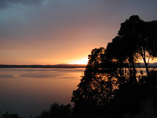
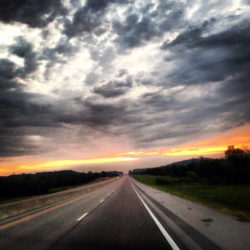
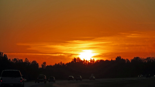
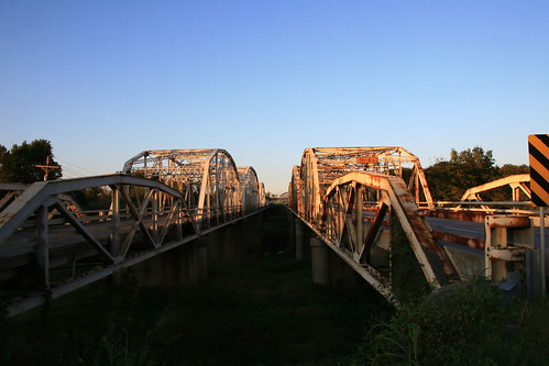
日出日落照片
W Cedar St, Claremore, OK 美国的地图
查询其他地方的日出日落时间
附近地点
S Lynn Riggs Blvd, Claremore, OK 美国La Quinta Inn & Suites Claremore
S Lynn Riggs Blvd, Claremore, OK 美国Piercing Pagoda
美国俄克拉何马克莱尔莫尔
W Blue Starr Dr, Claremore, OK 美国Chalet Apartments
W Blue Starr Dr #, Claremore, OK 美国Sen-Fields Anita
S Missouri Ave, Claremore, OK 美国
N Muskogee Pl, Claremore, OK 美国Engles Eric D MD
OK-20, Claremore, OK 美国East 20 Automotive
OK-20, Claremore, OK 美国Rogers County Pawn
S Rd, Claremore, OK 美国
S Rd, Claremore, OK 美国
E Rd, Claremore, OK 美国
N st East Ave, Catoosa, OK 美国Bruce Oakley's Port 33
OK-20, Claremore, OK 美国
Foyil, OK 美国
Andy Payne Blvd, Claremore, OK 美国
11 W Commercial St, Inola, OK 美国Inola City Hall
美国俄克拉何马伊诺拉
W. Highway 20, Pryor, OK 美国Northeast Tech - Pryor Campus
N, Adair, OK 美国Abbott Kennels/Abbott Labradors
最近搜索
- Red Dog Mine, AK, USA的日出日落时间表
- Am bhf, Borken, 德国Am Bahnhof的日出日落时间表
- 4th St E, Sonoma, CA 美国的日出日落时间表
- Oakland Ave, Williamsport, PA 美国的日出日落时间表
- Via Roma, Pieranica CR, Italy的日出日落时间表
- 克罗地亚杜布罗夫尼克 GradClock Tower of Dubrovnik的日出日落时间表
- 阿根廷丘布特省特雷利乌的日出日落时间表
- Hartfords Bluff Cir, Mt Pleasant, SC 美国的日出日落时间表
- 日本熊本县熊本市北区的日出日落时间表
- 中国福州市平潭县平潭岛的日出日落时间表
