Spring Creek Rd, Red Lodge, MT 美国的日出日落时间表
Location: 美国 > 蒙大纳 > 卡本县 > 美国蒙大纳雷德洛奇 >
时区:
America/Denver
当地时间:
2025-07-05 02:36:37
经度:
-109.3417101
纬度:
45.0819662
今天日出时间:
05:37:15 AM
今天日落时间:
09:06:59 PM
今天日照时常:
15h 29m 44s
明天日出时间:
05:37:58 AM
明天日落时间:
09:06:36 PM
明天日照时常:
15h 28m 38s
显示所有日期
| 日期 | 日出 | 日落 | 日照时常 |
|---|---|---|---|
| 2025年01月01日 | 07:55:48 AM | 04:47:18 PM | 8h 51m 30s |
| 2025年01月02日 | 07:55:46 AM | 04:48:16 PM | 8h 52m 30s |
| 2025年01月03日 | 07:55:40 AM | 04:49:16 PM | 8h 53m 36s |
| 2025年01月04日 | 07:55:33 AM | 04:50:17 PM | 8h 54m 44s |
| 2025年01月05日 | 07:55:22 AM | 04:51:20 PM | 8h 55m 58s |
| 2025年01月06日 | 07:55:09 AM | 04:52:25 PM | 8h 57m 16s |
| 2025年01月07日 | 07:54:53 AM | 04:53:31 PM | 8h 58m 38s |
| 2025年01月08日 | 07:54:35 AM | 04:54:39 PM | 9h 0m 4s |
| 2025年01月09日 | 07:54:14 AM | 04:55:48 PM | 9h 1m 34s |
| 2025年01月10日 | 07:53:51 AM | 04:56:59 PM | 9h 3m 8s |
| 2025年01月11日 | 07:53:25 AM | 04:58:11 PM | 9h 4m 46s |
| 2025年01月12日 | 07:52:57 AM | 04:59:24 PM | 9h 6m 27s |
| 2025年01月13日 | 07:52:26 AM | 05:00:38 PM | 9h 8m 12s |
| 2025年01月14日 | 07:51:52 AM | 05:01:54 PM | 9h 10m 2s |
| 2025年01月15日 | 07:51:17 AM | 05:03:11 PM | 9h 11m 54s |
| 2025年01月16日 | 07:50:38 AM | 05:04:28 PM | 9h 13m 50s |
| 2025年01月17日 | 07:49:58 AM | 05:05:47 PM | 9h 15m 49s |
| 2025年01月18日 | 07:49:15 AM | 05:07:06 PM | 9h 17m 51s |
| 2025年01月19日 | 07:48:30 AM | 05:08:26 PM | 9h 19m 56s |
| 2025年01月20日 | 07:47:43 AM | 05:09:47 PM | 9h 22m 4s |
| 2025年01月21日 | 07:46:53 AM | 05:11:09 PM | 9h 24m 16s |
| 2025年01月22日 | 07:46:01 AM | 05:12:31 PM | 9h 26m 30s |
| 2025年01月23日 | 07:45:07 AM | 05:13:54 PM | 9h 28m 47s |
| 2025年01月24日 | 07:44:11 AM | 05:15:18 PM | 9h 31m 7s |
| 2025年01月25日 | 07:43:13 AM | 05:16:42 PM | 9h 33m 29s |
| 2025年01月26日 | 07:42:12 AM | 05:18:06 PM | 9h 35m 54s |
| 2025年01月27日 | 07:41:10 AM | 05:19:31 PM | 9h 38m 21s |
| 2025年01月28日 | 07:40:06 AM | 05:20:56 PM | 9h 40m 50s |
| 2025年01月29日 | 07:39:00 AM | 05:22:21 PM | 9h 43m 21s |
| 2025年01月30日 | 07:37:52 AM | 05:23:47 PM | 9h 45m 55s |
| 2025年01月31日 | 07:36:42 AM | 05:25:13 PM | 9h 48m 31s |
| 2025年02月01日 | 07:35:30 AM | 05:26:39 PM | 9h 51m 9s |
| 2025年02月02日 | 07:34:17 AM | 05:28:05 PM | 9h 53m 48s |
| 2025年02月03日 | 07:33:02 AM | 05:29:31 PM | 9h 56m 29s |
| 2025年02月04日 | 07:31:45 AM | 05:30:58 PM | 9h 59m 13s |
| 2025年02月05日 | 07:30:27 AM | 05:32:24 PM | 10h 1m 57s |
| 2025年02月06日 | 07:29:07 AM | 05:33:50 PM | 10h 4m 43s |
| 2025年02月07日 | 07:27:45 AM | 05:35:17 PM | 10h 7m 32s |
| 2025年02月08日 | 07:26:22 AM | 05:36:43 PM | 10h 10m 21s |
| 2025年02月09日 | 07:24:57 AM | 05:38:09 PM | 10h 13m 12s |
| 2025年02月10日 | 07:23:31 AM | 05:39:35 PM | 10h 16m 4s |
| 2025年02月11日 | 07:22:04 AM | 05:41:01 PM | 10h 18m 57s |
| 2025年02月12日 | 07:20:35 AM | 05:42:27 PM | 10h 21m 52s |
| 2025年02月13日 | 07:19:05 AM | 05:43:53 PM | 10h 24m 48s |
| 2025年02月14日 | 07:17:34 AM | 05:45:18 PM | 10h 27m 44s |
| 2025年02月15日 | 07:16:01 AM | 05:46:43 PM | 10h 30m 42s |
| 2025年02月16日 | 07:14:28 AM | 05:48:08 PM | 10h 33m 40s |
| 2025年02月17日 | 07:12:53 AM | 05:49:33 PM | 10h 36m 40s |
| 2025年02月18日 | 07:11:17 AM | 05:50:57 PM | 10h 39m 40s |
| 2025年02月19日 | 07:09:40 AM | 05:52:22 PM | 10h 42m 42s |
| 2025年02月20日 | 07:08:02 AM | 05:53:46 PM | 10h 45m 44s |
| 2025年02月21日 | 07:06:22 AM | 05:55:10 PM | 10h 48m 48s |
| 2025年02月22日 | 07:04:42 AM | 05:56:33 PM | 10h 51m 51s |
| 2025年02月23日 | 07:03:01 AM | 05:57:56 PM | 10h 54m 55s |
| 2025年02月24日 | 07:01:20 AM | 05:59:19 PM | 10h 57m 59s |
| 2025年02月25日 | 06:59:37 AM | 06:00:42 PM | 11h 1m 5s |
| 2025年02月26日 | 06:57:53 AM | 06:02:04 PM | 11h 4m 11s |
| 2025年02月27日 | 06:56:09 AM | 06:03:26 PM | 11h 7m 17s |
| 2025年02月28日 | 06:54:24 AM | 06:04:48 PM | 11h 10m 24s |
| 2025年03月01日 | 06:52:38 AM | 06:06:10 PM | 11h 13m 32s |
| 2025年03月02日 | 06:50:52 AM | 06:07:31 PM | 11h 16m 39s |
| 2025年03月03日 | 06:49:05 AM | 06:08:52 PM | 11h 19m 47s |
| 2025年03月04日 | 06:47:17 AM | 06:10:12 PM | 11h 22m 55s |
| 2025年03月05日 | 06:45:29 AM | 06:11:33 PM | 11h 26m 4s |
| 2025年03月06日 | 06:43:40 AM | 06:12:53 PM | 11h 29m 13s |
| 2025年03月07日 | 06:41:51 AM | 06:14:13 PM | 11h 32m 22s |
| 2025年03月08日 | 06:40:01 AM | 06:15:32 PM | 11h 35m 31s |
| 2025年03月09日 | 07:38:15 AM | 07:16:49 PM | 11h 38m 34s |
| 2025年03月10日 | 07:36:25 AM | 07:18:08 PM | 11h 41m 43s |
| 2025年03月11日 | 07:34:34 AM | 07:19:27 PM | 11h 44m 53s |
| 2025年03月12日 | 07:32:42 AM | 07:20:45 PM | 11h 48m 3s |
| 2025年03月13日 | 07:30:51 AM | 07:22:04 PM | 11h 51m 13s |
| 2025年03月14日 | 07:28:59 AM | 07:23:22 PM | 11h 54m 23s |
| 2025年03月15日 | 07:27:07 AM | 07:24:40 PM | 11h 57m 33s |
| 2025年03月16日 | 07:25:14 AM | 07:25:58 PM | 12h 0m 44s |
| 2025年03月17日 | 07:23:22 AM | 07:27:16 PM | 12h 3m 54s |
| 2025年03月18日 | 07:21:29 AM | 07:28:34 PM | 12h 7m 5s |
| 2025年03月19日 | 07:19:36 AM | 07:29:51 PM | 12h 10m 15s |
| 2025年03月20日 | 07:17:43 AM | 07:31:08 PM | 12h 13m 25s |
| 2025年03月21日 | 07:15:50 AM | 07:32:25 PM | 12h 16m 35s |
| 2025年03月22日 | 07:13:57 AM | 07:33:42 PM | 12h 19m 45s |
| 2025年03月23日 | 07:12:04 AM | 07:34:59 PM | 12h 22m 55s |
| 2025年03月24日 | 07:10:11 AM | 07:36:16 PM | 12h 26m 5s |
| 2025年03月25日 | 07:08:18 AM | 07:37:33 PM | 12h 29m 15s |
| 2025年03月26日 | 07:06:26 AM | 07:38:49 PM | 12h 32m 23s |
| 2025年03月27日 | 07:04:33 AM | 07:40:06 PM | 12h 35m 33s |
| 2025年03月28日 | 07:02:40 AM | 07:41:22 PM | 12h 38m 42s |
| 2025年03月29日 | 07:00:48 AM | 07:42:39 PM | 12h 41m 51s |
| 2025年03月30日 | 06:58:56 AM | 07:43:55 PM | 12h 44m 59s |
| 2025年03月31日 | 06:57:04 AM | 07:45:11 PM | 12h 48m 7s |
| 2025年04月01日 | 06:55:13 AM | 07:46:28 PM | 12h 51m 15s |
| 2025年04月02日 | 06:53:21 AM | 07:47:44 PM | 12h 54m 23s |
| 2025年04月03日 | 06:51:30 AM | 07:49:00 PM | 12h 57m 30s |
| 2025年04月04日 | 06:49:40 AM | 07:50:16 PM | 13h 0m 36s |
| 2025年04月05日 | 06:47:50 AM | 07:51:32 PM | 13h 3m 42s |
| 2025年04月06日 | 06:46:00 AM | 07:52:48 PM | 13h 6m 48s |
| 2025年04月07日 | 06:44:11 AM | 07:54:04 PM | 13h 9m 53s |
| 2025年04月08日 | 06:42:22 AM | 07:55:20 PM | 13h 12m 58s |
| 2025年04月09日 | 06:40:34 AM | 07:56:37 PM | 13h 16m 3s |
| 2025年04月10日 | 06:38:46 AM | 07:57:53 PM | 13h 19m 7s |
| 2025年04月11日 | 06:36:59 AM | 07:59:09 PM | 13h 22m 10s |
| 2025年04月12日 | 06:35:13 AM | 08:00:25 PM | 13h 25m 12s |
| 2025年04月13日 | 06:33:27 AM | 08:01:41 PM | 13h 28m 14s |
| 2025年04月14日 | 06:31:42 AM | 08:02:57 PM | 13h 31m 15s |
| 2025年04月15日 | 06:29:57 AM | 08:04:13 PM | 13h 34m 16s |
| 2025年04月16日 | 06:28:14 AM | 08:05:29 PM | 13h 37m 15s |
| 2025年04月17日 | 06:26:31 AM | 08:06:45 PM | 13h 40m 14s |
| 2025年04月18日 | 06:24:49 AM | 08:08:01 PM | 13h 43m 12s |
| 2025年04月19日 | 06:23:08 AM | 08:09:17 PM | 13h 46m 9s |
| 2025年04月20日 | 06:21:28 AM | 08:10:33 PM | 13h 49m 5s |
| 2025年04月21日 | 06:19:49 AM | 08:11:49 PM | 13h 52m 0s |
| 2025年04月22日 | 06:18:11 AM | 08:13:05 PM | 13h 54m 54s |
| 2025年04月23日 | 06:16:33 AM | 08:14:20 PM | 13h 57m 47s |
| 2025年04月24日 | 06:14:57 AM | 08:15:36 PM | 14h 0m 39s |
| 2025年04月25日 | 06:13:22 AM | 08:16:52 PM | 14h 3m 30s |
| 2025年04月26日 | 06:11:48 AM | 08:18:07 PM | 14h 6m 19s |
| 2025年04月27日 | 06:10:15 AM | 08:19:23 PM | 14h 9m 8s |
| 2025年04月28日 | 06:08:43 AM | 08:20:38 PM | 14h 11m 55s |
| 2025年04月29日 | 06:07:13 AM | 08:21:53 PM | 14h 14m 40s |
| 2025年04月30日 | 06:05:44 AM | 08:23:08 PM | 14h 17m 24s |
| 2025年05月01日 | 06:04:16 AM | 08:24:22 PM | 14h 20m 6s |
| 2025年05月02日 | 06:02:49 AM | 08:25:36 PM | 14h 22m 47s |
| 2025年05月03日 | 06:01:24 AM | 08:26:51 PM | 14h 25m 27s |
| 2025年05月04日 | 06:00:00 AM | 08:28:04 PM | 14h 28m 4s |
| 2025年05月05日 | 05:58:38 AM | 08:29:18 PM | 14h 30m 40s |
| 2025年05月06日 | 05:57:17 AM | 08:30:31 PM | 14h 33m 14s |
| 2025年05月07日 | 05:55:58 AM | 08:31:44 PM | 14h 35m 46s |
| 2025年05月08日 | 05:54:40 AM | 08:32:56 PM | 14h 38m 16s |
| 2025年05月09日 | 05:53:24 AM | 08:34:08 PM | 14h 40m 44s |
| 2025年05月10日 | 05:52:09 AM | 08:35:20 PM | 14h 43m 11s |
| 2025年05月11日 | 05:50:56 AM | 08:36:30 PM | 14h 45m 34s |
| 2025年05月12日 | 05:49:45 AM | 08:37:41 PM | 14h 47m 56s |
| 2025年05月13日 | 05:48:35 AM | 08:38:51 PM | 14h 50m 16s |
| 2025年05月14日 | 05:47:28 AM | 08:40:00 PM | 14h 52m 32s |
| 2025年05月15日 | 05:46:22 AM | 08:41:08 PM | 14h 54m 46s |
| 2025年05月16日 | 05:45:18 AM | 08:42:16 PM | 14h 56m 58s |
| 2025年05月17日 | 05:44:15 AM | 08:43:23 PM | 14h 59m 8s |
| 2025年05月18日 | 05:43:15 AM | 08:44:29 PM | 15h 1m 14s |
| 2025年05月19日 | 05:42:17 AM | 08:45:35 PM | 15h 3m 18s |
| 2025年05月20日 | 05:41:20 AM | 08:46:39 PM | 15h 5m 19s |
| 2025年05月21日 | 05:40:26 AM | 08:47:43 PM | 15h 7m 17s |
| 2025年05月22日 | 05:39:33 AM | 08:48:45 PM | 15h 9m 12s |
| 2025年05月23日 | 05:38:43 AM | 08:49:47 PM | 15h 11m 4s |
| 2025年05月24日 | 05:37:54 AM | 08:50:47 PM | 15h 12m 53s |
| 2025年05月25日 | 05:37:08 AM | 08:51:46 PM | 15h 14m 38s |
| 2025年05月26日 | 05:36:24 AM | 08:52:45 PM | 15h 16m 21s |
| 2025年05月27日 | 05:35:42 AM | 08:53:41 PM | 15h 17m 59s |
| 2025年05月28日 | 05:35:03 AM | 08:54:37 PM | 15h 19m 34s |
| 2025年05月29日 | 05:34:25 AM | 08:55:31 PM | 15h 21m 6s |
| 2025年05月30日 | 05:33:50 AM | 08:56:24 PM | 15h 22m 34s |
| 2025年05月31日 | 05:33:17 AM | 08:57:15 PM | 15h 23m 58s |
| 2025年06月01日 | 05:32:46 AM | 08:58:05 PM | 15h 25m 19s |
| 2025年06月02日 | 05:32:18 AM | 08:58:54 PM | 15h 26m 36s |
| 2025年06月03日 | 05:31:51 AM | 08:59:41 PM | 15h 27m 50s |
| 2025年06月04日 | 05:31:27 AM | 09:00:26 PM | 15h 28m 59s |
| 2025年06月05日 | 05:31:06 AM | 09:01:09 PM | 15h 30m 3s |
| 2025年06月06日 | 05:30:47 AM | 09:01:51 PM | 15h 31m 4s |
| 2025年06月07日 | 05:30:30 AM | 09:02:31 PM | 15h 32m 1s |
| 2025年06月08日 | 05:30:15 AM | 09:03:09 PM | 15h 32m 54s |
| 2025年06月09日 | 05:30:03 AM | 09:03:45 PM | 15h 33m 42s |
| 2025年06月10日 | 05:29:53 AM | 09:04:19 PM | 15h 34m 26s |
| 2025年06月11日 | 05:29:45 AM | 09:04:52 PM | 15h 35m 7s |
| 2025年06月12日 | 05:29:40 AM | 09:05:22 PM | 15h 35m 42s |
| 2025年06月13日 | 05:29:37 AM | 09:05:51 PM | 15h 36m 14s |
| 2025年06月14日 | 05:29:37 AM | 09:06:17 PM | 15h 36m 40s |
| 2025年06月15日 | 05:29:38 AM | 09:06:41 PM | 15h 37m 3s |
| 2025年06月16日 | 05:29:42 AM | 09:07:03 PM | 15h 37m 21s |
| 2025年06月17日 | 05:29:49 AM | 09:07:23 PM | 15h 37m 34s |
| 2025年06月18日 | 05:29:57 AM | 09:07:40 PM | 15h 37m 43s |
| 2025年06月19日 | 05:30:08 AM | 09:07:56 PM | 15h 37m 48s |
| 2025年06月20日 | 05:30:21 AM | 09:08:09 PM | 15h 37m 48s |
| 2025年06月21日 | 05:30:36 AM | 09:08:20 PM | 15h 37m 44s |
| 2025年06月22日 | 05:30:53 AM | 09:08:29 PM | 15h 37m 36s |
| 2025年06月23日 | 05:31:13 AM | 09:08:35 PM | 15h 37m 22s |
| 2025年06月24日 | 05:31:34 AM | 09:08:39 PM | 15h 37m 5s |
| 2025年06月25日 | 05:31:58 AM | 09:08:40 PM | 15h 36m 42s |
| 2025年06月26日 | 05:32:24 AM | 09:08:40 PM | 15h 36m 16s |
| 2025年06月27日 | 05:32:51 AM | 09:08:37 PM | 15h 35m 46s |
| 2025年06月28日 | 05:33:21 AM | 09:08:31 PM | 15h 35m 10s |
| 2025年06月29日 | 05:33:52 AM | 09:08:23 PM | 15h 34m 31s |
| 2025年06月30日 | 05:34:26 AM | 09:08:13 PM | 15h 33m 47s |
| 2025年07月01日 | 05:35:01 AM | 09:08:00 PM | 15h 32m 59s |
| 2025年07月02日 | 05:35:38 AM | 09:07:45 PM | 15h 32m 7s |
| 2025年07月03日 | 05:36:17 AM | 09:07:28 PM | 15h 31m 11s |
| 2025年07月04日 | 05:36:57 AM | 09:07:08 PM | 15h 30m 11s |
| 2025年07月05日 | 05:37:40 AM | 09:06:46 PM | 15h 29m 6s |
| 2025年07月06日 | 05:38:23 AM | 09:06:22 PM | 15h 27m 59s |
| 2025年07月07日 | 05:39:09 AM | 09:05:55 PM | 15h 26m 46s |
| 2025年07月08日 | 05:39:56 AM | 09:05:26 PM | 15h 25m 30s |
| 2025年07月09日 | 05:40:44 AM | 09:04:54 PM | 15h 24m 10s |
| 2025年07月10日 | 05:41:34 AM | 09:04:20 PM | 15h 22m 46s |
| 2025年07月11日 | 05:42:25 AM | 09:03:44 PM | 15h 21m 19s |
| 2025年07月12日 | 05:43:17 AM | 09:03:06 PM | 15h 19m 49s |
| 2025年07月13日 | 05:44:11 AM | 09:02:26 PM | 15h 18m 15s |
| 2025年07月14日 | 05:45:06 AM | 09:01:43 PM | 15h 16m 37s |
| 2025年07月15日 | 05:46:02 AM | 09:00:58 PM | 15h 14m 56s |
| 2025年07月16日 | 05:46:59 AM | 09:00:11 PM | 15h 13m 12s |
| 2025年07月17日 | 05:47:57 AM | 08:59:22 PM | 15h 11m 25s |
| 2025年07月18日 | 05:48:56 AM | 08:58:30 PM | 15h 9m 34s |
| 2025年07月19日 | 05:49:57 AM | 08:57:37 PM | 15h 7m 40s |
| 2025年07月20日 | 05:50:58 AM | 08:56:42 PM | 15h 5m 44s |
| 2025年07月21日 | 05:52:00 AM | 08:55:44 PM | 15h 3m 44s |
| 2025年07月22日 | 05:53:02 AM | 08:54:45 PM | 15h 1m 43s |
| 2025年07月23日 | 05:54:06 AM | 08:53:44 PM | 14h 59m 38s |
| 2025年07月24日 | 05:55:10 AM | 08:52:40 PM | 14h 57m 30s |
| 2025年07月25日 | 05:56:15 AM | 08:51:35 PM | 14h 55m 20s |
| 2025年07月26日 | 05:57:21 AM | 08:50:28 PM | 14h 53m 7s |
| 2025年07月27日 | 05:58:27 AM | 08:49:19 PM | 14h 50m 52s |
| 2025年07月28日 | 05:59:34 AM | 08:48:09 PM | 14h 48m 35s |
| 2025年07月29日 | 06:00:41 AM | 08:46:56 PM | 14h 46m 15s |
| 2025年07月30日 | 06:01:49 AM | 08:45:42 PM | 14h 43m 53s |
| 2025年07月31日 | 06:02:57 AM | 08:44:27 PM | 14h 41m 30s |
| 2025年08月01日 | 06:04:06 AM | 08:43:09 PM | 14h 39m 3s |
| 2025年08月02日 | 06:05:15 AM | 08:41:50 PM | 14h 36m 35s |
| 2025年08月03日 | 06:06:25 AM | 08:40:30 PM | 14h 34m 5s |
| 2025年08月04日 | 06:07:34 AM | 08:39:08 PM | 14h 31m 34s |
| 2025年08月05日 | 06:08:44 AM | 08:37:44 PM | 14h 29m 0s |
| 2025年08月06日 | 06:09:55 AM | 08:36:19 PM | 14h 26m 24s |
| 2025年08月07日 | 06:11:05 AM | 08:34:53 PM | 14h 23m 48s |
| 2025年08月08日 | 06:12:16 AM | 08:33:25 PM | 14h 21m 9s |
| 2025年08月09日 | 06:13:27 AM | 08:31:56 PM | 14h 18m 29s |
| 2025年08月10日 | 06:14:38 AM | 08:30:26 PM | 14h 15m 48s |
| 2025年08月11日 | 06:15:49 AM | 08:28:54 PM | 14h 13m 5s |
| 2025年08月12日 | 06:17:01 AM | 08:27:21 PM | 14h 10m 20s |
| 2025年08月13日 | 06:18:12 AM | 08:25:47 PM | 14h 7m 35s |
| 2025年08月14日 | 06:19:24 AM | 08:24:12 PM | 14h 4m 48s |
| 2025年08月15日 | 06:20:35 AM | 08:22:36 PM | 14h 2m 1s |
| 2025年08月16日 | 06:21:47 AM | 08:20:58 PM | 13h 59m 11s |
| 2025年08月17日 | 06:22:59 AM | 08:19:20 PM | 13h 56m 21s |
| 2025年08月18日 | 06:24:11 AM | 08:17:40 PM | 13h 53m 29s |
| 2025年08月19日 | 06:25:22 AM | 08:16:00 PM | 13h 50m 38s |
| 2025年08月20日 | 06:26:34 AM | 08:14:18 PM | 13h 47m 44s |
| 2025年08月21日 | 06:27:46 AM | 08:12:36 PM | 13h 44m 50s |
| 2025年08月22日 | 06:28:58 AM | 08:10:53 PM | 13h 41m 55s |
| 2025年08月23日 | 06:30:10 AM | 08:09:08 PM | 13h 38m 58s |
| 2025年08月24日 | 06:31:21 AM | 08:07:24 PM | 13h 36m 3s |
| 2025年08月25日 | 06:32:33 AM | 08:05:38 PM | 13h 33m 5s |
| 2025年08月26日 | 06:33:45 AM | 08:03:51 PM | 13h 30m 6s |
| 2025年08月27日 | 06:34:56 AM | 08:02:04 PM | 13h 27m 8s |
| 2025年08月28日 | 06:36:08 AM | 08:00:16 PM | 13h 24m 8s |
| 2025年08月29日 | 06:37:20 AM | 07:58:28 PM | 13h 21m 8s |
| 2025年08月30日 | 06:38:31 AM | 07:56:39 PM | 13h 18m 8s |
| 2025年08月31日 | 06:39:43 AM | 07:54:49 PM | 13h 15m 6s |
| 2025年09月01日 | 06:40:55 AM | 07:52:59 PM | 13h 12m 4s |
| 2025年09月02日 | 06:42:06 AM | 07:51:08 PM | 13h 9m 2s |
| 2025年09月03日 | 06:43:18 AM | 07:49:17 PM | 13h 5m 59s |
| 2025年09月04日 | 06:44:29 AM | 07:47:25 PM | 13h 2m 56s |
| 2025年09月05日 | 06:45:41 AM | 07:45:33 PM | 12h 59m 52s |
| 2025年09月06日 | 06:46:52 AM | 07:43:41 PM | 12h 56m 49s |
| 2025年09月07日 | 06:48:04 AM | 07:41:48 PM | 12h 53m 44s |
| 2025年09月08日 | 06:49:15 AM | 07:39:55 PM | 12h 50m 40s |
| 2025年09月09日 | 06:50:27 AM | 07:38:01 PM | 12h 47m 34s |
| 2025年09月10日 | 06:51:38 AM | 07:36:07 PM | 12h 44m 29s |
| 2025年09月11日 | 06:52:50 AM | 07:34:13 PM | 12h 41m 23s |
| 2025年09月12日 | 06:54:01 AM | 07:32:19 PM | 12h 38m 18s |
| 2025年09月13日 | 06:55:13 AM | 07:30:24 PM | 12h 35m 11s |
| 2025年09月14日 | 06:56:25 AM | 07:28:30 PM | 12h 32m 5s |
| 2025年09月15日 | 06:57:37 AM | 07:26:35 PM | 12h 28m 58s |
| 2025年09月16日 | 06:58:49 AM | 07:24:40 PM | 12h 25m 51s |
| 2025年09月17日 | 07:00:01 AM | 07:22:45 PM | 12h 22m 44s |
| 2025年09月18日 | 07:01:13 AM | 07:20:51 PM | 12h 19m 38s |
| 2025年09月19日 | 07:02:25 AM | 07:18:56 PM | 12h 16m 31s |
| 2025年09月20日 | 07:03:37 AM | 07:17:01 PM | 12h 13m 24s |
| 2025年09月21日 | 07:04:50 AM | 07:15:06 PM | 12h 10m 16s |
| 2025年09月22日 | 07:06:02 AM | 07:13:11 PM | 12h 7m 9s |
| 2025年09月23日 | 07:07:15 AM | 07:11:17 PM | 12h 4m 2s |
| 2025年09月24日 | 07:08:28 AM | 07:09:22 PM | 12h 0m 54s |
| 2025年09月25日 | 07:09:41 AM | 07:07:28 PM | 11h 57m 47s |
| 2025年09月26日 | 07:10:54 AM | 07:05:34 PM | 11h 54m 40s |
| 2025年09月27日 | 07:12:08 AM | 07:03:40 PM | 11h 51m 32s |
| 2025年09月28日 | 07:13:22 AM | 07:01:46 PM | 11h 48m 24s |
| 2025年09月29日 | 07:14:35 AM | 06:59:53 PM | 11h 45m 18s |
| 2025年09月30日 | 07:15:50 AM | 06:58:00 PM | 11h 42m 10s |
| 2025年10月01日 | 07:17:04 AM | 06:56:08 PM | 11h 39m 4s |
| 2025年10月02日 | 07:18:19 AM | 06:54:16 PM | 11h 35m 57s |
| 2025年10月03日 | 07:19:33 AM | 06:52:24 PM | 11h 32m 51s |
| 2025年10月04日 | 07:20:49 AM | 06:50:33 PM | 11h 29m 44s |
| 2025年10月05日 | 07:22:04 AM | 06:48:42 PM | 11h 26m 38s |
| 2025年10月06日 | 07:23:20 AM | 06:46:51 PM | 11h 23m 31s |
| 2025年10月07日 | 07:24:36 AM | 06:45:02 PM | 11h 20m 26s |
| 2025年10月08日 | 07:25:52 AM | 06:43:13 PM | 11h 17m 21s |
| 2025年10月09日 | 07:27:08 AM | 06:41:24 PM | 11h 14m 16s |
| 2025年10月10日 | 07:28:25 AM | 06:39:36 PM | 11h 11m 11s |
| 2025年10月11日 | 07:29:42 AM | 06:37:49 PM | 11h 8m 7s |
| 2025年10月12日 | 07:31:00 AM | 06:36:03 PM | 11h 5m 3s |
| 2025年10月13日 | 07:32:17 AM | 06:34:17 PM | 11h 2m 0s |
| 2025年10月14日 | 07:33:35 AM | 06:32:32 PM | 10h 58m 57s |
| 2025年10月15日 | 07:34:54 AM | 06:30:48 PM | 10h 55m 54s |
| 2025年10月16日 | 07:36:12 AM | 06:29:05 PM | 10h 52m 53s |
| 2025年10月17日 | 07:37:31 AM | 06:27:23 PM | 10h 49m 52s |
| 2025年10月18日 | 07:38:51 AM | 06:25:42 PM | 10h 46m 51s |
| 2025年10月19日 | 07:40:10 AM | 06:24:01 PM | 10h 43m 51s |
| 2025年10月20日 | 07:41:30 AM | 06:22:22 PM | 10h 40m 52s |
| 2025年10月21日 | 07:42:50 AM | 06:20:44 PM | 10h 37m 54s |
| 2025年10月22日 | 07:44:11 AM | 06:19:06 PM | 10h 34m 55s |
| 2025年10月23日 | 07:45:31 AM | 06:17:30 PM | 10h 31m 59s |
| 2025年10月24日 | 07:46:52 AM | 06:15:55 PM | 10h 29m 3s |
| 2025年10月25日 | 07:48:13 AM | 06:14:22 PM | 10h 26m 9s |
| 2025年10月26日 | 07:49:35 AM | 06:12:49 PM | 10h 23m 14s |
| 2025年10月27日 | 07:50:57 AM | 06:11:18 PM | 10h 20m 21s |
| 2025年10月28日 | 07:52:18 AM | 06:09:48 PM | 10h 17m 30s |
| 2025年10月29日 | 07:53:40 AM | 06:08:20 PM | 10h 14m 40s |
| 2025年10月30日 | 07:55:03 AM | 06:06:52 PM | 10h 11m 49s |
| 2025年10月31日 | 07:56:25 AM | 06:05:27 PM | 10h 9m 2s |
| 2025年11月01日 | 07:57:48 AM | 06:04:03 PM | 10h 6m 15s |
| 2025年11月02日 | 06:59:14 AM | 05:02:36 PM | 10h 3m 22s |
| 2025年11月03日 | 07:00:36 AM | 05:01:15 PM | 10h 0m 39s |
| 2025年11月04日 | 07:01:59 AM | 04:59:56 PM | 9h 57m 57s |
| 2025年11月05日 | 07:03:22 AM | 04:58:38 PM | 9h 55m 16s |
| 2025年11月06日 | 07:04:45 AM | 04:57:22 PM | 9h 52m 37s |
| 2025年11月07日 | 07:06:07 AM | 04:56:08 PM | 9h 50m 1s |
| 2025年11月08日 | 07:07:30 AM | 04:54:55 PM | 9h 47m 25s |
| 2025年11月09日 | 07:08:52 AM | 04:53:44 PM | 9h 44m 52s |
| 2025年11月10日 | 07:10:15 AM | 04:52:35 PM | 9h 42m 20s |
| 2025年11月11日 | 07:11:37 AM | 04:51:28 PM | 9h 39m 51s |
| 2025年11月12日 | 07:12:59 AM | 04:50:23 PM | 9h 37m 24s |
| 2025年11月13日 | 07:14:20 AM | 04:49:20 PM | 9h 35m 0s |
| 2025年11月14日 | 07:15:42 AM | 04:48:19 PM | 9h 32m 37s |
| 2025年11月15日 | 07:17:03 AM | 04:47:20 PM | 9h 30m 17s |
| 2025年11月16日 | 07:18:23 AM | 04:46:23 PM | 9h 28m 0s |
| 2025年11月17日 | 07:19:43 AM | 04:45:28 PM | 9h 25m 45s |
| 2025年11月18日 | 07:21:03 AM | 04:44:35 PM | 9h 23m 32s |
| 2025年11月19日 | 07:22:22 AM | 04:43:45 PM | 9h 21m 23s |
| 2025年11月20日 | 07:23:40 AM | 04:42:57 PM | 9h 19m 17s |
| 2025年11月21日 | 07:24:57 AM | 04:42:11 PM | 9h 17m 14s |
| 2025年11月22日 | 07:26:14 AM | 04:41:27 PM | 9h 15m 13s |
| 2025年11月23日 | 07:27:30 AM | 04:40:46 PM | 9h 13m 16s |
| 2025年11月24日 | 07:28:45 AM | 04:40:07 PM | 9h 11m 22s |
| 2025年11月25日 | 07:30:00 AM | 04:39:31 PM | 9h 9m 31s |
| 2025年11月26日 | 07:31:13 AM | 04:38:57 PM | 9h 7m 44s |
| 2025年11月27日 | 07:32:25 AM | 04:38:25 PM | 9h 6m 0s |
| 2025年11月28日 | 07:33:36 AM | 04:37:56 PM | 9h 4m 20s |
| 2025年11月29日 | 07:34:46 AM | 04:37:30 PM | 9h 2m 44s |
| 2025年11月30日 | 07:35:55 AM | 04:37:06 PM | 9h 1m 11s |
| 2025年12月01日 | 07:37:02 AM | 04:36:45 PM | 8h 59m 43s |
| 2025年12月02日 | 07:38:08 AM | 04:36:26 PM | 8h 58m 18s |
| 2025年12月03日 | 07:39:12 AM | 04:36:10 PM | 8h 56m 58s |
| 2025年12月04日 | 07:40:16 AM | 04:35:56 PM | 8h 55m 40s |
| 2025年12月05日 | 07:41:17 AM | 04:35:46 PM | 8h 54m 29s |
| 2025年12月06日 | 07:42:17 AM | 04:35:37 PM | 8h 53m 20s |
| 2025年12月07日 | 07:43:15 AM | 04:35:32 PM | 8h 52m 17s |
| 2025年12月08日 | 07:44:11 AM | 04:35:29 PM | 8h 51m 18s |
| 2025年12月09日 | 07:45:06 AM | 04:35:29 PM | 8h 50m 23s |
| 2025年12月10日 | 07:45:59 AM | 04:35:31 PM | 8h 49m 32s |
| 2025年12月11日 | 07:46:49 AM | 04:35:36 PM | 8h 48m 47s |
| 2025年12月12日 | 07:47:38 AM | 04:35:44 PM | 8h 48m 6s |
| 2025年12月13日 | 07:48:25 AM | 04:35:55 PM | 8h 47m 30s |
| 2025年12月14日 | 07:49:09 AM | 04:36:08 PM | 8h 46m 59s |
| 2025年12月15日 | 07:49:52 AM | 04:36:23 PM | 8h 46m 31s |
| 2025年12月16日 | 07:50:32 AM | 04:36:42 PM | 8h 46m 10s |
| 2025年12月17日 | 07:51:10 AM | 04:37:03 PM | 8h 45m 53s |
| 2025年12月18日 | 07:51:46 AM | 04:37:26 PM | 8h 45m 40s |
| 2025年12月19日 | 07:52:20 AM | 04:37:52 PM | 8h 45m 32s |
| 2025年12月20日 | 07:52:51 AM | 04:38:21 PM | 8h 45m 30s |
| 2025年12月21日 | 07:53:19 AM | 04:38:52 PM | 8h 45m 33s |
| 2025年12月22日 | 07:53:46 AM | 04:39:25 PM | 8h 45m 39s |
| 2025年12月23日 | 07:54:09 AM | 04:40:01 PM | 8h 45m 52s |
| 2025年12月24日 | 07:54:31 AM | 04:40:39 PM | 8h 46m 8s |
| 2025年12月25日 | 07:54:49 AM | 04:41:20 PM | 8h 46m 31s |
| 2025年12月26日 | 07:55:06 AM | 04:42:03 PM | 8h 46m 57s |
| 2025年12月27日 | 07:55:19 AM | 04:42:48 PM | 8h 47m 29s |
| 2025年12月28日 | 07:55:30 AM | 04:43:35 PM | 8h 48m 5s |
| 2025年12月29日 | 07:55:39 AM | 04:44:24 PM | 8h 48m 45s |
| 2025年12月30日 | 07:55:45 AM | 04:45:16 PM | 8h 49m 31s |
| 2025年12月31日 | 07:55:48 AM | 04:46:09 PM | 8h 50m 21s |
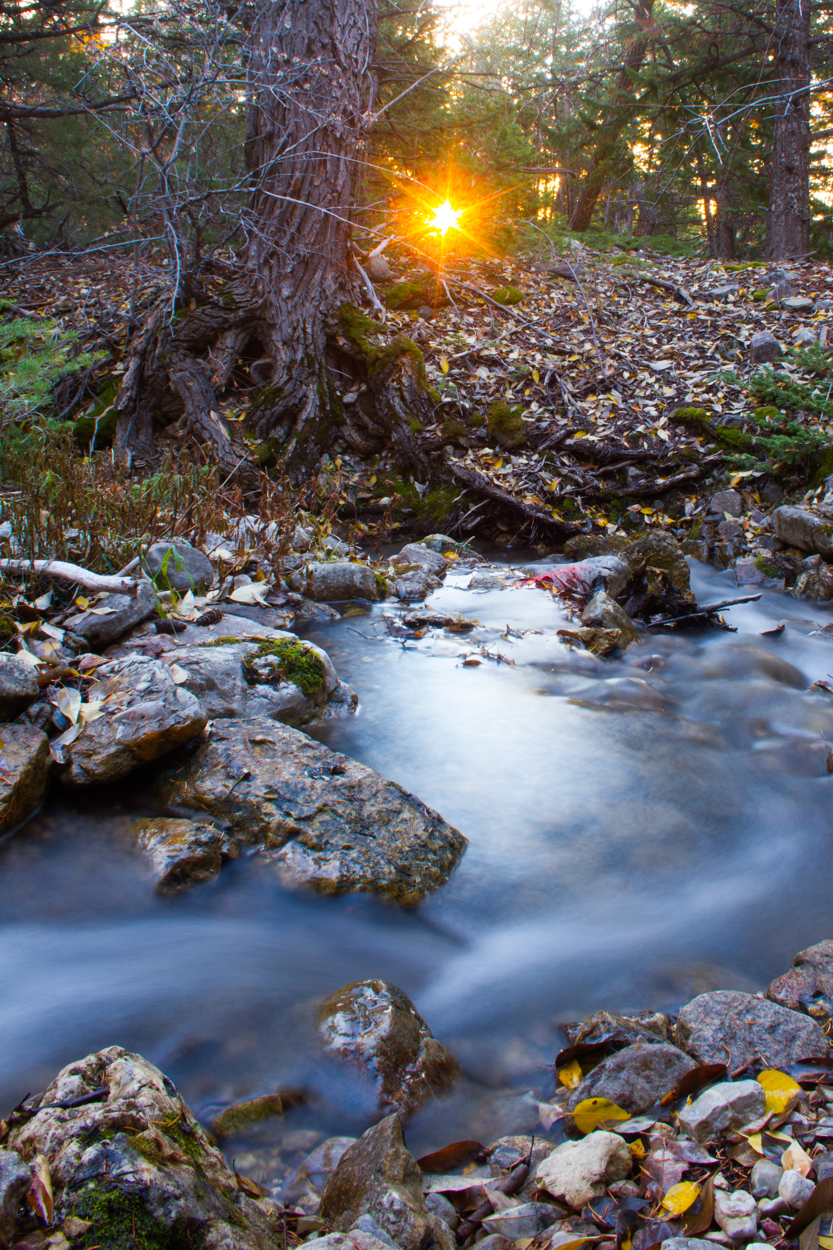
日出日落照片

Basin of Light

Beartooth Plateau Sunset
Red Lodge Panorama

Quinnebaugh Meadows

High atop the tundra, revisiting Beartooth

On the Road in Beartooth

Beartooth Pass

Panorama: Road into Rock Creek Valley

Beartooth Pass, Wyoming

Highlands Sunset

Fire in the Sky...

A Wave Goodbye

Top of the World. Photo by @znazari #yellowstone #beartoothhighway #allamericanroad #montana #roadtrip #sunset
Evening Mammatus

Frosted Sky

Camp Senia Sky

Pilot Peak Sunset

Red Lodge Sunset

Remains of the Smith coal mine

Pink & Purple Morning

Morning Solitude

Summer Storm, Carbon County, MT
Beartooth Pass - Along the Scenic Outlook

Guards of the Wild

The Best Time

Beartooth Pass - Scenic Valley

Waking Up

Rising Edge of the Mountains
Meeteetse Trail
Morning Burst

Timberline Lake From up high sunrise

Sunrise on September Morn
Spring Creek Rd, Red Lodge, MT 美国的地图
查询其他地方的日出日落时间
附近地点
35 Bull Moose Ln, Red Lodge, MT 美国
Richel Lodge, MT 美国
美国蒙大纳雷德洛奇SHERIDAN
42 Silver Run Rd, Red Lodge, MT 美国
美国蒙大纳雷德洛奇Greenough Lake Campground
3 Lower Wapiti Valley Rd, Red Lodge, MT 美国
美国蒙大纳雷德洛奇Basin Campground
Meeteetse Meadow Rd, Red Lodge, MT 美国Meeteetse Meadow Road
Meeteetse Meadows Rd, Montana 美国Meeteetse Meadows Road
美国蒙大纳雷德洛奇Hellroaring Plateau Trailhead
Broadway Ave S, Red Lodge, MT 美国Beartooth Hideaway Inn & Cabins
Grant Ave S, Red Lodge, MT 美国
美国蒙大纳雷德洛奇
11 Mountainbrook Dr, Red Lodge, MT 美国
US-, Red Lodge, MT 美国Beartooth All-American Road
US Hwy, Red Lodge, MT 美国Glacier Lake Trailhead
Barlow Creek Spur, Montana 美国
37 Red Lodge Creek Ranch Rd, Red Lodge, MT 美国
美国蒙大纳贝尔弗里
E Rosebud Rd, Roscoe, MT 美国
最近搜索
- Red Dog Mine, AK, USA的日出日落时间表
- Am bhf, Borken, 德国Am Bahnhof的日出日落时间表
- 4th St E, Sonoma, CA 美国的日出日落时间表
- Oakland Ave, Williamsport, PA 美国的日出日落时间表
- Via Roma, Pieranica CR, Italy的日出日落时间表
- 克罗地亚杜布罗夫尼克 GradClock Tower of Dubrovnik的日出日落时间表
- 阿根廷丘布特省特雷利乌的日出日落时间表
- Hartfords Bluff Cir, Mt Pleasant, SC 美国的日出日落时间表
- 日本熊本县熊本市北区的日出日落时间表
- 中国福州市平潭县平潭岛的日出日落时间表