时区:尼泊尔时间
当地时间:2026年11月15日星期日下午4点55分
经度:83.0576156
纬度:28.8441957
今天日出时间:06:36:48
今天日落时间:17:20:35
今天日照时长:10小时43分46秒
明天日出时间:06:37:37
明天日落时间:17:20:08
明天日照时长:10小时42分31秒

: 显示所有日期

日期 日出时间 日落时间 日照时长
2026年1月1日 07:06:55 17:26:40 10小时19分45秒
2026年2月1日 07:03:18 17:51:27 10小时48分9秒
2026年3月1日 06:41:02 18:12:44 11小时31分42秒
2026年4月1日 06:05:34 18:30:53 12小时25分19秒
2026年5月1日 05:34:08 18:48:20 13小时14分12秒
2026年6月1日 05:16:34 19:07:07 13小时50分32秒
2026年7月1日 05:18:37 19:16:21 13小时57分44秒
2026年8月1日 05:34:10 19:06:36 13小时32分25秒
2026年9月1日 05:51:23 18:38:09 12小时46分46秒
2026年10月1日 06:06:11 18:02:08 11小时55分57秒
2026年11月1日 06:25:11 17:30:03 11小时4分52秒
2026年11月15日 06:36:00 17:21:03 10小时45分3秒
2026年11月16日 06:36:48 17:20:35 10小时43分46秒
2026年12月1日 06:48:54 17:16:37 10小时27分43秒

日出日落照片

Valley by ::ErWin, Could be in Europe too, but not at altitude 3200m.

IMG_7175mukot midwesternregion nepal dolpo dolpa
Valley by ::ErWin
Free and Easy by ::ErWin, IMG_7332dolpo dolpa himalaya himalayas trekking mukot midwesternregion nepal uww weitwinkel wideangl
Free and Easy by ::ErWin
Village by ::ErWin, IMG_7080dolpo dolpa himalaya himalayas trekking dunai midwesternregion nepal cloudsstormssunsetssunr
Village by ::ErWin
Left or right? Soon. by ::ErWin, IMG_7151sahartara midwesternregion nepal dolpa dolpo valley pine kiefer himalayas himalaya trekking
Left or right? Soon. by ::ErWin
So High by ::ErWin, IMG_7197dolpo dolpa himalaya himalayas mukot midwesternregion nepal uww weitwinkel wideangle travel
So High by ::ErWin
Cold as ice by ::ErWin, IMG_7181dolpa midwesternregion nepal travel reise voyage journey byerwin water
Cold as ice by ::ErWin
Nepal_2-490 Dhaulagiri IV by Roger Nix's Travel Collection, Dhaulagiri (in the background) may be the biggest peak, but it is the peak in the foreground (a mere
Nepal_2-490 Dhaulagiri IV by Roger Nix's Travel Collection
Nepal_2-482 Dhaulagiri massif, from Seri to Kakkotgaon trail by Roger Nix's Travel Collection, From left-to-right on the main ridge: Dhaulagiri II, III, V, IV and VI. The gorge on the right-hand
Nepal_2-482 Dhaulagiri massif, from Seri to Kakkotgaon trail by Roger Nix's Travel Collection
Nepal_2-551 Kakkotgaon (Kakkot Village) by Roger Nix's Travel Collection, A real "rabbit-warren" of a village, which appeared (to me) to be predominantly Buddhist (
Nepal_2-551 Kakkotgaon (Kakkot Village) by Roger Nix's Travel Collection
Nepal_2-516 Mary's Peak by Roger Nix's Travel Collection, This stupendous peak is shown as being 6700 m on maps of the Dhaulagiri Himal. It's official name is
Nepal_2-516 Mary's Peak by Roger Nix's Travel Collection
DSC_0082_DxO6x by BobCarney, nepal himalaya
DSC_0082_DxO6x by BobCarney
Nepal_2-484 Dhaulagiri Massif by Roger Nix's Travel Collection, The northern side of the massif, from the high trail down-valley of Seri. The snowclad peaks of Dhau
Nepal_2-484 Dhaulagiri Massif by Roger Nix's Travel Collection
Nepal_2-521 Bharbun Khola, Seri to Kakkotgaon by Roger Nix's Travel Collection, The side-valley branching off to the right (near the end of the visible part of the valley-floor) is
Nepal_2-521 Bharbun Khola, Seri to Kakkotgaon by Roger Nix's Travel Collection
Nepal_2-515 Kane Chorten, Seri to Kakkotgaon by Roger Nix's Travel Collection, nepal dhaulagiri dhawalagiri himalaya dolpa dolpo
Nepal_2-515 Kane Chorten, Seri to Kakkotgaon by Roger Nix's Travel Collection
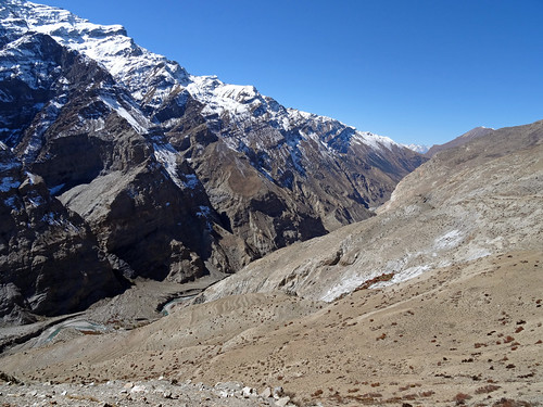
Nepal_2-487 Bharbun Khola (view west) by Roger Nix's Travel Collection, nepal dhaulagiri dhawalagiri himalaya dolpa dolpo
Nepal_2-487 Bharbun Khola (view west) by Roger Nix's Travel Collection
Nepal_2-625 Yalankot Khola by Roger Nix's Travel Collection, A tributary valley of the Thuli Bherinepal himalaya dolpa dolpo
Nepal_2-625 Yalankot Khola by Roger Nix's Travel Collection
Nepal_2-489 High Trail, Seri to Kakkotgaon by Roger Nix's Travel Collection, nepal himalaya dolpa dolpo
Nepal_2-489 High Trail, Seri to Kakkotgaon by Roger Nix's Travel Collection
Nepal_2-512 Mani Wall, Seri to Kakkotgaon by Roger Nix's Travel Collection, nepal himalaya dolpa dolpo
Nepal_2-512 Mani Wall, Seri to Kakkotgaon by Roger Nix's Travel Collection
Nepal_2-522 Bharbun Khola, Seri to Kakkotgaon by Roger Nix's Travel Collection, nepal dhaulagiri dhawalagiri himalaya dolpa dolpo
Nepal_2-522 Bharbun Khola, Seri to Kakkotgaon by Roger Nix's Travel Collection
Nepal_2-594 Bharbun Khola by Roger Nix's Travel Collection,                                nepal himalaya dolpa dolpo
Nepal_2-594 Bharbun Khola by Roger Nix's Travel Collection
Nepal_2-592 Bharbun Khola by Roger Nix's Travel Collection,                                nepal himalaya dolpa dolpo
Nepal_2-592 Bharbun Khola by Roger Nix's Travel Collection
China and the Looming Asian Food Crisis: Nepal by D J Clark, The Bheri river flowing through Dunai. The Karnali area of Nepal in the mid western hills and along
China and the Looming Asian Food Crisis: Nepal by D J Clark
China and the Looming Asian Food Crisis: Nepal by D J Clark, The Bheri river flowing through Dunai. The Karnali area of Nepal in the mid western hills and along
China and the Looming Asian Food Crisis: Nepal by D J Clark
China and the Looming Asian Food Crisis: Nepal by D J Clark, Corn fields on the edge of Dunai. The Karnali area of Nepal in the mid western hills and along the C
China and the Looming Asian Food Crisis: Nepal by D J Clark
China and the Looming Asian Food Crisis: Nepal by D J Clark, A view down the valley to the Tahanze mountains. The Karnali area of Nepal in the mid western hills
China and the Looming Asian Food Crisis: Nepal by D J Clark
China and the Looming Asian Food Crisis: Nepal by D J Clark, Corn fields on the edge of Dunai. The Karnali area of Nepal in the mid western hills and along the C
China and the Looming Asian Food Crisis: Nepal by D J Clark
China and the Looming Asian Food Crisis: Nepal by D J Clark, A small outpost flying the Nepali flag on the road to Dunai. The Karnali area of Nepal in the mid we
China and the Looming Asian Food Crisis: Nepal by D J Clark