时区:北美东部标准时间
当地时间:2026年11月9日星期一下午1点53分
经度:-83.7300933
纬度:46.3831381
今天日出时间:07:29:02
今天日落时间:17:11:07
今天日照时长:9小时42分4秒
明天日出时间:07:30:30
明天日落时间:17:09:52
明天日照时长:9小时39分22秒

: 显示所有日期

日期 日出时间 日落时间 日照时长
2026年1月1日 08:19:33 16:58:46 8小时39分13秒
2026年2月1日 08:00:51 17:38:20 9小时37分28秒
2026年3月1日 07:17:39 18:20:13 11小时2分34秒
2026年4月1日 07:17:45 20:02:43 12小时44分57秒
2026年5月1日 06:23:44 20:42:55 14小时19分11秒
2026年6月1日 05:48:20 21:19:48 15小时31分28秒
2026年7月1日 05:47:04 21:32:23 15小时45分19秒
2026年8月1日 06:16:06 21:08:56 14小时52分50秒
2026年9月1日 06:55:13 20:18:20 13小时23分6秒
2026年10月1日 07:33:11 19:19:07 11小时45分55秒
2026年11月1日 08:15:53 18:23:38 10小时7分45秒
2026年11月10日 07:29:02 17:11:07 9小时42分4秒
2026年11月11日 07:30:30 17:09:52 9小时39分22秒
2026年12月1日 07:57:53 16:52:16 8小时54分23秒

日出日落照片

brent gilbertson bridge, st. joseph island, ontario by twurdemann, <b>EXPLORE #36, December 30,  2015</b>

Winter sunset- -the Brent Gilbertson bridge opened in 1972 a
brent gilbertson bridge, st. joseph island, ontario by twurdemann
truck + tree by twurdemann, <b>EXPLORE #49 Highest, January 15,  2016</b>

The newest Northern Ontario hybrid- -Plummer Addition
truck + tree by twurdemann
dam, thessalon river, rydal bank, ontario by twurdemann, The setting sun illuminates a water control dam on the Thessalon River, in the village of Rydal Bank
dam, thessalon river, rydal bank, ontario by twurdemann
bernt gilbertson st. joseph island bridge, ontario by twurdemann, The Bernt Gilbertson St. Joseph Island Bridge opened in 1972. The bridge spans Lake Huron’s North Ch
bernt gilbertson st. joseph island bridge, ontario by twurdemann
bernt gilbertson st. joseph island bridge, ontario by twurdemann, The Bernt Gilbertson St. Joseph Island Bridge opened in 1972. The bridge spans Lake Huron’s North Ch
bernt gilbertson st. joseph island bridge, ontario by twurdemann
truck + tree by twurdemann, A Northern Ontario sunset to end a cold winter's day and an abandoned 1951 Ford truck + maple tree-
truck + tree by twurdemann
sunset, ottertail lake, rydal bank, ontario by twurdemann, Sunset over Ottertail Lake. Ottertail Lake was created in 1957 by the Ontario Department of Lands an
sunset, ottertail lake, rydal bank, ontario by twurdemann
truck + tree by twurdemann, A 1951 Ford truck + maple tree on a cold ( -15°C) winter's day at sunset- -Plummer Additional Townsh
truck + tree by twurdemann
bernt gilbertson st. joseph island bridge, ontario by twurdemann, The Bernt Gilbertson St. Joseph Island Bridge opened in 1972. The bridge spans Lake Huron’s North Ch
bernt gilbertson st. joseph island bridge, ontario by twurdemann
rydal bank church, rydal bank, ontario by twurdemann, The Presbyterian Church was built in 1907, by noted local builder Walter Robinson in the Carpenter G
rydal bank church, rydal bank, ontario by twurdemann
bernt gilbertson bridge st. joseph island bridge, tarbutt township, ontario by twurdemann, Winter's setting sun illuminates the Brent Gilberston Bridge; the bridge to St. Josephs Island cross
bernt gilbertson bridge st. joseph island bridge, tarbutt township, ontario by twurdemann
bernt gilbertson st. joseph island bridge, ontario by twurdemann, 
The Bernt Gilbertson St. Joseph Island Bridge opened in 1972. The bridge spans Lake Huron’s North C
bernt gilbertson st. joseph island bridge, ontario by twurdemann
bernt gilbertson st. joseph island bridge, ontario by twurdemann, The Bernt Gilbertson St. Joseph Island Bridge opened in 1972. The bridge spans Lake Huron’s North Ch
bernt gilbertson st. joseph island bridge, ontario by twurdemann
st. john's anglican church by twurdemann, Spring
Church
Cemetery
Hilton Beach
St. Joseph Island

Hilton Beach is a small village on eastern St
st. john's anglican church by twurdemann
brent gilbertson bridge, st. joseph island, ontario by twurdemann, Sunset.
The Brent Gilbertson bridge opened in 1972 and spans Lake Huron’s North Channel, connecting
brent gilbertson bridge, st. joseph island, ontario by twurdemann
winter, downtown, thessalon, ontario by twurdemann, Main Street, Thessalon, Ontario, as the sun sets on Boxing Day. Thessalon is a town of 1,279 (2011 c
winter, downtown, thessalon, ontario by twurdemann
truck + tree by twurdemann, A 1951 Ford truck + maple tree on a cold ( -15°C) winter's day- -Plummer Additional Township / Bruce
truck + tree by twurdemann
abandoned ferry dock by twurdemann, Waiting for a ship- -destined never to arrive.

Th abandoned St. Joseph Island ferry docks at Bamfor
abandoned ferry dock by twurdemann
black creek bridge by twurdemann, Sunset
Abandoned
Black Creek Bridge
Rydal Bank, Ontarioabandoned blackcreek bridge brucemines creek
black creek bridge by twurdemann
bernt gilbertson st. joseph island bridge, ontario by twurdemann, Sunset, Brent Gilbertson Bridge.  The Bernt Gilbertson St. Joseph Island Bridge opened in 1972. The
bernt gilbertson st. joseph island bridge, ontario by twurdemann
sunset, thessalon, ontario by twurdemann, The sun sets upon Thessalon's Main Street. Thessalon is a small town of 1,279 (2011 census) on the T
sunset, thessalon, ontario by twurdemann
north channel sunset by twurdemann, Sunset, North Channel Lake Huron from Bamfort Island in  Tarbutt Township, Ontario. Bamfort Island i
north channel sunset by twurdemann
Sunset on the Trans-Canada Highway by vynsane, sunset ontario greatlakes transcanadahighway on thessalon
Sunset on the Trans-Canada Highway by vynsane
Sunset by strixboy, ontario beach st joseph island hilton
Sunset by strixboy
sunset, north channel, lake huron, ontario by twurdemann, sunset silhouette night soo lakehuron northchannel seacape stjosephisland hwy548 highway548 TGAM:pho
sunset, north channel, lake huron, ontario by twurdemann
gawas bay sunrise 3 by samoht35, A beautiful sunrise this morning that I saw on my way to work.  Modified in Adobe LightRoom.ontario
gawas bay sunrise 3 by samoht35
20th Side Road by tfavretto, An autumn evening at the southern end of 20th Side Road on St. Joseph Island, roughly 4 km west of H
20th Side Road by tfavretto
Marina at Hilton Beach by tfavretto, An evening at the Hilton Beach Marina on St. Joseph Island.algoma beach boats calm clouds dock dusk
Marina at Hilton Beach by tfavretto
Day's First Light by tfavretto, Early morning light hits the remnants of an old dock found on the shoreline near the St. Joseph Isla
Day's First Light by tfavretto
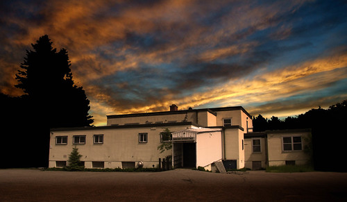
Old Hospital.jpg by Nano Debassige, canon 40d
Old Hospital.jpg by Nano Debassige
Channelside Relic by tfavretto, Remnants of an old dock found on a calm morning along the shoreline near the St. Joseph Island Bridg
Channelside Relic by tfavretto
Secured Through the Seasons by tfavretto, A weathered bolt holds down a timber of what used to be a dock, located along the shoreline near the
Secured Through the Seasons by tfavretto
Twyning Island Rock Pools by tfavretto, Water collects among the rocks on Twyning Island next to the "Bernt Gilbertson Bridge" whi
Twyning Island Rock Pools by tfavretto
Little Rapids Orange by lennoxsmith, A pretty impressive shot of a setting sun over the hamlet of Little Rapids about 3 KM's north of The
Little Rapids Orange by lennoxsmith
Link to the Mainland by tfavretto, This is the "Bernt Gilbertson Bridge" that connects St. Joseph Island to the mainland, rou
Link to the Mainland by tfavretto
Calm Evening on St. Joseph Island by tfavretto, A calm evening on a dock in the St. Joseph Channel, just east of Richards Landing on St. Joseph Isla
Calm Evening on St. Joseph Island by tfavretto
Sunrise on Labour Day #2 Copyright Sheri Minardi Photography  #photography #sheriminardi #sheriminardiphotography #sunrise #stjosephisland #hiltonbeach #marina #landscape #algoma #algomacountry #labou by sheriminardi, instagramapp square squareformat iphoneography uploaded:by=instagram
Sunrise on Labour Day #2 Copyright Sheri Minardi Photography #photography #sheriminardi #sheriminardiphotography #sunrise #stjosephisland #hiltonbeach #marina #landscape #algoma #algomacountry #labou by sheriminardi
Bernt Gilbertson Bridge by tfavretto, A foggy morning under the Bernt Gilbertson Bridge, which connects St. Joseph Island to the mainland,
Bernt Gilbertson Bridge by tfavretto
Where a Dock Once Stood by tfavretto, Remnants of an old dock found on a calm morning along the shoreline near the St. Joseph Island Bridg
Where a Dock Once Stood by tfavretto
On the Lookout by tfavretto, A pair of sandhill cranes spotted along Mount Zion Road, roughly 16 km north of Bruce Mines, ON.300m
On the Lookout by tfavretto
St. Joseph Channel by tfavretto, This is the "Bernt Gilbertson Bridge" that spans St. Joseph Channel, roughly 50 km southea
St. Joseph Channel by tfavretto
Calm Evening at Gawas Bay by tfavretto, Dusk falls over a dock during a calm evening at Gawas Bay on St. Joseph Island, roughly 7 km northwe
Calm Evening at Gawas Bay by tfavretto
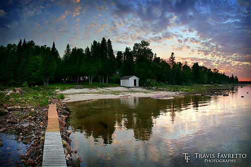
Canoe Point by tfavretto, The view from the dock at a friend's camp at Canoe Point on St. Joseph Island.  This is a series of
Canoe Point by tfavretto
north sunrise by Candido Designs, nature sunrise landscapes dusk northernontario brucemines watersunrise
north sunrise by Candido Designs
Hilton Beach Marina by tfavretto, An evening at the Hilton Beach Marina on St. Joseph Island.algoma boats breakwater circularpolarizer
Hilton Beach Marina by tfavretto
Last Light at Gawas Bay by tfavretto, A calm evening on the shore of Gawas Bay on St. Joseph Island, roughly 7 km northwest of Hilton Beac
Last Light at Gawas Bay by tfavretto
Sunrise northern Ontario by Candido Designs,
Sunrise northern Ontario by Candido Designs
Sunrise northern Ontario by Candido Designs,
Sunrise northern Ontario by Candido Designs