Parinacota, Putre, Arica y Parinacota Region, 智利的日出日落时间表
Location: 智利 > 阿里卡和帕里纳科塔大区 > 帕里纳科塔省 > 智利阿里卡和帕里纳科塔大区普特雷 >
时区:
America/Santiago
当地时间:
2025-06-26 04:56:19
经度:
-69.2667
纬度:
-18.2
今天日出时间:
07:08:46 AM
今天日落时间:
06:11:24 PM
今天日照时常:
11h 2m 38s
明天日出时间:
07:08:54 AM
明天日落时间:
06:11:40 PM
明天日照时常:
11h 2m 46s
显示所有日期
| 日期 | 日出 | 日落 | 日照时常 |
|---|---|---|---|
| 2025年01月01日 | 07:05:17 AM | 08:16:59 PM | 13h 11m 42s |
| 2025年01月02日 | 07:05:54 AM | 08:17:17 PM | 13h 11m 23s |
| 2025年01月03日 | 07:06:31 AM | 08:17:34 PM | 13h 11m 3s |
| 2025年01月04日 | 07:07:08 AM | 08:17:51 PM | 13h 10m 43s |
| 2025年01月05日 | 07:07:46 AM | 08:18:06 PM | 13h 10m 20s |
| 2025年01月06日 | 07:08:24 AM | 08:18:20 PM | 13h 9m 56s |
| 2025年01月07日 | 07:09:02 AM | 08:18:32 PM | 13h 9m 30s |
| 2025年01月08日 | 07:09:40 AM | 08:18:44 PM | 13h 9m 4s |
| 2025年01月09日 | 07:10:19 AM | 08:18:54 PM | 13h 8m 35s |
| 2025年01月10日 | 07:10:57 AM | 08:19:03 PM | 13h 8m 6s |
| 2025年01月11日 | 07:11:36 AM | 08:19:11 PM | 13h 7m 35s |
| 2025年01月12日 | 07:12:14 AM | 08:19:18 PM | 13h 7m 4s |
| 2025年01月13日 | 07:12:53 AM | 08:19:24 PM | 13h 6m 31s |
| 2025年01月14日 | 07:13:31 AM | 08:19:28 PM | 13h 5m 57s |
| 2025年01月15日 | 07:14:09 AM | 08:19:31 PM | 13h 5m 22s |
| 2025年01月16日 | 07:14:47 AM | 08:19:33 PM | 13h 4m 46s |
| 2025年01月17日 | 07:15:25 AM | 08:19:33 PM | 13h 4m 8s |
| 2025年01月18日 | 07:16:03 AM | 08:19:32 PM | 13h 3m 29s |
| 2025年01月19日 | 07:16:41 AM | 08:19:30 PM | 13h 2m 49s |
| 2025年01月20日 | 07:17:18 AM | 08:19:27 PM | 13h 2m 9s |
| 2025年01月21日 | 07:17:55 AM | 08:19:22 PM | 13h 1m 27s |
| 2025年01月22日 | 07:18:32 AM | 08:19:16 PM | 13h 0m 44s |
| 2025年01月23日 | 07:19:08 AM | 08:19:09 PM | 13h 0m 1s |
| 2025年01月24日 | 07:19:44 AM | 08:19:01 PM | 12h 59m 17s |
| 2025年01月25日 | 07:20:20 AM | 08:18:51 PM | 12h 58m 31s |
| 2025年01月26日 | 07:20:55 AM | 08:18:41 PM | 12h 57m 46s |
| 2025年01月27日 | 07:21:30 AM | 08:18:29 PM | 12h 56m 59s |
| 2025年01月28日 | 07:22:05 AM | 08:18:15 PM | 12h 56m 10s |
| 2025年01月29日 | 07:22:39 AM | 08:18:01 PM | 12h 55m 22s |
| 2025年01月30日 | 07:23:13 AM | 08:17:45 PM | 12h 54m 32s |
| 2025年01月31日 | 07:23:46 AM | 08:17:28 PM | 12h 53m 42s |
| 2025年02月01日 | 07:24:19 AM | 08:17:10 PM | 12h 52m 51s |
| 2025年02月02日 | 07:24:51 AM | 08:16:51 PM | 12h 52m 0s |
| 2025年02月03日 | 07:25:23 AM | 08:16:31 PM | 12h 51m 8s |
| 2025年02月04日 | 07:25:55 AM | 08:16:10 PM | 12h 50m 15s |
| 2025年02月05日 | 07:26:25 AM | 08:15:47 PM | 12h 49m 22s |
| 2025年02月06日 | 07:26:56 AM | 08:15:24 PM | 12h 48m 28s |
| 2025年02月07日 | 07:27:26 AM | 08:14:59 PM | 12h 47m 33s |
| 2025年02月08日 | 07:27:55 AM | 08:14:33 PM | 12h 46m 38s |
| 2025年02月09日 | 07:28:24 AM | 08:14:06 PM | 12h 45m 42s |
| 2025年02月10日 | 07:28:52 AM | 08:13:39 PM | 12h 44m 47s |
| 2025年02月11日 | 07:29:20 AM | 08:13:10 PM | 12h 43m 50s |
| 2025年02月12日 | 07:29:47 AM | 08:12:40 PM | 12h 42m 53s |
| 2025年02月13日 | 07:30:14 AM | 08:12:10 PM | 12h 41m 56s |
| 2025年02月14日 | 07:30:40 AM | 08:11:38 PM | 12h 40m 58s |
| 2025年02月15日 | 07:31:05 AM | 08:11:05 PM | 12h 40m 0s |
| 2025年02月16日 | 07:31:30 AM | 08:10:32 PM | 12h 39m 2s |
| 2025年02月17日 | 07:31:55 AM | 08:09:58 PM | 12h 38m 3s |
| 2025年02月18日 | 07:32:19 AM | 08:09:23 PM | 12h 37m 4s |
| 2025年02月19日 | 07:32:42 AM | 08:08:47 PM | 12h 36m 5s |
| 2025年02月20日 | 07:33:06 AM | 08:08:10 PM | 12h 35m 4s |
| 2025年02月21日 | 07:33:28 AM | 08:07:32 PM | 12h 34m 4s |
| 2025年02月22日 | 07:33:50 AM | 08:06:54 PM | 12h 33m 4s |
| 2025年02月23日 | 07:34:12 AM | 08:06:15 PM | 12h 32m 3s |
| 2025年02月24日 | 07:34:33 AM | 08:05:35 PM | 12h 31m 2s |
| 2025年02月25日 | 07:34:53 AM | 08:04:55 PM | 12h 30m 2s |
| 2025年02月26日 | 07:35:13 AM | 08:04:14 PM | 12h 29m 1s |
| 2025年02月27日 | 07:35:33 AM | 08:03:32 PM | 12h 27m 59s |
| 2025年02月28日 | 07:35:52 AM | 08:02:50 PM | 12h 26m 58s |
| 2025年03月01日 | 07:36:11 AM | 08:02:07 PM | 12h 25m 56s |
| 2025年03月02日 | 07:36:30 AM | 08:01:24 PM | 12h 24m 54s |
| 2025年03月03日 | 07:36:48 AM | 08:00:40 PM | 12h 23m 52s |
| 2025年03月04日 | 07:37:05 AM | 07:59:55 PM | 12h 22m 50s |
| 2025年03月05日 | 07:37:23 AM | 07:59:11 PM | 12h 21m 48s |
| 2025年03月06日 | 07:37:40 AM | 07:58:25 PM | 12h 20m 45s |
| 2025年03月07日 | 07:37:56 AM | 07:57:39 PM | 12h 19m 43s |
| 2025年03月08日 | 07:38:13 AM | 07:56:53 PM | 12h 18m 40s |
| 2025年03月09日 | 07:38:28 AM | 07:56:07 PM | 12h 17m 39s |
| 2025年03月10日 | 07:38:44 AM | 07:55:20 PM | 12h 16m 36s |
| 2025年03月11日 | 07:38:59 AM | 07:54:33 PM | 12h 15m 34s |
| 2025年03月12日 | 07:39:14 AM | 07:53:45 PM | 12h 14m 31s |
| 2025年03月13日 | 07:39:29 AM | 07:52:57 PM | 12h 13m 28s |
| 2025年03月14日 | 07:39:44 AM | 07:52:09 PM | 12h 12m 25s |
| 2025年03月15日 | 07:39:58 AM | 07:51:21 PM | 12h 11m 23s |
| 2025年03月16日 | 07:40:12 AM | 07:50:33 PM | 12h 10m 21s |
| 2025年03月17日 | 07:40:26 AM | 07:49:44 PM | 12h 9m 18s |
| 2025年03月18日 | 07:40:40 AM | 07:48:55 PM | 12h 8m 15s |
| 2025年03月19日 | 07:40:53 AM | 07:48:06 PM | 12h 7m 13s |
| 2025年03月20日 | 07:41:07 AM | 07:47:17 PM | 12h 6m 10s |
| 2025年03月21日 | 07:41:20 AM | 07:46:28 PM | 12h 5m 8s |
| 2025年03月22日 | 07:41:33 AM | 07:45:39 PM | 12h 4m 6s |
| 2025年03月23日 | 07:41:46 AM | 07:44:50 PM | 12h 3m 4s |
| 2025年03月24日 | 07:41:59 AM | 07:44:01 PM | 12h 2m 2s |
| 2025年03月25日 | 07:42:12 AM | 07:43:12 PM | 12h 1m 0s |
| 2025年03月26日 | 07:42:25 AM | 07:42:23 PM | 11h 59m 58s |
| 2025年03月27日 | 07:42:38 AM | 07:41:34 PM | 11h 58m 56s |
| 2025年03月28日 | 07:42:50 AM | 07:40:45 PM | 11h 57m 55s |
| 2025年03月29日 | 07:43:03 AM | 07:39:56 PM | 11h 56m 53s |
| 2025年03月30日 | 07:43:16 AM | 07:39:08 PM | 11h 55m 52s |
| 2025年03月31日 | 07:43:29 AM | 07:38:19 PM | 11h 54m 50s |
| 2025年04月01日 | 07:43:41 AM | 07:37:31 PM | 11h 53m 50s |
| 2025年04月02日 | 07:43:54 AM | 07:36:43 PM | 11h 52m 49s |
| 2025年04月03日 | 07:44:07 AM | 07:35:55 PM | 11h 51m 48s |
| 2025年04月04日 | 07:44:20 AM | 07:35:08 PM | 11h 50m 48s |
| 2025年04月05日 | 07:44:33 AM | 07:34:21 PM | 11h 49m 48s |
| 2025年04月06日 | 07:44:46 AM | 07:33:34 PM | 11h 48m 48s |
| 2025年04月07日 | 07:44:59 AM | 07:32:47 PM | 11h 47m 48s |
| 2025年04月08日 | 07:45:13 AM | 07:32:01 PM | 11h 46m 48s |
| 2025年04月09日 | 07:45:26 AM | 07:31:16 PM | 11h 45m 50s |
| 2025年04月10日 | 07:45:40 AM | 07:30:30 PM | 11h 44m 50s |
| 2025年04月11日 | 07:45:53 AM | 07:29:45 PM | 11h 43m 52s |
| 2025年04月12日 | 07:46:07 AM | 07:29:01 PM | 11h 42m 54s |
| 2025年04月13日 | 07:46:22 AM | 07:28:17 PM | 11h 41m 55s |
| 2025年04月14日 | 07:46:36 AM | 07:27:34 PM | 11h 40m 58s |
| 2025年04月15日 | 07:46:50 AM | 07:26:51 PM | 11h 40m 1s |
| 2025年04月16日 | 07:47:05 AM | 07:26:08 PM | 11h 39m 3s |
| 2025年04月17日 | 07:47:20 AM | 07:25:27 PM | 11h 38m 7s |
| 2025年04月18日 | 07:47:35 AM | 07:24:45 PM | 11h 37m 10s |
| 2025年04月19日 | 07:47:50 AM | 07:24:05 PM | 11h 36m 15s |
| 2025年04月20日 | 07:48:06 AM | 07:23:25 PM | 11h 35m 19s |
| 2025年04月21日 | 07:48:22 AM | 07:22:45 PM | 11h 34m 23s |
| 2025年04月22日 | 07:48:38 AM | 07:22:07 PM | 11h 33m 29s |
| 2025年04月23日 | 07:48:54 AM | 07:21:29 PM | 11h 32m 35s |
| 2025年04月24日 | 07:49:11 AM | 07:20:51 PM | 11h 31m 40s |
| 2025年04月25日 | 07:49:28 AM | 07:20:15 PM | 11h 30m 47s |
| 2025年04月26日 | 07:49:45 AM | 07:19:39 PM | 11h 29m 54s |
| 2025年04月26日 | 07:49:45 AM | 07:19:39 PM | 11h 29m 54s |
| 2025年04月27日 | 06:50:03 AM | 06:19:02 PM | 11h 28m 59s |
| 2025年04月28日 | 06:50:20 AM | 06:18:28 PM | 11h 28m 8s |
| 2025年04月29日 | 06:50:38 AM | 06:17:55 PM | 11h 27m 17s |
| 2025年04月30日 | 06:50:56 AM | 06:17:22 PM | 11h 26m 26s |
| 2025年05月01日 | 06:51:15 AM | 06:16:50 PM | 11h 25m 35s |
| 2025年05月02日 | 06:51:33 AM | 06:16:19 PM | 11h 24m 46s |
| 2025年05月03日 | 06:51:52 AM | 06:15:49 PM | 11h 23m 57s |
| 2025年05月04日 | 06:52:11 AM | 06:15:19 PM | 11h 23m 8s |
| 2025年05月05日 | 06:52:31 AM | 06:14:51 PM | 11h 22m 20s |
| 2025年05月06日 | 06:52:50 AM | 06:14:23 PM | 11h 21m 33s |
| 2025年05月07日 | 06:53:10 AM | 06:13:57 PM | 11h 20m 47s |
| 2025年05月08日 | 06:53:30 AM | 06:13:31 PM | 11h 20m 1s |
| 2025年05月09日 | 06:53:50 AM | 06:13:06 PM | 11h 19m 16s |
| 2025年05月10日 | 06:54:11 AM | 06:12:42 PM | 11h 18m 31s |
| 2025年05月11日 | 06:54:32 AM | 06:12:19 PM | 11h 17m 47s |
| 2025年05月12日 | 06:54:52 AM | 06:11:57 PM | 11h 17m 5s |
| 2025年05月13日 | 06:55:13 AM | 06:11:36 PM | 11h 16m 23s |
| 2025年05月14日 | 06:55:35 AM | 06:11:16 PM | 11h 15m 41s |
| 2025年05月15日 | 06:55:56 AM | 06:10:57 PM | 11h 15m 1s |
| 2025年05月16日 | 06:56:18 AM | 06:10:39 PM | 11h 14m 21s |
| 2025年05月17日 | 06:56:39 AM | 06:10:22 PM | 11h 13m 43s |
| 2025年05月18日 | 06:57:01 AM | 06:10:06 PM | 11h 13m 5s |
| 2025年05月19日 | 06:57:23 AM | 06:09:51 PM | 11h 12m 28s |
| 2025年05月20日 | 06:57:45 AM | 06:09:37 PM | 11h 11m 52s |
| 2025年05月21日 | 06:58:07 AM | 06:09:24 PM | 11h 11m 17s |
| 2025年05月22日 | 06:58:29 AM | 06:09:12 PM | 11h 10m 43s |
| 2025年05月23日 | 06:58:51 AM | 06:09:00 PM | 11h 10m 9s |
| 2025年05月24日 | 06:59:13 AM | 06:08:50 PM | 11h 9m 37s |
| 2025年05月25日 | 06:59:35 AM | 06:08:41 PM | 11h 9m 6s |
| 2025年05月26日 | 06:59:57 AM | 06:08:33 PM | 11h 8m 36s |
| 2025年05月27日 | 07:00:19 AM | 06:08:26 PM | 11h 8m 7s |
| 2025年05月28日 | 07:00:41 AM | 06:08:20 PM | 11h 7m 39s |
| 2025年05月29日 | 07:01:03 AM | 06:08:14 PM | 11h 7m 11s |
| 2025年05月30日 | 07:01:24 AM | 06:08:10 PM | 11h 6m 46s |
| 2025年05月31日 | 07:01:46 AM | 06:08:07 PM | 11h 6m 21s |
| 2025年06月01日 | 07:02:07 AM | 06:08:05 PM | 11h 5m 58s |
| 2025年06月02日 | 07:02:28 AM | 06:08:03 PM | 11h 5m 35s |
| 2025年06月03日 | 07:02:49 AM | 06:08:03 PM | 11h 5m 14s |
| 2025年06月04日 | 07:03:10 AM | 06:08:03 PM | 11h 4m 53s |
| 2025年06月05日 | 07:03:30 AM | 06:08:05 PM | 11h 4m 35s |
| 2025年06月06日 | 07:03:50 AM | 06:08:07 PM | 11h 4m 17s |
| 2025年06月07日 | 07:04:10 AM | 06:08:10 PM | 11h 4m 0s |
| 2025年06月08日 | 07:04:29 AM | 06:08:14 PM | 11h 3m 45s |
| 2025年06月09日 | 07:04:48 AM | 06:08:19 PM | 11h 3m 31s |
| 2025年06月10日 | 07:05:07 AM | 06:08:25 PM | 11h 3m 18s |
| 2025年06月11日 | 07:05:25 AM | 06:08:31 PM | 11h 3m 6s |
| 2025年06月12日 | 07:05:43 AM | 06:08:38 PM | 11h 2m 55s |
| 2025年06月13日 | 07:06:00 AM | 06:08:46 PM | 11h 2m 46s |
| 2025年06月14日 | 07:06:17 AM | 06:08:55 PM | 11h 2m 38s |
| 2025年06月15日 | 07:06:33 AM | 06:09:05 PM | 11h 2m 32s |
| 2025年06月16日 | 07:06:49 AM | 06:09:15 PM | 11h 2m 26s |
| 2025年06月17日 | 07:07:04 AM | 06:09:26 PM | 11h 2m 22s |
| 2025年06月18日 | 07:07:19 AM | 06:09:38 PM | 11h 2m 19s |
| 2025年06月19日 | 07:07:33 AM | 06:09:50 PM | 11h 2m 17s |
| 2025年06月20日 | 07:07:46 AM | 06:10:03 PM | 11h 2m 17s |
| 2025年06月21日 | 07:07:58 AM | 06:10:16 PM | 11h 2m 18s |
| 2025年06月22日 | 07:08:10 AM | 06:10:30 PM | 11h 2m 20s |
| 2025年06月23日 | 07:08:21 AM | 06:10:45 PM | 11h 2m 24s |
| 2025年06月24日 | 07:08:32 AM | 06:11:00 PM | 11h 2m 28s |
| 2025年06月25日 | 07:08:41 AM | 06:11:16 PM | 11h 2m 35s |
| 2025年06月26日 | 07:08:50 AM | 06:11:32 PM | 11h 2m 42s |
| 2025年06月27日 | 07:08:58 AM | 06:11:49 PM | 11h 2m 51s |
| 2025年06月28日 | 07:09:06 AM | 06:12:06 PM | 11h 3m 0s |
| 2025年06月29日 | 07:09:12 AM | 06:12:23 PM | 11h 3m 11s |
| 2025年06月30日 | 07:09:17 AM | 06:12:41 PM | 11h 3m 24s |
| 2025年07月01日 | 07:09:22 AM | 06:12:59 PM | 11h 3m 37s |
| 2025年07月02日 | 07:09:26 AM | 06:13:17 PM | 11h 3m 51s |
| 2025年07月03日 | 07:09:28 AM | 06:13:36 PM | 11h 4m 8s |
| 2025年07月04日 | 07:09:30 AM | 06:13:55 PM | 11h 4m 25s |
| 2025年07月05日 | 07:09:31 AM | 06:14:15 PM | 11h 4m 44s |
| 2025年07月06日 | 07:09:31 AM | 06:14:34 PM | 11h 5m 3s |
| 2025年07月07日 | 07:09:30 AM | 06:14:54 PM | 11h 5m 24s |
| 2025年07月08日 | 07:09:28 AM | 06:15:13 PM | 11h 5m 45s |
| 2025年07月09日 | 07:09:25 AM | 06:15:33 PM | 11h 6m 8s |
| 2025年07月10日 | 07:09:21 AM | 06:15:54 PM | 11h 6m 33s |
| 2025年07月11日 | 07:09:17 AM | 06:16:14 PM | 11h 6m 57s |
| 2025年07月12日 | 07:09:11 AM | 06:16:34 PM | 11h 7m 23s |
| 2025年07月13日 | 07:09:04 AM | 06:16:54 PM | 11h 7m 50s |
| 2025年07月14日 | 07:08:56 AM | 06:17:15 PM | 11h 8m 19s |
| 2025年07月15日 | 07:08:47 AM | 06:17:35 PM | 11h 8m 48s |
| 2025年07月16日 | 07:08:37 AM | 06:17:55 PM | 11h 9m 18s |
| 2025年07月17日 | 07:08:25 AM | 06:18:16 PM | 11h 9m 51s |
| 2025年07月18日 | 07:08:13 AM | 06:18:36 PM | 11h 10m 23s |
| 2025年07月19日 | 07:08:00 AM | 06:18:56 PM | 11h 10m 56s |
| 2025年07月20日 | 07:07:46 AM | 06:19:16 PM | 11h 11m 30s |
| 2025年07月21日 | 07:07:31 AM | 06:19:36 PM | 11h 12m 5s |
| 2025年07月22日 | 07:07:15 AM | 06:19:56 PM | 11h 12m 41s |
| 2025年07月23日 | 07:06:57 AM | 06:20:16 PM | 11h 13m 19s |
| 2025年07月24日 | 07:06:39 AM | 06:20:35 PM | 11h 13m 56s |
| 2025年07月25日 | 07:06:20 AM | 06:20:55 PM | 11h 14m 35s |
| 2025年07月26日 | 07:05:59 AM | 06:21:14 PM | 11h 15m 15s |
| 2025年07月27日 | 07:05:38 AM | 06:21:33 PM | 11h 15m 55s |
| 2025年07月28日 | 07:05:16 AM | 06:21:52 PM | 11h 16m 36s |
| 2025年07月29日 | 07:04:52 AM | 06:22:10 PM | 11h 17m 18s |
| 2025年07月30日 | 07:04:28 AM | 06:22:29 PM | 11h 18m 1s |
| 2025年07月31日 | 07:04:03 AM | 06:22:47 PM | 11h 18m 44s |
| 2025年08月01日 | 07:03:36 AM | 06:23:05 PM | 11h 19m 29s |
| 2025年08月02日 | 07:03:09 AM | 06:23:22 PM | 11h 20m 13s |
| 2025年08月03日 | 07:02:41 AM | 06:23:40 PM | 11h 20m 59s |
| 2025年08月04日 | 07:02:12 AM | 06:23:57 PM | 11h 21m 45s |
| 2025年08月05日 | 07:01:42 AM | 06:24:13 PM | 11h 22m 31s |
| 2025年08月06日 | 07:01:11 AM | 06:24:30 PM | 11h 23m 19s |
| 2025年08月07日 | 07:00:39 AM | 06:24:46 PM | 11h 24m 7s |
| 2025年08月08日 | 07:00:07 AM | 06:25:02 PM | 11h 24m 55s |
| 2025年08月09日 | 06:59:33 AM | 06:25:18 PM | 11h 25m 45s |
| 2025年08月10日 | 06:58:59 AM | 06:25:33 PM | 11h 26m 34s |
| 2025年08月11日 | 06:58:23 AM | 06:25:48 PM | 11h 27m 25s |
| 2025年08月12日 | 06:57:47 AM | 06:26:03 PM | 11h 28m 16s |
| 2025年08月13日 | 06:57:10 AM | 06:26:17 PM | 11h 29m 7s |
| 2025年08月14日 | 06:56:33 AM | 06:26:32 PM | 11h 29m 59s |
| 2025年08月15日 | 06:55:54 AM | 06:26:45 PM | 11h 30m 51s |
| 2025年08月16日 | 06:55:15 AM | 06:26:59 PM | 11h 31m 44s |
| 2025年08月17日 | 06:54:35 AM | 06:27:12 PM | 11h 32m 37s |
| 2025年08月18日 | 06:53:55 AM | 06:27:25 PM | 11h 33m 30s |
| 2025年08月19日 | 06:53:13 AM | 06:27:38 PM | 11h 34m 25s |
| 2025年08月20日 | 06:52:32 AM | 06:27:51 PM | 11h 35m 19s |
| 2025年08月21日 | 06:51:49 AM | 06:28:03 PM | 11h 36m 14s |
| 2025年08月22日 | 06:51:06 AM | 06:28:15 PM | 11h 37m 9s |
| 2025年08月23日 | 06:50:22 AM | 06:28:27 PM | 11h 38m 5s |
| 2025年08月24日 | 06:49:37 AM | 06:28:38 PM | 11h 39m 1s |
| 2025年08月25日 | 06:48:52 AM | 06:28:49 PM | 11h 39m 57s |
| 2025年08月26日 | 06:48:07 AM | 06:29:00 PM | 11h 40m 53s |
| 2025年08月27日 | 06:47:21 AM | 06:29:11 PM | 11h 41m 50s |
| 2025年08月28日 | 06:46:34 AM | 06:29:22 PM | 11h 42m 48s |
| 2025年08月29日 | 06:45:47 AM | 06:29:32 PM | 11h 43m 45s |
| 2025年08月30日 | 06:44:59 AM | 06:29:42 PM | 11h 44m 43s |
| 2025年08月31日 | 06:44:11 AM | 06:29:52 PM | 11h 45m 41s |
| 2025年09月01日 | 06:43:23 AM | 06:30:02 PM | 11h 46m 39s |
| 2025年09月02日 | 06:42:34 AM | 06:30:12 PM | 11h 47m 38s |
| 2025年09月03日 | 06:41:45 AM | 06:30:22 PM | 11h 48m 37s |
| 2025年09月04日 | 06:40:55 AM | 06:30:31 PM | 11h 49m 36s |
| 2025年09月05日 | 06:40:05 AM | 06:30:40 PM | 11h 50m 35s |
| 2025年09月06日 | 06:39:15 AM | 06:30:50 PM | 11h 51m 35s |
| 2025年09月08日 | 07:37:36 AM | 07:31:07 PM | 11h 53m 31s |
| 2025年09月09日 | 07:36:45 AM | 07:31:16 PM | 11h 54m 31s |
| 2025年09月10日 | 07:35:54 AM | 07:31:25 PM | 11h 55m 31s |
| 2025年09月11日 | 07:35:03 AM | 07:31:34 PM | 11h 56m 31s |
| 2025年09月12日 | 07:34:11 AM | 07:31:43 PM | 11h 57m 32s |
| 2025年09月13日 | 07:33:19 AM | 07:31:52 PM | 11h 58m 33s |
| 2025年09月14日 | 07:32:28 AM | 07:32:01 PM | 11h 59m 33s |
| 2025年09月15日 | 07:31:36 AM | 07:32:10 PM | 12h 0m 34s |
| 2025年09月16日 | 07:30:44 AM | 07:32:19 PM | 12h 1m 35s |
| 2025年09月17日 | 07:29:52 AM | 07:32:28 PM | 12h 2m 36s |
| 2025年09月18日 | 07:29:00 AM | 07:32:38 PM | 12h 3m 38s |
| 2025年09月19日 | 07:28:08 AM | 07:32:47 PM | 12h 4m 39s |
| 2025年09月20日 | 07:27:16 AM | 07:32:56 PM | 12h 5m 40s |
| 2025年09月21日 | 07:26:24 AM | 07:33:06 PM | 12h 6m 42s |
| 2025年09月22日 | 07:25:32 AM | 07:33:15 PM | 12h 7m 43s |
| 2025年09月23日 | 07:24:40 AM | 07:33:25 PM | 12h 8m 45s |
| 2025年09月24日 | 07:23:49 AM | 07:33:35 PM | 12h 9m 46s |
| 2025年09月25日 | 07:22:57 AM | 07:33:45 PM | 12h 10m 48s |
| 2025年09月26日 | 07:22:06 AM | 07:33:56 PM | 12h 11m 50s |
| 2025年09月27日 | 07:21:15 AM | 07:34:06 PM | 12h 12m 51s |
| 2025年09月28日 | 07:20:24 AM | 07:34:17 PM | 12h 13m 53s |
| 2025年09月29日 | 07:19:34 AM | 07:34:28 PM | 12h 14m 54s |
| 2025年09月30日 | 07:18:44 AM | 07:34:39 PM | 12h 15m 55s |
| 2025年10月01日 | 07:17:54 AM | 07:34:51 PM | 12h 16m 57s |
| 2025年10月02日 | 07:17:04 AM | 07:35:03 PM | 12h 17m 59s |
| 2025年10月03日 | 07:16:15 AM | 07:35:15 PM | 12h 19m 0s |
| 2025年10月04日 | 07:15:26 AM | 07:35:28 PM | 12h 20m 2s |
| 2025年10月05日 | 07:14:37 AM | 07:35:41 PM | 12h 21m 4s |
| 2025年10月06日 | 07:13:49 AM | 07:35:54 PM | 12h 22m 5s |
| 2025年10月07日 | 07:13:02 AM | 07:36:08 PM | 12h 23m 6s |
| 2025年10月08日 | 07:12:14 AM | 07:36:22 PM | 12h 24m 8s |
| 2025年10月09日 | 07:11:28 AM | 07:36:36 PM | 12h 25m 8s |
| 2025年10月10日 | 07:10:42 AM | 07:36:51 PM | 12h 26m 9s |
| 2025年10月11日 | 07:09:56 AM | 07:37:06 PM | 12h 27m 10s |
| 2025年10月12日 | 07:09:11 AM | 07:37:22 PM | 12h 28m 11s |
| 2025年10月13日 | 07:08:27 AM | 07:37:38 PM | 12h 29m 11s |
| 2025年10月14日 | 07:07:43 AM | 07:37:55 PM | 12h 30m 12s |
| 2025年10月15日 | 07:07:00 AM | 07:38:12 PM | 12h 31m 12s |
| 2025年10月16日 | 07:06:18 AM | 07:38:29 PM | 12h 32m 11s |
| 2025年10月17日 | 07:05:36 AM | 07:38:47 PM | 12h 33m 11s |
| 2025年10月18日 | 07:04:55 AM | 07:39:06 PM | 12h 34m 11s |
| 2025年10月19日 | 07:04:15 AM | 07:39:25 PM | 12h 35m 10s |
| 2025年10月20日 | 07:03:36 AM | 07:39:44 PM | 12h 36m 8s |
| 2025年10月21日 | 07:02:57 AM | 07:40:05 PM | 12h 37m 8s |
| 2025年10月22日 | 07:02:20 AM | 07:40:25 PM | 12h 38m 5s |
| 2025年10月23日 | 07:01:43 AM | 07:40:46 PM | 12h 39m 3s |
| 2025年10月24日 | 07:01:07 AM | 07:41:08 PM | 12h 40m 1s |
| 2025年10月25日 | 07:00:32 AM | 07:41:30 PM | 12h 40m 58s |
| 2025年10月26日 | 06:59:57 AM | 07:41:53 PM | 12h 41m 56s |
| 2025年10月27日 | 06:59:24 AM | 07:42:16 PM | 12h 42m 52s |
| 2025年10月28日 | 06:58:52 AM | 07:42:40 PM | 12h 43m 48s |
| 2025年10月29日 | 06:58:21 AM | 07:43:05 PM | 12h 44m 44s |
| 2025年10月30日 | 06:57:50 AM | 07:43:30 PM | 12h 45m 40s |
| 2025年10月31日 | 06:57:21 AM | 07:43:56 PM | 12h 46m 35s |
| 2025年11月01日 | 06:56:53 AM | 07:44:22 PM | 12h 47m 29s |
| 2025年11月02日 | 06:56:25 AM | 07:44:48 PM | 12h 48m 23s |
| 2025年11月03日 | 06:55:59 AM | 07:45:16 PM | 12h 49m 17s |
| 2025年11月04日 | 06:55:34 AM | 07:45:44 PM | 12h 50m 10s |
| 2025年11月05日 | 06:55:10 AM | 07:46:12 PM | 12h 51m 2s |
| 2025年11月06日 | 06:54:48 AM | 07:46:41 PM | 12h 51m 53s |
| 2025年11月07日 | 06:54:26 AM | 07:47:10 PM | 12h 52m 44s |
| 2025年11月08日 | 06:54:06 AM | 07:47:40 PM | 12h 53m 34s |
| 2025年11月09日 | 06:53:47 AM | 07:48:11 PM | 12h 54m 24s |
| 2025年11月10日 | 06:53:28 AM | 07:48:42 PM | 12h 55m 14s |
| 2025年11月11日 | 06:53:12 AM | 07:49:13 PM | 12h 56m 1s |
| 2025年11月12日 | 06:52:56 AM | 07:49:45 PM | 12h 56m 49s |
| 2025年11月13日 | 06:52:42 AM | 07:50:17 PM | 12h 57m 35s |
| 2025年11月14日 | 06:52:29 AM | 07:50:50 PM | 12h 58m 21s |
| 2025年11月15日 | 06:52:17 AM | 07:51:23 PM | 12h 59m 6s |
| 2025年11月16日 | 06:52:06 AM | 07:51:57 PM | 12h 59m 51s |
| 2025年11月17日 | 06:51:57 AM | 07:52:31 PM | 13h 0m 34s |
| 2025年11月18日 | 06:51:49 AM | 07:53:06 PM | 13h 1m 17s |
| 2025年11月19日 | 06:51:42 AM | 07:53:40 PM | 13h 1m 58s |
| 2025年11月20日 | 06:51:36 AM | 07:54:16 PM | 13h 2m 40s |
| 2025年11月21日 | 06:51:32 AM | 07:54:51 PM | 13h 3m 19s |
| 2025年11月22日 | 06:51:29 AM | 07:55:27 PM | 13h 3m 58s |
| 2025年11月23日 | 06:51:28 AM | 07:56:03 PM | 13h 4m 35s |
| 2025年11月24日 | 06:51:28 AM | 07:56:39 PM | 13h 5m 11s |
| 2025年11月25日 | 06:51:29 AM | 07:57:15 PM | 13h 5m 46s |
| 2025年11月26日 | 06:51:31 AM | 07:57:52 PM | 13h 6m 21s |
| 2025年11月27日 | 06:51:35 AM | 07:58:28 PM | 13h 6m 53s |
| 2025年11月28日 | 06:51:39 AM | 07:59:05 PM | 13h 7m 26s |
| 2025年11月29日 | 06:51:46 AM | 07:59:42 PM | 13h 7m 56s |
| 2025年11月30日 | 06:51:53 AM | 08:00:19 PM | 13h 8m 26s |
| 2025年12月01日 | 06:52:02 AM | 08:00:56 PM | 13h 8m 54s |
| 2025年12月02日 | 06:52:12 AM | 08:01:33 PM | 13h 9m 21s |
| 2025年12月03日 | 06:52:23 AM | 08:02:10 PM | 13h 9m 47s |
| 2025年12月04日 | 06:52:35 AM | 08:02:47 PM | 13h 10m 12s |
| 2025年12月05日 | 06:52:49 AM | 08:03:23 PM | 13h 10m 34s |
| 2025年12月06日 | 06:53:04 AM | 08:04:00 PM | 13h 10m 56s |
| 2025年12月07日 | 06:53:20 AM | 08:04:36 PM | 13h 11m 16s |
| 2025年12月08日 | 06:53:37 AM | 08:05:12 PM | 13h 11m 35s |
| 2025年12月09日 | 06:53:55 AM | 08:05:48 PM | 13h 11m 53s |
| 2025年12月10日 | 06:54:15 AM | 08:06:24 PM | 13h 12m 9s |
| 2025年12月11日 | 06:54:35 AM | 08:06:59 PM | 13h 12m 24s |
| 2025年12月12日 | 06:54:57 AM | 08:07:34 PM | 13h 12m 37s |
| 2025年12月13日 | 06:55:19 AM | 08:08:08 PM | 13h 12m 49s |
| 2025年12月14日 | 06:55:43 AM | 08:08:42 PM | 13h 12m 59s |
| 2025年12月15日 | 06:56:08 AM | 08:09:15 PM | 13h 13m 7s |
| 2025年12月16日 | 06:56:33 AM | 08:09:48 PM | 13h 13m 15s |
| 2025年12月17日 | 06:57:00 AM | 08:10:21 PM | 13h 13m 21s |
| 2025年12月18日 | 06:57:27 AM | 08:10:52 PM | 13h 13m 25s |
| 2025年12月19日 | 06:57:56 AM | 08:11:23 PM | 13h 13m 27s |
| 2025年12月20日 | 06:58:25 AM | 08:11:54 PM | 13h 13m 29s |
| 2025年12月21日 | 06:58:55 AM | 08:12:24 PM | 13h 13m 29s |
| 2025年12月22日 | 06:59:26 AM | 08:12:52 PM | 13h 13m 26s |
| 2025年12月23日 | 06:59:57 AM | 08:13:21 PM | 13h 13m 24s |
| 2025年12月24日 | 07:00:29 AM | 08:13:48 PM | 13h 13m 19s |
| 2025年12月25日 | 07:01:02 AM | 08:14:14 PM | 13h 13m 12s |
| 2025年12月26日 | 07:01:36 AM | 08:14:40 PM | 13h 13m 4s |
| 2025年12月27日 | 07:02:10 AM | 08:15:05 PM | 13h 12m 55s |
| 2025年12月28日 | 07:02:44 AM | 08:15:29 PM | 13h 12m 45s |
| 2025年12月29日 | 07:03:19 AM | 08:15:51 PM | 13h 12m 32s |
| 2025年12月30日 | 07:03:55 AM | 08:16:13 PM | 13h 12m 18s |
| 2025年12月31日 | 07:04:31 AM | 08:16:34 PM | 13h 12m 3s |
日出日落照片
Solnedgang fra telt
Kitschy Postcard Motive
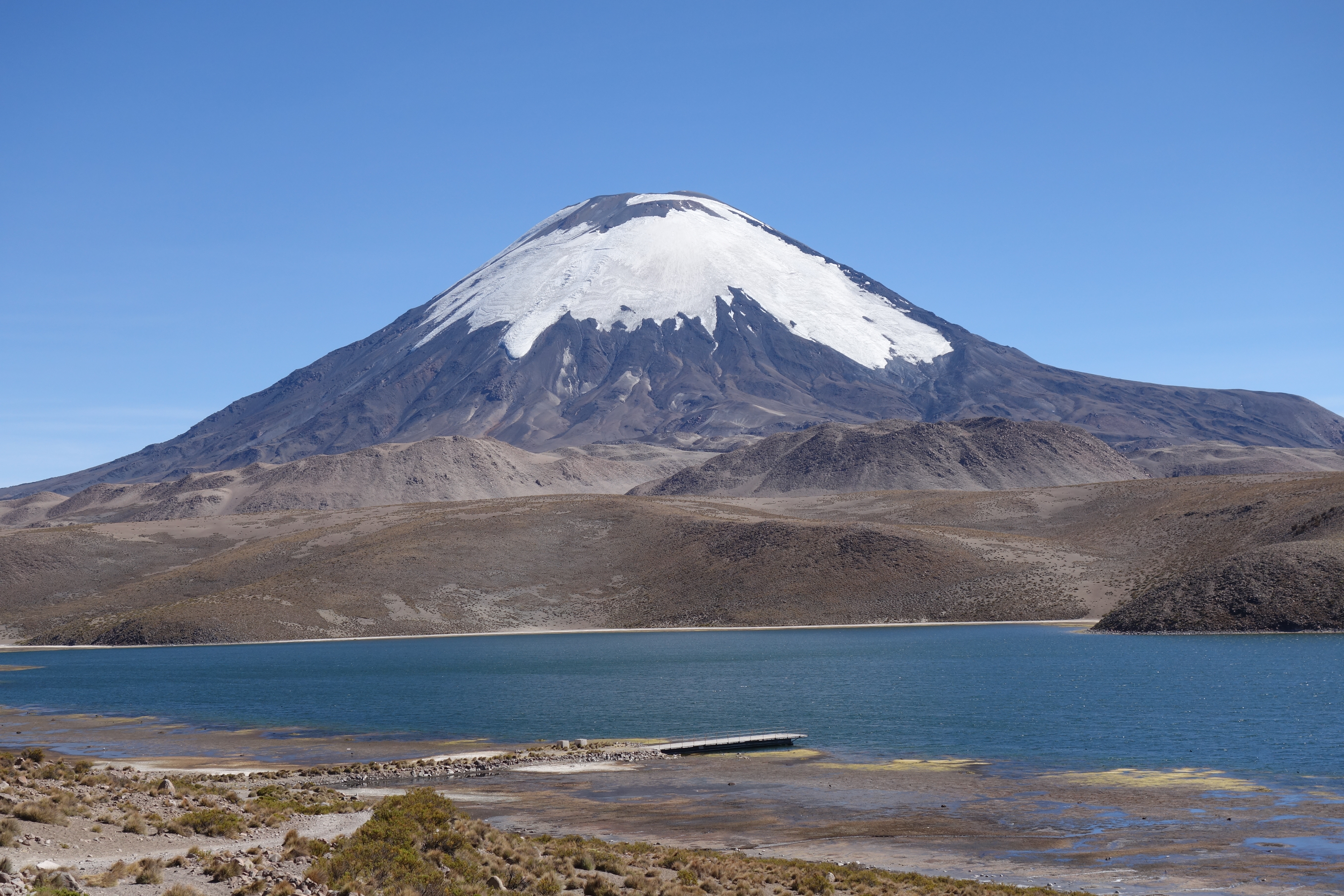
Altiplano Landscape - Lakes
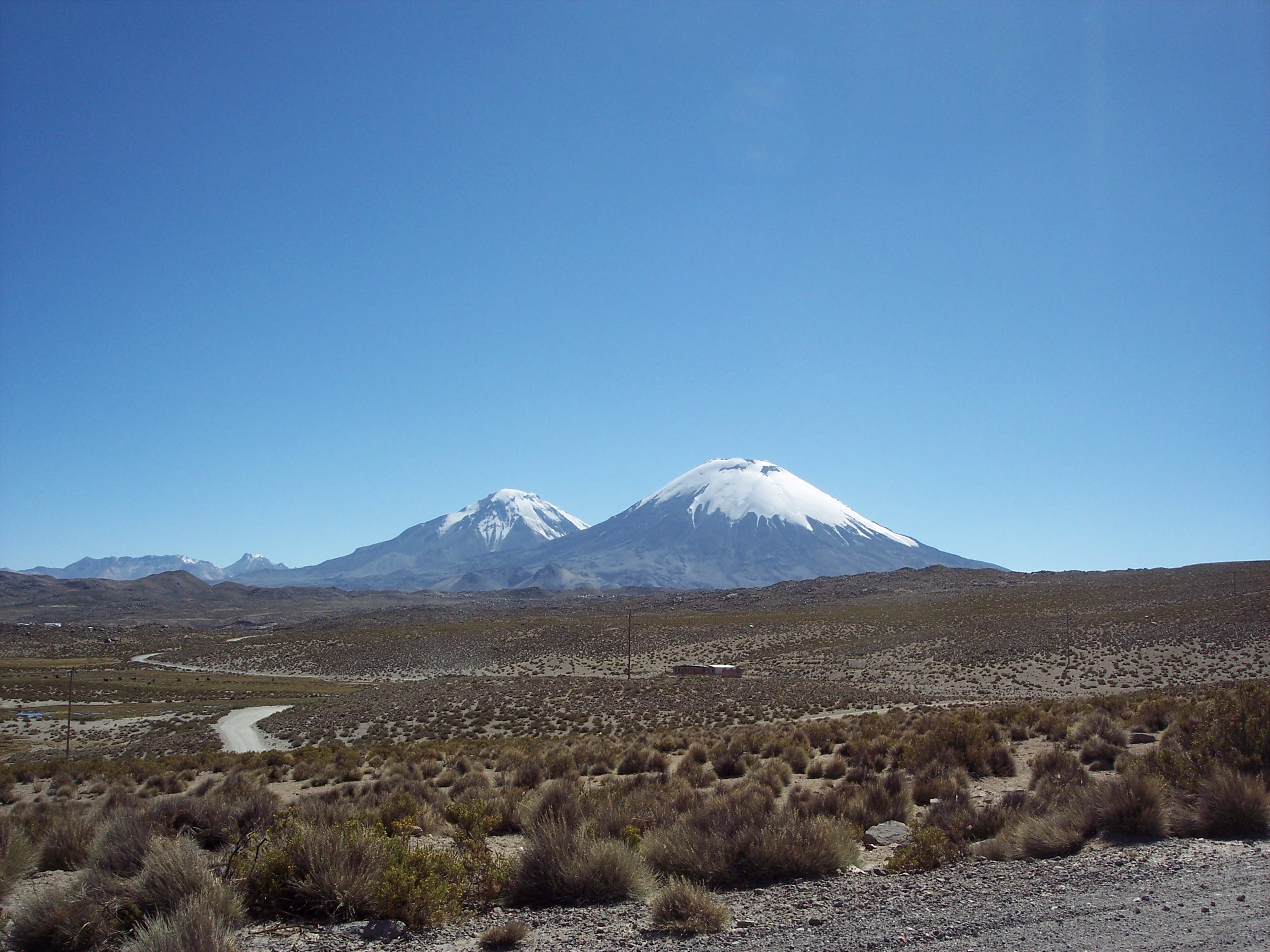
Parinacota Landscape View
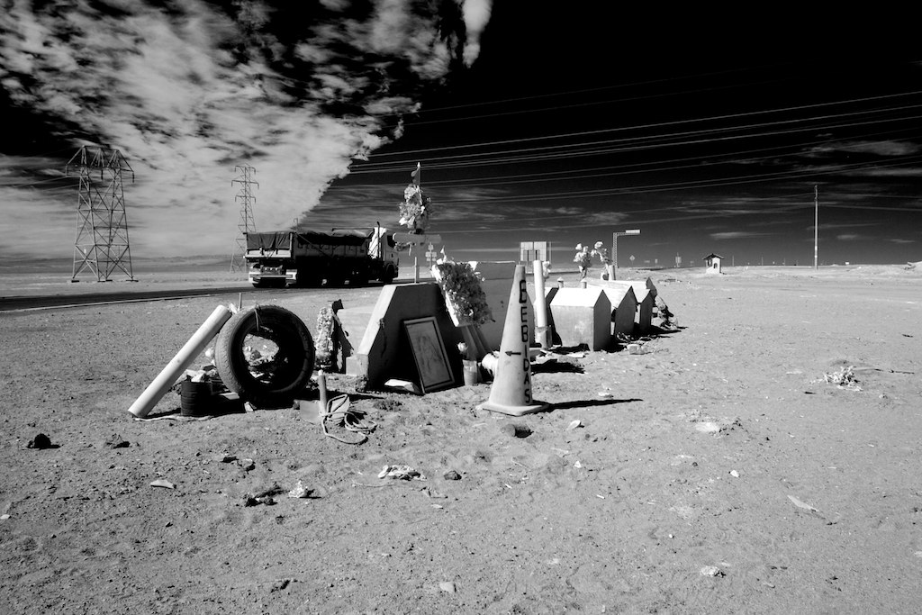
Graves at Pan-American Highway
Chile 2016
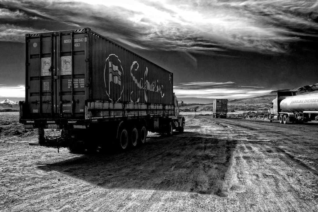
Trucks going to Bolivia
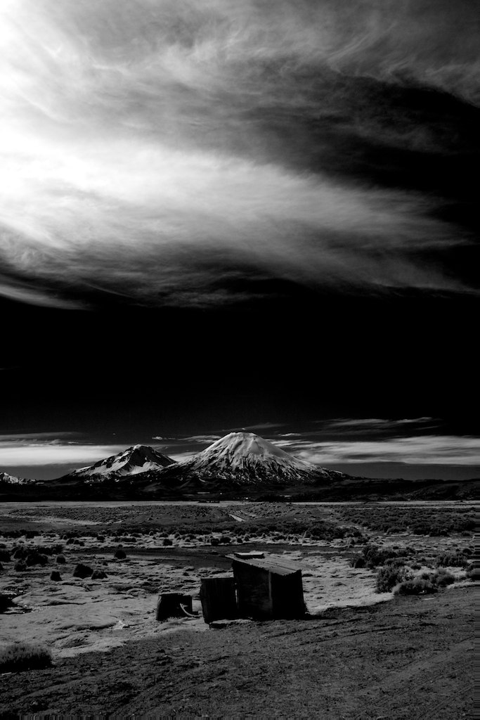
Wild Parinacota
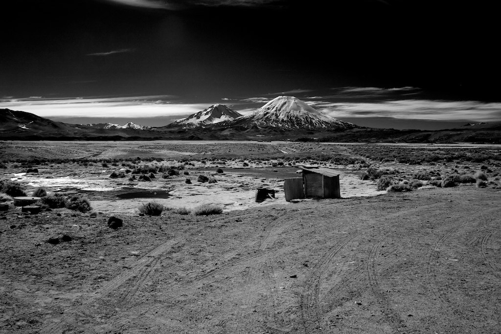
Parinacota view
Chungara met zicht op de volcan Parinacota(1)
Lauca Nationalpark
Cráter en las alturas
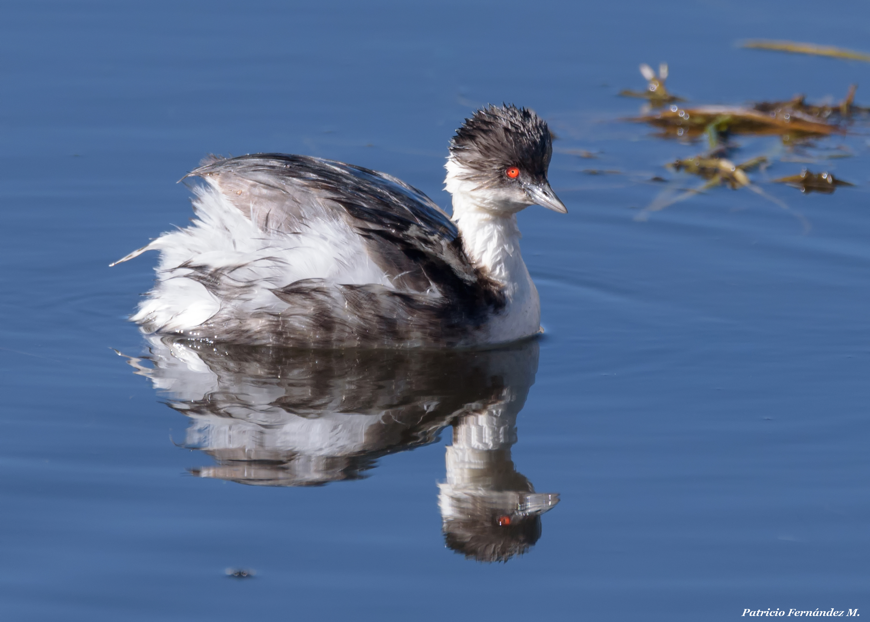
Blanquillo (Podiceps occipitalis)
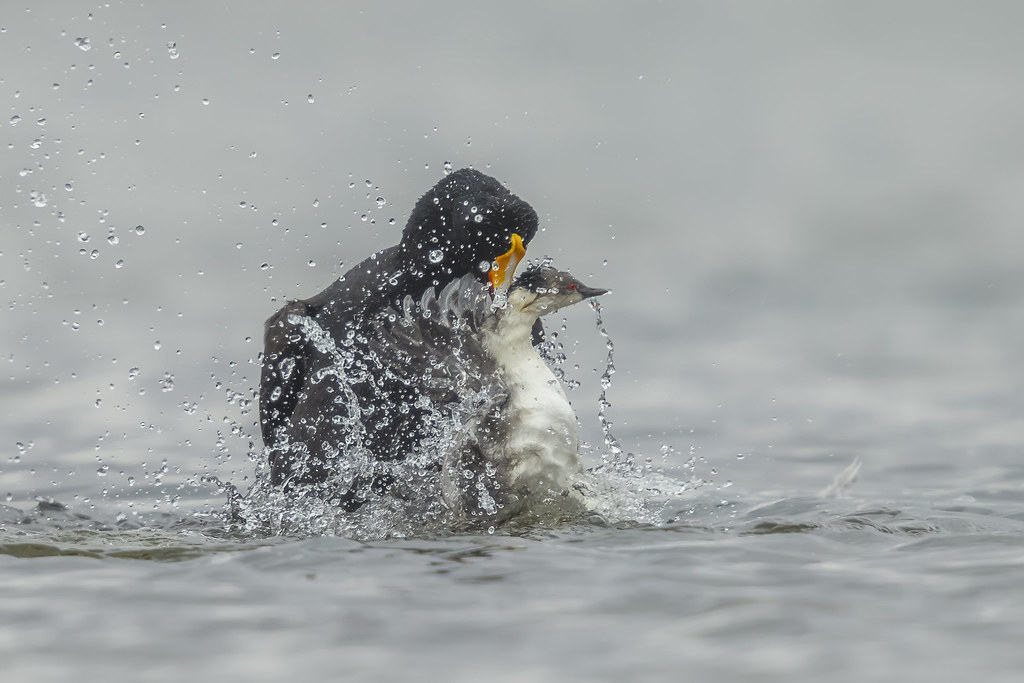
La muerte
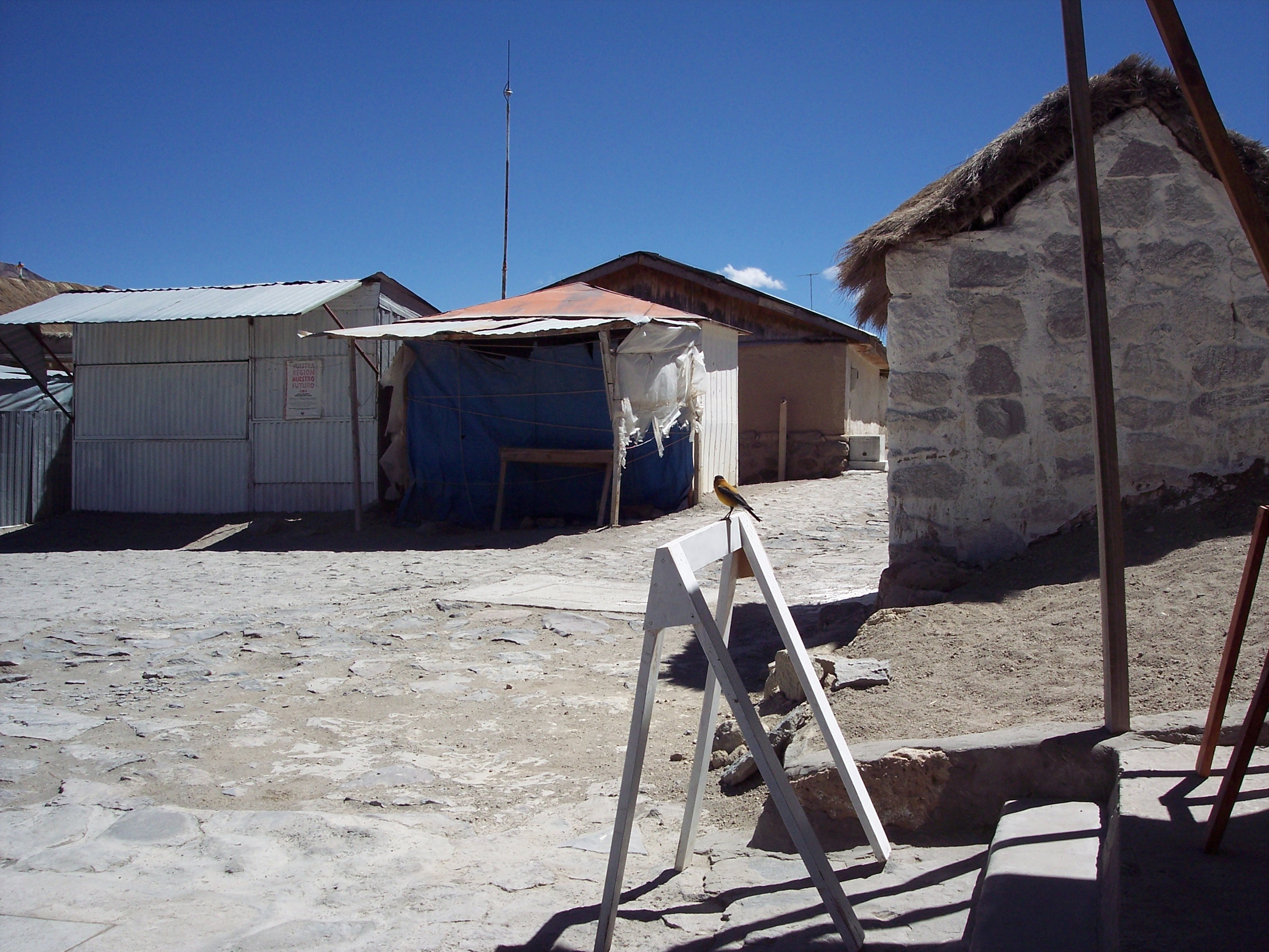
Zwartkapsierragors Black-hooded Sierra-Finch (Phrygilus atriceps) in Parinacota (national monument), Arica and Parinacota Region, Atacama, Chile (2007).
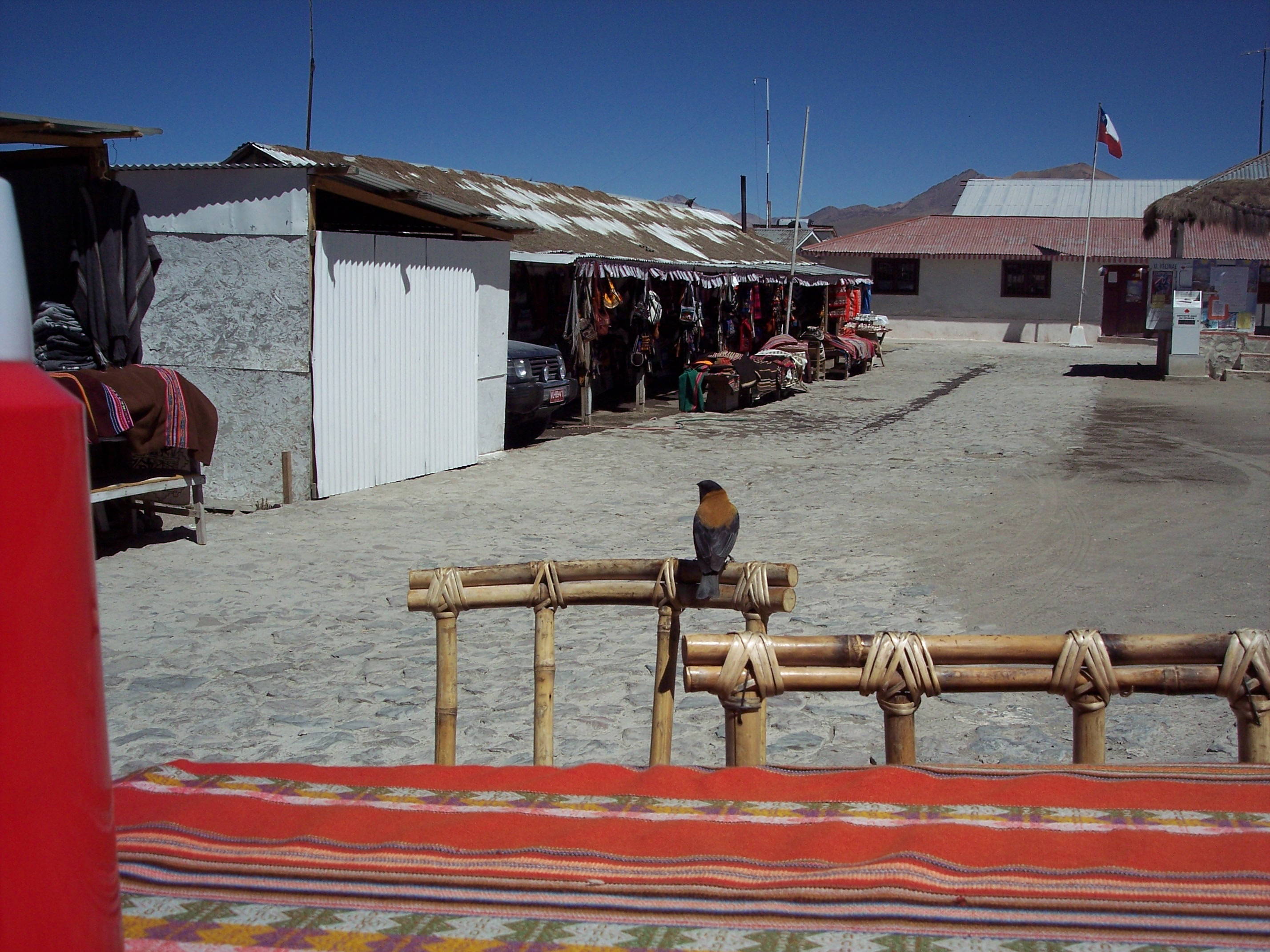
Zwartkapsierragors Black-hooded Sierra-Finch (Phrygilus atriceps) in Parinacota (national monument), Arica and Parinacota Region, Atacama, Chile (2007).

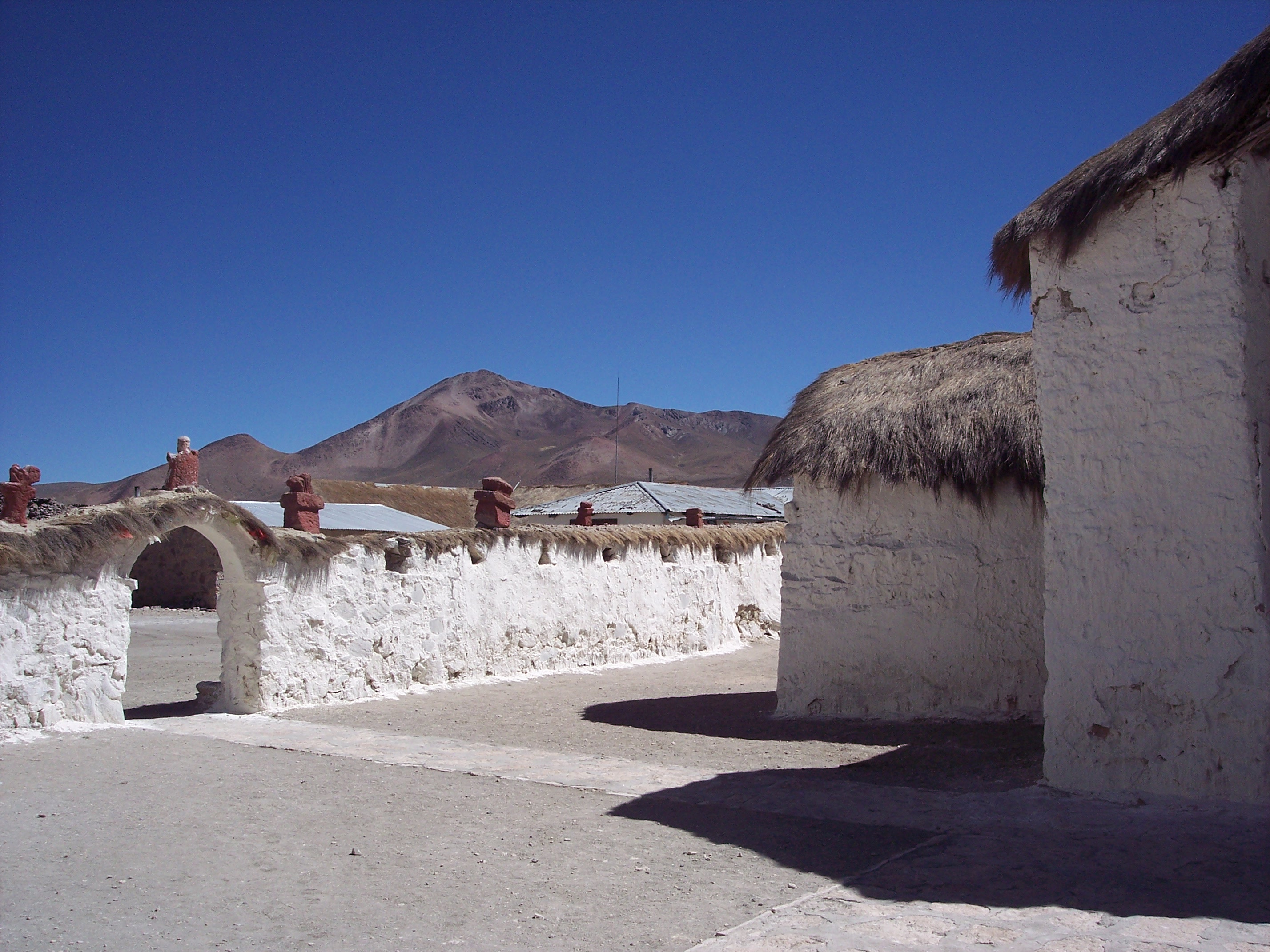
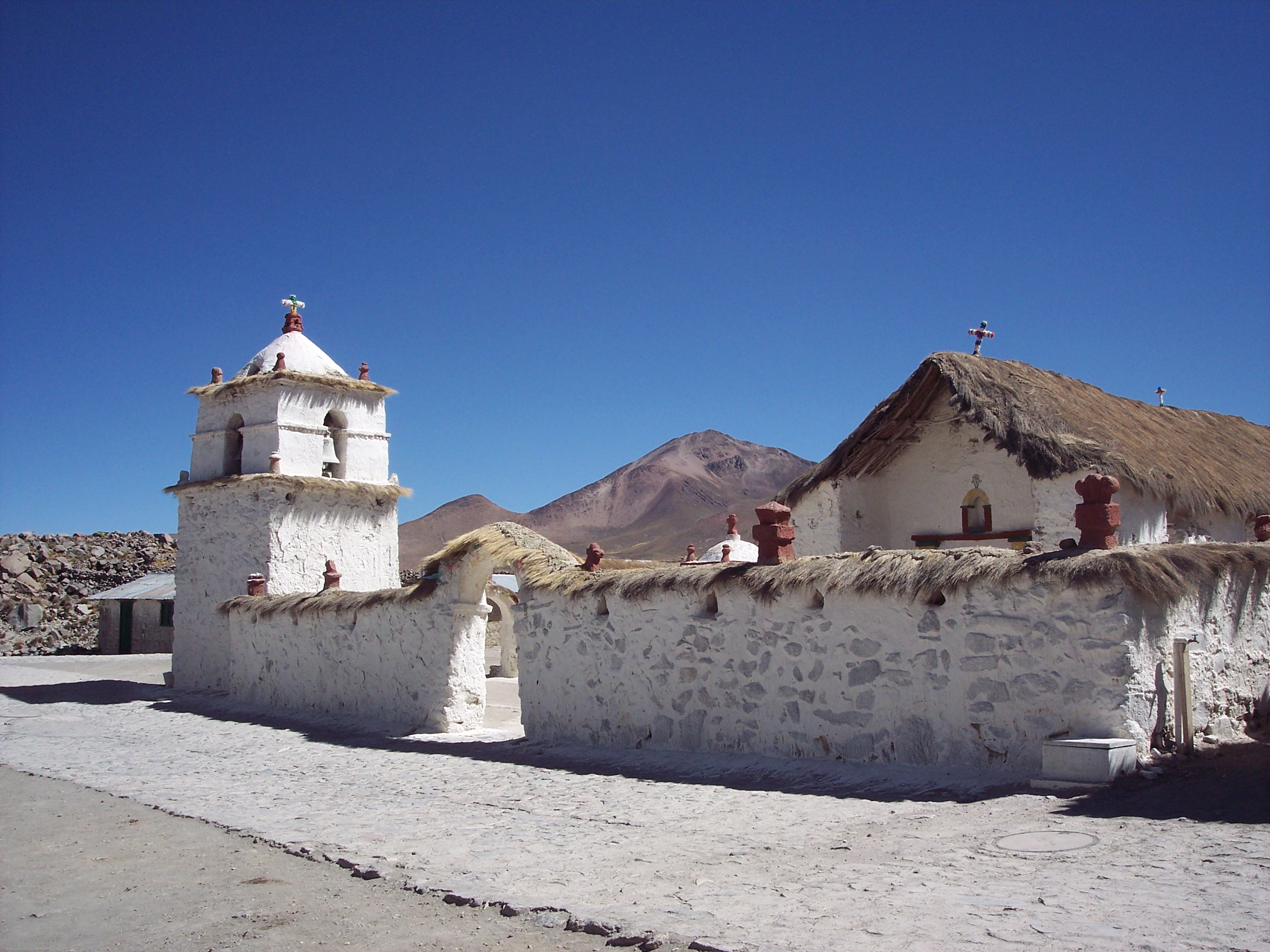
Parinacota (national monument), Arica and Parinacota Region, Atacama, Chile (2007).
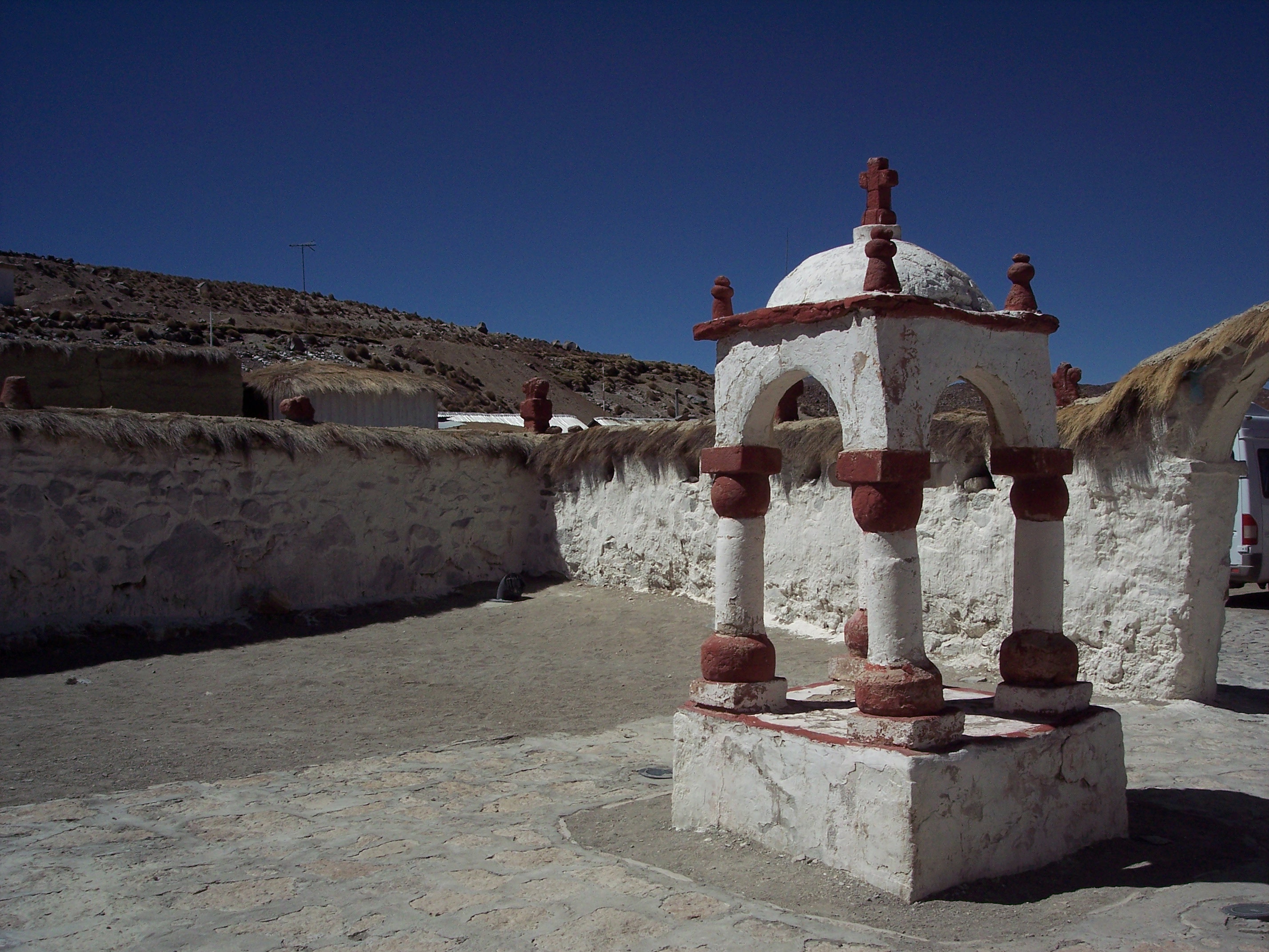
Parinacota (national monument), Arica and Parinacota Region, Atacama, Chile (2007).

Parinacota (national monument), Arica and Parinacota Region, Atacama, Chile (2007).
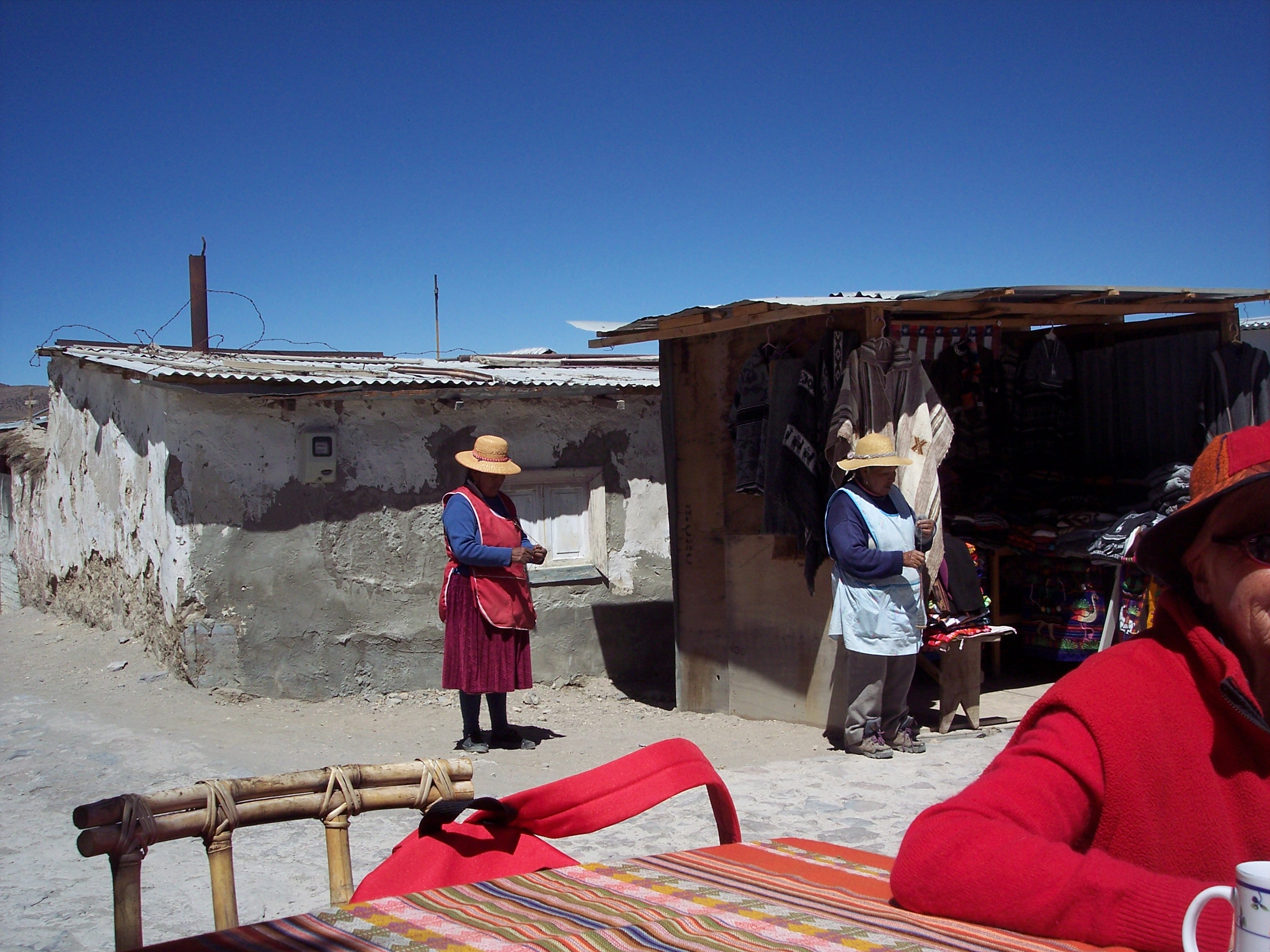
Parinacota (national monument), Arica and Parinacota Region, Atacama, Chile (2007).
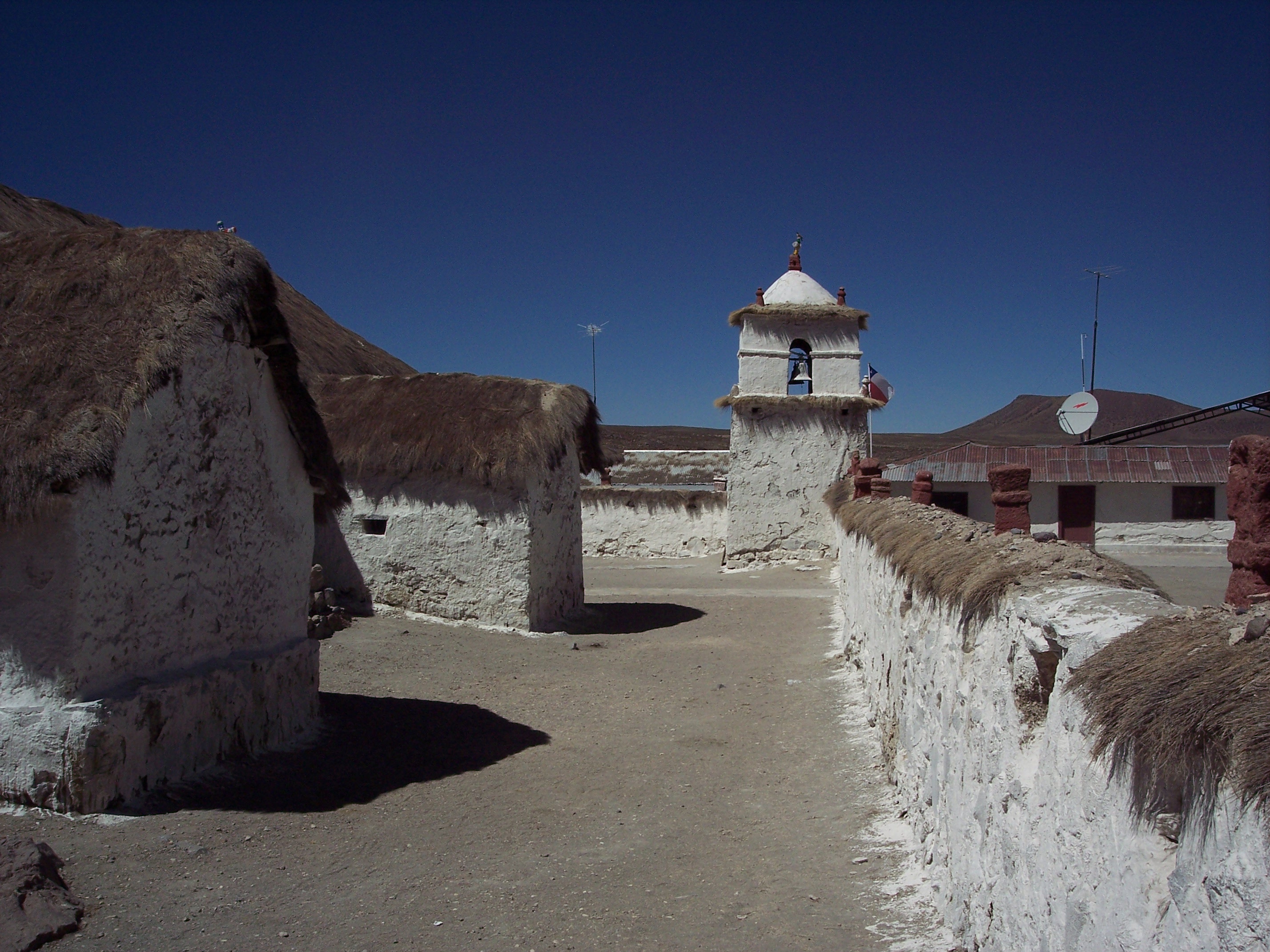
Parinacota (national monument), Arica and Parinacota Region, Atacama, Chile (2007).
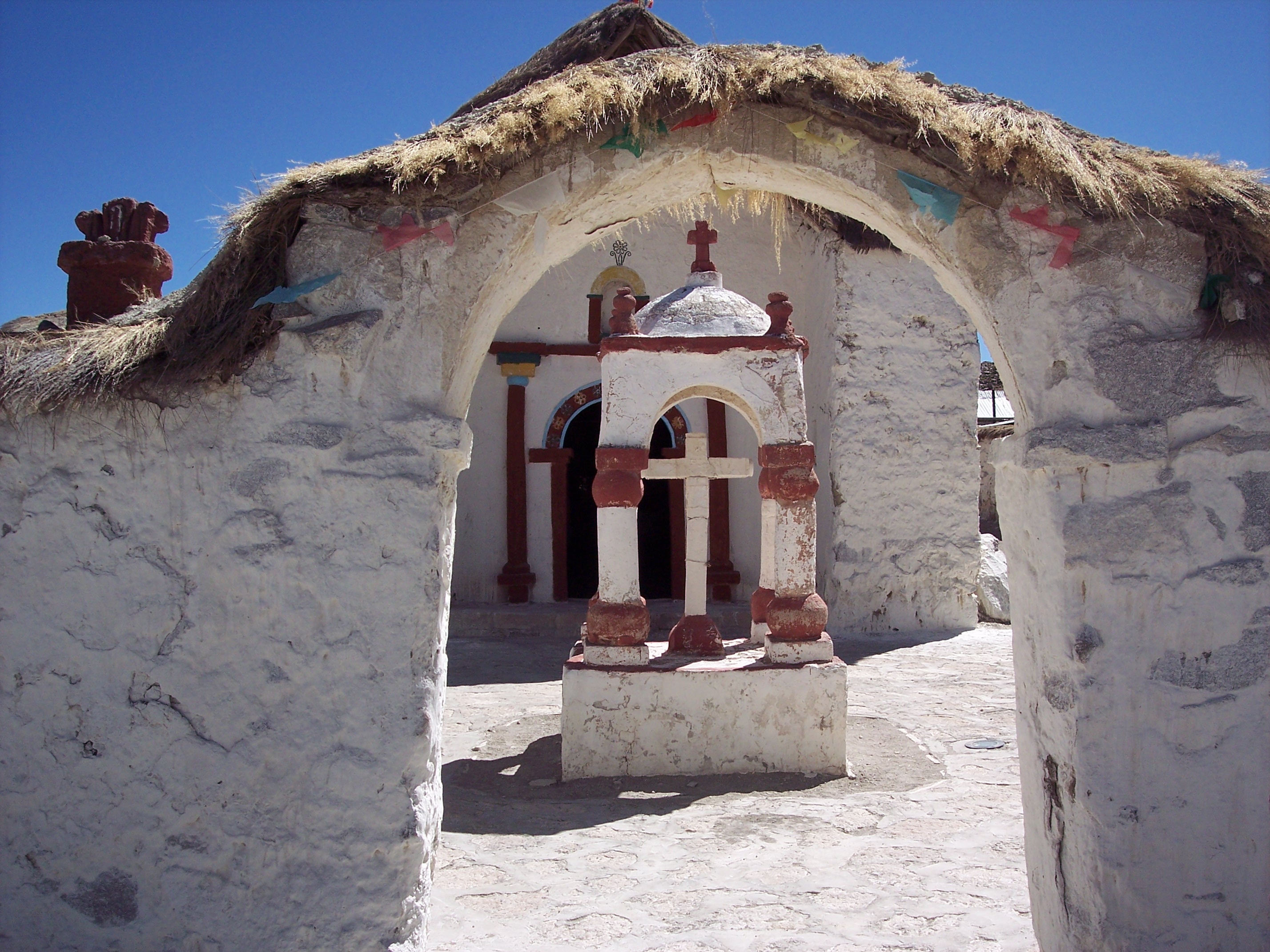
Parinacota (national monument), Arica and Parinacota Region, Atacama, Chile (2007).
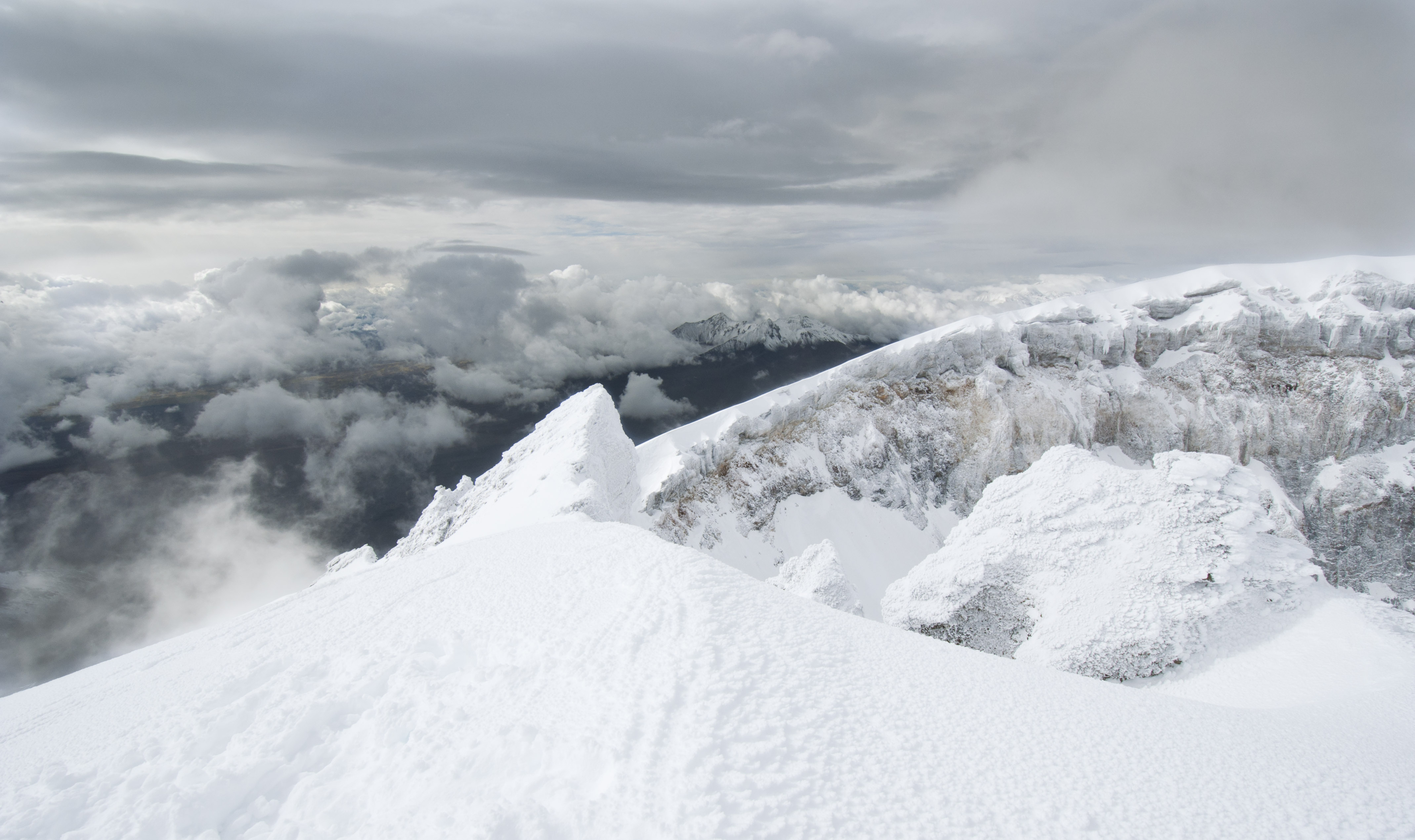
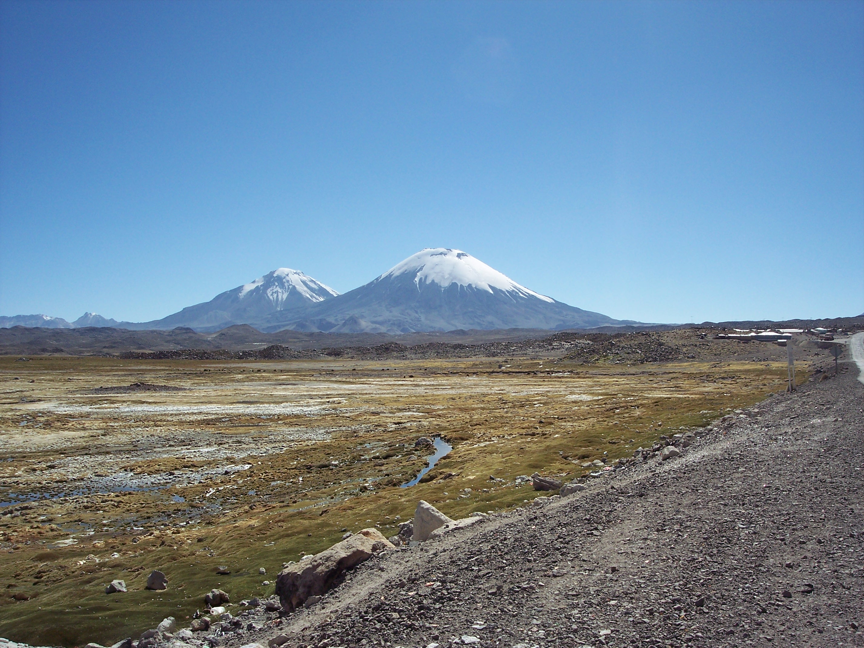
Parinacota (national monument) and Cerro Guane Guane (5050m), Arica and Parinacota Region, Atacama, Chile (2007).
Parinacota (national monument) and Cerro Guane Guane (5050m), Arica and Parinacota Region, Atacama, Chile (2007).
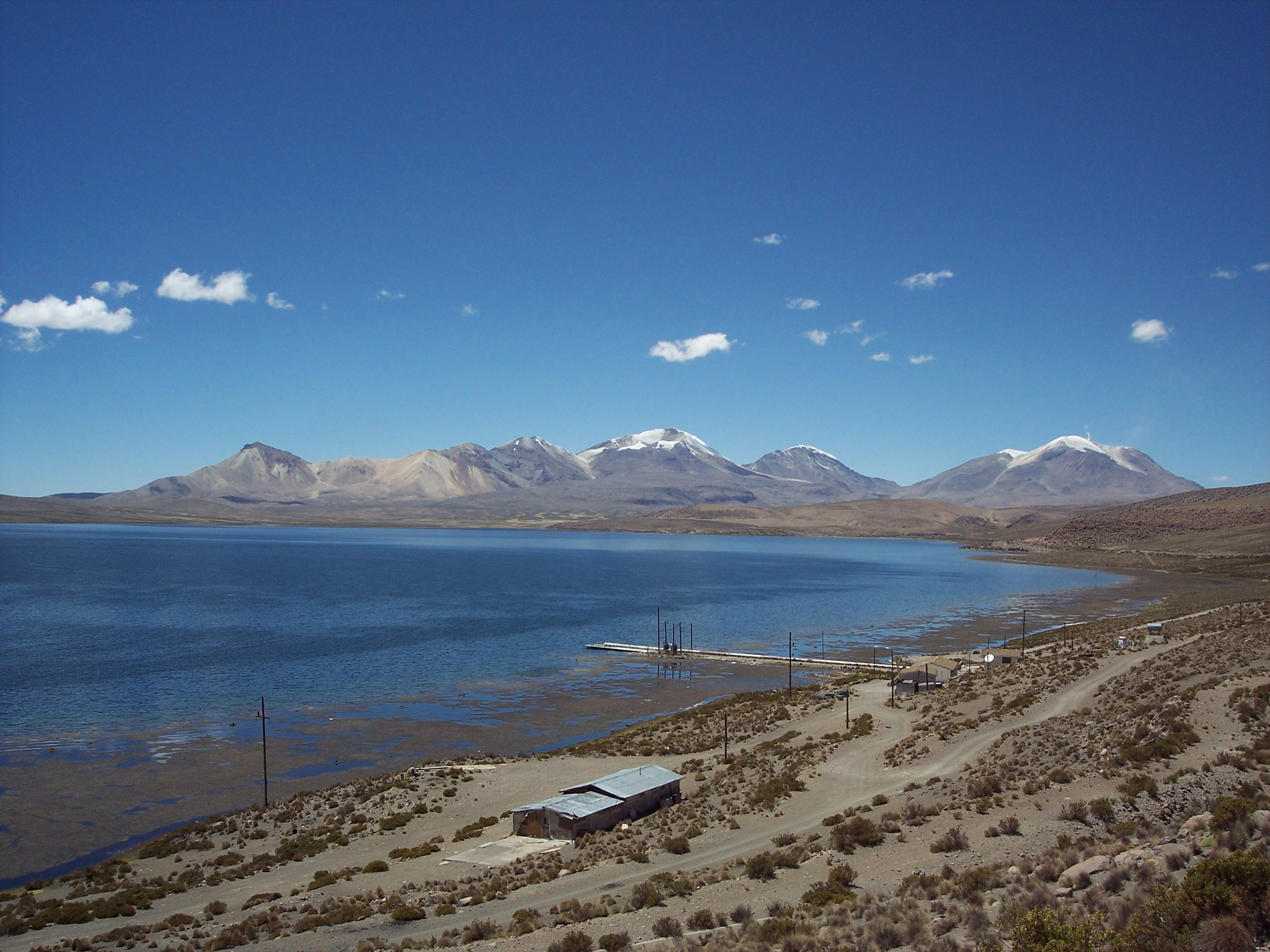
Chungará Lake (4500m), with the three volcanoes Umurata (5730m), Acotango (6052m), and Capurata (5950m), on the border of Chile en Bolivia. On the right the volcano Guallatiri (6071m), Putre, Arica and Parinacota Region, Chile (2007).
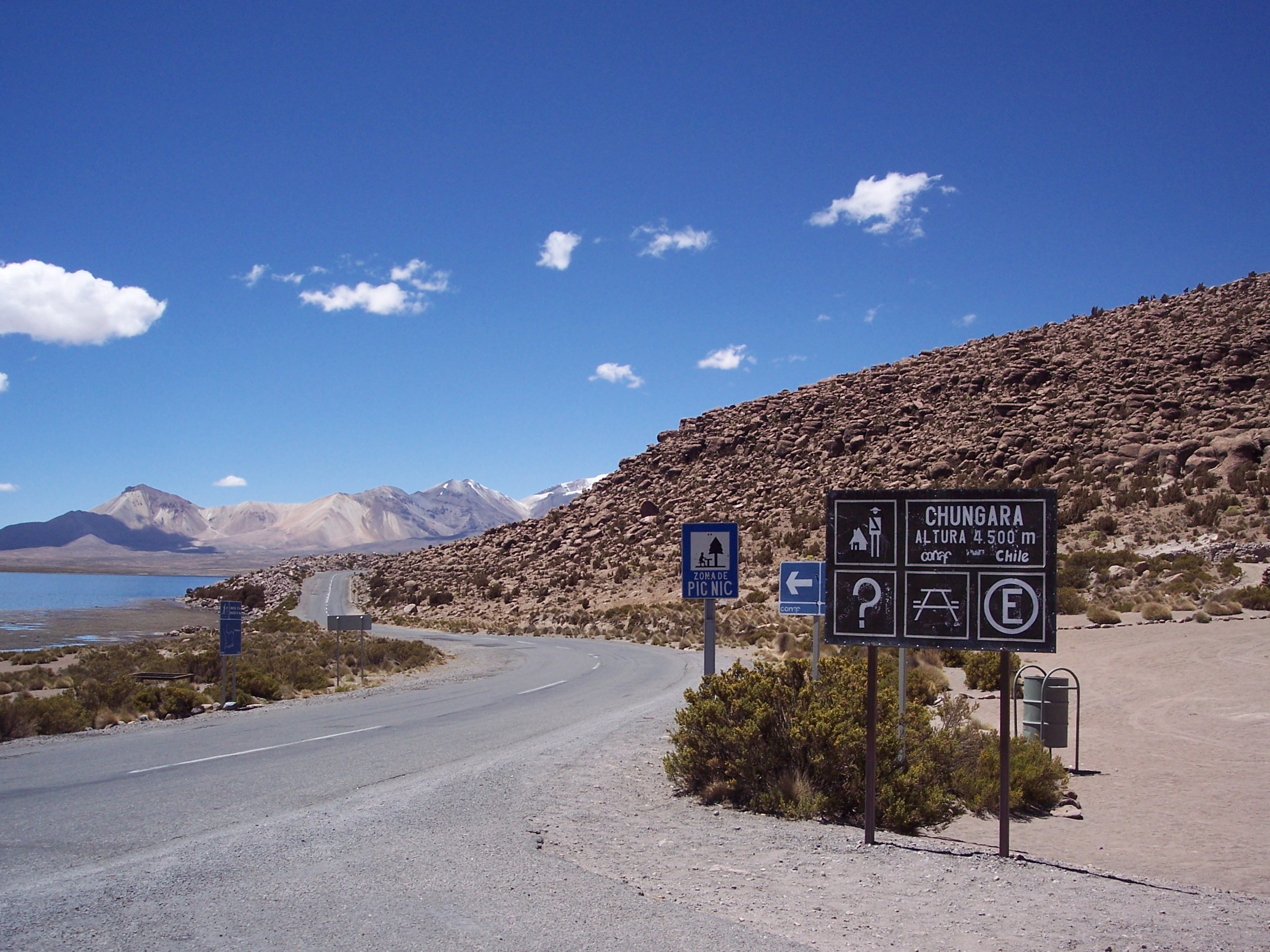
Chungará Lake (4500m), Putre, Arica and Parinacota Region, Chile. On the background the border of Chili and Bolivia (2007).
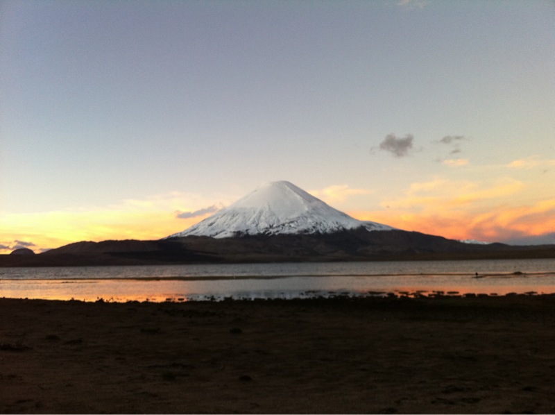
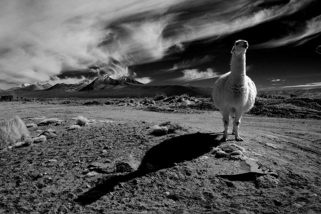
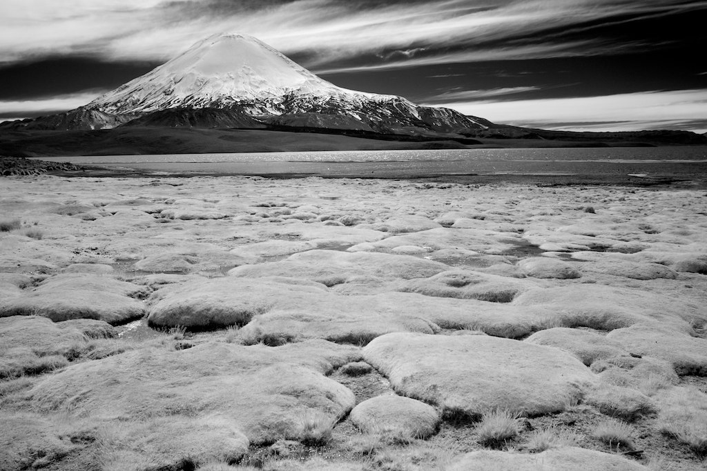
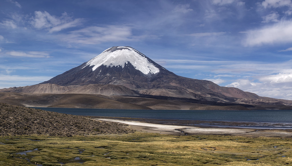
Chungará (4500m), the volcano Parinacota (6348m) and the volcano Pomerape (6222m), Putre, Arica and Parinacota Region, Chile (2007). The animals are vicuñas.
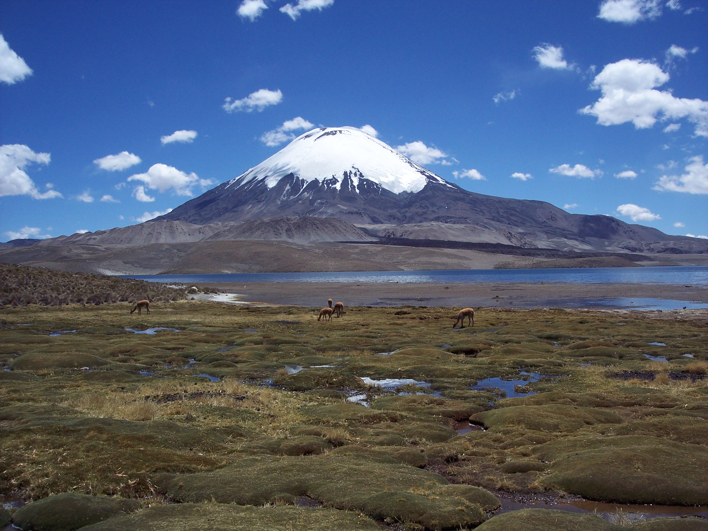
Chungará Lake (4500m) and the volcano Parinacota (6348m), Putre, Arica and Parinacota Region, Chile (2007). The animals are vicuñas.

Chungará Lake (4500m) and the volcano Parinacota (6348m), Putre, Arica and Parinacota Region, Chile (2007). The animals are vicuñas.
Parinacota, Putre, Arica y Parinacota Region, 智利的地图
查询其他地方的日出日落时间
附近地点
Lauca, Putre, Región de Arica y Parinacota, 智利
智利阿里卡和帕里纳科塔大区普特雷琼加拉湖
玻利维亚帕里那哥塔火山
Mount Laram Q'awa, Putre, Arica y Parinacota Region, 智利
智利奥鲁罗基西尼山
玻利维亚帕科卡瓦山
智利奥鲁罗昆图里里山
智利阿里卡和帕里纳科塔大区普特雷普特雷
玻利维亚萨哈马国家公园
Socoroma, Putre, Arica y Parinacota Region, 智利
玻利维亚奇亚拉萨利亚山
玻利维亚阿纳利亚赫西火山
Gral. Lagos, Región de Arica y Parinacota, 智利General Lagos
Tacora, Gral. Lagos, Región de Arica y Parinacota, 智利
秘鲁阿查科柳山
Pallagua 秘鲁
秘鲁卡西里山
Kusima, 玻利维亚
General Jose Manuel Pando, 玻利维亚
秘鲁塔克纳
最近搜索
- Red Dog Mine, AK, USA的日出日落时间表
- Am bhf, Borken, 德国Am Bahnhof的日出日落时间表
- 4th St E, Sonoma, CA 美国的日出日落时间表
- Oakland Ave, Williamsport, PA 美国的日出日落时间表
- Via Roma, Pieranica CR, Italy的日出日落时间表
- 克罗地亚杜布罗夫尼克 GradClock Tower of Dubrovnik的日出日落时间表
- 阿根廷丘布特省特雷利乌的日出日落时间表
- Hartfords Bluff Cir, Mt Pleasant, SC 美国的日出日落时间表
- 日本熊本县熊本市北区的日出日落时间表
- 中国福州市平潭县平潭岛的日出日落时间表