台湾屏東縣三地門鄉青山村至安坡村聯絡道路48號的日出日落时间表
Location: 台湾 > 屏东 > 三地门乡 > 青山村 >
时区:
Asia/Taipei
当地时间:
2025-07-08 19:19:28
经度:
120.6402022
纬度:
22.8200184
今天日出时间:
05:18:32 AM
今天日落时间:
06:46:36 PM
今天日照时常:
13h 28m 4s
明天日出时间:
05:18:55 AM
明天日落时间:
06:46:31 PM
明天日照时常:
13h 27m 36s
显示所有日期
| 日期 | 日出 | 日落 | 日照时常 |
|---|---|---|---|
| 2025年01月01日 | 06:38:02 AM | 05:24:02 PM | 10h 46m 0s |
| 2025年01月02日 | 06:38:20 AM | 05:24:41 PM | 10h 46m 21s |
| 2025年01月03日 | 06:38:36 AM | 05:25:20 PM | 10h 46m 44s |
| 2025年01月04日 | 06:38:51 AM | 05:25:59 PM | 10h 47m 8s |
| 2025年01月05日 | 06:39:05 AM | 05:26:40 PM | 10h 47m 35s |
| 2025年01月06日 | 06:39:17 AM | 05:27:20 PM | 10h 48m 3s |
| 2025年01月07日 | 06:39:28 AM | 05:28:01 PM | 10h 48m 33s |
| 2025年01月08日 | 06:39:38 AM | 05:28:42 PM | 10h 49m 4s |
| 2025年01月09日 | 06:39:46 AM | 05:29:23 PM | 10h 49m 37s |
| 2025年01月10日 | 06:39:53 AM | 05:30:05 PM | 10h 50m 12s |
| 2025年01月11日 | 06:39:59 AM | 05:30:47 PM | 10h 50m 48s |
| 2025年01月12日 | 06:40:03 AM | 05:31:29 PM | 10h 51m 26s |
| 2025年01月13日 | 06:40:06 AM | 05:32:12 PM | 10h 52m 6s |
| 2025年01月14日 | 06:40:08 AM | 05:32:54 PM | 10h 52m 46s |
| 2025年01月15日 | 06:40:08 AM | 05:33:36 PM | 10h 53m 28s |
| 2025年01月16日 | 06:40:06 AM | 05:34:19 PM | 10h 54m 13s |
| 2025年01月17日 | 06:40:04 AM | 05:35:01 PM | 10h 54m 57s |
| 2025年01月18日 | 06:40:00 AM | 05:35:44 PM | 10h 55m 44s |
| 2025年01月19日 | 06:39:54 AM | 05:36:26 PM | 10h 56m 32s |
| 2025年01月20日 | 06:39:47 AM | 05:37:09 PM | 10h 57m 22s |
| 2025年01月21日 | 06:39:39 AM | 05:37:51 PM | 10h 58m 12s |
| 2025年01月22日 | 06:39:29 AM | 05:38:33 PM | 10h 59m 4s |
| 2025年01月23日 | 06:39:18 AM | 05:39:15 PM | 10h 59m 57s |
| 2025年01月24日 | 06:39:06 AM | 05:39:57 PM | 11h 0m 51s |
| 2025年01月25日 | 06:38:52 AM | 05:40:38 PM | 11h 1m 46s |
| 2025年01月26日 | 06:38:37 AM | 05:41:19 PM | 11h 2m 42s |
| 2025年01月27日 | 06:38:21 AM | 05:42:01 PM | 11h 3m 40s |
| 2025年01月28日 | 06:38:03 AM | 05:42:41 PM | 11h 4m 38s |
| 2025年01月29日 | 06:37:44 AM | 05:43:22 PM | 11h 5m 38s |
| 2025年01月30日 | 06:37:23 AM | 05:44:02 PM | 11h 6m 39s |
| 2025年01月31日 | 06:37:02 AM | 05:44:42 PM | 11h 7m 40s |
| 2025年02月01日 | 06:36:39 AM | 05:45:21 PM | 11h 8m 42s |
| 2025年02月02日 | 06:36:14 AM | 05:46:00 PM | 11h 9m 46s |
| 2025年02月03日 | 06:35:49 AM | 05:46:39 PM | 11h 10m 50s |
| 2025年02月04日 | 06:35:22 AM | 05:47:17 PM | 11h 11m 55s |
| 2025年02月05日 | 06:34:54 AM | 05:47:55 PM | 11h 13m 1s |
| 2025年02月06日 | 06:34:25 AM | 05:48:32 PM | 11h 14m 7s |
| 2025年02月07日 | 06:33:55 AM | 05:49:10 PM | 11h 15m 15s |
| 2025年02月08日 | 06:33:23 AM | 05:49:46 PM | 11h 16m 23s |
| 2025年02月09日 | 06:32:51 AM | 05:50:22 PM | 11h 17m 31s |
| 2025年02月10日 | 06:32:17 AM | 05:50:58 PM | 11h 18m 41s |
| 2025年02月11日 | 06:31:42 AM | 05:51:33 PM | 11h 19m 51s |
| 2025年02月12日 | 06:31:06 AM | 05:52:08 PM | 11h 21m 2s |
| 2025年02月13日 | 06:30:29 AM | 05:52:42 PM | 11h 22m 13s |
| 2025年02月14日 | 06:29:51 AM | 05:53:16 PM | 11h 23m 25s |
| 2025年02月15日 | 06:29:12 AM | 05:53:50 PM | 11h 24m 38s |
| 2025年02月16日 | 06:28:32 AM | 05:54:23 PM | 11h 25m 51s |
| 2025年02月17日 | 06:27:51 AM | 05:54:55 PM | 11h 27m 4s |
| 2025年02月18日 | 06:27:10 AM | 05:55:27 PM | 11h 28m 17s |
| 2025年02月19日 | 06:26:27 AM | 05:55:59 PM | 11h 29m 32s |
| 2025年02月20日 | 06:25:43 AM | 05:56:30 PM | 11h 30m 47s |
| 2025年02月21日 | 06:24:59 AM | 05:57:01 PM | 11h 32m 2s |
| 2025年02月22日 | 06:24:14 AM | 05:57:31 PM | 11h 33m 17s |
| 2025年02月23日 | 06:23:28 AM | 05:58:01 PM | 11h 34m 33s |
| 2025年02月24日 | 06:22:41 AM | 05:58:30 PM | 11h 35m 49s |
| 2025年02月25日 | 06:21:53 AM | 05:58:59 PM | 11h 37m 6s |
| 2025年02月26日 | 06:21:05 AM | 05:59:28 PM | 11h 38m 23s |
| 2025年02月27日 | 06:20:16 AM | 05:59:56 PM | 11h 39m 40s |
| 2025年02月28日 | 06:19:26 AM | 06:00:24 PM | 11h 40m 58s |
| 2025年03月01日 | 06:18:36 AM | 06:00:51 PM | 11h 42m 15s |
| 2025年03月02日 | 06:17:45 AM | 06:01:18 PM | 11h 43m 33s |
| 2025年03月03日 | 06:16:53 AM | 06:01:45 PM | 11h 44m 52s |
| 2025年03月04日 | 06:16:01 AM | 06:02:11 PM | 11h 46m 10s |
| 2025年03月05日 | 06:15:08 AM | 06:02:37 PM | 11h 47m 29s |
| 2025年03月06日 | 06:14:15 AM | 06:03:02 PM | 11h 48m 47s |
| 2025年03月07日 | 06:13:22 AM | 06:03:28 PM | 11h 50m 6s |
| 2025年03月08日 | 06:12:27 AM | 06:03:53 PM | 11h 51m 26s |
| 2025年03月09日 | 06:11:33 AM | 06:04:17 PM | 11h 52m 44s |
| 2025年03月10日 | 06:10:38 AM | 06:04:42 PM | 11h 54m 4s |
| 2025年03月11日 | 06:09:43 AM | 06:05:06 PM | 11h 55m 23s |
| 2025年03月12日 | 06:08:47 AM | 06:05:29 PM | 11h 56m 42s |
| 2025年03月13日 | 06:07:51 AM | 06:05:53 PM | 11h 58m 2s |
| 2025年03月14日 | 06:06:54 AM | 06:06:16 PM | 11h 59m 22s |
| 2025年03月15日 | 06:05:58 AM | 06:06:39 PM | 12h 0m 41s |
| 2025年03月16日 | 06:05:01 AM | 06:07:02 PM | 12h 2m 1s |
| 2025年03月17日 | 06:04:04 AM | 06:07:25 PM | 12h 3m 21s |
| 2025年03月18日 | 06:03:07 AM | 06:07:48 PM | 12h 4m 41s |
| 2025年03月19日 | 06:02:09 AM | 06:08:10 PM | 12h 6m 1s |
| 2025年03月20日 | 06:01:12 AM | 06:08:32 PM | 12h 7m 20s |
| 2025年03月21日 | 06:00:14 AM | 06:08:54 PM | 12h 8m 40s |
| 2025年03月22日 | 05:59:16 AM | 06:09:16 PM | 12h 10m 0s |
| 2025年03月23日 | 05:58:18 AM | 06:09:38 PM | 12h 11m 20s |
| 2025年03月24日 | 05:57:20 AM | 06:10:00 PM | 12h 12m 40s |
| 2025年03月25日 | 05:56:23 AM | 06:10:22 PM | 12h 13m 59s |
| 2025年03月26日 | 05:55:25 AM | 06:10:43 PM | 12h 15m 18s |
| 2025年03月27日 | 05:54:27 AM | 06:11:05 PM | 12h 16m 38s |
| 2025年03月28日 | 05:53:29 AM | 06:11:26 PM | 12h 17m 57s |
| 2025年03月29日 | 05:52:31 AM | 06:11:48 PM | 12h 19m 17s |
| 2025年03月30日 | 05:51:34 AM | 06:12:10 PM | 12h 20m 36s |
| 2025年03月31日 | 05:50:37 AM | 06:12:31 PM | 12h 21m 54s |
| 2025年04月01日 | 05:49:39 AM | 06:12:53 PM | 12h 23m 14s |
| 2025年04月02日 | 05:48:42 AM | 06:13:14 PM | 12h 24m 32s |
| 2025年04月03日 | 05:47:46 AM | 06:13:36 PM | 12h 25m 50s |
| 2025年04月04日 | 05:46:49 AM | 06:13:58 PM | 12h 27m 9s |
| 2025年04月05日 | 05:45:53 AM | 06:14:19 PM | 12h 28m 26s |
| 2025年04月06日 | 05:44:57 AM | 06:14:41 PM | 12h 29m 44s |
| 2025年04月07日 | 05:44:01 AM | 06:15:03 PM | 12h 31m 2s |
| 2025年04月08日 | 05:43:06 AM | 06:15:25 PM | 12h 32m 19s |
| 2025年04月09日 | 05:42:11 AM | 06:15:47 PM | 12h 33m 36s |
| 2025年04月10日 | 05:41:17 AM | 06:16:09 PM | 12h 34m 52s |
| 2025年04月11日 | 05:40:22 AM | 06:16:32 PM | 12h 36m 10s |
| 2025年04月12日 | 05:39:29 AM | 06:16:54 PM | 12h 37m 25s |
| 2025年04月13日 | 05:38:36 AM | 06:17:17 PM | 12h 38m 41s |
| 2025年04月14日 | 05:37:43 AM | 06:17:40 PM | 12h 39m 57s |
| 2025年04月15日 | 05:36:51 AM | 06:18:03 PM | 12h 41m 12s |
| 2025年04月16日 | 05:35:59 AM | 06:18:26 PM | 12h 42m 27s |
| 2025年04月17日 | 05:35:08 AM | 06:18:49 PM | 12h 43m 41s |
| 2025年04月18日 | 05:34:18 AM | 06:19:13 PM | 12h 44m 55s |
| 2025年04月19日 | 05:33:28 AM | 06:19:37 PM | 12h 46m 9s |
| 2025年04月20日 | 05:32:39 AM | 06:20:00 PM | 12h 47m 21s |
| 2025年04月21日 | 05:31:50 AM | 06:20:25 PM | 12h 48m 35s |
| 2025年04月22日 | 05:31:03 AM | 06:20:49 PM | 12h 49m 46s |
| 2025年04月23日 | 05:30:16 AM | 06:21:13 PM | 12h 50m 57s |
| 2025年04月24日 | 05:29:29 AM | 06:21:38 PM | 12h 52m 9s |
| 2025年04月25日 | 05:28:43 AM | 06:22:03 PM | 12h 53m 20s |
| 2025年04月26日 | 05:27:59 AM | 06:22:28 PM | 12h 54m 29s |
| 2025年04月27日 | 05:27:15 AM | 06:22:53 PM | 12h 55m 38s |
| 2025年04月28日 | 05:26:31 AM | 06:23:19 PM | 12h 56m 48s |
| 2025年04月29日 | 05:25:49 AM | 06:23:45 PM | 12h 57m 56s |
| 2025年04月30日 | 05:25:07 AM | 06:24:10 PM | 12h 59m 3s |
| 2025年05月01日 | 05:24:27 AM | 06:24:37 PM | 13h 0m 10s |
| 2025年05月02日 | 05:23:47 AM | 06:25:03 PM | 13h 1m 16s |
| 2025年05月03日 | 05:23:08 AM | 06:25:29 PM | 13h 2m 21s |
| 2025年05月04日 | 05:22:30 AM | 06:25:56 PM | 13h 3m 26s |
| 2025年05月05日 | 05:21:53 AM | 06:26:23 PM | 13h 4m 30s |
| 2025年05月06日 | 05:21:17 AM | 06:26:50 PM | 13h 5m 33s |
| 2025年05月07日 | 05:20:42 AM | 06:27:17 PM | 13h 6m 35s |
| 2025年05月08日 | 05:20:08 AM | 06:27:44 PM | 13h 7m 36s |
| 2025年05月09日 | 05:19:34 AM | 06:28:12 PM | 13h 8m 38s |
| 2025年05月10日 | 05:19:02 AM | 06:28:39 PM | 13h 9m 37s |
| 2025年05月11日 | 05:18:31 AM | 06:29:07 PM | 13h 10m 36s |
| 2025年05月12日 | 05:18:01 AM | 06:29:34 PM | 13h 11m 33s |
| 2025年05月13日 | 05:17:32 AM | 06:30:02 PM | 13h 12m 30s |
| 2025年05月14日 | 05:17:04 AM | 06:30:30 PM | 13h 13m 26s |
| 2025年05月15日 | 05:16:38 AM | 06:30:58 PM | 13h 14m 20s |
| 2025年05月16日 | 05:16:12 AM | 06:31:26 PM | 13h 15m 14s |
| 2025年05月17日 | 05:15:47 AM | 06:31:54 PM | 13h 16m 7s |
| 2025年05月18日 | 05:15:24 AM | 06:32:22 PM | 13h 16m 58s |
| 2025年05月19日 | 05:15:02 AM | 06:32:50 PM | 13h 17m 48s |
| 2025年05月20日 | 05:14:40 AM | 06:33:18 PM | 13h 18m 38s |
| 2025年05月21日 | 05:14:20 AM | 06:33:46 PM | 13h 19m 26s |
| 2025年05月22日 | 05:14:01 AM | 06:34:13 PM | 13h 20m 12s |
| 2025年05月23日 | 05:13:44 AM | 06:34:41 PM | 13h 20m 57s |
| 2025年05月24日 | 05:13:27 AM | 06:35:09 PM | 13h 21m 42s |
| 2025年05月25日 | 05:13:11 AM | 06:35:36 PM | 13h 22m 25s |
| 2025年05月26日 | 05:12:57 AM | 06:36:03 PM | 13h 23m 6s |
| 2025年05月27日 | 05:12:44 AM | 06:36:30 PM | 13h 23m 46s |
| 2025年05月28日 | 05:12:32 AM | 06:36:57 PM | 13h 24m 25s |
| 2025年05月29日 | 05:12:21 AM | 06:37:24 PM | 13h 25m 3s |
| 2025年05月30日 | 05:12:11 AM | 06:37:50 PM | 13h 25m 39s |
| 2025年05月31日 | 05:12:03 AM | 06:38:16 PM | 13h 26m 13s |
| 2025年06月01日 | 05:11:55 AM | 06:38:42 PM | 13h 26m 47s |
| 2025年06月02日 | 05:11:49 AM | 06:39:07 PM | 13h 27m 18s |
| 2025年06月03日 | 05:11:44 AM | 06:39:32 PM | 13h 27m 48s |
| 2025年06月04日 | 05:11:40 AM | 06:39:56 PM | 13h 28m 16s |
| 2025年06月05日 | 05:11:37 AM | 06:40:20 PM | 13h 28m 43s |
| 2025年06月06日 | 05:11:35 AM | 06:40:44 PM | 13h 29m 9s |
| 2025年06月07日 | 05:11:34 AM | 06:41:07 PM | 13h 29m 33s |
| 2025年06月08日 | 05:11:34 AM | 06:41:30 PM | 13h 29m 56s |
| 2025年06月09日 | 05:11:36 AM | 06:41:52 PM | 13h 30m 16s |
| 2025年06月10日 | 05:11:38 AM | 06:42:13 PM | 13h 30m 35s |
| 2025年06月11日 | 05:11:42 AM | 06:42:34 PM | 13h 30m 52s |
| 2025年06月12日 | 05:11:46 AM | 06:42:54 PM | 13h 31m 8s |
| 2025年06月13日 | 05:11:52 AM | 06:43:14 PM | 13h 31m 22s |
| 2025年06月14日 | 05:11:58 AM | 06:43:33 PM | 13h 31m 35s |
| 2025年06月15日 | 05:12:06 AM | 06:43:51 PM | 13h 31m 45s |
| 2025年06月16日 | 05:12:14 AM | 06:44:08 PM | 13h 31m 54s |
| 2025年06月17日 | 05:12:23 AM | 06:44:25 PM | 13h 32m 2s |
| 2025年06月18日 | 05:12:34 AM | 06:44:41 PM | 13h 32m 7s |
| 2025年06月19日 | 05:12:45 AM | 06:44:56 PM | 13h 32m 11s |
| 2025年06月20日 | 05:12:57 AM | 06:45:10 PM | 13h 32m 13s |
| 2025年06月21日 | 05:13:10 AM | 06:45:23 PM | 13h 32m 13s |
| 2025年06月22日 | 05:13:23 AM | 06:45:36 PM | 13h 32m 13s |
| 2025年06月23日 | 05:13:38 AM | 06:45:47 PM | 13h 32m 9s |
| 2025年06月24日 | 05:13:53 AM | 06:45:58 PM | 13h 32m 5s |
| 2025年06月25日 | 05:14:09 AM | 06:46:07 PM | 13h 31m 58s |
| 2025年06月26日 | 05:14:26 AM | 06:46:16 PM | 13h 31m 50s |
| 2025年06月27日 | 05:14:43 AM | 06:46:23 PM | 13h 31m 40s |
| 2025年06月28日 | 05:15:01 AM | 06:46:30 PM | 13h 31m 29s |
| 2025年06月29日 | 05:15:20 AM | 06:46:36 PM | 13h 31m 16s |
| 2025年06月30日 | 05:15:39 AM | 06:46:40 PM | 13h 31m 1s |
| 2025年07月01日 | 05:15:59 AM | 06:46:43 PM | 13h 30m 44s |
| 2025年07月02日 | 05:16:19 AM | 06:46:46 PM | 13h 30m 27s |
| 2025年07月03日 | 05:16:40 AM | 06:46:47 PM | 13h 30m 7s |
| 2025年07月04日 | 05:17:02 AM | 06:46:47 PM | 13h 29m 45s |
| 2025年07月05日 | 05:17:24 AM | 06:46:46 PM | 13h 29m 22s |
| 2025年07月06日 | 05:17:46 AM | 06:46:44 PM | 13h 28m 58s |
| 2025年07月07日 | 05:18:09 AM | 06:46:41 PM | 13h 28m 32s |
| 2025年07月08日 | 05:18:32 AM | 06:46:36 PM | 13h 28m 4s |
| 2025年07月09日 | 05:18:55 AM | 06:46:31 PM | 13h 27m 36s |
| 2025年07月10日 | 05:19:19 AM | 06:46:24 PM | 13h 27m 5s |
| 2025年07月11日 | 05:19:43 AM | 06:46:16 PM | 13h 26m 33s |
| 2025年07月12日 | 05:20:08 AM | 06:46:07 PM | 13h 25m 59s |
| 2025年07月13日 | 05:20:32 AM | 06:45:57 PM | 13h 25m 25s |
| 2025年07月14日 | 05:20:57 AM | 06:45:45 PM | 13h 24m 48s |
| 2025年07月15日 | 05:21:22 AM | 06:45:32 PM | 13h 24m 10s |
| 2025年07月16日 | 05:21:48 AM | 06:45:18 PM | 13h 23m 30s |
| 2025年07月17日 | 05:22:13 AM | 06:45:03 PM | 13h 22m 50s |
| 2025年07月18日 | 05:22:38 AM | 06:44:47 PM | 13h 22m 9s |
| 2025年07月19日 | 05:23:04 AM | 06:44:30 PM | 13h 21m 26s |
| 2025年07月20日 | 05:23:30 AM | 06:44:11 PM | 13h 20m 41s |
| 2025年07月21日 | 05:23:56 AM | 06:43:51 PM | 13h 19m 55s |
| 2025年07月22日 | 05:24:21 AM | 06:43:30 PM | 13h 19m 9s |
| 2025年07月23日 | 05:24:47 AM | 06:43:08 PM | 13h 18m 21s |
| 2025年07月24日 | 05:25:13 AM | 06:42:45 PM | 13h 17m 32s |
| 2025年07月25日 | 05:25:39 AM | 06:42:20 PM | 13h 16m 41s |
| 2025年07月26日 | 05:26:04 AM | 06:41:55 PM | 13h 15m 51s |
| 2025年07月27日 | 05:26:30 AM | 06:41:28 PM | 13h 14m 58s |
| 2025年07月28日 | 05:26:56 AM | 06:41:00 PM | 13h 14m 4s |
| 2025年07月29日 | 05:27:21 AM | 06:40:31 PM | 13h 13m 10s |
| 2025年07月30日 | 05:27:47 AM | 06:40:01 PM | 13h 12m 14s |
| 2025年07月31日 | 05:28:12 AM | 06:39:30 PM | 13h 11m 18s |
| 2025年08月01日 | 05:28:37 AM | 06:38:57 PM | 13h 10m 20s |
| 2025年08月02日 | 05:29:02 AM | 06:38:24 PM | 13h 9m 22s |
| 2025年08月03日 | 05:29:27 AM | 06:37:50 PM | 13h 8m 23s |
| 2025年08月04日 | 05:29:51 AM | 06:37:14 PM | 13h 7m 23s |
| 2025年08月05日 | 05:30:16 AM | 06:36:38 PM | 13h 6m 22s |
| 2025年08月06日 | 05:30:40 AM | 06:36:00 PM | 13h 5m 20s |
| 2025年08月07日 | 05:31:04 AM | 06:35:22 PM | 13h 4m 18s |
| 2025年08月08日 | 05:31:28 AM | 06:34:42 PM | 13h 3m 14s |
| 2025年08月09日 | 05:31:52 AM | 06:34:02 PM | 13h 2m 10s |
| 2025年08月10日 | 05:32:15 AM | 06:33:21 PM | 13h 1m 6s |
| 2025年08月11日 | 05:32:38 AM | 06:32:38 PM | 13h 0m 0s |
| 2025年08月12日 | 05:33:01 AM | 06:31:55 PM | 12h 58m 54s |
| 2025年08月13日 | 05:33:24 AM | 06:31:11 PM | 12h 57m 47s |
| 2025年08月14日 | 05:33:47 AM | 06:30:26 PM | 12h 56m 39s |
| 2025年08月15日 | 05:34:09 AM | 06:29:41 PM | 12h 55m 32s |
| 2025年08月16日 | 05:34:31 AM | 06:28:54 PM | 12h 54m 23s |
| 2025年08月17日 | 05:34:53 AM | 06:28:07 PM | 12h 53m 14s |
| 2025年08月18日 | 05:35:14 AM | 06:27:19 PM | 12h 52m 5s |
| 2025年08月19日 | 05:35:36 AM | 06:26:30 PM | 12h 50m 54s |
| 2025年08月20日 | 05:35:57 AM | 06:25:40 PM | 12h 49m 43s |
| 2025年08月21日 | 05:36:18 AM | 06:24:50 PM | 12h 48m 32s |
| 2025年08月22日 | 05:36:38 AM | 06:23:59 PM | 12h 47m 21s |
| 2025年08月23日 | 05:36:59 AM | 06:23:07 PM | 12h 46m 8s |
| 2025年08月24日 | 05:37:19 AM | 06:22:15 PM | 12h 44m 56s |
| 2025年08月25日 | 05:37:39 AM | 06:21:22 PM | 12h 43m 43s |
| 2025年08月26日 | 05:37:59 AM | 06:20:29 PM | 12h 42m 30s |
| 2025年08月27日 | 05:38:18 AM | 06:19:34 PM | 12h 41m 16s |
| 2025年08月28日 | 05:38:38 AM | 06:18:40 PM | 12h 40m 2s |
| 2025年08月29日 | 05:38:57 AM | 06:17:45 PM | 12h 38m 48s |
| 2025年08月30日 | 05:39:16 AM | 06:16:49 PM | 12h 37m 33s |
| 2025年08月31日 | 05:39:35 AM | 06:15:53 PM | 12h 36m 18s |
| 2025年09月01日 | 05:39:53 AM | 06:14:56 PM | 12h 35m 3s |
| 2025年09月02日 | 05:40:12 AM | 06:13:59 PM | 12h 33m 47s |
| 2025年09月03日 | 05:40:30 AM | 06:13:01 PM | 12h 32m 31s |
| 2025年09月04日 | 05:40:49 AM | 06:12:04 PM | 12h 31m 15s |
| 2025年09月05日 | 05:41:07 AM | 06:11:05 PM | 12h 29m 58s |
| 2025年09月06日 | 05:41:25 AM | 06:10:07 PM | 12h 28m 42s |
| 2025年09月07日 | 05:41:43 AM | 06:09:08 PM | 12h 27m 25s |
| 2025年09月08日 | 05:42:01 AM | 06:08:09 PM | 12h 26m 8s |
| 2025年09月09日 | 05:42:18 AM | 06:07:09 PM | 12h 24m 51s |
| 2025年09月10日 | 05:42:36 AM | 06:06:10 PM | 12h 23m 34s |
| 2025年09月11日 | 05:42:54 AM | 06:05:10 PM | 12h 22m 16s |
| 2025年09月12日 | 05:43:11 AM | 06:04:10 PM | 12h 20m 59s |
| 2025年09月13日 | 05:43:29 AM | 06:03:10 PM | 12h 19m 41s |
| 2025年09月14日 | 05:43:47 AM | 06:02:09 PM | 12h 18m 22s |
| 2025年09月15日 | 05:44:04 AM | 06:01:09 PM | 12h 17m 5s |
| 2025年09月16日 | 05:44:22 AM | 06:00:08 PM | 12h 15m 46s |
| 2025年09月17日 | 05:44:39 AM | 05:59:08 PM | 12h 14m 29s |
| 2025年09月18日 | 05:44:57 AM | 05:58:07 PM | 12h 13m 10s |
| 2025年09月19日 | 05:45:15 AM | 05:57:06 PM | 12h 11m 51s |
| 2025年09月20日 | 05:45:33 AM | 05:56:06 PM | 12h 10m 33s |
| 2025年09月21日 | 05:45:51 AM | 05:55:05 PM | 12h 9m 14s |
| 2025年09月22日 | 05:46:09 AM | 05:54:05 PM | 12h 7m 56s |
| 2025年09月23日 | 05:46:27 AM | 05:53:04 PM | 12h 6m 37s |
| 2025年09月24日 | 05:46:45 AM | 05:52:04 PM | 12h 5m 19s |
| 2025年09月25日 | 05:47:04 AM | 05:51:04 PM | 12h 4m 0s |
| 2025年09月26日 | 05:47:23 AM | 05:50:04 PM | 12h 2m 41s |
| 2025年09月27日 | 05:47:41 AM | 05:49:04 PM | 12h 1m 23s |
| 2025年09月28日 | 05:48:00 AM | 05:48:05 PM | 12h 0m 5s |
| 2025年09月29日 | 05:48:20 AM | 05:47:06 PM | 11h 58m 46s |
| 2025年09月30日 | 05:48:39 AM | 05:46:07 PM | 11h 57m 28s |
| 2025年10月01日 | 05:48:59 AM | 05:45:08 PM | 11h 56m 9s |
| 2025年10月02日 | 05:49:19 AM | 05:44:10 PM | 11h 54m 51s |
| 2025年10月03日 | 05:49:39 AM | 05:43:12 PM | 11h 53m 33s |
| 2025年10月04日 | 05:50:00 AM | 05:42:14 PM | 11h 52m 14s |
| 2025年10月05日 | 05:50:20 AM | 05:41:17 PM | 11h 50m 57s |
| 2025年10月06日 | 05:50:42 AM | 05:40:21 PM | 11h 49m 39s |
| 2025年10月07日 | 05:51:03 AM | 05:39:24 PM | 11h 48m 21s |
| 2025年10月08日 | 05:51:25 AM | 05:38:29 PM | 11h 47m 4s |
| 2025年10月09日 | 05:51:47 AM | 05:37:33 PM | 11h 45m 46s |
| 2025年10月10日 | 05:52:09 AM | 05:36:39 PM | 11h 44m 30s |
| 2025年10月11日 | 05:52:32 AM | 05:35:45 PM | 11h 43m 13s |
| 2025年10月12日 | 05:52:56 AM | 05:34:51 PM | 11h 41m 55s |
| 2025年10月13日 | 05:53:19 AM | 05:33:58 PM | 11h 40m 39s |
| 2025年10月14日 | 05:53:43 AM | 05:33:06 PM | 11h 39m 23s |
| 2025年10月15日 | 05:54:08 AM | 05:32:14 PM | 11h 38m 6s |
| 2025年10月16日 | 05:54:33 AM | 05:31:24 PM | 11h 36m 51s |
| 2025年10月17日 | 05:54:58 AM | 05:30:34 PM | 11h 35m 36s |
| 2025年10月18日 | 05:55:24 AM | 05:29:44 PM | 11h 34m 20s |
| 2025年10月19日 | 05:55:50 AM | 05:28:56 PM | 11h 33m 6s |
| 2025年10月20日 | 05:56:17 AM | 05:28:08 PM | 11h 31m 51s |
| 2025年10月21日 | 05:56:44 AM | 05:27:21 PM | 11h 30m 37s |
| 2025年10月22日 | 05:57:11 AM | 05:26:35 PM | 11h 29m 24s |
| 2025年10月23日 | 05:57:40 AM | 05:25:50 PM | 11h 28m 10s |
| 2025年10月24日 | 05:58:08 AM | 05:25:05 PM | 11h 26m 57s |
| 2025年10月25日 | 05:58:37 AM | 05:24:22 PM | 11h 25m 45s |
| 2025年10月26日 | 05:59:07 AM | 05:23:40 PM | 11h 24m 33s |
| 2025年10月27日 | 05:59:37 AM | 05:22:58 PM | 11h 23m 21s |
| 2025年10月28日 | 06:00:07 AM | 05:22:18 PM | 11h 22m 11s |
| 2025年10月29日 | 06:00:38 AM | 05:21:38 PM | 11h 21m 0s |
| 2025年10月30日 | 06:01:10 AM | 05:21:00 PM | 11h 19m 50s |
| 2025年10月31日 | 06:01:42 AM | 05:20:23 PM | 11h 18m 41s |
| 2025年11月01日 | 06:02:14 AM | 05:19:47 PM | 11h 17m 33s |
| 2025年11月02日 | 06:02:47 AM | 05:19:12 PM | 11h 16m 25s |
| 2025年11月03日 | 06:03:21 AM | 05:18:38 PM | 11h 15m 17s |
| 2025年11月04日 | 06:03:55 AM | 05:18:05 PM | 11h 14m 10s |
| 2025年11月05日 | 06:04:29 AM | 05:17:34 PM | 11h 13m 5s |
| 2025年11月06日 | 06:05:04 AM | 05:17:03 PM | 11h 11m 59s |
| 2025年11月07日 | 06:05:39 AM | 05:16:34 PM | 11h 10m 55s |
| 2025年11月08日 | 06:06:15 AM | 05:16:06 PM | 11h 9m 51s |
| 2025年11月09日 | 06:06:51 AM | 05:15:40 PM | 11h 8m 49s |
| 2025年11月10日 | 06:07:28 AM | 05:15:14 PM | 11h 7m 46s |
| 2025年11月11日 | 06:08:05 AM | 05:14:50 PM | 11h 6m 45s |
| 2025年11月12日 | 06:08:42 AM | 05:14:28 PM | 11h 5m 46s |
| 2025年11月13日 | 06:09:20 AM | 05:14:06 PM | 11h 4m 46s |
| 2025年11月14日 | 06:09:58 AM | 05:13:46 PM | 11h 3m 48s |
| 2025年11月15日 | 06:10:36 AM | 05:13:28 PM | 11h 2m 52s |
| 2025年11月16日 | 06:11:15 AM | 05:13:10 PM | 11h 1m 55s |
| 2025年11月17日 | 06:11:54 AM | 05:12:54 PM | 11h 1m 0s |
| 2025年11月18日 | 06:12:33 AM | 05:12:40 PM | 11h 0m 7s |
| 2025年11月19日 | 06:13:13 AM | 05:12:27 PM | 10h 59m 14s |
| 2025年11月20日 | 06:13:53 AM | 05:12:15 PM | 10h 58m 22s |
| 2025年11月21日 | 06:14:33 AM | 05:12:04 PM | 10h 57m 31s |
| 2025年11月22日 | 06:15:13 AM | 05:11:56 PM | 10h 56m 43s |
| 2025年11月23日 | 06:15:53 AM | 05:11:48 PM | 10h 55m 55s |
| 2025年11月24日 | 06:16:34 AM | 05:11:42 PM | 10h 55m 8s |
| 2025年11月25日 | 06:17:14 AM | 05:11:37 PM | 10h 54m 23s |
| 2025年11月26日 | 06:17:55 AM | 05:11:34 PM | 10h 53m 39s |
| 2025年11月27日 | 06:18:36 AM | 05:11:32 PM | 10h 52m 56s |
| 2025年11月28日 | 06:19:16 AM | 05:11:32 PM | 10h 52m 16s |
| 2025年11月29日 | 06:19:57 AM | 05:11:33 PM | 10h 51m 36s |
| 2025年11月30日 | 06:20:37 AM | 05:11:36 PM | 10h 50m 59s |
| 2025年12月01日 | 06:21:18 AM | 05:11:40 PM | 10h 50m 22s |
| 2025年12月02日 | 06:21:58 AM | 05:11:45 PM | 10h 49m 47s |
| 2025年12月03日 | 06:22:38 AM | 05:11:52 PM | 10h 49m 14s |
| 2025年12月04日 | 06:23:18 AM | 05:12:00 PM | 10h 48m 42s |
| 2025年12月05日 | 06:23:58 AM | 05:12:09 PM | 10h 48m 11s |
| 2025年12月06日 | 06:24:37 AM | 05:12:20 PM | 10h 47m 43s |
| 2025年12月07日 | 06:25:16 AM | 05:12:33 PM | 10h 47m 17s |
| 2025年12月08日 | 06:25:55 AM | 05:12:46 PM | 10h 46m 51s |
| 2025年12月09日 | 06:26:34 AM | 05:13:01 PM | 10h 46m 27s |
| 2025年12月10日 | 06:27:11 AM | 05:13:18 PM | 10h 46m 7s |
| 2025年12月11日 | 06:27:49 AM | 05:13:35 PM | 10h 45m 46s |
| 2025年12月12日 | 06:28:26 AM | 05:13:54 PM | 10h 45m 28s |
| 2025年12月13日 | 06:29:02 AM | 05:14:14 PM | 10h 45m 12s |
| 2025年12月14日 | 06:29:38 AM | 05:14:35 PM | 10h 44m 57s |
| 2025年12月15日 | 06:30:13 AM | 05:14:58 PM | 10h 44m 45s |
| 2025年12月16日 | 06:30:47 AM | 05:15:21 PM | 10h 44m 34s |
| 2025年12月17日 | 06:31:21 AM | 05:15:46 PM | 10h 44m 25s |
| 2025年12月18日 | 06:31:54 AM | 05:16:12 PM | 10h 44m 18s |
| 2025年12月19日 | 06:32:26 AM | 05:16:39 PM | 10h 44m 13s |
| 2025年12月20日 | 06:32:58 AM | 05:17:07 PM | 10h 44m 9s |
| 2025年12月21日 | 06:33:28 AM | 05:17:36 PM | 10h 44m 8s |
| 2025年12月22日 | 06:33:58 AM | 05:18:06 PM | 10h 44m 8s |
| 2025年12月23日 | 06:34:27 AM | 05:18:37 PM | 10h 44m 10s |
| 2025年12月24日 | 06:34:54 AM | 05:19:09 PM | 10h 44m 15s |
| 2025年12月25日 | 06:35:21 AM | 05:19:42 PM | 10h 44m 21s |
| 2025年12月26日 | 06:35:47 AM | 05:20:15 PM | 10h 44m 28s |
| 2025年12月27日 | 06:36:11 AM | 05:20:50 PM | 10h 44m 39s |
| 2025年12月28日 | 06:36:35 AM | 05:21:25 PM | 10h 44m 50s |
| 2025年12月29日 | 06:36:57 AM | 05:22:01 PM | 10h 45m 4s |
| 2025年12月30日 | 06:37:19 AM | 05:22:38 PM | 10h 45m 19s |
| 2025年12月31日 | 06:37:39 AM | 05:23:15 PM | 10h 45m 36s |
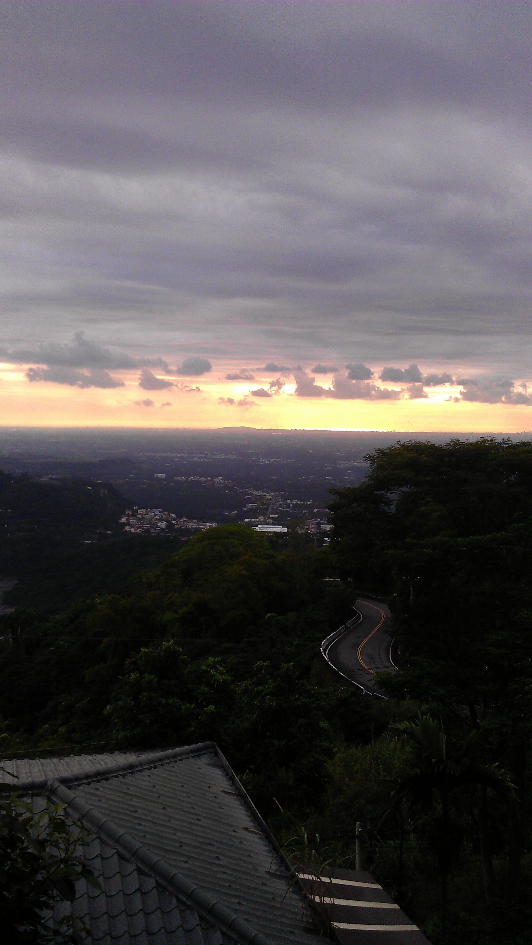
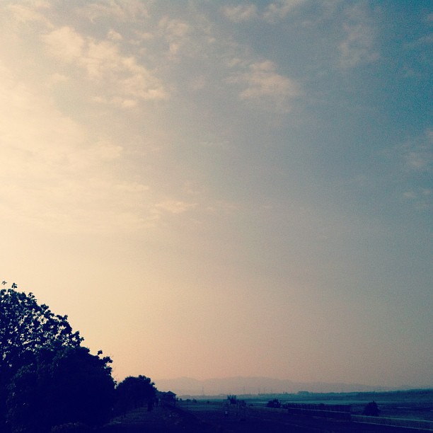
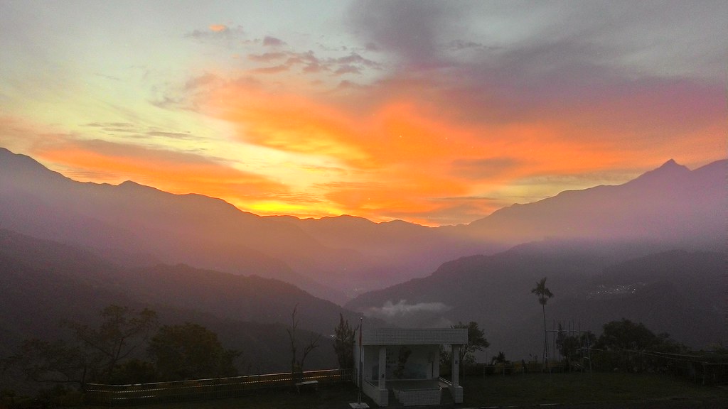
日出日落照片
可愛的小baby

天空 sky
#sunset #sky
P_20141025_054904_HDR.jpg

2016/初2

天光

2016/01/10 屏東高樹蜜鄕國際馬拉松

Fei's Art: the sunset

影子
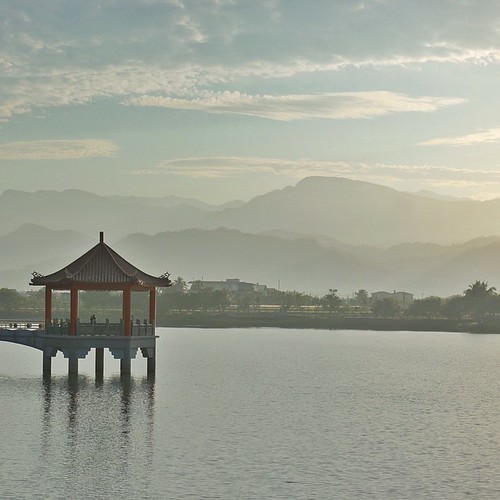
| Peace & Serenity | This is another photo I took during a trip to the tiny town of Meinong (in southern Taiwan) where I woke before daybreak to catch the sunrise from this lake/reservoir. The morning air was still, humid, and muggy; the sky was hazy
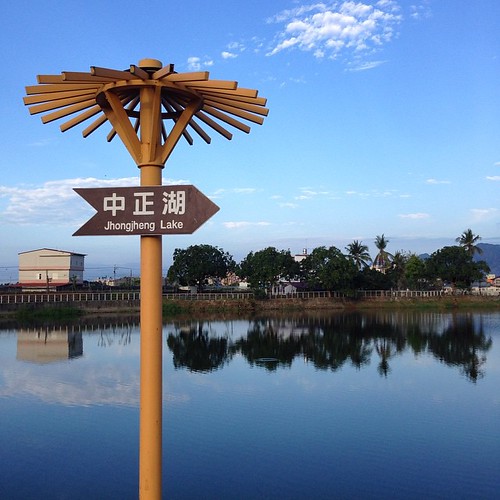
| 中正湖 | Caught the sunrise from this lake this morning; a lake and reservoir storing water for irrigation for the farmlands nearby. Many locals come here for their morning exercise: walks, runs, and bikes. We were greeted with warm smiles, nods, waves,
台湾屏東縣三地門鄉青山村至安坡村聯絡道路48號的地图
查询其他地方的日出日落时间
附近地点
台湾屏東縣三地門鄉光復巷1-2號
台湾屏东三地门乡青山村
台湾屏東縣三地門鄉屏7鄉道10號
台湾屏东三地门乡安坡村
台湾屏东高树乡建兴村
台湾屏東縣高樹鄉高興路15號
台湾屏东高树乡
台湾屏東縣三地門鄉馬兒巷1號
台湾屏东三地门乡马儿村
台湾屏东高树乡泰山村
台湾屏東縣高樹鄉產業路41號
台湾屏东高树乡长荣村
台湾屏東縣高樹鄉圓環路8號
台湾屏东三地门乡
台湾屏東縣高樹鄉振興路23號
台湾屏東縣三地門鄉信義巷1號
台湾屏東縣高樹鄉永安路3號
台湾屏东三地门乡口社村
台湾屏东高树乡大埔村
台湾屏東縣高樹鄉光復路17-1號
最近搜索
- Red Dog Mine, AK, USA的日出日落时间表
- Am bhf, Borken, 德国Am Bahnhof的日出日落时间表
- 4th St E, Sonoma, CA 美国的日出日落时间表
- Oakland Ave, Williamsport, PA 美国的日出日落时间表
- Via Roma, Pieranica CR, Italy的日出日落时间表
- 克罗地亚杜布罗夫尼克 GradClock Tower of Dubrovnik的日出日落时间表
- 阿根廷丘布特省特雷利乌的日出日落时间表
- Hartfords Bluff Cir, Mt Pleasant, SC 美国的日出日落时间表
- 日本熊本县熊本市北区的日出日落时间表
- 中国福州市平潭县平潭岛的日出日落时间表