N Co Rd E, Connersville, IN 美国的日出日落时间表
Location: 美国 > 印第安纳州 > 费耶特 > 美国印第安纳州滑铁卢 >
时区:
America/New_York
当地时间:
2025-07-13 08:23:19
经度:
-85.103221
纬度:
39.703831
今天日出时间:
06:24:09 AM
今天日落时间:
09:08:25 PM
今天日照时常:
14h 44m 16s
明天日出时间:
06:24:54 AM
明天日落时间:
09:07:53 PM
明天日照时常:
14h 42m 59s
显示所有日期
| 日期 | 日出 | 日落 | 日照时常 |
|---|---|---|---|
| 2025年01月01日 | 08:01:24 AM | 05:27:40 PM | 9h 26m 16s |
| 2025年01月02日 | 08:01:28 AM | 05:28:31 PM | 9h 27m 3s |
| 2025年01月03日 | 08:01:29 AM | 05:29:24 PM | 9h 27m 55s |
| 2025年01月04日 | 08:01:28 AM | 05:30:19 PM | 9h 28m 51s |
| 2025年01月05日 | 08:01:26 AM | 05:31:14 PM | 9h 29m 48s |
| 2025年01月06日 | 08:01:20 AM | 05:32:11 PM | 9h 30m 51s |
| 2025年01月07日 | 08:01:13 AM | 05:33:09 PM | 9h 31m 56s |
| 2025年01月08日 | 08:01:03 AM | 05:34:09 PM | 9h 33m 6s |
| 2025年01月09日 | 08:00:52 AM | 05:35:09 PM | 9h 34m 17s |
| 2025年01月10日 | 08:00:38 AM | 05:36:10 PM | 9h 35m 32s |
| 2025年01月11日 | 08:00:22 AM | 05:37:13 PM | 9h 36m 51s |
| 2025年01月12日 | 08:00:03 AM | 05:38:16 PM | 9h 38m 13s |
| 2025年01月13日 | 07:59:43 AM | 05:39:20 PM | 9h 39m 37s |
| 2025年01月14日 | 07:59:21 AM | 05:40:25 PM | 9h 41m 4s |
| 2025年01月15日 | 07:58:56 AM | 05:41:31 PM | 9h 42m 35s |
| 2025年01月16日 | 07:58:29 AM | 05:42:37 PM | 9h 44m 8s |
| 2025年01月17日 | 07:58:00 AM | 05:43:44 PM | 9h 45m 44s |
| 2025年01月18日 | 07:57:29 AM | 05:44:52 PM | 9h 47m 23s |
| 2025年01月19日 | 07:56:57 AM | 05:46:00 PM | 9h 49m 3s |
| 2025年01月20日 | 07:56:22 AM | 05:47:09 PM | 9h 50m 47s |
| 2025年01月21日 | 07:55:45 AM | 05:48:18 PM | 9h 52m 33s |
| 2025年01月22日 | 07:55:06 AM | 05:49:28 PM | 9h 54m 22s |
| 2025年01月23日 | 07:54:25 AM | 05:50:38 PM | 9h 56m 13s |
| 2025年01月24日 | 07:53:42 AM | 05:51:48 PM | 9h 58m 6s |
| 2025年01月25日 | 07:52:58 AM | 05:52:59 PM | 10h 0m 1s |
| 2025年01月26日 | 07:52:11 AM | 05:54:09 PM | 10h 1m 58s |
| 2025年01月27日 | 07:51:23 AM | 05:55:21 PM | 10h 3m 58s |
| 2025年01月28日 | 07:50:33 AM | 05:56:32 PM | 10h 5m 59s |
| 2025年01月29日 | 07:49:41 AM | 05:57:43 PM | 10h 8m 2s |
| 2025年01月30日 | 07:48:47 AM | 05:58:55 PM | 10h 10m 8s |
| 2025年01月31日 | 07:47:52 AM | 06:00:06 PM | 10h 12m 14s |
| 2025年02月01日 | 07:46:55 AM | 06:01:18 PM | 10h 14m 23s |
| 2025年02月02日 | 07:45:57 AM | 06:02:29 PM | 10h 16m 32s |
| 2025年02月03日 | 07:44:57 AM | 06:03:41 PM | 10h 18m 44s |
| 2025年02月04日 | 07:43:55 AM | 06:04:52 PM | 10h 20m 57s |
| 2025年02月05日 | 07:42:52 AM | 06:06:03 PM | 10h 23m 11s |
| 2025年02月06日 | 07:41:47 AM | 06:07:15 PM | 10h 25m 28s |
| 2025年02月07日 | 07:40:41 AM | 06:08:26 PM | 10h 27m 45s |
| 2025年02月08日 | 07:39:33 AM | 06:09:37 PM | 10h 30m 4s |
| 2025年02月09日 | 07:38:24 AM | 06:10:48 PM | 10h 32m 24s |
| 2025年02月10日 | 07:37:14 AM | 06:11:58 PM | 10h 34m 44s |
| 2025年02月11日 | 07:36:02 AM | 06:13:09 PM | 10h 37m 7s |
| 2025年02月12日 | 07:34:49 AM | 06:14:19 PM | 10h 39m 30s |
| 2025年02月13日 | 07:33:35 AM | 06:15:29 PM | 10h 41m 54s |
| 2025年02月14日 | 07:32:20 AM | 06:16:38 PM | 10h 44m 18s |
| 2025年02月15日 | 07:31:03 AM | 06:17:48 PM | 10h 46m 45s |
| 2025年02月16日 | 07:29:46 AM | 06:18:57 PM | 10h 49m 11s |
| 2025年02月17日 | 07:28:27 AM | 06:20:06 PM | 10h 51m 39s |
| 2025年02月18日 | 07:27:07 AM | 06:21:15 PM | 10h 54m 8s |
| 2025年02月19日 | 07:25:46 AM | 06:22:23 PM | 10h 56m 37s |
| 2025年02月20日 | 07:24:24 AM | 06:23:31 PM | 10h 59m 7s |
| 2025年02月21日 | 07:23:01 AM | 06:24:39 PM | 11h 1m 38s |
| 2025年02月22日 | 07:21:38 AM | 06:25:46 PM | 11h 4m 8s |
| 2025年02月23日 | 07:20:13 AM | 06:26:53 PM | 11h 6m 40s |
| 2025年02月24日 | 07:18:47 AM | 06:28:00 PM | 11h 9m 13s |
| 2025年02月25日 | 07:17:21 AM | 06:29:06 PM | 11h 11m 45s |
| 2025年02月26日 | 07:15:54 AM | 06:30:13 PM | 11h 14m 19s |
| 2025年02月27日 | 07:14:26 AM | 06:31:18 PM | 11h 16m 52s |
| 2025年02月28日 | 07:12:57 AM | 06:32:24 PM | 11h 19m 27s |
| 2025年03月01日 | 07:11:28 AM | 06:33:29 PM | 11h 22m 1s |
| 2025年03月02日 | 07:09:58 AM | 06:34:34 PM | 11h 24m 36s |
| 2025年03月03日 | 07:08:27 AM | 06:35:39 PM | 11h 27m 12s |
| 2025年03月04日 | 07:06:56 AM | 06:36:43 PM | 11h 29m 47s |
| 2025年03月05日 | 07:05:24 AM | 06:37:47 PM | 11h 32m 23s |
| 2025年03月06日 | 07:03:51 AM | 06:38:51 PM | 11h 35m 0s |
| 2025年03月07日 | 07:02:19 AM | 06:39:55 PM | 11h 37m 36s |
| 2025年03月08日 | 07:00:45 AM | 06:40:58 PM | 11h 40m 13s |
| 2025年03月09日 | 07:59:15 AM | 07:41:59 PM | 11h 42m 44s |
| 2025年03月10日 | 07:57:41 AM | 07:43:02 PM | 11h 45m 21s |
| 2025年03月11日 | 07:56:07 AM | 07:44:04 PM | 11h 47m 57s |
| 2025年03月12日 | 07:54:32 AM | 07:45:06 PM | 11h 50m 34s |
| 2025年03月13日 | 07:52:57 AM | 07:46:09 PM | 11h 53m 12s |
| 2025年03月14日 | 07:51:21 AM | 07:47:11 PM | 11h 55m 50s |
| 2025年03月15日 | 07:49:45 AM | 07:48:12 PM | 11h 58m 27s |
| 2025年03月16日 | 07:48:09 AM | 07:49:14 PM | 12h 1m 5s |
| 2025年03月17日 | 07:46:33 AM | 07:50:15 PM | 12h 3m 42s |
| 2025年03月18日 | 07:44:57 AM | 07:51:17 PM | 12h 6m 20s |
| 2025年03月19日 | 07:43:20 AM | 07:52:18 PM | 12h 8m 58s |
| 2025年03月20日 | 07:41:44 AM | 07:53:19 PM | 12h 11m 35s |
| 2025年03月21日 | 07:40:07 AM | 07:54:19 PM | 12h 14m 12s |
| 2025年03月22日 | 07:38:31 AM | 07:55:20 PM | 12h 16m 49s |
| 2025年03月23日 | 07:36:54 AM | 07:56:21 PM | 12h 19m 27s |
| 2025年03月24日 | 07:35:17 AM | 07:57:21 PM | 12h 22m 4s |
| 2025年03月25日 | 07:33:41 AM | 07:58:21 PM | 12h 24m 40s |
| 2025年03月26日 | 07:32:04 AM | 07:59:22 PM | 12h 27m 18s |
| 2025年03月27日 | 07:30:28 AM | 08:00:22 PM | 12h 29m 54s |
| 2025年03月28日 | 07:28:52 AM | 08:01:22 PM | 12h 32m 30s |
| 2025年03月29日 | 07:27:16 AM | 08:02:22 PM | 12h 35m 6s |
| 2025年03月30日 | 07:25:40 AM | 08:03:22 PM | 12h 37m 42s |
| 2025年03月31日 | 07:24:04 AM | 08:04:22 PM | 12h 40m 18s |
| 2025年04月01日 | 07:22:29 AM | 08:05:22 PM | 12h 42m 53s |
| 2025年04月02日 | 07:20:54 AM | 08:06:22 PM | 12h 45m 28s |
| 2025年04月03日 | 07:19:19 AM | 08:07:22 PM | 12h 48m 3s |
| 2025年04月04日 | 07:17:45 AM | 08:08:22 PM | 12h 50m 37s |
| 2025年04月05日 | 07:16:11 AM | 08:09:22 PM | 12h 53m 11s |
| 2025年04月06日 | 07:14:37 AM | 08:10:22 PM | 12h 55m 45s |
| 2025年04月07日 | 07:13:04 AM | 08:11:22 PM | 12h 58m 18s |
| 2025年04月08日 | 07:11:31 AM | 08:12:22 PM | 13h 0m 51s |
| 2025年04月09日 | 07:09:59 AM | 08:13:21 PM | 13h 3m 22s |
| 2025年04月10日 | 07:08:27 AM | 08:14:21 PM | 13h 5m 54s |
| 2025年04月11日 | 07:06:56 AM | 08:15:21 PM | 13h 8m 25s |
| 2025年04月12日 | 07:05:26 AM | 08:16:21 PM | 13h 10m 55s |
| 2025年04月13日 | 07:03:56 AM | 08:17:22 PM | 13h 13m 26s |
| 2025年04月14日 | 07:02:27 AM | 08:18:22 PM | 13h 15m 55s |
| 2025年04月15日 | 07:00:58 AM | 08:19:22 PM | 13h 18m 24s |
| 2025年04月16日 | 06:59:31 AM | 08:20:22 PM | 13h 20m 51s |
| 2025年04月17日 | 06:58:04 AM | 08:21:22 PM | 13h 23m 18s |
| 2025年04月18日 | 06:56:38 AM | 08:22:22 PM | 13h 25m 44s |
| 2025年04月19日 | 06:55:12 AM | 08:23:22 PM | 13h 28m 10s |
| 2025年04月20日 | 06:53:48 AM | 08:24:23 PM | 13h 30m 35s |
| 2025年04月21日 | 06:52:24 AM | 08:25:23 PM | 13h 32m 59s |
| 2025年04月22日 | 06:51:01 AM | 08:26:23 PM | 13h 35m 22s |
| 2025年04月23日 | 06:49:39 AM | 08:27:23 PM | 13h 37m 44s |
| 2025年04月24日 | 06:48:18 AM | 08:28:23 PM | 13h 40m 5s |
| 2025年04月25日 | 06:46:59 AM | 08:29:23 PM | 13h 42m 24s |
| 2025年04月26日 | 06:45:40 AM | 08:30:24 PM | 13h 44m 44s |
| 2025年04月27日 | 06:44:22 AM | 08:31:24 PM | 13h 47m 2s |
| 2025年04月28日 | 06:43:05 AM | 08:32:24 PM | 13h 49m 19s |
| 2025年04月29日 | 06:41:50 AM | 08:33:24 PM | 13h 51m 34s |
| 2025年04月30日 | 06:40:36 AM | 08:34:23 PM | 13h 53m 47s |
| 2025年05月01日 | 06:39:22 AM | 08:35:23 PM | 13h 56m 1s |
| 2025年05月02日 | 06:38:11 AM | 08:36:23 PM | 13h 58m 12s |
| 2025年05月03日 | 06:37:00 AM | 08:37:22 PM | 14h 0m 22s |
| 2025年05月04日 | 06:35:50 AM | 08:38:21 PM | 14h 2m 31s |
| 2025年05月05日 | 06:34:42 AM | 08:39:20 PM | 14h 4m 38s |
| 2025年05月06日 | 06:33:36 AM | 08:40:19 PM | 14h 6m 43s |
| 2025年05月07日 | 06:32:30 AM | 08:41:18 PM | 14h 8m 48s |
| 2025年05月08日 | 06:31:26 AM | 08:42:16 PM | 14h 10m 50s |
| 2025年05月09日 | 06:30:24 AM | 08:43:14 PM | 14h 12m 50s |
| 2025年05月10日 | 06:29:23 AM | 08:44:12 PM | 14h 14m 49s |
| 2025年05月11日 | 06:28:23 AM | 08:45:09 PM | 14h 16m 46s |
| 2025年05月12日 | 06:27:25 AM | 08:46:06 PM | 14h 18m 41s |
| 2025年05月13日 | 06:26:28 AM | 08:47:03 PM | 14h 20m 35s |
| 2025年05月14日 | 06:25:33 AM | 08:47:59 PM | 14h 22m 26s |
| 2025年05月15日 | 06:24:40 AM | 08:48:55 PM | 14h 24m 15s |
| 2025年05月16日 | 06:23:48 AM | 08:49:50 PM | 14h 26m 2s |
| 2025年05月17日 | 06:22:58 AM | 08:50:45 PM | 14h 27m 47s |
| 2025年05月18日 | 06:22:10 AM | 08:51:39 PM | 14h 29m 29s |
| 2025年05月19日 | 06:21:23 AM | 08:52:33 PM | 14h 31m 10s |
| 2025年05月20日 | 06:20:38 AM | 08:53:26 PM | 14h 32m 48s |
| 2025年05月21日 | 06:19:55 AM | 08:54:18 PM | 14h 34m 23s |
| 2025年05月22日 | 06:19:13 AM | 08:55:09 PM | 14h 35m 56s |
| 2025年05月23日 | 06:18:33 AM | 08:56:00 PM | 14h 37m 27s |
| 2025年05月24日 | 06:17:55 AM | 08:56:50 PM | 14h 38m 55s |
| 2025年05月25日 | 06:17:19 AM | 08:57:39 PM | 14h 40m 20s |
| 2025年05月26日 | 06:16:45 AM | 08:58:27 PM | 14h 41m 42s |
| 2025年05月27日 | 06:16:13 AM | 08:59:14 PM | 14h 43m 1s |
| 2025年05月28日 | 06:15:42 AM | 09:00:01 PM | 14h 44m 19s |
| 2025年05月29日 | 06:15:13 AM | 09:00:46 PM | 14h 45m 33s |
| 2025年05月30日 | 06:14:46 AM | 09:01:30 PM | 14h 46m 44s |
| 2025年05月31日 | 06:14:22 AM | 09:02:13 PM | 14h 47m 51s |
| 2025年06月01日 | 06:13:58 AM | 09:02:56 PM | 14h 48m 58s |
| 2025年06月02日 | 06:13:37 AM | 09:03:36 PM | 14h 49m 59s |
| 2025年06月03日 | 06:13:18 AM | 09:04:16 PM | 14h 50m 58s |
| 2025年06月04日 | 06:13:01 AM | 09:04:55 PM | 14h 51m 54s |
| 2025年06月05日 | 06:12:46 AM | 09:05:32 PM | 14h 52m 46s |
| 2025年06月06日 | 06:12:32 AM | 09:06:07 PM | 14h 53m 35s |
| 2025年06月07日 | 06:12:21 AM | 09:06:42 PM | 14h 54m 21s |
| 2025年06月08日 | 06:12:11 AM | 09:07:15 PM | 14h 55m 4s |
| 2025年06月09日 | 06:12:03 AM | 09:07:46 PM | 14h 55m 43s |
| 2025年06月10日 | 06:11:58 AM | 09:08:17 PM | 14h 56m 19s |
| 2025年06月11日 | 06:11:54 AM | 09:08:45 PM | 14h 56m 51s |
| 2025年06月12日 | 06:11:52 AM | 09:09:12 PM | 14h 57m 20s |
| 2025年06月13日 | 06:11:52 AM | 09:09:38 PM | 14h 57m 46s |
| 2025年06月14日 | 06:11:54 AM | 09:10:01 PM | 14h 58m 7s |
| 2025年06月15日 | 06:11:57 AM | 09:10:23 PM | 14h 58m 26s |
| 2025年06月16日 | 06:12:03 AM | 09:10:44 PM | 14h 58m 41s |
| 2025年06月17日 | 06:12:10 AM | 09:11:03 PM | 14h 58m 53s |
| 2025年06月18日 | 06:12:20 AM | 09:11:20 PM | 14h 59m 0s |
| 2025年06月19日 | 06:12:30 AM | 09:11:35 PM | 14h 59m 5s |
| 2025年06月20日 | 06:12:43 AM | 09:11:48 PM | 14h 59m 5s |
| 2025年06月21日 | 06:12:58 AM | 09:12:00 PM | 14h 59m 2s |
| 2025年06月22日 | 06:13:14 AM | 09:12:10 PM | 14h 58m 56s |
| 2025年06月23日 | 06:13:32 AM | 09:12:18 PM | 14h 58m 46s |
| 2025年06月24日 | 06:13:51 AM | 09:12:24 PM | 14h 58m 33s |
| 2025年06月25日 | 06:14:12 AM | 09:12:28 PM | 14h 58m 16s |
| 2025年06月26日 | 06:14:35 AM | 09:12:30 PM | 14h 57m 55s |
| 2025年06月27日 | 06:14:59 AM | 09:12:30 PM | 14h 57m 31s |
| 2025年06月28日 | 06:15:25 AM | 09:12:29 PM | 14h 57m 4s |
| 2025年06月29日 | 06:15:53 AM | 09:12:25 PM | 14h 56m 32s |
| 2025年06月30日 | 06:16:21 AM | 09:12:19 PM | 14h 55m 58s |
| 2025年07月01日 | 06:16:52 AM | 09:12:12 PM | 14h 55m 20s |
| 2025年07月02日 | 06:17:23 AM | 09:12:02 PM | 14h 54m 39s |
| 2025年07月03日 | 06:17:56 AM | 09:11:51 PM | 14h 53m 55s |
| 2025年07月04日 | 06:18:30 AM | 09:11:38 PM | 14h 53m 8s |
| 2025年07月05日 | 06:19:06 AM | 09:11:22 PM | 14h 52m 16s |
| 2025年07月06日 | 06:19:43 AM | 09:11:05 PM | 14h 51m 22s |
| 2025年07月07日 | 06:20:21 AM | 09:10:46 PM | 14h 50m 25s |
| 2025年07月08日 | 06:21:00 AM | 09:10:24 PM | 14h 49m 24s |
| 2025年07月09日 | 06:21:40 AM | 09:10:01 PM | 14h 48m 21s |
| 2025年07月10日 | 06:22:21 AM | 09:09:36 PM | 14h 47m 15s |
| 2025年07月11日 | 06:23:04 AM | 09:09:09 PM | 14h 46m 5s |
| 2025年07月12日 | 06:23:47 AM | 09:08:40 PM | 14h 44m 53s |
| 2025年07月13日 | 06:24:31 AM | 09:08:09 PM | 14h 43m 38s |
| 2025年07月14日 | 06:25:16 AM | 09:07:36 PM | 14h 42m 20s |
| 2025年07月15日 | 06:26:02 AM | 09:07:01 PM | 14h 40m 59s |
| 2025年07月16日 | 06:26:49 AM | 09:06:25 PM | 14h 39m 36s |
| 2025年07月17日 | 06:27:37 AM | 09:05:46 PM | 14h 38m 9s |
| 2025年07月18日 | 06:28:25 AM | 09:05:06 PM | 14h 36m 41s |
| 2025年07月19日 | 06:29:14 AM | 09:04:24 PM | 14h 35m 10s |
| 2025年07月20日 | 06:30:04 AM | 09:03:40 PM | 14h 33m 36s |
| 2025年07月21日 | 06:30:54 AM | 09:02:55 PM | 14h 32m 1s |
| 2025年07月22日 | 06:31:45 AM | 09:02:07 PM | 14h 30m 22s |
| 2025年07月23日 | 06:32:36 AM | 09:01:18 PM | 14h 28m 42s |
| 2025年07月24日 | 06:33:28 AM | 09:00:27 PM | 14h 26m 59s |
| 2025年07月25日 | 06:34:21 AM | 08:59:35 PM | 14h 25m 14s |
| 2025年07月26日 | 06:35:14 AM | 08:58:41 PM | 14h 23m 27s |
| 2025年07月27日 | 06:36:07 AM | 08:57:45 PM | 14h 21m 38s |
| 2025年07月28日 | 06:37:01 AM | 08:56:48 PM | 14h 19m 47s |
| 2025年07月29日 | 06:37:55 AM | 08:55:49 PM | 14h 17m 54s |
| 2025年07月30日 | 06:38:49 AM | 08:54:49 PM | 14h 16m 0s |
| 2025年07月31日 | 06:39:44 AM | 08:53:47 PM | 14h 14m 3s |
| 2025年08月01日 | 06:40:39 AM | 08:52:43 PM | 14h 12m 4s |
| 2025年08月02日 | 06:41:34 AM | 08:51:38 PM | 14h 10m 4s |
| 2025年08月03日 | 06:42:30 AM | 08:50:32 PM | 14h 8m 2s |
| 2025年08月04日 | 06:43:25 AM | 08:49:25 PM | 14h 6m 0s |
| 2025年08月05日 | 06:44:21 AM | 08:48:16 PM | 14h 3m 55s |
| 2025年08月06日 | 06:45:17 AM | 08:47:05 PM | 14h 1m 48s |
| 2025年08月07日 | 06:46:13 AM | 08:45:53 PM | 13h 59m 40s |
| 2025年08月08日 | 06:47:09 AM | 08:44:41 PM | 13h 57m 32s |
| 2025年08月09日 | 06:48:05 AM | 08:43:26 PM | 13h 55m 21s |
| 2025年08月10日 | 06:49:01 AM | 08:42:11 PM | 13h 53m 10s |
| 2025年08月11日 | 06:49:58 AM | 08:40:54 PM | 13h 50m 56s |
| 2025年08月12日 | 06:50:54 AM | 08:39:37 PM | 13h 48m 43s |
| 2025年08月13日 | 06:51:51 AM | 08:38:18 PM | 13h 46m 27s |
| 2025年08月14日 | 06:52:47 AM | 08:36:58 PM | 13h 44m 11s |
| 2025年08月15日 | 06:53:44 AM | 08:35:37 PM | 13h 41m 53s |
| 2025年08月16日 | 06:54:40 AM | 08:34:15 PM | 13h 39m 35s |
| 2025年08月17日 | 06:55:36 AM | 08:32:52 PM | 13h 37m 16s |
| 2025年08月18日 | 06:56:33 AM | 08:31:28 PM | 13h 34m 55s |
| 2025年08月19日 | 06:57:29 AM | 08:30:03 PM | 13h 32m 34s |
| 2025年08月20日 | 06:58:25 AM | 08:28:37 PM | 13h 30m 12s |
| 2025年08月21日 | 06:59:22 AM | 08:27:10 PM | 13h 27m 48s |
| 2025年08月22日 | 07:00:18 AM | 08:25:43 PM | 13h 25m 25s |
| 2025年08月23日 | 07:01:14 AM | 08:24:14 PM | 13h 23m 0s |
| 2025年08月24日 | 07:02:10 AM | 08:22:45 PM | 13h 20m 35s |
| 2025年08月25日 | 07:03:06 AM | 08:21:15 PM | 13h 18m 9s |
| 2025年08月26日 | 07:04:02 AM | 08:19:45 PM | 13h 15m 43s |
| 2025年08月27日 | 07:04:58 AM | 08:18:14 PM | 13h 13m 16s |
| 2025年08月28日 | 07:05:54 AM | 08:16:42 PM | 13h 10m 48s |
| 2025年08月29日 | 07:06:50 AM | 08:15:09 PM | 13h 8m 19s |
| 2025年08月30日 | 07:07:46 AM | 08:13:36 PM | 13h 5m 50s |
| 2025年08月31日 | 07:08:41 AM | 08:12:02 PM | 13h 3m 21s |
| 2025年09月01日 | 07:09:37 AM | 08:10:28 PM | 13h 0m 51s |
| 2025年09月02日 | 07:10:33 AM | 08:08:53 PM | 12h 58m 20s |
| 2025年09月03日 | 07:11:28 AM | 08:07:18 PM | 12h 55m 50s |
| 2025年09月04日 | 07:12:24 AM | 08:05:42 PM | 12h 53m 18s |
| 2025年09月05日 | 07:13:19 AM | 08:04:06 PM | 12h 50m 47s |
| 2025年09月06日 | 07:14:15 AM | 08:02:30 PM | 12h 48m 15s |
| 2025年09月07日 | 07:15:10 AM | 08:00:53 PM | 12h 45m 43s |
| 2025年09月08日 | 07:16:06 AM | 07:59:16 PM | 12h 43m 10s |
| 2025年09月09日 | 07:17:01 AM | 07:57:38 PM | 12h 40m 37s |
| 2025年09月10日 | 07:17:57 AM | 07:56:01 PM | 12h 38m 4s |
| 2025年09月11日 | 07:18:52 AM | 07:54:23 PM | 12h 35m 31s |
| 2025年09月12日 | 07:19:48 AM | 07:52:44 PM | 12h 32m 56s |
| 2025年09月13日 | 07:20:43 AM | 07:51:06 PM | 12h 30m 23s |
| 2025年09月14日 | 07:21:39 AM | 07:49:28 PM | 12h 27m 49s |
| 2025年09月15日 | 07:22:35 AM | 07:47:49 PM | 12h 25m 14s |
| 2025年09月16日 | 07:23:31 AM | 07:46:10 PM | 12h 22m 39s |
| 2025年09月17日 | 07:24:27 AM | 07:44:32 PM | 12h 20m 5s |
| 2025年09月18日 | 07:25:22 AM | 07:42:53 PM | 12h 17m 31s |
| 2025年09月19日 | 07:26:19 AM | 07:41:14 PM | 12h 14m 55s |
| 2025年09月20日 | 07:27:15 AM | 07:39:35 PM | 12h 12m 20s |
| 2025年09月21日 | 07:28:11 AM | 07:37:56 PM | 12h 9m 45s |
| 2025年09月22日 | 07:29:08 AM | 07:36:18 PM | 12h 7m 10s |
| 2025年09月23日 | 07:30:04 AM | 07:34:39 PM | 12h 4m 35s |
| 2025年09月24日 | 07:31:01 AM | 07:33:01 PM | 12h 2m 0s |
| 2025年09月25日 | 07:31:58 AM | 07:31:23 PM | 11h 59m 25s |
| 2025年09月26日 | 07:32:55 AM | 07:29:45 PM | 11h 56m 50s |
| 2025年09月27日 | 07:33:52 AM | 07:28:07 PM | 11h 54m 15s |
| 2025年09月28日 | 07:34:50 AM | 07:26:30 PM | 11h 51m 40s |
| 2025年09月29日 | 07:35:48 AM | 07:24:52 PM | 11h 49m 4s |
| 2025年09月30日 | 07:36:46 AM | 07:23:16 PM | 11h 46m 30s |
| 2025年10月01日 | 07:37:44 AM | 07:21:39 PM | 11h 43m 55s |
| 2025年10月02日 | 07:38:42 AM | 07:20:03 PM | 11h 41m 21s |
| 2025年10月03日 | 07:39:41 AM | 07:18:27 PM | 11h 38m 46s |
| 2025年10月04日 | 07:40:40 AM | 07:16:52 PM | 11h 36m 12s |
| 2025年10月05日 | 07:41:39 AM | 07:15:17 PM | 11h 33m 38s |
| 2025年10月06日 | 07:42:39 AM | 07:13:43 PM | 11h 31m 4s |
| 2025年10月07日 | 07:43:38 AM | 07:12:09 PM | 11h 28m 31s |
| 2025年10月08日 | 07:44:39 AM | 07:10:36 PM | 11h 25m 57s |
| 2025年10月09日 | 07:45:39 AM | 07:09:04 PM | 11h 23m 25s |
| 2025年10月10日 | 07:46:40 AM | 07:07:32 PM | 11h 20m 52s |
| 2025年10月11日 | 07:47:41 AM | 07:06:01 PM | 11h 18m 20s |
| 2025年10月12日 | 07:48:42 AM | 07:04:30 PM | 11h 15m 48s |
| 2025年10月13日 | 07:49:44 AM | 07:03:00 PM | 11h 13m 16s |
| 2025年10月14日 | 07:50:46 AM | 07:01:31 PM | 11h 10m 45s |
| 2025年10月15日 | 07:51:48 AM | 07:00:03 PM | 11h 8m 15s |
| 2025年10月16日 | 07:52:51 AM | 06:58:36 PM | 11h 5m 45s |
| 2025年10月17日 | 07:53:54 AM | 06:57:09 PM | 11h 3m 15s |
| 2025年10月18日 | 07:54:57 AM | 06:55:44 PM | 11h 0m 47s |
| 2025年10月19日 | 07:56:01 AM | 06:54:19 PM | 10h 58m 18s |
| 2025年10月20日 | 07:57:05 AM | 06:52:55 PM | 10h 55m 50s |
| 2025年10月21日 | 07:58:09 AM | 06:51:33 PM | 10h 53m 24s |
| 2025年10月22日 | 07:59:14 AM | 06:50:11 PM | 10h 50m 57s |
| 2025年10月23日 | 08:00:19 AM | 06:48:51 PM | 10h 48m 32s |
| 2025年10月24日 | 08:01:24 AM | 06:47:31 PM | 10h 46m 7s |
| 2025年10月25日 | 08:02:30 AM | 06:46:13 PM | 10h 43m 43s |
| 2025年10月26日 | 08:03:35 AM | 06:44:56 PM | 10h 41m 21s |
| 2025年10月27日 | 08:04:42 AM | 06:43:40 PM | 10h 38m 58s |
| 2025年10月28日 | 08:05:48 AM | 06:42:25 PM | 10h 36m 37s |
| 2025年10月29日 | 08:06:55 AM | 06:41:12 PM | 10h 34m 17s |
| 2025年10月30日 | 08:08:02 AM | 06:40:00 PM | 10h 31m 58s |
| 2025年10月31日 | 08:09:09 AM | 06:38:49 PM | 10h 29m 40s |
| 2025年11月01日 | 08:10:16 AM | 06:37:40 PM | 10h 27m 24s |
| 2025年11月02日 | 07:11:27 AM | 05:36:29 PM | 10h 25m 2s |
| 2025年11月03日 | 07:12:35 AM | 05:35:22 PM | 10h 22m 47s |
| 2025年11月04日 | 07:13:42 AM | 05:34:17 PM | 10h 20m 35s |
| 2025年11月05日 | 07:14:51 AM | 05:33:14 PM | 10h 18m 23s |
| 2025年11月06日 | 07:15:59 AM | 05:32:12 PM | 10h 16m 13s |
| 2025年11月07日 | 07:17:07 AM | 05:31:12 PM | 10h 14m 5s |
| 2025年11月08日 | 07:18:15 AM | 05:30:14 PM | 10h 11m 59s |
| 2025年11月09日 | 07:19:24 AM | 05:29:17 PM | 10h 9m 53s |
| 2025年11月10日 | 07:20:32 AM | 05:28:21 PM | 10h 7m 49s |
| 2025年11月11日 | 07:21:40 AM | 05:27:28 PM | 10h 5m 48s |
| 2025年11月12日 | 07:22:49 AM | 05:26:36 PM | 10h 3m 47s |
| 2025年11月13日 | 07:23:57 AM | 05:25:46 PM | 10h 1m 49s |
| 2025年11月14日 | 07:25:05 AM | 05:24:58 PM | 9h 59m 53s |
| 2025年11月15日 | 07:26:13 AM | 05:24:12 PM | 9h 57m 59s |
| 2025年11月16日 | 07:27:20 AM | 05:23:28 PM | 9h 56m 8s |
| 2025年11月17日 | 07:28:27 AM | 05:22:45 PM | 9h 54m 18s |
| 2025年11月18日 | 07:29:35 AM | 05:22:05 PM | 9h 52m 30s |
| 2025年11月19日 | 07:30:41 AM | 05:21:26 PM | 9h 50m 45s |
| 2025年11月20日 | 07:31:48 AM | 05:20:50 PM | 9h 49m 2s |
| 2025年11月21日 | 07:32:54 AM | 05:20:15 PM | 9h 47m 21s |
| 2025年11月22日 | 07:33:59 AM | 05:19:43 PM | 9h 45m 44s |
| 2025年11月23日 | 07:35:04 AM | 05:19:13 PM | 9h 44m 9s |
| 2025年11月24日 | 07:36:08 AM | 05:18:44 PM | 9h 42m 36s |
| 2025年11月25日 | 07:37:12 AM | 05:18:18 PM | 9h 41m 6s |
| 2025年11月26日 | 07:38:15 AM | 05:17:54 PM | 9h 39m 39s |
| 2025年11月27日 | 07:39:17 AM | 05:17:33 PM | 9h 38m 16s |
| 2025年11月28日 | 07:40:19 AM | 05:17:13 PM | 9h 36m 54s |
| 2025年11月29日 | 07:41:19 AM | 05:16:55 PM | 9h 35m 36s |
| 2025年11月30日 | 07:42:19 AM | 05:16:40 PM | 9h 34m 21s |
| 2025年12月01日 | 07:43:18 AM | 05:16:27 PM | 9h 33m 9s |
| 2025年12月02日 | 07:44:16 AM | 05:16:16 PM | 9h 32m 0s |
| 2025年12月03日 | 07:45:13 AM | 05:16:08 PM | 9h 30m 55s |
| 2025年12月04日 | 07:46:08 AM | 05:16:02 PM | 9h 29m 54s |
| 2025年12月05日 | 07:47:03 AM | 05:15:57 PM | 9h 28m 54s |
| 2025年12月06日 | 07:47:56 AM | 05:15:56 PM | 9h 28m 0s |
| 2025年12月07日 | 07:48:48 AM | 05:15:56 PM | 9h 27m 8s |
| 2025年12月08日 | 07:49:39 AM | 05:15:59 PM | 9h 26m 20s |
| 2025年12月09日 | 07:50:28 AM | 05:16:04 PM | 9h 25m 36s |
| 2025年12月10日 | 07:51:16 AM | 05:16:11 PM | 9h 24m 55s |
| 2025年12月11日 | 07:52:03 AM | 05:16:20 PM | 9h 24m 17s |
| 2025年12月12日 | 07:52:48 AM | 05:16:31 PM | 9h 23m 43s |
| 2025年12月13日 | 07:53:31 AM | 05:16:45 PM | 9h 23m 14s |
| 2025年12月14日 | 07:54:13 AM | 05:17:01 PM | 9h 22m 48s |
| 2025年12月15日 | 07:54:53 AM | 05:17:19 PM | 9h 22m 26s |
| 2025年12月16日 | 07:55:31 AM | 05:17:39 PM | 9h 22m 8s |
| 2025年12月17日 | 07:56:08 AM | 05:18:02 PM | 9h 21m 54s |
| 2025年12月18日 | 07:56:43 AM | 05:18:26 PM | 9h 21m 43s |
| 2025年12月19日 | 07:57:16 AM | 05:18:52 PM | 9h 21m 36s |
| 2025年12月20日 | 07:57:47 AM | 05:19:21 PM | 9h 21m 34s |
| 2025年12月21日 | 07:58:16 AM | 05:19:51 PM | 9h 21m 35s |
| 2025年12月22日 | 07:58:43 AM | 05:20:24 PM | 9h 21m 41s |
| 2025年12月23日 | 07:59:09 AM | 05:20:58 PM | 9h 21m 49s |
| 2025年12月24日 | 07:59:32 AM | 05:21:34 PM | 9h 22m 2s |
| 2025年12月25日 | 07:59:53 AM | 05:22:12 PM | 9h 22m 19s |
| 2025年12月26日 | 08:00:12 AM | 05:22:52 PM | 9h 22m 40s |
| 2025年12月27日 | 08:00:29 AM | 05:23:34 PM | 9h 23m 5s |
| 2025年12月28日 | 08:00:44 AM | 05:24:17 PM | 9h 23m 33s |
| 2025年12月29日 | 08:00:57 AM | 05:25:03 PM | 9h 24m 6s |
| 2025年12月30日 | 08:01:08 AM | 05:25:49 PM | 9h 24m 41s |
| 2025年12月31日 | 08:01:16 AM | 05:26:37 PM | 9h 25m 21s |
日出日落照片

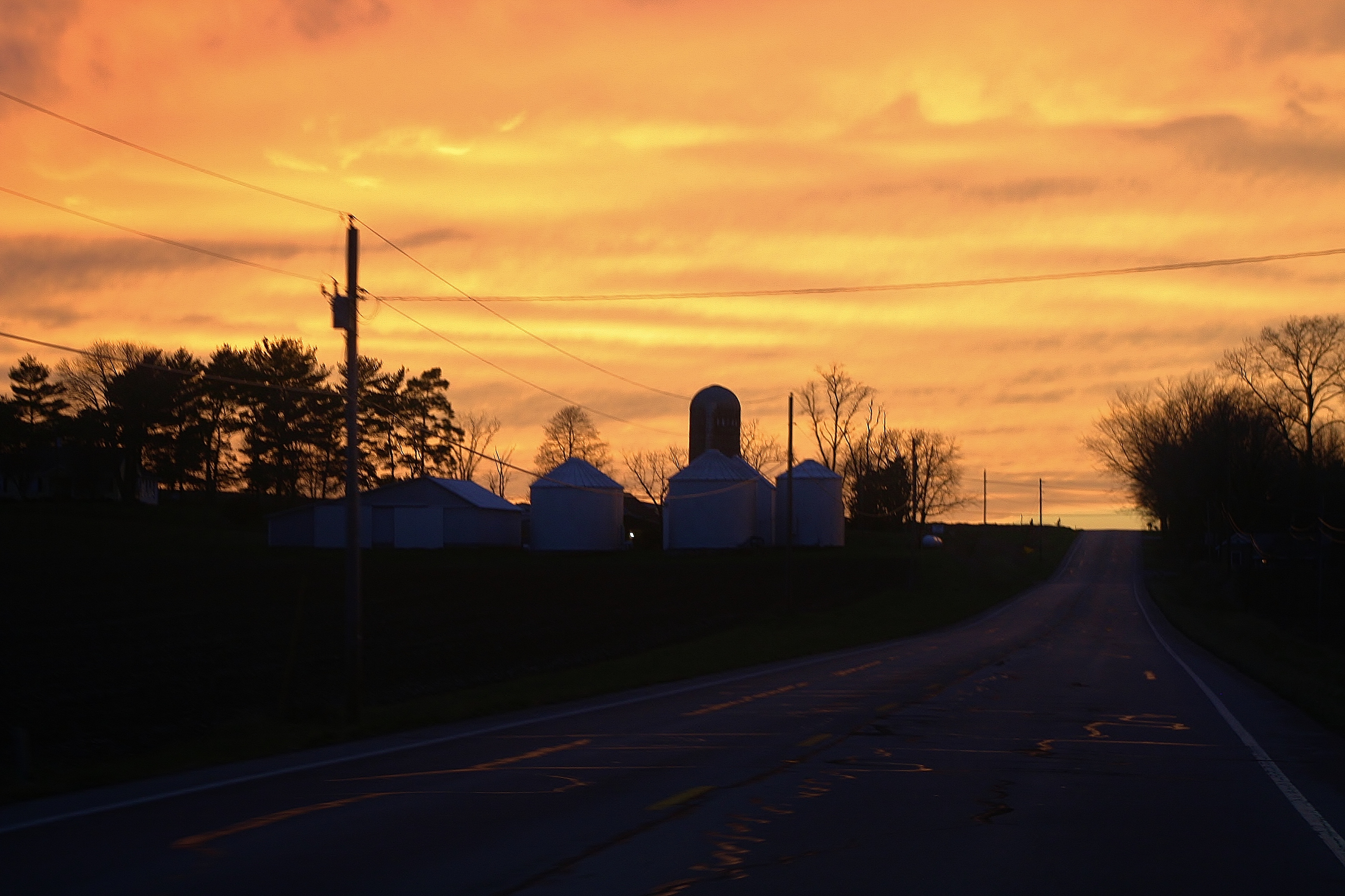
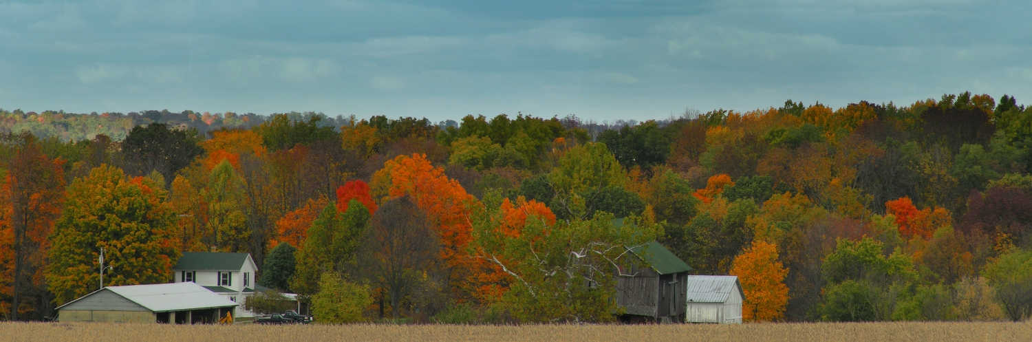
Sun Sets Over a Western Wayne County Farm
Sunset on the Farm
Sunset from Alquina School, Alquina, IN
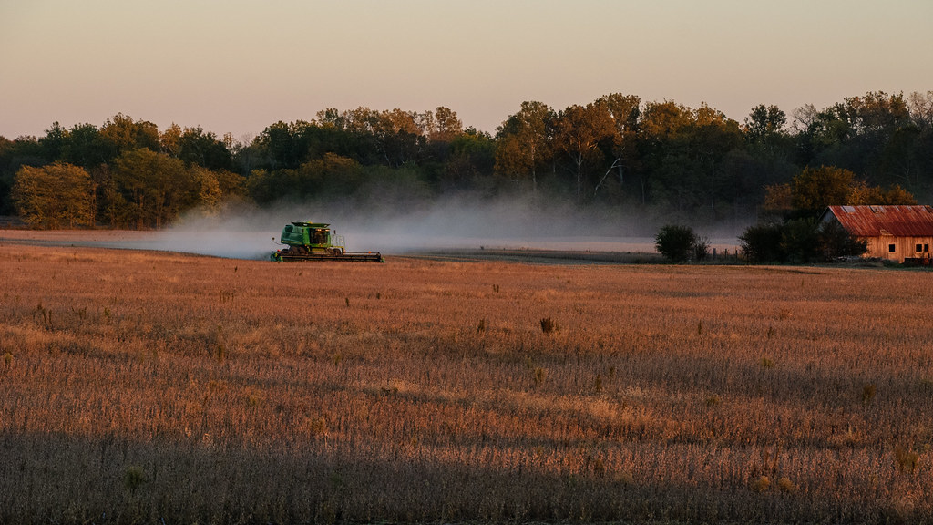
Combining Soybeans at Sunset
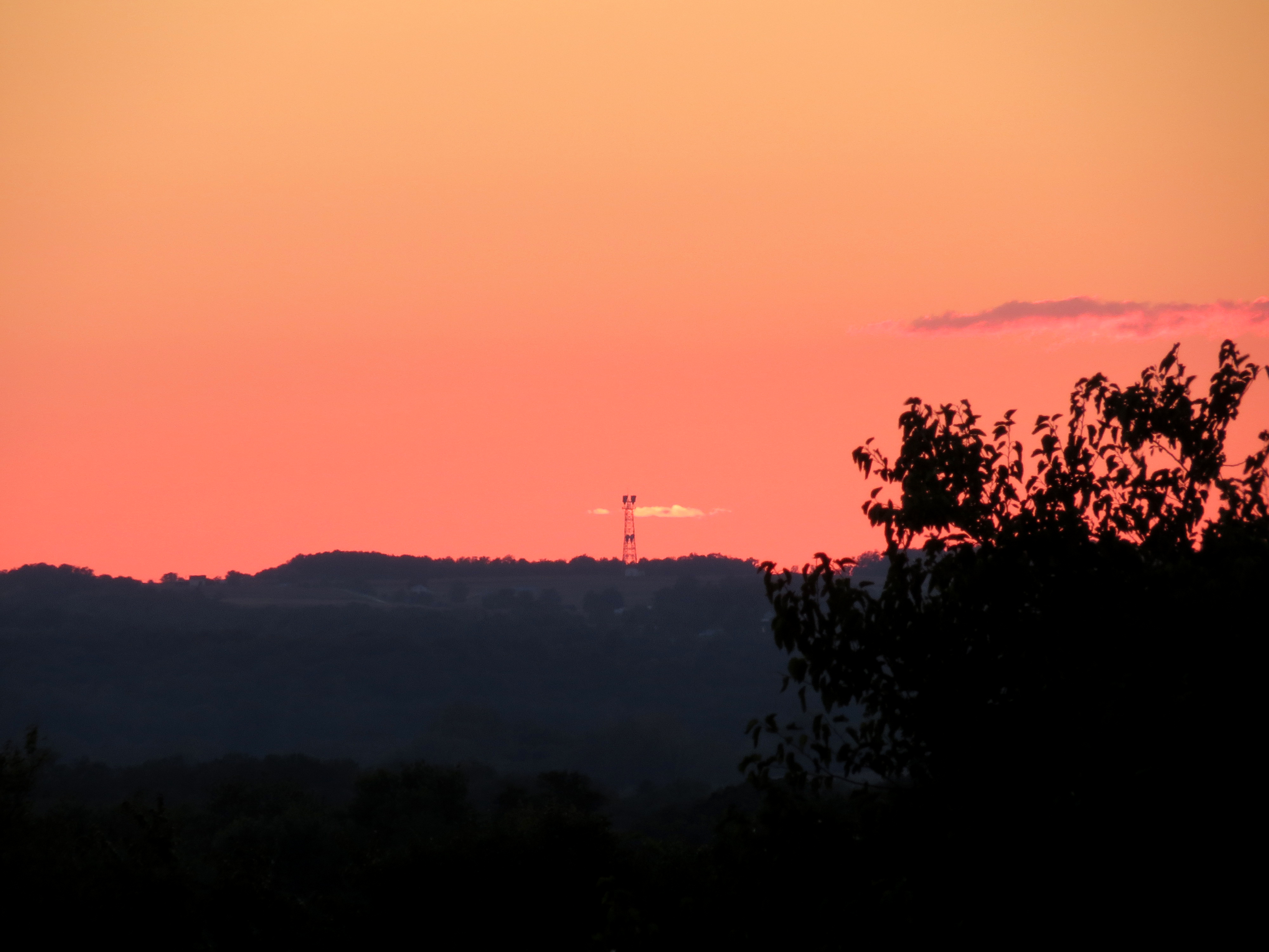
Sunset Quakertown, Indiana

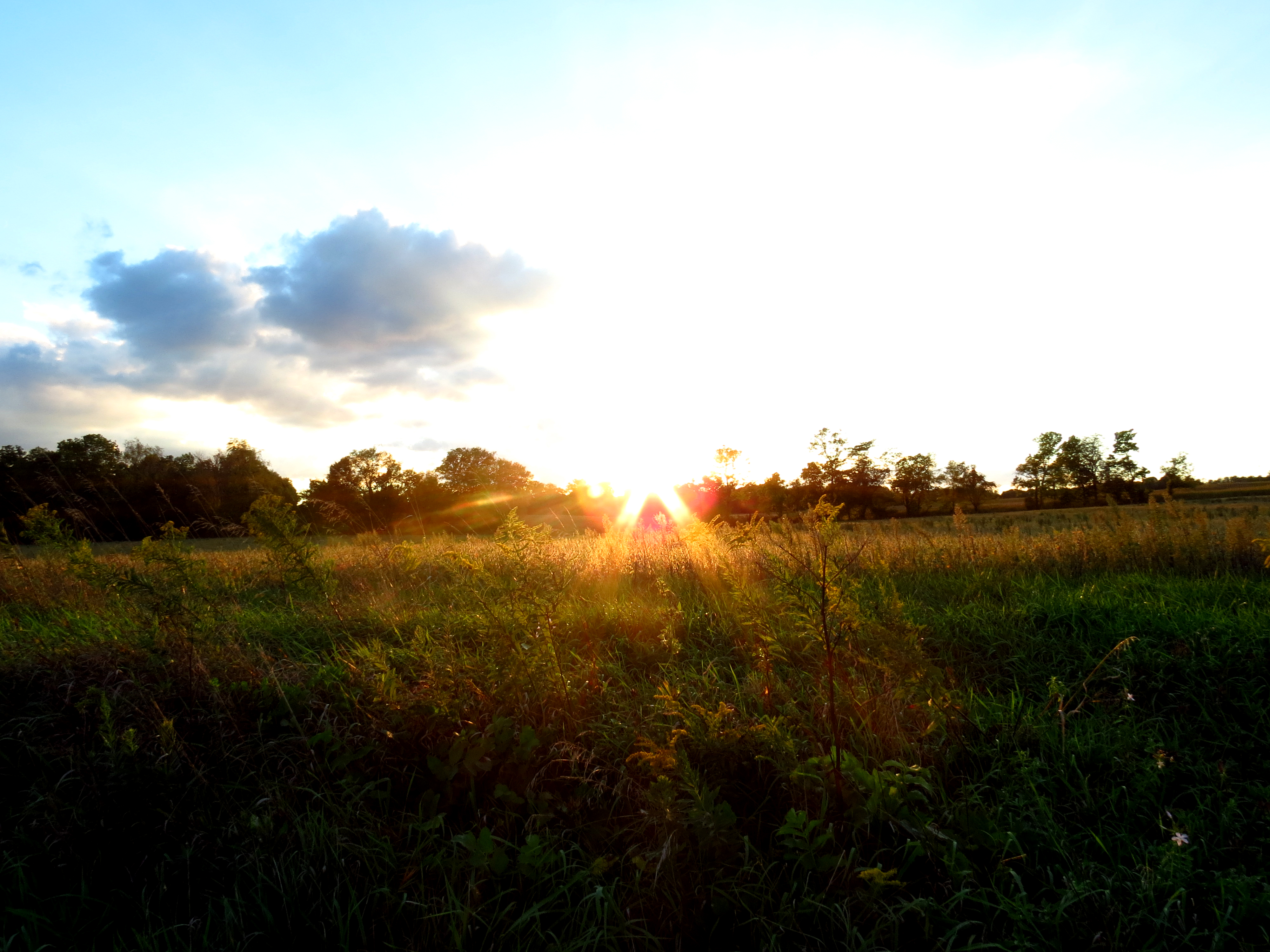
Twilight on the Farm
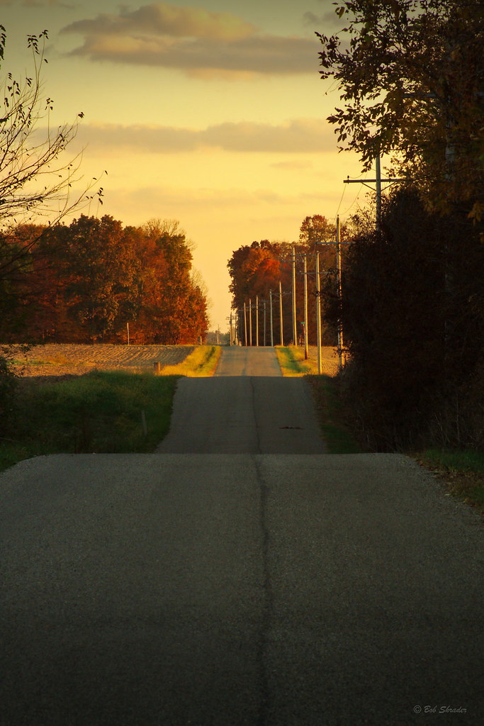
County Road 450 West

Dublin, Indiana
Backlands Indiana
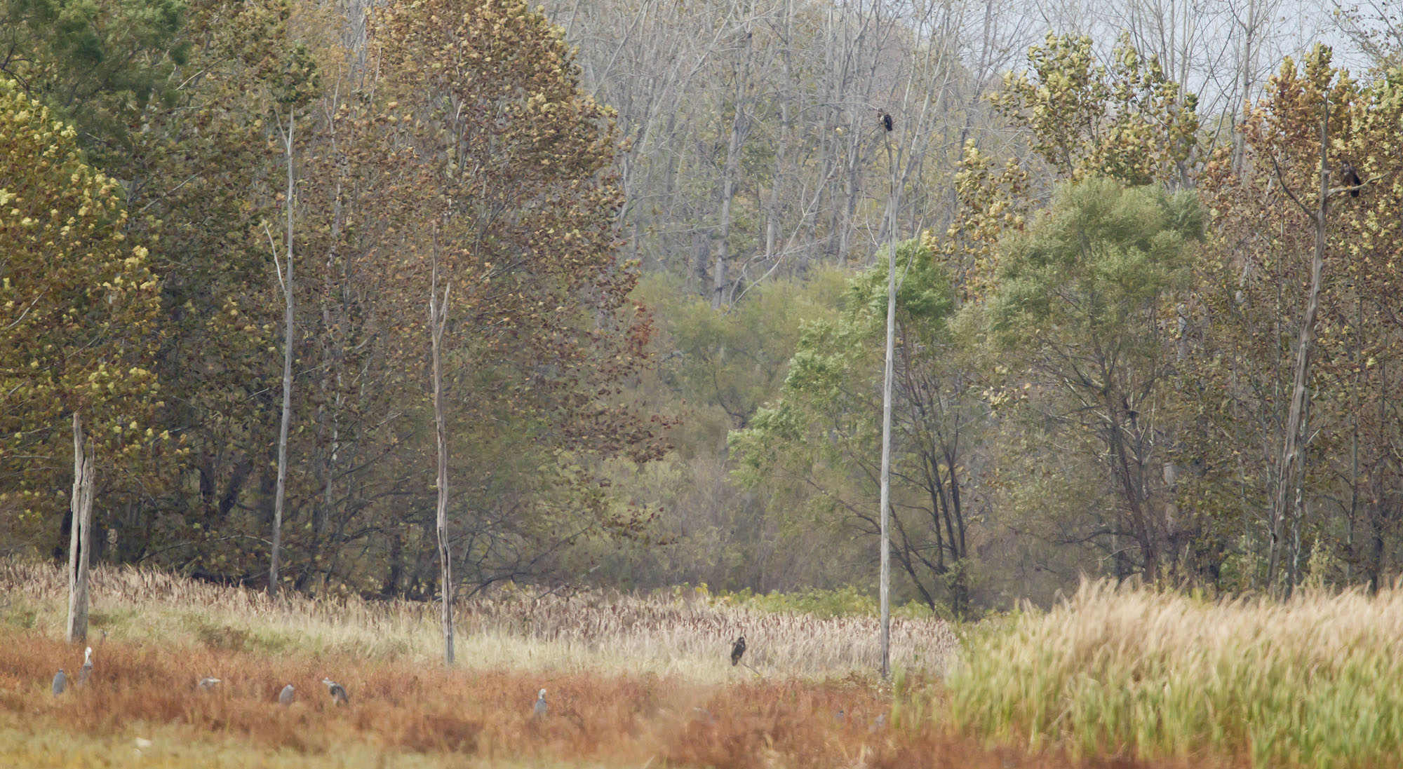
3 BALD EAGLES IN THIS IMAGE ALONG WITH SEVERAL GREAT BLUE HERONS.
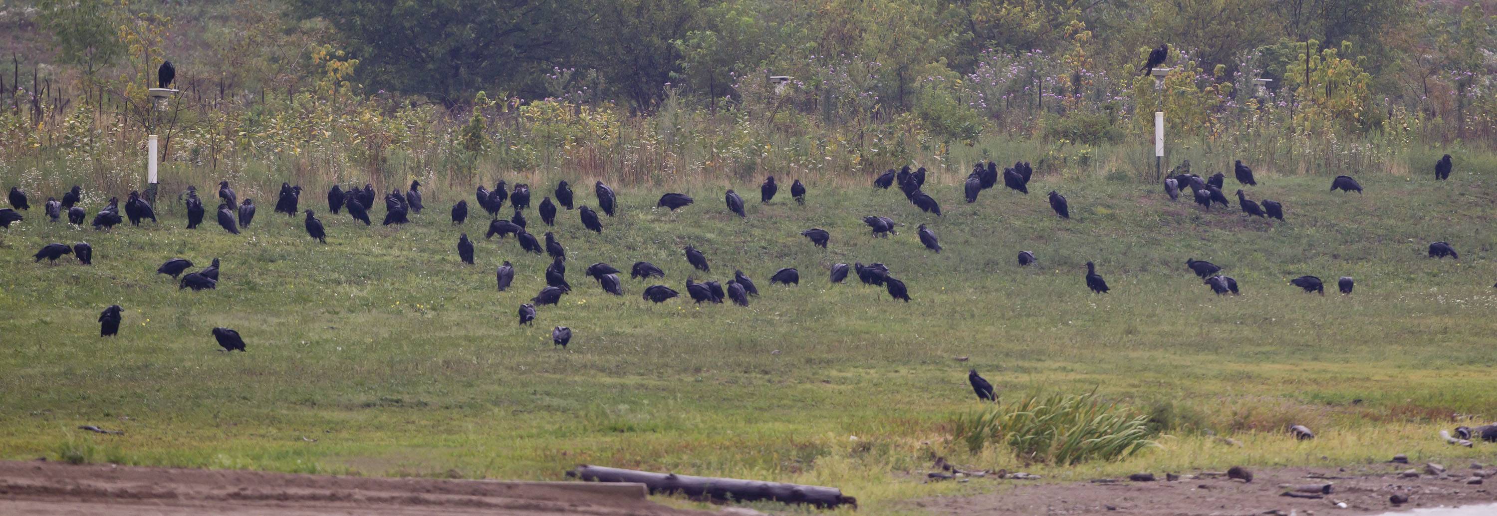
BLACK VULTURES
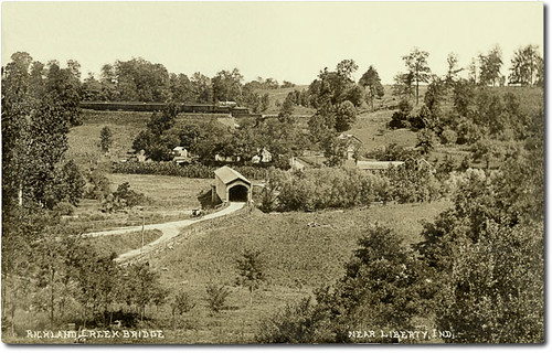
Richland Creek Valley and covered bridge near Liberty, Indiana
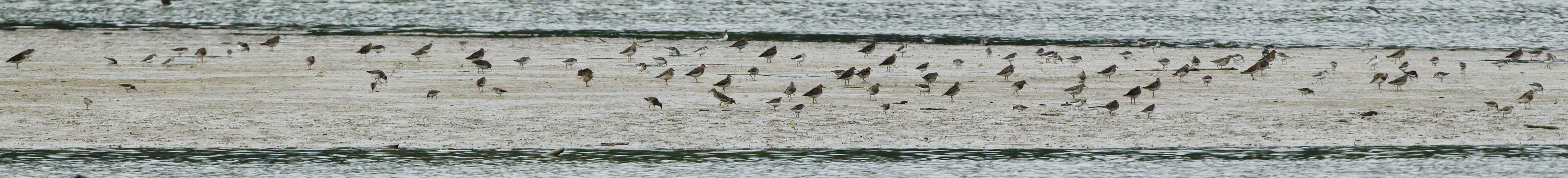
SHOREBIRDS ON THE MUDFLAT
N Co Rd E, Connersville, IN 美国的地图
查询其他地方的日出日落时间
附近地点
美国印第安纳州滑铁卢
Whitaker Dr, Milton, IN 美国
N Eby Dr, Connersville, IN 美国
Market St, Connersville, IN 美国
美国印第安纳州康纳斯维尔
美国印第安纳州华盛顿
美国印第安纳州哈里森
Sunset Ave, Connersville, IN 美国
美国印第安纳州康纳斯维尔
美国印第安纳州詹宁斯
美国印第安纳州米尔顿
E Alquina Rd, Connersville, IN 美国
美国印第安纳州阿宾顿
美国印第安纳州费耶特
Delaware Ct, Cambridge City, IN 美国Cambridge Square 2 Apartments
美国印第安纳州剑桥城
美国印第安纳州杰克逊
Lead Line Rd, Centerville, IN 美国
美国印第安纳州利伯蒂
Abington Pike, Centerville, IN 美国
最近搜索
- Red Dog Mine, AK, USA的日出日落时间表
- Am bhf, Borken, 德国Am Bahnhof的日出日落时间表
- 4th St E, Sonoma, CA 美国的日出日落时间表
- Oakland Ave, Williamsport, PA 美国的日出日落时间表
- Via Roma, Pieranica CR, Italy的日出日落时间表
- 克罗地亚杜布罗夫尼克 GradClock Tower of Dubrovnik的日出日落时间表
- 阿根廷丘布特省特雷利乌的日出日落时间表
- Hartfords Bluff Cir, Mt Pleasant, SC 美国的日出日落时间表
- 日本熊本县熊本市北区的日出日落时间表
- 中国福州市平潭县平潭岛的日出日落时间表