美国堪萨斯芒德城的日出日落时间表
Location: 美国 > 堪萨斯 > 林恩 >
时区:
America/Chicago
当地时间:
2025-07-12 10:30:09
经度:
-94.8313257
纬度:
38.1120169
今天日出时间:
06:06:57 AM
今天日落时间:
08:43:13 PM
今天日照时常:
14h 36m 16s
明天日出时间:
06:07:38 AM
明天日落时间:
08:42:45 PM
明天日照时常:
14h 35m 7s
显示所有日期
| 日期 | 日出 | 日落 | 日照时常 |
|---|---|---|---|
| 2025年01月01日 | 07:35:45 AM | 05:11:12 PM | 9h 35m 27s |
| 2025年01月02日 | 07:35:50 AM | 05:12:02 PM | 9h 36m 12s |
| 2025年01月03日 | 07:35:53 AM | 05:12:54 PM | 9h 37m 1s |
| 2025年01月04日 | 07:35:54 AM | 05:13:46 PM | 9h 37m 52s |
| 2025年01月05日 | 07:35:53 AM | 05:14:40 PM | 9h 38m 47s |
| 2025年01月06日 | 07:35:49 AM | 05:15:35 PM | 9h 39m 46s |
| 2025年01月07日 | 07:35:44 AM | 05:16:32 PM | 9h 40m 48s |
| 2025年01月08日 | 07:35:36 AM | 05:17:29 PM | 9h 41m 53s |
| 2025年01月09日 | 07:35:26 AM | 05:18:27 PM | 9h 43m 1s |
| 2025年01月10日 | 07:35:15 AM | 05:19:26 PM | 9h 44m 11s |
| 2025年01月11日 | 07:35:01 AM | 05:20:26 PM | 9h 45m 25s |
| 2025年01月12日 | 07:34:45 AM | 05:21:27 PM | 9h 46m 42s |
| 2025年01月13日 | 07:34:27 AM | 05:22:29 PM | 9h 48m 2s |
| 2025年01月14日 | 07:34:07 AM | 05:23:31 PM | 9h 49m 24s |
| 2025年01月15日 | 07:33:45 AM | 05:24:34 PM | 9h 50m 49s |
| 2025年01月16日 | 07:33:21 AM | 05:25:38 PM | 9h 52m 17s |
| 2025年01月17日 | 07:32:55 AM | 05:26:42 PM | 9h 53m 47s |
| 2025年01月18日 | 07:32:27 AM | 05:27:47 PM | 9h 55m 20s |
| 2025年01月19日 | 07:31:57 AM | 05:28:52 PM | 9h 56m 55s |
| 2025年01月20日 | 07:31:25 AM | 05:29:57 PM | 9h 58m 32s |
| 2025年01月21日 | 07:30:51 AM | 05:31:03 PM | 10h 0m 12s |
| 2025年01月22日 | 07:30:15 AM | 05:32:10 PM | 10h 1m 55s |
| 2025年01月23日 | 07:29:38 AM | 05:33:17 PM | 10h 3m 39s |
| 2025年01月24日 | 07:28:58 AM | 05:34:24 PM | 10h 5m 26s |
| 2025年01月25日 | 07:28:17 AM | 05:35:31 PM | 10h 7m 14s |
| 2025年01月26日 | 07:27:34 AM | 05:36:38 PM | 10h 9m 4s |
| 2025年01月27日 | 07:26:49 AM | 05:37:46 PM | 10h 10m 57s |
| 2025年01月28日 | 07:26:02 AM | 05:38:53 PM | 10h 12m 51s |
| 2025年01月29日 | 07:25:14 AM | 05:40:01 PM | 10h 14m 47s |
| 2025年01月30日 | 07:24:24 AM | 05:41:09 PM | 10h 16m 45s |
| 2025年01月31日 | 07:23:32 AM | 05:42:17 PM | 10h 18m 45s |
| 2025年02月01日 | 07:22:39 AM | 05:43:24 PM | 10h 20m 45s |
| 2025年02月02日 | 07:21:44 AM | 05:44:32 PM | 10h 22m 48s |
| 2025年02月03日 | 07:20:48 AM | 05:45:40 PM | 10h 24m 52s |
| 2025年02月04日 | 07:19:50 AM | 05:46:47 PM | 10h 26m 57s |
| 2025年02月05日 | 07:18:50 AM | 05:47:55 PM | 10h 29m 5s |
| 2025年02月06日 | 07:17:49 AM | 05:49:02 PM | 10h 31m 13s |
| 2025年02月07日 | 07:16:47 AM | 05:50:09 PM | 10h 33m 22s |
| 2025年02月08日 | 07:15:43 AM | 05:51:16 PM | 10h 35m 33s |
| 2025年02月09日 | 07:14:38 AM | 05:52:23 PM | 10h 37m 45s |
| 2025年02月10日 | 07:13:32 AM | 05:53:30 PM | 10h 39m 58s |
| 2025年02月11日 | 07:12:24 AM | 05:54:36 PM | 10h 42m 12s |
| 2025年02月12日 | 07:11:15 AM | 05:55:42 PM | 10h 44m 27s |
| 2025年02月13日 | 07:10:05 AM | 05:56:48 PM | 10h 46m 43s |
| 2025年02月14日 | 07:08:54 AM | 05:57:53 PM | 10h 48m 59s |
| 2025年02月15日 | 07:07:42 AM | 05:58:59 PM | 10h 51m 17s |
| 2025年02月16日 | 07:06:28 AM | 06:00:04 PM | 10h 53m 36s |
| 2025年02月17日 | 07:05:13 AM | 06:01:08 PM | 10h 55m 55s |
| 2025年02月18日 | 07:03:58 AM | 06:02:13 PM | 10h 58m 15s |
| 2025年02月19日 | 07:02:41 AM | 06:03:17 PM | 11h 0m 36s |
| 2025年02月20日 | 07:01:23 AM | 06:04:20 PM | 11h 2m 57s |
| 2025年02月21日 | 07:00:04 AM | 06:05:24 PM | 11h 5m 20s |
| 2025年02月22日 | 06:58:45 AM | 06:06:27 PM | 11h 7m 42s |
| 2025年02月23日 | 06:57:24 AM | 06:07:30 PM | 11h 10m 6s |
| 2025年02月24日 | 06:56:03 AM | 06:08:32 PM | 11h 12m 29s |
| 2025年02月25日 | 06:54:41 AM | 06:09:35 PM | 11h 14m 54s |
| 2025年02月26日 | 06:53:18 AM | 06:10:36 PM | 11h 17m 18s |
| 2025年02月27日 | 06:51:54 AM | 06:11:38 PM | 11h 19m 44s |
| 2025年02月28日 | 06:50:30 AM | 06:12:39 PM | 11h 22m 9s |
| 2025年03月01日 | 06:49:05 AM | 06:13:40 PM | 11h 24m 35s |
| 2025年03月02日 | 06:47:39 AM | 06:14:41 PM | 11h 27m 2s |
| 2025年03月03日 | 06:46:12 AM | 06:15:41 PM | 11h 29m 29s |
| 2025年03月04日 | 06:44:45 AM | 06:16:41 PM | 11h 31m 56s |
| 2025年03月05日 | 06:43:18 AM | 06:17:41 PM | 11h 34m 23s |
| 2025年03月06日 | 06:41:50 AM | 06:18:40 PM | 11h 36m 50s |
| 2025年03月07日 | 06:40:21 AM | 06:19:40 PM | 11h 39m 19s |
| 2025年03月08日 | 06:38:52 AM | 06:20:39 PM | 11h 41m 47s |
| 2025年03月09日 | 07:37:27 AM | 07:21:35 PM | 11h 44m 8s |
| 2025年03月10日 | 07:35:57 AM | 07:22:33 PM | 11h 46m 36s |
| 2025年03月11日 | 07:34:26 AM | 07:23:32 PM | 11h 49m 6s |
| 2025年03月12日 | 07:32:56 AM | 07:24:30 PM | 11h 51m 34s |
| 2025年03月13日 | 07:31:25 AM | 07:25:27 PM | 11h 54m 2s |
| 2025年03月14日 | 07:29:54 AM | 07:26:25 PM | 11h 56m 31s |
| 2025年03月15日 | 07:28:22 AM | 07:27:22 PM | 11h 59m 0s |
| 2025年03月16日 | 07:26:51 AM | 07:28:20 PM | 12h 1m 29s |
| 2025年03月17日 | 07:25:19 AM | 07:29:17 PM | 12h 3m 58s |
| 2025年03月18日 | 07:23:47 AM | 07:30:14 PM | 12h 6m 27s |
| 2025年03月19日 | 07:22:15 AM | 07:31:10 PM | 12h 8m 55s |
| 2025年03月20日 | 07:20:43 AM | 07:32:07 PM | 12h 11m 24s |
| 2025年03月21日 | 07:19:11 AM | 07:33:03 PM | 12h 13m 52s |
| 2025年03月22日 | 07:17:38 AM | 07:34:00 PM | 12h 16m 22s |
| 2025年03月23日 | 07:16:06 AM | 07:34:56 PM | 12h 18m 50s |
| 2025年03月24日 | 07:14:34 AM | 07:35:52 PM | 12h 21m 18s |
| 2025年03月25日 | 07:13:01 AM | 07:36:48 PM | 12h 23m 47s |
| 2025年03月26日 | 07:11:29 AM | 07:37:44 PM | 12h 26m 15s |
| 2025年03月27日 | 07:09:57 AM | 07:38:40 PM | 12h 28m 43s |
| 2025年03月28日 | 07:08:25 AM | 07:39:35 PM | 12h 31m 10s |
| 2025年03月29日 | 07:06:54 AM | 07:40:31 PM | 12h 33m 37s |
| 2025年03月30日 | 07:05:22 AM | 07:41:27 PM | 12h 36m 5s |
| 2025年03月31日 | 07:03:51 AM | 07:42:23 PM | 12h 38m 32s |
| 2025年04月01日 | 07:02:20 AM | 07:43:18 PM | 12h 40m 58s |
| 2025年04月02日 | 07:00:49 AM | 07:44:14 PM | 12h 43m 25s |
| 2025年04月03日 | 06:59:19 AM | 07:45:09 PM | 12h 45m 50s |
| 2025年04月04日 | 06:57:49 AM | 07:46:05 PM | 12h 48m 16s |
| 2025年04月05日 | 06:56:19 AM | 07:47:01 PM | 12h 50m 42s |
| 2025年04月06日 | 06:54:50 AM | 07:47:56 PM | 12h 53m 6s |
| 2025年04月07日 | 06:53:21 AM | 07:48:52 PM | 12h 55m 31s |
| 2025年04月08日 | 06:51:52 AM | 07:49:48 PM | 12h 57m 56s |
| 2025年04月09日 | 06:50:25 AM | 07:50:43 PM | 13h 0m 18s |
| 2025年04月10日 | 06:48:57 AM | 07:51:39 PM | 13h 2m 42s |
| 2025年04月11日 | 06:47:30 AM | 07:52:35 PM | 13h 5m 5s |
| 2025年04月12日 | 06:46:04 AM | 07:53:31 PM | 13h 7m 27s |
| 2025年04月13日 | 06:44:39 AM | 07:54:26 PM | 13h 9m 47s |
| 2025年04月14日 | 06:43:14 AM | 07:55:22 PM | 13h 12m 8s |
| 2025年04月15日 | 06:41:50 AM | 07:56:18 PM | 13h 14m 28s |
| 2025年04月16日 | 06:40:26 AM | 07:57:14 PM | 13h 16m 48s |
| 2025年04月17日 | 06:39:03 AM | 07:58:10 PM | 13h 19m 7s |
| 2025年04月18日 | 06:37:41 AM | 07:59:06 PM | 13h 21m 25s |
| 2025年04月19日 | 06:36:20 AM | 08:00:02 PM | 13h 23m 42s |
| 2025年04月20日 | 06:35:00 AM | 08:00:58 PM | 13h 25m 58s |
| 2025年04月21日 | 06:33:40 AM | 08:01:54 PM | 13h 28m 14s |
| 2025年04月22日 | 06:32:22 AM | 08:02:50 PM | 13h 30m 28s |
| 2025年04月23日 | 06:31:04 AM | 08:03:47 PM | 13h 32m 43s |
| 2025年04月24日 | 06:29:47 AM | 08:04:43 PM | 13h 34m 56s |
| 2025年04月25日 | 06:28:31 AM | 08:05:39 PM | 13h 37m 8s |
| 2025年04月26日 | 06:27:17 AM | 08:06:35 PM | 13h 39m 18s |
| 2025年04月27日 | 06:26:03 AM | 08:07:31 PM | 13h 41m 28s |
| 2025年04月28日 | 06:24:50 AM | 08:08:27 PM | 13h 43m 37s |
| 2025年04月29日 | 06:23:39 AM | 08:09:23 PM | 13h 45m 44s |
| 2025年04月30日 | 06:22:29 AM | 08:10:19 PM | 13h 47m 50s |
| 2025年05月01日 | 06:21:19 AM | 08:11:15 PM | 13h 49m 56s |
| 2025年05月02日 | 06:20:11 AM | 08:12:11 PM | 13h 52m 0s |
| 2025年05月03日 | 06:19:05 AM | 08:13:06 PM | 13h 54m 1s |
| 2025年05月04日 | 06:17:59 AM | 08:14:02 PM | 13h 56m 3s |
| 2025年05月05日 | 06:16:55 AM | 08:14:57 PM | 13h 58m 2s |
| 2025年05月06日 | 06:15:52 AM | 08:15:52 PM | 14h 0m 0s |
| 2025年05月07日 | 06:14:50 AM | 08:16:47 PM | 14h 1m 57s |
| 2025年05月08日 | 06:13:50 AM | 08:17:42 PM | 14h 3m 52s |
| 2025年05月09日 | 06:12:51 AM | 08:18:36 PM | 14h 5m 45s |
| 2025年05月10日 | 06:11:54 AM | 08:19:30 PM | 14h 7m 36s |
| 2025年05月11日 | 06:10:57 AM | 08:20:24 PM | 14h 9m 27s |
| 2025年05月12日 | 06:10:03 AM | 08:21:18 PM | 14h 11m 15s |
| 2025年05月13日 | 06:09:10 AM | 08:22:11 PM | 14h 13m 1s |
| 2025年05月14日 | 06:08:18 AM | 08:23:04 PM | 14h 14m 46s |
| 2025年05月15日 | 06:07:28 AM | 08:23:56 PM | 14h 16m 28s |
| 2025年05月16日 | 06:06:40 AM | 08:24:48 PM | 14h 18m 8s |
| 2025年05月17日 | 06:05:53 AM | 08:25:40 PM | 14h 19m 47s |
| 2025年05月18日 | 06:05:08 AM | 08:26:31 PM | 14h 21m 23s |
| 2025年05月19日 | 06:04:24 AM | 08:27:21 PM | 14h 22m 57s |
| 2025年05月20日 | 06:03:42 AM | 08:28:11 PM | 14h 24m 29s |
| 2025年05月21日 | 06:03:02 AM | 08:29:00 PM | 14h 25m 58s |
| 2025年05月22日 | 06:02:24 AM | 08:29:49 PM | 14h 27m 25s |
| 2025年05月23日 | 06:01:47 AM | 08:30:37 PM | 14h 28m 50s |
| 2025年05月24日 | 06:01:12 AM | 08:31:24 PM | 14h 30m 12s |
| 2025年05月25日 | 06:00:38 AM | 08:32:10 PM | 14h 31m 32s |
| 2025年05月26日 | 06:00:07 AM | 08:32:56 PM | 14h 32m 49s |
| 2025年05月27日 | 05:59:37 AM | 08:33:41 PM | 14h 34m 4s |
| 2025年05月28日 | 05:59:09 AM | 08:34:25 PM | 14h 35m 16s |
| 2025年05月29日 | 05:58:42 AM | 08:35:08 PM | 14h 36m 26s |
| 2025年05月30日 | 05:58:18 AM | 08:35:50 PM | 14h 37m 32s |
| 2025年05月31日 | 05:57:55 AM | 08:36:31 PM | 14h 38m 36s |
| 2025年06月01日 | 05:57:34 AM | 08:37:11 PM | 14h 39m 37s |
| 2025年06月02日 | 05:57:15 AM | 08:37:50 PM | 14h 40m 35s |
| 2025年06月03日 | 05:56:58 AM | 08:38:27 PM | 14h 41m 29s |
| 2025年06月04日 | 05:56:42 AM | 08:39:04 PM | 14h 42m 22s |
| 2025年06月05日 | 05:56:29 AM | 08:39:39 PM | 14h 43m 10s |
| 2025年06月06日 | 05:56:17 AM | 08:40:14 PM | 14h 43m 57s |
| 2025年06月07日 | 05:56:07 AM | 08:40:46 PM | 14h 44m 39s |
| 2025年06月08日 | 05:55:59 AM | 08:41:18 PM | 14h 45m 19s |
| 2025年06月09日 | 05:55:53 AM | 08:41:48 PM | 14h 45m 55s |
| 2025年06月10日 | 05:55:48 AM | 08:42:17 PM | 14h 46m 29s |
| 2025年06月11日 | 05:55:46 AM | 08:42:45 PM | 14h 46m 59s |
| 2025年06月12日 | 05:55:45 AM | 08:43:11 PM | 14h 47m 26s |
| 2025年06月13日 | 05:55:46 AM | 08:43:35 PM | 14h 47m 49s |
| 2025年06月14日 | 05:55:48 AM | 08:43:58 PM | 14h 48m 10s |
| 2025年06月15日 | 05:55:53 AM | 08:44:19 PM | 14h 48m 26s |
| 2025年06月16日 | 05:55:59 AM | 08:44:39 PM | 14h 48m 40s |
| 2025年06月17日 | 05:56:07 AM | 08:44:58 PM | 14h 48m 51s |
| 2025年06月18日 | 05:56:16 AM | 08:45:14 PM | 14h 48m 58s |
| 2025年06月19日 | 05:56:27 AM | 08:45:29 PM | 14h 49m 2s |
| 2025年06月20日 | 05:56:40 AM | 08:45:43 PM | 14h 49m 3s |
| 2025年06月21日 | 05:56:55 AM | 08:45:54 PM | 14h 48m 59s |
| 2025年06月22日 | 05:57:11 AM | 08:46:04 PM | 14h 48m 53s |
| 2025年06月23日 | 05:57:28 AM | 08:46:12 PM | 14h 48m 44s |
| 2025年06月24日 | 05:57:48 AM | 08:46:18 PM | 14h 48m 30s |
| 2025年06月25日 | 05:58:08 AM | 08:46:23 PM | 14h 48m 15s |
| 2025年06月26日 | 05:58:31 AM | 08:46:26 PM | 14h 47m 55s |
| 2025年06月27日 | 05:58:54 AM | 08:46:27 PM | 14h 47m 33s |
| 2025年06月28日 | 05:59:19 AM | 08:46:26 PM | 14h 47m 7s |
| 2025年06月29日 | 05:59:46 AM | 08:46:23 PM | 14h 46m 37s |
| 2025年06月30日 | 06:00:14 AM | 08:46:18 PM | 14h 46m 4s |
| 2025年07月01日 | 06:00:43 AM | 08:46:12 PM | 14h 45m 29s |
| 2025年07月02日 | 06:01:13 AM | 08:46:04 PM | 14h 44m 51s |
| 2025年07月03日 | 06:01:45 AM | 08:45:53 PM | 14h 44m 8s |
| 2025年07月04日 | 06:02:18 AM | 08:45:41 PM | 14h 43m 23s |
| 2025年07月05日 | 06:02:52 AM | 08:45:27 PM | 14h 42m 35s |
| 2025年07月06日 | 06:03:27 AM | 08:45:12 PM | 14h 41m 45s |
| 2025年07月07日 | 06:04:03 AM | 08:44:54 PM | 14h 40m 51s |
| 2025年07月08日 | 06:04:40 AM | 08:44:34 PM | 14h 39m 54s |
| 2025年07月09日 | 06:05:19 AM | 08:44:13 PM | 14h 38m 54s |
| 2025年07月10日 | 06:05:58 AM | 08:43:50 PM | 14h 37m 52s |
| 2025年07月11日 | 06:06:38 AM | 08:43:25 PM | 14h 36m 47s |
| 2025年07月12日 | 06:07:19 AM | 08:42:58 PM | 14h 35m 39s |
| 2025年07月13日 | 06:08:01 AM | 08:42:29 PM | 14h 34m 28s |
| 2025年07月14日 | 06:08:44 AM | 08:41:59 PM | 14h 33m 15s |
| 2025年07月15日 | 06:09:28 AM | 08:41:26 PM | 14h 31m 58s |
| 2025年07月16日 | 06:10:12 AM | 08:40:52 PM | 14h 30m 40s |
| 2025年07月17日 | 06:10:57 AM | 08:40:16 PM | 14h 29m 19s |
| 2025年07月18日 | 06:11:43 AM | 08:39:39 PM | 14h 27m 56s |
| 2025年07月19日 | 06:12:29 AM | 08:38:59 PM | 14h 26m 30s |
| 2025年07月20日 | 06:13:16 AM | 08:38:18 PM | 14h 25m 2s |
| 2025年07月21日 | 06:14:03 AM | 08:37:35 PM | 14h 23m 32s |
| 2025年07月22日 | 06:14:51 AM | 08:36:51 PM | 14h 22m 0s |
| 2025年07月23日 | 06:15:40 AM | 08:36:05 PM | 14h 20m 25s |
| 2025年07月24日 | 06:16:29 AM | 08:35:17 PM | 14h 18m 48s |
| 2025年07月25日 | 06:17:18 AM | 08:34:28 PM | 14h 17m 10s |
| 2025年07月26日 | 06:18:08 AM | 08:33:37 PM | 14h 15m 29s |
| 2025年07月27日 | 06:18:58 AM | 08:32:44 PM | 14h 13m 46s |
| 2025年07月28日 | 06:19:48 AM | 08:31:50 PM | 14h 12m 2s |
| 2025年07月29日 | 06:20:39 AM | 08:30:54 PM | 14h 10m 15s |
| 2025年07月30日 | 06:21:30 AM | 08:29:57 PM | 14h 8m 27s |
| 2025年07月31日 | 06:22:21 AM | 08:28:59 PM | 14h 6m 38s |
| 2025年08月01日 | 06:23:12 AM | 08:27:59 PM | 14h 4m 47s |
| 2025年08月02日 | 06:24:04 AM | 08:26:57 PM | 14h 2m 53s |
| 2025年08月03日 | 06:24:56 AM | 08:25:55 PM | 14h 0m 59s |
| 2025年08月04日 | 06:25:48 AM | 08:24:50 PM | 13h 59m 2s |
| 2025年08月05日 | 06:26:40 AM | 08:23:45 PM | 13h 57m 5s |
| 2025年08月06日 | 06:27:32 AM | 08:22:38 PM | 13h 55m 6s |
| 2025年08月07日 | 06:28:24 AM | 08:21:30 PM | 13h 53m 6s |
| 2025年08月08日 | 06:29:17 AM | 08:20:21 PM | 13h 51m 4s |
| 2025年08月09日 | 06:30:09 AM | 08:19:10 PM | 13h 49m 1s |
| 2025年08月10日 | 06:31:02 AM | 08:17:59 PM | 13h 46m 57s |
| 2025年08月11日 | 06:31:54 AM | 08:16:46 PM | 13h 44m 52s |
| 2025年08月12日 | 06:32:47 AM | 08:15:32 PM | 13h 42m 45s |
| 2025年08月13日 | 06:33:39 AM | 08:14:17 PM | 13h 40m 38s |
| 2025年08月14日 | 06:34:32 AM | 08:13:01 PM | 13h 38m 29s |
| 2025年08月15日 | 06:35:24 AM | 08:11:44 PM | 13h 36m 20s |
| 2025年08月16日 | 06:36:17 AM | 08:10:26 PM | 13h 34m 9s |
| 2025年08月17日 | 06:37:09 AM | 08:09:07 PM | 13h 31m 58s |
| 2025年08月18日 | 06:38:01 AM | 08:07:47 PM | 13h 29m 46s |
| 2025年08月19日 | 06:38:54 AM | 08:06:26 PM | 13h 27m 32s |
| 2025年08月20日 | 06:39:46 AM | 08:05:04 PM | 13h 25m 18s |
| 2025年08月21日 | 06:40:38 AM | 08:03:41 PM | 13h 23m 3s |
| 2025年08月22日 | 06:41:30 AM | 08:02:18 PM | 13h 20m 48s |
| 2025年08月23日 | 06:42:22 AM | 08:00:53 PM | 13h 18m 31s |
| 2025年08月24日 | 06:43:14 AM | 07:59:28 PM | 13h 16m 14s |
| 2025年08月25日 | 06:44:06 AM | 07:58:03 PM | 13h 13m 57s |
| 2025年08月26日 | 06:44:58 AM | 07:56:36 PM | 13h 11m 38s |
| 2025年08月27日 | 06:45:50 AM | 07:55:09 PM | 13h 9m 19s |
| 2025年08月28日 | 06:46:42 AM | 07:53:41 PM | 13h 6m 59s |
| 2025年08月29日 | 06:47:33 AM | 07:52:13 PM | 13h 4m 40s |
| 2025年08月30日 | 06:48:25 AM | 07:50:44 PM | 13h 2m 19s |
| 2025年08月31日 | 06:49:16 AM | 07:49:14 PM | 12h 59m 58s |
| 2025年09月01日 | 06:50:08 AM | 07:47:44 PM | 12h 57m 36s |
| 2025年09月02日 | 06:50:59 AM | 07:46:13 PM | 12h 55m 14s |
| 2025年09月03日 | 06:51:50 AM | 07:44:42 PM | 12h 52m 52s |
| 2025年09月04日 | 06:52:42 AM | 07:43:11 PM | 12h 50m 29s |
| 2025年09月05日 | 06:53:33 AM | 07:41:39 PM | 12h 48m 6s |
| 2025年09月06日 | 06:54:24 AM | 07:40:07 PM | 12h 45m 43s |
| 2025年09月07日 | 06:55:16 AM | 07:38:34 PM | 12h 43m 18s |
| 2025年09月08日 | 06:56:07 AM | 07:37:01 PM | 12h 40m 54s |
| 2025年09月09日 | 06:56:58 AM | 07:35:28 PM | 12h 38m 30s |
| 2025年09月10日 | 06:57:49 AM | 07:33:54 PM | 12h 36m 5s |
| 2025年09月11日 | 06:58:41 AM | 07:32:21 PM | 12h 33m 40s |
| 2025年09月12日 | 06:59:32 AM | 07:30:47 PM | 12h 31m 15s |
| 2025年09月13日 | 07:00:23 AM | 07:29:13 PM | 12h 28m 50s |
| 2025年09月14日 | 07:01:15 AM | 07:27:39 PM | 12h 26m 24s |
| 2025年09月15日 | 07:02:06 AM | 07:26:04 PM | 12h 23m 58s |
| 2025年09月16日 | 07:02:58 AM | 07:24:30 PM | 12h 21m 32s |
| 2025年09月17日 | 07:03:49 AM | 07:22:55 PM | 12h 19m 6s |
| 2025年09月18日 | 07:04:41 AM | 07:21:21 PM | 12h 16m 40s |
| 2025年09月19日 | 07:05:33 AM | 07:19:46 PM | 12h 14m 13s |
| 2025年09月20日 | 07:06:25 AM | 07:18:12 PM | 12h 11m 47s |
| 2025年09月21日 | 07:07:17 AM | 07:16:37 PM | 12h 9m 20s |
| 2025年09月22日 | 07:08:09 AM | 07:15:03 PM | 12h 6m 54s |
| 2025年09月23日 | 07:09:01 AM | 07:13:29 PM | 12h 4m 28s |
| 2025年09月24日 | 07:09:54 AM | 07:11:55 PM | 12h 2m 1s |
| 2025年09月25日 | 07:10:47 AM | 07:10:21 PM | 11h 59m 34s |
| 2025年09月26日 | 07:11:39 AM | 07:08:47 PM | 11h 57m 8s |
| 2025年09月27日 | 07:12:32 AM | 07:07:14 PM | 11h 54m 42s |
| 2025年09月28日 | 07:13:26 AM | 07:05:41 PM | 11h 52m 15s |
| 2025年09月29日 | 07:14:19 AM | 07:04:08 PM | 11h 49m 49s |
| 2025年09月30日 | 07:15:13 AM | 07:02:35 PM | 11h 47m 22s |
| 2025年10月01日 | 07:16:07 AM | 07:01:03 PM | 11h 44m 56s |
| 2025年10月02日 | 07:17:01 AM | 06:59:31 PM | 11h 42m 30s |
| 2025年10月03日 | 07:17:55 AM | 06:58:00 PM | 11h 40m 5s |
| 2025年10月04日 | 07:18:50 AM | 06:56:29 PM | 11h 37m 39s |
| 2025年10月05日 | 07:19:45 AM | 06:54:58 PM | 11h 35m 13s |
| 2025年10月06日 | 07:20:40 AM | 06:53:28 PM | 11h 32m 48s |
| 2025年10月07日 | 07:21:36 AM | 06:51:59 PM | 11h 30m 23s |
| 2025年10月08日 | 07:22:32 AM | 06:50:30 PM | 11h 27m 58s |
| 2025年10月09日 | 07:23:28 AM | 06:49:02 PM | 11h 25m 34s |
| 2025年10月10日 | 07:24:24 AM | 06:47:34 PM | 11h 23m 10s |
| 2025年10月11日 | 07:25:21 AM | 06:46:08 PM | 11h 20m 47s |
| 2025年10月12日 | 07:26:18 AM | 06:44:41 PM | 11h 18m 23s |
| 2025年10月13日 | 07:27:16 AM | 06:43:16 PM | 11h 16m 0s |
| 2025年10月14日 | 07:28:14 AM | 06:41:51 PM | 11h 13m 37s |
| 2025年10月15日 | 07:29:12 AM | 06:40:27 PM | 11h 11m 15s |
| 2025年10月16日 | 07:30:10 AM | 06:39:04 PM | 11h 8m 54s |
| 2025年10月17日 | 07:31:09 AM | 06:37:42 PM | 11h 6m 33s |
| 2025年10月18日 | 07:32:08 AM | 06:36:21 PM | 11h 4m 13s |
| 2025年10月19日 | 07:33:08 AM | 06:35:00 PM | 11h 1m 52s |
| 2025年10月20日 | 07:34:08 AM | 06:33:41 PM | 10h 59m 33s |
| 2025年10月21日 | 07:35:08 AM | 06:32:22 PM | 10h 57m 14s |
| 2025年10月22日 | 07:36:08 AM | 06:31:05 PM | 10h 54m 57s |
| 2025年10月23日 | 07:37:09 AM | 06:29:49 PM | 10h 52m 40s |
| 2025年10月24日 | 07:38:10 AM | 06:28:33 PM | 10h 50m 23s |
| 2025年10月25日 | 07:39:12 AM | 06:27:19 PM | 10h 48m 7s |
| 2025年10月26日 | 07:40:14 AM | 06:26:06 PM | 10h 45m 52s |
| 2025年10月27日 | 07:41:16 AM | 06:24:54 PM | 10h 43m 38s |
| 2025年10月28日 | 07:42:18 AM | 06:23:44 PM | 10h 41m 26s |
| 2025年10月29日 | 07:43:21 AM | 06:22:35 PM | 10h 39m 14s |
| 2025年10月30日 | 07:44:24 AM | 06:21:27 PM | 10h 37m 3s |
| 2025年10月31日 | 07:45:27 AM | 06:20:20 PM | 10h 34m 53s |
| 2025年11月01日 | 07:46:31 AM | 06:19:15 PM | 10h 32m 44s |
| 2025年11月02日 | 06:47:37 AM | 05:18:08 PM | 10h 30m 31s |
| 2025年11月03日 | 06:48:41 AM | 05:17:06 PM | 10h 28m 25s |
| 2025年11月04日 | 06:49:45 AM | 05:16:05 PM | 10h 26m 20s |
| 2025年11月05日 | 06:50:49 AM | 05:15:05 PM | 10h 24m 16s |
| 2025年11月06日 | 06:51:54 AM | 05:14:07 PM | 10h 22m 13s |
| 2025年11月07日 | 06:52:58 AM | 05:13:11 PM | 10h 20m 13s |
| 2025年11月08日 | 06:54:03 AM | 05:12:16 PM | 10h 18m 13s |
| 2025年11月09日 | 06:55:07 AM | 05:11:23 PM | 10h 16m 16s |
| 2025年11月10日 | 06:56:12 AM | 05:10:32 PM | 10h 14m 20s |
| 2025年11月11日 | 06:57:17 AM | 05:09:42 PM | 10h 12m 25s |
| 2025年11月12日 | 06:58:22 AM | 05:08:54 PM | 10h 10m 32s |
| 2025年11月13日 | 06:59:26 AM | 05:08:08 PM | 10h 8m 42s |
| 2025年11月14日 | 07:00:31 AM | 05:07:23 PM | 10h 6m 52s |
| 2025年11月15日 | 07:01:35 AM | 05:06:40 PM | 10h 5m 5s |
| 2025年11月16日 | 07:02:40 AM | 05:05:59 PM | 10h 3m 19s |
| 2025年11月17日 | 07:03:44 AM | 05:05:20 PM | 10h 1m 36s |
| 2025年11月18日 | 07:04:47 AM | 05:04:43 PM | 9h 59m 56s |
| 2025年11月19日 | 07:05:51 AM | 05:04:08 PM | 9h 58m 17s |
| 2025年11月20日 | 07:06:54 AM | 05:03:35 PM | 9h 56m 41s |
| 2025年11月21日 | 07:07:57 AM | 05:03:03 PM | 9h 55m 6s |
| 2025年11月22日 | 07:09:00 AM | 05:02:34 PM | 9h 53m 34s |
| 2025年11月23日 | 07:10:02 AM | 05:02:07 PM | 9h 52m 5s |
| 2025年11月24日 | 07:11:03 AM | 05:01:42 PM | 9h 50m 39s |
| 2025年11月25日 | 07:12:04 AM | 05:01:18 PM | 9h 49m 14s |
| 2025年11月26日 | 07:13:04 AM | 05:00:57 PM | 9h 47m 53s |
| 2025年11月27日 | 07:14:04 AM | 05:00:38 PM | 9h 46m 34s |
| 2025年11月28日 | 07:15:03 AM | 05:00:21 PM | 9h 45m 18s |
| 2025年11月29日 | 07:16:01 AM | 05:00:06 PM | 9h 44m 5s |
| 2025年11月30日 | 07:16:59 AM | 04:59:53 PM | 9h 42m 54s |
| 2025年12月01日 | 07:17:55 AM | 04:59:43 PM | 9h 41m 48s |
| 2025年12月02日 | 07:18:51 AM | 04:59:34 PM | 9h 40m 43s |
| 2025年12月03日 | 07:19:46 AM | 04:59:28 PM | 9h 39m 42s |
| 2025年12月04日 | 07:20:39 AM | 04:59:23 PM | 9h 38m 44s |
| 2025年12月05日 | 07:21:32 AM | 04:59:21 PM | 9h 37m 49s |
| 2025年12月06日 | 07:22:24 AM | 04:59:21 PM | 9h 36m 57s |
| 2025年12月07日 | 07:23:14 AM | 04:59:23 PM | 9h 36m 9s |
| 2025年12月08日 | 07:24:03 AM | 04:59:28 PM | 9h 35m 25s |
| 2025年12月09日 | 07:24:51 AM | 04:59:34 PM | 9h 34m 43s |
| 2025年12月10日 | 07:25:38 AM | 04:59:43 PM | 9h 34m 5s |
| 2025年12月11日 | 07:26:23 AM | 04:59:53 PM | 9h 33m 30s |
| 2025年12月12日 | 07:27:07 AM | 05:00:06 PM | 9h 32m 59s |
| 2025年12月13日 | 07:27:49 AM | 05:00:21 PM | 9h 32m 32s |
| 2025年12月14日 | 07:28:30 AM | 05:00:38 PM | 9h 32m 8s |
| 2025年12月15日 | 07:29:09 AM | 05:00:56 PM | 9h 31m 47s |
| 2025年12月16日 | 07:29:47 AM | 05:01:17 PM | 9h 31m 30s |
| 2025年12月17日 | 07:30:23 AM | 05:01:40 PM | 9h 31m 17s |
| 2025年12月18日 | 07:30:57 AM | 05:02:05 PM | 9h 31m 8s |
| 2025年12月19日 | 07:31:30 AM | 05:02:32 PM | 9h 31m 2s |
| 2025年12月20日 | 07:32:01 AM | 05:03:01 PM | 9h 31m 0s |
| 2025年12月21日 | 07:32:30 AM | 05:03:31 PM | 9h 31m 1s |
| 2025年12月22日 | 07:32:57 AM | 05:04:03 PM | 9h 31m 6s |
| 2025年12月23日 | 07:33:23 AM | 05:04:38 PM | 9h 31m 15s |
| 2025年12月24日 | 07:33:46 AM | 05:05:14 PM | 9h 31m 28s |
| 2025年12月25日 | 07:34:08 AM | 05:05:51 PM | 9h 31m 43s |
| 2025年12月26日 | 07:34:28 AM | 05:06:31 PM | 9h 32m 3s |
| 2025年12月27日 | 07:34:45 AM | 05:07:12 PM | 9h 32m 27s |
| 2025年12月28日 | 07:35:01 AM | 05:07:54 PM | 9h 32m 53s |
| 2025年12月29日 | 07:35:15 AM | 05:08:38 PM | 9h 33m 23s |
| 2025年12月30日 | 07:35:26 AM | 05:09:24 PM | 9h 33m 58s |
| 2025年12月31日 | 07:35:36 AM | 05:10:11 PM | 9h 34m 35s |
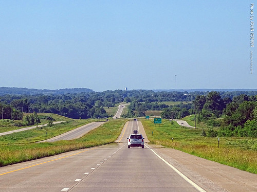
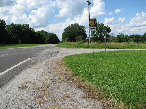
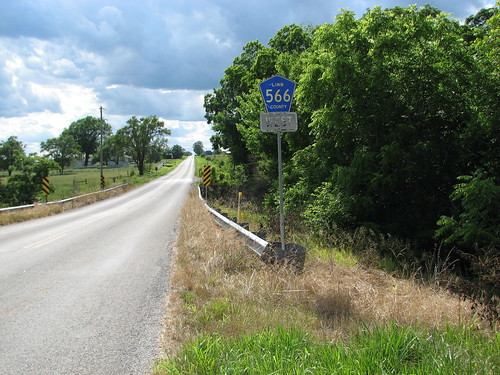
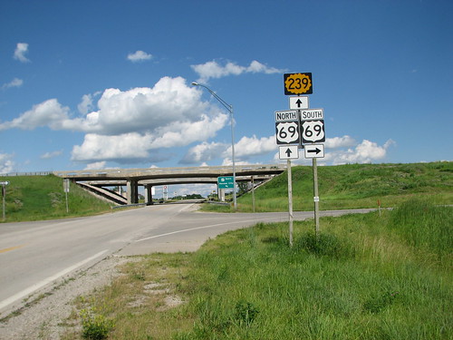
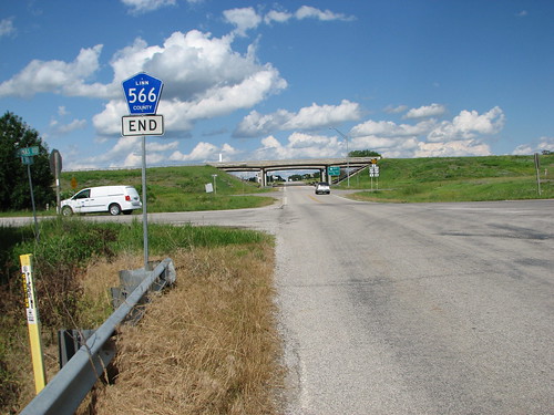
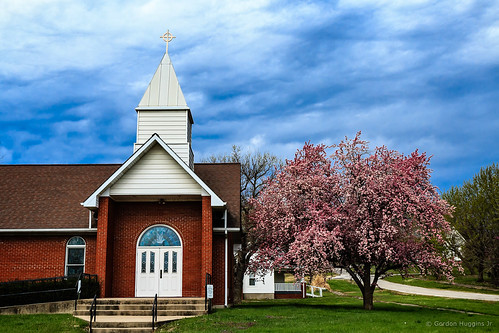
日出日落照片
美国堪萨斯芒德城的地图
查询其他地方的日出日落时间
美国堪萨斯芒德城的其他地方
附近地点
53 Fairway Dr, Mound City, KS 美国Sugar Valley & Hidden Valley Lakes
美国堪萨斯林恩
美国堪萨斯芒德城
E 7th St, Mapleton, KS 美国
美国堪萨斯梅普尔顿
Timberhill, KS, 美国
Main St, Pleasanton, KS 美国
美国堪萨斯普莱森顿
Valley Rd, Mapleton, KS 美国Timber Hills Lake Ranch Cattle Company
W Cedar St, Fulton, KS 美国
美国堪萨斯弗里德姆
美国堪萨斯富尔顿
美国堪萨斯波托西
E Main St, Blue Mound, KS 美国
美国堪萨斯布卢芒德
46 NE Lakeside Dr, Lacygne, KS 美国
美国堪萨斯布卢芒德
Main St, Pleasanton, KS 美国
美国堪萨斯森特维尔
W Rd, Centerville, KS 美国
最近搜索
- Red Dog Mine, AK, USA的日出日落时间表
- Am bhf, Borken, 德国Am Bahnhof的日出日落时间表
- 4th St E, Sonoma, CA 美国的日出日落时间表
- Oakland Ave, Williamsport, PA 美国的日出日落时间表
- Via Roma, Pieranica CR, Italy的日出日落时间表
- 克罗地亚杜布罗夫尼克 GradClock Tower of Dubrovnik的日出日落时间表
- 阿根廷丘布特省特雷利乌的日出日落时间表
- Hartfords Bluff Cir, Mt Pleasant, SC 美国的日出日落时间表
- 日本熊本县熊本市北区的日出日落时间表
- 中国福州市平潭县平潭岛的日出日落时间表


