| 时区: | 巴西利亚标准时间 |
|---|---|
| 当地时间: | 2026年9月15日星期二晚上6点47分 |
| 经度: | -54.4590898 |
| 纬度: | -29.5637643 |
| 今天日出时间: | 06:37:34 |
| 今天日落时间: | 18:31:28 |
| 今天日照时长: | 11小时53分54秒 |
| 明天日出时间: | 06:36:19 |
| 明天日落时间: | 18:31:58 |
| 明天日照时长: | 11小时55分39秒 |
: 显示所有日期
| 日期 | 日出时间 | 日落时间 | 日照时长 |
|---|---|---|---|
| 2026年1月1日 | 05:41:47 | 19:42:18 | 14小时0分30秒 |
| 2026年2月1日 | 06:07:31 | 19:37:30 | 13小时29分58秒 |
| 2026年3月1日 | 06:29:47 | 19:13:58 | 12小时44分10秒 |
| 2026年4月1日 | 06:48:47 | 18:37:34 | 11小时48分47秒 |
| 2026年5月1日 | 07:06:40 | 18:05:51 | 10小时59分11秒 |
| 2026年6月1日 | 07:25:30 | 17:48:26 | 10小时22分56秒 |
| 2026年7月1日 | 07:34:33 | 17:50:42 | 10小时16分9秒 |
| 2026年8月1日 | 07:24:30 | 18:06:22 | 10小时41分52秒 |
| 2026年9月1日 | 06:55:37 | 18:23:49 | 11小时28分11秒 |
| 2026年9月16日 | 06:37:34 | 18:31:28 | 11小时53分54秒 |
| 2026年9月17日 | 06:36:19 | 18:31:58 | 11小时55分39秒 |
| 2026年10月1日 | 06:18:55 | 18:39:17 | 12小时20分21秒 |
| 2026年11月1日 | 05:45:55 | 18:59:26 | 13小时13分31秒 |
| 2026年12月1日 | 05:31:42 | 19:24:13 | 13小时52分31秒 |
日出日落照片

Conquering the Giant: My Epic Ascent of Pico Paraná. by ER's Eyes - Our planet is so beautiful.

Sunrise from the Summit at Pico da Bandeira (Flag Peak) at 2,892 m (9,488 ft) MSL, Caparaó National Park, on the border between the municipalities of Ibitirama (Espírito Santo State) and Alto Caparaó by ER's Eyes - Our planet is so beautiful.

Conquering Pedra da Mina ('Water Spring Rock'): A Tale of Rain, Wind, and One Very Stubborn Mountain. by ER's Eyes - Our planet is so beautiful.

Early morning mist and Te Mata Peak by Jos Buurmans

Sete Pilões Waterfall (Seven Pylons) at 1,855 m (6,085 ft) MSL, Acampamento da Macieira (Apple Tree Camp), Caparaó National Park, Alto Caparaó, Minas Gerais State, Brazil. by ER's Eyes - Our planet is so beautiful.

Catching the sunrise at the peak of my world. by ER's Eyes - Our planet is so beautiful.

Cheetah in Kgalagadi Transfrontier Park /South Africa by nicole le roy91

Pedra da Mina: Where the Rain Reigns and the Wind Whispers (or Yells). by ER's Eyes - Our planet is so beautiful.

Climbing down Pico do Cristal (Crystal Peak) at 2,770 m (9,087 ft) MSL, Caparaó National Park, Alto Caparaó, Minas Gerais State, Brazil. by ER's Eyes - Our planet is so beautiful.

Frost in the Tuki Tuki valley by Jos Buurmans

A Sea of Mountains: Panoramic Views from Pico Paraná. by ER's Eyes - Our planet is so beautiful.

Camp Casa Queimada at 2,190 m (7,185 ft) MSL, Caparaó National Park, Dores do Rio Preto, Espírito Santo, Brazil. by ER's Eyes - Our planet is so beautiful.

Twilight from the Summit at Pico da Bandeira (Flag Peak) at 2,892 m (9,488 ft) MSL, Caparaó National Park, on the border between the municipalities of Ibitirama (Espírito Santo State) and Alto Caparaó by ER's Eyes - Our planet is so beautiful.

Sunrise from the Summit at Pico da Bandeira (Flag Peak) at 2,892 m (9,488 ft) MSL, Caparaó National Park, on the border between the municipalities of Ibitirama (Espírito Santo State) and Alto Caparaó by ER's Eyes - Our planet is so beautiful.

Sunrise from the Summit at Pico da Bandeira (Flag Peak) at 2,892 m (9,488 ft) MSL, Caparaó National Park, on the border between the municipalities of Ibitirama (Espírito Santo State) and Alto Caparaó by ER's Eyes - Our planet is so beautiful.

Sunrise from the Summit at Pico da Bandeira (Flag Peak) at 2,892 m (9,488 ft) MSL, Caparaó National Park, on the border between the municipalities of Ibitirama (Espírito Santo State) and Alto Caparaó by ER's Eyes - Our planet is so beautiful.

Sunrise from the Summit at Pico da Bandeira (Flag Peak) at 2,892 m (9,488 ft) MSL, Caparaó National Park, on the border between the municipalities of Ibitirama (Espírito Santo State) and Alto Caparaó by ER's Eyes - Our planet is so beautiful.

Twilight from the Summit at Pico da Bandeira (Flag Peak) at 2,892 m (9,488 ft) MSL, Caparaó National Park, on the border between the municipalities of Ibitirama (Espírito Santo State) and Alto Caparaó by ER's Eyes - Our planet is so beautiful.

Pico da Bandeira (Flag Peak) seen from the Summit of Pico do Calçado (Shoe Peak) at 2,849 m (9,347 ft), Caparaó National Park, on the border between the municipalities of Ibitirama (Espírito Santo Sta by ER's Eyes - Our planet is so beautiful.

Sunrise from the Summit at Pico da Bandeira (Flag Peak) at 2,892 m (9,488 ft) MSL, Caparaó National Park, on the border between the municipalities of Ibitirama (Espírito Santo State) and Alto Caparaó by ER's Eyes - Our planet is so beautiful.

Pedra Duas Irmãs (Two Sisters Stone) at 2,390 m (7,841 ft) MSL, Trail by way of Caparaó-Capixaba, Caparaó National Park, Alto Caparaó, Minas Gerais State, Brazil. by ER's Eyes - Our planet is so beautiful.

Sunrise from the Cruzeiro at the Summit at Pico da Bandeira (Flag Peak) at 2,892 m (9,488 ft) MSL, Caparaó National Park, on the border between the municipalities of Ibitirama (Espírito Santo State) a by ER's Eyes - Our planet is so beautiful.

Sunrise from the Summit at Pico da Bandeira (Flag Peak) at 2,892 m (9,488 ft) MSL, Caparaó National Park, on the border between the municipalities of Ibitirama (Espírito Santo State) and Alto Caparaó by ER's Eyes - Our planet is so beautiful.

Sunrise from the Summit at Pico da Bandeira (Flag Peak) at 2,892 m (9,488 ft) MSL, Caparaó National Park, on the border between the municipalities of Ibitirama (Espírito Santo State) and Alto Caparaó by ER's Eyes - Our planet is so beautiful.

Trail by way of Caparaó-Capixaba at 2,480 m (8,136 ft) MSL, Caparaó National Park, Dores do Rio Preto, Espírito Santo State, Brazil. by ER's Eyes - Our planet is so beautiful.
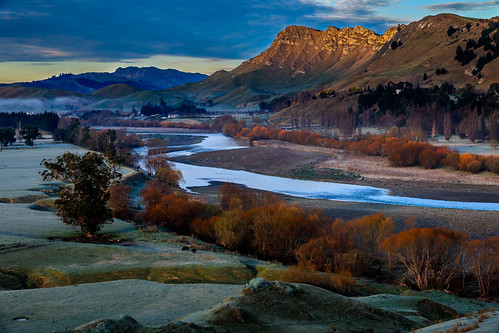
Tukituki River by Jos Buurmans

Trail by way of Caparaó-Capixaba at 2,540 m (8,333 ft) MSL, Caparaó National Park, Dores do Rio Preto, Espírito Santo State, Brazil. by ER's Eyes - Our planet is so beautiful.

Casa da Serra Caparaó (Caparao Mountain Range House) at 1,220 m (4,002 ft) MSL, Forquilha do Rio, Minas Gerais State, Brazil. by ER's Eyes - Our planet is so beautiful.

Camp Casa Queimada at 2,180 m (7,152 ft) MSL, Caparaó National Park, Dores do Rio Preto, Espírito Santo, Brazil. by ER's Eyes - Our planet is so beautiful.
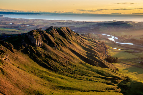
Tuki Tuki Valley from Te Mata Peak by Jos Buurmans

Valley of two halves by Jos Buurmans
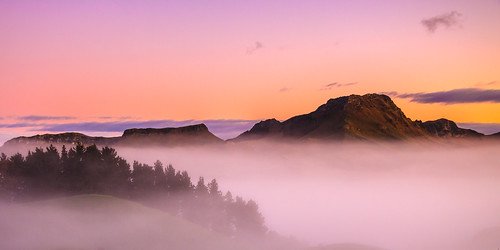
Early morning mist and Te Mata Peak by Jos Buurmans
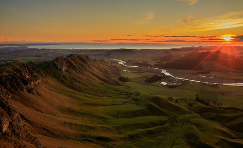
Early sunrays over the Tuki Tuki valley by Jos Buurmans

Misty Hawke's Bay Sunrise from Te Mata Peak by Jos Buurmans

Early light on Tree by Jos Buurmans

6:13 p.m by Ruby Augusto

Visitor Center at 1,420 m (4,658 ft) MSL, Caparaó National Park, Pedra Menina, Espírito Santo, Brazil. by ER's Eyes - Our planet is so beautiful.

Casa da Serra Caparaó (Caparao Mountain Range House) at 1,220 m (4,002 ft) MSL, Forquilha do Rio, Minas Gerais State, Brazil. by ER's Eyes - Our planet is so beautiful.

Sunrise over Mt. Erin by Jos Buurmans

Guest Houses, Casa da Serra Caparaó at 1,220 m (4,002 ft) MSL, Forquilha do Rio, Minas Gerais, Brazil. by ER's Eyes - Our planet is so beautiful.
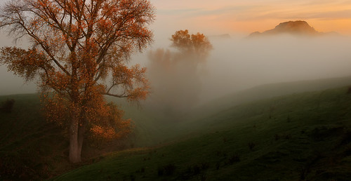
Autumn, Trees and Mist (and Te Mata Peak) by Jos Buurmans
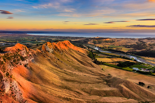
First light on Te Mata Peak by Jos Buurmans
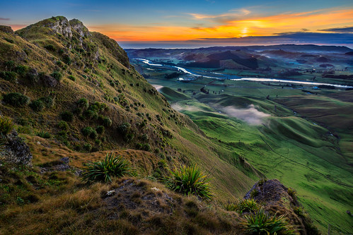
Another day in the Tukituki Valley by Jos Buurmans

silhuetas ao entardecer by Ruby Augusto

FCAB 2003 + 2004 Polapi - San Pedro 7. listopadu 2022 by Pavel Šturm

Receding Morning Fog by Jos Buurmans

Pea Beach, Hanga Roa Otai, Hanga Roa, Rapa Nui (Easter Island), Chile, Oceania. by ER's Eyes - Our planet is so beautiful.

Bright Sunrise at Te Mata Peak by Jos Buurmans

The Ahu Huri a Ureŋa, Puku Rangi Uka (IPA 6 - inland island), Rapa Nui (Easter Island), Chile, Oceania. by ER's Eyes - Our planet is so beautiful.

where in the world 32 - te mata in the distance, hastings & havelock north area, north island NZ by keefhwebdesigns

◕‿◕ ... Feliz Semana... by Ruby Augusto

Sunset at the Ahu Ko Te Riku, the Tahai Ceremonial Complex, Rapa Nui (Easter Island), Chile, Oceania. by ER's Eyes - Our planet is so beautiful.

Pronto para uma nova semana... by Ruby Augusto

Sunset at the Ahu Hotake, Hanga Roa Otai, Rapa Nui (Easter Island), Chile, Polynesia, Oceania. by ER's Eyes - Our planet is so beautiful.

HOJE, começa o nosso Verão! by Ruby Augusto

Por melhores dias... by Ruby Augusto

Pea Beach, Hanga Roa Otai, Hanga Roa, Rapa Nui (Easter Island), Chile, Oceania. by ER's Eyes - Our planet is so beautiful.

Pisco Sour, La Kaleta Restaurant, Pea Beach, Hanga Roa Otai, Hanga Roa, Rapa Nui (Easter Island), Chile, Oceania. by ER's Eyes - Our planet is so beautiful.

The Ahu Vai Uri, the Tahai Ceremonial Complex, Rapa Nui (Easter Island), Chile, Oceania. by ER's Eyes - Our planet is so beautiful.

bfds procê by Ruby Augusto