Timezone:Pacific Standard Time
Current Time:Tuesday, November 10, 2026 1:11 AM
Longitude:-116.4255689
Latitude:33.5233623
Sunrise Time Today:6:14:00 AM
Sunset Time Today:4:47:57 PM
Daylength Today:10h 33m 57s
Sunrise Time Tomorrow:6:14:56 AM
Sunset Time Tomorrow:4:47:16 PM
Daylength Tomorrow:10h 32m 19s

: Show All Dates

Date Sunrise Time Sunset Time Daylength
Jan 1, 2026 6:51:01 AM 4:48:57 PM 9h 57m 56s
Feb 1, 2026 6:43:51 AM 5:16:57 PM 10h 33m 5s
Mar 1, 2026 6:16:45 AM 5:42:40 PM 11h 25m 54s
Apr 1, 2026 6:35:46 AM 7:06:13 PM 12h 30m 26s
May 1, 2026 5:59:30 AM 7:28:42 PM 13h 29m 12s
Jun 1, 2026 5:38:28 AM 7:51:15 PM 14h 12m 46s
Jul 1, 2026 5:40:07 AM 8:00:55 PM 14h 20m 48s
Aug 1, 2026 5:58:35 AM 7:48:00 PM 13h 49m 25s
Sep 1, 2026 6:20:31 AM 7:14:33 PM 12h 54m 2s
Oct 1, 2026 6:40:29 AM 6:33:19 PM 11h 52m 49s
Nov 1, 2026 7:04:50 AM 5:56:14 PM 10h 51m 23s
Nov 10, 2026 6:13:04 AM 4:48:40 PM 10h 35m 36s
Nov 11, 2026 6:14:00 AM 4:47:57 PM 10h 33m 57s
Dec 1, 2026 6:32:29 AM 4:39:18 PM 10h 6m 48s

Sunrise & Sunset Photos

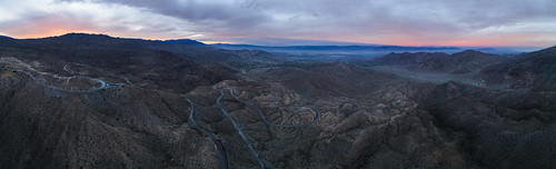
Palms To Pines Panorama by Decaseconds, Aerial panorama of US 74, the Palms to Pines Scenic Byway, in the mountains above Palm Springs, Cali
Palms To Pines Panorama by Decaseconds
Palm Springs sunrise panorama 2014 by Gord McKenna, These photos are from the Vancouver Sun Newspaper Architecture Tour series – Palm Springs Mid-Centur
Palm Springs sunrise panorama 2014 by Gord McKenna
Palm Springs sunrise panorama 2014 by Gord McKenna, These photos are from the Vancouver Sun Newspaper Architecture Tour series – Palm Springs Mid-Centur
Palm Springs sunrise panorama 2014 by Gord McKenna
Palm Springs sunrise panorama 2014 by Gord McKenna, These photos are from the Vancouver Sun Newspaper Architecture Tour series – Palm Springs Mid-Centur
Palm Springs sunrise panorama 2014 by Gord McKenna
Sunrise at Palm Springs 2014 by Gord McKenna, These photos are from the Vancouver Sun Newspaper Architecture Tour series – Palm Springs Mid-Centur
Sunrise at Palm Springs 2014 by Gord McKenna
Sunrise at Palm Springs 2014 by Gord McKenna, These photos are from the Vancouver Sun Newspaper Architecture Tour series – Palm Springs Mid-Centur
Sunrise at Palm Springs 2014 by Gord McKenna
Sunrise at Palm Springs 2014 by Gord McKenna, These photos are from the Vancouver Sun Newspaper Architecture Tour series – Palm Springs Mid-Centur
Sunrise at Palm Springs 2014 by Gord McKenna
Palm Desert sunrise pano 2014 by Gord McKenna, Got to the lookout about 40 minutes of the minutes ahead of the 630am sunrise this morning. This sho
Palm Desert sunrise pano 2014 by Gord McKenna
Palm to Pines Hwy - Palm Desert, CA by Axe.Man, Another viewpoint at this location.

A segment of Route 74 named "Seven Level Hill," just
Palm to Pines Hwy - Palm Desert, CA by Axe.Man
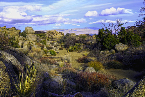
Tropical Desert by paynepat44, cactus grass colorful desert palmdesert rocks clouds sand sunset red blue green gold sky landscape c
Tropical Desert by paynepat44
Coachella Valley at Dusk by pdweinstein, View of Palm Desert and California Highway 74 at the Coachella Valley Vista Point at sunsetcoachella
Coachella Valley at Dusk by pdweinstein
Sunrise at Palm Springs 2014 by Gord McKenna, These photos are from the Vancouver Sun Newspaper Architecture Tour series – Palm Springs Mid-Centur
Sunrise at Palm Springs 2014 by Gord McKenna
Sunrise at Palm Springs 2014 by Gord McKenna, These photos are from the Vancouver Sun Newspaper Architecture Tour series – Palm Springs Mid-Centur
Sunrise at Palm Springs 2014 by Gord McKenna
Santa Rosa and San Jacinto National Monument by USFWS Pacific Southwest Region, The calm before the storm. Shortly after this photo, it began raining in the mountains. In contrast,
Santa Rosa and San Jacinto National Monument by USFWS Pacific Southwest Region
Salton Sea from Coachella Valley Overlook by El Cajon, 0things coachellavalley desert saltonsea clouds landscape mountains silhouette sunrise mountaincente
Salton Sea from Coachella Valley Overlook by El Cajon
Desert Rainbow by paynepat44, california landscape geotagged rainbow desert boulders rockgarden palmdesert skychurch scenicview in
Desert Rainbow by paynepat44
PSP Sibling Trip by johncdenman, Me, Joe, wife Sara, Sara's sister palmsprings psp california palmspringscalifornia socal southerncal
PSP Sibling Trip by johncdenman
big sky by FitzClick, desert anzaborrego landscape sunset
big sky by FitzClick
Maximum Tarmac Curvature by Decaseconds, Flying above the Palms to Pines Scenic Byway outside Palm Springs, California.aerial landscape drivi
Maximum Tarmac Curvature by Decaseconds
snowycactussunrise by danvandesign, Sunrise over Palm Desert CA.
Off of highway 74

Snow yesterday in the upper elevations left for a wh
snowycactussunrise by danvandesign
Desert Until the Valley Floor by Decaseconds, Flying at La Quinta Cove at sunset.drone aerial quadcopter laquinta laquintacove coachellavalley cal
Desert Until the Valley Floor by Decaseconds
Palms to Pines Panorama by Dan90266, panorama clouds sunrise perfectpanoramas
Palms to Pines Panorama by Dan90266
Burn Zone by Dan90266, Frost covered ashes in Idyllwild.sunrise fire frost burn idyllwild wildfire
Burn Zone by Dan90266
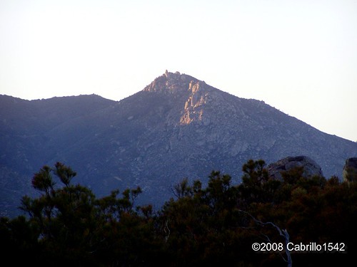
Another Last Light at Sunset by cabrillo1542, abandoned desert gasstation riversidecounty abandonedgasstation
Another Last Light at Sunset by cabrillo1542
Mt. San Jacinto Driving Tour by johncdenman, palmsprings psp california palmspringscalifornia socal southerncalifornia desert mountain pool airbn
Mt. San Jacinto Driving Tour by johncdenman
Mt. San Jacinto Driving Tour by johncdenman, palmsprings psp california palmspringscalifornia socal southerncalifornia desert mountain pool airbn
Mt. San Jacinto Driving Tour by johncdenman
Last Light at Sunset Zoomed by cabrillo1542, abandoned desert gasstation riversidecounty abandonedgasstation
Last Light at Sunset Zoomed by cabrillo1542
Mt. San Jacinto Driving Tour by johncdenman, palmsprings psp california palmspringscalifornia socal southerncalifornia desert mountain pool airbn
Mt. San Jacinto Driving Tour by johncdenman
Valentines Day Sunset by Coyote Crossing, square squareformat iphoneography instagramapp uploaded:by=instagram foursquare:venue=2391171
Valentines Day Sunset by Coyote Crossing
1345 Sunset colors on Santa Rosa Mountain and Toro Peak over Nance Canyon from Coyote Canyon Road by _JFR_, hiking backpacking pacificcresttrail pct pacificcrest
1345 Sunset colors on Santa Rosa Mountain and Toro Peak over Nance Canyon from Coyote Canyon Road by _JFR_
Artificial Green by Decaseconds, View of Coachella Valley from above the Palms to Pines Highway.california coachellavalley aerial sun
Artificial Green by Decaseconds
Desert mountain sunset... Beautiful. #latergram by RossSheingold, square squareformat iphoneography instagramapp xproii uploaded:by=instagram foursquare:venue=4bc2672
Desert mountain sunset... Beautiful. #latergram by RossSheingold
Hwy 74 Lookout over Palm Desert by HMM Photos, palmdesert hwy74viewpoint
Hwy 74 Lookout over Palm Desert by HMM Photos
Desert Settlement at Sunset by Decaseconds, View of Coachella Valley from above the Palms to Pines Highway.california coachellavalley aerial sun
Desert Settlement at Sunset by Decaseconds
Camped on Santa Rosa Mtn w/ amazing sunset view of Coachella Valley 8k ft below by crosby_cj,
Camped on Santa Rosa Mtn w/ amazing sunset view of Coachella Valley 8k ft below by crosby_cj
Ra. #cycling #coachella #palmstopines #hwy74 #wakethatassup #sunrise #climbing by guatemalo, instagramapp square squareformat iphoneography uploaded:by=instagram
Ra. #cycling #coachella #palmstopines #hwy74 #wakethatassup #sunrise #climbing by guatemalo
0904 Sunset clouds at our campsite on the PCT near mile 140 by _JFR_, hiking backpacking pacificcresttrail pct pacificcrest
0904 Sunset clouds at our campsite on the PCT near mile 140 by _JFR_
0906 Sunrise on our fourth day of hiking at our campsite on the PCT near mile 140 by _JFR_, hiking backpacking pacificcresttrail pct pacificcrest
0906 Sunrise on our fourth day of hiking at our campsite on the PCT near mile 140 by _JFR_
#coachella #sunrise #thanksgiving #film #skipfredricks #producer #timelaps #desert #palmsprings #single by Skip TV, square squareformat iphoneography instagramapp uploaded:by=instagram foursquare:venue=4bc26727b492d1
#coachella #sunrise #thanksgiving #film #skipfredricks #producer #timelaps #desert #palmsprings #single by Skip TV
#coachella #mountains #desert #mazda #convertible #palmsprings #sunrise #skipfredricks by Skip TV, square squareformat rise iphoneography instagramapp uploaded:by=instagram foursquare:venue=4bc26727b
#coachella #mountains #desert #mazda #convertible #palmsprings #sunrise #skipfredricks by Skip TV
#mailbox #mailboxes #sunset by elleraok, square squareformat earlybird iphoneography instagramapp uploaded:by=instagram foursquare:venue=5015
#mailbox #mailboxes #sunset by elleraok
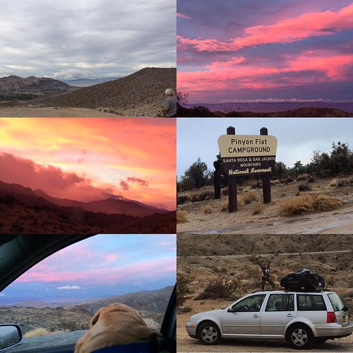
Earthing! #BeautifulEarth #OmRoamSuccess #OmRoamSunHome #pinyonpine #californiachristmas #californiaadventure #OmRoam #itrained #chemtrails #geoengineering #californiachemtrails #haarp #HAARPskies #su by comma?, square squareformat iphoneography instagramapp uploaded:by=instagram
Earthing! #BeautifulEarth #OmRoamSuccess #OmRoamSunHome #pinyonpine #californiachristmas #californiaadventure #OmRoam #itrained #chemtrails #geoengineering #californiachemtrails #haarp #HAARPskies #su by comma?
1391 Sunset light on the clouds over Borrego Springs, from the PCT near Nance Canyon by _JFR_, pct pacificcresttrail sectionb anzaborregodesertstatepark nancecanyon
1391 Sunset light on the clouds over Borrego Springs, from the PCT near Nance Canyon by _JFR_