Sunrise Sunset Times of Synrang Kaban, Meghalaya, India
Location: India > Meghalaya > East Khasi Hills >
Timezone:
Asia/Calcutta
Current Time:
2025-07-02 23:50:19
Longitude:
91.7563156
Latitude:
25.4480999
Sunrise Today:
04:36:42 AM
Sunset Today:
06:17:52 PM
Daylength Today:
13h 41m 10s
Sunrise Tomorrow:
04:37:05 AM
Sunset Tomorrow:
06:17:50 PM
Daylength Tomorrow:
13h 40m 45s
Year Show All Dates
| Date | Sunrise | Sunset | Daylength |
|---|---|---|---|
| 01/01/2025 | 06:08:58 AM | 04:44:21 PM | 10h 35m 23s |
| 01/02/2025 | 06:09:14 AM | 04:45:01 PM | 10h 35m 47s |
| 01/03/2025 | 06:09:29 AM | 04:45:42 PM | 10h 36m 13s |
| 01/04/2025 | 06:09:42 AM | 04:46:23 PM | 10h 36m 41s |
| 01/05/2025 | 06:09:53 AM | 04:47:05 PM | 10h 37m 12s |
| 01/06/2025 | 06:10:03 AM | 04:47:48 PM | 10h 37m 45s |
| 01/07/2025 | 06:10:12 AM | 04:48:31 PM | 10h 38m 19s |
| 01/08/2025 | 06:10:19 AM | 04:49:14 PM | 10h 38m 55s |
| 01/09/2025 | 06:10:25 AM | 04:49:58 PM | 10h 39m 33s |
| 01/10/2025 | 06:10:30 AM | 04:50:42 PM | 10h 40m 12s |
| 01/11/2025 | 06:10:32 AM | 04:51:26 PM | 10h 40m 54s |
| 01/12/2025 | 06:10:34 AM | 04:52:11 PM | 10h 41m 37s |
| 01/13/2025 | 06:10:34 AM | 04:52:56 PM | 10h 42m 22s |
| 01/14/2025 | 06:10:32 AM | 04:53:41 PM | 10h 43m 9s |
| 01/15/2025 | 06:10:29 AM | 04:54:27 PM | 10h 43m 58s |
| 01/16/2025 | 06:10:25 AM | 04:55:12 PM | 10h 44m 47s |
| 01/17/2025 | 06:10:19 AM | 04:55:58 PM | 10h 45m 39s |
| 01/18/2025 | 06:10:11 AM | 04:56:43 PM | 10h 46m 32s |
| 01/19/2025 | 06:10:02 AM | 04:57:29 PM | 10h 47m 27s |
| 01/20/2025 | 06:09:52 AM | 04:58:15 PM | 10h 48m 23s |
| 01/21/2025 | 06:09:40 AM | 04:59:01 PM | 10h 49m 21s |
| 01/22/2025 | 06:09:26 AM | 04:59:46 PM | 10h 50m 20s |
| 01/23/2025 | 06:09:11 AM | 05:00:32 PM | 10h 51m 21s |
| 01/24/2025 | 06:08:55 AM | 05:01:17 PM | 10h 52m 22s |
| 01/25/2025 | 06:08:37 AM | 05:02:02 PM | 10h 53m 25s |
| 01/26/2025 | 06:08:18 AM | 05:02:47 PM | 10h 54m 29s |
| 01/27/2025 | 06:07:58 AM | 05:03:32 PM | 10h 55m 34s |
| 01/28/2025 | 06:07:36 AM | 05:04:17 PM | 10h 56m 41s |
| 01/29/2025 | 06:07:12 AM | 05:05:01 PM | 10h 57m 49s |
| 01/30/2025 | 06:06:47 AM | 05:05:45 PM | 10h 58m 58s |
| 01/31/2025 | 06:06:21 AM | 05:06:29 PM | 11h 0m 8s |
| 02/01/2025 | 06:05:54 AM | 05:07:13 PM | 11h 1m 19s |
| 02/02/2025 | 06:05:25 AM | 05:07:56 PM | 11h 2m 31s |
| 02/03/2025 | 06:04:55 AM | 05:08:39 PM | 11h 3m 44s |
| 02/04/2025 | 06:04:24 AM | 05:09:22 PM | 11h 4m 58s |
| 02/05/2025 | 06:03:51 AM | 05:10:04 PM | 11h 6m 13s |
| 02/06/2025 | 06:03:17 AM | 05:10:46 PM | 11h 7m 29s |
| 02/07/2025 | 06:02:42 AM | 05:11:27 PM | 11h 8m 45s |
| 02/08/2025 | 06:02:06 AM | 05:12:08 PM | 11h 10m 2s |
| 02/09/2025 | 06:01:29 AM | 05:12:49 PM | 11h 11m 20s |
| 02/10/2025 | 06:00:50 AM | 05:13:29 PM | 11h 12m 39s |
| 02/11/2025 | 06:00:10 AM | 05:14:09 PM | 11h 13m 59s |
| 02/12/2025 | 05:59:29 AM | 05:14:49 PM | 11h 15m 20s |
| 02/13/2025 | 05:58:48 AM | 05:15:28 PM | 11h 16m 40s |
| 02/14/2025 | 05:58:05 AM | 05:16:06 PM | 11h 18m 1s |
| 02/15/2025 | 05:57:21 AM | 05:16:45 PM | 11h 19m 24s |
| 02/16/2025 | 05:56:36 AM | 05:17:22 PM | 11h 20m 46s |
| 02/17/2025 | 05:55:50 AM | 05:18:00 PM | 11h 22m 10s |
| 02/18/2025 | 05:55:03 AM | 05:18:36 PM | 11h 23m 33s |
| 02/19/2025 | 05:54:15 AM | 05:19:13 PM | 11h 24m 58s |
| 02/20/2025 | 05:53:26 AM | 05:19:49 PM | 11h 26m 23s |
| 02/21/2025 | 05:52:37 AM | 05:20:25 PM | 11h 27m 48s |
| 02/22/2025 | 05:51:46 AM | 05:21:00 PM | 11h 29m 14s |
| 02/23/2025 | 05:50:55 AM | 05:21:35 PM | 11h 30m 40s |
| 02/24/2025 | 05:50:03 AM | 05:22:09 PM | 11h 32m 6s |
| 02/25/2025 | 05:49:10 AM | 05:22:43 PM | 11h 33m 33s |
| 02/26/2025 | 05:48:17 AM | 05:23:16 PM | 11h 34m 59s |
| 02/27/2025 | 05:47:23 AM | 05:23:50 PM | 11h 36m 27s |
| 02/28/2025 | 05:46:28 AM | 05:24:22 PM | 11h 37m 54s |
| 03/01/2025 | 05:45:32 AM | 05:24:55 PM | 11h 39m 23s |
| 03/02/2025 | 05:44:36 AM | 05:25:27 PM | 11h 40m 51s |
| 03/03/2025 | 05:43:39 AM | 05:25:59 PM | 11h 42m 20s |
| 03/04/2025 | 05:42:42 AM | 05:26:30 PM | 11h 43m 48s |
| 03/05/2025 | 05:41:44 AM | 05:27:01 PM | 11h 45m 17s |
| 03/06/2025 | 05:40:45 AM | 05:27:32 PM | 11h 46m 47s |
| 03/07/2025 | 05:39:46 AM | 05:28:02 PM | 11h 48m 16s |
| 03/08/2025 | 05:38:47 AM | 05:28:32 PM | 11h 49m 45s |
| 03/09/2025 | 05:37:47 AM | 05:29:02 PM | 11h 51m 15s |
| 03/10/2025 | 05:36:47 AM | 05:29:31 PM | 11h 52m 44s |
| 03/11/2025 | 05:35:46 AM | 05:30:01 PM | 11h 54m 15s |
| 03/12/2025 | 05:34:45 AM | 05:30:30 PM | 11h 55m 45s |
| 03/13/2025 | 05:33:44 AM | 05:30:58 PM | 11h 57m 14s |
| 03/14/2025 | 05:32:42 AM | 05:31:27 PM | 11h 58m 45s |
| 03/15/2025 | 05:31:40 AM | 05:31:55 PM | 12h 0m 15s |
| 03/16/2025 | 05:30:38 AM | 05:32:23 PM | 12h 1m 45s |
| 03/17/2025 | 05:29:36 AM | 05:32:51 PM | 12h 3m 15s |
| 03/18/2025 | 05:28:33 AM | 05:33:19 PM | 12h 4m 46s |
| 03/19/2025 | 05:27:31 AM | 05:33:46 PM | 12h 6m 15s |
| 03/20/2025 | 05:26:28 AM | 05:34:14 PM | 12h 7m 46s |
| 03/21/2025 | 05:25:25 AM | 05:34:41 PM | 12h 9m 16s |
| 03/22/2025 | 05:24:22 AM | 05:35:08 PM | 12h 10m 46s |
| 03/23/2025 | 05:23:19 AM | 05:35:35 PM | 12h 12m 16s |
| 03/24/2025 | 05:22:16 AM | 05:36:02 PM | 12h 13m 46s |
| 03/25/2025 | 05:21:13 AM | 05:36:29 PM | 12h 15m 16s |
| 03/26/2025 | 05:20:09 AM | 05:36:56 PM | 12h 16m 47s |
| 03/27/2025 | 05:19:06 AM | 05:37:23 PM | 12h 18m 17s |
| 03/28/2025 | 05:18:04 AM | 05:37:50 PM | 12h 19m 46s |
| 03/29/2025 | 05:17:01 AM | 05:38:16 PM | 12h 21m 15s |
| 03/30/2025 | 05:15:58 AM | 05:38:43 PM | 12h 22m 45s |
| 03/31/2025 | 05:14:56 AM | 05:39:10 PM | 12h 24m 14s |
| 04/01/2025 | 05:13:53 AM | 05:39:36 PM | 12h 25m 43s |
| 04/02/2025 | 05:12:51 AM | 05:40:03 PM | 12h 27m 12s |
| 04/03/2025 | 05:11:49 AM | 05:40:30 PM | 12h 28m 41s |
| 04/04/2025 | 05:10:48 AM | 05:40:57 PM | 12h 30m 9s |
| 04/05/2025 | 05:09:46 AM | 05:41:24 PM | 12h 31m 38s |
| 04/06/2025 | 05:08:45 AM | 05:41:51 PM | 12h 33m 6s |
| 04/07/2025 | 05:07:45 AM | 05:42:18 PM | 12h 34m 33s |
| 04/08/2025 | 05:06:44 AM | 05:42:45 PM | 12h 36m 1s |
| 04/09/2025 | 05:05:45 AM | 05:43:12 PM | 12h 37m 27s |
| 04/10/2025 | 05:04:45 AM | 05:43:39 PM | 12h 38m 54s |
| 04/11/2025 | 05:03:46 AM | 05:44:07 PM | 12h 40m 21s |
| 04/12/2025 | 05:02:48 AM | 05:44:34 PM | 12h 41m 46s |
| 04/13/2025 | 05:01:50 AM | 05:45:02 PM | 12h 43m 12s |
| 04/14/2025 | 05:00:52 AM | 05:45:30 PM | 12h 44m 38s |
| 04/15/2025 | 04:59:55 AM | 05:45:58 PM | 12h 46m 3s |
| 04/16/2025 | 04:58:59 AM | 05:46:26 PM | 12h 47m 27s |
| 04/17/2025 | 04:58:03 AM | 05:46:54 PM | 12h 48m 51s |
| 04/18/2025 | 04:57:08 AM | 05:47:22 PM | 12h 50m 14s |
| 04/19/2025 | 04:56:13 AM | 05:47:51 PM | 12h 51m 38s |
| 04/20/2025 | 04:55:19 AM | 05:48:20 PM | 12h 53m 1s |
| 04/21/2025 | 04:54:26 AM | 05:48:49 PM | 12h 54m 23s |
| 04/22/2025 | 04:53:34 AM | 05:49:18 PM | 12h 55m 44s |
| 04/23/2025 | 04:52:42 AM | 05:49:47 PM | 12h 57m 5s |
| 04/24/2025 | 04:51:51 AM | 05:50:16 PM | 12h 58m 25s |
| 04/25/2025 | 04:51:01 AM | 05:50:46 PM | 12h 59m 45s |
| 04/26/2025 | 04:50:12 AM | 05:51:16 PM | 13h 1m 4s |
| 04/27/2025 | 04:49:23 AM | 05:51:46 PM | 13h 2m 23s |
| 04/28/2025 | 04:48:36 AM | 05:52:16 PM | 13h 3m 40s |
| 04/29/2025 | 04:47:49 AM | 05:52:46 PM | 13h 4m 57s |
| 04/30/2025 | 04:47:03 AM | 05:53:16 PM | 13h 6m 13s |
| 05/01/2025 | 04:46:18 AM | 05:53:47 PM | 13h 7m 29s |
| 05/02/2025 | 04:45:34 AM | 05:54:18 PM | 13h 8m 44s |
| 05/03/2025 | 04:44:51 AM | 05:54:48 PM | 13h 9m 57s |
| 05/04/2025 | 04:44:09 AM | 05:55:19 PM | 13h 11m 10s |
| 05/05/2025 | 04:43:28 AM | 05:55:50 PM | 13h 12m 22s |
| 05/06/2025 | 04:42:48 AM | 05:56:22 PM | 13h 13m 34s |
| 05/07/2025 | 04:42:09 AM | 05:56:53 PM | 13h 14m 44s |
| 05/08/2025 | 04:41:31 AM | 05:57:24 PM | 13h 15m 53s |
| 05/09/2025 | 04:40:54 AM | 05:57:56 PM | 13h 17m 2s |
| 05/10/2025 | 04:40:18 AM | 05:58:27 PM | 13h 18m 9s |
| 05/11/2025 | 04:39:43 AM | 05:58:59 PM | 13h 19m 16s |
| 05/12/2025 | 04:39:09 AM | 05:59:30 PM | 13h 20m 21s |
| 05/13/2025 | 04:38:37 AM | 06:00:02 PM | 13h 21m 25s |
| 05/14/2025 | 04:38:06 AM | 06:00:33 PM | 13h 22m 27s |
| 05/15/2025 | 04:37:35 AM | 06:01:05 PM | 13h 23m 30s |
| 05/16/2025 | 04:37:06 AM | 06:01:36 PM | 13h 24m 30s |
| 05/17/2025 | 04:36:38 AM | 06:02:08 PM | 13h 25m 30s |
| 05/18/2025 | 04:36:12 AM | 06:02:39 PM | 13h 26m 27s |
| 05/19/2025 | 04:35:46 AM | 06:03:11 PM | 13h 27m 25s |
| 05/20/2025 | 04:35:22 AM | 06:03:42 PM | 13h 28m 20s |
| 05/21/2025 | 04:34:59 AM | 06:04:13 PM | 13h 29m 14s |
| 05/22/2025 | 04:34:37 AM | 06:04:44 PM | 13h 30m 7s |
| 05/23/2025 | 04:34:16 AM | 06:05:14 PM | 13h 30m 58s |
| 05/24/2025 | 04:33:57 AM | 06:05:45 PM | 13h 31m 48s |
| 05/25/2025 | 04:33:39 AM | 06:06:15 PM | 13h 32m 36s |
| 05/26/2025 | 04:33:22 AM | 06:06:45 PM | 13h 33m 23s |
| 05/27/2025 | 04:33:06 AM | 06:07:15 PM | 13h 34m 9s |
| 05/28/2025 | 04:32:52 AM | 06:07:44 PM | 13h 34m 52s |
| 05/29/2025 | 04:32:39 AM | 06:08:13 PM | 13h 35m 34s |
| 05/30/2025 | 04:32:27 AM | 06:08:42 PM | 13h 36m 15s |
| 05/31/2025 | 04:32:16 AM | 06:09:10 PM | 13h 36m 54s |
| 06/01/2025 | 04:32:07 AM | 06:09:38 PM | 13h 37m 31s |
| 06/02/2025 | 04:31:58 AM | 06:10:05 PM | 13h 38m 7s |
| 06/03/2025 | 04:31:51 AM | 06:10:32 PM | 13h 38m 41s |
| 06/04/2025 | 04:31:46 AM | 06:10:58 PM | 13h 39m 12s |
| 06/05/2025 | 04:31:41 AM | 06:11:24 PM | 13h 39m 43s |
| 06/06/2025 | 04:31:38 AM | 06:11:49 PM | 13h 40m 11s |
| 06/07/2025 | 04:31:36 AM | 06:12:14 PM | 13h 40m 38s |
| 06/08/2025 | 04:31:35 AM | 06:12:38 PM | 13h 41m 3s |
| 06/09/2025 | 04:31:35 AM | 06:13:01 PM | 13h 41m 26s |
| 06/10/2025 | 04:31:36 AM | 06:13:24 PM | 13h 41m 48s |
| 06/11/2025 | 04:31:39 AM | 06:13:46 PM | 13h 42m 7s |
| 06/12/2025 | 04:31:42 AM | 06:14:07 PM | 13h 42m 25s |
| 06/13/2025 | 04:31:47 AM | 06:14:27 PM | 13h 42m 40s |
| 06/14/2025 | 04:31:53 AM | 06:14:47 PM | 13h 42m 54s |
| 06/15/2025 | 04:32:00 AM | 06:15:06 PM | 13h 43m 6s |
| 06/16/2025 | 04:32:08 AM | 06:15:23 PM | 13h 43m 15s |
| 06/17/2025 | 04:32:17 AM | 06:15:40 PM | 13h 43m 23s |
| 06/18/2025 | 04:32:27 AM | 06:15:56 PM | 13h 43m 29s |
| 06/19/2025 | 04:32:38 AM | 06:16:11 PM | 13h 43m 33s |
| 06/20/2025 | 04:32:50 AM | 06:16:26 PM | 13h 43m 36s |
| 06/21/2025 | 04:33:03 AM | 06:16:39 PM | 13h 43m 36s |
| 06/22/2025 | 04:33:17 AM | 06:16:51 PM | 13h 43m 34s |
| 06/23/2025 | 04:33:32 AM | 06:17:02 PM | 13h 43m 30s |
| 06/24/2025 | 04:33:48 AM | 06:17:12 PM | 13h 43m 24s |
| 06/25/2025 | 04:34:04 AM | 06:17:21 PM | 13h 43m 17s |
| 06/26/2025 | 04:34:21 AM | 06:17:29 PM | 13h 43m 8s |
| 06/27/2025 | 04:34:40 AM | 06:17:36 PM | 13h 42m 56s |
| 06/28/2025 | 04:34:59 AM | 06:17:41 PM | 13h 42m 42s |
| 06/29/2025 | 04:35:18 AM | 06:17:46 PM | 13h 42m 28s |
| 06/30/2025 | 04:35:39 AM | 06:17:49 PM | 13h 42m 10s |
| 07/01/2025 | 04:36:00 AM | 06:17:51 PM | 13h 41m 51s |
| 07/02/2025 | 04:36:22 AM | 06:17:52 PM | 13h 41m 30s |
| 07/03/2025 | 04:36:44 AM | 06:17:52 PM | 13h 41m 8s |
| 07/04/2025 | 04:37:07 AM | 06:17:50 PM | 13h 40m 43s |
| 07/05/2025 | 04:37:30 AM | 06:17:47 PM | 13h 40m 17s |
| 07/06/2025 | 04:37:55 AM | 06:17:43 PM | 13h 39m 48s |
| 07/07/2025 | 04:38:19 AM | 06:17:38 PM | 13h 39m 19s |
| 07/08/2025 | 04:38:44 AM | 06:17:31 PM | 13h 38m 47s |
| 07/09/2025 | 04:39:10 AM | 06:17:24 PM | 13h 38m 14s |
| 07/10/2025 | 04:39:36 AM | 06:17:15 PM | 13h 37m 39s |
| 07/11/2025 | 04:40:02 AM | 06:17:04 PM | 13h 37m 2s |
| 07/12/2025 | 04:40:29 AM | 06:16:53 PM | 13h 36m 24s |
| 07/13/2025 | 04:40:56 AM | 06:16:40 PM | 13h 35m 44s |
| 07/14/2025 | 04:41:23 AM | 06:16:26 PM | 13h 35m 3s |
| 07/15/2025 | 04:41:51 AM | 06:16:10 PM | 13h 34m 19s |
| 07/16/2025 | 04:42:19 AM | 06:15:53 PM | 13h 33m 34s |
| 07/17/2025 | 04:42:47 AM | 06:15:35 PM | 13h 32m 48s |
| 07/18/2025 | 04:43:15 AM | 06:15:16 PM | 13h 32m 1s |
| 07/19/2025 | 04:43:44 AM | 06:14:55 PM | 13h 31m 11s |
| 07/20/2025 | 04:44:13 AM | 06:14:34 PM | 13h 30m 21s |
| 07/21/2025 | 04:44:42 AM | 06:14:10 PM | 13h 29m 28s |
| 07/22/2025 | 04:45:11 AM | 06:13:46 PM | 13h 28m 35s |
| 07/23/2025 | 04:45:40 AM | 06:13:21 PM | 13h 27m 41s |
| 07/24/2025 | 04:46:09 AM | 06:12:54 PM | 13h 26m 45s |
| 07/25/2025 | 04:46:38 AM | 06:12:26 PM | 13h 25m 48s |
| 07/26/2025 | 04:47:07 AM | 06:11:56 PM | 13h 24m 49s |
| 07/27/2025 | 04:47:36 AM | 06:11:26 PM | 13h 23m 50s |
| 07/28/2025 | 04:48:05 AM | 06:10:54 PM | 13h 22m 49s |
| 07/29/2025 | 04:48:34 AM | 06:10:21 PM | 13h 21m 47s |
| 07/30/2025 | 04:49:04 AM | 06:09:47 PM | 13h 20m 43s |
| 07/31/2025 | 04:49:33 AM | 06:09:12 PM | 13h 19m 39s |
| 08/01/2025 | 04:50:01 AM | 06:08:36 PM | 13h 18m 35s |
| 08/02/2025 | 04:50:30 AM | 06:07:58 PM | 13h 17m 28s |
| 08/03/2025 | 04:50:59 AM | 06:07:20 PM | 13h 16m 21s |
| 08/04/2025 | 04:51:28 AM | 06:06:40 PM | 13h 15m 12s |
| 08/05/2025 | 04:51:56 AM | 06:06:00 PM | 13h 14m 4s |
| 08/06/2025 | 04:52:24 AM | 06:05:18 PM | 13h 12m 54s |
| 08/07/2025 | 04:52:53 AM | 06:04:35 PM | 13h 11m 42s |
| 08/08/2025 | 04:53:21 AM | 06:03:51 PM | 13h 10m 30s |
| 08/09/2025 | 04:53:49 AM | 06:03:06 PM | 13h 9m 17s |
| 08/10/2025 | 04:54:16 AM | 06:02:21 PM | 13h 8m 5s |
| 08/11/2025 | 04:54:44 AM | 06:01:34 PM | 13h 6m 50s |
| 08/12/2025 | 04:55:11 AM | 06:00:46 PM | 13h 5m 35s |
| 08/13/2025 | 04:55:38 AM | 05:59:58 PM | 13h 4m 20s |
| 08/14/2025 | 04:56:05 AM | 05:59:08 PM | 13h 3m 3s |
| 08/15/2025 | 04:56:32 AM | 05:58:18 PM | 13h 1m 46s |
| 08/16/2025 | 04:56:58 AM | 05:57:26 PM | 13h 0m 28s |
| 08/17/2025 | 04:57:25 AM | 05:56:34 PM | 12h 59m 9s |
| 08/18/2025 | 04:57:51 AM | 05:55:42 PM | 12h 57m 51s |
| 08/19/2025 | 04:58:17 AM | 05:54:48 PM | 12h 56m 31s |
| 08/20/2025 | 04:58:42 AM | 05:53:54 PM | 12h 55m 12s |
| 08/21/2025 | 04:59:08 AM | 05:52:58 PM | 12h 53m 50s |
| 08/22/2025 | 04:59:33 AM | 05:52:03 PM | 12h 52m 30s |
| 08/23/2025 | 04:59:58 AM | 05:51:06 PM | 12h 51m 8s |
| 08/24/2025 | 05:00:23 AM | 05:50:09 PM | 12h 49m 46s |
| 08/25/2025 | 05:00:48 AM | 05:49:11 PM | 12h 48m 23s |
| 08/26/2025 | 05:01:13 AM | 05:48:12 PM | 12h 46m 59s |
| 08/27/2025 | 05:01:37 AM | 05:47:13 PM | 12h 45m 36s |
| 08/28/2025 | 05:02:01 AM | 05:46:14 PM | 12h 44m 13s |
| 08/29/2025 | 05:02:25 AM | 05:45:14 PM | 12h 42m 49s |
| 08/30/2025 | 05:02:49 AM | 05:44:13 PM | 12h 41m 24s |
| 08/31/2025 | 05:03:13 AM | 05:43:12 PM | 12h 39m 59s |
| 09/01/2025 | 05:03:37 AM | 05:42:10 PM | 12h 38m 33s |
| 09/02/2025 | 05:04:00 AM | 05:41:08 PM | 12h 37m 8s |
| 09/03/2025 | 05:04:23 AM | 05:40:05 PM | 12h 35m 42s |
| 09/04/2025 | 05:04:47 AM | 05:39:02 PM | 12h 34m 15s |
| 09/05/2025 | 05:05:10 AM | 05:37:59 PM | 12h 32m 49s |
| 09/06/2025 | 05:05:33 AM | 05:36:56 PM | 12h 31m 23s |
| 09/07/2025 | 05:05:56 AM | 05:35:52 PM | 12h 29m 56s |
| 09/08/2025 | 05:06:19 AM | 05:34:47 PM | 12h 28m 28s |
| 09/09/2025 | 05:06:41 AM | 05:33:43 PM | 12h 27m 2s |
| 09/10/2025 | 05:07:04 AM | 05:32:38 PM | 12h 25m 34s |
| 09/11/2025 | 05:07:27 AM | 05:31:33 PM | 12h 24m 6s |
| 09/12/2025 | 05:07:50 AM | 05:30:28 PM | 12h 22m 38s |
| 09/13/2025 | 05:08:12 AM | 05:29:23 PM | 12h 21m 11s |
| 09/14/2025 | 05:08:35 AM | 05:28:17 PM | 12h 19m 42s |
| 09/15/2025 | 05:08:58 AM | 05:27:12 PM | 12h 18m 14s |
| 09/16/2025 | 05:09:21 AM | 05:26:06 PM | 12h 16m 45s |
| 09/17/2025 | 05:09:43 AM | 05:25:00 PM | 12h 15m 17s |
| 09/18/2025 | 05:10:06 AM | 05:23:54 PM | 12h 13m 48s |
| 09/19/2025 | 05:10:29 AM | 05:22:49 PM | 12h 12m 20s |
| 09/20/2025 | 05:10:52 AM | 05:21:43 PM | 12h 10m 51s |
| 09/21/2025 | 05:11:15 AM | 05:20:37 PM | 12h 9m 22s |
| 09/22/2025 | 05:11:39 AM | 05:19:32 PM | 12h 7m 53s |
| 09/23/2025 | 05:12:02 AM | 05:18:26 PM | 12h 6m 24s |
| 09/24/2025 | 05:12:25 AM | 05:17:21 PM | 12h 4m 56s |
| 09/25/2025 | 05:12:49 AM | 05:16:16 PM | 12h 3m 27s |
| 09/26/2025 | 05:13:13 AM | 05:15:11 PM | 12h 1m 58s |
| 09/27/2025 | 05:13:37 AM | 05:14:06 PM | 12h 0m 29s |
| 09/28/2025 | 05:14:01 AM | 05:13:01 PM | 11h 59m 0s |
| 09/29/2025 | 05:14:26 AM | 05:11:57 PM | 11h 57m 31s |
| 09/30/2025 | 05:14:50 AM | 05:10:53 PM | 11h 56m 3s |
| 10/01/2025 | 05:15:15 AM | 05:09:49 PM | 11h 54m 34s |
| 10/02/2025 | 05:15:40 AM | 05:08:46 PM | 11h 53m 6s |
| 10/03/2025 | 05:16:06 AM | 05:07:43 PM | 11h 51m 37s |
| 10/04/2025 | 05:16:31 AM | 05:06:40 PM | 11h 50m 9s |
| 10/05/2025 | 05:16:57 AM | 05:05:38 PM | 11h 48m 41s |
| 10/06/2025 | 05:17:24 AM | 05:04:36 PM | 11h 47m 12s |
| 10/07/2025 | 05:17:50 AM | 05:03:35 PM | 11h 45m 45s |
| 10/08/2025 | 05:18:17 AM | 05:02:34 PM | 11h 44m 17s |
| 10/09/2025 | 05:18:45 AM | 05:01:34 PM | 11h 42m 49s |
| 10/10/2025 | 05:19:12 AM | 05:00:34 PM | 11h 41m 22s |
| 10/11/2025 | 05:19:40 AM | 04:59:35 PM | 11h 39m 55s |
| 10/12/2025 | 05:20:09 AM | 04:58:37 PM | 11h 38m 28s |
| 10/13/2025 | 05:20:37 AM | 04:57:39 PM | 11h 37m 2s |
| 10/14/2025 | 05:21:07 AM | 04:56:42 PM | 11h 35m 35s |
| 10/15/2025 | 05:21:36 AM | 04:55:45 PM | 11h 34m 9s |
| 10/16/2025 | 05:22:06 AM | 04:54:50 PM | 11h 32m 44s |
| 10/17/2025 | 05:22:37 AM | 04:53:55 PM | 11h 31m 18s |
| 10/18/2025 | 05:23:07 AM | 04:53:01 PM | 11h 29m 54s |
| 10/19/2025 | 05:23:39 AM | 04:52:07 PM | 11h 28m 28s |
| 10/20/2025 | 05:24:10 AM | 04:51:15 PM | 11h 27m 5s |
| 10/21/2025 | 05:24:42 AM | 04:50:23 PM | 11h 25m 41s |
| 10/22/2025 | 05:25:15 AM | 04:49:32 PM | 11h 24m 17s |
| 10/23/2025 | 05:25:48 AM | 04:48:42 PM | 11h 22m 54s |
| 10/24/2025 | 05:26:22 AM | 04:47:53 PM | 11h 21m 31s |
| 10/25/2025 | 05:26:56 AM | 04:47:05 PM | 11h 20m 9s |
| 10/26/2025 | 05:27:30 AM | 04:46:18 PM | 11h 18m 48s |
| 10/27/2025 | 05:28:05 AM | 04:45:32 PM | 11h 17m 27s |
| 10/28/2025 | 05:28:40 AM | 04:44:48 PM | 11h 16m 8s |
| 10/29/2025 | 05:29:16 AM | 04:44:04 PM | 11h 14m 48s |
| 10/30/2025 | 05:29:52 AM | 04:43:21 PM | 11h 13m 29s |
| 10/31/2025 | 05:30:29 AM | 04:42:39 PM | 11h 12m 10s |
| 11/01/2025 | 05:31:06 AM | 04:41:59 PM | 11h 10m 53s |
| 11/02/2025 | 05:31:44 AM | 04:41:19 PM | 11h 9m 35s |
| 11/03/2025 | 05:32:22 AM | 04:40:41 PM | 11h 8m 19s |
| 11/04/2025 | 05:33:00 AM | 04:40:04 PM | 11h 7m 4s |
| 11/05/2025 | 05:33:39 AM | 04:39:29 PM | 11h 5m 50s |
| 11/06/2025 | 05:34:18 AM | 04:38:54 PM | 11h 4m 36s |
| 11/07/2025 | 05:34:58 AM | 04:38:21 PM | 11h 3m 23s |
| 11/08/2025 | 05:35:38 AM | 04:37:49 PM | 11h 2m 11s |
| 11/09/2025 | 05:36:19 AM | 04:37:18 PM | 11h 0m 59s |
| 11/10/2025 | 05:36:59 AM | 04:36:49 PM | 10h 59m 50s |
| 11/11/2025 | 05:37:40 AM | 04:36:21 PM | 10h 58m 41s |
| 11/12/2025 | 05:38:22 AM | 04:35:55 PM | 10h 57m 33s |
| 11/13/2025 | 05:39:04 AM | 04:35:30 PM | 10h 56m 26s |
| 11/14/2025 | 05:39:46 AM | 04:35:06 PM | 10h 55m 20s |
| 11/15/2025 | 05:40:28 AM | 04:34:44 PM | 10h 54m 16s |
| 11/16/2025 | 05:41:11 AM | 04:34:23 PM | 10h 53m 12s |
| 11/17/2025 | 05:41:53 AM | 04:34:03 PM | 10h 52m 10s |
| 11/18/2025 | 05:42:36 AM | 04:33:46 PM | 10h 51m 10s |
| 11/19/2025 | 05:43:20 AM | 04:33:29 PM | 10h 50m 9s |
| 11/20/2025 | 05:44:03 AM | 04:33:14 PM | 10h 49m 11s |
| 11/21/2025 | 05:44:46 AM | 04:33:01 PM | 10h 48m 15s |
| 11/22/2025 | 05:45:30 AM | 04:32:49 PM | 10h 47m 19s |
| 11/23/2025 | 05:46:14 AM | 04:32:38 PM | 10h 46m 24s |
| 11/24/2025 | 05:46:57 AM | 04:32:29 PM | 10h 45m 32s |
| 11/25/2025 | 05:47:41 AM | 04:32:22 PM | 10h 44m 41s |
| 11/26/2025 | 05:48:24 AM | 04:32:16 PM | 10h 43m 52s |
| 11/27/2025 | 05:49:08 AM | 04:32:12 PM | 10h 43m 4s |
| 11/28/2025 | 05:49:51 AM | 04:32:09 PM | 10h 42m 18s |
| 11/29/2025 | 05:50:35 AM | 04:32:07 PM | 10h 41m 32s |
| 11/30/2025 | 05:51:18 AM | 04:32:08 PM | 10h 40m 50s |
| 12/01/2025 | 05:52:01 AM | 04:32:09 PM | 10h 40m 8s |
| 12/02/2025 | 05:52:43 AM | 04:32:13 PM | 10h 39m 30s |
| 12/03/2025 | 05:53:26 AM | 04:32:17 PM | 10h 38m 51s |
| 12/04/2025 | 05:54:08 AM | 04:32:24 PM | 10h 38m 16s |
| 12/05/2025 | 05:54:50 AM | 04:32:31 PM | 10h 37m 41s |
| 12/06/2025 | 05:55:31 AM | 04:32:41 PM | 10h 37m 10s |
| 12/07/2025 | 05:56:12 AM | 04:32:51 PM | 10h 36m 39s |
| 12/08/2025 | 05:56:52 AM | 04:33:04 PM | 10h 36m 12s |
| 12/09/2025 | 05:57:32 AM | 04:33:17 PM | 10h 35m 45s |
| 12/10/2025 | 05:58:11 AM | 04:33:32 PM | 10h 35m 21s |
| 12/11/2025 | 05:58:50 AM | 04:33:49 PM | 10h 34m 59s |
| 12/12/2025 | 05:59:28 AM | 04:34:06 PM | 10h 34m 38s |
| 12/13/2025 | 06:00:05 AM | 04:34:26 PM | 10h 34m 21s |
| 12/14/2025 | 06:00:42 AM | 04:34:46 PM | 10h 34m 4s |
| 12/15/2025 | 06:01:18 AM | 04:35:08 PM | 10h 33m 50s |
| 12/16/2025 | 06:01:53 AM | 04:35:31 PM | 10h 33m 38s |
| 12/17/2025 | 06:02:27 AM | 04:35:56 PM | 10h 33m 29s |
| 12/18/2025 | 06:03:00 AM | 04:36:21 PM | 10h 33m 21s |
| 12/19/2025 | 06:03:33 AM | 04:36:48 PM | 10h 33m 15s |
| 12/20/2025 | 06:04:04 AM | 04:37:16 PM | 10h 33m 12s |
| 12/21/2025 | 06:04:34 AM | 04:37:45 PM | 10h 33m 11s |
| 12/22/2025 | 06:05:04 AM | 04:38:15 PM | 10h 33m 11s |
| 12/23/2025 | 06:05:32 AM | 04:38:47 PM | 10h 33m 15s |
| 12/24/2025 | 06:05:59 AM | 04:39:19 PM | 10h 33m 20s |
| 12/25/2025 | 06:06:25 AM | 04:39:53 PM | 10h 33m 28s |
| 12/26/2025 | 06:06:50 AM | 04:40:27 PM | 10h 33m 37s |
| 12/27/2025 | 06:07:14 AM | 04:41:02 PM | 10h 33m 48s |
| 12/28/2025 | 06:07:37 AM | 04:41:38 PM | 10h 34m 1s |
| 12/29/2025 | 06:07:58 AM | 04:42:15 PM | 10h 34m 17s |
| 12/30/2025 | 06:08:18 AM | 04:42:53 PM | 10h 34m 35s |
| 12/31/2025 | 06:08:37 AM | 04:43:32 PM | 10h 34m 55s |
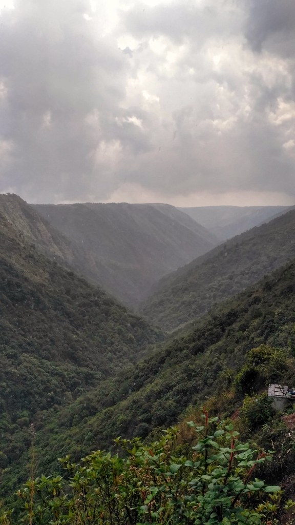
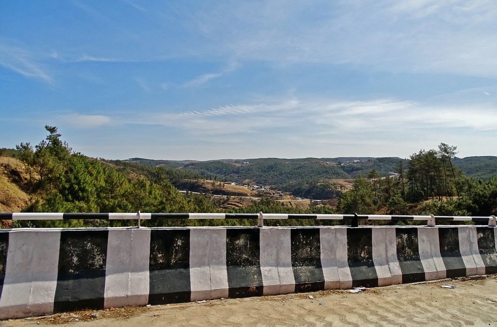
Sunrise & Sunset Photos

IMG_20180630_174103566-01

Mawlmeng, Meghalaya

Lyngkein, Meghalaya

Mawkohngoh, Meghalaya

Spice Market #Nohkalikai#falls #sohra#cherrapunji #Meghalaya

NohKaLiKai Falls #FallsOfMeghalaya #sohra#cherrapunji #Meghalaya It is the tallest (340 mts) plunge waterfall in India. It is one of the most visited tourist spot in Chetra punji, however it has a rather gruesome legend attached to it, read more on wi
Mawkdok Dympep Valley, Meghalaya

M I L K Y (03)

M I L K Y (02)

A segment of the lower level of Elephant Falls in Shillong.

Elephant Falls in Shillong, Meghalaya

IMG_20180703_152105641_BURST000_COVER_TOP-01

IMG_20180703_151800727-01

IMG_20180703_151313022-01

IMG_20180703_150701981-01

IMG_20180701_093907450-01

IMG_20180630_104239956-01

IMG_20180630_103640322-01

20180213.2701.Indien.Meghalaya.Manai
20180213.2702.Indien.Meghalaya.Manai

20180213.2703.Indien.Meghalaya.Manai

20180213.2704.Indien.Meghalaya.Manai

20180213.2705.Indien.Meghalaya.Manai

20180213.2706.Indien.Meghalaya.Wahlulu
Synrang Kaban, Meghalaya, India Map
Search another place
Places in Synrang Kaban, Meghalaya, India
Near Places
Mawphlang, Synrang Kaban, Meghalaya, India
Mawphlang Dam, Meghalaya
East Khasi Hills, Meghalaya, India
Shillong Peak, Laitkor, East Khasi Hills, Meghalaya, India
Lummawbah, Shillong, Meghalaya, India
Ïewduh, Bara Bazar, Shillong, Meghalaya, India
Gorkha Durga Temple, G S Road, NH 40, Lewduh, Bara Bazar, Shillong, Meghalaya, India
Upper Mawprem, Garikhana, Shillong, Meghalaya, India
Police Bazar Point, Police Bazar, Shillong, Meghalaya, India
Police Bazar, Shillong, Meghalaya, India
NIT MEGHALAYA, Gordon Rd, Nongkynrih, Laitumkhrah, Shillong, Meghalaya, India
National Institute of Technology, Meghalaya, Bijni Complex, Laitumkhrah, Laitumkhrah, Shillong, Megh
Shillong, Meghalaya, India
Mawlai-Mawïong, Meghalaya, India
Umiam Lake, Meghalaya
Umiam Lake, East Khasi Hills, Meghalaya, India
Umiam, Meghalaya, India
Syntung, Meghalaya, India
Wahrashi Falls (Syntung), Syntung, Meghalaya, India
Ri-Bhoi, Meghalaya, India
Recent Searches
- Sunrise Sunset Times of Red Dog Mine, AK, USA
- Sunrise Sunset Times of Am Bahnhof, Am bhf, Borken, Germany
- Sunrise Sunset Times of 4th St E, Sonoma, CA, USA
- Sunrise Sunset Times of Oakland Ave, Williamsport, PA, USA
- Sunrise Sunset Times of Via Roma, Pieranica CR, Italy
- Sunrise Sunset Times of Clock Tower of Dubrovnik, Grad, Dubrovnik, Croatia
- Sunrise Sunset Times of Trelew, Chubut Province, Argentina
- Sunrise Sunset Times of Hartfords Bluff Cir, Mt Pleasant, SC, USA
- Sunrise Sunset Times of Kita Ward, Kumamoto, Japan
- Sunrise Sunset Times of Pingtan Island, Pingtan County, Fuzhou, China