| Timezone: | Ecuador Time |
|---|---|
| Current Time: | Monday, November 9, 2026 5:48 AM |
| Longitude: | -78.5788601 |
| Latitude: | -1.3214443 |
| Sunrise Time Today: | 5:54:23 AM |
| Sunset Time Today: | 6:04:34 PM |
| Daylength Today: | 12h 10m 10s |
| Sunrise Time Tomorrow: | 5:54:28 AM |
| Sunset Time Tomorrow: | 6:04:42 PM |
| Daylength Tomorrow: | 12h 10m 14s |
: Show All Dates
| Date | Sunrise Time | Sunset Time | Daylength |
|---|---|---|---|
| Jan 1, 2026 | 6:12:41 AM | 6:24:26 PM | 12h 11m 45s |
| Feb 1, 2026 | 6:23:51 AM | 6:34:08 PM | 12h 10m 17s |
| Mar 1, 2026 | 6:24:14 AM | 6:32:26 PM | 12h 8m 12s |
| Apr 1, 2026 | 6:16:41 AM | 6:22:35 PM | 12h 5m 54s |
| May 1, 2026 | 6:10:40 AM | 6:14:46 PM | 12h 4m 6s |
| Jun 1, 2026 | 6:12:00 AM | 6:14:55 PM | 12h 2m 55s |
| Jul 1, 2026 | 6:17:45 AM | 6:20:29 PM | 12h 2m 43s |
| Aug 1, 2026 | 6:20:09 AM | 6:23:41 PM | 12h 3m 31s |
| Sep 1, 2026 | 6:13:36 AM | 6:18:45 PM | 12h 5m 8s |
| Oct 1, 2026 | 6:01:57 AM | 6:09:09 PM | 12h 7m 11s |
| Nov 1, 2026 | 5:54:23 AM | 6:03:55 PM | 12h 9m 32s |
| Nov 9, 2026 | 5:54:20 AM | 6:04:26 PM | 12h 10m 6s |
| Nov 10, 2026 | 5:54:23 AM | 6:04:34 PM | 12h 10m 10s |
| Dec 1, 2026 | 5:58:47 AM | 6:10:09 PM | 12h 11m 22s |
Sunrise & Sunset Photos
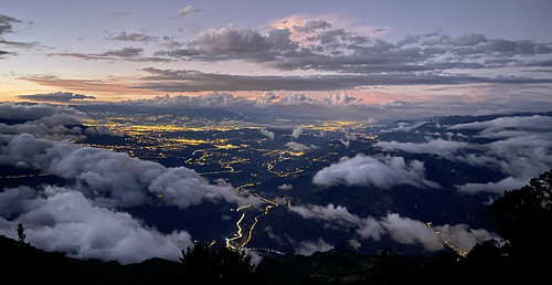
El Refugio del Volcán at 3,830 meters (12,565 feet) above sea level, Climbing the Summit of the Active and Mighty Stratovolcano 'Tungurahua' ('Throat of Fire' volcano) at 5,023 meters (16,479 feet) ab by ER's Eyes - Our planet is so beautiful.

El Refugio del Volcán at 3,830 meters (12,565 feet) above sea level, Climbing the Summit of the Active and Mighty Stratovolcano 'Tungurahua' ('Throat of Fire' volcano) at 5,023 meters (16,479 feet) ab by ER's Eyes - Our planet is so beautiful.

The Crater, Climbing the Summit of the Active and Mighty Stratovolcano 'Tungurahua' ('Throat of Fire' volcano) at 5,023 meters (16,479 feet) above sea level, Baños, the Central Highlands, Ecuador. by ER's Eyes - Our planet is so beautiful.

Sunrise, Climbing the Summit of the Active and Mighty Stratovolcano 'Tungurahua' ('Throat of Fire' volcano) at 5,023 meters (16,479 feet) above sea level, Baños, the Central Highlands, Ecuador. by ER's Eyes - Our planet is so beautiful.

Climbing the Summit of the Active and Mighty Stratovolcano 'Tungurahua' ('Throat of Fire' volcano) at 5,023 meters (16,479 feet) above sea level, Baños, the Central Highlands, Ecuador. by ER's Eyes - Our planet is so beautiful.

Parque Aventura San Martin at 1,800 meters (5,905 ft) above sea level, Baños, Ecuador. by ER's Eyes - Our planet is so beautiful.
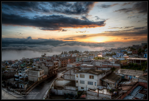
GoNativePhoto_081223_IMG_3427_5_6 by Native Photo

Texturas de una hueca ! #latín #food #restaurant #street #texture by Gabo Díaz
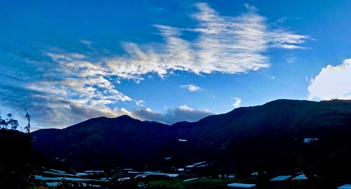
Sunrise at Hacienda Leito by krossbow
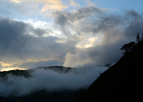
Baños sunset by Jessie Reeder

White haze! by Ortzak
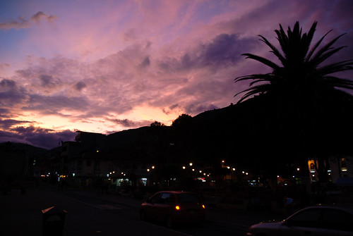
Sunset over Baños by Antoine R.

Ocultandose by kimcalvas_1

The sunset, looking almost straight up at the huge mountain next door by kobenhavn

IMG_20180413_184646 by secomigre