Sunrise Sunset Times of Kettle Point Indian Reserve No. 44, Warwick, ON N0N, Canada
Location: Canada > Ontario > Lambton County >
Timezone:
America/Toronto
Current Time:
2025-07-11 16:35:10
Longitude:
-82.0025626
Latitude:
43.1897876
Sunrise Today:
05:59:59 AM
Sunset Today:
09:07:32 PM
Daylength Today:
15h 7m 33s
Sunrise Tomorrow:
06:00:49 AM
Sunset Tomorrow:
09:06:56 PM
Daylength Tomorrow:
15h 6m 7s
Year Show All Dates
| Date | Sunrise | Sunset | Daylength |
|---|---|---|---|
| 01/01/2025 | 07:59:54 AM | 05:04:20 PM | 9h 4m 26s |
| 01/02/2025 | 07:59:54 AM | 05:05:16 PM | 9h 5m 22s |
| 01/03/2025 | 07:59:52 AM | 05:06:13 PM | 9h 6m 21s |
| 01/04/2025 | 07:59:47 AM | 05:07:11 PM | 9h 7m 24s |
| 01/05/2025 | 07:59:40 AM | 05:08:11 PM | 9h 8m 31s |
| 01/06/2025 | 07:59:30 AM | 05:09:13 PM | 9h 9m 43s |
| 01/07/2025 | 07:59:18 AM | 05:10:16 PM | 9h 10m 58s |
| 01/08/2025 | 07:59:03 AM | 05:11:20 PM | 9h 12m 17s |
| 01/09/2025 | 07:58:46 AM | 05:12:26 PM | 9h 13m 40s |
| 01/10/2025 | 07:58:27 AM | 05:13:33 PM | 9h 15m 6s |
| 01/11/2025 | 07:58:05 AM | 05:14:41 PM | 9h 16m 36s |
| 01/12/2025 | 07:57:40 AM | 05:15:50 PM | 9h 18m 10s |
| 01/13/2025 | 07:57:14 AM | 05:17:01 PM | 9h 19m 47s |
| 01/14/2025 | 07:56:45 AM | 05:18:12 PM | 9h 21m 27s |
| 01/15/2025 | 07:56:13 AM | 05:19:25 PM | 9h 23m 12s |
| 01/16/2025 | 07:55:40 AM | 05:20:38 PM | 9h 24m 58s |
| 01/17/2025 | 07:55:04 AM | 05:21:52 PM | 9h 26m 48s |
| 01/18/2025 | 07:54:26 AM | 05:23:07 PM | 9h 28m 41s |
| 01/19/2025 | 07:53:46 AM | 05:24:22 PM | 9h 30m 36s |
| 01/20/2025 | 07:53:03 AM | 05:25:39 PM | 9h 32m 36s |
| 01/21/2025 | 07:52:19 AM | 05:26:56 PM | 9h 34m 37s |
| 01/22/2025 | 07:51:32 AM | 05:28:13 PM | 9h 36m 41s |
| 01/23/2025 | 07:50:43 AM | 05:29:31 PM | 9h 38m 48s |
| 01/24/2025 | 07:49:52 AM | 05:30:49 PM | 9h 40m 57s |
| 01/25/2025 | 07:48:59 AM | 05:32:08 PM | 9h 43m 9s |
| 01/26/2025 | 07:48:05 AM | 05:33:28 PM | 9h 45m 23s |
| 01/27/2025 | 07:47:08 AM | 05:34:47 PM | 9h 47m 39s |
| 01/28/2025 | 07:46:09 AM | 05:36:07 PM | 9h 49m 58s |
| 01/29/2025 | 07:45:09 AM | 05:37:27 PM | 9h 52m 18s |
| 01/30/2025 | 07:44:06 AM | 05:38:47 PM | 9h 54m 41s |
| 01/31/2025 | 07:43:02 AM | 05:40:08 PM | 9h 57m 6s |
| 02/01/2025 | 07:41:56 AM | 05:41:28 PM | 9h 59m 32s |
| 02/02/2025 | 07:40:49 AM | 05:42:49 PM | 10h 2m 0s |
| 02/03/2025 | 07:39:39 AM | 05:44:10 PM | 10h 4m 31s |
| 02/04/2025 | 07:38:28 AM | 05:45:30 PM | 10h 7m 2s |
| 02/05/2025 | 07:37:16 AM | 05:46:51 PM | 10h 9m 35s |
| 02/06/2025 | 07:36:02 AM | 05:48:12 PM | 10h 12m 10s |
| 02/07/2025 | 07:34:46 AM | 05:49:32 PM | 10h 14m 46s |
| 02/08/2025 | 07:33:29 AM | 05:50:53 PM | 10h 17m 24s |
| 02/09/2025 | 07:32:10 AM | 05:52:13 PM | 10h 20m 3s |
| 02/10/2025 | 07:30:50 AM | 05:53:34 PM | 10h 22m 44s |
| 02/11/2025 | 07:29:29 AM | 05:54:54 PM | 10h 25m 25s |
| 02/12/2025 | 07:28:06 AM | 05:56:14 PM | 10h 28m 8s |
| 02/13/2025 | 07:26:42 AM | 05:57:33 PM | 10h 30m 51s |
| 02/14/2025 | 07:25:17 AM | 05:58:53 PM | 10h 33m 36s |
| 02/15/2025 | 07:23:51 AM | 06:00:12 PM | 10h 36m 21s |
| 02/16/2025 | 07:22:23 AM | 06:01:31 PM | 10h 39m 8s |
| 02/17/2025 | 07:20:54 AM | 06:02:50 PM | 10h 41m 56s |
| 02/18/2025 | 07:19:24 AM | 06:04:09 PM | 10h 44m 45s |
| 02/19/2025 | 07:17:54 AM | 06:05:27 PM | 10h 47m 33s |
| 02/20/2025 | 07:16:22 AM | 06:06:45 PM | 10h 50m 23s |
| 02/21/2025 | 07:14:49 AM | 06:08:03 PM | 10h 53m 14s |
| 02/22/2025 | 07:13:15 AM | 06:09:21 PM | 10h 56m 6s |
| 02/23/2025 | 07:11:40 AM | 06:10:38 PM | 10h 58m 58s |
| 02/24/2025 | 07:10:04 AM | 06:11:55 PM | 11h 1m 51s |
| 02/25/2025 | 07:08:28 AM | 06:13:11 PM | 11h 4m 43s |
| 02/26/2025 | 07:06:50 AM | 06:14:28 PM | 11h 7m 38s |
| 02/27/2025 | 07:05:12 AM | 06:15:44 PM | 11h 10m 32s |
| 02/28/2025 | 07:03:33 AM | 06:17:00 PM | 11h 13m 27s |
| 03/01/2025 | 07:01:54 AM | 06:18:15 PM | 11h 16m 21s |
| 03/02/2025 | 07:00:14 AM | 06:19:30 PM | 11h 19m 16s |
| 03/03/2025 | 06:58:33 AM | 06:20:45 PM | 11h 22m 12s |
| 03/04/2025 | 06:56:51 AM | 06:22:00 PM | 11h 25m 9s |
| 03/05/2025 | 06:55:09 AM | 06:23:14 PM | 11h 28m 5s |
| 03/06/2025 | 06:53:26 AM | 06:24:28 PM | 11h 31m 2s |
| 03/07/2025 | 06:51:43 AM | 06:25:42 PM | 11h 33m 59s |
| 03/08/2025 | 06:50:00 AM | 06:26:56 PM | 11h 36m 56s |
| 03/09/2025 | 07:48:20 AM | 07:28:06 PM | 11h 39m 46s |
| 03/10/2025 | 07:46:35 AM | 07:29:19 PM | 11h 42m 44s |
| 03/11/2025 | 07:44:51 AM | 07:30:32 PM | 11h 45m 41s |
| 03/12/2025 | 07:43:05 AM | 07:31:45 PM | 11h 48m 40s |
| 03/13/2025 | 07:41:20 AM | 07:32:57 PM | 11h 51m 37s |
| 03/14/2025 | 07:39:34 AM | 07:34:09 PM | 11h 54m 35s |
| 03/15/2025 | 07:37:48 AM | 07:35:22 PM | 11h 57m 34s |
| 03/16/2025 | 07:36:02 AM | 07:36:33 PM | 12h 0m 31s |
| 03/17/2025 | 07:34:16 AM | 07:37:45 PM | 12h 3m 29s |
| 03/18/2025 | 07:32:29 AM | 07:38:57 PM | 12h 6m 28s |
| 03/19/2025 | 07:30:42 AM | 07:40:08 PM | 12h 9m 26s |
| 03/20/2025 | 07:28:55 AM | 07:41:19 PM | 12h 12m 24s |
| 03/21/2025 | 07:27:08 AM | 07:42:30 PM | 12h 15m 22s |
| 03/22/2025 | 07:25:22 AM | 07:43:41 PM | 12h 18m 19s |
| 03/23/2025 | 07:23:35 AM | 07:44:52 PM | 12h 21m 17s |
| 03/24/2025 | 07:21:48 AM | 07:46:03 PM | 12h 24m 15s |
| 03/25/2025 | 07:20:01 AM | 07:47:13 PM | 12h 27m 12s |
| 03/26/2025 | 07:18:14 AM | 07:48:24 PM | 12h 30m 10s |
| 03/27/2025 | 07:16:27 AM | 07:49:34 PM | 12h 33m 7s |
| 03/28/2025 | 07:14:41 AM | 07:50:45 PM | 12h 36m 4s |
| 03/29/2025 | 07:12:55 AM | 07:51:55 PM | 12h 39m 0s |
| 03/30/2025 | 07:11:09 AM | 07:53:05 PM | 12h 41m 56s |
| 03/31/2025 | 07:09:23 AM | 07:54:16 PM | 12h 44m 53s |
| 04/01/2025 | 07:07:37 AM | 07:55:26 PM | 12h 47m 49s |
| 04/02/2025 | 07:05:52 AM | 07:56:36 PM | 12h 50m 44s |
| 04/03/2025 | 07:04:07 AM | 07:57:46 PM | 12h 53m 39s |
| 04/04/2025 | 07:02:22 AM | 07:58:56 PM | 12h 56m 34s |
| 04/05/2025 | 07:00:38 AM | 08:00:06 PM | 12h 59m 28s |
| 04/06/2025 | 06:58:54 AM | 08:01:16 PM | 13h 2m 22s |
| 04/07/2025 | 06:57:11 AM | 08:02:26 PM | 13h 5m 15s |
| 04/08/2025 | 06:55:28 AM | 08:03:36 PM | 13h 8m 8s |
| 04/09/2025 | 06:53:46 AM | 08:04:46 PM | 13h 11m 0s |
| 04/10/2025 | 06:52:04 AM | 08:05:57 PM | 13h 13m 53s |
| 04/11/2025 | 06:50:23 AM | 08:07:07 PM | 13h 16m 44s |
| 04/12/2025 | 06:48:43 AM | 08:08:17 PM | 13h 19m 34s |
| 04/13/2025 | 06:47:03 AM | 08:09:27 PM | 13h 22m 24s |
| 04/14/2025 | 06:45:24 AM | 08:10:37 PM | 13h 25m 13s |
| 04/15/2025 | 06:43:45 AM | 08:11:47 PM | 13h 28m 2s |
| 04/16/2025 | 06:42:07 AM | 08:12:57 PM | 13h 30m 50s |
| 04/17/2025 | 06:40:30 AM | 08:14:07 PM | 13h 33m 37s |
| 04/18/2025 | 06:38:54 AM | 08:15:17 PM | 13h 36m 23s |
| 04/19/2025 | 06:37:19 AM | 08:16:27 PM | 13h 39m 8s |
| 04/20/2025 | 06:35:45 AM | 08:17:37 PM | 13h 41m 52s |
| 04/21/2025 | 06:34:11 AM | 08:18:47 PM | 13h 44m 36s |
| 04/22/2025 | 06:32:39 AM | 08:19:57 PM | 13h 47m 18s |
| 04/23/2025 | 06:31:07 AM | 08:21:07 PM | 13h 50m 0s |
| 04/24/2025 | 06:29:37 AM | 08:22:17 PM | 13h 52m 40s |
| 04/25/2025 | 06:28:07 AM | 08:23:27 PM | 13h 55m 20s |
| 04/26/2025 | 06:26:39 AM | 08:24:37 PM | 13h 57m 58s |
| 04/27/2025 | 06:25:11 AM | 08:25:46 PM | 14h 0m 35s |
| 04/28/2025 | 06:23:45 AM | 08:26:56 PM | 14h 3m 11s |
| 04/29/2025 | 06:22:20 AM | 08:28:05 PM | 14h 5m 45s |
| 04/30/2025 | 06:20:57 AM | 08:29:14 PM | 14h 8m 17s |
| 05/01/2025 | 06:19:34 AM | 08:30:23 PM | 14h 10m 49s |
| 05/02/2025 | 06:18:13 AM | 08:31:32 PM | 14h 13m 19s |
| 05/03/2025 | 06:16:53 AM | 08:32:41 PM | 14h 15m 48s |
| 05/04/2025 | 06:15:35 AM | 08:33:49 PM | 14h 18m 14s |
| 05/05/2025 | 06:14:17 AM | 08:34:57 PM | 14h 20m 40s |
| 05/06/2025 | 06:13:02 AM | 08:36:05 PM | 14h 23m 3s |
| 05/07/2025 | 06:11:48 AM | 08:37:12 PM | 14h 25m 24s |
| 05/08/2025 | 06:10:35 AM | 08:38:19 PM | 14h 27m 44s |
| 05/09/2025 | 06:09:24 AM | 08:39:26 PM | 14h 30m 2s |
| 05/10/2025 | 06:08:14 AM | 08:40:32 PM | 14h 32m 18s |
| 05/11/2025 | 06:07:06 AM | 08:41:38 PM | 14h 34m 32s |
| 05/12/2025 | 06:05:59 AM | 08:42:44 PM | 14h 36m 45s |
| 05/13/2025 | 06:04:55 AM | 08:43:49 PM | 14h 38m 54s |
| 05/14/2025 | 06:03:52 AM | 08:44:53 PM | 14h 41m 1s |
| 05/15/2025 | 06:02:50 AM | 08:45:57 PM | 14h 43m 7s |
| 05/16/2025 | 06:01:51 AM | 08:47:00 PM | 14h 45m 9s |
| 05/17/2025 | 06:00:53 AM | 08:48:02 PM | 14h 47m 9s |
| 05/18/2025 | 05:59:57 AM | 08:49:04 PM | 14h 49m 7s |
| 05/19/2025 | 05:59:03 AM | 08:50:05 PM | 14h 51m 2s |
| 05/20/2025 | 05:58:10 AM | 08:51:05 PM | 14h 52m 55s |
| 05/21/2025 | 05:57:20 AM | 08:52:04 PM | 14h 54m 44s |
| 05/22/2025 | 05:56:31 AM | 08:53:03 PM | 14h 56m 32s |
| 05/23/2025 | 05:55:45 AM | 08:54:00 PM | 14h 58m 15s |
| 05/24/2025 | 05:55:00 AM | 08:54:57 PM | 14h 59m 57s |
| 05/25/2025 | 05:54:18 AM | 08:55:52 PM | 15h 1m 34s |
| 05/26/2025 | 05:53:37 AM | 08:56:46 PM | 15h 3m 9s |
| 05/27/2025 | 05:52:59 AM | 08:57:40 PM | 15h 4m 41s |
| 05/28/2025 | 05:52:22 AM | 08:58:32 PM | 15h 6m 10s |
| 05/29/2025 | 05:51:48 AM | 08:59:23 PM | 15h 7m 35s |
| 05/30/2025 | 05:51:16 AM | 09:00:13 PM | 15h 8m 57s |
| 05/31/2025 | 05:50:46 AM | 09:01:01 PM | 15h 10m 15s |
| 06/01/2025 | 05:50:17 AM | 09:01:48 PM | 15h 11m 31s |
| 06/02/2025 | 05:49:52 AM | 09:02:34 PM | 15h 12m 42s |
| 06/03/2025 | 05:49:28 AM | 09:03:18 PM | 15h 13m 50s |
| 06/04/2025 | 05:49:06 AM | 09:04:01 PM | 15h 14m 55s |
| 06/05/2025 | 05:48:47 AM | 09:04:42 PM | 15h 15m 55s |
| 06/06/2025 | 05:48:30 AM | 09:05:21 PM | 15h 16m 51s |
| 06/07/2025 | 05:48:15 AM | 09:05:59 PM | 15h 17m 44s |
| 06/08/2025 | 05:48:02 AM | 09:06:36 PM | 15h 18m 34s |
| 06/09/2025 | 05:47:51 AM | 09:07:10 PM | 15h 19m 19s |
| 06/10/2025 | 05:47:42 AM | 09:07:43 PM | 15h 20m 1s |
| 06/11/2025 | 05:47:36 AM | 09:08:14 PM | 15h 20m 38s |
| 06/12/2025 | 05:47:32 AM | 09:08:44 PM | 15h 21m 12s |
| 06/13/2025 | 05:47:30 AM | 09:09:11 PM | 15h 21m 41s |
| 06/14/2025 | 05:47:30 AM | 09:09:37 PM | 15h 22m 7s |
| 06/15/2025 | 05:47:32 AM | 09:10:00 PM | 15h 22m 28s |
| 06/16/2025 | 05:47:37 AM | 09:10:22 PM | 15h 22m 45s |
| 06/17/2025 | 05:47:43 AM | 09:10:42 PM | 15h 22m 59s |
| 06/18/2025 | 05:47:52 AM | 09:10:59 PM | 15h 23m 7s |
| 06/19/2025 | 05:48:02 AM | 09:11:15 PM | 15h 23m 13s |
| 06/20/2025 | 05:48:15 AM | 09:11:28 PM | 15h 23m 13s |
| 06/21/2025 | 05:48:29 AM | 09:11:40 PM | 15h 23m 11s |
| 06/22/2025 | 05:48:46 AM | 09:11:49 PM | 15h 23m 3s |
| 06/23/2025 | 05:49:05 AM | 09:11:56 PM | 15h 22m 51s |
| 06/24/2025 | 05:49:25 AM | 09:12:01 PM | 15h 22m 36s |
| 06/25/2025 | 05:49:48 AM | 09:12:04 PM | 15h 22m 16s |
| 06/26/2025 | 05:50:12 AM | 09:12:04 PM | 15h 21m 52s |
| 06/27/2025 | 05:50:38 AM | 09:12:03 PM | 15h 21m 25s |
| 06/28/2025 | 05:51:06 AM | 09:11:59 PM | 15h 20m 53s |
| 06/29/2025 | 05:51:36 AM | 09:11:53 PM | 15h 20m 17s |
| 06/30/2025 | 05:52:07 AM | 09:11:45 PM | 15h 19m 38s |
| 07/01/2025 | 05:52:41 AM | 09:11:34 PM | 15h 18m 53s |
| 07/02/2025 | 05:53:15 AM | 09:11:22 PM | 15h 18m 7s |
| 07/03/2025 | 05:53:52 AM | 09:11:07 PM | 15h 17m 15s |
| 07/04/2025 | 05:54:30 AM | 09:10:50 PM | 15h 16m 20s |
| 07/05/2025 | 05:55:09 AM | 09:10:31 PM | 15h 15m 22s |
| 07/06/2025 | 05:55:50 AM | 09:10:09 PM | 15h 14m 19s |
| 07/07/2025 | 05:56:32 AM | 09:09:45 PM | 15h 13m 13s |
| 07/08/2025 | 05:57:16 AM | 09:09:20 PM | 15h 12m 4s |
| 07/09/2025 | 05:58:01 AM | 09:08:51 PM | 15h 10m 50s |
| 07/10/2025 | 05:58:48 AM | 09:08:21 PM | 15h 9m 33s |
| 07/11/2025 | 05:59:35 AM | 09:07:49 PM | 15h 8m 14s |
| 07/12/2025 | 06:00:24 AM | 09:07:14 PM | 15h 6m 50s |
| 07/13/2025 | 06:01:14 AM | 09:06:38 PM | 15h 5m 24s |
| 07/14/2025 | 06:02:05 AM | 09:05:59 PM | 15h 3m 54s |
| 07/15/2025 | 06:02:57 AM | 09:05:18 PM | 15h 2m 21s |
| 07/16/2025 | 06:03:50 AM | 09:04:35 PM | 15h 0m 45s |
| 07/17/2025 | 06:04:44 AM | 09:03:51 PM | 14h 59m 7s |
| 07/18/2025 | 06:05:39 AM | 09:03:04 PM | 14h 57m 25s |
| 07/19/2025 | 06:06:35 AM | 09:02:15 PM | 14h 55m 40s |
| 07/20/2025 | 06:07:32 AM | 09:01:24 PM | 14h 53m 52s |
| 07/21/2025 | 06:08:29 AM | 09:00:31 PM | 14h 52m 2s |
| 07/22/2025 | 06:09:27 AM | 08:59:37 PM | 14h 50m 10s |
| 07/23/2025 | 06:10:26 AM | 08:58:40 PM | 14h 48m 14s |
| 07/24/2025 | 06:11:26 AM | 08:57:42 PM | 14h 46m 16s |
| 07/25/2025 | 06:12:26 AM | 08:56:42 PM | 14h 44m 16s |
| 07/26/2025 | 06:13:26 AM | 08:55:40 PM | 14h 42m 14s |
| 07/27/2025 | 06:14:28 AM | 08:54:36 PM | 14h 40m 8s |
| 07/28/2025 | 06:15:30 AM | 08:53:31 PM | 14h 38m 1s |
| 07/29/2025 | 06:16:32 AM | 08:52:24 PM | 14h 35m 52s |
| 07/30/2025 | 06:17:34 AM | 08:51:15 PM | 14h 33m 41s |
| 07/31/2025 | 06:18:38 AM | 08:50:05 PM | 14h 31m 27s |
| 08/01/2025 | 06:19:41 AM | 08:48:53 PM | 14h 29m 12s |
| 08/02/2025 | 06:20:45 AM | 08:47:40 PM | 14h 26m 55s |
| 08/03/2025 | 06:21:49 AM | 08:46:25 PM | 14h 24m 36s |
| 08/04/2025 | 06:22:53 AM | 08:45:08 PM | 14h 22m 15s |
| 08/05/2025 | 06:23:58 AM | 08:43:50 PM | 14h 19m 52s |
| 08/06/2025 | 06:25:03 AM | 08:42:31 PM | 14h 17m 28s |
| 08/07/2025 | 06:26:08 AM | 08:41:10 PM | 14h 15m 2s |
| 08/08/2025 | 06:27:13 AM | 08:39:48 PM | 14h 12m 35s |
| 08/09/2025 | 06:28:18 AM | 08:38:25 PM | 14h 10m 7s |
| 08/10/2025 | 06:29:24 AM | 08:37:00 PM | 14h 7m 36s |
| 08/11/2025 | 06:30:29 AM | 08:35:35 PM | 14h 5m 6s |
| 08/12/2025 | 06:31:35 AM | 08:34:08 PM | 14h 2m 33s |
| 08/13/2025 | 06:32:41 AM | 08:32:39 PM | 13h 59m 58s |
| 08/14/2025 | 06:33:47 AM | 08:31:10 PM | 13h 57m 23s |
| 08/15/2025 | 06:34:53 AM | 08:29:39 PM | 13h 54m 46s |
| 08/16/2025 | 06:35:59 AM | 08:28:08 PM | 13h 52m 9s |
| 08/17/2025 | 06:37:05 AM | 08:26:35 PM | 13h 49m 30s |
| 08/18/2025 | 06:38:11 AM | 08:25:02 PM | 13h 46m 51s |
| 08/19/2025 | 06:39:17 AM | 08:23:27 PM | 13h 44m 10s |
| 08/20/2025 | 06:40:23 AM | 08:21:52 PM | 13h 41m 29s |
| 08/21/2025 | 06:41:29 AM | 08:20:15 PM | 13h 38m 46s |
| 08/22/2025 | 06:42:35 AM | 08:18:38 PM | 13h 36m 3s |
| 08/23/2025 | 06:43:41 AM | 08:17:00 PM | 13h 33m 19s |
| 08/24/2025 | 06:44:46 AM | 08:15:21 PM | 13h 30m 35s |
| 08/25/2025 | 06:45:52 AM | 08:13:41 PM | 13h 27m 49s |
| 08/26/2025 | 06:46:58 AM | 08:12:01 PM | 13h 25m 3s |
| 08/27/2025 | 06:48:04 AM | 08:10:20 PM | 13h 22m 16s |
| 08/28/2025 | 06:49:10 AM | 08:08:38 PM | 13h 19m 28s |
| 08/29/2025 | 06:50:15 AM | 08:06:55 PM | 13h 16m 40s |
| 08/30/2025 | 06:51:21 AM | 08:05:12 PM | 13h 13m 51s |
| 08/31/2025 | 06:52:27 AM | 08:03:29 PM | 13h 11m 2s |
| 09/01/2025 | 06:53:32 AM | 08:01:44 PM | 13h 8m 12s |
| 09/02/2025 | 06:54:38 AM | 08:00:00 PM | 13h 5m 22s |
| 09/03/2025 | 06:55:44 AM | 07:58:14 PM | 13h 2m 30s |
| 09/04/2025 | 06:56:49 AM | 07:56:29 PM | 12h 59m 40s |
| 09/05/2025 | 06:57:55 AM | 07:54:43 PM | 12h 56m 48s |
| 09/06/2025 | 06:59:00 AM | 07:52:56 PM | 12h 53m 56s |
| 09/07/2025 | 07:00:06 AM | 07:51:09 PM | 12h 51m 3s |
| 09/08/2025 | 07:01:11 AM | 07:49:22 PM | 12h 48m 11s |
| 09/09/2025 | 07:02:17 AM | 07:47:35 PM | 12h 45m 18s |
| 09/10/2025 | 07:03:23 AM | 07:45:47 PM | 12h 42m 24s |
| 09/11/2025 | 07:04:28 AM | 07:43:59 PM | 12h 39m 31s |
| 09/12/2025 | 07:05:34 AM | 07:42:11 PM | 12h 36m 37s |
| 09/13/2025 | 07:06:40 AM | 07:40:22 PM | 12h 33m 42s |
| 09/14/2025 | 07:07:45 AM | 07:38:33 PM | 12h 30m 48s |
| 09/15/2025 | 07:08:51 AM | 07:36:45 PM | 12h 27m 54s |
| 09/16/2025 | 07:09:57 AM | 07:34:56 PM | 12h 24m 59s |
| 09/17/2025 | 07:11:03 AM | 07:33:07 PM | 12h 22m 4s |
| 09/18/2025 | 07:12:09 AM | 07:31:18 PM | 12h 19m 9s |
| 09/19/2025 | 07:13:15 AM | 07:29:29 PM | 12h 16m 14s |
| 09/20/2025 | 07:14:22 AM | 07:27:40 PM | 12h 13m 18s |
| 09/21/2025 | 07:15:28 AM | 07:25:52 PM | 12h 10m 24s |
| 09/22/2025 | 07:16:35 AM | 07:24:03 PM | 12h 7m 28s |
| 09/23/2025 | 07:17:41 AM | 07:22:14 PM | 12h 4m 33s |
| 09/24/2025 | 07:18:48 AM | 07:20:26 PM | 12h 1m 38s |
| 09/25/2025 | 07:19:55 AM | 07:18:37 PM | 11h 58m 42s |
| 09/26/2025 | 07:21:03 AM | 07:16:49 PM | 11h 55m 46s |
| 09/27/2025 | 07:22:10 AM | 07:15:01 PM | 11h 52m 51s |
| 09/28/2025 | 07:23:18 AM | 07:13:14 PM | 11h 49m 56s |
| 09/29/2025 | 07:24:26 AM | 07:11:26 PM | 11h 47m 0s |
| 09/30/2025 | 07:25:34 AM | 07:09:39 PM | 11h 44m 5s |
| 10/01/2025 | 07:26:42 AM | 07:07:53 PM | 11h 41m 11s |
| 10/02/2025 | 07:27:51 AM | 07:06:07 PM | 11h 38m 16s |
| 10/03/2025 | 07:28:59 AM | 07:04:21 PM | 11h 35m 22s |
| 10/04/2025 | 07:30:09 AM | 07:02:35 PM | 11h 32m 26s |
| 10/05/2025 | 07:31:18 AM | 07:00:51 PM | 11h 29m 33s |
| 10/06/2025 | 07:32:28 AM | 06:59:06 PM | 11h 26m 38s |
| 10/07/2025 | 07:33:37 AM | 06:57:22 PM | 11h 23m 45s |
| 10/08/2025 | 07:34:48 AM | 06:55:39 PM | 11h 20m 51s |
| 10/09/2025 | 07:35:58 AM | 06:53:57 PM | 11h 17m 59s |
| 10/10/2025 | 07:37:09 AM | 06:52:15 PM | 11h 15m 6s |
| 10/11/2025 | 07:38:20 AM | 06:50:33 PM | 11h 12m 13s |
| 10/12/2025 | 07:39:31 AM | 06:48:53 PM | 11h 9m 22s |
| 10/13/2025 | 07:40:43 AM | 06:47:13 PM | 11h 6m 30s |
| 10/14/2025 | 07:41:55 AM | 06:45:34 PM | 11h 3m 39s |
| 10/15/2025 | 07:43:08 AM | 06:43:56 PM | 11h 0m 48s |
| 10/16/2025 | 07:44:20 AM | 06:42:18 PM | 10h 57m 58s |
| 10/17/2025 | 07:45:33 AM | 06:40:42 PM | 10h 55m 9s |
| 10/18/2025 | 07:46:46 AM | 06:39:06 PM | 10h 52m 20s |
| 10/19/2025 | 07:48:00 AM | 06:37:32 PM | 10h 49m 32s |
| 10/20/2025 | 07:49:14 AM | 06:35:58 PM | 10h 46m 44s |
| 10/21/2025 | 07:50:28 AM | 06:34:26 PM | 10h 43m 58s |
| 10/22/2025 | 07:51:43 AM | 06:32:54 PM | 10h 41m 11s |
| 10/23/2025 | 07:52:57 AM | 06:31:24 PM | 10h 38m 27s |
| 10/24/2025 | 07:54:12 AM | 06:29:54 PM | 10h 35m 42s |
| 10/25/2025 | 07:55:28 AM | 06:28:26 PM | 10h 32m 58s |
| 10/26/2025 | 07:56:43 AM | 06:27:00 PM | 10h 30m 17s |
| 10/27/2025 | 07:57:59 AM | 06:25:34 PM | 10h 27m 35s |
| 10/28/2025 | 07:59:15 AM | 06:24:10 PM | 10h 24m 55s |
| 10/29/2025 | 08:00:32 AM | 06:22:47 PM | 10h 22m 15s |
| 10/30/2025 | 08:01:48 AM | 06:21:25 PM | 10h 19m 37s |
| 10/31/2025 | 08:03:05 AM | 06:20:05 PM | 10h 17m 0s |
| 11/01/2025 | 08:04:22 AM | 06:18:46 PM | 10h 14m 24s |
| 11/02/2025 | 07:05:42 AM | 05:17:25 PM | 10h 11m 43s |
| 11/03/2025 | 07:06:59 AM | 05:16:10 PM | 10h 9m 11s |
| 11/04/2025 | 07:08:16 AM | 05:14:56 PM | 10h 6m 40s |
| 11/05/2025 | 07:09:33 AM | 05:13:43 PM | 10h 4m 10s |
| 11/06/2025 | 07:10:50 AM | 05:12:32 PM | 10h 1m 42s |
| 11/07/2025 | 07:12:08 AM | 05:11:23 PM | 9h 59m 15s |
| 11/08/2025 | 07:13:25 AM | 05:10:15 PM | 9h 56m 50s |
| 11/09/2025 | 07:14:42 AM | 05:09:10 PM | 9h 54m 28s |
| 11/10/2025 | 07:15:59 AM | 05:08:06 PM | 9h 52m 7s |
| 11/11/2025 | 07:17:16 AM | 05:07:04 PM | 9h 49m 48s |
| 11/12/2025 | 07:18:33 AM | 05:06:03 PM | 9h 47m 30s |
| 11/13/2025 | 07:19:50 AM | 05:05:05 PM | 9h 45m 15s |
| 11/14/2025 | 07:21:06 AM | 05:04:09 PM | 9h 43m 3s |
| 11/15/2025 | 07:22:22 AM | 05:03:14 PM | 9h 40m 52s |
| 11/16/2025 | 07:23:38 AM | 05:02:22 PM | 9h 38m 44s |
| 11/17/2025 | 07:24:53 AM | 05:01:31 PM | 9h 36m 38s |
| 11/18/2025 | 07:26:08 AM | 05:00:43 PM | 9h 34m 35s |
| 11/19/2025 | 07:27:22 AM | 04:59:57 PM | 9h 32m 35s |
| 11/20/2025 | 07:28:36 AM | 04:59:13 PM | 9h 30m 37s |
| 11/21/2025 | 07:29:49 AM | 04:58:31 PM | 9h 28m 42s |
| 11/22/2025 | 07:31:02 AM | 04:57:52 PM | 9h 26m 50s |
| 11/23/2025 | 07:32:14 AM | 04:57:14 PM | 9h 25m 0s |
| 11/24/2025 | 07:33:25 AM | 04:56:39 PM | 9h 23m 14s |
| 11/25/2025 | 07:34:35 AM | 04:56:07 PM | 9h 21m 32s |
| 11/26/2025 | 07:35:44 AM | 04:55:36 PM | 9h 19m 52s |
| 11/27/2025 | 07:36:53 AM | 04:55:08 PM | 9h 18m 15s |
| 11/28/2025 | 07:38:01 AM | 04:54:42 PM | 9h 16m 41s |
| 11/29/2025 | 07:39:07 AM | 04:54:19 PM | 9h 15m 12s |
| 11/30/2025 | 07:40:12 AM | 04:53:58 PM | 9h 13m 46s |
| 12/01/2025 | 07:41:17 AM | 04:53:40 PM | 9h 12m 23s |
| 12/02/2025 | 07:42:20 AM | 04:53:24 PM | 9h 11m 4s |
| 12/03/2025 | 07:43:21 AM | 04:53:10 PM | 9h 9m 49s |
| 12/04/2025 | 07:44:22 AM | 04:52:59 PM | 9h 8m 37s |
| 12/05/2025 | 07:45:21 AM | 04:52:51 PM | 9h 7m 30s |
| 12/06/2025 | 07:46:18 AM | 04:52:45 PM | 9h 6m 27s |
| 12/07/2025 | 07:47:14 AM | 04:52:41 PM | 9h 5m 27s |
| 12/08/2025 | 07:48:09 AM | 04:52:40 PM | 9h 4m 31s |
| 12/09/2025 | 07:49:01 AM | 04:52:42 PM | 9h 3m 41s |
| 12/10/2025 | 07:49:52 AM | 04:52:46 PM | 9h 2m 54s |
| 12/11/2025 | 07:50:42 AM | 04:52:52 PM | 9h 2m 10s |
| 12/12/2025 | 07:51:29 AM | 04:53:01 PM | 9h 1m 32s |
| 12/13/2025 | 07:52:15 AM | 04:53:13 PM | 9h 0m 58s |
| 12/14/2025 | 07:52:59 AM | 04:53:27 PM | 9h 0m 28s |
| 12/15/2025 | 07:53:41 AM | 04:53:43 PM | 9h 0m 2s |
| 12/16/2025 | 07:54:20 AM | 04:54:02 PM | 8h 59m 42s |
| 12/17/2025 | 07:54:58 AM | 04:54:23 PM | 8h 59m 25s |
| 12/18/2025 | 07:55:34 AM | 04:54:46 PM | 8h 59m 12s |
| 12/19/2025 | 07:56:07 AM | 04:55:12 PM | 8h 59m 5s |
| 12/20/2025 | 07:56:39 AM | 04:55:41 PM | 8h 59m 2s |
| 12/21/2025 | 07:57:08 AM | 04:56:11 PM | 8h 59m 3s |
| 12/22/2025 | 07:57:34 AM | 04:56:44 PM | 8h 59m 10s |
| 12/23/2025 | 07:57:59 AM | 04:57:19 PM | 8h 59m 20s |
| 12/24/2025 | 07:58:21 AM | 04:57:56 PM | 8h 59m 35s |
| 12/25/2025 | 07:58:41 AM | 04:58:36 PM | 8h 59m 55s |
| 12/26/2025 | 07:58:59 AM | 04:59:17 PM | 9h 0m 18s |
| 12/27/2025 | 07:59:14 AM | 05:00:00 PM | 9h 0m 46s |
| 12/28/2025 | 07:59:27 AM | 05:00:46 PM | 9h 1m 19s |
| 12/29/2025 | 07:59:37 AM | 05:01:34 PM | 9h 1m 57s |
| 12/30/2025 | 07:59:45 AM | 05:02:23 PM | 9h 2m 38s |
| 12/31/2025 | 07:59:51 AM | 05:03:14 PM | 9h 3m 23s |
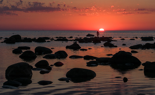
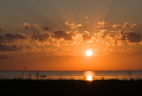
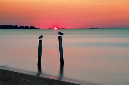
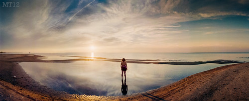
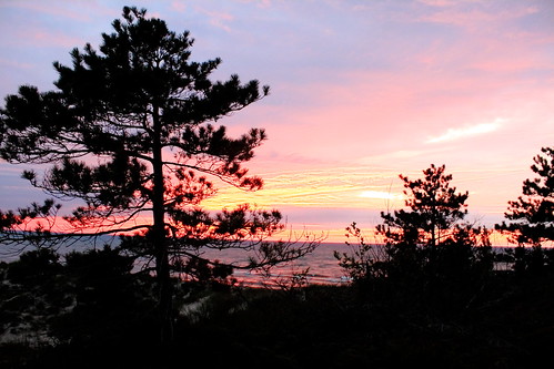
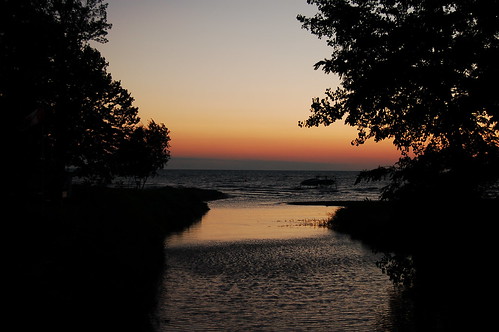
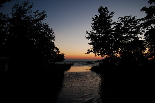
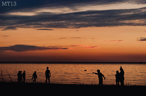
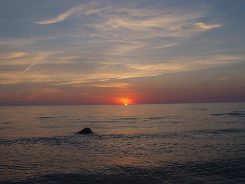
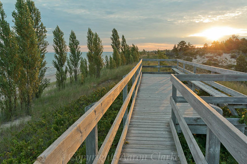
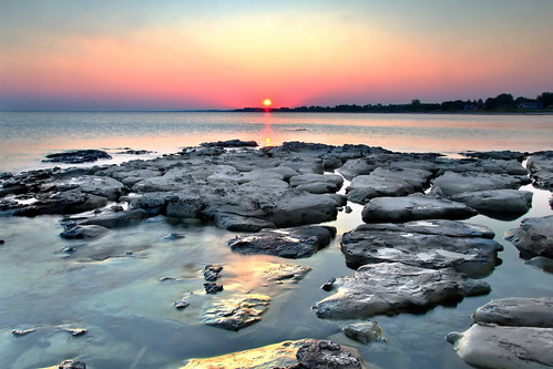
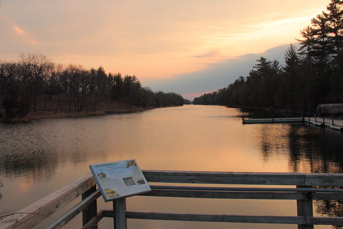
Sunrise & Sunset Photos
Kettle Point Indian Reserve No. 44, Warwick, ON N0N, Canada Map
Search another place
Near Places
Spruce St, Lambton Shores, ON N0N 1J2, Canada
Kettle Point, ON N0N 1J1, Canada
Beachway Dr, Lambton Shores, ON N0N 1J3, Canada
Lake Rd, Ontario N0N 1J1, Canada
Oak Ave, Lambton Shores, ON N0N 1J7, Canada
23 Albert St, Forest, ON N0N 1J0, Canada
Forest, Lambton Shores, ON N0N, Canada
Uttoxeter Rd, Plympton-Wyoming, ON N0N 1J5, Canada
Lambton Shores, ON, Canada
Lambton County, ON, Canada
Thedford, Lambton Shores, ON N0M, Canada
County Rd 18, Thedford, ON N0M 2N0, Canada
Pinery Provincial Park, Lakeshore Rd, Grand Bend, ON N0M 1T0, Canada
Plympton-Wyoming, ON, Canada
Arkona, Lambton Shores, ON N0M 1B0, Canada
Warwick, ON, Canada
Lakeshore Rd, Grand Bend, ON N0M 1T0, Canada
Sylvan, ON N0M 2K0, Canada
Hungry Hollow Road, Hungry Hollow Rd, Arkona, ON N0M 1B0, Canada
Wisbeach Rd, Arkona, ON N0M 1B0, Canada
Recent Searches
- Sunrise Sunset Times of Red Dog Mine, AK, USA
- Sunrise Sunset Times of Am Bahnhof, Am bhf, Borken, Germany
- Sunrise Sunset Times of 4th St E, Sonoma, CA, USA
- Sunrise Sunset Times of Oakland Ave, Williamsport, PA, USA
- Sunrise Sunset Times of Via Roma, Pieranica CR, Italy
- Sunrise Sunset Times of Clock Tower of Dubrovnik, Grad, Dubrovnik, Croatia
- Sunrise Sunset Times of Trelew, Chubut Province, Argentina
- Sunrise Sunset Times of Hartfords Bluff Cir, Mt Pleasant, SC, USA
- Sunrise Sunset Times of Kita Ward, Kumamoto, Japan
- Sunrise Sunset Times of Pingtan Island, Pingtan County, Fuzhou, China
