Timezone:India Standard Time
Current Time:Thursday, November 12, 2026 11:00 PM
Longitude:77.8242479
Latitude:35.513227
Sunrise Time Today:6:52:04 AM
Sunset Time Today:5:16:16 PM
Daylength Today:10h 24m 11s
Sunrise Time Tomorrow:6:53:04 AM
Sunset Time Tomorrow:5:15:32 PM
Daylength Tomorrow:10h 22m 28s

: Show All Dates

Date Sunrise Time Sunset Time Daylength
Jan 1, 2026 7:28:59 AM 5:16:29 PM 9h 47m 29s
Feb 1, 2026 7:20:52 AM 5:45:45 PM 10h 24m 52s
Mar 1, 2026 6:51:59 AM 6:13:38 PM 11h 21m 39s
Apr 1, 2026 6:08:34 AM 6:39:45 PM 12h 31m 10s
May 1, 2026 5:29:49 AM 7:04:31 PM 13h 34m 42s
Jun 1, 2026 5:06:37 AM 7:28:57 PM 14h 22m 20s
Jul 1, 2026 5:07:31 AM 7:39:20 PM 14h 31m 49s
Aug 1, 2026 5:27:04 AM 7:25:33 PM 13h 58m 29s
Sep 1, 2026 5:51:13 AM 6:50:10 PM 12h 58m 56s
Oct 1, 2026 6:13:34 AM 6:06:37 PM 11h 53m 2s
Nov 1, 2026 6:40:13 AM 5:26:53 PM 10h 46m 40s
Nov 13, 2026 6:52:04 AM 5:16:16 PM 10h 24m 11s
Nov 14, 2026 6:53:04 AM 5:15:32 PM 10h 22m 28s
Dec 1, 2026 7:09:42 AM 5:07:42 PM 9h 57m 59s

Sunrise & Sunset Photos

Sunrise In the Karakorams, Diamer, Pakistan - June 2006 by SaffyH, 
<a href="https://en.wikipedia.org/wiki/Karakoram" rel="nofollow">en.wikipedia.org/wiki/Karakoram</a
Sunrise In the Karakorams, Diamer, Pakistan - June 2006 by SaffyH
Road to Khagan & Naran via Abbottabad,Pakistan.2015 by Prof. Sajid H.Khan, Abbottabad /əˈbɒtəbɑːd/ (Urdu, Hindko: ایبٹ آباد Aibṭ ābād [ɛːbʈaːˈbaːd̪]) is a city located in the
Road to Khagan & Naran via Abbottabad,Pakistan.2015 by Prof. Sajid H.Khan
Road to Khagan & Naran via Abbottabad,Pakistan.2015 by Prof. Sajid H.Khan, Abbottabad /əˈbɒtəbɑːd/ (Urdu, Hindko: ایبٹ آباد Aibṭ ābād [ɛːbʈaːˈbaːd̪]) is a city located in the
Road to Khagan & Naran via Abbottabad,Pakistan.2015 by Prof. Sajid H.Khan
Something blue... by StrobistAdventures, <b>When that fat old sun in the sky is falling
Summer evenin' birds are calling
Children's laughter
Something blue... by StrobistAdventures
Road to Khagan & Naran via Abbottabad,Pakistan.2015 by Prof. Sajid H.Khan, Abbottabad /əˈbɒtəbɑːd/ (Urdu, Hindko: ایبٹ آباد Aibṭ ābād [ɛːbʈaːˈbaːd̪]) is a city located in the
Road to Khagan & Naran via Abbottabad,Pakistan.2015 by Prof. Sajid H.Khan
Road to Khagan & Naran via Abbottabad,Pakistan.2015 by Prof. Sajid H.Khan, Abbottabad /əˈbɒtəbɑːd/ (Urdu, Hindko: ایبٹ آباد Aibṭ ābād [ɛːbʈaːˈbaːd̪]) is a city located in the
Road to Khagan & Naran via Abbottabad,Pakistan.2015 by Prof. Sajid H.Khan
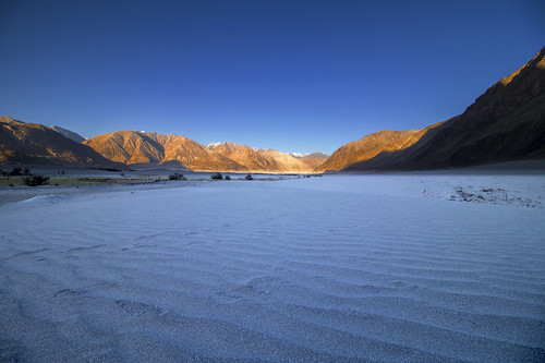
Nubra Valley Sand Dunes-A High Altitude Cold Desert by Traveler | Photographer | Graphic Designer, Siachen Glacier lies to the north of the valley. The Sasser Pass and the famous Karakoram Pass lie t
Nubra Valley Sand Dunes-A High Altitude Cold Desert by Traveler | Photographer | Graphic Designer
Road to Khagan & Naran via Abbottabad,Pakistan.2015 by Prof. Sajid H.Khan, Abbottabad /əˈbɒtəbɑːd/ (Urdu, Hindko: ایبٹ آباد Aibṭ ābād [ɛːbʈaːˈbaːd̪]) is a city located in the
Road to Khagan & Naran via Abbottabad,Pakistan.2015 by Prof. Sajid H.Khan
Road to Khagan & Naran via Abbottabad,Pakistan.2015 by Prof. Sajid H.Khan, Abbottabad /əˈbɒtəbɑːd/ (Urdu, Hindko: ایبٹ آباد Aibṭ ābād [ɛːbʈaːˈbaːd̪]) is a city located in the
Road to Khagan & Naran via Abbottabad,Pakistan.2015 by Prof. Sajid H.Khan
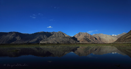
Nubra Valley in a Reflection by Sayid Budhi, <a href="http://www.flickr.com/photos/docbudie/sets/72157627461721492/"><b>"Adventure in the La
Nubra Valley in a Reflection by Sayid Budhi
This is Pakistan too! by ijaz18,  

>
>
>
> 
>KHUDA KARAY KE MERI ARZ-PAK PER UTRY
>WO FASL-E-GUL JISY ANDESSHA-E-Z
This is Pakistan too! by ijaz18
Road to Khagan & Naran via Abbottabad,Pakistan.2015 by Prof. Sajid H.Khan, Abbottabad /əˈbɒtəbɑːd/ (Urdu, Hindko: ایبٹ آباد Aibṭ ābād [ɛːbʈaːˈbaːd̪]) is a city located in the
Road to Khagan & Naran via Abbottabad,Pakistan.2015 by Prof. Sajid H.Khan
Its Pakistan! by ijaz18, KHUDA KARAY KE MERI ARZ-PAK PER UTRY
>WO FASL-E-GUL JISY ANDESSHA-E-ZAWAL NO HO(AMEEN)
> 
>
Its Pakistan! by ijaz18
This is Pakistan too! by ijaz18,  

>
>
>
> 
>KHUDA KARAY KE MERI ARZ-PAK PER UTRY
>WO FASL-E-GUL JISY ANDESSHA-E-Z
This is Pakistan too! by ijaz18
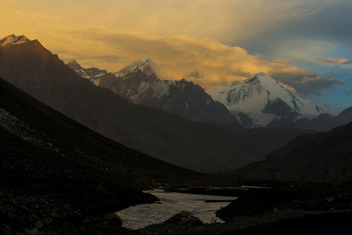
Near to the sun-set time - Nun Mountain - on the way to Zanskar Valley by ChetPix, The Nun Kun mountain massif comprises a pair of Himalayan peaks: Nun, 7,135 m (23,409 ft) and its ne
Near to the sun-set time - Nun Mountain - on the way to Zanskar Valley by ChetPix
Its Pakistan! by ijaz18, KHUDA KARAY KE MERI ARZ-PAK PER UTRY
>WO FASL-E-GUL JISY ANDESSHA-E-ZAWAL NO HO(AMEEN)
> 
>
Its Pakistan! by ijaz18
Road to Khagan & Naran via Abbottabad,Pakistan.2015 by Prof. Sajid H.Khan, Abbottabad /əˈbɒtəbɑːd/ (Urdu, Hindko: ایبٹ آباد Aibṭ ābād [ɛːbʈaːˈbaːd̪]) is a city located in the
Road to Khagan & Naran via Abbottabad,Pakistan.2015 by Prof. Sajid H.Khan
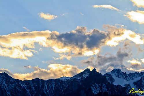
Sunset at Rohtang pass !!! by Rambonp:loves all creatures of this universe., Rohtang Pass (Hindi: रोहतांग दर्रा) (Bhoti: Rohtang , lit: pile of corpses,[1] due to people dying i
Sunset at Rohtang pass !!! by Rambonp:loves all creatures of this universe.
Sunset Reflection Over Karakoram, Snow Lake, Biafo Hispar Snow Lake Trek, Central Karakoram National Park, Gilgit-Baltistan, Pakistan by Feng Wei Photography, 巴基斯坦-Gilgit-Baltistan地区-喀喇昆仑中央国家公园-Biafo Hispar Snow Lake徒步-Snow Lake-暮光中的雪峰

Reflection of sunset l
Sunset Reflection Over Karakoram, Snow Lake, Biafo Hispar Snow Lake Trek, Central Karakoram National Park, Gilgit-Baltistan, Pakistan by Feng Wei Photography
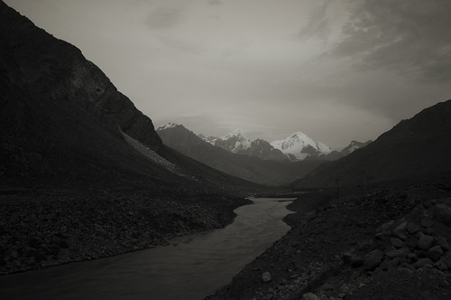
Nun Mountain - on the way to Zanskar Valley by ChetPix, The Nun Kun mountain massif comprises a pair of Himalayan peaks: Nun, 7,135 m (23,409 ft) and its ne
Nun Mountain - on the way to Zanskar Valley by ChetPix
Sunrise Reflection of Kongur Tagh on Karakul Lake by spearhawk, Kongur Tagh (7649m) is the highest peak of the Kunlun Mountains in China. It is just north of Muztag
Sunrise Reflection of Kongur Tagh on Karakul Lake by spearhawk
...let the light shine! by CoSurvivor, <a href="http://www.bighugelabs.com/onblack.php?id=6851260703&size=large&posted=1" rel="nofo
...let the light shine! by CoSurvivor
Hindukush range Pakistan by Shahid A Khan, Hindukush range in the Northwest region in the KPK province of Pakistan. This birds eyeview is from
Hindukush range Pakistan by Shahid A Khan
The glow of sunset. by draskd, This image is dedicated to Pemba Chhuti Sherpa ,a mountaineer par excellence, who is supposed to hav
The glow of sunset. by draskd
Post sun-set blues - Nun Mountain - on the way to Zanskar Valley by ChetPix, The Nun Kun mountain massif comprises a pair of Himalayan peaks: Nun, 7,135 m (23,409 ft) and its ne
Post sun-set blues - Nun Mountain - on the way to Zanskar Valley by ChetPix
Sunset Over Hispar La, Biafo Hispar Snow Lake Trek, Central Karakoram National Park, Gilgit-Baltistan, Pakistan by Feng Wei Photography, 巴基斯坦-Gilgit-Baltistan地区-喀喇昆仑中央国家公园-Biafo Hispar Snow Lake徒步-Hispar垭口-日落余晖

Sunset over Hunza valley
Sunset Over Hispar La, Biafo Hispar Snow Lake Trek, Central Karakoram National Park, Gilgit-Baltistan, Pakistan by Feng Wei Photography
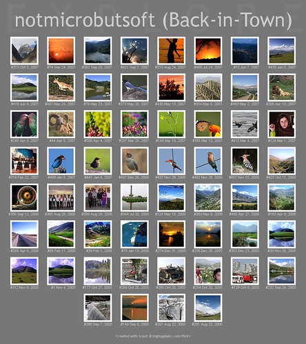
Explor-ED by NotMicroButSoft (Fallen in Love with Ghizar, GB), Although nothing to be so proud of, yet just sharing that so far 60 of my pictures have been made to
Explor-ED by NotMicroButSoft (Fallen in Love with Ghizar, GB)
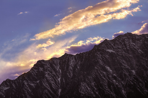
Leh India.......... by Rambonp:loves all creatures of this universe., leh laddakh lake mountains highway sky clouds blue green grey brown light day rivers wallpaper parad
Leh India.......... by Rambonp:loves all creatures of this universe.
Sunset Over Hispar La, Biafo Hispar Snow Lake Trek, Central Karakoram National Park, Gilgit-Baltistan, Pakistan by Feng Wei Photography, 巴基斯坦-Gilgit-Baltistan地区-喀喇昆仑中央国家公园-Biafo Hispar Snow Lake徒步-Hispar垭口-日落余晖

Sunset over Hunza valley
Sunset Over Hispar La, Biafo Hispar Snow Lake Trek, Central Karakoram National Park, Gilgit-Baltistan, Pakistan by Feng Wei Photography
Sunset Cloud Over Karakoram, Hispar La, Biafo Hispar Snow Lake Trek, Central Karakoram National Park, Gilgit-Baltistan, Pakistan by Feng Wei Photography, 巴基斯坦-Gilgit-Baltistan地区-喀喇昆仑中央国家公园-Biafo Hispar Snow Lake徒步-Hispar垭口-日落余晖

Sunset clouds over Karako
Sunset Cloud Over Karakoram, Hispar La, Biafo Hispar Snow Lake Trek, Central Karakoram National Park, Gilgit-Baltistan, Pakistan by Feng Wei Photography
Dawn @ Hispar Glacier, Biafo Hispar Snow Lake Trek, Kani Basa To Jutmal, Central Karakoram National Park, Gilgit-Baltistan, Pakistan by Feng Wei Photography, 巴基斯坦-Gilgit-Baltistan地区-喀喇昆仑中央国家公园-Biafo Hispar Snow Lake徒步-Kani Basa-Jutmal-Hispar冰川之晨

Dawn light
Dawn @ Hispar Glacier, Biafo Hispar Snow Lake Trek, Kani Basa To Jutmal, Central Karakoram National Park, Gilgit-Baltistan, Pakistan by Feng Wei Photography
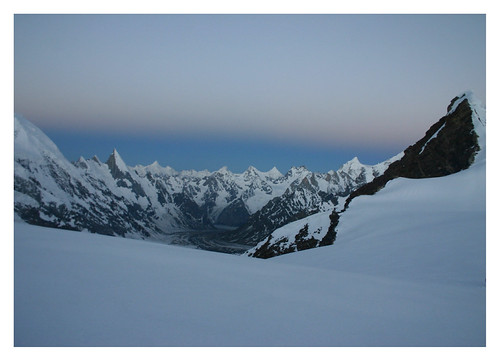
The Power of Silence by malczyk, View from the Gondogoro Snow Pass on the Hushe Valley in Karakoram, Pakistan. The picture has been t
The Power of Silence by malczyk
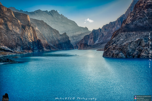
Serene Sunset by MolviDSLR, The lake is glowing more pretty with the sun set for the sunset. With every moment that passes by, n
Serene Sunset by MolviDSLR
Dusk Light Over Baintha Brakk, Hispar La, Biafo Hispar Snow Lake Trek, Central Karakoram National Park, Gilgit-Baltistan, Pakistan by Feng Wei Photography, 巴基斯坦-Gilgit-Baltistan地区-喀喇昆仑中央国家公园-Biafo Hispar Snow Lake徒步-Hispar垭口-Baintha Brakk峰的日落余晖

Dusk light
Dusk Light Over Baintha Brakk, Hispar La, Biafo Hispar Snow Lake Trek, Central Karakoram National Park, Gilgit-Baltistan, Pakistan by Feng Wei Photography
Sunrise Reflection of Kongur Tagh on Karakul Lake by spearhawk, Kongur Tagh (7649m) is the highest peak of the Kunlun Mountains in China. It is just north of Muztag
Sunrise Reflection of Kongur Tagh on Karakul Lake by spearhawk
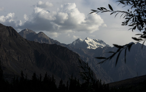
First look of Kun by ChetPix, The Nun Kun mountain massif comprises a pair of Himalayan peaks: Nun, 7,135 m (23,409 ft) and its ne
First look of Kun by ChetPix
Sunset at Sughet Jangal by Les Koppe Photography, On this, the 5th day of our successful 16-day trek to the K2 North Base Camp and the North Gasherbru
Sunset at Sughet Jangal by Les Koppe Photography
Sunset over Kongur Tagh by spearhawk, Kongur Tagh (7649m) is the highest peak of the Kunlun Mountains in China. It is just north of Muztag
Sunset over Kongur Tagh by spearhawk
Sunrise Reflection of Kongur Tagh on Karakul Lake by spearhawk, Kongur Tagh (7649m) is the highest peak of the Kunlun Mountains in China. It is just north of Muztag
Sunrise Reflection of Kongur Tagh on Karakul Lake by spearhawk
Tashkurgan before sunset タシュクルガン、日の入前の空 by travelingmipo, Tashkurgan (Uyghur: تاشقورغان بازىرى‎; Sarikoli: [tɔʃqyrʁɔn buzur]; Chinese: 塔什库尔干镇; pinyin: Tǎshíkù
Tashkurgan before sunset タシュクルガン、日の入前の空 by travelingmipo
Sunset over Muztagh Ata by spearhawk, Muztagh Ata (7546m) is the second highest of the mountains which form the northern edge of the Tibet
Sunset over Muztagh Ata by spearhawk
K2 North Base Camp Sunset by Les Koppe Photography, On this, the 5th day of our successful 16-day trek to the K2 North Base Camp and the North Gasherbru
K2 North Base Camp Sunset by Les Koppe Photography
Sunrise over Muztagh Ata by spearhawk, Muztagh Ata (7546m) is the second highest of the mountains which form the northern edge of the Tibet
Sunrise over Muztagh Ata by spearhawk
Sughet Jangal Sunset by Les Koppe Photography, On this, the 5th day of our successful 16-day trek to the K2 North Base Camp and the North Gasherbru
Sughet Jangal Sunset by Les Koppe Photography
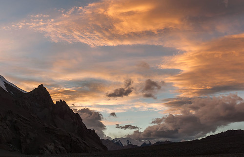
Aghil Pass Sunset by Les Koppe Photography, Looking north-northwest toward a beautiful sunset from our campsite (elevation 4,790 m, 15,715 ft.)
Aghil Pass Sunset by Les Koppe Photography
Sunset Cloud Over Karakoram, Hispar La, Biafo Hispar Snow Lake Trek, Central Karakoram National Park, Gilgit-Baltistan, Pakistan by Feng Wei Photography, 巴基斯坦-Gilgit-Baltistan地区-喀喇昆仑中央国家公园-Biafo Hispar Snow Lake徒步-Hispar垭口-日落余晖

Sunset clouds over Karako
Sunset Cloud Over Karakoram, Hispar La, Biafo Hispar Snow Lake Trek, Central Karakoram National Park, Gilgit-Baltistan, Pakistan by Feng Wei Photography
Ascending Khurdopin Pass at 05:00 AM by Johan Assarsson, Khurdopin Traverse, Pakistankhurdopinpass snowlake pakistan climbing trekking hiking khurdopintraver
Ascending Khurdopin Pass at 05:00 AM by Johan Assarsson
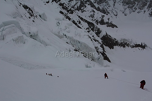
Crossing Gondogoro La Pass by The_Mountain_Man_, Crossing Technical Sections of Gondogoro La Pass 5,940m (19,483 feet) in the early morning well befo
Crossing Gondogoro La Pass by The_Mountain_Man_
Prelude on the Aghil Pass by Les Koppe Photography, Looking north-northwest toward a beautiful sunset in the making from our campsite (elevation 4,790 m
Prelude on the Aghil Pass by Les Koppe Photography
Pakistani style decorative truck running on Karakoram Highway, Pakistan パキスタン、カラコルム・ハイウェイを走るデコトラ by travelingmipo, The Karakoram Highway (KKH), also known as the China-Pakistan Friendship Highway, is one of the high
Pakistani style decorative truck running on Karakoram Highway, Pakistan パキスタン、カラコルム・ハイウェイを走るデコトラ by travelingmipo
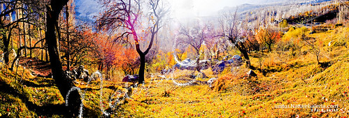
Central_Hunza_Gardens"Karimabad"backlit-Panorama"_Untitled-cropped_c2b6_968_ by pall,ansar, i was so late but i still got last pass of autumn/fall , stayed in karimabad for a week, lucky last
Central_Hunza_Gardens"Karimabad"backlit-Panorama"_Untitled-cropped_c2b6_968_ by pall,ansar
fog rolling in fast (camphone) by jeffconlin, park sunset horse mountains fall fog 30 john washington iron state wayne pass rail trail cascades wa
fog rolling in fast (camphone) by jeffconlin
Sunset at the K2 North Base Camp by Les Koppe Photography, On this, the 5th day of our successful 16-day trek to the K2 North Base Camp and the North Gasherbru
Sunset at the K2 North Base Camp by Les Koppe Photography
Sunrise in the Land of Giants by Bilal A., Sun rising up from behind the Gashabrum mountains. Taken from on top of the highest mountain pass in
Sunrise in the Land of Giants by Bilal A.
Slice of life in Walled City of Lahore, Pakistan by T Ξ Ξ J Ξ, Delhi Gate is located in the east of the city and faces Delhi which was the capital of the Mughal em
Slice of life in Walled City of Lahore, Pakistan by T Ξ Ξ J Ξ
Stalls close to masjid Wazir Khan by T Ξ Ξ J Ξ, Delhi Gate is located in the east of the city and faces Delhi which was the capital of the Mughal em
Stalls close to masjid Wazir Khan by T Ξ Ξ J Ξ
Shrine of Syed Suf near Wazir Khan Mosque Lahore by T Ξ Ξ J Ξ, Delhi Gate is located in the east of the city and faces Delhi which was the capital of the Mughal em
Shrine of Syed Suf near Wazir Khan Mosque Lahore by T Ξ Ξ J Ξ
Prata morning delivery by T Ξ Ξ J Ξ, Delhi Gate is located in the east of the city and faces Delhi which was the capital of the Mughal em
Prata morning delivery by T Ξ Ξ J Ξ
Home without financial assistance by T Ξ Ξ J Ξ, Delhi Gate is located in the east of the city and faces Delhi which was the capital of the Mughal em
Home without financial assistance by T Ξ Ξ J Ξ
Another ancient gate by T Ξ Ξ J Ξ, Delhi Gate is located in the east of the city and faces Delhi which was the capital of the Mughal em
Another ancient gate by T Ξ Ξ J Ξ