時間帯:中国標準時
現地時間:2026年11月11日 水曜日 04:50
経度:84.03153
緯度:29.770279
今日の日の出時刻:08:46:12
今日の日の入時刻:19:32:13
今日の日長:10時間46分0秒
明日の日の出時刻:08:47:01
明日の日の入時刻:19:31:38
明日の日長:10時間44分37秒

: すべて表示する

日付 日出 日没 日長
2026年1月1日 09:20:07 19:35:41 10時間15分34秒
2026年2月1日 09:15:55 20:01:02 10時間45分6秒
2026年3月1日 08:52:48 20:23:10 11時間30分22秒
2026年4月1日 08:16:18 20:42:22 12時間26分4秒
2026年5月1日 07:43:54 21:00:46 13時間16分51秒
2026年6月1日 07:25:38 21:20:16 13時間54分38秒
2026年7月1日 07:27:31 21:29:40 14時間2分8秒
2026年8月1日 07:43:35 21:19:23 13時間35分48秒
2026年9月1日 08:01:41 20:50:03 12時間48分21秒
2026年10月1日 08:17:28 20:13:03 11時間55分34秒
2026年11月1日 08:37:28 19:39:59 11時間2分30秒
2026年11月11日 08:45:23 19:32:48 10時間47分25秒
2026年11月12日 08:46:12 19:32:13 10時間46分0秒
2026年12月1日 09:01:56 19:25:48 10時間23分51秒

日の出と日の入りの写真

Desert sand dunes in the Tibetan Himalayas, Tibet 2017 by reurinkjan, Landscape of Tibet
Tibet is the highest country on earth with an average elevation of over 4000m. Th
Desert sand dunes in the Tibetan Himalayas, Tibet 2017 by reurinkjan
Landscape with Yaks along the river Yarlung Tsangpo (Brahmaputra), Tibet 2015 by reurinkjan, Drongpa county is the region around the source of the Yarlung Tsangpo ཡར་ཀླུངས་གཙང་པོ་ (Brahmaputra)
Landscape with Yaks along the river Yarlung Tsangpo (Brahmaputra), Tibet 2015 by reurinkjan
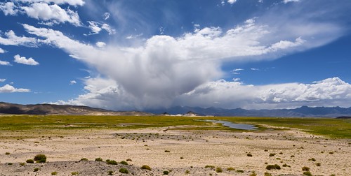
Immediately I thought there is my "Garuda", Tibet 2017 by reurinkjan, Garuda is a large mythical bird or bird-like creature that appears in both Hindu and Buddhist mythol
Immediately I thought there is my "Garuda", Tibet 2017 by reurinkjan
Twin peaks on a rainy day, Tibet 2015 by reurinkjan, Landscapes of Tibet
Tibet is the highest country on earth with an average elevation of over 4000m. T
Twin peaks on a rainy day, Tibet 2015 by reurinkjan
Desert sand dunes along the Brahmaputra river, Tibet 2017 by reurinkjan, Landscape of Tibet
Tibet is the highest country on earth with an average elevation of over 4000m. Th
Desert sand dunes along the Brahmaputra river, Tibet 2017 by reurinkjan
Headwaters of the Yarlung Tsangpo also known as the Brahmaputra, Tibet 2017 by reurinkjan, About 2,900 km (1,800 miles) long
The Yarlung Tsangpo ཡར་ཀླུངས་གཙང་པོ་ or Brahmaputra arises at the
Headwaters of the Yarlung Tsangpo also known as the Brahmaputra, Tibet 2017 by reurinkjan
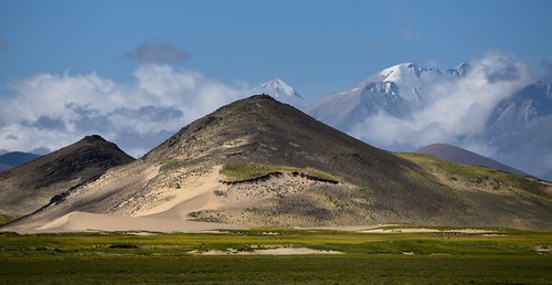
Desert sand dunes in the Tibetan Himalayas, Tibet 2017 by reurinkjan, Landscape of Tibet
Tibet is the highest country on earth with an average elevation of over 4000m. Th
Desert sand dunes in the Tibetan Himalayas, Tibet 2017 by reurinkjan
The mountain Rongla Kangri 6647 m, Tibet 2015 by reurinkjan, Drongpa county is the region around the source of the Yarlung Tsangpo ཡར་ཀླུངས་གཙང་པོ་ (Brahmaputra)
The mountain Rongla Kangri 6647 m, Tibet 2015 by reurinkjan
Ice peaks and desert sand dunes along the river Yarlung Tsangpo, Tibet 2015 by reurinkjan, Landscapes of Tibet
Tibet is the highest country on earth with an average elevation of over 4000m. T
Ice peaks and desert sand dunes along the river Yarlung Tsangpo, Tibet 2015 by reurinkjan
Drongpa county Landscape, Tibet 2015 by reurinkjan, Photo: bottom left are some yak.

Drongpa county is the region around the source of the Yarlung Tsan
Drongpa county Landscape, Tibet 2015 by reurinkjan
Himalayan snow peaks and desert sand dunes along the river Yarlung Tsangpo, Tibet 2015 by reurinkjan, Photo: Snow mountain of Kubi Gangri ཀུ་ བི་གང་ རི་ 6859m (22503ft).

Landscapes of Tibet
Tibet is th
Himalayan snow peaks and desert sand dunes along the river Yarlung Tsangpo, Tibet 2015 by reurinkjan
The Himalaya mountains, Tibet 2019 by reurinkjan, Landscape of Tibet
Tibet is the highest country on earth with an average elevation of over 4000m. Th
The Himalaya mountains, Tibet 2019 by reurinkjan
Shepherd's garden, Tibet 2015 by reurinkjan, Looking from Jang Traduntse monastery towards the Kitse Rinak mountains, there inbetween lays a vast
Shepherd's garden, Tibet 2015 by reurinkjan
Landscape of Drongpa county, Tibet 2015 by reurinkjan, Landscapes of Tibet
Tibet is the highest country on earth with an average elevation of over 4000m. T
Landscape of Drongpa county, Tibet 2015 by reurinkjan
Sanddunes, the river Yarlung Tsangpo and the mountain Kubi Gangri, Tibet 2015 by reurinkjan, Photo: Snow mountain of Kubi Gangri ཀུ་ བི་གང་ རི་ 6859m (22503ft).
Headwaters of the Yarlung Tsangp
Sanddunes, the river Yarlung Tsangpo and the mountain Kubi Gangri, Tibet 2015 by reurinkjan
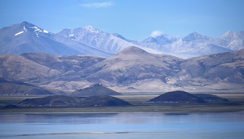
Along the river Yarlung Tsangpo, Tibet 2015 by reurinkjan, Landscapes of Tibet
Tibet is the highest country on earth with an average elevation of over 4000m. T
Along the river Yarlung Tsangpo, Tibet 2015 by reurinkjan
Landscape with Yak along the river Yarlung Tsangpo (Brahmaputra), Tibet 2015 by reurinkjan, Drongpa county is the region around the source of the Yarlung Tsangpo ཡར་ཀླུངས་གཙང་པོ་ (Brahmaputra)
Landscape with Yak along the river Yarlung Tsangpo (Brahmaputra), Tibet 2015 by reurinkjan
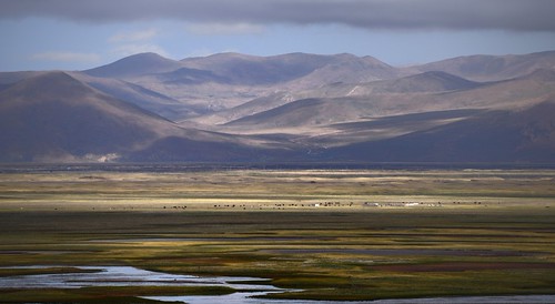
Landscape with domestic Yak, Tibet 2015 by reurinkjan, Drongpa county is the region around the source of the Yarlung Tsangpo ཡར་ཀླུངས་གཙང་པོ་ (Brahmaputra)
Landscape with domestic Yak, Tibet 2015 by reurinkjan
Drongpa county Landscape, Tibet 2015 by reurinkjan, Landscape of Tibet
Tibet is the highest country on earth with an average elevation of over 4000m. Th
Drongpa county Landscape, Tibet 2015 by reurinkjan
Drongpa county Landscape, Tibet 2015 by reurinkjan, Landscape of Tibet
Tibet is the highest country on earth with an average elevation of over 4000m. Th
Drongpa county Landscape, Tibet 2015 by reurinkjan
Landscape of Tibet, 2019 by reurinkjan, Landscape of Tibet
Tibet is the highest country on earth with an average elevation of over 4000m. Th
Landscape of Tibet, 2019 by reurinkjan
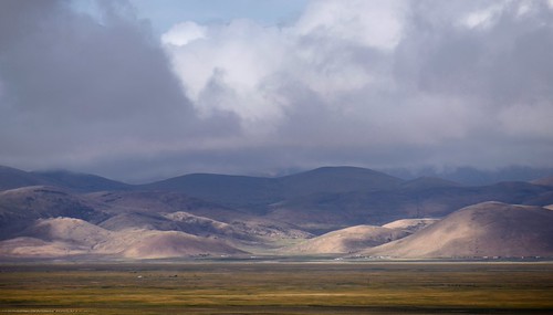
Landscape of Drongpa county, Tibet 2015 by reurinkjan, Drongpa county is the region around the source of the Yarlung Tsangpo ཡར་ཀླུངས་གཙང་པོ་ (Brahmaputra)
Landscape of Drongpa county, Tibet 2015 by reurinkjan
Landscape of Tibet, 2019 by reurinkjan, Landscape of Tibet
Tibet is the highest country on earth with an average elevation of over 4000m. Th
Landscape of Tibet, 2019 by reurinkjan
Downfall can uplift a landscape, Tibet 2015 by reurinkjan, Looking from Jang Traduntse monastery towards the Kitse Rinak mountains, there inbetween lays a vast
Downfall can uplift a landscape, Tibet 2015 by reurinkjan
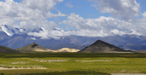
The Himalaya mountains, Tibet 2019 by reurinkjan, Landscape of Tibet
Tibet is the highest country on earth with an average elevation of over 4000m. Th
The Himalaya mountains, Tibet 2019 by reurinkjan
The Himalaya mountains, Tibet 2019 by reurinkjan, Landscape of Tibet
Tibet is the highest country on earth with an average elevation of over 4000m. Th
The Himalaya mountains, Tibet 2019 by reurinkjan
Desert sand dunes along the Brahmaputra river, Tibet 2019 by reurinkjan, Landscape of Tibet
Tibet is the highest country on earth with an average elevation of over 4000m. Th
Desert sand dunes along the Brahmaputra river, Tibet 2019 by reurinkjan
Desert sand dunes along the Himalayas, Tibet 2019 by reurinkjan, Landscape of Tibet
Tibet is the highest country on earth with an average elevation of over 4000m. Th
Desert sand dunes along the Himalayas, Tibet 2019 by reurinkjan
Drongpa county landscape, Tibet 2019 by reurinkjan, Landscape of Tibet
Tibet is the highest country on earth with an average elevation of over 4000m. Th
Drongpa county landscape, Tibet 2019 by reurinkjan
Tibetan ponies, Tibet 2019 by reurinkjan,  History
It is generally believed that most Tibetan ponies descended from ancient stock, likely part
Tibetan ponies, Tibet 2019 by reurinkjan
Desert sand dunes along the Brahmaputra river, Tibet 2019 by reurinkjan, Landscape of Tibet
Tibet is the highest country on earth with an average elevation of over 4000m. Th
Desert sand dunes along the Brahmaputra river, Tibet 2019 by reurinkjan
Landscape of Drongpa county, Tibet 2019 by reurinkjan, Drongpa county is the region around the source of the Yarlung Tsangpo ཡར་ཀླུངས་གཙང་པོ་ (Brahmaputra)
Landscape of Drongpa county, Tibet 2019 by reurinkjan
Desert sand dunes along the Brahmaputra river, Tibet 2019 by reurinkjan, Landscape of Tibet
Tibet is the highest country on earth with an average elevation of over 4000m. Th
Desert sand dunes along the Brahmaputra river, Tibet 2019 by reurinkjan
The Himalayas, Tibet 2019 by reurinkjan, Before knowing the weather condition of the Himalayan region we should understand its geography. The
The Himalayas, Tibet 2019 by reurinkjan
Drongpa county landscape, Tibet 2019 by reurinkjan, Drongpa འབྲོང་པ་ county

Drongpa county is the region around the source of the Yarlung Tsangpo ཡར་ཀླ
Drongpa county landscape, Tibet 2019 by reurinkjan
Desert sand dunes along the Himalayas, Tibet 2019 by reurinkjan, Landscape of Tibet
Tibet is the highest country on earth with an average elevation of over 4000m. Th
Desert sand dunes along the Himalayas, Tibet 2019 by reurinkjan
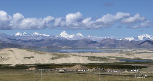
Desert sand dunes along the Brahmaputra river, Tibet 2019 by reurinkjan, Landscape of Tibet
Tibet is the highest country on earth with an average elevation of over 4000m. Th
Desert sand dunes along the Brahmaputra river, Tibet 2019 by reurinkjan
Desert sand dunes along the Brahmaputra river, Tibet 2019 by reurinkjan, Landscape of Tibet
Tibet is the highest country on earth with an average elevation of over 4000m. Th
Desert sand dunes along the Brahmaputra river, Tibet 2019 by reurinkjan
Drongpa county landscape, Tibet 2019 by reurinkjan, Landscape of Tibet
Tibet is the highest country on earth with an average elevation of over 4000m. Th
Drongpa county landscape, Tibet 2019 by reurinkjan
The Himalaya mountains, Tibet 2019 by reurinkjan, Landscape of Tibet
Tibet is the highest country on earth with an average elevation of over 4000m. Th
The Himalaya mountains, Tibet 2019 by reurinkjan
Saga county landscape, Tibet 2019 by reurinkjan, Saga ས་དགའ་ county

Saga county in North Lato is the region occupied by the upper rivers of Yarlung
Saga county landscape, Tibet 2019 by reurinkjan
Drongpa county landscape, Tibet 2019 by reurinkjan, Drongpa འབྲོང་པ་ county

Drongpa county is the region around the source of the Yarlung Tsangpo ཡར་ཀླ
Drongpa county landscape, Tibet 2019 by reurinkjan
Drongpa county landscape, Tibet 2019 by reurinkjan, Drongpa འབྲོང་པ་ county

Drongpa county is the region around the source of the Yarlung Tsangpo ཡར་ཀླ
Drongpa county landscape, Tibet 2019 by reurinkjan
Saga county landscape, Tibet 2019 by reurinkjan, Saga ས་དགའ་ county

Saga county in North Lato is the region occupied by the upper rivers of Yarlung
Saga county landscape, Tibet 2019 by reurinkjan
Landscape with Yak, Tibet 2019 by reurinkjan, Drongpa འབྲོང་པ་ county

Drongpa county is the region around the source of the Yarlung Tsangpo ཡར་ཀླ
Landscape with Yak, Tibet 2019 by reurinkjan
Drongpa county landscape, Tibet 2019 by reurinkjan, Drongpa འབྲོང་པ་ county

Drongpa county is the region around the source of the Yarlung Tsangpo ཡར་ཀླ
Drongpa county landscape, Tibet 2019 by reurinkjan
Brahmaputra river, Tibet 2017 by reurinkjan, Headwaters of the Yarlung Tsangpo ཡར་ཀླུངས་གཙང་པོ་ (Brahmaputra)

About 2,900 km (1,800 miles) long
Brahmaputra river, Tibet 2017 by reurinkjan
Rainy day, Tibet 2024 by reurinkjan, Drongpa འབྲོང་པ་ county

Drongpa county is the region around the source of the Yarlung Tsangpo ཡར་ཀླ
Rainy day, Tibet 2024 by reurinkjan
Drongpa county landscape, Tibet 2024 by reurinkjan, Drongpa འབྲོང་པ་ county

Drongpa county is the region around the source of the Yarlung Tsangpo ཡར་ཀླ
Drongpa county landscape, Tibet 2024 by reurinkjan
Headwaters of the Yarlung Tsangpo (Brahmaputra),Tibet 2024 by reurinkjan, Headwaters of the Yarlung Tsangpo ཡར་ཀླུངས་གཙང་པོ་ (Brahmaputra)

About 2,900 km (1,800 miles) long
Headwaters of the Yarlung Tsangpo (Brahmaputra),Tibet 2024 by reurinkjan
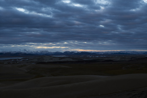
Sunrise in Zhongba by 喜马拉雅野人,
Sunrise in Zhongba by 喜马拉雅野人