Yoder Rd, Altamont, TN アメリカ合衆国日の出日の入り時間
Location: アメリカ合衆国 > テネシー州 > グランディ > アメリカ合衆国 テネシー州 アルタモント >
時間帯:
America/Chicago
現地時間:
2025-07-06 23:54:06
経度:
-85.855951
緯度:
35.416754
今日の日の出時刻:
05:35:20 AM
今日の日の入時刻:
08:01:38 PM
今日の日長:
14h 26m 18s
明日の日の出時刻:
05:35:54 AM
明日の日の入時刻:
08:01:22 PM
明日の日長:
14h 25m 28s
すべて表示する
| 日付 | 日出 | 日没 | 日長 |
|---|---|---|---|
| 2025年01月01日 | 06:52:36 AM | 04:42:31 PM | 9h 49m 55s |
| 2025年01月02日 | 06:52:43 AM | 04:43:19 PM | 9h 50m 36s |
| 2025年01月03日 | 06:52:49 AM | 04:44:08 PM | 9h 51m 19s |
| 2025年01月04日 | 06:52:52 AM | 04:44:58 PM | 9h 52m 6s |
| 2025年01月05日 | 06:52:54 AM | 04:45:49 PM | 9h 52m 55s |
| 2025年01月06日 | 06:52:54 AM | 04:46:41 PM | 9h 53m 47s |
| 2025年01月07日 | 06:52:51 AM | 04:47:34 PM | 9h 54m 43s |
| 2025年01月08日 | 06:52:47 AM | 04:48:28 PM | 9h 55m 41s |
| 2025年01月09日 | 06:52:41 AM | 04:49:23 PM | 9h 56m 42s |
| 2025年01月10日 | 06:52:33 AM | 04:50:19 PM | 9h 57m 46s |
| 2025年01月11日 | 06:52:23 AM | 04:51:15 PM | 9h 58m 52s |
| 2025年01月12日 | 06:52:11 AM | 04:52:12 PM | 10h 0m 1s |
| 2025年01月13日 | 06:51:57 AM | 04:53:09 PM | 10h 1m 12s |
| 2025年01月14日 | 06:51:41 AM | 04:54:07 PM | 10h 2m 26s |
| 2025年01月15日 | 06:51:24 AM | 04:55:06 PM | 10h 3m 42s |
| 2025年01月16日 | 06:51:04 AM | 04:56:05 PM | 10h 5m 1s |
| 2025年01月17日 | 06:50:42 AM | 04:57:05 PM | 10h 6m 23s |
| 2025年01月18日 | 06:50:19 AM | 04:58:05 PM | 10h 7m 46s |
| 2025年01月19日 | 06:49:54 AM | 04:59:06 PM | 10h 9m 12s |
| 2025年01月20日 | 06:49:27 AM | 05:00:06 PM | 10h 10m 39s |
| 2025年01月21日 | 06:48:58 AM | 05:01:07 PM | 10h 12m 9s |
| 2025年01月22日 | 06:48:27 AM | 05:02:09 PM | 10h 13m 42s |
| 2025年01月23日 | 06:47:55 AM | 05:03:10 PM | 10h 15m 15s |
| 2025年01月24日 | 06:47:21 AM | 05:04:12 PM | 10h 16m 51s |
| 2025年01月25日 | 06:46:45 AM | 05:05:14 PM | 10h 18m 29s |
| 2025年01月26日 | 06:46:07 AM | 05:06:16 PM | 10h 20m 9s |
| 2025年01月27日 | 06:45:28 AM | 05:07:18 PM | 10h 21m 50s |
| 2025年01月28日 | 06:44:47 AM | 05:08:20 PM | 10h 23m 33s |
| 2025年01月29日 | 06:44:05 AM | 05:09:22 PM | 10h 25m 17s |
| 2025年01月30日 | 06:43:21 AM | 05:10:24 PM | 10h 27m 3s |
| 2025年01月31日 | 06:42:35 AM | 05:11:25 PM | 10h 28m 50s |
| 2025年02月01日 | 06:41:47 AM | 05:12:27 PM | 10h 30m 40s |
| 2025年02月02日 | 06:40:59 AM | 05:13:29 PM | 10h 32m 30s |
| 2025年02月03日 | 06:40:08 AM | 05:14:31 PM | 10h 34m 23s |
| 2025年02月04日 | 06:39:17 AM | 05:15:32 PM | 10h 36m 15s |
| 2025年02月05日 | 06:38:23 AM | 05:16:33 PM | 10h 38m 10s |
| 2025年02月06日 | 06:37:29 AM | 05:17:34 PM | 10h 40m 5s |
| 2025年02月07日 | 06:36:33 AM | 05:18:35 PM | 10h 42m 2s |
| 2025年02月08日 | 06:35:35 AM | 05:19:36 PM | 10h 44m 1s |
| 2025年02月09日 | 06:34:37 AM | 05:20:36 PM | 10h 45m 59s |
| 2025年02月10日 | 06:33:37 AM | 05:21:36 PM | 10h 47m 59s |
| 2025年02月11日 | 06:32:36 AM | 05:22:36 PM | 10h 50m 0s |
| 2025年02月12日 | 06:31:33 AM | 05:23:36 PM | 10h 52m 3s |
| 2025年02月13日 | 06:30:30 AM | 05:24:35 PM | 10h 54m 5s |
| 2025年02月14日 | 06:29:25 AM | 05:25:34 PM | 10h 56m 9s |
| 2025年02月15日 | 06:28:19 AM | 05:26:33 PM | 10h 58m 14s |
| 2025年02月16日 | 06:27:12 AM | 05:27:31 PM | 11h 0m 19s |
| 2025年02月17日 | 06:26:04 AM | 05:28:29 PM | 11h 2m 25s |
| 2025年02月18日 | 06:24:55 AM | 05:29:27 PM | 11h 4m 32s |
| 2025年02月19日 | 06:23:45 AM | 05:30:24 PM | 11h 6m 39s |
| 2025年02月20日 | 06:22:34 AM | 05:31:21 PM | 11h 8m 47s |
| 2025年02月21日 | 06:21:22 AM | 05:32:18 PM | 11h 10m 56s |
| 2025年02月22日 | 06:20:10 AM | 05:33:14 PM | 11h 13m 4s |
| 2025年02月23日 | 06:18:56 AM | 05:34:10 PM | 11h 15m 14s |
| 2025年02月24日 | 06:17:41 AM | 05:35:06 PM | 11h 17m 25s |
| 2025年02月25日 | 06:16:26 AM | 05:36:02 PM | 11h 19m 36s |
| 2025年02月26日 | 06:15:10 AM | 05:36:57 PM | 11h 21m 47s |
| 2025年02月27日 | 06:13:53 AM | 05:37:51 PM | 11h 23m 58s |
| 2025年02月28日 | 06:12:36 AM | 05:38:46 PM | 11h 26m 10s |
| 2025年03月01日 | 06:11:17 AM | 05:39:40 PM | 11h 28m 23s |
| 2025年03月02日 | 06:09:59 AM | 05:40:33 PM | 11h 30m 34s |
| 2025年03月03日 | 06:08:39 AM | 05:41:27 PM | 11h 32m 48s |
| 2025年03月04日 | 06:07:19 AM | 05:42:20 PM | 11h 35m 1s |
| 2025年03月05日 | 06:05:59 AM | 05:43:13 PM | 11h 37m 14s |
| 2025年03月06日 | 06:04:37 AM | 05:44:05 PM | 11h 39m 28s |
| 2025年03月07日 | 06:03:16 AM | 05:44:58 PM | 11h 41m 42s |
| 2025年03月08日 | 06:01:54 AM | 05:45:50 PM | 11h 43m 56s |
| 2025年03月09日 | 07:00:35 AM | 06:46:39 PM | 11h 46m 4s |
| 2025年03月10日 | 06:59:12 AM | 06:47:31 PM | 11h 48m 19s |
| 2025年03月11日 | 06:57:48 AM | 06:48:22 PM | 11h 50m 34s |
| 2025年03月12日 | 06:56:25 AM | 06:49:13 PM | 11h 52m 48s |
| 2025年03月13日 | 06:55:01 AM | 06:50:04 PM | 11h 55m 3s |
| 2025年03月14日 | 06:53:37 AM | 06:50:55 PM | 11h 57m 18s |
| 2025年03月15日 | 06:52:12 AM | 06:51:45 PM | 11h 59m 33s |
| 2025年03月16日 | 06:50:48 AM | 06:52:35 PM | 12h 1m 47s |
| 2025年03月17日 | 06:49:23 AM | 06:53:26 PM | 12h 4m 3s |
| 2025年03月18日 | 06:47:58 AM | 06:54:15 PM | 12h 6m 17s |
| 2025年03月19日 | 06:46:33 AM | 06:55:05 PM | 12h 8m 32s |
| 2025年03月20日 | 06:45:07 AM | 06:55:55 PM | 12h 10m 48s |
| 2025年03月21日 | 06:43:42 AM | 06:56:44 PM | 12h 13m 2s |
| 2025年03月22日 | 06:42:17 AM | 06:57:34 PM | 12h 15m 17s |
| 2025年03月23日 | 06:40:51 AM | 06:58:23 PM | 12h 17m 32s |
| 2025年03月24日 | 06:39:26 AM | 06:59:12 PM | 12h 19m 46s |
| 2025年03月25日 | 06:38:01 AM | 07:00:01 PM | 12h 22m 0s |
| 2025年03月26日 | 06:36:36 AM | 07:00:50 PM | 12h 24m 14s |
| 2025年03月27日 | 06:35:11 AM | 07:01:39 PM | 12h 26m 28s |
| 2025年03月28日 | 06:33:46 AM | 07:02:28 PM | 12h 28m 42s |
| 2025年03月29日 | 06:32:21 AM | 07:03:17 PM | 12h 30m 56s |
| 2025年03月30日 | 06:30:56 AM | 07:04:06 PM | 12h 33m 10s |
| 2025年03月31日 | 06:29:32 AM | 07:04:54 PM | 12h 35m 22s |
| 2025年04月01日 | 06:28:08 AM | 07:05:43 PM | 12h 37m 35s |
| 2025年04月02日 | 06:26:44 AM | 07:06:32 PM | 12h 39m 48s |
| 2025年04月03日 | 06:25:20 AM | 07:07:21 PM | 12h 42m 1s |
| 2025年04月04日 | 06:23:57 AM | 07:08:09 PM | 12h 44m 12s |
| 2025年04月05日 | 06:22:34 AM | 07:08:58 PM | 12h 46m 24s |
| 2025年04月06日 | 06:21:12 AM | 07:09:47 PM | 12h 48m 35s |
| 2025年04月07日 | 06:19:50 AM | 07:10:36 PM | 12h 50m 46s |
| 2025年04月08日 | 06:18:28 AM | 07:11:25 PM | 12h 52m 57s |
| 2025年04月09日 | 06:17:07 AM | 07:12:14 PM | 12h 55m 7s |
| 2025年04月10日 | 06:15:46 AM | 07:13:02 PM | 12h 57m 16s |
| 2025年04月11日 | 06:14:26 AM | 07:13:51 PM | 12h 59m 25s |
| 2025年04月12日 | 06:13:07 AM | 07:14:41 PM | 13h 1m 34s |
| 2025年04月13日 | 06:11:48 AM | 07:15:30 PM | 13h 3m 42s |
| 2025年04月14日 | 06:10:30 AM | 07:16:19 PM | 13h 5m 49s |
| 2025年04月15日 | 06:09:12 AM | 07:17:08 PM | 13h 7m 56s |
| 2025年04月16日 | 06:07:55 AM | 07:17:57 PM | 13h 10m 2s |
| 2025年04月17日 | 06:06:39 AM | 07:18:47 PM | 13h 12m 8s |
| 2025年04月18日 | 06:05:24 AM | 07:19:36 PM | 13h 14m 12s |
| 2025年04月19日 | 06:04:09 AM | 07:20:26 PM | 13h 16m 17s |
| 2025年04月20日 | 06:02:55 AM | 07:21:15 PM | 13h 18m 20s |
| 2025年04月21日 | 06:01:42 AM | 07:22:05 PM | 13h 20m 23s |
| 2025年04月22日 | 06:00:30 AM | 07:22:54 PM | 13h 22m 24s |
| 2025年04月23日 | 05:59:19 AM | 07:23:44 PM | 13h 24m 25s |
| 2025年04月24日 | 05:58:08 AM | 07:24:34 PM | 13h 26m 26s |
| 2025年04月25日 | 05:56:59 AM | 07:25:24 PM | 13h 28m 25s |
| 2025年04月26日 | 05:55:51 AM | 07:26:13 PM | 13h 30m 22s |
| 2025年04月27日 | 05:54:43 AM | 07:27:03 PM | 13h 32m 20s |
| 2025年04月28日 | 05:53:37 AM | 07:27:53 PM | 13h 34m 16s |
| 2025年04月29日 | 05:52:31 AM | 07:28:43 PM | 13h 36m 12s |
| 2025年04月30日 | 05:51:27 AM | 07:29:32 PM | 13h 38m 5s |
| 2025年05月01日 | 05:50:24 AM | 07:30:22 PM | 13h 39m 58s |
| 2025年05月02日 | 05:49:22 AM | 07:31:12 PM | 13h 41m 50s |
| 2025年05月03日 | 05:48:21 AM | 07:32:01 PM | 13h 43m 40s |
| 2025年05月04日 | 05:47:22 AM | 07:32:51 PM | 13h 45m 29s |
| 2025年05月05日 | 05:46:23 AM | 07:33:40 PM | 13h 47m 17s |
| 2025年05月06日 | 05:45:26 AM | 07:34:30 PM | 13h 49m 4s |
| 2025年05月07日 | 05:44:30 AM | 07:35:19 PM | 13h 50m 49s |
| 2025年05月08日 | 05:43:36 AM | 07:36:08 PM | 13h 52m 32s |
| 2025年05月09日 | 05:42:42 AM | 07:36:57 PM | 13h 54m 15s |
| 2025年05月10日 | 05:41:50 AM | 07:37:46 PM | 13h 55m 56s |
| 2025年05月11日 | 05:41:00 AM | 07:38:34 PM | 13h 57m 34s |
| 2025年05月12日 | 05:40:10 AM | 07:39:22 PM | 13h 59m 12s |
| 2025年05月13日 | 05:39:23 AM | 07:40:10 PM | 14h 0m 47s |
| 2025年05月14日 | 05:38:36 AM | 07:40:58 PM | 14h 2m 22s |
| 2025年05月15日 | 05:37:51 AM | 07:41:45 PM | 14h 3m 54s |
| 2025年05月16日 | 05:37:08 AM | 07:42:32 PM | 14h 5m 24s |
| 2025年05月17日 | 05:36:26 AM | 07:43:19 PM | 14h 6m 53s |
| 2025年05月18日 | 05:35:46 AM | 07:44:05 PM | 14h 8m 19s |
| 2025年05月19日 | 05:35:07 AM | 07:44:50 PM | 14h 9m 43s |
| 2025年05月20日 | 05:34:29 AM | 07:45:36 PM | 14h 11m 7s |
| 2025年05月21日 | 05:33:54 AM | 07:46:20 PM | 14h 12m 26s |
| 2025年05月22日 | 05:33:20 AM | 07:47:05 PM | 14h 13m 45s |
| 2025年05月23日 | 05:32:47 AM | 07:47:48 PM | 14h 15m 1s |
| 2025年05月24日 | 05:32:16 AM | 07:48:31 PM | 14h 16m 15s |
| 2025年05月25日 | 05:31:47 AM | 07:49:14 PM | 14h 17m 27s |
| 2025年05月26日 | 05:31:19 AM | 07:49:55 PM | 14h 18m 36s |
| 2025年05月27日 | 05:30:53 AM | 07:50:36 PM | 14h 19m 43s |
| 2025年05月28日 | 05:30:28 AM | 07:51:16 PM | 14h 20m 48s |
| 2025年05月29日 | 05:30:05 AM | 07:51:56 PM | 14h 21m 51s |
| 2025年05月30日 | 05:29:44 AM | 07:52:34 PM | 14h 22m 50s |
| 2025年05月31日 | 05:29:25 AM | 07:53:12 PM | 14h 23m 47s |
| 2025年06月01日 | 05:29:07 AM | 07:53:49 PM | 14h 24m 42s |
| 2025年06月02日 | 05:28:51 AM | 07:54:25 PM | 14h 25m 34s |
| 2025年06月03日 | 05:28:37 AM | 07:55:00 PM | 14h 26m 23s |
| 2025年06月04日 | 05:28:24 AM | 07:55:34 PM | 14h 27m 10s |
| 2025年06月05日 | 05:28:13 AM | 07:56:07 PM | 14h 27m 54s |
| 2025年06月06日 | 05:28:03 AM | 07:56:39 PM | 14h 28m 36s |
| 2025年06月07日 | 05:27:56 AM | 07:57:09 PM | 14h 29m 13s |
| 2025年06月08日 | 05:27:50 AM | 07:57:39 PM | 14h 29m 49s |
| 2025年06月09日 | 05:27:45 AM | 07:58:07 PM | 14h 30m 22s |
| 2025年06月10日 | 05:27:42 AM | 07:58:34 PM | 14h 30m 52s |
| 2025年06月11日 | 05:27:41 AM | 07:59:00 PM | 14h 31m 19s |
| 2025年06月12日 | 05:27:42 AM | 07:59:25 PM | 14h 31m 43s |
| 2025年06月13日 | 05:27:44 AM | 07:59:48 PM | 14h 32m 4s |
| 2025年06月14日 | 05:27:47 AM | 08:00:10 PM | 14h 32m 23s |
| 2025年06月15日 | 05:27:53 AM | 08:00:31 PM | 14h 32m 38s |
| 2025年06月16日 | 05:27:59 AM | 08:00:50 PM | 14h 32m 51s |
| 2025年06月17日 | 05:28:08 AM | 08:01:08 PM | 14h 33m 0s |
| 2025年06月18日 | 05:28:18 AM | 08:01:24 PM | 14h 33m 6s |
| 2025年06月19日 | 05:28:29 AM | 08:01:39 PM | 14h 33m 10s |
| 2025年06月20日 | 05:28:42 AM | 08:01:52 PM | 14h 33m 10s |
| 2025年06月21日 | 05:28:56 AM | 08:02:04 PM | 14h 33m 8s |
| 2025年06月22日 | 05:29:12 AM | 08:02:14 PM | 14h 33m 2s |
| 2025年06月23日 | 05:29:29 AM | 08:02:23 PM | 14h 32m 54s |
| 2025年06月24日 | 05:29:47 AM | 08:02:30 PM | 14h 32m 43s |
| 2025年06月25日 | 05:30:07 AM | 08:02:35 PM | 14h 32m 28s |
| 2025年06月26日 | 05:30:28 AM | 08:02:39 PM | 14h 32m 11s |
| 2025年06月27日 | 05:30:51 AM | 08:02:41 PM | 14h 31m 50s |
| 2025年06月28日 | 05:31:15 AM | 08:02:42 PM | 14h 31m 27s |
| 2025年06月29日 | 05:31:39 AM | 08:02:40 PM | 14h 31m 1s |
| 2025年06月30日 | 05:32:06 AM | 08:02:38 PM | 14h 30m 32s |
| 2025年07月01日 | 05:32:33 AM | 08:02:33 PM | 14h 30m 0s |
| 2025年07月02日 | 05:33:01 AM | 08:02:27 PM | 14h 29m 26s |
| 2025年07月03日 | 05:33:31 AM | 08:02:19 PM | 14h 28m 48s |
| 2025年07月04日 | 05:34:01 AM | 08:02:09 PM | 14h 28m 8s |
| 2025年07月05日 | 05:34:33 AM | 08:01:58 PM | 14h 27m 25s |
| 2025年07月06日 | 05:35:05 AM | 08:01:45 PM | 14h 26m 40s |
| 2025年07月07日 | 05:35:39 AM | 08:01:30 PM | 14h 25m 51s |
| 2025年07月08日 | 05:36:13 AM | 08:01:13 PM | 14h 25m 0s |
| 2025年07月09日 | 05:36:48 AM | 08:00:55 PM | 14h 24m 7s |
| 2025年07月10日 | 05:37:24 AM | 08:00:35 PM | 14h 23m 11s |
| 2025年07月11日 | 05:38:01 AM | 08:00:13 PM | 14h 22m 12s |
| 2025年07月12日 | 05:38:39 AM | 07:59:50 PM | 14h 21m 11s |
| 2025年07月13日 | 05:39:17 AM | 07:59:25 PM | 14h 20m 8s |
| 2025年07月14日 | 05:39:56 AM | 07:58:58 PM | 14h 19m 2s |
| 2025年07月15日 | 05:40:36 AM | 07:58:30 PM | 14h 17m 54s |
| 2025年07月16日 | 05:41:16 AM | 07:58:00 PM | 14h 16m 44s |
| 2025年07月17日 | 05:41:57 AM | 07:57:28 PM | 14h 15m 31s |
| 2025年07月18日 | 05:42:38 AM | 07:56:55 PM | 14h 14m 17s |
| 2025年07月19日 | 05:43:20 AM | 07:56:20 PM | 14h 13m 0s |
| 2025年07月20日 | 05:44:03 AM | 07:55:43 PM | 14h 11m 40s |
| 2025年07月21日 | 05:44:45 AM | 07:55:05 PM | 14h 10m 20s |
| 2025年07月22日 | 05:45:29 AM | 07:54:25 PM | 14h 8m 56s |
| 2025年07月23日 | 05:46:12 AM | 07:53:44 PM | 14h 7m 32s |
| 2025年07月24日 | 05:46:56 AM | 07:53:01 PM | 14h 6m 5s |
| 2025年07月25日 | 05:47:41 AM | 07:52:16 PM | 14h 4m 35s |
| 2025年07月26日 | 05:48:26 AM | 07:51:31 PM | 14h 3m 5s |
| 2025年07月27日 | 05:49:10 AM | 07:50:43 PM | 14h 1m 33s |
| 2025年07月28日 | 05:49:56 AM | 07:49:54 PM | 13h 59m 58s |
| 2025年07月29日 | 05:50:41 AM | 07:49:04 PM | 13h 58m 23s |
| 2025年07月30日 | 05:51:27 AM | 07:48:12 PM | 13h 56m 45s |
| 2025年07月31日 | 05:52:12 AM | 07:47:19 PM | 13h 55m 7s |
| 2025年08月01日 | 05:52:58 AM | 07:46:25 PM | 13h 53m 27s |
| 2025年08月02日 | 05:53:44 AM | 07:45:29 PM | 13h 51m 45s |
| 2025年08月03日 | 05:54:31 AM | 07:44:32 PM | 13h 50m 1s |
| 2025年08月04日 | 05:55:17 AM | 07:43:34 PM | 13h 48m 17s |
| 2025年08月05日 | 05:56:03 AM | 07:42:34 PM | 13h 46m 31s |
| 2025年08月06日 | 05:56:49 AM | 07:41:33 PM | 13h 44m 44s |
| 2025年08月07日 | 05:57:36 AM | 07:40:31 PM | 13h 42m 55s |
| 2025年08月08日 | 05:58:22 AM | 07:39:28 PM | 13h 41m 6s |
| 2025年08月09日 | 05:59:09 AM | 07:38:23 PM | 13h 39m 14s |
| 2025年08月10日 | 05:59:55 AM | 07:37:18 PM | 13h 37m 23s |
| 2025年08月11日 | 06:00:42 AM | 07:36:11 PM | 13h 35m 29s |
| 2025年08月12日 | 06:01:28 AM | 07:35:03 PM | 13h 33m 35s |
| 2025年08月13日 | 06:02:14 AM | 07:33:54 PM | 13h 31m 40s |
| 2025年08月14日 | 06:03:00 AM | 07:32:45 PM | 13h 29m 45s |
| 2025年08月15日 | 06:03:47 AM | 07:31:34 PM | 13h 27m 47s |
| 2025年08月16日 | 06:04:33 AM | 07:30:22 PM | 13h 25m 49s |
| 2025年08月17日 | 06:05:19 AM | 07:29:09 PM | 13h 23m 50s |
| 2025年08月18日 | 06:06:05 AM | 07:27:56 PM | 13h 21m 51s |
| 2025年08月19日 | 06:06:51 AM | 07:26:41 PM | 13h 19m 50s |
| 2025年08月20日 | 06:07:37 AM | 07:25:26 PM | 13h 17m 49s |
| 2025年08月21日 | 06:08:22 AM | 07:24:10 PM | 13h 15m 48s |
| 2025年08月22日 | 06:09:08 AM | 07:22:53 PM | 13h 13m 45s |
| 2025年08月23日 | 06:09:53 AM | 07:21:35 PM | 13h 11m 42s |
| 2025年08月24日 | 06:10:39 AM | 07:20:16 PM | 13h 9m 37s |
| 2025年08月25日 | 06:11:24 AM | 07:18:57 PM | 13h 7m 33s |
| 2025年08月26日 | 06:12:10 AM | 07:17:37 PM | 13h 5m 27s |
| 2025年08月27日 | 06:12:55 AM | 07:16:17 PM | 13h 3m 22s |
| 2025年08月28日 | 06:13:40 AM | 07:14:56 PM | 13h 1m 16s |
| 2025年08月29日 | 06:14:25 AM | 07:13:34 PM | 12h 59m 9s |
| 2025年08月30日 | 06:15:10 AM | 07:12:11 PM | 12h 57m 1s |
| 2025年08月31日 | 06:15:55 AM | 07:10:49 PM | 12h 54m 54s |
| 2025年09月01日 | 06:16:39 AM | 07:09:25 PM | 12h 52m 46s |
| 2025年09月02日 | 06:17:24 AM | 07:08:01 PM | 12h 50m 37s |
| 2025年09月03日 | 06:18:09 AM | 07:06:37 PM | 12h 48m 28s |
| 2025年09月04日 | 06:18:53 AM | 07:05:12 PM | 12h 46m 19s |
| 2025年09月05日 | 06:19:38 AM | 07:03:47 PM | 12h 44m 9s |
| 2025年09月06日 | 06:20:22 AM | 07:02:22 PM | 12h 42m 0s |
| 2025年09月07日 | 06:21:07 AM | 07:00:56 PM | 12h 39m 49s |
| 2025年09月08日 | 06:21:51 AM | 06:59:30 PM | 12h 37m 39s |
| 2025年09月09日 | 06:22:36 AM | 06:58:03 PM | 12h 35m 27s |
| 2025年09月10日 | 06:23:20 AM | 06:56:37 PM | 12h 33m 17s |
| 2025年09月11日 | 06:24:05 AM | 06:55:10 PM | 12h 31m 5s |
| 2025年09月12日 | 06:24:49 AM | 06:53:42 PM | 12h 28m 53s |
| 2025年09月13日 | 06:25:34 AM | 06:52:15 PM | 12h 26m 41s |
| 2025年09月14日 | 06:26:18 AM | 06:50:48 PM | 12h 24m 30s |
| 2025年09月15日 | 06:27:03 AM | 06:49:20 PM | 12h 22m 17s |
| 2025年09月16日 | 06:27:48 AM | 06:47:53 PM | 12h 20m 5s |
| 2025年09月17日 | 06:28:32 AM | 06:46:25 PM | 12h 17m 53s |
| 2025年09月18日 | 06:29:17 AM | 06:44:57 PM | 12h 15m 40s |
| 2025年09月19日 | 06:30:02 AM | 06:43:30 PM | 12h 13m 28s |
| 2025年09月20日 | 06:30:47 AM | 06:42:02 PM | 12h 11m 15s |
| 2025年09月21日 | 06:31:33 AM | 06:40:34 PM | 12h 9m 1s |
| 2025年09月22日 | 06:32:18 AM | 06:39:07 PM | 12h 6m 49s |
| 2025年09月23日 | 06:33:03 AM | 06:37:40 PM | 12h 4m 37s |
| 2025年09月24日 | 06:33:49 AM | 06:36:12 PM | 12h 2m 23s |
| 2025年09月25日 | 06:34:35 AM | 06:34:45 PM | 12h 0m 10s |
| 2025年09月26日 | 06:35:21 AM | 06:33:19 PM | 11h 57m 58s |
| 2025年09月27日 | 06:36:07 AM | 06:31:52 PM | 11h 55m 45s |
| 2025年09月28日 | 06:36:53 AM | 06:30:26 PM | 11h 53m 33s |
| 2025年09月29日 | 06:37:40 AM | 06:29:00 PM | 11h 51m 20s |
| 2025年09月30日 | 06:38:27 AM | 06:27:34 PM | 11h 49m 7s |
| 2025年10月01日 | 06:39:14 AM | 06:26:09 PM | 11h 46m 55s |
| 2025年10月02日 | 06:40:01 AM | 06:24:44 PM | 11h 44m 43s |
| 2025年10月03日 | 06:40:49 AM | 06:23:19 PM | 11h 42m 30s |
| 2025年10月04日 | 06:41:37 AM | 06:21:55 PM | 11h 40m 18s |
| 2025年10月05日 | 06:42:25 AM | 06:20:31 PM | 11h 38m 6s |
| 2025年10月06日 | 06:43:13 AM | 06:19:08 PM | 11h 35m 55s |
| 2025年10月07日 | 06:44:02 AM | 06:17:46 PM | 11h 33m 44s |
| 2025年10月08日 | 06:44:51 AM | 06:16:24 PM | 11h 31m 33s |
| 2025年10月09日 | 06:45:40 AM | 06:15:02 PM | 11h 29m 22s |
| 2025年10月10日 | 06:46:30 AM | 06:13:41 PM | 11h 27m 11s |
| 2025年10月11日 | 06:47:20 AM | 06:12:21 PM | 11h 25m 1s |
| 2025年10月12日 | 06:48:11 AM | 06:11:02 PM | 11h 22m 51s |
| 2025年10月13日 | 06:49:01 AM | 06:09:43 PM | 11h 20m 42s |
| 2025年10月14日 | 06:49:52 AM | 06:08:25 PM | 11h 18m 33s |
| 2025年10月15日 | 06:50:44 AM | 06:07:08 PM | 11h 16m 24s |
| 2025年10月16日 | 06:51:35 AM | 06:05:51 PM | 11h 14m 16s |
| 2025年10月17日 | 06:52:28 AM | 06:04:36 PM | 11h 12m 8s |
| 2025年10月18日 | 06:53:20 AM | 06:03:21 PM | 11h 10m 1s |
| 2025年10月19日 | 06:54:13 AM | 06:02:07 PM | 11h 7m 54s |
| 2025年10月20日 | 06:55:06 AM | 06:00:55 PM | 11h 5m 49s |
| 2025年10月21日 | 06:56:00 AM | 05:59:43 PM | 11h 3m 43s |
| 2025年10月22日 | 06:56:54 AM | 05:58:32 PM | 11h 1m 38s |
| 2025年10月23日 | 06:57:48 AM | 05:57:22 PM | 10h 59m 34s |
| 2025年10月24日 | 06:58:43 AM | 05:56:13 PM | 10h 57m 30s |
| 2025年10月25日 | 06:59:38 AM | 05:55:06 PM | 10h 55m 28s |
| 2025年10月26日 | 07:00:33 AM | 05:53:59 PM | 10h 53m 26s |
| 2025年10月27日 | 07:01:29 AM | 05:52:54 PM | 10h 51m 25s |
| 2025年10月28日 | 07:02:25 AM | 05:51:50 PM | 10h 49m 25s |
| 2025年10月29日 | 07:03:21 AM | 05:50:47 PM | 10h 47m 26s |
| 2025年10月30日 | 07:04:18 AM | 05:49:45 PM | 10h 45m 27s |
| 2025年10月31日 | 07:05:14 AM | 05:48:44 PM | 10h 43m 30s |
| 2025年11月01日 | 07:06:12 AM | 05:47:45 PM | 10h 41m 33s |
| 2025年11月02日 | 06:07:12 AM | 04:46:45 PM | 10h 39m 33s |
| 2025年11月03日 | 06:08:09 AM | 04:45:49 PM | 10h 37m 40s |
| 2025年11月04日 | 06:09:07 AM | 04:44:54 PM | 10h 35m 47s |
| 2025年11月05日 | 06:10:06 AM | 04:44:01 PM | 10h 33m 55s |
| 2025年11月06日 | 06:11:04 AM | 04:43:09 PM | 10h 32m 5s |
| 2025年11月07日 | 06:12:03 AM | 04:42:18 PM | 10h 30m 15s |
| 2025年11月08日 | 06:13:01 AM | 04:41:29 PM | 10h 28m 28s |
| 2025年11月09日 | 06:14:00 AM | 04:40:42 PM | 10h 26m 42s |
| 2025年11月10日 | 06:14:59 AM | 04:39:56 PM | 10h 24m 57s |
| 2025年11月11日 | 06:15:58 AM | 04:39:12 PM | 10h 23m 14s |
| 2025年11月12日 | 06:16:57 AM | 04:38:29 PM | 10h 21m 32s |
| 2025年11月13日 | 06:17:57 AM | 04:37:49 PM | 10h 19m 52s |
| 2025年11月14日 | 06:18:56 AM | 04:37:09 PM | 10h 18m 13s |
| 2025年11月15日 | 06:19:55 AM | 04:36:32 PM | 10h 16m 37s |
| 2025年11月16日 | 06:20:54 AM | 04:35:56 PM | 10h 15m 2s |
| 2025年11月17日 | 06:21:53 AM | 04:35:22 PM | 10h 13m 29s |
| 2025年11月18日 | 06:22:52 AM | 04:34:50 PM | 10h 11m 58s |
| 2025年11月19日 | 06:23:50 AM | 04:34:20 PM | 10h 10m 30s |
| 2025年11月20日 | 06:24:49 AM | 04:33:51 PM | 10h 9m 2s |
| 2025年11月21日 | 06:25:47 AM | 04:33:25 PM | 10h 7m 38s |
| 2025年11月22日 | 06:26:45 AM | 04:33:00 PM | 10h 6m 15s |
| 2025年11月23日 | 06:27:42 AM | 04:32:37 PM | 10h 4m 55s |
| 2025年11月24日 | 06:28:39 AM | 04:32:16 PM | 10h 3m 37s |
| 2025年11月25日 | 06:29:36 AM | 04:31:57 PM | 10h 2m 21s |
| 2025年11月26日 | 06:30:32 AM | 04:31:40 PM | 10h 1m 8s |
| 2025年11月27日 | 06:31:28 AM | 04:31:25 PM | 9h 59m 57s |
| 2025年11月28日 | 06:32:23 AM | 04:31:12 PM | 9h 58m 49s |
| 2025年11月29日 | 06:33:18 AM | 04:31:01 PM | 9h 57m 43s |
| 2025年11月30日 | 06:34:11 AM | 04:30:51 PM | 9h 56m 40s |
| 2025年12月01日 | 06:35:05 AM | 04:30:44 PM | 9h 55m 39s |
| 2025年12月02日 | 06:35:57 AM | 04:30:39 PM | 9h 54m 42s |
| 2025年12月03日 | 06:36:49 AM | 04:30:35 PM | 9h 53m 46s |
| 2025年12月04日 | 06:37:39 AM | 04:30:34 PM | 9h 52m 55s |
| 2025年12月05日 | 06:38:29 AM | 04:30:35 PM | 9h 52m 6s |
| 2025年12月06日 | 06:39:18 AM | 04:30:37 PM | 9h 51m 19s |
| 2025年12月07日 | 06:40:06 AM | 04:30:42 PM | 9h 50m 36s |
| 2025年12月08日 | 06:40:53 AM | 04:30:48 PM | 9h 49m 55s |
| 2025年12月09日 | 06:41:39 AM | 04:30:57 PM | 9h 49m 18s |
| 2025年12月10日 | 06:42:23 AM | 04:31:07 PM | 9h 48m 44s |
| 2025年12月11日 | 06:43:07 AM | 04:31:20 PM | 9h 48m 13s |
| 2025年12月12日 | 06:43:49 AM | 04:31:34 PM | 9h 47m 45s |
| 2025年12月13日 | 06:44:30 AM | 04:31:50 PM | 9h 47m 20s |
| 2025年12月14日 | 06:45:10 AM | 04:32:08 PM | 9h 46m 58s |
| 2025年12月15日 | 06:45:48 AM | 04:32:28 PM | 9h 46m 40s |
| 2025年12月16日 | 06:46:25 AM | 04:32:50 PM | 9h 46m 25s |
| 2025年12月17日 | 06:47:00 AM | 04:33:13 PM | 9h 46m 13s |
| 2025年12月18日 | 06:47:34 AM | 04:33:38 PM | 9h 46m 4s |
| 2025年12月19日 | 06:48:07 AM | 04:34:06 PM | 9h 45m 59s |
| 2025年12月20日 | 06:48:38 AM | 04:34:34 PM | 9h 45m 56s |
| 2025年12月21日 | 06:49:07 AM | 04:35:05 PM | 9h 45m 58s |
| 2025年12月22日 | 06:49:34 AM | 04:35:37 PM | 9h 46m 3s |
| 2025年12月23日 | 06:50:00 AM | 04:36:11 PM | 9h 46m 11s |
| 2025年12月24日 | 06:50:24 AM | 04:36:46 PM | 9h 46m 22s |
| 2025年12月25日 | 06:50:47 AM | 04:37:23 PM | 9h 46m 36s |
| 2025年12月26日 | 06:51:08 AM | 04:38:01 PM | 9h 46m 53s |
| 2025年12月27日 | 06:51:27 AM | 04:38:41 PM | 9h 47m 14s |
| 2025年12月28日 | 06:51:44 AM | 04:39:22 PM | 9h 47m 38s |
| 2025年12月29日 | 06:51:59 AM | 04:40:04 PM | 9h 48m 5s |
| 2025年12月30日 | 06:52:13 AM | 04:40:48 PM | 9h 48m 35s |
| 2025年12月31日 | 06:52:24 AM | 04:41:33 PM | 9h 49m 9s |
写真

South Cumberland State Park - Stone Door Backpack Trip - on Greeter Falls Trail near Alum Gap
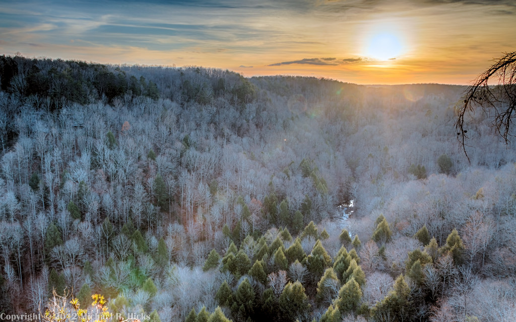
South Cumberland State Park - Stone Door Backpack Trip - on Greeter Falls Trail near Alum Gap

South Cumberland State Park - Stone Door Backpack Trip - on Greeter Falls Trail near Alum Gap
South Cumberland State Park - Stone Door Backpack Trip - on Greeter Falls Trail near Alum Gap

The fangs of a jealous cliff

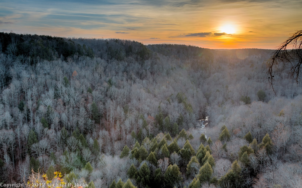
South Cumberland State Park - Stone Door Backpack Trip - on Greeter Falls Trail near Alum Gap

South Cumberland State Park - Stone Door Backpack Trip - on Greeter Falls Trail near Alum Gap

South Cumberland State Park - Stone Door Backpack Trip - on Greeter Falls Trail near Alum Gap

South Cumberland State Park - Stone Door Backpack Trip - on Greeter Falls Trail near Alum Gap

South Cumberland State Park - Stone Door Backpack Trip - on Greeter Falls Trail near Alum Gap

South Cumberland State Park - Stone Door Backpack Trip - on Greeter Falls Trail near Alum Gap

South Cumberland State Park - Stone Door Backpack Trip - on Greeter Falls Trail near Alum Gap

South Cumberland State Park - Stone Door Backpack Trip - on Greeter Falls Trail near Alum Gap

South Cumberland State Park - Stone Door Backpack Trip - on Greeter Falls Trail near Alum Gap

Daytona Beach 2015

Sunset Viola

Daytona Beach July 2013
Yoder Rd, Altamont, TN アメリカ合衆国の地図
別の場所を検索
近所の場所
Frontier Rd, Altamont, TN アメリカ合衆国
Roth Point Rd, Altamont, TN アメリカ合衆国ロス・ポイント・ロード
TN-, Altamont, TN アメリカ合衆国
Stephenson Rd, Hillsboro, TN アメリカ合衆国
アメリカ合衆国 〒 テネシー州 ヒルスボーロ
Prairie Plains Rd, Hillsboro, TN アメリカ合衆国
Bains Rd, Hillsboro, TN アメリカ合衆国
Volunteer Pkwy, Manchester, TN アメリカ合衆国
Wattendorf Memorial Hwy, Tullahoma, TN アメリカ合衆国Arnold Air Force Base
アメリカ合衆国 テネシー州 アーノルド・エアー・フォース・ベース
アメリカ合衆国 テネシー州 コーフィ
Campground Rd, Manchester, TN アメリカ合衆国
Briarwood Dr, Manchester, TN アメリカ合衆国
E Fort St, Manchester, TN アメリカ合衆国Duck River Electric Membership
アメリカ合衆国 テネシー州 マンチェスター
Old Tullahoma Hwy, Manchester, TN アメリカ合衆国
Mortons Lake Rd, Manchester, TN アメリカ合衆国
Mortons Lake Rd, Manchester, TN アメリカ合衆国
Toliver Lake Rd, Manchester, TN アメリカ合衆国
最近の検索
- アメリカ合衆国 アラスカ州 レッド・ドッグ・マイン日の出日の入り時間
- Am bhf, Borken, ドイツアム・バーンホーフ日の出日の入り時間
- 4th St E, Sonoma, CA, USA日の出日の入り時間
- Oakland Ave, Williamsport, PA アメリカ合衆国日の出日の入り時間
- Via Roma, Pieranica CR, イタリアローマ通り日の出日の入り時間
- クロアチア 〒 ドゥブロブニク GradClock Tower of Dubrovnik日の出日の入り時間
- アルゼンチン チュブ州 トレリュー日の出日の入り時間
- Hartfords Bluff Cir, Mt Pleasant, SC アメリカ合衆国日の出日の入り時間
- 日本、熊本県熊本市北区日の出日の入り時間
- 中華人民共和国 福州市 平潭県 平潭島日の出日の入り時間