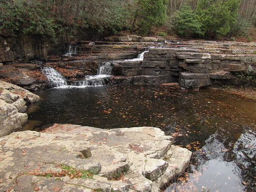
Wilderness Rd, Bland, VA アメリカ合衆国日の出日の入り時間
Location: アメリカ合衆国 > バージニア州 > ブランド > アメリカ合衆国 バージニア州 3 >
時間帯:
America/New_York
現地時間:
2025-06-30 00:02:52
経度:
-80.9627546
緯度:
37.1855783
今日の日の出時刻:
06:07:14 AM
今日の日の入時刻:
08:48:07 PM
今日の日長:
14h 40m 53s
明日の日の出時刻:
06:07:42 AM
明日の日の入時刻:
08:48:03 PM
明日の日長:
14h 40m 21s
すべて表示する
| 日付 | 日出 | 日没 | 日長 |
|---|---|---|---|
| 2025年01月01日 | 07:37:43 AM | 05:18:13 PM | 9h 40m 30s |
| 2025年01月02日 | 07:37:49 AM | 05:19:02 PM | 9h 41m 13s |
| 2025年01月03日 | 07:37:53 AM | 05:19:53 PM | 9h 42m 0s |
| 2025年01月04日 | 07:37:55 AM | 05:20:44 PM | 9h 42m 49s |
| 2025年01月05日 | 07:37:55 AM | 05:21:37 PM | 9h 43m 42s |
| 2025年01月06日 | 07:37:52 AM | 05:22:31 PM | 9h 44m 39s |
| 2025年01月07日 | 07:37:48 AM | 05:23:26 PM | 9h 45m 38s |
| 2025年01月08日 | 07:37:42 AM | 05:24:22 PM | 9h 46m 40s |
| 2025年01月09日 | 07:37:34 AM | 05:25:19 PM | 9h 47m 45s |
| 2025年01月10日 | 07:37:23 AM | 05:26:17 PM | 9h 48m 54s |
| 2025年01月11日 | 07:37:11 AM | 05:27:15 PM | 9h 50m 4s |
| 2025年01月12日 | 07:36:57 AM | 05:28:15 PM | 9h 51m 18s |
| 2025年01月13日 | 07:36:40 AM | 05:29:15 PM | 9h 52m 35s |
| 2025年01月14日 | 07:36:22 AM | 05:30:16 PM | 9h 53m 54s |
| 2025年01月15日 | 07:36:02 AM | 05:31:17 PM | 9h 55m 15s |
| 2025年01月16日 | 07:35:39 AM | 05:32:19 PM | 9h 56m 40s |
| 2025年01月17日 | 07:35:15 AM | 05:33:22 PM | 9h 58m 7s |
| 2025年01月18日 | 07:34:49 AM | 05:34:25 PM | 9h 59m 36s |
| 2025年01月19日 | 07:34:20 AM | 05:35:28 PM | 10h 1m 8s |
| 2025年01月20日 | 07:33:50 AM | 05:36:32 PM | 10h 2m 42s |
| 2025年01月21日 | 07:33:18 AM | 05:37:37 PM | 10h 4m 19s |
| 2025年01月22日 | 07:32:45 AM | 05:38:41 PM | 10h 5m 56s |
| 2025年01月23日 | 07:32:09 AM | 05:39:46 PM | 10h 7m 37s |
| 2025年01月24日 | 07:31:32 AM | 05:40:51 PM | 10h 9m 19s |
| 2025年01月25日 | 07:30:52 AM | 05:41:56 PM | 10h 11m 4s |
| 2025年01月26日 | 07:30:11 AM | 05:43:02 PM | 10h 12m 51s |
| 2025年01月27日 | 07:29:28 AM | 05:44:07 PM | 10h 14m 39s |
| 2025年01月28日 | 07:28:44 AM | 05:45:13 PM | 10h 16m 29s |
| 2025年01月29日 | 07:27:58 AM | 05:46:19 PM | 10h 18m 21s |
| 2025年01月30日 | 07:27:10 AM | 05:47:24 PM | 10h 20m 14s |
| 2025年01月31日 | 07:26:21 AM | 05:48:30 PM | 10h 22m 9s |
| 2025年02月01日 | 07:25:29 AM | 05:49:36 PM | 10h 24m 7s |
| 2025年02月02日 | 07:24:37 AM | 05:50:41 PM | 10h 26m 4s |
| 2025年02月03日 | 07:23:43 AM | 05:51:47 PM | 10h 28m 4s |
| 2025年02月04日 | 07:22:47 AM | 05:52:52 PM | 10h 30m 5s |
| 2025年02月05日 | 07:21:50 AM | 05:53:58 PM | 10h 32m 8s |
| 2025年02月06日 | 07:20:51 AM | 05:55:03 PM | 10h 34m 12s |
| 2025年02月07日 | 07:19:51 AM | 05:56:08 PM | 10h 36m 17s |
| 2025年02月08日 | 07:18:50 AM | 05:57:12 PM | 10h 38m 22s |
| 2025年02月09日 | 07:17:47 AM | 05:58:17 PM | 10h 40m 30s |
| 2025年02月10日 | 07:16:43 AM | 05:59:21 PM | 10h 42m 38s |
| 2025年02月11日 | 07:15:38 AM | 06:00:25 PM | 10h 44m 47s |
| 2025年02月12日 | 07:14:32 AM | 06:01:29 PM | 10h 46m 57s |
| 2025年02月13日 | 07:13:24 AM | 06:02:33 PM | 10h 49m 9s |
| 2025年02月14日 | 07:12:15 AM | 06:03:36 PM | 10h 51m 21s |
| 2025年02月15日 | 07:11:05 AM | 06:04:39 PM | 10h 53m 34s |
| 2025年02月16日 | 07:09:54 AM | 06:05:42 PM | 10h 55m 48s |
| 2025年02月17日 | 07:08:42 AM | 06:06:44 PM | 10h 58m 2s |
| 2025年02月18日 | 07:07:28 AM | 06:07:46 PM | 11h 0m 18s |
| 2025年02月19日 | 07:06:14 AM | 06:08:48 PM | 11h 2m 34s |
| 2025年02月20日 | 07:04:59 AM | 06:09:49 PM | 11h 4m 50s |
| 2025年02月21日 | 07:03:42 AM | 06:10:50 PM | 11h 7m 8s |
| 2025年02月22日 | 07:02:25 AM | 06:11:51 PM | 11h 9m 26s |
| 2025年02月23日 | 07:01:07 AM | 06:12:51 PM | 11h 11m 44s |
| 2025年02月24日 | 06:59:48 AM | 06:13:52 PM | 11h 14m 4s |
| 2025年02月25日 | 06:58:29 AM | 06:14:51 PM | 11h 16m 22s |
| 2025年02月26日 | 06:57:08 AM | 06:15:51 PM | 11h 18m 43s |
| 2025年02月27日 | 06:55:47 AM | 06:16:50 PM | 11h 21m 3s |
| 2025年02月28日 | 06:54:25 AM | 06:17:49 PM | 11h 23m 24s |
| 2025年03月01日 | 06:53:02 AM | 06:18:47 PM | 11h 25m 45s |
| 2025年03月02日 | 06:51:39 AM | 06:19:46 PM | 11h 28m 7s |
| 2025年03月03日 | 06:50:15 AM | 06:20:44 PM | 11h 30m 29s |
| 2025年03月04日 | 06:48:51 AM | 06:21:41 PM | 11h 32m 50s |
| 2025年03月05日 | 06:47:26 AM | 06:22:39 PM | 11h 35m 13s |
| 2025年03月06日 | 06:46:00 AM | 06:23:36 PM | 11h 37m 36s |
| 2025年03月07日 | 06:44:34 AM | 06:24:32 PM | 11h 39m 58s |
| 2025年03月08日 | 06:43:07 AM | 06:25:29 PM | 11h 42m 22s |
| 2025年03月09日 | 07:41:44 AM | 07:26:23 PM | 11h 44m 39s |
| 2025年03月10日 | 07:40:17 AM | 07:27:19 PM | 11h 47m 2s |
| 2025年03月11日 | 07:38:49 AM | 07:28:15 PM | 11h 49m 26s |
| 2025年03月12日 | 07:37:21 AM | 07:29:10 PM | 11h 51m 49s |
| 2025年03月13日 | 07:35:52 AM | 07:30:06 PM | 11h 54m 14s |
| 2025年03月14日 | 07:34:24 AM | 07:31:01 PM | 11h 56m 37s |
| 2025年03月15日 | 07:32:55 AM | 07:31:56 PM | 11h 59m 1s |
| 2025年03月16日 | 07:31:26 AM | 07:32:51 PM | 12h 1m 25s |
| 2025年03月17日 | 07:29:56 AM | 07:33:45 PM | 12h 3m 49s |
| 2025年03月18日 | 07:28:27 AM | 07:34:40 PM | 12h 6m 13s |
| 2025年03月19日 | 07:26:57 AM | 07:35:34 PM | 12h 8m 37s |
| 2025年03月20日 | 07:25:27 AM | 07:36:28 PM | 12h 11m 1s |
| 2025年03月21日 | 07:23:58 AM | 07:37:22 PM | 12h 13m 24s |
| 2025年03月22日 | 07:22:28 AM | 07:38:16 PM | 12h 15m 48s |
| 2025年03月23日 | 07:20:58 AM | 07:39:10 PM | 12h 18m 12s |
| 2025年03月24日 | 07:19:28 AM | 07:40:03 PM | 12h 20m 35s |
| 2025年03月25日 | 07:17:58 AM | 07:40:57 PM | 12h 22m 59s |
| 2025年03月26日 | 07:16:29 AM | 07:41:50 PM | 12h 25m 21s |
| 2025年03月27日 | 07:14:59 AM | 07:42:44 PM | 12h 27m 45s |
| 2025年03月28日 | 07:13:29 AM | 07:43:37 PM | 12h 30m 8s |
| 2025年03月29日 | 07:12:00 AM | 07:44:31 PM | 12h 32m 31s |
| 2025年03月30日 | 07:10:31 AM | 07:45:24 PM | 12h 34m 53s |
| 2025年03月31日 | 07:09:02 AM | 07:46:17 PM | 12h 37m 15s |
| 2025年04月01日 | 07:07:34 AM | 07:47:10 PM | 12h 39m 36s |
| 2025年04月02日 | 07:06:05 AM | 07:48:04 PM | 12h 41m 59s |
| 2025年04月03日 | 07:04:37 AM | 07:48:57 PM | 12h 44m 20s |
| 2025年04月04日 | 07:03:10 AM | 07:49:50 PM | 12h 46m 40s |
| 2025年04月05日 | 07:01:42 AM | 07:50:43 PM | 12h 49m 1s |
| 2025年04月06日 | 07:00:15 AM | 07:51:36 PM | 12h 51m 21s |
| 2025年04月07日 | 06:58:49 AM | 07:52:30 PM | 12h 53m 41s |
| 2025年04月08日 | 06:57:23 AM | 07:53:23 PM | 12h 56m 0s |
| 2025年04月09日 | 06:55:57 AM | 07:54:16 PM | 12h 58m 19s |
| 2025年04月10日 | 06:54:32 AM | 07:55:09 PM | 13h 0m 37s |
| 2025年04月11日 | 06:53:08 AM | 07:56:03 PM | 13h 2m 55s |
| 2025年04月12日 | 06:51:44 AM | 07:56:56 PM | 13h 5m 12s |
| 2025年04月13日 | 06:50:21 AM | 07:57:50 PM | 13h 7m 29s |
| 2025年04月14日 | 06:48:58 AM | 07:58:43 PM | 13h 9m 45s |
| 2025年04月15日 | 06:47:36 AM | 07:59:37 PM | 13h 12m 1s |
| 2025年04月16日 | 06:46:15 AM | 08:00:30 PM | 13h 14m 15s |
| 2025年04月17日 | 06:44:55 AM | 08:01:24 PM | 13h 16m 29s |
| 2025年04月18日 | 06:43:35 AM | 08:02:18 PM | 13h 18m 43s |
| 2025年04月19日 | 06:42:16 AM | 08:03:11 PM | 13h 20m 55s |
| 2025年04月20日 | 06:40:58 AM | 08:04:05 PM | 13h 23m 7s |
| 2025年04月21日 | 06:39:40 AM | 08:04:59 PM | 13h 25m 19s |
| 2025年04月22日 | 06:38:24 AM | 08:05:53 PM | 13h 27m 29s |
| 2025年04月23日 | 06:37:09 AM | 08:06:47 PM | 13h 29m 38s |
| 2025年04月24日 | 06:35:54 AM | 08:07:41 PM | 13h 31m 47s |
| 2025年04月25日 | 06:34:40 AM | 08:08:34 PM | 13h 33m 54s |
| 2025年04月26日 | 06:33:28 AM | 08:09:28 PM | 13h 36m 0s |
| 2025年04月27日 | 06:32:16 AM | 08:10:22 PM | 13h 38m 6s |
| 2025年04月28日 | 06:31:06 AM | 08:11:16 PM | 13h 40m 10s |
| 2025年04月29日 | 06:29:56 AM | 08:12:10 PM | 13h 42m 14s |
| 2025年04月30日 | 06:28:48 AM | 08:13:04 PM | 13h 44m 16s |
| 2025年05月01日 | 06:27:41 AM | 08:13:57 PM | 13h 46m 16s |
| 2025年05月02日 | 06:26:35 AM | 08:14:51 PM | 13h 48m 16s |
| 2025年05月03日 | 06:25:30 AM | 08:15:44 PM | 13h 50m 14s |
| 2025年05月04日 | 06:24:27 AM | 08:16:38 PM | 13h 52m 11s |
| 2025年05月05日 | 06:23:24 AM | 08:17:31 PM | 13h 54m 7s |
| 2025年05月06日 | 06:22:23 AM | 08:18:24 PM | 13h 56m 1s |
| 2025年05月07日 | 06:21:24 AM | 08:19:17 PM | 13h 57m 53s |
| 2025年05月08日 | 06:20:25 AM | 08:20:10 PM | 13h 59m 45s |
| 2025年05月09日 | 06:19:28 AM | 08:21:02 PM | 14h 1m 34s |
| 2025年05月10日 | 06:18:33 AM | 08:21:54 PM | 14h 3m 21s |
| 2025年05月11日 | 06:17:39 AM | 08:22:46 PM | 14h 5m 7s |
| 2025年05月12日 | 06:16:46 AM | 08:23:38 PM | 14h 6m 52s |
| 2025年05月13日 | 06:15:55 AM | 08:24:30 PM | 14h 8m 35s |
| 2025年05月14日 | 06:15:05 AM | 08:25:21 PM | 14h 10m 16s |
| 2025年05月15日 | 06:14:16 AM | 08:26:11 PM | 14h 11m 55s |
| 2025年05月16日 | 06:13:30 AM | 08:27:01 PM | 14h 13m 31s |
| 2025年05月17日 | 06:12:44 AM | 08:27:51 PM | 14h 15m 7s |
| 2025年05月18日 | 06:12:01 AM | 08:28:41 PM | 14h 16m 40s |
| 2025年05月19日 | 06:11:19 AM | 08:29:29 PM | 14h 18m 10s |
| 2025年05月20日 | 06:10:38 AM | 08:30:18 PM | 14h 19m 40s |
| 2025年05月21日 | 06:10:00 AM | 08:31:05 PM | 14h 21m 5s |
| 2025年05月22日 | 06:09:22 AM | 08:31:52 PM | 14h 22m 30s |
| 2025年05月23日 | 06:08:47 AM | 08:32:39 PM | 14h 23m 52s |
| 2025年05月24日 | 06:08:13 AM | 08:33:25 PM | 14h 25m 12s |
| 2025年05月25日 | 06:07:41 AM | 08:34:10 PM | 14h 26m 29s |
| 2025年05月26日 | 06:07:11 AM | 08:34:54 PM | 14h 27m 43s |
| 2025年05月27日 | 06:06:42 AM | 08:35:37 PM | 14h 28m 55s |
| 2025年05月28日 | 06:06:15 AM | 08:36:20 PM | 14h 30m 5s |
| 2025年05月29日 | 06:05:50 AM | 08:37:02 PM | 14h 31m 12s |
| 2025年05月30日 | 06:05:27 AM | 08:37:43 PM | 14h 32m 16s |
| 2025年05月31日 | 06:05:05 AM | 08:38:22 PM | 14h 33m 17s |
| 2025年06月01日 | 06:04:45 AM | 08:39:01 PM | 14h 34m 16s |
| 2025年06月02日 | 06:04:27 AM | 08:39:39 PM | 14h 35m 12s |
| 2025年06月03日 | 06:04:10 AM | 08:40:16 PM | 14h 36m 6s |
| 2025年06月04日 | 06:03:56 AM | 08:40:52 PM | 14h 36m 56s |
| 2025年06月05日 | 06:03:43 AM | 08:41:26 PM | 14h 37m 43s |
| 2025年06月06日 | 06:03:32 AM | 08:42:00 PM | 14h 38m 28s |
| 2025年06月07日 | 06:03:23 AM | 08:42:32 PM | 14h 39m 9s |
| 2025年06月08日 | 06:03:15 AM | 08:43:03 PM | 14h 39m 48s |
| 2025年06月09日 | 06:03:09 AM | 08:43:33 PM | 14h 40m 24s |
| 2025年06月10日 | 06:03:05 AM | 08:44:01 PM | 14h 40m 56s |
| 2025年06月11日 | 06:03:03 AM | 08:44:28 PM | 14h 41m 25s |
| 2025年06月12日 | 06:03:03 AM | 08:44:54 PM | 14h 41m 51s |
| 2025年06月13日 | 06:03:04 AM | 08:45:18 PM | 14h 42m 14s |
| 2025年06月14日 | 06:03:07 AM | 08:45:41 PM | 14h 42m 34s |
| 2025年06月15日 | 06:03:11 AM | 08:46:02 PM | 14h 42m 51s |
| 2025年06月16日 | 06:03:18 AM | 08:46:22 PM | 14h 43m 4s |
| 2025年06月17日 | 06:03:25 AM | 08:46:40 PM | 14h 43m 15s |
| 2025年06月18日 | 06:03:35 AM | 08:46:56 PM | 14h 43m 21s |
| 2025年06月19日 | 06:03:46 AM | 08:47:11 PM | 14h 43m 25s |
| 2025年06月20日 | 06:03:59 AM | 08:47:25 PM | 14h 43m 26s |
| 2025年06月21日 | 06:04:13 AM | 08:47:37 PM | 14h 43m 24s |
| 2025年06月22日 | 06:04:29 AM | 08:47:47 PM | 14h 43m 18s |
| 2025年06月23日 | 06:04:46 AM | 08:47:55 PM | 14h 43m 9s |
| 2025年06月24日 | 06:05:05 AM | 08:48:02 PM | 14h 42m 57s |
| 2025年06月25日 | 06:05:26 AM | 08:48:07 PM | 14h 42m 41s |
| 2025年06月26日 | 06:05:47 AM | 08:48:10 PM | 14h 42m 23s |
| 2025年06月27日 | 06:06:10 AM | 08:48:12 PM | 14h 42m 2s |
| 2025年06月28日 | 06:06:35 AM | 08:48:11 PM | 14h 41m 36s |
| 2025年06月29日 | 06:07:01 AM | 08:48:09 PM | 14h 41m 8s |
| 2025年06月30日 | 06:07:28 AM | 08:48:05 PM | 14h 40m 37s |
| 2025年07月01日 | 06:07:56 AM | 08:48:00 PM | 14h 40m 4s |
| 2025年07月02日 | 06:08:26 AM | 08:47:52 PM | 14h 39m 26s |
| 2025年07月03日 | 06:08:57 AM | 08:47:43 PM | 14h 38m 46s |
| 2025年07月04日 | 06:09:28 AM | 08:47:32 PM | 14h 38m 4s |
| 2025年07月05日 | 06:10:02 AM | 08:47:19 PM | 14h 37m 17s |
| 2025年07月06日 | 06:10:36 AM | 08:47:04 PM | 14h 36m 28s |
| 2025年07月07日 | 06:11:11 AM | 08:46:48 PM | 14h 35m 37s |
| 2025年07月08日 | 06:11:47 AM | 08:46:29 PM | 14h 34m 42s |
| 2025年07月09日 | 06:12:24 AM | 08:46:09 PM | 14h 33m 45s |
| 2025年07月10日 | 06:13:02 AM | 08:45:47 PM | 14h 32m 45s |
| 2025年07月11日 | 06:13:41 AM | 08:45:24 PM | 14h 31m 43s |
| 2025年07月12日 | 06:14:21 AM | 08:44:58 PM | 14h 30m 37s |
| 2025年07月13日 | 06:15:02 AM | 08:44:31 PM | 14h 29m 29s |
| 2025年07月14日 | 06:15:43 AM | 08:44:02 PM | 14h 28m 19s |
| 2025年07月15日 | 06:16:25 AM | 08:43:31 PM | 14h 27m 6s |
| 2025年07月16日 | 06:17:08 AM | 08:42:58 PM | 14h 25m 50s |
| 2025年07月17日 | 06:17:51 AM | 08:42:24 PM | 14h 24m 33s |
| 2025年07月18日 | 06:18:36 AM | 08:41:48 PM | 14h 23m 12s |
| 2025年07月19日 | 06:19:20 AM | 08:41:10 PM | 14h 21m 50s |
| 2025年07月20日 | 06:20:06 AM | 08:40:31 PM | 14h 20m 25s |
| 2025年07月21日 | 06:20:51 AM | 08:39:50 PM | 14h 18m 59s |
| 2025年07月22日 | 06:21:38 AM | 08:39:07 PM | 14h 17m 29s |
| 2025年07月23日 | 06:22:24 AM | 08:38:23 PM | 14h 15m 59s |
| 2025年07月24日 | 06:23:11 AM | 08:37:37 PM | 14h 14m 26s |
| 2025年07月25日 | 06:23:59 AM | 08:36:50 PM | 14h 12m 51s |
| 2025年07月26日 | 06:24:47 AM | 08:36:00 PM | 14h 11m 13s |
| 2025年07月27日 | 06:25:35 AM | 08:35:10 PM | 14h 9m 35s |
| 2025年07月28日 | 06:26:24 AM | 08:34:18 PM | 14h 7m 54s |
| 2025年07月29日 | 06:27:12 AM | 08:33:24 PM | 14h 6m 12s |
| 2025年07月30日 | 06:28:02 AM | 08:32:29 PM | 14h 4m 27s |
| 2025年07月31日 | 06:28:51 AM | 08:31:33 PM | 14h 2m 42s |
| 2025年08月01日 | 06:29:40 AM | 08:30:35 PM | 14h 0m 55s |
| 2025年08月02日 | 06:30:30 AM | 08:29:35 PM | 13h 59m 5s |
| 2025年08月03日 | 06:31:20 AM | 08:28:35 PM | 13h 57m 15s |
| 2025年08月04日 | 06:32:10 AM | 08:27:33 PM | 13h 55m 23s |
| 2025年08月05日 | 06:33:00 AM | 08:26:29 PM | 13h 53m 29s |
| 2025年08月06日 | 06:33:50 AM | 08:25:25 PM | 13h 51m 35s |
| 2025年08月07日 | 06:34:40 AM | 08:24:19 PM | 13h 49m 39s |
| 2025年08月08日 | 06:35:30 AM | 08:23:12 PM | 13h 47m 42s |
| 2025年08月09日 | 06:36:21 AM | 08:22:04 PM | 13h 45m 43s |
| 2025年08月10日 | 06:37:11 AM | 08:20:54 PM | 13h 43m 43s |
| 2025年08月11日 | 06:38:01 AM | 08:19:44 PM | 13h 41m 43s |
| 2025年08月12日 | 06:38:52 AM | 08:18:32 PM | 13h 39m 40s |
| 2025年08月13日 | 06:39:42 AM | 08:17:19 PM | 13h 37m 37s |
| 2025年08月14日 | 06:40:32 AM | 08:16:05 PM | 13h 35m 33s |
| 2025年08月15日 | 06:41:23 AM | 08:14:51 PM | 13h 33m 28s |
| 2025年08月16日 | 06:42:13 AM | 08:13:35 PM | 13h 31m 22s |
| 2025年08月17日 | 06:43:03 AM | 08:12:18 PM | 13h 29m 15s |
| 2025年08月18日 | 06:43:53 AM | 08:11:00 PM | 13h 27m 7s |
| 2025年08月19日 | 06:44:43 AM | 08:09:42 PM | 13h 24m 59s |
| 2025年08月20日 | 06:45:33 AM | 08:08:22 PM | 13h 22m 49s |
| 2025年08月21日 | 06:46:23 AM | 08:07:02 PM | 13h 20m 39s |
| 2025年08月22日 | 06:47:13 AM | 08:05:41 PM | 13h 18m 28s |
| 2025年08月23日 | 06:48:03 AM | 08:04:19 PM | 13h 16m 16s |
| 2025年08月24日 | 06:48:52 AM | 08:02:56 PM | 13h 14m 4s |
| 2025年08月25日 | 06:49:42 AM | 08:01:33 PM | 13h 11m 51s |
| 2025年08月26日 | 06:50:31 AM | 08:00:09 PM | 13h 9m 38s |
| 2025年08月27日 | 06:51:21 AM | 07:58:44 PM | 13h 7m 23s |
| 2025年08月28日 | 06:52:10 AM | 07:57:18 PM | 13h 5m 8s |
| 2025年08月29日 | 06:53:00 AM | 07:55:52 PM | 13h 2m 52s |
| 2025年08月30日 | 06:53:49 AM | 07:54:26 PM | 13h 0m 37s |
| 2025年08月31日 | 06:54:38 AM | 07:52:59 PM | 12h 58m 21s |
| 2025年09月01日 | 06:55:27 AM | 07:51:31 PM | 12h 56m 4s |
| 2025年09月02日 | 06:56:16 AM | 07:50:03 PM | 12h 53m 47s |
| 2025年09月03日 | 06:57:05 AM | 07:48:34 PM | 12h 51m 29s |
| 2025年09月04日 | 06:57:54 AM | 07:47:05 PM | 12h 49m 11s |
| 2025年09月05日 | 06:58:43 AM | 07:45:35 PM | 12h 46m 52s |
| 2025年09月06日 | 06:59:32 AM | 07:44:06 PM | 12h 44m 34s |
| 2025年09月07日 | 07:00:21 AM | 07:42:35 PM | 12h 42m 14s |
| 2025年09月08日 | 07:01:10 AM | 07:41:05 PM | 12h 39m 55s |
| 2025年09月09日 | 07:01:59 AM | 07:39:34 PM | 12h 37m 35s |
| 2025年09月10日 | 07:02:47 AM | 07:38:03 PM | 12h 35m 16s |
| 2025年09月11日 | 07:03:36 AM | 07:36:32 PM | 12h 32m 56s |
| 2025年09月12日 | 07:04:25 AM | 07:35:00 PM | 12h 30m 35s |
| 2025年09月13日 | 07:05:14 AM | 07:33:29 PM | 12h 28m 15s |
| 2025年09月14日 | 07:06:03 AM | 07:31:57 PM | 12h 25m 54s |
| 2025年09月15日 | 07:06:52 AM | 07:30:25 PM | 12h 23m 33s |
| 2025年09月16日 | 07:07:41 AM | 07:28:53 PM | 12h 21m 12s |
| 2025年09月17日 | 07:08:30 AM | 07:27:21 PM | 12h 18m 51s |
| 2025年09月18日 | 07:09:20 AM | 07:25:49 PM | 12h 16m 29s |
| 2025年09月19日 | 07:10:09 AM | 07:24:16 PM | 12h 14m 7s |
| 2025年09月20日 | 07:10:59 AM | 07:22:44 PM | 12h 11m 45s |
| 2025年09月21日 | 07:11:48 AM | 07:21:12 PM | 12h 9m 24s |
| 2025年09月22日 | 07:12:38 AM | 07:19:40 PM | 12h 7m 2s |
| 2025年09月23日 | 07:13:28 AM | 07:18:09 PM | 12h 4m 41s |
| 2025年09月24日 | 07:14:18 AM | 07:16:37 PM | 12h 2m 19s |
| 2025年09月25日 | 07:15:08 AM | 07:15:05 PM | 11h 59m 57s |
| 2025年09月26日 | 07:15:59 AM | 07:13:34 PM | 11h 57m 35s |
| 2025年09月27日 | 07:16:49 AM | 07:12:03 PM | 11h 55m 14s |
| 2025年09月28日 | 07:17:40 AM | 07:10:32 PM | 11h 52m 52s |
| 2025年09月29日 | 07:18:31 AM | 07:09:02 PM | 11h 50m 31s |
| 2025年09月30日 | 07:19:22 AM | 07:07:32 PM | 11h 48m 10s |
| 2025年10月01日 | 07:20:14 AM | 07:06:02 PM | 11h 45m 48s |
| 2025年10月02日 | 07:21:06 AM | 07:04:32 PM | 11h 43m 26s |
| 2025年10月03日 | 07:21:58 AM | 07:03:03 PM | 11h 41m 5s |
| 2025年10月04日 | 07:22:50 AM | 07:01:35 PM | 11h 38m 45s |
| 2025年10月05日 | 07:23:43 AM | 07:00:07 PM | 11h 36m 24s |
| 2025年10月06日 | 07:24:35 AM | 06:58:39 PM | 11h 34m 4s |
| 2025年10月07日 | 07:25:29 AM | 06:57:12 PM | 11h 31m 43s |
| 2025年10月08日 | 07:26:22 AM | 06:55:46 PM | 11h 29m 24s |
| 2025年10月09日 | 07:27:16 AM | 06:54:20 PM | 11h 27m 4s |
| 2025年10月10日 | 07:28:10 AM | 06:52:55 PM | 11h 24m 45s |
| 2025年10月11日 | 07:29:04 AM | 06:51:30 PM | 11h 22m 26s |
| 2025年10月12日 | 07:29:59 AM | 06:50:06 PM | 11h 20m 7s |
| 2025年10月13日 | 07:30:54 AM | 06:48:43 PM | 11h 17m 49s |
| 2025年10月14日 | 07:31:49 AM | 06:47:21 PM | 11h 15m 32s |
| 2025年10月15日 | 07:32:45 AM | 06:45:59 PM | 11h 13m 14s |
| 2025年10月16日 | 07:33:41 AM | 06:44:38 PM | 11h 10m 57s |
| 2025年10月17日 | 07:34:38 AM | 06:43:18 PM | 11h 8m 40s |
| 2025年10月18日 | 07:35:35 AM | 06:41:59 PM | 11h 6m 24s |
| 2025年10月19日 | 07:36:32 AM | 06:40:41 PM | 11h 4m 9s |
| 2025年10月20日 | 07:37:29 AM | 06:39:24 PM | 11h 1m 55s |
| 2025年10月21日 | 07:38:27 AM | 06:38:08 PM | 10h 59m 41s |
| 2025年10月22日 | 07:39:25 AM | 06:36:52 PM | 10h 57m 27s |
| 2025年10月23日 | 07:40:24 AM | 06:35:38 PM | 10h 55m 14s |
| 2025年10月24日 | 07:41:23 AM | 06:34:25 PM | 10h 53m 2s |
| 2025年10月25日 | 07:42:22 AM | 06:33:13 PM | 10h 50m 51s |
| 2025年10月26日 | 07:43:21 AM | 06:32:03 PM | 10h 48m 42s |
| 2025年10月27日 | 07:44:21 AM | 06:30:53 PM | 10h 46m 32s |
| 2025年10月28日 | 07:45:21 AM | 06:29:45 PM | 10h 44m 24s |
| 2025年10月29日 | 07:46:22 AM | 06:28:37 PM | 10h 42m 15s |
| 2025年10月30日 | 07:47:22 AM | 06:27:32 PM | 10h 40m 10s |
| 2025年10月31日 | 07:48:23 AM | 06:26:27 PM | 10h 38m 4s |
| 2025年11月01日 | 07:49:25 AM | 06:25:24 PM | 10h 35m 59s |
| 2025年11月02日 | 06:50:29 AM | 05:24:19 PM | 10h 33m 50s |
| 2025年11月03日 | 06:51:30 AM | 05:23:19 PM | 10h 31m 49s |
| 2025年11月04日 | 06:52:32 AM | 05:22:20 PM | 10h 29m 48s |
| 2025年11月05日 | 06:53:34 AM | 05:21:23 PM | 10h 27m 49s |
| 2025年11月06日 | 06:54:37 AM | 05:20:27 PM | 10h 25m 50s |
| 2025年11月07日 | 06:55:39 AM | 05:19:32 PM | 10h 23m 53s |
| 2025年11月08日 | 06:56:42 AM | 05:18:40 PM | 10h 21m 58s |
| 2025年11月09日 | 06:57:44 AM | 05:17:48 PM | 10h 20m 4s |
| 2025年11月10日 | 06:58:47 AM | 05:16:59 PM | 10h 18m 12s |
| 2025年11月11日 | 06:59:50 AM | 05:16:11 PM | 10h 16m 21s |
| 2025年11月12日 | 07:00:52 AM | 05:15:25 PM | 10h 14m 33s |
| 2025年11月13日 | 07:01:55 AM | 05:14:40 PM | 10h 12m 45s |
| 2025年11月14日 | 07:02:58 AM | 05:13:57 PM | 10h 10m 59s |
| 2025年11月15日 | 07:04:00 AM | 05:13:16 PM | 10h 9m 16s |
| 2025年11月16日 | 07:05:03 AM | 05:12:37 PM | 10h 7m 34s |
| 2025年11月17日 | 07:06:05 AM | 05:12:00 PM | 10h 5m 55s |
| 2025年11月18日 | 07:07:07 AM | 05:11:25 PM | 10h 4m 18s |
| 2025年11月19日 | 07:08:09 AM | 05:10:51 PM | 10h 2m 42s |
| 2025年11月20日 | 07:09:10 AM | 05:10:19 PM | 10h 1m 9s |
| 2025年11月21日 | 07:10:12 AM | 05:09:49 PM | 9h 59m 37s |
| 2025年11月22日 | 07:11:13 AM | 05:09:22 PM | 9h 58m 9s |
| 2025年11月23日 | 07:12:13 AM | 05:08:56 PM | 9h 56m 43s |
| 2025年11月24日 | 07:13:13 AM | 05:08:32 PM | 9h 55m 19s |
| 2025年11月25日 | 07:14:12 AM | 05:08:10 PM | 9h 53m 58s |
| 2025年11月26日 | 07:15:11 AM | 05:07:50 PM | 9h 52m 39s |
| 2025年11月27日 | 07:16:10 AM | 05:07:32 PM | 9h 51m 22s |
| 2025年11月28日 | 07:17:07 AM | 05:07:16 PM | 9h 50m 9s |
| 2025年11月29日 | 07:18:04 AM | 05:07:03 PM | 9h 48m 59s |
| 2025年11月30日 | 07:19:01 AM | 05:06:51 PM | 9h 47m 50s |
| 2025年12月01日 | 07:19:56 AM | 05:06:41 PM | 9h 46m 45s |
| 2025年12月02日 | 07:20:51 AM | 05:06:34 PM | 9h 45m 43s |
| 2025年12月03日 | 07:21:44 AM | 05:06:28 PM | 9h 44m 44s |
| 2025年12月04日 | 07:22:37 AM | 05:06:25 PM | 9h 43m 48s |
| 2025年12月05日 | 07:23:29 AM | 05:06:24 PM | 9h 42m 55s |
| 2025年12月06日 | 07:24:19 AM | 05:06:24 PM | 9h 42m 5s |
| 2025年12月07日 | 07:25:09 AM | 05:06:27 PM | 9h 41m 18s |
| 2025年12月08日 | 07:25:57 AM | 05:06:32 PM | 9h 40m 35s |
| 2025年12月09日 | 07:26:45 AM | 05:06:39 PM | 9h 39m 54s |
| 2025年12月10日 | 07:27:31 AM | 05:06:48 PM | 9h 39m 17s |
| 2025年12月11日 | 07:28:15 AM | 05:06:59 PM | 9h 38m 44s |
| 2025年12月12日 | 07:28:59 AM | 05:07:12 PM | 9h 38m 13s |
| 2025年12月13日 | 07:29:41 AM | 05:07:28 PM | 9h 37m 47s |
| 2025年12月14日 | 07:30:21 AM | 05:07:45 PM | 9h 37m 24s |
| 2025年12月15日 | 07:31:00 AM | 05:08:04 PM | 9h 37m 4s |
| 2025年12月16日 | 07:31:38 AM | 05:08:25 PM | 9h 36m 47s |
| 2025年12月17日 | 07:32:14 AM | 05:08:48 PM | 9h 36m 34s |
| 2025年12月18日 | 07:32:48 AM | 05:09:13 PM | 9h 36m 25s |
| 2025年12月19日 | 07:33:21 AM | 05:09:39 PM | 9h 36m 18s |
| 2025年12月20日 | 07:33:52 AM | 05:10:08 PM | 9h 36m 16s |
| 2025年12月21日 | 07:34:21 AM | 05:10:38 PM | 9h 36m 17s |
| 2025年12月22日 | 07:34:49 AM | 05:11:10 PM | 9h 36m 21s |
| 2025年12月23日 | 07:35:14 AM | 05:11:44 PM | 9h 36m 30s |
| 2025年12月24日 | 07:35:38 AM | 05:12:20 PM | 9h 36m 42s |
| 2025年12月25日 | 07:36:00 AM | 05:12:57 PM | 9h 36m 57s |
| 2025年12月26日 | 07:36:20 AM | 05:13:36 PM | 9h 37m 16s |
| 2025年12月27日 | 07:36:39 AM | 05:14:17 PM | 9h 37m 38s |
| 2025年12月28日 | 07:36:55 AM | 05:14:59 PM | 9h 38m 4s |
| 2025年12月29日 | 07:37:10 AM | 05:15:42 PM | 9h 38m 32s |
| 2025年12月30日 | 07:37:22 AM | 05:16:27 PM | 9h 39m 5s |
| 2025年12月31日 | 07:37:32 AM | 05:17:13 PM | 9h 39m 41s |
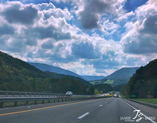
写真
Wilderness Rd, Bland, VA アメリカ合衆国の地図
別の場所を検索
近所の場所
アメリカ合衆国 バージニア州 3
E Blue Grass Trail, Bland, VA アメリカ合衆国
Wolf Creek Hwy, Narrows, VA アメリカ合衆国
Little Creek Rd, Dublin, VA アメリカ合衆国
アメリカ合衆国 バージニア州 2
Shady Branch Cir, Narrows, VA アメリカ合衆国
Walkers Creek Rd, Bland, VA アメリカ合衆国
4, VA, アメリカ合衆国
Southview Ln, Bland, VA アメリカ合衆国
Southview Ln, Bland, VA アメリカ合衆国
N Scenic Hwy, Bastian, VA アメリカ合衆国
アメリカ合衆国 〒 バージニア州 ロッキー・ギャップ
アメリカ合衆国 〒 バージニア州 ヒクスビル
アメリカ合衆国 〒 バージニア州 ブランド
Jackson St, Bland, VA アメリカ合衆国Mountain Sky Properties, Inc.
Laurel Fork Rd, Rocky Gap, VA アメリカ合衆国
アメリカ合衆国 バージニア州 ブランド
N Scenic Hwy, Bastian, VA アメリカ合衆国
アメリカ合衆国 〒 バージニア州 バスティアン
E River Mountain Rd, Rocky Gap, VA アメリカ合衆国
最近の検索
- アメリカ合衆国 アラスカ州 レッド・ドッグ・マイン日の出日の入り時間
- Am bhf, Borken, ドイツアム・バーンホーフ日の出日の入り時間
- 4th St E, Sonoma, CA, USA日の出日の入り時間
- Oakland Ave, Williamsport, PA アメリカ合衆国日の出日の入り時間
- Via Roma, Pieranica CR, イタリアローマ通り日の出日の入り時間
- クロアチア 〒 ドゥブロブニク GradClock Tower of Dubrovnik日の出日の入り時間
- アルゼンチン チュブ州 トレリュー日の出日の入り時間
- Hartfords Bluff Cir, Mt Pleasant, SC アメリカ合衆国日の出日の入り時間
- 日本、熊本県熊本市北区日の出日の入り時間
- 中華人民共和国 福州市 平潭県 平潭島日の出日の入り時間

