Wildcat Way, California アメリカ合衆国ワイルドキャット・ウェイ日の出日の入り時間
Location: アメリカ合衆国 > カリフォルニア州 > アマドール > アメリカ合衆国 〒 カリフォルニア州 ボルケーノ >
時間帯:
America/Los_Angeles
現地時間:
2025-06-22 14:33:53
経度:
-120.6225822
緯度:
38.4792413
今日の日の出時刻:
05:39:22 AM
今日の日の入時刻:
08:30:26 PM
今日の日長:
14h 51m 4s
明日の日の出時刻:
05:39:40 AM
明日の日の入時刻:
08:30:33 PM
明日の日長:
14h 50m 53s
すべて表示する
| 日付 | 日出 | 日没 | 日長 |
|---|---|---|---|
| 2025年01月01日 | 07:19:58 AM | 04:53:28 PM | 9h 33m 30s |
| 2025年01月02日 | 07:20:02 AM | 04:54:18 PM | 9h 34m 16s |
| 2025年01月03日 | 07:20:04 AM | 04:55:10 PM | 9h 35m 6s |
| 2025年01月04日 | 07:20:05 AM | 04:56:04 PM | 9h 35m 59s |
| 2025年01月05日 | 07:20:03 AM | 04:56:58 PM | 9h 36m 55s |
| 2025年01月06日 | 07:19:58 AM | 04:57:54 PM | 9h 37m 56s |
| 2025年01月07日 | 07:19:52 AM | 04:58:51 PM | 9h 38m 59s |
| 2025年01月08日 | 07:19:44 AM | 04:59:49 PM | 9h 40m 5s |
| 2025年01月09日 | 07:19:33 AM | 05:00:47 PM | 9h 41m 14s |
| 2025年01月10日 | 07:19:21 AM | 05:01:47 PM | 9h 42m 26s |
| 2025年01月11日 | 07:19:06 AM | 05:02:48 PM | 9h 43m 42s |
| 2025年01月12日 | 07:18:49 AM | 05:03:49 PM | 9h 45m 0s |
| 2025年01月13日 | 07:18:30 AM | 05:04:52 PM | 9h 46m 22s |
| 2025年01月14日 | 07:18:09 AM | 05:05:55 PM | 9h 47m 46s |
| 2025年01月15日 | 07:17:46 AM | 05:06:59 PM | 9h 49m 13s |
| 2025年01月16日 | 07:17:21 AM | 05:08:03 PM | 9h 50m 42s |
| 2025年01月17日 | 07:16:54 AM | 05:09:08 PM | 9h 52m 14s |
| 2025年01月18日 | 07:16:25 AM | 05:10:13 PM | 9h 53m 48s |
| 2025年01月19日 | 07:15:54 AM | 05:11:19 PM | 9h 55m 25s |
| 2025年01月20日 | 07:15:21 AM | 05:12:26 PM | 9h 57m 5s |
| 2025年01月21日 | 07:14:46 AM | 05:13:33 PM | 9h 58m 47s |
| 2025年01月22日 | 07:14:10 AM | 05:14:40 PM | 10h 0m 30s |
| 2025年01月23日 | 07:13:31 AM | 05:15:47 PM | 10h 2m 16s |
| 2025年01月24日 | 07:12:50 AM | 05:16:55 PM | 10h 4m 5s |
| 2025年01月25日 | 07:12:08 AM | 05:18:03 PM | 10h 5m 55s |
| 2025年01月26日 | 07:11:24 AM | 05:19:11 PM | 10h 7m 47s |
| 2025年01月27日 | 07:10:38 AM | 05:20:20 PM | 10h 9m 42s |
| 2025年01月28日 | 07:09:50 AM | 05:21:28 PM | 10h 11m 38s |
| 2025年01月29日 | 07:09:01 AM | 05:22:37 PM | 10h 13m 36s |
| 2025年01月30日 | 07:08:10 AM | 05:23:45 PM | 10h 15m 35s |
| 2025年01月31日 | 07:07:17 AM | 05:24:54 PM | 10h 17m 37s |
| 2025年02月01日 | 07:06:23 AM | 05:26:03 PM | 10h 19m 40s |
| 2025年02月02日 | 07:05:27 AM | 05:27:11 PM | 10h 21m 44s |
| 2025年02月03日 | 07:04:29 AM | 05:28:20 PM | 10h 23m 51s |
| 2025年02月04日 | 07:03:30 AM | 05:29:28 PM | 10h 25m 58s |
| 2025年02月05日 | 07:02:30 AM | 05:30:36 PM | 10h 28m 6s |
| 2025年02月06日 | 07:01:28 AM | 05:31:45 PM | 10h 30m 17s |
| 2025年02月07日 | 07:00:24 AM | 05:32:53 PM | 10h 32m 29s |
| 2025年02月08日 | 06:59:19 AM | 05:34:00 PM | 10h 34m 41s |
| 2025年02月09日 | 06:58:13 AM | 05:35:08 PM | 10h 36m 55s |
| 2025年02月10日 | 06:57:06 AM | 05:36:15 PM | 10h 39m 9s |
| 2025年02月11日 | 06:55:57 AM | 05:37:23 PM | 10h 41m 26s |
| 2025年02月12日 | 06:54:47 AM | 05:38:30 PM | 10h 43m 43s |
| 2025年02月13日 | 06:53:36 AM | 05:39:36 PM | 10h 46m 0s |
| 2025年02月14日 | 06:52:23 AM | 05:40:43 PM | 10h 48m 20s |
| 2025年02月15日 | 06:51:10 AM | 05:41:49 PM | 10h 50m 39s |
| 2025年02月16日 | 06:49:55 AM | 05:42:55 PM | 10h 53m 0s |
| 2025年02月17日 | 06:48:39 AM | 05:44:00 PM | 10h 55m 21s |
| 2025年02月18日 | 06:47:22 AM | 05:45:06 PM | 10h 57m 44s |
| 2025年02月19日 | 06:46:04 AM | 05:46:11 PM | 11h 0m 7s |
| 2025年02月20日 | 06:44:46 AM | 05:47:15 PM | 11h 2m 29s |
| 2025年02月21日 | 06:43:26 AM | 05:48:20 PM | 11h 4m 54s |
| 2025年02月22日 | 06:42:05 AM | 05:49:24 PM | 11h 7m 19s |
| 2025年02月23日 | 06:40:44 AM | 05:50:28 PM | 11h 9m 44s |
| 2025年02月24日 | 06:39:21 AM | 05:51:31 PM | 11h 12m 10s |
| 2025年02月25日 | 06:37:58 AM | 05:52:34 PM | 11h 14m 36s |
| 2025年02月26日 | 06:36:34 AM | 05:53:37 PM | 11h 17m 3s |
| 2025年02月27日 | 06:35:09 AM | 05:54:39 PM | 11h 19m 30s |
| 2025年02月28日 | 06:33:44 AM | 05:55:42 PM | 11h 21m 58s |
| 2025年03月01日 | 06:32:17 AM | 05:56:43 PM | 11h 24m 26s |
| 2025年03月02日 | 06:30:51 AM | 05:57:45 PM | 11h 26m 54s |
| 2025年03月03日 | 06:29:23 AM | 05:58:46 PM | 11h 29m 23s |
| 2025年03月04日 | 06:27:55 AM | 05:59:47 PM | 11h 31m 52s |
| 2025年03月05日 | 06:26:26 AM | 06:00:48 PM | 11h 34m 22s |
| 2025年03月06日 | 06:24:57 AM | 06:01:48 PM | 11h 36m 51s |
| 2025年03月07日 | 06:23:28 AM | 06:02:49 PM | 11h 39m 21s |
| 2025年03月08日 | 06:21:58 AM | 06:03:48 PM | 11h 41m 50s |
| 2025年03月09日 | 07:20:31 AM | 07:04:46 PM | 11h 44m 15s |
| 2025年03月10日 | 07:19:00 AM | 07:05:45 PM | 11h 46m 45s |
| 2025年03月11日 | 07:17:29 AM | 07:06:44 PM | 11h 49m 15s |
| 2025年03月12日 | 07:15:57 AM | 07:07:43 PM | 11h 51m 46s |
| 2025年03月13日 | 07:14:25 AM | 07:08:42 PM | 11h 54m 17s |
| 2025年03月14日 | 07:12:53 AM | 07:09:40 PM | 11h 56m 47s |
| 2025年03月15日 | 07:11:21 AM | 07:10:39 PM | 11h 59m 18s |
| 2025年03月16日 | 07:09:48 AM | 07:11:37 PM | 12h 1m 49s |
| 2025年03月17日 | 07:08:15 AM | 07:12:35 PM | 12h 4m 20s |
| 2025年03月18日 | 07:06:42 AM | 07:13:33 PM | 12h 6m 51s |
| 2025年03月19日 | 07:05:09 AM | 07:14:30 PM | 12h 9m 21s |
| 2025年03月20日 | 07:03:36 AM | 07:15:28 PM | 12h 11m 52s |
| 2025年03月21日 | 07:02:03 AM | 07:16:25 PM | 12h 14m 22s |
| 2025年03月22日 | 07:00:29 AM | 07:17:23 PM | 12h 16m 54s |
| 2025年03月23日 | 06:58:56 AM | 07:18:20 PM | 12h 19m 24s |
| 2025年03月24日 | 06:57:23 AM | 07:19:17 PM | 12h 21m 54s |
| 2025年03月25日 | 06:55:50 AM | 07:20:14 PM | 12h 24m 24s |
| 2025年03月26日 | 06:54:16 AM | 07:21:11 PM | 12h 26m 55s |
| 2025年03月27日 | 06:52:43 AM | 07:22:08 PM | 12h 29m 25s |
| 2025年03月28日 | 06:51:11 AM | 07:23:04 PM | 12h 31m 53s |
| 2025年03月29日 | 06:49:38 AM | 07:24:01 PM | 12h 34m 23s |
| 2025年03月30日 | 06:48:05 AM | 07:24:58 PM | 12h 36m 53s |
| 2025年03月31日 | 06:46:33 AM | 07:25:54 PM | 12h 39m 21s |
| 2025年04月01日 | 06:45:01 AM | 07:26:51 PM | 12h 41m 50s |
| 2025年04月02日 | 06:43:30 AM | 07:27:48 PM | 12h 44m 18s |
| 2025年04月03日 | 06:41:58 AM | 07:28:44 PM | 12h 46m 46s |
| 2025年04月04日 | 06:40:27 AM | 07:29:41 PM | 12h 49m 14s |
| 2025年04月05日 | 06:38:57 AM | 07:30:37 PM | 12h 51m 40s |
| 2025年04月06日 | 06:37:26 AM | 07:31:34 PM | 12h 54m 8s |
| 2025年04月07日 | 06:35:57 AM | 07:32:31 PM | 12h 56m 34s |
| 2025年04月08日 | 06:34:27 AM | 07:33:27 PM | 12h 59m 0s |
| 2025年04月09日 | 06:32:59 AM | 07:34:24 PM | 13h 1m 25s |
| 2025年04月10日 | 06:31:31 AM | 07:35:21 PM | 13h 3m 50s |
| 2025年04月11日 | 06:30:03 AM | 07:36:17 PM | 13h 6m 14s |
| 2025年04月12日 | 06:28:36 AM | 07:37:14 PM | 13h 8m 38s |
| 2025年04月13日 | 06:27:09 AM | 07:38:11 PM | 13h 11m 2s |
| 2025年04月14日 | 06:25:44 AM | 07:39:08 PM | 13h 13m 24s |
| 2025年04月15日 | 06:24:19 AM | 07:40:05 PM | 13h 15m 46s |
| 2025年04月16日 | 06:22:54 AM | 07:41:02 PM | 13h 18m 8s |
| 2025年04月17日 | 06:21:31 AM | 07:41:58 PM | 13h 20m 27s |
| 2025年04月18日 | 06:20:08 AM | 07:42:55 PM | 13h 22m 47s |
| 2025年04月19日 | 06:18:46 AM | 07:43:52 PM | 13h 25m 6s |
| 2025年04月20日 | 06:17:25 AM | 07:44:49 PM | 13h 27m 24s |
| 2025年04月21日 | 06:16:04 AM | 07:45:46 PM | 13h 29m 42s |
| 2025年04月22日 | 06:14:45 AM | 07:46:43 PM | 13h 31m 58s |
| 2025年04月23日 | 06:13:27 AM | 07:47:41 PM | 13h 34m 14s |
| 2025年04月24日 | 06:12:09 AM | 07:48:38 PM | 13h 36m 29s |
| 2025年04月25日 | 06:10:53 AM | 07:49:35 PM | 13h 38m 42s |
| 2025年04月26日 | 06:09:37 AM | 07:50:32 PM | 13h 40m 55s |
| 2025年04月27日 | 06:08:23 AM | 07:51:29 PM | 13h 43m 6s |
| 2025年04月28日 | 06:07:09 AM | 07:52:25 PM | 13h 45m 16s |
| 2025年04月29日 | 06:05:57 AM | 07:53:22 PM | 13h 47m 25s |
| 2025年04月30日 | 06:04:46 AM | 07:54:19 PM | 13h 49m 33s |
| 2025年05月01日 | 06:03:36 AM | 07:55:16 PM | 13h 51m 40s |
| 2025年05月02日 | 06:02:27 AM | 07:56:12 PM | 13h 53m 45s |
| 2025年05月03日 | 06:01:20 AM | 07:57:09 PM | 13h 55m 49s |
| 2025年05月04日 | 06:00:14 AM | 07:58:05 PM | 13h 57m 51s |
| 2025年05月05日 | 05:59:09 AM | 07:59:01 PM | 13h 59m 52s |
| 2025年05月06日 | 05:58:05 AM | 07:59:57 PM | 14h 1m 52s |
| 2025年05月07日 | 05:57:03 AM | 08:00:53 PM | 14h 3m 50s |
| 2025年05月08日 | 05:56:02 AM | 08:01:48 PM | 14h 5m 46s |
| 2025年05月09日 | 05:55:03 AM | 08:02:44 PM | 14h 7m 41s |
| 2025年05月10日 | 05:54:05 AM | 08:03:39 PM | 14h 9m 34s |
| 2025年05月11日 | 05:53:08 AM | 08:04:33 PM | 14h 11m 25s |
| 2025年05月12日 | 05:52:13 AM | 08:05:28 PM | 14h 13m 15s |
| 2025年05月13日 | 05:51:19 AM | 08:06:22 PM | 14h 15m 3s |
| 2025年05月14日 | 05:50:27 AM | 08:07:15 PM | 14h 16m 48s |
| 2025年05月15日 | 05:49:37 AM | 08:08:08 PM | 14h 18m 31s |
| 2025年05月16日 | 05:48:48 AM | 08:09:01 PM | 14h 20m 13s |
| 2025年05月17日 | 05:48:01 AM | 08:09:53 PM | 14h 21m 52s |
| 2025年05月18日 | 05:47:15 AM | 08:10:45 PM | 14h 23m 30s |
| 2025年05月19日 | 05:46:31 AM | 08:11:36 PM | 14h 25m 5s |
| 2025年05月20日 | 05:45:49 AM | 08:12:26 PM | 14h 26m 37s |
| 2025年05月21日 | 05:45:08 AM | 08:13:16 PM | 14h 28m 8s |
| 2025年05月22日 | 05:44:29 AM | 08:14:05 PM | 14h 29m 36s |
| 2025年05月23日 | 05:43:52 AM | 08:14:53 PM | 14h 31m 1s |
| 2025年05月24日 | 05:43:16 AM | 08:15:41 PM | 14h 32m 25s |
| 2025年05月25日 | 05:42:43 AM | 08:16:28 PM | 14h 33m 45s |
| 2025年05月26日 | 05:42:11 AM | 08:17:14 PM | 14h 35m 3s |
| 2025年05月27日 | 05:41:41 AM | 08:17:59 PM | 14h 36m 18s |
| 2025年05月28日 | 05:41:12 AM | 08:18:43 PM | 14h 37m 31s |
| 2025年05月29日 | 05:40:46 AM | 08:19:27 PM | 14h 38m 41s |
| 2025年05月30日 | 05:40:21 AM | 08:20:09 PM | 14h 39m 48s |
| 2025年05月31日 | 05:39:58 AM | 08:20:50 PM | 14h 40m 52s |
| 2025年06月01日 | 05:39:37 AM | 08:21:31 PM | 14h 41m 54s |
| 2025年06月02日 | 05:39:18 AM | 08:22:10 PM | 14h 42m 52s |
| 2025年06月03日 | 05:39:01 AM | 08:22:48 PM | 14h 43m 47s |
| 2025年06月04日 | 05:38:45 AM | 08:23:25 PM | 14h 44m 40s |
| 2025年06月05日 | 05:38:31 AM | 08:24:00 PM | 14h 45m 29s |
| 2025年06月06日 | 05:38:20 AM | 08:24:34 PM | 14h 46m 14s |
| 2025年06月07日 | 05:38:10 AM | 08:25:07 PM | 14h 46m 57s |
| 2025年06月08日 | 05:38:01 AM | 08:25:39 PM | 14h 47m 38s |
| 2025年06月09日 | 05:37:55 AM | 08:26:09 PM | 14h 48m 14s |
| 2025年06月10日 | 05:37:51 AM | 08:26:38 PM | 14h 48m 47s |
| 2025年06月11日 | 05:37:48 AM | 08:27:06 PM | 14h 49m 18s |
| 2025年06月12日 | 05:37:47 AM | 08:27:32 PM | 14h 49m 45s |
| 2025年06月13日 | 05:37:48 AM | 08:27:56 PM | 14h 50m 8s |
| 2025年06月14日 | 05:37:51 AM | 08:28:19 PM | 14h 50m 28s |
| 2025年06月15日 | 05:37:56 AM | 08:28:40 PM | 14h 50m 44s |
| 2025年06月16日 | 05:38:02 AM | 08:29:00 PM | 14h 50m 58s |
| 2025年06月17日 | 05:38:10 AM | 08:29:18 PM | 14h 51m 8s |
| 2025年06月18日 | 05:38:20 AM | 08:29:35 PM | 14h 51m 15s |
| 2025年06月19日 | 05:38:31 AM | 08:29:49 PM | 14h 51m 18s |
| 2025年06月20日 | 05:38:44 AM | 08:30:02 PM | 14h 51m 18s |
| 2025年06月21日 | 05:38:59 AM | 08:30:14 PM | 14h 51m 15s |
| 2025年06月22日 | 05:39:15 AM | 08:30:23 PM | 14h 51m 8s |
| 2025年06月23日 | 05:39:33 AM | 08:30:31 PM | 14h 50m 58s |
| 2025年06月24日 | 05:39:53 AM | 08:30:37 PM | 14h 50m 44s |
| 2025年06月25日 | 05:40:14 AM | 08:30:41 PM | 14h 50m 27s |
| 2025年06月26日 | 05:40:37 AM | 08:30:43 PM | 14h 50m 6s |
| 2025年06月27日 | 05:41:01 AM | 08:30:44 PM | 14h 49m 43s |
| 2025年06月28日 | 05:41:26 AM | 08:30:42 PM | 14h 49m 16s |
| 2025年06月29日 | 05:41:53 AM | 08:30:39 PM | 14h 48m 46s |
| 2025年06月30日 | 05:42:21 AM | 08:30:34 PM | 14h 48m 13s |
| 2025年07月01日 | 05:42:51 AM | 08:30:27 PM | 14h 47m 36s |
| 2025年07月02日 | 05:43:22 AM | 08:30:18 PM | 14h 46m 56s |
| 2025年07月03日 | 05:43:54 AM | 08:30:07 PM | 14h 46m 13s |
| 2025年07月04日 | 05:44:27 AM | 08:29:55 PM | 14h 45m 28s |
| 2025年07月05日 | 05:45:02 AM | 08:29:40 PM | 14h 44m 38s |
| 2025年07月06日 | 05:45:38 AM | 08:29:24 PM | 14h 43m 46s |
| 2025年07月07日 | 05:46:14 AM | 08:29:05 PM | 14h 42m 51s |
| 2025年07月08日 | 05:46:52 AM | 08:28:45 PM | 14h 41m 53s |
| 2025年07月09日 | 05:47:31 AM | 08:28:23 PM | 14h 40m 52s |
| 2025年07月10日 | 05:48:11 AM | 08:27:59 PM | 14h 39m 48s |
| 2025年07月11日 | 05:48:52 AM | 08:27:33 PM | 14h 38m 41s |
| 2025年07月12日 | 05:49:34 AM | 08:27:05 PM | 14h 37m 31s |
| 2025年07月13日 | 05:50:16 AM | 08:26:36 PM | 14h 36m 20s |
| 2025年07月14日 | 05:51:00 AM | 08:26:05 PM | 14h 35m 5s |
| 2025年07月15日 | 05:51:44 AM | 08:25:31 PM | 14h 33m 47s |
| 2025年07月16日 | 05:52:29 AM | 08:24:56 PM | 14h 32m 27s |
| 2025年07月17日 | 05:53:15 AM | 08:24:20 PM | 14h 31m 5s |
| 2025年07月18日 | 05:54:01 AM | 08:23:41 PM | 14h 29m 40s |
| 2025年07月19日 | 05:54:48 AM | 08:23:01 PM | 14h 28m 13s |
| 2025年07月20日 | 05:55:36 AM | 08:22:19 PM | 14h 26m 43s |
| 2025年07月21日 | 05:56:24 AM | 08:21:35 PM | 14h 25m 11s |
| 2025年07月22日 | 05:57:13 AM | 08:20:50 PM | 14h 23m 37s |
| 2025年07月23日 | 05:58:02 AM | 08:20:03 PM | 14h 22m 1s |
| 2025年07月24日 | 05:58:51 AM | 08:19:14 PM | 14h 20m 23s |
| 2025年07月25日 | 05:59:42 AM | 08:18:24 PM | 14h 18m 42s |
| 2025年07月26日 | 06:00:32 AM | 08:17:32 PM | 14h 17m 0s |
| 2025年07月27日 | 06:01:23 AM | 08:16:38 PM | 14h 15m 15s |
| 2025年07月28日 | 06:02:14 AM | 08:15:43 PM | 14h 13m 29s |
| 2025年07月29日 | 06:03:06 AM | 08:14:46 PM | 14h 11m 40s |
| 2025年07月30日 | 06:03:57 AM | 08:13:48 PM | 14h 9m 51s |
| 2025年07月31日 | 06:04:50 AM | 08:12:49 PM | 14h 7m 59s |
| 2025年08月01日 | 06:05:42 AM | 08:11:48 PM | 14h 6m 6s |
| 2025年08月02日 | 06:06:34 AM | 08:10:45 PM | 14h 4m 11s |
| 2025年08月03日 | 06:07:27 AM | 08:09:42 PM | 14h 2m 15s |
| 2025年08月04日 | 06:08:20 AM | 08:08:36 PM | 14h 0m 16s |
| 2025年08月05日 | 06:09:13 AM | 08:07:30 PM | 13h 58m 17s |
| 2025年08月06日 | 06:10:06 AM | 08:06:22 PM | 13h 56m 16s |
| 2025年08月07日 | 06:10:59 AM | 08:05:13 PM | 13h 54m 14s |
| 2025年08月08日 | 06:11:52 AM | 08:04:03 PM | 13h 52m 11s |
| 2025年08月09日 | 06:12:45 AM | 08:02:51 PM | 13h 50m 6s |
| 2025年08月10日 | 06:13:39 AM | 08:01:38 PM | 13h 47m 59s |
| 2025年08月11日 | 06:14:32 AM | 08:00:25 PM | 13h 45m 53s |
| 2025年08月12日 | 06:15:26 AM | 07:59:10 PM | 13h 43m 44s |
| 2025年08月13日 | 06:16:19 AM | 07:57:54 PM | 13h 41m 35s |
| 2025年08月14日 | 06:17:12 AM | 07:56:36 PM | 13h 39m 24s |
| 2025年08月15日 | 06:18:06 AM | 07:55:18 PM | 13h 37m 12s |
| 2025年08月16日 | 06:18:59 AM | 07:53:59 PM | 13h 35m 0s |
| 2025年08月17日 | 06:19:52 AM | 07:52:39 PM | 13h 32m 47s |
| 2025年08月18日 | 06:20:46 AM | 07:51:18 PM | 13h 30m 32s |
| 2025年08月19日 | 06:21:39 AM | 07:49:56 PM | 13h 28m 17s |
| 2025年08月20日 | 06:22:32 AM | 07:48:33 PM | 13h 26m 1s |
| 2025年08月21日 | 06:23:25 AM | 07:47:09 PM | 13h 23m 44s |
| 2025年08月22日 | 06:24:18 AM | 07:45:45 PM | 13h 21m 27s |
| 2025年08月23日 | 06:25:11 AM | 07:44:19 PM | 13h 19m 8s |
| 2025年08月24日 | 06:26:04 AM | 07:42:53 PM | 13h 16m 49s |
| 2025年08月25日 | 06:26:57 AM | 07:41:26 PM | 13h 14m 29s |
| 2025年08月26日 | 06:27:50 AM | 07:39:59 PM | 13h 12m 9s |
| 2025年08月27日 | 06:28:42 AM | 07:38:31 PM | 13h 9m 49s |
| 2025年08月28日 | 06:29:35 AM | 07:37:02 PM | 13h 7m 27s |
| 2025年08月29日 | 06:30:27 AM | 07:35:32 PM | 13h 5m 5s |
| 2025年08月30日 | 06:31:20 AM | 07:34:02 PM | 13h 2m 42s |
| 2025年08月31日 | 06:32:12 AM | 07:32:32 PM | 13h 0m 20s |
| 2025年09月01日 | 06:33:05 AM | 07:31:01 PM | 12h 57m 56s |
| 2025年09月02日 | 06:33:57 AM | 07:29:29 PM | 12h 55m 32s |
| 2025年09月03日 | 06:34:50 AM | 07:27:57 PM | 12h 53m 7s |
| 2025年09月04日 | 06:35:42 AM | 07:26:24 PM | 12h 50m 42s |
| 2025年09月05日 | 06:36:34 AM | 07:24:52 PM | 12h 48m 18s |
| 2025年09月06日 | 06:37:26 AM | 07:23:18 PM | 12h 45m 52s |
| 2025年09月07日 | 06:38:19 AM | 07:21:45 PM | 12h 43m 26s |
| 2025年09月08日 | 06:39:11 AM | 07:20:11 PM | 12h 41m 0s |
| 2025年09月09日 | 06:40:03 AM | 07:18:36 PM | 12h 38m 33s |
| 2025年09月10日 | 06:40:55 AM | 07:17:02 PM | 12h 36m 7s |
| 2025年09月11日 | 06:41:47 AM | 07:15:27 PM | 12h 33m 40s |
| 2025年09月12日 | 06:42:40 AM | 07:13:52 PM | 12h 31m 12s |
| 2025年09月13日 | 06:43:32 AM | 07:12:17 PM | 12h 28m 45s |
| 2025年09月14日 | 06:44:24 AM | 07:10:42 PM | 12h 26m 18s |
| 2025年09月15日 | 06:45:17 AM | 07:09:07 PM | 12h 23m 50s |
| 2025年09月16日 | 06:46:09 AM | 07:07:31 PM | 12h 21m 22s |
| 2025年09月17日 | 06:47:02 AM | 07:05:56 PM | 12h 18m 54s |
| 2025年09月18日 | 06:47:55 AM | 07:04:20 PM | 12h 16m 25s |
| 2025年09月19日 | 06:48:47 AM | 07:02:45 PM | 12h 13m 58s |
| 2025年09月20日 | 06:49:40 AM | 07:01:09 PM | 12h 11m 29s |
| 2025年09月21日 | 06:50:33 AM | 06:59:34 PM | 12h 9m 1s |
| 2025年09月22日 | 06:51:27 AM | 06:57:59 PM | 12h 6m 32s |
| 2025年09月23日 | 06:52:20 AM | 06:56:24 PM | 12h 4m 4s |
| 2025年09月24日 | 06:53:13 AM | 06:54:49 PM | 12h 1m 36s |
| 2025年09月25日 | 06:54:07 AM | 06:53:14 PM | 11h 59m 7s |
| 2025年09月26日 | 06:55:01 AM | 06:51:39 PM | 11h 56m 38s |
| 2025年09月27日 | 06:55:55 AM | 06:50:05 PM | 11h 54m 10s |
| 2025年09月28日 | 06:56:49 AM | 06:48:31 PM | 11h 51m 42s |
| 2025年09月29日 | 06:57:44 AM | 06:46:57 PM | 11h 49m 13s |
| 2025年09月30日 | 06:58:38 AM | 06:45:23 PM | 11h 46m 45s |
| 2025年10月01日 | 06:59:33 AM | 06:43:50 PM | 11h 44m 17s |
| 2025年10月02日 | 07:00:29 AM | 06:42:18 PM | 11h 41m 49s |
| 2025年10月03日 | 07:01:24 AM | 06:40:45 PM | 11h 39m 21s |
| 2025年10月04日 | 07:02:20 AM | 06:39:14 PM | 11h 36m 54s |
| 2025年10月05日 | 07:03:16 AM | 06:37:42 PM | 11h 34m 26s |
| 2025年10月06日 | 07:04:12 AM | 06:36:11 PM | 11h 31m 59s |
| 2025年10月07日 | 07:05:09 AM | 06:34:41 PM | 11h 29m 32s |
| 2025年10月08日 | 07:06:05 AM | 06:33:11 PM | 11h 27m 6s |
| 2025年10月09日 | 07:07:03 AM | 06:31:42 PM | 11h 24m 39s |
| 2025年10月10日 | 07:08:00 AM | 06:30:14 PM | 11h 22m 14s |
| 2025年10月11日 | 07:08:58 AM | 06:28:46 PM | 11h 19m 48s |
| 2025年10月12日 | 07:09:56 AM | 06:27:19 PM | 11h 17m 23s |
| 2025年10月13日 | 07:10:55 AM | 06:25:53 PM | 11h 14m 58s |
| 2025年10月14日 | 07:11:53 AM | 06:24:27 PM | 11h 12m 34s |
| 2025年10月15日 | 07:12:53 AM | 06:23:02 PM | 11h 10m 9s |
| 2025年10月16日 | 07:13:52 AM | 06:21:39 PM | 11h 7m 47s |
| 2025年10月17日 | 07:14:52 AM | 06:20:15 PM | 11h 5m 23s |
| 2025年10月18日 | 07:15:52 AM | 06:18:53 PM | 11h 3m 1s |
| 2025年10月19日 | 07:16:53 AM | 06:17:32 PM | 11h 0m 39s |
| 2025年10月20日 | 07:17:53 AM | 06:16:12 PM | 10h 58m 19s |
| 2025年10月21日 | 07:18:55 AM | 06:14:53 PM | 10h 55m 58s |
| 2025年10月22日 | 07:19:56 AM | 06:13:34 PM | 10h 53m 38s |
| 2025年10月23日 | 07:20:58 AM | 06:12:17 PM | 10h 51m 19s |
| 2025年10月24日 | 07:22:00 AM | 06:11:01 PM | 10h 49m 1s |
| 2025年10月25日 | 07:23:03 AM | 06:09:46 PM | 10h 46m 43s |
| 2025年10月26日 | 07:24:05 AM | 06:08:33 PM | 10h 44m 28s |
| 2025年10月27日 | 07:25:08 AM | 06:07:20 PM | 10h 42m 12s |
| 2025年10月28日 | 07:26:12 AM | 06:06:09 PM | 10h 39m 57s |
| 2025年10月29日 | 07:27:15 AM | 06:04:59 PM | 10h 37m 44s |
| 2025年10月30日 | 07:28:19 AM | 06:03:50 PM | 10h 35m 31s |
| 2025年10月31日 | 07:29:24 AM | 06:02:43 PM | 10h 33m 19s |
| 2025年11月01日 | 07:30:28 AM | 06:01:37 PM | 10h 31m 9s |
| 2025年11月02日 | 06:31:35 AM | 05:00:30 PM | 10h 28m 55s |
| 2025年11月03日 | 06:32:40 AM | 04:59:27 PM | 10h 26m 47s |
| 2025年11月04日 | 06:33:45 AM | 04:58:25 PM | 10h 24m 40s |
| 2025年11月05日 | 06:34:50 AM | 04:57:25 PM | 10h 22m 35s |
| 2025年11月06日 | 06:35:55 AM | 04:56:26 PM | 10h 20m 31s |
| 2025年11月07日 | 06:37:01 AM | 04:55:30 PM | 10h 18m 29s |
| 2025年11月08日 | 06:38:06 AM | 04:54:34 PM | 10h 16m 28s |
| 2025年11月09日 | 06:39:12 AM | 04:53:40 PM | 10h 14m 28s |
| 2025年11月10日 | 06:40:17 AM | 04:52:48 PM | 10h 12m 31s |
| 2025年11月11日 | 06:41:23 AM | 04:51:58 PM | 10h 10m 35s |
| 2025年11月12日 | 06:42:28 AM | 04:51:10 PM | 10h 8m 42s |
| 2025年11月13日 | 06:43:34 AM | 04:50:23 PM | 10h 6m 49s |
| 2025年11月14日 | 06:44:39 AM | 04:49:38 PM | 10h 4m 59s |
| 2025年11月15日 | 06:45:44 AM | 04:48:55 PM | 10h 3m 11s |
| 2025年11月16日 | 06:46:49 AM | 04:48:13 PM | 10h 1m 24s |
| 2025年11月17日 | 06:47:54 AM | 04:47:34 PM | 9h 59m 40s |
| 2025年11月18日 | 06:48:59 AM | 04:46:56 PM | 9h 57m 57s |
| 2025年11月19日 | 06:50:03 AM | 04:46:21 PM | 9h 56m 18s |
| 2025年11月20日 | 06:51:07 AM | 04:45:47 PM | 9h 54m 40s |
| 2025年11月21日 | 06:52:10 AM | 04:45:15 PM | 9h 53m 5s |
| 2025年11月22日 | 06:53:13 AM | 04:44:46 PM | 9h 51m 33s |
| 2025年11月23日 | 06:54:16 AM | 04:44:18 PM | 9h 50m 2s |
| 2025年11月24日 | 06:55:18 AM | 04:43:52 PM | 9h 48m 34s |
| 2025年11月25日 | 06:56:19 AM | 04:43:29 PM | 9h 47m 10s |
| 2025年11月26日 | 06:57:20 AM | 04:43:07 PM | 9h 45m 47s |
| 2025年11月27日 | 06:58:20 AM | 04:42:48 PM | 9h 44m 28s |
| 2025年11月28日 | 06:59:20 AM | 04:42:31 PM | 9h 43m 11s |
| 2025年11月29日 | 07:00:18 AM | 04:42:16 PM | 9h 41m 58s |
| 2025年11月30日 | 07:01:16 AM | 04:42:03 PM | 9h 40m 47s |
| 2025年12月01日 | 07:02:13 AM | 04:41:52 PM | 9h 39m 39s |
| 2025年12月02日 | 07:03:09 AM | 04:41:43 PM | 9h 38m 34s |
| 2025年12月03日 | 07:04:04 AM | 04:41:37 PM | 9h 37m 33s |
| 2025年12月04日 | 07:04:58 AM | 04:41:32 PM | 9h 36m 34s |
| 2025年12月05日 | 07:05:51 AM | 04:41:30 PM | 9h 35m 39s |
| 2025年12月06日 | 07:06:43 AM | 04:41:30 PM | 9h 34m 47s |
| 2025年12月07日 | 07:07:33 AM | 04:41:32 PM | 9h 33m 59s |
| 2025年12月08日 | 07:08:23 AM | 04:41:36 PM | 9h 33m 13s |
| 2025年12月09日 | 07:09:11 AM | 04:41:43 PM | 9h 32m 32s |
| 2025年12月10日 | 07:09:57 AM | 04:41:51 PM | 9h 31m 54s |
| 2025年12月11日 | 07:10:43 AM | 04:42:02 PM | 9h 31m 19s |
| 2025年12月12日 | 07:11:26 AM | 04:42:15 PM | 9h 30m 49s |
| 2025年12月13日 | 07:12:09 AM | 04:42:30 PM | 9h 30m 21s |
| 2025年12月14日 | 07:12:50 AM | 04:42:47 PM | 9h 29m 57s |
| 2025年12月15日 | 07:13:29 AM | 04:43:06 PM | 9h 29m 37s |
| 2025年12月16日 | 07:14:06 AM | 04:43:27 PM | 9h 29m 21s |
| 2025年12月17日 | 07:14:42 AM | 04:43:50 PM | 9h 29m 8s |
| 2025年12月18日 | 07:15:16 AM | 04:44:15 PM | 9h 28m 59s |
| 2025年12月19日 | 07:15:49 AM | 04:44:42 PM | 9h 28m 53s |
| 2025年12月20日 | 07:16:19 AM | 04:45:11 PM | 9h 28m 52s |
| 2025年12月21日 | 07:16:48 AM | 04:45:42 PM | 9h 28m 54s |
| 2025年12月22日 | 07:17:15 AM | 04:46:15 PM | 9h 29m 0s |
| 2025年12月23日 | 07:17:40 AM | 04:46:49 PM | 9h 29m 9s |
| 2025年12月24日 | 07:18:03 AM | 04:47:26 PM | 9h 29m 23s |
| 2025年12月25日 | 07:18:25 AM | 04:48:04 PM | 9h 29m 39s |
| 2025年12月26日 | 07:18:44 AM | 04:48:43 PM | 9h 29m 59s |
| 2025年12月27日 | 07:19:01 AM | 04:49:25 PM | 9h 30m 24s |
| 2025年12月28日 | 07:19:16 AM | 04:50:08 PM | 9h 30m 52s |
| 2025年12月29日 | 07:19:29 AM | 04:50:52 PM | 9h 31m 23s |
| 2025年12月30日 | 07:19:40 AM | 04:51:39 PM | 9h 31m 59s |
| 2025年12月31日 | 07:19:49 AM | 04:52:26 PM | 9h 32m 37s |
写真

The Veins of an Oak at Sunset - Sutter Creek, CA

sunset skies, Red Mule Ranch, Fiddletown,

Cowboy Campfire, Dave Stamey, Hopkins, torch, sunset, Red Mule Ranch, Fiddletown,

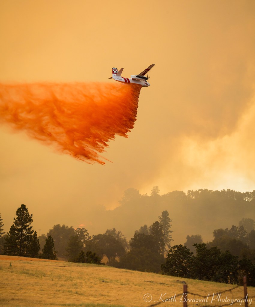
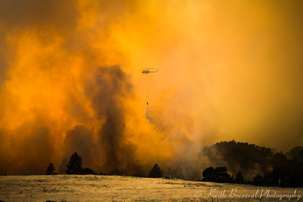
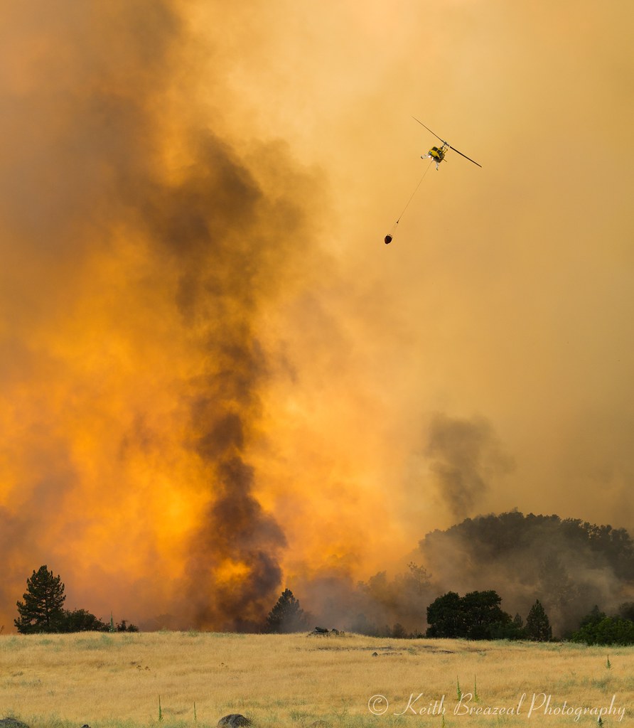
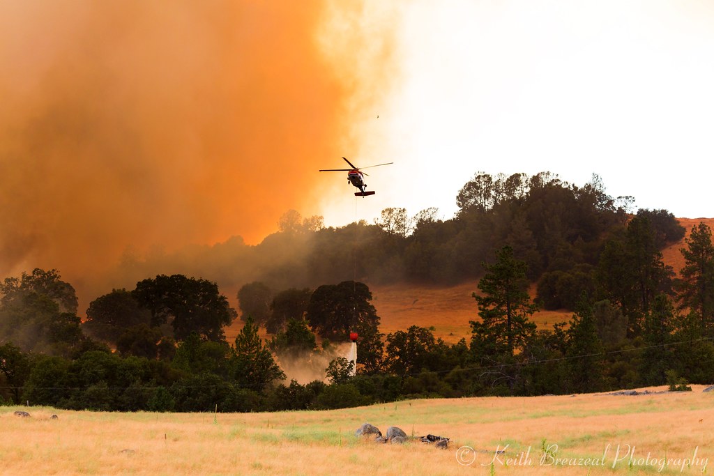
Sand Fire July 2014 © Keith Breazeal-30

Sand Fire July 2014 © Keith Breazeal-28

sunset, hilltop, Red Mule Ranch, Fiddletown,

sunset, "Cowboy Campfire", cowboy, Fiddletown, Red Mule Ranch, Ron Scofield

Evening came early
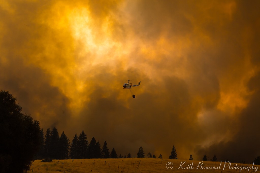
Sand Fire July 2014 © Keith Breazeal

sunset, men,

Sacramento deluge

D'Agostini Reservoir
Sand Fire July 2014 © Keith Breazeal-38

The Shed on the Pond
Sand Fire July 2014 © Keith Breazeal-19

Sand Fire July 2014 © Keith Breazeal-23
Sand Fire July 2014 © Keith Breazeal-21
Sand Fire July 2014 © Keith Breazeal-24

Sand Fire July 2014 © Keith Breazeal-20

At the End of the Day at the Pond

Sunset on the Pond
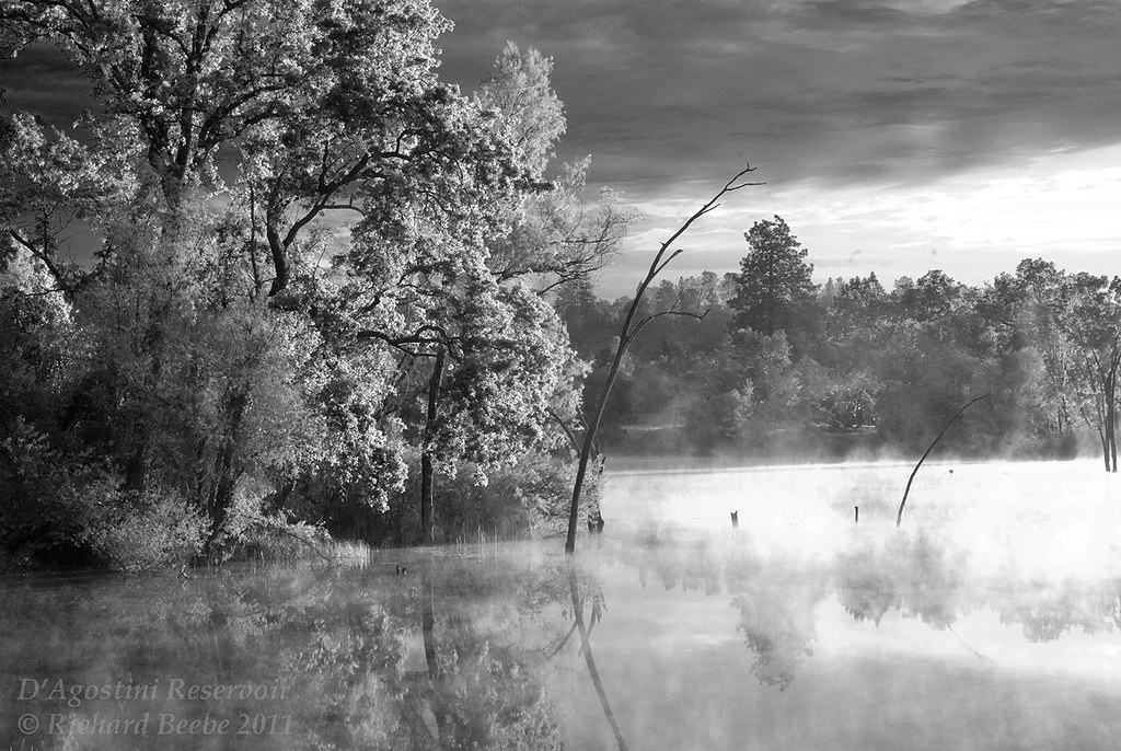
RB_05-27-11_033bw1_D'AgostiniRes-Sunrise

Sunrise through the trees in Amador County

Sunrise through the trees in Amador County

Sunrise through the trees in Amador County

Sunrise through the trees in Amador County

Sunrise through the trees in Amador County

Sunrise through the trees in Amador County

Sunrise through the trees in Amador County

Sunrise through the trees in Amador County

Sunrise through the trees in Amador County

Sunrise through the trees in Amador County

Sunrise Behind the Trees Amador County

Sunrise through the trees in Amador County

Sunrise through the trees in Amador County
Wildcat Way, California アメリカ合衆国ワイルドキャット・ウェイの地図
別の場所を検索
近所の場所
Shake Ridge Rd, Volcano, CA アメリカ合衆国
Ponderosa Hills Rd, Volcano, CA アメリカ合衆国
Rams Horn Grade Road, Volcano, CA アメリカ合衆国
Rams Horn Grade Road, Volcano, CA アメリカ合衆国McLaughlin's Daffodil Hill
Shake Ridge Rd, Volcano, CA アメリカ合衆国
Shake Ridge Rd, Volcano, CA アメリカ合衆国
Shake Ridge Rd, Volcano, CA アメリカ合衆国
Rams Horn Grade Road, Volcano, CA アメリカ合衆国
Charleston Ct, Volcano, CA アメリカ合衆国
Gold Creek Trail, Volcano, CA アメリカ合衆国
Charleston Ct, Volcano, CA アメリカ合衆国
Shake Ridge Rd, Volcano, CA アメリカ合衆国
Rams Horn Grade Road, Volcano, CA アメリカ合衆国
Markley Mine Rd, Volcano, CA アメリカ合衆国
Shake Ridge Rd, Volcano, CA アメリカ合衆国
Shake Ridge Rd, Volcano, CA アメリカ合衆国
Shake Ridge Rd, Volcano, CA アメリカ合衆国Lockwood Fire Protection District - Station 1
Charleston Rd, Volcano, CA アメリカ合衆国
Gold Creek Trail, Volcano, CA アメリカ合衆国
Gold Creek Trail, Volcano, CA アメリカ合衆国
最近の検索
- アメリカ合衆国 アラスカ州 レッド・ドッグ・マイン日の出日の入り時間
- Am bhf, Borken, ドイツアム・バーンホーフ日の出日の入り時間
- 4th St E, Sonoma, CA, USA日の出日の入り時間
- Oakland Ave, Williamsport, PA アメリカ合衆国日の出日の入り時間
- Via Roma, Pieranica CR, イタリアローマ通り日の出日の入り時間
- クロアチア 〒 ドゥブロブニク GradClock Tower of Dubrovnik日の出日の入り時間
- アルゼンチン チュブ州 トレリュー日の出日の入り時間
- Hartfords Bluff Cir, Mt Pleasant, SC アメリカ合衆国日の出日の入り時間
- 日本、熊本県熊本市北区日の出日の入り時間
- 中華人民共和国 福州市 平潭県 平潭島日の出日の入り時間