Wilbur Rd, East Calais, VT アメリカ合衆国日の出日の入り時間
Location: アメリカ合衆国 > バーモント州 > ワシントン > アメリカ合衆国 バーモント州 キャレー > イースト・キャレー >
時間帯:
America/New_York
現地時間:
2025-06-28 07:44:32
経度:
-72.423301
緯度:
44.406394
今日の日の出時刻:
05:07:58 AM
今日の日の入時刻:
08:38:16 PM
今日の日長:
15h 30m 18s
明日の日の出時刻:
05:08:28 AM
明日の日の入時刻:
08:38:11 PM
明日の日長:
15h 29m 43s
すべて表示する
| 日付 | 日出 | 日没 | 日長 |
|---|---|---|---|
| 2025年01月01日 | 07:25:44 AM | 04:21:51 PM | 8h 56m 7s |
| 2025年01月02日 | 07:25:43 AM | 04:22:48 PM | 8h 57m 5s |
| 2025年01月03日 | 07:25:39 AM | 04:23:46 PM | 8h 58m 7s |
| 2025年01月04日 | 07:25:33 AM | 04:24:46 PM | 8h 59m 13s |
| 2025年01月05日 | 07:25:24 AM | 04:25:48 PM | 9h 0m 24s |
| 2025年01月06日 | 07:25:12 AM | 04:26:51 PM | 9h 1m 39s |
| 2025年01月07日 | 07:24:58 AM | 04:27:56 PM | 9h 2m 58s |
| 2025年01月08日 | 07:24:42 AM | 04:29:02 PM | 9h 4m 20s |
| 2025年01月09日 | 07:24:22 AM | 04:30:10 PM | 9h 5m 48s |
| 2025年01月10日 | 07:24:01 AM | 04:31:19 PM | 9h 7m 18s |
| 2025年01月11日 | 07:23:37 AM | 04:32:30 PM | 9h 8m 53s |
| 2025年01月12日 | 07:23:10 AM | 04:33:41 PM | 9h 10m 31s |
| 2025年01月13日 | 07:22:41 AM | 04:34:54 PM | 9h 12m 13s |
| 2025年01月14日 | 07:22:10 AM | 04:36:08 PM | 9h 13m 58s |
| 2025年01月15日 | 07:21:36 AM | 04:37:23 PM | 9h 15m 47s |
| 2025年01月16日 | 07:21:00 AM | 04:38:39 PM | 9h 17m 39s |
| 2025年01月17日 | 07:20:21 AM | 04:39:56 PM | 9h 19m 35s |
| 2025年01月18日 | 07:19:40 AM | 04:41:13 PM | 9h 21m 33s |
| 2025年01月19日 | 07:18:57 AM | 04:42:32 PM | 9h 23m 35s |
| 2025年01月20日 | 07:18:12 AM | 04:43:51 PM | 9h 25m 39s |
| 2025年01月21日 | 07:17:25 AM | 04:45:11 PM | 9h 27m 46s |
| 2025年01月22日 | 07:16:35 AM | 04:46:31 PM | 9h 29m 56s |
| 2025年01月23日 | 07:15:43 AM | 04:47:52 PM | 9h 32m 9s |
| 2025年01月24日 | 07:14:49 AM | 04:49:14 PM | 9h 34m 25s |
| 2025年01月25日 | 07:13:53 AM | 04:50:36 PM | 9h 36m 43s |
| 2025年01月26日 | 07:12:55 AM | 04:51:58 PM | 9h 39m 3s |
| 2025年01月27日 | 07:11:55 AM | 04:53:21 PM | 9h 41m 26s |
| 2025年01月28日 | 07:10:53 AM | 04:54:44 PM | 9h 43m 51s |
| 2025年01月29日 | 07:09:49 AM | 04:56:08 PM | 9h 46m 19s |
| 2025年01月30日 | 07:08:44 AM | 04:57:31 PM | 9h 48m 47s |
| 2025年01月31日 | 07:07:36 AM | 04:58:55 PM | 9h 51m 19s |
| 2025年02月01日 | 07:06:27 AM | 05:00:19 PM | 9h 53m 52s |
| 2025年02月02日 | 07:05:16 AM | 05:01:43 PM | 9h 56m 27s |
| 2025年02月03日 | 07:04:03 AM | 05:03:07 PM | 9h 59m 4s |
| 2025年02月04日 | 07:02:49 AM | 05:04:32 PM | 10h 1m 43s |
| 2025年02月05日 | 07:01:32 AM | 05:05:56 PM | 10h 4m 24s |
| 2025年02月06日 | 07:00:15 AM | 05:07:20 PM | 10h 7m 5s |
| 2025年02月07日 | 06:58:56 AM | 05:08:45 PM | 10h 9m 49s |
| 2025年02月08日 | 06:57:35 AM | 05:10:09 PM | 10h 12m 34s |
| 2025年02月09日 | 06:56:13 AM | 05:11:33 PM | 10h 15m 20s |
| 2025年02月10日 | 06:54:49 AM | 05:12:57 PM | 10h 18m 8s |
| 2025年02月11日 | 06:53:24 AM | 05:14:21 PM | 10h 20m 57s |
| 2025年02月12日 | 06:51:58 AM | 05:15:44 PM | 10h 23m 46s |
| 2025年02月13日 | 06:50:30 AM | 05:17:08 PM | 10h 26m 38s |
| 2025年02月14日 | 06:49:01 AM | 05:18:31 PM | 10h 29m 30s |
| 2025年02月15日 | 06:47:31 AM | 05:19:54 PM | 10h 32m 23s |
| 2025年02月16日 | 06:46:00 AM | 05:21:17 PM | 10h 35m 17s |
| 2025年02月17日 | 06:44:27 AM | 05:22:40 PM | 10h 38m 13s |
| 2025年02月18日 | 06:42:54 AM | 05:24:02 PM | 10h 41m 8s |
| 2025年02月19日 | 06:41:19 AM | 05:25:24 PM | 10h 44m 5s |
| 2025年02月20日 | 06:39:43 AM | 05:26:46 PM | 10h 47m 3s |
| 2025年02月21日 | 06:38:06 AM | 05:28:08 PM | 10h 50m 2s |
| 2025年02月22日 | 06:36:29 AM | 05:29:29 PM | 10h 53m 0s |
| 2025年02月23日 | 06:34:50 AM | 05:30:50 PM | 10h 56m 0s |
| 2025年02月24日 | 06:33:11 AM | 05:32:11 PM | 10h 59m 0s |
| 2025年02月25日 | 06:31:30 AM | 05:33:31 PM | 11h 2m 1s |
| 2025年02月26日 | 06:29:49 AM | 05:34:52 PM | 11h 5m 3s |
| 2025年02月27日 | 06:28:07 AM | 05:36:11 PM | 11h 8m 4s |
| 2025年02月28日 | 06:26:24 AM | 05:37:31 PM | 11h 11m 7s |
| 2025年03月01日 | 06:24:41 AM | 05:38:50 PM | 11h 14m 9s |
| 2025年03月02日 | 06:22:57 AM | 05:40:09 PM | 11h 17m 12s |
| 2025年03月03日 | 06:21:12 AM | 05:41:28 PM | 11h 20m 16s |
| 2025年03月04日 | 06:19:27 AM | 05:42:47 PM | 11h 23m 20s |
| 2025年03月05日 | 06:17:41 AM | 05:44:05 PM | 11h 26m 24s |
| 2025年03月06日 | 06:15:54 AM | 05:45:23 PM | 11h 29m 29s |
| 2025年03月07日 | 06:14:07 AM | 05:46:41 PM | 11h 32m 34s |
| 2025年03月08日 | 06:12:20 AM | 05:47:58 PM | 11h 35m 38s |
| 2025年03月09日 | 07:10:37 AM | 06:49:12 PM | 11h 38m 35s |
| 2025年03月10日 | 07:08:48 AM | 06:50:29 PM | 11h 41m 41s |
| 2025年03月11日 | 07:07:00 AM | 06:51:46 PM | 11h 44m 46s |
| 2025年03月12日 | 07:05:11 AM | 06:53:03 PM | 11h 47m 52s |
| 2025年03月13日 | 07:03:21 AM | 06:54:19 PM | 11h 50m 58s |
| 2025年03月14日 | 07:01:32 AM | 06:55:35 PM | 11h 54m 3s |
| 2025年03月15日 | 06:59:42 AM | 06:56:51 PM | 11h 57m 9s |
| 2025年03月16日 | 06:57:52 AM | 06:58:07 PM | 12h 0m 15s |
| 2025年03月17日 | 06:56:01 AM | 06:59:22 PM | 12h 3m 21s |
| 2025年03月18日 | 06:54:11 AM | 07:00:38 PM | 12h 6m 27s |
| 2025年03月19日 | 06:52:20 AM | 07:01:53 PM | 12h 9m 33s |
| 2025年03月20日 | 06:50:30 AM | 07:03:08 PM | 12h 12m 38s |
| 2025年03月21日 | 06:48:39 AM | 07:04:23 PM | 12h 15m 44s |
| 2025年03月22日 | 06:46:48 AM | 07:05:38 PM | 12h 18m 50s |
| 2025年03月23日 | 06:44:57 AM | 07:06:52 PM | 12h 21m 55s |
| 2025年03月24日 | 06:43:06 AM | 07:08:07 PM | 12h 25m 1s |
| 2025年03月25日 | 06:41:16 AM | 07:09:21 PM | 12h 28m 5s |
| 2025年03月26日 | 06:39:25 AM | 07:10:36 PM | 12h 31m 11s |
| 2025年03月27日 | 06:37:35 AM | 07:11:50 PM | 12h 34m 15s |
| 2025年03月28日 | 06:35:44 AM | 07:13:04 PM | 12h 37m 20s |
| 2025年03月29日 | 06:33:54 AM | 07:14:19 PM | 12h 40m 25s |
| 2025年03月30日 | 06:32:04 AM | 07:15:33 PM | 12h 43m 29s |
| 2025年03月31日 | 06:30:14 AM | 07:16:47 PM | 12h 46m 33s |
| 2025年04月01日 | 06:28:25 AM | 07:18:01 PM | 12h 49m 36s |
| 2025年04月02日 | 06:26:36 AM | 07:19:15 PM | 12h 52m 39s |
| 2025年04月03日 | 06:24:47 AM | 07:20:29 PM | 12h 55m 42s |
| 2025年04月04日 | 06:22:59 AM | 07:21:43 PM | 12h 58m 44s |
| 2025年04月05日 | 06:21:11 AM | 07:22:57 PM | 13h 1m 46s |
| 2025年04月06日 | 06:19:23 AM | 07:24:11 PM | 13h 4m 48s |
| 2025年04月07日 | 06:17:36 AM | 07:25:24 PM | 13h 7m 48s |
| 2025年04月08日 | 06:15:49 AM | 07:26:38 PM | 13h 10m 49s |
| 2025年04月09日 | 06:14:03 AM | 07:27:52 PM | 13h 13m 49s |
| 2025年04月10日 | 06:12:18 AM | 07:29:06 PM | 13h 16m 48s |
| 2025年04月11日 | 06:10:33 AM | 07:30:20 PM | 13h 19m 47s |
| 2025年04月12日 | 06:08:48 AM | 07:31:34 PM | 13h 22m 46s |
| 2025年04月13日 | 06:07:05 AM | 07:32:48 PM | 13h 25m 43s |
| 2025年04月14日 | 06:05:22 AM | 07:34:02 PM | 13h 28m 40s |
| 2025年04月15日 | 06:03:39 AM | 07:35:16 PM | 13h 31m 37s |
| 2025年04月16日 | 06:01:58 AM | 07:36:29 PM | 13h 34m 31s |
| 2025年04月17日 | 06:00:17 AM | 07:37:43 PM | 13h 37m 26s |
| 2025年04月18日 | 05:58:37 AM | 07:38:57 PM | 13h 40m 20s |
| 2025年04月19日 | 05:56:58 AM | 07:40:11 PM | 13h 43m 13s |
| 2025年04月20日 | 05:55:20 AM | 07:41:25 PM | 13h 46m 5s |
| 2025年04月21日 | 05:53:43 AM | 07:42:38 PM | 13h 48m 55s |
| 2025年04月22日 | 05:52:06 AM | 07:43:52 PM | 13h 51m 46s |
| 2025年04月23日 | 05:50:31 AM | 07:45:06 PM | 13h 54m 35s |
| 2025年04月24日 | 05:48:57 AM | 07:46:19 PM | 13h 57m 22s |
| 2025年04月25日 | 05:47:24 AM | 07:47:33 PM | 14h 0m 9s |
| 2025年04月26日 | 05:45:52 AM | 07:48:46 PM | 14h 2m 54s |
| 2025年04月27日 | 05:44:21 AM | 07:49:59 PM | 14h 5m 38s |
| 2025年04月28日 | 05:42:51 AM | 07:51:13 PM | 14h 8m 22s |
| 2025年04月29日 | 05:41:22 AM | 07:52:26 PM | 14h 11m 4s |
| 2025年04月30日 | 05:39:55 AM | 07:53:38 PM | 14h 13m 43s |
| 2025年05月01日 | 05:38:29 AM | 07:54:51 PM | 14h 16m 22s |
| 2025年05月02日 | 05:37:04 AM | 07:56:03 PM | 14h 18m 59s |
| 2025年05月03日 | 05:35:41 AM | 07:57:15 PM | 14h 21m 34s |
| 2025年05月04日 | 05:34:19 AM | 07:58:27 PM | 14h 24m 8s |
| 2025年05月05日 | 05:32:58 AM | 07:59:39 PM | 14h 26m 41s |
| 2025年05月06日 | 05:31:39 AM | 08:00:50 PM | 14h 29m 11s |
| 2025年05月07日 | 05:30:21 AM | 08:02:01 PM | 14h 31m 40s |
| 2025年05月08日 | 05:29:05 AM | 08:03:11 PM | 14h 34m 6s |
| 2025年05月09日 | 05:27:50 AM | 08:04:21 PM | 14h 36m 31s |
| 2025年05月10日 | 05:26:37 AM | 08:05:31 PM | 14h 38m 54s |
| 2025年05月11日 | 05:25:26 AM | 08:06:40 PM | 14h 41m 14s |
| 2025年05月12日 | 05:24:16 AM | 08:07:49 PM | 14h 43m 33s |
| 2025年05月13日 | 05:23:08 AM | 08:08:57 PM | 14h 45m 49s |
| 2025年05月14日 | 05:22:02 AM | 08:10:04 PM | 14h 48m 2s |
| 2025年05月15日 | 05:20:58 AM | 08:11:11 PM | 14h 50m 13s |
| 2025年05月16日 | 05:19:55 AM | 08:12:17 PM | 14h 52m 22s |
| 2025年05月17日 | 05:18:54 AM | 08:13:23 PM | 14h 54m 29s |
| 2025年05月18日 | 05:17:55 AM | 08:14:27 PM | 14h 56m 32s |
| 2025年05月19日 | 05:16:58 AM | 08:15:31 PM | 14h 58m 33s |
| 2025年05月20日 | 05:16:03 AM | 08:16:34 PM | 15h 0m 31s |
| 2025年05月21日 | 05:15:09 AM | 08:17:36 PM | 15h 2m 27s |
| 2025年05月22日 | 05:14:18 AM | 08:18:37 PM | 15h 4m 19s |
| 2025年05月23日 | 05:13:29 AM | 08:19:38 PM | 15h 6m 9s |
| 2025年05月24日 | 05:12:42 AM | 08:20:37 PM | 15h 7m 55s |
| 2025年05月25日 | 05:11:57 AM | 08:21:35 PM | 15h 9m 38s |
| 2025年05月26日 | 05:11:14 AM | 08:22:32 PM | 15h 11m 18s |
| 2025年05月27日 | 05:10:33 AM | 08:23:27 PM | 15h 12m 54s |
| 2025年05月28日 | 05:09:54 AM | 08:24:22 PM | 15h 14m 28s |
| 2025年05月29日 | 05:09:17 AM | 08:25:15 PM | 15h 15m 58s |
| 2025年05月30日 | 05:08:43 AM | 08:26:07 PM | 15h 17m 24s |
| 2025年05月31日 | 05:08:11 AM | 08:26:57 PM | 15h 18m 46s |
| 2025年06月01日 | 05:07:41 AM | 08:27:46 PM | 15h 20m 5s |
| 2025年06月02日 | 05:07:13 AM | 08:28:34 PM | 15h 21m 21s |
| 2025年06月03日 | 05:06:47 AM | 08:29:20 PM | 15h 22m 33s |
| 2025年06月04日 | 05:06:24 AM | 08:30:04 PM | 15h 23m 40s |
| 2025年06月05日 | 05:06:03 AM | 08:30:47 PM | 15h 24m 44s |
| 2025年06月06日 | 05:05:44 AM | 08:31:28 PM | 15h 25m 44s |
| 2025年06月07日 | 05:05:27 AM | 08:32:08 PM | 15h 26m 41s |
| 2025年06月08日 | 05:05:13 AM | 08:32:46 PM | 15h 27m 33s |
| 2025年06月09日 | 05:05:01 AM | 08:33:21 PM | 15h 28m 20s |
| 2025年06月10日 | 05:04:52 AM | 08:33:56 PM | 15h 29m 4s |
| 2025年06月11日 | 05:04:44 AM | 08:34:28 PM | 15h 29m 44s |
| 2025年06月12日 | 05:04:39 AM | 08:34:58 PM | 15h 30m 19s |
| 2025年06月13日 | 05:04:36 AM | 08:35:26 PM | 15h 30m 50s |
| 2025年06月14日 | 05:04:35 AM | 08:35:52 PM | 15h 31m 17s |
| 2025年06月15日 | 05:04:37 AM | 08:36:17 PM | 15h 31m 40s |
| 2025年06月16日 | 05:04:41 AM | 08:36:39 PM | 15h 31m 58s |
| 2025年06月17日 | 05:04:47 AM | 08:36:59 PM | 15h 32m 12s |
| 2025年06月18日 | 05:04:55 AM | 08:37:17 PM | 15h 32m 22s |
| 2025年06月19日 | 05:05:06 AM | 08:37:32 PM | 15h 32m 26s |
| 2025年06月20日 | 05:05:18 AM | 08:37:46 PM | 15h 32m 28s |
| 2025年06月21日 | 05:05:33 AM | 08:37:57 PM | 15h 32m 24s |
| 2025年06月22日 | 05:05:50 AM | 08:38:07 PM | 15h 32m 17s |
| 2025年06月23日 | 05:06:09 AM | 08:38:13 PM | 15h 32m 4s |
| 2025年06月24日 | 05:06:29 AM | 08:38:18 PM | 15h 31m 49s |
| 2025年06月25日 | 05:06:52 AM | 08:38:20 PM | 15h 31m 28s |
| 2025年06月26日 | 05:07:17 AM | 08:38:21 PM | 15h 31m 4s |
| 2025年06月27日 | 05:07:44 AM | 08:38:18 PM | 15h 30m 34s |
| 2025年06月28日 | 05:08:13 AM | 08:38:14 PM | 15h 30m 1s |
| 2025年06月29日 | 05:08:44 AM | 08:38:07 PM | 15h 29m 23s |
| 2025年06月30日 | 05:09:16 AM | 08:37:58 PM | 15h 28m 42s |
| 2025年07月01日 | 05:09:50 AM | 08:37:46 PM | 15h 27m 56s |
| 2025年07月02日 | 05:10:26 AM | 08:37:32 PM | 15h 27m 6s |
| 2025年07月03日 | 05:11:04 AM | 08:37:16 PM | 15h 26m 12s |
| 2025年07月04日 | 05:11:43 AM | 08:36:58 PM | 15h 25m 15s |
| 2025年07月05日 | 05:12:24 AM | 08:36:37 PM | 15h 24m 13s |
| 2025年07月06日 | 05:13:07 AM | 08:36:14 PM | 15h 23m 7s |
| 2025年07月07日 | 05:13:51 AM | 08:35:48 PM | 15h 21m 57s |
| 2025年07月08日 | 05:14:36 AM | 08:35:21 PM | 15h 20m 45s |
| 2025年07月09日 | 05:15:23 AM | 08:34:51 PM | 15h 19m 28s |
| 2025年07月10日 | 05:16:12 AM | 08:34:19 PM | 15h 18m 7s |
| 2025年07月11日 | 05:17:01 AM | 08:33:44 PM | 15h 16m 43s |
| 2025年07月12日 | 05:17:52 AM | 08:33:08 PM | 15h 15m 16s |
| 2025年07月13日 | 05:18:44 AM | 08:32:29 PM | 15h 13m 45s |
| 2025年07月14日 | 05:19:38 AM | 08:31:48 PM | 15h 12m 10s |
| 2025年07月15日 | 05:20:32 AM | 08:31:05 PM | 15h 10m 33s |
| 2025年07月16日 | 05:21:27 AM | 08:30:20 PM | 15h 8m 53s |
| 2025年07月17日 | 05:22:24 AM | 08:29:32 PM | 15h 7m 8s |
| 2025年07月18日 | 05:23:22 AM | 08:28:43 PM | 15h 5m 21s |
| 2025年07月19日 | 05:24:20 AM | 08:27:52 PM | 15h 3m 32s |
| 2025年07月20日 | 05:25:19 AM | 08:26:58 PM | 15h 1m 39s |
| 2025年07月21日 | 05:26:20 AM | 08:26:03 PM | 14h 59m 43s |
| 2025年07月22日 | 05:27:21 AM | 08:25:05 PM | 14h 57m 44s |
| 2025年07月23日 | 05:28:22 AM | 08:24:06 PM | 14h 55m 44s |
| 2025年07月24日 | 05:29:25 AM | 08:23:05 PM | 14h 53m 40s |
| 2025年07月25日 | 05:30:28 AM | 08:22:02 PM | 14h 51m 34s |
| 2025年07月26日 | 05:31:32 AM | 08:20:57 PM | 14h 49m 25s |
| 2025年07月27日 | 05:32:36 AM | 08:19:50 PM | 14h 47m 14s |
| 2025年07月28日 | 05:33:41 AM | 08:18:42 PM | 14h 45m 1s |
| 2025年07月29日 | 05:34:46 AM | 08:17:32 PM | 14h 42m 46s |
| 2025年07月30日 | 05:35:52 AM | 08:16:20 PM | 14h 40m 28s |
| 2025年07月31日 | 05:36:58 AM | 08:15:06 PM | 14h 38m 8s |
| 2025年08月01日 | 05:38:05 AM | 08:13:51 PM | 14h 35m 46s |
| 2025年08月02日 | 05:39:12 AM | 08:12:34 PM | 14h 33m 22s |
| 2025年08月03日 | 05:40:20 AM | 08:11:16 PM | 14h 30m 56s |
| 2025年08月04日 | 05:41:27 AM | 08:09:56 PM | 14h 28m 29s |
| 2025年08月05日 | 05:42:35 AM | 08:08:35 PM | 14h 26m 0s |
| 2025年08月06日 | 05:43:44 AM | 08:07:12 PM | 14h 23m 28s |
| 2025年08月07日 | 05:44:52 AM | 08:05:48 PM | 14h 20m 56s |
| 2025年08月08日 | 05:46:01 AM | 08:04:23 PM | 14h 18m 22s |
| 2025年08月09日 | 05:47:10 AM | 08:02:56 PM | 14h 15m 46s |
| 2025年08月10日 | 05:48:19 AM | 08:01:28 PM | 14h 13m 9s |
| 2025年08月11日 | 05:49:28 AM | 07:59:58 PM | 14h 10m 30s |
| 2025年08月12日 | 05:50:37 AM | 07:58:28 PM | 14h 7m 51s |
| 2025年08月13日 | 05:51:47 AM | 07:56:56 PM | 14h 5m 9s |
| 2025年08月14日 | 05:52:56 AM | 07:55:23 PM | 14h 2m 27s |
| 2025年08月15日 | 05:54:06 AM | 07:53:49 PM | 13h 59m 43s |
| 2025年08月16日 | 05:55:15 AM | 07:52:14 PM | 13h 56m 59s |
| 2025年08月17日 | 05:56:25 AM | 07:50:38 PM | 13h 54m 13s |
| 2025年08月18日 | 05:57:35 AM | 07:49:01 PM | 13h 51m 26s |
| 2025年08月19日 | 05:58:44 AM | 07:47:22 PM | 13h 48m 38s |
| 2025年08月20日 | 05:59:54 AM | 07:45:43 PM | 13h 45m 49s |
| 2025年08月21日 | 06:01:04 AM | 07:44:03 PM | 13h 42m 59s |
| 2025年08月22日 | 06:02:13 AM | 07:42:22 PM | 13h 40m 9s |
| 2025年08月23日 | 06:03:23 AM | 07:40:40 PM | 13h 37m 17s |
| 2025年08月24日 | 06:04:33 AM | 07:38:58 PM | 13h 34m 25s |
| 2025年08月25日 | 06:05:42 AM | 07:37:14 PM | 13h 31m 32s |
| 2025年08月26日 | 06:06:52 AM | 07:35:30 PM | 13h 28m 38s |
| 2025年08月27日 | 06:08:01 AM | 07:33:45 PM | 13h 25m 44s |
| 2025年08月28日 | 06:09:11 AM | 07:32:00 PM | 13h 22m 49s |
| 2025年08月29日 | 06:10:20 AM | 07:30:14 PM | 13h 19m 54s |
| 2025年08月30日 | 06:11:30 AM | 07:28:27 PM | 13h 16m 57s |
| 2025年08月31日 | 06:12:39 AM | 07:26:39 PM | 13h 14m 0s |
| 2025年09月01日 | 06:13:49 AM | 07:24:51 PM | 13h 11m 2s |
| 2025年09月02日 | 06:14:58 AM | 07:23:03 PM | 13h 8m 5s |
| 2025年09月03日 | 06:16:07 AM | 07:21:14 PM | 13h 5m 7s |
| 2025年09月04日 | 06:17:17 AM | 07:19:24 PM | 13h 2m 7s |
| 2025年09月05日 | 06:18:26 AM | 07:17:35 PM | 12h 59m 9s |
| 2025年09月06日 | 06:19:35 AM | 07:15:44 PM | 12h 56m 9s |
| 2025年09月07日 | 06:20:45 AM | 07:13:54 PM | 12h 53m 9s |
| 2025年09月08日 | 06:21:54 AM | 07:12:03 PM | 12h 50m 9s |
| 2025年09月09日 | 06:23:03 AM | 07:10:11 PM | 12h 47m 8s |
| 2025年09月10日 | 06:24:13 AM | 07:08:20 PM | 12h 44m 7s |
| 2025年09月11日 | 06:25:22 AM | 07:06:28 PM | 12h 41m 6s |
| 2025年09月12日 | 06:26:32 AM | 07:04:36 PM | 12h 38m 4s |
| 2025年09月13日 | 06:27:41 AM | 07:02:44 PM | 12h 35m 3s |
| 2025年09月14日 | 06:28:51 AM | 07:00:51 PM | 12h 32m 0s |
| 2025年09月15日 | 06:30:00 AM | 06:58:59 PM | 12h 28m 59s |
| 2025年09月16日 | 06:31:10 AM | 06:57:06 PM | 12h 25m 56s |
| 2025年09月17日 | 06:32:20 AM | 06:55:13 PM | 12h 22m 53s |
| 2025年09月18日 | 06:33:30 AM | 06:53:21 PM | 12h 19m 51s |
| 2025年09月19日 | 06:34:40 AM | 06:51:28 PM | 12h 16m 48s |
| 2025年09月20日 | 06:35:50 AM | 06:49:35 PM | 12h 13m 45s |
| 2025年09月21日 | 06:37:00 AM | 06:47:43 PM | 12h 10m 43s |
| 2025年09月22日 | 06:38:10 AM | 06:45:50 PM | 12h 7m 40s |
| 2025年09月23日 | 06:39:21 AM | 06:43:58 PM | 12h 4m 37s |
| 2025年09月24日 | 06:40:32 AM | 06:42:05 PM | 12h 1m 33s |
| 2025年09月25日 | 06:41:43 AM | 06:40:13 PM | 11h 58m 30s |
| 2025年09月26日 | 06:42:54 AM | 06:38:21 PM | 11h 55m 27s |
| 2025年09月27日 | 06:44:05 AM | 06:36:30 PM | 11h 52m 25s |
| 2025年09月28日 | 06:45:16 AM | 06:34:38 PM | 11h 49m 22s |
| 2025年09月29日 | 06:46:28 AM | 06:32:47 PM | 11h 46m 19s |
| 2025年09月30日 | 06:47:40 AM | 06:30:56 PM | 11h 43m 16s |
| 2025年10月01日 | 06:48:52 AM | 06:29:06 PM | 11h 40m 14s |
| 2025年10月02日 | 06:50:04 AM | 06:27:16 PM | 11h 37m 12s |
| 2025年10月03日 | 06:51:17 AM | 06:25:26 PM | 11h 34m 9s |
| 2025年10月04日 | 06:52:30 AM | 06:23:37 PM | 11h 31m 7s |
| 2025年10月05日 | 06:53:43 AM | 06:21:48 PM | 11h 28m 5s |
| 2025年10月06日 | 06:54:57 AM | 06:20:00 PM | 11h 25m 3s |
| 2025年10月07日 | 06:56:10 AM | 06:18:12 PM | 11h 22m 2s |
| 2025年10月08日 | 06:57:24 AM | 06:16:25 PM | 11h 19m 1s |
| 2025年10月09日 | 06:58:38 AM | 06:14:39 PM | 11h 16m 1s |
| 2025年10月10日 | 06:59:53 AM | 06:12:53 PM | 11h 13m 0s |
| 2025年10月11日 | 07:01:08 AM | 06:11:08 PM | 11h 10m 0s |
| 2025年10月12日 | 07:02:23 AM | 06:09:24 PM | 11h 7m 1s |
| 2025年10月13日 | 07:03:39 AM | 06:07:40 PM | 11h 4m 1s |
| 2025年10月14日 | 07:04:54 AM | 06:05:57 PM | 11h 1m 3s |
| 2025年10月15日 | 07:06:11 AM | 06:04:15 PM | 10h 58m 4s |
| 2025年10月16日 | 07:07:27 AM | 06:02:34 PM | 10h 55m 7s |
| 2025年10月17日 | 07:08:44 AM | 06:00:54 PM | 10h 52m 10s |
| 2025年10月18日 | 07:10:01 AM | 05:59:15 PM | 10h 49m 14s |
| 2025年10月19日 | 07:11:18 AM | 05:57:36 PM | 10h 46m 18s |
| 2025年10月20日 | 07:12:36 AM | 05:55:59 PM | 10h 43m 23s |
| 2025年10月21日 | 07:13:54 AM | 05:54:22 PM | 10h 40m 28s |
| 2025年10月22日 | 07:15:12 AM | 05:52:47 PM | 10h 37m 35s |
| 2025年10月23日 | 07:16:30 AM | 05:51:13 PM | 10h 34m 43s |
| 2025年10月24日 | 07:17:49 AM | 05:49:40 PM | 10h 31m 51s |
| 2025年10月25日 | 07:19:08 AM | 05:48:08 PM | 10h 29m 0s |
| 2025年10月26日 | 07:20:27 AM | 05:46:38 PM | 10h 26m 11s |
| 2025年10月27日 | 07:21:47 AM | 05:45:08 PM | 10h 23m 21s |
| 2025年10月28日 | 07:23:07 AM | 05:43:40 PM | 10h 20m 33s |
| 2025年10月29日 | 07:24:27 AM | 05:42:14 PM | 10h 17m 47s |
| 2025年10月30日 | 07:25:47 AM | 05:40:48 PM | 10h 15m 1s |
| 2025年10月31日 | 07:27:07 AM | 05:39:24 PM | 10h 12m 17s |
| 2025年11月01日 | 07:28:27 AM | 05:38:02 PM | 10h 9m 35s |
| 2025年11月02日 | 06:29:51 AM | 04:36:38 PM | 10h 6m 47s |
| 2025年11月03日 | 06:31:12 AM | 04:35:19 PM | 10h 4m 7s |
| 2025年11月04日 | 06:32:33 AM | 04:34:01 PM | 10h 1m 28s |
| 2025年11月05日 | 06:33:53 AM | 04:32:45 PM | 9h 58m 52s |
| 2025年11月06日 | 06:35:14 AM | 04:31:30 PM | 9h 56m 16s |
| 2025年11月07日 | 06:36:35 AM | 04:30:18 PM | 9h 53m 43s |
| 2025年11月08日 | 06:37:55 AM | 04:29:07 PM | 9h 51m 12s |
| 2025年11月09日 | 06:39:16 AM | 04:27:57 PM | 9h 48m 41s |
| 2025年11月10日 | 06:40:36 AM | 04:26:50 PM | 9h 46m 14s |
| 2025年11月11日 | 06:41:57 AM | 04:25:45 PM | 9h 43m 48s |
| 2025年11月12日 | 06:43:17 AM | 04:24:41 PM | 9h 41m 24s |
| 2025年11月13日 | 06:44:37 AM | 04:23:39 PM | 9h 39m 2s |
| 2025年11月14日 | 06:45:56 AM | 04:22:40 PM | 9h 36m 44s |
| 2025年11月15日 | 06:47:15 AM | 04:21:42 PM | 9h 34m 27s |
| 2025年11月16日 | 06:48:34 AM | 04:20:47 PM | 9h 32m 13s |
| 2025年11月17日 | 06:49:52 AM | 04:19:53 PM | 9h 30m 1s |
| 2025年11月18日 | 06:51:10 AM | 04:19:02 PM | 9h 27m 52s |
| 2025年11月19日 | 06:52:28 AM | 04:18:13 PM | 9h 25m 45s |
| 2025年11月20日 | 06:53:44 AM | 04:17:26 PM | 9h 23m 42s |
| 2025年11月21日 | 06:55:00 AM | 04:16:41 PM | 9h 21m 41s |
| 2025年11月22日 | 06:56:16 AM | 04:15:59 PM | 9h 19m 43s |
| 2025年11月23日 | 06:57:30 AM | 04:15:19 PM | 9h 17m 49s |
| 2025年11月24日 | 06:58:44 AM | 04:14:41 PM | 9h 15m 57s |
| 2025年11月25日 | 06:59:57 AM | 04:14:05 PM | 9h 14m 8s |
| 2025年11月26日 | 07:01:09 AM | 04:13:32 PM | 9h 12m 23s |
| 2025年11月27日 | 07:02:20 AM | 04:13:02 PM | 9h 10m 42s |
| 2025年11月28日 | 07:03:30 AM | 04:12:34 PM | 9h 9m 4s |
| 2025年11月29日 | 07:04:39 AM | 04:12:08 PM | 9h 7m 29s |
| 2025年11月30日 | 07:05:46 AM | 04:11:45 PM | 9h 5m 59s |
| 2025年12月01日 | 07:06:53 AM | 04:11:25 PM | 9h 4m 32s |
| 2025年12月02日 | 07:07:58 AM | 04:11:06 PM | 9h 3m 8s |
| 2025年12月03日 | 07:09:01 AM | 04:10:51 PM | 9h 1m 50s |
| 2025年12月04日 | 07:10:04 AM | 04:10:38 PM | 9h 0m 34s |
| 2025年12月05日 | 07:11:04 AM | 04:10:28 PM | 8h 59m 24s |
| 2025年12月06日 | 07:12:04 AM | 04:10:20 PM | 8h 58m 16s |
| 2025年12月07日 | 07:13:01 AM | 04:10:15 PM | 8h 57m 14s |
| 2025年12月08日 | 07:13:57 AM | 04:10:12 PM | 8h 56m 15s |
| 2025年12月09日 | 07:14:51 AM | 04:10:12 PM | 8h 55m 21s |
| 2025年12月10日 | 07:15:44 AM | 04:10:15 PM | 8h 54m 31s |
| 2025年12月11日 | 07:16:34 AM | 04:10:20 PM | 8h 53m 46s |
| 2025年12月12日 | 07:17:23 AM | 04:10:28 PM | 8h 53m 5s |
| 2025年12月13日 | 07:18:09 AM | 04:10:39 PM | 8h 52m 30s |
| 2025年12月14日 | 07:18:54 AM | 04:10:52 PM | 8h 51m 58s |
| 2025年12月15日 | 07:19:36 AM | 04:11:08 PM | 8h 51m 32s |
| 2025年12月16日 | 07:20:17 AM | 04:11:26 PM | 8h 51m 9s |
| 2025年12月17日 | 07:20:55 AM | 04:11:46 PM | 8h 50m 51s |
| 2025年12月18日 | 07:21:31 AM | 04:12:10 PM | 8h 50m 39s |
| 2025年12月19日 | 07:22:05 AM | 04:12:35 PM | 8h 50m 30s |
| 2025年12月20日 | 07:22:36 AM | 04:13:03 PM | 8h 50m 27s |
| 2025年12月21日 | 07:23:05 AM | 04:13:34 PM | 8h 50m 29s |
| 2025年12月22日 | 07:23:32 AM | 04:14:07 PM | 8h 50m 35s |
| 2025年12月23日 | 07:23:56 AM | 04:14:42 PM | 8h 50m 46s |
| 2025年12月24日 | 07:24:18 AM | 04:15:20 PM | 8h 51m 2s |
| 2025年12月25日 | 07:24:38 AM | 04:15:59 PM | 8h 51m 21s |
| 2025年12月26日 | 07:24:55 AM | 04:16:41 PM | 8h 51m 46s |
| 2025年12月27日 | 07:25:09 AM | 04:17:26 PM | 8h 52m 17s |
| 2025年12月28日 | 07:25:22 AM | 04:18:12 PM | 8h 52m 50s |
| 2025年12月29日 | 07:25:31 AM | 04:19:00 PM | 8h 53m 29s |
| 2025年12月30日 | 07:25:38 AM | 04:19:51 PM | 8h 54m 13s |
| 2025年12月31日 | 07:25:42 AM | 04:20:43 PM | 8h 55m 1s |
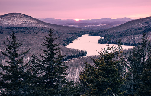
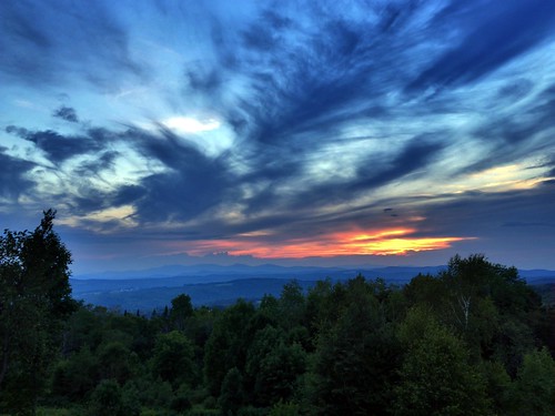
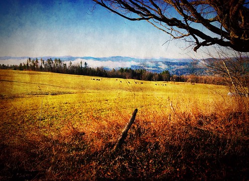
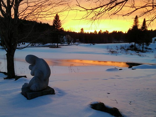
写真
Wilbur Rd, East Calais, VT アメリカ合衆国の地図
別の場所を検索
近所の場所
Foster Hill Rd, East Calais, VT アメリカ合衆国
Dog Pond Rd, East Calais, VT アメリカ合衆国
Moscow Woods Rd, East Calais, VT アメリカ合衆国
Scribner Rd, Woodbury, VT アメリカ合衆国スクリブナー・ロード
アメリカ合衆国 バーモント州 キャレー イースト・キャレー
Cranberry Meadow Rd, East Calais, VT アメリカ合衆国
アメリカ合衆国 バーモント州 ウッドベリー グリーンウッド湖
W County Rd, Calais, VT アメリカ合衆国
アメリカ合衆国 バーモント州 キャレー
Singleton Rd, East Calais, VT アメリカ合衆国
Max Gray Rd, Calais, VT, アメリカ合衆国マックス・グレー・ロード
アメリカ合衆国 〒 バーモント州 キャレー メープル・コーナー
31 W County Rd, Calais, VT アメリカ合衆国Maple Corner Store
Worcester Rd, Adamant, VT アメリカ合衆国
Harris Hill Rd, Worcester, VT アメリカ合衆国
Collar Hill Rd, Worcester, VT アメリカ合衆国Collar Hill Road
アメリカ合衆国 〒 バーモント州 キャレー ブリス池
County Rd, Calais, VT アメリカ合衆国
VT-14, Plainfield, VT アメリカ合衆国
アメリカ合衆国 〒 バーモント州 キャレー アダマント
最近の検索
- アメリカ合衆国 アラスカ州 レッド・ドッグ・マイン日の出日の入り時間
- Am bhf, Borken, ドイツアム・バーンホーフ日の出日の入り時間
- 4th St E, Sonoma, CA, USA日の出日の入り時間
- Oakland Ave, Williamsport, PA アメリカ合衆国日の出日の入り時間
- Via Roma, Pieranica CR, イタリアローマ通り日の出日の入り時間
- クロアチア 〒 ドゥブロブニク GradClock Tower of Dubrovnik日の出日の入り時間
- アルゼンチン チュブ州 トレリュー日の出日の入り時間
- Hartfords Bluff Cir, Mt Pleasant, SC アメリカ合衆国日の出日の入り時間
- 日本、熊本県熊本市北区日の出日の入り時間
- 中華人民共和国 福州市 平潭県 平潭島日の出日の入り時間


