Volcano Ln, California アメリカ合衆国ボルケーノ・レーン日の出日の入り時間
Location: アメリカ合衆国 > カリフォルニア州 > シャスタ > アメリカ合衆国 〒 カリフォルニア州 ハット・クリーク >
時間帯:
America/Los_Angeles
現地時間:
2025-06-17 22:21:10
経度:
-121.5374955
緯度:
40.8576671
今日の日の出時刻:
05:34:11 AM
今日の日の入時刻:
08:40:46 PM
今日の日長:
15h 6m 35s
明日の日の出時刻:
05:34:21 AM
明日の日の入時刻:
08:41:02 PM
明日の日長:
15h 6m 41s
すべて表示する
| 日付 | 日出 | 日没 | 日長 |
|---|---|---|---|
| 2025年01月01日 | 07:30:37 AM | 04:50:08 PM | 9h 19m 31s |
| 2025年01月02日 | 07:30:39 AM | 04:51:01 PM | 9h 20m 22s |
| 2025年01月03日 | 07:30:39 AM | 04:51:55 PM | 9h 21m 16s |
| 2025年01月04日 | 07:30:36 AM | 04:52:51 PM | 9h 22m 15s |
| 2025年01月05日 | 07:30:31 AM | 04:53:49 PM | 9h 23m 18s |
| 2025年01月06日 | 07:30:24 AM | 04:54:48 PM | 9h 24m 24s |
| 2025年01月07日 | 07:30:15 AM | 04:55:47 PM | 9h 25m 32s |
| 2025年01月08日 | 07:30:03 AM | 04:56:49 PM | 9h 26m 46s |
| 2025年01月09日 | 07:29:49 AM | 04:57:51 PM | 9h 28m 2s |
| 2025年01月10日 | 07:29:33 AM | 04:58:54 PM | 9h 29m 21s |
| 2025年01月11日 | 07:29:14 AM | 04:59:59 PM | 9h 30m 45s |
| 2025年01月12日 | 07:28:54 AM | 05:01:04 PM | 9h 32m 10s |
| 2025年01月13日 | 07:28:31 AM | 05:02:10 PM | 9h 33m 39s |
| 2025年01月14日 | 07:28:06 AM | 05:03:18 PM | 9h 35m 12s |
| 2025年01月15日 | 07:27:39 AM | 05:04:26 PM | 9h 36m 47s |
| 2025年01月16日 | 07:27:09 AM | 05:05:34 PM | 9h 38m 25s |
| 2025年01月17日 | 07:26:38 AM | 05:06:44 PM | 9h 40m 6s |
| 2025年01月18日 | 07:26:04 AM | 05:07:54 PM | 9h 41m 50s |
| 2025年01月19日 | 07:25:28 AM | 05:09:04 PM | 9h 43m 36s |
| 2025年01月20日 | 07:24:51 AM | 05:10:16 PM | 9h 45m 25s |
| 2025年01月21日 | 07:24:11 AM | 05:11:27 PM | 9h 47m 16s |
| 2025年01月22日 | 07:23:29 AM | 05:12:40 PM | 9h 49m 11s |
| 2025年01月23日 | 07:22:45 AM | 05:13:52 PM | 9h 51m 7s |
| 2025年01月24日 | 07:21:59 AM | 05:15:05 PM | 9h 53m 6s |
| 2025年01月25日 | 07:21:12 AM | 05:16:19 PM | 9h 55m 7s |
| 2025年01月26日 | 07:20:22 AM | 05:17:32 PM | 9h 57m 10s |
| 2025年01月27日 | 07:19:31 AM | 05:18:46 PM | 9h 59m 15s |
| 2025年01月28日 | 07:18:38 AM | 05:20:00 PM | 10h 1m 22s |
| 2025年01月29日 | 07:17:43 AM | 05:21:14 PM | 10h 3m 31s |
| 2025年01月30日 | 07:16:46 AM | 05:22:28 PM | 10h 5m 42s |
| 2025年01月31日 | 07:15:48 AM | 05:23:43 PM | 10h 7m 55s |
| 2025年02月01日 | 07:14:47 AM | 05:24:57 PM | 10h 10m 10s |
| 2025年02月02日 | 07:13:46 AM | 05:26:11 PM | 10h 12m 25s |
| 2025年02月03日 | 07:12:42 AM | 05:27:26 PM | 10h 14m 44s |
| 2025年02月04日 | 07:11:37 AM | 05:28:40 PM | 10h 17m 3s |
| 2025年02月05日 | 07:10:31 AM | 05:29:55 PM | 10h 19m 24s |
| 2025年02月06日 | 07:09:23 AM | 05:31:09 PM | 10h 21m 46s |
| 2025年02月07日 | 07:08:13 AM | 05:32:23 PM | 10h 24m 10s |
| 2025年02月08日 | 07:07:02 AM | 05:33:37 PM | 10h 26m 35s |
| 2025年02月09日 | 07:05:50 AM | 05:34:51 PM | 10h 29m 1s |
| 2025年02月10日 | 07:04:36 AM | 05:36:04 PM | 10h 31m 28s |
| 2025年02月11日 | 07:03:21 AM | 05:37:18 PM | 10h 33m 57s |
| 2025年02月12日 | 07:02:05 AM | 05:38:31 PM | 10h 36m 26s |
| 2025年02月13日 | 07:00:47 AM | 05:39:44 PM | 10h 38m 57s |
| 2025年02月14日 | 06:59:29 AM | 05:40:57 PM | 10h 41m 28s |
| 2025年02月15日 | 06:58:09 AM | 05:42:09 PM | 10h 44m 0s |
| 2025年02月16日 | 06:56:47 AM | 05:43:22 PM | 10h 46m 35s |
| 2025年02月17日 | 06:55:25 AM | 05:44:34 PM | 10h 49m 9s |
| 2025年02月18日 | 06:54:02 AM | 05:45:45 PM | 10h 51m 43s |
| 2025年02月19日 | 06:52:38 AM | 05:46:57 PM | 10h 54m 19s |
| 2025年02月20日 | 06:51:12 AM | 05:48:08 PM | 10h 56m 56s |
| 2025年02月21日 | 06:49:46 AM | 05:49:19 PM | 10h 59m 33s |
| 2025年02月22日 | 06:48:19 AM | 05:50:29 PM | 11h 2m 10s |
| 2025年02月23日 | 06:46:51 AM | 05:51:40 PM | 11h 4m 49s |
| 2025年02月24日 | 06:45:22 AM | 05:52:49 PM | 11h 7m 27s |
| 2025年02月25日 | 06:43:52 AM | 05:53:59 PM | 11h 10m 7s |
| 2025年02月26日 | 06:42:21 AM | 05:55:09 PM | 11h 12m 48s |
| 2025年02月27日 | 06:40:50 AM | 05:56:18 PM | 11h 15m 28s |
| 2025年02月28日 | 06:39:18 AM | 05:57:26 PM | 11h 18m 8s |
| 2025年03月01日 | 06:37:45 AM | 05:58:35 PM | 11h 20m 50s |
| 2025年03月02日 | 06:36:12 AM | 05:59:43 PM | 11h 23m 31s |
| 2025年03月03日 | 06:34:38 AM | 06:00:51 PM | 11h 26m 13s |
| 2025年03月04日 | 06:33:03 AM | 06:01:58 PM | 11h 28m 55s |
| 2025年03月05日 | 06:31:28 AM | 06:03:06 PM | 11h 31m 38s |
| 2025年03月06日 | 06:29:52 AM | 06:04:13 PM | 11h 34m 21s |
| 2025年03月07日 | 06:28:16 AM | 06:05:20 PM | 11h 37m 4s |
| 2025年03月08日 | 06:26:39 AM | 06:06:26 PM | 11h 39m 47s |
| 2025年03月09日 | 07:25:06 AM | 07:07:30 PM | 11h 42m 24s |
| 2025年03月10日 | 07:23:28 AM | 07:08:36 PM | 11h 45m 8s |
| 2025年03月11日 | 07:21:50 AM | 07:09:42 PM | 11h 47m 52s |
| 2025年03月12日 | 07:20:12 AM | 07:10:47 PM | 11h 50m 35s |
| 2025年03月13日 | 07:18:34 AM | 07:11:53 PM | 11h 53m 19s |
| 2025年03月14日 | 07:16:55 AM | 07:12:58 PM | 11h 56m 3s |
| 2025年03月15日 | 07:15:16 AM | 07:14:03 PM | 11h 58m 47s |
| 2025年03月16日 | 07:13:36 AM | 07:15:08 PM | 12h 1m 32s |
| 2025年03月17日 | 07:11:57 AM | 07:16:12 PM | 12h 4m 15s |
| 2025年03月18日 | 07:10:17 AM | 07:17:17 PM | 12h 7m 0s |
| 2025年03月19日 | 07:08:37 AM | 07:18:21 PM | 12h 9m 44s |
| 2025年03月20日 | 07:06:58 AM | 07:19:25 PM | 12h 12m 27s |
| 2025年03月21日 | 07:05:18 AM | 07:20:29 PM | 12h 15m 11s |
| 2025年03月22日 | 07:03:38 AM | 07:21:33 PM | 12h 17m 55s |
| 2025年03月23日 | 07:01:58 AM | 07:22:37 PM | 12h 20m 39s |
| 2025年03月24日 | 07:00:18 AM | 07:23:41 PM | 12h 23m 23s |
| 2025年03月25日 | 06:58:38 AM | 07:24:44 PM | 12h 26m 6s |
| 2025年03月26日 | 06:56:58 AM | 07:25:48 PM | 12h 28m 50s |
| 2025年03月27日 | 06:55:19 AM | 07:26:51 PM | 12h 31m 32s |
| 2025年03月28日 | 06:53:39 AM | 07:27:55 PM | 12h 34m 16s |
| 2025年03月29日 | 06:52:00 AM | 07:28:58 PM | 12h 36m 58s |
| 2025年03月30日 | 06:50:21 AM | 07:30:01 PM | 12h 39m 40s |
| 2025年03月31日 | 06:48:42 AM | 07:31:05 PM | 12h 42m 23s |
| 2025年04月01日 | 06:47:04 AM | 07:32:08 PM | 12h 45m 4s |
| 2025年04月02日 | 06:45:25 AM | 07:33:11 PM | 12h 47m 46s |
| 2025年04月03日 | 06:43:47 AM | 07:34:14 PM | 12h 50m 27s |
| 2025年04月04日 | 06:42:10 AM | 07:35:17 PM | 12h 53m 7s |
| 2025年04月05日 | 06:40:33 AM | 07:36:21 PM | 12h 55m 48s |
| 2025年04月06日 | 06:38:56 AM | 07:37:24 PM | 12h 58m 28s |
| 2025年04月07日 | 06:37:20 AM | 07:38:27 PM | 13h 1m 7s |
| 2025年04月08日 | 06:35:44 AM | 07:39:30 PM | 13h 3m 46s |
| 2025年04月09日 | 06:34:09 AM | 07:40:33 PM | 13h 6m 24s |
| 2025年04月10日 | 06:32:34 AM | 07:41:36 PM | 13h 9m 2s |
| 2025年04月11日 | 06:31:00 AM | 07:42:40 PM | 13h 11m 40s |
| 2025年04月12日 | 06:29:26 AM | 07:43:43 PM | 13h 14m 17s |
| 2025年04月13日 | 06:27:53 AM | 07:44:46 PM | 13h 16m 53s |
| 2025年04月14日 | 06:26:21 AM | 07:45:49 PM | 13h 19m 28s |
| 2025年04月15日 | 06:24:50 AM | 07:46:53 PM | 13h 22m 3s |
| 2025年04月16日 | 06:23:19 AM | 07:47:56 PM | 13h 24m 37s |
| 2025年04月17日 | 06:21:49 AM | 07:48:59 PM | 13h 27m 10s |
| 2025年04月18日 | 06:20:20 AM | 07:50:03 PM | 13h 29m 43s |
| 2025年04月19日 | 06:18:51 AM | 07:51:06 PM | 13h 32m 15s |
| 2025年04月20日 | 06:17:24 AM | 07:52:09 PM | 13h 34m 45s |
| 2025年04月21日 | 06:15:57 AM | 07:53:13 PM | 13h 37m 16s |
| 2025年04月22日 | 06:14:32 AM | 07:54:16 PM | 13h 39m 44s |
| 2025年04月23日 | 06:13:07 AM | 07:55:19 PM | 13h 42m 12s |
| 2025年04月24日 | 06:11:43 AM | 07:56:22 PM | 13h 44m 39s |
| 2025年04月25日 | 06:10:21 AM | 07:57:26 PM | 13h 47m 5s |
| 2025年04月26日 | 06:08:59 AM | 07:58:29 PM | 13h 49m 30s |
| 2025年04月27日 | 06:07:39 AM | 07:59:32 PM | 13h 51m 53s |
| 2025年04月28日 | 06:06:19 AM | 08:00:35 PM | 13h 54m 16s |
| 2025年04月29日 | 06:05:01 AM | 08:01:38 PM | 13h 56m 37s |
| 2025年04月30日 | 06:03:44 AM | 08:02:40 PM | 13h 58m 56s |
| 2025年05月01日 | 06:02:28 AM | 08:03:43 PM | 14h 1m 15s |
| 2025年05月02日 | 06:01:14 AM | 08:04:45 PM | 14h 3m 31s |
| 2025年05月03日 | 06:00:00 AM | 08:05:48 PM | 14h 5m 48s |
| 2025年05月04日 | 05:58:48 AM | 08:06:50 PM | 14h 8m 2s |
| 2025年05月05日 | 05:57:38 AM | 08:07:52 PM | 14h 10m 14s |
| 2025年05月06日 | 05:56:28 AM | 08:08:53 PM | 14h 12m 25s |
| 2025年05月07日 | 05:55:21 AM | 08:09:55 PM | 14h 14m 34s |
| 2025年05月08日 | 05:54:14 AM | 08:10:56 PM | 14h 16m 42s |
| 2025年05月09日 | 05:53:09 AM | 08:11:56 PM | 14h 18m 47s |
| 2025年05月10日 | 05:52:06 AM | 08:12:57 PM | 14h 20m 51s |
| 2025年05月11日 | 05:51:04 AM | 08:13:57 PM | 14h 22m 53s |
| 2025年05月12日 | 05:50:03 AM | 08:14:56 PM | 14h 24m 53s |
| 2025年05月13日 | 05:49:05 AM | 08:15:55 PM | 14h 26m 50s |
| 2025年05月14日 | 05:48:08 AM | 08:16:54 PM | 14h 28m 46s |
| 2025年05月15日 | 05:47:12 AM | 08:17:52 PM | 14h 30m 40s |
| 2025年05月16日 | 05:46:18 AM | 08:18:50 PM | 14h 32m 32s |
| 2025年05月17日 | 05:45:26 AM | 08:19:47 PM | 14h 34m 21s |
| 2025年05月18日 | 05:44:36 AM | 08:20:43 PM | 14h 36m 7s |
| 2025年05月19日 | 05:43:47 AM | 08:21:39 PM | 14h 37m 52s |
| 2025年05月20日 | 05:43:00 AM | 08:22:34 PM | 14h 39m 34s |
| 2025年05月21日 | 05:42:15 AM | 08:23:28 PM | 14h 41m 13s |
| 2025年05月22日 | 05:41:32 AM | 08:24:21 PM | 14h 42m 49s |
| 2025年05月23日 | 05:40:50 AM | 08:25:14 PM | 14h 44m 24s |
| 2025年05月24日 | 05:40:11 AM | 08:26:06 PM | 14h 45m 55s |
| 2025年05月25日 | 05:39:33 AM | 08:26:57 PM | 14h 47m 24s |
| 2025年05月26日 | 05:38:57 AM | 08:27:47 PM | 14h 48m 50s |
| 2025年05月27日 | 05:38:23 AM | 08:28:36 PM | 14h 50m 13s |
| 2025年05月28日 | 05:37:51 AM | 08:29:24 PM | 14h 51m 33s |
| 2025年05月29日 | 05:37:21 AM | 08:30:10 PM | 14h 52m 49s |
| 2025年05月30日 | 05:36:53 AM | 08:30:56 PM | 14h 54m 3s |
| 2025年05月31日 | 05:36:27 AM | 08:31:41 PM | 14h 55m 14s |
| 2025年06月01日 | 05:36:03 AM | 08:32:24 PM | 14h 56m 21s |
| 2025年06月02日 | 05:35:41 AM | 08:33:06 PM | 14h 57m 25s |
| 2025年06月03日 | 05:35:21 AM | 08:33:47 PM | 14h 58m 26s |
| 2025年06月04日 | 05:35:02 AM | 08:34:26 PM | 14h 59m 24s |
| 2025年06月05日 | 05:34:46 AM | 08:35:04 PM | 15h 0m 18s |
| 2025年06月06日 | 05:34:32 AM | 08:35:41 PM | 15h 1m 9s |
| 2025年06月07日 | 05:34:20 AM | 08:36:16 PM | 15h 1m 56s |
| 2025年06月08日 | 05:34:10 AM | 08:36:50 PM | 15h 2m 40s |
| 2025年06月09日 | 05:34:02 AM | 08:37:22 PM | 15h 3m 20s |
| 2025年06月10日 | 05:33:56 AM | 08:37:53 PM | 15h 3m 57s |
| 2025年06月11日 | 05:33:51 AM | 08:38:22 PM | 15h 4m 31s |
| 2025年06月12日 | 05:33:49 AM | 08:38:49 PM | 15h 5m 0s |
| 2025年06月13日 | 05:33:49 AM | 08:39:15 PM | 15h 5m 26s |
| 2025年06月14日 | 05:33:51 AM | 08:39:39 PM | 15h 5m 48s |
| 2025年06月15日 | 05:33:54 AM | 08:40:01 PM | 15h 6m 7s |
| 2025年06月16日 | 05:34:00 AM | 08:40:21 PM | 15h 6m 21s |
| 2025年06月17日 | 05:34:08 AM | 08:40:40 PM | 15h 6m 32s |
| 2025年06月18日 | 05:34:17 AM | 08:40:57 PM | 15h 6m 40s |
| 2025年06月19日 | 05:34:28 AM | 08:41:12 PM | 15h 6m 44s |
| 2025年06月20日 | 05:34:41 AM | 08:41:25 PM | 15h 6m 44s |
| 2025年06月21日 | 05:34:56 AM | 08:41:36 PM | 15h 6m 40s |
| 2025年06月22日 | 05:35:13 AM | 08:41:45 PM | 15h 6m 32s |
| 2025年06月23日 | 05:35:31 AM | 08:41:52 PM | 15h 6m 21s |
| 2025年06月24日 | 05:35:52 AM | 08:41:57 PM | 15h 6m 5s |
| 2025年06月25日 | 05:36:14 AM | 08:42:01 PM | 15h 5m 47s |
| 2025年06月26日 | 05:36:37 AM | 08:42:02 PM | 15h 5m 25s |
| 2025年06月27日 | 05:37:03 AM | 08:42:01 PM | 15h 4m 58s |
| 2025年06月28日 | 05:37:29 AM | 08:41:58 PM | 15h 4m 29s |
| 2025年06月29日 | 05:37:58 AM | 08:41:53 PM | 15h 3m 55s |
| 2025年06月30日 | 05:38:28 AM | 08:41:47 PM | 15h 3m 19s |
| 2025年07月01日 | 05:38:59 AM | 08:41:38 PM | 15h 2m 39s |
| 2025年07月02日 | 05:39:32 AM | 08:41:27 PM | 15h 1m 55s |
| 2025年07月03日 | 05:40:07 AM | 08:41:14 PM | 15h 1m 7s |
| 2025年07月04日 | 05:40:42 AM | 08:40:59 PM | 15h 0m 17s |
| 2025年07月05日 | 05:41:19 AM | 08:40:42 PM | 14h 59m 23s |
| 2025年07月06日 | 05:41:58 AM | 08:40:23 PM | 14h 58m 25s |
| 2025年07月07日 | 05:42:37 AM | 08:40:01 PM | 14h 57m 24s |
| 2025年07月08日 | 05:43:18 AM | 08:39:38 PM | 14h 56m 20s |
| 2025年07月09日 | 05:44:00 AM | 08:39:13 PM | 14h 55m 13s |
| 2025年07月10日 | 05:44:43 AM | 08:38:46 PM | 14h 54m 3s |
| 2025年07月11日 | 05:45:28 AM | 08:38:17 PM | 14h 52m 49s |
| 2025年07月12日 | 05:46:13 AM | 08:37:46 PM | 14h 51m 33s |
| 2025年07月13日 | 05:46:59 AM | 08:37:12 PM | 14h 50m 13s |
| 2025年07月14日 | 05:47:46 AM | 08:36:37 PM | 14h 48m 51s |
| 2025年07月15日 | 05:48:34 AM | 08:36:00 PM | 14h 47m 26s |
| 2025年07月16日 | 05:49:23 AM | 08:35:21 PM | 14h 45m 58s |
| 2025年07月17日 | 05:50:13 AM | 08:34:40 PM | 14h 44m 27s |
| 2025年07月18日 | 05:51:04 AM | 08:33:58 PM | 14h 42m 54s |
| 2025年07月19日 | 05:51:55 AM | 08:33:13 PM | 14h 41m 18s |
| 2025年07月20日 | 05:52:47 AM | 08:32:27 PM | 14h 39m 40s |
| 2025年07月21日 | 05:53:40 AM | 08:31:38 PM | 14h 37m 58s |
| 2025年07月22日 | 05:54:33 AM | 08:30:48 PM | 14h 36m 15s |
| 2025年07月23日 | 05:55:27 AM | 08:29:57 PM | 14h 34m 30s |
| 2025年07月24日 | 05:56:22 AM | 08:29:03 PM | 14h 32m 41s |
| 2025年07月25日 | 05:57:17 AM | 08:28:08 PM | 14h 30m 51s |
| 2025年07月26日 | 05:58:12 AM | 08:27:11 PM | 14h 28m 59s |
| 2025年07月27日 | 05:59:08 AM | 08:26:12 PM | 14h 27m 4s |
| 2025年07月28日 | 06:00:04 AM | 08:25:12 PM | 14h 25m 8s |
| 2025年07月29日 | 06:01:01 AM | 08:24:10 PM | 14h 23m 9s |
| 2025年07月30日 | 06:01:58 AM | 08:23:07 PM | 14h 21m 9s |
| 2025年07月31日 | 06:02:55 AM | 08:22:02 PM | 14h 19m 7s |
| 2025年08月01日 | 06:03:53 AM | 08:20:56 PM | 14h 17m 3s |
| 2025年08月02日 | 06:04:51 AM | 08:19:48 PM | 14h 14m 57s |
| 2025年08月03日 | 06:05:49 AM | 08:18:38 PM | 14h 12m 49s |
| 2025年08月04日 | 06:06:48 AM | 08:17:27 PM | 14h 10m 39s |
| 2025年08月05日 | 06:07:46 AM | 08:16:15 PM | 14h 8m 29s |
| 2025年08月06日 | 06:08:45 AM | 08:15:02 PM | 14h 6m 17s |
| 2025年08月07日 | 06:09:44 AM | 08:13:47 PM | 14h 4m 3s |
| 2025年08月08日 | 06:10:43 AM | 08:12:31 PM | 14h 1m 48s |
| 2025年08月09日 | 06:11:42 AM | 08:11:14 PM | 13h 59m 32s |
| 2025年08月10日 | 06:12:41 AM | 08:09:55 PM | 13h 57m 14s |
| 2025年08月11日 | 06:13:41 AM | 08:08:35 PM | 13h 54m 54s |
| 2025年08月12日 | 06:14:40 AM | 08:07:14 PM | 13h 52m 34s |
| 2025年08月13日 | 06:15:39 AM | 08:05:52 PM | 13h 50m 13s |
| 2025年08月14日 | 06:16:39 AM | 08:04:29 PM | 13h 47m 50s |
| 2025年08月15日 | 06:17:38 AM | 08:03:05 PM | 13h 45m 27s |
| 2025年08月16日 | 06:18:38 AM | 08:01:39 PM | 13h 43m 1s |
| 2025年08月17日 | 06:19:37 AM | 08:00:13 PM | 13h 40m 36s |
| 2025年08月18日 | 06:20:37 AM | 07:58:46 PM | 13h 38m 9s |
| 2025年08月19日 | 06:21:36 AM | 07:57:18 PM | 13h 35m 42s |
| 2025年08月20日 | 06:22:35 AM | 07:55:49 PM | 13h 33m 14s |
| 2025年08月21日 | 06:23:35 AM | 07:54:19 PM | 13h 30m 44s |
| 2025年08月22日 | 06:24:34 AM | 07:52:48 PM | 13h 28m 14s |
| 2025年08月23日 | 06:25:33 AM | 07:51:16 PM | 13h 25m 43s |
| 2025年08月24日 | 06:26:33 AM | 07:49:44 PM | 13h 23m 11s |
| 2025年08月25日 | 06:27:32 AM | 07:48:11 PM | 13h 20m 39s |
| 2025年08月26日 | 06:28:31 AM | 07:46:37 PM | 13h 18m 6s |
| 2025年08月27日 | 06:29:30 AM | 07:45:02 PM | 13h 15m 32s |
| 2025年08月28日 | 06:30:29 AM | 07:43:27 PM | 13h 12m 58s |
| 2025年08月29日 | 06:31:28 AM | 07:41:51 PM | 13h 10m 23s |
| 2025年08月30日 | 06:32:27 AM | 07:40:15 PM | 13h 7m 48s |
| 2025年08月31日 | 06:33:26 AM | 07:38:38 PM | 13h 5m 12s |
| 2025年09月01日 | 06:34:24 AM | 07:37:00 PM | 13h 2m 36s |
| 2025年09月02日 | 06:35:23 AM | 07:35:22 PM | 12h 59m 59s |
| 2025年09月03日 | 06:36:22 AM | 07:33:44 PM | 12h 57m 22s |
| 2025年09月04日 | 06:37:21 AM | 07:32:05 PM | 12h 54m 44s |
| 2025年09月05日 | 06:38:19 AM | 07:30:25 PM | 12h 52m 6s |
| 2025年09月06日 | 06:39:18 AM | 07:28:45 PM | 12h 49m 27s |
| 2025年09月07日 | 06:40:17 AM | 07:27:05 PM | 12h 46m 48s |
| 2025年09月08日 | 06:41:16 AM | 07:25:25 PM | 12h 44m 9s |
| 2025年09月09日 | 06:42:14 AM | 07:23:44 PM | 12h 41m 30s |
| 2025年09月10日 | 06:43:13 AM | 07:22:03 PM | 12h 38m 50s |
| 2025年09月11日 | 06:44:12 AM | 07:20:22 PM | 12h 36m 10s |
| 2025年09月12日 | 06:45:11 AM | 07:18:41 PM | 12h 33m 30s |
| 2025年09月13日 | 06:46:09 AM | 07:16:59 PM | 12h 30m 50s |
| 2025年09月14日 | 06:47:08 AM | 07:15:17 PM | 12h 28m 9s |
| 2025年09月15日 | 06:48:07 AM | 07:13:35 PM | 12h 25m 28s |
| 2025年09月16日 | 06:49:06 AM | 07:11:53 PM | 12h 22m 47s |
| 2025年09月17日 | 06:50:05 AM | 07:10:11 PM | 12h 20m 6s |
| 2025年09月18日 | 06:51:05 AM | 07:08:29 PM | 12h 17m 24s |
| 2025年09月19日 | 06:52:04 AM | 07:06:47 PM | 12h 14m 43s |
| 2025年09月20日 | 06:53:04 AM | 07:05:05 PM | 12h 12m 1s |
| 2025年09月21日 | 06:54:03 AM | 07:03:23 PM | 12h 9m 20s |
| 2025年09月22日 | 06:55:03 AM | 07:01:42 PM | 12h 6m 39s |
| 2025年09月23日 | 06:56:03 AM | 07:00:00 PM | 12h 3m 57s |
| 2025年09月24日 | 06:57:03 AM | 06:58:18 PM | 12h 1m 15s |
| 2025年09月25日 | 06:58:03 AM | 06:56:37 PM | 11h 58m 34s |
| 2025年09月26日 | 06:59:03 AM | 06:54:56 PM | 11h 55m 53s |
| 2025年09月27日 | 07:00:04 AM | 06:53:15 PM | 11h 53m 11s |
| 2025年09月28日 | 07:01:05 AM | 06:51:34 PM | 11h 50m 29s |
| 2025年09月29日 | 07:02:06 AM | 06:49:54 PM | 11h 47m 48s |
| 2025年09月30日 | 07:03:07 AM | 06:48:14 PM | 11h 45m 7s |
| 2025年10月01日 | 07:04:09 AM | 06:46:34 PM | 11h 42m 25s |
| 2025年10月02日 | 07:05:10 AM | 06:44:55 PM | 11h 39m 45s |
| 2025年10月03日 | 07:06:12 AM | 06:43:16 PM | 11h 37m 4s |
| 2025年10月04日 | 07:07:15 AM | 06:41:38 PM | 11h 34m 23s |
| 2025年10月05日 | 07:08:17 AM | 06:40:00 PM | 11h 31m 43s |
| 2025年10月06日 | 07:09:20 AM | 06:38:23 PM | 11h 29m 3s |
| 2025年10月07日 | 07:10:23 AM | 06:36:46 PM | 11h 26m 23s |
| 2025年10月08日 | 07:11:26 AM | 06:35:10 PM | 11h 23m 44s |
| 2025年10月09日 | 07:12:30 AM | 06:33:34 PM | 11h 21m 4s |
| 2025年10月10日 | 07:13:34 AM | 06:31:59 PM | 11h 18m 25s |
| 2025年10月11日 | 07:14:38 AM | 06:30:25 PM | 11h 15m 47s |
| 2025年10月12日 | 07:15:43 AM | 06:28:51 PM | 11h 13m 8s |
| 2025年10月13日 | 07:16:48 AM | 06:27:18 PM | 11h 10m 30s |
| 2025年10月14日 | 07:17:53 AM | 06:25:46 PM | 11h 7m 53s |
| 2025年10月15日 | 07:18:59 AM | 06:24:15 PM | 11h 5m 16s |
| 2025年10月16日 | 07:20:05 AM | 06:22:45 PM | 11h 2m 40s |
| 2025年10月17日 | 07:21:11 AM | 06:21:15 PM | 11h 0m 4s |
| 2025年10月18日 | 07:22:18 AM | 06:19:47 PM | 10h 57m 29s |
| 2025年10月19日 | 07:23:25 AM | 06:18:19 PM | 10h 54m 54s |
| 2025年10月20日 | 07:24:32 AM | 06:16:53 PM | 10h 52m 21s |
| 2025年10月21日 | 07:25:39 AM | 06:15:27 PM | 10h 49m 48s |
| 2025年10月22日 | 07:26:47 AM | 06:14:03 PM | 10h 47m 16s |
| 2025年10月23日 | 07:27:55 AM | 06:12:39 PM | 10h 44m 44s |
| 2025年10月24日 | 07:29:04 AM | 06:11:17 PM | 10h 42m 13s |
| 2025年10月25日 | 07:30:13 AM | 06:09:56 PM | 10h 39m 43s |
| 2025年10月26日 | 07:31:22 AM | 06:08:36 PM | 10h 37m 14s |
| 2025年10月27日 | 07:32:31 AM | 06:07:17 PM | 10h 34m 46s |
| 2025年10月28日 | 07:33:40 AM | 06:06:00 PM | 10h 32m 20s |
| 2025年10月29日 | 07:34:50 AM | 06:04:43 PM | 10h 29m 53s |
| 2025年10月30日 | 07:36:00 AM | 06:03:29 PM | 10h 27m 29s |
| 2025年10月31日 | 07:37:10 AM | 06:02:15 PM | 10h 25m 5s |
| 2025年11月01日 | 07:38:21 AM | 06:01:03 PM | 10h 22m 42s |
| 2025年11月02日 | 06:39:34 AM | 04:59:50 PM | 10h 20m 16s |
| 2025年11月03日 | 06:40:45 AM | 04:58:41 PM | 10h 17m 56s |
| 2025年11月04日 | 06:41:56 AM | 04:57:33 PM | 10h 15m 37s |
| 2025年11月05日 | 06:43:07 AM | 04:56:27 PM | 10h 13m 20s |
| 2025年11月06日 | 06:44:18 AM | 04:55:23 PM | 10h 11m 5s |
| 2025年11月07日 | 06:45:29 AM | 04:54:20 PM | 10h 8m 51s |
| 2025年11月08日 | 06:46:40 AM | 04:53:19 PM | 10h 6m 39s |
| 2025年11月09日 | 06:47:52 AM | 04:52:20 PM | 10h 4m 28s |
| 2025年11月10日 | 06:49:03 AM | 04:51:22 PM | 10h 2m 19s |
| 2025年11月11日 | 06:50:14 AM | 04:50:27 PM | 10h 0m 13s |
| 2025年11月12日 | 06:51:25 AM | 04:49:33 PM | 9h 58m 8s |
| 2025年11月13日 | 06:52:35 AM | 04:48:40 PM | 9h 56m 5s |
| 2025年11月14日 | 06:53:46 AM | 04:47:50 PM | 9h 54m 4s |
| 2025年11月15日 | 06:54:56 AM | 04:47:02 PM | 9h 52m 6s |
| 2025年11月16日 | 06:56:06 AM | 04:46:15 PM | 9h 50m 9s |
| 2025年11月17日 | 06:57:16 AM | 04:45:31 PM | 9h 48m 15s |
| 2025年11月18日 | 06:58:26 AM | 04:44:48 PM | 9h 46m 22s |
| 2025年11月19日 | 06:59:35 AM | 04:44:08 PM | 9h 44m 33s |
| 2025年11月20日 | 07:00:43 AM | 04:43:30 PM | 9h 42m 47s |
| 2025年11月21日 | 07:01:51 AM | 04:42:53 PM | 9h 41m 2s |
| 2025年11月22日 | 07:02:59 AM | 04:42:19 PM | 9h 39m 20s |
| 2025年11月23日 | 07:04:06 AM | 04:41:47 PM | 9h 37m 41s |
| 2025年11月24日 | 07:05:12 AM | 04:41:17 PM | 9h 36m 5s |
| 2025年11月25日 | 07:06:18 AM | 04:40:50 PM | 9h 34m 32s |
| 2025年11月26日 | 07:07:23 AM | 04:40:24 PM | 9h 33m 1s |
| 2025年11月27日 | 07:08:27 AM | 04:40:01 PM | 9h 31m 34s |
| 2025年11月28日 | 07:09:30 AM | 04:39:40 PM | 9h 30m 10s |
| 2025年11月29日 | 07:10:32 AM | 04:39:21 PM | 9h 28m 49s |
| 2025年11月30日 | 07:11:34 AM | 04:39:05 PM | 9h 27m 31s |
| 2025年12月01日 | 07:12:34 AM | 04:38:50 PM | 9h 26m 16s |
| 2025年12月02日 | 07:13:33 AM | 04:38:39 PM | 9h 25m 6s |
| 2025年12月03日 | 07:14:31 AM | 04:38:29 PM | 9h 23m 58s |
| 2025年12月04日 | 07:15:28 AM | 04:38:22 PM | 9h 22m 54s |
| 2025年12月05日 | 07:16:24 AM | 04:38:17 PM | 9h 21m 53s |
| 2025年12月06日 | 07:17:18 AM | 04:38:14 PM | 9h 20m 56s |
| 2025年12月07日 | 07:18:11 AM | 04:38:14 PM | 9h 20m 3s |
| 2025年12月08日 | 07:19:03 AM | 04:38:16 PM | 9h 19m 13s |
| 2025年12月09日 | 07:19:53 AM | 04:38:20 PM | 9h 18m 27s |
| 2025年12月10日 | 07:20:41 AM | 04:38:27 PM | 9h 17m 46s |
| 2025年12月11日 | 07:21:28 AM | 04:38:36 PM | 9h 17m 8s |
| 2025年12月12日 | 07:22:14 AM | 04:38:47 PM | 9h 16m 33s |
| 2025年12月13日 | 07:22:57 AM | 04:39:01 PM | 9h 16m 4s |
| 2025年12月14日 | 07:23:39 AM | 04:39:16 PM | 9h 15m 37s |
| 2025年12月15日 | 07:24:20 AM | 04:39:34 PM | 9h 15m 14s |
| 2025年12月16日 | 07:24:58 AM | 04:39:55 PM | 9h 14m 57s |
| 2025年12月17日 | 07:25:34 AM | 04:40:17 PM | 9h 14m 43s |
| 2025年12月18日 | 07:26:09 AM | 04:40:42 PM | 9h 14m 33s |
| 2025年12月19日 | 07:26:42 AM | 04:41:08 PM | 9h 14m 26s |
| 2025年12月20日 | 07:27:13 AM | 04:41:37 PM | 9h 14m 24s |
| 2025年12月21日 | 07:27:41 AM | 04:42:08 PM | 9h 14m 27s |
| 2025年12月22日 | 07:28:08 AM | 04:42:41 PM | 9h 14m 33s |
| 2025年12月23日 | 07:28:32 AM | 04:43:16 PM | 9h 14m 44s |
| 2025年12月24日 | 07:28:55 AM | 04:43:53 PM | 9h 14m 58s |
| 2025年12月25日 | 07:29:15 AM | 04:44:32 PM | 9h 15m 17s |
| 2025年12月26日 | 07:29:33 AM | 04:45:13 PM | 9h 15m 40s |
| 2025年12月27日 | 07:29:49 AM | 04:45:56 PM | 9h 16m 7s |
| 2025年12月28日 | 07:30:03 AM | 04:46:40 PM | 9h 16m 37s |
| 2025年12月29日 | 07:30:15 AM | 04:47:26 PM | 9h 17m 11s |
| 2025年12月30日 | 07:30:24 AM | 04:48:14 PM | 9h 17m 50s |
| 2025年12月31日 | 07:30:31 AM | 04:49:04 PM | 9h 18m 33s |
写真
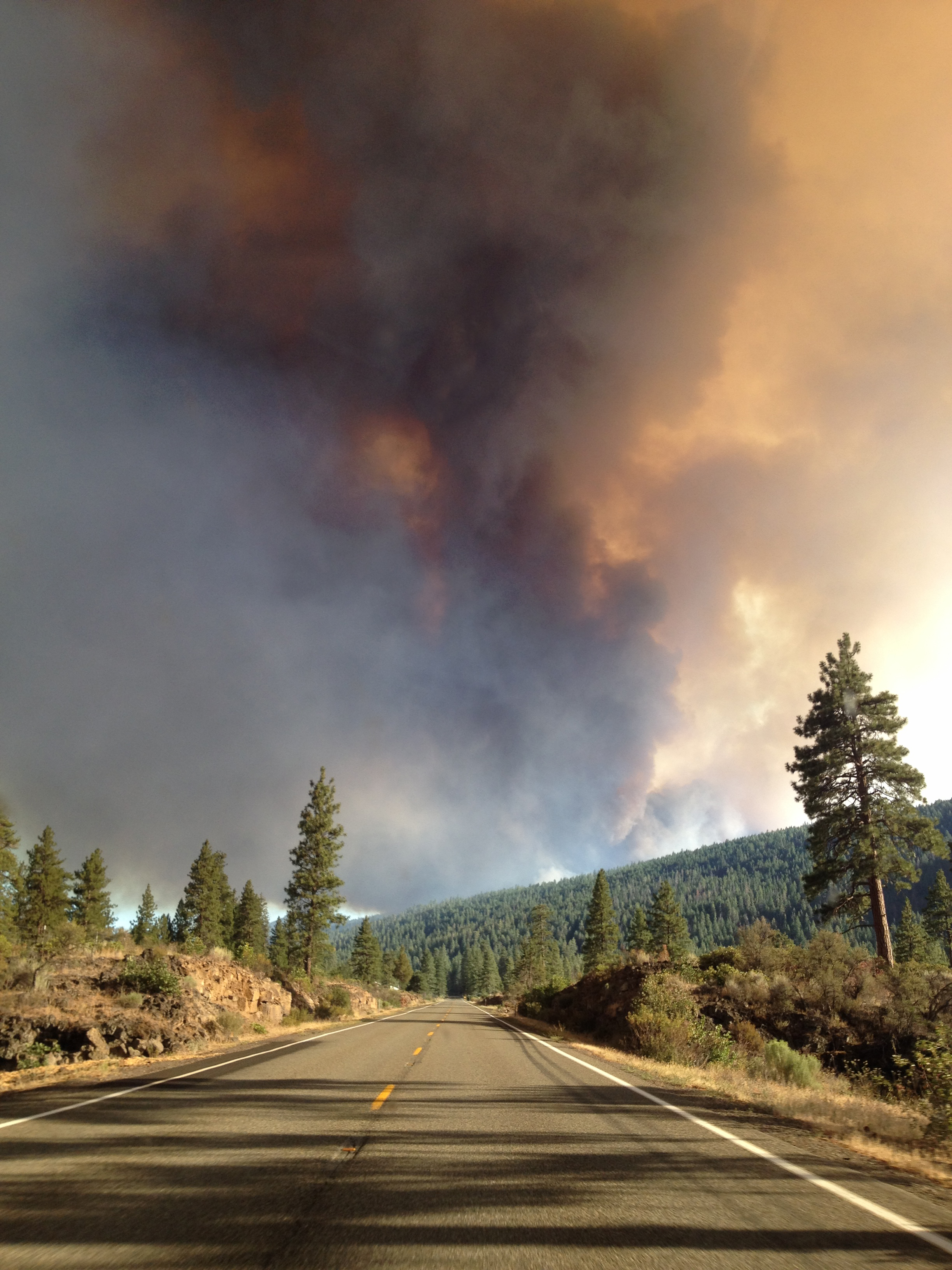
Eiler Fire, Aug 1 2014
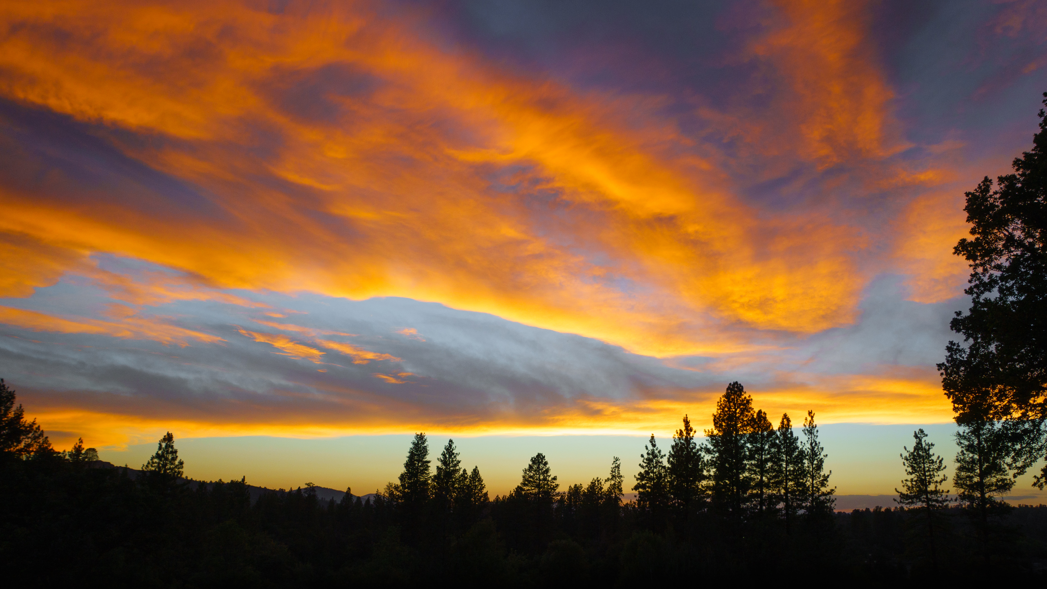
Sunset after a hot day
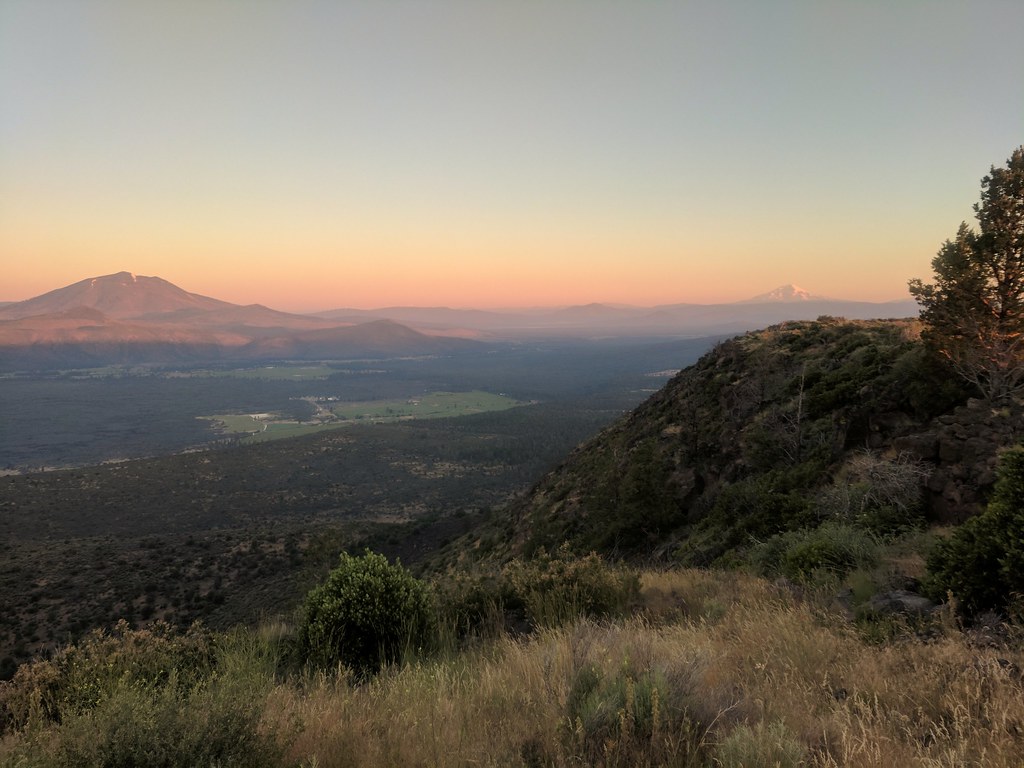
hat creek rim sunrise, mount Shasta in the background.
WAITING FOR THAT "REALLY" LONG DISTANCE CALL
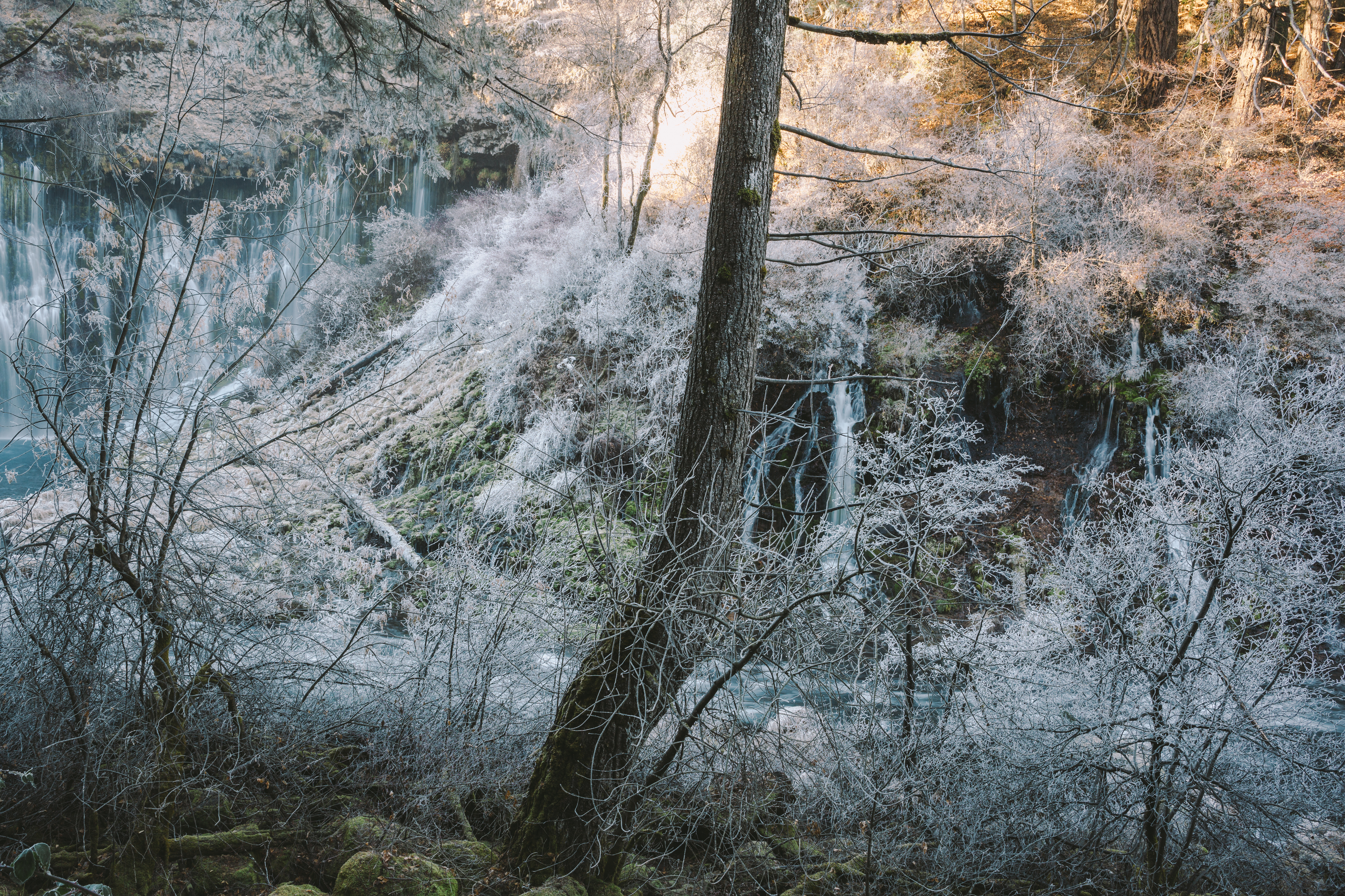
Where Frozen Dreams Are Kept

What a View
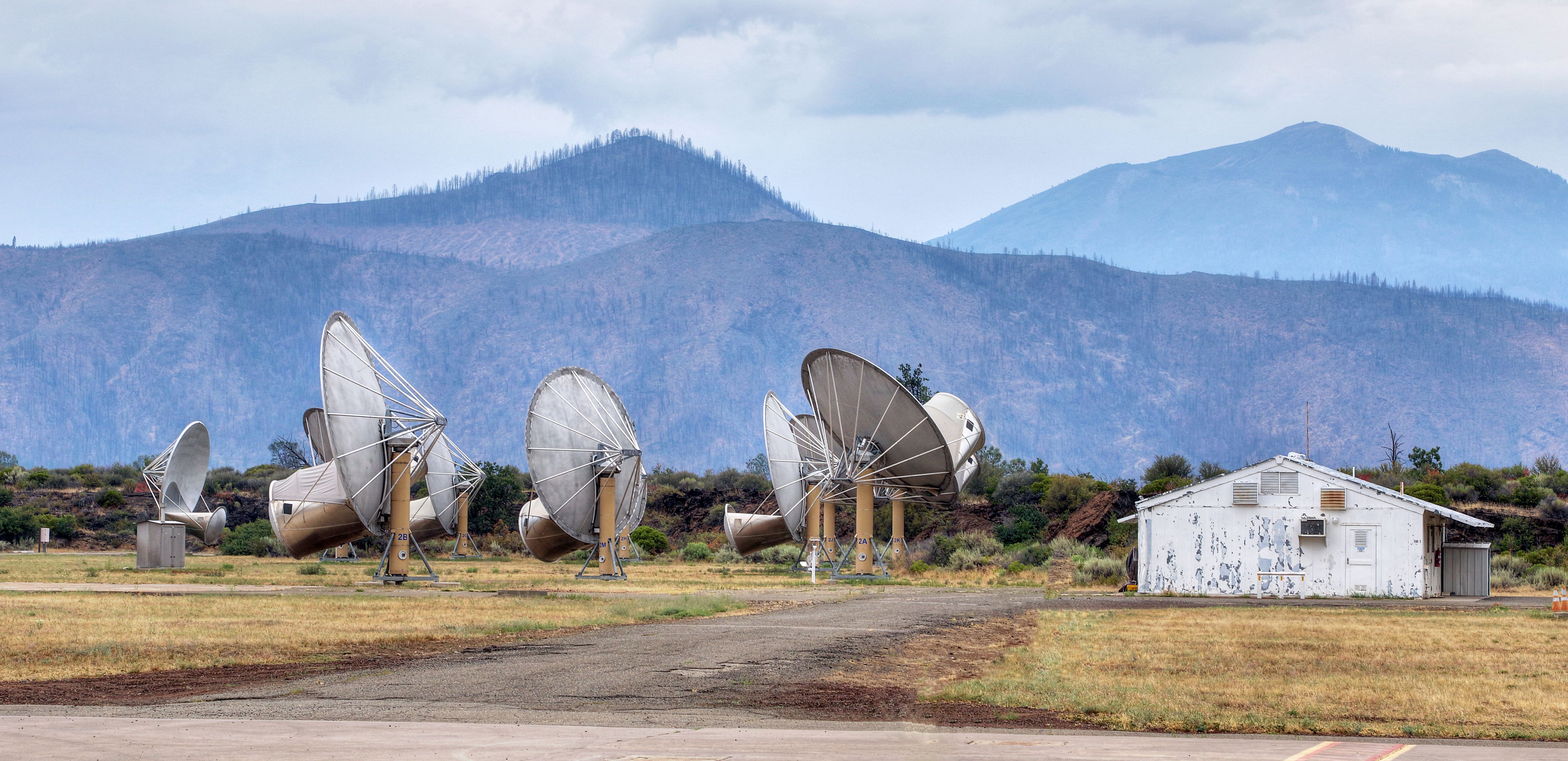
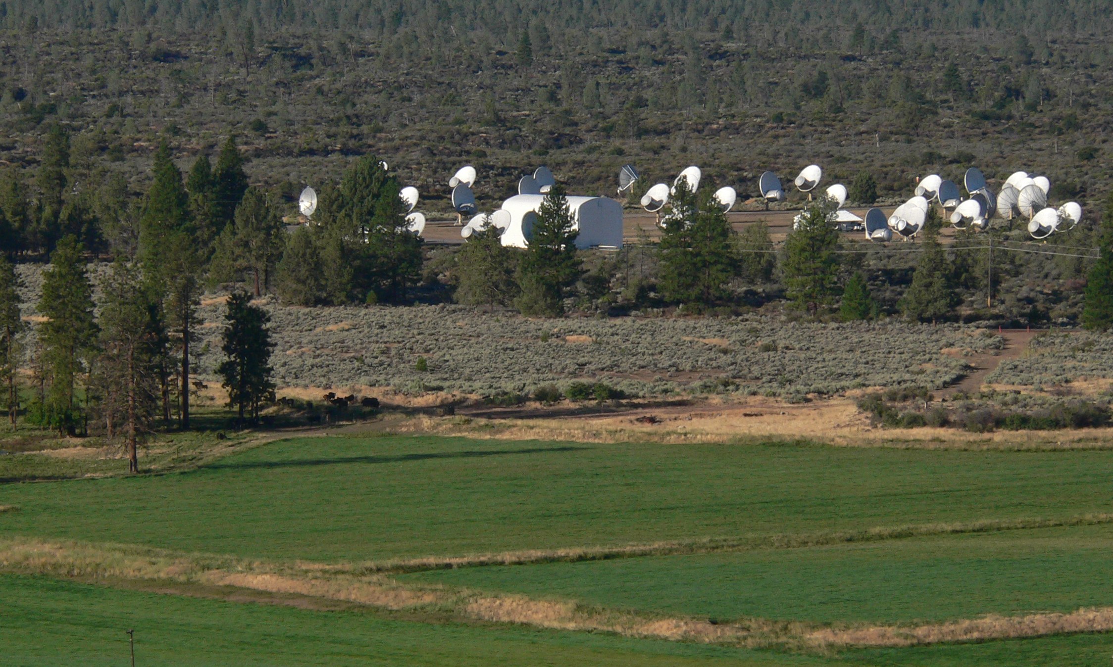
Hat Creek Radio Observatory (HCRO)

Pull over, and have a shot
0522-144606
0522-143230a
Shasta, CA. April 2018.
Shasta, CA. April 2018.
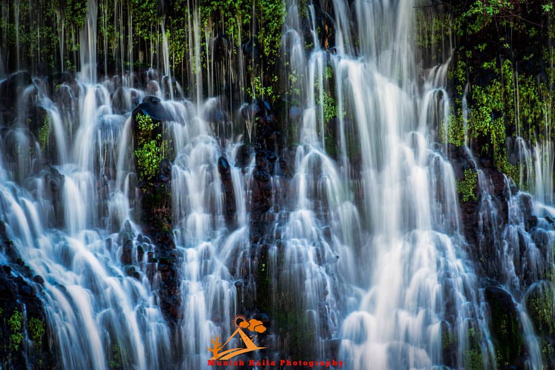
Burney Falls
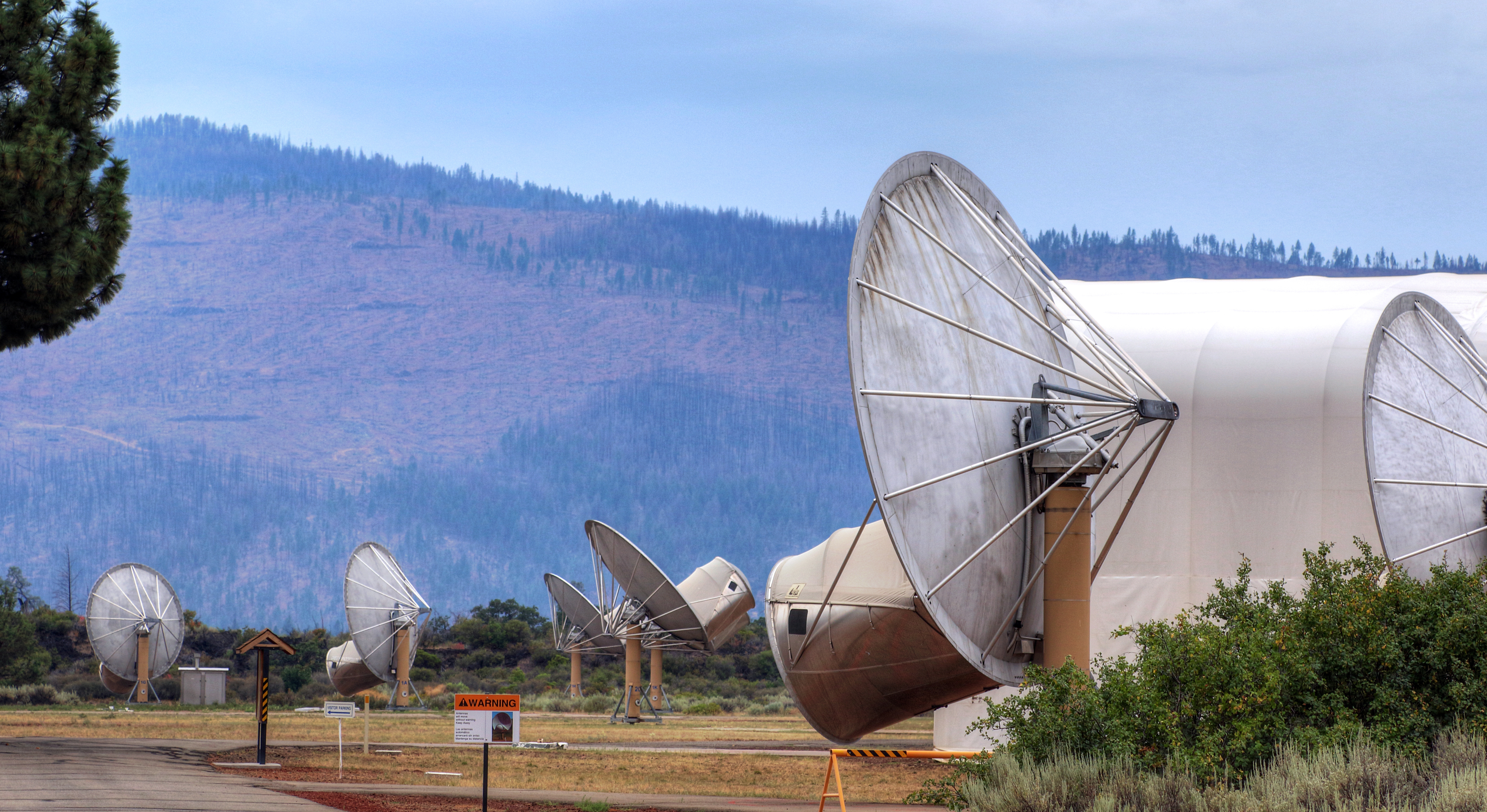
Hat Creek Radio Observatory (HCRO)
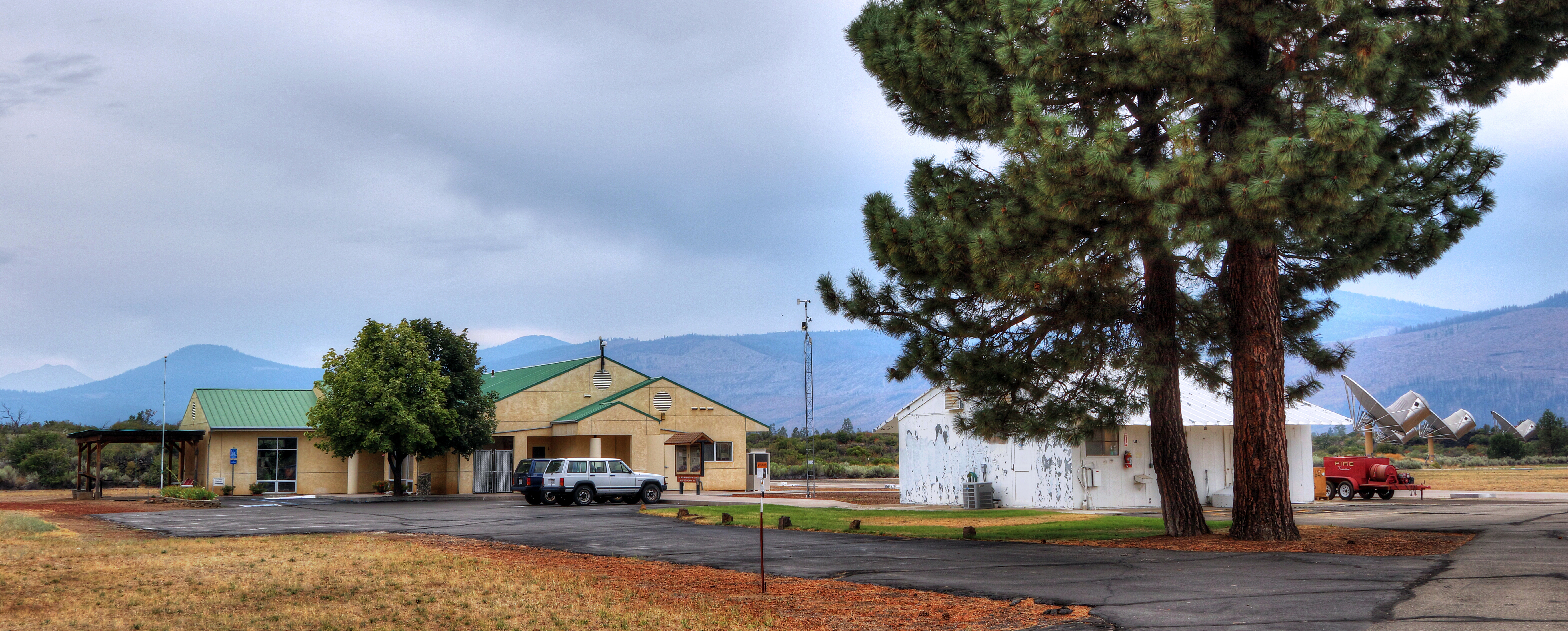
Hat Creek Radio Observatory (HCRO)
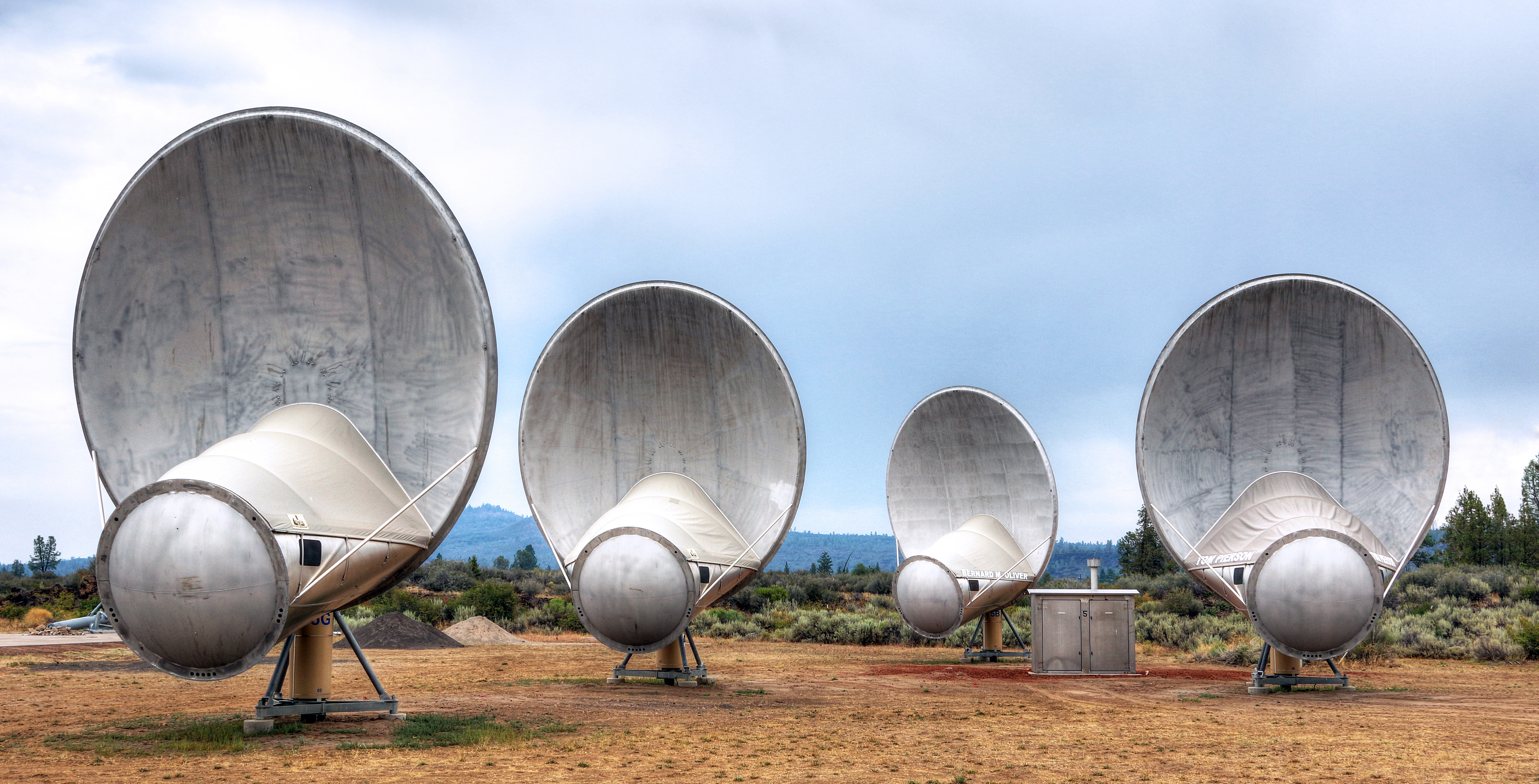
Hat Creek Radio Observatory (HCRO)

Stone Man
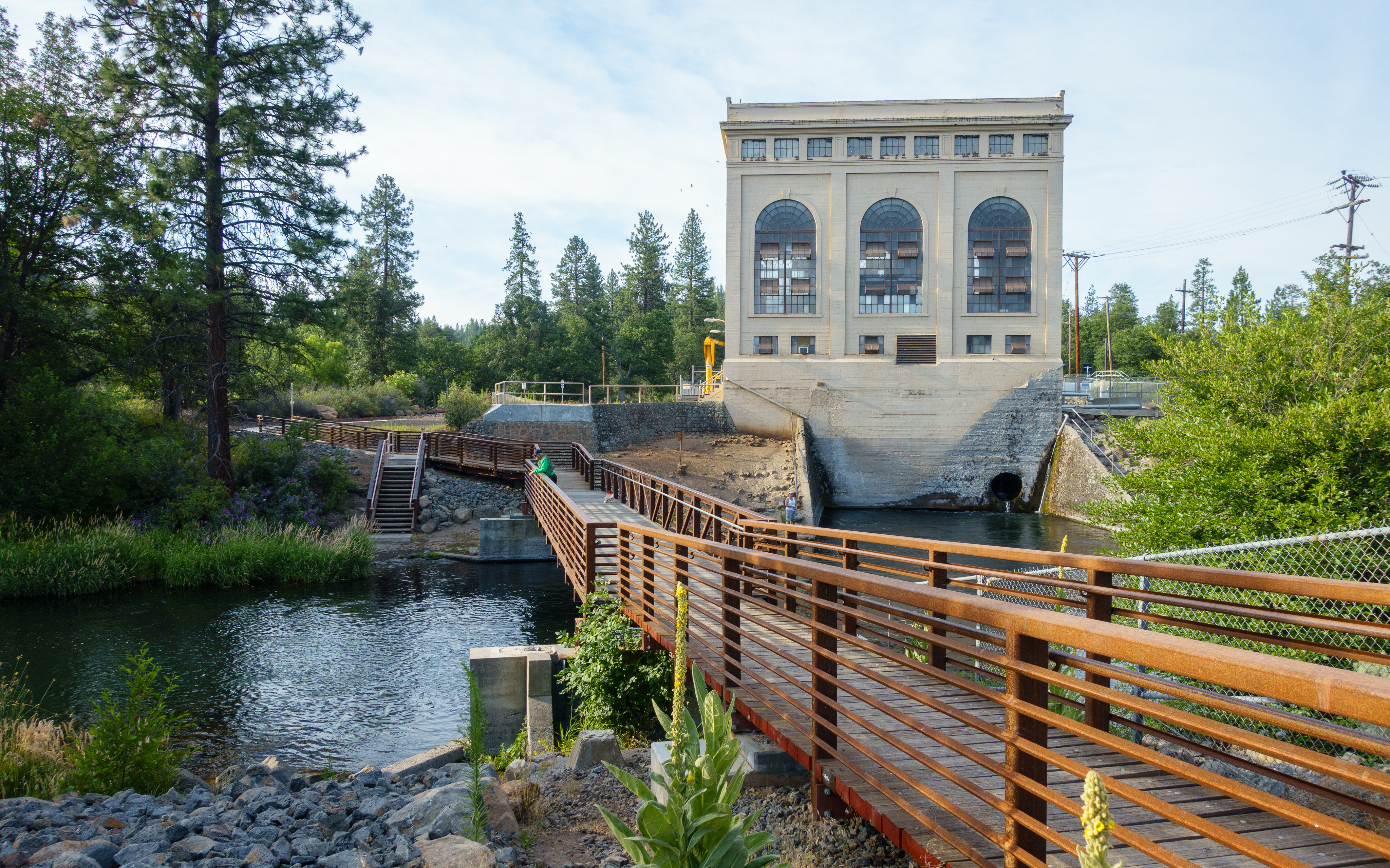
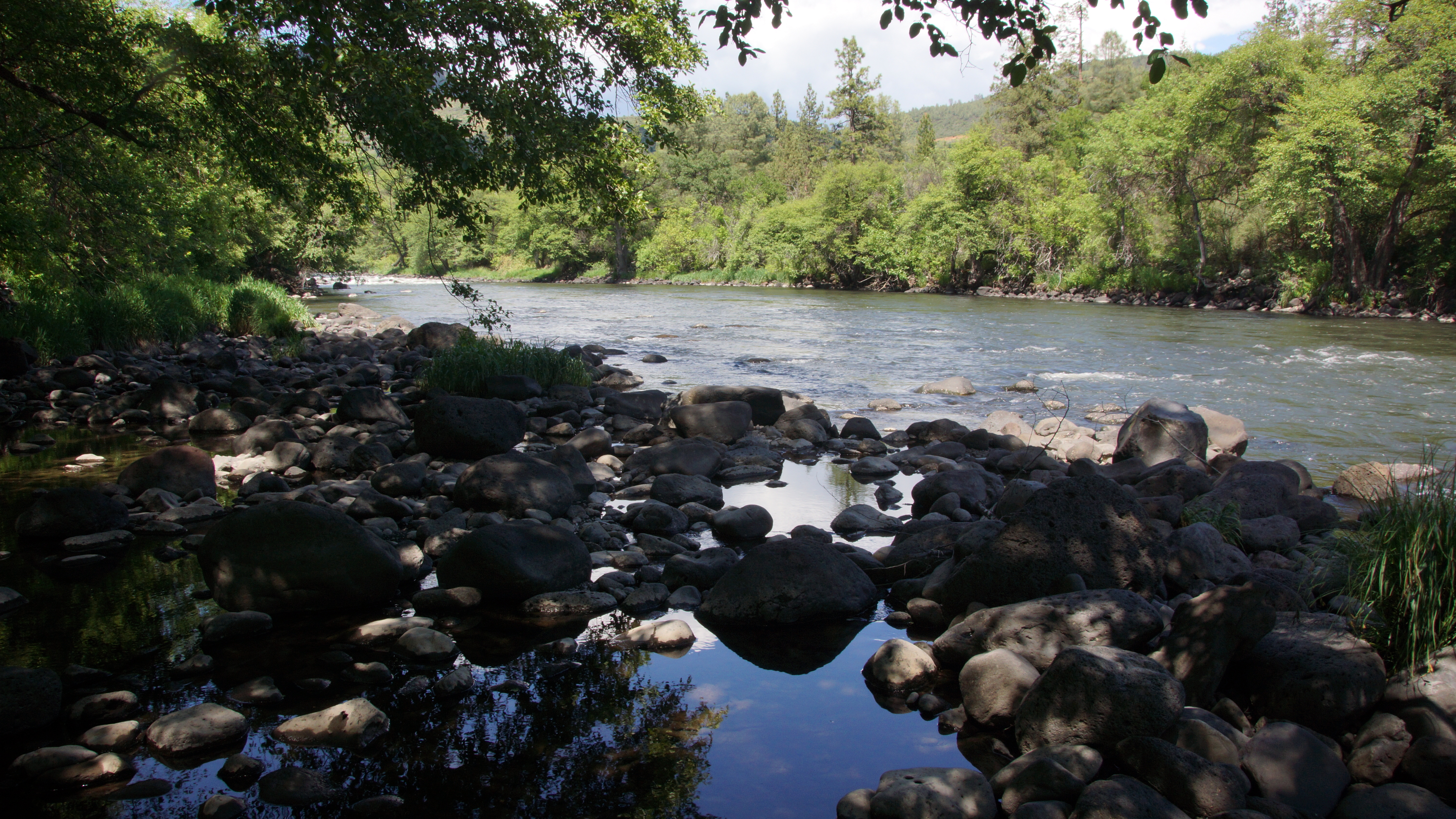
Baum Lake hydro plant

Black Ranch rd. just past Burney,Ca.-Johnson park City area before 299 and 89

Football games
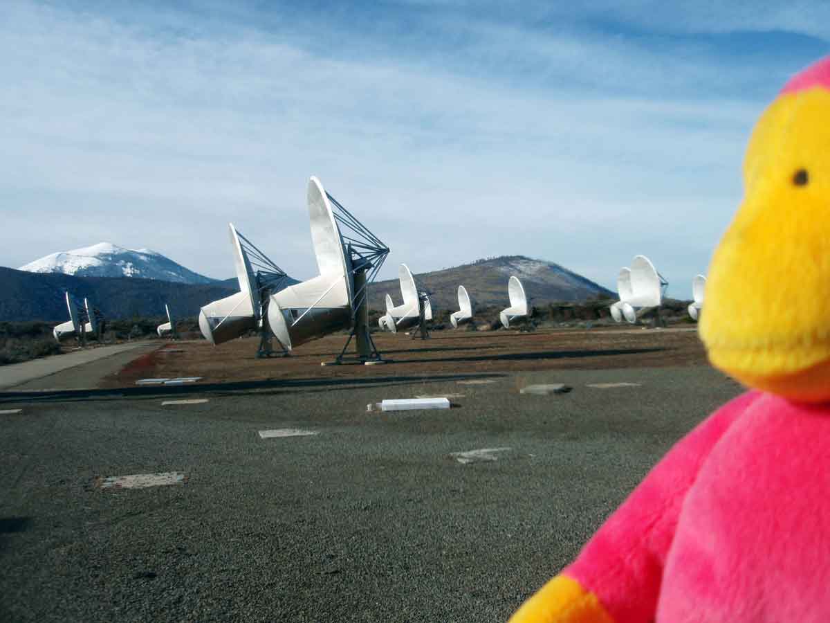
Mountain Monkey at the Allen Telescope Array (ATA)
Zach & Greg launch 2

A Buddy
0522-145239

Roberts_32 Radio Observatory
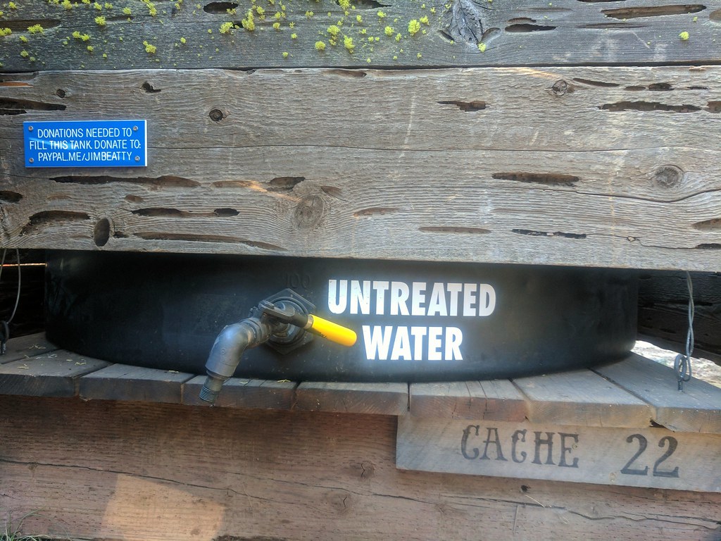
Cache 22
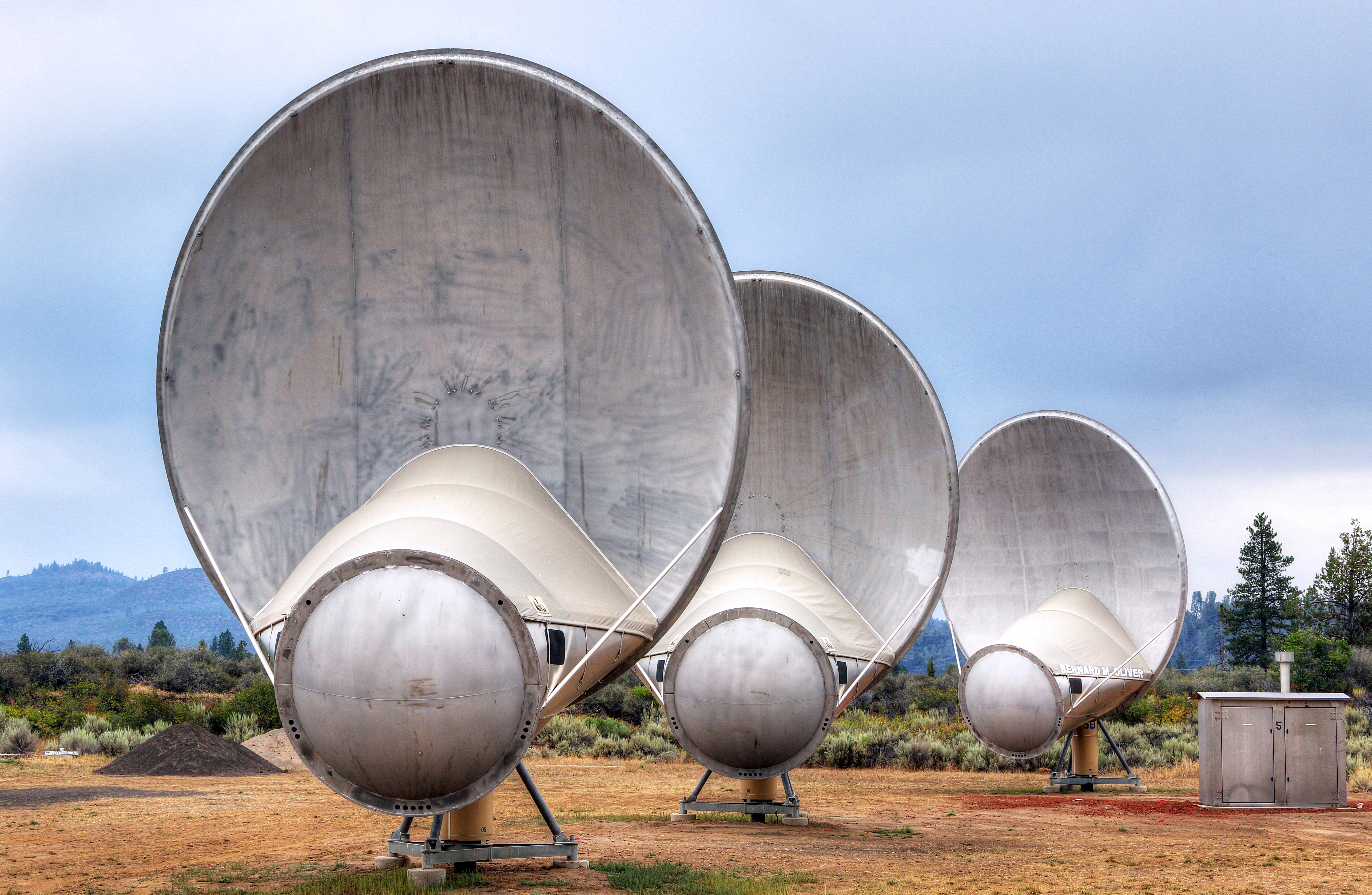
Hat Creek Radio Observatory (HCRO)
Volcano Ln, California アメリカ合衆国ボルケーノ・レーンの地図
別の場所を検索
近所の場所
アメリカ合衆国 〒 カリフォルニア州 ハット・クリーク
Doty Rd, Hat Creek, CA アメリカ合衆国
CA-89, Hat Creek, CA アメリカ合衆国
アメリカ合衆国 〒 カリフォルニア州 キャセル
Thrush Rd, Cassel, CA アメリカ合衆国スラッシュ・ロード
アメリカ合衆国 カリフォルニア州 バーニー山
Garden Ln, Burney, CA アメリカ合衆国
アメリカ合衆国 〒 カリフォルニア州 バーニー
Birch Ave, Burney, CA アメリカ合衆国
Peridot Ln, Burney, CA アメリカ合衆国
Clark Creek Rd, Burney, CA アメリカ合衆国
Clark Creek Rd, Burney, CA アメリカ合衆国
アメリカ合衆国 〒 カリフォルニア州 フォール・リバー・ミルズ
CA-, Fall River Mills, CA アメリカ合衆国
アメリカ合衆国 カリフォルニア州 バーニー滝
Cayton Valley Rd, Burney, CA アメリカ合衆国
アメリカ合衆国 カリフォルニア州 マッカーサー
Fort Mountain Rd, Fall River Mills, CA アメリカ合衆国
McArthur Rd, Fall River Mills, CA アメリカ合衆国
Pittville Rd, McArthur, CA アメリカ合衆国
最近の検索
- アメリカ合衆国 アラスカ州 レッド・ドッグ・マイン日の出日の入り時間
- Am bhf, Borken, ドイツアム・バーンホーフ日の出日の入り時間
- 4th St E, Sonoma, CA, USA日の出日の入り時間
- Oakland Ave, Williamsport, PA アメリカ合衆国日の出日の入り時間
- Via Roma, Pieranica CR, イタリアローマ通り日の出日の入り時間
- クロアチア 〒 ドゥブロブニク GradClock Tower of Dubrovnik日の出日の入り時間
- アルゼンチン チュブ州 トレリュー日の出日の入り時間
- Hartfords Bluff Cir, Mt Pleasant, SC アメリカ合衆国日の出日の入り時間
- 日本、熊本県熊本市北区日の出日の入り時間
- 中華人民共和国 福州市 平潭県 平潭島日の出日の入り時間