Twin Bridges Creek Rd, Mackay, ID アメリカ合衆国日の出日の入り時間
Location: アメリカ合衆国 > アイダホ州 > カスター > アメリカ合衆国 〒 アイダホ州 マッケイ >
時間帯:
America/Boise
現地時間:
2025-07-11 10:38:32
経度:
-114.1285645
緯度:
43.9665745
今日の日の出時刻:
06:05:54 AM
今日の日の入時刻:
09:18:39 PM
今日の日長:
15h 12m 45s
明日の日の出時刻:
06:06:45 AM
明日の日の入時刻:
09:18:02 PM
明日の日長:
15h 11m 17s
すべて表示する
| 日付 | 日出 | 日没 | 日長 |
|---|---|---|---|
| 2025年01月01日 | 08:11:02 AM | 05:10:23 PM | 8h 59m 21s |
| 2025年01月02日 | 08:11:01 AM | 05:11:19 PM | 9h 0m 18s |
| 2025年01月03日 | 08:10:57 AM | 05:12:17 PM | 9h 1m 20s |
| 2025年01月04日 | 08:10:51 AM | 05:13:17 PM | 9h 2m 26s |
| 2025年01月05日 | 08:10:42 AM | 05:14:19 PM | 9h 3m 37s |
| 2025年01月06日 | 08:10:31 AM | 05:15:21 PM | 9h 4m 50s |
| 2025年01月07日 | 08:10:17 AM | 05:16:26 PM | 9h 6m 9s |
| 2025年01月08日 | 08:10:00 AM | 05:17:32 PM | 9h 7m 32s |
| 2025年01月09日 | 08:09:42 AM | 05:18:39 PM | 9h 8m 57s |
| 2025年01月10日 | 08:09:20 AM | 05:19:48 PM | 9h 10m 28s |
| 2025年01月11日 | 08:08:56 AM | 05:20:58 PM | 9h 12m 2s |
| 2025年01月12日 | 08:08:30 AM | 05:22:09 PM | 9h 13m 39s |
| 2025年01月13日 | 08:08:02 AM | 05:23:21 PM | 9h 15m 19s |
| 2025年01月14日 | 08:07:31 AM | 05:24:34 PM | 9h 17m 3s |
| 2025年01月15日 | 08:06:57 AM | 05:25:48 PM | 9h 18m 51s |
| 2025年01月16日 | 08:06:22 AM | 05:27:03 PM | 9h 20m 41s |
| 2025年01月17日 | 08:05:44 AM | 05:28:19 PM | 9h 22m 35s |
| 2025年01月18日 | 08:05:04 AM | 05:29:36 PM | 9h 24m 32s |
| 2025年01月19日 | 08:04:21 AM | 05:30:53 PM | 9h 26m 32s |
| 2025年01月20日 | 08:03:36 AM | 05:32:12 PM | 9h 28m 36s |
| 2025年01月21日 | 08:02:50 AM | 05:33:30 PM | 9h 30m 40s |
| 2025年01月22日 | 08:02:01 AM | 05:34:50 PM | 9h 32m 49s |
| 2025年01月23日 | 08:01:10 AM | 05:36:10 PM | 9h 35m 0s |
| 2025年01月24日 | 08:00:16 AM | 05:37:30 PM | 9h 37m 14s |
| 2025年01月25日 | 07:59:21 AM | 05:38:51 PM | 9h 39m 30s |
| 2025年01月26日 | 07:58:24 AM | 05:40:13 PM | 9h 41m 49s |
| 2025年01月27日 | 07:57:25 AM | 05:41:34 PM | 9h 44m 9s |
| 2025年01月28日 | 07:56:24 AM | 05:42:56 PM | 9h 46m 32s |
| 2025年01月29日 | 07:55:21 AM | 05:44:19 PM | 9h 48m 58s |
| 2025年01月30日 | 07:54:16 AM | 05:45:41 PM | 9h 51m 25s |
| 2025年01月31日 | 07:53:09 AM | 05:47:04 PM | 9h 53m 55s |
| 2025年02月01日 | 07:52:01 AM | 05:48:26 PM | 9h 56m 25s |
| 2025年02月02日 | 07:50:51 AM | 05:49:49 PM | 9h 58m 58s |
| 2025年02月03日 | 07:49:39 AM | 05:51:12 PM | 10h 1m 33s |
| 2025年02月04日 | 07:48:25 AM | 05:52:35 PM | 10h 4m 10s |
| 2025年02月05日 | 07:47:10 AM | 05:53:58 PM | 10h 6m 48s |
| 2025年02月06日 | 07:45:54 AM | 05:55:21 PM | 10h 9m 27s |
| 2025年02月07日 | 07:44:35 AM | 05:56:44 PM | 10h 12m 9s |
| 2025年02月08日 | 07:43:16 AM | 05:58:07 PM | 10h 14m 51s |
| 2025年02月09日 | 07:41:55 AM | 05:59:30 PM | 10h 17m 35s |
| 2025年02月10日 | 07:40:32 AM | 06:00:52 PM | 10h 20m 20s |
| 2025年02月11日 | 07:39:08 AM | 06:02:15 PM | 10h 23m 7s |
| 2025年02月12日 | 07:37:43 AM | 06:03:37 PM | 10h 25m 54s |
| 2025年02月13日 | 07:36:16 AM | 06:04:59 PM | 10h 28m 43s |
| 2025年02月14日 | 07:34:49 AM | 06:06:21 PM | 10h 31m 32s |
| 2025年02月15日 | 07:33:20 AM | 06:07:42 PM | 10h 34m 22s |
| 2025年02月16日 | 07:31:49 AM | 06:09:04 PM | 10h 37m 15s |
| 2025年02月17日 | 07:30:18 AM | 06:10:25 PM | 10h 40m 7s |
| 2025年02月18日 | 07:28:46 AM | 06:11:46 PM | 10h 43m 0s |
| 2025年02月19日 | 07:27:12 AM | 06:13:07 PM | 10h 45m 55s |
| 2025年02月20日 | 07:25:38 AM | 06:14:27 PM | 10h 48m 49s |
| 2025年02月21日 | 07:24:02 AM | 06:15:47 PM | 10h 51m 45s |
| 2025年02月22日 | 07:22:26 AM | 06:17:07 PM | 10h 54m 41s |
| 2025年02月23日 | 07:20:48 AM | 06:18:27 PM | 10h 57m 39s |
| 2025年02月24日 | 07:19:10 AM | 06:19:46 PM | 11h 0m 36s |
| 2025年02月25日 | 07:17:31 AM | 06:21:05 PM | 11h 3m 34s |
| 2025年02月26日 | 07:15:51 AM | 06:22:24 PM | 11h 6m 33s |
| 2025年02月27日 | 07:14:10 AM | 06:23:42 PM | 11h 9m 32s |
| 2025年02月28日 | 07:12:29 AM | 06:25:01 PM | 11h 12m 32s |
| 2025年03月01日 | 07:10:47 AM | 06:26:18 PM | 11h 15m 31s |
| 2025年03月02日 | 07:09:04 AM | 06:27:36 PM | 11h 18m 32s |
| 2025年03月03日 | 07:07:20 AM | 06:28:53 PM | 11h 21m 33s |
| 2025年03月04日 | 07:05:36 AM | 06:30:10 PM | 11h 24m 34s |
| 2025年03月05日 | 07:03:52 AM | 06:31:27 PM | 11h 27m 35s |
| 2025年03月06日 | 07:02:07 AM | 06:32:44 PM | 11h 30m 37s |
| 2025年03月07日 | 07:00:21 AM | 06:34:00 PM | 11h 33m 39s |
| 2025年03月08日 | 06:58:35 AM | 06:35:16 PM | 11h 36m 41s |
| 2025年03月09日 | 07:56:53 AM | 07:36:29 PM | 11h 39m 36s |
| 2025年03月10日 | 07:55:06 AM | 07:37:44 PM | 11h 42m 38s |
| 2025年03月11日 | 07:53:18 AM | 07:38:59 PM | 11h 45m 41s |
| 2025年03月12日 | 07:51:31 AM | 07:40:14 PM | 11h 48m 43s |
| 2025年03月13日 | 07:49:43 AM | 07:41:29 PM | 11h 51m 46s |
| 2025年03月14日 | 07:47:54 AM | 07:42:44 PM | 11h 54m 50s |
| 2025年03月15日 | 07:46:06 AM | 07:43:59 PM | 11h 57m 53s |
| 2025年03月16日 | 07:44:17 AM | 07:45:13 PM | 12h 0m 56s |
| 2025年03月17日 | 07:42:28 AM | 07:46:27 PM | 12h 3m 59s |
| 2025年03月18日 | 07:40:39 AM | 07:47:41 PM | 12h 7m 2s |
| 2025年03月19日 | 07:38:50 AM | 07:48:55 PM | 12h 10m 5s |
| 2025年03月20日 | 07:37:01 AM | 07:50:08 PM | 12h 13m 7s |
| 2025年03月21日 | 07:35:11 AM | 07:51:22 PM | 12h 16m 11s |
| 2025年03月22日 | 07:33:22 AM | 07:52:35 PM | 12h 19m 13s |
| 2025年03月23日 | 07:31:32 AM | 07:53:48 PM | 12h 22m 16s |
| 2025年03月24日 | 07:29:43 AM | 07:55:02 PM | 12h 25m 19s |
| 2025年03月25日 | 07:27:54 AM | 07:56:15 PM | 12h 28m 21s |
| 2025年03月26日 | 07:26:05 AM | 07:57:28 PM | 12h 31m 23s |
| 2025年03月27日 | 07:24:16 AM | 07:58:40 PM | 12h 34m 24s |
| 2025年03月28日 | 07:22:27 AM | 07:59:53 PM | 12h 37m 26s |
| 2025年03月29日 | 07:20:38 AM | 08:01:06 PM | 12h 40m 28s |
| 2025年03月30日 | 07:18:49 AM | 08:02:19 PM | 12h 43m 30s |
| 2025年03月31日 | 07:17:01 AM | 08:03:31 PM | 12h 46m 30s |
| 2025年04月01日 | 07:15:13 AM | 08:04:44 PM | 12h 49m 31s |
| 2025年04月02日 | 07:13:26 AM | 08:05:57 PM | 12h 52m 31s |
| 2025年04月03日 | 07:11:38 AM | 08:07:09 PM | 12h 55m 31s |
| 2025年04月04日 | 07:09:51 AM | 08:08:22 PM | 12h 58m 31s |
| 2025年04月05日 | 07:08:05 AM | 08:09:34 PM | 13h 1m 29s |
| 2025年04月06日 | 07:06:19 AM | 08:10:47 PM | 13h 4m 28s |
| 2025年04月07日 | 07:04:33 AM | 08:11:59 PM | 13h 7m 26s |
| 2025年04月08日 | 07:02:48 AM | 08:13:12 PM | 13h 10m 24s |
| 2025年04月09日 | 07:01:03 AM | 08:14:24 PM | 13h 13m 21s |
| 2025年04月10日 | 06:59:19 AM | 08:15:37 PM | 13h 16m 18s |
| 2025年04月11日 | 06:57:36 AM | 08:16:49 PM | 13h 19m 13s |
| 2025年04月12日 | 06:55:53 AM | 08:18:02 PM | 13h 22m 9s |
| 2025年04月13日 | 06:54:11 AM | 08:19:14 PM | 13h 25m 3s |
| 2025年04月14日 | 06:52:29 AM | 08:20:27 PM | 13h 27m 58s |
| 2025年04月15日 | 06:50:49 AM | 08:21:39 PM | 13h 30m 50s |
| 2025年04月16日 | 06:49:09 AM | 08:22:52 PM | 13h 33m 43s |
| 2025年04月17日 | 06:47:29 AM | 08:24:04 PM | 13h 36m 35s |
| 2025年04月18日 | 06:45:51 AM | 08:25:17 PM | 13h 39m 26s |
| 2025年04月19日 | 06:44:14 AM | 08:26:29 PM | 13h 42m 15s |
| 2025年04月20日 | 06:42:37 AM | 08:27:41 PM | 13h 45m 4s |
| 2025年04月21日 | 06:41:01 AM | 08:28:54 PM | 13h 47m 53s |
| 2025年04月22日 | 06:39:27 AM | 08:30:06 PM | 13h 50m 39s |
| 2025年04月23日 | 06:37:53 AM | 08:31:18 PM | 13h 53m 25s |
| 2025年04月24日 | 06:36:20 AM | 08:32:31 PM | 13h 56m 11s |
| 2025年04月25日 | 06:34:49 AM | 08:33:43 PM | 13h 58m 54s |
| 2025年04月26日 | 06:33:18 AM | 08:34:55 PM | 14h 1m 37s |
| 2025年04月27日 | 06:31:49 AM | 08:36:06 PM | 14h 4m 17s |
| 2025年04月28日 | 06:30:20 AM | 08:37:18 PM | 14h 6m 58s |
| 2025年04月29日 | 06:28:53 AM | 08:38:30 PM | 14h 9m 37s |
| 2025年04月30日 | 06:27:28 AM | 08:39:41 PM | 14h 12m 13s |
| 2025年05月01日 | 06:26:03 AM | 08:40:52 PM | 14h 14m 49s |
| 2025年05月02日 | 06:24:40 AM | 08:42:04 PM | 14h 17m 24s |
| 2025年05月03日 | 06:23:18 AM | 08:43:14 PM | 14h 19m 56s |
| 2025年05月04日 | 06:21:58 AM | 08:44:25 PM | 14h 22m 27s |
| 2025年05月05日 | 06:20:38 AM | 08:45:35 PM | 14h 24m 57s |
| 2025年05月06日 | 06:19:21 AM | 08:46:45 PM | 14h 27m 24s |
| 2025年05月07日 | 06:18:05 AM | 08:47:54 PM | 14h 29m 49s |
| 2025年05月08日 | 06:16:50 AM | 08:49:04 PM | 14h 32m 14s |
| 2025年05月09日 | 06:15:37 AM | 08:50:12 PM | 14h 34m 35s |
| 2025年05月10日 | 06:14:26 AM | 08:51:21 PM | 14h 36m 55s |
| 2025年05月11日 | 06:13:16 AM | 08:52:29 PM | 14h 39m 13s |
| 2025年05月12日 | 06:12:08 AM | 08:53:36 PM | 14h 41m 28s |
| 2025年05月13日 | 06:11:01 AM | 08:54:43 PM | 14h 43m 42s |
| 2025年05月14日 | 06:09:56 AM | 08:55:49 PM | 14h 45m 53s |
| 2025年05月15日 | 06:08:53 AM | 08:56:54 PM | 14h 48m 1s |
| 2025年05月16日 | 06:07:52 AM | 08:57:59 PM | 14h 50m 7s |
| 2025年05月17日 | 06:06:53 AM | 08:59:03 PM | 14h 52m 10s |
| 2025年05月18日 | 06:05:55 AM | 09:00:07 PM | 14h 54m 12s |
| 2025年05月19日 | 06:05:00 AM | 09:01:09 PM | 14h 56m 9s |
| 2025年05月20日 | 06:04:06 AM | 09:02:11 PM | 14h 58m 5s |
| 2025年05月21日 | 06:03:14 AM | 09:03:12 PM | 14h 59m 58s |
| 2025年05月22日 | 06:02:24 AM | 09:04:12 PM | 15h 1m 48s |
| 2025年05月23日 | 06:01:36 AM | 09:05:11 PM | 15h 3m 35s |
| 2025年05月24日 | 06:00:50 AM | 09:06:09 PM | 15h 5m 19s |
| 2025年05月25日 | 06:00:07 AM | 09:07:06 PM | 15h 6m 59s |
| 2025年05月26日 | 05:59:25 AM | 09:08:02 PM | 15h 8m 37s |
| 2025年05月27日 | 05:58:45 AM | 09:08:56 PM | 15h 10m 11s |
| 2025年05月28日 | 05:58:08 AM | 09:09:50 PM | 15h 11m 42s |
| 2025年05月29日 | 05:57:32 AM | 09:10:42 PM | 15h 13m 10s |
| 2025年05月30日 | 05:56:59 AM | 09:11:33 PM | 15h 14m 34s |
| 2025年05月31日 | 05:56:28 AM | 09:12:22 PM | 15h 15m 54s |
| 2025年06月01日 | 05:55:59 AM | 09:13:10 PM | 15h 17m 11s |
| 2025年06月02日 | 05:55:33 AM | 09:13:57 PM | 15h 18m 24s |
| 2025年06月03日 | 05:55:08 AM | 09:14:42 PM | 15h 19m 34s |
| 2025年06月04日 | 05:54:46 AM | 09:15:25 PM | 15h 20m 39s |
| 2025年06月05日 | 05:54:26 AM | 09:16:07 PM | 15h 21m 41s |
| 2025年06月06日 | 05:54:08 AM | 09:16:48 PM | 15h 22m 40s |
| 2025年06月07日 | 05:53:52 AM | 09:17:26 PM | 15h 23m 34s |
| 2025年06月08日 | 05:53:39 AM | 09:18:03 PM | 15h 24m 24s |
| 2025年06月09日 | 05:53:28 AM | 09:18:38 PM | 15h 25m 10s |
| 2025年06月10日 | 05:53:19 AM | 09:19:11 PM | 15h 25m 52s |
| 2025年06月11日 | 05:53:13 AM | 09:19:43 PM | 15h 26m 30s |
| 2025年06月12日 | 05:53:08 AM | 09:20:12 PM | 15h 27m 4s |
| 2025年06月13日 | 05:53:06 AM | 09:20:40 PM | 15h 27m 34s |
| 2025年06月14日 | 05:53:06 AM | 09:21:05 PM | 15h 27m 59s |
| 2025年06月15日 | 05:53:08 AM | 09:21:29 PM | 15h 28m 21s |
| 2025年06月16日 | 05:53:13 AM | 09:21:51 PM | 15h 28m 38s |
| 2025年06月17日 | 05:53:19 AM | 09:22:10 PM | 15h 28m 51s |
| 2025年06月18日 | 05:53:28 AM | 09:22:27 PM | 15h 28m 59s |
| 2025年06月19日 | 05:53:39 AM | 09:22:43 PM | 15h 29m 4s |
| 2025年06月20日 | 05:53:52 AM | 09:22:56 PM | 15h 29m 4s |
| 2025年06月21日 | 05:54:07 AM | 09:23:07 PM | 15h 29m 0s |
| 2025年06月22日 | 05:54:24 AM | 09:23:16 PM | 15h 28m 52s |
| 2025年06月23日 | 05:54:43 AM | 09:23:22 PM | 15h 28m 39s |
| 2025年06月24日 | 05:55:05 AM | 09:23:27 PM | 15h 28m 22s |
| 2025年06月25日 | 05:55:28 AM | 09:23:29 PM | 15h 28m 1s |
| 2025年06月26日 | 05:55:53 AM | 09:23:28 PM | 15h 27m 35s |
| 2025年06月27日 | 05:56:20 AM | 09:23:26 PM | 15h 27m 6s |
| 2025年06月28日 | 05:56:49 AM | 09:23:21 PM | 15h 26m 32s |
| 2025年06月29日 | 05:57:19 AM | 09:23:14 PM | 15h 25m 55s |
| 2025年06月30日 | 05:57:52 AM | 09:23:05 PM | 15h 25m 13s |
| 2025年07月01日 | 05:58:26 AM | 09:22:54 PM | 15h 24m 28s |
| 2025年07月02日 | 05:59:02 AM | 09:22:40 PM | 15h 23m 38s |
| 2025年07月03日 | 05:59:39 AM | 09:22:24 PM | 15h 22m 45s |
| 2025年07月04日 | 06:00:18 AM | 09:22:05 PM | 15h 21m 47s |
| 2025年07月05日 | 06:00:59 AM | 09:21:45 PM | 15h 20m 46s |
| 2025年07月06日 | 06:01:41 AM | 09:21:22 PM | 15h 19m 41s |
| 2025年07月07日 | 06:02:25 AM | 09:20:57 PM | 15h 18m 32s |
| 2025年07月08日 | 06:03:10 AM | 09:20:29 PM | 15h 17m 19s |
| 2025年07月09日 | 06:03:57 AM | 09:19:59 PM | 15h 16m 2s |
| 2025年07月10日 | 06:04:44 AM | 09:19:28 PM | 15h 14m 44s |
| 2025年07月11日 | 06:05:33 AM | 09:18:54 PM | 15h 13m 21s |
| 2025年07月12日 | 06:06:24 AM | 09:18:17 PM | 15h 11m 53s |
| 2025年07月13日 | 06:07:15 AM | 09:17:39 PM | 15h 10m 24s |
| 2025年07月14日 | 06:08:08 AM | 09:16:58 PM | 15h 8m 50s |
| 2025年07月15日 | 06:09:02 AM | 09:16:16 PM | 15h 7m 14s |
| 2025年07月16日 | 06:09:57 AM | 09:15:31 PM | 15h 5m 34s |
| 2025年07月17日 | 06:10:52 AM | 09:14:44 PM | 15h 3m 52s |
| 2025年07月18日 | 06:11:49 AM | 09:13:55 PM | 15h 2m 6s |
| 2025年07月19日 | 06:12:47 AM | 09:13:05 PM | 15h 0m 18s |
| 2025年07月20日 | 06:13:45 AM | 09:12:12 PM | 14h 58m 27s |
| 2025年07月21日 | 06:14:45 AM | 09:11:17 PM | 14h 56m 32s |
| 2025年07月22日 | 06:15:45 AM | 09:10:20 PM | 14h 54m 35s |
| 2025年07月23日 | 06:16:46 AM | 09:09:22 PM | 14h 52m 36s |
| 2025年07月24日 | 06:17:47 AM | 09:08:21 PM | 14h 50m 34s |
| 2025年07月25日 | 06:18:49 AM | 09:07:19 PM | 14h 48m 30s |
| 2025年07月26日 | 06:19:52 AM | 09:06:15 PM | 14h 46m 23s |
| 2025年07月27日 | 06:20:55 AM | 09:05:09 PM | 14h 44m 14s |
| 2025年07月28日 | 06:21:59 AM | 09:04:01 PM | 14h 42m 2s |
| 2025年07月29日 | 06:23:04 AM | 09:02:52 PM | 14h 39m 48s |
| 2025年07月30日 | 06:24:08 AM | 09:01:41 PM | 14h 37m 33s |
| 2025年07月31日 | 06:25:14 AM | 09:00:28 PM | 14h 35m 14s |
| 2025年08月01日 | 06:26:19 AM | 08:59:14 PM | 14h 32m 55s |
| 2025年08月02日 | 06:27:25 AM | 08:57:58 PM | 14h 30m 33s |
| 2025年08月03日 | 06:28:31 AM | 08:56:41 PM | 14h 28m 10s |
| 2025年08月04日 | 06:29:38 AM | 08:55:22 PM | 14h 25m 44s |
| 2025年08月05日 | 06:30:45 AM | 08:54:02 PM | 14h 23m 17s |
| 2025年08月06日 | 06:31:52 AM | 08:52:40 PM | 14h 20m 48s |
| 2025年08月07日 | 06:32:59 AM | 08:51:17 PM | 14h 18m 18s |
| 2025年08月08日 | 06:34:06 AM | 08:49:52 PM | 14h 15m 46s |
| 2025年08月09日 | 06:35:14 AM | 08:48:27 PM | 14h 13m 13s |
| 2025年08月10日 | 06:36:22 AM | 08:46:59 PM | 14h 10m 37s |
| 2025年08月11日 | 06:37:30 AM | 08:45:31 PM | 14h 8m 1s |
| 2025年08月12日 | 06:38:38 AM | 08:44:02 PM | 14h 5m 24s |
| 2025年08月13日 | 06:39:46 AM | 08:42:31 PM | 14h 2m 45s |
| 2025年08月14日 | 06:40:54 AM | 08:40:59 PM | 14h 0m 5s |
| 2025年08月15日 | 06:42:02 AM | 08:39:26 PM | 13h 57m 24s |
| 2025年08月16日 | 06:43:10 AM | 08:37:52 PM | 13h 54m 42s |
| 2025年08月17日 | 06:44:19 AM | 08:36:17 PM | 13h 51m 58s |
| 2025年08月18日 | 06:45:27 AM | 08:34:41 PM | 13h 49m 14s |
| 2025年08月19日 | 06:46:35 AM | 08:33:04 PM | 13h 46m 29s |
| 2025年08月20日 | 06:47:44 AM | 08:31:26 PM | 13h 43m 42s |
| 2025年08月21日 | 06:48:52 AM | 08:29:47 PM | 13h 40m 55s |
| 2025年08月22日 | 06:50:00 AM | 08:28:07 PM | 13h 38m 7s |
| 2025年08月23日 | 06:51:09 AM | 08:26:27 PM | 13h 35m 18s |
| 2025年08月24日 | 06:52:17 AM | 08:24:45 PM | 13h 32m 28s |
| 2025年08月25日 | 06:53:25 AM | 08:23:03 PM | 13h 29m 38s |
| 2025年08月26日 | 06:54:33 AM | 08:21:20 PM | 13h 26m 47s |
| 2025年08月27日 | 06:55:41 AM | 08:19:36 PM | 13h 23m 55s |
| 2025年08月28日 | 06:56:50 AM | 08:17:52 PM | 13h 21m 2s |
| 2025年08月29日 | 06:57:58 AM | 08:16:07 PM | 13h 18m 9s |
| 2025年08月30日 | 06:59:06 AM | 08:14:22 PM | 13h 15m 16s |
| 2025年08月31日 | 07:00:14 AM | 08:12:36 PM | 13h 12m 22s |
| 2025年09月01日 | 07:01:22 AM | 08:10:49 PM | 13h 9m 27s |
| 2025年09月02日 | 07:02:30 AM | 08:09:02 PM | 13h 6m 32s |
| 2025年09月03日 | 07:03:38 AM | 08:07:14 PM | 13h 3m 36s |
| 2025年09月04日 | 07:04:46 AM | 08:05:26 PM | 13h 0m 40s |
| 2025年09月05日 | 07:05:54 AM | 08:03:37 PM | 12h 57m 43s |
| 2025年09月06日 | 07:07:02 AM | 08:01:48 PM | 12h 54m 46s |
| 2025年09月07日 | 07:08:10 AM | 07:59:59 PM | 12h 51m 49s |
| 2025年09月08日 | 07:09:18 AM | 07:58:09 PM | 12h 48m 51s |
| 2025年09月09日 | 07:10:26 AM | 07:56:19 PM | 12h 45m 53s |
| 2025年09月10日 | 07:11:34 AM | 07:54:29 PM | 12h 42m 55s |
| 2025年09月11日 | 07:12:42 AM | 07:52:39 PM | 12h 39m 57s |
| 2025年09月12日 | 07:13:50 AM | 07:50:48 PM | 12h 36m 58s |
| 2025年09月13日 | 07:14:58 AM | 07:48:57 PM | 12h 33m 59s |
| 2025年09月14日 | 07:16:06 AM | 07:47:06 PM | 12h 31m 0s |
| 2025年09月15日 | 07:17:14 AM | 07:45:15 PM | 12h 28m 1s |
| 2025年09月16日 | 07:18:23 AM | 07:43:24 PM | 12h 25m 1s |
| 2025年09月17日 | 07:19:31 AM | 07:41:32 PM | 12h 22m 1s |
| 2025年09月18日 | 07:20:39 AM | 07:39:41 PM | 12h 19m 2s |
| 2025年09月19日 | 07:21:48 AM | 07:37:50 PM | 12h 16m 2s |
| 2025年09月20日 | 07:22:57 AM | 07:35:58 PM | 12h 13m 1s |
| 2025年09月21日 | 07:24:06 AM | 07:34:07 PM | 12h 10m 1s |
| 2025年09月22日 | 07:25:15 AM | 07:32:16 PM | 12h 7m 1s |
| 2025年09月23日 | 07:26:24 AM | 07:30:25 PM | 12h 4m 1s |
| 2025年09月24日 | 07:27:33 AM | 07:28:34 PM | 12h 1m 1s |
| 2025年09月25日 | 07:28:43 AM | 07:26:43 PM | 11h 58m 0s |
| 2025年09月26日 | 07:29:52 AM | 07:24:53 PM | 11h 55m 1s |
| 2025年09月27日 | 07:31:02 AM | 07:23:03 PM | 11h 52m 1s |
| 2025年09月28日 | 07:32:12 AM | 07:21:13 PM | 11h 49m 1s |
| 2025年09月29日 | 07:33:23 AM | 07:19:23 PM | 11h 46m 0s |
| 2025年09月30日 | 07:34:33 AM | 07:17:34 PM | 11h 43m 1s |
| 2025年10月01日 | 07:35:44 AM | 07:15:45 PM | 11h 40m 1s |
| 2025年10月02日 | 07:36:55 AM | 07:13:56 PM | 11h 37m 1s |
| 2025年10月03日 | 07:38:06 AM | 07:12:08 PM | 11h 34m 2s |
| 2025年10月04日 | 07:39:18 AM | 07:10:20 PM | 11h 31m 2s |
| 2025年10月05日 | 07:40:30 AM | 07:08:33 PM | 11h 28m 3s |
| 2025年10月06日 | 07:41:42 AM | 07:06:46 PM | 11h 25m 4s |
| 2025年10月07日 | 07:42:54 AM | 07:05:00 PM | 11h 22m 6s |
| 2025年10月08日 | 07:44:07 AM | 07:03:15 PM | 11h 19m 8s |
| 2025年10月09日 | 07:45:20 AM | 07:01:30 PM | 11h 16m 10s |
| 2025年10月10日 | 07:46:33 AM | 06:59:46 PM | 11h 13m 13s |
| 2025年10月11日 | 07:47:47 AM | 06:58:02 PM | 11h 10m 15s |
| 2025年10月12日 | 07:49:01 AM | 06:56:19 PM | 11h 7m 18s |
| 2025年10月13日 | 07:50:15 AM | 06:54:37 PM | 11h 4m 22s |
| 2025年10月14日 | 07:51:29 AM | 06:52:56 PM | 11h 1m 27s |
| 2025年10月15日 | 07:52:44 AM | 06:51:15 PM | 10h 58m 31s |
| 2025年10月16日 | 07:53:59 AM | 06:49:36 PM | 10h 55m 37s |
| 2025年10月17日 | 07:55:15 AM | 06:47:57 PM | 10h 52m 42s |
| 2025年10月18日 | 07:56:30 AM | 06:46:19 PM | 10h 49m 49s |
| 2025年10月19日 | 07:57:46 AM | 06:44:43 PM | 10h 46m 57s |
| 2025年10月20日 | 07:59:03 AM | 06:43:07 PM | 10h 44m 4s |
| 2025年10月21日 | 08:00:19 AM | 06:41:32 PM | 10h 41m 13s |
| 2025年10月22日 | 08:01:36 AM | 06:39:58 PM | 10h 38m 22s |
| 2025年10月23日 | 08:02:53 AM | 06:38:26 PM | 10h 35m 33s |
| 2025年10月24日 | 08:04:11 AM | 06:36:54 PM | 10h 32m 43s |
| 2025年10月25日 | 08:05:28 AM | 06:35:24 PM | 10h 29m 56s |
| 2025年10月26日 | 08:06:46 AM | 06:33:55 PM | 10h 27m 9s |
| 2025年10月27日 | 08:08:05 AM | 06:32:27 PM | 10h 24m 22s |
| 2025年10月28日 | 08:09:23 AM | 06:31:01 PM | 10h 21m 38s |
| 2025年10月29日 | 08:10:42 AM | 06:29:36 PM | 10h 18m 54s |
| 2025年10月30日 | 08:12:01 AM | 06:28:12 PM | 10h 16m 11s |
| 2025年10月31日 | 08:13:20 AM | 06:26:50 PM | 10h 13m 30s |
| 2025年11月01日 | 08:14:39 AM | 06:25:29 PM | 10h 10m 50s |
| 2025年11月02日 | 07:16:01 AM | 05:24:07 PM | 10h 8m 6s |
| 2025年11月03日 | 07:17:21 AM | 05:22:49 PM | 10h 5m 28s |
| 2025年11月04日 | 07:18:40 AM | 05:21:33 PM | 10h 2m 53s |
| 2025年11月05日 | 07:19:59 AM | 05:20:18 PM | 10h 0m 19s |
| 2025年11月06日 | 07:21:19 AM | 05:19:06 PM | 9h 57m 47s |
| 2025年11月07日 | 07:22:38 AM | 05:17:54 PM | 9h 55m 16s |
| 2025年11月08日 | 07:23:58 AM | 05:16:45 PM | 9h 52m 47s |
| 2025年11月09日 | 07:25:17 AM | 05:15:37 PM | 9h 50m 20s |
| 2025年11月10日 | 07:26:36 AM | 05:14:32 PM | 9h 47m 56s |
| 2025年11月11日 | 07:27:55 AM | 05:13:28 PM | 9h 45m 33s |
| 2025年11月12日 | 07:29:14 AM | 05:12:26 PM | 9h 43m 12s |
| 2025年11月13日 | 07:30:33 AM | 05:11:26 PM | 9h 40m 53s |
| 2025年11月14日 | 07:31:51 AM | 05:10:28 PM | 9h 38m 37s |
| 2025年11月15日 | 07:33:09 AM | 05:09:32 PM | 9h 36m 23s |
| 2025年11月16日 | 07:34:26 AM | 05:08:38 PM | 9h 34m 12s |
| 2025年11月17日 | 07:35:43 AM | 05:07:46 PM | 9h 32m 3s |
| 2025年11月18日 | 07:37:00 AM | 05:06:56 PM | 9h 29m 56s |
| 2025年11月19日 | 07:38:16 AM | 05:06:08 PM | 9h 27m 52s |
| 2025年11月20日 | 07:39:32 AM | 05:05:23 PM | 9h 25m 51s |
| 2025年11月21日 | 07:40:47 AM | 05:04:40 PM | 9h 23m 53s |
| 2025年11月22日 | 07:42:01 AM | 05:03:59 PM | 9h 21m 58s |
| 2025年11月23日 | 07:43:14 AM | 05:03:20 PM | 9h 20m 6s |
| 2025年11月24日 | 07:44:27 AM | 05:02:44 PM | 9h 18m 17s |
| 2025年11月25日 | 07:45:39 AM | 05:02:10 PM | 9h 16m 31s |
| 2025年11月26日 | 07:46:50 AM | 05:01:38 PM | 9h 14m 48s |
| 2025年11月27日 | 07:48:00 AM | 05:01:09 PM | 9h 13m 9s |
| 2025年11月28日 | 07:49:08 AM | 05:00:42 PM | 9h 11m 34s |
| 2025年11月29日 | 07:50:16 AM | 05:00:18 PM | 9h 10m 2s |
| 2025年11月30日 | 07:51:23 AM | 04:59:56 PM | 9h 8m 33s |
| 2025年12月01日 | 07:52:28 AM | 04:59:37 PM | 9h 7m 9s |
| 2025年12月02日 | 07:53:32 AM | 04:59:20 PM | 9h 5m 48s |
| 2025年12月03日 | 07:54:35 AM | 04:59:06 PM | 9h 4m 31s |
| 2025年12月04日 | 07:55:36 AM | 04:58:54 PM | 9h 3m 18s |
| 2025年12月05日 | 07:56:36 AM | 04:58:45 PM | 9h 2m 9s |
| 2025年12月06日 | 07:57:34 AM | 04:58:38 PM | 9h 1m 4s |
| 2025年12月07日 | 07:58:31 AM | 04:58:34 PM | 9h 0m 3s |
| 2025年12月08日 | 07:59:26 AM | 04:58:33 PM | 8h 59m 7s |
| 2025年12月09日 | 08:00:19 AM | 04:58:34 PM | 8h 58m 15s |
| 2025年12月10日 | 08:01:11 AM | 04:58:38 PM | 8h 57m 27s |
| 2025年12月11日 | 08:02:00 AM | 04:58:44 PM | 8h 56m 44s |
| 2025年12月12日 | 08:02:48 AM | 04:58:53 PM | 8h 56m 5s |
| 2025年12月13日 | 08:03:34 AM | 04:59:04 PM | 8h 55m 30s |
| 2025年12月14日 | 08:04:18 AM | 04:59:18 PM | 8h 55m 0s |
| 2025年12月15日 | 08:05:00 AM | 04:59:34 PM | 8h 54m 34s |
| 2025年12月16日 | 08:05:40 AM | 04:59:53 PM | 8h 54m 13s |
| 2025年12月17日 | 08:06:17 AM | 05:00:14 PM | 8h 53m 57s |
| 2025年12月18日 | 08:06:53 AM | 05:00:38 PM | 8h 53m 45s |
| 2025年12月19日 | 08:07:26 AM | 05:01:04 PM | 8h 53m 38s |
| 2025年12月20日 | 08:07:57 AM | 05:01:33 PM | 8h 53m 36s |
| 2025年12月21日 | 08:08:26 AM | 05:02:04 PM | 8h 53m 38s |
| 2025年12月22日 | 08:08:52 AM | 05:02:37 PM | 8h 53m 45s |
| 2025年12月23日 | 08:09:16 AM | 05:03:13 PM | 8h 53m 57s |
| 2025年12月24日 | 08:09:38 AM | 05:03:51 PM | 8h 54m 13s |
| 2025年12月25日 | 08:09:57 AM | 05:04:31 PM | 8h 54m 34s |
| 2025年12月26日 | 08:10:14 AM | 05:05:13 PM | 8h 54m 59s |
| 2025年12月27日 | 08:10:28 AM | 05:05:57 PM | 8h 55m 29s |
| 2025年12月28日 | 08:10:40 AM | 05:06:44 PM | 8h 56m 4s |
| 2025年12月29日 | 08:10:49 AM | 05:07:32 PM | 8h 56m 43s |
| 2025年12月30日 | 08:10:56 AM | 05:08:23 PM | 8h 57m 27s |
| 2025年12月31日 | 08:11:00 AM | 05:09:15 PM | 8h 58m 15s |
写真

Telephoto view up Fall Creek Canyon from near mouth of its Left Fork

20181019-FS-SCNF-JJS-001.jpg
Shunned and Isolated Tree (1416)

Entering Wildhorse Canyon (1418)

Twin Falls to Challis flight

Sawtooth Mountains, Idaho, USA
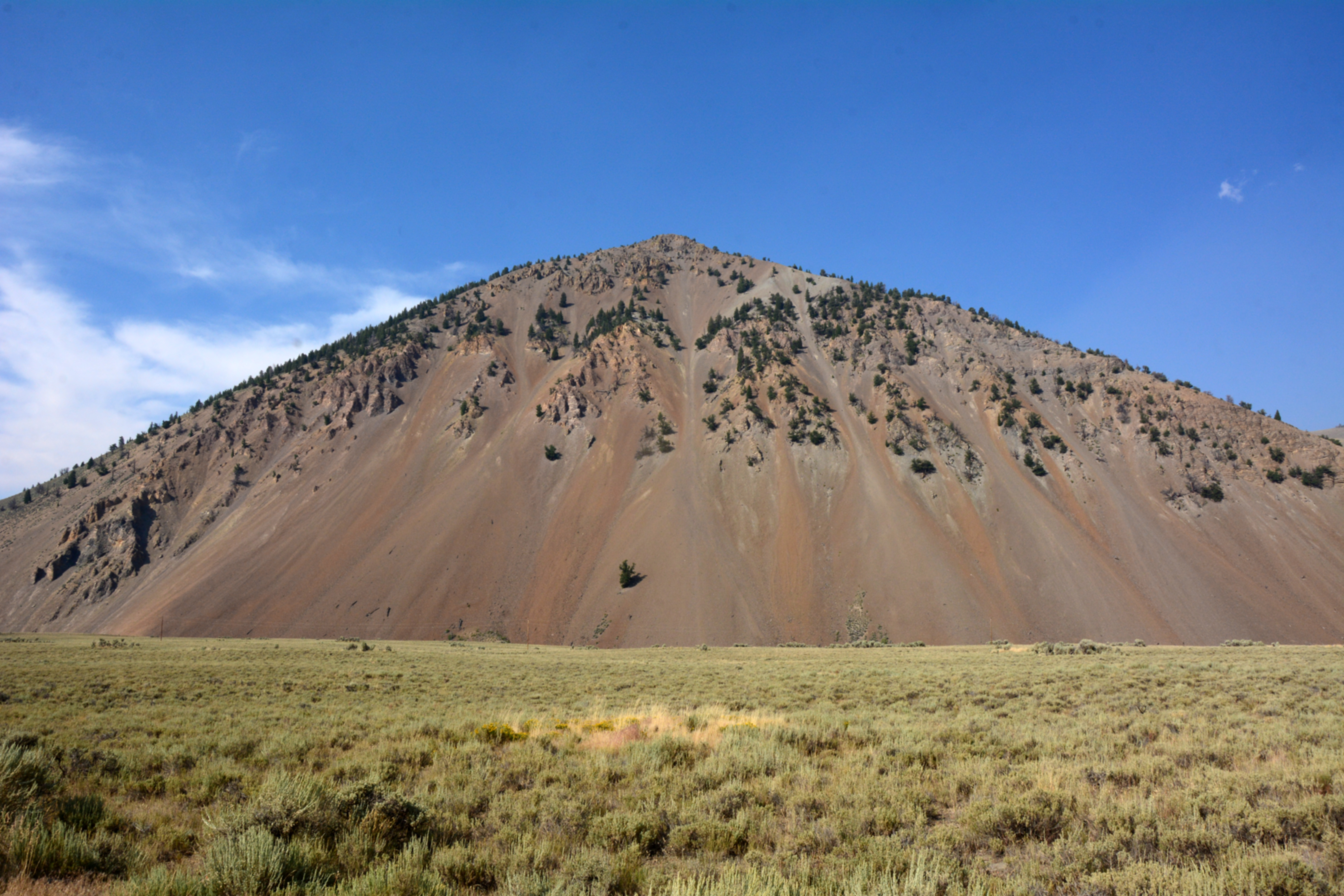
Lost River Range

Snaky Canyon Formation (Pms)

Trail Creek Road: mountain big sagebrush steppe

Trail Creek Road: Wyoming big sagebrush steppe

TF-Challis-Boise flight

TF-Challis-Boise flight

Oh, Damn - 1218

Lone Tree, and Power Lines (1415)

Oops!

Beaver dam on the Summit Creek

Fall Creek Trail
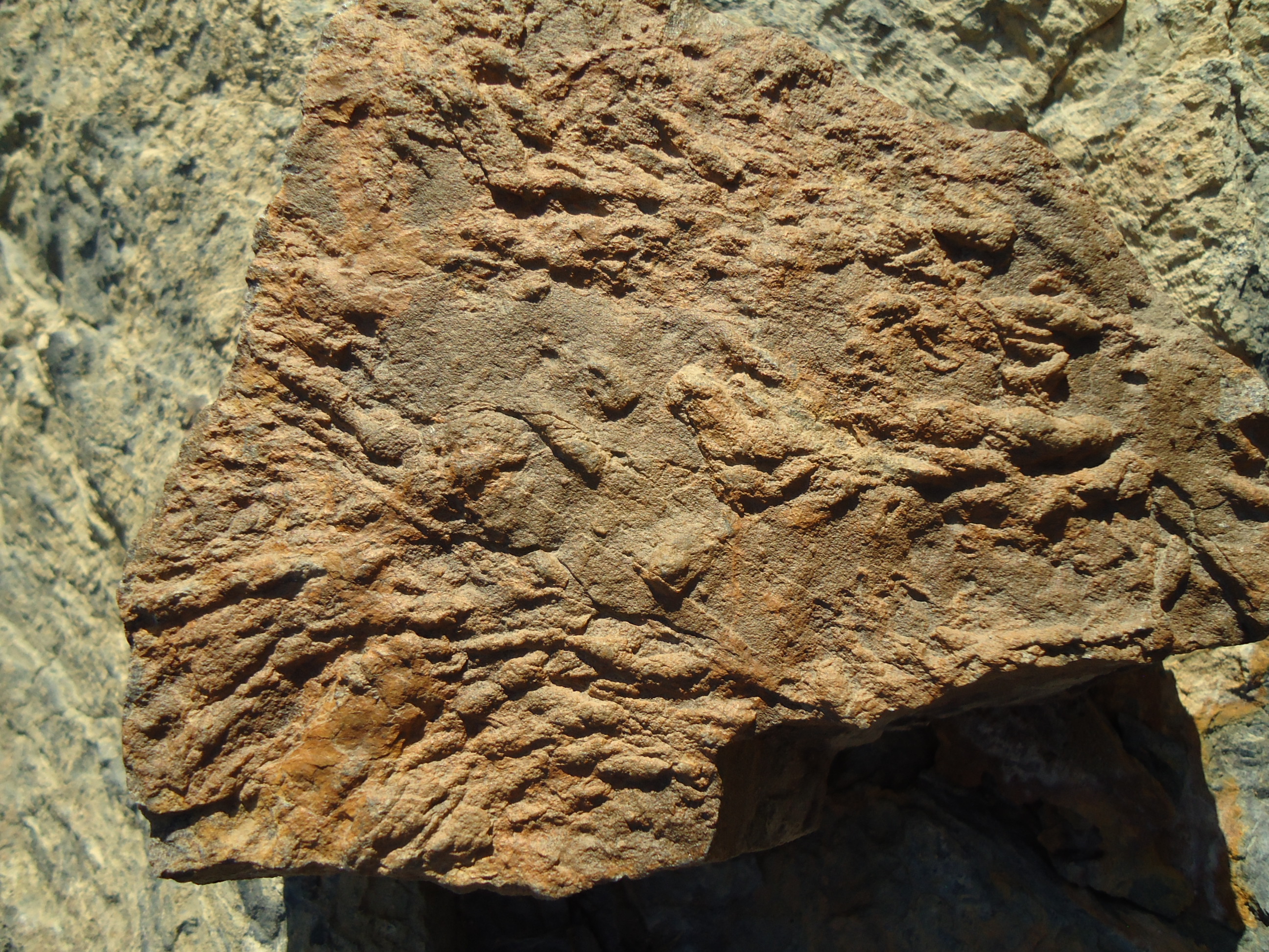
Quartzite with trace fossils

N Fork Big Lost River

N Fork Big Lost River

N Fork Big Lost River
Twin Bridges Creek Rd, Mackay, ID アメリカ合衆国の地図
別の場所を検索
近所の場所
Wild Horse Creek Rd, Mackay, ID アメリカ合衆国Wild Horse Creek Ranch
Trail Creek Rd, Mackay, ID アメリカ合衆国コッパー・ベイシン・キャンプ
Duncan's Peak, Idaho アメリカ合衆国
NF-51, Sun Valley, ID アメリカ合衆国バウンダリー・キャンプグランド
Fairway Loop, Sun Valley, ID アメリカ合衆国
アメリカ合衆国 〒 アイダホ州 トライアンフ
アメリカ合衆国 〒 アイダホ州 サン・バレー
4 Kitzbuhler Strasse, Sun Valley, ID アメリカ合衆国Sun Valley Ski Club
Village Way, Hailey, ID アメリカ合衆国
Angani Way, Sun Valley, ID アメリカ合衆国アンガニ・ウェイ
1 Sun Valley Rd, Sun Valley, ID アメリカ合衆国Sun Valley Lodge
Angani Way, Sun Valley, ID アメリカ合衆国
Boulder View Ln, Ketchum, ID アメリカ合衆国
Leadville Ave, Sun Valley, ID アメリカ合衆国
Leadville Ave, Ketchum, ID アメリカ合衆国
アメリカ合衆国 アイダホ州 ケチャム
Forest Rd, Ketchum, ID アメリカ合衆国ウッド・リバー・キャンプグランド
57 E Ln Ranch Rd, Sun Valley, ID アメリカ合衆国
Belmont Dr, Ketchum, ID アメリカ合衆国
アメリカ合衆国 アイダホ州 カスター
最近の検索
- アメリカ合衆国 アラスカ州 レッド・ドッグ・マイン日の出日の入り時間
- Am bhf, Borken, ドイツアム・バーンホーフ日の出日の入り時間
- 4th St E, Sonoma, CA, USA日の出日の入り時間
- Oakland Ave, Williamsport, PA アメリカ合衆国日の出日の入り時間
- Via Roma, Pieranica CR, イタリアローマ通り日の出日の入り時間
- クロアチア 〒 ドゥブロブニク GradClock Tower of Dubrovnik日の出日の入り時間
- アルゼンチン チュブ州 トレリュー日の出日の入り時間
- Hartfords Bluff Cir, Mt Pleasant, SC アメリカ合衆国日の出日の入り時間
- 日本、熊本県熊本市北区日の出日の入り時間
- 中華人民共和国 福州市 平潭県 平潭島日の出日の入り時間