US-85, Lead, SD アメリカ合衆国トレイルズヘッド・ロッジ日の出日の入り時間
Location: アメリカ合衆国 > サウス・ダゴタ州 > ローレンス > アメリカ合衆国 サウス・ダゴタ州 サウス・ローレンス > アメリカ合衆国 サウス・ダゴタ州 リード >
時間帯:
America/Denver
現地時間:
2025-06-26 04:19:11
経度:
-104.0250953
緯度:
44.2017289
今日の日の出時刻:
05:14:19 AM
今日の日の入時刻:
08:43:58 PM
今日の日長:
15h 29m 39s
明日の日の出時刻:
05:14:44 AM
明日の日の入時刻:
08:43:57 PM
明日の日長:
15h 29m 13s
すべて表示する
| 日付 | 日出 | 日没 | 日長 |
|---|---|---|---|
| 2025年01月01日 | 07:31:26 AM | 04:29:08 PM | 8h 57m 42s |
| 2025年01月02日 | 07:31:25 AM | 04:30:04 PM | 8h 58m 39s |
| 2025年01月03日 | 07:31:21 AM | 04:31:03 PM | 8h 59m 42s |
| 2025年01月04日 | 07:31:14 AM | 04:32:03 PM | 9h 0m 49s |
| 2025年01月05日 | 07:31:05 AM | 04:33:05 PM | 9h 2m 0s |
| 2025年01月06日 | 07:30:53 AM | 04:34:08 PM | 9h 3m 15s |
| 2025年01月07日 | 07:30:39 AM | 04:35:13 PM | 9h 4m 34s |
| 2025年01月08日 | 07:30:22 AM | 04:36:19 PM | 9h 5m 57s |
| 2025年01月09日 | 07:30:03 AM | 04:37:27 PM | 9h 7m 24s |
| 2025年01月10日 | 07:29:41 AM | 04:38:36 PM | 9h 8m 55s |
| 2025年01月11日 | 07:29:17 AM | 04:39:46 PM | 9h 10m 29s |
| 2025年01月12日 | 07:28:51 AM | 04:40:57 PM | 9h 12m 6s |
| 2025年01月13日 | 07:28:22 AM | 04:42:10 PM | 9h 13m 48s |
| 2025年01月14日 | 07:27:50 AM | 04:43:23 PM | 9h 15m 33s |
| 2025年01月15日 | 07:27:17 AM | 04:44:38 PM | 9h 17m 21s |
| 2025年01月16日 | 07:26:40 AM | 04:45:54 PM | 9h 19m 14s |
| 2025年01月17日 | 07:26:02 AM | 04:47:10 PM | 9h 21m 8s |
| 2025年01月18日 | 07:25:21 AM | 04:48:27 PM | 9h 23m 6s |
| 2025年01月19日 | 07:24:38 AM | 04:49:45 PM | 9h 25m 7s |
| 2025年01月20日 | 07:23:53 AM | 04:51:04 PM | 9h 27m 11s |
| 2025年01月21日 | 07:23:06 AM | 04:52:24 PM | 9h 29m 18s |
| 2025年01月22日 | 07:22:16 AM | 04:53:44 PM | 9h 31m 28s |
| 2025年01月23日 | 07:21:25 AM | 04:55:04 PM | 9h 33m 39s |
| 2025年01月24日 | 07:20:31 AM | 04:56:25 PM | 9h 35m 54s |
| 2025年01月25日 | 07:19:35 AM | 04:57:47 PM | 9h 38m 12s |
| 2025年01月26日 | 07:18:37 AM | 04:59:09 PM | 9h 40m 32s |
| 2025年01月27日 | 07:17:38 AM | 05:00:31 PM | 9h 42m 53s |
| 2025年01月28日 | 07:16:36 AM | 05:01:54 PM | 9h 45m 18s |
| 2025年01月29日 | 07:15:32 AM | 05:03:17 PM | 9h 47m 45s |
| 2025年01月30日 | 07:14:27 AM | 05:04:40 PM | 9h 50m 13s |
| 2025年01月31日 | 07:13:20 AM | 05:06:03 PM | 9h 52m 43s |
| 2025年02月01日 | 07:12:11 AM | 05:07:27 PM | 9h 55m 16s |
| 2025年02月02日 | 07:11:00 AM | 05:08:50 PM | 9h 57m 50s |
| 2025年02月03日 | 07:09:47 AM | 05:10:14 PM | 10h 0m 27s |
| 2025年02月04日 | 07:08:33 AM | 05:11:37 PM | 10h 3m 4s |
| 2025年02月05日 | 07:07:17 AM | 05:13:01 PM | 10h 5m 44s |
| 2025年02月06日 | 07:06:00 AM | 05:14:25 PM | 10h 8m 25s |
| 2025年02月07日 | 07:04:41 AM | 05:15:48 PM | 10h 11m 7s |
| 2025年02月08日 | 07:03:21 AM | 05:17:12 PM | 10h 13m 51s |
| 2025年02月09日 | 07:01:59 AM | 05:18:35 PM | 10h 16m 36s |
| 2025年02月10日 | 07:00:36 AM | 05:19:59 PM | 10h 19m 23s |
| 2025年02月11日 | 06:59:11 AM | 05:21:22 PM | 10h 22m 11s |
| 2025年02月12日 | 06:57:45 AM | 05:22:45 PM | 10h 25m 0s |
| 2025年02月13日 | 06:56:18 AM | 05:24:08 PM | 10h 27m 50s |
| 2025年02月14日 | 06:54:50 AM | 05:25:30 PM | 10h 30m 40s |
| 2025年02月15日 | 06:53:20 AM | 05:26:53 PM | 10h 33m 33s |
| 2025年02月16日 | 06:51:49 AM | 05:28:15 PM | 10h 36m 26s |
| 2025年02月17日 | 06:50:17 AM | 05:29:37 PM | 10h 39m 20s |
| 2025年02月18日 | 06:48:44 AM | 05:30:58 PM | 10h 42m 14s |
| 2025年02月19日 | 06:47:10 AM | 05:32:20 PM | 10h 45m 10s |
| 2025年02月20日 | 06:45:34 AM | 05:33:41 PM | 10h 48m 7s |
| 2025年02月21日 | 06:43:58 AM | 05:35:02 PM | 10h 51m 4s |
| 2025年02月22日 | 06:42:21 AM | 05:36:23 PM | 10h 54m 2s |
| 2025年02月23日 | 06:40:43 AM | 05:37:43 PM | 10h 57m 0s |
| 2025年02月24日 | 06:39:04 AM | 05:39:03 PM | 10h 59m 59s |
| 2025年02月25日 | 06:37:24 AM | 05:40:23 PM | 11h 2m 59s |
| 2025年02月26日 | 06:35:43 AM | 05:41:42 PM | 11h 5m 59s |
| 2025年02月27日 | 06:34:02 AM | 05:43:02 PM | 11h 9m 0s |
| 2025年02月28日 | 06:32:20 AM | 05:44:21 PM | 11h 12m 1s |
| 2025年03月01日 | 06:30:37 AM | 05:45:39 PM | 11h 15m 2s |
| 2025年03月02日 | 06:28:53 AM | 05:46:58 PM | 11h 18m 5s |
| 2025年03月03日 | 06:27:09 AM | 05:48:16 PM | 11h 21m 7s |
| 2025年03月04日 | 06:25:24 AM | 05:49:33 PM | 11h 24m 9s |
| 2025年03月05日 | 06:23:39 AM | 05:50:51 PM | 11h 27m 12s |
| 2025年03月06日 | 06:21:53 AM | 05:52:08 PM | 11h 30m 15s |
| 2025年03月07日 | 06:20:07 AM | 05:53:25 PM | 11h 33m 18s |
| 2025年03月08日 | 06:18:20 AM | 05:54:42 PM | 11h 36m 22s |
| 2025年03月09日 | 07:16:37 AM | 06:55:55 PM | 11h 39m 18s |
| 2025年03月10日 | 07:14:49 AM | 06:57:12 PM | 11h 42m 23s |
| 2025年03月11日 | 07:13:01 AM | 06:58:28 PM | 11h 45m 27s |
| 2025年03月12日 | 07:11:13 AM | 06:59:44 PM | 11h 48m 31s |
| 2025年03月13日 | 07:09:24 AM | 07:00:59 PM | 11h 51m 35s |
| 2025年03月14日 | 07:07:35 AM | 07:02:15 PM | 11h 54m 40s |
| 2025年03月15日 | 07:05:46 AM | 07:03:30 PM | 11h 57m 44s |
| 2025年03月16日 | 07:03:56 AM | 07:04:45 PM | 12h 0m 49s |
| 2025年03月17日 | 07:02:07 AM | 07:06:00 PM | 12h 3m 53s |
| 2025年03月18日 | 07:00:17 AM | 07:07:14 PM | 12h 6m 57s |
| 2025年03月19日 | 06:58:27 AM | 07:08:29 PM | 12h 10m 2s |
| 2025年03月20日 | 06:56:37 AM | 07:09:43 PM | 12h 13m 6s |
| 2025年03月21日 | 06:54:47 AM | 07:10:58 PM | 12h 16m 11s |
| 2025年03月22日 | 06:52:57 AM | 07:12:12 PM | 12h 19m 15s |
| 2025年03月23日 | 06:51:06 AM | 07:13:26 PM | 12h 22m 20s |
| 2025年03月24日 | 06:49:16 AM | 07:14:40 PM | 12h 25m 24s |
| 2025年03月25日 | 06:47:26 AM | 07:15:54 PM | 12h 28m 28s |
| 2025年03月26日 | 06:45:36 AM | 07:17:07 PM | 12h 31m 31s |
| 2025年03月27日 | 06:43:47 AM | 07:18:21 PM | 12h 34m 34s |
| 2025年03月28日 | 06:41:57 AM | 07:19:34 PM | 12h 37m 37s |
| 2025年03月29日 | 06:40:07 AM | 07:20:48 PM | 12h 40m 41s |
| 2025年03月30日 | 06:38:18 AM | 07:22:01 PM | 12h 43m 43s |
| 2025年03月31日 | 06:36:29 AM | 07:23:15 PM | 12h 46m 46s |
| 2025年04月01日 | 06:34:40 AM | 07:24:28 PM | 12h 49m 48s |
| 2025年04月02日 | 06:32:52 AM | 07:25:42 PM | 12h 52m 50s |
| 2025年04月03日 | 06:31:04 AM | 07:26:55 PM | 12h 55m 51s |
| 2025年04月04日 | 06:29:16 AM | 07:28:08 PM | 12h 58m 52s |
| 2025年04月05日 | 06:27:29 AM | 07:29:21 PM | 13h 1m 52s |
| 2025年04月06日 | 06:25:42 AM | 07:30:35 PM | 13h 4m 53s |
| 2025年04月07日 | 06:23:56 AM | 07:31:48 PM | 13h 7m 52s |
| 2025年04月08日 | 06:22:10 AM | 07:33:01 PM | 13h 10m 51s |
| 2025年04月09日 | 06:20:24 AM | 07:34:14 PM | 13h 13m 50s |
| 2025年04月10日 | 06:18:40 AM | 07:35:28 PM | 13h 16m 48s |
| 2025年04月11日 | 06:16:55 AM | 07:36:41 PM | 13h 19m 46s |
| 2025年04月12日 | 06:15:12 AM | 07:37:54 PM | 13h 22m 42s |
| 2025年04月13日 | 06:13:29 AM | 07:39:07 PM | 13h 25m 38s |
| 2025年04月14日 | 06:11:47 AM | 07:40:21 PM | 13h 28m 34s |
| 2025年04月15日 | 06:10:05 AM | 07:41:34 PM | 13h 31m 29s |
| 2025年04月16日 | 06:08:24 AM | 07:42:47 PM | 13h 34m 23s |
| 2025年04月17日 | 06:06:44 AM | 07:44:00 PM | 13h 37m 16s |
| 2025年04月18日 | 06:05:05 AM | 07:45:13 PM | 13h 40m 8s |
| 2025年04月19日 | 06:03:27 AM | 07:46:27 PM | 13h 43m 0s |
| 2025年04月20日 | 06:01:50 AM | 07:47:40 PM | 13h 45m 50s |
| 2025年04月21日 | 06:00:13 AM | 07:48:53 PM | 13h 48m 40s |
| 2025年04月22日 | 05:58:38 AM | 07:50:06 PM | 13h 51m 28s |
| 2025年04月23日 | 05:57:03 AM | 07:51:19 PM | 13h 54m 16s |
| 2025年04月24日 | 05:55:30 AM | 07:52:32 PM | 13h 57m 2s |
| 2025年04月25日 | 05:53:57 AM | 07:53:45 PM | 13h 59m 48s |
| 2025年04月26日 | 05:52:26 AM | 07:54:57 PM | 14h 2m 31s |
| 2025年04月27日 | 05:50:56 AM | 07:56:10 PM | 14h 5m 14s |
| 2025年04月28日 | 05:49:27 AM | 07:57:22 PM | 14h 7m 55s |
| 2025年04月29日 | 05:47:59 AM | 07:58:35 PM | 14h 10m 36s |
| 2025年04月30日 | 05:46:33 AM | 07:59:47 PM | 14h 13m 14s |
| 2025年05月01日 | 05:45:08 AM | 08:00:59 PM | 14h 15m 51s |
| 2025年05月02日 | 05:43:44 AM | 08:02:10 PM | 14h 18m 26s |
| 2025年05月03日 | 05:42:21 AM | 08:03:22 PM | 14h 21m 1s |
| 2025年05月04日 | 05:41:00 AM | 08:04:33 PM | 14h 23m 33s |
| 2025年05月05日 | 05:39:40 AM | 08:05:44 PM | 14h 26m 4s |
| 2025年05月06日 | 05:38:22 AM | 08:06:55 PM | 14h 28m 33s |
| 2025年05月07日 | 05:37:05 AM | 08:08:05 PM | 14h 31m 0s |
| 2025年05月08日 | 05:35:50 AM | 08:09:15 PM | 14h 33m 25s |
| 2025年05月09日 | 05:34:36 AM | 08:10:24 PM | 14h 35m 48s |
| 2025年05月10日 | 05:33:24 AM | 08:11:33 PM | 14h 38m 9s |
| 2025年05月11日 | 05:32:13 AM | 08:12:42 PM | 14h 40m 29s |
| 2025年05月12日 | 05:31:04 AM | 08:13:49 PM | 14h 42m 45s |
| 2025年05月13日 | 05:29:57 AM | 08:14:57 PM | 14h 45m 0s |
| 2025年05月14日 | 05:28:52 AM | 08:16:04 PM | 14h 47m 12s |
| 2025年05月15日 | 05:27:48 AM | 08:17:10 PM | 14h 49m 22s |
| 2025年05月16日 | 05:26:46 AM | 08:18:15 PM | 14h 51m 29s |
| 2025年05月17日 | 05:25:46 AM | 08:19:20 PM | 14h 53m 34s |
| 2025年05月18日 | 05:24:48 AM | 08:20:24 PM | 14h 55m 36s |
| 2025年05月19日 | 05:23:52 AM | 08:21:27 PM | 14h 57m 35s |
| 2025年05月20日 | 05:22:57 AM | 08:22:30 PM | 14h 59m 33s |
| 2025年05月21日 | 05:22:05 AM | 08:23:31 PM | 15h 1m 26s |
| 2025年05月22日 | 05:21:15 AM | 08:24:32 PM | 15h 3m 17s |
| 2025年05月23日 | 05:20:26 AM | 08:25:31 PM | 15h 5m 5s |
| 2025年05月24日 | 05:19:40 AM | 08:26:30 PM | 15h 6m 50s |
| 2025年05月25日 | 05:18:55 AM | 08:27:27 PM | 15h 8m 32s |
| 2025年05月26日 | 05:18:13 AM | 08:28:23 PM | 15h 10m 10s |
| 2025年05月27日 | 05:17:33 AM | 08:29:19 PM | 15h 11m 46s |
| 2025年05月28日 | 05:16:55 AM | 08:30:12 PM | 15h 13m 17s |
| 2025年05月29日 | 05:16:19 AM | 08:31:05 PM | 15h 14m 46s |
| 2025年05月30日 | 05:15:45 AM | 08:31:56 PM | 15h 16m 11s |
| 2025年05月31日 | 05:15:14 AM | 08:32:46 PM | 15h 17m 32s |
| 2025年06月01日 | 05:14:45 AM | 08:33:35 PM | 15h 18m 50s |
| 2025年06月02日 | 05:14:17 AM | 08:34:22 PM | 15h 20m 5s |
| 2025年06月03日 | 05:13:53 AM | 08:35:07 PM | 15h 21m 14s |
| 2025年06月04日 | 05:13:30 AM | 08:35:51 PM | 15h 22m 21s |
| 2025年06月05日 | 05:13:10 AM | 08:36:33 PM | 15h 23m 23s |
| 2025年06月06日 | 05:12:51 AM | 08:37:14 PM | 15h 24m 23s |
| 2025年06月07日 | 05:12:35 AM | 08:37:53 PM | 15h 25m 18s |
| 2025年06月08日 | 05:12:22 AM | 08:38:30 PM | 15h 26m 8s |
| 2025年06月09日 | 05:12:10 AM | 08:39:05 PM | 15h 26m 55s |
| 2025年06月10日 | 05:12:01 AM | 08:39:39 PM | 15h 27m 38s |
| 2025年06月11日 | 05:11:54 AM | 08:40:10 PM | 15h 28m 16s |
| 2025年06月12日 | 05:11:50 AM | 08:40:40 PM | 15h 28m 50s |
| 2025年06月13日 | 05:11:47 AM | 08:41:08 PM | 15h 29m 21s |
| 2025年06月14日 | 05:11:47 AM | 08:41:34 PM | 15h 29m 47s |
| 2025年06月15日 | 05:11:49 AM | 08:41:58 PM | 15h 30m 9s |
| 2025年06月16日 | 05:11:54 AM | 08:42:19 PM | 15h 30m 25s |
| 2025年06月17日 | 05:12:00 AM | 08:42:39 PM | 15h 30m 39s |
| 2025年06月18日 | 05:12:09 AM | 08:42:56 PM | 15h 30m 47s |
| 2025年06月19日 | 05:12:20 AM | 08:43:12 PM | 15h 30m 52s |
| 2025年06月20日 | 05:12:33 AM | 08:43:25 PM | 15h 30m 52s |
| 2025年06月21日 | 05:12:48 AM | 08:43:36 PM | 15h 30m 48s |
| 2025年06月22日 | 05:13:05 AM | 08:43:45 PM | 15h 30m 40s |
| 2025年06月23日 | 05:13:24 AM | 08:43:51 PM | 15h 30m 27s |
| 2025年06月24日 | 05:13:45 AM | 08:43:56 PM | 15h 30m 11s |
| 2025年06月25日 | 05:14:08 AM | 08:43:58 PM | 15h 29m 50s |
| 2025年06月26日 | 05:14:33 AM | 08:43:57 PM | 15h 29m 24s |
| 2025年06月27日 | 05:15:00 AM | 08:43:55 PM | 15h 28m 55s |
| 2025年06月28日 | 05:15:29 AM | 08:43:50 PM | 15h 28m 21s |
| 2025年06月29日 | 05:16:00 AM | 08:43:43 PM | 15h 27m 43s |
| 2025年06月30日 | 05:16:33 AM | 08:43:34 PM | 15h 27m 1s |
| 2025年07月01日 | 05:17:07 AM | 08:43:22 PM | 15h 26m 15s |
| 2025年07月02日 | 05:17:43 AM | 08:43:08 PM | 15h 25m 25s |
| 2025年07月03日 | 05:18:21 AM | 08:42:52 PM | 15h 24m 31s |
| 2025年07月04日 | 05:19:00 AM | 08:42:33 PM | 15h 23m 33s |
| 2025年07月05日 | 05:19:41 AM | 08:42:12 PM | 15h 22m 31s |
| 2025年07月06日 | 05:20:24 AM | 08:41:49 PM | 15h 21m 25s |
| 2025年07月07日 | 05:21:08 AM | 08:41:23 PM | 15h 20m 15s |
| 2025年07月08日 | 05:21:53 AM | 08:40:56 PM | 15h 19m 3s |
| 2025年07月09日 | 05:22:40 AM | 08:40:26 PM | 15h 17m 46s |
| 2025年07月10日 | 05:23:28 AM | 08:39:54 PM | 15h 16m 26s |
| 2025年07月11日 | 05:24:18 AM | 08:39:19 PM | 15h 15m 1s |
| 2025年07月12日 | 05:25:08 AM | 08:38:43 PM | 15h 13m 35s |
| 2025年07月13日 | 05:26:00 AM | 08:38:04 PM | 15h 12m 4s |
| 2025年07月14日 | 05:26:54 AM | 08:37:23 PM | 15h 10m 29s |
| 2025年07月15日 | 05:27:48 AM | 08:36:40 PM | 15h 8m 52s |
| 2025年07月16日 | 05:28:43 AM | 08:35:55 PM | 15h 7m 12s |
| 2025年07月17日 | 05:29:39 AM | 08:35:07 PM | 15h 5m 28s |
| 2025年07月18日 | 05:30:37 AM | 08:34:18 PM | 15h 3m 41s |
| 2025年07月19日 | 05:31:35 AM | 08:33:27 PM | 15h 1m 52s |
| 2025年07月20日 | 05:32:34 AM | 08:32:34 PM | 15h 0m 0s |
| 2025年07月21日 | 05:33:34 AM | 08:31:38 PM | 14h 58m 4s |
| 2025年07月22日 | 05:34:34 AM | 08:30:41 PM | 14h 56m 7s |
| 2025年07月23日 | 05:35:36 AM | 08:29:42 PM | 14h 54m 6s |
| 2025年07月24日 | 05:36:38 AM | 08:28:41 PM | 14h 52m 3s |
| 2025年07月25日 | 05:37:40 AM | 08:27:38 PM | 14h 49m 58s |
| 2025年07月26日 | 05:38:44 AM | 08:26:33 PM | 14h 47m 49s |
| 2025年07月27日 | 05:39:48 AM | 08:25:27 PM | 14h 45m 39s |
| 2025年07月28日 | 05:40:52 AM | 08:24:19 PM | 14h 43m 27s |
| 2025年07月29日 | 05:41:57 AM | 08:23:09 PM | 14h 41m 12s |
| 2025年07月30日 | 05:43:02 AM | 08:21:57 PM | 14h 38m 55s |
| 2025年07月31日 | 05:44:08 AM | 08:20:44 PM | 14h 36m 36s |
| 2025年08月01日 | 05:45:14 AM | 08:19:29 PM | 14h 34m 15s |
| 2025年08月02日 | 05:46:21 AM | 08:18:13 PM | 14h 31m 52s |
| 2025年08月03日 | 05:47:28 AM | 08:16:55 PM | 14h 29m 27s |
| 2025年08月04日 | 05:48:35 AM | 08:15:35 PM | 14h 27m 0s |
| 2025年08月05日 | 05:49:43 AM | 08:14:14 PM | 14h 24m 31s |
| 2025年08月06日 | 05:50:50 AM | 08:12:52 PM | 14h 22m 2s |
| 2025年08月07日 | 05:51:58 AM | 08:11:28 PM | 14h 19m 30s |
| 2025年08月08日 | 05:53:06 AM | 08:10:03 PM | 14h 16m 57s |
| 2025年08月09日 | 05:54:15 AM | 08:08:37 PM | 14h 14m 22s |
| 2025年08月10日 | 05:55:23 AM | 08:07:09 PM | 14h 11m 46s |
| 2025年08月11日 | 05:56:32 AM | 08:05:40 PM | 14h 9m 8s |
| 2025年08月12日 | 05:57:40 AM | 08:04:10 PM | 14h 6m 30s |
| 2025年08月13日 | 05:58:49 AM | 08:02:39 PM | 14h 3m 50s |
| 2025年08月14日 | 05:59:58 AM | 08:01:06 PM | 14h 1m 8s |
| 2025年08月15日 | 06:01:07 AM | 07:59:32 PM | 13h 58m 25s |
| 2025年08月16日 | 06:02:16 AM | 07:57:58 PM | 13h 55m 42s |
| 2025年08月17日 | 06:03:25 AM | 07:56:22 PM | 13h 52m 57s |
| 2025年08月18日 | 06:04:34 AM | 07:54:45 PM | 13h 50m 11s |
| 2025年08月19日 | 06:05:43 AM | 07:53:07 PM | 13h 47m 24s |
| 2025年08月20日 | 06:06:52 AM | 07:51:29 PM | 13h 44m 37s |
| 2025年08月21日 | 06:08:01 AM | 07:49:49 PM | 13h 41m 48s |
| 2025年08月22日 | 06:09:10 AM | 07:48:09 PM | 13h 38m 59s |
| 2025年08月23日 | 06:10:19 AM | 07:46:27 PM | 13h 36m 8s |
| 2025年08月24日 | 06:11:28 AM | 07:44:45 PM | 13h 33m 17s |
| 2025年08月25日 | 06:12:37 AM | 07:43:02 PM | 13h 30m 25s |
| 2025年08月26日 | 06:13:46 AM | 07:41:19 PM | 13h 27m 33s |
| 2025年08月27日 | 06:14:55 AM | 07:39:34 PM | 13h 24m 39s |
| 2025年08月28日 | 06:16:04 AM | 07:37:49 PM | 13h 21m 45s |
| 2025年08月29日 | 06:17:13 AM | 07:36:04 PM | 13h 18m 51s |
| 2025年08月30日 | 06:18:21 AM | 07:34:17 PM | 13h 15m 56s |
| 2025年08月31日 | 06:19:30 AM | 07:32:31 PM | 13h 13m 1s |
| 2025年09月01日 | 06:20:39 AM | 07:30:43 PM | 13h 10m 4s |
| 2025年09月02日 | 06:21:48 AM | 07:28:55 PM | 13h 7m 7s |
| 2025年09月03日 | 06:22:56 AM | 07:27:07 PM | 13h 4m 11s |
| 2025年09月04日 | 06:24:05 AM | 07:25:18 PM | 13h 1m 13s |
| 2025年09月05日 | 06:25:14 AM | 07:23:29 PM | 12h 58m 15s |
| 2025年09月06日 | 06:26:23 AM | 07:21:39 PM | 12h 55m 16s |
| 2025年09月07日 | 06:27:31 AM | 07:19:49 PM | 12h 52m 18s |
| 2025年09月08日 | 06:28:40 AM | 07:17:58 PM | 12h 49m 18s |
| 2025年09月09日 | 06:29:49 AM | 07:16:08 PM | 12h 46m 19s |
| 2025年09月10日 | 06:30:57 AM | 07:14:17 PM | 12h 43m 20s |
| 2025年09月11日 | 06:32:06 AM | 07:12:26 PM | 12h 40m 20s |
| 2025年09月12日 | 06:33:15 AM | 07:10:34 PM | 12h 37m 19s |
| 2025年09月13日 | 06:34:24 AM | 07:08:42 PM | 12h 34m 18s |
| 2025年09月14日 | 06:35:33 AM | 07:06:51 PM | 12h 31m 18s |
| 2025年09月15日 | 06:36:42 AM | 07:04:59 PM | 12h 28m 17s |
| 2025年09月16日 | 06:37:51 AM | 07:03:07 PM | 12h 25m 16s |
| 2025年09月17日 | 06:39:00 AM | 07:01:15 PM | 12h 22m 15s |
| 2025年09月18日 | 06:40:09 AM | 06:59:23 PM | 12h 19m 14s |
| 2025年09月19日 | 06:41:19 AM | 06:57:31 PM | 12h 16m 12s |
| 2025年09月20日 | 06:42:28 AM | 06:55:39 PM | 12h 13m 11s |
| 2025年09月21日 | 06:43:38 AM | 06:53:47 PM | 12h 10m 9s |
| 2025年09月22日 | 06:44:47 AM | 06:51:55 PM | 12h 7m 8s |
| 2025年09月23日 | 06:45:57 AM | 06:50:03 PM | 12h 4m 6s |
| 2025年09月24日 | 06:47:07 AM | 06:48:11 PM | 12h 1m 4s |
| 2025年09月25日 | 06:48:18 AM | 06:46:20 PM | 11h 58m 2s |
| 2025年09月26日 | 06:49:28 AM | 06:44:29 PM | 11h 55m 1s |
| 2025年09月27日 | 06:50:39 AM | 06:42:38 PM | 11h 51m 59s |
| 2025年09月28日 | 06:51:50 AM | 06:40:47 PM | 11h 48m 57s |
| 2025年09月29日 | 06:53:01 AM | 06:38:57 PM | 11h 45m 56s |
| 2025年09月30日 | 06:54:12 AM | 06:37:06 PM | 11h 42m 54s |
| 2025年10月01日 | 06:55:23 AM | 06:35:17 PM | 11h 39m 54s |
| 2025年10月02日 | 06:56:35 AM | 06:33:27 PM | 11h 36m 52s |
| 2025年10月03日 | 06:57:47 AM | 06:31:38 PM | 11h 33m 51s |
| 2025年10月04日 | 06:59:00 AM | 06:29:50 PM | 11h 30m 50s |
| 2025年10月05日 | 07:00:12 AM | 06:28:02 PM | 11h 27m 50s |
| 2025年10月06日 | 07:01:25 AM | 06:26:15 PM | 11h 24m 50s |
| 2025年10月07日 | 07:02:38 AM | 06:24:28 PM | 11h 21m 50s |
| 2025年10月08日 | 07:03:51 AM | 06:22:42 PM | 11h 18m 51s |
| 2025年10月09日 | 07:05:05 AM | 06:20:56 PM | 11h 15m 51s |
| 2025年10月10日 | 07:06:19 AM | 06:19:11 PM | 11h 12m 52s |
| 2025年10月11日 | 07:07:33 AM | 06:17:27 PM | 11h 9m 54s |
| 2025年10月12日 | 07:08:48 AM | 06:15:43 PM | 11h 6m 55s |
| 2025年10月13日 | 07:10:03 AM | 06:14:00 PM | 11h 3m 57s |
| 2025年10月14日 | 07:11:18 AM | 06:12:18 PM | 11h 1m 0s |
| 2025年10月15日 | 07:12:34 AM | 06:10:37 PM | 10h 58m 3s |
| 2025年10月16日 | 07:13:49 AM | 06:08:56 PM | 10h 55m 7s |
| 2025年10月17日 | 07:15:06 AM | 06:07:17 PM | 10h 52m 11s |
| 2025年10月18日 | 07:16:22 AM | 06:05:38 PM | 10h 49m 16s |
| 2025年10月19日 | 07:17:39 AM | 06:04:01 PM | 10h 46m 22s |
| 2025年10月20日 | 07:18:56 AM | 06:02:24 PM | 10h 43m 28s |
| 2025年10月21日 | 07:20:13 AM | 06:00:49 PM | 10h 40m 36s |
| 2025年10月22日 | 07:21:31 AM | 05:59:14 PM | 10h 37m 43s |
| 2025年10月23日 | 07:22:49 AM | 05:57:41 PM | 10h 34m 52s |
| 2025年10月24日 | 07:24:07 AM | 05:56:09 PM | 10h 32m 2s |
| 2025年10月25日 | 07:25:25 AM | 05:54:38 PM | 10h 29m 13s |
| 2025年10月26日 | 07:26:44 AM | 05:53:08 PM | 10h 26m 24s |
| 2025年10月27日 | 07:28:03 AM | 05:51:40 PM | 10h 23m 37s |
| 2025年10月28日 | 07:29:22 AM | 05:50:13 PM | 10h 20m 51s |
| 2025年10月29日 | 07:30:41 AM | 05:48:47 PM | 10h 18m 6s |
| 2025年10月30日 | 07:32:01 AM | 05:47:22 PM | 10h 15m 21s |
| 2025年10月31日 | 07:33:21 AM | 05:45:59 PM | 10h 12m 38s |
| 2025年11月01日 | 07:34:40 AM | 05:44:38 PM | 10h 9m 58s |
| 2025年11月02日 | 06:36:04 AM | 04:43:14 PM | 10h 7m 10s |
| 2025年11月03日 | 06:37:24 AM | 04:41:56 PM | 10h 4m 32s |
| 2025年11月04日 | 06:38:44 AM | 04:40:39 PM | 10h 1m 55s |
| 2025年11月05日 | 06:40:04 AM | 04:39:24 PM | 9h 59m 20s |
| 2025年11月06日 | 06:41:24 AM | 04:38:10 PM | 9h 56m 46s |
| 2025年11月07日 | 06:42:44 AM | 04:36:59 PM | 9h 54m 15s |
| 2025年11月08日 | 06:44:04 AM | 04:35:49 PM | 9h 51m 45s |
| 2025年11月09日 | 06:45:24 AM | 04:34:40 PM | 9h 49m 16s |
| 2025年11月10日 | 06:46:44 AM | 04:33:34 PM | 9h 46m 50s |
| 2025年11月11日 | 06:48:04 AM | 04:32:29 PM | 9h 44m 25s |
| 2025年11月12日 | 06:49:23 AM | 04:31:26 PM | 9h 42m 3s |
| 2025年11月13日 | 06:50:42 AM | 04:30:26 PM | 9h 39m 44s |
| 2025年11月14日 | 06:52:01 AM | 04:29:27 PM | 9h 37m 26s |
| 2025年11月15日 | 06:53:20 AM | 04:28:30 PM | 9h 35m 10s |
| 2025年11月16日 | 06:54:38 AM | 04:27:36 PM | 9h 32m 58s |
| 2025年11月17日 | 06:55:56 AM | 04:26:43 PM | 9h 30m 47s |
| 2025年11月18日 | 06:57:13 AM | 04:25:53 PM | 9h 28m 40s |
| 2025年11月19日 | 06:58:30 AM | 04:25:04 PM | 9h 26m 34s |
| 2025年11月20日 | 06:59:46 AM | 04:24:18 PM | 9h 24m 32s |
| 2025年11月21日 | 07:01:01 AM | 04:23:34 PM | 9h 22m 33s |
| 2025年11月22日 | 07:02:16 AM | 04:22:53 PM | 9h 20m 37s |
| 2025年11月23日 | 07:03:30 AM | 04:22:14 PM | 9h 18m 44s |
| 2025年11月24日 | 07:04:43 AM | 04:21:37 PM | 9h 16m 54s |
| 2025年11月25日 | 07:05:56 AM | 04:21:02 PM | 9h 15m 6s |
| 2025年11月26日 | 07:07:07 AM | 04:20:30 PM | 9h 13m 23s |
| 2025年11月27日 | 07:08:17 AM | 04:20:00 PM | 9h 11m 43s |
| 2025年11月28日 | 07:09:27 AM | 04:19:33 PM | 9h 10m 6s |
| 2025年11月29日 | 07:10:35 AM | 04:19:08 PM | 9h 8m 33s |
| 2025年11月30日 | 07:11:42 AM | 04:18:46 PM | 9h 7m 4s |
| 2025年12月01日 | 07:12:48 AM | 04:18:26 PM | 9h 5m 38s |
| 2025年12月02日 | 07:13:52 AM | 04:18:09 PM | 9h 4m 17s |
| 2025年12月03日 | 07:14:55 AM | 04:17:54 PM | 9h 2m 59s |
| 2025年12月04日 | 07:15:57 AM | 04:17:42 PM | 9h 1m 45s |
| 2025年12月05日 | 07:16:57 AM | 04:17:33 PM | 9h 0m 36s |
| 2025年12月06日 | 07:17:56 AM | 04:17:26 PM | 8h 59m 30s |
| 2025年12月07日 | 07:18:53 AM | 04:17:21 PM | 8h 58m 28s |
| 2025年12月08日 | 07:19:48 AM | 04:17:19 PM | 8h 57m 31s |
| 2025年12月09日 | 07:20:42 AM | 04:17:20 PM | 8h 56m 38s |
| 2025年12月10日 | 07:21:34 AM | 04:17:24 PM | 8h 55m 50s |
| 2025年12月11日 | 07:22:24 AM | 04:17:29 PM | 8h 55m 5s |
| 2025年12月12日 | 07:23:12 AM | 04:17:38 PM | 8h 54m 26s |
| 2025年12月13日 | 07:23:58 AM | 04:17:49 PM | 8h 53m 51s |
| 2025年12月14日 | 07:24:42 AM | 04:18:03 PM | 8h 53m 21s |
| 2025年12月15日 | 07:25:24 AM | 04:18:19 PM | 8h 52m 55s |
| 2025年12月16日 | 07:26:04 AM | 04:18:37 PM | 8h 52m 33s |
| 2025年12月17日 | 07:26:42 AM | 04:18:59 PM | 8h 52m 17s |
| 2025年12月18日 | 07:27:17 AM | 04:19:22 PM | 8h 52m 5s |
| 2025年12月19日 | 07:27:50 AM | 04:19:48 PM | 8h 51m 58s |
| 2025年12月20日 | 07:28:22 AM | 04:20:17 PM | 8h 51m 55s |
| 2025年12月21日 | 07:28:50 AM | 04:20:48 PM | 8h 51m 58s |
| 2025年12月22日 | 07:29:17 AM | 04:21:21 PM | 8h 52m 4s |
| 2025年12月23日 | 07:29:41 AM | 04:21:57 PM | 8h 52m 16s |
| 2025年12月24日 | 07:30:02 AM | 04:22:35 PM | 8h 52m 33s |
| 2025年12月25日 | 07:30:21 AM | 04:23:15 PM | 8h 52m 54s |
| 2025年12月26日 | 07:30:38 AM | 04:23:57 PM | 8h 53m 19s |
| 2025年12月27日 | 07:30:52 AM | 04:24:41 PM | 8h 53m 49s |
| 2025年12月28日 | 07:31:04 AM | 04:25:28 PM | 8h 54m 24s |
| 2025年12月29日 | 07:31:13 AM | 04:26:17 PM | 8h 55m 4s |
| 2025年12月30日 | 07:31:20 AM | 04:27:07 PM | 8h 55m 47s |
| 2025年12月31日 | 07:31:24 AM | 04:28:00 PM | 8h 56m 36s |
写真
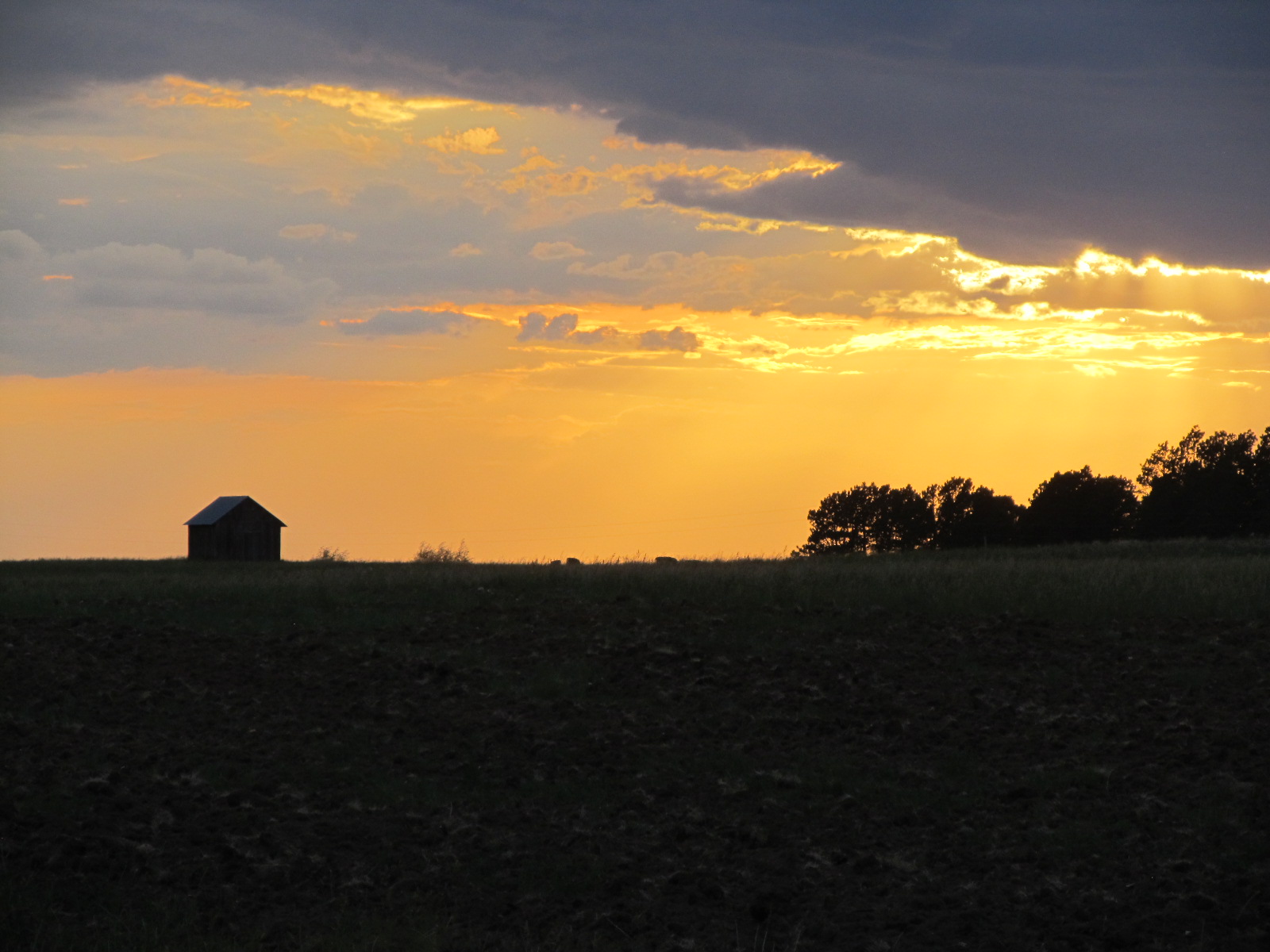
Black Hills Sunset
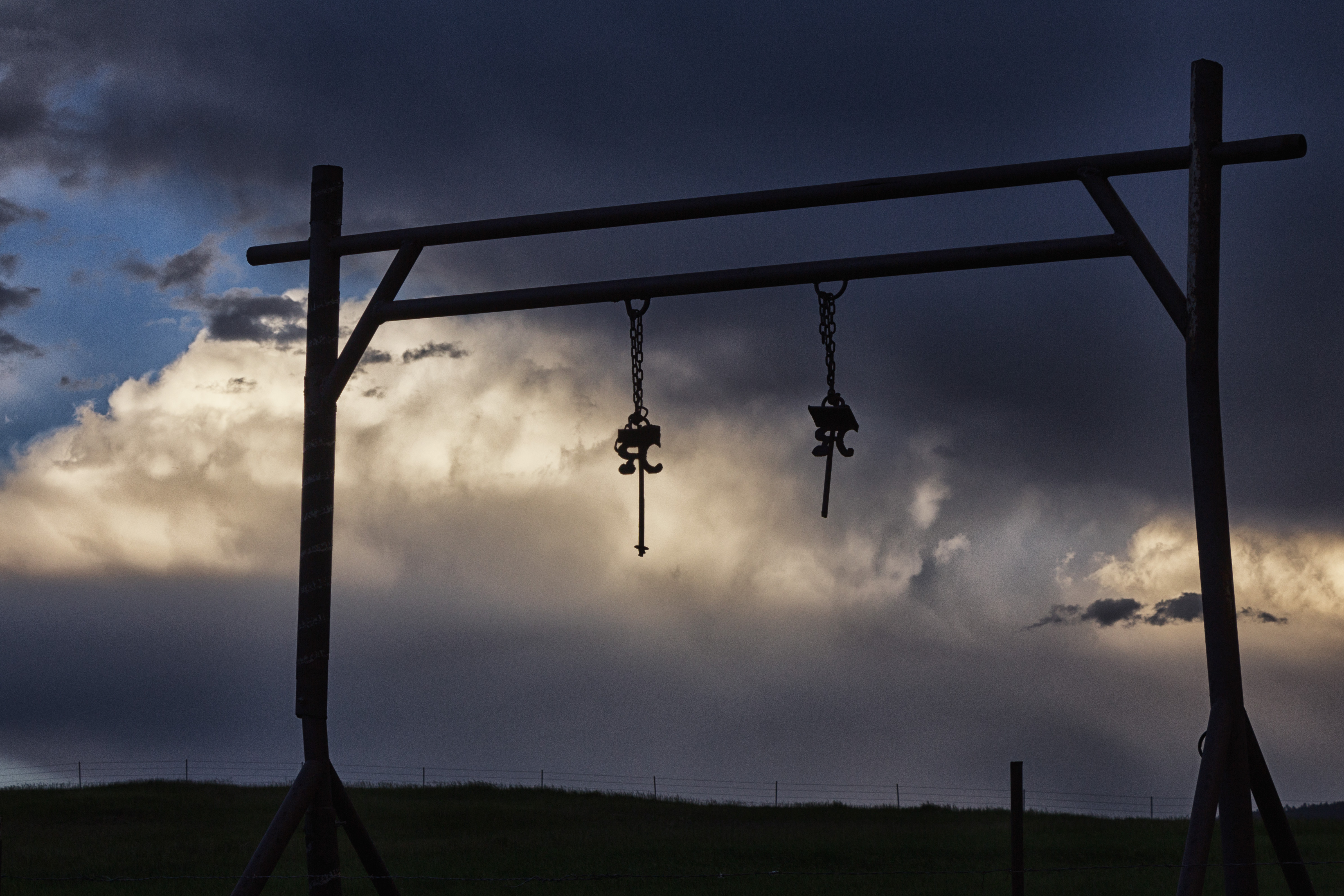
Ranch entrance
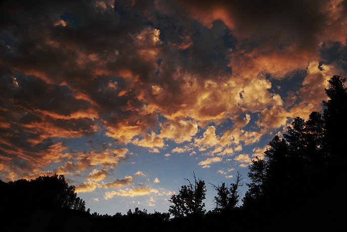
After the Storm

Sunset in the Black Hills
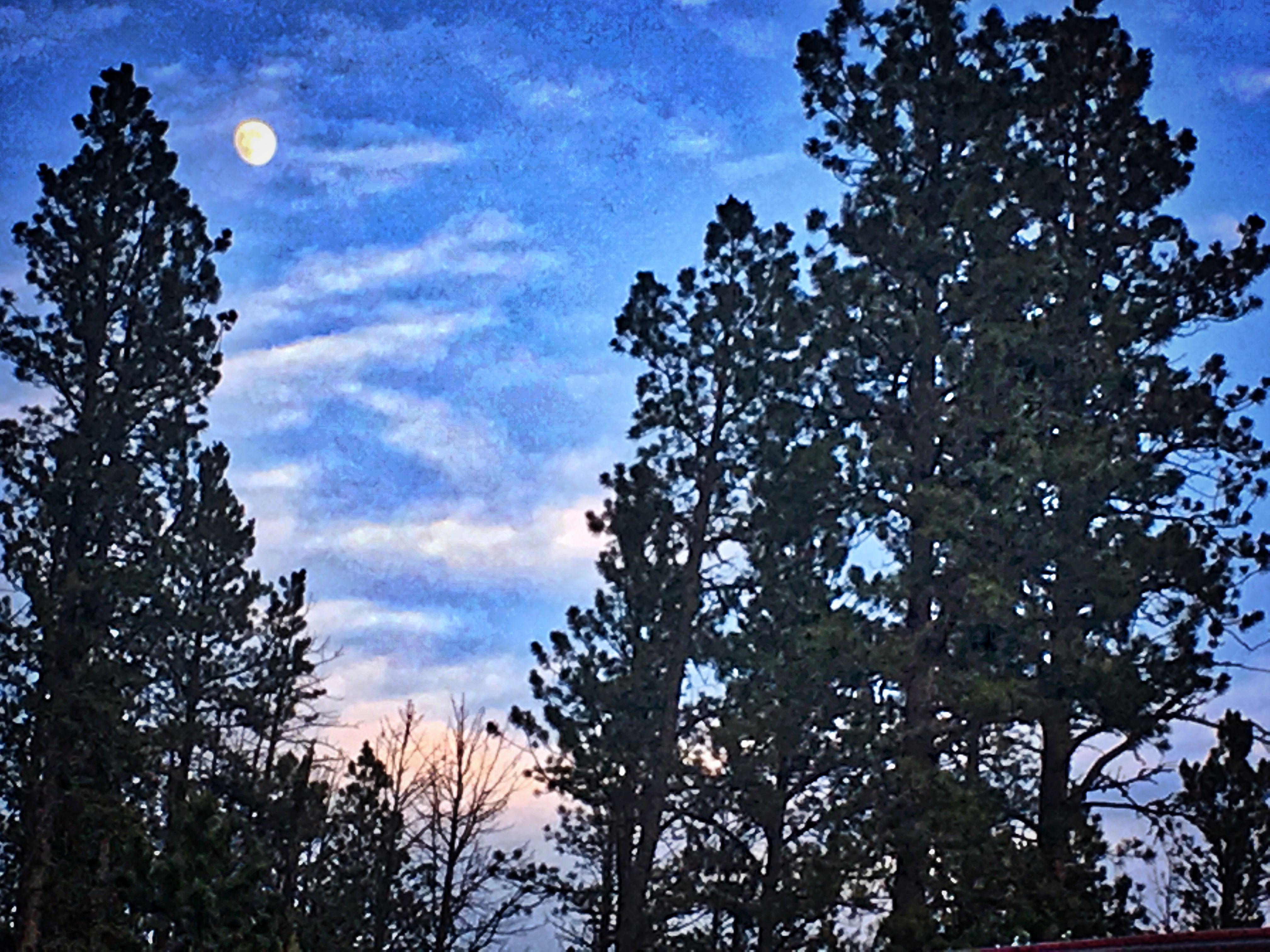
Moonrise at Sunset
The View From Below
Brave Explorers

Spearfish Creek (Lead, South Dakota)

Spearfish Creek (Lead, South Dakota)

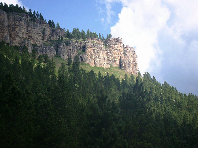
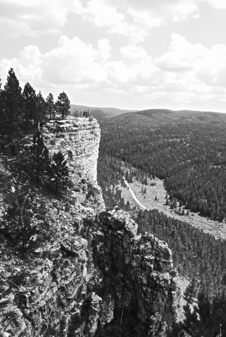
Spearfish Canyon
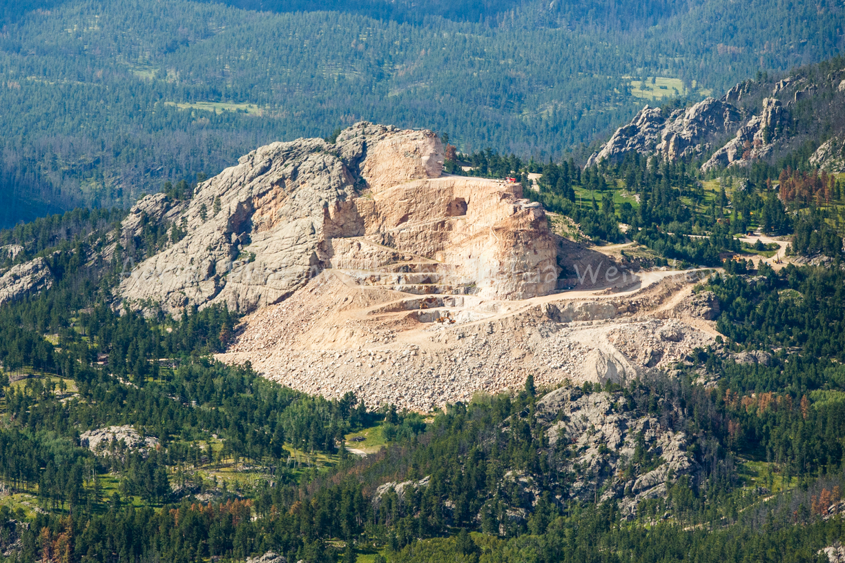
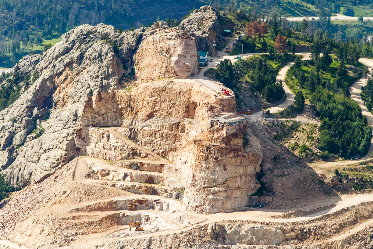
Crazy Horse Memorial
_90A9408.jpg

_90A9381.jpg

Secret Pond

Tim on the Edge

Spearfish Creek (Lead, South Dakota)

DSCF1885.jpg

DSCF1882.jpg

Life in the Black Hills

"It's My Turn to Drive!"

This is "Stolen Kiss Rd"

Big Pink

The Black Halls are Topped with White Limestone

He Loves to Romp in the Tall Grass

Another Camping Breakfast
US-85, Lead, SD アメリカ合衆国トレイルズヘッド・ロッジの地図
別の場所を検索
近所の場所
High Ridge Trail, Lead, SD アメリカ合衆国
アメリカ合衆国 〒 サウス・ダゴタ州 ノース・ローレンス テリー・ピーク
アメリカ合衆国 〒 サウス・ダゴタ州 デュモン
Whitetail Dr, Lead, SD アメリカ合衆国
アメリカ合衆国 サウス・ダゴタ州 ローレンス
アメリカ合衆国 〒 サウス・ダゴタ州 エングルウッド
アメリカ合衆国 サウス・ダゴタ州 ノース・ローレンス ブライダル・ベイル滝
Nevada Gulch Rd, Lead, SD アメリカ合衆国
Pasque Loop, Spearfish, SD アメリカ合衆国
Grier Ave, Lead, SD アメリカ合衆国Grier Avenue
Aster Rd, Spearfish, SD アメリカ合衆国
Deer Path, Lead, SD アメリカ合衆国
Ridge Rd, Lead, SD アメリカ合衆国
アメリカ合衆国 サウス・ダゴタ州 ノース・ローレンス
アメリカ合衆国 〒 サウス・ダゴタ州 スピアフィッシュ
S Rochford Rd, Hill City, SD アメリカ合衆国
アメリカ合衆国 サウス・ダゴタ州 リード
S Rochford Rd, Hill City, SD アメリカ合衆国
Fox St, Lead, SD アメリカ合衆国
Pine Cone Ave, Spearfish, SD アメリカ合衆国
最近の検索
- アメリカ合衆国 アラスカ州 レッド・ドッグ・マイン日の出日の入り時間
- Am bhf, Borken, ドイツアム・バーンホーフ日の出日の入り時間
- 4th St E, Sonoma, CA, USA日の出日の入り時間
- Oakland Ave, Williamsport, PA アメリカ合衆国日の出日の入り時間
- Via Roma, Pieranica CR, イタリアローマ通り日の出日の入り時間
- クロアチア 〒 ドゥブロブニク GradClock Tower of Dubrovnik日の出日の入り時間
- アルゼンチン チュブ州 トレリュー日の出日の入り時間
- Hartfords Bluff Cir, Mt Pleasant, SC アメリカ合衆国日の出日の入り時間
- 日本、熊本県熊本市北区日の出日の入り時間
- 中華人民共和国 福州市 平潭県 平潭島日の出日の入り時間