台湾 高雄市 美濃区 獅山里日の出日の入り時間
Location: 台湾 > 高雄市 > 美濃区 >
時間帯:
Asia/Taipei
現地時間:
2025-06-17 20:19:02
経度:
120.5710804
緯度:
22.857021
今日の日の出時刻:
05:12:35 AM
今日の日の入時刻:
06:44:46 PM
今日の日長:
13h 32m 11s
明日の日の出時刻:
05:12:46 AM
明日の日の入時刻:
06:45:02 PM
明日の日長:
13h 32m 16s
すべて表示する
| 日付 | 日出 | 日没 | 日長 |
|---|---|---|---|
| 2025年01月01日 | 06:38:23 AM | 05:24:14 PM | 10h 45m 51s |
| 2025年01月02日 | 06:38:41 AM | 05:24:53 PM | 10h 46m 12s |
| 2025年01月03日 | 06:38:57 AM | 05:25:32 PM | 10h 46m 35s |
| 2025年01月04日 | 06:39:12 AM | 05:26:12 PM | 10h 47m 0s |
| 2025年01月05日 | 06:39:26 AM | 05:26:52 PM | 10h 47m 26s |
| 2025年01月06日 | 06:39:38 AM | 05:27:32 PM | 10h 47m 54s |
| 2025年01月07日 | 06:39:49 AM | 05:28:13 PM | 10h 48m 24s |
| 2025年01月08日 | 06:39:59 AM | 05:28:54 PM | 10h 48m 55s |
| 2025年01月09日 | 06:40:07 AM | 05:29:36 PM | 10h 49m 29s |
| 2025年01月10日 | 06:40:14 AM | 05:30:18 PM | 10h 50m 4s |
| 2025年01月11日 | 06:40:20 AM | 05:31:00 PM | 10h 50m 40s |
| 2025年01月12日 | 06:40:24 AM | 05:31:42 PM | 10h 51m 18s |
| 2025年01月13日 | 06:40:27 AM | 05:32:24 PM | 10h 51m 57s |
| 2025年01月14日 | 06:40:28 AM | 05:33:06 PM | 10h 52m 38s |
| 2025年01月15日 | 06:40:28 AM | 05:33:49 PM | 10h 53m 21s |
| 2025年01月16日 | 06:40:27 AM | 05:34:31 PM | 10h 54m 4s |
| 2025年01月17日 | 06:40:24 AM | 05:35:14 PM | 10h 54m 50s |
| 2025年01月18日 | 06:40:20 AM | 05:35:57 PM | 10h 55m 37s |
| 2025年01月19日 | 06:40:15 AM | 05:36:39 PM | 10h 56m 24s |
| 2025年01月20日 | 06:40:08 AM | 05:37:21 PM | 10h 57m 13s |
| 2025年01月21日 | 06:39:59 AM | 05:38:04 PM | 10h 58m 5s |
| 2025年01月22日 | 06:39:50 AM | 05:38:46 PM | 10h 58m 56s |
| 2025年01月23日 | 06:39:39 AM | 05:39:28 PM | 10h 59m 49s |
| 2025年01月24日 | 06:39:26 AM | 05:40:10 PM | 11h 0m 44s |
| 2025年01月25日 | 06:39:12 AM | 05:40:51 PM | 11h 1m 39s |
| 2025年01月26日 | 06:38:57 AM | 05:41:33 PM | 11h 2m 36s |
| 2025年01月27日 | 06:38:41 AM | 05:42:14 PM | 11h 3m 33s |
| 2025年01月28日 | 06:38:23 AM | 05:42:54 PM | 11h 4m 31s |
| 2025年01月29日 | 06:38:04 AM | 05:43:35 PM | 11h 5m 31s |
| 2025年01月30日 | 06:37:43 AM | 05:44:15 PM | 11h 6m 32s |
| 2025年01月31日 | 06:37:21 AM | 05:44:55 PM | 11h 7m 34s |
| 2025年02月01日 | 06:36:58 AM | 05:45:35 PM | 11h 8m 37s |
| 2025年02月02日 | 06:36:34 AM | 05:46:14 PM | 11h 9m 40s |
| 2025年02月03日 | 06:36:08 AM | 05:46:52 PM | 11h 10m 44s |
| 2025年02月04日 | 06:35:42 AM | 05:47:31 PM | 11h 11m 49s |
| 2025年02月05日 | 06:35:14 AM | 05:48:09 PM | 11h 12m 55s |
| 2025年02月06日 | 06:34:44 AM | 05:48:46 PM | 11h 14m 2s |
| 2025年02月07日 | 06:34:14 AM | 05:49:23 PM | 11h 15m 9s |
| 2025年02月08日 | 06:33:42 AM | 05:50:00 PM | 11h 16m 18s |
| 2025年02月09日 | 06:33:10 AM | 05:50:36 PM | 11h 17m 26s |
| 2025年02月10日 | 06:32:36 AM | 05:51:12 PM | 11h 18m 36s |
| 2025年02月11日 | 06:32:01 AM | 05:51:47 PM | 11h 19m 46s |
| 2025年02月12日 | 06:31:25 AM | 05:52:22 PM | 11h 20m 57s |
| 2025年02月13日 | 06:30:48 AM | 05:52:57 PM | 11h 22m 9s |
| 2025年02月14日 | 06:30:10 AM | 05:53:31 PM | 11h 23m 21s |
| 2025年02月15日 | 06:29:31 AM | 05:54:04 PM | 11h 24m 33s |
| 2025年02月16日 | 06:28:51 AM | 05:54:37 PM | 11h 25m 46s |
| 2025年02月17日 | 06:28:10 AM | 05:55:10 PM | 11h 27m 0s |
| 2025年02月18日 | 06:27:28 AM | 05:55:42 PM | 11h 28m 14s |
| 2025年02月19日 | 06:26:46 AM | 05:56:14 PM | 11h 29m 28s |
| 2025年02月20日 | 06:26:02 AM | 05:56:45 PM | 11h 30m 43s |
| 2025年02月21日 | 06:25:17 AM | 05:57:16 PM | 11h 31m 59s |
| 2025年02月22日 | 06:24:32 AM | 05:57:46 PM | 11h 33m 14s |
| 2025年02月23日 | 06:23:46 AM | 05:58:16 PM | 11h 34m 30s |
| 2025年02月24日 | 06:22:59 AM | 05:58:45 PM | 11h 35m 46s |
| 2025年02月25日 | 06:22:11 AM | 05:59:14 PM | 11h 37m 3s |
| 2025年02月26日 | 06:21:23 AM | 05:59:43 PM | 11h 38m 20s |
| 2025年02月27日 | 06:20:34 AM | 06:00:11 PM | 11h 39m 37s |
| 2025年02月28日 | 06:19:44 AM | 06:00:39 PM | 11h 40m 55s |
| 2025年03月01日 | 06:18:54 AM | 06:01:06 PM | 11h 42m 12s |
| 2025年03月02日 | 06:18:03 AM | 06:01:33 PM | 11h 43m 30s |
| 2025年03月03日 | 06:17:11 AM | 06:02:00 PM | 11h 44m 49s |
| 2025年03月04日 | 06:16:19 AM | 06:02:26 PM | 11h 46m 7s |
| 2025年03月05日 | 06:15:26 AM | 06:02:52 PM | 11h 47m 26s |
| 2025年03月06日 | 06:14:33 AM | 06:03:18 PM | 11h 48m 45s |
| 2025年03月07日 | 06:13:39 AM | 06:03:43 PM | 11h 50m 4s |
| 2025年03月08日 | 06:12:45 AM | 06:04:08 PM | 11h 51m 23s |
| 2025年03月09日 | 06:11:50 AM | 06:04:33 PM | 11h 52m 43s |
| 2025年03月10日 | 06:10:55 AM | 06:04:58 PM | 11h 54m 3s |
| 2025年03月11日 | 06:10:00 AM | 06:05:22 PM | 11h 55m 22s |
| 2025年03月12日 | 06:09:04 AM | 06:05:46 PM | 11h 56m 42s |
| 2025年03月13日 | 06:08:08 AM | 06:06:09 PM | 11h 58m 1s |
| 2025年03月14日 | 06:07:11 AM | 06:06:33 PM | 11h 59m 22s |
| 2025年03月15日 | 06:06:15 AM | 06:06:56 PM | 12h 0m 41s |
| 2025年03月16日 | 06:05:18 AM | 06:07:19 PM | 12h 2m 1s |
| 2025年03月17日 | 06:04:21 AM | 06:07:42 PM | 12h 3m 21s |
| 2025年03月18日 | 06:03:23 AM | 06:08:04 PM | 12h 4m 41s |
| 2025年03月19日 | 06:02:26 AM | 06:08:27 PM | 12h 6m 1s |
| 2025年03月20日 | 06:01:28 AM | 06:08:49 PM | 12h 7m 21s |
| 2025年03月21日 | 06:00:30 AM | 06:09:11 PM | 12h 8m 41s |
| 2025年03月22日 | 05:59:33 AM | 06:09:33 PM | 12h 10m 0s |
| 2025年03月23日 | 05:58:35 AM | 06:09:55 PM | 12h 11m 20s |
| 2025年03月24日 | 05:57:37 AM | 06:10:17 PM | 12h 12m 40s |
| 2025年03月25日 | 05:56:39 AM | 06:10:39 PM | 12h 14m 0s |
| 2025年03月26日 | 05:55:41 AM | 06:11:00 PM | 12h 15m 19s |
| 2025年03月27日 | 05:54:43 AM | 06:11:22 PM | 12h 16m 39s |
| 2025年03月28日 | 05:53:45 AM | 06:11:44 PM | 12h 17m 59s |
| 2025年03月29日 | 05:52:47 AM | 06:12:05 PM | 12h 19m 18s |
| 2025年03月30日 | 05:51:50 AM | 06:12:27 PM | 12h 20m 37s |
| 2025年03月31日 | 05:50:52 AM | 06:12:48 PM | 12h 21m 56s |
| 2025年04月01日 | 05:49:55 AM | 06:13:10 PM | 12h 23m 15s |
| 2025年04月02日 | 05:48:58 AM | 06:13:32 PM | 12h 24m 34s |
| 2025年04月03日 | 05:48:01 AM | 06:13:53 PM | 12h 25m 52s |
| 2025年04月04日 | 05:47:05 AM | 06:14:15 PM | 12h 27m 10s |
| 2025年04月05日 | 05:46:08 AM | 06:14:37 PM | 12h 28m 29s |
| 2025年04月06日 | 05:45:12 AM | 06:14:59 PM | 12h 29m 47s |
| 2025年04月07日 | 05:44:16 AM | 06:15:21 PM | 12h 31m 5s |
| 2025年04月08日 | 05:43:21 AM | 06:15:43 PM | 12h 32m 22s |
| 2025年04月09日 | 05:42:26 AM | 06:16:05 PM | 12h 33m 39s |
| 2025年04月10日 | 05:41:32 AM | 06:16:28 PM | 12h 34m 56s |
| 2025年04月11日 | 05:40:37 AM | 06:16:50 PM | 12h 36m 13s |
| 2025年04月12日 | 05:39:44 AM | 06:17:13 PM | 12h 37m 29s |
| 2025年04月13日 | 05:38:51 AM | 06:17:35 PM | 12h 38m 44s |
| 2025年04月14日 | 05:37:58 AM | 06:17:58 PM | 12h 40m 0s |
| 2025年04月15日 | 05:37:06 AM | 06:18:21 PM | 12h 41m 15s |
| 2025年04月16日 | 05:36:14 AM | 06:18:45 PM | 12h 42m 31s |
| 2025年04月17日 | 05:35:23 AM | 06:19:08 PM | 12h 43m 45s |
| 2025年04月18日 | 05:34:32 AM | 06:19:32 PM | 12h 45m 0s |
| 2025年04月19日 | 05:33:43 AM | 06:19:55 PM | 12h 46m 12s |
| 2025年04月20日 | 05:32:53 AM | 06:20:19 PM | 12h 47m 26s |
| 2025年04月21日 | 05:32:05 AM | 06:20:43 PM | 12h 48m 38s |
| 2025年04月22日 | 05:31:17 AM | 06:21:08 PM | 12h 49m 51s |
| 2025年04月23日 | 05:30:30 AM | 06:21:32 PM | 12h 51m 2s |
| 2025年04月24日 | 05:29:43 AM | 06:21:57 PM | 12h 52m 14s |
| 2025年04月25日 | 05:28:58 AM | 06:22:22 PM | 12h 53m 24s |
| 2025年04月26日 | 05:28:13 AM | 06:22:47 PM | 12h 54m 34s |
| 2025年04月27日 | 05:27:28 AM | 06:23:13 PM | 12h 55m 45s |
| 2025年04月28日 | 05:26:45 AM | 06:23:38 PM | 12h 56m 53s |
| 2025年04月29日 | 05:26:03 AM | 06:24:04 PM | 12h 58m 1s |
| 2025年04月30日 | 05:25:21 AM | 06:24:30 PM | 12h 59m 9s |
| 2025年05月01日 | 05:24:40 AM | 06:24:56 PM | 13h 0m 16s |
| 2025年05月02日 | 05:24:00 AM | 06:25:22 PM | 13h 1m 22s |
| 2025年05月03日 | 05:23:21 AM | 06:25:49 PM | 13h 2m 28s |
| 2025年05月04日 | 05:22:43 AM | 06:26:16 PM | 13h 3m 33s |
| 2025年05月05日 | 05:22:06 AM | 06:26:43 PM | 13h 4m 37s |
| 2025年05月06日 | 05:21:30 AM | 06:27:10 PM | 13h 5m 40s |
| 2025年05月07日 | 05:20:55 AM | 06:27:37 PM | 13h 6m 42s |
| 2025年05月08日 | 05:20:21 AM | 06:28:04 PM | 13h 7m 43s |
| 2025年05月09日 | 05:19:48 AM | 06:28:32 PM | 13h 8m 44s |
| 2025年05月10日 | 05:19:15 AM | 06:28:59 PM | 13h 9m 44s |
| 2025年05月11日 | 05:18:44 AM | 06:29:27 PM | 13h 10m 43s |
| 2025年05月12日 | 05:18:14 AM | 06:29:55 PM | 13h 11m 41s |
| 2025年05月13日 | 05:17:45 AM | 06:30:22 PM | 13h 12m 37s |
| 2025年05月14日 | 05:17:17 AM | 06:30:50 PM | 13h 13m 33s |
| 2025年05月15日 | 05:16:51 AM | 06:31:18 PM | 13h 14m 27s |
| 2025年05月16日 | 05:16:25 AM | 06:31:46 PM | 13h 15m 21s |
| 2025年05月17日 | 05:16:00 AM | 06:32:14 PM | 13h 16m 14s |
| 2025年05月18日 | 05:15:37 AM | 06:32:42 PM | 13h 17m 5s |
| 2025年05月19日 | 05:15:14 AM | 06:33:10 PM | 13h 17m 56s |
| 2025年05月20日 | 05:14:53 AM | 06:33:38 PM | 13h 18m 45s |
| 2025年05月21日 | 05:14:33 AM | 06:34:06 PM | 13h 19m 33s |
| 2025年05月22日 | 05:14:14 AM | 06:34:34 PM | 13h 20m 20s |
| 2025年05月23日 | 05:13:56 AM | 06:35:02 PM | 13h 21m 6s |
| 2025年05月24日 | 05:13:39 AM | 06:35:29 PM | 13h 21m 50s |
| 2025年05月25日 | 05:13:24 AM | 06:35:57 PM | 13h 22m 33s |
| 2025年05月26日 | 05:13:10 AM | 06:36:24 PM | 13h 23m 14s |
| 2025年05月27日 | 05:12:56 AM | 06:36:51 PM | 13h 23m 55s |
| 2025年05月28日 | 05:12:44 AM | 06:37:18 PM | 13h 24m 34s |
| 2025年05月29日 | 05:12:33 AM | 06:37:45 PM | 13h 25m 12s |
| 2025年05月30日 | 05:12:24 AM | 06:38:11 PM | 13h 25m 47s |
| 2025年05月31日 | 05:12:15 AM | 06:38:37 PM | 13h 26m 22s |
| 2025年06月01日 | 05:12:07 AM | 06:39:03 PM | 13h 26m 56s |
| 2025年06月02日 | 05:12:01 AM | 06:39:28 PM | 13h 27m 27s |
| 2025年06月03日 | 05:11:56 AM | 06:39:53 PM | 13h 27m 57s |
| 2025年06月04日 | 05:11:52 AM | 06:40:17 PM | 13h 28m 25s |
| 2025年06月05日 | 05:11:49 AM | 06:40:41 PM | 13h 28m 52s |
| 2025年06月06日 | 05:11:47 AM | 06:41:05 PM | 13h 29m 18s |
| 2025年06月07日 | 05:11:46 AM | 06:41:28 PM | 13h 29m 42s |
| 2025年06月08日 | 05:11:46 AM | 06:41:51 PM | 13h 30m 5s |
| 2025年06月09日 | 05:11:48 AM | 06:42:13 PM | 13h 30m 25s |
| 2025年06月10日 | 05:11:50 AM | 06:42:34 PM | 13h 30m 44s |
| 2025年06月11日 | 05:11:54 AM | 06:42:55 PM | 13h 31m 1s |
| 2025年06月12日 | 05:11:58 AM | 06:43:15 PM | 13h 31m 17s |
| 2025年06月13日 | 05:12:04 AM | 06:43:35 PM | 13h 31m 31s |
| 2025年06月14日 | 05:12:10 AM | 06:43:54 PM | 13h 31m 44s |
| 2025年06月15日 | 05:12:18 AM | 06:44:12 PM | 13h 31m 54s |
| 2025年06月16日 | 05:12:26 AM | 06:44:29 PM | 13h 32m 3s |
| 2025年06月17日 | 05:12:35 AM | 06:44:46 PM | 13h 32m 11s |
| 2025年06月18日 | 05:12:46 AM | 06:45:02 PM | 13h 32m 16s |
| 2025年06月19日 | 05:12:57 AM | 06:45:17 PM | 13h 32m 20s |
| 2025年06月20日 | 05:13:09 AM | 06:45:31 PM | 13h 32m 22s |
| 2025年06月21日 | 05:13:22 AM | 06:45:44 PM | 13h 32m 22s |
| 2025年06月22日 | 05:13:35 AM | 06:45:57 PM | 13h 32m 22s |
| 2025年06月23日 | 05:13:50 AM | 06:46:08 PM | 13h 32m 18s |
| 2025年06月24日 | 05:14:05 AM | 06:46:19 PM | 13h 32m 14s |
| 2025年06月25日 | 05:14:21 AM | 06:46:28 PM | 13h 32m 7s |
| 2025年06月26日 | 05:14:38 AM | 06:46:37 PM | 13h 31m 59s |
| 2025年06月27日 | 05:14:55 AM | 06:46:45 PM | 13h 31m 50s |
| 2025年06月28日 | 05:15:13 AM | 06:46:51 PM | 13h 31m 38s |
| 2025年06月29日 | 05:15:32 AM | 06:46:57 PM | 13h 31m 25s |
| 2025年06月30日 | 05:15:51 AM | 06:47:01 PM | 13h 31m 10s |
| 2025年07月01日 | 05:16:11 AM | 06:47:05 PM | 13h 30m 54s |
| 2025年07月02日 | 05:16:31 AM | 06:47:07 PM | 13h 30m 36s |
| 2025年07月03日 | 05:16:52 AM | 06:47:08 PM | 13h 30m 16s |
| 2025年07月04日 | 05:17:14 AM | 06:47:08 PM | 13h 29m 54s |
| 2025年07月05日 | 05:17:36 AM | 06:47:07 PM | 13h 29m 31s |
| 2025年07月06日 | 05:17:58 AM | 06:47:05 PM | 13h 29m 7s |
| 2025年07月07日 | 05:18:21 AM | 06:47:02 PM | 13h 28m 41s |
| 2025年07月08日 | 05:18:44 AM | 06:46:57 PM | 13h 28m 13s |
| 2025年07月09日 | 05:19:07 AM | 06:46:52 PM | 13h 27m 45s |
| 2025年07月10日 | 05:19:31 AM | 06:46:45 PM | 13h 27m 14s |
| 2025年07月11日 | 05:19:55 AM | 06:46:37 PM | 13h 26m 42s |
| 2025年07月12日 | 05:20:20 AM | 06:46:28 PM | 13h 26m 8s |
| 2025年07月13日 | 05:20:45 AM | 06:46:17 PM | 13h 25m 32s |
| 2025年07月14日 | 05:21:10 AM | 06:46:06 PM | 13h 24m 56s |
| 2025年07月15日 | 05:21:35 AM | 06:45:53 PM | 13h 24m 18s |
| 2025年07月16日 | 05:22:00 AM | 06:45:39 PM | 13h 23m 39s |
| 2025年07月17日 | 05:22:25 AM | 06:45:24 PM | 13h 22m 59s |
| 2025年07月18日 | 05:22:51 AM | 06:45:08 PM | 13h 22m 17s |
| 2025年07月19日 | 05:23:17 AM | 06:44:50 PM | 13h 21m 33s |
| 2025年07月20日 | 05:23:42 AM | 06:44:32 PM | 13h 20m 50s |
| 2025年07月21日 | 05:24:08 AM | 06:44:12 PM | 13h 20m 4s |
| 2025年07月22日 | 05:24:34 AM | 06:43:51 PM | 13h 19m 17s |
| 2025年07月23日 | 05:25:00 AM | 06:43:29 PM | 13h 18m 29s |
| 2025年07月24日 | 05:25:26 AM | 06:43:05 PM | 13h 17m 39s |
| 2025年07月25日 | 05:25:52 AM | 06:42:41 PM | 13h 16m 49s |
| 2025年07月26日 | 05:26:17 AM | 06:42:15 PM | 13h 15m 58s |
| 2025年07月27日 | 05:26:43 AM | 06:41:48 PM | 13h 15m 5s |
| 2025年07月28日 | 05:27:09 AM | 06:41:20 PM | 13h 14m 11s |
| 2025年07月29日 | 05:27:34 AM | 06:40:51 PM | 13h 13m 17s |
| 2025年07月30日 | 05:28:00 AM | 06:40:21 PM | 13h 12m 21s |
| 2025年07月31日 | 05:28:25 AM | 06:39:50 PM | 13h 11m 25s |
| 2025年08月01日 | 05:28:50 AM | 06:39:17 PM | 13h 10m 27s |
| 2025年08月02日 | 05:29:15 AM | 06:38:44 PM | 13h 9m 29s |
| 2025年08月03日 | 05:29:40 AM | 06:38:10 PM | 13h 8m 30s |
| 2025年08月04日 | 05:30:05 AM | 06:37:34 PM | 13h 7m 29s |
| 2025年08月05日 | 05:30:29 AM | 06:36:58 PM | 13h 6m 29s |
| 2025年08月06日 | 05:30:54 AM | 06:36:20 PM | 13h 5m 26s |
| 2025年08月07日 | 05:31:18 AM | 06:35:42 PM | 13h 4m 24s |
| 2025年08月08日 | 05:31:42 AM | 06:35:02 PM | 13h 3m 20s |
| 2025年08月09日 | 05:32:05 AM | 06:34:22 PM | 13h 2m 17s |
| 2025年08月10日 | 05:32:29 AM | 06:33:40 PM | 13h 1m 11s |
| 2025年08月11日 | 05:32:52 AM | 06:32:58 PM | 13h 0m 6s |
| 2025年08月12日 | 05:33:15 AM | 06:32:15 PM | 12h 59m 0s |
| 2025年08月13日 | 05:33:38 AM | 06:31:31 PM | 12h 57m 53s |
| 2025年08月14日 | 05:34:01 AM | 06:30:46 PM | 12h 56m 45s |
| 2025年08月15日 | 05:34:23 AM | 06:30:00 PM | 12h 55m 37s |
| 2025年08月16日 | 05:34:45 AM | 06:29:13 PM | 12h 54m 28s |
| 2025年08月17日 | 05:35:07 AM | 06:28:26 PM | 12h 53m 19s |
| 2025年08月18日 | 05:35:28 AM | 06:27:38 PM | 12h 52m 10s |
| 2025年08月19日 | 05:35:50 AM | 06:26:49 PM | 12h 50m 59s |
| 2025年08月20日 | 05:36:11 AM | 06:25:59 PM | 12h 49m 48s |
| 2025年08月21日 | 05:36:32 AM | 06:25:09 PM | 12h 48m 37s |
| 2025年08月22日 | 05:36:53 AM | 06:24:18 PM | 12h 47m 25s |
| 2025年08月23日 | 05:37:13 AM | 06:23:26 PM | 12h 46m 13s |
| 2025年08月24日 | 05:37:33 AM | 06:22:34 PM | 12h 45m 1s |
| 2025年08月25日 | 05:37:53 AM | 06:21:41 PM | 12h 43m 48s |
| 2025年08月26日 | 05:38:13 AM | 06:20:47 PM | 12h 42m 34s |
| 2025年08月27日 | 05:38:33 AM | 06:19:53 PM | 12h 41m 20s |
| 2025年08月28日 | 05:38:52 AM | 06:18:58 PM | 12h 40m 6s |
| 2025年08月29日 | 05:39:12 AM | 06:18:03 PM | 12h 38m 51s |
| 2025年08月30日 | 05:39:31 AM | 06:17:07 PM | 12h 37m 36s |
| 2025年08月31日 | 05:39:50 AM | 06:16:11 PM | 12h 36m 21s |
| 2025年09月01日 | 05:40:08 AM | 06:15:14 PM | 12h 35m 6s |
| 2025年09月02日 | 05:40:27 AM | 06:14:17 PM | 12h 33m 50s |
| 2025年09月03日 | 05:40:45 AM | 06:13:19 PM | 12h 32m 34s |
| 2025年09月04日 | 05:41:04 AM | 06:12:21 PM | 12h 31m 17s |
| 2025年09月05日 | 05:41:22 AM | 06:11:23 PM | 12h 30m 1s |
| 2025年09月06日 | 05:41:40 AM | 06:10:25 PM | 12h 28m 45s |
| 2025年09月07日 | 05:41:58 AM | 06:09:26 PM | 12h 27m 28s |
| 2025年09月08日 | 05:42:16 AM | 06:08:26 PM | 12h 26m 10s |
| 2025年09月09日 | 05:42:34 AM | 06:07:27 PM | 12h 24m 53s |
| 2025年09月10日 | 05:42:52 AM | 06:06:27 PM | 12h 23m 35s |
| 2025年09月11日 | 05:43:09 AM | 06:05:27 PM | 12h 22m 18s |
| 2025年09月12日 | 05:43:27 AM | 06:04:27 PM | 12h 21m 0s |
| 2025年09月13日 | 05:43:45 AM | 06:03:27 PM | 12h 19m 42s |
| 2025年09月14日 | 05:44:02 AM | 06:02:26 PM | 12h 18m 24s |
| 2025年09月15日 | 05:44:20 AM | 06:01:26 PM | 12h 17m 6s |
| 2025年09月16日 | 05:44:38 AM | 06:00:25 PM | 12h 15m 47s |
| 2025年09月17日 | 05:44:56 AM | 05:59:25 PM | 12h 14m 29s |
| 2025年09月18日 | 05:45:13 AM | 05:58:24 PM | 12h 13m 11s |
| 2025年09月19日 | 05:45:31 AM | 05:57:23 PM | 12h 11m 52s |
| 2025年09月20日 | 05:45:49 AM | 05:56:23 PM | 12h 10m 34s |
| 2025年09月21日 | 05:46:07 AM | 05:55:22 PM | 12h 9m 15s |
| 2025年09月22日 | 05:46:25 AM | 05:54:22 PM | 12h 7m 57s |
| 2025年09月23日 | 05:46:44 AM | 05:53:21 PM | 12h 6m 37s |
| 2025年09月24日 | 05:47:02 AM | 05:52:21 PM | 12h 5m 19s |
| 2025年09月25日 | 05:47:21 AM | 05:51:21 PM | 12h 4m 0s |
| 2025年09月26日 | 05:47:39 AM | 05:50:21 PM | 12h 2m 42s |
| 2025年09月27日 | 05:47:58 AM | 05:49:21 PM | 12h 1m 23s |
| 2025年09月28日 | 05:48:17 AM | 05:48:21 PM | 12h 0m 4s |
| 2025年09月29日 | 05:48:37 AM | 05:47:22 PM | 11h 58m 45s |
| 2025年09月30日 | 05:48:56 AM | 05:46:23 PM | 11h 57m 27s |
| 2025年10月01日 | 05:49:16 AM | 05:45:24 PM | 11h 56m 8s |
| 2025年10月02日 | 05:49:36 AM | 05:44:26 PM | 11h 54m 50s |
| 2025年10月03日 | 05:49:56 AM | 05:43:28 PM | 11h 53m 32s |
| 2025年10月04日 | 05:50:17 AM | 05:42:30 PM | 11h 52m 13s |
| 2025年10月05日 | 05:50:38 AM | 05:41:33 PM | 11h 50m 55s |
| 2025年10月06日 | 05:50:59 AM | 05:40:36 PM | 11h 49m 37s |
| 2025年10月07日 | 05:51:21 AM | 05:39:40 PM | 11h 48m 19s |
| 2025年10月08日 | 05:51:42 AM | 05:38:44 PM | 11h 47m 2s |
| 2025年10月09日 | 05:52:05 AM | 05:37:49 PM | 11h 45m 44s |
| 2025年10月10日 | 05:52:27 AM | 05:36:54 PM | 11h 44m 27s |
| 2025年10月11日 | 05:52:50 AM | 05:36:00 PM | 11h 43m 10s |
| 2025年10月12日 | 05:53:13 AM | 05:35:06 PM | 11h 41m 53s |
| 2025年10月13日 | 05:53:37 AM | 05:34:13 PM | 11h 40m 36s |
| 2025年10月14日 | 05:54:01 AM | 05:33:21 PM | 11h 39m 20s |
| 2025年10月15日 | 05:54:26 AM | 05:32:29 PM | 11h 38m 3s |
| 2025年10月16日 | 05:54:51 AM | 05:31:39 PM | 11h 36m 48s |
| 2025年10月17日 | 05:55:16 AM | 05:30:48 PM | 11h 35m 32s |
| 2025年10月18日 | 05:55:42 AM | 05:29:59 PM | 11h 34m 17s |
| 2025年10月19日 | 05:56:08 AM | 05:29:10 PM | 11h 33m 2s |
| 2025年10月20日 | 05:56:35 AM | 05:28:23 PM | 11h 31m 48s |
| 2025年10月21日 | 05:57:02 AM | 05:27:36 PM | 11h 30m 34s |
| 2025年10月22日 | 05:57:30 AM | 05:26:49 PM | 11h 29m 19s |
| 2025年10月23日 | 05:57:58 AM | 05:26:04 PM | 11h 28m 6s |
| 2025年10月24日 | 05:58:27 AM | 05:25:20 PM | 11h 26m 53s |
| 2025年10月25日 | 05:58:56 AM | 05:24:36 PM | 11h 25m 40s |
| 2025年10月26日 | 05:59:26 AM | 05:23:54 PM | 11h 24m 28s |
| 2025年10月27日 | 05:59:56 AM | 05:23:12 PM | 11h 23m 16s |
| 2025年10月28日 | 06:00:26 AM | 05:22:32 PM | 11h 22m 6s |
| 2025年10月29日 | 06:00:57 AM | 05:21:53 PM | 11h 20m 56s |
| 2025年10月30日 | 06:01:29 AM | 05:21:14 PM | 11h 19m 45s |
| 2025年10月31日 | 06:02:01 AM | 05:20:37 PM | 11h 18m 36s |
| 2025年11月01日 | 06:02:34 AM | 05:20:01 PM | 11h 17m 27s |
| 2025年11月02日 | 06:03:07 AM | 05:19:26 PM | 11h 16m 19s |
| 2025年11月03日 | 06:03:40 AM | 05:18:52 PM | 11h 15m 12s |
| 2025年11月04日 | 06:04:14 AM | 05:18:19 PM | 11h 14m 5s |
| 2025年11月05日 | 06:04:49 AM | 05:17:47 PM | 11h 12m 58s |
| 2025年11月06日 | 06:05:23 AM | 05:17:17 PM | 11h 11m 54s |
| 2025年11月07日 | 06:05:59 AM | 05:16:48 PM | 11h 10m 49s |
| 2025年11月08日 | 06:06:35 AM | 05:16:20 PM | 11h 9m 45s |
| 2025年11月09日 | 06:07:11 AM | 05:15:53 PM | 11h 8m 42s |
| 2025年11月10日 | 06:07:47 AM | 05:15:28 PM | 11h 7m 41s |
| 2025年11月11日 | 06:08:24 AM | 05:15:04 PM | 11h 6m 40s |
| 2025年11月12日 | 06:09:02 AM | 05:14:41 PM | 11h 5m 39s |
| 2025年11月13日 | 06:09:40 AM | 05:14:19 PM | 11h 4m 39s |
| 2025年11月14日 | 06:10:18 AM | 05:13:59 PM | 11h 3m 41s |
| 2025年11月15日 | 06:10:56 AM | 05:13:41 PM | 11h 2m 45s |
| 2025年11月16日 | 06:11:35 AM | 05:13:23 PM | 11h 1m 48s |
| 2025年11月17日 | 06:12:14 AM | 05:13:07 PM | 11h 0m 53s |
| 2025年11月18日 | 06:12:54 AM | 05:12:53 PM | 10h 59m 59s |
| 2025年11月19日 | 06:13:33 AM | 05:12:39 PM | 10h 59m 6s |
| 2025年11月20日 | 06:14:13 AM | 05:12:28 PM | 10h 58m 15s |
| 2025年11月21日 | 06:14:53 AM | 05:12:17 PM | 10h 57m 24s |
| 2025年11月22日 | 06:15:33 AM | 05:12:08 PM | 10h 56m 35s |
| 2025年11月23日 | 06:16:14 AM | 05:12:01 PM | 10h 55m 47s |
| 2025年11月24日 | 06:16:54 AM | 05:11:55 PM | 10h 55m 1s |
| 2025年11月25日 | 06:17:35 AM | 05:11:50 PM | 10h 54m 15s |
| 2025年11月26日 | 06:18:15 AM | 05:11:47 PM | 10h 53m 32s |
| 2025年11月27日 | 06:18:56 AM | 05:11:45 PM | 10h 52m 49s |
| 2025年11月28日 | 06:19:37 AM | 05:11:45 PM | 10h 52m 8s |
| 2025年11月29日 | 06:20:18 AM | 05:11:46 PM | 10h 51m 28s |
| 2025年11月30日 | 06:20:58 AM | 05:11:48 PM | 10h 50m 50s |
| 2025年12月01日 | 06:21:39 AM | 05:11:52 PM | 10h 50m 13s |
| 2025年12月02日 | 06:22:19 AM | 05:11:57 PM | 10h 49m 38s |
| 2025年12月03日 | 06:22:59 AM | 05:12:04 PM | 10h 49m 5s |
| 2025年12月04日 | 06:23:39 AM | 05:12:12 PM | 10h 48m 33s |
| 2025年12月05日 | 06:24:19 AM | 05:12:22 PM | 10h 48m 3s |
| 2025年12月06日 | 06:24:58 AM | 05:12:33 PM | 10h 47m 35s |
| 2025年12月07日 | 06:25:37 AM | 05:12:45 PM | 10h 47m 8s |
| 2025年12月08日 | 06:26:16 AM | 05:12:59 PM | 10h 46m 43s |
| 2025年12月09日 | 06:26:55 AM | 05:13:13 PM | 10h 46m 18s |
| 2025年12月10日 | 06:27:32 AM | 05:13:30 PM | 10h 45m 58s |
| 2025年12月11日 | 06:28:10 AM | 05:13:47 PM | 10h 45m 37s |
| 2025年12月12日 | 06:28:47 AM | 05:14:06 PM | 10h 45m 19s |
| 2025年12月13日 | 06:29:23 AM | 05:14:26 PM | 10h 45m 3s |
| 2025年12月14日 | 06:29:59 AM | 05:14:47 PM | 10h 44m 48s |
| 2025年12月15日 | 06:30:34 AM | 05:15:10 PM | 10h 44m 36s |
| 2025年12月16日 | 06:31:08 AM | 05:15:33 PM | 10h 44m 25s |
| 2025年12月17日 | 06:31:42 AM | 05:15:58 PM | 10h 44m 16s |
| 2025年12月18日 | 06:32:15 AM | 05:16:24 PM | 10h 44m 9s |
| 2025年12月19日 | 06:32:47 AM | 05:16:51 PM | 10h 44m 4s |
| 2025年12月20日 | 06:33:19 AM | 05:17:19 PM | 10h 44m 0s |
| 2025年12月21日 | 06:33:49 AM | 05:17:48 PM | 10h 43m 59s |
| 2025年12月22日 | 06:34:19 AM | 05:18:18 PM | 10h 43m 59s |
| 2025年12月23日 | 06:34:48 AM | 05:18:49 PM | 10h 44m 1s |
| 2025年12月24日 | 06:35:15 AM | 05:19:21 PM | 10h 44m 6s |
| 2025年12月25日 | 06:35:42 AM | 05:19:54 PM | 10h 44m 12s |
| 2025年12月26日 | 06:36:08 AM | 05:20:27 PM | 10h 44m 19s |
| 2025年12月27日 | 06:36:32 AM | 05:21:02 PM | 10h 44m 30s |
| 2025年12月28日 | 06:36:56 AM | 05:21:37 PM | 10h 44m 41s |
| 2025年12月29日 | 06:37:18 AM | 05:22:13 PM | 10h 44m 55s |
| 2025年12月30日 | 06:37:40 AM | 05:22:50 PM | 10h 45m 10s |
| 2025年12月31日 | 06:38:00 AM | 05:23:27 PM | 10h 45m 27s |
写真

天空 sky
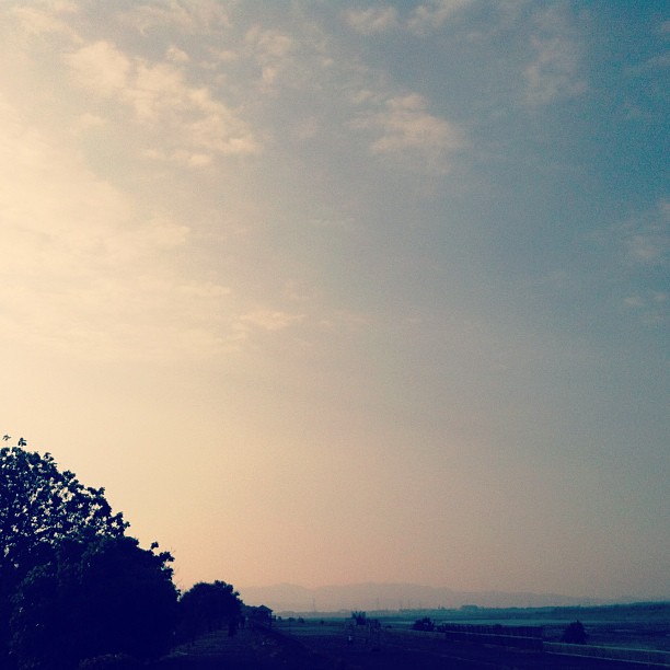
#sunset #sky

2016/初2

天光

2016/01/10 屏東高樹蜜鄕國際馬拉松

Fei's Art: the sunset
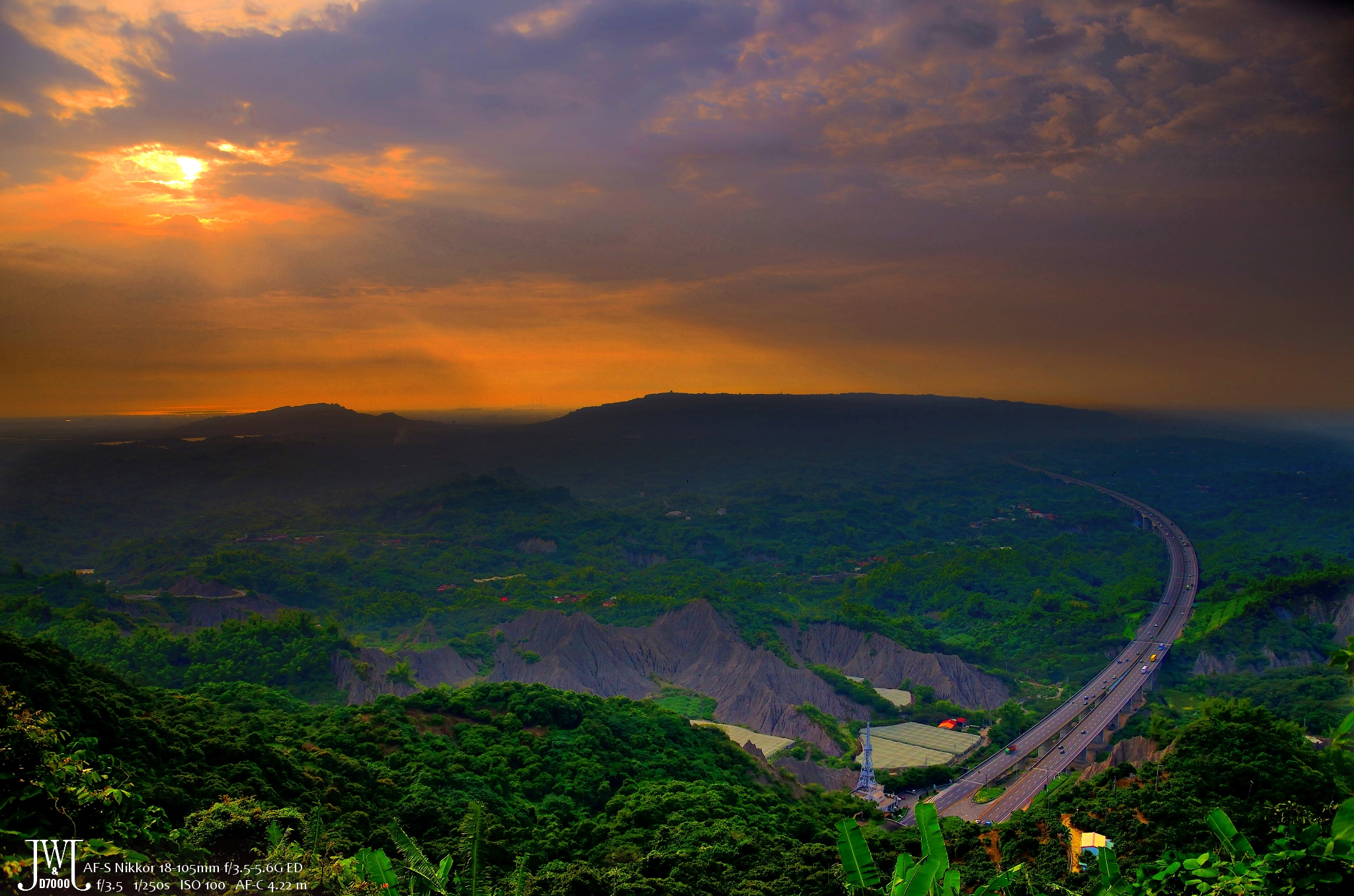
Highway and sunset
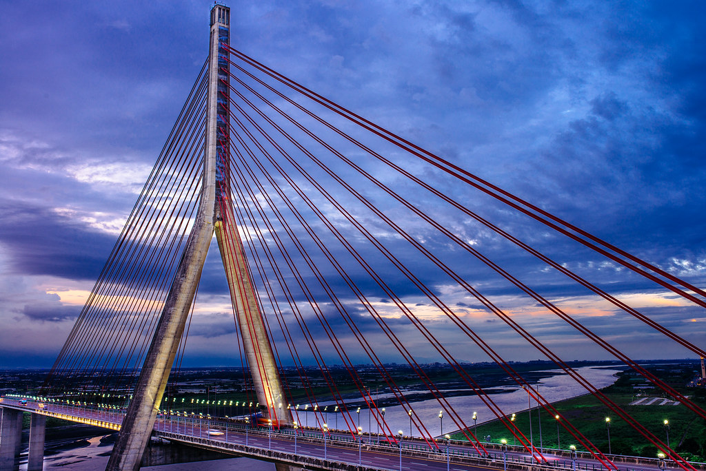
斜張橋-夕
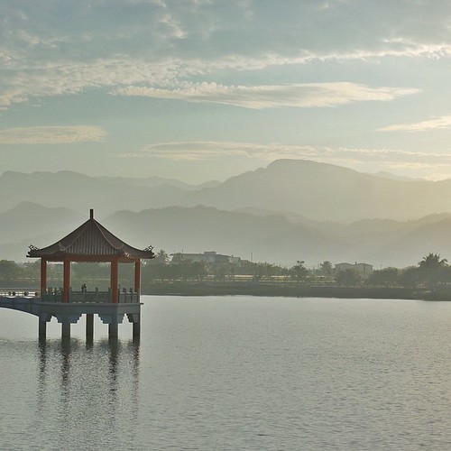
| Peace & Serenity | This is another photo I took during a trip to the tiny town of Meinong (in southern Taiwan) where I woke before daybreak to catch the sunrise from this lake/reservoir. The morning air was still, humid, and muggy; the sky was hazy
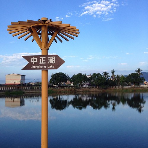
| 中正湖 | Caught the sunrise from this lake this morning; a lake and reservoir storing water for irrigation for the farmlands nearby. Many locals come here for their morning exercise: walks, runs, and bikes. We were greeted with warm smiles, nods, waves,
台湾 高雄市 美濃区 獅山里の地図
別の場所を検索
近所の場所
No. 25, Shishan St, Meinong District, Kaohsiung City, 台湾
No. 87-2, Zhonghua Rd, Meinong District, Kaohsiung City, 台湾
台湾 高雄市 美濃区 龍山里
台湾 Kaohsiung City, Meinong District, 28
No. 34, Longshan St, Meinong District, Kaohsiung City, 台湾
No. 27, Longdong St, Meinong District, Kaohsiung City, 台湾
No. 23, Wugu St, Meinong District, Kaohsiung City, 台湾
台湾 高雄市 美濃区 中壇里
台湾 高雄市 美濃区 龍肚里
台湾 高雄市 美濃区
台湾 高雄市 美濃区 合和里
No., Longdong St, Meinong District, Kaohsiung City, 台湾
台湾 高雄市 美濃区 徳興里
No. 23, Yonghua St, Meinong District, Kaohsiung City, 台湾
No. 16, Lane 97, Section 2, Zhongxiao Rd, Meinong District, Kaohsiung City, 台湾
No. 36, Meizhong Rd, Meinong District, Kaohsiung City, 台湾
No. 47, Minquan Rd, Meinong District, Kaohsiung City, 台湾
台湾 Kaohsiung City, Meinong District, 高97鄉道33號
台湾 高雄市 美濃区 福安里
No., Fumei Road, Meinong District, Kaohsiung City, 台湾
最近の検索
- アメリカ合衆国 アラスカ州 レッド・ドッグ・マイン日の出日の入り時間
- Am bhf, Borken, ドイツアム・バーンホーフ日の出日の入り時間
- 4th St E, Sonoma, CA, USA日の出日の入り時間
- Oakland Ave, Williamsport, PA アメリカ合衆国日の出日の入り時間
- Via Roma, Pieranica CR, イタリアローマ通り日の出日の入り時間
- クロアチア 〒 ドゥブロブニク GradClock Tower of Dubrovnik日の出日の入り時間
- アルゼンチン チュブ州 トレリュー日の出日の入り時間
- Hartfords Bluff Cir, Mt Pleasant, SC アメリカ合衆国日の出日の入り時間
- 日本、熊本県熊本市北区日の出日の入り時間
- 中華人民共和国 福州市 平潭県 平潭島日の出日の入り時間