Hirekolale, lake Road, Nagenahalli, Karnataka インドSilver Palm Retreat日の出日の入り時間
Location: インド > カルナータカ > チクマガルル > インド 〒 カルナータカ ナラガナハリ >
時間帯:
Asia/Kolkata
現地時間:
2025-05-21 23:22:53
経度:
75.7376484
緯度:
13.3476632
今日の日の出時刻:
05:59:40 AM
今日の日の入時刻:
06:47:49 PM
今日の日長:
12h 48m 9s
明日の日の出時刻:
05:59:33 AM
明日の日の入時刻:
06:48:07 PM
明日の日長:
12h 48m 34s
すべて表示する
| 日付 | 日出 | 日没 | 日長 |
|---|---|---|---|
| 2025年01月01日 | 06:49:59 AM | 06:11:31 PM | 11h 21m 32s |
| 2025年01月02日 | 06:50:21 AM | 06:12:05 PM | 11h 21m 44s |
| 2025年01月03日 | 06:50:42 AM | 06:12:39 PM | 11h 21m 57s |
| 2025年01月04日 | 06:51:03 AM | 06:13:13 PM | 11h 22m 10s |
| 2025年01月05日 | 06:51:22 AM | 06:13:48 PM | 11h 22m 26s |
| 2025年01月06日 | 06:51:40 AM | 06:14:22 PM | 11h 22m 42s |
| 2025年01月07日 | 06:51:58 AM | 06:14:56 PM | 11h 22m 58s |
| 2025年01月08日 | 06:52:14 AM | 06:15:30 PM | 11h 23m 16s |
| 2025年01月09日 | 06:52:30 AM | 06:16:04 PM | 11h 23m 34s |
| 2025年01月10日 | 06:52:44 AM | 06:16:38 PM | 11h 23m 54s |
| 2025年01月11日 | 06:52:58 AM | 06:17:12 PM | 11h 24m 14s |
| 2025年01月12日 | 06:53:10 AM | 06:17:46 PM | 11h 24m 36s |
| 2025年01月13日 | 06:53:22 AM | 06:18:19 PM | 11h 24m 57s |
| 2025年01月14日 | 06:53:32 AM | 06:18:52 PM | 11h 25m 20s |
| 2025年01月15日 | 06:53:42 AM | 06:19:25 PM | 11h 25m 43s |
| 2025年01月16日 | 06:53:50 AM | 06:19:58 PM | 11h 26m 8s |
| 2025年01月17日 | 06:53:57 AM | 06:20:30 PM | 11h 26m 33s |
| 2025年01月18日 | 06:54:03 AM | 06:21:02 PM | 11h 26m 59s |
| 2025年01月19日 | 06:54:08 AM | 06:21:34 PM | 11h 27m 26s |
| 2025年01月20日 | 06:54:12 AM | 06:22:05 PM | 11h 27m 53s |
| 2025年01月21日 | 06:54:15 AM | 06:22:36 PM | 11h 28m 21s |
| 2025年01月22日 | 06:54:16 AM | 06:23:07 PM | 11h 28m 51s |
| 2025年01月23日 | 06:54:17 AM | 06:23:37 PM | 11h 29m 20s |
| 2025年01月24日 | 06:54:16 AM | 06:24:06 PM | 11h 29m 50s |
| 2025年01月25日 | 06:54:14 AM | 06:24:35 PM | 11h 30m 21s |
| 2025年01月26日 | 06:54:11 AM | 06:25:04 PM | 11h 30m 53s |
| 2025年01月27日 | 06:54:08 AM | 06:25:32 PM | 11h 31m 24s |
| 2025年01月28日 | 06:54:02 AM | 06:26:00 PM | 11h 31m 58s |
| 2025年01月29日 | 06:53:56 AM | 06:26:27 PM | 11h 32m 31s |
| 2025年01月30日 | 06:53:49 AM | 06:26:54 PM | 11h 33m 5s |
| 2025年01月31日 | 06:53:41 AM | 06:27:20 PM | 11h 33m 39s |
| 2025年02月01日 | 06:53:31 AM | 06:27:45 PM | 11h 34m 14s |
| 2025年02月02日 | 06:53:21 AM | 06:28:10 PM | 11h 34m 49s |
| 2025年02月03日 | 06:53:09 AM | 06:28:34 PM | 11h 35m 25s |
| 2025年02月04日 | 06:52:57 AM | 06:28:58 PM | 11h 36m 1s |
| 2025年02月05日 | 06:52:43 AM | 06:29:21 PM | 11h 36m 38s |
| 2025年02月06日 | 06:52:28 AM | 06:29:44 PM | 11h 37m 16s |
| 2025年02月07日 | 06:52:13 AM | 06:30:06 PM | 11h 37m 53s |
| 2025年02月08日 | 06:51:56 AM | 06:30:27 PM | 11h 38m 31s |
| 2025年02月09日 | 06:51:39 AM | 06:30:48 PM | 11h 39m 9s |
| 2025年02月10日 | 06:51:20 AM | 06:31:08 PM | 11h 39m 48s |
| 2025年02月11日 | 06:51:00 AM | 06:31:28 PM | 11h 40m 28s |
| 2025年02月12日 | 06:50:40 AM | 06:31:47 PM | 11h 41m 7s |
| 2025年02月13日 | 06:50:18 AM | 06:32:06 PM | 11h 41m 48s |
| 2025年02月14日 | 06:49:56 AM | 06:32:24 PM | 11h 42m 28s |
| 2025年02月15日 | 06:49:33 AM | 06:32:41 PM | 11h 43m 8s |
| 2025年02月16日 | 06:49:09 AM | 06:32:58 PM | 11h 43m 49s |
| 2025年02月17日 | 06:48:44 AM | 06:33:14 PM | 11h 44m 30s |
| 2025年02月18日 | 06:48:18 AM | 06:33:30 PM | 11h 45m 12s |
| 2025年02月19日 | 06:47:52 AM | 06:33:45 PM | 11h 45m 53s |
| 2025年02月20日 | 06:47:24 AM | 06:33:59 PM | 11h 46m 35s |
| 2025年02月21日 | 06:46:56 AM | 06:34:13 PM | 11h 47m 17s |
| 2025年02月22日 | 06:46:27 AM | 06:34:27 PM | 11h 48m 0s |
| 2025年02月23日 | 06:45:58 AM | 06:34:40 PM | 11h 48m 42s |
| 2025年02月24日 | 06:45:28 AM | 06:34:53 PM | 11h 49m 25s |
| 2025年02月25日 | 06:44:57 AM | 06:35:05 PM | 11h 50m 8s |
| 2025年02月26日 | 06:44:25 AM | 06:35:16 PM | 11h 50m 51s |
| 2025年02月27日 | 06:43:53 AM | 06:35:27 PM | 11h 51m 34s |
| 2025年02月28日 | 06:43:20 AM | 06:35:38 PM | 11h 52m 18s |
| 2025年03月01日 | 06:42:47 AM | 06:35:48 PM | 11h 53m 1s |
| 2025年03月02日 | 06:42:13 AM | 06:35:58 PM | 11h 53m 45s |
| 2025年03月03日 | 06:41:38 AM | 06:36:07 PM | 11h 54m 29s |
| 2025年03月04日 | 06:41:03 AM | 06:36:16 PM | 11h 55m 13s |
| 2025年03月05日 | 06:40:27 AM | 06:36:25 PM | 11h 55m 58s |
| 2025年03月06日 | 06:39:51 AM | 06:36:33 PM | 11h 56m 42s |
| 2025年03月07日 | 06:39:15 AM | 06:36:41 PM | 11h 57m 26s |
| 2025年03月08日 | 06:38:38 AM | 06:36:49 PM | 11h 58m 11s |
| 2025年03月09日 | 06:38:01 AM | 06:36:56 PM | 11h 58m 55s |
| 2025年03月10日 | 06:37:23 AM | 06:37:03 PM | 11h 59m 40s |
| 2025年03月11日 | 06:36:45 AM | 06:37:09 PM | 12h 0m 24s |
| 2025年03月12日 | 06:36:06 AM | 06:37:16 PM | 12h 1m 10s |
| 2025年03月13日 | 06:35:28 AM | 06:37:22 PM | 12h 1m 54s |
| 2025年03月14日 | 06:34:49 AM | 06:37:28 PM | 12h 2m 39s |
| 2025年03月15日 | 06:34:09 AM | 06:37:33 PM | 12h 3m 24s |
| 2025年03月16日 | 06:33:30 AM | 06:37:39 PM | 12h 4m 9s |
| 2025年03月17日 | 06:32:50 AM | 06:37:44 PM | 12h 4m 54s |
| 2025年03月18日 | 06:32:10 AM | 06:37:49 PM | 12h 5m 39s |
| 2025年03月19日 | 06:31:30 AM | 06:37:54 PM | 12h 6m 24s |
| 2025年03月20日 | 06:30:50 AM | 06:37:59 PM | 12h 7m 9s |
| 2025年03月21日 | 06:30:10 AM | 06:38:03 PM | 12h 7m 53s |
| 2025年03月22日 | 06:29:29 AM | 06:38:08 PM | 12h 8m 39s |
| 2025年03月23日 | 06:28:49 AM | 06:38:13 PM | 12h 9m 24s |
| 2025年03月24日 | 06:28:08 AM | 06:38:17 PM | 12h 10m 9s |
| 2025年03月25日 | 06:27:28 AM | 06:38:21 PM | 12h 10m 53s |
| 2025年03月26日 | 06:26:47 AM | 06:38:26 PM | 12h 11m 39s |
| 2025年03月27日 | 06:26:07 AM | 06:38:30 PM | 12h 12m 23s |
| 2025年03月28日 | 06:25:26 AM | 06:38:34 PM | 12h 13m 8s |
| 2025年03月29日 | 06:24:46 AM | 06:38:38 PM | 12h 13m 52s |
| 2025年03月30日 | 06:24:06 AM | 06:38:43 PM | 12h 14m 37s |
| 2025年03月31日 | 06:23:26 AM | 06:38:47 PM | 12h 15m 21s |
| 2025年04月01日 | 06:22:46 AM | 06:38:52 PM | 12h 16m 6s |
| 2025年04月02日 | 06:22:06 AM | 06:38:56 PM | 12h 16m 50s |
| 2025年04月03日 | 06:21:26 AM | 06:39:01 PM | 12h 17m 35s |
| 2025年04月04日 | 06:20:47 AM | 06:39:05 PM | 12h 18m 18s |
| 2025年04月05日 | 06:20:07 AM | 06:39:10 PM | 12h 19m 3s |
| 2025年04月06日 | 06:19:28 AM | 06:39:15 PM | 12h 19m 47s |
| 2025年04月07日 | 06:18:50 AM | 06:39:20 PM | 12h 20m 30s |
| 2025年04月08日 | 06:18:11 AM | 06:39:25 PM | 12h 21m 14s |
| 2025年04月09日 | 06:17:33 AM | 06:39:31 PM | 12h 21m 58s |
| 2025年04月10日 | 06:16:56 AM | 06:39:36 PM | 12h 22m 40s |
| 2025年04月11日 | 06:16:18 AM | 06:39:42 PM | 12h 23m 24s |
| 2025年04月12日 | 06:15:41 AM | 06:39:48 PM | 12h 24m 7s |
| 2025年04月13日 | 06:15:05 AM | 06:39:54 PM | 12h 24m 49s |
| 2025年04月14日 | 06:14:29 AM | 06:40:01 PM | 12h 25m 32s |
| 2025年04月15日 | 06:13:53 AM | 06:40:08 PM | 12h 26m 15s |
| 2025年04月16日 | 06:13:18 AM | 06:40:14 PM | 12h 26m 56s |
| 2025年04月17日 | 06:12:43 AM | 06:40:22 PM | 12h 27m 39s |
| 2025年04月18日 | 06:12:09 AM | 06:40:29 PM | 12h 28m 20s |
| 2025年04月19日 | 06:11:35 AM | 06:40:37 PM | 12h 29m 2s |
| 2025年04月20日 | 06:11:02 AM | 06:40:45 PM | 12h 29m 43s |
| 2025年04月21日 | 06:10:29 AM | 06:40:53 PM | 12h 30m 24s |
| 2025年04月22日 | 06:09:57 AM | 06:41:02 PM | 12h 31m 5s |
| 2025年04月23日 | 06:09:26 AM | 06:41:11 PM | 12h 31m 45s |
| 2025年04月24日 | 06:08:55 AM | 06:41:20 PM | 12h 32m 25s |
| 2025年04月25日 | 06:08:25 AM | 06:41:30 PM | 12h 33m 5s |
| 2025年04月26日 | 06:07:56 AM | 06:41:40 PM | 12h 33m 44s |
| 2025年04月27日 | 06:07:27 AM | 06:41:50 PM | 12h 34m 23s |
| 2025年04月28日 | 06:06:59 AM | 06:42:01 PM | 12h 35m 2s |
| 2025年04月29日 | 06:06:31 AM | 06:42:12 PM | 12h 35m 41s |
| 2025年04月30日 | 06:06:04 AM | 06:42:23 PM | 12h 36m 19s |
| 2025年05月01日 | 06:05:38 AM | 06:42:35 PM | 12h 36m 57s |
| 2025年05月02日 | 06:05:13 AM | 06:42:47 PM | 12h 37m 34s |
| 2025年05月03日 | 06:04:49 AM | 06:42:59 PM | 12h 38m 10s |
| 2025年05月04日 | 06:04:25 AM | 06:43:12 PM | 12h 38m 47s |
| 2025年05月05日 | 06:04:02 AM | 06:43:25 PM | 12h 39m 23s |
| 2025年05月06日 | 06:03:40 AM | 06:43:38 PM | 12h 39m 58s |
| 2025年05月07日 | 06:03:19 AM | 06:43:51 PM | 12h 40m 32s |
| 2025年05月08日 | 06:02:58 AM | 06:44:05 PM | 12h 41m 7s |
| 2025年05月09日 | 06:02:38 AM | 06:44:20 PM | 12h 41m 42s |
| 2025年05月10日 | 06:02:19 AM | 06:44:34 PM | 12h 42m 15s |
| 2025年05月11日 | 06:02:01 AM | 06:44:49 PM | 12h 42m 48s |
| 2025年05月12日 | 06:01:44 AM | 06:45:04 PM | 12h 43m 20s |
| 2025年05月13日 | 06:01:28 AM | 06:45:20 PM | 12h 43m 52s |
| 2025年05月14日 | 06:01:12 AM | 06:45:36 PM | 12h 44m 24s |
| 2025年05月15日 | 06:00:58 AM | 06:45:52 PM | 12h 44m 54s |
| 2025年05月16日 | 06:00:44 AM | 06:46:08 PM | 12h 45m 24s |
| 2025年05月17日 | 06:00:31 AM | 06:46:25 PM | 12h 45m 54s |
| 2025年05月18日 | 06:00:19 AM | 06:46:41 PM | 12h 46m 22s |
| 2025年05月19日 | 06:00:08 AM | 06:46:58 PM | 12h 46m 50s |
| 2025年05月20日 | 05:59:57 AM | 06:47:16 PM | 12h 47m 19s |
| 2025年05月21日 | 05:59:48 AM | 06:47:33 PM | 12h 47m 45s |
| 2025年05月22日 | 05:59:39 AM | 06:47:51 PM | 12h 48m 12s |
| 2025年05月23日 | 05:59:32 AM | 06:48:09 PM | 12h 48m 37s |
| 2025年05月24日 | 05:59:25 AM | 06:48:26 PM | 12h 49m 1s |
| 2025年05月25日 | 05:59:19 AM | 06:48:45 PM | 12h 49m 26s |
| 2025年05月26日 | 05:59:14 AM | 06:49:03 PM | 12h 49m 49s |
| 2025年05月27日 | 05:59:10 AM | 06:49:21 PM | 12h 50m 11s |
| 2025年05月28日 | 05:59:07 AM | 06:49:39 PM | 12h 50m 32s |
| 2025年05月29日 | 05:59:04 AM | 06:49:58 PM | 12h 50m 54s |
| 2025年05月30日 | 05:59:02 AM | 06:50:16 PM | 12h 51m 14s |
| 2025年05月31日 | 05:59:01 AM | 06:50:34 PM | 12h 51m 33s |
| 2025年06月01日 | 05:59:01 AM | 06:50:53 PM | 12h 51m 52s |
| 2025年06月02日 | 05:59:02 AM | 06:51:11 PM | 12h 52m 9s |
| 2025年06月03日 | 05:59:04 AM | 06:51:30 PM | 12h 52m 26s |
| 2025年06月04日 | 05:59:06 AM | 06:51:48 PM | 12h 52m 42s |
| 2025年06月05日 | 05:59:09 AM | 06:52:06 PM | 12h 52m 57s |
| 2025年06月06日 | 05:59:13 AM | 06:52:24 PM | 12h 53m 11s |
| 2025年06月07日 | 05:59:18 AM | 06:52:42 PM | 12h 53m 24s |
| 2025年06月08日 | 05:59:23 AM | 06:52:59 PM | 12h 53m 36s |
| 2025年06月09日 | 05:59:29 AM | 06:53:17 PM | 12h 53m 48s |
| 2025年06月10日 | 05:59:36 AM | 06:53:34 PM | 12h 53m 58s |
| 2025年06月11日 | 05:59:43 AM | 06:53:51 PM | 12h 54m 8s |
| 2025年06月12日 | 05:59:52 AM | 06:54:08 PM | 12h 54m 16s |
| 2025年06月13日 | 06:00:00 AM | 06:54:24 PM | 12h 54m 24s |
| 2025年06月14日 | 06:00:10 AM | 06:54:40 PM | 12h 54m 30s |
| 2025年06月15日 | 06:00:20 AM | 06:54:56 PM | 12h 54m 36s |
| 2025年06月16日 | 06:00:30 AM | 06:55:11 PM | 12h 54m 41s |
| 2025年06月17日 | 06:00:41 AM | 06:55:26 PM | 12h 54m 45s |
| 2025年06月18日 | 06:00:53 AM | 06:55:41 PM | 12h 54m 48s |
| 2025年06月19日 | 06:01:05 AM | 06:55:55 PM | 12h 54m 50s |
| 2025年06月20日 | 06:01:17 AM | 06:56:08 PM | 12h 54m 51s |
| 2025年06月21日 | 06:01:30 AM | 06:56:22 PM | 12h 54m 52s |
| 2025年06月22日 | 06:01:44 AM | 06:56:34 PM | 12h 54m 50s |
| 2025年06月23日 | 06:01:58 AM | 06:56:46 PM | 12h 54m 48s |
| 2025年06月24日 | 06:02:12 AM | 06:56:58 PM | 12h 54m 46s |
| 2025年06月25日 | 06:02:27 AM | 06:57:08 PM | 12h 54m 41s |
| 2025年06月26日 | 06:02:42 AM | 06:57:19 PM | 12h 54m 37s |
| 2025年06月27日 | 06:02:57 AM | 06:57:28 PM | 12h 54m 31s |
| 2025年06月28日 | 06:03:13 AM | 06:57:37 PM | 12h 54m 24s |
| 2025年06月29日 | 06:03:29 AM | 06:57:45 PM | 12h 54m 16s |
| 2025年06月30日 | 06:03:45 AM | 06:57:53 PM | 12h 54m 8s |
| 2025年07月01日 | 06:04:01 AM | 06:58:00 PM | 12h 53m 59s |
| 2025年07月02日 | 06:04:17 AM | 06:58:06 PM | 12h 53m 49s |
| 2025年07月03日 | 06:04:34 AM | 06:58:11 PM | 12h 53m 37s |
| 2025年07月04日 | 06:04:51 AM | 06:58:16 PM | 12h 53m 25s |
| 2025年07月05日 | 06:05:08 AM | 06:58:20 PM | 12h 53m 12s |
| 2025年07月06日 | 06:05:25 AM | 06:58:23 PM | 12h 52m 58s |
| 2025年07月07日 | 06:05:42 AM | 06:58:25 PM | 12h 52m 43s |
| 2025年07月08日 | 06:05:59 AM | 06:58:26 PM | 12h 52m 27s |
| 2025年07月09日 | 06:06:16 AM | 06:58:27 PM | 12h 52m 11s |
| 2025年07月10日 | 06:06:33 AM | 06:58:27 PM | 12h 51m 54s |
| 2025年07月11日 | 06:06:50 AM | 06:58:26 PM | 12h 51m 36s |
| 2025年07月12日 | 06:07:07 AM | 06:58:24 PM | 12h 51m 17s |
| 2025年07月13日 | 06:07:24 AM | 06:58:21 PM | 12h 50m 57s |
| 2025年07月14日 | 06:07:41 AM | 06:58:17 PM | 12h 50m 36s |
| 2025年07月15日 | 06:07:58 AM | 06:58:12 PM | 12h 50m 14s |
| 2025年07月16日 | 06:08:15 AM | 06:58:07 PM | 12h 49m 52s |
| 2025年07月17日 | 06:08:31 AM | 06:58:00 PM | 12h 49m 29s |
| 2025年07月18日 | 06:08:48 AM | 06:57:53 PM | 12h 49m 5s |
| 2025年07月19日 | 06:09:04 AM | 06:57:45 PM | 12h 48m 41s |
| 2025年07月20日 | 06:09:20 AM | 06:57:36 PM | 12h 48m 16s |
| 2025年07月21日 | 06:09:36 AM | 06:57:26 PM | 12h 47m 50s |
| 2025年07月22日 | 06:09:51 AM | 06:57:15 PM | 12h 47m 24s |
| 2025年07月23日 | 06:10:06 AM | 06:57:03 PM | 12h 46m 57s |
| 2025年07月24日 | 06:10:21 AM | 06:56:50 PM | 12h 46m 29s |
| 2025年07月25日 | 06:10:36 AM | 06:56:36 PM | 12h 46m 0s |
| 2025年07月26日 | 06:10:51 AM | 06:56:22 PM | 12h 45m 31s |
| 2025年07月27日 | 06:11:05 AM | 06:56:06 PM | 12h 45m 1s |
| 2025年07月28日 | 06:11:19 AM | 06:55:50 PM | 12h 44m 31s |
| 2025年07月29日 | 06:11:32 AM | 06:55:32 PM | 12h 44m 0s |
| 2025年07月30日 | 06:11:45 AM | 06:55:14 PM | 12h 43m 29s |
| 2025年07月31日 | 06:11:58 AM | 06:54:55 PM | 12h 42m 57s |
| 2025年08月01日 | 06:12:11 AM | 06:54:35 PM | 12h 42m 24s |
| 2025年08月02日 | 06:12:23 AM | 06:54:14 PM | 12h 41m 51s |
| 2025年08月03日 | 06:12:35 AM | 06:53:53 PM | 12h 41m 18s |
| 2025年08月04日 | 06:12:46 AM | 06:53:30 PM | 12h 40m 44s |
| 2025年08月05日 | 06:12:57 AM | 06:53:07 PM | 12h 40m 10s |
| 2025年08月06日 | 06:13:08 AM | 06:52:42 PM | 12h 39m 34s |
| 2025年08月07日 | 06:13:19 AM | 06:52:17 PM | 12h 38m 58s |
| 2025年08月08日 | 06:13:29 AM | 06:51:52 PM | 12h 38m 23s |
| 2025年08月09日 | 06:13:38 AM | 06:51:25 PM | 12h 37m 47s |
| 2025年08月10日 | 06:13:47 AM | 06:50:58 PM | 12h 37m 11s |
| 2025年08月11日 | 06:13:56 AM | 06:50:29 PM | 12h 36m 33s |
| 2025年08月12日 | 06:14:05 AM | 06:50:00 PM | 12h 35m 55s |
| 2025年08月13日 | 06:14:13 AM | 06:49:31 PM | 12h 35m 18s |
| 2025年08月14日 | 06:14:21 AM | 06:49:00 PM | 12h 34m 39s |
| 2025年08月15日 | 06:14:28 AM | 06:48:29 PM | 12h 34m 1s |
| 2025年08月16日 | 06:14:35 AM | 06:47:58 PM | 12h 33m 23s |
| 2025年08月17日 | 06:14:42 AM | 06:47:25 PM | 12h 32m 43s |
| 2025年08月18日 | 06:14:48 AM | 06:46:52 PM | 12h 32m 4s |
| 2025年08月19日 | 06:14:54 AM | 06:46:18 PM | 12h 31m 24s |
| 2025年08月20日 | 06:15:00 AM | 06:45:44 PM | 12h 30m 44s |
| 2025年08月21日 | 06:15:05 AM | 06:45:09 PM | 12h 30m 4s |
| 2025年08月22日 | 06:15:10 AM | 06:44:34 PM | 12h 29m 24s |
| 2025年08月23日 | 06:15:15 AM | 06:43:57 PM | 12h 28m 42s |
| 2025年08月24日 | 06:15:19 AM | 06:43:21 PM | 12h 28m 2s |
| 2025年08月25日 | 06:15:23 AM | 06:42:44 PM | 12h 27m 21s |
| 2025年08月26日 | 06:15:27 AM | 06:42:06 PM | 12h 26m 39s |
| 2025年08月27日 | 06:15:30 AM | 06:41:28 PM | 12h 25m 58s |
| 2025年08月28日 | 06:15:33 AM | 06:40:49 PM | 12h 25m 16s |
| 2025年08月29日 | 06:15:36 AM | 06:40:10 PM | 12h 24m 34s |
| 2025年08月30日 | 06:15:39 AM | 06:39:30 PM | 12h 23m 51s |
| 2025年08月31日 | 06:15:42 AM | 06:38:50 PM | 12h 23m 8s |
| 2025年09月01日 | 06:15:44 AM | 06:38:10 PM | 12h 22m 26s |
| 2025年09月02日 | 06:15:46 AM | 06:37:29 PM | 12h 21m 43s |
| 2025年09月03日 | 06:15:48 AM | 06:36:48 PM | 12h 21m 0s |
| 2025年09月04日 | 06:15:49 AM | 06:36:07 PM | 12h 20m 18s |
| 2025年09月05日 | 06:15:51 AM | 06:35:25 PM | 12h 19m 34s |
| 2025年09月06日 | 06:15:52 AM | 06:34:43 PM | 12h 18m 51s |
| 2025年09月07日 | 06:15:53 AM | 06:34:01 PM | 12h 18m 8s |
| 2025年09月08日 | 06:15:54 AM | 06:33:19 PM | 12h 17m 25s |
| 2025年09月09日 | 06:15:55 AM | 06:32:36 PM | 12h 16m 41s |
| 2025年09月10日 | 06:15:56 AM | 06:31:53 PM | 12h 15m 57s |
| 2025年09月11日 | 06:15:57 AM | 06:31:10 PM | 12h 15m 13s |
| 2025年09月12日 | 06:15:58 AM | 06:30:27 PM | 12h 14m 29s |
| 2025年09月13日 | 06:15:58 AM | 06:29:44 PM | 12h 13m 46s |
| 2025年09月14日 | 06:15:59 AM | 06:29:00 PM | 12h 13m 1s |
| 2025年09月15日 | 06:16:00 AM | 06:28:17 PM | 12h 12m 17s |
| 2025年09月16日 | 06:16:00 AM | 06:27:33 PM | 12h 11m 33s |
| 2025年09月17日 | 06:16:01 AM | 06:26:50 PM | 12h 10m 49s |
| 2025年09月18日 | 06:16:01 AM | 06:26:06 PM | 12h 10m 5s |
| 2025年09月19日 | 06:16:02 AM | 06:25:23 PM | 12h 9m 21s |
| 2025年09月20日 | 06:16:03 AM | 06:24:39 PM | 12h 8m 36s |
| 2025年09月21日 | 06:16:04 AM | 06:23:56 PM | 12h 7m 52s |
| 2025年09月22日 | 06:16:05 AM | 06:23:13 PM | 12h 7m 8s |
| 2025年09月23日 | 06:16:06 AM | 06:22:29 PM | 12h 6m 23s |
| 2025年09月24日 | 06:16:07 AM | 06:21:46 PM | 12h 5m 39s |
| 2025年09月25日 | 06:16:08 AM | 06:21:03 PM | 12h 4m 55s |
| 2025年09月26日 | 06:16:10 AM | 06:20:21 PM | 12h 4m 11s |
| 2025年09月27日 | 06:16:12 AM | 06:19:38 PM | 12h 3m 26s |
| 2025年09月28日 | 06:16:14 AM | 06:18:56 PM | 12h 2m 42s |
| 2025年09月29日 | 06:16:16 AM | 06:18:14 PM | 12h 1m 58s |
| 2025年09月30日 | 06:16:18 AM | 06:17:32 PM | 12h 1m 14s |
| 2025年10月01日 | 06:16:21 AM | 06:16:51 PM | 12h 0m 30s |
| 2025年10月02日 | 06:16:24 AM | 06:16:09 PM | 11h 59m 45s |
| 2025年10月03日 | 06:16:27 AM | 06:15:29 PM | 11h 59m 2s |
| 2025年10月04日 | 06:16:30 AM | 06:14:48 PM | 11h 58m 18s |
| 2025年10月05日 | 06:16:34 AM | 06:14:08 PM | 11h 57m 34s |
| 2025年10月06日 | 06:16:39 AM | 06:13:29 PM | 11h 56m 50s |
| 2025年10月07日 | 06:16:43 AM | 06:12:50 PM | 11h 56m 7s |
| 2025年10月08日 | 06:16:48 AM | 06:12:11 PM | 11h 55m 23s |
| 2025年10月09日 | 06:16:53 AM | 06:11:33 PM | 11h 54m 40s |
| 2025年10月10日 | 06:16:59 AM | 06:10:55 PM | 11h 53m 56s |
| 2025年10月11日 | 06:17:05 AM | 06:10:18 PM | 11h 53m 13s |
| 2025年10月12日 | 06:17:12 AM | 06:09:42 PM | 11h 52m 30s |
| 2025年10月13日 | 06:17:19 AM | 06:09:06 PM | 11h 51m 47s |
| 2025年10月14日 | 06:17:26 AM | 06:08:30 PM | 11h 51m 4s |
| 2025年10月15日 | 06:17:34 AM | 06:07:56 PM | 11h 50m 22s |
| 2025年10月16日 | 06:17:42 AM | 06:07:22 PM | 11h 49m 40s |
| 2025年10月17日 | 06:17:51 AM | 06:06:48 PM | 11h 48m 57s |
| 2025年10月18日 | 06:18:00 AM | 06:06:15 PM | 11h 48m 15s |
| 2025年10月19日 | 06:18:10 AM | 06:05:43 PM | 11h 47m 33s |
| 2025年10月20日 | 06:18:21 AM | 06:05:12 PM | 11h 46m 51s |
| 2025年10月21日 | 06:18:32 AM | 06:04:42 PM | 11h 46m 10s |
| 2025年10月22日 | 06:18:43 AM | 06:04:12 PM | 11h 45m 29s |
| 2025年10月23日 | 06:18:55 AM | 06:03:43 PM | 11h 44m 48s |
| 2025年10月24日 | 06:19:08 AM | 06:03:15 PM | 11h 44m 7s |
| 2025年10月25日 | 06:19:21 AM | 06:02:48 PM | 11h 43m 27s |
| 2025年10月26日 | 06:19:35 AM | 06:02:22 PM | 11h 42m 47s |
| 2025年10月27日 | 06:19:50 AM | 06:01:56 PM | 11h 42m 6s |
| 2025年10月28日 | 06:20:05 AM | 06:01:32 PM | 11h 41m 27s |
| 2025年10月29日 | 06:20:20 AM | 06:01:08 PM | 11h 40m 48s |
| 2025年10月30日 | 06:20:37 AM | 06:00:45 PM | 11h 40m 8s |
| 2025年10月31日 | 06:20:53 AM | 06:00:24 PM | 11h 39m 31s |
| 2025年11月01日 | 06:21:11 AM | 06:00:03 PM | 11h 38m 52s |
| 2025年11月02日 | 06:21:29 AM | 05:59:43 PM | 11h 38m 14s |
| 2025年11月03日 | 06:21:48 AM | 05:59:24 PM | 11h 37m 36s |
| 2025年11月04日 | 06:22:07 AM | 05:59:07 PM | 11h 37m 0s |
| 2025年11月05日 | 06:22:27 AM | 05:58:50 PM | 11h 36m 23s |
| 2025年11月06日 | 06:22:47 AM | 05:58:34 PM | 11h 35m 47s |
| 2025年11月07日 | 06:23:09 AM | 05:58:20 PM | 11h 35m 11s |
| 2025年11月08日 | 06:23:30 AM | 05:58:06 PM | 11h 34m 36s |
| 2025年11月09日 | 06:23:53 AM | 05:57:54 PM | 11h 34m 1s |
| 2025年11月10日 | 06:24:16 AM | 05:57:42 PM | 11h 33m 26s |
| 2025年11月11日 | 06:24:39 AM | 05:57:32 PM | 11h 32m 53s |
| 2025年11月12日 | 06:25:03 AM | 05:57:23 PM | 11h 32m 20s |
| 2025年11月13日 | 06:25:28 AM | 05:57:15 PM | 11h 31m 47s |
| 2025年11月14日 | 06:25:54 AM | 05:57:08 PM | 11h 31m 14s |
| 2025年11月15日 | 06:26:19 AM | 05:57:02 PM | 11h 30m 43s |
| 2025年11月16日 | 06:26:46 AM | 05:56:58 PM | 11h 30m 12s |
| 2025年11月17日 | 06:27:13 AM | 05:56:54 PM | 11h 29m 41s |
| 2025年11月18日 | 06:27:40 AM | 05:56:52 PM | 11h 29m 12s |
| 2025年11月19日 | 06:28:08 AM | 05:56:51 PM | 11h 28m 43s |
| 2025年11月20日 | 06:28:37 AM | 05:56:51 PM | 11h 28m 14s |
| 2025年11月21日 | 06:29:06 AM | 05:56:52 PM | 11h 27m 46s |
| 2025年11月22日 | 06:29:35 AM | 05:56:54 PM | 11h 27m 19s |
| 2025年11月23日 | 06:30:05 AM | 05:56:58 PM | 11h 26m 53s |
| 2025年11月24日 | 06:30:35 AM | 05:57:02 PM | 11h 26m 27s |
| 2025年11月25日 | 06:31:05 AM | 05:57:08 PM | 11h 26m 3s |
| 2025年11月26日 | 06:31:36 AM | 05:57:15 PM | 11h 25m 39s |
| 2025年11月27日 | 06:32:08 AM | 05:57:23 PM | 11h 25m 15s |
| 2025年11月28日 | 06:32:39 AM | 05:57:32 PM | 11h 24m 53s |
| 2025年11月29日 | 06:33:11 AM | 05:57:42 PM | 11h 24m 31s |
| 2025年11月30日 | 06:33:43 AM | 05:57:53 PM | 11h 24m 10s |
| 2025年12月01日 | 06:34:16 AM | 05:58:05 PM | 11h 23m 49s |
| 2025年12月02日 | 06:34:48 AM | 05:58:19 PM | 11h 23m 31s |
| 2025年12月03日 | 06:35:21 AM | 05:58:33 PM | 11h 23m 12s |
| 2025年12月04日 | 06:35:54 AM | 05:58:49 PM | 11h 22m 55s |
| 2025年12月05日 | 06:36:27 AM | 05:59:05 PM | 11h 22m 38s |
| 2025年12月06日 | 06:37:00 AM | 05:59:23 PM | 11h 22m 23s |
| 2025年12月07日 | 06:37:33 AM | 05:59:41 PM | 11h 22m 8s |
| 2025年12月08日 | 06:38:06 AM | 06:00:01 PM | 11h 21m 55s |
| 2025年12月09日 | 06:38:39 AM | 06:00:21 PM | 11h 21m 42s |
| 2025年12月10日 | 06:39:12 AM | 06:00:43 PM | 11h 21m 31s |
| 2025年12月11日 | 06:39:45 AM | 06:01:05 PM | 11h 21m 20s |
| 2025年12月12日 | 06:40:18 AM | 06:01:28 PM | 11h 21m 10s |
| 2025年12月13日 | 06:40:51 AM | 06:01:52 PM | 11h 21m 1s |
| 2025年12月14日 | 06:41:23 AM | 06:02:16 PM | 11h 20m 53s |
| 2025年12月15日 | 06:41:55 AM | 06:02:42 PM | 11h 20m 47s |
| 2025年12月16日 | 06:42:27 AM | 06:03:08 PM | 11h 20m 41s |
| 2025年12月17日 | 06:42:59 AM | 06:03:35 PM | 11h 20m 36s |
| 2025年12月18日 | 06:43:30 AM | 06:04:03 PM | 11h 20m 33s |
| 2025年12月19日 | 06:44:01 AM | 06:04:31 PM | 11h 20m 30s |
| 2025年12月20日 | 06:44:32 AM | 06:05:00 PM | 11h 20m 28s |
| 2025年12月21日 | 06:45:02 AM | 06:05:29 PM | 11h 20m 27s |
| 2025年12月22日 | 06:45:31 AM | 06:06:00 PM | 11h 20m 29s |
| 2025年12月23日 | 06:46:00 AM | 06:06:30 PM | 11h 20m 30s |
| 2025年12月24日 | 06:46:29 AM | 06:07:01 PM | 11h 20m 32s |
| 2025年12月25日 | 06:46:57 AM | 06:07:33 PM | 11h 20m 36s |
| 2025年12月26日 | 06:47:24 AM | 06:08:05 PM | 11h 20m 41s |
| 2025年12月27日 | 06:47:51 AM | 06:08:37 PM | 11h 20m 46s |
| 2025年12月28日 | 06:48:17 AM | 06:09:10 PM | 11h 20m 53s |
| 2025年12月29日 | 06:48:42 AM | 06:09:43 PM | 11h 21m 1s |
| 2025年12月30日 | 06:49:07 AM | 06:10:16 PM | 11h 21m 9s |
| 2025年12月31日 | 06:49:31 AM | 06:10:49 PM | 11h 21m 18s |
写真
Great place

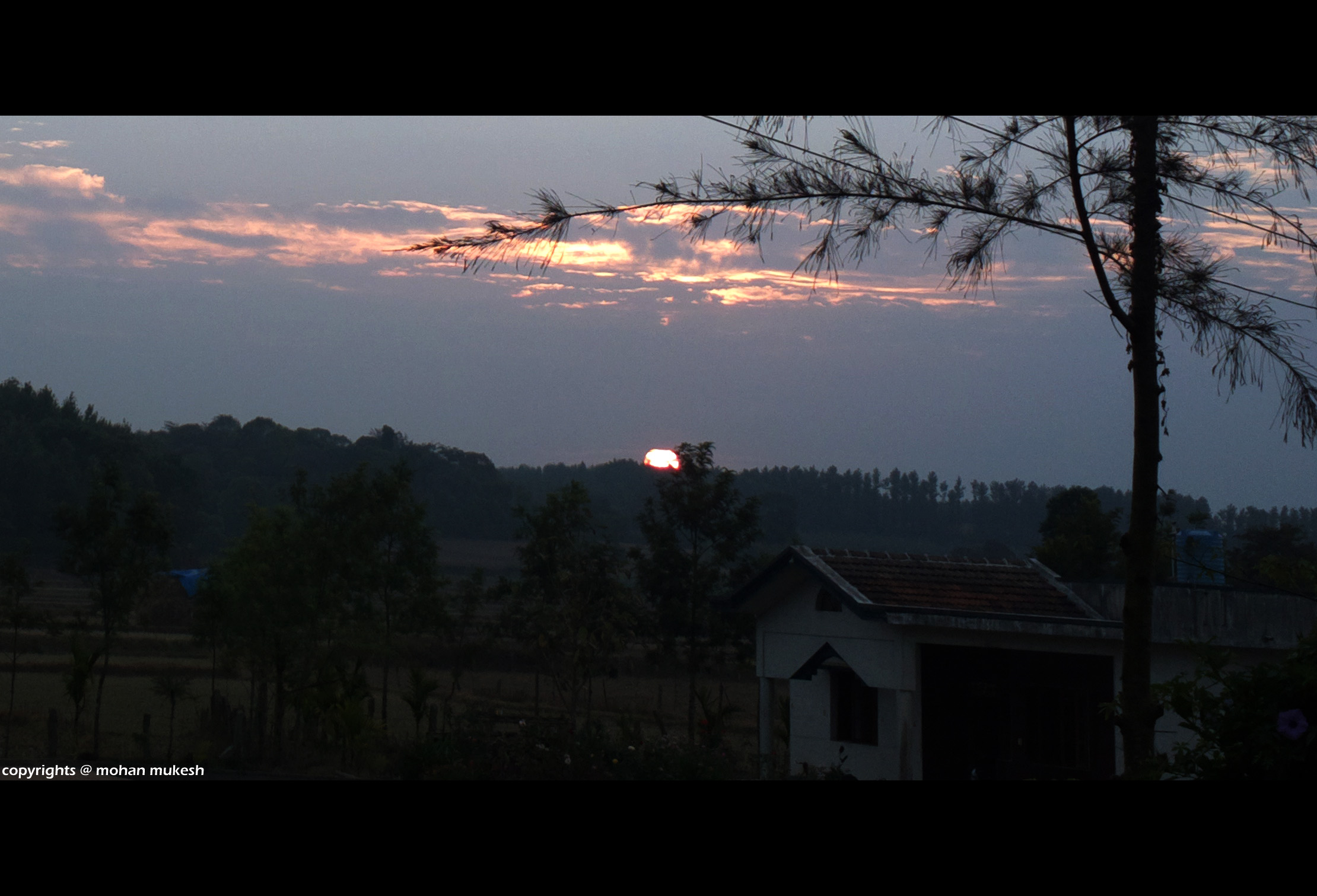
Speechless Sunset

Hirekolale Lake, Chikmagalur

9321 - mullayanagiri, Chikmagaluru

Silhoutte and the Pink Aura

The Illusion: It's most enthralling to unravel the mystery hidden in plain sight. That is why we love illusions so much. But who do define which part of what we see is illusionary and what is real. Don't we only see what we wish to see? What if there are
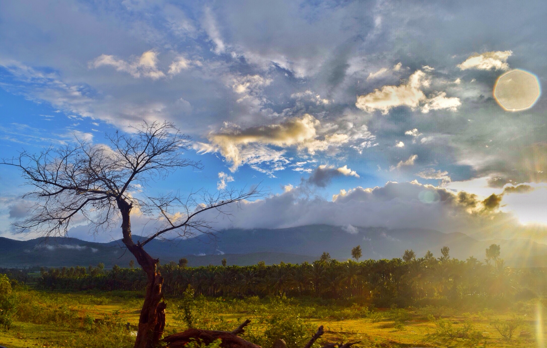
sun rise

poorvoday...at deviramma hill.

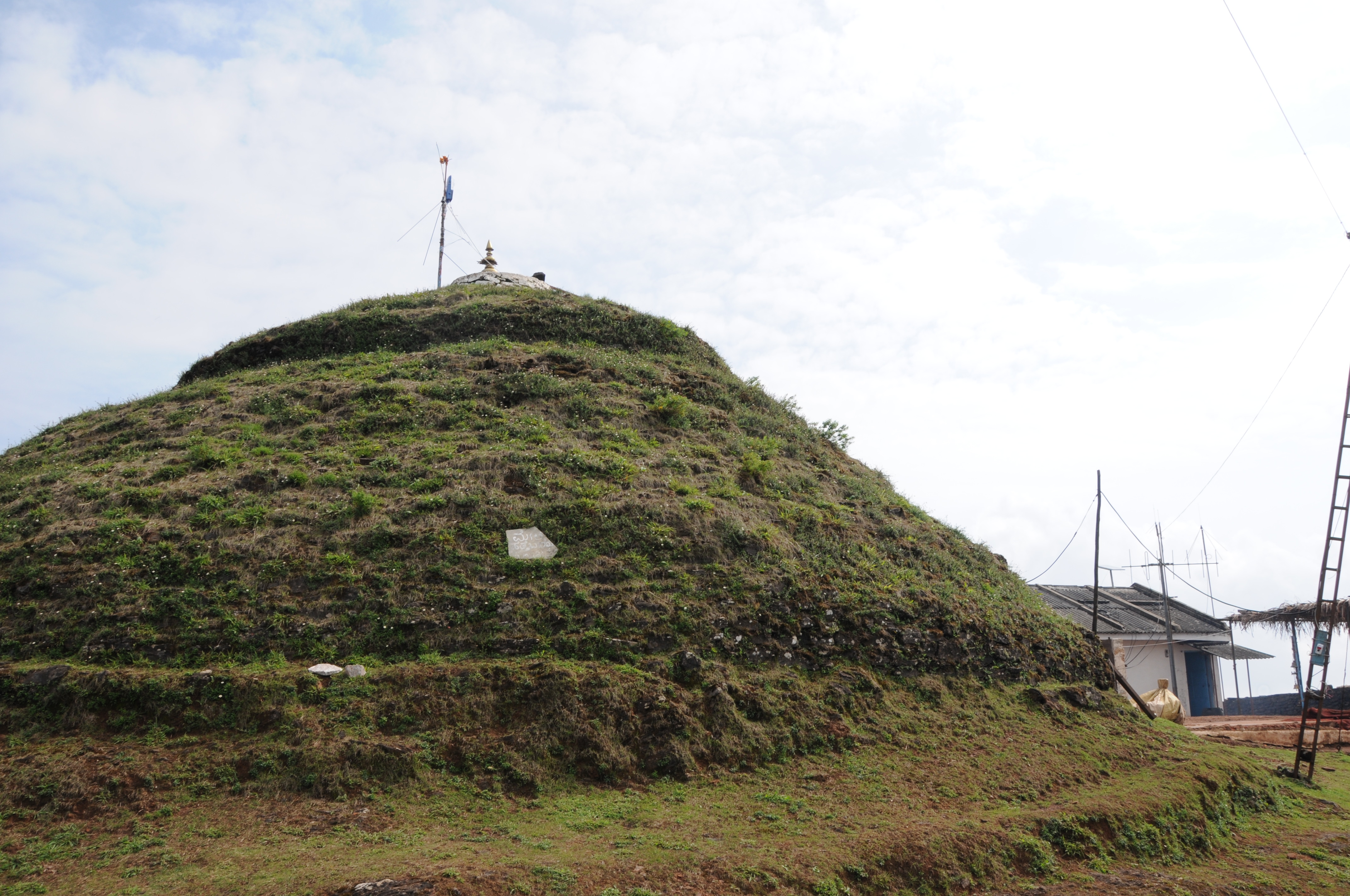
A view from Mullayanagiri

Jagara Valley near Sigekhana

Kavikallu Matha

... view from Mullayyanagiri Road

A view of Mullayanagiri - the highest peak of the Western Ghats

CSP_4537.jpg

A view along the drive to Mullayanagiri

CSP_4546.jpg

CSP_4543.jpg

CSP_4541.jpg

CSP_4539.jpg

CSP_4545.jpg

CSP_4536.jpg
CSP_4553.jpg
Hirekolale, lake Road, Nagenahalli, Karnataka インドSilver Palm Retreatの地図
別の場所を検索
近所の場所
インド 〒 カルナータカ ナラガナハリ
インド 〒 カルナータカ カイマラ
Mylemoney Estate, Chikmagalur, Karnataka インドArabidacool Bungalow Tata Coffee
Mullayanagiri Peak, Pandaravalli, Karnataka
インド 〒 カルナータカ チクマガルル
インド 〒 カルナータカ パンダラバリ
Coffee Bean Homestay Rd, Mallandur, Karnataka インドMALLANDUR HOMESTAY
Srilakshmi Estate, Jakkanahalli Post, Chikamagalur, Avathi, Karnataka インドThe Sattva - Nature Retreat
Prakruthi Estate, Sampige Khatte, Athigundi Village, 3 kms Before Nature Nirvana Resort, Chikmangalu
インド 〒 カルナータカ アーダバリ
インド カルナータカ チクマガルル
Mutthodi Chikkamagaluru Road, Yallakhikhanu Estate, Sirivase, Karnataka インドMahiyaddin Jumma Masjid
インド 〒 カルナータカ シリバス
インド カルナータカ イェラグーディジ
Swaroopa Arvind, Belagod B Estate, Aldur Post, Chickmagaluru, Karnataka インドCoffee Tranquil
Handi, Machagondanahally 20KM Chikmagalur-Mudigere Road, Karnataka インドTHE HIDDEN VALLEY
Kemmannugundi, Manchethevaru, Karnataka インド
インド カルナータカ サクレパトナ
インド 〒 カルナータカ マンチェスバルー
インド 〒 カルナータカ ベルール
最近の検索
- アメリカ合衆国 アラスカ州 レッド・ドッグ・マイン日の出日の入り時間
- Am bhf, Borken, ドイツアム・バーンホーフ日の出日の入り時間
- 4th St E, Sonoma, CA, USA日の出日の入り時間
- Oakland Ave, Williamsport, PA アメリカ合衆国日の出日の入り時間
- Via Roma, Pieranica CR, イタリアローマ通り日の出日の入り時間
- クロアチア 〒 ドゥブロブニク GradClock Tower of Dubrovnik日の出日の入り時間
- アルゼンチン チュブ州 トレリュー日の出日の入り時間
- Hartfords Bluff Cir, Mt Pleasant, SC アメリカ合衆国日の出日の入り時間
- 日本、熊本県熊本市北区日の出日の入り時間
- 中華人民共和国 福州市 平潭県 平潭島日の出日の入り時間