アメリカ合衆国 〒 モンタナ州 シグナル山日の出日の入り時間
Location: アメリカ合衆国 > モンタナ州 > アメリカ合衆国 〒 モンタナ州 オーガスタ >
時間帯:
America/Denver
現地時間:
2025-07-10 21:02:53
経度:
-113.0370058
緯度:
47.899391
今日の日の出時刻:
05:45:40 AM
今日の日の入時刻:
09:29:55 PM
今日の日長:
15h 44m 15s
明日の日の出時刻:
05:46:37 AM
明日の日の入時刻:
09:29:12 PM
明日の日長:
15h 42m 35s
すべて表示する
| 日付 | 日出 | 日没 | 日長 |
|---|---|---|---|
| 2025年01月01日 | 08:21:20 AM | 04:51:21 PM | 8h 30m 1s |
| 2025年01月02日 | 08:21:14 AM | 04:52:22 PM | 8h 31m 8s |
| 2025年01月03日 | 08:21:04 AM | 04:53:26 PM | 8h 32m 22s |
| 2025年01月04日 | 08:20:52 AM | 04:54:32 PM | 8h 33m 40s |
| 2025年01月05日 | 08:20:37 AM | 04:55:40 PM | 8h 35m 3s |
| 2025年01月06日 | 08:20:19 AM | 04:56:49 PM | 8h 36m 30s |
| 2025年01月07日 | 08:19:58 AM | 04:58:01 PM | 8h 38m 3s |
| 2025年01月08日 | 08:19:34 AM | 04:59:14 PM | 8h 39m 40s |
| 2025年01月09日 | 08:19:08 AM | 05:00:29 PM | 8h 41m 21s |
| 2025年01月10日 | 08:18:38 AM | 05:01:46 PM | 8h 43m 8s |
| 2025年01月11日 | 08:18:06 AM | 05:03:04 PM | 8h 44m 58s |
| 2025年01月12日 | 08:17:31 AM | 05:04:23 PM | 8h 46m 52s |
| 2025年01月13日 | 08:16:54 AM | 05:05:44 PM | 8h 48m 50s |
| 2025年01月14日 | 08:16:14 AM | 05:07:06 PM | 8h 50m 52s |
| 2025年01月15日 | 08:15:31 AM | 05:08:30 PM | 8h 52m 59s |
| 2025年01月16日 | 08:14:46 AM | 05:09:55 PM | 8h 55m 9s |
| 2025年01月17日 | 08:13:58 AM | 05:11:21 PM | 8h 57m 23s |
| 2025年01月18日 | 08:13:08 AM | 05:12:47 PM | 8h 59m 39s |
| 2025年01月19日 | 08:12:15 AM | 05:14:15 PM | 9h 2m 0s |
| 2025年01月20日 | 08:11:20 AM | 05:15:44 PM | 9h 4m 24s |
| 2025年01月21日 | 08:10:22 AM | 05:17:14 PM | 9h 6m 52s |
| 2025年01月22日 | 08:09:23 AM | 05:18:44 PM | 9h 9m 21s |
| 2025年01月23日 | 08:08:20 AM | 05:20:15 PM | 9h 11m 55s |
| 2025年01月24日 | 08:07:16 AM | 05:21:47 PM | 9h 14m 31s |
| 2025年01月25日 | 08:06:09 AM | 05:23:19 PM | 9h 17m 10s |
| 2025年01月26日 | 08:05:01 AM | 05:24:52 PM | 9h 19m 51s |
| 2025年01月27日 | 08:03:50 AM | 05:26:25 PM | 9h 22m 35s |
| 2025年01月28日 | 08:02:37 AM | 05:27:59 PM | 9h 25m 22s |
| 2025年01月29日 | 08:01:22 AM | 05:29:33 PM | 9h 28m 11s |
| 2025年01月30日 | 08:00:05 AM | 05:31:08 PM | 9h 31m 3s |
| 2025年01月31日 | 07:58:46 AM | 05:32:43 PM | 9h 33m 57s |
| 2025年02月01日 | 07:57:25 AM | 05:34:18 PM | 9h 36m 53s |
| 2025年02月02日 | 07:56:03 AM | 05:35:53 PM | 9h 39m 50s |
| 2025年02月03日 | 07:54:38 AM | 05:37:29 PM | 9h 42m 51s |
| 2025年02月04日 | 07:53:12 AM | 05:39:04 PM | 9h 45m 52s |
| 2025年02月05日 | 07:51:45 AM | 05:40:40 PM | 9h 48m 55s |
| 2025年02月06日 | 07:50:15 AM | 05:42:16 PM | 9h 52m 1s |
| 2025年02月07日 | 07:48:44 AM | 05:43:51 PM | 9h 55m 7s |
| 2025年02月08日 | 07:47:12 AM | 05:45:27 PM | 9h 58m 15s |
| 2025年02月09日 | 07:45:38 AM | 05:47:03 PM | 10h 1m 25s |
| 2025年02月10日 | 07:44:02 AM | 05:48:38 PM | 10h 4m 36s |
| 2025年02月11日 | 07:42:25 AM | 05:50:14 PM | 10h 7m 49s |
| 2025年02月12日 | 07:40:47 AM | 05:51:49 PM | 10h 11m 2s |
| 2025年02月13日 | 07:39:07 AM | 05:53:24 PM | 10h 14m 17s |
| 2025年02月14日 | 07:37:26 AM | 05:54:59 PM | 10h 17m 33s |
| 2025年02月15日 | 07:35:44 AM | 05:56:34 PM | 10h 20m 50s |
| 2025年02月16日 | 07:34:00 AM | 05:58:09 PM | 10h 24m 9s |
| 2025年02月17日 | 07:32:16 AM | 05:59:43 PM | 10h 27m 27s |
| 2025年02月18日 | 07:30:30 AM | 06:01:18 PM | 10h 30m 48s |
| 2025年02月19日 | 07:28:43 AM | 06:02:52 PM | 10h 34m 9s |
| 2025年02月20日 | 07:26:55 AM | 06:04:25 PM | 10h 37m 30s |
| 2025年02月21日 | 07:25:07 AM | 06:05:59 PM | 10h 40m 52s |
| 2025年02月22日 | 07:23:17 AM | 06:07:32 PM | 10h 44m 15s |
| 2025年02月23日 | 07:21:26 AM | 06:09:05 PM | 10h 47m 39s |
| 2025年02月24日 | 07:19:34 AM | 06:10:38 PM | 10h 51m 4s |
| 2025年02月25日 | 07:17:42 AM | 06:12:11 PM | 10h 54m 29s |
| 2025年02月26日 | 07:15:48 AM | 06:13:43 PM | 10h 57m 55s |
| 2025年02月27日 | 07:13:54 AM | 06:15:15 PM | 11h 1m 21s |
| 2025年02月28日 | 07:11:59 AM | 06:16:46 PM | 11h 4m 47s |
| 2025年03月01日 | 07:10:04 AM | 06:18:18 PM | 11h 8m 14s |
| 2025年03月02日 | 07:08:07 AM | 06:19:49 PM | 11h 11m 42s |
| 2025年03月03日 | 07:06:10 AM | 06:21:19 PM | 11h 15m 9s |
| 2025年03月04日 | 07:04:13 AM | 06:22:50 PM | 11h 18m 37s |
| 2025年03月05日 | 07:02:15 AM | 06:24:20 PM | 11h 22m 5s |
| 2025年03月06日 | 07:00:16 AM | 06:25:50 PM | 11h 25m 34s |
| 2025年03月07日 | 06:58:17 AM | 06:27:20 PM | 11h 29m 3s |
| 2025年03月08日 | 06:56:17 AM | 06:28:50 PM | 11h 32m 33s |
| 2025年03月09日 | 07:54:22 AM | 07:30:15 PM | 11h 35m 53s |
| 2025年03月10日 | 07:52:22 AM | 07:31:44 PM | 11h 39m 22s |
| 2025年03月11日 | 07:50:21 AM | 07:33:13 PM | 11h 42m 52s |
| 2025年03月12日 | 07:48:20 AM | 07:34:41 PM | 11h 46m 21s |
| 2025年03月13日 | 07:46:18 AM | 07:36:10 PM | 11h 49m 52s |
| 2025年03月14日 | 07:44:17 AM | 07:37:38 PM | 11h 53m 21s |
| 2025年03月15日 | 07:42:15 AM | 07:39:06 PM | 11h 56m 51s |
| 2025年03月16日 | 07:40:12 AM | 07:40:34 PM | 12h 0m 22s |
| 2025年03月17日 | 07:38:10 AM | 07:42:01 PM | 12h 3m 51s |
| 2025年03月18日 | 07:36:07 AM | 07:43:29 PM | 12h 7m 22s |
| 2025年03月19日 | 07:34:05 AM | 07:44:56 PM | 12h 10m 51s |
| 2025年03月20日 | 07:32:02 AM | 07:46:23 PM | 12h 14m 21s |
| 2025年03月21日 | 07:29:59 AM | 07:47:50 PM | 12h 17m 51s |
| 2025年03月22日 | 07:27:56 AM | 07:49:17 PM | 12h 21m 21s |
| 2025年03月23日 | 07:25:53 AM | 07:50:44 PM | 12h 24m 51s |
| 2025年03月24日 | 07:23:51 AM | 07:52:10 PM | 12h 28m 19s |
| 2025年03月25日 | 07:21:48 AM | 07:53:37 PM | 12h 31m 49s |
| 2025年03月26日 | 07:19:45 AM | 07:55:03 PM | 12h 35m 18s |
| 2025年03月27日 | 07:17:43 AM | 07:56:30 PM | 12h 38m 47s |
| 2025年03月28日 | 07:15:40 AM | 07:57:56 PM | 12h 42m 16s |
| 2025年03月29日 | 07:13:38 AM | 07:59:22 PM | 12h 45m 44s |
| 2025年03月30日 | 07:11:36 AM | 08:00:48 PM | 12h 49m 12s |
| 2025年03月31日 | 07:09:34 AM | 08:02:14 PM | 12h 52m 40s |
| 2025年04月01日 | 07:07:33 AM | 08:03:41 PM | 12h 56m 8s |
| 2025年04月02日 | 07:05:32 AM | 08:05:07 PM | 12h 59m 35s |
| 2025年04月03日 | 07:03:31 AM | 08:06:33 PM | 13h 3m 2s |
| 2025年04月04日 | 07:01:31 AM | 08:07:59 PM | 13h 6m 28s |
| 2025年04月05日 | 06:59:31 AM | 08:09:24 PM | 13h 9m 53s |
| 2025年04月06日 | 06:57:31 AM | 08:10:50 PM | 13h 13m 19s |
| 2025年04月07日 | 06:55:32 AM | 08:12:16 PM | 13h 16m 44s |
| 2025年04月08日 | 06:53:33 AM | 08:13:42 PM | 13h 20m 9s |
| 2025年04月09日 | 06:51:35 AM | 08:15:08 PM | 13h 23m 33s |
| 2025年04月10日 | 06:49:38 AM | 08:16:34 PM | 13h 26m 56s |
| 2025年04月11日 | 06:47:41 AM | 08:18:00 PM | 13h 30m 19s |
| 2025年04月12日 | 06:45:45 AM | 08:19:26 PM | 13h 33m 41s |
| 2025年04月13日 | 06:43:49 AM | 08:20:52 PM | 13h 37m 3s |
| 2025年04月14日 | 06:41:55 AM | 08:22:17 PM | 13h 40m 22s |
| 2025年04月15日 | 06:40:01 AM | 08:23:43 PM | 13h 43m 42s |
| 2025年04月16日 | 06:38:07 AM | 08:25:09 PM | 13h 47m 2s |
| 2025年04月17日 | 06:36:15 AM | 08:26:35 PM | 13h 50m 20s |
| 2025年04月18日 | 06:34:23 AM | 08:28:01 PM | 13h 53m 38s |
| 2025年04月19日 | 06:32:32 AM | 08:29:26 PM | 13h 56m 54s |
| 2025年04月20日 | 06:30:43 AM | 08:30:52 PM | 14h 0m 9s |
| 2025年04月21日 | 06:28:54 AM | 08:32:17 PM | 14h 3m 23s |
| 2025年04月22日 | 06:27:06 AM | 08:33:43 PM | 14h 6m 37s |
| 2025年04月23日 | 06:25:19 AM | 08:35:08 PM | 14h 9m 49s |
| 2025年04月24日 | 06:23:33 AM | 08:36:33 PM | 14h 13m 0s |
| 2025年04月25日 | 06:21:49 AM | 08:37:59 PM | 14h 16m 10s |
| 2025年04月26日 | 06:20:05 AM | 08:39:24 PM | 14h 19m 19s |
| 2025年04月27日 | 06:18:23 AM | 08:40:48 PM | 14h 22m 25s |
| 2025年04月28日 | 06:16:42 AM | 08:42:13 PM | 14h 25m 31s |
| 2025年04月29日 | 06:15:02 AM | 08:43:37 PM | 14h 28m 35s |
| 2025年04月30日 | 06:13:23 AM | 08:45:02 PM | 14h 31m 39s |
| 2025年05月01日 | 06:11:46 AM | 08:46:26 PM | 14h 34m 40s |
| 2025年05月02日 | 06:10:10 AM | 08:47:49 PM | 14h 37m 39s |
| 2025年05月03日 | 06:08:36 AM | 08:49:12 PM | 14h 40m 36s |
| 2025年05月04日 | 06:07:03 AM | 08:50:35 PM | 14h 43m 32s |
| 2025年05月05日 | 06:05:32 AM | 08:51:58 PM | 14h 46m 26s |
| 2025年05月06日 | 06:04:02 AM | 08:53:20 PM | 14h 49m 18s |
| 2025年05月07日 | 06:02:33 AM | 08:54:42 PM | 14h 52m 9s |
| 2025年05月08日 | 06:01:07 AM | 08:56:03 PM | 14h 54m 56s |
| 2025年05月09日 | 05:59:42 AM | 08:57:24 PM | 14h 57m 42s |
| 2025年05月10日 | 05:58:18 AM | 08:58:44 PM | 15h 0m 26s |
| 2025年05月11日 | 05:56:57 AM | 09:00:04 PM | 15h 3m 7s |
| 2025年05月12日 | 05:55:37 AM | 09:01:23 PM | 15h 5m 46s |
| 2025年05月13日 | 05:54:19 AM | 09:02:41 PM | 15h 8m 22s |
| 2025年05月14日 | 05:53:03 AM | 09:03:58 PM | 15h 10m 55s |
| 2025年05月15日 | 05:51:49 AM | 09:05:15 PM | 15h 13m 26s |
| 2025年05月16日 | 05:50:37 AM | 09:06:31 PM | 15h 15m 54s |
| 2025年05月17日 | 05:49:26 AM | 09:07:46 PM | 15h 18m 20s |
| 2025年05月18日 | 05:48:18 AM | 09:09:00 PM | 15h 20m 42s |
| 2025年05月19日 | 05:47:12 AM | 09:10:13 PM | 15h 23m 1s |
| 2025年05月20日 | 05:46:08 AM | 09:11:25 PM | 15h 25m 17s |
| 2025年05月21日 | 05:45:06 AM | 09:12:36 PM | 15h 27m 30s |
| 2025年05月22日 | 05:44:07 AM | 09:13:46 PM | 15h 29m 39s |
| 2025年05月23日 | 05:43:09 AM | 09:14:54 PM | 15h 31m 45s |
| 2025年05月24日 | 05:42:14 AM | 09:16:01 PM | 15h 33m 47s |
| 2025年05月25日 | 05:41:21 AM | 09:17:07 PM | 15h 35m 46s |
| 2025年05月26日 | 05:40:31 AM | 09:18:12 PM | 15h 37m 41s |
| 2025年05月27日 | 05:39:42 AM | 09:19:15 PM | 15h 39m 33s |
| 2025年05月28日 | 05:38:57 AM | 09:20:17 PM | 15h 41m 20s |
| 2025年05月29日 | 05:38:13 AM | 09:21:17 PM | 15h 43m 4s |
| 2025年05月30日 | 05:37:32 AM | 09:22:16 PM | 15h 44m 44s |
| 2025年05月31日 | 05:36:54 AM | 09:23:13 PM | 15h 46m 19s |
| 2025年06月01日 | 05:36:18 AM | 09:24:08 PM | 15h 47m 50s |
| 2025年06月02日 | 05:35:44 AM | 09:25:01 PM | 15h 49m 17s |
| 2025年06月03日 | 05:35:13 AM | 09:25:53 PM | 15h 50m 40s |
| 2025年06月04日 | 05:34:45 AM | 09:26:42 PM | 15h 51m 57s |
| 2025年06月05日 | 05:34:19 AM | 09:27:30 PM | 15h 53m 11s |
| 2025年06月06日 | 05:33:56 AM | 09:28:16 PM | 15h 54m 20s |
| 2025年06月07日 | 05:33:35 AM | 09:29:00 PM | 15h 55m 25s |
| 2025年06月08日 | 05:33:17 AM | 09:29:41 PM | 15h 56m 24s |
| 2025年06月09日 | 05:33:01 AM | 09:30:21 PM | 15h 57m 20s |
| 2025年06月10日 | 05:32:48 AM | 09:30:58 PM | 15h 58m 10s |
| 2025年06月11日 | 05:32:38 AM | 09:31:33 PM | 15h 58m 55s |
| 2025年06月12日 | 05:32:31 AM | 09:32:06 PM | 15h 59m 35s |
| 2025年06月13日 | 05:32:26 AM | 09:32:36 PM | 16h 0m 10s |
| 2025年06月14日 | 05:32:23 AM | 09:33:04 PM | 16h 0m 41s |
| 2025年06月15日 | 05:32:23 AM | 09:33:30 PM | 16h 1m 7s |
| 2025年06月16日 | 05:32:26 AM | 09:33:53 PM | 16h 1m 27s |
| 2025年06月17日 | 05:32:32 AM | 09:34:14 PM | 16h 1m 42s |
| 2025年06月18日 | 05:32:39 AM | 09:34:32 PM | 16h 1m 53s |
| 2025年06月19日 | 05:32:50 AM | 09:34:48 PM | 16h 1m 58s |
| 2025年06月20日 | 05:33:03 AM | 09:35:01 PM | 16h 1m 58s |
| 2025年06月21日 | 05:33:18 AM | 09:35:12 PM | 16h 1m 54s |
| 2025年06月22日 | 05:33:36 AM | 09:35:20 PM | 16h 1m 44s |
| 2025年06月23日 | 05:33:57 AM | 09:35:25 PM | 16h 1m 28s |
| 2025年06月24日 | 05:34:19 AM | 09:35:28 PM | 16h 1m 9s |
| 2025年06月25日 | 05:34:45 AM | 09:35:28 PM | 16h 0m 43s |
| 2025年06月26日 | 05:35:12 AM | 09:35:25 PM | 16h 0m 13s |
| 2025年06月27日 | 05:35:42 AM | 09:35:20 PM | 15h 59m 38s |
| 2025年06月28日 | 05:36:14 AM | 09:35:12 PM | 15h 58m 58s |
| 2025年06月29日 | 05:36:48 AM | 09:35:02 PM | 15h 58m 14s |
| 2025年06月30日 | 05:37:24 AM | 09:34:48 PM | 15h 57m 24s |
| 2025年07月01日 | 05:38:03 AM | 09:34:32 PM | 15h 56m 29s |
| 2025年07月02日 | 05:38:43 AM | 09:34:14 PM | 15h 55m 31s |
| 2025年07月03日 | 05:39:26 AM | 09:33:53 PM | 15h 54m 27s |
| 2025年07月04日 | 05:40:11 AM | 09:33:29 PM | 15h 53m 18s |
| 2025年07月05日 | 05:40:57 AM | 09:33:03 PM | 15h 52m 6s |
| 2025年07月06日 | 05:41:45 AM | 09:32:34 PM | 15h 50m 49s |
| 2025年07月07日 | 05:42:35 AM | 09:32:02 PM | 15h 49m 27s |
| 2025年07月08日 | 05:43:27 AM | 09:31:28 PM | 15h 48m 1s |
| 2025年07月09日 | 05:44:21 AM | 09:30:51 PM | 15h 46m 30s |
| 2025年07月10日 | 05:45:16 AM | 09:30:12 PM | 15h 44m 56s |
| 2025年07月11日 | 05:46:13 AM | 09:29:30 PM | 15h 43m 17s |
| 2025年07月12日 | 05:47:11 AM | 09:28:46 PM | 15h 41m 35s |
| 2025年07月13日 | 05:48:11 AM | 09:27:59 PM | 15h 39m 48s |
| 2025年07月14日 | 05:49:12 AM | 09:27:10 PM | 15h 37m 58s |
| 2025年07月15日 | 05:50:15 AM | 09:26:19 PM | 15h 36m 4s |
| 2025年07月16日 | 05:51:18 AM | 09:25:25 PM | 15h 34m 7s |
| 2025年07月17日 | 05:52:23 AM | 09:24:29 PM | 15h 32m 6s |
| 2025年07月18日 | 05:53:30 AM | 09:23:31 PM | 15h 30m 1s |
| 2025年07月19日 | 05:54:37 AM | 09:22:30 PM | 15h 27m 53s |
| 2025年07月20日 | 05:55:45 AM | 09:21:28 PM | 15h 25m 43s |
| 2025年07月21日 | 05:56:55 AM | 09:20:23 PM | 15h 23m 28s |
| 2025年07月22日 | 05:58:05 AM | 09:19:16 PM | 15h 21m 11s |
| 2025年07月23日 | 05:59:17 AM | 09:18:07 PM | 15h 18m 50s |
| 2025年07月24日 | 06:00:29 AM | 09:16:55 PM | 15h 16m 26s |
| 2025年07月25日 | 06:01:42 AM | 09:15:42 PM | 15h 14m 0s |
| 2025年07月26日 | 06:02:56 AM | 09:14:27 PM | 15h 11m 31s |
| 2025年07月27日 | 06:04:10 AM | 09:13:10 PM | 15h 9m 0s |
| 2025年07月28日 | 06:05:25 AM | 09:11:51 PM | 15h 6m 26s |
| 2025年07月29日 | 06:06:41 AM | 09:10:30 PM | 15h 3m 49s |
| 2025年07月30日 | 06:07:57 AM | 09:09:08 PM | 15h 1m 11s |
| 2025年07月31日 | 06:09:14 AM | 09:07:43 PM | 14h 58m 29s |
| 2025年08月01日 | 06:10:32 AM | 09:06:17 PM | 14h 55m 45s |
| 2025年08月02日 | 06:11:49 AM | 09:04:50 PM | 14h 53m 1s |
| 2025年08月03日 | 06:13:08 AM | 09:03:20 PM | 14h 50m 12s |
| 2025年08月04日 | 06:14:26 AM | 09:01:49 PM | 14h 47m 23s |
| 2025年08月05日 | 06:15:45 AM | 09:00:17 PM | 14h 44m 32s |
| 2025年08月06日 | 06:17:05 AM | 08:58:43 PM | 14h 41m 38s |
| 2025年08月07日 | 06:18:24 AM | 08:57:07 PM | 14h 38m 43s |
| 2025年08月08日 | 06:19:44 AM | 08:55:31 PM | 14h 35m 47s |
| 2025年08月09日 | 06:21:04 AM | 08:53:52 PM | 14h 32m 48s |
| 2025年08月10日 | 06:22:25 AM | 08:52:13 PM | 14h 29m 48s |
| 2025年08月11日 | 06:23:45 AM | 08:50:32 PM | 14h 26m 47s |
| 2025年08月12日 | 06:25:06 AM | 08:48:49 PM | 14h 23m 43s |
| 2025年08月13日 | 06:26:27 AM | 08:47:06 PM | 14h 20m 39s |
| 2025年08月14日 | 06:27:48 AM | 08:45:21 PM | 14h 17m 33s |
| 2025年08月15日 | 06:29:09 AM | 08:43:36 PM | 14h 14m 27s |
| 2025年08月16日 | 06:30:30 AM | 08:41:49 PM | 14h 11m 19s |
| 2025年08月17日 | 06:31:51 AM | 08:40:01 PM | 14h 8m 10s |
| 2025年08月18日 | 06:33:13 AM | 08:38:12 PM | 14h 4m 59s |
| 2025年08月19日 | 06:34:34 AM | 08:36:22 PM | 14h 1m 48s |
| 2025年08月20日 | 06:35:55 AM | 08:34:31 PM | 13h 58m 36s |
| 2025年08月21日 | 06:37:17 AM | 08:32:39 PM | 13h 55m 22s |
| 2025年08月22日 | 06:38:38 AM | 08:30:46 PM | 13h 52m 8s |
| 2025年08月23日 | 06:39:59 AM | 08:28:52 PM | 13h 48m 53s |
| 2025年08月24日 | 06:41:21 AM | 08:26:58 PM | 13h 45m 37s |
| 2025年08月25日 | 06:42:42 AM | 08:25:02 PM | 13h 42m 20s |
| 2025年08月26日 | 06:44:03 AM | 08:23:06 PM | 13h 39m 3s |
| 2025年08月27日 | 06:45:25 AM | 08:21:09 PM | 13h 35m 44s |
| 2025年08月28日 | 06:46:46 AM | 08:19:12 PM | 13h 32m 26s |
| 2025年08月29日 | 06:48:07 AM | 08:17:14 PM | 13h 29m 7s |
| 2025年08月30日 | 06:49:29 AM | 08:15:15 PM | 13h 25m 46s |
| 2025年08月31日 | 06:50:50 AM | 08:13:16 PM | 13h 22m 26s |
| 2025年09月01日 | 06:52:11 AM | 08:11:16 PM | 13h 19m 5s |
| 2025年09月02日 | 06:53:32 AM | 08:09:15 PM | 13h 15m 43s |
| 2025年09月03日 | 06:54:53 AM | 08:07:14 PM | 13h 12m 21s |
| 2025年09月04日 | 06:56:15 AM | 08:05:13 PM | 13h 8m 58s |
| 2025年09月05日 | 06:57:36 AM | 08:03:11 PM | 13h 5m 35s |
| 2025年09月06日 | 06:58:57 AM | 08:01:09 PM | 13h 2m 12s |
| 2025年09月07日 | 07:00:18 AM | 07:59:06 PM | 12h 58m 48s |
| 2025年09月08日 | 07:01:39 AM | 07:57:04 PM | 12h 55m 25s |
| 2025年09月09日 | 07:03:01 AM | 07:55:00 PM | 12h 51m 59s |
| 2025年09月10日 | 07:04:22 AM | 07:52:57 PM | 12h 48m 35s |
| 2025年09月11日 | 07:05:43 AM | 07:50:53 PM | 12h 45m 10s |
| 2025年09月12日 | 07:07:05 AM | 07:48:49 PM | 12h 41m 44s |
| 2025年09月13日 | 07:08:26 AM | 07:46:45 PM | 12h 38m 19s |
| 2025年09月14日 | 07:09:47 AM | 07:44:41 PM | 12h 34m 54s |
| 2025年09月15日 | 07:11:09 AM | 07:42:36 PM | 12h 31m 27s |
| 2025年09月16日 | 07:12:30 AM | 07:40:32 PM | 12h 28m 2s |
| 2025年09月17日 | 07:13:52 AM | 07:38:27 PM | 12h 24m 35s |
| 2025年09月18日 | 07:15:14 AM | 07:36:23 PM | 12h 21m 9s |
| 2025年09月19日 | 07:16:36 AM | 07:34:18 PM | 12h 17m 42s |
| 2025年09月20日 | 07:17:58 AM | 07:32:13 PM | 12h 14m 15s |
| 2025年09月21日 | 07:19:20 AM | 07:30:09 PM | 12h 10m 49s |
| 2025年09月22日 | 07:20:42 AM | 07:28:04 PM | 12h 7m 22s |
| 2025年09月23日 | 07:22:05 AM | 07:26:00 PM | 12h 3m 55s |
| 2025年09月24日 | 07:23:27 AM | 07:23:56 PM | 12h 0m 29s |
| 2025年09月25日 | 07:24:50 AM | 07:21:52 PM | 11h 57m 2s |
| 2025年09月26日 | 07:26:13 AM | 07:19:48 PM | 11h 53m 35s |
| 2025年09月27日 | 07:27:36 AM | 07:17:45 PM | 11h 50m 9s |
| 2025年09月28日 | 07:29:00 AM | 07:15:41 PM | 11h 46m 41s |
| 2025年09月29日 | 07:30:23 AM | 07:13:39 PM | 11h 43m 16s |
| 2025年09月30日 | 07:31:47 AM | 07:11:36 PM | 11h 39m 49s |
| 2025年10月01日 | 07:33:11 AM | 07:09:34 PM | 11h 36m 23s |
| 2025年10月02日 | 07:34:36 AM | 07:07:32 PM | 11h 32m 56s |
| 2025年10月03日 | 07:36:00 AM | 07:05:30 PM | 11h 29m 30s |
| 2025年10月04日 | 07:37:25 AM | 07:03:29 PM | 11h 26m 4s |
| 2025年10月05日 | 07:38:50 AM | 07:01:29 PM | 11h 22m 39s |
| 2025年10月06日 | 07:40:16 AM | 06:59:29 PM | 11h 19m 13s |
| 2025年10月07日 | 07:41:41 AM | 06:57:29 PM | 11h 15m 48s |
| 2025年10月08日 | 07:43:07 AM | 06:55:31 PM | 11h 12m 24s |
| 2025年10月09日 | 07:44:33 AM | 06:53:32 PM | 11h 8m 59s |
| 2025年10月10日 | 07:46:00 AM | 06:51:35 PM | 11h 5m 35s |
| 2025年10月11日 | 07:47:27 AM | 06:49:38 PM | 11h 2m 11s |
| 2025年10月12日 | 07:48:54 AM | 06:47:42 PM | 10h 58m 48s |
| 2025年10月13日 | 07:50:21 AM | 06:45:47 PM | 10h 55m 26s |
| 2025年10月14日 | 07:51:49 AM | 06:43:52 PM | 10h 52m 3s |
| 2025年10月15日 | 07:53:17 AM | 06:41:58 PM | 10h 48m 41s |
| 2025年10月16日 | 07:54:45 AM | 06:40:06 PM | 10h 45m 21s |
| 2025年10月17日 | 07:56:14 AM | 06:38:14 PM | 10h 42m 0s |
| 2025年10月18日 | 07:57:43 AM | 06:36:23 PM | 10h 38m 40s |
| 2025年10月19日 | 07:59:12 AM | 06:34:33 PM | 10h 35m 21s |
| 2025年10月20日 | 08:00:42 AM | 06:32:44 PM | 10h 32m 2s |
| 2025年10月21日 | 08:02:11 AM | 06:30:56 PM | 10h 28m 45s |
| 2025年10月22日 | 08:03:41 AM | 06:29:09 PM | 10h 25m 28s |
| 2025年10月23日 | 08:05:12 AM | 06:27:23 PM | 10h 22m 11s |
| 2025年10月24日 | 08:06:42 AM | 06:25:39 PM | 10h 18m 57s |
| 2025年10月25日 | 08:08:13 AM | 06:23:56 PM | 10h 15m 43s |
| 2025年10月26日 | 08:09:44 AM | 06:22:14 PM | 10h 12m 30s |
| 2025年10月27日 | 08:11:15 AM | 06:20:33 PM | 10h 9m 18s |
| 2025年10月28日 | 08:12:46 AM | 06:18:54 PM | 10h 6m 8s |
| 2025年10月29日 | 08:14:18 AM | 06:17:16 PM | 10h 2m 58s |
| 2025年10月30日 | 08:15:50 AM | 06:15:39 PM | 9h 59m 49s |
| 2025年10月31日 | 08:17:21 AM | 06:14:04 PM | 9h 56m 43s |
| 2025年11月01日 | 08:18:53 AM | 06:12:31 PM | 9h 53m 38s |
| 2025年11月02日 | 07:20:29 AM | 05:10:55 PM | 9h 50m 26s |
| 2025年11月03日 | 07:22:01 AM | 05:09:25 PM | 9h 47m 24s |
| 2025年11月04日 | 07:23:33 AM | 05:07:56 PM | 9h 44m 23s |
| 2025年11月05日 | 07:25:04 AM | 05:06:29 PM | 9h 41m 25s |
| 2025年11月06日 | 07:26:36 AM | 05:05:04 PM | 9h 38m 28s |
| 2025年11月07日 | 07:28:08 AM | 05:03:41 PM | 9h 35m 33s |
| 2025年11月08日 | 07:29:39 AM | 05:02:19 PM | 9h 32m 40s |
| 2025年11月09日 | 07:31:11 AM | 05:01:00 PM | 9h 29m 49s |
| 2025年11月10日 | 07:32:42 AM | 04:59:42 PM | 9h 27m 0s |
| 2025年11月11日 | 07:34:13 AM | 04:58:26 PM | 9h 24m 13s |
| 2025年11月12日 | 07:35:43 AM | 04:57:13 PM | 9h 21m 30s |
| 2025年11月13日 | 07:37:13 AM | 04:56:01 PM | 9h 18m 48s |
| 2025年11月14日 | 07:38:43 AM | 04:54:52 PM | 9h 16m 9s |
| 2025年11月15日 | 07:40:12 AM | 04:53:44 PM | 9h 13m 32s |
| 2025年11月16日 | 07:41:41 AM | 04:52:39 PM | 9h 10m 58s |
| 2025年11月17日 | 07:43:09 AM | 04:51:36 PM | 9h 8m 27s |
| 2025年11月18日 | 07:44:36 AM | 04:50:36 PM | 9h 6m 0s |
| 2025年11月19日 | 07:46:03 AM | 04:49:38 PM | 9h 3m 35s |
| 2025年11月20日 | 07:47:29 AM | 04:48:42 PM | 9h 1m 13s |
| 2025年11月21日 | 07:48:54 AM | 04:47:48 PM | 8h 58m 54s |
| 2025年11月22日 | 07:50:18 AM | 04:46:58 PM | 8h 56m 40s |
| 2025年11月23日 | 07:51:41 AM | 04:46:09 PM | 8h 54m 28s |
| 2025年11月24日 | 07:53:03 AM | 04:45:23 PM | 8h 52m 20s |
| 2025年11月25日 | 07:54:24 AM | 04:44:40 PM | 8h 50m 16s |
| 2025年11月26日 | 07:55:44 AM | 04:44:00 PM | 8h 48m 16s |
| 2025年11月27日 | 07:57:03 AM | 04:43:22 PM | 8h 46m 19s |
| 2025年11月28日 | 07:58:20 AM | 04:42:47 PM | 8h 44m 27s |
| 2025年11月29日 | 07:59:36 AM | 04:42:14 PM | 8h 42m 38s |
| 2025年11月30日 | 08:00:50 AM | 04:41:44 PM | 8h 40m 54s |
| 2025年12月01日 | 08:02:03 AM | 04:41:18 PM | 8h 39m 15s |
| 2025年12月02日 | 08:03:15 AM | 04:40:54 PM | 8h 37m 39s |
| 2025年12月03日 | 08:04:24 AM | 04:40:32 PM | 8h 36m 8s |
| 2025年12月04日 | 08:05:32 AM | 04:40:14 PM | 8h 34m 42s |
| 2025年12月05日 | 08:06:38 AM | 04:39:59 PM | 8h 33m 21s |
| 2025年12月06日 | 08:07:42 AM | 04:39:46 PM | 8h 32m 4s |
| 2025年12月07日 | 08:08:44 AM | 04:39:37 PM | 8h 30m 53s |
| 2025年12月08日 | 08:09:45 AM | 04:39:30 PM | 8h 29m 45s |
| 2025年12月09日 | 08:10:43 AM | 04:39:26 PM | 8h 28m 43s |
| 2025年12月10日 | 08:11:39 AM | 04:39:26 PM | 8h 27m 47s |
| 2025年12月11日 | 08:12:32 AM | 04:39:28 PM | 8h 26m 56s |
| 2025年12月12日 | 08:13:24 AM | 04:39:33 PM | 8h 26m 9s |
| 2025年12月13日 | 08:14:13 AM | 04:39:41 PM | 8h 25m 28s |
| 2025年12月14日 | 08:14:59 AM | 04:39:52 PM | 8h 24m 53s |
| 2025年12月15日 | 08:15:44 AM | 04:40:06 PM | 8h 24m 22s |
| 2025年12月16日 | 08:16:25 AM | 04:40:23 PM | 8h 23m 58s |
| 2025年12月17日 | 08:17:04 AM | 04:40:43 PM | 8h 23m 39s |
| 2025年12月18日 | 08:17:41 AM | 04:41:06 PM | 8h 23m 25s |
| 2025年12月19日 | 08:18:15 AM | 04:41:31 PM | 8h 23m 16s |
| 2025年12月20日 | 08:18:46 AM | 04:42:00 PM | 8h 23m 14s |
| 2025年12月21日 | 08:19:15 AM | 04:42:31 PM | 8h 23m 16s |
| 2025年12月22日 | 08:19:40 AM | 04:43:05 PM | 8h 23m 25s |
| 2025年12月23日 | 08:20:03 AM | 04:43:41 PM | 8h 23m 38s |
| 2025年12月24日 | 08:20:23 AM | 04:44:21 PM | 8h 23m 58s |
| 2025年12月25日 | 08:20:41 AM | 04:45:03 PM | 8h 24m 22s |
| 2025年12月26日 | 08:20:55 AM | 04:45:47 PM | 8h 24m 52s |
| 2025年12月27日 | 08:21:07 AM | 04:46:34 PM | 8h 25m 27s |
| 2025年12月28日 | 08:21:15 AM | 04:47:24 PM | 8h 26m 9s |
| 2025年12月29日 | 08:21:21 AM | 04:48:16 PM | 8h 26m 55s |
| 2025年12月30日 | 08:21:24 AM | 04:49:10 PM | 8h 27m 46s |
| 2025年12月31日 | 08:21:24 AM | 04:50:07 PM | 8h 28m 43s |
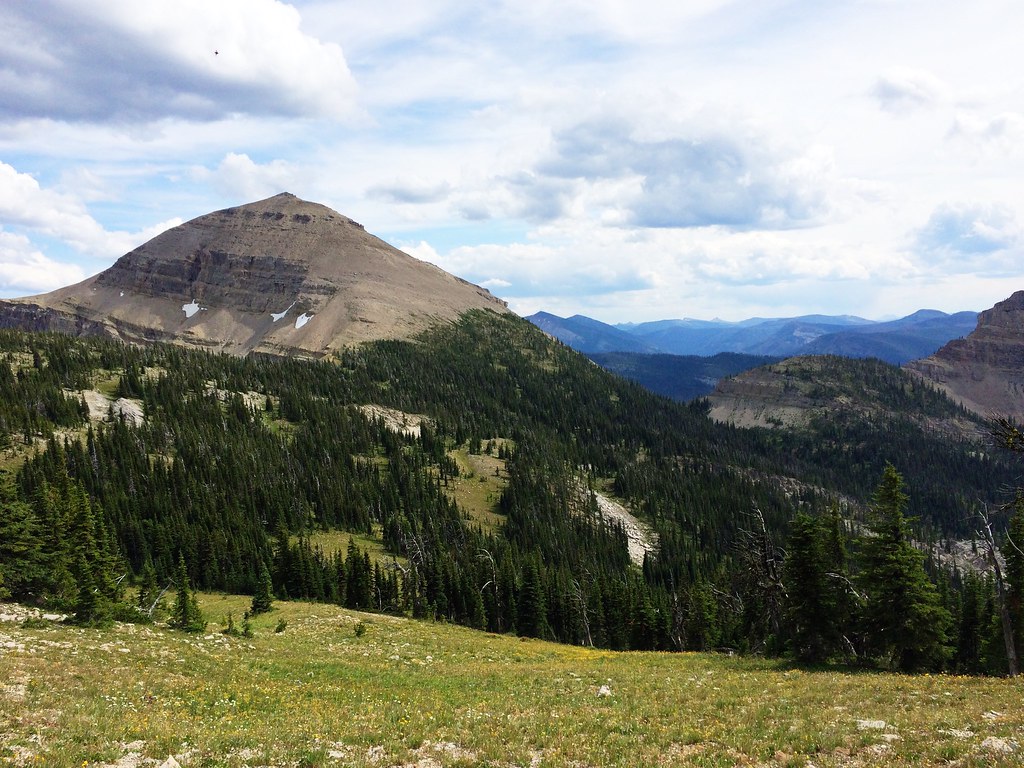
写真
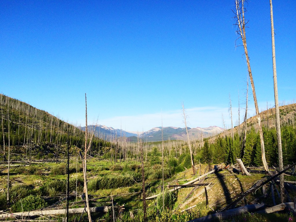
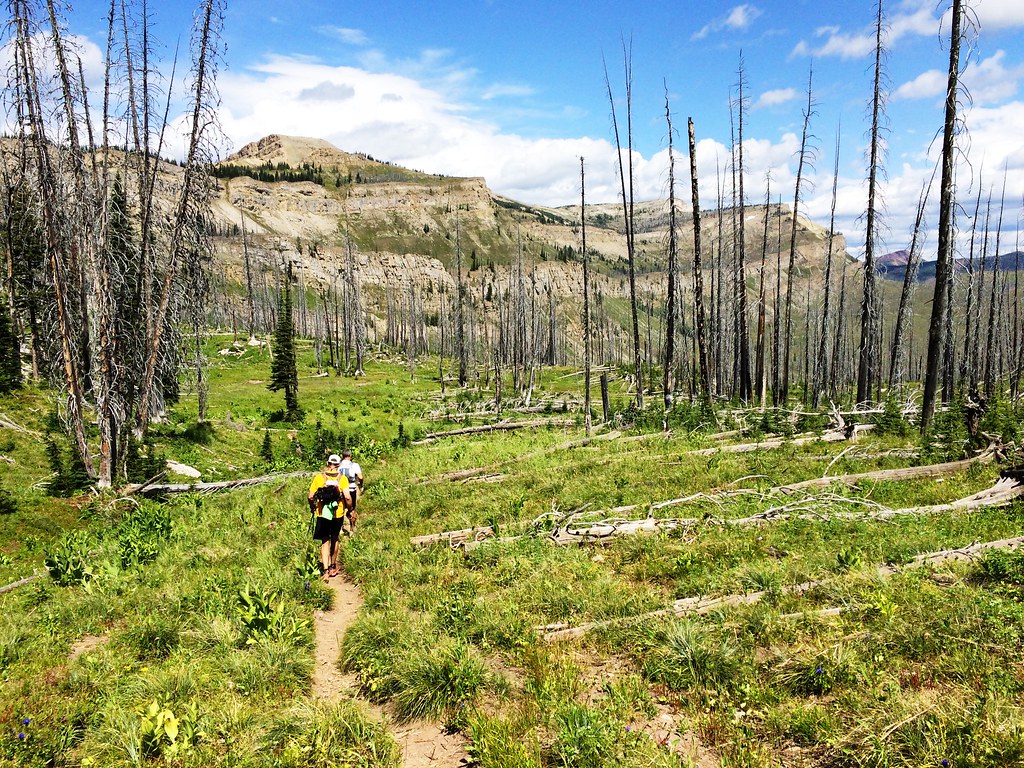
Sunrise on Headquarters Pass during the 53-mile Run Across The Bob

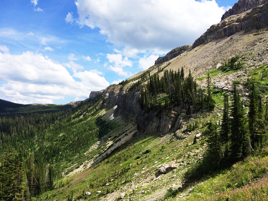
Along the North Wall during the 53-mile Run Across The Bob
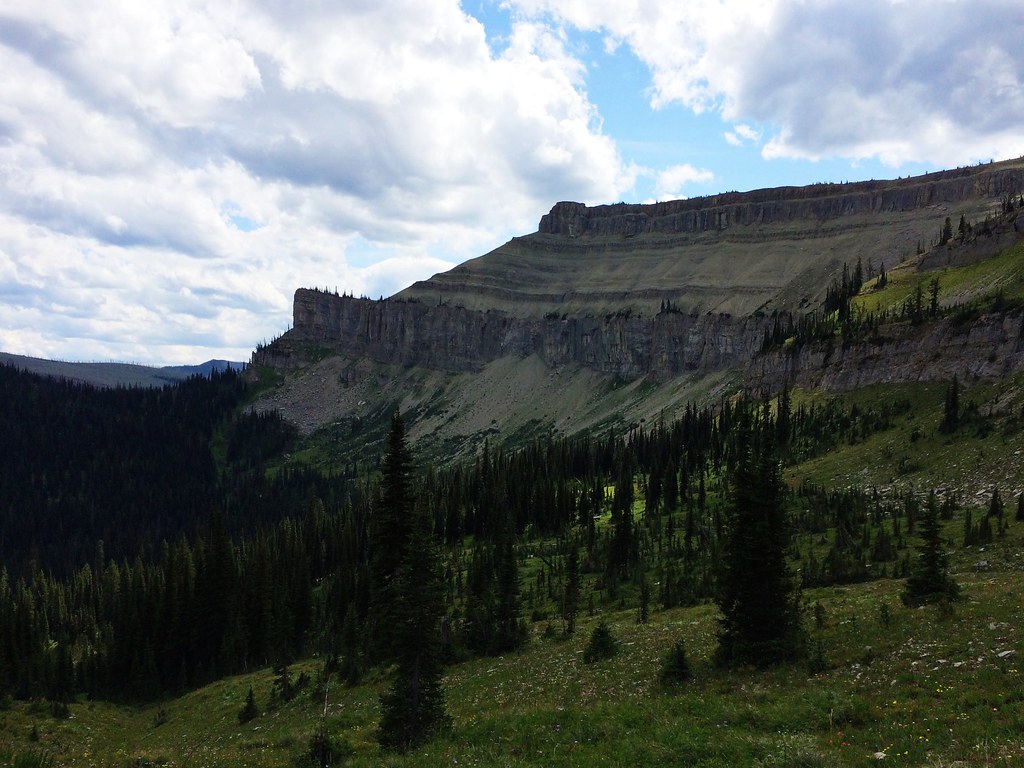
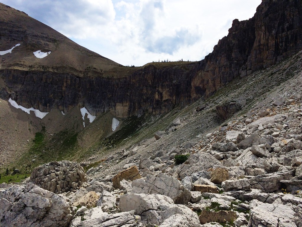
Along the North Wall during the 53-mile Run Across The Bob
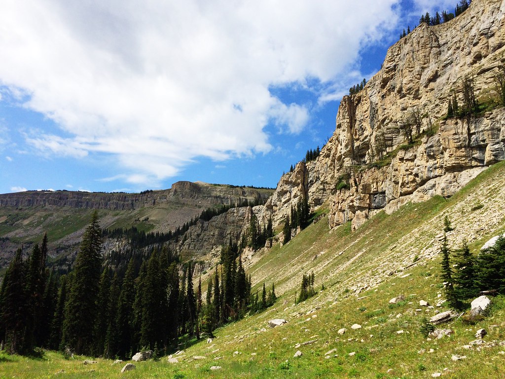
Along the North Wall during the 53-mile Run Across The Bob
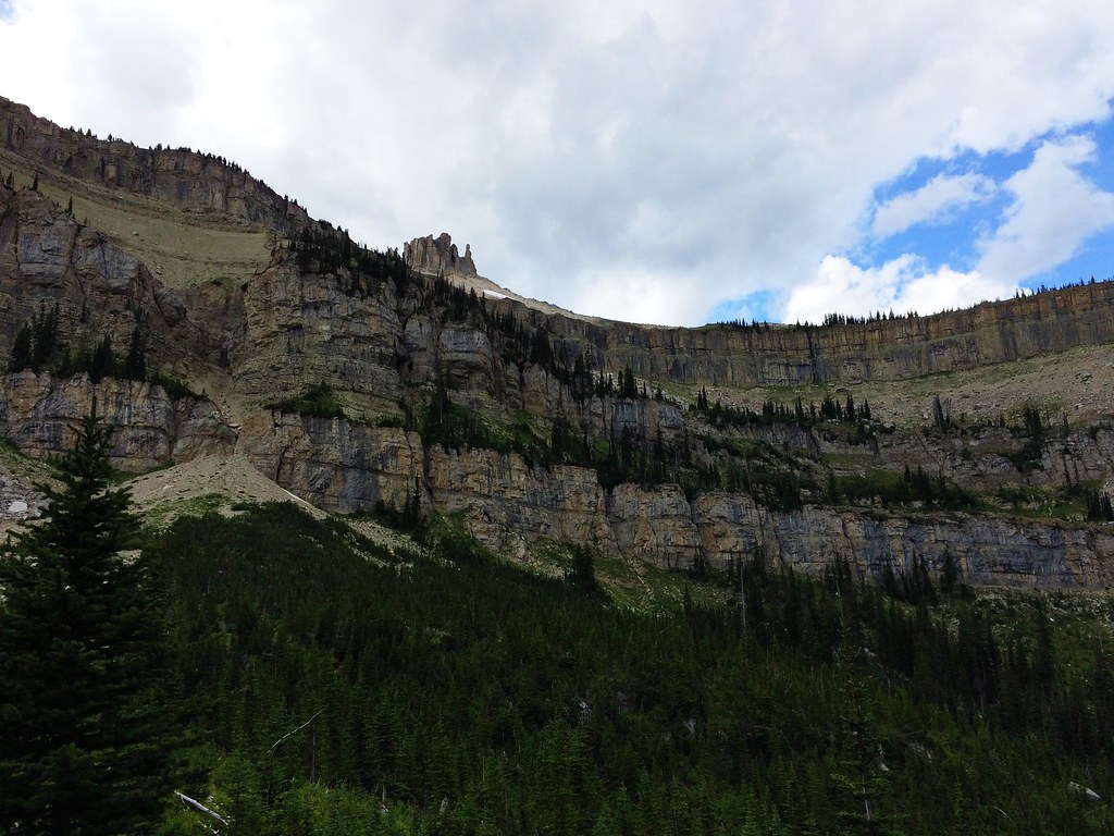
Along the North Wall during the 53-mile Run Across The Bob
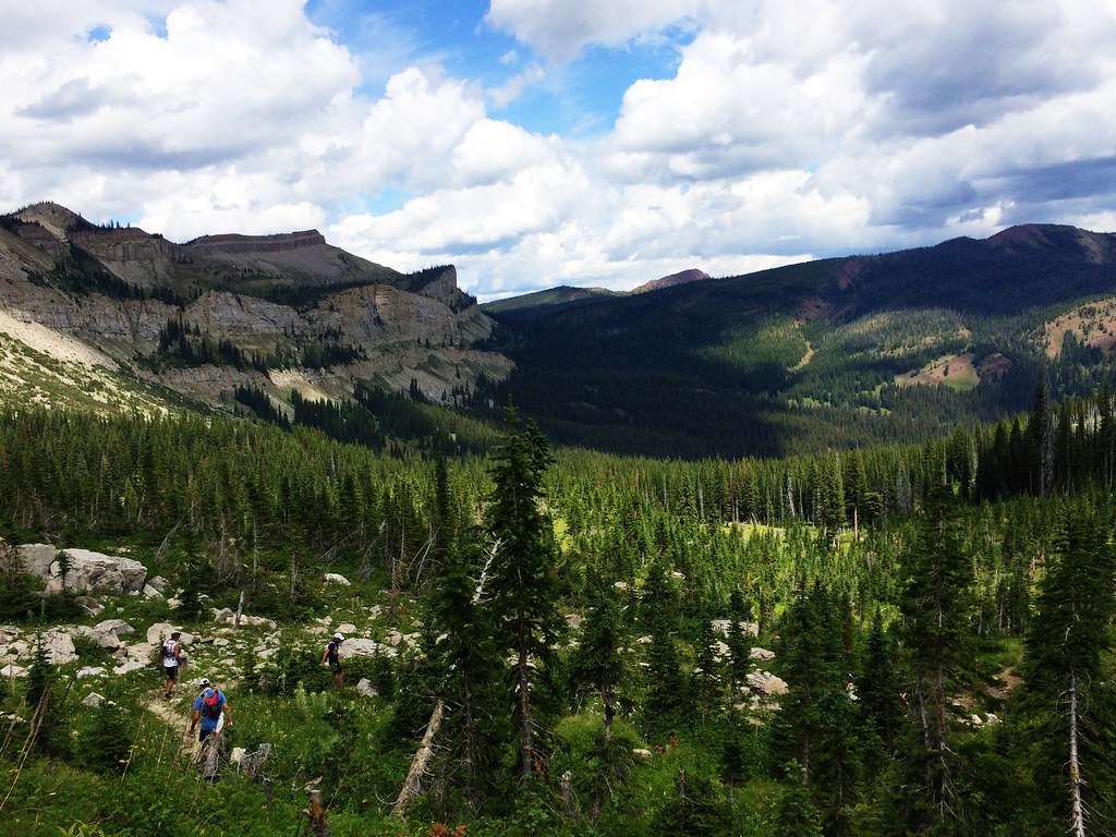
Up Switchback Pass during the 53-mile Run Across The Bob
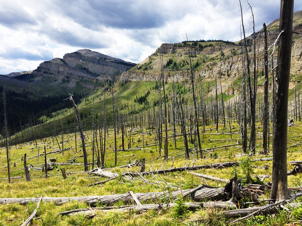
Along the North Wall during the 53-mile Run Across The Bob
Up Switchback Pass during the 53-mile Run Across The Bob
Along the North Wall during the 53-mile Run Across The Bob
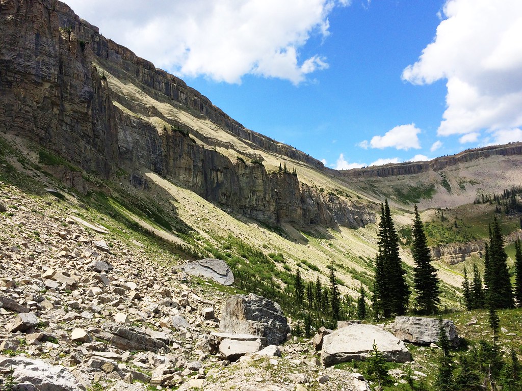
Along the North Wall during the 53-mile Run Across The Bob
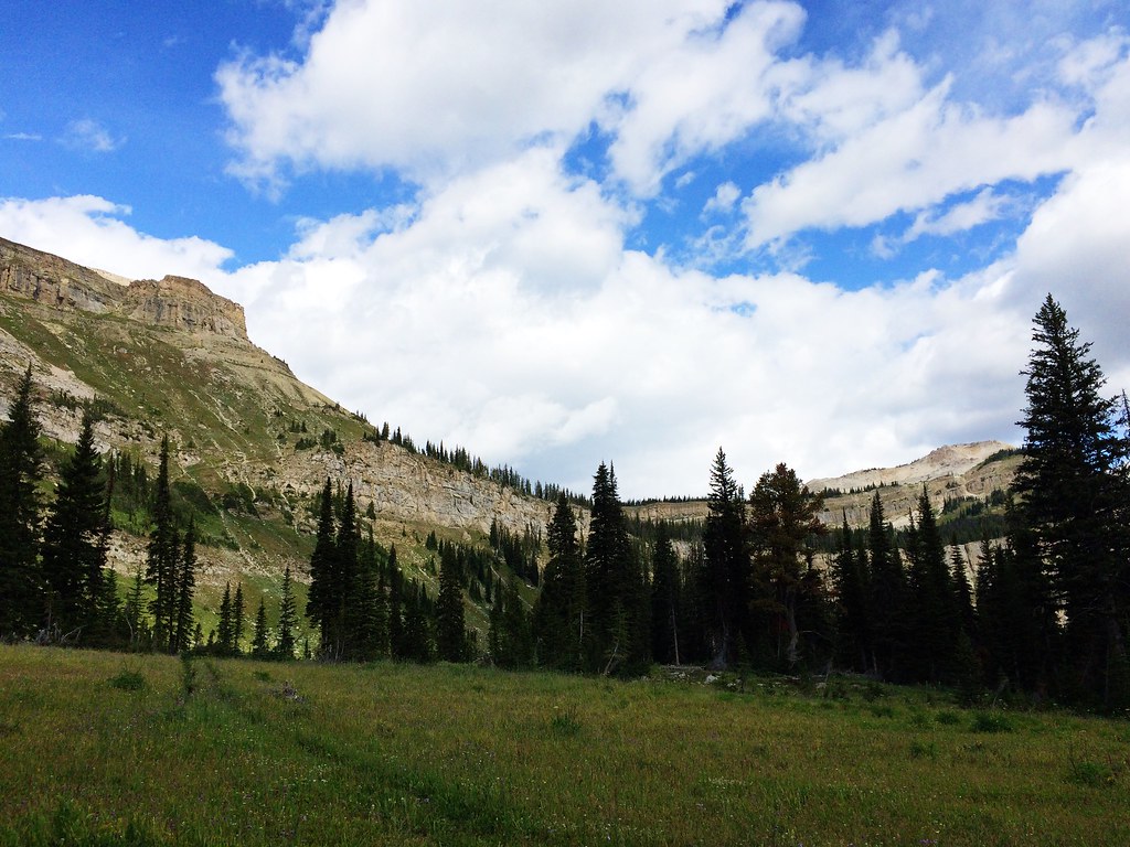
Along the North Wall during the 53-mile Run Across The Bob

Up Switchback Pass during the 53-mile Run Across The Bob
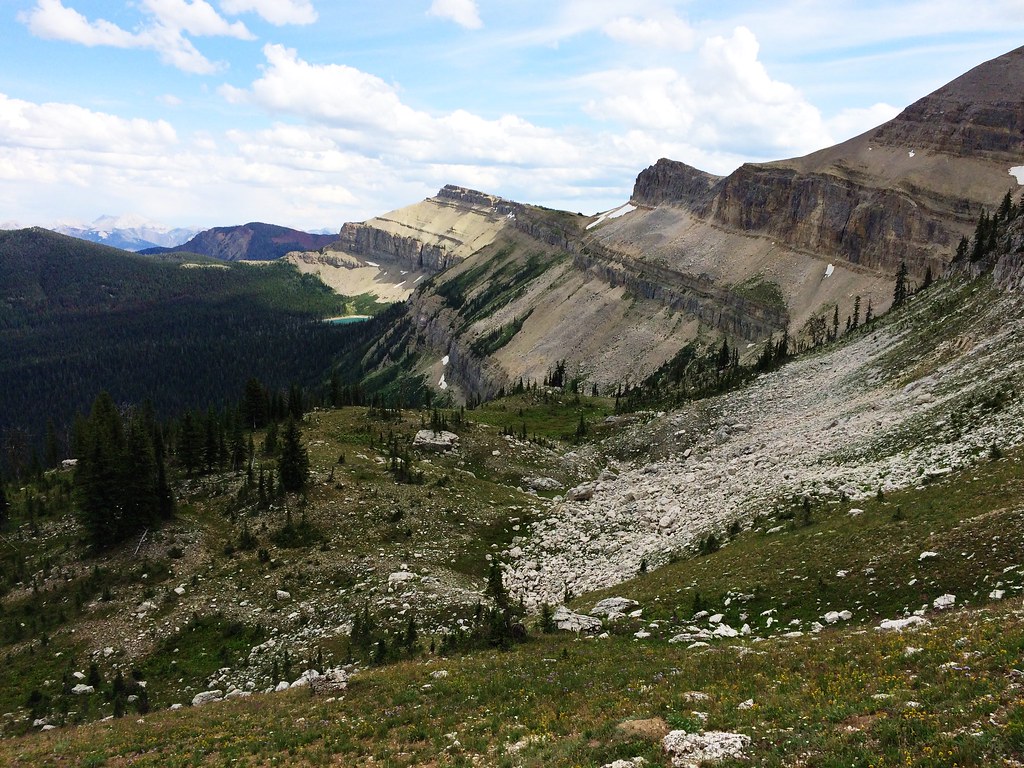
Along the North Wall during the 53-mile Run Across The Bob
Up Switchback Pass during the 53-mile Run Across The Bob

Along the North Wall during the 53-mile Run Across The Bob
Up Switchback Pass during the 53-mile Run Across The Bob

Its Me. At the top of Route Creek Pass. Montana

Chinese Wall

Camping on the Teton
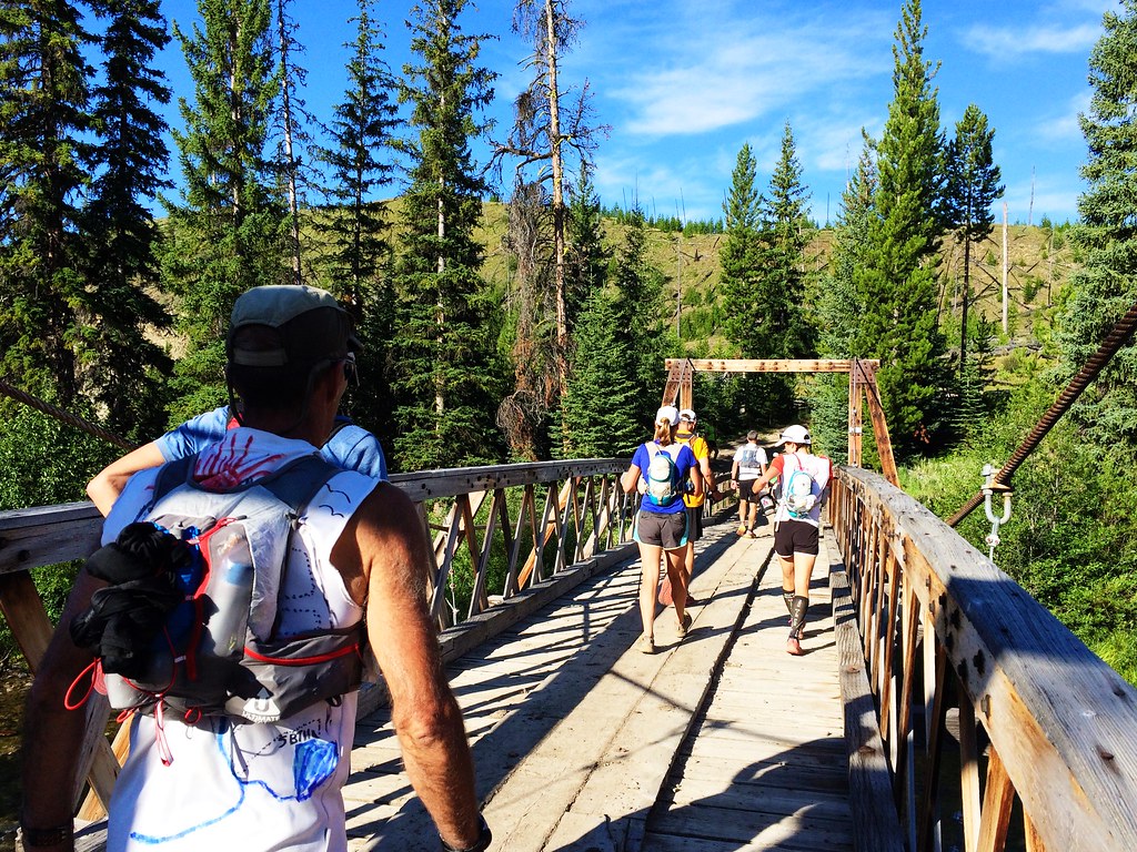
Crossing the Sun River during the 53-mile Run Across The Bob

Starting up Red Shale Creek during the 53-mile Run Across The Bob
アメリカ合衆国 〒 モンタナ州 シグナル山の地図
別の場所を検索
近所の場所
アメリカ合衆国 〒 モンタナ州 ムーンライト・ピーク
アメリカ合衆国 〒 モンタナ州 アングル・ポイント
アメリカ合衆国 〒 モンタナ州 リック山
アメリカ合衆国 〒 モンタナ州 ケバン山
アメリカ合衆国 〒 モンタナ州 ボウ山
アメリカ合衆国 〒 モンタナ州 ハーン・ピーク
アメリカ合衆国 〒 モンタナ州 メイ山
アメリカ合衆国 〒 モンタナ州 ポーフィリー・リーフ
アメリカ合衆国 〒 モンタナ州 ロング・リッジ
アメリカ合衆国 〒 モンタナ州 ウォッシュボード・リーフ
アメリカ合衆国 〒 モンタナ州 ワピティ・リッジ・サウス
アメリカ合衆国 〒 モンタナ州 ワピティ・リッジ・ノース
アメリカ合衆国 〒 モンタナ州 ビッグホーン山
アメリカ合衆国 〒 モンタナ州 コルーゲート・リッジ
アメリカ合衆国 〒 モンタナ州 ロックハート山
アメリカ合衆国 〒 モンタナ州 エルク・リッジ
アメリカ合衆国 〒 モンタナ州 ティートン・ピーク
アメリカ合衆国 〒 モンタナ州 アイベックス山
アメリカ合衆国 〒 モンタナ州 パトリック・ガス山
アメリカ合衆国 〒 モンタナ州 ライムストーン・ピーク
最近の検索
- アメリカ合衆国 アラスカ州 レッド・ドッグ・マイン日の出日の入り時間
- Am bhf, Borken, ドイツアム・バーンホーフ日の出日の入り時間
- 4th St E, Sonoma, CA, USA日の出日の入り時間
- Oakland Ave, Williamsport, PA アメリカ合衆国日の出日の入り時間
- Via Roma, Pieranica CR, イタリアローマ通り日の出日の入り時間
- クロアチア 〒 ドゥブロブニク GradClock Tower of Dubrovnik日の出日の入り時間
- アルゼンチン チュブ州 トレリュー日の出日の入り時間
- Hartfords Bluff Cir, Mt Pleasant, SC アメリカ合衆国日の出日の入り時間
- 日本、熊本県熊本市北区日の出日の入り時間
- 中華人民共和国 福州市 平潭県 平潭島日の出日の入り時間