アメリカ合衆国 〒 ニューメキシコ州 シエラ・デ・ロス・ピノス日の出日の入り時間
Location: アメリカ合衆国 > ニューメキシコ州 > サンドヴァル >
時間帯:
America/Denver
現地時間:
2025-06-22 22:49:46
経度:
-106.5908673
緯度:
35.8116907
今日の日の出時刻:
05:51:10 AM
今日の日の入時刻:
08:26:22 PM
今日の日長:
14h 35m 12s
明日の日の出時刻:
05:51:28 AM
明日の日の入時刻:
08:26:30 PM
明日の日長:
14h 35m 2s
すべて表示する
| 日付 | 日出 | 日没 | 日長 |
|---|---|---|---|
| 2025年01月01日 | 07:16:35 AM | 05:04:31 PM | 9h 47m 56s |
| 2025年01月02日 | 07:16:42 AM | 05:05:19 PM | 9h 48m 37s |
| 2025年01月03日 | 07:16:47 AM | 05:06:09 PM | 9h 49m 22s |
| 2025年01月04日 | 07:16:50 AM | 05:06:59 PM | 9h 50m 9s |
| 2025年01月05日 | 07:16:51 AM | 05:07:51 PM | 9h 51m 0s |
| 2025年01月06日 | 07:16:50 AM | 05:08:43 PM | 9h 51m 53s |
| 2025年01月07日 | 07:16:47 AM | 05:09:37 PM | 9h 52m 50s |
| 2025年01月08日 | 07:16:42 AM | 05:10:31 PM | 9h 53m 49s |
| 2025年01月09日 | 07:16:35 AM | 05:11:27 PM | 9h 54m 52s |
| 2025年01月10日 | 07:16:26 AM | 05:12:23 PM | 9h 55m 57s |
| 2025年01月11日 | 07:16:15 AM | 05:13:20 PM | 9h 57m 5s |
| 2025年01月12日 | 07:16:03 AM | 05:14:17 PM | 9h 58m 14s |
| 2025年01月13日 | 07:15:48 AM | 05:15:15 PM | 9h 59m 27s |
| 2025年01月14日 | 07:15:32 AM | 05:16:14 PM | 10h 0m 42s |
| 2025年01月15日 | 07:15:13 AM | 05:17:13 PM | 10h 2m 0s |
| 2025年01月16日 | 07:14:53 AM | 05:18:13 PM | 10h 3m 20s |
| 2025年01月17日 | 07:14:30 AM | 05:19:14 PM | 10h 4m 44s |
| 2025年01月18日 | 07:14:06 AM | 05:20:14 PM | 10h 6m 8s |
| 2025年01月19日 | 07:13:40 AM | 05:21:16 PM | 10h 7m 36s |
| 2025年01月20日 | 07:13:12 AM | 05:22:17 PM | 10h 9m 5s |
| 2025年01月21日 | 07:12:42 AM | 05:23:19 PM | 10h 10m 37s |
| 2025年01月22日 | 07:12:11 AM | 05:24:21 PM | 10h 12m 10s |
| 2025年01月23日 | 07:11:38 AM | 05:25:23 PM | 10h 13m 45s |
| 2025年01月24日 | 07:11:03 AM | 05:26:26 PM | 10h 15m 23s |
| 2025年01月25日 | 07:10:26 AM | 05:27:28 PM | 10h 17m 2s |
| 2025年01月26日 | 07:09:47 AM | 05:28:31 PM | 10h 18m 44s |
| 2025年01月27日 | 07:09:07 AM | 05:29:34 PM | 10h 20m 27s |
| 2025年01月28日 | 07:08:25 AM | 05:30:36 PM | 10h 22m 11s |
| 2025年01月29日 | 07:07:42 AM | 05:31:39 PM | 10h 23m 57s |
| 2025年01月30日 | 07:06:56 AM | 05:32:42 PM | 10h 25m 46s |
| 2025年01月31日 | 07:06:10 AM | 05:33:45 PM | 10h 27m 35s |
| 2025年02月01日 | 07:05:21 AM | 05:34:47 PM | 10h 29m 26s |
| 2025年02月02日 | 07:04:32 AM | 05:35:50 PM | 10h 31m 18s |
| 2025年02月03日 | 07:03:40 AM | 05:36:52 PM | 10h 33m 12s |
| 2025年02月04日 | 07:02:48 AM | 05:37:55 PM | 10h 35m 7s |
| 2025年02月05日 | 07:01:53 AM | 05:38:57 PM | 10h 37m 4s |
| 2025年02月06日 | 07:00:58 AM | 05:39:59 PM | 10h 39m 1s |
| 2025年02月07日 | 07:00:01 AM | 05:41:01 PM | 10h 41m 0s |
| 2025年02月08日 | 06:59:02 AM | 05:42:02 PM | 10h 43m 0s |
| 2025年02月09日 | 06:58:03 AM | 05:43:03 PM | 10h 45m 0s |
| 2025年02月10日 | 06:57:02 AM | 05:44:04 PM | 10h 47m 2s |
| 2025年02月11日 | 06:56:00 AM | 05:45:05 PM | 10h 49m 5s |
| 2025年02月12日 | 06:54:56 AM | 05:46:06 PM | 10h 51m 10s |
| 2025年02月13日 | 06:53:51 AM | 05:47:06 PM | 10h 53m 15s |
| 2025年02月14日 | 06:52:46 AM | 05:48:06 PM | 10h 55m 20s |
| 2025年02月15日 | 06:51:39 AM | 05:49:05 PM | 10h 57m 26s |
| 2025年02月16日 | 06:50:31 AM | 05:50:05 PM | 10h 59m 34s |
| 2025年02月17日 | 06:49:22 AM | 05:51:03 PM | 11h 1m 41s |
| 2025年02月18日 | 06:48:12 AM | 05:52:02 PM | 11h 3m 50s |
| 2025年02月19日 | 06:47:01 AM | 05:53:00 PM | 11h 5m 59s |
| 2025年02月20日 | 06:45:49 AM | 05:53:58 PM | 11h 8m 9s |
| 2025年02月21日 | 06:44:36 AM | 05:54:56 PM | 11h 10m 20s |
| 2025年02月22日 | 06:43:22 AM | 05:55:53 PM | 11h 12m 31s |
| 2025年02月23日 | 06:42:07 AM | 05:56:50 PM | 11h 14m 43s |
| 2025年02月24日 | 06:40:52 AM | 05:57:47 PM | 11h 16m 55s |
| 2025年02月25日 | 06:39:35 AM | 05:58:43 PM | 11h 19m 8s |
| 2025年02月26日 | 06:38:18 AM | 05:59:39 PM | 11h 21m 21s |
| 2025年02月27日 | 06:37:00 AM | 06:00:35 PM | 11h 23m 35s |
| 2025年02月28日 | 06:35:42 AM | 06:01:30 PM | 11h 25m 48s |
| 2025年03月01日 | 06:34:22 AM | 06:02:25 PM | 11h 28m 3s |
| 2025年03月02日 | 06:33:02 AM | 06:03:20 PM | 11h 30m 18s |
| 2025年03月03日 | 06:31:42 AM | 06:04:14 PM | 11h 32m 32s |
| 2025年03月04日 | 06:30:21 AM | 06:05:08 PM | 11h 34m 47s |
| 2025年03月05日 | 06:28:59 AM | 06:06:02 PM | 11h 37m 3s |
| 2025年03月06日 | 06:27:37 AM | 06:06:56 PM | 11h 39m 19s |
| 2025年03月07日 | 06:26:14 AM | 06:07:49 PM | 11h 41m 35s |
| 2025年03月08日 | 06:24:51 AM | 06:08:42 PM | 11h 43m 51s |
| 2025年03月09日 | 07:23:31 AM | 07:09:32 PM | 11h 46m 1s |
| 2025年03月10日 | 07:22:07 AM | 07:10:25 PM | 11h 48m 18s |
| 2025年03月11日 | 07:20:43 AM | 07:11:17 PM | 11h 50m 34s |
| 2025年03月12日 | 07:19:18 AM | 07:12:09 PM | 11h 52m 51s |
| 2025年03月13日 | 07:17:54 AM | 07:13:01 PM | 11h 55m 7s |
| 2025年03月14日 | 07:16:28 AM | 07:13:53 PM | 11h 57m 25s |
| 2025年03月15日 | 07:15:03 AM | 07:14:44 PM | 11h 59m 41s |
| 2025年03月16日 | 07:13:37 AM | 07:15:35 PM | 12h 1m 58s |
| 2025年03月17日 | 07:12:11 AM | 07:16:26 PM | 12h 4m 15s |
| 2025年03月18日 | 07:10:45 AM | 07:17:17 PM | 12h 6m 32s |
| 2025年03月19日 | 07:09:19 AM | 07:18:08 PM | 12h 8m 49s |
| 2025年03月20日 | 07:07:53 AM | 07:18:59 PM | 12h 11m 6s |
| 2025年03月21日 | 07:06:27 AM | 07:19:49 PM | 12h 13m 22s |
| 2025年03月22日 | 07:05:00 AM | 07:20:39 PM | 12h 15m 39s |
| 2025年03月23日 | 07:03:34 AM | 07:21:30 PM | 12h 17m 56s |
| 2025年03月24日 | 07:02:08 AM | 07:22:20 PM | 12h 20m 12s |
| 2025年03月25日 | 07:00:41 AM | 07:23:10 PM | 12h 22m 29s |
| 2025年03月26日 | 06:59:15 AM | 07:24:00 PM | 12h 24m 45s |
| 2025年03月27日 | 06:57:49 AM | 07:24:50 PM | 12h 27m 1s |
| 2025年03月28日 | 06:56:23 AM | 07:25:39 PM | 12h 29m 16s |
| 2025年03月29日 | 06:54:57 AM | 07:26:29 PM | 12h 31m 32s |
| 2025年03月30日 | 06:53:32 AM | 07:27:19 PM | 12h 33m 47s |
| 2025年03月31日 | 06:52:06 AM | 07:28:09 PM | 12h 36m 3s |
| 2025年04月01日 | 06:50:41 AM | 07:28:59 PM | 12h 38m 18s |
| 2025年04月02日 | 06:49:17 AM | 07:29:48 PM | 12h 40m 31s |
| 2025年04月03日 | 06:47:52 AM | 07:30:38 PM | 12h 42m 46s |
| 2025年04月04日 | 06:46:28 AM | 07:31:28 PM | 12h 45m 0s |
| 2025年04月05日 | 06:45:04 AM | 07:32:17 PM | 12h 47m 13s |
| 2025年04月06日 | 06:43:41 AM | 07:33:07 PM | 12h 49m 26s |
| 2025年04月07日 | 06:42:18 AM | 07:33:57 PM | 12h 51m 39s |
| 2025年04月08日 | 06:40:55 AM | 07:34:47 PM | 12h 53m 52s |
| 2025年04月09日 | 06:39:33 AM | 07:35:37 PM | 12h 56m 4s |
| 2025年04月10日 | 06:38:12 AM | 07:36:27 PM | 12h 58m 15s |
| 2025年04月11日 | 06:36:51 AM | 07:37:17 PM | 13h 0m 26s |
| 2025年04月12日 | 06:35:31 AM | 07:38:07 PM | 13h 2m 36s |
| 2025年04月13日 | 06:34:11 AM | 07:38:57 PM | 13h 4m 46s |
| 2025年04月14日 | 06:32:52 AM | 07:39:47 PM | 13h 6m 55s |
| 2025年04月15日 | 06:31:33 AM | 07:40:37 PM | 13h 9m 4s |
| 2025年04月16日 | 06:30:15 AM | 07:41:27 PM | 13h 11m 12s |
| 2025年04月17日 | 06:28:58 AM | 07:42:18 PM | 13h 13m 20s |
| 2025年04月18日 | 06:27:42 AM | 07:43:08 PM | 13h 15m 26s |
| 2025年04月19日 | 06:26:27 AM | 07:43:58 PM | 13h 17m 31s |
| 2025年04月20日 | 06:25:12 AM | 07:44:49 PM | 13h 19m 37s |
| 2025年04月21日 | 06:23:58 AM | 07:45:39 PM | 13h 21m 41s |
| 2025年04月22日 | 06:22:45 AM | 07:46:30 PM | 13h 23m 45s |
| 2025年04月23日 | 06:21:33 AM | 07:47:21 PM | 13h 25m 48s |
| 2025年04月24日 | 06:20:22 AM | 07:48:11 PM | 13h 27m 49s |
| 2025年04月25日 | 06:19:12 AM | 07:49:02 PM | 13h 29m 50s |
| 2025年04月26日 | 06:18:02 AM | 07:49:52 PM | 13h 31m 50s |
| 2025年04月27日 | 06:16:54 AM | 07:50:43 PM | 13h 33m 49s |
| 2025年04月28日 | 06:15:47 AM | 07:51:34 PM | 13h 35m 47s |
| 2025年04月29日 | 06:14:41 AM | 07:52:24 PM | 13h 37m 43s |
| 2025年04月30日 | 06:13:36 AM | 07:53:15 PM | 13h 39m 39s |
| 2025年05月01日 | 06:12:32 AM | 07:54:06 PM | 13h 41m 34s |
| 2025年05月02日 | 06:11:29 AM | 07:54:56 PM | 13h 43m 27s |
| 2025年05月03日 | 06:10:28 AM | 07:55:47 PM | 13h 45m 19s |
| 2025年05月04日 | 06:09:27 AM | 07:56:37 PM | 13h 47m 10s |
| 2025年05月05日 | 06:08:28 AM | 07:57:27 PM | 13h 48m 59s |
| 2025年05月06日 | 06:07:30 AM | 07:58:17 PM | 13h 50m 47s |
| 2025年05月07日 | 06:06:34 AM | 07:59:07 PM | 13h 52m 33s |
| 2025年05月08日 | 06:05:39 AM | 07:59:57 PM | 13h 54m 18s |
| 2025年05月09日 | 06:04:45 AM | 08:00:47 PM | 13h 56m 2s |
| 2025年05月10日 | 06:03:52 AM | 08:01:36 PM | 13h 57m 44s |
| 2025年05月11日 | 06:03:01 AM | 08:02:26 PM | 13h 59m 25s |
| 2025年05月12日 | 06:02:11 AM | 08:03:14 PM | 14h 1m 3s |
| 2025年05月13日 | 06:01:23 AM | 08:04:03 PM | 14h 2m 40s |
| 2025年05月14日 | 06:00:36 AM | 08:04:51 PM | 14h 4m 15s |
| 2025年05月15日 | 05:59:50 AM | 08:05:39 PM | 14h 5m 49s |
| 2025年05月16日 | 05:59:06 AM | 08:06:27 PM | 14h 7m 21s |
| 2025年05月17日 | 05:58:24 AM | 08:07:14 PM | 14h 8m 50s |
| 2025年05月18日 | 05:57:43 AM | 08:08:01 PM | 14h 10m 18s |
| 2025年05月19日 | 05:57:03 AM | 08:08:47 PM | 14h 11m 44s |
| 2025年05月20日 | 05:56:26 AM | 08:09:33 PM | 14h 13m 7s |
| 2025年05月21日 | 05:55:49 AM | 08:10:19 PM | 14h 14m 30s |
| 2025年05月22日 | 05:55:15 AM | 08:11:03 PM | 14h 15m 48s |
| 2025年05月23日 | 05:54:42 AM | 08:11:47 PM | 14h 17m 5s |
| 2025年05月24日 | 05:54:10 AM | 08:12:31 PM | 14h 18m 21s |
| 2025年05月25日 | 05:53:40 AM | 08:13:14 PM | 14h 19m 34s |
| 2025年05月26日 | 05:53:12 AM | 08:13:56 PM | 14h 20m 44s |
| 2025年05月27日 | 05:52:46 AM | 08:14:37 PM | 14h 21m 51s |
| 2025年05月28日 | 05:52:21 AM | 08:15:18 PM | 14h 22m 57s |
| 2025年05月29日 | 05:51:58 AM | 08:15:58 PM | 14h 24m 0s |
| 2025年05月30日 | 05:51:36 AM | 08:16:37 PM | 14h 25m 1s |
| 2025年05月31日 | 05:51:17 AM | 08:17:15 PM | 14h 25m 58s |
| 2025年06月01日 | 05:50:59 AM | 08:17:52 PM | 14h 26m 53s |
| 2025年06月02日 | 05:50:42 AM | 08:18:28 PM | 14h 27m 46s |
| 2025年06月03日 | 05:50:28 AM | 08:19:04 PM | 14h 28m 36s |
| 2025年06月04日 | 05:50:15 AM | 08:19:38 PM | 14h 29m 23s |
| 2025年06月05日 | 05:50:03 AM | 08:20:11 PM | 14h 30m 8s |
| 2025年06月06日 | 05:49:54 AM | 08:20:43 PM | 14h 30m 49s |
| 2025年06月07日 | 05:49:46 AM | 08:21:14 PM | 14h 31m 28s |
| 2025年06月08日 | 05:49:40 AM | 08:21:44 PM | 14h 32m 4s |
| 2025年06月09日 | 05:49:35 AM | 08:22:12 PM | 14h 32m 37s |
| 2025年06月10日 | 05:49:32 AM | 08:22:40 PM | 14h 33m 8s |
| 2025年06月11日 | 05:49:31 AM | 08:23:06 PM | 14h 33m 35s |
| 2025年06月12日 | 05:49:32 AM | 08:23:30 PM | 14h 33m 58s |
| 2025年06月13日 | 05:49:34 AM | 08:23:54 PM | 14h 34m 20s |
| 2025年06月14日 | 05:49:37 AM | 08:24:16 PM | 14h 34m 39s |
| 2025年06月15日 | 05:49:43 AM | 08:24:36 PM | 14h 34m 53s |
| 2025年06月16日 | 05:49:49 AM | 08:24:55 PM | 14h 35m 6s |
| 2025年06月17日 | 05:49:58 AM | 08:25:13 PM | 14h 35m 15s |
| 2025年06月18日 | 05:50:08 AM | 08:25:29 PM | 14h 35m 21s |
| 2025年06月19日 | 05:50:19 AM | 08:25:44 PM | 14h 35m 25s |
| 2025年06月20日 | 05:50:32 AM | 08:25:57 PM | 14h 35m 25s |
| 2025年06月21日 | 05:50:47 AM | 08:26:09 PM | 14h 35m 22s |
| 2025年06月22日 | 05:51:03 AM | 08:26:19 PM | 14h 35m 16s |
| 2025年06月23日 | 05:51:20 AM | 08:26:27 PM | 14h 35m 7s |
| 2025年06月24日 | 05:51:39 AM | 08:26:34 PM | 14h 34m 55s |
| 2025年06月25日 | 05:51:59 AM | 08:26:39 PM | 14h 34m 40s |
| 2025年06月26日 | 05:52:20 AM | 08:26:42 PM | 14h 34m 22s |
| 2025年06月27日 | 05:52:43 AM | 08:26:44 PM | 14h 34m 1s |
| 2025年06月28日 | 05:53:07 AM | 08:26:44 PM | 14h 33m 37s |
| 2025年06月29日 | 05:53:32 AM | 08:26:43 PM | 14h 33m 11s |
| 2025年06月30日 | 05:53:59 AM | 08:26:40 PM | 14h 32m 41s |
| 2025年07月01日 | 05:54:26 AM | 08:26:35 PM | 14h 32m 9s |
| 2025年07月02日 | 05:54:55 AM | 08:26:28 PM | 14h 31m 33s |
| 2025年07月03日 | 05:55:25 AM | 08:26:19 PM | 14h 30m 54s |
| 2025年07月04日 | 05:55:56 AM | 08:26:09 PM | 14h 30m 13s |
| 2025年07月05日 | 05:56:28 AM | 08:25:57 PM | 14h 29m 29s |
| 2025年07月06日 | 05:57:01 AM | 08:25:44 PM | 14h 28m 43s |
| 2025年07月07日 | 05:57:35 AM | 08:25:28 PM | 14h 27m 53s |
| 2025年07月08日 | 05:58:10 AM | 08:25:11 PM | 14h 27m 1s |
| 2025年07月09日 | 05:58:45 AM | 08:24:52 PM | 14h 26m 7s |
| 2025年07月10日 | 05:59:22 AM | 08:24:32 PM | 14h 25m 10s |
| 2025年07月11日 | 05:59:59 AM | 08:24:09 PM | 14h 24m 10s |
| 2025年07月12日 | 06:00:37 AM | 08:23:45 PM | 14h 23m 8s |
| 2025年07月13日 | 06:01:16 AM | 08:23:20 PM | 14h 22m 4s |
| 2025年07月14日 | 06:01:56 AM | 08:22:52 PM | 14h 20m 56s |
| 2025年07月15日 | 06:02:36 AM | 08:22:23 PM | 14h 19m 47s |
| 2025年07月16日 | 06:03:17 AM | 08:21:52 PM | 14h 18m 35s |
| 2025年07月17日 | 06:03:59 AM | 08:21:20 PM | 14h 17m 21s |
| 2025年07月18日 | 06:04:41 AM | 08:20:46 PM | 14h 16m 5s |
| 2025年07月19日 | 06:05:23 AM | 08:20:10 PM | 14h 14m 47s |
| 2025年07月20日 | 06:06:06 AM | 08:19:33 PM | 14h 13m 27s |
| 2025年07月21日 | 06:06:50 AM | 08:18:54 PM | 14h 12m 4s |
| 2025年07月22日 | 06:07:34 AM | 08:18:13 PM | 14h 10m 39s |
| 2025年07月23日 | 06:08:18 AM | 08:17:31 PM | 14h 9m 13s |
| 2025年07月24日 | 06:09:03 AM | 08:16:47 PM | 14h 7m 44s |
| 2025年07月25日 | 06:09:48 AM | 08:16:02 PM | 14h 6m 14s |
| 2025年07月26日 | 06:10:34 AM | 08:15:15 PM | 14h 4m 41s |
| 2025年07月27日 | 06:11:19 AM | 08:14:27 PM | 14h 3m 8s |
| 2025年07月28日 | 06:12:05 AM | 08:13:37 PM | 14h 1m 32s |
| 2025年07月29日 | 06:12:51 AM | 08:12:46 PM | 13h 59m 55s |
| 2025年07月30日 | 06:13:38 AM | 08:11:53 PM | 13h 58m 15s |
| 2025年07月31日 | 06:14:24 AM | 08:10:59 PM | 13h 56m 35s |
| 2025年08月01日 | 06:15:11 AM | 08:10:04 PM | 13h 54m 53s |
| 2025年08月02日 | 06:15:58 AM | 08:09:07 PM | 13h 53m 9s |
| 2025年08月03日 | 06:16:45 AM | 08:08:09 PM | 13h 51m 24s |
| 2025年08月04日 | 06:17:32 AM | 08:07:10 PM | 13h 49m 38s |
| 2025年08月05日 | 06:18:19 AM | 08:06:09 PM | 13h 47m 50s |
| 2025年08月06日 | 06:19:06 AM | 08:05:08 PM | 13h 46m 2s |
| 2025年08月07日 | 06:19:53 AM | 08:04:05 PM | 13h 44m 12s |
| 2025年08月08日 | 06:20:41 AM | 08:03:00 PM | 13h 42m 19s |
| 2025年08月09日 | 06:21:28 AM | 08:01:55 PM | 13h 40m 27s |
| 2025年08月10日 | 06:22:15 AM | 08:00:48 PM | 13h 38m 33s |
| 2025年08月11日 | 06:23:02 AM | 07:59:41 PM | 13h 36m 39s |
| 2025年08月12日 | 06:23:50 AM | 07:58:32 PM | 13h 34m 42s |
| 2025年08月13日 | 06:24:37 AM | 07:57:22 PM | 13h 32m 45s |
| 2025年08月14日 | 06:25:24 AM | 07:56:11 PM | 13h 30m 47s |
| 2025年08月15日 | 06:26:11 AM | 07:55:00 PM | 13h 28m 49s |
| 2025年08月16日 | 06:26:58 AM | 07:53:47 PM | 13h 26m 49s |
| 2025年08月17日 | 06:27:45 AM | 07:52:33 PM | 13h 24m 48s |
| 2025年08月18日 | 06:28:32 AM | 07:51:18 PM | 13h 22m 46s |
| 2025年08月19日 | 06:29:19 AM | 07:50:03 PM | 13h 20m 44s |
| 2025年08月20日 | 06:30:06 AM | 07:48:47 PM | 13h 18m 41s |
| 2025年08月21日 | 06:30:52 AM | 07:47:29 PM | 13h 16m 37s |
| 2025年08月22日 | 06:31:39 AM | 07:46:11 PM | 13h 14m 32s |
| 2025年08月23日 | 06:32:25 AM | 07:44:53 PM | 13h 12m 28s |
| 2025年08月24日 | 06:33:12 AM | 07:43:33 PM | 13h 10m 21s |
| 2025年08月25日 | 06:33:58 AM | 07:42:13 PM | 13h 8m 15s |
| 2025年08月26日 | 06:34:44 AM | 07:40:52 PM | 13h 6m 8s |
| 2025年08月27日 | 06:35:30 AM | 07:39:31 PM | 13h 4m 1s |
| 2025年08月28日 | 06:36:16 AM | 07:38:08 PM | 13h 1m 52s |
| 2025年08月29日 | 06:37:02 AM | 07:36:46 PM | 12h 59m 44s |
| 2025年08月30日 | 06:37:48 AM | 07:35:22 PM | 12h 57m 34s |
| 2025年08月31日 | 06:38:34 AM | 07:33:58 PM | 12h 55m 24s |
| 2025年09月01日 | 06:39:19 AM | 07:32:34 PM | 12h 53m 15s |
| 2025年09月02日 | 06:40:05 AM | 07:31:09 PM | 12h 51m 4s |
| 2025年09月03日 | 06:40:51 AM | 07:29:44 PM | 12h 48m 53s |
| 2025年09月04日 | 06:41:36 AM | 07:28:18 PM | 12h 46m 42s |
| 2025年09月05日 | 06:42:22 AM | 07:26:52 PM | 12h 44m 30s |
| 2025年09月06日 | 06:43:07 AM | 07:25:25 PM | 12h 42m 18s |
| 2025年09月07日 | 06:43:53 AM | 07:23:59 PM | 12h 40m 6s |
| 2025年09月08日 | 06:44:38 AM | 07:22:31 PM | 12h 37m 53s |
| 2025年09月09日 | 06:45:24 AM | 07:21:04 PM | 12h 35m 40s |
| 2025年09月10日 | 06:46:09 AM | 07:19:36 PM | 12h 33m 27s |
| 2025年09月11日 | 06:46:54 AM | 07:18:09 PM | 12h 31m 15s |
| 2025年09月12日 | 06:47:40 AM | 07:16:40 PM | 12h 29m 0s |
| 2025年09月13日 | 06:48:25 AM | 07:15:12 PM | 12h 26m 47s |
| 2025年09月14日 | 06:49:11 AM | 07:13:44 PM | 12h 24m 33s |
| 2025年09月15日 | 06:49:57 AM | 07:12:15 PM | 12h 22m 18s |
| 2025年09月16日 | 06:50:42 AM | 07:10:47 PM | 12h 20m 5s |
| 2025年09月17日 | 06:51:28 AM | 07:09:18 PM | 12h 17m 50s |
| 2025年09月18日 | 06:52:14 AM | 07:07:49 PM | 12h 15m 35s |
| 2025年09月19日 | 06:53:00 AM | 07:06:21 PM | 12h 13m 21s |
| 2025年09月20日 | 06:53:46 AM | 07:04:52 PM | 12h 11m 6s |
| 2025年09月21日 | 06:54:32 AM | 07:03:24 PM | 12h 8m 52s |
| 2025年09月22日 | 06:55:18 AM | 07:01:55 PM | 12h 6m 37s |
| 2025年09月23日 | 06:56:05 AM | 07:00:27 PM | 12h 4m 22s |
| 2025年09月24日 | 06:56:51 AM | 06:58:59 PM | 12h 2m 8s |
| 2025年09月25日 | 06:57:38 AM | 06:57:31 PM | 11h 59m 53s |
| 2025年09月26日 | 06:58:25 AM | 06:56:03 PM | 11h 57m 38s |
| 2025年09月27日 | 06:59:12 AM | 06:54:35 PM | 11h 55m 23s |
| 2025年09月28日 | 07:00:00 AM | 06:53:08 PM | 11h 53m 8s |
| 2025年09月29日 | 07:00:47 AM | 06:51:41 PM | 11h 50m 54s |
| 2025年09月30日 | 07:01:35 AM | 06:50:14 PM | 11h 48m 39s |
| 2025年10月01日 | 07:02:23 AM | 06:48:48 PM | 11h 46m 25s |
| 2025年10月02日 | 07:03:12 AM | 06:47:22 PM | 11h 44m 10s |
| 2025年10月03日 | 07:04:00 AM | 06:45:57 PM | 11h 41m 57s |
| 2025年10月04日 | 07:04:49 AM | 06:44:32 PM | 11h 39m 43s |
| 2025年10月05日 | 07:05:38 AM | 06:43:07 PM | 11h 37m 29s |
| 2025年10月06日 | 07:06:28 AM | 06:41:43 PM | 11h 35m 15s |
| 2025年10月07日 | 07:07:17 AM | 06:40:20 PM | 11h 33m 3s |
| 2025年10月08日 | 07:08:07 AM | 06:38:57 PM | 11h 30m 50s |
| 2025年10月09日 | 07:08:58 AM | 06:37:34 PM | 11h 28m 36s |
| 2025年10月10日 | 07:09:49 AM | 06:36:13 PM | 11h 26m 24s |
| 2025年10月11日 | 07:10:40 AM | 06:34:52 PM | 11h 24m 12s |
| 2025年10月12日 | 07:11:31 AM | 06:33:31 PM | 11h 22m 0s |
| 2025年10月13日 | 07:12:23 AM | 06:32:12 PM | 11h 19m 49s |
| 2025年10月14日 | 07:13:15 AM | 06:30:53 PM | 11h 17m 38s |
| 2025年10月15日 | 07:14:07 AM | 06:29:35 PM | 11h 15m 28s |
| 2025年10月16日 | 07:15:00 AM | 06:28:17 PM | 11h 13m 17s |
| 2025年10月17日 | 07:15:53 AM | 06:27:01 PM | 11h 11m 8s |
| 2025年10月18日 | 07:16:46 AM | 06:25:46 PM | 11h 9m 0s |
| 2025年10月19日 | 07:17:40 AM | 06:24:31 PM | 11h 6m 51s |
| 2025年10月20日 | 07:18:34 AM | 06:23:17 PM | 11h 4m 43s |
| 2025年10月21日 | 07:19:29 AM | 06:22:05 PM | 11h 2m 36s |
| 2025年10月22日 | 07:20:24 AM | 06:20:53 PM | 11h 0m 29s |
| 2025年10月23日 | 07:21:19 AM | 06:19:42 PM | 10h 58m 23s |
| 2025年10月24日 | 07:22:15 AM | 06:18:33 PM | 10h 56m 18s |
| 2025年10月25日 | 07:23:11 AM | 06:17:24 PM | 10h 54m 13s |
| 2025年10月26日 | 07:24:07 AM | 06:16:17 PM | 10h 52m 10s |
| 2025年10月27日 | 07:25:04 AM | 06:15:11 PM | 10h 50m 7s |
| 2025年10月28日 | 07:26:00 AM | 06:14:06 PM | 10h 48m 6s |
| 2025年10月29日 | 07:26:58 AM | 06:13:02 PM | 10h 46m 4s |
| 2025年10月30日 | 07:27:55 AM | 06:11:59 PM | 10h 44m 4s |
| 2025年10月31日 | 07:28:53 AM | 06:10:58 PM | 10h 42m 5s |
| 2025年11月01日 | 07:29:51 AM | 06:09:58 PM | 10h 40m 7s |
| 2025年11月02日 | 06:30:52 AM | 05:08:58 PM | 10h 38m 6s |
| 2025年11月03日 | 06:31:51 AM | 05:08:01 PM | 10h 36m 10s |
| 2025年11月04日 | 06:32:50 AM | 05:07:05 PM | 10h 34m 15s |
| 2025年11月05日 | 06:33:49 AM | 05:06:11 PM | 10h 32m 22s |
| 2025年11月06日 | 06:34:48 AM | 05:05:18 PM | 10h 30m 30s |
| 2025年11月07日 | 06:35:47 AM | 05:04:27 PM | 10h 28m 40s |
| 2025年11月08日 | 06:36:47 AM | 05:03:37 PM | 10h 26m 50s |
| 2025年11月09日 | 06:37:47 AM | 05:02:49 PM | 10h 25m 2s |
| 2025年11月10日 | 06:38:47 AM | 05:02:03 PM | 10h 23m 16s |
| 2025年11月11日 | 06:39:46 AM | 05:01:18 PM | 10h 21m 32s |
| 2025年11月12日 | 06:40:46 AM | 05:00:35 PM | 10h 19m 49s |
| 2025年11月13日 | 06:41:46 AM | 04:59:53 PM | 10h 18m 7s |
| 2025年11月14日 | 06:42:46 AM | 04:59:14 PM | 10h 16m 28s |
| 2025年11月15日 | 06:43:46 AM | 04:58:36 PM | 10h 14m 50s |
| 2025年11月16日 | 06:44:46 AM | 04:57:59 PM | 10h 13m 13s |
| 2025年11月17日 | 06:45:46 AM | 04:57:25 PM | 10h 11m 39s |
| 2025年11月18日 | 06:46:45 AM | 04:56:52 PM | 10h 10m 7s |
| 2025年11月19日 | 06:47:44 AM | 04:56:22 PM | 10h 8m 38s |
| 2025年11月20日 | 06:48:43 AM | 04:55:53 PM | 10h 7m 10s |
| 2025年11月21日 | 06:49:42 AM | 04:55:25 PM | 10h 5m 43s |
| 2025年11月22日 | 06:50:41 AM | 04:55:00 PM | 10h 4m 19s |
| 2025年11月23日 | 06:51:39 AM | 04:54:37 PM | 10h 2m 58s |
| 2025年11月24日 | 06:52:36 AM | 04:54:16 PM | 10h 1m 40s |
| 2025年11月25日 | 06:53:34 AM | 04:53:56 PM | 10h 0m 22s |
| 2025年11月26日 | 06:54:30 AM | 04:53:39 PM | 9h 59m 9s |
| 2025年11月27日 | 06:55:27 AM | 04:53:23 PM | 9h 57m 56s |
| 2025年11月28日 | 06:56:22 AM | 04:53:10 PM | 9h 56m 48s |
| 2025年11月29日 | 06:57:17 AM | 04:52:58 PM | 9h 55m 41s |
| 2025年11月30日 | 06:58:12 AM | 04:52:48 PM | 9h 54m 36s |
| 2025年12月01日 | 06:59:05 AM | 04:52:41 PM | 9h 53m 36s |
| 2025年12月02日 | 06:59:58 AM | 04:52:35 PM | 9h 52m 37s |
| 2025年12月03日 | 07:00:50 AM | 04:52:32 PM | 9h 51m 42s |
| 2025年12月04日 | 07:01:41 AM | 04:52:30 PM | 9h 50m 49s |
| 2025年12月05日 | 07:02:31 AM | 04:52:31 PM | 9h 50m 0s |
| 2025年12月06日 | 07:03:20 AM | 04:52:33 PM | 9h 49m 13s |
| 2025年12月07日 | 07:04:09 AM | 04:52:37 PM | 9h 48m 28s |
| 2025年12月08日 | 07:04:56 AM | 04:52:44 PM | 9h 47m 48s |
| 2025年12月09日 | 07:05:42 AM | 04:52:52 PM | 9h 47m 10s |
| 2025年12月10日 | 07:06:26 AM | 04:53:03 PM | 9h 46m 37s |
| 2025年12月11日 | 07:07:10 AM | 04:53:15 PM | 9h 46m 5s |
| 2025年12月12日 | 07:07:52 AM | 04:53:29 PM | 9h 45m 37s |
| 2025年12月13日 | 07:08:33 AM | 04:53:45 PM | 9h 45m 12s |
| 2025年12月14日 | 07:09:13 AM | 04:54:03 PM | 9h 44m 50s |
| 2025年12月15日 | 07:09:51 AM | 04:54:23 PM | 9h 44m 32s |
| 2025年12月16日 | 07:10:28 AM | 04:54:45 PM | 9h 44m 17s |
| 2025年12月17日 | 07:11:04 AM | 04:55:09 PM | 9h 44m 5s |
| 2025年12月18日 | 07:11:37 AM | 04:55:34 PM | 9h 43m 57s |
| 2025年12月19日 | 07:12:10 AM | 04:56:01 PM | 9h 43m 51s |
| 2025年12月20日 | 07:12:40 AM | 04:56:30 PM | 9h 43m 50s |
| 2025年12月21日 | 07:13:09 AM | 04:57:01 PM | 9h 43m 52s |
| 2025年12月22日 | 07:13:37 AM | 04:57:33 PM | 9h 43m 56s |
| 2025年12月23日 | 07:14:03 AM | 04:58:07 PM | 9h 44m 4s |
| 2025年12月24日 | 07:14:27 AM | 04:58:42 PM | 9h 44m 15s |
| 2025年12月25日 | 07:14:49 AM | 04:59:19 PM | 9h 44m 30s |
| 2025年12月26日 | 07:15:09 AM | 04:59:58 PM | 9h 44m 49s |
| 2025年12月27日 | 07:15:28 AM | 05:00:38 PM | 9h 45m 10s |
| 2025年12月28日 | 07:15:44 AM | 05:01:20 PM | 9h 45m 36s |
| 2025年12月29日 | 07:15:59 AM | 05:02:03 PM | 9h 46m 4s |
| 2025年12月30日 | 07:16:12 AM | 05:02:47 PM | 9h 46m 35s |
| 2025年12月31日 | 07:16:24 AM | 05:03:32 PM | 9h 47m 8s |
写真

Morning At Battship Rock

Battleship Rock
20140527_201218_Richtone(HDR)

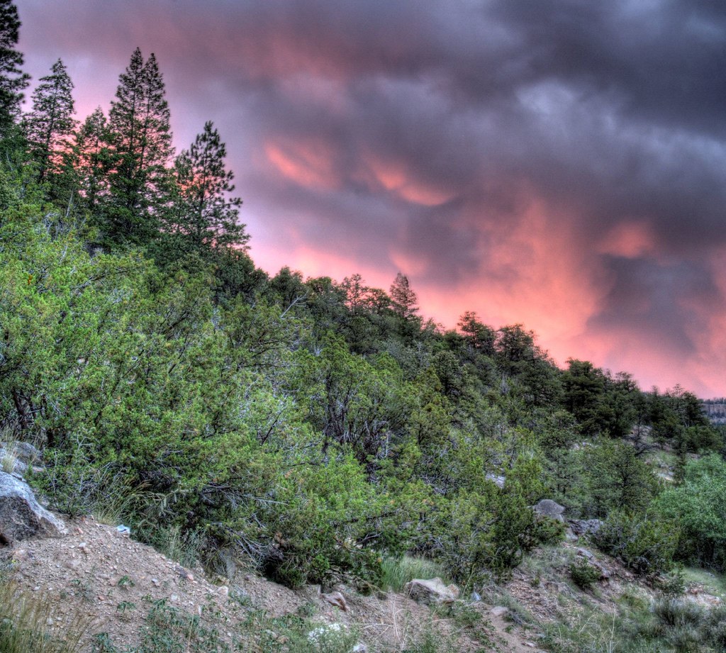
Smoky Jemez Cliffs

Thompson Ridge Fire
Sunset Through the Wildfire
Valles Caldera
Valle Grande
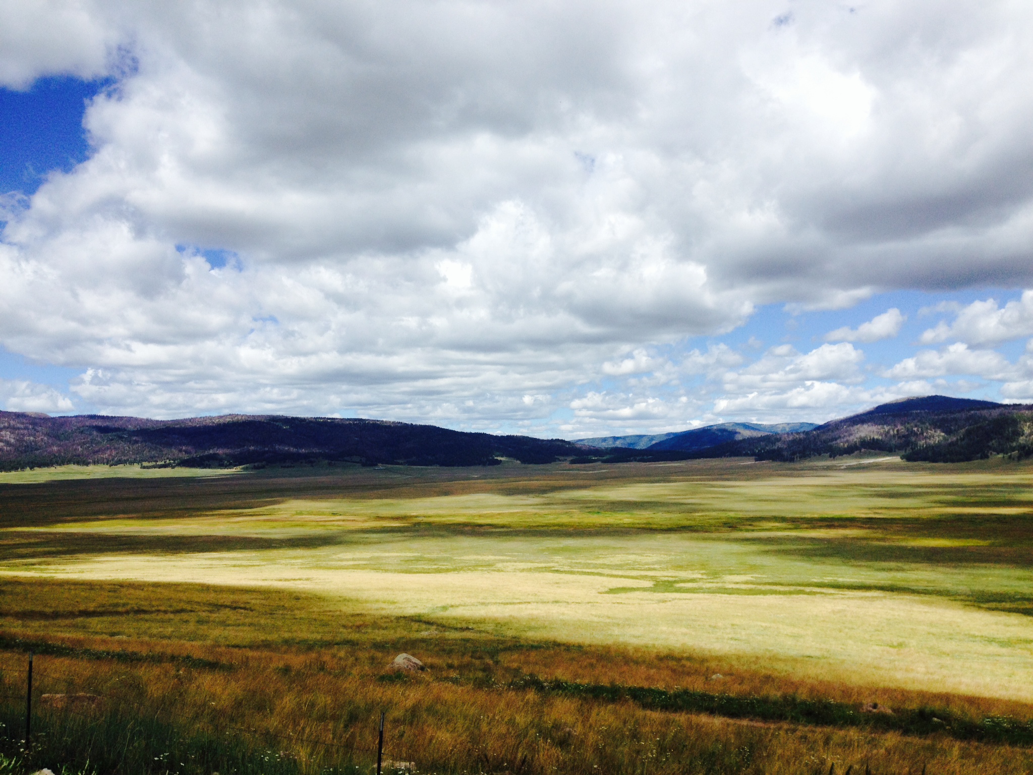
Valles Caldera
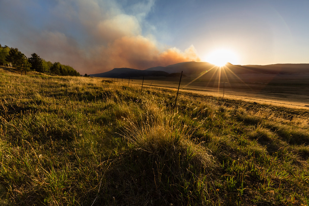
Thompson Ridge Fire
Sunset over SodaDam
アメリカ合衆国 〒 ニューメキシコ州 シエラ・デ・ロス・ピノスの地図
別の場所を検索
近所の場所
74 Calypso Ln, Jemez Springs, NM アメリカ合衆国
99 Juniper Rd, Jemez Springs, NM アメリカ合衆国
San Diego Loop, Jemez Springs, NM アメリカ合衆国
アメリカ合衆国 〒 ニューメキシコ州 テント・ロックス
Horseshoe Hollow, Jemez Springs, NM アメリカ合衆国
Valles Caldera, New Mexico アメリカ合衆国
アメリカ合衆国 〒 ニューメキシコ州 ジェメス・スプリングス
アメリカ合衆国 〒 ニューメキシコ州 サン・アントニオ山
Jemez Springs, NM アメリカ合衆国San Antonio Hot Springs
Jemez Springs, NM アメリカ合衆国カシャ=カトゥウ・テント・ロックス・ナショナル・モニュメント - ベタラン・メモリアル・オーバールック
アメリカ合衆国 ニューメキシコ州 ジェメス・プエブロ
アメリカ合衆国 ニューメキシコ州 サンドヴァル
アメリカ合衆国 〒 ニューメキシコ州 ロス・アラモス
アメリカ合衆国 〒 ニューメキシコ州 ホワイト・ロック
48th St, Los Alamos, NM アメリカ合衆国
42nd St, Los Alamos, NM アメリカ合衆国
15 Entrance Rd, Los Alamos, NM アメリカ合衆国バンデリア国定公園
37th St, Los Alamos, NM アメリカ合衆国
アメリカ合衆国 〒 ニューメキシコ州 ビッグ山
アメリカ合衆国 〒 ニューメキシコ州 ロス・アラモス
最近の検索
- アメリカ合衆国 アラスカ州 レッド・ドッグ・マイン日の出日の入り時間
- Am bhf, Borken, ドイツアム・バーンホーフ日の出日の入り時間
- 4th St E, Sonoma, CA, USA日の出日の入り時間
- Oakland Ave, Williamsport, PA アメリカ合衆国日の出日の入り時間
- Via Roma, Pieranica CR, イタリアローマ通り日の出日の入り時間
- クロアチア 〒 ドゥブロブニク GradClock Tower of Dubrovnik日の出日の入り時間
- アルゼンチン チュブ州 トレリュー日の出日の入り時間
- Hartfords Bluff Cir, Mt Pleasant, SC アメリカ合衆国日の出日の入り時間
- 日本、熊本県熊本市北区日の出日の入り時間
- 中華人民共和国 福州市 平潭県 平潭島日の出日の入り時間