日本, 兵庫県篠山市日の出日の入り時間
Location: 日本 > 兵庫県 >
時間帯:
Asia/Tokyo
現地時間:
2025-07-08 23:37:41
経度:
135.2190508
緯度:
35.0756607
今日の日の出時刻:
04:52:10 AM
今日の日の入時刻:
07:16:20 PM
今日の日長:
14h 24m 10s
明日の日の出時刻:
04:52:44 AM
明日の日の入時刻:
07:16:04 PM
明日の日長:
14h 23m 20s
すべて表示する
| 日付 | 日出 | 日没 | 日長 |
|---|---|---|---|
| 2025年01月01日 | 07:07:13 AM | 04:58:09 PM | 9h 50m 56s |
| 2025年01月02日 | 07:07:23 AM | 04:58:55 PM | 9h 51m 32s |
| 2025年01月03日 | 07:07:31 AM | 04:59:42 PM | 9h 52m 11s |
| 2025年01月04日 | 07:07:38 AM | 05:00:31 PM | 9h 52m 53s |
| 2025年01月05日 | 07:07:42 AM | 05:01:20 PM | 9h 53m 38s |
| 2025年01月06日 | 07:07:44 AM | 05:02:11 PM | 9h 54m 27s |
| 2025年01月07日 | 07:07:45 AM | 05:03:02 PM | 9h 55m 17s |
| 2025年01月08日 | 07:07:43 AM | 05:03:55 PM | 9h 56m 12s |
| 2025年01月09日 | 07:07:40 AM | 05:04:48 PM | 9h 57m 8s |
| 2025年01月10日 | 07:07:35 AM | 05:05:42 PM | 9h 58m 7s |
| 2025年01月11日 | 07:07:27 AM | 05:06:37 PM | 9h 59m 10s |
| 2025年01月12日 | 07:07:18 AM | 05:07:32 PM | 10h 0m 14s |
| 2025年01月13日 | 07:07:07 AM | 05:08:29 PM | 10h 1m 22s |
| 2025年01月14日 | 07:06:54 AM | 05:09:26 PM | 10h 2m 32s |
| 2025年01月15日 | 07:06:39 AM | 05:10:23 PM | 10h 3m 44s |
| 2025年01月16日 | 07:06:23 AM | 05:11:21 PM | 10h 4m 58s |
| 2025年01月17日 | 07:06:04 AM | 05:12:20 PM | 10h 6m 16s |
| 2025年01月18日 | 07:05:44 AM | 05:13:19 PM | 10h 7m 35s |
| 2025年01月19日 | 07:05:21 AM | 05:14:18 PM | 10h 8m 57s |
| 2025年01月20日 | 07:04:57 AM | 05:15:18 PM | 10h 10m 21s |
| 2025年01月21日 | 07:04:31 AM | 05:16:18 PM | 10h 11m 47s |
| 2025年01月22日 | 07:04:03 AM | 05:17:19 PM | 10h 13m 16s |
| 2025年01月23日 | 07:03:34 AM | 05:18:19 PM | 10h 14m 45s |
| 2025年01月24日 | 07:03:02 AM | 05:19:20 PM | 10h 16m 18s |
| 2025年01月25日 | 07:02:29 AM | 05:20:21 PM | 10h 17m 52s |
| 2025年01月26日 | 07:01:54 AM | 05:21:22 PM | 10h 19m 28s |
| 2025年01月27日 | 07:01:18 AM | 05:22:23 PM | 10h 21m 5s |
| 2025年01月28日 | 07:00:40 AM | 05:23:25 PM | 10h 22m 45s |
| 2025年01月29日 | 07:00:00 AM | 05:24:26 PM | 10h 24m 26s |
| 2025年01月30日 | 06:59:18 AM | 05:25:27 PM | 10h 26m 9s |
| 2025年01月31日 | 06:58:35 AM | 05:26:29 PM | 10h 27m 54s |
| 2025年02月01日 | 06:57:51 AM | 05:27:30 PM | 10h 29m 39s |
| 2025年02月02日 | 06:57:04 AM | 05:28:31 PM | 10h 31m 27s |
| 2025年02月03日 | 06:56:17 AM | 05:29:32 PM | 10h 33m 15s |
| 2025年02月04日 | 06:55:28 AM | 05:30:33 PM | 10h 35m 5s |
| 2025年02月05日 | 06:54:37 AM | 05:31:34 PM | 10h 36m 57s |
| 2025年02月06日 | 06:53:45 AM | 05:32:34 PM | 10h 38m 49s |
| 2025年02月07日 | 06:52:51 AM | 05:33:35 PM | 10h 40m 44s |
| 2025年02月08日 | 06:51:56 AM | 05:34:35 PM | 10h 42m 39s |
| 2025年02月09日 | 06:51:00 AM | 05:35:35 PM | 10h 44m 35s |
| 2025年02月10日 | 06:50:03 AM | 05:36:34 PM | 10h 46m 31s |
| 2025年02月11日 | 06:49:04 AM | 05:37:34 PM | 10h 48m 30s |
| 2025年02月12日 | 06:48:04 AM | 05:38:33 PM | 10h 50m 29s |
| 2025年02月13日 | 06:47:02 AM | 05:39:32 PM | 10h 52m 30s |
| 2025年02月14日 | 06:46:00 AM | 05:40:30 PM | 10h 54m 30s |
| 2025年02月15日 | 06:44:56 AM | 05:41:29 PM | 10h 56m 33s |
| 2025年02月16日 | 06:43:51 AM | 05:42:27 PM | 10h 58m 36s |
| 2025年02月17日 | 06:42:45 AM | 05:43:24 PM | 11h 0m 39s |
| 2025年02月18日 | 06:41:39 AM | 05:44:22 PM | 11h 2m 43s |
| 2025年02月19日 | 06:40:31 AM | 05:45:19 PM | 11h 4m 48s |
| 2025年02月20日 | 06:39:22 AM | 05:46:15 PM | 11h 6m 53s |
| 2025年02月21日 | 06:38:12 AM | 05:47:11 PM | 11h 8m 59s |
| 2025年02月22日 | 06:37:01 AM | 05:48:07 PM | 11h 11m 6s |
| 2025年02月23日 | 06:35:49 AM | 05:49:03 PM | 11h 13m 14s |
| 2025年02月24日 | 06:34:36 AM | 05:49:58 PM | 11h 15m 22s |
| 2025年02月25日 | 06:33:23 AM | 05:50:53 PM | 11h 17m 30s |
| 2025年02月26日 | 06:32:09 AM | 05:51:48 PM | 11h 19m 39s |
| 2025年02月27日 | 06:30:54 AM | 05:52:42 PM | 11h 21m 48s |
| 2025年02月28日 | 06:29:38 AM | 05:53:36 PM | 11h 23m 58s |
| 2025年03月01日 | 06:28:21 AM | 05:54:30 PM | 11h 26m 9s |
| 2025年03月02日 | 06:27:04 AM | 05:55:23 PM | 11h 28m 19s |
| 2025年03月03日 | 06:25:46 AM | 05:56:16 PM | 11h 30m 30s |
| 2025年03月04日 | 06:24:28 AM | 05:57:09 PM | 11h 32m 41s |
| 2025年03月05日 | 06:23:09 AM | 05:58:01 PM | 11h 34m 52s |
| 2025年03月06日 | 06:21:49 AM | 05:58:53 PM | 11h 37m 4s |
| 2025年03月07日 | 06:20:29 AM | 05:59:45 PM | 11h 39m 16s |
| 2025年03月08日 | 06:19:08 AM | 06:00:36 PM | 11h 41m 28s |
| 2025年03月09日 | 06:17:47 AM | 06:01:28 PM | 11h 43m 41s |
| 2025年03月10日 | 06:16:25 AM | 06:02:19 PM | 11h 45m 54s |
| 2025年03月11日 | 06:15:03 AM | 06:03:09 PM | 11h 48m 6s |
| 2025年03月12日 | 06:13:41 AM | 06:04:00 PM | 11h 50m 19s |
| 2025年03月13日 | 06:12:18 AM | 06:04:50 PM | 11h 52m 32s |
| 2025年03月14日 | 06:10:55 AM | 06:05:40 PM | 11h 54m 45s |
| 2025年03月15日 | 06:09:32 AM | 06:06:30 PM | 11h 56m 58s |
| 2025年03月16日 | 06:08:09 AM | 06:07:20 PM | 11h 59m 11s |
| 2025年03月17日 | 06:06:45 AM | 06:08:09 PM | 12h 1m 24s |
| 2025年03月18日 | 06:05:21 AM | 06:08:58 PM | 12h 3m 37s |
| 2025年03月19日 | 06:03:57 AM | 06:09:47 PM | 12h 5m 50s |
| 2025年03月20日 | 06:02:32 AM | 06:10:36 PM | 12h 8m 4s |
| 2025年03月21日 | 06:01:08 AM | 06:11:25 PM | 12h 10m 17s |
| 2025年03月22日 | 05:59:44 AM | 06:12:14 PM | 12h 12m 30s |
| 2025年03月23日 | 05:58:19 AM | 06:13:02 PM | 12h 14m 43s |
| 2025年03月24日 | 05:56:55 AM | 06:13:51 PM | 12h 16m 56s |
| 2025年03月25日 | 05:55:30 AM | 06:14:39 PM | 12h 19m 9s |
| 2025年03月26日 | 05:54:06 AM | 06:15:27 PM | 12h 21m 21s |
| 2025年03月27日 | 05:52:41 AM | 06:16:16 PM | 12h 23m 35s |
| 2025年03月28日 | 05:51:17 AM | 06:17:04 PM | 12h 25m 47s |
| 2025年03月29日 | 05:49:53 AM | 06:17:52 PM | 12h 27m 59s |
| 2025年03月30日 | 05:48:29 AM | 06:18:40 PM | 12h 30m 11s |
| 2025年03月31日 | 05:47:05 AM | 06:19:28 PM | 12h 32m 23s |
| 2025年04月01日 | 05:45:41 AM | 06:20:16 PM | 12h 34m 35s |
| 2025年04月02日 | 05:44:18 AM | 06:21:04 PM | 12h 36m 46s |
| 2025年04月03日 | 05:42:55 AM | 06:21:51 PM | 12h 38m 56s |
| 2025年04月04日 | 05:41:32 AM | 06:22:39 PM | 12h 41m 7s |
| 2025年04月05日 | 05:40:10 AM | 06:23:27 PM | 12h 43m 17s |
| 2025年04月06日 | 05:38:48 AM | 06:24:15 PM | 12h 45m 27s |
| 2025年04月07日 | 05:37:26 AM | 06:25:03 PM | 12h 47m 37s |
| 2025年04月08日 | 05:36:05 AM | 06:25:51 PM | 12h 49m 46s |
| 2025年04月09日 | 05:34:44 AM | 06:26:39 PM | 12h 51m 55s |
| 2025年04月10日 | 05:33:23 AM | 06:27:27 PM | 12h 54m 4s |
| 2025年04月11日 | 05:32:04 AM | 06:28:15 PM | 12h 56m 11s |
| 2025年04月12日 | 05:30:44 AM | 06:29:04 PM | 12h 58m 20s |
| 2025年04月13日 | 05:29:26 AM | 06:29:52 PM | 13h 0m 26s |
| 2025年04月14日 | 05:28:07 AM | 06:30:40 PM | 13h 2m 33s |
| 2025年04月15日 | 05:26:50 AM | 06:31:28 PM | 13h 4m 38s |
| 2025年04月16日 | 05:25:33 AM | 06:32:17 PM | 13h 6m 44s |
| 2025年04月17日 | 05:24:17 AM | 06:33:05 PM | 13h 8m 48s |
| 2025年04月18日 | 05:23:01 AM | 06:33:54 PM | 13h 10m 53s |
| 2025年04月19日 | 05:21:46 AM | 06:34:43 PM | 13h 12m 57s |
| 2025年04月20日 | 05:20:32 AM | 06:35:31 PM | 13h 14m 59s |
| 2025年04月21日 | 05:19:19 AM | 06:36:20 PM | 13h 17m 1s |
| 2025年04月22日 | 05:18:07 AM | 06:37:09 PM | 13h 19m 2s |
| 2025年04月23日 | 05:16:55 AM | 06:37:58 PM | 13h 21m 3s |
| 2025年04月24日 | 05:15:45 AM | 06:38:46 PM | 13h 23m 1s |
| 2025年04月25日 | 05:14:35 AM | 06:39:35 PM | 13h 25m 0s |
| 2025年04月26日 | 05:13:26 AM | 06:40:24 PM | 13h 26m 58s |
| 2025年04月27日 | 05:12:18 AM | 06:41:13 PM | 13h 28m 55s |
| 2025年04月28日 | 05:11:11 AM | 06:42:02 PM | 13h 30m 51s |
| 2025年04月29日 | 05:10:06 AM | 06:42:51 PM | 13h 32m 45s |
| 2025年04月30日 | 05:09:01 AM | 06:43:40 PM | 13h 34m 39s |
| 2025年05月01日 | 05:07:57 AM | 06:44:29 PM | 13h 36m 32s |
| 2025年05月02日 | 05:06:54 AM | 06:45:18 PM | 13h 38m 24s |
| 2025年05月03日 | 05:05:53 AM | 06:46:07 PM | 13h 40m 14s |
| 2025年05月04日 | 05:04:53 AM | 06:46:56 PM | 13h 42m 3s |
| 2025年05月05日 | 05:03:53 AM | 06:47:45 PM | 13h 43m 52s |
| 2025年05月06日 | 05:02:55 AM | 06:48:34 PM | 13h 45m 39s |
| 2025年05月07日 | 05:01:59 AM | 06:49:23 PM | 13h 47m 24s |
| 2025年05月08日 | 05:01:03 AM | 06:50:11 PM | 13h 49m 8s |
| 2025年05月09日 | 05:00:09 AM | 06:50:59 PM | 13h 50m 50s |
| 2025年05月10日 | 04:59:16 AM | 06:51:48 PM | 13h 52m 32s |
| 2025年05月11日 | 04:58:25 AM | 06:52:36 PM | 13h 54m 11s |
| 2025年05月12日 | 04:57:34 AM | 06:53:24 PM | 13h 55m 50s |
| 2025年05月13日 | 04:56:46 AM | 06:54:11 PM | 13h 57m 25s |
| 2025年05月14日 | 04:55:58 AM | 06:54:59 PM | 13h 59m 1s |
| 2025年05月15日 | 04:55:12 AM | 06:55:46 PM | 14h 0m 34s |
| 2025年05月16日 | 04:54:28 AM | 06:56:32 PM | 14h 2m 4s |
| 2025年05月17日 | 04:53:44 AM | 06:57:19 PM | 14h 3m 35s |
| 2025年05月18日 | 04:53:03 AM | 06:58:05 PM | 14h 5m 2s |
| 2025年05月19日 | 04:52:23 AM | 06:58:50 PM | 14h 6m 27s |
| 2025年05月20日 | 04:51:44 AM | 06:59:36 PM | 14h 7m 52s |
| 2025年05月21日 | 04:51:07 AM | 07:00:20 PM | 14h 9m 13s |
| 2025年05月22日 | 04:50:31 AM | 07:01:05 PM | 14h 10m 34s |
| 2025年05月23日 | 04:49:58 AM | 07:01:49 PM | 14h 11m 51s |
| 2025年05月24日 | 04:49:25 AM | 07:02:32 PM | 14h 13m 7s |
| 2025年05月25日 | 04:48:54 AM | 07:03:14 PM | 14h 14m 20s |
| 2025年05月26日 | 04:48:25 AM | 07:03:56 PM | 14h 15m 31s |
| 2025年05月27日 | 04:47:58 AM | 07:04:38 PM | 14h 16m 40s |
| 2025年05月28日 | 04:47:32 AM | 07:05:18 PM | 14h 17m 46s |
| 2025年05月29日 | 04:47:07 AM | 07:05:58 PM | 14h 18m 51s |
| 2025年05月30日 | 04:46:45 AM | 07:06:37 PM | 14h 19m 52s |
| 2025年05月31日 | 04:46:24 AM | 07:07:16 PM | 14h 20m 52s |
| 2025年06月01日 | 04:46:04 AM | 07:07:53 PM | 14h 21m 49s |
| 2025年06月02日 | 04:45:46 AM | 07:08:30 PM | 14h 22m 44s |
| 2025年06月03日 | 04:45:30 AM | 07:09:06 PM | 14h 23m 36s |
| 2025年06月04日 | 04:45:16 AM | 07:09:40 PM | 14h 24m 24s |
| 2025年06月05日 | 04:45:03 AM | 07:10:14 PM | 14h 25m 11s |
| 2025年06月06日 | 04:44:52 AM | 07:10:47 PM | 14h 25m 55s |
| 2025年06月07日 | 04:44:43 AM | 07:11:19 PM | 14h 26m 36s |
| 2025年06月08日 | 04:44:35 AM | 07:11:50 PM | 14h 27m 15s |
| 2025年06月09日 | 04:44:29 AM | 07:12:19 PM | 14h 27m 50s |
| 2025年06月10日 | 04:44:24 AM | 07:12:47 PM | 14h 28m 23s |
| 2025年06月11日 | 04:44:21 AM | 07:13:15 PM | 14h 28m 54s |
| 2025年06月12日 | 04:44:20 AM | 07:13:41 PM | 14h 29m 21s |
| 2025年06月13日 | 04:44:20 AM | 07:14:05 PM | 14h 29m 45s |
| 2025年06月14日 | 04:44:22 AM | 07:14:29 PM | 14h 30m 7s |
| 2025年06月15日 | 04:44:26 AM | 07:14:51 PM | 14h 30m 25s |
| 2025年06月16日 | 04:44:31 AM | 07:15:12 PM | 14h 30m 41s |
| 2025年06月17日 | 04:44:37 AM | 07:15:31 PM | 14h 30m 54s |
| 2025年06月18日 | 04:44:45 AM | 07:15:49 PM | 14h 31m 4s |
| 2025年06月19日 | 04:44:55 AM | 07:16:05 PM | 14h 31m 10s |
| 2025年06月20日 | 04:45:06 AM | 07:16:21 PM | 14h 31m 15s |
| 2025年06月21日 | 04:45:19 AM | 07:16:34 PM | 14h 31m 15s |
| 2025年06月22日 | 04:45:33 AM | 07:16:46 PM | 14h 31m 13s |
| 2025年06月23日 | 04:45:48 AM | 07:16:57 PM | 14h 31m 9s |
| 2025年06月24日 | 04:46:05 AM | 07:17:06 PM | 14h 31m 1s |
| 2025年06月25日 | 04:46:23 AM | 07:17:13 PM | 14h 30m 50s |
| 2025年06月26日 | 04:46:42 AM | 07:17:19 PM | 14h 30m 37s |
| 2025年06月27日 | 04:47:03 AM | 07:17:23 PM | 14h 30m 20s |
| 2025年06月28日 | 04:47:25 AM | 07:17:26 PM | 14h 30m 1s |
| 2025年06月29日 | 04:47:49 AM | 07:17:27 PM | 14h 29m 38s |
| 2025年06月30日 | 04:48:13 AM | 07:17:26 PM | 14h 29m 13s |
| 2025年07月01日 | 04:48:39 AM | 07:17:24 PM | 14h 28m 45s |
| 2025年07月02日 | 04:49:06 AM | 07:17:20 PM | 14h 28m 14s |
| 2025年07月03日 | 04:49:33 AM | 07:17:14 PM | 14h 27m 41s |
| 2025年07月04日 | 04:50:02 AM | 07:17:07 PM | 14h 27m 5s |
| 2025年07月05日 | 04:50:32 AM | 07:16:58 PM | 14h 26m 26s |
| 2025年07月06日 | 04:51:04 AM | 07:16:47 PM | 14h 25m 43s |
| 2025年07月07日 | 04:51:36 AM | 07:16:34 PM | 14h 24m 58s |
| 2025年07月08日 | 04:52:08 AM | 07:16:20 PM | 14h 24m 12s |
| 2025年07月09日 | 04:52:42 AM | 07:16:04 PM | 14h 23m 22s |
| 2025年07月10日 | 04:53:17 AM | 07:15:47 PM | 14h 22m 30s |
| 2025年07月11日 | 04:53:52 AM | 07:15:28 PM | 14h 21m 36s |
| 2025年07月12日 | 04:54:29 AM | 07:15:07 PM | 14h 20m 38s |
| 2025年07月13日 | 04:55:06 AM | 07:14:44 PM | 14h 19m 38s |
| 2025年07月14日 | 04:55:44 AM | 07:14:20 PM | 14h 18m 36s |
| 2025年07月15日 | 04:56:22 AM | 07:13:54 PM | 14h 17m 32s |
| 2025年07月16日 | 04:57:01 AM | 07:13:26 PM | 14h 16m 25s |
| 2025年07月17日 | 04:57:41 AM | 07:12:57 PM | 14h 15m 16s |
| 2025年07月18日 | 04:58:21 AM | 07:12:26 PM | 14h 14m 5s |
| 2025年07月19日 | 04:59:02 AM | 07:11:53 PM | 14h 12m 51s |
| 2025年07月20日 | 04:59:43 AM | 07:11:19 PM | 14h 11m 36s |
| 2025年07月21日 | 05:00:25 AM | 07:10:44 PM | 14h 10m 19s |
| 2025年07月22日 | 05:01:07 AM | 07:10:06 PM | 14h 8m 59s |
| 2025年07月23日 | 05:01:50 AM | 07:09:27 PM | 14h 7m 37s |
| 2025年07月24日 | 05:02:33 AM | 07:08:47 PM | 14h 6m 14s |
| 2025年07月25日 | 05:03:16 AM | 07:08:05 PM | 14h 4m 49s |
| 2025年07月26日 | 05:04:00 AM | 07:07:21 PM | 14h 3m 21s |
| 2025年07月27日 | 05:04:44 AM | 07:06:36 PM | 14h 1m 52s |
| 2025年07月28日 | 05:05:28 AM | 07:05:50 PM | 14h 0m 22s |
| 2025年07月29日 | 05:06:13 AM | 07:05:02 PM | 13h 58m 49s |
| 2025年07月30日 | 05:06:57 AM | 07:04:13 PM | 13h 57m 16s |
| 2025年07月31日 | 05:07:42 AM | 07:03:22 PM | 13h 55m 40s |
| 2025年08月01日 | 05:08:27 AM | 07:02:30 PM | 13h 54m 3s |
| 2025年08月02日 | 05:09:13 AM | 07:01:36 PM | 13h 52m 23s |
| 2025年08月03日 | 05:09:58 AM | 07:00:41 PM | 13h 50m 43s |
| 2025年08月04日 | 05:10:44 AM | 06:59:45 PM | 13h 49m 1s |
| 2025年08月05日 | 05:11:29 AM | 06:58:48 PM | 13h 47m 19s |
| 2025年08月06日 | 05:12:15 AM | 06:57:49 PM | 13h 45m 34s |
| 2025年08月07日 | 05:13:00 AM | 06:56:49 PM | 13h 43m 49s |
| 2025年08月08日 | 05:13:46 AM | 06:55:48 PM | 13h 42m 2s |
| 2025年08月09日 | 05:14:32 AM | 06:54:46 PM | 13h 40m 14s |
| 2025年08月10日 | 05:15:17 AM | 06:53:42 PM | 13h 38m 25s |
| 2025年08月11日 | 05:16:03 AM | 06:52:38 PM | 13h 36m 35s |
| 2025年08月12日 | 05:16:49 AM | 06:51:32 PM | 13h 34m 43s |
| 2025年08月13日 | 05:17:34 AM | 06:50:25 PM | 13h 32m 51s |
| 2025年08月14日 | 05:18:20 AM | 06:49:17 PM | 13h 30m 57s |
| 2025年08月15日 | 05:19:06 AM | 06:48:08 PM | 13h 29m 2s |
| 2025年08月16日 | 05:19:51 AM | 06:46:58 PM | 13h 27m 7s |
| 2025年08月17日 | 05:20:36 AM | 06:45:48 PM | 13h 25m 12s |
| 2025年08月18日 | 05:21:22 AM | 06:44:36 PM | 13h 23m 14s |
| 2025年08月19日 | 05:22:07 AM | 06:43:23 PM | 13h 21m 16s |
| 2025年08月20日 | 05:22:52 AM | 06:42:10 PM | 13h 19m 18s |
| 2025年08月21日 | 05:23:37 AM | 06:40:55 PM | 13h 17m 18s |
| 2025年08月22日 | 05:24:22 AM | 06:39:40 PM | 13h 15m 18s |
| 2025年08月23日 | 05:25:07 AM | 06:38:24 PM | 13h 13m 17s |
| 2025年08月24日 | 05:25:52 AM | 06:37:07 PM | 13h 11m 15s |
| 2025年08月25日 | 05:26:36 AM | 06:35:49 PM | 13h 9m 13s |
| 2025年08月26日 | 05:27:21 AM | 06:34:31 PM | 13h 7m 10s |
| 2025年08月27日 | 05:28:05 AM | 06:33:12 PM | 13h 5m 7s |
| 2025年08月28日 | 05:28:50 AM | 06:31:53 PM | 13h 3m 3s |
| 2025年08月29日 | 05:29:34 AM | 06:30:32 PM | 13h 0m 58s |
| 2025年08月30日 | 05:30:18 AM | 06:29:11 PM | 12h 58m 53s |
| 2025年08月31日 | 05:31:02 AM | 06:27:50 PM | 12h 56m 48s |
| 2025年09月01日 | 05:31:47 AM | 06:26:28 PM | 12h 54m 41s |
| 2025年09月02日 | 05:32:30 AM | 06:25:06 PM | 12h 52m 36s |
| 2025年09月03日 | 05:33:14 AM | 06:23:43 PM | 12h 50m 29s |
| 2025年09月04日 | 05:33:58 AM | 06:22:19 PM | 12h 48m 21s |
| 2025年09月05日 | 05:34:42 AM | 06:20:55 PM | 12h 46m 13s |
| 2025年09月06日 | 05:35:26 AM | 06:19:31 PM | 12h 44m 5s |
| 2025年09月07日 | 05:36:09 AM | 06:18:07 PM | 12h 41m 58s |
| 2025年09月08日 | 05:36:53 AM | 06:16:42 PM | 12h 39m 49s |
| 2025年09月09日 | 05:37:37 AM | 06:15:16 PM | 12h 37m 39s |
| 2025年09月10日 | 05:38:20 AM | 06:13:51 PM | 12h 35m 31s |
| 2025年09月11日 | 05:39:04 AM | 06:12:25 PM | 12h 33m 21s |
| 2025年09月12日 | 05:39:48 AM | 06:10:59 PM | 12h 31m 11s |
| 2025年09月13日 | 05:40:31 AM | 06:09:33 PM | 12h 29m 2s |
| 2025年09月14日 | 05:41:15 AM | 06:08:06 PM | 12h 26m 51s |
| 2025年09月15日 | 05:41:59 AM | 06:06:40 PM | 12h 24m 41s |
| 2025年09月16日 | 05:42:43 AM | 06:05:13 PM | 12h 22m 30s |
| 2025年09月17日 | 05:43:27 AM | 06:03:46 PM | 12h 20m 19s |
| 2025年09月18日 | 05:44:10 AM | 06:02:20 PM | 12h 18m 10s |
| 2025年09月19日 | 05:44:54 AM | 06:00:53 PM | 12h 15m 59s |
| 2025年09月20日 | 05:45:39 AM | 05:59:26 PM | 12h 13m 47s |
| 2025年09月21日 | 05:46:23 AM | 05:57:59 PM | 12h 11m 36s |
| 2025年09月22日 | 05:47:07 AM | 05:56:32 PM | 12h 9m 25s |
| 2025年09月23日 | 05:47:52 AM | 05:55:06 PM | 12h 7m 14s |
| 2025年09月24日 | 05:48:36 AM | 05:53:39 PM | 12h 5m 3s |
| 2025年09月25日 | 05:49:21 AM | 05:52:13 PM | 12h 2m 52s |
| 2025年09月26日 | 05:50:06 AM | 05:50:46 PM | 12h 0m 40s |
| 2025年09月27日 | 05:50:51 AM | 05:49:20 PM | 11h 58m 29s |
| 2025年09月28日 | 05:51:36 AM | 05:47:55 PM | 11h 56m 19s |
| 2025年09月29日 | 05:52:22 AM | 05:46:29 PM | 11h 54m 7s |
| 2025年09月30日 | 05:53:08 AM | 05:45:04 PM | 11h 51m 56s |
| 2025年10月01日 | 05:53:54 AM | 05:43:39 PM | 11h 49m 45s |
| 2025年10月02日 | 05:54:40 AM | 05:42:14 PM | 11h 47m 34s |
| 2025年10月03日 | 05:55:26 AM | 05:40:50 PM | 11h 45m 24s |
| 2025年10月04日 | 05:56:13 AM | 05:39:26 PM | 11h 43m 13s |
| 2025年10月05日 | 05:57:00 AM | 05:38:03 PM | 11h 41m 3s |
| 2025年10月06日 | 05:57:47 AM | 05:36:40 PM | 11h 38m 53s |
| 2025年10月07日 | 05:58:35 AM | 05:35:18 PM | 11h 36m 43s |
| 2025年10月08日 | 05:59:23 AM | 05:33:56 PM | 11h 34m 33s |
| 2025年10月09日 | 06:00:11 AM | 05:32:34 PM | 11h 32m 23s |
| 2025年10月10日 | 06:00:59 AM | 05:31:14 PM | 11h 30m 15s |
| 2025年10月11日 | 06:01:48 AM | 05:29:54 PM | 11h 28m 6s |
| 2025年10月12日 | 06:02:37 AM | 05:28:34 PM | 11h 25m 57s |
| 2025年10月13日 | 06:03:27 AM | 05:27:15 PM | 11h 23m 48s |
| 2025年10月14日 | 06:04:16 AM | 05:25:57 PM | 11h 21m 41s |
| 2025年10月15日 | 06:05:07 AM | 05:24:40 PM | 11h 19m 33s |
| 2025年10月16日 | 06:05:57 AM | 05:23:23 PM | 11h 17m 26s |
| 2025年10月17日 | 06:06:48 AM | 05:22:08 PM | 11h 15m 20s |
| 2025年10月18日 | 06:07:39 AM | 05:20:53 PM | 11h 13m 14s |
| 2025年10月19日 | 06:08:31 AM | 05:19:39 PM | 11h 11m 8s |
| 2025年10月20日 | 06:09:23 AM | 05:18:26 PM | 11h 9m 3s |
| 2025年10月21日 | 06:10:15 AM | 05:17:13 PM | 11h 6m 58s |
| 2025年10月22日 | 06:11:08 AM | 05:16:02 PM | 11h 4m 54s |
| 2025年10月23日 | 06:12:01 AM | 05:14:52 PM | 11h 2m 51s |
| 2025年10月24日 | 06:12:54 AM | 05:13:43 PM | 11h 0m 49s |
| 2025年10月25日 | 06:13:48 AM | 05:12:34 PM | 10h 58m 46s |
| 2025年10月26日 | 06:14:42 AM | 05:11:27 PM | 10h 56m 45s |
| 2025年10月27日 | 06:15:37 AM | 05:10:21 PM | 10h 54m 44s |
| 2025年10月28日 | 06:16:32 AM | 05:09:17 PM | 10h 52m 45s |
| 2025年10月29日 | 06:17:27 AM | 05:08:13 PM | 10h 50m 46s |
| 2025年10月30日 | 06:18:22 AM | 05:07:10 PM | 10h 48m 48s |
| 2025年10月31日 | 06:19:18 AM | 05:06:09 PM | 10h 46m 51s |
| 2025年11月01日 | 06:20:14 AM | 05:05:09 PM | 10h 44m 55s |
| 2025年11月02日 | 06:21:11 AM | 05:04:11 PM | 10h 43m 0s |
| 2025年11月03日 | 06:22:07 AM | 05:03:14 PM | 10h 41m 7s |
| 2025年11月04日 | 06:23:04 AM | 05:02:18 PM | 10h 39m 14s |
| 2025年11月05日 | 06:24:01 AM | 05:01:23 PM | 10h 37m 22s |
| 2025年11月06日 | 06:24:59 AM | 05:00:30 PM | 10h 35m 31s |
| 2025年11月07日 | 06:25:56 AM | 04:59:39 PM | 10h 33m 43s |
| 2025年11月08日 | 06:26:54 AM | 04:58:48 PM | 10h 31m 54s |
| 2025年11月09日 | 06:27:52 AM | 04:58:00 PM | 10h 30m 8s |
| 2025年11月10日 | 06:28:50 AM | 04:57:13 PM | 10h 28m 23s |
| 2025年11月11日 | 06:29:49 AM | 04:56:27 PM | 10h 26m 38s |
| 2025年11月12日 | 06:30:47 AM | 04:55:43 PM | 10h 24m 56s |
| 2025年11月13日 | 06:31:46 AM | 04:55:01 PM | 10h 23m 15s |
| 2025年11月14日 | 06:32:44 AM | 04:54:21 PM | 10h 21m 37s |
| 2025年11月15日 | 06:33:43 AM | 04:53:42 PM | 10h 19m 59s |
| 2025年11月16日 | 06:34:41 AM | 04:53:04 PM | 10h 18m 23s |
| 2025年11月17日 | 06:35:39 AM | 04:52:29 PM | 10h 16m 50s |
| 2025年11月18日 | 06:36:38 AM | 04:51:55 PM | 10h 15m 17s |
| 2025年11月19日 | 06:37:36 AM | 04:51:23 PM | 10h 13m 47s |
| 2025年11月20日 | 06:38:34 AM | 04:50:53 PM | 10h 12m 19s |
| 2025年11月21日 | 06:39:32 AM | 04:50:25 PM | 10h 10m 53s |
| 2025年11月22日 | 06:40:30 AM | 04:49:58 PM | 10h 9m 28s |
| 2025年11月23日 | 06:41:27 AM | 04:49:34 PM | 10h 8m 7s |
| 2025年11月24日 | 06:42:24 AM | 04:49:11 PM | 10h 6m 47s |
| 2025年11月25日 | 06:43:21 AM | 04:48:50 PM | 10h 5m 29s |
| 2025年11月26日 | 06:44:17 AM | 04:48:31 PM | 10h 4m 14s |
| 2025年11月27日 | 06:45:13 AM | 04:48:14 PM | 10h 3m 1s |
| 2025年11月28日 | 06:46:08 AM | 04:47:59 PM | 10h 1m 51s |
| 2025年11月29日 | 06:47:03 AM | 04:47:46 PM | 10h 0m 43s |
| 2025年11月30日 | 06:47:57 AM | 04:47:34 PM | 9h 59m 37s |
| 2025年12月01日 | 06:48:51 AM | 04:47:25 PM | 9h 58m 34s |
| 2025年12月02日 | 06:49:44 AM | 04:47:18 PM | 9h 57m 34s |
| 2025年12月03日 | 06:50:36 AM | 04:47:12 PM | 9h 56m 36s |
| 2025年12月04日 | 06:51:27 AM | 04:47:09 PM | 9h 55m 42s |
| 2025年12月05日 | 06:52:18 AM | 04:47:08 PM | 9h 54m 50s |
| 2025年12月06日 | 06:53:08 AM | 04:47:08 PM | 9h 54m 0s |
| 2025年12月07日 | 06:53:57 AM | 04:47:10 PM | 9h 53m 13s |
| 2025年12月08日 | 06:54:44 AM | 04:47:15 PM | 9h 52m 31s |
| 2025年12月09日 | 06:55:31 AM | 04:47:21 PM | 9h 51m 50s |
| 2025年12月10日 | 06:56:17 AM | 04:47:30 PM | 9h 51m 13s |
| 2025年12月11日 | 06:57:02 AM | 04:47:40 PM | 9h 50m 38s |
| 2025年12月12日 | 06:57:45 AM | 04:47:52 PM | 9h 50m 7s |
| 2025年12月13日 | 06:58:28 AM | 04:48:06 PM | 9h 49m 38s |
| 2025年12月14日 | 06:59:09 AM | 04:48:22 PM | 9h 49m 13s |
| 2025年12月15日 | 06:59:49 AM | 04:48:39 PM | 9h 48m 50s |
| 2025年12月16日 | 07:00:27 AM | 04:48:59 PM | 9h 48m 32s |
| 2025年12月17日 | 07:01:04 AM | 04:49:20 PM | 9h 48m 16s |
| 2025年12月18日 | 07:01:40 AM | 04:49:44 PM | 9h 48m 4s |
| 2025年12月19日 | 07:02:14 AM | 04:50:09 PM | 9h 47m 55s |
| 2025年12月20日 | 07:02:47 AM | 04:50:35 PM | 9h 47m 48s |
| 2025年12月21日 | 07:03:18 AM | 04:51:04 PM | 9h 47m 46s |
| 2025年12月22日 | 07:03:48 AM | 04:51:34 PM | 9h 47m 46s |
| 2025年12月23日 | 07:04:16 AM | 04:52:05 PM | 9h 47m 49s |
| 2025年12月24日 | 07:04:42 AM | 04:52:39 PM | 9h 47m 57s |
| 2025年12月25日 | 07:05:07 AM | 04:53:13 PM | 9h 48m 6s |
| 2025年12月26日 | 07:05:30 AM | 04:53:50 PM | 9h 48m 20s |
| 2025年12月27日 | 07:05:51 AM | 04:54:28 PM | 9h 48m 37s |
| 2025年12月28日 | 07:06:10 AM | 04:55:07 PM | 9h 48m 57s |
| 2025年12月29日 | 07:06:28 AM | 04:55:48 PM | 9h 49m 20s |
| 2025年12月30日 | 07:06:44 AM | 04:56:30 PM | 9h 49m 46s |
| 2025年12月31日 | 07:06:58 AM | 04:57:13 PM | 9h 50m 15s |
写真
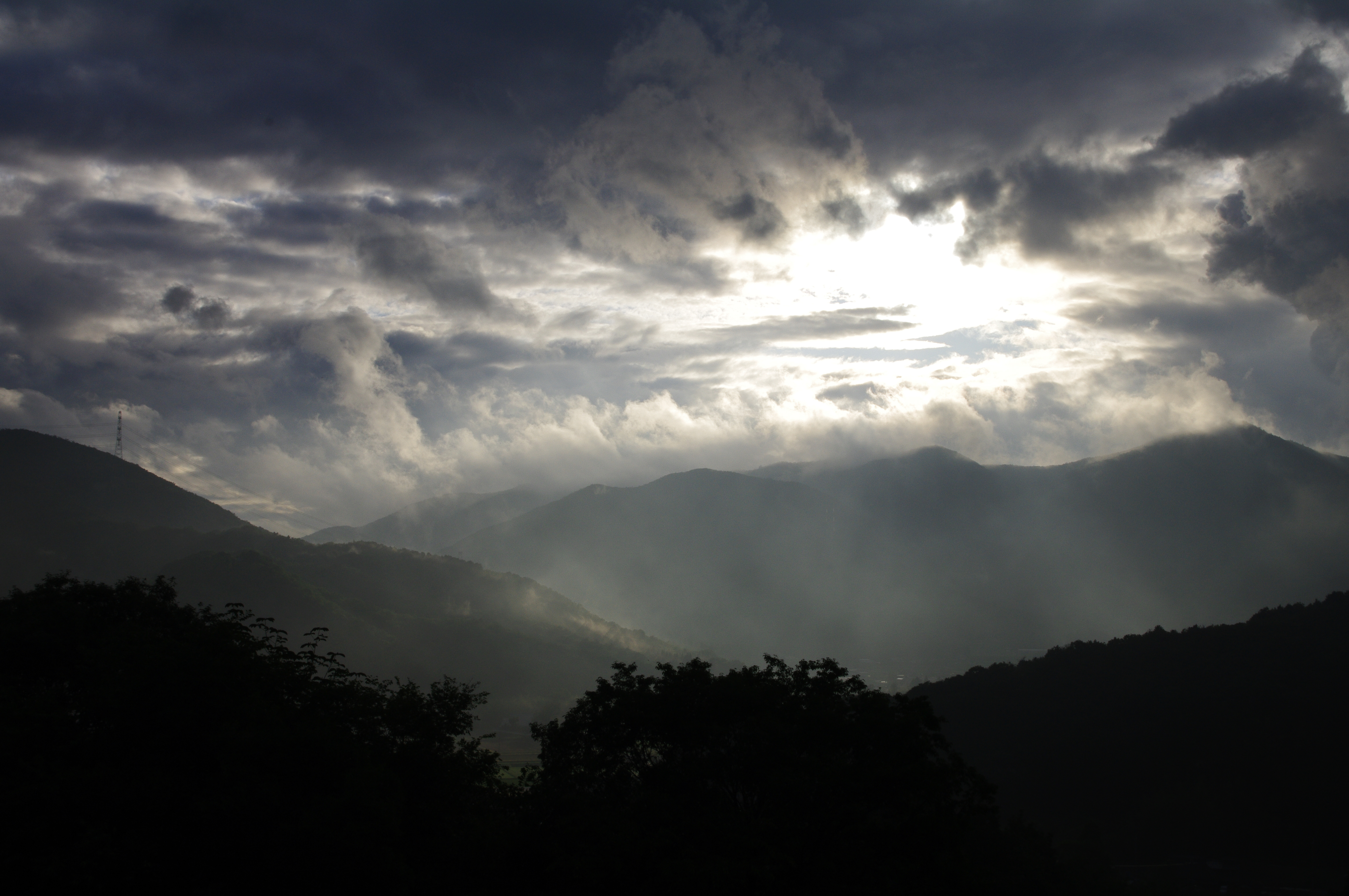
雨上がりの山々
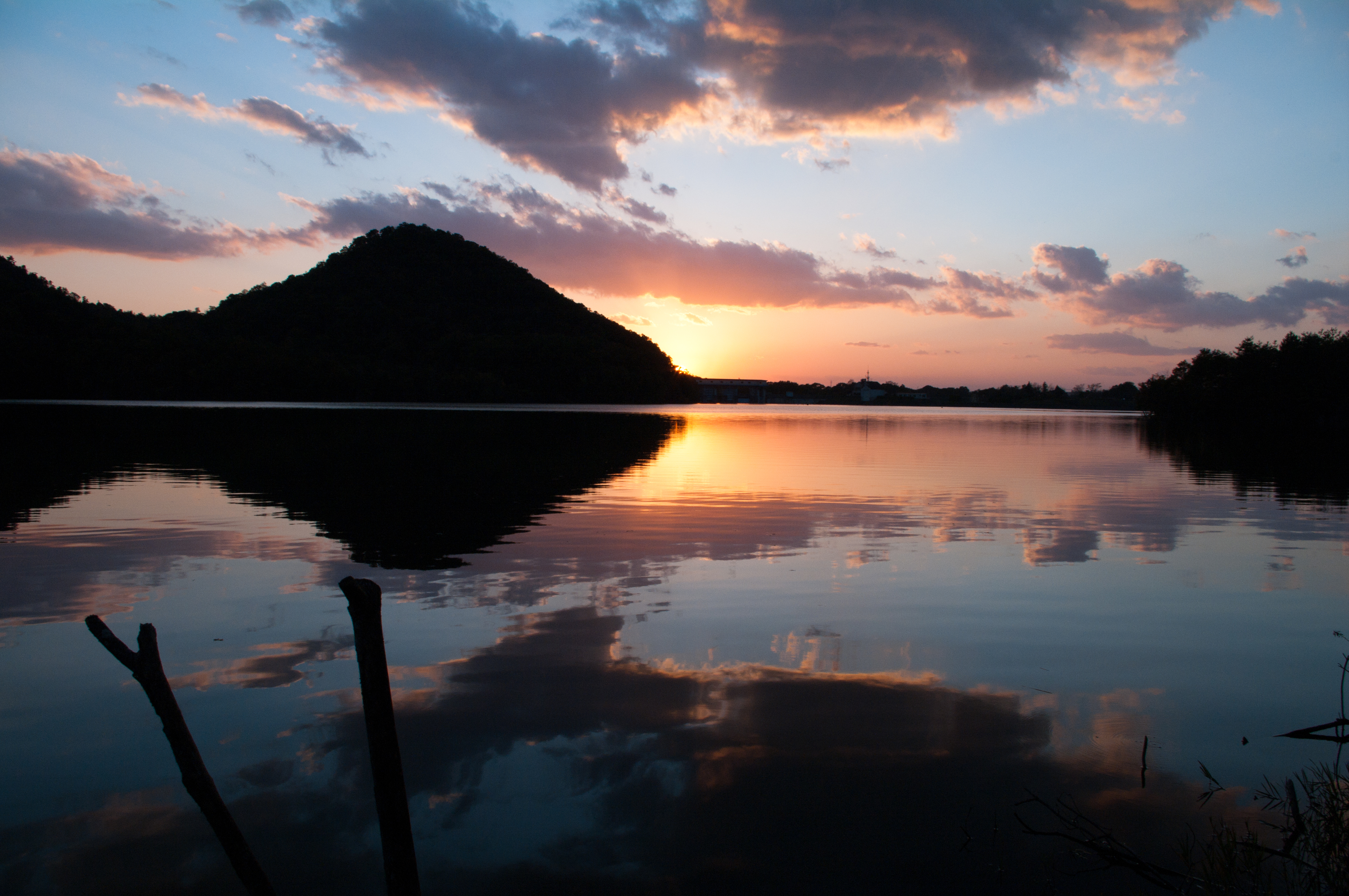
千丈寺湖の夕日 / Sunset at Senjyouji-Lake
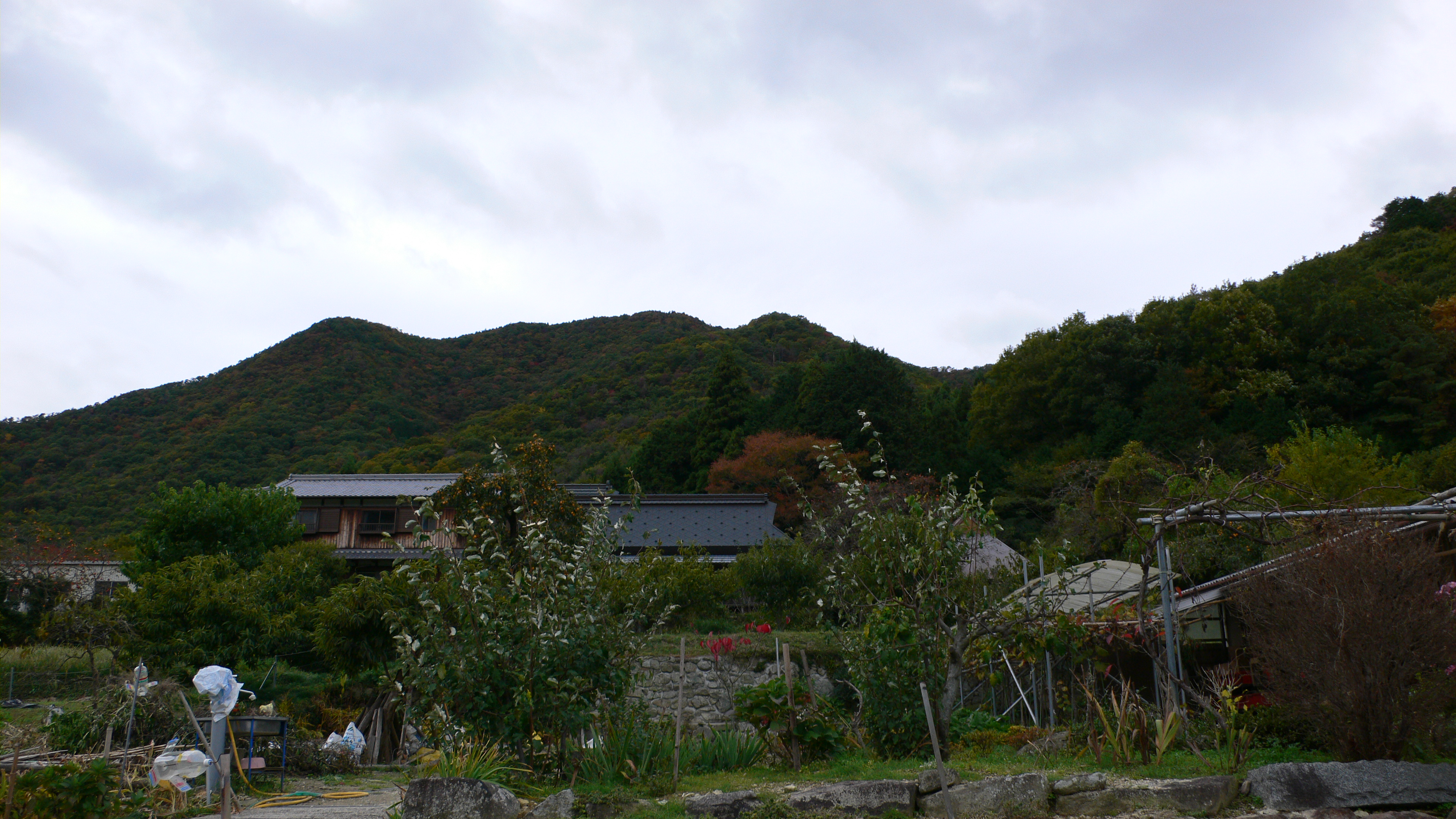
春日町黒井城跡
春日町黒井城跡
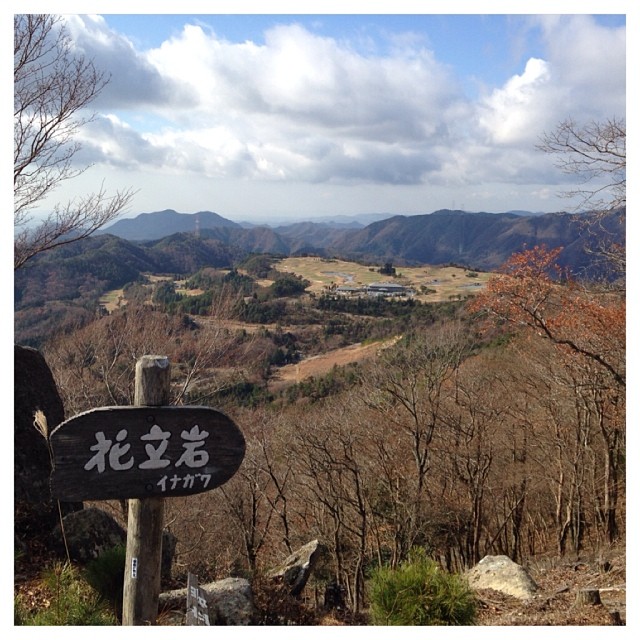
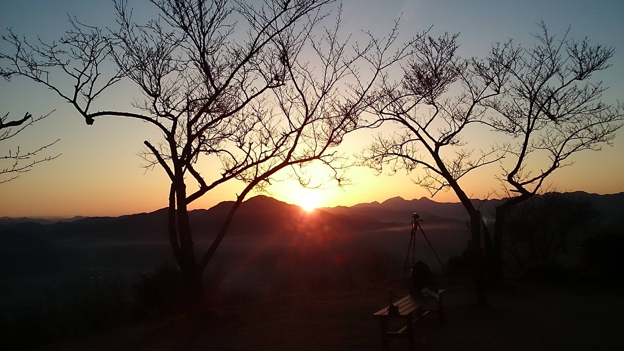
猪名川町ナウ! 大野山ハイキング。まだ誰にも会っていません。 #猪名川町 #大野山 #ハイキング #景色 #絶景 #今 #雲 #山 #眺め #inagawa #mtono #hiking #landscape #now #clouds #view #mountain #nofilter #japan
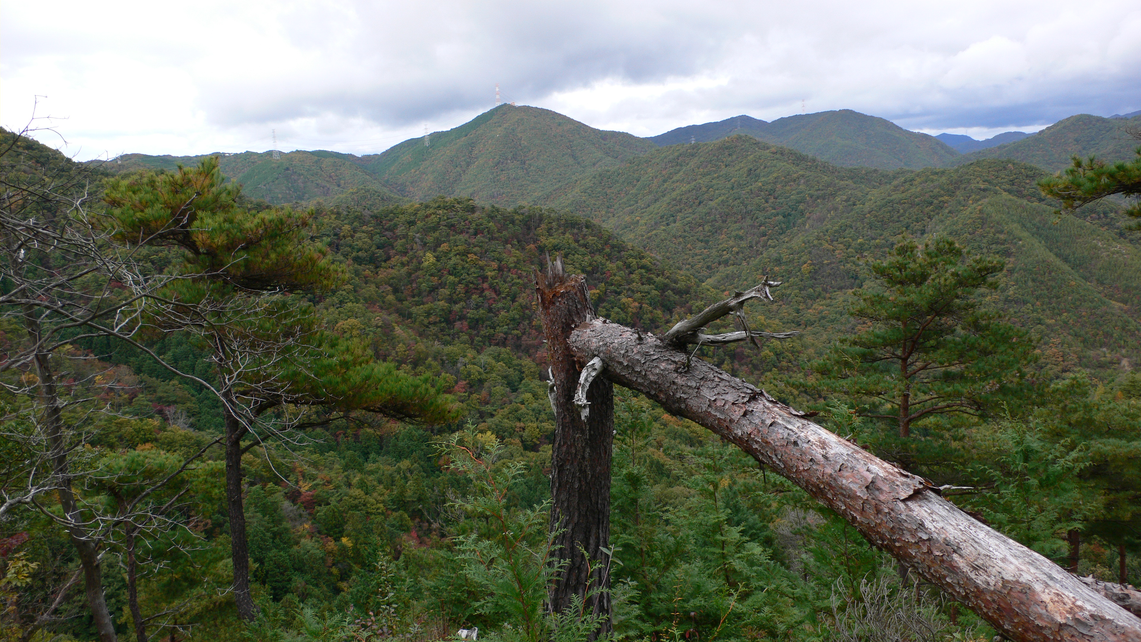
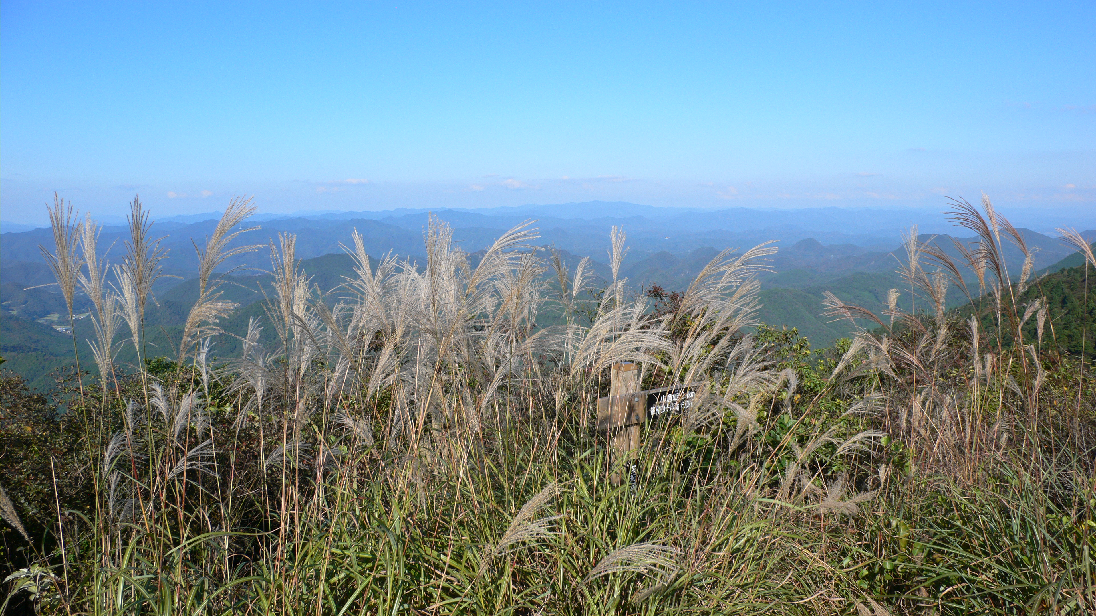
View from Trail of Mt. Senjyouji
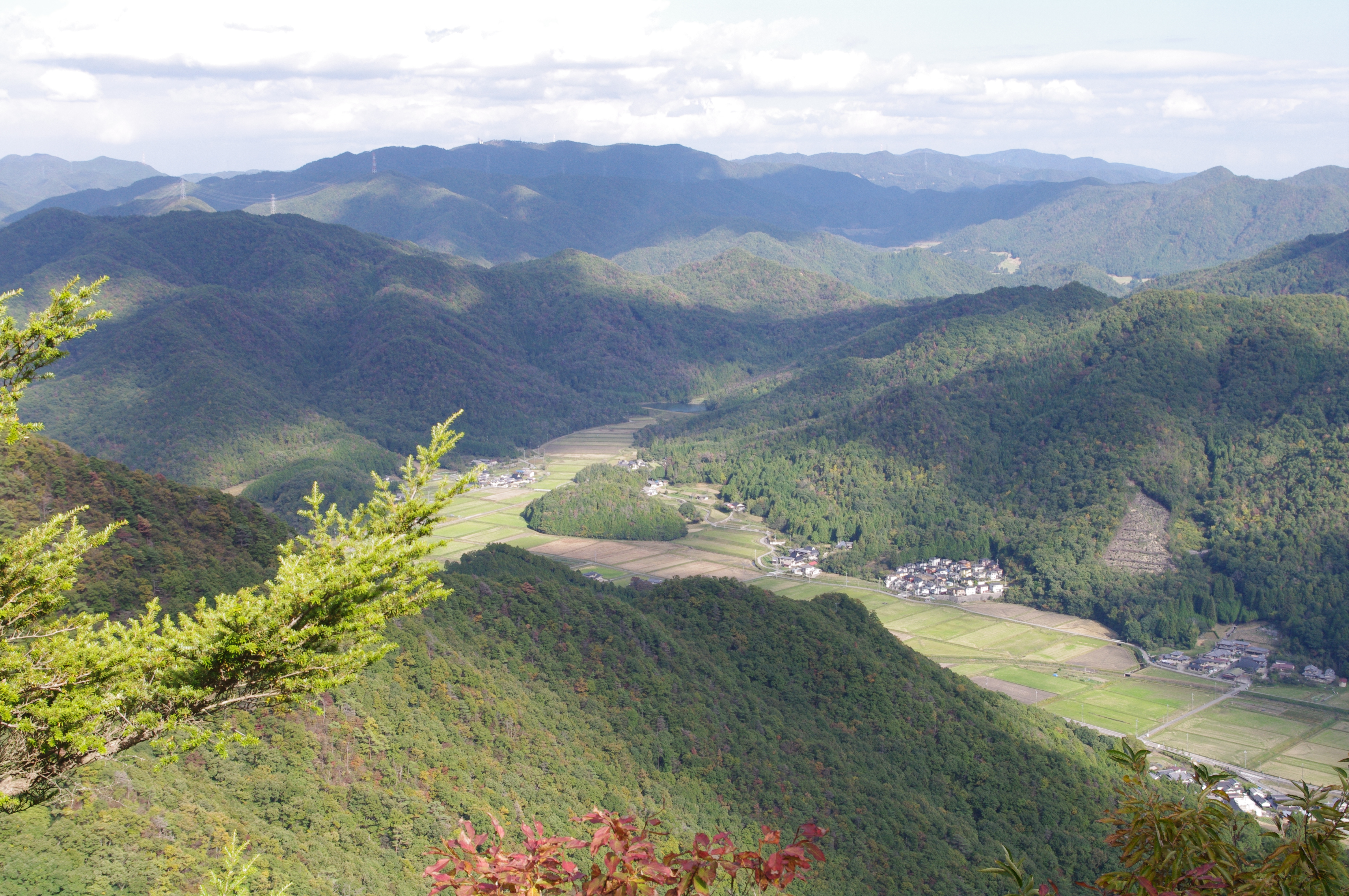
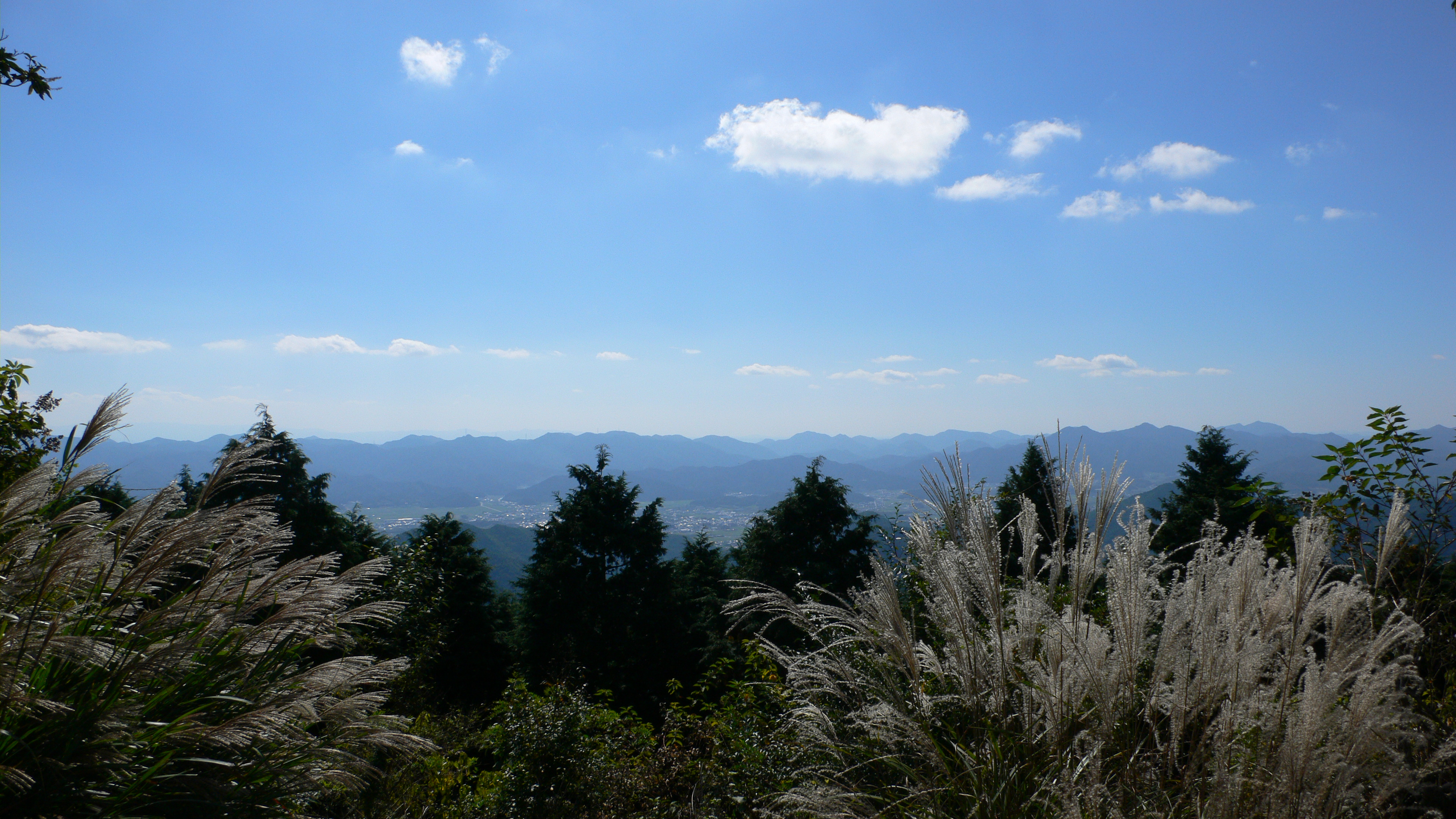
View from Mt.Senjyouji / 仙丈寺山からの展望
View from Mt.Senjyouji / 仙丈寺山からの展望
Mt. Senjyouji View from Starting Point of Trail
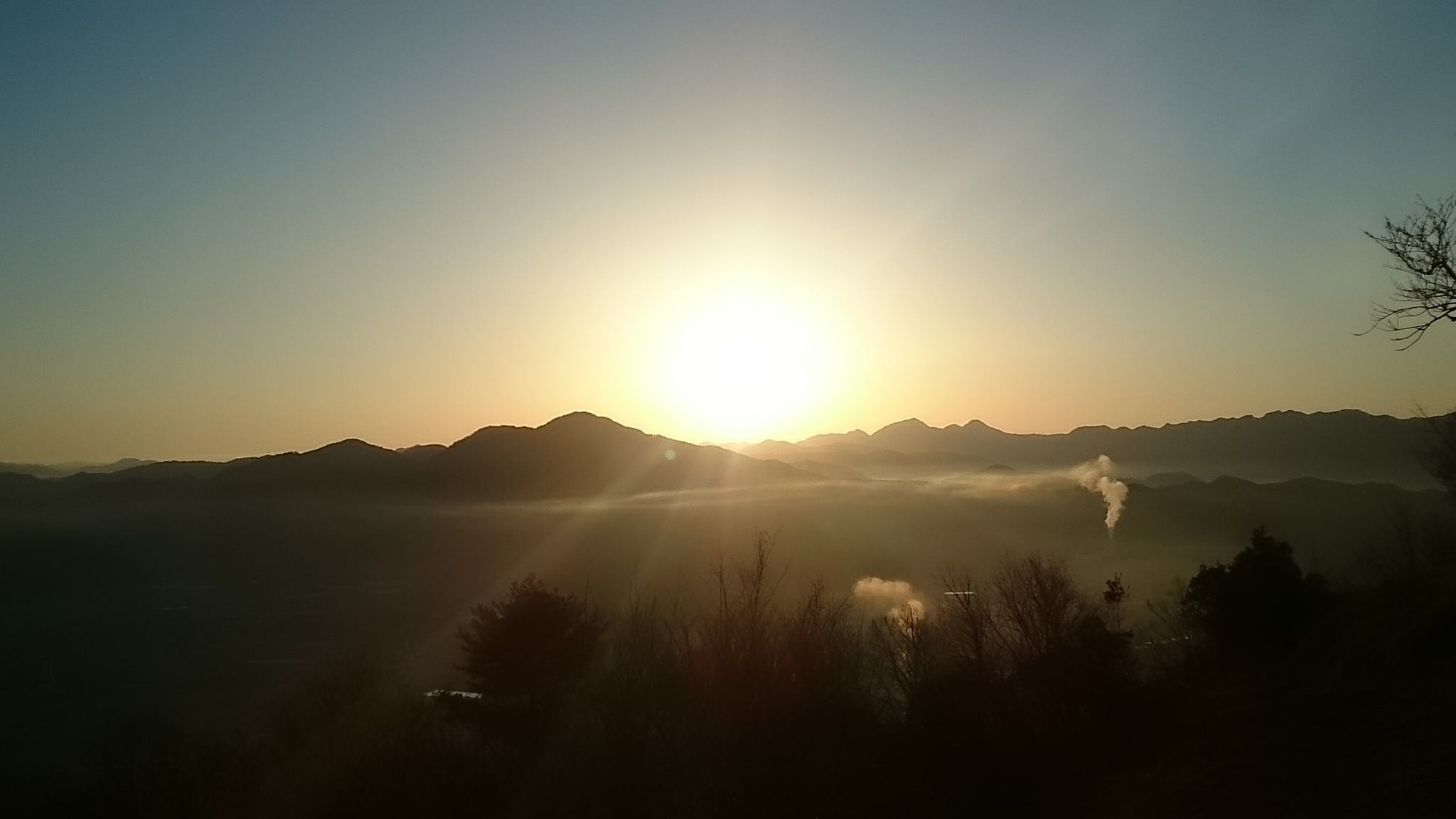
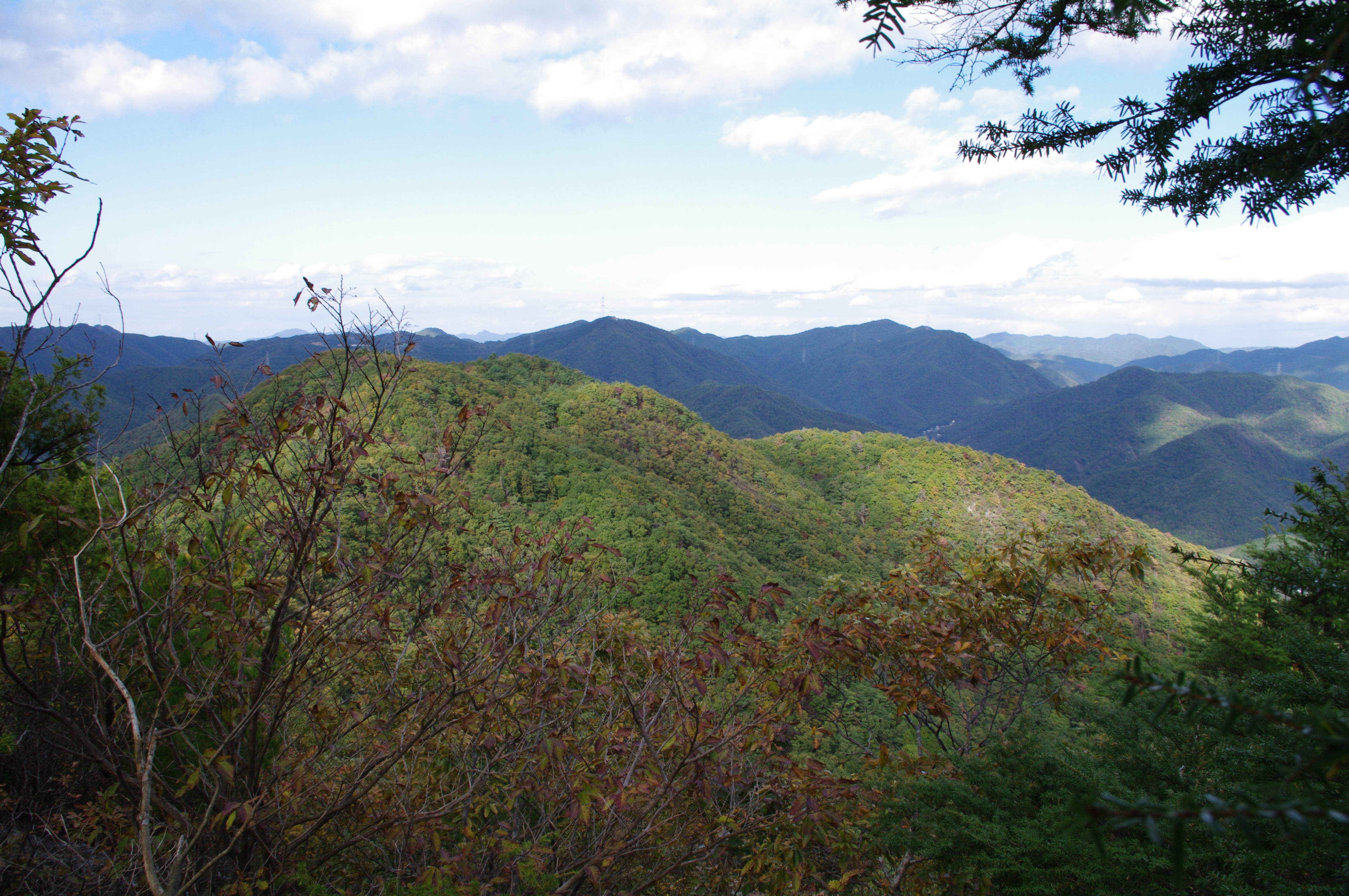
View from Mt. Mitake
View from Mt. Koganegadake
日本, 兵庫県篠山市の地図
別の場所を検索
近所の場所
日本, 〒- 兵庫県篠山市西新町76
日本, 〒- 兵庫県篠山市池上430
日本、〒- 兵庫県篠山市火打岩字畑山265−3フォレストアドベンチャー・丹波ささやま
日本、〒- 兵庫県丹波市春日町栢野
日本、〒- 兵庫県丹波市春日町栢野701
日本、〒- 兵庫県丹波市春日町栢野17
日本, 〒- 兵庫県三田市須磨田55−13
日本、〒- 兵庫県三田市藍本
日本, 〒- 兵庫県三田市藍本3755−21
日本、〒- 兵庫県三田市大川瀬1443−92
日本、〒- 兵庫県三田市学園1丁目
日本、〒- 兵庫県三田市学園1丁目1番地兵庫県立三田祥雲館高等学校
日本、〒- 兵庫県三田市あかしあ台
日本、〒- 兵庫県丹波市山南町谷川
日本, 兵庫県川辺郡
日本, 兵庫県三田市
日本、〒- 兵庫県三田市武庫が丘8丁目
日本, 〒- 兵庫県三田市駅前町1−46
日本、〒- 兵庫県三田市屋敷町
日本、〒- 京都府南丹市園部町大河内
最近の検索
- アメリカ合衆国 アラスカ州 レッド・ドッグ・マイン日の出日の入り時間
- Am bhf, Borken, ドイツアム・バーンホーフ日の出日の入り時間
- 4th St E, Sonoma, CA, USA日の出日の入り時間
- Oakland Ave, Williamsport, PA アメリカ合衆国日の出日の入り時間
- Via Roma, Pieranica CR, イタリアローマ通り日の出日の入り時間
- クロアチア 〒 ドゥブロブニク GradClock Tower of Dubrovnik日の出日の入り時間
- アルゼンチン チュブ州 トレリュー日の出日の入り時間
- Hartfords Bluff Cir, Mt Pleasant, SC アメリカ合衆国日の出日の入り時間
- 日本、熊本県熊本市北区日の出日の入り時間
- 中華人民共和国 福州市 平潭県 平潭島日の出日の入り時間