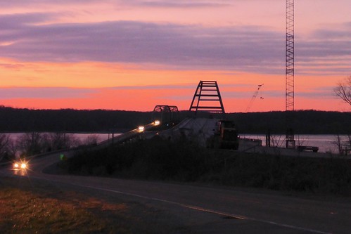
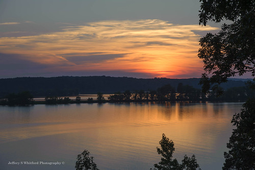
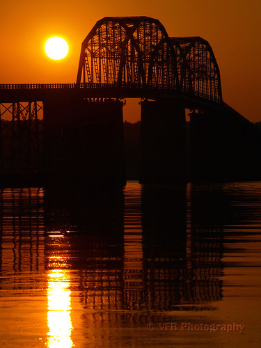
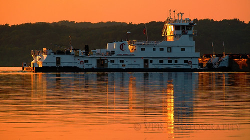
Sam Downs Rd, Kentucky アメリカ合衆国サム・ダウンズ・ロード日の出日の入り時間
Location: アメリカ合衆国 > ケンタッキー州 > トリッグ > アメリカ合衆国 〒 ケンタッキー州 カーディス >
時間帯:
America/Chicago
現地時間:
2025-07-11 14:29:28
経度:
-87.914204
緯度:
36.790549
今日の日の出時刻:
05:42:54 AM
今日の日の入時刻:
08:11:55 PM
今日の日長:
14h 29m 1s
明日の日の出時刻:
05:43:34 AM
明日の日の入時刻:
08:11:29 PM
明日の日長:
14h 27m 55s
すべて表示する
| 日付 | 日出 | 日没 | 日長 |
|---|---|---|---|
| 2025年01月01日 | 07:04:27 AM | 04:47:08 PM | 9h 42m 41s |
| 2025年01月02日 | 07:04:34 AM | 04:47:57 PM | 9h 43m 23s |
| 2025年01月03日 | 07:04:38 AM | 04:48:48 PM | 9h 44m 10s |
| 2025年01月04日 | 07:04:40 AM | 04:49:39 PM | 9h 44m 59s |
| 2025年01月05日 | 07:04:40 AM | 04:50:31 PM | 9h 45m 51s |
| 2025年01月06日 | 07:04:38 AM | 04:51:25 PM | 9h 46m 47s |
| 2025年01月07日 | 07:04:35 AM | 04:52:20 PM | 9h 47m 45s |
| 2025年01月08日 | 07:04:29 AM | 04:53:15 PM | 9h 48m 46s |
| 2025年01月09日 | 07:04:21 AM | 04:54:12 PM | 9h 49m 51s |
| 2025年01月10日 | 07:04:11 AM | 04:55:09 PM | 9h 50m 58s |
| 2025年01月11日 | 07:03:59 AM | 04:56:07 PM | 9h 52m 8s |
| 2025年01月12日 | 07:03:45 AM | 04:57:06 PM | 9h 53m 21s |
| 2025年01月13日 | 07:03:29 AM | 04:58:05 PM | 9h 54m 36s |
| 2025年01月14日 | 07:03:11 AM | 04:59:06 PM | 9h 55m 55s |
| 2025年01月15日 | 07:02:51 AM | 05:00:06 PM | 9h 57m 15s |
| 2025年01月16日 | 07:02:30 AM | 05:01:08 PM | 9h 58m 38s |
| 2025年01月17日 | 07:02:06 AM | 05:02:10 PM | 10h 0m 4s |
| 2025年01月18日 | 07:01:40 AM | 05:03:12 PM | 10h 1m 32s |
| 2025年01月19日 | 07:01:13 AM | 05:04:15 PM | 10h 3m 2s |
| 2025年01月20日 | 07:00:43 AM | 05:05:18 PM | 10h 4m 35s |
| 2025年01月21日 | 07:00:12 AM | 05:06:22 PM | 10h 6m 10s |
| 2025年01月22日 | 06:59:39 AM | 05:07:26 PM | 10h 7m 47s |
| 2025年01月23日 | 06:59:04 AM | 05:08:30 PM | 10h 9m 26s |
| 2025年01月24日 | 06:58:27 AM | 05:09:34 PM | 10h 11m 7s |
| 2025年01月25日 | 06:57:48 AM | 05:10:39 PM | 10h 12m 51s |
| 2025年01月26日 | 06:57:08 AM | 05:11:43 PM | 10h 14m 35s |
| 2025年01月27日 | 06:56:26 AM | 05:12:48 PM | 10h 16m 22s |
| 2025年01月28日 | 06:55:42 AM | 05:13:53 PM | 10h 18m 11s |
| 2025年01月29日 | 06:54:57 AM | 05:14:58 PM | 10h 20m 1s |
| 2025年01月30日 | 06:54:10 AM | 05:16:02 PM | 10h 21m 52s |
| 2025年01月31日 | 06:53:21 AM | 05:17:07 PM | 10h 23m 46s |
| 2025年02月01日 | 06:52:31 AM | 05:18:12 PM | 10h 25m 41s |
| 2025年02月02日 | 06:51:39 AM | 05:19:17 PM | 10h 27m 38s |
| 2025年02月03日 | 06:50:46 AM | 05:20:21 PM | 10h 29m 35s |
| 2025年02月04日 | 06:49:51 AM | 05:21:26 PM | 10h 31m 35s |
| 2025年02月05日 | 06:48:54 AM | 05:22:30 PM | 10h 33m 36s |
| 2025年02月06日 | 06:47:57 AM | 05:23:35 PM | 10h 35m 38s |
| 2025年02月07日 | 06:46:58 AM | 05:24:39 PM | 10h 37m 41s |
| 2025年02月08日 | 06:45:57 AM | 05:25:42 PM | 10h 39m 45s |
| 2025年02月09日 | 06:44:55 AM | 05:26:46 PM | 10h 41m 51s |
| 2025年02月10日 | 06:43:52 AM | 05:27:49 PM | 10h 43m 57s |
| 2025年02月11日 | 06:42:48 AM | 05:28:52 PM | 10h 46m 4s |
| 2025年02月12日 | 06:41:42 AM | 05:29:55 PM | 10h 48m 13s |
| 2025年02月13日 | 06:40:35 AM | 05:30:58 PM | 10h 50m 23s |
| 2025年02月14日 | 06:39:27 AM | 05:32:00 PM | 10h 52m 33s |
| 2025年02月15日 | 06:38:18 AM | 05:33:02 PM | 10h 54m 44s |
| 2025年02月16日 | 06:37:08 AM | 05:34:04 PM | 10h 56m 56s |
| 2025年02月17日 | 06:35:56 AM | 05:35:05 PM | 10h 59m 9s |
| 2025年02月18日 | 06:34:44 AM | 05:36:06 PM | 11h 1m 22s |
| 2025年02月19日 | 06:33:31 AM | 05:37:07 PM | 11h 3m 36s |
| 2025年02月20日 | 06:32:16 AM | 05:38:07 PM | 11h 5m 51s |
| 2025年02月21日 | 06:31:01 AM | 05:39:07 PM | 11h 8m 6s |
| 2025年02月22日 | 06:29:45 AM | 05:40:07 PM | 11h 10m 22s |
| 2025年02月23日 | 06:28:28 AM | 05:41:06 PM | 11h 12m 38s |
| 2025年02月24日 | 06:27:10 AM | 05:42:06 PM | 11h 14m 56s |
| 2025年02月25日 | 06:25:51 AM | 05:43:04 PM | 11h 17m 13s |
| 2025年02月26日 | 06:24:32 AM | 05:44:03 PM | 11h 19m 31s |
| 2025年02月27日 | 06:23:11 AM | 05:45:01 PM | 11h 21m 50s |
| 2025年02月28日 | 06:21:50 AM | 05:45:59 PM | 11h 24m 9s |
| 2025年03月01日 | 06:20:29 AM | 05:46:56 PM | 11h 26m 27s |
| 2025年03月02日 | 06:19:06 AM | 05:47:53 PM | 11h 28m 47s |
| 2025年03月03日 | 06:17:43 AM | 05:48:50 PM | 11h 31m 7s |
| 2025年03月04日 | 06:16:20 AM | 05:49:47 PM | 11h 33m 27s |
| 2025年03月05日 | 06:14:56 AM | 05:50:43 PM | 11h 35m 47s |
| 2025年03月06日 | 06:13:31 AM | 05:51:39 PM | 11h 38m 8s |
| 2025年03月07日 | 06:12:06 AM | 05:52:35 PM | 11h 40m 29s |
| 2025年03月08日 | 06:10:41 AM | 05:53:31 PM | 11h 42m 50s |
| 2025年03月09日 | 07:09:18 AM | 06:54:24 PM | 11h 45m 6s |
| 2025年03月10日 | 07:07:52 AM | 06:55:19 PM | 11h 47m 27s |
| 2025年03月11日 | 07:06:25 AM | 06:56:13 PM | 11h 49m 48s |
| 2025年03月12日 | 07:04:58 AM | 06:57:08 PM | 11h 52m 10s |
| 2025年03月13日 | 07:03:31 AM | 06:58:02 PM | 11h 54m 31s |
| 2025年03月14日 | 07:02:03 AM | 06:58:56 PM | 11h 56m 53s |
| 2025年03月15日 | 07:00:35 AM | 06:59:50 PM | 11h 59m 15s |
| 2025年03月16日 | 06:59:07 AM | 07:00:44 PM | 12h 1m 37s |
| 2025年03月17日 | 06:57:39 AM | 07:01:38 PM | 12h 3m 59s |
| 2025年03月18日 | 06:56:10 AM | 07:02:31 PM | 12h 6m 21s |
| 2025年03月19日 | 06:54:41 AM | 07:03:24 PM | 12h 8m 43s |
| 2025年03月20日 | 06:53:13 AM | 07:04:17 PM | 12h 11m 4s |
| 2025年03月21日 | 06:51:44 AM | 07:05:10 PM | 12h 13m 26s |
| 2025年03月22日 | 06:50:15 AM | 07:06:03 PM | 12h 15m 48s |
| 2025年03月23日 | 06:48:46 AM | 07:06:56 PM | 12h 18m 10s |
| 2025年03月24日 | 06:47:17 AM | 07:07:48 PM | 12h 20m 31s |
| 2025年03月25日 | 06:45:49 AM | 07:08:41 PM | 12h 22m 52s |
| 2025年03月26日 | 06:44:20 AM | 07:09:33 PM | 12h 25m 13s |
| 2025年03月27日 | 06:42:51 AM | 07:10:26 PM | 12h 27m 35s |
| 2025年03月28日 | 06:41:23 AM | 07:11:18 PM | 12h 29m 55s |
| 2025年03月29日 | 06:39:55 AM | 07:12:11 PM | 12h 32m 16s |
| 2025年03月30日 | 06:38:27 AM | 07:13:03 PM | 12h 34m 36s |
| 2025年03月31日 | 06:36:59 AM | 07:13:55 PM | 12h 36m 56s |
| 2025年04月01日 | 06:35:31 AM | 07:14:47 PM | 12h 39m 16s |
| 2025年04月02日 | 06:34:04 AM | 07:15:39 PM | 12h 41m 35s |
| 2025年04月03日 | 06:32:37 AM | 07:16:32 PM | 12h 43m 55s |
| 2025年04月04日 | 06:31:10 AM | 07:17:24 PM | 12h 46m 14s |
| 2025年04月05日 | 06:29:44 AM | 07:18:16 PM | 12h 48m 32s |
| 2025年04月06日 | 06:28:18 AM | 07:19:08 PM | 12h 50m 50s |
| 2025年04月07日 | 06:26:53 AM | 07:20:00 PM | 12h 53m 7s |
| 2025年04月08日 | 06:25:28 AM | 07:20:53 PM | 12h 55m 25s |
| 2025年04月09日 | 06:24:03 AM | 07:21:45 PM | 12h 57m 42s |
| 2025年04月10日 | 06:22:39 AM | 07:22:37 PM | 12h 59m 58s |
| 2025年04月11日 | 06:21:16 AM | 07:23:30 PM | 13h 2m 14s |
| 2025年04月12日 | 06:19:53 AM | 07:24:22 PM | 13h 4m 29s |
| 2025年04月13日 | 06:18:31 AM | 07:25:15 PM | 13h 6m 44s |
| 2025年04月14日 | 06:17:09 AM | 07:26:07 PM | 13h 8m 58s |
| 2025年04月15日 | 06:15:48 AM | 07:27:00 PM | 13h 11m 12s |
| 2025年04月16日 | 06:14:28 AM | 07:27:52 PM | 13h 13m 24s |
| 2025年04月17日 | 06:13:09 AM | 07:28:45 PM | 13h 15m 36s |
| 2025年04月18日 | 06:11:50 AM | 07:29:38 PM | 13h 17m 48s |
| 2025年04月19日 | 06:10:32 AM | 07:30:30 PM | 13h 19m 58s |
| 2025年04月20日 | 06:09:15 AM | 07:31:23 PM | 13h 22m 8s |
| 2025年04月21日 | 06:07:59 AM | 07:32:16 PM | 13h 24m 17s |
| 2025年04月22日 | 06:06:43 AM | 07:33:09 PM | 13h 26m 26s |
| 2025年04月23日 | 06:05:29 AM | 07:34:02 PM | 13h 28m 33s |
| 2025年04月24日 | 06:04:15 AM | 07:34:55 PM | 13h 30m 40s |
| 2025年04月25日 | 06:03:03 AM | 07:35:48 PM | 13h 32m 45s |
| 2025年04月26日 | 06:01:51 AM | 07:36:41 PM | 13h 34m 50s |
| 2025年04月27日 | 06:00:41 AM | 07:37:34 PM | 13h 36m 53s |
| 2025年04月28日 | 05:59:31 AM | 07:38:27 PM | 13h 38m 56s |
| 2025年04月29日 | 05:58:23 AM | 07:39:19 PM | 13h 40m 56s |
| 2025年04月30日 | 05:57:15 AM | 07:40:12 PM | 13h 42m 57s |
| 2025年05月01日 | 05:56:09 AM | 07:41:05 PM | 13h 44m 56s |
| 2025年05月02日 | 05:55:04 AM | 07:41:58 PM | 13h 46m 54s |
| 2025年05月03日 | 05:54:00 AM | 07:42:50 PM | 13h 48m 50s |
| 2025年05月04日 | 05:52:58 AM | 07:43:43 PM | 13h 50m 45s |
| 2025年05月05日 | 05:51:56 AM | 07:44:35 PM | 13h 52m 39s |
| 2025年05月06日 | 05:50:56 AM | 07:45:27 PM | 13h 54m 31s |
| 2025年05月07日 | 05:49:58 AM | 07:46:20 PM | 13h 56m 22s |
| 2025年05月08日 | 05:49:00 AM | 07:47:11 PM | 13h 58m 11s |
| 2025年05月09日 | 05:48:04 AM | 07:48:03 PM | 13h 59m 59s |
| 2025年05月10日 | 05:47:09 AM | 07:48:54 PM | 14h 1m 45s |
| 2025年05月11日 | 05:46:16 AM | 07:49:46 PM | 14h 3m 30s |
| 2025年05月12日 | 05:45:24 AM | 07:50:37 PM | 14h 5m 13s |
| 2025年05月13日 | 05:44:34 AM | 07:51:27 PM | 14h 6m 53s |
| 2025年05月14日 | 05:43:45 AM | 07:52:17 PM | 14h 8m 32s |
| 2025年05月15日 | 05:42:57 AM | 07:53:07 PM | 14h 10m 10s |
| 2025年05月16日 | 05:42:11 AM | 07:53:57 PM | 14h 11m 46s |
| 2025年05月17日 | 05:41:27 AM | 07:54:46 PM | 14h 13m 19s |
| 2025年05月18日 | 05:40:44 AM | 07:55:34 PM | 14h 14m 50s |
| 2025年05月19日 | 05:40:03 AM | 07:56:22 PM | 14h 16m 19s |
| 2025年05月20日 | 05:39:23 AM | 07:57:10 PM | 14h 17m 47s |
| 2025年05月21日 | 05:38:45 AM | 07:57:57 PM | 14h 19m 12s |
| 2025年05月22日 | 05:38:09 AM | 07:58:43 PM | 14h 20m 34s |
| 2025年05月23日 | 05:37:34 AM | 07:59:29 PM | 14h 21m 55s |
| 2025年05月24日 | 05:37:01 AM | 08:00:14 PM | 14h 23m 13s |
| 2025年05月25日 | 05:36:30 AM | 08:00:58 PM | 14h 24m 28s |
| 2025年05月26日 | 05:36:00 AM | 08:01:42 PM | 14h 25m 42s |
| 2025年05月27日 | 05:35:32 AM | 08:02:25 PM | 14h 26m 53s |
| 2025年05月28日 | 05:35:06 AM | 08:03:07 PM | 14h 28m 1s |
| 2025年05月29日 | 05:34:41 AM | 08:03:48 PM | 14h 29m 7s |
| 2025年05月30日 | 05:34:18 AM | 08:04:28 PM | 14h 30m 10s |
| 2025年05月31日 | 05:33:57 AM | 08:05:08 PM | 14h 31m 11s |
| 2025年06月01日 | 05:33:38 AM | 08:05:46 PM | 14h 32m 8s |
| 2025年06月02日 | 05:33:20 AM | 08:06:24 PM | 14h 33m 4s |
| 2025年06月03日 | 05:33:05 AM | 08:07:00 PM | 14h 33m 55s |
| 2025年06月04日 | 05:32:51 AM | 08:07:35 PM | 14h 34m 44s |
| 2025年06月05日 | 05:32:38 AM | 08:08:09 PM | 14h 35m 31s |
| 2025年06月06日 | 05:32:28 AM | 08:08:42 PM | 14h 36m 14s |
| 2025年06月07日 | 05:32:19 AM | 08:09:14 PM | 14h 36m 55s |
| 2025年06月08日 | 05:32:12 AM | 08:09:45 PM | 14h 37m 33s |
| 2025年06月09日 | 05:32:06 AM | 08:10:14 PM | 14h 38m 8s |
| 2025年06月10日 | 05:32:03 AM | 08:10:42 PM | 14h 38m 39s |
| 2025年06月11日 | 05:32:01 AM | 08:11:09 PM | 14h 39m 8s |
| 2025年06月12日 | 05:32:01 AM | 08:11:34 PM | 14h 39m 33s |
| 2025年06月13日 | 05:32:02 AM | 08:11:58 PM | 14h 39m 56s |
| 2025年06月14日 | 05:32:05 AM | 08:12:21 PM | 14h 40m 16s |
| 2025年06月15日 | 05:32:10 AM | 08:12:42 PM | 14h 40m 32s |
| 2025年06月16日 | 05:32:16 AM | 08:13:01 PM | 14h 40m 45s |
| 2025年06月17日 | 05:32:24 AM | 08:13:19 PM | 14h 40m 55s |
| 2025年06月18日 | 05:32:34 AM | 08:13:36 PM | 14h 41m 2s |
| 2025年06月19日 | 05:32:45 AM | 08:13:50 PM | 14h 41m 5s |
| 2025年06月20日 | 05:32:58 AM | 08:14:04 PM | 14h 41m 6s |
| 2025年06月21日 | 05:33:13 AM | 08:14:15 PM | 14h 41m 2s |
| 2025年06月22日 | 05:33:29 AM | 08:14:25 PM | 14h 40m 56s |
| 2025年06月23日 | 05:33:46 AM | 08:14:34 PM | 14h 40m 48s |
| 2025年06月24日 | 05:34:05 AM | 08:14:41 PM | 14h 40m 36s |
| 2025年06月25日 | 05:34:25 AM | 08:14:46 PM | 14h 40m 21s |
| 2025年06月26日 | 05:34:47 AM | 08:14:49 PM | 14h 40m 2s |
| 2025年06月27日 | 05:35:10 AM | 08:14:50 PM | 14h 39m 40s |
| 2025年06月28日 | 05:35:34 AM | 08:14:50 PM | 14h 39m 16s |
| 2025年06月29日 | 05:36:00 AM | 08:14:48 PM | 14h 38m 48s |
| 2025年06月30日 | 05:36:27 AM | 08:14:45 PM | 14h 38m 18s |
| 2025年07月01日 | 05:36:55 AM | 08:14:39 PM | 14h 37m 44s |
| 2025年07月02日 | 05:37:24 AM | 08:14:32 PM | 14h 37m 8s |
| 2025年07月03日 | 05:37:55 AM | 08:14:23 PM | 14h 36m 28s |
| 2025年07月04日 | 05:38:26 AM | 08:14:12 PM | 14h 35m 46s |
| 2025年07月05日 | 05:38:59 AM | 08:13:59 PM | 14h 35m 0s |
| 2025年07月06日 | 05:39:33 AM | 08:13:45 PM | 14h 34m 12s |
| 2025年07月07日 | 05:40:08 AM | 08:13:29 PM | 14h 33m 21s |
| 2025年07月08日 | 05:40:44 AM | 08:13:11 PM | 14h 32m 27s |
| 2025年07月09日 | 05:41:20 AM | 08:12:51 PM | 14h 31m 31s |
| 2025年07月10日 | 05:41:58 AM | 08:12:29 PM | 14h 30m 31s |
| 2025年07月11日 | 05:42:37 AM | 08:12:06 PM | 14h 29m 29s |
| 2025年07月12日 | 05:43:16 AM | 08:11:41 PM | 14h 28m 25s |
| 2025年07月13日 | 05:43:56 AM | 08:11:14 PM | 14h 27m 18s |
| 2025年07月14日 | 05:44:37 AM | 08:10:45 PM | 14h 26m 8s |
| 2025年07月15日 | 05:45:18 AM | 08:10:15 PM | 14h 24m 57s |
| 2025年07月16日 | 05:46:01 AM | 08:09:43 PM | 14h 23m 42s |
| 2025年07月17日 | 05:46:44 AM | 08:09:09 PM | 14h 22m 25s |
| 2025年07月18日 | 05:47:27 AM | 08:08:34 PM | 14h 21m 7s |
| 2025年07月19日 | 05:48:11 AM | 08:07:56 PM | 14h 19m 45s |
| 2025年07月20日 | 05:48:56 AM | 08:07:18 PM | 14h 18m 22s |
| 2025年07月21日 | 05:49:41 AM | 08:06:37 PM | 14h 16m 56s |
| 2025年07月22日 | 05:50:27 AM | 08:05:55 PM | 14h 15m 28s |
| 2025年07月23日 | 05:51:13 AM | 08:05:11 PM | 14h 13m 58s |
| 2025年07月24日 | 05:51:59 AM | 08:04:26 PM | 14h 12m 27s |
| 2025年07月25日 | 05:52:46 AM | 08:03:39 PM | 14h 10m 53s |
| 2025年07月26日 | 05:53:33 AM | 08:02:51 PM | 14h 9m 18s |
| 2025年07月27日 | 05:54:21 AM | 08:02:01 PM | 14h 7m 40s |
| 2025年07月28日 | 05:55:09 AM | 08:01:09 PM | 14h 6m 0s |
| 2025年07月29日 | 05:55:57 AM | 08:00:16 PM | 14h 4m 19s |
| 2025年07月30日 | 05:56:45 AM | 07:59:22 PM | 14h 2m 37s |
| 2025年07月31日 | 05:57:33 AM | 07:58:26 PM | 14h 0m 53s |
| 2025年08月01日 | 05:58:22 AM | 07:57:29 PM | 13h 59m 7s |
| 2025年08月02日 | 05:59:11 AM | 07:56:31 PM | 13h 57m 20s |
| 2025年08月03日 | 06:00:00 AM | 07:55:31 PM | 13h 55m 31s |
| 2025年08月04日 | 06:00:49 AM | 07:54:29 PM | 13h 53m 40s |
| 2025年08月05日 | 06:01:38 AM | 07:53:27 PM | 13h 51m 49s |
| 2025年08月06日 | 06:02:27 AM | 07:52:23 PM | 13h 49m 56s |
| 2025年08月07日 | 06:03:17 AM | 07:51:18 PM | 13h 48m 1s |
| 2025年08月08日 | 06:04:06 AM | 07:50:12 PM | 13h 46m 6s |
| 2025年08月09日 | 06:04:56 AM | 07:49:04 PM | 13h 44m 8s |
| 2025年08月10日 | 06:05:45 AM | 07:47:56 PM | 13h 42m 11s |
| 2025年08月11日 | 06:06:34 AM | 07:46:46 PM | 13h 40m 12s |
| 2025年08月12日 | 06:07:24 AM | 07:45:35 PM | 13h 38m 11s |
| 2025年08月13日 | 06:08:13 AM | 07:44:23 PM | 13h 36m 10s |
| 2025年08月14日 | 06:09:03 AM | 07:43:10 PM | 13h 34m 7s |
| 2025年08月15日 | 06:09:52 AM | 07:41:56 PM | 13h 32m 4s |
| 2025年08月16日 | 06:10:41 AM | 07:40:41 PM | 13h 30m 0s |
| 2025年08月17日 | 06:11:30 AM | 07:39:26 PM | 13h 27m 56s |
| 2025年08月18日 | 06:12:20 AM | 07:38:09 PM | 13h 25m 49s |
| 2025年08月19日 | 06:13:09 AM | 07:36:51 PM | 13h 23m 42s |
| 2025年08月20日 | 06:13:58 AM | 07:35:32 PM | 13h 21m 34s |
| 2025年08月21日 | 06:14:47 AM | 07:34:13 PM | 13h 19m 26s |
| 2025年08月22日 | 06:15:36 AM | 07:32:53 PM | 13h 17m 17s |
| 2025年08月23日 | 06:16:24 AM | 07:31:32 PM | 13h 15m 8s |
| 2025年08月24日 | 06:17:13 AM | 07:30:10 PM | 13h 12m 57s |
| 2025年08月25日 | 06:18:02 AM | 07:28:47 PM | 13h 10m 45s |
| 2025年08月26日 | 06:18:50 AM | 07:27:24 PM | 13h 8m 34s |
| 2025年08月27日 | 06:19:39 AM | 07:26:00 PM | 13h 6m 21s |
| 2025年08月28日 | 06:20:27 AM | 07:24:36 PM | 13h 4m 9s |
| 2025年08月29日 | 06:21:16 AM | 07:23:11 PM | 13h 1m 55s |
| 2025年08月30日 | 06:22:04 AM | 07:21:45 PM | 12h 59m 41s |
| 2025年08月31日 | 06:22:52 AM | 07:20:19 PM | 12h 57m 27s |
| 2025年09月01日 | 06:23:40 AM | 07:18:52 PM | 12h 55m 12s |
| 2025年09月02日 | 06:24:28 AM | 07:17:25 PM | 12h 52m 57s |
| 2025年09月03日 | 06:25:16 AM | 07:15:57 PM | 12h 50m 41s |
| 2025年09月04日 | 06:26:04 AM | 07:14:29 PM | 12h 48m 25s |
| 2025年09月05日 | 06:26:52 AM | 07:13:01 PM | 12h 46m 9s |
| 2025年09月06日 | 06:27:40 AM | 07:11:32 PM | 12h 43m 52s |
| 2025年09月07日 | 06:28:28 AM | 07:10:03 PM | 12h 41m 35s |
| 2025年09月08日 | 06:29:16 AM | 07:08:33 PM | 12h 39m 17s |
| 2025年09月09日 | 06:30:04 AM | 07:07:03 PM | 12h 36m 59s |
| 2025年09月10日 | 06:30:51 AM | 07:05:33 PM | 12h 34m 42s |
| 2025年09月11日 | 06:31:39 AM | 07:04:03 PM | 12h 32m 24s |
| 2025年09月12日 | 06:32:27 AM | 07:02:32 PM | 12h 30m 5s |
| 2025年09月13日 | 06:33:15 AM | 07:01:02 PM | 12h 27m 47s |
| 2025年09月14日 | 06:34:03 AM | 06:59:31 PM | 12h 25m 28s |
| 2025年09月15日 | 06:34:51 AM | 06:58:00 PM | 12h 23m 9s |
| 2025年09月16日 | 06:35:39 AM | 06:56:29 PM | 12h 20m 50s |
| 2025年09月17日 | 06:36:28 AM | 06:54:58 PM | 12h 18m 30s |
| 2025年09月18日 | 06:37:16 AM | 06:53:27 PM | 12h 16m 11s |
| 2025年09月19日 | 06:38:04 AM | 06:51:56 PM | 12h 13m 52s |
| 2025年09月20日 | 06:38:53 AM | 06:50:24 PM | 12h 11m 31s |
| 2025年09月21日 | 06:39:41 AM | 06:48:53 PM | 12h 9m 12s |
| 2025年09月22日 | 06:40:30 AM | 06:47:23 PM | 12h 6m 53s |
| 2025年09月23日 | 06:41:19 AM | 06:45:52 PM | 12h 4m 33s |
| 2025年09月24日 | 06:42:08 AM | 06:44:21 PM | 12h 2m 13s |
| 2025年09月25日 | 06:42:57 AM | 06:42:51 PM | 11h 59m 54s |
| 2025年09月26日 | 06:43:47 AM | 06:41:20 PM | 11h 57m 33s |
| 2025年09月27日 | 06:44:36 AM | 06:39:50 PM | 11h 55m 14s |
| 2025年09月28日 | 06:45:26 AM | 06:38:21 PM | 11h 52m 55s |
| 2025年09月29日 | 06:46:16 AM | 06:36:51 PM | 11h 50m 35s |
| 2025年09月30日 | 06:47:07 AM | 06:35:22 PM | 11h 48m 15s |
| 2025年10月01日 | 06:47:57 AM | 06:33:53 PM | 11h 45m 56s |
| 2025年10月02日 | 06:48:48 AM | 06:32:25 PM | 11h 43m 37s |
| 2025年10月03日 | 06:49:39 AM | 06:30:57 PM | 11h 41m 18s |
| 2025年10月04日 | 06:50:30 AM | 06:29:29 PM | 11h 38m 59s |
| 2025年10月05日 | 06:51:22 AM | 06:28:02 PM | 11h 36m 40s |
| 2025年10月06日 | 06:52:14 AM | 06:26:36 PM | 11h 34m 22s |
| 2025年10月07日 | 06:53:06 AM | 06:25:10 PM | 11h 32m 4s |
| 2025年10月08日 | 06:53:58 AM | 06:23:44 PM | 11h 29m 46s |
| 2025年10月09日 | 06:54:51 AM | 06:22:19 PM | 11h 27m 28s |
| 2025年10月10日 | 06:55:44 AM | 06:20:55 PM | 11h 25m 11s |
| 2025年10月11日 | 06:56:37 AM | 06:19:32 PM | 11h 22m 55s |
| 2025年10月12日 | 06:57:31 AM | 06:18:09 PM | 11h 20m 38s |
| 2025年10月13日 | 06:58:25 AM | 06:16:47 PM | 11h 18m 22s |
| 2025年10月14日 | 06:59:20 AM | 06:15:25 PM | 11h 16m 5s |
| 2025年10月15日 | 07:00:14 AM | 06:14:05 PM | 11h 13m 51s |
| 2025年10月16日 | 07:01:10 AM | 06:12:45 PM | 11h 11m 35s |
| 2025年10月17日 | 07:02:05 AM | 06:11:26 PM | 11h 9m 21s |
| 2025年10月18日 | 07:03:01 AM | 06:10:08 PM | 11h 7m 7s |
| 2025年10月19日 | 07:03:57 AM | 06:08:51 PM | 11h 4m 54s |
| 2025年10月20日 | 07:04:54 AM | 06:07:35 PM | 11h 2m 41s |
| 2025年10月21日 | 07:05:50 AM | 06:06:20 PM | 11h 0m 30s |
| 2025年10月22日 | 07:06:48 AM | 06:05:06 PM | 10h 58m 18s |
| 2025年10月23日 | 07:07:45 AM | 06:03:53 PM | 10h 56m 8s |
| 2025年10月24日 | 07:08:43 AM | 06:02:41 PM | 10h 53m 58s |
| 2025年10月25日 | 07:09:41 AM | 06:01:30 PM | 10h 51m 49s |
| 2025年10月26日 | 07:10:40 AM | 06:00:20 PM | 10h 49m 40s |
| 2025年10月27日 | 07:11:39 AM | 05:59:11 PM | 10h 47m 32s |
| 2025年10月28日 | 07:12:38 AM | 05:58:04 PM | 10h 45m 26s |
| 2025年10月29日 | 07:13:38 AM | 05:56:58 PM | 10h 43m 20s |
| 2025年10月30日 | 07:14:37 AM | 05:55:53 PM | 10h 41m 16s |
| 2025年10月31日 | 07:15:38 AM | 05:54:49 PM | 10h 39m 11s |
| 2025年11月01日 | 07:16:38 AM | 05:53:47 PM | 10h 37m 9s |
| 2025年11月02日 | 06:17:41 AM | 04:52:44 PM | 10h 35m 3s |
| 2025年11月03日 | 06:18:42 AM | 04:51:44 PM | 10h 33m 2s |
| 2025年11月04日 | 06:19:43 AM | 04:50:47 PM | 10h 31m 4s |
| 2025年11月05日 | 06:20:44 AM | 04:49:50 PM | 10h 29m 6s |
| 2025年11月06日 | 06:21:45 AM | 04:48:55 PM | 10h 27m 10s |
| 2025年11月07日 | 06:22:47 AM | 04:48:02 PM | 10h 25m 15s |
| 2025年11月08日 | 06:23:49 AM | 04:47:10 PM | 10h 23m 21s |
| 2025年11月09日 | 06:24:50 AM | 04:46:20 PM | 10h 21m 30s |
| 2025年11月10日 | 06:25:52 AM | 04:45:31 PM | 10h 19m 39s |
| 2025年11月11日 | 06:26:54 AM | 04:44:44 PM | 10h 17m 50s |
| 2025年11月12日 | 06:27:56 AM | 04:43:59 PM | 10h 16m 3s |
| 2025年11月13日 | 06:28:58 AM | 04:43:15 PM | 10h 14m 17s |
| 2025年11月14日 | 06:30:00 AM | 04:42:33 PM | 10h 12m 33s |
| 2025年11月15日 | 06:31:02 AM | 04:41:53 PM | 10h 10m 51s |
| 2025年11月16日 | 06:32:03 AM | 04:41:15 PM | 10h 9m 12s |
| 2025年11月17日 | 06:33:05 AM | 04:40:38 PM | 10h 7m 33s |
| 2025年11月18日 | 06:34:06 AM | 04:40:04 PM | 10h 5m 58s |
| 2025年11月19日 | 06:35:07 AM | 04:39:31 PM | 10h 4m 24s |
| 2025年11月20日 | 06:36:08 AM | 04:39:00 PM | 10h 2m 52s |
| 2025年11月21日 | 06:37:09 AM | 04:38:31 PM | 10h 1m 22s |
| 2025年11月22日 | 06:38:09 AM | 04:38:04 PM | 9h 59m 55s |
| 2025年11月23日 | 06:39:08 AM | 04:37:39 PM | 9h 58m 31s |
| 2025年11月24日 | 06:40:08 AM | 04:37:16 PM | 9h 57m 8s |
| 2025年11月25日 | 06:41:07 AM | 04:36:55 PM | 9h 55m 48s |
| 2025年11月26日 | 06:42:05 AM | 04:36:36 PM | 9h 54m 31s |
| 2025年11月27日 | 06:43:02 AM | 04:36:19 PM | 9h 53m 17s |
| 2025年11月28日 | 06:44:00 AM | 04:36:03 PM | 9h 52m 3s |
| 2025年11月29日 | 06:44:56 AM | 04:35:50 PM | 9h 50m 54s |
| 2025年11月30日 | 06:45:52 AM | 04:35:39 PM | 9h 49m 47s |
| 2025年12月01日 | 06:46:46 AM | 04:35:30 PM | 9h 48m 44s |
| 2025年12月02日 | 06:47:41 AM | 04:35:23 PM | 9h 47m 42s |
| 2025年12月03日 | 06:48:34 AM | 04:35:19 PM | 9h 46m 45s |
| 2025年12月04日 | 06:49:26 AM | 04:35:16 PM | 9h 45m 50s |
| 2025年12月05日 | 06:50:17 AM | 04:35:15 PM | 9h 44m 58s |
| 2025年12月06日 | 06:51:07 AM | 04:35:16 PM | 9h 44m 9s |
| 2025年12月07日 | 06:51:57 AM | 04:35:20 PM | 9h 43m 23s |
| 2025年12月08日 | 06:52:45 AM | 04:35:25 PM | 9h 42m 40s |
| 2025年12月09日 | 06:53:32 AM | 04:35:32 PM | 9h 42m 0s |
| 2025年12月10日 | 06:54:17 AM | 04:35:42 PM | 9h 41m 25s |
| 2025年12月11日 | 06:55:01 AM | 04:35:53 PM | 9h 40m 52s |
| 2025年12月12日 | 06:55:45 AM | 04:36:07 PM | 9h 40m 22s |
| 2025年12月13日 | 06:56:26 AM | 04:36:22 PM | 9h 39m 56s |
| 2025年12月14日 | 06:57:06 AM | 04:36:40 PM | 9h 39m 34s |
| 2025年12月15日 | 06:57:45 AM | 04:36:59 PM | 9h 39m 14s |
| 2025年12月16日 | 06:58:23 AM | 04:37:20 PM | 9h 38m 57s |
| 2025年12月17日 | 06:58:58 AM | 04:37:44 PM | 9h 38m 46s |
| 2025年12月18日 | 06:59:32 AM | 04:38:09 PM | 9h 38m 37s |
| 2025年12月19日 | 07:00:05 AM | 04:38:36 PM | 9h 38m 31s |
| 2025年12月20日 | 07:00:36 AM | 04:39:04 PM | 9h 38m 28s |
| 2025年12月21日 | 07:01:05 AM | 04:39:35 PM | 9h 38m 30s |
| 2025年12月22日 | 07:01:32 AM | 04:40:07 PM | 9h 38m 35s |
| 2025年12月23日 | 07:01:58 AM | 04:40:41 PM | 9h 38m 43s |
| 2025年12月24日 | 07:02:22 AM | 04:41:16 PM | 9h 38m 54s |
| 2025年12月25日 | 07:02:44 AM | 04:41:54 PM | 9h 39m 10s |
| 2025年12月26日 | 07:03:04 AM | 04:42:33 PM | 9h 39m 29s |
| 2025年12月27日 | 07:03:23 AM | 04:43:13 PM | 9h 39m 50s |
| 2025年12月28日 | 07:03:39 AM | 04:43:55 PM | 9h 40m 16s |
| 2025年12月29日 | 07:03:54 AM | 04:44:38 PM | 9h 40m 44s |
| 2025年12月30日 | 07:04:06 AM | 04:45:23 PM | 9h 41m 17s |
| 2025年12月31日 | 07:04:17 AM | 04:46:09 PM | 9h 41m 52s |
写真
Sam Downs Rd, Kentucky アメリカ合衆国サム・ダウンズ・ロードの地図
別の場所を検索
近所の場所
Blue Spring Rd, Cadiz, KY アメリカ合衆国
22 Edgewater Dr, Cadiz, KY アメリカ合衆国
46 Deepwood Dr, Cadiz, KY アメリカ合衆国
Donaldson Creek Rd, Cadiz, KY アメリカ合衆国
76 Plum Dr, Cadiz, KY アメリカ合衆国
アメリカ合衆国 〒 ケンタッキー州 カーディス
アメリカ合衆国 〒 ケンタッキー州 ゴールデン・ポンド
Hurricane Camp Rd, Eddyville, KY アメリカ合衆国Hurricane Creek Recreation
Peninsula Dr, Eddyville, KY アメリカ合衆国
アメリカ合衆国 ケンタッキー州 トリッグ
Visitor Center Dr, Golden Pond, KY アメリカ合衆国ランド・ビトゥウィーン・ザ・レイクス国立保養地
Whitley Way, Kentucky アメリカ合衆国ウィットレイ・ウェイ
Hopkinsville Rd, Cadiz, KY アメリカ合衆国
Ferguson Rd, Princeton, KY アメリカ合衆国
Binns Mill Rd, Herndon, KY アメリカ合衆国
アメリカ合衆国 〒 ケンタッキー州 グレイシー
Railroad St S, Gracey, KY アメリカ合衆国
Hay Rd, Princeton, KY アメリカ合衆国Hay Road
Redmond Ln, Benton, KY アメリカ合衆国Redmond Lane
アメリカ合衆国 〒 ケンタッキー州 ラフェイエット ラ・ファイエット
最近の検索
- アメリカ合衆国 アラスカ州 レッド・ドッグ・マイン日の出日の入り時間
- Am bhf, Borken, ドイツアム・バーンホーフ日の出日の入り時間
- 4th St E, Sonoma, CA, USA日の出日の入り時間
- Oakland Ave, Williamsport, PA アメリカ合衆国日の出日の入り時間
- Via Roma, Pieranica CR, イタリアローマ通り日の出日の入り時間
- クロアチア 〒 ドゥブロブニク GradClock Tower of Dubrovnik日の出日の入り時間
- アルゼンチン チュブ州 トレリュー日の出日の入り時間
- Hartfords Bluff Cir, Mt Pleasant, SC アメリカ合衆国日の出日の入り時間
- 日本、熊本県熊本市北区日の出日の入り時間
- 中華人民共和国 福州市 平潭県 平潭島日の出日の入り時間


