アメリカ合衆国 バージニア州 サルーダ日の出日の入り時間
Location: アメリカ合衆国 > バージニア州 > ミドルセックス >
時間帯:
America/New_York
現地時間:
2025-07-08 16:45:17
経度:
-76.5257007
緯度:
37.6040106
今日の日の出時刻:
05:53:10 AM
今日の日の入時刻:
08:29:46 PM
今日の日長:
14h 36m 36s
明日の日の出時刻:
05:53:48 AM
明日の日の入時刻:
08:29:24 PM
明日の日長:
14h 35m 36s
すべて表示する
| 日付 | 日出 | 日没 | 日長 |
|---|---|---|---|
| 2025年01月01日 | 07:21:07 AM | 04:59:19 PM | 9h 38m 12s |
| 2025年01月02日 | 07:21:12 AM | 05:00:08 PM | 9h 38m 56s |
| 2025年01月03日 | 07:21:16 AM | 05:00:59 PM | 9h 39m 43s |
| 2025年01月04日 | 07:21:17 AM | 05:01:51 PM | 9h 40m 34s |
| 2025年01月05日 | 07:21:17 AM | 05:02:45 PM | 9h 41m 28s |
| 2025年01月06日 | 07:21:14 AM | 05:03:39 PM | 9h 42m 25s |
| 2025年01月07日 | 07:21:10 AM | 05:04:34 PM | 9h 43m 24s |
| 2025年01月08日 | 07:21:03 AM | 05:05:31 PM | 9h 44m 28s |
| 2025年01月09日 | 07:20:54 AM | 05:06:28 PM | 9h 45m 34s |
| 2025年01月10日 | 07:20:43 AM | 05:07:27 PM | 9h 46m 44s |
| 2025年01月11日 | 07:20:30 AM | 05:08:26 PM | 9h 47m 56s |
| 2025年01月12日 | 07:20:15 AM | 05:09:26 PM | 9h 49m 11s |
| 2025年01月13日 | 07:19:58 AM | 05:10:27 PM | 9h 50m 29s |
| 2025年01月14日 | 07:19:39 AM | 05:11:28 PM | 9h 51m 49s |
| 2025年01月15日 | 07:19:18 AM | 05:12:30 PM | 9h 53m 12s |
| 2025年01月16日 | 07:18:55 AM | 05:13:33 PM | 9h 54m 38s |
| 2025年01月17日 | 07:18:30 AM | 05:14:36 PM | 9h 56m 6s |
| 2025年01月18日 | 07:18:03 AM | 05:15:40 PM | 9h 57m 37s |
| 2025年01月19日 | 07:17:34 AM | 05:16:44 PM | 9h 59m 10s |
| 2025年01月20日 | 07:17:04 AM | 05:17:49 PM | 10h 0m 45s |
| 2025年01月21日 | 07:16:31 AM | 05:18:54 PM | 10h 2m 23s |
| 2025年01月22日 | 07:15:56 AM | 05:19:59 PM | 10h 4m 3s |
| 2025年01月23日 | 07:15:20 AM | 05:21:05 PM | 10h 5m 45s |
| 2025年01月24日 | 07:14:41 AM | 05:22:11 PM | 10h 7m 30s |
| 2025年01月25日 | 07:14:01 AM | 05:23:17 PM | 10h 9m 16s |
| 2025年01月26日 | 07:13:20 AM | 05:24:23 PM | 10h 11m 3s |
| 2025年01月27日 | 07:12:36 AM | 05:25:30 PM | 10h 12m 54s |
| 2025年01月28日 | 07:11:51 AM | 05:26:36 PM | 10h 14m 45s |
| 2025年01月29日 | 07:11:03 AM | 05:27:43 PM | 10h 16m 40s |
| 2025年01月30日 | 07:10:15 AM | 05:28:50 PM | 10h 18m 35s |
| 2025年01月31日 | 07:09:24 AM | 05:29:56 PM | 10h 20m 32s |
| 2025年02月01日 | 07:08:32 AM | 05:31:03 PM | 10h 22m 31s |
| 2025年02月02日 | 07:07:39 AM | 05:32:09 PM | 10h 24m 30s |
| 2025年02月03日 | 07:06:44 AM | 05:33:16 PM | 10h 26m 32s |
| 2025年02月04日 | 07:05:47 AM | 05:34:22 PM | 10h 28m 35s |
| 2025年02月05日 | 07:04:49 AM | 05:35:29 PM | 10h 30m 40s |
| 2025年02月06日 | 07:03:50 AM | 05:36:35 PM | 10h 32m 45s |
| 2025年02月07日 | 07:02:49 AM | 05:37:41 PM | 10h 34m 52s |
| 2025年02月08日 | 07:01:46 AM | 05:38:46 PM | 10h 37m 0s |
| 2025年02月09日 | 07:00:43 AM | 05:39:52 PM | 10h 39m 9s |
| 2025年02月10日 | 06:59:38 AM | 05:40:57 PM | 10h 41m 19s |
| 2025年02月11日 | 06:58:31 AM | 05:42:02 PM | 10h 43m 31s |
| 2025年02月12日 | 06:57:24 AM | 05:43:07 PM | 10h 45m 43s |
| 2025年02月13日 | 06:56:15 AM | 05:44:12 PM | 10h 47m 57s |
| 2025年02月14日 | 06:55:05 AM | 05:45:16 PM | 10h 50m 11s |
| 2025年02月15日 | 06:53:54 AM | 05:46:20 PM | 10h 52m 26s |
| 2025年02月16日 | 06:52:42 AM | 05:47:24 PM | 10h 54m 42s |
| 2025年02月17日 | 06:51:29 AM | 05:48:27 PM | 10h 56m 58s |
| 2025年02月18日 | 06:50:14 AM | 05:49:30 PM | 10h 59m 16s |
| 2025年02月19日 | 06:48:59 AM | 05:50:33 PM | 11h 1m 34s |
| 2025年02月20日 | 06:47:43 AM | 05:51:36 PM | 11h 3m 53s |
| 2025年02月21日 | 06:46:25 AM | 05:52:38 PM | 11h 6m 13s |
| 2025年02月22日 | 06:45:07 AM | 05:53:40 PM | 11h 8m 33s |
| 2025年02月23日 | 06:43:48 AM | 05:54:41 PM | 11h 10m 53s |
| 2025年02月24日 | 06:42:28 AM | 05:55:42 PM | 11h 13m 14s |
| 2025年02月25日 | 06:41:07 AM | 05:56:43 PM | 11h 15m 36s |
| 2025年02月26日 | 06:39:46 AM | 05:57:44 PM | 11h 17m 58s |
| 2025年02月27日 | 06:38:23 AM | 05:58:44 PM | 11h 20m 21s |
| 2025年02月28日 | 06:37:00 AM | 05:59:44 PM | 11h 22m 44s |
| 2025年03月01日 | 06:35:37 AM | 06:00:44 PM | 11h 25m 7s |
| 2025年03月02日 | 06:34:12 AM | 06:01:43 PM | 11h 27m 31s |
| 2025年03月03日 | 06:32:47 AM | 06:02:42 PM | 11h 29m 55s |
| 2025年03月04日 | 06:31:22 AM | 06:03:41 PM | 11h 32m 19s |
| 2025年03月05日 | 06:29:56 AM | 06:04:39 PM | 11h 34m 43s |
| 2025年03月06日 | 06:28:29 AM | 06:05:37 PM | 11h 37m 8s |
| 2025年03月07日 | 06:27:02 AM | 06:06:35 PM | 11h 39m 33s |
| 2025年03月08日 | 06:25:34 AM | 06:07:33 PM | 11h 41m 59s |
| 2025年03月09日 | 07:24:10 AM | 07:08:28 PM | 11h 44m 18s |
| 2025年03月10日 | 07:22:41 AM | 07:09:25 PM | 11h 46m 44s |
| 2025年03月11日 | 07:21:12 AM | 07:10:22 PM | 11h 49m 10s |
| 2025年03月12日 | 07:19:43 AM | 07:11:19 PM | 11h 51m 36s |
| 2025年03月13日 | 07:18:14 AM | 07:12:15 PM | 11h 54m 1s |
| 2025年03月14日 | 07:16:44 AM | 07:13:11 PM | 11h 56m 27s |
| 2025年03月15日 | 07:15:14 AM | 07:14:07 PM | 11h 58m 53s |
| 2025年03月16日 | 07:13:44 AM | 07:15:03 PM | 12h 1m 19s |
| 2025年03月17日 | 07:12:13 AM | 07:15:59 PM | 12h 3m 46s |
| 2025年03月18日 | 07:10:43 AM | 07:16:54 PM | 12h 6m 11s |
| 2025年03月19日 | 07:09:12 AM | 07:17:50 PM | 12h 8m 38s |
| 2025年03月20日 | 07:07:41 AM | 07:18:45 PM | 12h 11m 4s |
| 2025年03月21日 | 07:06:10 AM | 07:19:40 PM | 12h 13m 30s |
| 2025年03月22日 | 07:04:39 AM | 07:20:35 PM | 12h 15m 56s |
| 2025年03月23日 | 07:03:08 AM | 07:21:30 PM | 12h 18m 22s |
| 2025年03月24日 | 07:01:37 AM | 07:22:25 PM | 12h 20m 48s |
| 2025年03月25日 | 07:00:06 AM | 07:23:19 PM | 12h 23m 13s |
| 2025年03月26日 | 06:58:36 AM | 07:24:14 PM | 12h 25m 38s |
| 2025年03月27日 | 06:57:05 AM | 07:25:09 PM | 12h 28m 4s |
| 2025年03月28日 | 06:55:34 AM | 07:26:03 PM | 12h 30m 29s |
| 2025年03月29日 | 06:54:04 AM | 07:26:57 PM | 12h 32m 53s |
| 2025年03月30日 | 06:52:34 AM | 07:27:52 PM | 12h 35m 18s |
| 2025年03月31日 | 06:51:04 AM | 07:28:46 PM | 12h 37m 42s |
| 2025年04月01日 | 06:49:34 AM | 07:29:40 PM | 12h 40m 6s |
| 2025年04月02日 | 06:48:05 AM | 07:30:35 PM | 12h 42m 30s |
| 2025年04月03日 | 06:46:36 AM | 07:31:29 PM | 12h 44m 53s |
| 2025年04月04日 | 06:45:07 AM | 07:32:23 PM | 12h 47m 16s |
| 2025年04月05日 | 06:43:38 AM | 07:33:18 PM | 12h 49m 40s |
| 2025年04月06日 | 06:42:10 AM | 07:34:12 PM | 12h 52m 2s |
| 2025年04月07日 | 06:40:43 AM | 07:35:06 PM | 12h 54m 23s |
| 2025年04月08日 | 06:39:16 AM | 07:36:01 PM | 12h 56m 45s |
| 2025年04月09日 | 06:37:49 AM | 07:36:55 PM | 12h 59m 6s |
| 2025年04月10日 | 06:36:23 AM | 07:37:49 PM | 13h 1m 26s |
| 2025年04月11日 | 06:34:58 AM | 07:38:44 PM | 13h 3m 46s |
| 2025年04月12日 | 06:33:33 AM | 07:39:38 PM | 13h 6m 5s |
| 2025年04月13日 | 06:32:08 AM | 07:40:33 PM | 13h 8m 25s |
| 2025年04月14日 | 06:30:45 AM | 07:41:27 PM | 13h 10m 42s |
| 2025年04月15日 | 06:29:22 AM | 07:42:22 PM | 13h 13m 0s |
| 2025年04月16日 | 06:27:59 AM | 07:43:17 PM | 13h 15m 18s |
| 2025年04月17日 | 06:26:38 AM | 07:44:11 PM | 13h 17m 33s |
| 2025年04月18日 | 06:25:17 AM | 07:45:06 PM | 13h 19m 49s |
| 2025年04月19日 | 06:23:57 AM | 07:46:01 PM | 13h 22m 4s |
| 2025年04月20日 | 06:22:38 AM | 07:46:56 PM | 13h 24m 18s |
| 2025年04月21日 | 06:21:20 AM | 07:47:50 PM | 13h 26m 30s |
| 2025年04月22日 | 06:20:02 AM | 07:48:45 PM | 13h 28m 43s |
| 2025年04月23日 | 06:18:46 AM | 07:49:40 PM | 13h 30m 54s |
| 2025年04月24日 | 06:17:30 AM | 07:50:35 PM | 13h 33m 5s |
| 2025年04月25日 | 06:16:16 AM | 07:51:30 PM | 13h 35m 14s |
| 2025年04月26日 | 06:15:02 AM | 07:52:25 PM | 13h 37m 23s |
| 2025年04月27日 | 06:13:49 AM | 07:53:20 PM | 13h 39m 31s |
| 2025年04月28日 | 06:12:38 AM | 07:54:14 PM | 13h 41m 36s |
| 2025年04月29日 | 06:11:27 AM | 07:55:09 PM | 13h 43m 42s |
| 2025年04月30日 | 06:10:18 AM | 07:56:04 PM | 13h 45m 46s |
| 2025年05月01日 | 06:09:10 AM | 07:56:59 PM | 13h 47m 49s |
| 2025年05月02日 | 06:08:03 AM | 07:57:53 PM | 13h 49m 50s |
| 2025年05月03日 | 06:06:57 AM | 07:58:48 PM | 13h 51m 51s |
| 2025年05月04日 | 06:05:53 AM | 07:59:42 PM | 13h 53m 49s |
| 2025年05月05日 | 06:04:50 AM | 08:00:36 PM | 13h 55m 46s |
| 2025年05月06日 | 06:03:48 AM | 08:01:30 PM | 13h 57m 42s |
| 2025年05月07日 | 06:02:47 AM | 08:02:24 PM | 13h 59m 37s |
| 2025年05月08日 | 06:01:48 AM | 08:03:18 PM | 14h 1m 30s |
| 2025年05月09日 | 06:00:50 AM | 08:04:11 PM | 14h 3m 21s |
| 2025年05月10日 | 05:59:53 AM | 08:05:04 PM | 14h 5m 11s |
| 2025年05月11日 | 05:58:58 AM | 08:05:57 PM | 14h 6m 59s |
| 2025年05月12日 | 05:58:05 AM | 08:06:50 PM | 14h 8m 45s |
| 2025年05月13日 | 05:57:12 AM | 08:07:42 PM | 14h 10m 30s |
| 2025年05月14日 | 05:56:22 AM | 08:08:34 PM | 14h 12m 12s |
| 2025年05月15日 | 05:55:33 AM | 08:09:25 PM | 14h 13m 52s |
| 2025年05月16日 | 05:54:45 AM | 08:10:16 PM | 14h 15m 31s |
| 2025年05月17日 | 05:53:59 AM | 08:11:07 PM | 14h 17m 8s |
| 2025年05月18日 | 05:53:15 AM | 08:11:57 PM | 14h 18m 42s |
| 2025年05月19日 | 05:52:32 AM | 08:12:46 PM | 14h 20m 14s |
| 2025年05月20日 | 05:51:51 AM | 08:13:35 PM | 14h 21m 44s |
| 2025年05月21日 | 05:51:11 AM | 08:14:24 PM | 14h 23m 13s |
| 2025年05月22日 | 05:50:33 AM | 08:15:12 PM | 14h 24m 39s |
| 2025年05月23日 | 05:49:57 AM | 08:15:59 PM | 14h 26m 2s |
| 2025年05月24日 | 05:49:23 AM | 08:16:45 PM | 14h 27m 22s |
| 2025年05月25日 | 05:48:50 AM | 08:17:31 PM | 14h 28m 41s |
| 2025年05月26日 | 05:48:19 AM | 08:18:16 PM | 14h 29m 57s |
| 2025年05月27日 | 05:47:50 AM | 08:19:00 PM | 14h 31m 10s |
| 2025年05月28日 | 05:47:22 AM | 08:19:43 PM | 14h 32m 21s |
| 2025年05月29日 | 05:46:56 AM | 08:20:25 PM | 14h 33m 29s |
| 2025年05月30日 | 05:46:32 AM | 08:21:07 PM | 14h 34m 35s |
| 2025年05月31日 | 05:46:10 AM | 08:21:47 PM | 14h 35m 37s |
| 2025年06月01日 | 05:45:50 AM | 08:22:27 PM | 14h 36m 37s |
| 2025年06月02日 | 05:45:31 AM | 08:23:05 PM | 14h 37m 34s |
| 2025年06月03日 | 05:45:14 AM | 08:23:42 PM | 14h 38m 28s |
| 2025年06月04日 | 05:44:59 AM | 08:24:19 PM | 14h 39m 20s |
| 2025年06月05日 | 05:44:46 AM | 08:24:54 PM | 14h 40m 8s |
| 2025年06月06日 | 05:44:34 AM | 08:25:27 PM | 14h 40m 53s |
| 2025年06月07日 | 05:44:25 AM | 08:26:00 PM | 14h 41m 35s |
| 2025年06月08日 | 05:44:17 AM | 08:26:31 PM | 14h 42m 14s |
| 2025年06月09日 | 05:44:11 AM | 08:27:01 PM | 14h 42m 50s |
| 2025年06月10日 | 05:44:07 AM | 08:27:30 PM | 14h 43m 23s |
| 2025年06月11日 | 05:44:04 AM | 08:27:57 PM | 14h 43m 53s |
| 2025年06月12日 | 05:44:03 AM | 08:28:23 PM | 14h 44m 20s |
| 2025年06月13日 | 05:44:04 AM | 08:28:47 PM | 14h 44m 43s |
| 2025年06月14日 | 05:44:07 AM | 08:29:10 PM | 14h 45m 3s |
| 2025年06月15日 | 05:44:11 AM | 08:29:32 PM | 14h 45m 21s |
| 2025年06月16日 | 05:44:17 AM | 08:29:52 PM | 14h 45m 35s |
| 2025年06月17日 | 05:44:25 AM | 08:30:10 PM | 14h 45m 45s |
| 2025年06月18日 | 05:44:35 AM | 08:30:27 PM | 14h 45m 52s |
| 2025年06月19日 | 05:44:46 AM | 08:30:42 PM | 14h 45m 56s |
| 2025年06月20日 | 05:44:59 AM | 08:30:55 PM | 14h 45m 56s |
| 2025年06月21日 | 05:45:13 AM | 08:31:07 PM | 14h 45m 54s |
| 2025年06月22日 | 05:45:29 AM | 08:31:17 PM | 14h 45m 48s |
| 2025年06月23日 | 05:45:46 AM | 08:31:25 PM | 14h 45m 39s |
| 2025年06月24日 | 05:46:05 AM | 08:31:32 PM | 14h 45m 27s |
| 2025年06月25日 | 05:46:25 AM | 08:31:37 PM | 14h 45m 12s |
| 2025年06月26日 | 05:46:47 AM | 08:31:40 PM | 14h 44m 53s |
| 2025年06月27日 | 05:47:11 AM | 08:31:41 PM | 14h 44m 30s |
| 2025年06月28日 | 05:47:35 AM | 08:31:41 PM | 14h 44m 6s |
| 2025年06月29日 | 05:48:01 AM | 08:31:38 PM | 14h 43m 37s |
| 2025年06月30日 | 05:48:29 AM | 08:31:34 PM | 14h 43m 5s |
| 2025年07月01日 | 05:48:57 AM | 08:31:28 PM | 14h 42m 31s |
| 2025年07月02日 | 05:49:27 AM | 08:31:21 PM | 14h 41m 54s |
| 2025年07月03日 | 05:49:58 AM | 08:31:11 PM | 14h 41m 13s |
| 2025年07月04日 | 05:50:31 AM | 08:31:00 PM | 14h 40m 29s |
| 2025年07月05日 | 05:51:04 AM | 08:30:46 PM | 14h 39m 42s |
| 2025年07月06日 | 05:51:39 AM | 08:30:31 PM | 14h 38m 52s |
| 2025年07月07日 | 05:52:14 AM | 08:30:14 PM | 14h 38m 0s |
| 2025年07月08日 | 05:52:51 AM | 08:29:56 PM | 14h 37m 5s |
| 2025年07月09日 | 05:53:28 AM | 08:29:35 PM | 14h 36m 7s |
| 2025年07月10日 | 05:54:07 AM | 08:29:13 PM | 14h 35m 6s |
| 2025年07月11日 | 05:54:46 AM | 08:28:48 PM | 14h 34m 2s |
| 2025年07月12日 | 05:55:27 AM | 08:28:22 PM | 14h 32m 55s |
| 2025年07月13日 | 05:56:08 AM | 08:27:55 PM | 14h 31m 47s |
| 2025年07月14日 | 05:56:50 AM | 08:27:25 PM | 14h 30m 35s |
| 2025年07月15日 | 05:57:33 AM | 08:26:53 PM | 14h 29m 20s |
| 2025年07月16日 | 05:58:16 AM | 08:26:20 PM | 14h 28m 4s |
| 2025年07月17日 | 05:59:00 AM | 08:25:45 PM | 14h 26m 45s |
| 2025年07月18日 | 05:59:45 AM | 08:25:09 PM | 14h 25m 24s |
| 2025年07月19日 | 06:00:30 AM | 08:24:30 PM | 14h 24m 0s |
| 2025年07月20日 | 06:01:16 AM | 08:23:50 PM | 14h 22m 34s |
| 2025年07月21日 | 06:02:03 AM | 08:23:09 PM | 14h 21m 6s |
| 2025年07月22日 | 06:02:50 AM | 08:22:25 PM | 14h 19m 35s |
| 2025年07月23日 | 06:03:37 AM | 08:21:40 PM | 14h 18m 3s |
| 2025年07月24日 | 06:04:25 AM | 08:20:53 PM | 14h 16m 28s |
| 2025年07月25日 | 06:05:14 AM | 08:20:05 PM | 14h 14m 51s |
| 2025年07月26日 | 06:06:02 AM | 08:19:15 PM | 14h 13m 13s |
| 2025年07月27日 | 06:06:51 AM | 08:18:24 PM | 14h 11m 33s |
| 2025年07月28日 | 06:07:41 AM | 08:17:31 PM | 14h 9m 50s |
| 2025年07月29日 | 06:08:30 AM | 08:16:37 PM | 14h 8m 7s |
| 2025年07月30日 | 06:09:20 AM | 08:15:41 PM | 14h 6m 21s |
| 2025年07月31日 | 06:10:10 AM | 08:14:43 PM | 14h 4m 33s |
| 2025年08月01日 | 06:11:01 AM | 08:13:45 PM | 14h 2m 44s |
| 2025年08月02日 | 06:11:51 AM | 08:12:44 PM | 14h 0m 53s |
| 2025年08月03日 | 06:12:42 AM | 08:11:43 PM | 13h 59m 1s |
| 2025年08月04日 | 06:13:33 AM | 08:10:40 PM | 13h 57m 7s |
| 2025年08月05日 | 06:14:24 AM | 08:09:36 PM | 13h 55m 12s |
| 2025年08月06日 | 06:15:15 AM | 08:08:30 PM | 13h 53m 15s |
| 2025年08月07日 | 06:16:06 AM | 08:07:23 PM | 13h 51m 17s |
| 2025年08月08日 | 06:16:57 AM | 08:06:15 PM | 13h 49m 18s |
| 2025年08月09日 | 06:17:48 AM | 08:05:06 PM | 13h 47m 18s |
| 2025年08月10日 | 06:18:40 AM | 08:03:56 PM | 13h 45m 16s |
| 2025年08月11日 | 06:19:31 AM | 08:02:44 PM | 13h 43m 13s |
| 2025年08月12日 | 06:20:22 AM | 08:01:32 PM | 13h 41m 10s |
| 2025年08月13日 | 06:21:14 AM | 08:00:18 PM | 13h 39m 4s |
| 2025年08月14日 | 06:22:05 AM | 07:59:03 PM | 13h 36m 58s |
| 2025年08月15日 | 06:22:56 AM | 07:57:47 PM | 13h 34m 51s |
| 2025年08月16日 | 06:23:47 AM | 07:56:31 PM | 13h 32m 44s |
| 2025年08月17日 | 06:24:39 AM | 07:55:13 PM | 13h 30m 34s |
| 2025年08月18日 | 06:25:30 AM | 07:53:54 PM | 13h 28m 24s |
| 2025年08月19日 | 06:26:21 AM | 07:52:35 PM | 13h 26m 14s |
| 2025年08月20日 | 06:27:12 AM | 07:51:14 PM | 13h 24m 2s |
| 2025年08月21日 | 06:28:03 AM | 07:49:53 PM | 13h 21m 50s |
| 2025年08月22日 | 06:28:54 AM | 07:48:31 PM | 13h 19m 37s |
| 2025年08月23日 | 06:29:44 AM | 07:47:08 PM | 13h 17m 24s |
| 2025年08月24日 | 06:30:35 AM | 07:45:44 PM | 13h 15m 9s |
| 2025年08月25日 | 06:31:26 AM | 07:44:19 PM | 13h 12m 53s |
| 2025年08月26日 | 06:32:16 AM | 07:42:54 PM | 13h 10m 38s |
| 2025年08月27日 | 06:33:07 AM | 07:41:28 PM | 13h 8m 21s |
| 2025年08月28日 | 06:33:57 AM | 07:40:02 PM | 13h 6m 5s |
| 2025年08月29日 | 06:34:48 AM | 07:38:35 PM | 13h 3m 47s |
| 2025年08月30日 | 06:35:38 AM | 07:37:07 PM | 13h 1m 29s |
| 2025年08月31日 | 06:36:28 AM | 07:35:39 PM | 12h 59m 11s |
| 2025年09月01日 | 06:37:18 AM | 07:34:10 PM | 12h 56m 52s |
| 2025年09月02日 | 06:38:08 AM | 07:32:41 PM | 12h 54m 33s |
| 2025年09月03日 | 06:38:58 AM | 07:31:11 PM | 12h 52m 13s |
| 2025年09月04日 | 06:39:48 AM | 07:29:41 PM | 12h 49m 53s |
| 2025年09月05日 | 06:40:38 AM | 07:28:11 PM | 12h 47m 33s |
| 2025年09月06日 | 06:41:28 AM | 07:26:40 PM | 12h 45m 12s |
| 2025年09月07日 | 06:42:18 AM | 07:25:09 PM | 12h 42m 51s |
| 2025年09月08日 | 06:43:08 AM | 07:23:37 PM | 12h 40m 29s |
| 2025年09月09日 | 06:43:58 AM | 07:22:05 PM | 12h 38m 7s |
| 2025年09月10日 | 06:44:48 AM | 07:20:33 PM | 12h 35m 45s |
| 2025年09月11日 | 06:45:38 AM | 07:19:01 PM | 12h 33m 23s |
| 2025年09月12日 | 06:46:28 AM | 07:17:28 PM | 12h 31m 0s |
| 2025年09月13日 | 06:47:18 AM | 07:15:55 PM | 12h 28m 37s |
| 2025年09月14日 | 06:48:08 AM | 07:14:22 PM | 12h 26m 14s |
| 2025年09月15日 | 06:48:58 AM | 07:12:49 PM | 12h 23m 51s |
| 2025年09月16日 | 06:49:49 AM | 07:11:16 PM | 12h 21m 27s |
| 2025年09月17日 | 06:50:39 AM | 07:09:43 PM | 12h 19m 4s |
| 2025年09月18日 | 06:51:29 AM | 07:08:10 PM | 12h 16m 41s |
| 2025年09月19日 | 06:52:20 AM | 07:06:37 PM | 12h 14m 17s |
| 2025年09月20日 | 06:53:10 AM | 07:05:04 PM | 12h 11m 54s |
| 2025年09月21日 | 06:54:01 AM | 07:03:30 PM | 12h 9m 29s |
| 2025年09月22日 | 06:54:52 AM | 07:01:57 PM | 12h 7m 5s |
| 2025年09月23日 | 06:55:43 AM | 07:00:25 PM | 12h 4m 42s |
| 2025年09月24日 | 06:56:34 AM | 06:58:52 PM | 12h 2m 18s |
| 2025年09月25日 | 06:57:25 AM | 06:57:19 PM | 11h 59m 54s |
| 2025年09月26日 | 06:58:17 AM | 06:55:47 PM | 11h 57m 30s |
| 2025年09月27日 | 06:59:08 AM | 06:54:15 PM | 11h 55m 7s |
| 2025年09月28日 | 07:00:00 AM | 06:52:43 PM | 11h 52m 43s |
| 2025年09月29日 | 07:00:52 AM | 06:51:11 PM | 11h 50m 19s |
| 2025年09月30日 | 07:01:45 AM | 06:49:40 PM | 11h 47m 55s |
| 2025年10月01日 | 07:02:37 AM | 06:48:09 PM | 11h 45m 32s |
| 2025年10月02日 | 07:03:30 AM | 06:46:39 PM | 11h 43m 9s |
| 2025年10月03日 | 07:04:23 AM | 06:45:09 PM | 11h 40m 46s |
| 2025年10月04日 | 07:05:17 AM | 06:43:39 PM | 11h 38m 22s |
| 2025年10月05日 | 07:06:10 AM | 06:42:10 PM | 11h 36m 0s |
| 2025年10月06日 | 07:07:04 AM | 06:40:41 PM | 11h 33m 37s |
| 2025年10月07日 | 07:07:58 AM | 06:39:13 PM | 11h 31m 15s |
| 2025年10月08日 | 07:08:53 AM | 06:37:45 PM | 11h 28m 52s |
| 2025年10月09日 | 07:09:48 AM | 06:36:18 PM | 11h 26m 30s |
| 2025年10月10日 | 07:10:43 AM | 06:34:52 PM | 11h 24m 9s |
| 2025年10月11日 | 07:11:38 AM | 06:33:26 PM | 11h 21m 48s |
| 2025年10月12日 | 07:12:34 AM | 06:32:01 PM | 11h 19m 27s |
| 2025年10月13日 | 07:13:30 AM | 06:30:37 PM | 11h 17m 7s |
| 2025年10月14日 | 07:14:27 AM | 06:29:14 PM | 11h 14m 47s |
| 2025年10月15日 | 07:15:24 AM | 06:27:51 PM | 11h 12m 27s |
| 2025年10月16日 | 07:16:21 AM | 06:26:29 PM | 11h 10m 8s |
| 2025年10月17日 | 07:17:18 AM | 06:25:08 PM | 11h 7m 50s |
| 2025年10月18日 | 07:18:16 AM | 06:23:48 PM | 11h 5m 32s |
| 2025年10月19日 | 07:19:14 AM | 06:22:29 PM | 11h 3m 15s |
| 2025年10月20日 | 07:20:13 AM | 06:21:11 PM | 11h 0m 58s |
| 2025年10月21日 | 07:21:12 AM | 06:19:53 PM | 10h 58m 41s |
| 2025年10月22日 | 07:22:11 AM | 06:18:37 PM | 10h 56m 26s |
| 2025年10月23日 | 07:23:10 AM | 06:17:22 PM | 10h 54m 12s |
| 2025年10月24日 | 07:24:10 AM | 06:16:08 PM | 10h 51m 58s |
| 2025年10月25日 | 07:25:11 AM | 06:14:55 PM | 10h 49m 44s |
| 2025年10月26日 | 07:26:11 AM | 06:13:43 PM | 10h 47m 32s |
| 2025年10月27日 | 07:27:12 AM | 06:12:32 PM | 10h 45m 20s |
| 2025年10月28日 | 07:28:13 AM | 06:11:23 PM | 10h 43m 10s |
| 2025年10月29日 | 07:29:14 AM | 06:10:15 PM | 10h 41m 1s |
| 2025年10月30日 | 07:30:16 AM | 06:09:08 PM | 10h 38m 52s |
| 2025年10月31日 | 07:31:18 AM | 06:08:02 PM | 10h 36m 44s |
| 2025年11月01日 | 07:32:20 AM | 06:06:58 PM | 10h 34m 38s |
| 2025年11月02日 | 06:33:25 AM | 05:05:53 PM | 10h 32m 28s |
| 2025年11月03日 | 06:34:28 AM | 05:04:51 PM | 10h 30m 23s |
| 2025年11月04日 | 06:35:31 AM | 05:03:52 PM | 10h 28m 21s |
| 2025年11月05日 | 06:36:34 AM | 05:02:53 PM | 10h 26m 19s |
| 2025年11月06日 | 06:37:37 AM | 05:01:56 PM | 10h 24m 19s |
| 2025年11月07日 | 06:38:41 AM | 05:01:01 PM | 10h 22m 20s |
| 2025年11月08日 | 06:39:44 AM | 05:00:07 PM | 10h 20m 23s |
| 2025年11月09日 | 06:40:48 AM | 04:59:15 PM | 10h 18m 27s |
| 2025年11月10日 | 06:41:51 AM | 04:58:25 PM | 10h 16m 34s |
| 2025年11月11日 | 06:42:55 AM | 04:57:36 PM | 10h 14m 41s |
| 2025年11月12日 | 06:43:59 AM | 04:56:49 PM | 10h 12m 50s |
| 2025年11月13日 | 06:45:02 AM | 04:56:03 PM | 10h 11m 1s |
| 2025年11月14日 | 06:46:06 AM | 04:55:20 PM | 10h 9m 14s |
| 2025年11月15日 | 06:47:09 AM | 04:54:38 PM | 10h 7m 29s |
| 2025年11月16日 | 06:48:12 AM | 04:53:58 PM | 10h 5m 46s |
| 2025年11月17日 | 06:49:15 AM | 04:53:20 PM | 10h 4m 5s |
| 2025年11月18日 | 06:50:18 AM | 04:52:43 PM | 10h 2m 25s |
| 2025年11月19日 | 06:51:21 AM | 04:52:09 PM | 10h 0m 48s |
| 2025年11月20日 | 06:52:23 AM | 04:51:36 PM | 9h 59m 13s |
| 2025年11月21日 | 06:53:25 AM | 04:51:06 PM | 9h 57m 41s |
| 2025年11月22日 | 06:54:27 AM | 04:50:37 PM | 9h 56m 10s |
| 2025年11月23日 | 06:55:28 AM | 04:50:11 PM | 9h 54m 43s |
| 2025年11月24日 | 06:56:29 AM | 04:49:46 PM | 9h 53m 17s |
| 2025年11月25日 | 06:57:29 AM | 04:49:23 PM | 9h 51m 54s |
| 2025年11月26日 | 06:58:28 AM | 04:49:03 PM | 9h 50m 35s |
| 2025年11月27日 | 06:59:27 AM | 04:48:44 PM | 9h 49m 17s |
| 2025年11月28日 | 07:00:26 AM | 04:48:28 PM | 9h 48m 2s |
| 2025年11月29日 | 07:01:23 AM | 04:48:13 PM | 9h 46m 50s |
| 2025年11月30日 | 07:02:20 AM | 04:48:01 PM | 9h 45m 41s |
| 2025年12月01日 | 07:03:16 AM | 04:47:51 PM | 9h 44m 35s |
| 2025年12月02日 | 07:04:11 AM | 04:47:43 PM | 9h 43m 32s |
| 2025年12月03日 | 07:05:05 AM | 04:47:37 PM | 9h 42m 32s |
| 2025年12月04日 | 07:05:59 AM | 04:47:33 PM | 9h 41m 34s |
| 2025年12月05日 | 07:06:51 AM | 04:47:31 PM | 9h 40m 40s |
| 2025年12月06日 | 07:07:42 AM | 04:47:32 PM | 9h 39m 50s |
| 2025年12月07日 | 07:08:32 AM | 04:47:34 PM | 9h 39m 2s |
| 2025年12月08日 | 07:09:21 AM | 04:47:39 PM | 9h 38m 18s |
| 2025年12月09日 | 07:10:08 AM | 04:47:45 PM | 9h 37m 37s |
| 2025年12月10日 | 07:10:55 AM | 04:47:54 PM | 9h 36m 59s |
| 2025年12月11日 | 07:11:40 AM | 04:48:05 PM | 9h 36m 25s |
| 2025年12月12日 | 07:12:23 AM | 04:48:17 PM | 9h 35m 54s |
| 2025年12月13日 | 07:13:05 AM | 04:48:32 PM | 9h 35m 27s |
| 2025年12月14日 | 07:13:46 AM | 04:48:49 PM | 9h 35m 3s |
| 2025年12月15日 | 07:14:25 AM | 04:49:08 PM | 9h 34m 43s |
| 2025年12月16日 | 07:15:03 AM | 04:49:29 PM | 9h 34m 26s |
| 2025年12月17日 | 07:15:39 AM | 04:49:52 PM | 9h 34m 13s |
| 2025年12月18日 | 07:16:14 AM | 04:50:17 PM | 9h 34m 3s |
| 2025年12月19日 | 07:16:46 AM | 04:50:43 PM | 9h 33m 57s |
| 2025年12月20日 | 07:17:17 AM | 04:51:12 PM | 9h 33m 55s |
| 2025年12月21日 | 07:17:47 AM | 04:51:42 PM | 9h 33m 55s |
| 2025年12月22日 | 07:18:14 AM | 04:52:14 PM | 9h 34m 0s |
| 2025年12月23日 | 07:18:40 AM | 04:52:48 PM | 9h 34m 8s |
| 2025年12月24日 | 07:19:04 AM | 04:53:24 PM | 9h 34m 20s |
| 2025年12月25日 | 07:19:26 AM | 04:54:01 PM | 9h 34m 35s |
| 2025年12月26日 | 07:19:46 AM | 04:54:40 PM | 9h 34m 54s |
| 2025年12月27日 | 07:20:04 AM | 04:55:21 PM | 9h 35m 17s |
| 2025年12月28日 | 07:20:20 AM | 04:56:03 PM | 9h 35m 43s |
| 2025年12月29日 | 07:20:34 AM | 04:56:47 PM | 9h 36m 13s |
| 2025年12月30日 | 07:20:46 AM | 04:57:32 PM | 9h 36m 46s |
| 2025年12月31日 | 07:20:57 AM | 04:58:19 PM | 9h 37m 22s |
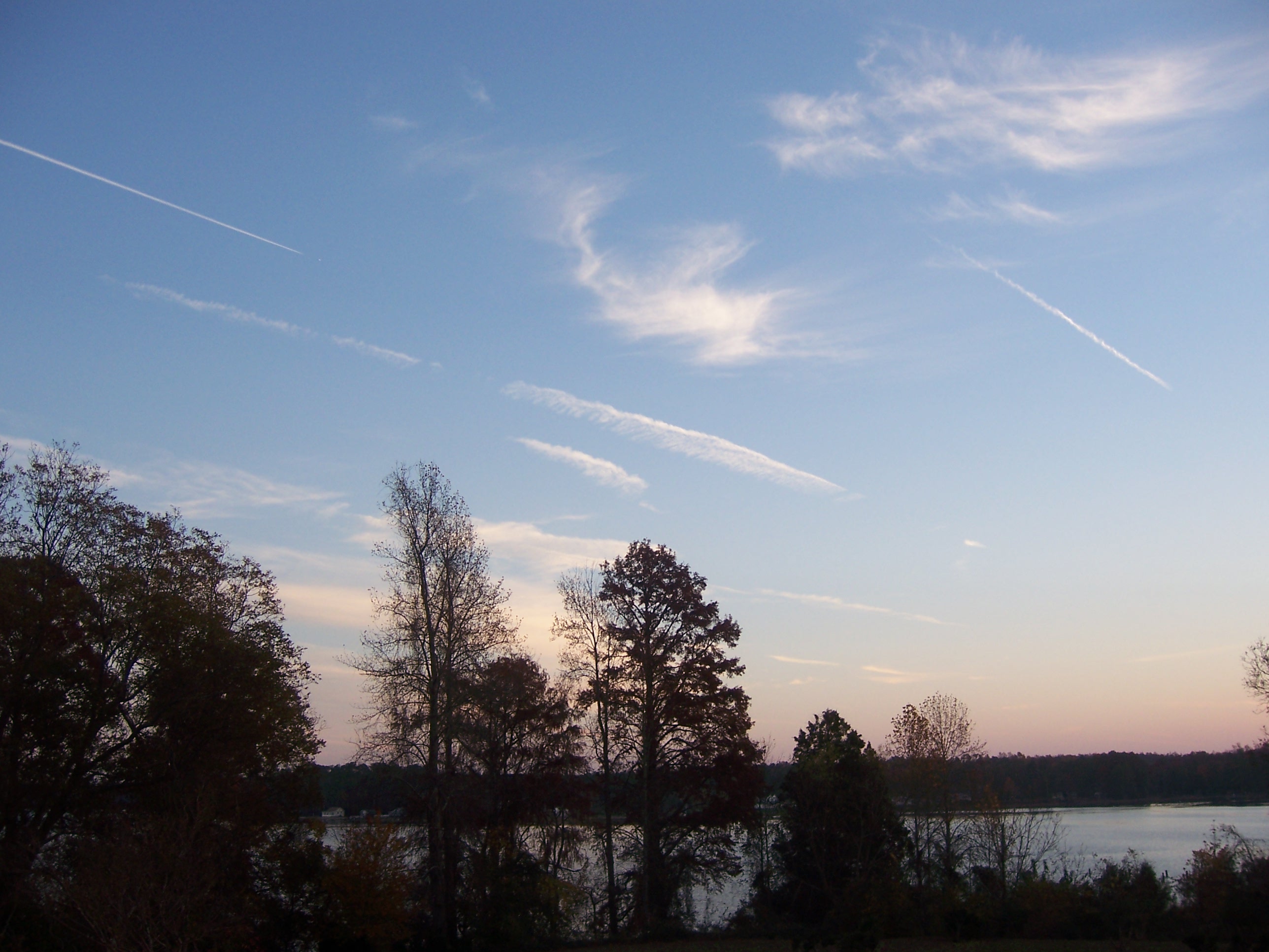
写真
Sunset Boat
#8532 - white_house_sunset
#8547 - white_house_sunset

#8560 - white_house_sunset
#8552 - white_house_sunset
#8533 - white_house_sunset
#8544 - white_house_sunset
#sunset #sunlight #sailboat #latergram
#8567 - white_house_sunset

#8975 - Greenvale Creek
#8566 - white_house_sunset_streetlight
#8967 - greenvale-sunset
Inn at Woodstock - River view at sunset

Burning Bush
#9866 - Rappahannock Sunset

#9852 - Owen on the Beach
Inn at Woodstock - River view at sunset

Sunset on the Piankatank
Queenstown Rd After, A Storm Northern Neck

Creek at Sunset

#10690-10692 - Corrotoman / Trichrome
#10449-51 - Corrotoman Sunrise (HDR)

#10455-7 - Corrotoman Sunrise (HDR)

#10446-8 - Sunrise on Whitehouse Creek (HDR)

Rappahannock River Oyster Company in Topping, Va.
アメリカ合衆国 バージニア州 サルーダの地図
別の場所を検索
アメリカ合衆国 バージニア州 サルーダでの場所
近所の場所
アメリカ合衆国 バージニア州 ミドルセックス
アメリカ合衆国 〒 バージニア州 ローカスト・ヒル
Bennett Farm Rd, Locust Hill, VA アメリカ合衆国Bennett Farm Road
Deerchase Rd, Saluda, VA アメリカ合衆国ディアチェース・ロード
Kates Neck Rd, Topping, VA アメリカ合衆国
50 Canton Dr, Hartfield, VA アメリカ合衆国
Highgate Ln, Gloucester Courthouse, VA アメリカ合衆国Highgate Lane
Walton Dr, Saluda, VA アメリカ合衆国ウォルトン・ドライブ
アメリカ合衆国 〒 バージニア州 サルーダ
Shore Dr, Hartfield, VA アメリカ合衆国
General Puller Hwy, Saluda, VA アメリカ合衆国
General Puller Hwy, Hartfield, VA アメリカ合衆国
Willow Ln, Wake, VA アメリカ合衆国
Salem Church Rd, Gloucester, VA アメリカ合衆国
59 Salt House Ln, Topping, VA アメリカ合衆国
アメリカ合衆国 〒 バージニア州 ハートフィールド
Hunny Pot Ln, Petsworth, VA アメリカ合衆国ハニー・ポット・レーン
River Run Dr, Hartfield, VA アメリカ合衆国リバー・ラン・ドライブ
48 Lakeview Dr, Hartfield, VA アメリカ合衆国
アメリカ合衆国 〒 バージニア州 ハートフィールド
最近の検索
- アメリカ合衆国 アラスカ州 レッド・ドッグ・マイン日の出日の入り時間
- Am bhf, Borken, ドイツアム・バーンホーフ日の出日の入り時間
- 4th St E, Sonoma, CA, USA日の出日の入り時間
- Oakland Ave, Williamsport, PA アメリカ合衆国日の出日の入り時間
- Via Roma, Pieranica CR, イタリアローマ通り日の出日の入り時間
- クロアチア 〒 ドゥブロブニク GradClock Tower of Dubrovnik日の出日の入り時間
- アルゼンチン チュブ州 トレリュー日の出日の入り時間
- Hartfords Bluff Cir, Mt Pleasant, SC アメリカ合衆国日の出日の入り時間
- 日本、熊本県熊本市北区日の出日の入り時間
- 中華人民共和国 福州市 平潭県 平潭島日の出日の入り時間