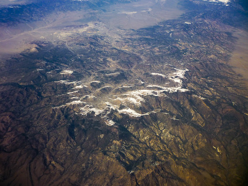
アメリカ合衆国 ネバダ州 ロッキー・ピーク日の出日の入り時間
Location: アメリカ合衆国 > パランプ >
時間帯:
America/Los_Angeles
現地時間:
2025-07-09 18:53:02
経度:
-116.7803448
緯度:
38.3088235
今日の日の出時刻:
05:32:53 AM
今日の日の入時刻:
08:12:23 PM
今日の日長:
14h 39m 30s
明日の日の出時刻:
05:33:33 AM
明日の日の入時刻:
08:11:58 PM
明日の日長:
14h 38m 25s
すべて表示する
| 日付 | 日出 | 日没 | 日長 |
|---|---|---|---|
| 2025年01月01日 | 07:04:07 AM | 04:38:34 PM | 9h 34m 27s |
| 2025年01月02日 | 07:04:11 AM | 04:39:24 PM | 9h 35m 13s |
| 2025年01月03日 | 07:04:14 AM | 04:40:16 PM | 9h 36m 2s |
| 2025年01月04日 | 07:04:14 AM | 04:41:09 PM | 9h 36m 55s |
| 2025年01月05日 | 07:04:12 AM | 04:42:04 PM | 9h 37m 52s |
| 2025年01月06日 | 07:04:08 AM | 04:42:59 PM | 9h 38m 51s |
| 2025年01月07日 | 07:04:02 AM | 04:43:56 PM | 9h 39m 54s |
| 2025年01月08日 | 07:03:54 AM | 04:44:53 PM | 9h 40m 59s |
| 2025年01月09日 | 07:03:44 AM | 04:45:52 PM | 9h 42m 8s |
| 2025年01月10日 | 07:03:32 AM | 04:46:51 PM | 9h 43m 19s |
| 2025年01月11日 | 07:03:17 AM | 04:47:52 PM | 9h 44m 35s |
| 2025年01月12日 | 07:03:01 AM | 04:48:53 PM | 9h 45m 52s |
| 2025年01月13日 | 07:02:42 AM | 04:49:55 PM | 9h 47m 13s |
| 2025年01月14日 | 07:02:22 AM | 04:50:58 PM | 9h 48m 36s |
| 2025年01月15日 | 07:01:59 AM | 04:52:01 PM | 9h 50m 2s |
| 2025年01月16日 | 07:01:34 AM | 04:53:05 PM | 9h 51m 31s |
| 2025年01月17日 | 07:01:07 AM | 04:54:10 PM | 9h 53m 3s |
| 2025年01月18日 | 07:00:39 AM | 04:55:15 PM | 9h 54m 36s |
| 2025年01月19日 | 07:00:08 AM | 04:56:21 PM | 9h 56m 13s |
| 2025年01月20日 | 06:59:35 AM | 04:57:27 PM | 9h 57m 52s |
| 2025年01月21日 | 06:59:01 AM | 04:58:34 PM | 9h 59m 33s |
| 2025年01月22日 | 06:58:24 AM | 04:59:40 PM | 10h 1m 16s |
| 2025年01月23日 | 06:57:46 AM | 05:00:48 PM | 10h 3m 2s |
| 2025年01月24日 | 06:57:06 AM | 05:01:55 PM | 10h 4m 49s |
| 2025年01月25日 | 06:56:24 AM | 05:03:03 PM | 10h 6m 39s |
| 2025年01月26日 | 06:55:40 AM | 05:04:10 PM | 10h 8m 30s |
| 2025年01月27日 | 06:54:55 AM | 05:05:18 PM | 10h 10m 23s |
| 2025年01月28日 | 06:54:07 AM | 05:06:26 PM | 10h 12m 19s |
| 2025年01月29日 | 06:53:18 AM | 05:07:35 PM | 10h 14m 17s |
| 2025年01月30日 | 06:52:28 AM | 05:08:43 PM | 10h 16m 15s |
| 2025年01月31日 | 06:51:35 AM | 05:09:51 PM | 10h 18m 16s |
| 2025年02月01日 | 06:50:41 AM | 05:10:59 PM | 10h 20m 18s |
| 2025年02月02日 | 06:49:46 AM | 05:12:08 PM | 10h 22m 22s |
| 2025年02月03日 | 06:48:49 AM | 05:13:16 PM | 10h 24m 27s |
| 2025年02月04日 | 06:47:50 AM | 05:14:24 PM | 10h 26m 34s |
| 2025年02月05日 | 06:46:50 AM | 05:15:32 PM | 10h 28m 42s |
| 2025年02月06日 | 06:45:49 AM | 05:16:39 PM | 10h 30m 50s |
| 2025年02月07日 | 06:44:46 AM | 05:17:47 PM | 10h 33m 1s |
| 2025年02月08日 | 06:43:41 AM | 05:18:54 PM | 10h 35m 13s |
| 2025年02月09日 | 06:42:35 AM | 05:20:02 PM | 10h 37m 27s |
| 2025年02月10日 | 06:41:28 AM | 05:21:09 PM | 10h 39m 41s |
| 2025年02月11日 | 06:40:20 AM | 05:22:15 PM | 10h 41m 55s |
| 2025年02月12日 | 06:39:10 AM | 05:23:22 PM | 10h 44m 12s |
| 2025年02月13日 | 06:38:00 AM | 05:24:28 PM | 10h 46m 28s |
| 2025年02月14日 | 06:36:48 AM | 05:25:34 PM | 10h 48m 46s |
| 2025年02月15日 | 06:35:35 AM | 05:26:40 PM | 10h 51m 5s |
| 2025年02月16日 | 06:34:20 AM | 05:27:45 PM | 10h 53m 25s |
| 2025年02月17日 | 06:33:05 AM | 05:28:51 PM | 10h 55m 46s |
| 2025年02月18日 | 06:31:49 AM | 05:29:55 PM | 10h 58m 6s |
| 2025年02月19日 | 06:30:31 AM | 05:31:00 PM | 11h 0m 29s |
| 2025年02月20日 | 06:29:13 AM | 05:32:04 PM | 11h 2m 51s |
| 2025年02月21日 | 06:27:53 AM | 05:33:08 PM | 11h 5m 15s |
| 2025年02月22日 | 06:26:33 AM | 05:34:12 PM | 11h 7m 39s |
| 2025年02月23日 | 06:25:12 AM | 05:35:15 PM | 11h 10m 3s |
| 2025年02月24日 | 06:23:50 AM | 05:36:18 PM | 11h 12m 28s |
| 2025年02月25日 | 06:22:27 AM | 05:37:21 PM | 11h 14m 54s |
| 2025年02月26日 | 06:21:04 AM | 05:38:23 PM | 11h 17m 19s |
| 2025年02月27日 | 06:19:39 AM | 05:39:25 PM | 11h 19m 46s |
| 2025年02月28日 | 06:18:14 AM | 05:40:27 PM | 11h 22m 13s |
| 2025年03月01日 | 06:16:49 AM | 05:41:28 PM | 11h 24m 39s |
| 2025年03月02日 | 06:15:22 AM | 05:42:29 PM | 11h 27m 7s |
| 2025年03月03日 | 06:13:55 AM | 05:43:30 PM | 11h 29m 35s |
| 2025年03月04日 | 06:12:28 AM | 05:44:31 PM | 11h 32m 3s |
| 2025年03月05日 | 06:11:00 AM | 05:45:31 PM | 11h 34m 31s |
| 2025年03月06日 | 06:09:31 AM | 05:46:31 PM | 11h 37m 0s |
| 2025年03月07日 | 06:08:02 AM | 05:47:31 PM | 11h 39m 29s |
| 2025年03月08日 | 06:06:32 AM | 05:48:30 PM | 11h 41m 58s |
| 2025年03月09日 | 07:05:06 AM | 06:49:27 PM | 11h 44m 21s |
| 2025年03月10日 | 07:03:35 AM | 06:50:26 PM | 11h 46m 51s |
| 2025年03月11日 | 07:02:05 AM | 06:51:24 PM | 11h 49m 19s |
| 2025年03月12日 | 07:00:33 AM | 06:52:23 PM | 11h 51m 50s |
| 2025年03月13日 | 06:59:02 AM | 06:53:21 PM | 11h 54m 19s |
| 2025年03月14日 | 06:57:30 AM | 06:54:19 PM | 11h 56m 49s |
| 2025年03月15日 | 06:55:58 AM | 06:55:17 PM | 11h 59m 19s |
| 2025年03月16日 | 06:54:26 AM | 06:56:15 PM | 12h 1m 49s |
| 2025年03月17日 | 06:52:54 AM | 06:57:12 PM | 12h 4m 18s |
| 2025年03月18日 | 06:51:21 AM | 06:58:10 PM | 12h 6m 49s |
| 2025年03月19日 | 06:49:49 AM | 06:59:07 PM | 12h 9m 18s |
| 2025年03月20日 | 06:48:16 AM | 07:00:04 PM | 12h 11m 48s |
| 2025年03月21日 | 06:46:43 AM | 07:01:01 PM | 12h 14m 18s |
| 2025年03月22日 | 06:45:10 AM | 07:01:58 PM | 12h 16m 48s |
| 2025年03月23日 | 06:43:37 AM | 07:02:55 PM | 12h 19m 18s |
| 2025年03月24日 | 06:42:05 AM | 07:03:51 PM | 12h 21m 46s |
| 2025年03月25日 | 06:40:32 AM | 07:04:48 PM | 12h 24m 16s |
| 2025年03月26日 | 06:38:59 AM | 07:05:44 PM | 12h 26m 45s |
| 2025年03月27日 | 06:37:27 AM | 07:06:41 PM | 12h 29m 14s |
| 2025年03月28日 | 06:35:54 AM | 07:07:37 PM | 12h 31m 43s |
| 2025年03月29日 | 06:34:22 AM | 07:08:33 PM | 12h 34m 11s |
| 2025年03月30日 | 06:32:50 AM | 07:09:29 PM | 12h 36m 39s |
| 2025年03月31日 | 06:31:18 AM | 07:10:25 PM | 12h 39m 7s |
| 2025年04月01日 | 06:29:47 AM | 07:11:22 PM | 12h 41m 35s |
| 2025年04月02日 | 06:28:16 AM | 07:12:18 PM | 12h 44m 2s |
| 2025年04月03日 | 06:26:45 AM | 07:13:14 PM | 12h 46m 29s |
| 2025年04月04日 | 06:25:14 AM | 07:14:10 PM | 12h 48m 56s |
| 2025年04月05日 | 06:23:44 AM | 07:15:06 PM | 12h 51m 22s |
| 2025年04月06日 | 06:22:14 AM | 07:16:02 PM | 12h 53m 48s |
| 2025年04月07日 | 06:20:45 AM | 07:16:59 PM | 12h 56m 14s |
| 2025年04月08日 | 06:19:16 AM | 07:17:55 PM | 12h 58m 39s |
| 2025年04月09日 | 06:17:48 AM | 07:18:51 PM | 13h 1m 3s |
| 2025年04月10日 | 06:16:20 AM | 07:19:47 PM | 13h 3m 27s |
| 2025年04月11日 | 06:14:53 AM | 07:20:43 PM | 13h 5m 50s |
| 2025年04月12日 | 06:13:26 AM | 07:21:40 PM | 13h 8m 14s |
| 2025年04月13日 | 06:12:00 AM | 07:22:36 PM | 13h 10m 36s |
| 2025年04月14日 | 06:10:35 AM | 07:23:32 PM | 13h 12m 57s |
| 2025年04月15日 | 06:09:10 AM | 07:24:29 PM | 13h 15m 19s |
| 2025年04月16日 | 06:07:46 AM | 07:25:25 PM | 13h 17m 39s |
| 2025年04月17日 | 06:06:23 AM | 07:26:22 PM | 13h 19m 59s |
| 2025年04月18日 | 06:05:01 AM | 07:27:18 PM | 13h 22m 17s |
| 2025年04月19日 | 06:03:39 AM | 07:28:15 PM | 13h 24m 36s |
| 2025年04月20日 | 06:02:19 AM | 07:29:12 PM | 13h 26m 53s |
| 2025年04月21日 | 06:00:59 AM | 07:30:08 PM | 13h 29m 9s |
| 2025年04月22日 | 05:59:40 AM | 07:31:05 PM | 13h 31m 25s |
| 2025年04月23日 | 05:58:22 AM | 07:32:01 PM | 13h 33m 39s |
| 2025年04月24日 | 05:57:05 AM | 07:32:58 PM | 13h 35m 53s |
| 2025年04月25日 | 05:55:49 AM | 07:33:55 PM | 13h 38m 6s |
| 2025年04月26日 | 05:54:33 AM | 07:34:51 PM | 13h 40m 18s |
| 2025年04月27日 | 05:53:19 AM | 07:35:48 PM | 13h 42m 29s |
| 2025年04月28日 | 05:52:07 AM | 07:36:44 PM | 13h 44m 37s |
| 2025年04月29日 | 05:50:55 AM | 07:37:41 PM | 13h 46m 46s |
| 2025年04月30日 | 05:49:44 AM | 07:38:37 PM | 13h 48m 53s |
| 2025年05月01日 | 05:48:35 AM | 07:39:33 PM | 13h 50m 58s |
| 2025年05月02日 | 05:47:26 AM | 07:40:29 PM | 13h 53m 3s |
| 2025年05月03日 | 05:46:19 AM | 07:41:26 PM | 13h 55m 7s |
| 2025年05月04日 | 05:45:13 AM | 07:42:21 PM | 13h 57m 8s |
| 2025年05月05日 | 05:44:09 AM | 07:43:17 PM | 13h 59m 8s |
| 2025年05月06日 | 05:43:06 AM | 07:44:13 PM | 14h 1m 7s |
| 2025年05月07日 | 05:42:04 AM | 07:45:08 PM | 14h 3m 4s |
| 2025年05月08日 | 05:41:03 AM | 07:46:03 PM | 14h 5m 0s |
| 2025年05月09日 | 05:40:04 AM | 07:46:58 PM | 14h 6m 54s |
| 2025年05月10日 | 05:39:06 AM | 07:47:53 PM | 14h 8m 47s |
| 2025年05月11日 | 05:38:10 AM | 07:48:47 PM | 14h 10m 37s |
| 2025年05月12日 | 05:37:15 AM | 07:49:41 PM | 14h 12m 26s |
| 2025年05月13日 | 05:36:22 AM | 07:50:34 PM | 14h 14m 12s |
| 2025年05月14日 | 05:35:30 AM | 07:51:28 PM | 14h 15m 58s |
| 2025年05月15日 | 05:34:40 AM | 07:52:20 PM | 14h 17m 40s |
| 2025年05月16日 | 05:33:52 AM | 07:53:13 PM | 14h 19m 21s |
| 2025年05月17日 | 05:33:05 AM | 07:54:05 PM | 14h 21m 0s |
| 2025年05月18日 | 05:32:19 AM | 07:54:56 PM | 14h 22m 37s |
| 2025年05月19日 | 05:31:36 AM | 07:55:47 PM | 14h 24m 11s |
| 2025年05月20日 | 05:30:54 AM | 07:56:37 PM | 14h 25m 43s |
| 2025年05月21日 | 05:30:13 AM | 07:57:26 PM | 14h 27m 13s |
| 2025年05月22日 | 05:29:35 AM | 07:58:15 PM | 14h 28m 40s |
| 2025年05月23日 | 05:28:58 AM | 07:59:03 PM | 14h 30m 5s |
| 2025年05月24日 | 05:28:22 AM | 07:59:51 PM | 14h 31m 29s |
| 2025年05月25日 | 05:27:49 AM | 08:00:37 PM | 14h 32m 48s |
| 2025年05月26日 | 05:27:17 AM | 08:01:23 PM | 14h 34m 6s |
| 2025年05月27日 | 05:26:47 AM | 08:02:08 PM | 14h 35m 21s |
| 2025年05月28日 | 05:26:19 AM | 08:02:52 PM | 14h 36m 33s |
| 2025年05月29日 | 05:25:53 AM | 08:03:35 PM | 14h 37m 42s |
| 2025年05月30日 | 05:25:28 AM | 08:04:17 PM | 14h 38m 49s |
| 2025年05月31日 | 05:25:06 AM | 08:04:58 PM | 14h 39m 52s |
| 2025年06月01日 | 05:24:45 AM | 08:05:38 PM | 14h 40m 53s |
| 2025年06月02日 | 05:24:26 AM | 08:06:17 PM | 14h 41m 51s |
| 2025年06月03日 | 05:24:09 AM | 08:06:55 PM | 14h 42m 46s |
| 2025年06月04日 | 05:23:53 AM | 08:07:32 PM | 14h 43m 39s |
| 2025年06月05日 | 05:23:40 AM | 08:08:07 PM | 14h 44m 27s |
| 2025年06月06日 | 05:23:28 AM | 08:08:41 PM | 14h 45m 13s |
| 2025年06月07日 | 05:23:18 AM | 08:09:14 PM | 14h 45m 56s |
| 2025年06月08日 | 05:23:10 AM | 08:09:46 PM | 14h 46m 36s |
| 2025年06月09日 | 05:23:04 AM | 08:10:16 PM | 14h 47m 12s |
| 2025年06月10日 | 05:23:00 AM | 08:10:45 PM | 14h 47m 45s |
| 2025年06月11日 | 05:22:57 AM | 08:11:12 PM | 14h 48m 15s |
| 2025年06月12日 | 05:22:57 AM | 08:11:38 PM | 14h 48m 41s |
| 2025年06月13日 | 05:22:58 AM | 08:12:02 PM | 14h 49m 4s |
| 2025年06月14日 | 05:23:00 AM | 08:12:25 PM | 14h 49m 25s |
| 2025年06月15日 | 05:23:05 AM | 08:12:46 PM | 14h 49m 41s |
| 2025年06月16日 | 05:23:11 AM | 08:13:06 PM | 14h 49m 55s |
| 2025年06月17日 | 05:23:19 AM | 08:13:24 PM | 14h 50m 5s |
| 2025年06月18日 | 05:23:29 AM | 08:13:41 PM | 14h 50m 12s |
| 2025年06月19日 | 05:23:41 AM | 08:13:55 PM | 14h 50m 14s |
| 2025年06月20日 | 05:23:54 AM | 08:14:08 PM | 14h 50m 14s |
| 2025年06月21日 | 05:24:08 AM | 08:14:20 PM | 14h 50m 12s |
| 2025年06月22日 | 05:24:25 AM | 08:14:29 PM | 14h 50m 4s |
| 2025年06月23日 | 05:24:43 AM | 08:14:37 PM | 14h 49m 54s |
| 2025年06月24日 | 05:25:02 AM | 08:14:43 PM | 14h 49m 41s |
| 2025年06月25日 | 05:25:23 AM | 08:14:47 PM | 14h 49m 24s |
| 2025年06月26日 | 05:25:46 AM | 08:14:50 PM | 14h 49m 4s |
| 2025年06月27日 | 05:26:10 AM | 08:14:50 PM | 14h 48m 40s |
| 2025年06月28日 | 05:26:35 AM | 08:14:49 PM | 14h 48m 14s |
| 2025年06月29日 | 05:27:02 AM | 08:14:46 PM | 14h 47m 44s |
| 2025年06月30日 | 05:27:30 AM | 08:14:41 PM | 14h 47m 11s |
| 2025年07月01日 | 05:27:59 AM | 08:14:34 PM | 14h 46m 35s |
| 2025年07月02日 | 05:28:30 AM | 08:14:25 PM | 14h 45m 55s |
| 2025年07月03日 | 05:29:02 AM | 08:14:15 PM | 14h 45m 13s |
| 2025年07月04日 | 05:29:35 AM | 08:14:02 PM | 14h 44m 27s |
| 2025年07月05日 | 05:30:10 AM | 08:13:48 PM | 14h 43m 38s |
| 2025年07月06日 | 05:30:45 AM | 08:13:32 PM | 14h 42m 47s |
| 2025年07月07日 | 05:31:22 AM | 08:13:13 PM | 14h 41m 51s |
| 2025年07月08日 | 05:31:59 AM | 08:12:53 PM | 14h 40m 54s |
| 2025年07月09日 | 05:32:38 AM | 08:12:32 PM | 14h 39m 54s |
| 2025年07月10日 | 05:33:18 AM | 08:12:08 PM | 14h 38m 50s |
| 2025年07月11日 | 05:33:58 AM | 08:11:42 PM | 14h 37m 44s |
| 2025年07月12日 | 05:34:40 AM | 08:11:15 PM | 14h 36m 35s |
| 2025年07月13日 | 05:35:22 AM | 08:10:45 PM | 14h 35m 23s |
| 2025年07月14日 | 05:36:05 AM | 08:10:14 PM | 14h 34m 9s |
| 2025年07月15日 | 05:36:49 AM | 08:09:42 PM | 14h 32m 53s |
| 2025年07月16日 | 05:37:34 AM | 08:09:07 PM | 14h 31m 33s |
| 2025年07月17日 | 05:38:20 AM | 08:08:30 PM | 14h 30m 10s |
| 2025年07月18日 | 05:39:06 AM | 08:07:52 PM | 14h 28m 46s |
| 2025年07月19日 | 05:39:52 AM | 08:07:12 PM | 14h 27m 20s |
| 2025年07月20日 | 05:40:40 AM | 08:06:30 PM | 14h 25m 50s |
| 2025年07月21日 | 05:41:28 AM | 08:05:47 PM | 14h 24m 19s |
| 2025年07月22日 | 05:42:16 AM | 08:05:02 PM | 14h 22m 46s |
| 2025年07月23日 | 05:43:05 AM | 08:04:15 PM | 14h 21m 10s |
| 2025年07月24日 | 05:43:54 AM | 08:03:27 PM | 14h 19m 33s |
| 2025年07月25日 | 05:44:44 AM | 08:02:37 PM | 14h 17m 53s |
| 2025年07月26日 | 05:45:34 AM | 08:01:45 PM | 14h 16m 11s |
| 2025年07月27日 | 05:46:25 AM | 08:00:52 PM | 14h 14m 27s |
| 2025年07月28日 | 05:47:16 AM | 07:59:57 PM | 14h 12m 41s |
| 2025年07月29日 | 05:48:07 AM | 07:59:01 PM | 14h 10m 54s |
| 2025年07月30日 | 05:48:58 AM | 07:58:03 PM | 14h 9m 5s |
| 2025年07月31日 | 05:49:50 AM | 07:57:04 PM | 14h 7m 14s |
| 2025年08月01日 | 05:50:42 AM | 07:56:04 PM | 14h 5m 22s |
| 2025年08月02日 | 05:51:34 AM | 07:55:02 PM | 14h 3m 28s |
| 2025年08月03日 | 05:52:26 AM | 07:53:58 PM | 14h 1m 32s |
| 2025年08月04日 | 05:53:19 AM | 07:52:53 PM | 13h 59m 34s |
| 2025年08月05日 | 05:54:11 AM | 07:51:47 PM | 13h 57m 36s |
| 2025年08月06日 | 05:55:04 AM | 07:50:40 PM | 13h 55m 36s |
| 2025年08月07日 | 05:55:56 AM | 07:49:31 PM | 13h 53m 35s |
| 2025年08月08日 | 05:56:49 AM | 07:48:21 PM | 13h 51m 32s |
| 2025年08月09日 | 05:57:42 AM | 07:47:10 PM | 13h 49m 28s |
| 2025年08月10日 | 05:58:35 AM | 07:45:58 PM | 13h 47m 23s |
| 2025年08月11日 | 05:59:28 AM | 07:44:45 PM | 13h 45m 17s |
| 2025年08月12日 | 06:00:21 AM | 07:43:30 PM | 13h 43m 9s |
| 2025年08月13日 | 06:01:14 AM | 07:42:14 PM | 13h 41m 0s |
| 2025年08月14日 | 06:02:07 AM | 07:40:58 PM | 13h 38m 51s |
| 2025年08月15日 | 06:03:00 AM | 07:39:40 PM | 13h 36m 40s |
| 2025年08月16日 | 06:03:53 AM | 07:38:21 PM | 13h 34m 28s |
| 2025年08月17日 | 06:04:46 AM | 07:37:01 PM | 13h 32m 15s |
| 2025年08月18日 | 06:05:39 AM | 07:35:41 PM | 13h 30m 2s |
| 2025年08月19日 | 06:06:31 AM | 07:34:19 PM | 13h 27m 48s |
| 2025年08月20日 | 06:07:24 AM | 07:32:57 PM | 13h 25m 33s |
| 2025年08月21日 | 06:08:17 AM | 07:31:34 PM | 13h 23m 17s |
| 2025年08月22日 | 06:09:09 AM | 07:30:09 PM | 13h 21m 0s |
| 2025年08月23日 | 06:10:02 AM | 07:28:45 PM | 13h 18m 43s |
| 2025年08月24日 | 06:10:54 AM | 07:27:19 PM | 13h 16m 25s |
| 2025年08月25日 | 06:11:47 AM | 07:25:52 PM | 13h 14m 5s |
| 2025年08月26日 | 06:12:39 AM | 07:24:25 PM | 13h 11m 46s |
| 2025年08月27日 | 06:13:31 AM | 07:22:58 PM | 13h 9m 27s |
| 2025年08月28日 | 06:14:24 AM | 07:21:29 PM | 13h 7m 5s |
| 2025年08月29日 | 06:15:16 AM | 07:20:00 PM | 13h 4m 44s |
| 2025年08月30日 | 06:16:08 AM | 07:18:31 PM | 13h 2m 23s |
| 2025年08月31日 | 06:17:00 AM | 07:17:00 PM | 13h 0m 0s |
| 2025年09月01日 | 06:17:52 AM | 07:15:30 PM | 12h 57m 38s |
| 2025年09月02日 | 06:18:44 AM | 07:13:59 PM | 12h 55m 15s |
| 2025年09月03日 | 06:19:36 AM | 07:12:27 PM | 12h 52m 51s |
| 2025年09月04日 | 06:20:27 AM | 07:10:55 PM | 12h 50m 28s |
| 2025年09月05日 | 06:21:19 AM | 07:09:23 PM | 12h 48m 4s |
| 2025年09月06日 | 06:22:11 AM | 07:07:50 PM | 12h 45m 39s |
| 2025年09月07日 | 06:23:03 AM | 07:06:17 PM | 12h 43m 14s |
| 2025年09月08日 | 06:23:55 AM | 07:04:43 PM | 12h 40m 48s |
| 2025年09月09日 | 06:24:46 AM | 07:03:09 PM | 12h 38m 23s |
| 2025年09月10日 | 06:25:38 AM | 07:01:35 PM | 12h 35m 57s |
| 2025年09月11日 | 06:26:30 AM | 07:00:01 PM | 12h 33m 31s |
| 2025年09月12日 | 06:27:22 AM | 06:58:27 PM | 12h 31m 5s |
| 2025年09月13日 | 06:28:14 AM | 06:56:52 PM | 12h 28m 38s |
| 2025年09月14日 | 06:29:06 AM | 06:55:17 PM | 12h 26m 11s |
| 2025年09月15日 | 06:29:58 AM | 06:53:42 PM | 12h 23m 44s |
| 2025年09月16日 | 06:30:50 AM | 06:52:07 PM | 12h 21m 17s |
| 2025年09月17日 | 06:31:42 AM | 06:50:32 PM | 12h 18m 50s |
| 2025年09月18日 | 06:32:34 AM | 06:48:57 PM | 12h 16m 23s |
| 2025年09月19日 | 06:33:26 AM | 06:47:22 PM | 12h 13m 56s |
| 2025年09月20日 | 06:34:19 AM | 06:45:47 PM | 12h 11m 28s |
| 2025年09月21日 | 06:35:11 AM | 06:44:12 PM | 12h 9m 1s |
| 2025年09月22日 | 06:36:04 AM | 06:42:37 PM | 12h 6m 33s |
| 2025年09月23日 | 06:36:57 AM | 06:41:03 PM | 12h 4m 6s |
| 2025年09月24日 | 06:37:50 AM | 06:39:28 PM | 12h 1m 38s |
| 2025年09月25日 | 06:38:43 AM | 06:37:54 PM | 11h 59m 11s |
| 2025年09月26日 | 06:39:37 AM | 06:36:20 PM | 11h 56m 43s |
| 2025年09月27日 | 06:40:30 AM | 06:34:46 PM | 11h 54m 16s |
| 2025年09月28日 | 06:41:24 AM | 06:33:12 PM | 11h 51m 48s |
| 2025年09月29日 | 06:42:18 AM | 06:31:39 PM | 11h 49m 21s |
| 2025年09月30日 | 06:43:12 AM | 06:30:06 PM | 11h 46m 54s |
| 2025年10月01日 | 06:44:07 AM | 06:28:33 PM | 11h 44m 26s |
| 2025年10月02日 | 06:45:02 AM | 06:27:01 PM | 11h 41m 59s |
| 2025年10月03日 | 06:45:57 AM | 06:25:29 PM | 11h 39m 32s |
| 2025年10月04日 | 06:46:52 AM | 06:23:58 PM | 11h 37m 6s |
| 2025年10月05日 | 06:47:47 AM | 06:22:27 PM | 11h 34m 40s |
| 2025年10月06日 | 06:48:43 AM | 06:20:56 PM | 11h 32m 13s |
| 2025年10月07日 | 06:49:39 AM | 06:19:26 PM | 11h 29m 47s |
| 2025年10月08日 | 06:50:36 AM | 06:17:57 PM | 11h 27m 21s |
| 2025年10月09日 | 06:51:32 AM | 06:16:29 PM | 11h 24m 57s |
| 2025年10月10日 | 06:52:29 AM | 06:15:01 PM | 11h 22m 32s |
| 2025年10月11日 | 06:53:27 AM | 06:13:33 PM | 11h 20m 6s |
| 2025年10月12日 | 06:54:25 AM | 06:12:07 PM | 11h 17m 42s |
| 2025年10月13日 | 06:55:23 AM | 06:10:41 PM | 11h 15m 18s |
| 2025年10月14日 | 06:56:21 AM | 06:09:16 PM | 11h 12m 55s |
| 2025年10月15日 | 06:57:20 AM | 06:07:51 PM | 11h 10m 31s |
| 2025年10月16日 | 06:58:19 AM | 06:06:28 PM | 11h 8m 9s |
| 2025年10月17日 | 06:59:18 AM | 06:05:05 PM | 11h 5m 47s |
| 2025年10月18日 | 07:00:18 AM | 06:03:44 PM | 11h 3m 26s |
| 2025年10月19日 | 07:01:18 AM | 06:02:23 PM | 11h 1m 5s |
| 2025年10月20日 | 07:02:18 AM | 06:01:03 PM | 10h 58m 45s |
| 2025年10月21日 | 07:03:19 AM | 05:59:44 PM | 10h 56m 25s |
| 2025年10月22日 | 07:04:20 AM | 05:58:26 PM | 10h 54m 6s |
| 2025年10月23日 | 07:05:21 AM | 05:57:10 PM | 10h 51m 49s |
| 2025年10月24日 | 07:06:23 AM | 05:55:54 PM | 10h 49m 31s |
| 2025年10月25日 | 07:07:25 AM | 05:54:40 PM | 10h 47m 15s |
| 2025年10月26日 | 07:08:28 AM | 05:53:26 PM | 10h 44m 58s |
| 2025年10月27日 | 07:09:30 AM | 05:52:14 PM | 10h 42m 44s |
| 2025年10月28日 | 07:10:33 AM | 05:51:03 PM | 10h 40m 30s |
| 2025年10月29日 | 07:11:36 AM | 05:49:54 PM | 10h 38m 18s |
| 2025年10月30日 | 07:12:40 AM | 05:48:45 PM | 10h 36m 5s |
| 2025年10月31日 | 07:13:44 AM | 05:47:39 PM | 10h 33m 55s |
| 2025年11月01日 | 07:14:48 AM | 05:46:33 PM | 10h 31m 45s |
| 2025年11月02日 | 06:15:55 AM | 04:45:26 PM | 10h 29m 31s |
| 2025年11月03日 | 06:16:59 AM | 04:44:23 PM | 10h 27m 24s |
| 2025年11月04日 | 06:18:04 AM | 04:43:22 PM | 10h 25m 18s |
| 2025年11月05日 | 06:19:08 AM | 04:42:23 PM | 10h 23m 15s |
| 2025年11月06日 | 06:20:13 AM | 04:41:24 PM | 10h 21m 11s |
| 2025年11月07日 | 06:21:18 AM | 04:40:28 PM | 10h 19m 10s |
| 2025年11月08日 | 06:22:23 AM | 04:39:33 PM | 10h 17m 10s |
| 2025年11月09日 | 06:23:28 AM | 04:38:40 PM | 10h 15m 12s |
| 2025年11月10日 | 06:24:33 AM | 04:37:48 PM | 10h 13m 15s |
| 2025年11月11日 | 06:25:39 AM | 04:36:58 PM | 10h 11m 19s |
| 2025年11月12日 | 06:26:44 AM | 04:36:10 PM | 10h 9m 26s |
| 2025年11月13日 | 06:27:49 AM | 04:35:23 PM | 10h 7m 34s |
| 2025年11月14日 | 06:28:54 AM | 04:34:39 PM | 10h 5m 45s |
| 2025年11月15日 | 06:29:59 AM | 04:33:56 PM | 10h 3m 57s |
| 2025年11月16日 | 06:31:03 AM | 04:33:15 PM | 10h 2m 12s |
| 2025年11月17日 | 06:32:08 AM | 04:32:36 PM | 10h 0m 28s |
| 2025年11月18日 | 06:33:12 AM | 04:31:58 PM | 9h 58m 46s |
| 2025年11月19日 | 06:34:16 AM | 04:31:23 PM | 9h 57m 7s |
| 2025年11月20日 | 06:35:19 AM | 04:30:50 PM | 9h 55m 31s |
| 2025年11月21日 | 06:36:22 AM | 04:30:18 PM | 9h 53m 56s |
| 2025年11月22日 | 06:37:25 AM | 04:29:49 PM | 9h 52m 24s |
| 2025年11月23日 | 06:38:27 AM | 04:29:22 PM | 9h 50m 55s |
| 2025年11月24日 | 06:39:29 AM | 04:28:56 PM | 9h 49m 27s |
| 2025年11月25日 | 06:40:30 AM | 04:28:33 PM | 9h 48m 3s |
| 2025年11月26日 | 06:41:31 AM | 04:28:12 PM | 9h 46m 41s |
| 2025年11月27日 | 06:42:31 AM | 04:27:53 PM | 9h 45m 22s |
| 2025年11月28日 | 06:43:30 AM | 04:27:36 PM | 9h 44m 6s |
| 2025年11月29日 | 06:44:28 AM | 04:27:21 PM | 9h 42m 53s |
| 2025年11月30日 | 06:45:26 AM | 04:27:08 PM | 9h 41m 42s |
| 2025年12月01日 | 06:46:23 AM | 04:26:57 PM | 9h 40m 34s |
| 2025年12月02日 | 06:47:19 AM | 04:26:49 PM | 9h 39m 30s |
| 2025年12月03日 | 06:48:13 AM | 04:26:43 PM | 9h 38m 30s |
| 2025年12月04日 | 06:49:07 AM | 04:26:38 PM | 9h 37m 31s |
| 2025年12月05日 | 06:50:00 AM | 04:26:36 PM | 9h 36m 36s |
| 2025年12月06日 | 06:50:52 AM | 04:26:36 PM | 9h 35m 44s |
| 2025年12月07日 | 06:51:42 AM | 04:26:39 PM | 9h 34m 57s |
| 2025年12月08日 | 06:52:31 AM | 04:26:43 PM | 9h 34m 12s |
| 2025年12月09日 | 06:53:19 AM | 04:26:50 PM | 9h 33m 31s |
| 2025年12月10日 | 06:54:06 AM | 04:26:58 PM | 9h 32m 52s |
| 2025年12月11日 | 06:54:51 AM | 04:27:09 PM | 9h 32m 18s |
| 2025年12月12日 | 06:55:34 AM | 04:27:22 PM | 9h 31m 48s |
| 2025年12月13日 | 06:56:17 AM | 04:27:37 PM | 9h 31m 20s |
| 2025年12月14日 | 06:56:57 AM | 04:27:54 PM | 9h 30m 57s |
| 2025年12月15日 | 06:57:37 AM | 04:28:13 PM | 9h 30m 36s |
| 2025年12月16日 | 06:58:14 AM | 04:28:34 PM | 9h 30m 20s |
| 2025年12月17日 | 06:58:50 AM | 04:28:57 PM | 9h 30m 7s |
| 2025年12月18日 | 06:59:24 AM | 04:29:22 PM | 9h 29m 58s |
| 2025年12月19日 | 06:59:57 AM | 04:29:49 PM | 9h 29m 52s |
| 2025年12月20日 | 07:00:27 AM | 04:30:18 PM | 9h 29m 51s |
| 2025年12月21日 | 07:00:56 AM | 04:30:49 PM | 9h 29m 53s |
| 2025年12月22日 | 07:01:23 AM | 04:31:22 PM | 9h 29m 59s |
| 2025年12月23日 | 07:01:48 AM | 04:31:56 PM | 9h 30m 8s |
| 2025年12月24日 | 07:02:11 AM | 04:32:33 PM | 9h 30m 22s |
| 2025年12月25日 | 07:02:33 AM | 04:33:11 PM | 9h 30m 38s |
| 2025年12月26日 | 07:02:52 AM | 04:33:50 PM | 9h 30m 58s |
| 2025年12月27日 | 07:03:09 AM | 04:34:32 PM | 9h 31m 23s |
| 2025年12月28日 | 07:03:25 AM | 04:35:15 PM | 9h 31m 50s |
| 2025年12月29日 | 07:03:38 AM | 04:35:59 PM | 9h 32m 21s |
| 2025年12月30日 | 07:03:49 AM | 04:36:45 PM | 9h 32m 56s |
| 2025年12月31日 | 07:03:58 AM | 04:37:33 PM | 9h 33m 35s |
写真
アメリカ合衆国 ネバダ州 ロッキー・ピークの地図
別の場所を検索
近所の場所
アメリカ合衆国 ネバダ州 ビッグ・テン・ピーク
アメリカ合衆国 ネバダ州 ハット・ピーク
アメリカ合衆国 ネバダ州 レッド・ピーク
アメリカ合衆国 〒 ネバダ州 ソールズベリー・ピーク
アメリカ合衆国 〒 ネバダ州 ザ・ボールド・シスター
アメリカ合衆国 〒 ネバダ州 マンハッタン
アメリカ合衆国 ネバダ州 スパニッシュ・ピーク
アメリカ合衆国 〒 ネバダ州 ショーション山
アメリカ合衆国 〒 ネバダ州 リトル・テーブル山
アメリカ合衆国 ネバダ州 ジェファーソン, サウス・サミット山
アメリカ合衆国 〒 ネバダ州 ラウンド・マウンテン
アメリカ合衆国 〒 ネバダ州 ジェファーソン, ノース・サミット山
アメリカ合衆国 ネバダ州 トノパー
アメリカ合衆国 〒 ネバダ州 カーバーズ
アメリカ合衆国 〒 ネバダ州 グッディング山
アメリカ合衆国 〒 ネバダ州 トワヤブ・ドーム
アメリカ合衆国 ネバダ州 マホガニー山
アメリカ合衆国 〒 ネバダ州 ワイルドキャット・ピーク
アメリカ合衆国 〒 ネバダ州 マスケット・ピーク
アメリカ合衆国 ネバダ州 ピーバイン山
最近の検索
- アメリカ合衆国 アラスカ州 レッド・ドッグ・マイン日の出日の入り時間
- Am bhf, Borken, ドイツアム・バーンホーフ日の出日の入り時間
- 4th St E, Sonoma, CA, USA日の出日の入り時間
- Oakland Ave, Williamsport, PA アメリカ合衆国日の出日の入り時間
- Via Roma, Pieranica CR, イタリアローマ通り日の出日の入り時間
- クロアチア 〒 ドゥブロブニク GradClock Tower of Dubrovnik日の出日の入り時間
- アルゼンチン チュブ州 トレリュー日の出日の入り時間
- Hartfords Bluff Cir, Mt Pleasant, SC アメリカ合衆国日の出日の入り時間
- 日本、熊本県熊本市北区日の出日の入り時間
- 中華人民共和国 福州市 平潭県 平潭島日の出日の入り時間

