アメリカ合衆国 〒 ワシントン州 ダンビル ロッキー山日の出日の入り時間
Location: アメリカ合衆国 > ワシントン州 > フェリー > アメリカ合衆国 〒 ワシントン州 ダンビル >
時間帯:
America/Los_Angeles
現地時間:
2025-06-24 12:37:29
経度:
-118.4080724
緯度:
48.888509
今日の日の出時刻:
04:51:21 AM
今日の日の入時刻:
09:01:35 PM
今日の日長:
16h 10m 14s
明日の日の出時刻:
04:51:48 AM
明日の日の入時刻:
09:01:33 PM
明日の日長:
16h 9m 45s
すべて表示する
| 日付 | 日出 | 日没 | 日長 |
|---|---|---|---|
| 2025年01月01日 | 07:46:56 AM | 04:08:46 PM | 8h 21m 50s |
| 2025年01月02日 | 07:46:48 AM | 04:09:50 PM | 8h 23m 2s |
| 2025年01月03日 | 07:46:36 AM | 04:10:55 PM | 8h 24m 19s |
| 2025年01月04日 | 07:46:22 AM | 04:12:03 PM | 8h 25m 41s |
| 2025年01月05日 | 07:46:05 AM | 04:13:13 PM | 8h 27m 8s |
| 2025年01月06日 | 07:45:45 AM | 04:14:24 PM | 8h 28m 39s |
| 2025年01月07日 | 07:45:22 AM | 04:15:38 PM | 8h 30m 16s |
| 2025年01月08日 | 07:44:56 AM | 04:16:54 PM | 8h 31m 58s |
| 2025年01月09日 | 07:44:27 AM | 04:18:11 PM | 8h 33m 44s |
| 2025年01月10日 | 07:43:55 AM | 04:19:30 PM | 8h 35m 35s |
| 2025年01月11日 | 07:43:20 AM | 04:20:50 PM | 8h 37m 30s |
| 2025年01月12日 | 07:42:43 AM | 04:22:12 PM | 8h 39m 29s |
| 2025年01月13日 | 07:42:03 AM | 04:23:36 PM | 8h 41m 33s |
| 2025年01月14日 | 07:41:20 AM | 04:25:01 PM | 8h 43m 41s |
| 2025年01月15日 | 07:40:34 AM | 04:26:27 PM | 8h 45m 53s |
| 2025年01月16日 | 07:39:46 AM | 04:27:55 PM | 8h 48m 9s |
| 2025年01月17日 | 07:38:55 AM | 04:29:24 PM | 8h 50m 29s |
| 2025年01月18日 | 07:38:02 AM | 04:30:53 PM | 8h 52m 51s |
| 2025年01月19日 | 07:37:06 AM | 04:32:24 PM | 8h 55m 18s |
| 2025年01月20日 | 07:36:08 AM | 04:33:56 PM | 8h 57m 48s |
| 2025年01月21日 | 07:35:07 AM | 04:35:29 PM | 9h 0m 22s |
| 2025年01月22日 | 07:34:04 AM | 04:37:02 PM | 9h 2m 58s |
| 2025年01月23日 | 07:32:59 AM | 04:38:37 PM | 9h 5m 38s |
| 2025年01月24日 | 07:31:51 AM | 04:40:12 PM | 9h 8m 21s |
| 2025年01月25日 | 07:30:41 AM | 04:41:47 PM | 9h 11m 6s |
| 2025年01月26日 | 07:29:29 AM | 04:43:23 PM | 9h 13m 54s |
| 2025年01月27日 | 07:28:14 AM | 04:45:00 PM | 9h 16m 46s |
| 2025年01月28日 | 07:26:58 AM | 04:46:37 PM | 9h 19m 39s |
| 2025年01月29日 | 07:25:39 AM | 04:48:15 PM | 9h 22m 36s |
| 2025年01月30日 | 07:24:19 AM | 04:49:53 PM | 9h 25m 34s |
| 2025年01月31日 | 07:22:57 AM | 04:51:31 PM | 9h 28m 34s |
| 2025年02月01日 | 07:21:32 AM | 04:53:10 PM | 9h 31m 38s |
| 2025年02月02日 | 07:20:06 AM | 04:54:49 PM | 9h 34m 43s |
| 2025年02月03日 | 07:18:38 AM | 04:56:28 PM | 9h 37m 50s |
| 2025年02月04日 | 07:17:08 AM | 04:58:07 PM | 9h 40m 59s |
| 2025年02月05日 | 07:15:37 AM | 04:59:46 PM | 9h 44m 9s |
| 2025年02月06日 | 07:14:04 AM | 05:01:25 PM | 9h 47m 21s |
| 2025年02月07日 | 07:12:29 AM | 05:03:05 PM | 9h 50m 36s |
| 2025年02月08日 | 07:10:53 AM | 05:04:44 PM | 9h 53m 51s |
| 2025年02月09日 | 07:09:15 AM | 05:06:23 PM | 9h 57m 8s |
| 2025年02月10日 | 07:07:36 AM | 05:08:02 PM | 10h 0m 26s |
| 2025年02月11日 | 07:05:55 AM | 05:09:42 PM | 10h 3m 47s |
| 2025年02月12日 | 07:04:13 AM | 05:11:21 PM | 10h 7m 8s |
| 2025年02月13日 | 07:02:30 AM | 05:12:59 PM | 10h 10m 29s |
| 2025年02月14日 | 07:00:45 AM | 05:14:38 PM | 10h 13m 53s |
| 2025年02月15日 | 06:58:59 AM | 05:16:17 PM | 10h 17m 18s |
| 2025年02月16日 | 06:57:12 AM | 05:17:55 PM | 10h 20m 43s |
| 2025年02月17日 | 06:55:23 AM | 05:19:33 PM | 10h 24m 10s |
| 2025年02月18日 | 06:53:34 AM | 05:21:11 PM | 10h 27m 37s |
| 2025年02月19日 | 06:51:43 AM | 05:22:49 PM | 10h 31m 6s |
| 2025年02月20日 | 06:49:52 AM | 05:24:26 PM | 10h 34m 34s |
| 2025年02月21日 | 06:47:59 AM | 05:26:04 PM | 10h 38m 5s |
| 2025年02月22日 | 06:46:05 AM | 05:27:41 PM | 10h 41m 36s |
| 2025年02月23日 | 06:44:11 AM | 05:29:17 PM | 10h 45m 6s |
| 2025年02月24日 | 06:42:15 AM | 05:30:54 PM | 10h 48m 39s |
| 2025年02月25日 | 06:40:19 AM | 05:32:30 PM | 10h 52m 11s |
| 2025年02月26日 | 06:38:22 AM | 05:34:06 PM | 10h 55m 44s |
| 2025年02月27日 | 06:36:24 AM | 05:35:42 PM | 10h 59m 18s |
| 2025年02月28日 | 06:34:25 AM | 05:37:17 PM | 11h 2m 52s |
| 2025年03月01日 | 06:32:26 AM | 05:38:52 PM | 11h 6m 26s |
| 2025年03月02日 | 06:30:26 AM | 05:40:27 PM | 11h 10m 1s |
| 2025年03月03日 | 06:28:25 AM | 05:42:01 PM | 11h 13m 36s |
| 2025年03月04日 | 06:26:24 AM | 05:43:35 PM | 11h 17m 11s |
| 2025年03月05日 | 06:24:22 AM | 05:45:09 PM | 11h 20m 47s |
| 2025年03月06日 | 06:22:20 AM | 05:46:43 PM | 11h 24m 23s |
| 2025年03月07日 | 06:20:17 AM | 05:48:17 PM | 11h 28m 0s |
| 2025年03月08日 | 06:18:13 AM | 05:49:50 PM | 11h 31m 37s |
| 2025年03月09日 | 07:16:15 AM | 06:51:19 PM | 11h 35m 4s |
| 2025年03月10日 | 07:14:11 AM | 06:52:52 PM | 11h 38m 41s |
| 2025年03月11日 | 07:12:06 AM | 06:54:24 PM | 11h 42m 18s |
| 2025年03月12日 | 07:10:01 AM | 06:55:56 PM | 11h 45m 55s |
| 2025年03月13日 | 07:07:56 AM | 06:57:28 PM | 11h 49m 32s |
| 2025年03月14日 | 07:05:50 AM | 06:59:00 PM | 11h 53m 10s |
| 2025年03月15日 | 07:03:45 AM | 07:00:32 PM | 11h 56m 47s |
| 2025年03月16日 | 07:01:39 AM | 07:02:04 PM | 12h 0m 25s |
| 2025年03月17日 | 06:59:33 AM | 07:03:35 PM | 12h 4m 2s |
| 2025年03月18日 | 06:57:26 AM | 07:05:06 PM | 12h 7m 40s |
| 2025年03月19日 | 06:55:20 AM | 07:06:37 PM | 12h 11m 17s |
| 2025年03月20日 | 06:53:13 AM | 07:08:08 PM | 12h 14m 55s |
| 2025年03月21日 | 06:51:07 AM | 07:09:38 PM | 12h 18m 31s |
| 2025年03月22日 | 06:49:00 AM | 07:11:09 PM | 12h 22m 9s |
| 2025年03月23日 | 06:46:54 AM | 07:12:39 PM | 12h 25m 45s |
| 2025年03月24日 | 06:44:47 AM | 07:14:10 PM | 12h 29m 23s |
| 2025年03月25日 | 06:42:41 AM | 07:15:40 PM | 12h 32m 59s |
| 2025年03月26日 | 06:40:34 AM | 07:17:10 PM | 12h 36m 36s |
| 2025年03月27日 | 06:38:28 AM | 07:18:40 PM | 12h 40m 12s |
| 2025年03月28日 | 06:36:22 AM | 07:20:10 PM | 12h 43m 48s |
| 2025年03月29日 | 06:34:16 AM | 07:21:40 PM | 12h 47m 24s |
| 2025年03月30日 | 06:32:10 AM | 07:23:10 PM | 12h 51m 0s |
| 2025年03月31日 | 06:30:05 AM | 07:24:40 PM | 12h 54m 35s |
| 2025年04月01日 | 06:28:00 AM | 07:26:10 PM | 12h 58m 10s |
| 2025年04月02日 | 06:25:55 AM | 07:27:39 PM | 13h 1m 44s |
| 2025年04月03日 | 06:23:51 AM | 07:29:09 PM | 13h 5m 18s |
| 2025年04月04日 | 06:21:46 AM | 07:30:39 PM | 13h 8m 53s |
| 2025年04月05日 | 06:19:43 AM | 07:32:09 PM | 13h 12m 26s |
| 2025年04月06日 | 06:17:40 AM | 07:33:38 PM | 13h 15m 58s |
| 2025年04月07日 | 06:15:37 AM | 07:35:08 PM | 13h 19m 31s |
| 2025年04月08日 | 06:13:35 AM | 07:36:37 PM | 13h 23m 2s |
| 2025年04月09日 | 06:11:33 AM | 07:38:07 PM | 13h 26m 34s |
| 2025年04月10日 | 06:09:32 AM | 07:39:37 PM | 13h 30m 5s |
| 2025年04月11日 | 06:07:31 AM | 07:41:06 PM | 13h 33m 35s |
| 2025年04月12日 | 06:05:31 AM | 07:42:36 PM | 13h 37m 5s |
| 2025年04月13日 | 06:03:32 AM | 07:44:05 PM | 13h 40m 33s |
| 2025年04月14日 | 06:01:34 AM | 07:45:35 PM | 13h 44m 1s |
| 2025年04月15日 | 05:59:36 AM | 07:47:05 PM | 13h 47m 29s |
| 2025年04月16日 | 05:57:39 AM | 07:48:34 PM | 13h 50m 55s |
| 2025年04月17日 | 05:55:43 AM | 07:50:04 PM | 13h 54m 21s |
| 2025年04月18日 | 05:53:48 AM | 07:51:33 PM | 13h 57m 45s |
| 2025年04月19日 | 05:51:53 AM | 07:53:02 PM | 14h 1m 9s |
| 2025年04月20日 | 05:50:00 AM | 07:54:32 PM | 14h 4m 32s |
| 2025年04月21日 | 05:48:07 AM | 07:56:01 PM | 14h 7m 54s |
| 2025年04月22日 | 05:46:16 AM | 07:57:30 PM | 14h 11m 14s |
| 2025年04月23日 | 05:44:25 AM | 07:58:59 PM | 14h 14m 34s |
| 2025年04月24日 | 05:42:36 AM | 08:00:28 PM | 14h 17m 52s |
| 2025年04月25日 | 05:40:48 AM | 08:01:57 PM | 14h 21m 9s |
| 2025年04月26日 | 05:39:00 AM | 08:03:25 PM | 14h 24m 25s |
| 2025年04月27日 | 05:37:15 AM | 08:04:54 PM | 14h 27m 39s |
| 2025年04月28日 | 05:35:30 AM | 08:06:22 PM | 14h 30m 52s |
| 2025年04月29日 | 05:33:47 AM | 08:07:50 PM | 14h 34m 3s |
| 2025年04月30日 | 05:32:04 AM | 08:09:18 PM | 14h 37m 14s |
| 2025年05月01日 | 05:30:24 AM | 08:10:45 PM | 14h 40m 21s |
| 2025年05月02日 | 05:28:44 AM | 08:12:13 PM | 14h 43m 29s |
| 2025年05月03日 | 05:27:07 AM | 08:13:39 PM | 14h 46m 32s |
| 2025年05月04日 | 05:25:30 AM | 08:15:06 PM | 14h 49m 36s |
| 2025年05月05日 | 05:23:55 AM | 08:16:32 PM | 14h 52m 37s |
| 2025年05月06日 | 05:22:22 AM | 08:17:58 PM | 14h 55m 36s |
| 2025年05月07日 | 05:20:50 AM | 08:19:23 PM | 14h 58m 33s |
| 2025年05月08日 | 05:19:20 AM | 08:20:47 PM | 15h 1m 27s |
| 2025年05月09日 | 05:17:52 AM | 08:22:12 PM | 15h 4m 20s |
| 2025年05月10日 | 05:16:25 AM | 08:23:35 PM | 15h 7m 10s |
| 2025年05月11日 | 05:15:00 AM | 08:24:58 PM | 15h 9m 58s |
| 2025年05月12日 | 05:13:37 AM | 08:26:20 PM | 15h 12m 43s |
| 2025年05月13日 | 05:12:16 AM | 08:27:42 PM | 15h 15m 26s |
| 2025年05月14日 | 05:10:57 AM | 08:29:02 PM | 15h 18m 5s |
| 2025年05月15日 | 05:09:40 AM | 08:30:22 PM | 15h 20m 42s |
| 2025年05月16日 | 05:08:25 AM | 08:31:41 PM | 15h 23m 16s |
| 2025年05月17日 | 05:07:11 AM | 08:32:59 PM | 15h 25m 48s |
| 2025年05月18日 | 05:06:00 AM | 08:34:16 PM | 15h 28m 16s |
| 2025年05月19日 | 05:04:51 AM | 08:35:32 PM | 15h 30m 41s |
| 2025年05月20日 | 05:03:44 AM | 08:36:47 PM | 15h 33m 3s |
| 2025年05月21日 | 05:02:40 AM | 08:38:01 PM | 15h 35m 21s |
| 2025年05月22日 | 05:01:37 AM | 08:39:13 PM | 15h 37m 36s |
| 2025年05月23日 | 05:00:37 AM | 08:40:25 PM | 15h 39m 48s |
| 2025年05月24日 | 04:59:40 AM | 08:41:35 PM | 15h 41m 55s |
| 2025年05月25日 | 04:58:44 AM | 08:42:43 PM | 15h 43m 59s |
| 2025年05月26日 | 04:57:51 AM | 08:43:50 PM | 15h 45m 59s |
| 2025年05月27日 | 04:57:01 AM | 08:44:56 PM | 15h 47m 55s |
| 2025年05月28日 | 04:56:12 AM | 08:46:00 PM | 15h 49m 48s |
| 2025年05月29日 | 04:55:27 AM | 08:47:03 PM | 15h 51m 36s |
| 2025年05月30日 | 04:54:44 AM | 08:48:03 PM | 15h 53m 19s |
| 2025年05月31日 | 04:54:03 AM | 08:49:02 PM | 15h 54m 59s |
| 2025年06月01日 | 04:53:25 AM | 08:49:59 PM | 15h 56m 34s |
| 2025年06月02日 | 04:52:50 AM | 08:50:55 PM | 15h 58m 5s |
| 2025年06月03日 | 04:52:17 AM | 08:51:48 PM | 15h 59m 31s |
| 2025年06月04日 | 04:51:47 AM | 08:52:40 PM | 16h 0m 53s |
| 2025年06月05日 | 04:51:19 AM | 08:53:29 PM | 16h 2m 10s |
| 2025年06月06日 | 04:50:55 AM | 08:54:16 PM | 16h 3m 21s |
| 2025年06月07日 | 04:50:33 AM | 08:55:01 PM | 16h 4m 28s |
| 2025年06月08日 | 04:50:13 AM | 08:55:44 PM | 16h 5m 31s |
| 2025年06月09日 | 04:49:57 AM | 08:56:25 PM | 16h 6m 28s |
| 2025年06月10日 | 04:49:43 AM | 08:57:03 PM | 16h 7m 20s |
| 2025年06月11日 | 04:49:32 AM | 08:57:39 PM | 16h 8m 7s |
| 2025年06月12日 | 04:49:23 AM | 08:58:13 PM | 16h 8m 50s |
| 2025年06月13日 | 04:49:18 AM | 08:58:44 PM | 16h 9m 26s |
| 2025年06月14日 | 04:49:15 AM | 08:59:12 PM | 16h 9m 57s |
| 2025年06月15日 | 04:49:14 AM | 08:59:39 PM | 16h 10m 25s |
| 2025年06月16日 | 04:49:17 AM | 09:00:02 PM | 16h 10m 45s |
| 2025年06月17日 | 04:49:22 AM | 09:00:23 PM | 16h 11m 1s |
| 2025年06月18日 | 04:49:30 AM | 09:00:41 PM | 16h 11m 11s |
| 2025年06月19日 | 04:49:40 AM | 09:00:57 PM | 16h 11m 17s |
| 2025年06月20日 | 04:49:53 AM | 09:01:10 PM | 16h 11m 17s |
| 2025年06月21日 | 04:50:09 AM | 09:01:20 PM | 16h 11m 11s |
| 2025年06月22日 | 04:50:27 AM | 09:01:28 PM | 16h 11m 1s |
| 2025年06月23日 | 04:50:48 AM | 09:01:33 PM | 16h 10m 45s |
| 2025年06月24日 | 04:51:12 AM | 09:01:35 PM | 16h 10m 23s |
| 2025年06月25日 | 04:51:38 AM | 09:01:34 PM | 16h 9m 56s |
| 2025年06月26日 | 04:52:06 AM | 09:01:31 PM | 16h 9m 25s |
| 2025年06月27日 | 04:52:37 AM | 09:01:25 PM | 16h 8m 48s |
| 2025年06月28日 | 04:53:10 AM | 09:01:16 PM | 16h 8m 6s |
| 2025年06月29日 | 04:53:45 AM | 09:01:04 PM | 16h 7m 19s |
| 2025年06月30日 | 04:54:23 AM | 09:00:49 PM | 16h 6m 26s |
| 2025年07月01日 | 04:55:03 AM | 09:00:32 PM | 16h 5m 29s |
| 2025年07月02日 | 04:55:45 AM | 09:00:12 PM | 16h 4m 27s |
| 2025年07月03日 | 04:56:29 AM | 08:59:49 PM | 16h 3m 20s |
| 2025年07月04日 | 04:57:15 AM | 08:59:24 PM | 16h 2m 9s |
| 2025年07月05日 | 04:58:04 AM | 08:58:55 PM | 16h 0m 51s |
| 2025年07月06日 | 04:58:54 AM | 08:58:24 PM | 15h 59m 30s |
| 2025年07月07日 | 04:59:46 AM | 08:57:51 PM | 15h 58m 5s |
| 2025年07月08日 | 05:00:40 AM | 08:57:14 PM | 15h 56m 34s |
| 2025年07月09日 | 05:01:36 AM | 08:56:35 PM | 15h 54m 59s |
| 2025年07月10日 | 05:02:33 AM | 08:55:54 PM | 15h 53m 21s |
| 2025年07月11日 | 05:03:32 AM | 08:55:10 PM | 15h 51m 38s |
| 2025年07月12日 | 05:04:33 AM | 08:54:23 PM | 15h 49m 50s |
| 2025年07月13日 | 05:05:35 AM | 08:53:34 PM | 15h 47m 59s |
| 2025年07月14日 | 05:06:39 AM | 08:52:42 PM | 15h 46m 3s |
| 2025年07月15日 | 05:07:44 AM | 08:51:48 PM | 15h 44m 4s |
| 2025年07月16日 | 05:08:51 AM | 08:50:52 PM | 15h 42m 1s |
| 2025年07月17日 | 05:09:58 AM | 08:49:53 PM | 15h 39m 55s |
| 2025年07月18日 | 05:11:07 AM | 08:48:52 PM | 15h 37m 45s |
| 2025年07月19日 | 05:12:18 AM | 08:47:48 PM | 15h 35m 30s |
| 2025年07月20日 | 05:13:29 AM | 08:46:42 PM | 15h 33m 13s |
| 2025年07月21日 | 05:14:41 AM | 08:45:35 PM | 15h 30m 54s |
| 2025年07月22日 | 05:15:55 AM | 08:44:24 PM | 15h 28m 29s |
| 2025年07月23日 | 05:17:09 AM | 08:43:12 PM | 15h 26m 3s |
| 2025年07月24日 | 05:18:25 AM | 08:41:58 PM | 15h 23m 33s |
| 2025年07月25日 | 05:19:41 AM | 08:40:41 PM | 15h 21m 0s |
| 2025年07月26日 | 05:20:58 AM | 08:39:23 PM | 15h 18m 25s |
| 2025年07月27日 | 05:22:16 AM | 08:38:03 PM | 15h 15m 47s |
| 2025年07月28日 | 05:23:34 AM | 08:36:40 PM | 15h 13m 6s |
| 2025年07月29日 | 05:24:53 AM | 08:35:16 PM | 15h 10m 23s |
| 2025年07月30日 | 05:26:13 AM | 08:33:50 PM | 15h 7m 37s |
| 2025年07月31日 | 05:27:33 AM | 08:32:22 PM | 15h 4m 49s |
| 2025年08月01日 | 05:28:54 AM | 08:30:53 PM | 15h 1m 59s |
| 2025年08月02日 | 05:30:15 AM | 08:29:22 PM | 14h 59m 7s |
| 2025年08月03日 | 05:31:37 AM | 08:27:49 PM | 14h 56m 12s |
| 2025年08月04日 | 05:32:59 AM | 08:26:14 PM | 14h 53m 15s |
| 2025年08月05日 | 05:34:21 AM | 08:24:38 PM | 14h 50m 17s |
| 2025年08月06日 | 05:35:44 AM | 08:23:01 PM | 14h 47m 17s |
| 2025年08月07日 | 05:37:08 AM | 08:21:22 PM | 14h 44m 14s |
| 2025年08月08日 | 05:38:31 AM | 08:19:41 PM | 14h 41m 10s |
| 2025年08月09日 | 05:39:55 AM | 08:17:59 PM | 14h 38m 4s |
| 2025年08月10日 | 05:41:19 AM | 08:16:16 PM | 14h 34m 57s |
| 2025年08月11日 | 05:42:43 AM | 08:14:31 PM | 14h 31m 48s |
| 2025年08月12日 | 05:44:07 AM | 08:12:45 PM | 14h 28m 38s |
| 2025年08月13日 | 05:45:31 AM | 08:10:58 PM | 14h 25m 27s |
| 2025年08月14日 | 05:46:56 AM | 08:09:10 PM | 14h 22m 14s |
| 2025年08月15日 | 05:48:21 AM | 08:07:20 PM | 14h 18m 59s |
| 2025年08月16日 | 05:49:45 AM | 08:05:30 PM | 14h 15m 45s |
| 2025年08月17日 | 05:51:10 AM | 08:03:38 PM | 14h 12m 28s |
| 2025年08月18日 | 05:52:35 AM | 08:01:45 PM | 14h 9m 10s |
| 2025年08月19日 | 05:54:00 AM | 07:59:52 PM | 14h 5m 52s |
| 2025年08月20日 | 05:55:25 AM | 07:57:57 PM | 14h 2m 32s |
| 2025年08月21日 | 05:56:50 AM | 07:56:01 PM | 13h 59m 11s |
| 2025年08月22日 | 05:58:15 AM | 07:54:05 PM | 13h 55m 50s |
| 2025年08月23日 | 05:59:40 AM | 07:52:07 PM | 13h 52m 27s |
| 2025年08月24日 | 06:01:05 AM | 07:50:09 PM | 13h 49m 4s |
| 2025年08月25日 | 06:02:30 AM | 07:48:10 PM | 13h 45m 40s |
| 2025年08月26日 | 06:03:55 AM | 07:46:10 PM | 13h 42m 15s |
| 2025年08月27日 | 06:05:20 AM | 07:44:10 PM | 13h 38m 50s |
| 2025年08月28日 | 06:06:45 AM | 07:42:09 PM | 13h 35m 24s |
| 2025年08月29日 | 06:08:10 AM | 07:40:07 PM | 13h 31m 57s |
| 2025年08月30日 | 06:09:35 AM | 07:38:04 PM | 13h 28m 29s |
| 2025年08月31日 | 06:11:00 AM | 07:36:01 PM | 13h 25m 1s |
| 2025年09月01日 | 06:12:25 AM | 07:33:58 PM | 13h 21m 33s |
| 2025年09月02日 | 06:13:50 AM | 07:31:54 PM | 13h 18m 4s |
| 2025年09月03日 | 06:15:15 AM | 07:29:49 PM | 13h 14m 34s |
| 2025年09月04日 | 06:16:40 AM | 07:27:44 PM | 13h 11m 4s |
| 2025年09月05日 | 06:18:04 AM | 07:25:38 PM | 13h 7m 34s |
| 2025年09月06日 | 06:19:29 AM | 07:23:33 PM | 13h 4m 4s |
| 2025年09月07日 | 06:20:54 AM | 07:21:26 PM | 13h 0m 32s |
| 2025年09月08日 | 06:22:19 AM | 07:19:20 PM | 12h 57m 1s |
| 2025年09月09日 | 06:23:44 AM | 07:17:13 PM | 12h 53m 29s |
| 2025年09月10日 | 06:25:09 AM | 07:15:06 PM | 12h 49m 57s |
| 2025年09月11日 | 06:26:34 AM | 07:12:58 PM | 12h 46m 24s |
| 2025年09月12日 | 06:27:59 AM | 07:10:51 PM | 12h 42m 52s |
| 2025年09月13日 | 06:29:24 AM | 07:08:43 PM | 12h 39m 19s |
| 2025年09月14日 | 06:30:49 AM | 07:06:35 PM | 12h 35m 46s |
| 2025年09月15日 | 06:32:14 AM | 07:04:27 PM | 12h 32m 13s |
| 2025年09月16日 | 06:33:39 AM | 07:02:19 PM | 12h 28m 40s |
| 2025年09月17日 | 06:35:05 AM | 07:00:10 PM | 12h 25m 5s |
| 2025年09月18日 | 06:36:30 AM | 06:58:02 PM | 12h 21m 32s |
| 2025年09月19日 | 06:37:56 AM | 06:55:54 PM | 12h 17m 58s |
| 2025年09月20日 | 06:39:21 AM | 06:53:46 PM | 12h 14m 25s |
| 2025年09月21日 | 06:40:47 AM | 06:51:37 PM | 12h 10m 50s |
| 2025年09月22日 | 06:42:13 AM | 06:49:29 PM | 12h 7m 16s |
| 2025年09月23日 | 06:43:39 AM | 06:47:21 PM | 12h 3m 42s |
| 2025年09月24日 | 06:45:06 AM | 06:45:14 PM | 12h 0m 8s |
| 2025年09月25日 | 06:46:32 AM | 06:43:06 PM | 11h 56m 34s |
| 2025年09月26日 | 06:47:59 AM | 06:40:59 PM | 11h 53m 0s |
| 2025年09月27日 | 06:49:26 AM | 06:38:51 PM | 11h 49m 25s |
| 2025年09月28日 | 06:50:53 AM | 06:36:44 PM | 11h 45m 51s |
| 2025年09月29日 | 06:52:20 AM | 06:34:38 PM | 11h 42m 18s |
| 2025年09月30日 | 06:53:48 AM | 06:32:32 PM | 11h 38m 44s |
| 2025年10月01日 | 06:55:15 AM | 06:30:26 PM | 11h 35m 11s |
| 2025年10月02日 | 06:56:43 AM | 06:28:20 PM | 11h 31m 37s |
| 2025年10月03日 | 06:58:12 AM | 06:26:15 PM | 11h 28m 3s |
| 2025年10月04日 | 06:59:40 AM | 06:24:10 PM | 11h 24m 30s |
| 2025年10月05日 | 07:01:09 AM | 06:22:06 PM | 11h 20m 57s |
| 2025年10月06日 | 07:02:38 AM | 06:20:03 PM | 11h 17m 25s |
| 2025年10月07日 | 07:04:07 AM | 06:18:00 PM | 11h 13m 53s |
| 2025年10月08日 | 07:05:37 AM | 06:15:57 PM | 11h 10m 20s |
| 2025年10月09日 | 07:07:07 AM | 06:13:55 PM | 11h 6m 48s |
| 2025年10月10日 | 07:08:37 AM | 06:11:54 PM | 11h 3m 17s |
| 2025年10月11日 | 07:10:07 AM | 06:09:54 PM | 10h 59m 47s |
| 2025年10月12日 | 07:11:38 AM | 06:07:54 PM | 10h 56m 16s |
| 2025年10月13日 | 07:13:09 AM | 06:05:55 PM | 10h 52m 46s |
| 2025年10月14日 | 07:14:41 AM | 06:03:57 PM | 10h 49m 16s |
| 2025年10月15日 | 07:16:13 AM | 06:02:00 PM | 10h 45m 47s |
| 2025年10月16日 | 07:17:45 AM | 06:00:03 PM | 10h 42m 18s |
| 2025年10月17日 | 07:19:17 AM | 05:58:08 PM | 10h 38m 51s |
| 2025年10月18日 | 07:20:49 AM | 05:56:13 PM | 10h 35m 24s |
| 2025年10月19日 | 07:22:22 AM | 05:54:20 PM | 10h 31m 58s |
| 2025年10月20日 | 07:23:56 AM | 05:52:27 PM | 10h 28m 31s |
| 2025年10月21日 | 07:25:29 AM | 05:50:35 PM | 10h 25m 6s |
| 2025年10月22日 | 07:27:03 AM | 05:48:45 PM | 10h 21m 42s |
| 2025年10月23日 | 07:28:37 AM | 05:46:56 PM | 10h 18m 19s |
| 2025年10月24日 | 07:30:11 AM | 05:45:08 PM | 10h 14m 57s |
| 2025年10月25日 | 07:31:45 AM | 05:43:21 PM | 10h 11m 36s |
| 2025年10月26日 | 07:33:20 AM | 05:41:35 PM | 10h 8m 15s |
| 2025年10月27日 | 07:34:55 AM | 05:39:51 PM | 10h 4m 56s |
| 2025年10月28日 | 07:36:30 AM | 05:38:08 PM | 10h 1m 38s |
| 2025年10月29日 | 07:38:05 AM | 05:36:27 PM | 9h 58m 22s |
| 2025年10月30日 | 07:39:40 AM | 05:34:47 PM | 9h 55m 7s |
| 2025年10月31日 | 07:41:15 AM | 05:33:08 PM | 9h 51m 53s |
| 2025年11月01日 | 07:42:51 AM | 05:31:31 PM | 9h 48m 40s |
| 2025年11月02日 | 06:44:30 AM | 04:29:52 PM | 9h 45m 22s |
| 2025年11月03日 | 06:46:05 AM | 04:28:18 PM | 9h 42m 13s |
| 2025年11月04日 | 06:47:41 AM | 04:26:46 PM | 9h 39m 5s |
| 2025年11月05日 | 06:49:16 AM | 04:25:16 PM | 9h 36m 0s |
| 2025年11月06日 | 06:50:51 AM | 04:23:47 PM | 9h 32m 56s |
| 2025年11月07日 | 06:52:27 AM | 04:22:21 PM | 9h 29m 54s |
| 2025年11月08日 | 06:54:02 AM | 04:20:56 PM | 9h 26m 54s |
| 2025年11月09日 | 06:55:36 AM | 04:19:33 PM | 9h 23m 57s |
| 2025年11月10日 | 06:57:11 AM | 04:18:12 PM | 9h 21m 1s |
| 2025年11月11日 | 06:58:45 AM | 04:16:53 PM | 9h 18m 8s |
| 2025年11月12日 | 07:00:19 AM | 04:15:36 PM | 9h 15m 17s |
| 2025年11月13日 | 07:01:52 AM | 04:14:21 PM | 9h 12m 29s |
| 2025年11月14日 | 07:03:25 AM | 04:13:09 PM | 9h 9m 44s |
| 2025年11月15日 | 07:04:57 AM | 04:11:58 PM | 9h 7m 1s |
| 2025年11月16日 | 07:06:29 AM | 04:10:50 PM | 9h 4m 21s |
| 2025年11月17日 | 07:08:00 AM | 04:09:45 PM | 9h 1m 45s |
| 2025年11月18日 | 07:09:31 AM | 04:08:41 PM | 8h 59m 10s |
| 2025年11月19日 | 07:11:00 AM | 04:07:40 PM | 8h 56m 40s |
| 2025年11月20日 | 07:12:29 AM | 04:06:41 PM | 8h 54m 12s |
| 2025年11月21日 | 07:13:57 AM | 04:05:45 PM | 8h 51m 48s |
| 2025年11月22日 | 07:15:24 AM | 04:04:52 PM | 8h 49m 28s |
| 2025年11月23日 | 07:16:50 AM | 04:04:01 PM | 8h 47m 11s |
| 2025年11月24日 | 07:18:15 AM | 04:03:12 PM | 8h 44m 57s |
| 2025年11月25日 | 07:19:38 AM | 04:02:27 PM | 8h 42m 49s |
| 2025年11月26日 | 07:21:01 AM | 04:01:44 PM | 8h 40m 43s |
| 2025年11月27日 | 07:22:22 AM | 04:01:03 PM | 8h 38m 41s |
| 2025年11月28日 | 07:23:41 AM | 04:00:26 PM | 8h 36m 45s |
| 2025年11月29日 | 07:25:00 AM | 03:59:51 PM | 8h 34m 51s |
| 2025年11月30日 | 07:26:16 AM | 03:59:19 PM | 8h 33m 3s |
| 2025年12月01日 | 07:27:31 AM | 03:58:51 PM | 8h 31m 20s |
| 2025年12月02日 | 07:28:44 AM | 03:58:25 PM | 8h 29m 41s |
| 2025年12月03日 | 07:29:56 AM | 03:58:02 PM | 8h 28m 6s |
| 2025年12月04日 | 07:31:06 AM | 03:57:42 PM | 8h 26m 36s |
| 2025年12月05日 | 07:32:13 AM | 03:57:24 PM | 8h 25m 11s |
| 2025年12月06日 | 07:33:19 AM | 03:57:10 PM | 8h 23m 51s |
| 2025年12月07日 | 07:34:23 AM | 03:56:59 PM | 8h 22m 36s |
| 2025年12月08日 | 07:35:24 AM | 03:56:51 PM | 8h 21m 27s |
| 2025年12月09日 | 07:36:24 AM | 03:56:47 PM | 8h 20m 23s |
| 2025年12月10日 | 07:37:21 AM | 03:56:45 PM | 8h 19m 24s |
| 2025年12月11日 | 07:38:15 AM | 03:56:46 PM | 8h 18m 31s |
| 2025年12月12日 | 07:39:08 AM | 03:56:50 PM | 8h 17m 42s |
| 2025年12月13日 | 07:39:58 AM | 03:56:58 PM | 8h 17m 0s |
| 2025年12月14日 | 07:40:45 AM | 03:57:08 PM | 8h 16m 23s |
| 2025年12月15日 | 07:41:30 AM | 03:57:22 PM | 8h 15m 52s |
| 2025年12月16日 | 07:42:12 AM | 03:57:38 PM | 8h 15m 26s |
| 2025年12月17日 | 07:42:51 AM | 03:57:58 PM | 8h 15m 7s |
| 2025年12月18日 | 07:43:28 AM | 03:58:20 PM | 8h 14m 52s |
| 2025年12月19日 | 07:44:02 AM | 03:58:46 PM | 8h 14m 44s |
| 2025年12月20日 | 07:44:33 AM | 03:59:14 PM | 8h 14m 41s |
| 2025年12月21日 | 07:45:01 AM | 03:59:46 PM | 8h 14m 45s |
| 2025年12月22日 | 07:45:27 AM | 04:00:20 PM | 8h 14m 53s |
| 2025年12月23日 | 07:45:49 AM | 04:00:57 PM | 8h 15m 8s |
| 2025年12月24日 | 07:46:09 AM | 04:01:37 PM | 8h 15m 28s |
| 2025年12月25日 | 07:46:25 AM | 04:02:20 PM | 8h 15m 55s |
| 2025年12月26日 | 07:46:39 AM | 04:03:05 PM | 8h 16m 26s |
| 2025年12月27日 | 07:46:49 AM | 04:03:53 PM | 8h 17m 4s |
| 2025年12月28日 | 07:46:57 AM | 04:04:44 PM | 8h 17m 47s |
| 2025年12月29日 | 07:47:02 AM | 04:05:37 PM | 8h 18m 35s |
| 2025年12月30日 | 07:47:03 AM | 04:06:33 PM | 8h 19m 30s |
| 2025年12月31日 | 07:47:02 AM | 04:07:31 PM | 8h 20m 29s |
写真
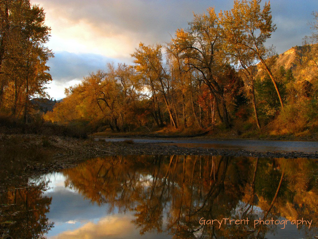
Autumn Reflections
view towards Curlew from the Mt Leona Trail
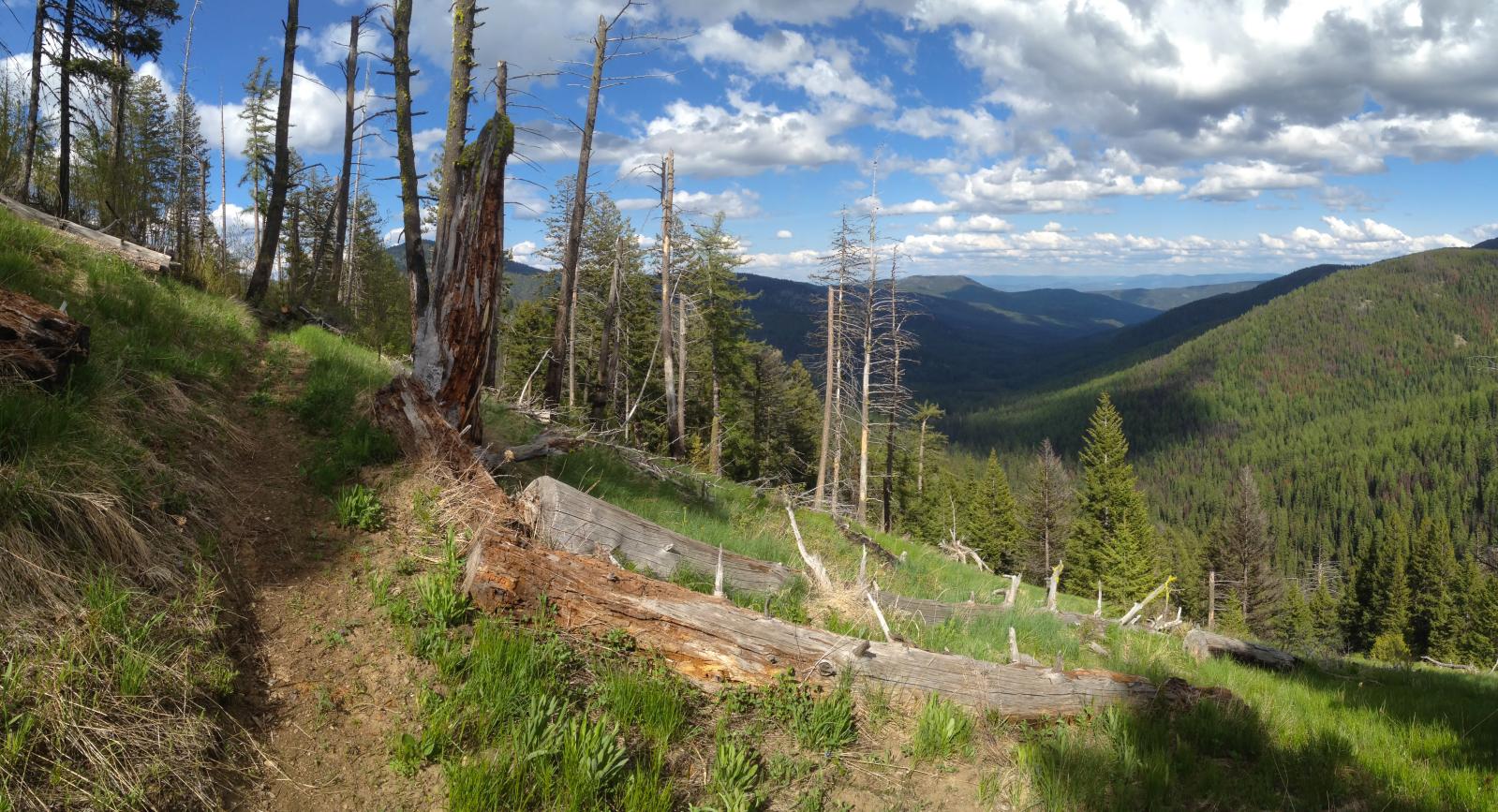
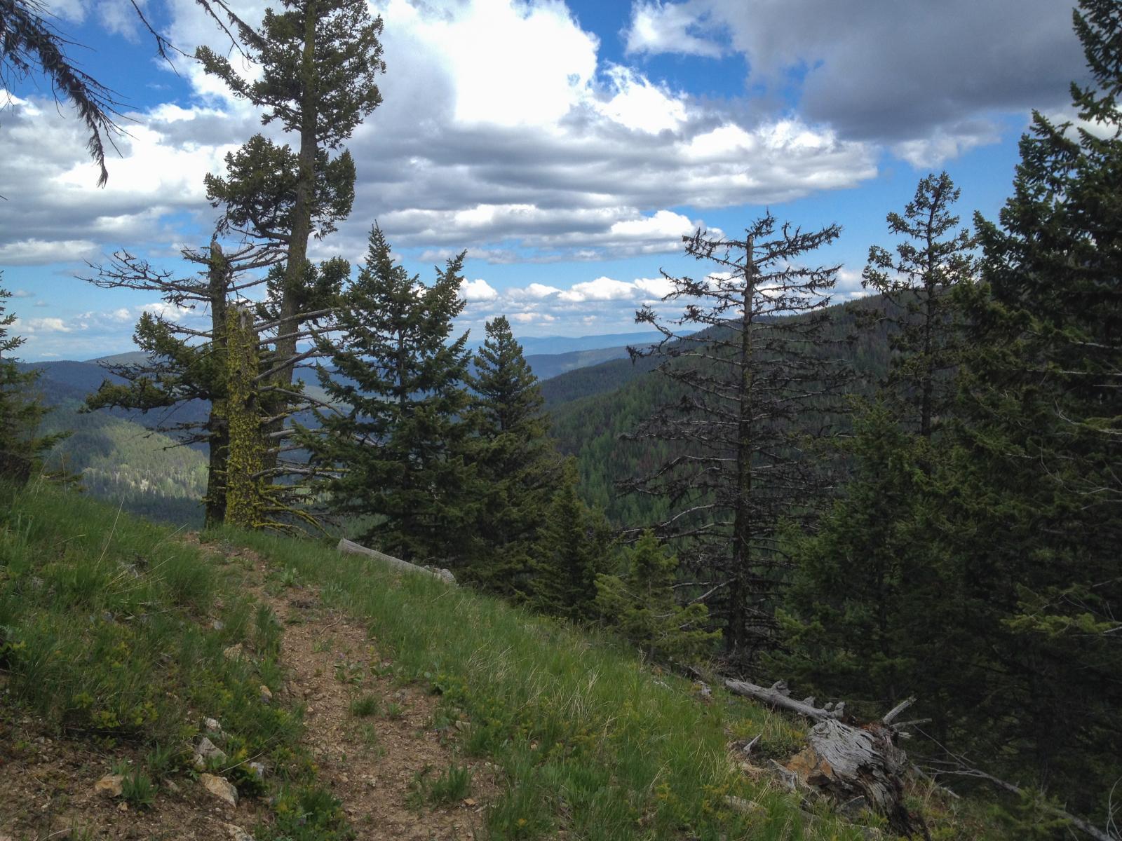
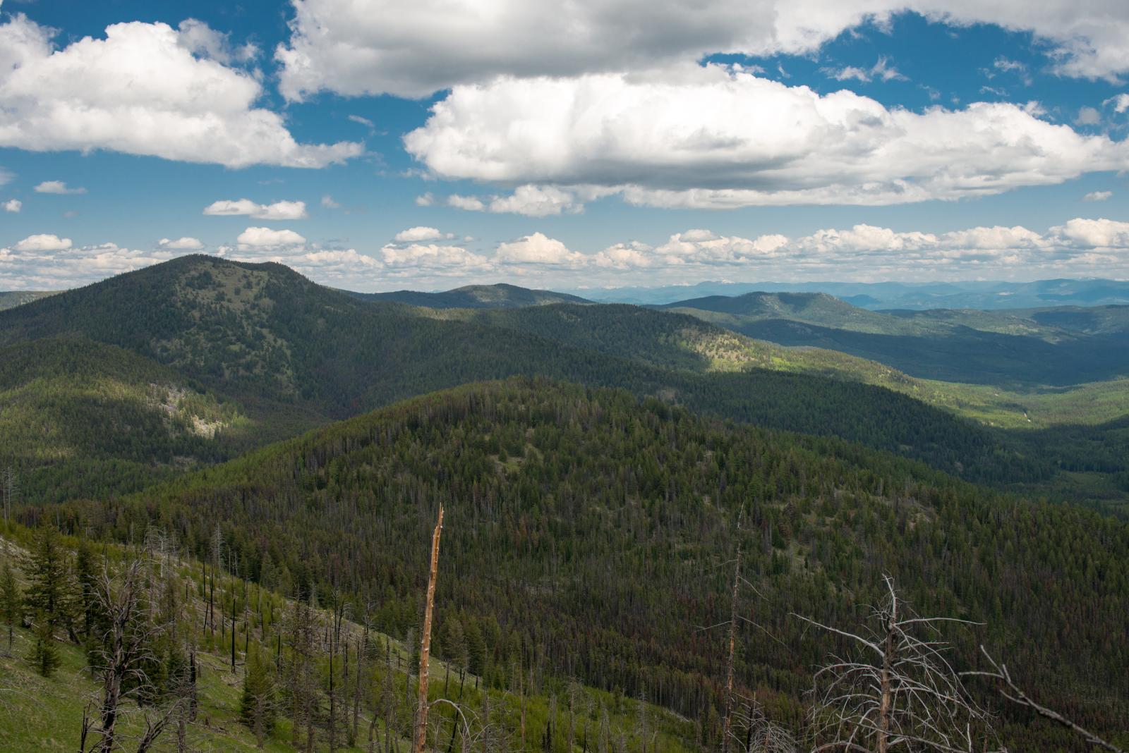
looking east down Boulder Creek from the Kettle Crest Trail near Stickpin Hill
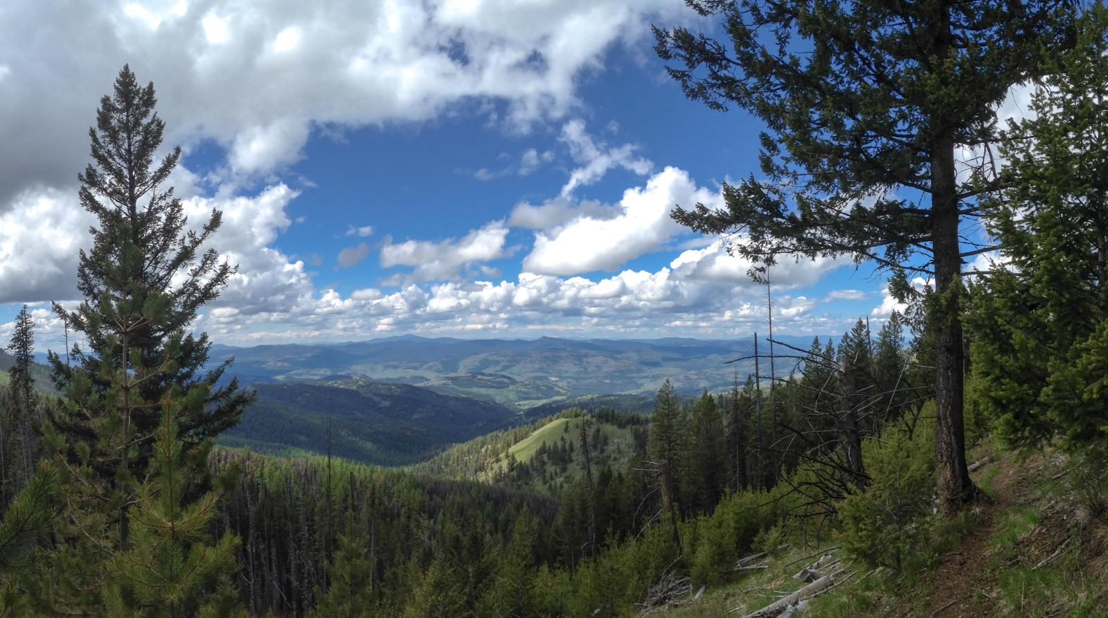
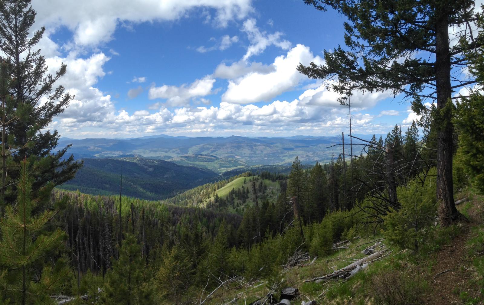
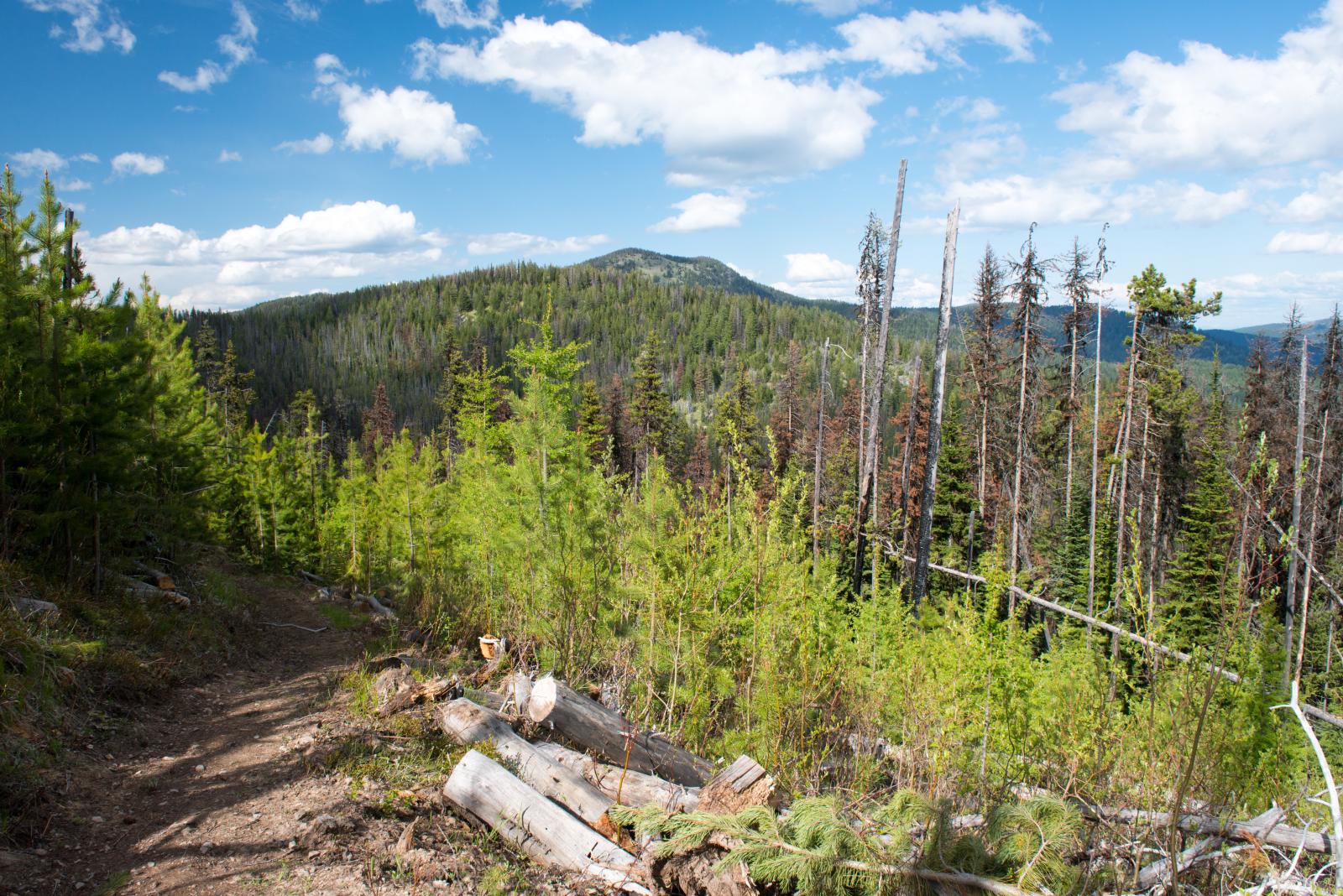
The Pacific Northwest Trail on the Kettle Crest, Boulder Creek drainage in the distance
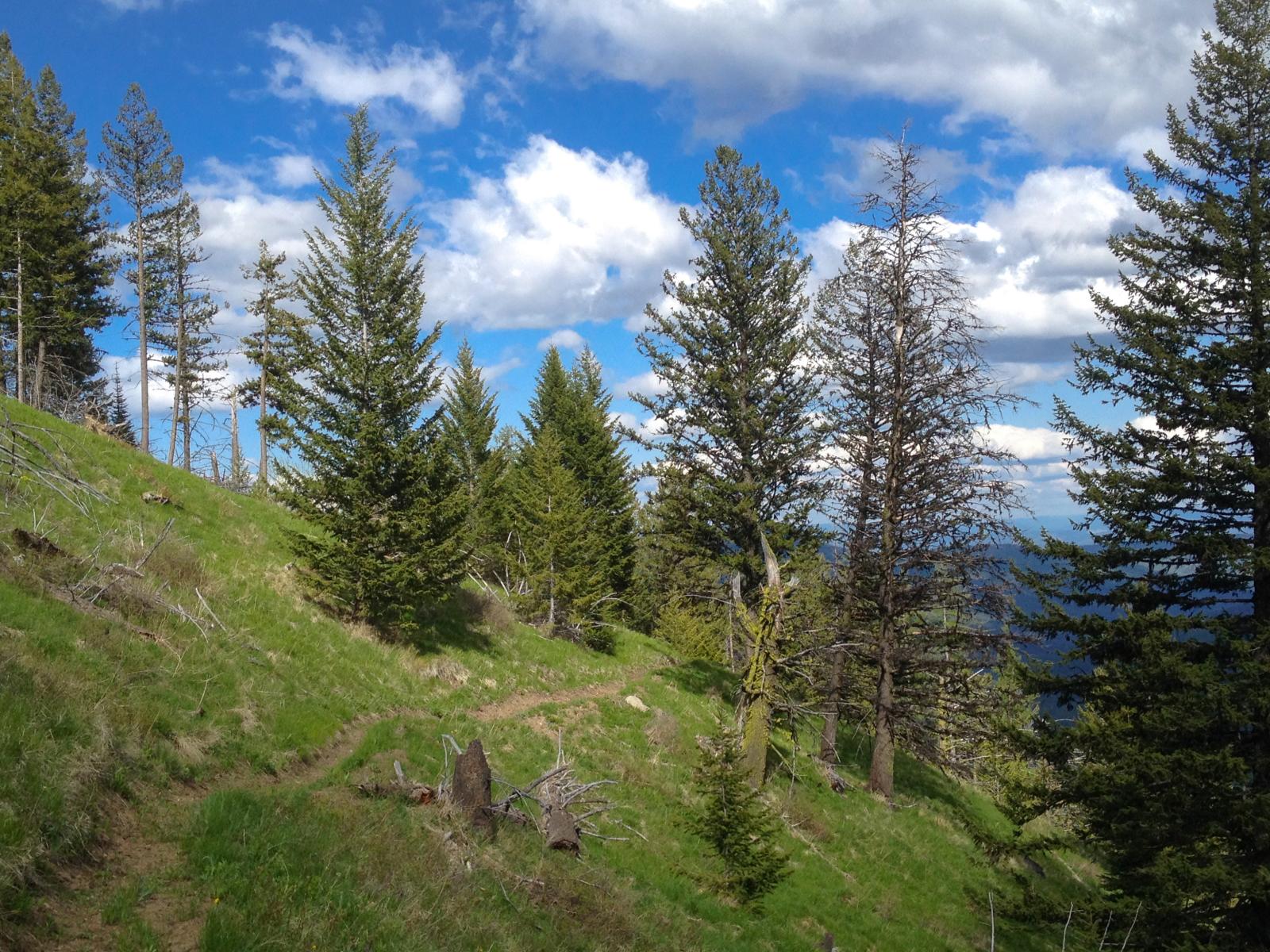
The Pacific Northwest Trail on the Kettle Crest near Ryan Hill
The Pacific Northwest Trail on the Kettle Crest near Stickpin Hill
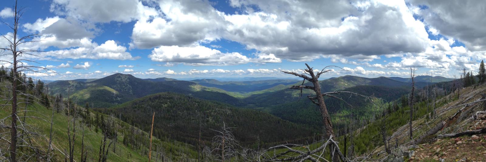
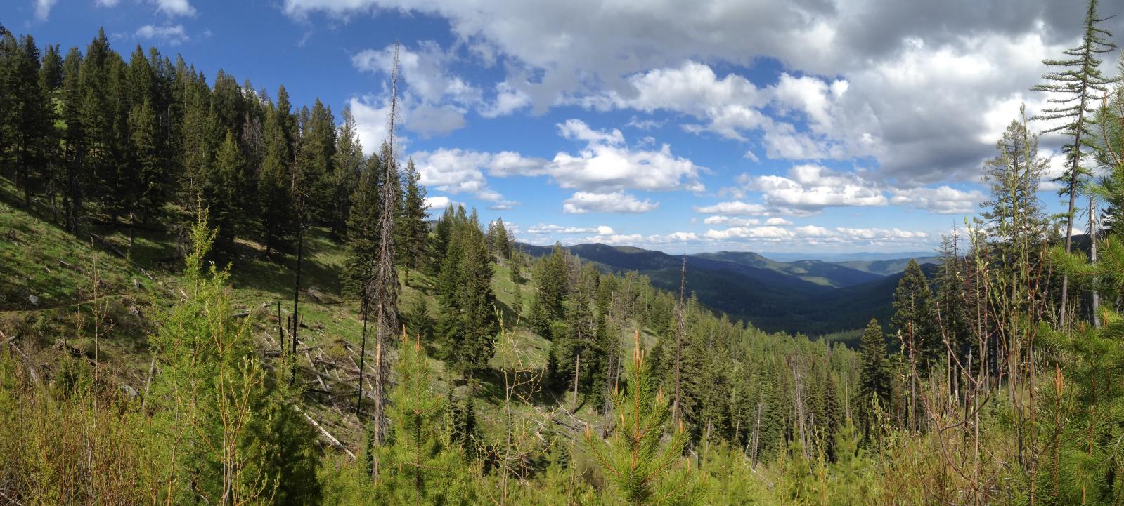
Boulder Creek panorama from the Pacific Northwest Trail on the Kettle Crest

Another Boulder Creek panorama from the Pacific Northwest Trail on the Kettle Crest
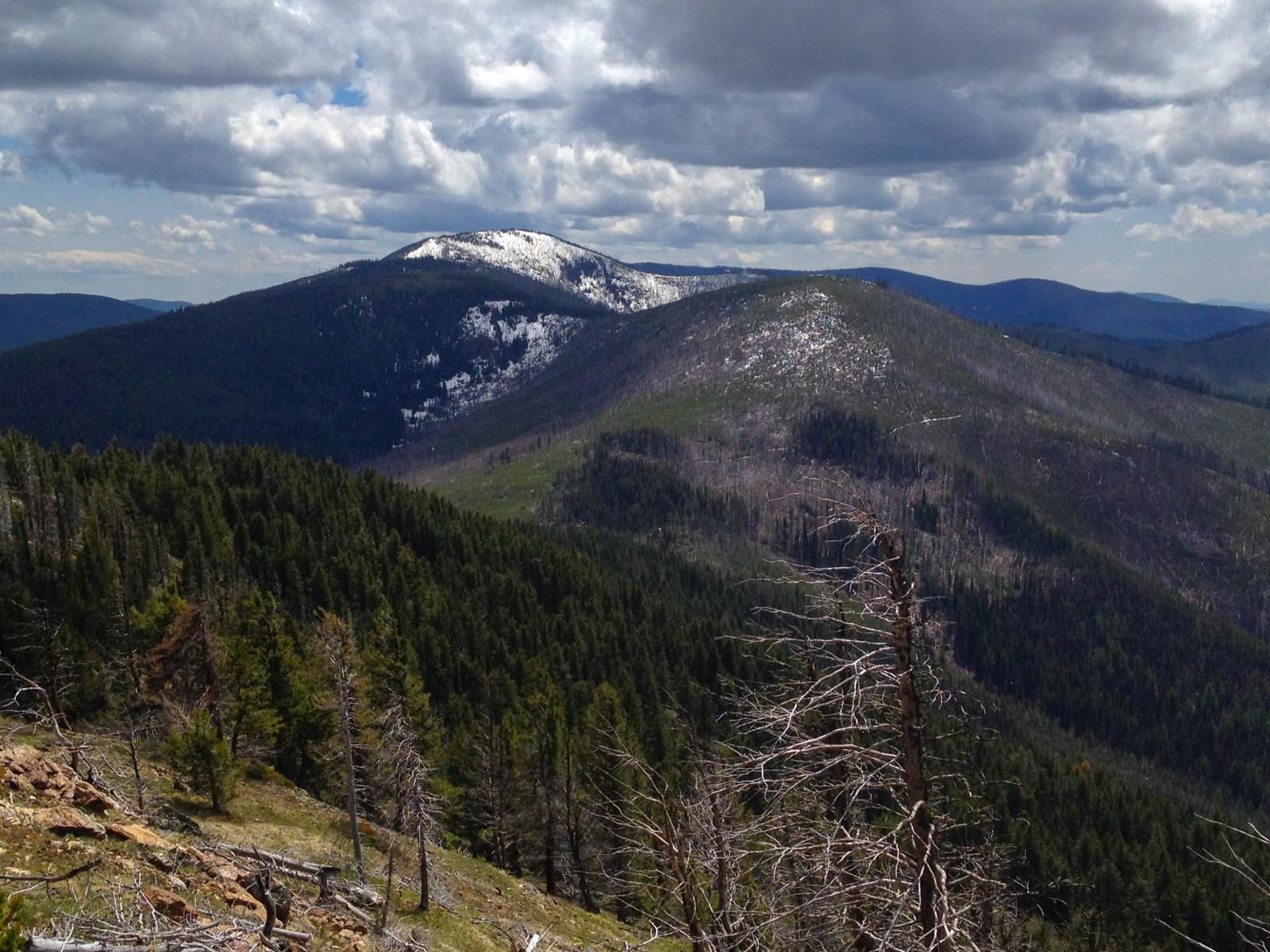
Lambert Mountain from the near the summit of Mt Leona

looking northwest from the Mt Leona Trail towards Curlew and Malo, Washington
West side of the Kettle Crest from the Mt Leona Trail
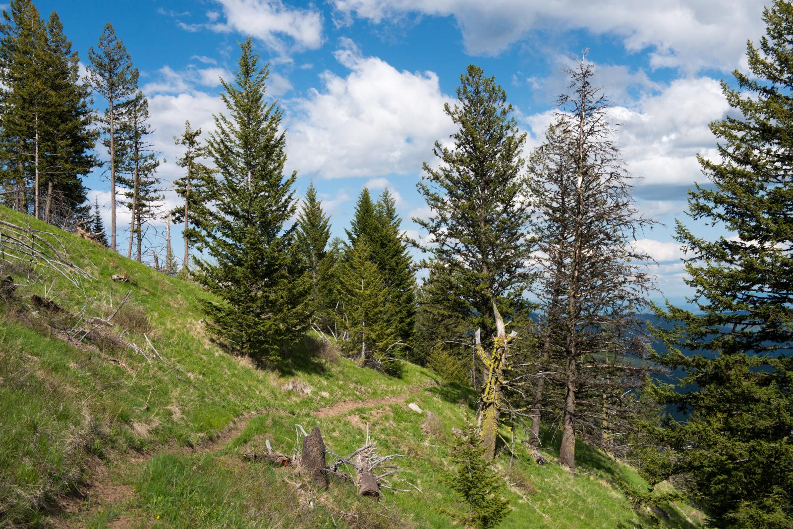
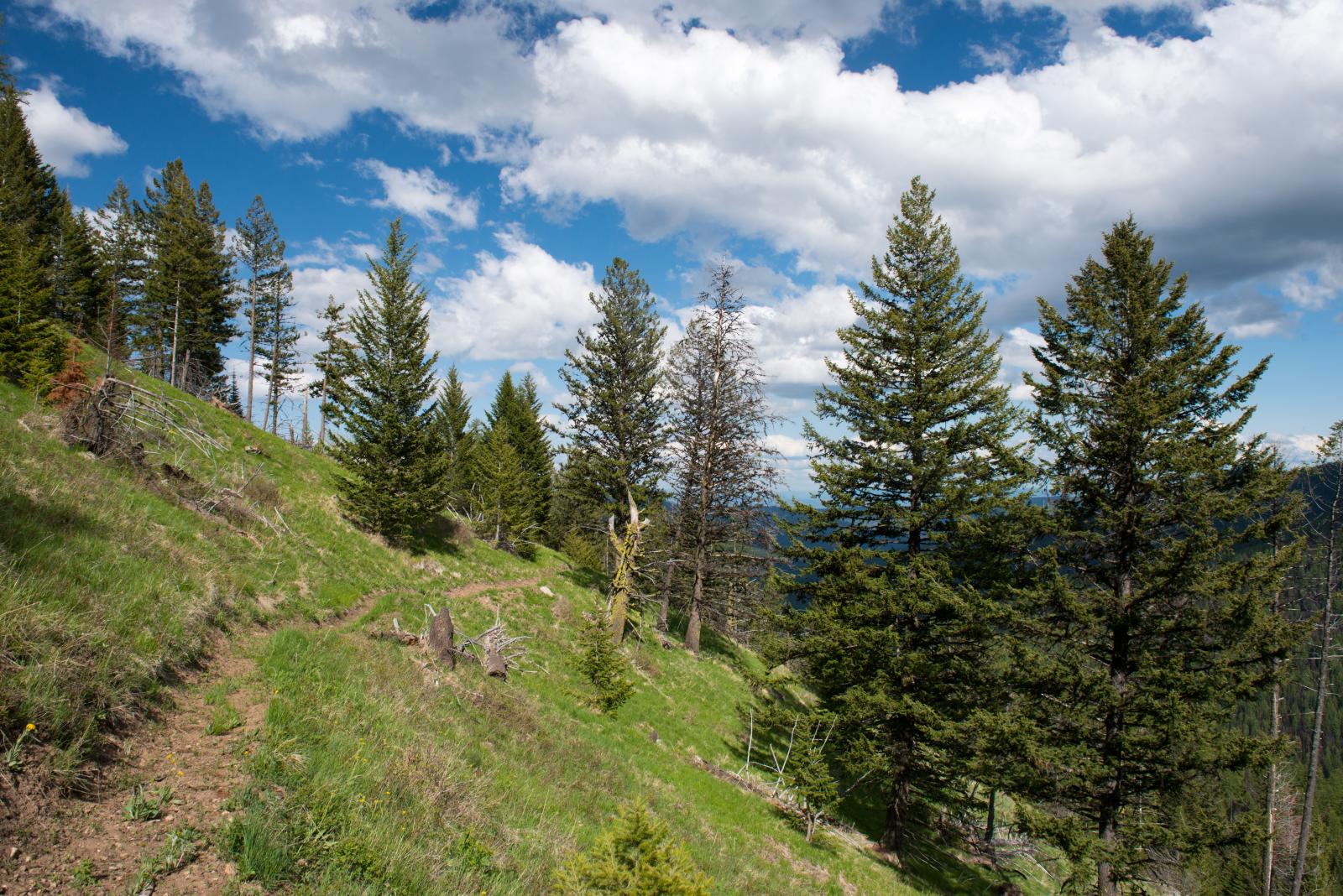
Pacific Northwest Trail on the Kettle Crest near Mt Leona

Trailhead sign for Mt Leona

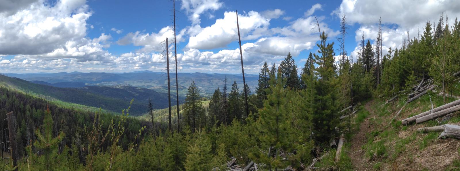
Kettle Crest panorama from the Pacific Northwest Trail near Ryan Hill

looking east down the Boulder Creek drainage from the Pacific Northwest Trail on the Kettle Crest
Pacific Northwest Trail on the Kettle Crest near Ryan Hill
Pacific Northwest Trail on the Kettle Crest near Ryan Hill

Pacific Northwest Trail on the Kettle Crest near Mt Leona
looking north over Ryan Hill to Profanity Peak from the Pacific Northwest Trail near Ryan Hill
Ryan Hill, Profanity Peak, and the Boulder Creek drainage from the Pacific Northwest Trail near Ryan Hill
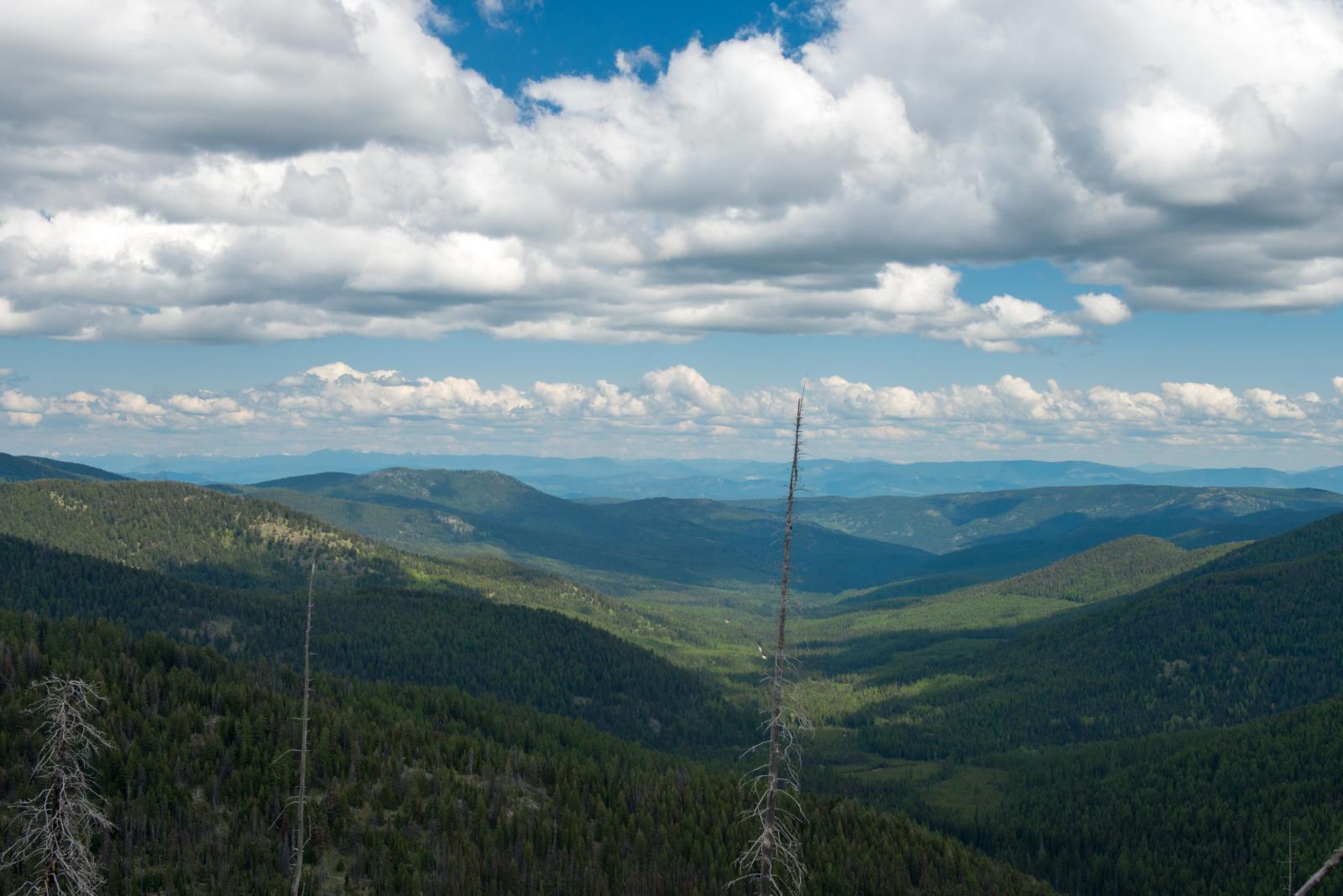
looking down Boulder Creek from the Kettle Crest
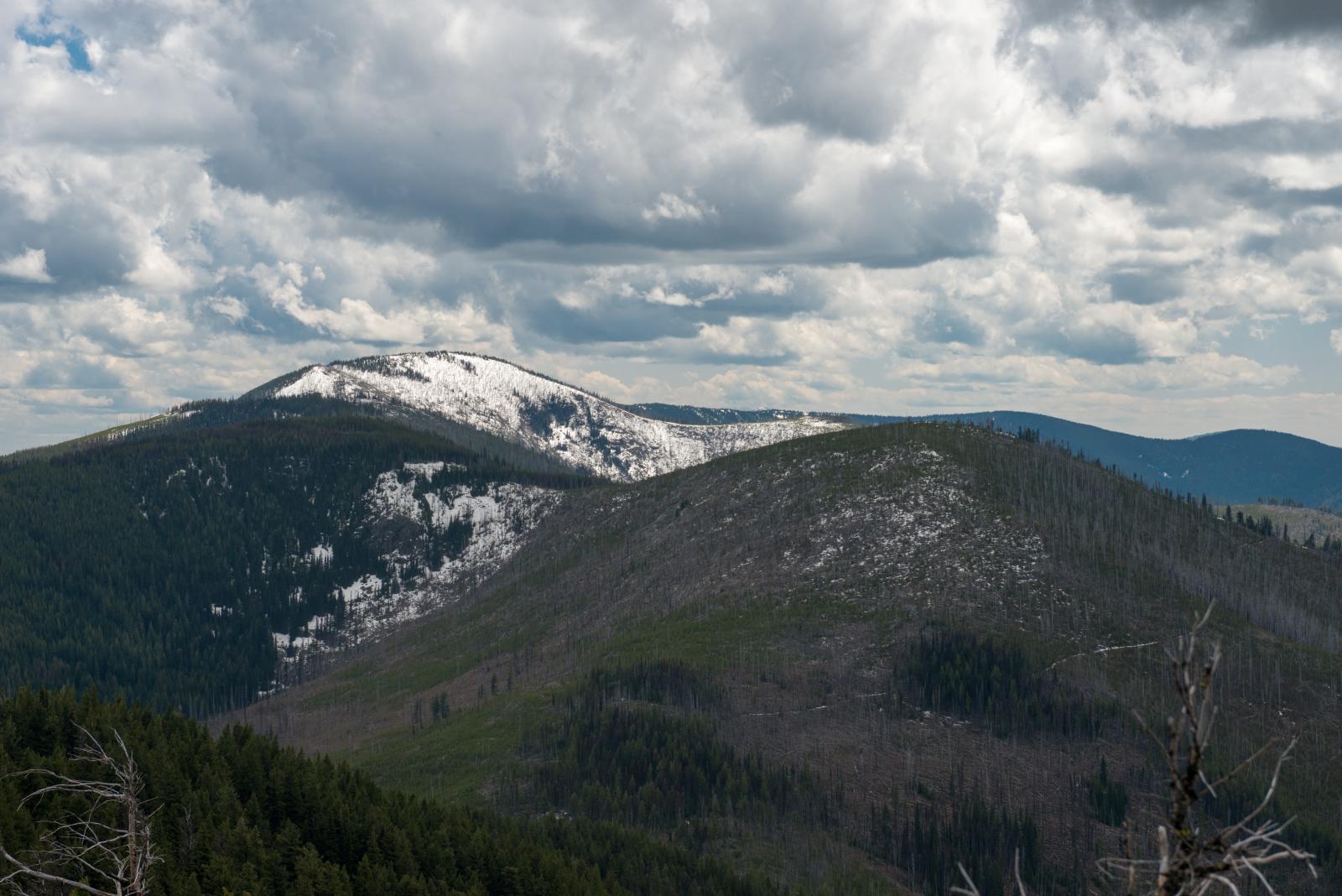
Snowy Lambert Mountain from the trail up to Mt Leona
アメリカ合衆国 〒 ワシントン州 ダンビル ロッキー山の地図
別の場所を検索
近所の場所
アメリカ合衆国 〒 ワシントン州 ダンビル マーブル山
アメリカ合衆国 〒 ワシントン州 トーゴ山
Gilpin Rd, Grand Forks, BC V0H 1H9 カナダ
64 Ave, Grand Forks, BC V0H 1H4 カナダ
Kettle River Dr, Grand Forks, BC V0H カナダケトル・リバー・ドライブ
アメリカ合衆国 〒 ワシントン州 ダンビル
カナダ 〒V0H ブリティッシュコロンビア州 グランド・フォークス
Riverside Ave, Grand Forks, BC V0H カナダリバーサイド・アベニュー
23 St, Grand Forks, BC V0H 1H2 カナダ
Covert Rd, Grand Forks, BC V0H 1H5 カナダ
Manly Way, Grand Forks, BC V0H 1H2 カナダ
Rincon Rd, Washington アメリカ合衆国リンコン・ロード
アメリカ合衆国 ワシントン州 クールー
アメリカ合衆国 〒 ワシントン州 コッパー・ビュート
River Dr W, Grand Forks, BC V0H 1H9 カナダ
River Dr E, Kootenay Boundary C, BC V0H 1H9 カナダリバー・ドライブ・イースト
アメリカ合衆国 〒 ワシントン州 マロ
River Road, Christina Lake, PO Box, BC V0H 1E0 カナダカスケード・コーブ RV パーク・アンド・キャンプグランド
Chase Rd, Kootenay Boundary C, BC V0H カナダチェイス・ロード
Chase Rd, Kootenay Boundary C, BC V0H 1H1 カナダ
最近の検索
- アメリカ合衆国 アラスカ州 レッド・ドッグ・マイン日の出日の入り時間
- Am bhf, Borken, ドイツアム・バーンホーフ日の出日の入り時間
- 4th St E, Sonoma, CA, USA日の出日の入り時間
- Oakland Ave, Williamsport, PA アメリカ合衆国日の出日の入り時間
- Via Roma, Pieranica CR, イタリアローマ通り日の出日の入り時間
- クロアチア 〒 ドゥブロブニク GradClock Tower of Dubrovnik日の出日の入り時間
- アルゼンチン チュブ州 トレリュー日の出日の入り時間
- Hartfords Bluff Cir, Mt Pleasant, SC アメリカ合衆国日の出日の入り時間
- 日本、熊本県熊本市北区日の出日の入り時間
- 中華人民共和国 福州市 平潭県 平潭島日の出日の入り時間