Potato Creek Rd, Wilson Creek, VA アメリカ合衆国ポテト・クリーク・ロード日の出日の入り時間
Location: アメリカ合衆国 > バージニア州 > グレイソン > アメリカ合衆国 バージニア州 ウィルソン・クリーク > アメリカ合衆国 〒 バージニア州 マウス・オブ・ウィルソン >
時間帯:
America/New_York
現地時間:
2025-06-26 22:33:58
経度:
-81.275302
緯度:
36.582844
今日の日の出時刻:
06:09:00 AM
今日の日の入時刻:
08:47:40 PM
今日の日長:
14h 38m 40s
明日の日の出時刻:
06:09:23 AM
明日の日の入時刻:
08:47:41 PM
明日の日長:
14h 38m 18s
すべて表示する
| 日付 | 日出 | 日没 | 日長 |
|---|---|---|---|
| 2025年01月01日 | 07:37:20 AM | 05:21:05 PM | 9h 43m 45s |
| 2025年01月02日 | 07:37:27 AM | 05:21:54 PM | 9h 44m 27s |
| 2025年01月03日 | 07:37:31 AM | 05:22:44 PM | 9h 45m 13s |
| 2025年01月04日 | 07:37:34 AM | 05:23:35 PM | 9h 46m 1s |
| 2025年01月05日 | 07:37:34 AM | 05:24:28 PM | 9h 46m 54s |
| 2025年01月06日 | 07:37:33 AM | 05:25:21 PM | 9h 47m 48s |
| 2025年01月07日 | 07:37:29 AM | 05:26:15 PM | 9h 48m 46s |
| 2025年01月08日 | 07:37:24 AM | 05:27:10 PM | 9h 49m 46s |
| 2025年01月09日 | 07:37:16 AM | 05:28:06 PM | 9h 50m 50s |
| 2025年01月10日 | 07:37:07 AM | 05:29:03 PM | 9h 51m 56s |
| 2025年01月11日 | 07:36:55 AM | 05:30:01 PM | 9h 53m 6s |
| 2025年01月12日 | 07:36:42 AM | 05:31:00 PM | 9h 54m 18s |
| 2025年01月13日 | 07:36:26 AM | 05:31:59 PM | 9h 55m 33s |
| 2025年01月14日 | 07:36:09 AM | 05:32:59 PM | 9h 56m 50s |
| 2025年01月15日 | 07:35:49 AM | 05:33:59 PM | 9h 58m 10s |
| 2025年01月16日 | 07:35:28 AM | 05:35:00 PM | 9h 59m 32s |
| 2025年01月17日 | 07:35:05 AM | 05:36:02 PM | 10h 0m 57s |
| 2025年01月18日 | 07:34:40 AM | 05:37:04 PM | 10h 2m 24s |
| 2025年01月19日 | 07:34:13 AM | 05:38:06 PM | 10h 3m 53s |
| 2025年01月20日 | 07:33:44 AM | 05:39:09 PM | 10h 5m 25s |
| 2025年01月21日 | 07:33:13 AM | 05:40:12 PM | 10h 6m 59s |
| 2025年01月22日 | 07:32:40 AM | 05:41:16 PM | 10h 8m 36s |
| 2025年01月23日 | 07:32:06 AM | 05:42:19 PM | 10h 10m 13s |
| 2025年01月24日 | 07:31:29 AM | 05:43:23 PM | 10h 11m 54s |
| 2025年01月25日 | 07:30:51 AM | 05:44:27 PM | 10h 13m 36s |
| 2025年01月26日 | 07:30:11 AM | 05:45:32 PM | 10h 15m 21s |
| 2025年01月27日 | 07:29:30 AM | 05:46:36 PM | 10h 17m 6s |
| 2025年01月28日 | 07:28:47 AM | 05:47:40 PM | 10h 18m 53s |
| 2025年01月29日 | 07:28:02 AM | 05:48:45 PM | 10h 20m 43s |
| 2025年01月30日 | 07:27:15 AM | 05:49:49 PM | 10h 22m 34s |
| 2025年01月31日 | 07:26:27 AM | 05:50:54 PM | 10h 24m 27s |
| 2025年02月01日 | 07:25:37 AM | 05:51:58 PM | 10h 26m 21s |
| 2025年02月02日 | 07:24:46 AM | 05:53:02 PM | 10h 28m 16s |
| 2025年02月03日 | 07:23:53 AM | 05:54:06 PM | 10h 30m 13s |
| 2025年02月04日 | 07:22:59 AM | 05:55:10 PM | 10h 32m 11s |
| 2025年02月05日 | 07:22:03 AM | 05:56:14 PM | 10h 34m 11s |
| 2025年02月06日 | 07:21:06 AM | 05:57:18 PM | 10h 36m 12s |
| 2025年02月07日 | 07:20:08 AM | 05:58:22 PM | 10h 38m 14s |
| 2025年02月08日 | 07:19:08 AM | 05:59:25 PM | 10h 40m 17s |
| 2025年02月09日 | 07:18:06 AM | 06:00:28 PM | 10h 42m 22s |
| 2025年02月10日 | 07:17:04 AM | 06:01:31 PM | 10h 44m 27s |
| 2025年02月11日 | 07:16:00 AM | 06:02:33 PM | 10h 46m 33s |
| 2025年02月12日 | 07:14:55 AM | 06:03:36 PM | 10h 48m 41s |
| 2025年02月13日 | 07:13:49 AM | 06:04:38 PM | 10h 50m 49s |
| 2025年02月14日 | 07:12:41 AM | 06:05:40 PM | 10h 52m 59s |
| 2025年02月15日 | 07:11:33 AM | 06:06:41 PM | 10h 55m 8s |
| 2025年02月16日 | 07:10:23 AM | 06:07:42 PM | 10h 57m 19s |
| 2025年02月17日 | 07:09:12 AM | 06:08:43 PM | 10h 59m 31s |
| 2025年02月18日 | 07:08:01 AM | 06:09:44 PM | 11h 1m 43s |
| 2025年02月19日 | 07:06:48 AM | 06:10:44 PM | 11h 3m 56s |
| 2025年02月20日 | 07:05:34 AM | 06:11:44 PM | 11h 6m 10s |
| 2025年02月21日 | 07:04:19 AM | 06:12:43 PM | 11h 8m 24s |
| 2025年02月22日 | 07:03:04 AM | 06:13:43 PM | 11h 10m 39s |
| 2025年02月23日 | 07:01:47 AM | 06:14:42 PM | 11h 12m 55s |
| 2025年02月24日 | 07:00:30 AM | 06:15:40 PM | 11h 15m 10s |
| 2025年02月25日 | 06:59:12 AM | 06:16:38 PM | 11h 17m 26s |
| 2025年02月26日 | 06:57:53 AM | 06:17:36 PM | 11h 19m 43s |
| 2025年02月27日 | 06:56:33 AM | 06:18:34 PM | 11h 22m 1s |
| 2025年02月28日 | 06:55:13 AM | 06:19:31 PM | 11h 24m 18s |
| 2025年03月01日 | 06:53:51 AM | 06:20:28 PM | 11h 26m 37s |
| 2025年03月02日 | 06:52:30 AM | 06:21:25 PM | 11h 28m 55s |
| 2025年03月03日 | 06:51:07 AM | 06:22:21 PM | 11h 31m 14s |
| 2025年03月04日 | 06:49:44 AM | 06:23:18 PM | 11h 33m 34s |
| 2025年03月05日 | 06:48:21 AM | 06:24:13 PM | 11h 35m 52s |
| 2025年03月06日 | 06:46:57 AM | 06:25:09 PM | 11h 38m 12s |
| 2025年03月07日 | 06:45:32 AM | 06:26:04 PM | 11h 40m 32s |
| 2025年03月08日 | 06:44:07 AM | 06:26:59 PM | 11h 42m 52s |
| 2025年03月09日 | 07:42:45 AM | 07:27:52 PM | 11h 45m 7s |
| 2025年03月10日 | 07:41:20 AM | 07:28:46 PM | 11h 47m 26s |
| 2025年03月11日 | 07:39:53 AM | 07:29:40 PM | 11h 49m 47s |
| 2025年03月12日 | 07:38:27 AM | 07:30:34 PM | 11h 52m 7s |
| 2025年03月13日 | 07:37:00 AM | 07:31:28 PM | 11h 54m 28s |
| 2025年03月14日 | 07:35:33 AM | 07:32:22 PM | 11h 56m 49s |
| 2025年03月15日 | 07:34:06 AM | 07:33:15 PM | 11h 59m 9s |
| 2025年03月16日 | 07:32:38 AM | 07:34:08 PM | 12h 1m 30s |
| 2025年03月17日 | 07:31:10 AM | 07:35:01 PM | 12h 3m 51s |
| 2025年03月18日 | 07:29:42 AM | 07:35:54 PM | 12h 6m 12s |
| 2025年03月19日 | 07:28:14 AM | 07:36:47 PM | 12h 8m 33s |
| 2025年03月20日 | 07:26:46 AM | 07:37:40 PM | 12h 10m 54s |
| 2025年03月21日 | 07:25:18 AM | 07:38:32 PM | 12h 13m 14s |
| 2025年03月22日 | 07:23:49 AM | 07:39:24 PM | 12h 15m 35s |
| 2025年03月23日 | 07:22:21 AM | 07:40:16 PM | 12h 17m 55s |
| 2025年03月24日 | 07:20:53 AM | 07:41:09 PM | 12h 20m 16s |
| 2025年03月25日 | 07:19:25 AM | 07:42:01 PM | 12h 22m 36s |
| 2025年03月26日 | 07:17:56 AM | 07:42:53 PM | 12h 24m 57s |
| 2025年03月27日 | 07:16:28 AM | 07:43:44 PM | 12h 27m 16s |
| 2025年03月28日 | 07:15:00 AM | 07:44:36 PM | 12h 29m 36s |
| 2025年03月29日 | 07:13:33 AM | 07:45:28 PM | 12h 31m 55s |
| 2025年03月30日 | 07:12:05 AM | 07:46:20 PM | 12h 34m 15s |
| 2025年03月31日 | 07:10:38 AM | 07:47:11 PM | 12h 36m 33s |
| 2025年04月01日 | 07:09:11 AM | 07:48:03 PM | 12h 38m 52s |
| 2025年04月02日 | 07:07:44 AM | 07:48:55 PM | 12h 41m 11s |
| 2025年04月03日 | 07:06:17 AM | 07:49:46 PM | 12h 43m 29s |
| 2025年04月04日 | 07:04:51 AM | 07:50:38 PM | 12h 45m 47s |
| 2025年04月05日 | 07:03:26 AM | 07:51:30 PM | 12h 48m 4s |
| 2025年04月06日 | 07:02:00 AM | 07:52:21 PM | 12h 50m 21s |
| 2025年04月07日 | 07:00:35 AM | 07:53:13 PM | 12h 52m 38s |
| 2025年04月08日 | 06:59:11 AM | 07:54:05 PM | 12h 54m 54s |
| 2025年04月09日 | 06:57:47 AM | 07:54:57 PM | 12h 57m 10s |
| 2025年04月10日 | 06:56:23 AM | 07:55:49 PM | 12h 59m 26s |
| 2025年04月11日 | 06:55:00 AM | 07:56:40 PM | 13h 1m 40s |
| 2025年04月12日 | 06:53:38 AM | 07:57:32 PM | 13h 3m 54s |
| 2025年04月13日 | 06:52:16 AM | 07:58:24 PM | 13h 6m 8s |
| 2025年04月14日 | 06:50:55 AM | 07:59:16 PM | 13h 8m 21s |
| 2025年04月15日 | 06:49:35 AM | 08:00:08 PM | 13h 10m 33s |
| 2025年04月16日 | 06:48:15 AM | 08:01:00 PM | 13h 12m 45s |
| 2025年04月17日 | 06:46:56 AM | 08:01:53 PM | 13h 14m 57s |
| 2025年04月18日 | 06:45:38 AM | 08:02:45 PM | 13h 17m 7s |
| 2025年04月19日 | 06:44:20 AM | 08:03:37 PM | 13h 19m 17s |
| 2025年04月20日 | 06:43:04 AM | 08:04:29 PM | 13h 21m 25s |
| 2025年04月21日 | 06:41:48 AM | 08:05:22 PM | 13h 23m 34s |
| 2025年04月22日 | 06:40:33 AM | 08:06:14 PM | 13h 25m 41s |
| 2025年04月23日 | 06:39:19 AM | 08:07:06 PM | 13h 27m 47s |
| 2025年04月24日 | 06:38:06 AM | 08:07:59 PM | 13h 29m 53s |
| 2025年04月25日 | 06:36:54 AM | 08:08:51 PM | 13h 31m 57s |
| 2025年04月26日 | 06:35:42 AM | 08:09:44 PM | 13h 34m 2s |
| 2025年04月27日 | 06:34:32 AM | 08:10:36 PM | 13h 36m 4s |
| 2025年04月28日 | 06:33:23 AM | 08:11:29 PM | 13h 38m 6s |
| 2025年04月29日 | 06:32:15 AM | 08:12:21 PM | 13h 40m 6s |
| 2025年04月30日 | 06:31:08 AM | 08:13:13 PM | 13h 42m 5s |
| 2025年05月01日 | 06:30:03 AM | 08:14:06 PM | 13h 44m 3s |
| 2025年05月02日 | 06:28:58 AM | 08:14:58 PM | 13h 46m 0s |
| 2025年05月03日 | 06:27:54 AM | 08:15:50 PM | 13h 47m 56s |
| 2025年05月04日 | 06:26:52 AM | 08:16:42 PM | 13h 49m 50s |
| 2025年05月05日 | 06:25:51 AM | 08:17:34 PM | 13h 51m 43s |
| 2025年05月06日 | 06:24:52 AM | 08:18:26 PM | 13h 53m 34s |
| 2025年05月07日 | 06:23:53 AM | 08:19:18 PM | 13h 55m 25s |
| 2025年05月08日 | 06:22:56 AM | 08:20:09 PM | 13h 57m 13s |
| 2025年05月09日 | 06:22:00 AM | 08:21:00 PM | 13h 59m 0s |
| 2025年05月10日 | 06:21:06 AM | 08:21:51 PM | 14h 0m 45s |
| 2025年05月11日 | 06:20:13 AM | 08:22:42 PM | 14h 2m 29s |
| 2025年05月12日 | 06:19:22 AM | 08:23:32 PM | 14h 4m 10s |
| 2025年05月13日 | 06:18:31 AM | 08:24:23 PM | 14h 5m 52s |
| 2025年05月14日 | 06:17:43 AM | 08:25:13 PM | 14h 7m 30s |
| 2025年05月15日 | 06:16:56 AM | 08:26:02 PM | 14h 9m 6s |
| 2025年05月16日 | 06:16:10 AM | 08:26:51 PM | 14h 10m 41s |
| 2025年05月17日 | 06:15:26 AM | 08:27:40 PM | 14h 12m 14s |
| 2025年05月18日 | 06:14:43 AM | 08:28:28 PM | 14h 13m 45s |
| 2025年05月19日 | 06:14:02 AM | 08:29:16 PM | 14h 15m 14s |
| 2025年05月20日 | 06:13:23 AM | 08:30:03 PM | 14h 16m 40s |
| 2025年05月21日 | 06:12:45 AM | 08:30:50 PM | 14h 18m 5s |
| 2025年05月22日 | 06:12:09 AM | 08:31:36 PM | 14h 19m 27s |
| 2025年05月23日 | 06:11:35 AM | 08:32:21 PM | 14h 20m 46s |
| 2025年05月24日 | 06:11:02 AM | 08:33:06 PM | 14h 22m 4s |
| 2025年05月25日 | 06:10:31 AM | 08:33:50 PM | 14h 23m 19s |
| 2025年05月26日 | 06:10:01 AM | 08:34:33 PM | 14h 24m 32s |
| 2025年05月27日 | 06:09:33 AM | 08:35:16 PM | 14h 25m 43s |
| 2025年05月28日 | 06:09:07 AM | 08:35:58 PM | 14h 26m 51s |
| 2025年05月29日 | 06:08:43 AM | 08:36:39 PM | 14h 27m 56s |
| 2025年05月30日 | 06:08:20 AM | 08:37:19 PM | 14h 28m 59s |
| 2025年05月31日 | 06:07:59 AM | 08:37:58 PM | 14h 29m 59s |
| 2025年06月01日 | 06:07:40 AM | 08:38:36 PM | 14h 30m 56s |
| 2025年06月02日 | 06:07:23 AM | 08:39:14 PM | 14h 31m 51s |
| 2025年06月03日 | 06:07:07 AM | 08:39:50 PM | 14h 32m 43s |
| 2025年06月04日 | 06:06:53 AM | 08:40:25 PM | 14h 33m 32s |
| 2025年06月05日 | 06:06:41 AM | 08:40:59 PM | 14h 34m 18s |
| 2025年06月06日 | 06:06:30 AM | 08:41:32 PM | 14h 35m 2s |
| 2025年06月07日 | 06:06:21 AM | 08:42:03 PM | 14h 35m 42s |
| 2025年06月08日 | 06:06:14 AM | 08:42:34 PM | 14h 36m 20s |
| 2025年06月09日 | 06:06:09 AM | 08:43:03 PM | 14h 36m 54s |
| 2025年06月10日 | 06:06:05 AM | 08:43:31 PM | 14h 37m 26s |
| 2025年06月11日 | 06:06:04 AM | 08:43:58 PM | 14h 37m 54s |
| 2025年06月12日 | 06:06:03 AM | 08:44:23 PM | 14h 38m 20s |
| 2025年06月13日 | 06:06:05 AM | 08:44:47 PM | 14h 38m 42s |
| 2025年06月14日 | 06:06:08 AM | 08:45:10 PM | 14h 39m 2s |
| 2025年06月15日 | 06:06:13 AM | 08:45:31 PM | 14h 39m 18s |
| 2025年06月16日 | 06:06:19 AM | 08:45:50 PM | 14h 39m 31s |
| 2025年06月17日 | 06:06:27 AM | 08:46:08 PM | 14h 39m 41s |
| 2025年06月18日 | 06:06:37 AM | 08:46:25 PM | 14h 39m 48s |
| 2025年06月19日 | 06:06:48 AM | 08:46:40 PM | 14h 39m 52s |
| 2025年06月20日 | 06:07:01 AM | 08:46:53 PM | 14h 39m 52s |
| 2025年06月21日 | 06:07:15 AM | 08:47:05 PM | 14h 39m 50s |
| 2025年06月22日 | 06:07:31 AM | 08:47:15 PM | 14h 39m 44s |
| 2025年06月23日 | 06:07:48 AM | 08:47:24 PM | 14h 39m 36s |
| 2025年06月24日 | 06:08:07 AM | 08:47:30 PM | 14h 39m 23s |
| 2025年06月25日 | 06:08:27 AM | 08:47:36 PM | 14h 39m 9s |
| 2025年06月26日 | 06:08:48 AM | 08:47:39 PM | 14h 38m 51s |
| 2025年06月27日 | 06:09:11 AM | 08:47:41 PM | 14h 38m 30s |
| 2025年06月28日 | 06:09:35 AM | 08:47:41 PM | 14h 38m 6s |
| 2025年06月29日 | 06:10:01 AM | 08:47:39 PM | 14h 37m 38s |
| 2025年06月30日 | 06:10:28 AM | 08:47:36 PM | 14h 37m 8s |
| 2025年07月01日 | 06:10:56 AM | 08:47:30 PM | 14h 36m 34s |
| 2025年07月02日 | 06:11:25 AM | 08:47:23 PM | 14h 35m 58s |
| 2025年07月03日 | 06:11:55 AM | 08:47:15 PM | 14h 35m 20s |
| 2025年07月04日 | 06:12:26 AM | 08:47:04 PM | 14h 34m 38s |
| 2025年07月05日 | 06:12:59 AM | 08:46:52 PM | 14h 33m 53s |
| 2025年07月06日 | 06:13:32 AM | 08:46:38 PM | 14h 33m 6s |
| 2025年07月07日 | 06:14:07 AM | 08:46:22 PM | 14h 32m 15s |
| 2025年07月08日 | 06:14:43 AM | 08:46:04 PM | 14h 31m 21s |
| 2025年07月09日 | 06:15:19 AM | 08:45:45 PM | 14h 30m 26s |
| 2025年07月10日 | 06:15:56 AM | 08:45:23 PM | 14h 29m 27s |
| 2025年07月11日 | 06:16:35 AM | 08:45:00 PM | 14h 28m 25s |
| 2025年07月12日 | 06:17:14 AM | 08:44:36 PM | 14h 27m 22s |
| 2025年07月13日 | 06:17:53 AM | 08:44:09 PM | 14h 26m 16s |
| 2025年07月14日 | 06:18:34 AM | 08:43:41 PM | 14h 25m 7s |
| 2025年07月15日 | 06:19:15 AM | 08:43:11 PM | 14h 23m 56s |
| 2025年07月16日 | 06:19:57 AM | 08:42:39 PM | 14h 22m 42s |
| 2025年07月17日 | 06:20:40 AM | 08:42:06 PM | 14h 21m 26s |
| 2025年07月18日 | 06:21:23 AM | 08:41:31 PM | 14h 20m 8s |
| 2025年07月19日 | 06:22:07 AM | 08:40:54 PM | 14h 18m 47s |
| 2025年07月20日 | 06:22:51 AM | 08:40:16 PM | 14h 17m 25s |
| 2025年07月21日 | 06:23:36 AM | 08:39:36 PM | 14h 16m 0s |
| 2025年07月22日 | 06:24:21 AM | 08:38:54 PM | 14h 14m 33s |
| 2025年07月23日 | 06:25:06 AM | 08:38:11 PM | 14h 13m 5s |
| 2025年07月24日 | 06:25:53 AM | 08:37:26 PM | 14h 11m 33s |
| 2025年07月25日 | 06:26:39 AM | 08:36:40 PM | 14h 10m 1s |
| 2025年07月26日 | 06:27:26 AM | 08:35:52 PM | 14h 8m 26s |
| 2025年07月27日 | 06:28:13 AM | 08:35:02 PM | 14h 6m 49s |
| 2025年07月28日 | 06:29:00 AM | 08:34:11 PM | 14h 5m 11s |
| 2025年07月29日 | 06:29:48 AM | 08:33:19 PM | 14h 3m 31s |
| 2025年07月30日 | 06:30:36 AM | 08:32:25 PM | 14h 1m 49s |
| 2025年07月31日 | 06:31:24 AM | 08:31:30 PM | 14h 0m 6s |
| 2025年08月01日 | 06:32:12 AM | 08:30:33 PM | 13h 58m 21s |
| 2025年08月02日 | 06:33:00 AM | 08:29:35 PM | 13h 56m 35s |
| 2025年08月03日 | 06:33:49 AM | 08:28:36 PM | 13h 54m 47s |
| 2025年08月04日 | 06:34:38 AM | 08:27:35 PM | 13h 52m 57s |
| 2025年08月05日 | 06:35:26 AM | 08:26:33 PM | 13h 51m 7s |
| 2025年08月06日 | 06:36:15 AM | 08:25:30 PM | 13h 49m 15s |
| 2025年08月07日 | 06:37:04 AM | 08:24:25 PM | 13h 47m 21s |
| 2025年08月08日 | 06:37:53 AM | 08:23:19 PM | 13h 45m 26s |
| 2025年08月09日 | 06:38:42 AM | 08:22:12 PM | 13h 43m 30s |
| 2025年08月10日 | 06:39:31 AM | 08:21:04 PM | 13h 41m 33s |
| 2025年08月11日 | 06:40:20 AM | 08:19:55 PM | 13h 39m 35s |
| 2025年08月12日 | 06:41:09 AM | 08:18:45 PM | 13h 37m 36s |
| 2025年08月13日 | 06:41:58 AM | 08:17:33 PM | 13h 35m 35s |
| 2025年08月14日 | 06:42:47 AM | 08:16:21 PM | 13h 33m 34s |
| 2025年08月15日 | 06:43:36 AM | 08:15:08 PM | 13h 31m 32s |
| 2025年08月16日 | 06:44:24 AM | 08:13:53 PM | 13h 29m 29s |
| 2025年08月17日 | 06:45:13 AM | 08:12:38 PM | 13h 27m 25s |
| 2025年08月18日 | 06:46:02 AM | 08:11:22 PM | 13h 25m 20s |
| 2025年08月19日 | 06:46:50 AM | 08:10:04 PM | 13h 23m 14s |
| 2025年08月20日 | 06:47:39 AM | 08:08:46 PM | 13h 21m 7s |
| 2025年08月21日 | 06:48:27 AM | 08:07:27 PM | 13h 19m 0s |
| 2025年08月22日 | 06:49:16 AM | 08:06:08 PM | 13h 16m 52s |
| 2025年08月23日 | 06:50:04 AM | 08:04:47 PM | 13h 14m 43s |
| 2025年08月24日 | 06:50:52 AM | 08:03:26 PM | 13h 12m 34s |
| 2025年08月25日 | 06:51:40 AM | 08:02:04 PM | 13h 10m 24s |
| 2025年08月26日 | 06:52:28 AM | 08:00:42 PM | 13h 8m 14s |
| 2025年08月27日 | 06:53:16 AM | 07:59:18 PM | 13h 6m 2s |
| 2025年08月28日 | 06:54:04 AM | 07:57:54 PM | 13h 3m 50s |
| 2025年08月29日 | 06:54:52 AM | 07:56:30 PM | 13h 1m 38s |
| 2025年08月30日 | 06:55:40 AM | 07:55:05 PM | 12h 59m 25s |
| 2025年08月31日 | 06:56:28 AM | 07:53:39 PM | 12h 57m 11s |
| 2025年09月01日 | 06:57:15 AM | 07:52:13 PM | 12h 54m 58s |
| 2025年09月02日 | 06:58:03 AM | 07:50:46 PM | 12h 52m 43s |
| 2025年09月03日 | 06:58:50 AM | 07:49:19 PM | 12h 50m 29s |
| 2025年09月04日 | 06:59:38 AM | 07:47:51 PM | 12h 48m 13s |
| 2025年09月05日 | 07:00:25 AM | 07:46:23 PM | 12h 45m 58s |
| 2025年09月06日 | 07:01:12 AM | 07:44:55 PM | 12h 43m 43s |
| 2025年09月07日 | 07:02:00 AM | 07:43:26 PM | 12h 41m 26s |
| 2025年09月08日 | 07:02:47 AM | 07:41:57 PM | 12h 39m 10s |
| 2025年09月09日 | 07:03:35 AM | 07:40:28 PM | 12h 36m 53s |
| 2025年09月10日 | 07:04:22 AM | 07:38:59 PM | 12h 34m 37s |
| 2025年09月11日 | 07:05:09 AM | 07:37:29 PM | 12h 32m 20s |
| 2025年09月12日 | 07:05:57 AM | 07:35:59 PM | 12h 30m 2s |
| 2025年09月13日 | 07:06:44 AM | 07:34:29 PM | 12h 27m 45s |
| 2025年09月14日 | 07:07:31 AM | 07:32:58 PM | 12h 25m 27s |
| 2025年09月15日 | 07:08:19 AM | 07:31:28 PM | 12h 23m 9s |
| 2025年09月16日 | 07:09:07 AM | 07:29:57 PM | 12h 20m 50s |
| 2025年09月17日 | 07:09:54 AM | 07:28:27 PM | 12h 18m 33s |
| 2025年09月18日 | 07:10:42 AM | 07:26:56 PM | 12h 16m 14s |
| 2025年09月19日 | 07:11:30 AM | 07:25:26 PM | 12h 13m 56s |
| 2025年09月20日 | 07:12:18 AM | 07:23:55 PM | 12h 11m 37s |
| 2025年09月21日 | 07:13:06 AM | 07:22:25 PM | 12h 9m 19s |
| 2025年09月22日 | 07:13:54 AM | 07:20:54 PM | 12h 7m 0s |
| 2025年09月23日 | 07:14:43 AM | 07:19:24 PM | 12h 4m 41s |
| 2025年09月24日 | 07:15:31 AM | 07:17:54 PM | 12h 2m 23s |
| 2025年09月25日 | 07:16:20 AM | 07:16:24 PM | 12h 0m 4s |
| 2025年09月26日 | 07:17:09 AM | 07:14:54 PM | 11h 57m 45s |
| 2025年09月27日 | 07:17:58 AM | 07:13:25 PM | 11h 55m 27s |
| 2025年09月28日 | 07:18:47 AM | 07:11:55 PM | 11h 53m 8s |
| 2025年09月29日 | 07:19:37 AM | 07:10:26 PM | 11h 50m 49s |
| 2025年09月30日 | 07:20:26 AM | 07:08:58 PM | 11h 48m 32s |
| 2025年10月01日 | 07:21:16 AM | 07:07:30 PM | 11h 46m 14s |
| 2025年10月02日 | 07:22:06 AM | 07:06:02 PM | 11h 43m 56s |
| 2025年10月03日 | 07:22:57 AM | 07:04:34 PM | 11h 41m 37s |
| 2025年10月04日 | 07:23:48 AM | 07:03:07 PM | 11h 39m 19s |
| 2025年10月05日 | 07:24:39 AM | 07:01:41 PM | 11h 37m 2s |
| 2025年10月06日 | 07:25:30 AM | 07:00:15 PM | 11h 34m 45s |
| 2025年10月07日 | 07:26:22 AM | 06:58:49 PM | 11h 32m 27s |
| 2025年10月08日 | 07:27:14 AM | 06:57:24 PM | 11h 30m 10s |
| 2025年10月09日 | 07:28:06 AM | 06:56:00 PM | 11h 27m 54s |
| 2025年10月10日 | 07:28:58 AM | 06:54:36 PM | 11h 25m 38s |
| 2025年10月11日 | 07:29:51 AM | 06:53:13 PM | 11h 23m 22s |
| 2025年10月12日 | 07:30:44 AM | 06:51:51 PM | 11h 21m 7s |
| 2025年10月13日 | 07:31:38 AM | 06:50:29 PM | 11h 18m 51s |
| 2025年10月14日 | 07:32:32 AM | 06:49:08 PM | 11h 16m 36s |
| 2025年10月15日 | 07:33:26 AM | 06:47:48 PM | 11h 14m 22s |
| 2025年10月16日 | 07:34:21 AM | 06:46:29 PM | 11h 12m 8s |
| 2025年10月17日 | 07:35:16 AM | 06:45:10 PM | 11h 9m 54s |
| 2025年10月18日 | 07:36:11 AM | 06:43:53 PM | 11h 7m 42s |
| 2025年10月19日 | 07:37:07 AM | 06:42:36 PM | 11h 5m 29s |
| 2025年10月20日 | 07:38:03 AM | 06:41:20 PM | 11h 3m 17s |
| 2025年10月21日 | 07:38:59 AM | 06:40:06 PM | 11h 1m 7s |
| 2025年10月22日 | 07:39:56 AM | 06:38:52 PM | 10h 58m 56s |
| 2025年10月23日 | 07:40:53 AM | 06:37:39 PM | 10h 56m 46s |
| 2025年10月24日 | 07:41:50 AM | 06:36:28 PM | 10h 54m 38s |
| 2025年10月25日 | 07:42:48 AM | 06:35:17 PM | 10h 52m 29s |
| 2025年10月26日 | 07:43:46 AM | 06:34:08 PM | 10h 50m 22s |
| 2025年10月27日 | 07:44:44 AM | 06:33:00 PM | 10h 48m 16s |
| 2025年10月28日 | 07:45:43 AM | 06:31:53 PM | 10h 46m 10s |
| 2025年10月29日 | 07:46:42 AM | 06:30:47 PM | 10h 44m 5s |
| 2025年10月30日 | 07:47:41 AM | 06:29:43 PM | 10h 42m 2s |
| 2025年10月31日 | 07:48:41 AM | 06:28:40 PM | 10h 39m 59s |
| 2025年11月01日 | 07:49:41 AM | 06:27:38 PM | 10h 37m 57s |
| 2025年11月02日 | 06:50:43 AM | 05:26:35 PM | 10h 35m 52s |
| 2025年11月03日 | 06:51:44 AM | 05:25:36 PM | 10h 33m 52s |
| 2025年11月04日 | 06:52:44 AM | 05:24:38 PM | 10h 31m 54s |
| 2025年11月05日 | 06:53:45 AM | 05:23:42 PM | 10h 29m 57s |
| 2025年11月06日 | 06:54:46 AM | 05:22:48 PM | 10h 28m 2s |
| 2025年11月07日 | 06:55:47 AM | 05:21:55 PM | 10h 26m 8s |
| 2025年11月08日 | 06:56:48 AM | 05:21:03 PM | 10h 24m 15s |
| 2025年11月09日 | 06:57:50 AM | 05:20:13 PM | 10h 22m 23s |
| 2025年11月10日 | 06:58:51 AM | 05:19:25 PM | 10h 20m 34s |
| 2025年11月11日 | 06:59:52 AM | 05:18:38 PM | 10h 18m 46s |
| 2025年11月12日 | 07:00:54 AM | 05:17:53 PM | 10h 16m 59s |
| 2025年11月13日 | 07:01:55 AM | 05:17:10 PM | 10h 15m 15s |
| 2025年11月14日 | 07:02:57 AM | 05:16:28 PM | 10h 13m 31s |
| 2025年11月15日 | 07:03:58 AM | 05:15:49 PM | 10h 11m 51s |
| 2025年11月16日 | 07:04:59 AM | 05:15:11 PM | 10h 10m 12s |
| 2025年11月17日 | 07:06:01 AM | 05:14:35 PM | 10h 8m 34s |
| 2025年11月18日 | 07:07:01 AM | 05:14:00 PM | 10h 6m 59s |
| 2025年11月19日 | 07:08:02 AM | 05:13:28 PM | 10h 5m 26s |
| 2025年11月20日 | 07:09:03 AM | 05:12:57 PM | 10h 3m 54s |
| 2025年11月21日 | 07:10:03 AM | 05:12:28 PM | 10h 2m 25s |
| 2025年11月22日 | 07:11:03 AM | 05:12:02 PM | 10h 0m 59s |
| 2025年11月23日 | 07:12:02 AM | 05:11:37 PM | 9h 59m 35s |
| 2025年11月24日 | 07:13:01 AM | 05:11:14 PM | 9h 58m 13s |
| 2025年11月25日 | 07:14:00 AM | 05:10:53 PM | 9h 56m 53s |
| 2025年11月26日 | 07:14:57 AM | 05:10:34 PM | 9h 55m 37s |
| 2025年11月27日 | 07:15:55 AM | 05:10:17 PM | 9h 54m 22s |
| 2025年11月28日 | 07:16:52 AM | 05:10:02 PM | 9h 53m 10s |
| 2025年11月29日 | 07:17:48 AM | 05:09:49 PM | 9h 52m 1s |
| 2025年11月30日 | 07:18:43 AM | 05:09:38 PM | 9h 50m 55s |
| 2025年12月01日 | 07:19:38 AM | 05:09:29 PM | 9h 49m 51s |
| 2025年12月02日 | 07:20:32 AM | 05:09:23 PM | 9h 48m 51s |
| 2025年12月03日 | 07:21:25 AM | 05:09:18 PM | 9h 47m 53s |
| 2025年12月04日 | 07:22:17 AM | 05:09:15 PM | 9h 46m 58s |
| 2025年12月05日 | 07:23:08 AM | 05:09:14 PM | 9h 46m 6s |
| 2025年12月06日 | 07:23:58 AM | 05:09:16 PM | 9h 45m 18s |
| 2025年12月07日 | 07:24:47 AM | 05:09:19 PM | 9h 44m 32s |
| 2025年12月08日 | 07:25:35 AM | 05:09:25 PM | 9h 43m 50s |
| 2025年12月09日 | 07:26:22 AM | 05:09:32 PM | 9h 43m 10s |
| 2025年12月10日 | 07:27:07 AM | 05:09:42 PM | 9h 42m 35s |
| 2025年12月11日 | 07:27:52 AM | 05:09:53 PM | 9h 42m 1s |
| 2025年12月12日 | 07:28:35 AM | 05:10:07 PM | 9h 41m 32s |
| 2025年12月13日 | 07:29:16 AM | 05:10:22 PM | 9h 41m 6s |
| 2025年12月14日 | 07:29:57 AM | 05:10:39 PM | 9h 40m 42s |
| 2025年12月15日 | 07:30:35 AM | 05:10:59 PM | 9h 40m 24s |
| 2025年12月16日 | 07:31:13 AM | 05:11:20 PM | 9h 40m 7s |
| 2025年12月17日 | 07:31:48 AM | 05:11:43 PM | 9h 39m 55s |
| 2025年12月18日 | 07:32:23 AM | 05:12:08 PM | 9h 39m 45s |
| 2025年12月19日 | 07:32:55 AM | 05:12:35 PM | 9h 39m 40s |
| 2025年12月20日 | 07:33:26 AM | 05:13:04 PM | 9h 39m 38s |
| 2025年12月21日 | 07:33:56 AM | 05:13:34 PM | 9h 39m 38s |
| 2025年12月22日 | 07:34:23 AM | 05:14:06 PM | 9h 39m 43s |
| 2025年12月23日 | 07:34:49 AM | 05:14:40 PM | 9h 39m 51s |
| 2025年12月24日 | 07:35:13 AM | 05:15:15 PM | 9h 40m 2s |
| 2025年12月25日 | 07:35:35 AM | 05:15:52 PM | 9h 40m 17s |
| 2025年12月26日 | 07:35:56 AM | 05:16:31 PM | 9h 40m 35s |
| 2025年12月27日 | 07:36:14 AM | 05:17:11 PM | 9h 40m 57s |
| 2025年12月28日 | 07:36:31 AM | 05:17:53 PM | 9h 41m 22s |
| 2025年12月29日 | 07:36:46 AM | 05:18:36 PM | 9h 41m 50s |
| 2025年12月30日 | 07:36:58 AM | 05:19:21 PM | 9h 42m 23s |
| 2025年12月31日 | 07:37:09 AM | 05:20:07 PM | 9h 42m 58s |
写真
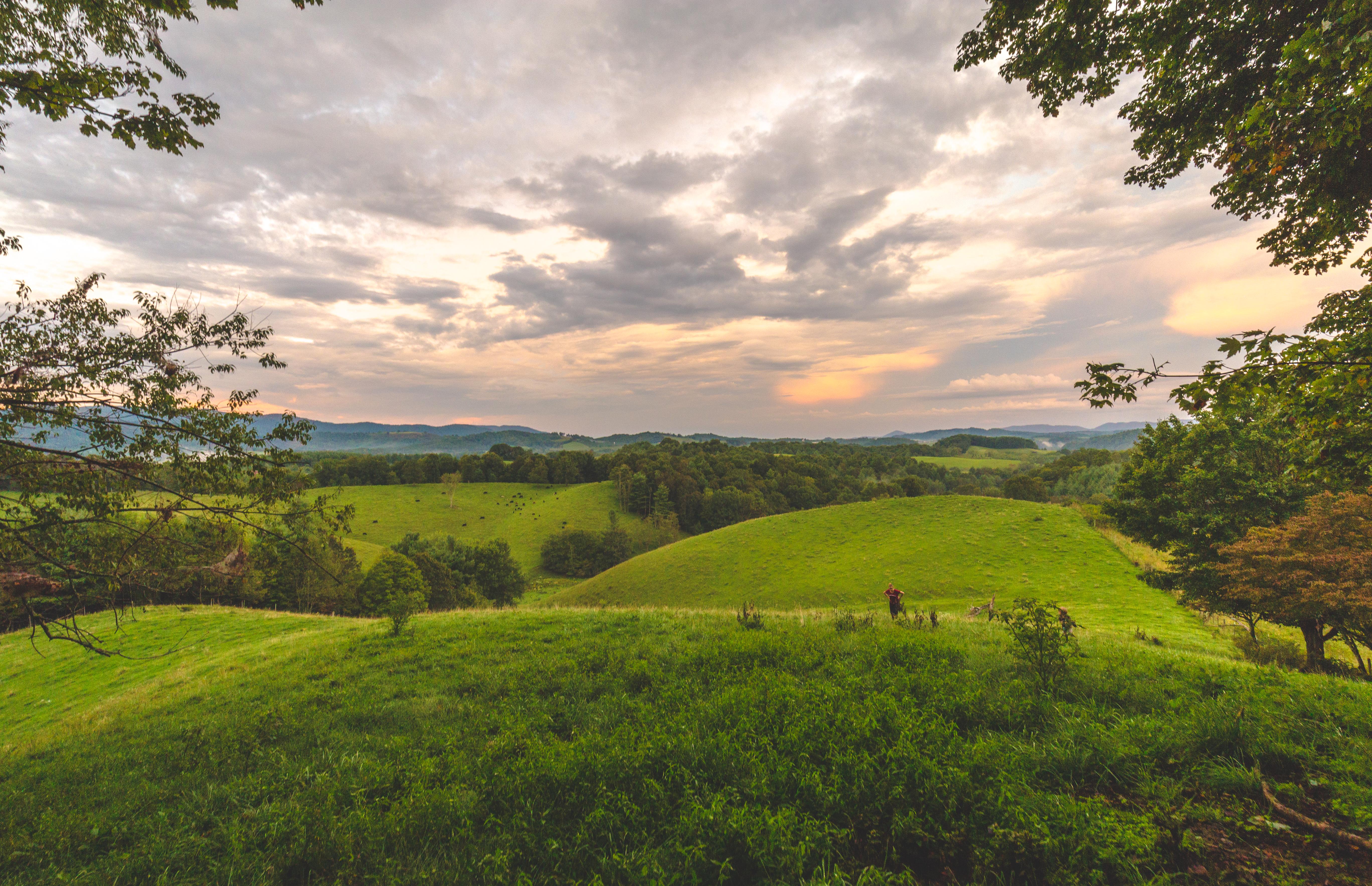
Virginia Hills Sunset

Storm Clouds Passing over Buck Mountain

Fire in the Sky

Waiting for the Sun

Early SWVA Morning

Forgotten House in the Hills

Virginia Hills

Mount Rogers

Mountain view from the meadow above our cabin

Mountain view just up the hill from our cabin
Potato Creek Rd, Wilson Creek, VA アメリカ合衆国ポテト・クリーク・ロードの地図
別の場所を検索
近所の場所
Gold Hill Rd, Independence, VA アメリカ合衆国
Bear Creek Ln, Sparta, NC アメリカ合衆国
Mt Carmel Rd, Sparta, NC アメリカ合衆国マウント・カーメル・ロード
30 W Ridge Rd, Piney Creek, NC アメリカ合衆国
W Ridge Rd, Piney Creek, NC アメリカ合衆国
11 Buck Trail Ln, Piney Creek, NC アメリカ合衆国
Deer Knoll Dr, Piney Creek, NC アメリカ合衆国
Milky Way, Sparta, NC アメリカ合衆国
83 Mountain Ridge Rd, Piney Creek, NC アメリカ合衆国
Deer Crossing Rd, Piney Creek, NC アメリカ合衆国
87 Big Rock Rd, Sparta, NC アメリカ合衆国
Wilson Hwy, Mouth of Wilson, VA アメリカ合衆国
60 Rocky Falls Ln, Mouth of Wilson, VA アメリカ合衆国
17 River Bend Rd, Mouth of Wilson, VA アメリカ合衆国
Phipps Rd, Sparta, NC アメリカ合衆国
アメリカ合衆国 〒 バージニア州 マウス・オブ・ウィルソン
Lucky Lakes Dr, Grassy Creek, NC アメリカ合衆国
Wilson Hwy, Mouth of Wilson, VA アメリカ合衆国
Lucky Valley Rd, Grassy Creek, NC アメリカ合衆国
Happy Forest Dr, Grassy Creek, NC アメリカ合衆国
最近の検索
- アメリカ合衆国 アラスカ州 レッド・ドッグ・マイン日の出日の入り時間
- Am bhf, Borken, ドイツアム・バーンホーフ日の出日の入り時間
- 4th St E, Sonoma, CA, USA日の出日の入り時間
- Oakland Ave, Williamsport, PA アメリカ合衆国日の出日の入り時間
- Via Roma, Pieranica CR, イタリアローマ通り日の出日の入り時間
- クロアチア 〒 ドゥブロブニク GradClock Tower of Dubrovnik日の出日の入り時間
- アルゼンチン チュブ州 トレリュー日の出日の入り時間
- Hartfords Bluff Cir, Mt Pleasant, SC アメリカ合衆国日の出日の入り時間
- 日本、熊本県熊本市北区日の出日の入り時間
- 中華人民共和国 福州市 平潭県 平潭島日の出日の入り時間