Pleasant Grove Rd, Independence, VA アメリカ合衆国日の出日の入り時間
Location: アメリカ合衆国 > バージニア州 > グレイソン > アメリカ合衆国 バージニア州 エルク・クリーク > アメリカ合衆国 〒 バージニア州 インディペンデンス >
時間帯:
America/New_York
現地時間:
2025-06-29 12:31:19
経度:
-81.094673
緯度:
36.6047229
今日の日の出時刻:
06:09:27 AM
今日の日の入時刻:
08:46:58 PM
今日の日長:
14h 37m 31s
明日の日の出時刻:
06:09:54 AM
明日の日の入時刻:
08:46:54 PM
明日の日長:
14h 37m 0s
すべて表示する
| 日付 | 日出 | 日没 | 日長 |
|---|---|---|---|
| 2025年01月01日 | 07:36:40 AM | 05:20:19 PM | 9h 43m 39s |
| 2025年01月02日 | 07:36:47 AM | 05:21:07 PM | 9h 44m 20s |
| 2025年01月03日 | 07:36:51 AM | 05:21:57 PM | 9h 45m 6s |
| 2025年01月04日 | 07:36:54 AM | 05:22:49 PM | 9h 45m 55s |
| 2025年01月05日 | 07:36:54 AM | 05:23:41 PM | 9h 46m 47s |
| 2025年01月06日 | 07:36:53 AM | 05:24:34 PM | 9h 47m 41s |
| 2025年01月07日 | 07:36:49 AM | 05:25:28 PM | 9h 48m 39s |
| 2025年01月08日 | 07:36:44 AM | 05:26:24 PM | 9h 49m 40s |
| 2025年01月09日 | 07:36:36 AM | 05:27:20 PM | 9h 50m 44s |
| 2025年01月10日 | 07:36:27 AM | 05:28:17 PM | 9h 51m 50s |
| 2025年01月11日 | 07:36:15 AM | 05:29:15 PM | 9h 53m 0s |
| 2025年01月12日 | 07:36:02 AM | 05:30:13 PM | 9h 54m 11s |
| 2025年01月13日 | 07:35:46 AM | 05:31:12 PM | 9h 55m 26s |
| 2025年01月14日 | 07:35:29 AM | 05:32:12 PM | 9h 56m 43s |
| 2025年01月15日 | 07:35:09 AM | 05:33:13 PM | 9h 58m 4s |
| 2025年01月16日 | 07:34:48 AM | 05:34:14 PM | 9h 59m 26s |
| 2025年01月17日 | 07:34:25 AM | 05:35:15 PM | 10h 0m 50s |
| 2025年01月18日 | 07:33:59 AM | 05:36:17 PM | 10h 2m 18s |
| 2025年01月19日 | 07:33:32 AM | 05:37:20 PM | 10h 3m 48s |
| 2025年01月20日 | 07:33:03 AM | 05:38:23 PM | 10h 5m 20s |
| 2025年01月21日 | 07:32:32 AM | 05:39:26 PM | 10h 6m 54s |
| 2025年01月22日 | 07:32:00 AM | 05:40:29 PM | 10h 8m 29s |
| 2025年01月23日 | 07:31:25 AM | 05:41:33 PM | 10h 10m 8s |
| 2025年01月24日 | 07:30:49 AM | 05:42:37 PM | 10h 11m 48s |
| 2025年01月25日 | 07:30:11 AM | 05:43:41 PM | 10h 13m 30s |
| 2025年01月26日 | 07:29:31 AM | 05:44:46 PM | 10h 15m 15s |
| 2025年01月27日 | 07:28:49 AM | 05:45:50 PM | 10h 17m 1s |
| 2025年01月28日 | 07:28:06 AM | 05:46:54 PM | 10h 18m 48s |
| 2025年01月29日 | 07:27:21 AM | 05:47:59 PM | 10h 20m 38s |
| 2025年01月30日 | 07:26:34 AM | 05:49:03 PM | 10h 22m 29s |
| 2025年01月31日 | 07:25:46 AM | 05:50:08 PM | 10h 24m 22s |
| 2025年02月01日 | 07:24:57 AM | 05:51:12 PM | 10h 26m 15s |
| 2025年02月02日 | 07:24:05 AM | 05:52:16 PM | 10h 28m 11s |
| 2025年02月03日 | 07:23:12 AM | 05:53:21 PM | 10h 30m 9s |
| 2025年02月04日 | 07:22:18 AM | 05:54:25 PM | 10h 32m 7s |
| 2025年02月05日 | 07:21:22 AM | 05:55:29 PM | 10h 34m 7s |
| 2025年02月06日 | 07:20:25 AM | 05:56:32 PM | 10h 36m 7s |
| 2025年02月07日 | 07:19:26 AM | 05:57:36 PM | 10h 38m 10s |
| 2025年02月08日 | 07:18:26 AM | 05:58:39 PM | 10h 40m 13s |
| 2025年02月09日 | 07:17:25 AM | 05:59:43 PM | 10h 42m 18s |
| 2025年02月10日 | 07:16:23 AM | 06:00:45 PM | 10h 44m 22s |
| 2025年02月11日 | 07:15:19 AM | 06:01:48 PM | 10h 46m 29s |
| 2025年02月12日 | 07:14:14 AM | 06:02:51 PM | 10h 48m 37s |
| 2025年02月13日 | 07:13:07 AM | 06:03:53 PM | 10h 50m 46s |
| 2025年02月14日 | 07:12:00 AM | 06:04:55 PM | 10h 52m 55s |
| 2025年02月15日 | 07:10:51 AM | 06:05:56 PM | 10h 55m 5s |
| 2025年02月16日 | 07:09:41 AM | 06:06:57 PM | 10h 57m 16s |
| 2025年02月17日 | 07:08:31 AM | 06:07:58 PM | 10h 59m 27s |
| 2025年02月18日 | 07:07:19 AM | 06:08:59 PM | 11h 1m 40s |
| 2025年02月19日 | 07:06:06 AM | 06:09:59 PM | 11h 3m 53s |
| 2025年02月20日 | 07:04:52 AM | 06:10:59 PM | 11h 6m 7s |
| 2025年02月21日 | 07:03:37 AM | 06:11:59 PM | 11h 8m 22s |
| 2025年02月22日 | 07:02:22 AM | 06:12:58 PM | 11h 10m 36s |
| 2025年02月23日 | 07:01:05 AM | 06:13:57 PM | 11h 12m 52s |
| 2025年02月24日 | 06:59:48 AM | 06:14:56 PM | 11h 15m 8s |
| 2025年02月25日 | 06:58:29 AM | 06:15:54 PM | 11h 17m 25s |
| 2025年02月26日 | 06:57:10 AM | 06:16:52 PM | 11h 19m 42s |
| 2025年02月27日 | 06:55:51 AM | 06:17:50 PM | 11h 21m 59s |
| 2025年02月28日 | 06:54:30 AM | 06:18:47 PM | 11h 24m 17s |
| 2025年03月01日 | 06:53:09 AM | 06:19:44 PM | 11h 26m 35s |
| 2025年03月02日 | 06:51:47 AM | 06:20:41 PM | 11h 28m 54s |
| 2025年03月03日 | 06:50:25 AM | 06:21:37 PM | 11h 31m 12s |
| 2025年03月04日 | 06:49:02 AM | 06:22:33 PM | 11h 33m 31s |
| 2025年03月05日 | 06:47:38 AM | 06:23:29 PM | 11h 35m 51s |
| 2025年03月06日 | 06:46:14 AM | 06:24:25 PM | 11h 38m 11s |
| 2025年03月07日 | 06:44:50 AM | 06:25:20 PM | 11h 40m 30s |
| 2025年03月08日 | 06:43:25 AM | 06:26:15 PM | 11h 42m 50s |
| 2025年03月09日 | 07:42:03 AM | 07:27:08 PM | 11h 45m 5s |
| 2025年03月10日 | 07:40:37 AM | 07:28:02 PM | 11h 47m 25s |
| 2025年03月11日 | 07:39:11 AM | 07:28:57 PM | 11h 49m 46s |
| 2025年03月12日 | 07:37:44 AM | 07:29:51 PM | 11h 52m 7s |
| 2025年03月13日 | 07:36:17 AM | 07:30:44 PM | 11h 54m 27s |
| 2025年03月14日 | 07:34:50 AM | 07:31:38 PM | 11h 56m 48s |
| 2025年03月15日 | 07:33:22 AM | 07:32:32 PM | 11h 59m 10s |
| 2025年03月16日 | 07:31:55 AM | 07:33:25 PM | 12h 1m 30s |
| 2025年03月17日 | 07:30:27 AM | 07:34:18 PM | 12h 3m 51s |
| 2025年03月18日 | 07:28:59 AM | 07:35:11 PM | 12h 6m 12s |
| 2025年03月19日 | 07:27:31 AM | 07:36:04 PM | 12h 8m 33s |
| 2025年03月20日 | 07:26:03 AM | 07:36:56 PM | 12h 10m 53s |
| 2025年03月21日 | 07:24:34 AM | 07:37:49 PM | 12h 13m 15s |
| 2025年03月22日 | 07:23:06 AM | 07:38:41 PM | 12h 15m 35s |
| 2025年03月23日 | 07:21:38 AM | 07:39:33 PM | 12h 17m 55s |
| 2025年03月24日 | 07:20:09 AM | 07:40:26 PM | 12h 20m 17s |
| 2025年03月25日 | 07:18:41 AM | 07:41:18 PM | 12h 22m 37s |
| 2025年03月26日 | 07:17:13 AM | 07:42:10 PM | 12h 24m 57s |
| 2025年03月27日 | 07:15:45 AM | 07:43:02 PM | 12h 27m 17s |
| 2025年03月28日 | 07:14:17 AM | 07:43:53 PM | 12h 29m 36s |
| 2025年03月29日 | 07:12:49 AM | 07:44:45 PM | 12h 31m 56s |
| 2025年03月30日 | 07:11:21 AM | 07:45:37 PM | 12h 34m 16s |
| 2025年03月31日 | 07:09:54 AM | 07:46:29 PM | 12h 36m 35s |
| 2025年04月01日 | 07:08:27 AM | 07:47:21 PM | 12h 38m 54s |
| 2025年04月02日 | 07:07:00 AM | 07:48:12 PM | 12h 41m 12s |
| 2025年04月03日 | 07:05:33 AM | 07:49:04 PM | 12h 43m 31s |
| 2025年04月04日 | 07:04:07 AM | 07:49:56 PM | 12h 45m 49s |
| 2025年04月05日 | 07:02:41 AM | 07:50:47 PM | 12h 48m 6s |
| 2025年04月06日 | 07:01:16 AM | 07:51:39 PM | 12h 50m 23s |
| 2025年04月07日 | 06:59:51 AM | 07:52:31 PM | 12h 52m 40s |
| 2025年04月08日 | 06:58:26 AM | 07:53:23 PM | 12h 54m 57s |
| 2025年04月09日 | 06:57:02 AM | 07:54:15 PM | 12h 57m 13s |
| 2025年04月10日 | 06:55:39 AM | 07:55:06 PM | 12h 59m 27s |
| 2025年04月11日 | 06:54:16 AM | 07:55:58 PM | 13h 1m 42s |
| 2025年04月12日 | 06:52:53 AM | 07:56:50 PM | 13h 3m 57s |
| 2025年04月13日 | 06:51:32 AM | 07:57:42 PM | 13h 6m 10s |
| 2025年04月14日 | 06:50:10 AM | 07:58:34 PM | 13h 8m 24s |
| 2025年04月15日 | 06:48:50 AM | 07:59:26 PM | 13h 10m 36s |
| 2025年04月16日 | 06:47:30 AM | 08:00:19 PM | 13h 12m 49s |
| 2025年04月17日 | 06:46:11 AM | 08:01:11 PM | 13h 15m 0s |
| 2025年04月18日 | 06:44:53 AM | 08:02:03 PM | 13h 17m 10s |
| 2025年04月19日 | 06:43:35 AM | 08:02:55 PM | 13h 19m 20s |
| 2025年04月20日 | 06:42:19 AM | 08:03:48 PM | 13h 21m 29s |
| 2025年04月21日 | 06:41:03 AM | 08:04:40 PM | 13h 23m 37s |
| 2025年04月22日 | 06:39:48 AM | 08:05:33 PM | 13h 25m 45s |
| 2025年04月23日 | 06:38:34 AM | 08:06:25 PM | 13h 27m 51s |
| 2025年04月24日 | 06:37:20 AM | 08:07:18 PM | 13h 29m 58s |
| 2025年04月25日 | 06:36:08 AM | 08:08:10 PM | 13h 32m 2s |
| 2025年04月26日 | 06:34:57 AM | 08:09:03 PM | 13h 34m 6s |
| 2025年04月27日 | 06:33:47 AM | 08:09:55 PM | 13h 36m 8s |
| 2025年04月28日 | 06:32:38 AM | 08:10:47 PM | 13h 38m 9s |
| 2025年04月29日 | 06:31:30 AM | 08:11:40 PM | 13h 40m 10s |
| 2025年04月30日 | 06:30:23 AM | 08:12:32 PM | 13h 42m 9s |
| 2025年05月01日 | 06:29:17 AM | 08:13:25 PM | 13h 44m 8s |
| 2025年05月02日 | 06:28:12 AM | 08:14:17 PM | 13h 46m 5s |
| 2025年05月03日 | 06:27:09 AM | 08:15:09 PM | 13h 48m 0s |
| 2025年05月04日 | 06:26:06 AM | 08:16:01 PM | 13h 49m 55s |
| 2025年05月05日 | 06:25:05 AM | 08:16:53 PM | 13h 51m 48s |
| 2025年05月06日 | 06:24:06 AM | 08:17:45 PM | 13h 53m 39s |
| 2025年05月07日 | 06:23:07 AM | 08:18:37 PM | 13h 55m 30s |
| 2025年05月08日 | 06:22:10 AM | 08:19:28 PM | 13h 57m 18s |
| 2025年05月09日 | 06:21:14 AM | 08:20:20 PM | 13h 59m 6s |
| 2025年05月10日 | 06:20:20 AM | 08:21:11 PM | 14h 0m 51s |
| 2025年05月11日 | 06:19:27 AM | 08:22:01 PM | 14h 2m 34s |
| 2025年05月12日 | 06:18:35 AM | 08:22:52 PM | 14h 4m 17s |
| 2025年05月13日 | 06:17:45 AM | 08:23:42 PM | 14h 5m 57s |
| 2025年05月14日 | 06:16:56 AM | 08:24:32 PM | 14h 7m 36s |
| 2025年05月15日 | 06:16:09 AM | 08:25:22 PM | 14h 9m 13s |
| 2025年05月16日 | 06:15:24 AM | 08:26:11 PM | 14h 10m 47s |
| 2025年05月17日 | 06:14:39 AM | 08:27:00 PM | 14h 12m 21s |
| 2025年05月18日 | 06:13:57 AM | 08:27:48 PM | 14h 13m 51s |
| 2025年05月19日 | 06:13:16 AM | 08:28:36 PM | 14h 15m 20s |
| 2025年05月20日 | 06:12:36 AM | 08:29:23 PM | 14h 16m 47s |
| 2025年05月21日 | 06:11:59 AM | 08:30:09 PM | 14h 18m 10s |
| 2025年05月22日 | 06:11:22 AM | 08:30:56 PM | 14h 19m 34s |
| 2025年05月23日 | 06:10:48 AM | 08:31:41 PM | 14h 20m 53s |
| 2025年05月24日 | 06:10:15 AM | 08:32:26 PM | 14h 22m 11s |
| 2025年05月25日 | 06:09:44 AM | 08:33:10 PM | 14h 23m 26s |
| 2025年05月26日 | 06:09:14 AM | 08:33:53 PM | 14h 24m 39s |
| 2025年05月27日 | 06:08:47 AM | 08:34:36 PM | 14h 25m 49s |
| 2025年05月28日 | 06:08:20 AM | 08:35:18 PM | 14h 26m 58s |
| 2025年05月29日 | 06:07:56 AM | 08:35:59 PM | 14h 28m 3s |
| 2025年05月30日 | 06:07:33 AM | 08:36:39 PM | 14h 29m 6s |
| 2025年05月31日 | 06:07:12 AM | 08:37:18 PM | 14h 30m 6s |
| 2025年06月01日 | 06:06:53 AM | 08:37:57 PM | 14h 31m 4s |
| 2025年06月02日 | 06:06:36 AM | 08:38:34 PM | 14h 31m 58s |
| 2025年06月03日 | 06:06:20 AM | 08:39:10 PM | 14h 32m 50s |
| 2025年06月04日 | 06:06:06 AM | 08:39:45 PM | 14h 33m 39s |
| 2025年06月05日 | 06:05:54 AM | 08:40:19 PM | 14h 34m 25s |
| 2025年06月06日 | 06:05:43 AM | 08:40:52 PM | 14h 35m 9s |
| 2025年06月07日 | 06:05:34 AM | 08:41:24 PM | 14h 35m 50s |
| 2025年06月08日 | 06:05:27 AM | 08:41:54 PM | 14h 36m 27s |
| 2025年06月09日 | 06:05:22 AM | 08:42:24 PM | 14h 37m 2s |
| 2025年06月10日 | 06:05:18 AM | 08:42:52 PM | 14h 37m 34s |
| 2025年06月11日 | 06:05:16 AM | 08:43:18 PM | 14h 38m 2s |
| 2025年06月12日 | 06:05:16 AM | 08:43:44 PM | 14h 38m 28s |
| 2025年06月13日 | 06:05:18 AM | 08:44:07 PM | 14h 38m 49s |
| 2025年06月14日 | 06:05:21 AM | 08:44:30 PM | 14h 39m 9s |
| 2025年06月15日 | 06:05:26 AM | 08:44:51 PM | 14h 39m 25s |
| 2025年06月16日 | 06:05:32 AM | 08:45:11 PM | 14h 39m 39s |
| 2025年06月17日 | 06:05:40 AM | 08:45:29 PM | 14h 39m 49s |
| 2025年06月18日 | 06:05:50 AM | 08:45:45 PM | 14h 39m 55s |
| 2025年06月19日 | 06:06:01 AM | 08:46:00 PM | 14h 39m 59s |
| 2025年06月20日 | 06:06:14 AM | 08:46:14 PM | 14h 40m 0s |
| 2025年06月21日 | 06:06:28 AM | 08:46:25 PM | 14h 39m 57s |
| 2025年06月22日 | 06:06:44 AM | 08:46:36 PM | 14h 39m 52s |
| 2025年06月23日 | 06:07:01 AM | 08:46:44 PM | 14h 39m 43s |
| 2025年06月24日 | 06:07:20 AM | 08:46:51 PM | 14h 39m 31s |
| 2025年06月25日 | 06:07:40 AM | 08:46:56 PM | 14h 39m 16s |
| 2025年06月26日 | 06:08:01 AM | 08:47:00 PM | 14h 38m 59s |
| 2025年06月27日 | 06:08:24 AM | 08:47:01 PM | 14h 38m 37s |
| 2025年06月28日 | 06:08:48 AM | 08:47:01 PM | 14h 38m 13s |
| 2025年06月29日 | 06:09:14 AM | 08:47:00 PM | 14h 37m 46s |
| 2025年06月30日 | 06:09:40 AM | 08:46:56 PM | 14h 37m 16s |
| 2025年07月01日 | 06:10:08 AM | 08:46:51 PM | 14h 36m 43s |
| 2025年07月02日 | 06:10:38 AM | 08:46:44 PM | 14h 36m 6s |
| 2025年07月03日 | 06:11:08 AM | 08:46:35 PM | 14h 35m 27s |
| 2025年07月04日 | 06:11:39 AM | 08:46:24 PM | 14h 34m 45s |
| 2025年07月05日 | 06:12:12 AM | 08:46:12 PM | 14h 34m 0s |
| 2025年07月06日 | 06:12:45 AM | 08:45:58 PM | 14h 33m 13s |
| 2025年07月07日 | 06:13:20 AM | 08:45:42 PM | 14h 32m 22s |
| 2025年07月08日 | 06:13:56 AM | 08:45:24 PM | 14h 31m 28s |
| 2025年07月09日 | 06:14:32 AM | 08:45:05 PM | 14h 30m 33s |
| 2025年07月10日 | 06:15:09 AM | 08:44:44 PM | 14h 29m 35s |
| 2025年07月11日 | 06:15:48 AM | 08:44:21 PM | 14h 28m 33s |
| 2025年07月12日 | 06:16:27 AM | 08:43:56 PM | 14h 27m 29s |
| 2025年07月13日 | 06:17:06 AM | 08:43:29 PM | 14h 26m 23s |
| 2025年07月14日 | 06:17:47 AM | 08:43:01 PM | 14h 25m 14s |
| 2025年07月15日 | 06:18:28 AM | 08:42:31 PM | 14h 24m 3s |
| 2025年07月16日 | 06:19:10 AM | 08:41:59 PM | 14h 22m 49s |
| 2025年07月17日 | 06:19:53 AM | 08:41:26 PM | 14h 21m 33s |
| 2025年07月18日 | 06:20:36 AM | 08:40:51 PM | 14h 20m 15s |
| 2025年07月19日 | 06:21:20 AM | 08:40:14 PM | 14h 18m 54s |
| 2025年07月20日 | 06:22:04 AM | 08:39:36 PM | 14h 17m 32s |
| 2025年07月21日 | 06:22:49 AM | 08:38:56 PM | 14h 16m 7s |
| 2025年07月22日 | 06:23:34 AM | 08:38:14 PM | 14h 14m 40s |
| 2025年07月23日 | 06:24:20 AM | 08:37:31 PM | 14h 13m 11s |
| 2025年07月24日 | 06:25:06 AM | 08:36:46 PM | 14h 11m 40s |
| 2025年07月25日 | 06:25:53 AM | 08:35:59 PM | 14h 10m 6s |
| 2025年07月26日 | 06:26:39 AM | 08:35:11 PM | 14h 8m 32s |
| 2025年07月27日 | 06:27:26 AM | 08:34:22 PM | 14h 6m 56s |
| 2025年07月28日 | 06:28:14 AM | 08:33:31 PM | 14h 5m 17s |
| 2025年07月29日 | 06:29:02 AM | 08:32:38 PM | 14h 3m 36s |
| 2025年07月30日 | 06:29:49 AM | 08:31:45 PM | 14h 1m 56s |
| 2025年07月31日 | 06:30:38 AM | 08:30:49 PM | 14h 0m 11s |
| 2025年08月01日 | 06:31:26 AM | 08:29:52 PM | 13h 58m 26s |
| 2025年08月02日 | 06:32:14 AM | 08:28:54 PM | 13h 56m 40s |
| 2025年08月03日 | 06:33:03 AM | 08:27:55 PM | 13h 54m 52s |
| 2025年08月04日 | 06:33:52 AM | 08:26:54 PM | 13h 53m 2s |
| 2025年08月05日 | 06:34:40 AM | 08:25:52 PM | 13h 51m 12s |
| 2025年08月06日 | 06:35:29 AM | 08:24:49 PM | 13h 49m 20s |
| 2025年08月07日 | 06:36:18 AM | 08:23:44 PM | 13h 47m 26s |
| 2025年08月08日 | 06:37:07 AM | 08:22:38 PM | 13h 45m 31s |
| 2025年08月09日 | 06:37:56 AM | 08:21:31 PM | 13h 43m 35s |
| 2025年08月10日 | 06:38:45 AM | 08:20:23 PM | 13h 41m 38s |
| 2025年08月11日 | 06:39:34 AM | 08:19:14 PM | 13h 39m 40s |
| 2025年08月12日 | 06:40:23 AM | 08:18:04 PM | 13h 37m 41s |
| 2025年08月13日 | 06:41:12 AM | 08:16:52 PM | 13h 35m 40s |
| 2025年08月14日 | 06:42:01 AM | 08:15:40 PM | 13h 33m 39s |
| 2025年08月15日 | 06:42:50 AM | 08:14:26 PM | 13h 31m 36s |
| 2025年08月16日 | 06:43:39 AM | 08:13:12 PM | 13h 29m 33s |
| 2025年08月17日 | 06:44:28 AM | 08:11:57 PM | 13h 27m 29s |
| 2025年08月18日 | 06:45:16 AM | 08:10:40 PM | 13h 25m 24s |
| 2025年08月19日 | 06:46:05 AM | 08:09:23 PM | 13h 23m 18s |
| 2025年08月20日 | 06:46:54 AM | 08:08:05 PM | 13h 21m 11s |
| 2025年08月21日 | 06:47:42 AM | 08:06:46 PM | 13h 19m 4s |
| 2025年08月22日 | 06:48:31 AM | 08:05:26 PM | 13h 16m 55s |
| 2025年08月23日 | 06:49:19 AM | 08:04:06 PM | 13h 14m 47s |
| 2025年08月24日 | 06:50:07 AM | 08:02:44 PM | 13h 12m 37s |
| 2025年08月25日 | 06:50:55 AM | 08:01:22 PM | 13h 10m 27s |
| 2025年08月26日 | 06:51:44 AM | 08:00:00 PM | 13h 8m 16s |
| 2025年08月27日 | 06:52:32 AM | 07:58:36 PM | 13h 6m 4s |
| 2025年08月28日 | 06:53:20 AM | 07:57:12 PM | 13h 3m 52s |
| 2025年08月29日 | 06:54:07 AM | 07:55:48 PM | 13h 1m 41s |
| 2025年08月30日 | 06:54:55 AM | 07:54:23 PM | 12h 59m 28s |
| 2025年08月31日 | 06:55:43 AM | 07:52:57 PM | 12h 57m 14s |
| 2025年09月01日 | 06:56:31 AM | 07:51:31 PM | 12h 55m 0s |
| 2025年09月02日 | 06:57:18 AM | 07:50:04 PM | 12h 52m 46s |
| 2025年09月03日 | 06:58:06 AM | 07:48:37 PM | 12h 50m 31s |
| 2025年09月04日 | 06:58:53 AM | 07:47:09 PM | 12h 48m 16s |
| 2025年09月05日 | 06:59:41 AM | 07:45:41 PM | 12h 46m 0s |
| 2025年09月06日 | 07:00:28 AM | 07:44:13 PM | 12h 43m 45s |
| 2025年09月07日 | 07:01:16 AM | 07:42:44 PM | 12h 41m 28s |
| 2025年09月08日 | 07:02:03 AM | 07:41:15 PM | 12h 39m 12s |
| 2025年09月09日 | 07:02:50 AM | 07:39:46 PM | 12h 36m 56s |
| 2025年09月10日 | 07:03:38 AM | 07:38:16 PM | 12h 34m 38s |
| 2025年09月11日 | 07:04:25 AM | 07:36:46 PM | 12h 32m 21s |
| 2025年09月12日 | 07:05:13 AM | 07:35:16 PM | 12h 30m 3s |
| 2025年09月13日 | 07:06:00 AM | 07:33:46 PM | 12h 27m 46s |
| 2025年09月14日 | 07:06:48 AM | 07:32:15 PM | 12h 25m 27s |
| 2025年09月15日 | 07:07:35 AM | 07:30:45 PM | 12h 23m 10s |
| 2025年09月16日 | 07:08:23 AM | 07:29:14 PM | 12h 20m 51s |
| 2025年09月17日 | 07:09:11 AM | 07:27:44 PM | 12h 18m 33s |
| 2025年09月18日 | 07:09:58 AM | 07:26:13 PM | 12h 16m 15s |
| 2025年09月19日 | 07:10:46 AM | 07:24:43 PM | 12h 13m 57s |
| 2025年09月20日 | 07:11:34 AM | 07:23:12 PM | 12h 11m 38s |
| 2025年09月21日 | 07:12:22 AM | 07:21:41 PM | 12h 9m 19s |
| 2025年09月22日 | 07:13:11 AM | 07:20:11 PM | 12h 7m 0s |
| 2025年09月23日 | 07:13:59 AM | 07:18:41 PM | 12h 4m 42s |
| 2025年09月24日 | 07:14:48 AM | 07:17:11 PM | 12h 2m 23s |
| 2025年09月25日 | 07:15:37 AM | 07:15:41 PM | 12h 0m 4s |
| 2025年09月26日 | 07:16:25 AM | 07:14:11 PM | 11h 57m 46s |
| 2025年09月27日 | 07:17:15 AM | 07:12:41 PM | 11h 55m 26s |
| 2025年09月28日 | 07:18:04 AM | 07:11:12 PM | 11h 53m 8s |
| 2025年09月29日 | 07:18:54 AM | 07:09:43 PM | 11h 50m 49s |
| 2025年09月30日 | 07:19:43 AM | 07:08:14 PM | 11h 48m 31s |
| 2025年10月01日 | 07:20:33 AM | 07:06:46 PM | 11h 46m 13s |
| 2025年10月02日 | 07:21:24 AM | 07:05:18 PM | 11h 43m 54s |
| 2025年10月03日 | 07:22:14 AM | 07:03:50 PM | 11h 41m 36s |
| 2025年10月04日 | 07:23:05 AM | 07:02:23 PM | 11h 39m 18s |
| 2025年10月05日 | 07:23:56 AM | 07:00:57 PM | 11h 37m 1s |
| 2025年10月06日 | 07:24:47 AM | 06:59:31 PM | 11h 34m 44s |
| 2025年10月07日 | 07:25:39 AM | 06:58:05 PM | 11h 32m 26s |
| 2025年10月08日 | 07:26:31 AM | 06:56:40 PM | 11h 30m 9s |
| 2025年10月09日 | 07:27:23 AM | 06:55:16 PM | 11h 27m 53s |
| 2025年10月10日 | 07:28:16 AM | 06:53:52 PM | 11h 25m 36s |
| 2025年10月11日 | 07:29:09 AM | 06:52:29 PM | 11h 23m 20s |
| 2025年10月12日 | 07:30:02 AM | 06:51:06 PM | 11h 21m 4s |
| 2025年10月13日 | 07:30:56 AM | 06:49:45 PM | 11h 18m 49s |
| 2025年10月14日 | 07:31:50 AM | 06:48:24 PM | 11h 16m 34s |
| 2025年10月15日 | 07:32:44 AM | 06:47:03 PM | 11h 14m 19s |
| 2025年10月16日 | 07:33:39 AM | 06:45:44 PM | 11h 12m 5s |
| 2025年10月17日 | 07:34:34 AM | 06:44:26 PM | 11h 9m 52s |
| 2025年10月18日 | 07:35:29 AM | 06:43:08 PM | 11h 7m 39s |
| 2025年10月19日 | 07:36:25 AM | 06:41:51 PM | 11h 5m 26s |
| 2025年10月20日 | 07:37:21 AM | 06:40:36 PM | 11h 3m 15s |
| 2025年10月21日 | 07:38:17 AM | 06:39:21 PM | 11h 1m 4s |
| 2025年10月22日 | 07:39:14 AM | 06:38:07 PM | 10h 58m 53s |
| 2025年10月23日 | 07:40:11 AM | 06:36:54 PM | 10h 56m 43s |
| 2025年10月24日 | 07:41:08 AM | 06:35:43 PM | 10h 54m 35s |
| 2025年10月25日 | 07:42:06 AM | 06:34:32 PM | 10h 52m 26s |
| 2025年10月26日 | 07:43:04 AM | 06:33:23 PM | 10h 50m 19s |
| 2025年10月27日 | 07:44:03 AM | 06:32:15 PM | 10h 48m 12s |
| 2025年10月28日 | 07:45:02 AM | 06:31:08 PM | 10h 46m 6s |
| 2025年10月29日 | 07:46:01 AM | 06:30:02 PM | 10h 44m 1s |
| 2025年10月30日 | 07:47:00 AM | 06:28:57 PM | 10h 41m 57s |
| 2025年10月31日 | 07:48:00 AM | 06:27:54 PM | 10h 39m 54s |
| 2025年11月01日 | 07:48:59 AM | 06:26:52 PM | 10h 37m 53s |
| 2025年11月02日 | 06:50:02 AM | 05:25:49 PM | 10h 35m 47s |
| 2025年11月03日 | 06:51:02 AM | 05:24:50 PM | 10h 33m 48s |
| 2025年11月04日 | 06:52:03 AM | 05:23:53 PM | 10h 31m 50s |
| 2025年11月05日 | 06:53:04 AM | 05:22:57 PM | 10h 29m 53s |
| 2025年11月06日 | 06:54:05 AM | 05:22:02 PM | 10h 27m 57s |
| 2025年11月07日 | 06:55:06 AM | 05:21:09 PM | 10h 26m 3s |
| 2025年11月08日 | 06:56:07 AM | 05:20:17 PM | 10h 24m 10s |
| 2025年11月09日 | 06:57:09 AM | 05:19:27 PM | 10h 22m 18s |
| 2025年11月10日 | 06:58:10 AM | 05:18:39 PM | 10h 20m 29s |
| 2025年11月11日 | 06:59:12 AM | 05:17:52 PM | 10h 18m 40s |
| 2025年11月12日 | 07:00:13 AM | 05:17:07 PM | 10h 16m 54s |
| 2025年11月13日 | 07:01:15 AM | 05:16:24 PM | 10h 15m 9s |
| 2025年11月14日 | 07:02:16 AM | 05:15:42 PM | 10h 13m 26s |
| 2025年11月15日 | 07:03:18 AM | 05:15:03 PM | 10h 11m 45s |
| 2025年11月16日 | 07:04:19 AM | 05:14:25 PM | 10h 10m 6s |
| 2025年11月17日 | 07:05:20 AM | 05:13:48 PM | 10h 8m 28s |
| 2025年11月18日 | 07:06:21 AM | 05:13:14 PM | 10h 6m 53s |
| 2025年11月19日 | 07:07:22 AM | 05:12:41 PM | 10h 5m 19s |
| 2025年11月20日 | 07:08:22 AM | 05:12:11 PM | 10h 3m 49s |
| 2025年11月21日 | 07:09:22 AM | 05:11:42 PM | 10h 2m 20s |
| 2025年11月22日 | 07:10:22 AM | 05:11:15 PM | 10h 0m 53s |
| 2025年11月23日 | 07:11:22 AM | 05:10:50 PM | 9h 59m 28s |
| 2025年11月24日 | 07:12:21 AM | 05:10:27 PM | 9h 58m 6s |
| 2025年11月25日 | 07:13:19 AM | 05:10:06 PM | 9h 56m 47s |
| 2025年11月26日 | 07:14:17 AM | 05:09:47 PM | 9h 55m 30s |
| 2025年11月27日 | 07:15:15 AM | 05:09:30 PM | 9h 54m 15s |
| 2025年11月28日 | 07:16:12 AM | 05:09:15 PM | 9h 53m 3s |
| 2025年11月29日 | 07:17:08 AM | 05:09:02 PM | 9h 51m 54s |
| 2025年11月30日 | 07:18:03 AM | 05:08:52 PM | 9h 50m 49s |
| 2025年12月01日 | 07:18:58 AM | 05:08:43 PM | 9h 49m 45s |
| 2025年12月02日 | 07:19:52 AM | 05:08:36 PM | 9h 48m 44s |
| 2025年12月03日 | 07:20:45 AM | 05:08:31 PM | 9h 47m 46s |
| 2025年12月04日 | 07:21:37 AM | 05:08:28 PM | 9h 46m 51s |
| 2025年12月05日 | 07:22:28 AM | 05:08:28 PM | 9h 46m 0s |
| 2025年12月06日 | 07:23:18 AM | 05:08:29 PM | 9h 45m 11s |
| 2025年12月07日 | 07:24:07 AM | 05:08:32 PM | 9h 44m 25s |
| 2025年12月08日 | 07:24:55 AM | 05:08:38 PM | 9h 43m 43s |
| 2025年12月09日 | 07:25:42 AM | 05:08:45 PM | 9h 43m 3s |
| 2025年12月10日 | 07:26:28 AM | 05:08:55 PM | 9h 42m 27s |
| 2025年12月11日 | 07:27:12 AM | 05:09:06 PM | 9h 41m 54s |
| 2025年12月12日 | 07:27:55 AM | 05:09:20 PM | 9h 41m 25s |
| 2025年12月13日 | 07:28:37 AM | 05:09:35 PM | 9h 40m 58s |
| 2025年12月14日 | 07:29:17 AM | 05:09:53 PM | 9h 40m 36s |
| 2025年12月15日 | 07:29:56 AM | 05:10:12 PM | 9h 40m 16s |
| 2025年12月16日 | 07:30:33 AM | 05:10:33 PM | 9h 40m 0s |
| 2025年12月17日 | 07:31:09 AM | 05:10:56 PM | 9h 39m 47s |
| 2025年12月18日 | 07:31:43 AM | 05:11:21 PM | 9h 39m 38s |
| 2025年12月19日 | 07:32:16 AM | 05:11:48 PM | 9h 39m 32s |
| 2025年12月20日 | 07:32:47 AM | 05:12:17 PM | 9h 39m 30s |
| 2025年12月21日 | 07:33:16 AM | 05:12:47 PM | 9h 39m 31s |
| 2025年12月22日 | 07:33:43 AM | 05:13:19 PM | 9h 39m 36s |
| 2025年12月23日 | 07:34:09 AM | 05:13:53 PM | 9h 39m 44s |
| 2025年12月24日 | 07:34:33 AM | 05:14:28 PM | 9h 39m 55s |
| 2025年12月25日 | 07:34:55 AM | 05:15:05 PM | 9h 40m 10s |
| 2025年12月26日 | 07:35:16 AM | 05:15:44 PM | 9h 40m 28s |
| 2025年12月27日 | 07:35:34 AM | 05:16:24 PM | 9h 40m 50s |
| 2025年12月28日 | 07:35:51 AM | 05:17:06 PM | 9h 41m 15s |
| 2025年12月29日 | 07:36:06 AM | 05:17:49 PM | 9h 41m 43s |
| 2025年12月30日 | 07:36:19 AM | 05:18:34 PM | 9h 42m 15s |
| 2025年12月31日 | 07:36:29 AM | 05:19:20 PM | 9h 42m 51s |
写真

Storm Clouds Passing over Buck Mountain

The glow. #frozen #mountain #lake

Mountain Sunset

Sunrise Through the Trees

Mount Rogers

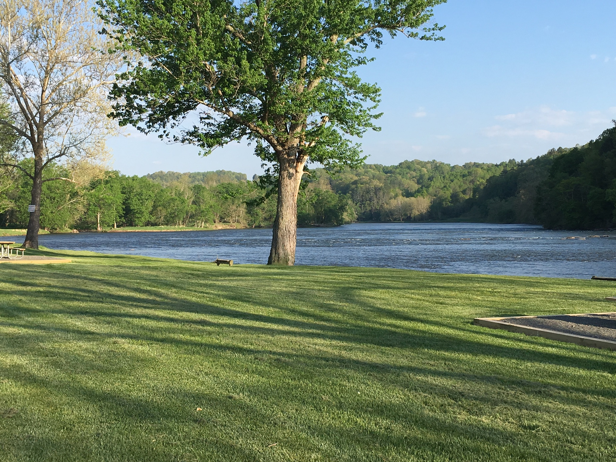
River views campground

view from park at fries
0B5FAAEB-E861-494E-973A-A61E5F292AC3

CB908A1D-3D5C-470E-ACA0-FA46D8310F6B

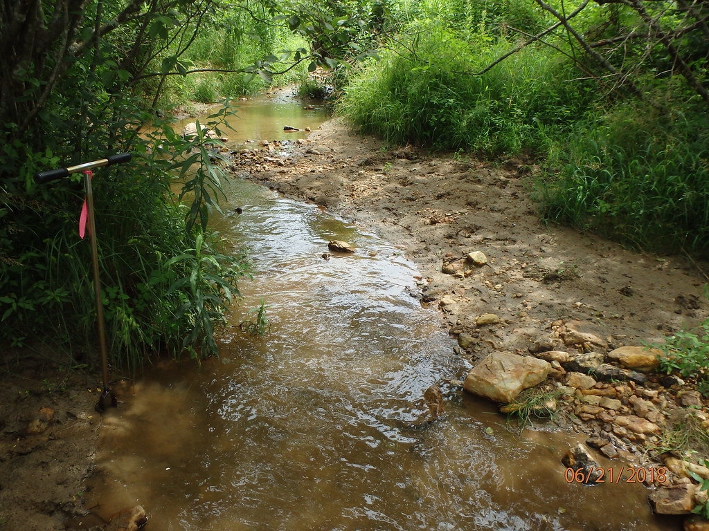
UT Rock Creek (282)

The Creek, Late Winter

A673051F-BCC8-4B60-9C8F-E9A1A821FE70

88F716A5-6E1D-4A6B-BC19-E156D941CA5E

CD3806AA-90B5-422C-BAE7-8498D1E5D1FF

Mt Rogers: Pony from previous 2 pictures

The Smokies

UT Rock Creek (251)

UT Rock Creek (252)

UT Rock Creek (253)

UT Rock Creek (254)

UT Rock Creek (255)

UT Rock Creek (257)

UT Rock Creek (258)
UT Rock Creek (259)

UT Rock Creek (261)

UT Rock Creek (262)

UT Rock Creek (263)

UT Rock Creek (264)
Pleasant Grove Rd, Independence, VA アメリカ合衆国の地図
別の場所を検索
近所の場所
Pleasant Grove Rd, Independence, VA アメリカ合衆国
Grayson Pkwy, Independence, VA アメリカ合衆国
River Ridge Ln, Independence, VA アメリカ合衆国River Ridge Lane
New View Ln, Independence, VA アメリカ合衆国New View Lane
Grayson Pkwy, Independence, VA アメリカ合衆国
River Hill Ln, Elk Creek, VA アメリカ合衆国リバー・ヒル・レーン
Rio Vista Lane, Independence, VA アメリカ合衆国リオ・ビスタ・レーン
Collinswood Ln, Independence, VA アメリカ合衆国
Powerhouse Rd, Independence, VA アメリカ合衆国
Powerhouse Rd, Independence, VA アメリカ合衆国
Longview Ln, Galax, VA アメリカ合衆国
Doe Ridge Ln, Old Town, VA アメリカ合衆国ドウ・リッジ・レーン
Longview Ln, Galax, VA アメリカ合衆国
Beaverdam Rd, Independence, VA アメリカ合衆国
Hilltop Dr, Independence, VA アメリカ合衆国
Penny Ln, Independence, VA アメリカ合衆国
Penny Ln, Independence, VA アメリカ合衆国
アメリカ合衆国 〒 バージニア州 インディペンデンス
Pine Mountain Rd, Independence, VA アメリカ合衆国
Mulberry Bottom Ln, Independence, VA アメリカ合衆国
最近の検索
- アメリカ合衆国 アラスカ州 レッド・ドッグ・マイン日の出日の入り時間
- Am bhf, Borken, ドイツアム・バーンホーフ日の出日の入り時間
- 4th St E, Sonoma, CA, USA日の出日の入り時間
- Oakland Ave, Williamsport, PA アメリカ合衆国日の出日の入り時間
- Via Roma, Pieranica CR, イタリアローマ通り日の出日の入り時間
- クロアチア 〒 ドゥブロブニク GradClock Tower of Dubrovnik日の出日の入り時間
- アルゼンチン チュブ州 トレリュー日の出日の入り時間
- Hartfords Bluff Cir, Mt Pleasant, SC アメリカ合衆国日の出日の入り時間
- 日本、熊本県熊本市北区日の出日の入り時間
- 中華人民共和国 福州市 平潭県 平潭島日の出日の入り時間