日本、〒- 鹿児島県曽於郡大崎町永吉日の出日の入り時間
Location: 日本 > 鹿児島県 > 曽於郡 > 大崎町 >
時間帯:
Asia/Tokyo
現地時間:
2025-07-09 00:03:37
経度:
131.0010772
緯度:
31.4180542
今日の日の出時刻:
05:18:16 AM
今日の日の入時刻:
07:23:59 PM
今日の日長:
14h 5m 43s
明日の日の出時刻:
05:18:46 AM
明日の日の入時刻:
07:23:46 PM
明日の日長:
14h 5m 0s
すべて表示する
| 日付 | 日出 | 日没 | 日長 |
|---|---|---|---|
| 2025年01月01日 | 07:15:06 AM | 05:24:01 PM | 10h 8m 55s |
| 2025年01月02日 | 07:15:18 AM | 05:24:45 PM | 10h 9m 27s |
| 2025年01月03日 | 07:15:29 AM | 05:25:30 PM | 10h 10m 1s |
| 2025年01月04日 | 07:15:38 AM | 05:26:15 PM | 10h 10m 37s |
| 2025年01月05日 | 07:15:46 AM | 05:27:01 PM | 10h 11m 15s |
| 2025年01月06日 | 07:15:52 AM | 05:27:49 PM | 10h 11m 57s |
| 2025年01月07日 | 07:15:56 AM | 05:28:36 PM | 10h 12m 40s |
| 2025年01月08日 | 07:15:58 AM | 05:29:25 PM | 10h 13m 27s |
| 2025年01月09日 | 07:15:58 AM | 05:30:15 PM | 10h 14m 17s |
| 2025年01月10日 | 07:15:57 AM | 05:31:04 PM | 10h 15m 7s |
| 2025年01月11日 | 07:15:54 AM | 05:31:55 PM | 10h 16m 1s |
| 2025年01月12日 | 07:15:50 AM | 05:32:46 PM | 10h 16m 56s |
| 2025年01月13日 | 07:15:43 AM | 05:33:38 PM | 10h 17m 55s |
| 2025年01月14日 | 07:15:35 AM | 05:34:30 PM | 10h 18m 55s |
| 2025年01月15日 | 07:15:25 AM | 05:35:22 PM | 10h 19m 57s |
| 2025年01月16日 | 07:15:14 AM | 05:36:15 PM | 10h 21m 1s |
| 2025年01月17日 | 07:15:00 AM | 05:37:09 PM | 10h 22m 9s |
| 2025年01月18日 | 07:14:45 AM | 05:38:02 PM | 10h 23m 17s |
| 2025年01月19日 | 07:14:29 AM | 05:38:56 PM | 10h 24m 27s |
| 2025年01月20日 | 07:14:10 AM | 05:39:50 PM | 10h 25m 40s |
| 2025年01月21日 | 07:13:50 AM | 05:40:44 PM | 10h 26m 54s |
| 2025年01月22日 | 07:13:28 AM | 05:41:38 PM | 10h 28m 10s |
| 2025年01月23日 | 07:13:05 AM | 05:42:33 PM | 10h 29m 28s |
| 2025年01月24日 | 07:12:40 AM | 05:43:27 PM | 10h 30m 47s |
| 2025年01月25日 | 07:12:13 AM | 05:44:22 PM | 10h 32m 9s |
| 2025年01月26日 | 07:11:45 AM | 05:45:17 PM | 10h 33m 32s |
| 2025年01月27日 | 07:11:15 AM | 05:46:11 PM | 10h 34m 56s |
| 2025年01月28日 | 07:10:44 AM | 05:47:06 PM | 10h 36m 22s |
| 2025年01月29日 | 07:10:11 AM | 05:48:00 PM | 10h 37m 49s |
| 2025年01月30日 | 07:09:36 AM | 05:48:54 PM | 10h 39m 18s |
| 2025年01月31日 | 07:09:00 AM | 05:49:49 PM | 10h 40m 49s |
| 2025年02月01日 | 07:08:23 AM | 05:50:43 PM | 10h 42m 20s |
| 2025年02月02日 | 07:07:44 AM | 05:51:37 PM | 10h 43m 53s |
| 2025年02月03日 | 07:07:03 AM | 05:52:30 PM | 10h 45m 27s |
| 2025年02月04日 | 07:06:21 AM | 05:53:24 PM | 10h 47m 3s |
| 2025年02月05日 | 07:05:38 AM | 05:54:17 PM | 10h 48m 39s |
| 2025年02月06日 | 07:04:54 AM | 05:55:10 PM | 10h 50m 16s |
| 2025年02月07日 | 07:04:08 AM | 05:56:03 PM | 10h 51m 55s |
| 2025年02月08日 | 07:03:20 AM | 05:56:55 PM | 10h 53m 35s |
| 2025年02月09日 | 07:02:32 AM | 05:57:47 PM | 10h 55m 15s |
| 2025年02月10日 | 07:01:42 AM | 05:58:39 PM | 10h 56m 57s |
| 2025年02月11日 | 07:00:51 AM | 05:59:31 PM | 10h 58m 40s |
| 2025年02月12日 | 06:59:59 AM | 06:00:22 PM | 11h 0m 23s |
| 2025年02月13日 | 06:59:06 AM | 06:01:13 PM | 11h 2m 7s |
| 2025年02月14日 | 06:58:11 AM | 06:02:03 PM | 11h 3m 52s |
| 2025年02月15日 | 06:57:16 AM | 06:02:54 PM | 11h 5m 38s |
| 2025年02月16日 | 06:56:19 AM | 06:03:43 PM | 11h 7m 24s |
| 2025年02月17日 | 06:55:22 AM | 06:04:33 PM | 11h 9m 11s |
| 2025年02月18日 | 06:54:23 AM | 06:05:22 PM | 11h 10m 59s |
| 2025年02月19日 | 06:53:23 AM | 06:06:11 PM | 11h 12m 48s |
| 2025年02月20日 | 06:52:22 AM | 06:06:59 PM | 11h 14m 37s |
| 2025年02月21日 | 06:51:21 AM | 06:07:47 PM | 11h 16m 26s |
| 2025年02月22日 | 06:50:18 AM | 06:08:34 PM | 11h 18m 16s |
| 2025年02月23日 | 06:49:15 AM | 06:09:22 PM | 11h 20m 7s |
| 2025年02月24日 | 06:48:11 AM | 06:10:08 PM | 11h 21m 57s |
| 2025年02月25日 | 06:47:06 AM | 06:10:55 PM | 11h 23m 49s |
| 2025年02月26日 | 06:46:00 AM | 06:11:41 PM | 11h 25m 41s |
| 2025年02月27日 | 06:44:53 AM | 06:12:27 PM | 11h 27m 34s |
| 2025年02月28日 | 06:43:46 AM | 06:13:12 PM | 11h 29m 26s |
| 2025年03月01日 | 06:42:38 AM | 06:13:57 PM | 11h 31m 19s |
| 2025年03月02日 | 06:41:29 AM | 06:14:42 PM | 11h 33m 13s |
| 2025年03月03日 | 06:40:20 AM | 06:15:27 PM | 11h 35m 7s |
| 2025年03月04日 | 06:39:10 AM | 06:16:11 PM | 11h 37m 1s |
| 2025年03月05日 | 06:38:00 AM | 06:16:54 PM | 11h 38m 54s |
| 2025年03月06日 | 06:36:49 AM | 06:17:38 PM | 11h 40m 49s |
| 2025年03月07日 | 06:35:37 AM | 06:18:21 PM | 11h 42m 44s |
| 2025年03月08日 | 06:34:25 AM | 06:19:04 PM | 11h 44m 39s |
| 2025年03月09日 | 06:33:12 AM | 06:19:47 PM | 11h 46m 35s |
| 2025年03月10日 | 06:32:00 AM | 06:20:29 PM | 11h 48m 29s |
| 2025年03月11日 | 06:30:46 AM | 06:21:11 PM | 11h 50m 25s |
| 2025年03月12日 | 06:29:32 AM | 06:21:53 PM | 11h 52m 21s |
| 2025年03月13日 | 06:28:18 AM | 06:22:34 PM | 11h 54m 16s |
| 2025年03月14日 | 06:27:04 AM | 06:23:16 PM | 11h 56m 12s |
| 2025年03月15日 | 06:25:50 AM | 06:23:57 PM | 11h 58m 7s |
| 2025年03月16日 | 06:24:35 AM | 06:24:38 PM | 12h 0m 3s |
| 2025年03月17日 | 06:23:20 AM | 06:25:19 PM | 12h 1m 59s |
| 2025年03月18日 | 06:22:04 AM | 06:25:59 PM | 12h 3m 55s |
| 2025年03月19日 | 06:20:49 AM | 06:26:40 PM | 12h 5m 51s |
| 2025年03月20日 | 06:19:33 AM | 06:27:20 PM | 12h 7m 47s |
| 2025年03月21日 | 06:18:17 AM | 06:28:00 PM | 12h 9m 43s |
| 2025年03月22日 | 06:17:02 AM | 06:28:40 PM | 12h 11m 38s |
| 2025年03月23日 | 06:15:46 AM | 06:29:20 PM | 12h 13m 34s |
| 2025年03月24日 | 06:14:30 AM | 06:30:00 PM | 12h 15m 30s |
| 2025年03月25日 | 06:13:14 AM | 06:30:39 PM | 12h 17m 25s |
| 2025年03月26日 | 06:11:58 AM | 06:31:19 PM | 12h 19m 21s |
| 2025年03月27日 | 06:10:43 AM | 06:31:59 PM | 12h 21m 16s |
| 2025年03月28日 | 06:09:27 AM | 06:32:38 PM | 12h 23m 11s |
| 2025年03月29日 | 06:08:11 AM | 06:33:17 PM | 12h 25m 6s |
| 2025年03月30日 | 06:06:56 AM | 06:33:57 PM | 12h 27m 1s |
| 2025年03月31日 | 06:05:41 AM | 06:34:36 PM | 12h 28m 55s |
| 2025年04月01日 | 06:04:26 AM | 06:35:16 PM | 12h 30m 50s |
| 2025年04月02日 | 06:03:11 AM | 06:35:55 PM | 12h 32m 44s |
| 2025年04月03日 | 06:01:56 AM | 06:36:34 PM | 12h 34m 38s |
| 2025年04月04日 | 06:00:42 AM | 06:37:14 PM | 12h 36m 32s |
| 2025年04月05日 | 05:59:28 AM | 06:37:53 PM | 12h 38m 25s |
| 2025年04月06日 | 05:58:15 AM | 06:38:33 PM | 12h 40m 18s |
| 2025年04月07日 | 05:57:01 AM | 06:39:12 PM | 12h 42m 11s |
| 2025年04月08日 | 05:55:49 AM | 06:39:52 PM | 12h 44m 3s |
| 2025年04月09日 | 05:54:36 AM | 06:40:31 PM | 12h 45m 55s |
| 2025年04月10日 | 05:53:24 AM | 06:41:11 PM | 12h 47m 47s |
| 2025年04月11日 | 05:52:13 AM | 06:41:51 PM | 12h 49m 38s |
| 2025年04月12日 | 05:51:02 AM | 06:42:30 PM | 12h 51m 28s |
| 2025年04月13日 | 05:49:51 AM | 06:43:10 PM | 12h 53m 19s |
| 2025年04月14日 | 05:48:42 AM | 06:43:50 PM | 12h 55m 8s |
| 2025年04月15日 | 05:47:32 AM | 06:44:30 PM | 12h 56m 58s |
| 2025年04月16日 | 05:46:24 AM | 06:45:10 PM | 12h 58m 46s |
| 2025年04月17日 | 05:45:16 AM | 06:45:51 PM | 13h 0m 35s |
| 2025年04月18日 | 05:44:08 AM | 06:46:31 PM | 13h 2m 23s |
| 2025年04月19日 | 05:43:02 AM | 06:47:12 PM | 13h 4m 10s |
| 2025年04月20日 | 05:41:56 AM | 06:47:52 PM | 13h 5m 56s |
| 2025年04月21日 | 05:40:51 AM | 06:48:33 PM | 13h 7m 42s |
| 2025年04月22日 | 05:39:46 AM | 06:49:14 PM | 13h 9m 28s |
| 2025年04月23日 | 05:38:43 AM | 06:49:54 PM | 13h 11m 11s |
| 2025年04月24日 | 05:37:40 AM | 06:50:35 PM | 13h 12m 55s |
| 2025年04月25日 | 05:36:38 AM | 06:51:16 PM | 13h 14m 38s |
| 2025年04月26日 | 05:35:37 AM | 06:51:58 PM | 13h 16m 21s |
| 2025年04月27日 | 05:34:37 AM | 06:52:39 PM | 13h 18m 2s |
| 2025年04月28日 | 05:33:38 AM | 06:53:20 PM | 13h 19m 42s |
| 2025年04月29日 | 05:32:40 AM | 06:54:01 PM | 13h 21m 21s |
| 2025年04月30日 | 05:31:43 AM | 06:54:43 PM | 13h 23m 0s |
| 2025年05月01日 | 05:30:47 AM | 06:55:24 PM | 13h 24m 37s |
| 2025年05月02日 | 05:29:52 AM | 06:56:06 PM | 13h 26m 14s |
| 2025年05月03日 | 05:28:57 AM | 06:56:47 PM | 13h 27m 50s |
| 2025年05月04日 | 05:28:04 AM | 06:57:29 PM | 13h 29m 25s |
| 2025年05月05日 | 05:27:13 AM | 06:58:10 PM | 13h 30m 57s |
| 2025年05月06日 | 05:26:22 AM | 06:58:52 PM | 13h 32m 30s |
| 2025年05月07日 | 05:25:32 AM | 06:59:34 PM | 13h 34m 2s |
| 2025年05月08日 | 05:24:44 AM | 07:00:15 PM | 13h 35m 31s |
| 2025年05月09日 | 05:23:57 AM | 07:00:56 PM | 13h 36m 59s |
| 2025年05月10日 | 05:23:11 AM | 07:01:38 PM | 13h 38m 27s |
| 2025年05月11日 | 05:22:26 AM | 07:02:19 PM | 13h 39m 53s |
| 2025年05月12日 | 05:21:42 AM | 07:03:00 PM | 13h 41m 18s |
| 2025年05月13日 | 05:21:00 AM | 07:03:41 PM | 13h 42m 41s |
| 2025年05月14日 | 05:20:19 AM | 07:04:22 PM | 13h 44m 3s |
| 2025年05月15日 | 05:19:39 AM | 07:05:03 PM | 13h 45m 24s |
| 2025年05月16日 | 05:19:01 AM | 07:05:43 PM | 13h 46m 42s |
| 2025年05月17日 | 05:18:24 AM | 07:06:24 PM | 13h 48m 0s |
| 2025年05月18日 | 05:17:49 AM | 07:07:04 PM | 13h 49m 15s |
| 2025年05月19日 | 05:17:14 AM | 07:07:44 PM | 13h 50m 30s |
| 2025年05月20日 | 05:16:42 AM | 07:08:23 PM | 13h 51m 41s |
| 2025年05月21日 | 05:16:10 AM | 07:09:02 PM | 13h 52m 52s |
| 2025年05月22日 | 05:15:40 AM | 07:09:41 PM | 13h 54m 1s |
| 2025年05月23日 | 05:15:11 AM | 07:10:19 PM | 13h 55m 8s |
| 2025年05月24日 | 05:14:44 AM | 07:10:57 PM | 13h 56m 13s |
| 2025年05月25日 | 05:14:19 AM | 07:11:35 PM | 13h 57m 16s |
| 2025年05月26日 | 05:13:54 AM | 07:12:12 PM | 13h 58m 18s |
| 2025年05月27日 | 05:13:32 AM | 07:12:48 PM | 13h 59m 16s |
| 2025年05月28日 | 05:13:10 AM | 07:13:24 PM | 14h 0m 14s |
| 2025年05月29日 | 05:12:50 AM | 07:14:00 PM | 14h 1m 10s |
| 2025年05月30日 | 05:12:32 AM | 07:14:35 PM | 14h 2m 3s |
| 2025年05月31日 | 05:12:15 AM | 07:15:09 PM | 14h 2m 54s |
| 2025年06月01日 | 05:12:00 AM | 07:15:43 PM | 14h 3m 43s |
| 2025年06月02日 | 05:11:46 AM | 07:16:15 PM | 14h 4m 29s |
| 2025年06月03日 | 05:11:33 AM | 07:16:47 PM | 14h 5m 14s |
| 2025年06月04日 | 05:11:22 AM | 07:17:19 PM | 14h 5m 57s |
| 2025年06月05日 | 05:11:13 AM | 07:17:49 PM | 14h 6m 36s |
| 2025年06月06日 | 05:11:05 AM | 07:18:19 PM | 14h 7m 14s |
| 2025年06月07日 | 05:10:58 AM | 07:18:48 PM | 14h 7m 50s |
| 2025年06月08日 | 05:10:53 AM | 07:19:16 PM | 14h 8m 23s |
| 2025年06月09日 | 05:10:50 AM | 07:19:43 PM | 14h 8m 53s |
| 2025年06月10日 | 05:10:47 AM | 07:20:09 PM | 14h 9m 22s |
| 2025年06月11日 | 05:10:47 AM | 07:20:34 PM | 14h 9m 47s |
| 2025年06月12日 | 05:10:47 AM | 07:20:58 PM | 14h 10m 11s |
| 2025年06月13日 | 05:10:49 AM | 07:21:21 PM | 14h 10m 32s |
| 2025年06月14日 | 05:10:53 AM | 07:21:43 PM | 14h 10m 50s |
| 2025年06月15日 | 05:10:58 AM | 07:22:04 PM | 14h 11m 6s |
| 2025年06月16日 | 05:11:04 AM | 07:22:23 PM | 14h 11m 19s |
| 2025年06月17日 | 05:11:11 AM | 07:22:42 PM | 14h 11m 31s |
| 2025年06月18日 | 05:11:20 AM | 07:22:59 PM | 14h 11m 39s |
| 2025年06月19日 | 05:11:30 AM | 07:23:15 PM | 14h 11m 45s |
| 2025年06月20日 | 05:11:42 AM | 07:23:30 PM | 14h 11m 48s |
| 2025年06月21日 | 05:11:54 AM | 07:23:43 PM | 14h 11m 49s |
| 2025年06月22日 | 05:12:08 AM | 07:23:56 PM | 14h 11m 48s |
| 2025年06月23日 | 05:12:23 AM | 07:24:07 PM | 14h 11m 44s |
| 2025年06月24日 | 05:12:40 AM | 07:24:16 PM | 14h 11m 36s |
| 2025年06月25日 | 05:12:57 AM | 07:24:24 PM | 14h 11m 27s |
| 2025年06月26日 | 05:13:15 AM | 07:24:31 PM | 14h 11m 16s |
| 2025年06月27日 | 05:13:35 AM | 07:24:36 PM | 14h 11m 1s |
| 2025年06月28日 | 05:13:56 AM | 07:24:40 PM | 14h 10m 44s |
| 2025年06月29日 | 05:14:18 AM | 07:24:43 PM | 14h 10m 25s |
| 2025年06月30日 | 05:14:40 AM | 07:24:44 PM | 14h 10m 4s |
| 2025年07月01日 | 05:15:04 AM | 07:24:44 PM | 14h 9m 40s |
| 2025年07月02日 | 05:15:29 AM | 07:24:42 PM | 14h 9m 13s |
| 2025年07月03日 | 05:15:54 AM | 07:24:38 PM | 14h 8m 44s |
| 2025年07月04日 | 05:16:21 AM | 07:24:33 PM | 14h 8m 12s |
| 2025年07月05日 | 05:16:48 AM | 07:24:27 PM | 14h 7m 39s |
| 2025年07月06日 | 05:17:16 AM | 07:24:19 PM | 14h 7m 3s |
| 2025年07月07日 | 05:17:45 AM | 07:24:10 PM | 14h 6m 25s |
| 2025年07月08日 | 05:18:15 AM | 07:23:59 PM | 14h 5m 44s |
| 2025年07月09日 | 05:18:45 AM | 07:23:47 PM | 14h 5m 2s |
| 2025年07月10日 | 05:19:16 AM | 07:23:33 PM | 14h 4m 17s |
| 2025年07月11日 | 05:19:48 AM | 07:23:17 PM | 14h 3m 29s |
| 2025年07月12日 | 05:20:20 AM | 07:23:00 PM | 14h 2m 40s |
| 2025年07月13日 | 05:20:53 AM | 07:22:42 PM | 14h 1m 49s |
| 2025年07月14日 | 05:21:26 AM | 07:22:22 PM | 14h 0m 56s |
| 2025年07月15日 | 05:22:00 AM | 07:22:00 PM | 14h 0m 0s |
| 2025年07月16日 | 05:22:35 AM | 07:21:37 PM | 13h 59m 2s |
| 2025年07月17日 | 05:23:10 AM | 07:21:13 PM | 13h 58m 3s |
| 2025年07月18日 | 05:23:45 AM | 07:20:47 PM | 13h 57m 2s |
| 2025年07月19日 | 05:24:21 AM | 07:20:19 PM | 13h 55m 58s |
| 2025年07月20日 | 05:24:57 AM | 07:19:50 PM | 13h 54m 53s |
| 2025年07月21日 | 05:25:33 AM | 07:19:20 PM | 13h 53m 47s |
| 2025年07月22日 | 05:26:10 AM | 07:18:48 PM | 13h 52m 38s |
| 2025年07月23日 | 05:26:47 AM | 07:18:15 PM | 13h 51m 28s |
| 2025年07月24日 | 05:27:24 AM | 07:17:40 PM | 13h 50m 16s |
| 2025年07月25日 | 05:28:02 AM | 07:17:04 PM | 13h 49m 2s |
| 2025年07月26日 | 05:28:40 AM | 07:16:26 PM | 13h 47m 46s |
| 2025年07月27日 | 05:29:18 AM | 07:15:47 PM | 13h 46m 29s |
| 2025年07月28日 | 05:29:56 AM | 07:15:07 PM | 13h 45m 11s |
| 2025年07月29日 | 05:30:34 AM | 07:14:25 PM | 13h 43m 51s |
| 2025年07月30日 | 05:31:12 AM | 07:13:42 PM | 13h 42m 30s |
| 2025年07月31日 | 05:31:51 AM | 07:12:58 PM | 13h 41m 7s |
| 2025年08月01日 | 05:32:29 AM | 07:12:13 PM | 13h 39m 44s |
| 2025年08月02日 | 05:33:08 AM | 07:11:26 PM | 13h 38m 18s |
| 2025年08月03日 | 05:33:46 AM | 07:10:38 PM | 13h 36m 52s |
| 2025年08月04日 | 05:34:25 AM | 07:09:49 PM | 13h 35m 24s |
| 2025年08月05日 | 05:35:03 AM | 07:08:58 PM | 13h 33m 55s |
| 2025年08月06日 | 05:35:42 AM | 07:08:06 PM | 13h 32m 24s |
| 2025年08月07日 | 05:36:20 AM | 07:07:14 PM | 13h 30m 54s |
| 2025年08月08日 | 05:36:59 AM | 07:06:20 PM | 13h 29m 21s |
| 2025年08月09日 | 05:37:37 AM | 07:05:24 PM | 13h 27m 47s |
| 2025年08月10日 | 05:38:16 AM | 07:04:28 PM | 13h 26m 12s |
| 2025年08月11日 | 05:38:54 AM | 07:03:31 PM | 13h 24m 37s |
| 2025年08月12日 | 05:39:32 AM | 07:02:33 PM | 13h 23m 1s |
| 2025年08月13日 | 05:40:10 AM | 07:01:33 PM | 13h 21m 23s |
| 2025年08月14日 | 05:40:48 AM | 07:00:33 PM | 13h 19m 45s |
| 2025年08月15日 | 05:41:26 AM | 06:59:32 PM | 13h 18m 6s |
| 2025年08月16日 | 05:42:04 AM | 06:58:30 PM | 13h 16m 26s |
| 2025年08月17日 | 05:42:42 AM | 06:57:27 PM | 13h 14m 45s |
| 2025年08月18日 | 05:43:19 AM | 06:56:23 PM | 13h 13m 4s |
| 2025年08月19日 | 05:43:57 AM | 06:55:18 PM | 13h 11m 21s |
| 2025年08月20日 | 05:44:34 AM | 06:54:12 PM | 13h 9m 38s |
| 2025年08月21日 | 05:45:11 AM | 06:53:06 PM | 13h 7m 55s |
| 2025年08月22日 | 05:45:48 AM | 06:51:58 PM | 13h 6m 10s |
| 2025年08月23日 | 05:46:25 AM | 06:50:50 PM | 13h 4m 25s |
| 2025年08月24日 | 05:47:02 AM | 06:49:41 PM | 13h 2m 39s |
| 2025年08月25日 | 05:47:38 AM | 06:48:32 PM | 13h 0m 54s |
| 2025年08月26日 | 05:48:15 AM | 06:47:22 PM | 12h 59m 7s |
| 2025年08月27日 | 05:48:51 AM | 06:46:11 PM | 12h 57m 20s |
| 2025年08月28日 | 05:49:27 AM | 06:44:59 PM | 12h 55m 32s |
| 2025年08月29日 | 05:50:03 AM | 06:43:47 PM | 12h 53m 44s |
| 2025年08月30日 | 05:50:39 AM | 06:42:35 PM | 12h 51m 56s |
| 2025年08月31日 | 05:51:15 AM | 06:41:21 PM | 12h 50m 6s |
| 2025年09月01日 | 05:51:51 AM | 06:40:08 PM | 12h 48m 17s |
| 2025年09月02日 | 05:52:27 AM | 06:38:54 PM | 12h 46m 27s |
| 2025年09月03日 | 05:53:02 AM | 06:37:39 PM | 12h 44m 37s |
| 2025年09月04日 | 05:53:38 AM | 06:36:24 PM | 12h 42m 46s |
| 2025年09月05日 | 05:54:13 AM | 06:35:08 PM | 12h 40m 55s |
| 2025年09月06日 | 05:54:49 AM | 06:33:53 PM | 12h 39m 4s |
| 2025年09月07日 | 05:55:24 AM | 06:32:36 PM | 12h 37m 12s |
| 2025年09月08日 | 05:55:59 AM | 06:31:20 PM | 12h 35m 21s |
| 2025年09月09日 | 05:56:34 AM | 06:30:03 PM | 12h 33m 29s |
| 2025年09月10日 | 05:57:10 AM | 06:28:46 PM | 12h 31m 36s |
| 2025年09月11日 | 05:57:45 AM | 06:27:28 PM | 12h 29m 43s |
| 2025年09月12日 | 05:58:20 AM | 06:26:11 PM | 12h 27m 51s |
| 2025年09月13日 | 05:58:55 AM | 06:24:53 PM | 12h 25m 58s |
| 2025年09月14日 | 05:59:31 AM | 06:23:35 PM | 12h 24m 4s |
| 2025年09月15日 | 06:00:06 AM | 06:22:17 PM | 12h 22m 11s |
| 2025年09月16日 | 06:00:41 AM | 06:20:59 PM | 12h 20m 18s |
| 2025年09月17日 | 06:01:16 AM | 06:19:41 PM | 12h 18m 25s |
| 2025年09月18日 | 06:01:52 AM | 06:18:22 PM | 12h 16m 30s |
| 2025年09月19日 | 06:02:27 AM | 06:17:04 PM | 12h 14m 37s |
| 2025年09月20日 | 06:03:03 AM | 06:15:46 PM | 12h 12m 43s |
| 2025年09月21日 | 06:03:39 AM | 06:14:27 PM | 12h 10m 48s |
| 2025年09月22日 | 06:04:14 AM | 06:13:09 PM | 12h 8m 55s |
| 2025年09月23日 | 06:04:50 AM | 06:11:51 PM | 12h 7m 1s |
| 2025年09月24日 | 06:05:26 AM | 06:10:33 PM | 12h 5m 7s |
| 2025年09月25日 | 06:06:03 AM | 06:09:15 PM | 12h 3m 12s |
| 2025年09月26日 | 06:06:39 AM | 06:07:57 PM | 12h 1m 18s |
| 2025年09月27日 | 06:07:16 AM | 06:06:40 PM | 11h 59m 24s |
| 2025年09月28日 | 06:07:52 AM | 06:05:23 PM | 11h 57m 31s |
| 2025年09月29日 | 06:08:29 AM | 06:04:06 PM | 11h 55m 37s |
| 2025年09月30日 | 06:09:07 AM | 06:02:49 PM | 11h 53m 42s |
| 2025年10月01日 | 06:09:44 AM | 06:01:32 PM | 11h 51m 48s |
| 2025年10月02日 | 06:10:22 AM | 06:00:16 PM | 11h 49m 54s |
| 2025年10月03日 | 06:11:00 AM | 05:59:01 PM | 11h 48m 1s |
| 2025年10月04日 | 06:11:38 AM | 05:57:45 PM | 11h 46m 7s |
| 2025年10月05日 | 06:12:16 AM | 05:56:31 PM | 11h 44m 15s |
| 2025年10月06日 | 06:12:55 AM | 05:55:16 PM | 11h 42m 21s |
| 2025年10月07日 | 06:13:34 AM | 05:54:02 PM | 11h 40m 28s |
| 2025年10月08日 | 06:14:14 AM | 05:52:49 PM | 11h 38m 35s |
| 2025年10月09日 | 06:14:53 AM | 05:51:36 PM | 11h 36m 43s |
| 2025年10月10日 | 06:15:33 AM | 05:50:24 PM | 11h 34m 51s |
| 2025年10月11日 | 06:16:14 AM | 05:49:12 PM | 11h 32m 58s |
| 2025年10月12日 | 06:16:54 AM | 05:48:01 PM | 11h 31m 7s |
| 2025年10月13日 | 06:17:35 AM | 05:46:51 PM | 11h 29m 16s |
| 2025年10月14日 | 06:18:17 AM | 05:45:41 PM | 11h 27m 24s |
| 2025年10月15日 | 06:18:59 AM | 05:44:32 PM | 11h 25m 33s |
| 2025年10月16日 | 06:19:41 AM | 05:43:24 PM | 11h 23m 43s |
| 2025年10月17日 | 06:20:23 AM | 05:42:17 PM | 11h 21m 54s |
| 2025年10月18日 | 06:21:06 AM | 05:41:10 PM | 11h 20m 4s |
| 2025年10月19日 | 06:21:50 AM | 05:40:04 PM | 11h 18m 14s |
| 2025年10月20日 | 06:22:33 AM | 05:38:59 PM | 11h 16m 26s |
| 2025年10月21日 | 06:23:18 AM | 05:37:55 PM | 11h 14m 37s |
| 2025年10月22日 | 06:24:02 AM | 05:36:52 PM | 11h 12m 50s |
| 2025年10月23日 | 06:24:47 AM | 05:35:50 PM | 11h 11m 3s |
| 2025年10月24日 | 06:25:32 AM | 05:34:49 PM | 11h 9m 17s |
| 2025年10月25日 | 06:26:18 AM | 05:33:49 PM | 11h 7m 31s |
| 2025年10月26日 | 06:27:04 AM | 05:32:50 PM | 11h 5m 46s |
| 2025年10月27日 | 06:27:51 AM | 05:31:52 PM | 11h 4m 1s |
| 2025年10月28日 | 06:28:37 AM | 05:30:55 PM | 11h 2m 18s |
| 2025年10月29日 | 06:29:25 AM | 05:30:00 PM | 11h 0m 35s |
| 2025年10月30日 | 06:30:12 AM | 05:29:05 PM | 10h 58m 53s |
| 2025年10月31日 | 06:31:00 AM | 05:28:12 PM | 10h 57m 12s |
| 2025年11月01日 | 06:31:49 AM | 05:27:19 PM | 10h 55m 30s |
| 2025年11月02日 | 06:32:37 AM | 05:26:29 PM | 10h 53m 52s |
| 2025年11月03日 | 06:33:26 AM | 05:25:39 PM | 10h 52m 13s |
| 2025年11月04日 | 06:34:16 AM | 05:24:51 PM | 10h 50m 35s |
| 2025年11月05日 | 06:35:05 AM | 05:24:04 PM | 10h 48m 59s |
| 2025年11月06日 | 06:35:55 AM | 05:23:18 PM | 10h 47m 23s |
| 2025年11月07日 | 06:36:46 AM | 05:22:34 PM | 10h 45m 48s |
| 2025年11月08日 | 06:37:36 AM | 05:21:51 PM | 10h 44m 15s |
| 2025年11月09日 | 06:38:27 AM | 05:21:10 PM | 10h 42m 43s |
| 2025年11月10日 | 06:39:18 AM | 05:20:30 PM | 10h 41m 12s |
| 2025年11月11日 | 06:40:09 AM | 05:19:51 PM | 10h 39m 42s |
| 2025年11月12日 | 06:41:01 AM | 05:19:14 PM | 10h 38m 13s |
| 2025年11月13日 | 06:41:52 AM | 05:18:39 PM | 10h 36m 47s |
| 2025年11月14日 | 06:42:44 AM | 05:18:05 PM | 10h 35m 21s |
| 2025年11月15日 | 06:43:36 AM | 05:17:33 PM | 10h 33m 57s |
| 2025年11月16日 | 06:44:28 AM | 05:17:02 PM | 10h 32m 34s |
| 2025年11月17日 | 06:45:20 AM | 05:16:33 PM | 10h 31m 13s |
| 2025年11月18日 | 06:46:12 AM | 05:16:06 PM | 10h 29m 54s |
| 2025年11月19日 | 06:47:04 AM | 05:15:40 PM | 10h 28m 36s |
| 2025年11月20日 | 06:47:56 AM | 05:15:16 PM | 10h 27m 20s |
| 2025年11月21日 | 06:48:48 AM | 05:14:54 PM | 10h 26m 6s |
| 2025年11月22日 | 06:49:40 AM | 05:14:33 PM | 10h 24m 53s |
| 2025年11月23日 | 06:50:32 AM | 05:14:14 PM | 10h 23m 42s |
| 2025年11月24日 | 06:51:23 AM | 05:13:57 PM | 10h 22m 34s |
| 2025年11月25日 | 06:52:15 AM | 05:13:41 PM | 10h 21m 26s |
| 2025年11月26日 | 06:53:06 AM | 05:13:27 PM | 10h 20m 21s |
| 2025年11月27日 | 06:53:56 AM | 05:13:15 PM | 10h 19m 19s |
| 2025年11月28日 | 06:54:47 AM | 05:13:05 PM | 10h 18m 18s |
| 2025年11月29日 | 06:55:37 AM | 05:12:57 PM | 10h 17m 20s |
| 2025年11月30日 | 06:56:27 AM | 05:12:50 PM | 10h 16m 23s |
| 2025年12月01日 | 06:57:16 AM | 05:12:45 PM | 10h 15m 29s |
| 2025年12月02日 | 06:58:05 AM | 05:12:42 PM | 10h 14m 37s |
| 2025年12月03日 | 06:58:53 AM | 05:12:41 PM | 10h 13m 48s |
| 2025年12月04日 | 06:59:40 AM | 05:12:41 PM | 10h 13m 1s |
| 2025年12月05日 | 07:00:27 AM | 05:12:43 PM | 10h 12m 16s |
| 2025年12月06日 | 07:01:14 AM | 05:12:47 PM | 10h 11m 33s |
| 2025年12月07日 | 07:01:59 AM | 05:12:53 PM | 10h 10m 54s |
| 2025年12月08日 | 07:02:44 AM | 05:13:00 PM | 10h 10m 16s |
| 2025年12月09日 | 07:03:28 AM | 05:13:10 PM | 10h 9m 42s |
| 2025年12月10日 | 07:04:11 AM | 05:13:21 PM | 10h 9m 10s |
| 2025年12月11日 | 07:04:54 AM | 05:13:33 PM | 10h 8m 39s |
| 2025年12月12日 | 07:05:35 AM | 05:13:48 PM | 10h 8m 13s |
| 2025年12月13日 | 07:06:15 AM | 05:14:04 PM | 10h 7m 49s |
| 2025年12月14日 | 07:06:55 AM | 05:14:21 PM | 10h 7m 26s |
| 2025年12月15日 | 07:07:33 AM | 05:14:41 PM | 10h 7m 8s |
| 2025年12月16日 | 07:08:10 AM | 05:15:01 PM | 10h 6m 51s |
| 2025年12月17日 | 07:08:46 AM | 05:15:24 PM | 10h 6m 38s |
| 2025年12月18日 | 07:09:21 AM | 05:15:48 PM | 10h 6m 27s |
| 2025年12月19日 | 07:09:54 AM | 05:16:14 PM | 10h 6m 20s |
| 2025年12月20日 | 07:10:27 AM | 05:16:41 PM | 10h 6m 14s |
| 2025年12月21日 | 07:10:58 AM | 05:17:09 PM | 10h 6m 11s |
| 2025年12月22日 | 07:11:27 AM | 05:17:39 PM | 10h 6m 12s |
| 2025年12月23日 | 07:11:55 AM | 05:18:11 PM | 10h 6m 16s |
| 2025年12月24日 | 07:12:22 AM | 05:18:44 PM | 10h 6m 22s |
| 2025年12月25日 | 07:12:48 AM | 05:19:18 PM | 10h 6m 30s |
| 2025年12月26日 | 07:13:12 AM | 05:19:53 PM | 10h 6m 41s |
| 2025年12月27日 | 07:13:34 AM | 05:20:30 PM | 10h 6m 56s |
| 2025年12月28日 | 07:13:55 AM | 05:21:08 PM | 10h 7m 13s |
| 2025年12月29日 | 07:14:14 AM | 05:21:47 PM | 10h 7m 33s |
| 2025年12月30日 | 07:14:32 AM | 05:22:27 PM | 10h 7m 55s |
| 2025年12月31日 | 07:14:48 AM | 05:23:08 PM | 10h 8m 20s |
写真

Seashore in sunset
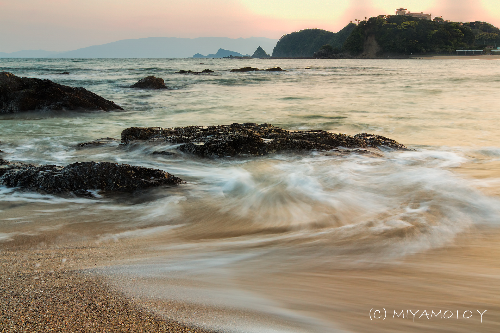
Seashore in sunset

Seashore in sunset
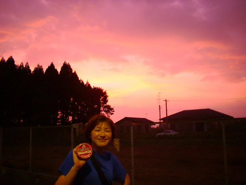
めんたいこのように真っ赤な夕焼け
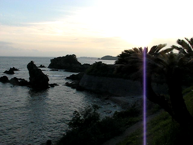
Miyazaki Coast, outside Kushima

Aerial view of Japanese coastline with Kaimondake Volcano on way to Narita International Airport (NRT) Tokyo Japan
大胆に鶏肉を焼いてます。火はそこまで通らないように。 #鳥刺

IMGP2062-1
VS鉄かぶと

Aerial view of Japanese coastline with Kaimondake Volcano on way to Narita International Airport (NRT) Tokyo Japan

IMG_1765.JPG

Liatris spicata TudioJepegii
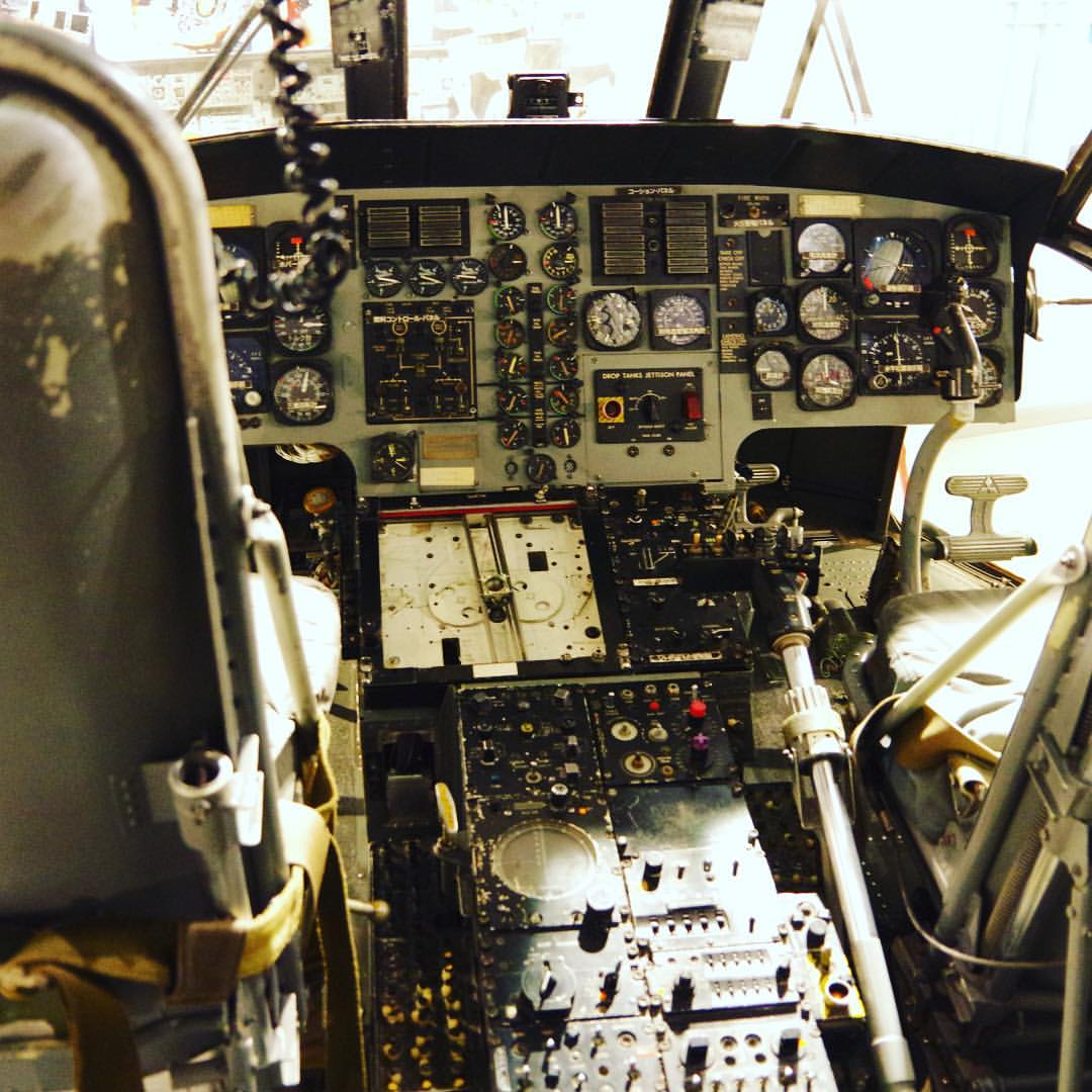
資料館内のヘリ、操縦席に実際に座れる。2階は特攻隊の資料室だけど、1階は自衛隊の広報施設って感じ。 #ヘリ #自衛隊

鹿屋航空基地資料館、なかなか楽しい。自衛隊が昔使ってた機体が展示されてるぞ。

natural art
DSC05153-2
2016-02-28 11.59.08
2016-02-28 11.59.02
日本、〒- 鹿児島県曽於郡大崎町永吉の地図
別の場所を検索
近所の場所
日本, 鹿児島県曽於郡大崎町
日本, 鹿児島県曽於郡
日本, 〒- 鹿児島県曽於郡大崎町永吉34
日本, 〒- 鹿児島県肝属郡東串良町新川西2257
日本, 鹿児島県肝属郡東串良町
日本, 〒- 鹿児島県曽於郡大崎町持留372
日本, 〒- 鹿児島県志布志市有明町野井倉1740−5
日本, 鹿児島県志布志市
日本, 〒- 鹿児島県肝属郡肝付町新富
日本, 鹿児島県肝属郡肝付町
日本, 〒- 鹿児島県肝属郡肝付町後田7416−21
日本, 〒- 鹿児島県曽於郡大崎町野方8519
日本, 〒- 鹿児島県曽於郡大崎町野方8519−2大隅カントリークラブ
日本, 〒- 鹿児島県肝属郡肝付町北方2170
日本, 〒- 鹿児島県肝属郡肝付町北方2118
日本, 〒- 鹿児島県鹿屋市王子町4645−22
日本, 鹿児島県鹿屋市
日本、〒- 鹿児島県肝属郡肝付町南方 鹿児島県肝属郡肝付町南方289内之浦銀河アリーナ天体観測室
日本、〒- 鹿児島県肝属郡肝付町南方
日本, 〒- 鹿児島県肝属郡肝付町南方1709−4
最近の検索
- アメリカ合衆国 アラスカ州 レッド・ドッグ・マイン日の出日の入り時間
- Am bhf, Borken, ドイツアム・バーンホーフ日の出日の入り時間
- 4th St E, Sonoma, CA, USA日の出日の入り時間
- Oakland Ave, Williamsport, PA アメリカ合衆国日の出日の入り時間
- Via Roma, Pieranica CR, イタリアローマ通り日の出日の入り時間
- クロアチア 〒 ドゥブロブニク GradClock Tower of Dubrovnik日の出日の入り時間
- アルゼンチン チュブ州 トレリュー日の出日の入り時間
- Hartfords Bluff Cir, Mt Pleasant, SC アメリカ合衆国日の出日の入り時間
- 日本、熊本県熊本市北区日の出日の入り時間
- 中華人民共和国 福州市 平潭県 平潭島日の出日の入り時間