W Hwy 19, Topton, NC アメリカ合衆国Mystic Lands日の出日の入り時間
Location: アメリカ合衆国 > ノース・カロライナ州 > スウェイン > アメリカ合衆国 ノース・カロライナ州 チャールストン > アメリカ合衆国 〒 ノース・カロライナ州 ブライソン・シティ >
時間帯:
America/New_York
現地時間:
2025-06-16 13:02:14
経度:
-83.666902
緯度:
35.2872366
今日の日の出時刻:
06:19:39 AM
今日の日の入時刻:
08:51:51 PM
今日の日長:
14h 32m 12s
明日の日の出時刻:
06:19:49 AM
明日の日の入時刻:
08:52:08 PM
明日の日長:
14h 32m 19s
すべて表示する
| 日付 | 日出 | 日没 | 日長 |
|---|---|---|---|
| 2025年01月01日 | 07:43:30 AM | 05:34:04 PM | 9h 50m 34s |
| 2025年01月02日 | 07:43:38 AM | 05:34:52 PM | 9h 51m 14s |
| 2025年01月03日 | 07:43:43 AM | 05:35:40 PM | 9h 51m 57s |
| 2025年01月04日 | 07:43:47 AM | 05:36:30 PM | 9h 52m 43s |
| 2025年01月05日 | 07:43:49 AM | 05:37:21 PM | 9h 53m 32s |
| 2025年01月06日 | 07:43:49 AM | 05:38:13 PM | 9h 54m 24s |
| 2025年01月07日 | 07:43:47 AM | 05:39:06 PM | 9h 55m 19s |
| 2025年01月08日 | 07:43:43 AM | 05:40:00 PM | 9h 56m 17s |
| 2025年01月09日 | 07:43:37 AM | 05:40:54 PM | 9h 57m 17s |
| 2025年01月10日 | 07:43:29 AM | 05:41:49 PM | 9h 58m 20s |
| 2025年01月11日 | 07:43:19 AM | 05:42:45 PM | 9h 59m 26s |
| 2025年01月12日 | 07:43:08 AM | 05:43:42 PM | 10h 0m 34s |
| 2025年01月13日 | 07:42:54 AM | 05:44:39 PM | 10h 1m 45s |
| 2025年01月14日 | 07:42:39 AM | 05:45:37 PM | 10h 2m 58s |
| 2025年01月15日 | 07:42:21 AM | 05:46:36 PM | 10h 4m 15s |
| 2025年01月16日 | 07:42:02 AM | 05:47:35 PM | 10h 5m 33s |
| 2025年01月17日 | 07:41:41 AM | 05:48:34 PM | 10h 6m 53s |
| 2025年01月18日 | 07:41:18 AM | 05:49:34 PM | 10h 8m 16s |
| 2025年01月19日 | 07:40:53 AM | 05:50:34 PM | 10h 9m 41s |
| 2025年01月20日 | 07:40:26 AM | 05:51:35 PM | 10h 11m 9s |
| 2025年01月21日 | 07:39:58 AM | 05:52:36 PM | 10h 12m 38s |
| 2025年01月22日 | 07:39:27 AM | 05:53:37 PM | 10h 14m 10s |
| 2025年01月23日 | 07:38:55 AM | 05:54:38 PM | 10h 15m 43s |
| 2025年01月24日 | 07:38:21 AM | 05:55:39 PM | 10h 17m 18s |
| 2025年01月25日 | 07:37:46 AM | 05:56:41 PM | 10h 18m 55s |
| 2025年01月26日 | 07:37:08 AM | 05:57:43 PM | 10h 20m 35s |
| 2025年01月27日 | 07:36:30 AM | 05:58:44 PM | 10h 22m 14s |
| 2025年01月28日 | 07:35:49 AM | 05:59:46 PM | 10h 23m 57s |
| 2025年01月29日 | 07:35:07 AM | 06:00:48 PM | 10h 25m 41s |
| 2025年01月30日 | 07:34:23 AM | 06:01:50 PM | 10h 27m 27s |
| 2025年01月31日 | 07:33:38 AM | 06:02:51 PM | 10h 29m 13s |
| 2025年02月01日 | 07:32:51 AM | 06:03:53 PM | 10h 31m 2s |
| 2025年02月02日 | 07:32:02 AM | 06:04:54 PM | 10h 32m 52s |
| 2025年02月03日 | 07:31:12 AM | 06:05:56 PM | 10h 34m 44s |
| 2025年02月04日 | 07:30:21 AM | 06:06:57 PM | 10h 36m 36s |
| 2025年02月05日 | 07:29:28 AM | 06:07:58 PM | 10h 38m 30s |
| 2025年02月06日 | 07:28:34 AM | 06:08:59 PM | 10h 40m 25s |
| 2025年02月07日 | 07:27:38 AM | 06:09:59 PM | 10h 42m 21s |
| 2025年02月08日 | 07:26:41 AM | 06:11:00 PM | 10h 44m 19s |
| 2025年02月09日 | 07:25:43 AM | 06:12:00 PM | 10h 46m 17s |
| 2025年02月10日 | 07:24:43 AM | 06:12:59 PM | 10h 48m 16s |
| 2025年02月11日 | 07:23:42 AM | 06:13:59 PM | 10h 50m 17s |
| 2025年02月12日 | 07:22:40 AM | 06:14:58 PM | 10h 52m 18s |
| 2025年02月13日 | 07:21:37 AM | 06:15:57 PM | 10h 54m 20s |
| 2025年02月14日 | 07:20:33 AM | 06:16:56 PM | 10h 56m 23s |
| 2025年02月15日 | 07:19:27 AM | 06:17:54 PM | 10h 58m 27s |
| 2025年02月16日 | 07:18:21 AM | 06:18:53 PM | 11h 0m 32s |
| 2025年02月17日 | 07:17:13 AM | 06:19:50 PM | 11h 2m 37s |
| 2025年02月18日 | 07:16:04 AM | 06:20:48 PM | 11h 4m 44s |
| 2025年02月19日 | 07:14:55 AM | 06:21:45 PM | 11h 6m 50s |
| 2025年02月20日 | 07:13:44 AM | 06:22:41 PM | 11h 8m 57s |
| 2025年02月21日 | 07:12:33 AM | 06:23:38 PM | 11h 11m 5s |
| 2025年02月22日 | 07:11:20 AM | 06:24:34 PM | 11h 13m 14s |
| 2025年02月23日 | 07:10:07 AM | 06:25:30 PM | 11h 15m 23s |
| 2025年02月24日 | 07:08:53 AM | 06:26:25 PM | 11h 17m 32s |
| 2025年02月25日 | 07:07:38 AM | 06:27:20 PM | 11h 19m 42s |
| 2025年02月26日 | 07:06:22 AM | 06:28:15 PM | 11h 21m 53s |
| 2025年02月27日 | 07:05:06 AM | 06:29:09 PM | 11h 24m 3s |
| 2025年02月28日 | 07:03:48 AM | 06:30:03 PM | 11h 26m 15s |
| 2025年03月01日 | 07:02:31 AM | 06:30:57 PM | 11h 28m 26s |
| 2025年03月02日 | 07:01:12 AM | 06:31:51 PM | 11h 30m 39s |
| 2025年03月03日 | 06:59:53 AM | 06:32:44 PM | 11h 32m 51s |
| 2025年03月04日 | 06:58:33 AM | 06:33:37 PM | 11h 35m 4s |
| 2025年03月05日 | 06:57:13 AM | 06:34:29 PM | 11h 37m 16s |
| 2025年03月06日 | 06:55:52 AM | 06:35:21 PM | 11h 39m 29s |
| 2025年03月07日 | 06:54:31 AM | 06:36:13 PM | 11h 41m 42s |
| 2025年03月08日 | 06:53:09 AM | 06:37:05 PM | 11h 43m 56s |
| 2025年03月09日 | 07:51:50 AM | 07:37:54 PM | 11h 46m 4s |
| 2025年03月10日 | 07:50:28 AM | 07:38:46 PM | 11h 48m 18s |
| 2025年03月11日 | 07:49:05 AM | 07:39:37 PM | 11h 50m 32s |
| 2025年03月12日 | 07:47:42 AM | 07:40:27 PM | 11h 52m 45s |
| 2025年03月13日 | 07:46:18 AM | 07:41:18 PM | 11h 55m 0s |
| 2025年03月14日 | 07:44:54 AM | 07:42:08 PM | 11h 57m 14s |
| 2025年03月15日 | 07:43:30 AM | 07:42:58 PM | 11h 59m 28s |
| 2025年03月16日 | 07:42:06 AM | 07:43:48 PM | 12h 1m 42s |
| 2025年03月17日 | 07:40:41 AM | 07:44:38 PM | 12h 3m 57s |
| 2025年03月18日 | 07:39:17 AM | 07:45:28 PM | 12h 6m 11s |
| 2025年03月19日 | 07:37:52 AM | 07:46:17 PM | 12h 8m 25s |
| 2025年03月20日 | 07:36:27 AM | 07:47:06 PM | 12h 10m 39s |
| 2025年03月21日 | 07:35:02 AM | 07:47:55 PM | 12h 12m 53s |
| 2025年03月22日 | 07:33:37 AM | 07:48:45 PM | 12h 15m 8s |
| 2025年03月23日 | 07:32:12 AM | 07:49:33 PM | 12h 17m 21s |
| 2025年03月24日 | 07:30:47 AM | 07:50:22 PM | 12h 19m 35s |
| 2025年03月25日 | 07:29:22 AM | 07:51:11 PM | 12h 21m 49s |
| 2025年03月26日 | 07:27:57 AM | 07:52:00 PM | 12h 24m 3s |
| 2025年03月27日 | 07:26:32 AM | 07:52:48 PM | 12h 26m 16s |
| 2025年03月28日 | 07:25:08 AM | 07:53:37 PM | 12h 28m 29s |
| 2025年03月29日 | 07:23:43 AM | 07:54:25 PM | 12h 30m 42s |
| 2025年03月30日 | 07:22:19 AM | 07:55:14 PM | 12h 32m 55s |
| 2025年03月31日 | 07:20:55 AM | 07:56:02 PM | 12h 35m 7s |
| 2025年04月01日 | 07:19:31 AM | 07:56:51 PM | 12h 37m 20s |
| 2025年04月02日 | 07:18:07 AM | 07:57:39 PM | 12h 39m 32s |
| 2025年04月03日 | 07:16:44 AM | 07:58:28 PM | 12h 41m 44s |
| 2025年04月04日 | 07:15:21 AM | 07:59:16 PM | 12h 43m 55s |
| 2025年04月05日 | 07:13:58 AM | 08:00:05 PM | 12h 46m 7s |
| 2025年04月06日 | 07:12:36 AM | 08:00:53 PM | 12h 48m 17s |
| 2025年04月07日 | 07:11:15 AM | 08:01:42 PM | 12h 50m 27s |
| 2025年04月08日 | 07:09:53 AM | 08:02:30 PM | 12h 52m 37s |
| 2025年04月09日 | 07:08:33 AM | 08:03:19 PM | 12h 54m 46s |
| 2025年04月10日 | 07:07:12 AM | 08:04:07 PM | 12h 56m 55s |
| 2025年04月11日 | 07:05:52 AM | 08:04:56 PM | 12h 59m 4s |
| 2025年04月12日 | 07:04:33 AM | 08:05:45 PM | 13h 1m 12s |
| 2025年04月13日 | 07:03:15 AM | 08:06:34 PM | 13h 3m 19s |
| 2025年04月14日 | 07:01:57 AM | 08:07:22 PM | 13h 5m 25s |
| 2025年04月15日 | 07:00:39 AM | 08:08:11 PM | 13h 7m 32s |
| 2025年04月16日 | 06:59:23 AM | 08:09:00 PM | 13h 9m 37s |
| 2025年04月17日 | 06:58:07 AM | 08:09:49 PM | 13h 11m 42s |
| 2025年04月18日 | 06:56:52 AM | 08:10:39 PM | 13h 13m 47s |
| 2025年04月19日 | 06:55:37 AM | 08:11:28 PM | 13h 15m 51s |
| 2025年04月20日 | 06:54:24 AM | 08:12:17 PM | 13h 17m 53s |
| 2025年04月21日 | 06:53:11 AM | 08:13:06 PM | 13h 19m 55s |
| 2025年04月22日 | 06:51:59 AM | 08:13:56 PM | 13h 21m 57s |
| 2025年04月23日 | 06:50:48 AM | 08:14:45 PM | 13h 23m 57s |
| 2025年04月24日 | 06:49:38 AM | 08:15:34 PM | 13h 25m 56s |
| 2025年04月25日 | 06:48:29 AM | 08:16:24 PM | 13h 27m 55s |
| 2025年04月26日 | 06:47:21 AM | 08:17:13 PM | 13h 29m 52s |
| 2025年04月27日 | 06:46:14 AM | 08:18:03 PM | 13h 31m 49s |
| 2025年04月28日 | 06:45:07 AM | 08:18:52 PM | 13h 33m 45s |
| 2025年04月29日 | 06:44:02 AM | 08:19:42 PM | 13h 35m 40s |
| 2025年04月30日 | 06:42:58 AM | 08:20:31 PM | 13h 37m 33s |
| 2025年05月01日 | 06:41:55 AM | 08:21:21 PM | 13h 39m 26s |
| 2025年05月02日 | 06:40:54 AM | 08:22:10 PM | 13h 41m 16s |
| 2025年05月03日 | 06:39:53 AM | 08:22:59 PM | 13h 43m 6s |
| 2025年05月04日 | 06:38:54 AM | 08:23:49 PM | 13h 44m 55s |
| 2025年05月05日 | 06:37:55 AM | 08:24:38 PM | 13h 46m 43s |
| 2025年05月06日 | 06:36:58 AM | 08:25:27 PM | 13h 48m 29s |
| 2025年05月07日 | 06:36:03 AM | 08:26:16 PM | 13h 50m 13s |
| 2025年05月08日 | 06:35:08 AM | 08:27:05 PM | 13h 51m 57s |
| 2025年05月09日 | 06:34:15 AM | 08:27:53 PM | 13h 53m 38s |
| 2025年05月10日 | 06:33:23 AM | 08:28:42 PM | 13h 55m 19s |
| 2025年05月11日 | 06:32:33 AM | 08:29:30 PM | 13h 56m 57s |
| 2025年05月12日 | 06:31:44 AM | 08:30:18 PM | 13h 58m 34s |
| 2025年05月13日 | 06:30:56 AM | 08:31:06 PM | 14h 0m 10s |
| 2025年05月14日 | 06:30:10 AM | 08:31:53 PM | 14h 1m 43s |
| 2025年05月15日 | 06:29:26 AM | 08:32:40 PM | 14h 3m 14s |
| 2025年05月16日 | 06:28:42 AM | 08:33:27 PM | 14h 4m 45s |
| 2025年05月17日 | 06:28:00 AM | 08:34:13 PM | 14h 6m 13s |
| 2025年05月18日 | 06:27:20 AM | 08:34:59 PM | 14h 7m 39s |
| 2025年05月19日 | 06:26:41 AM | 08:35:45 PM | 14h 9m 4s |
| 2025年05月20日 | 06:26:04 AM | 08:36:30 PM | 14h 10m 26s |
| 2025年05月21日 | 06:25:29 AM | 08:37:14 PM | 14h 11m 45s |
| 2025年05月22日 | 06:24:55 AM | 08:37:58 PM | 14h 13m 3s |
| 2025年05月23日 | 06:24:22 AM | 08:38:42 PM | 14h 14m 20s |
| 2025年05月24日 | 06:23:51 AM | 08:39:25 PM | 14h 15m 34s |
| 2025年05月25日 | 06:23:22 AM | 08:40:07 PM | 14h 16m 45s |
| 2025年05月26日 | 06:22:54 AM | 08:40:48 PM | 14h 17m 54s |
| 2025年05月27日 | 06:22:28 AM | 08:41:29 PM | 14h 19m 1s |
| 2025年05月28日 | 06:22:04 AM | 08:42:09 PM | 14h 20m 5s |
| 2025年05月29日 | 06:21:41 AM | 08:42:49 PM | 14h 21m 8s |
| 2025年05月30日 | 06:21:20 AM | 08:43:27 PM | 14h 22m 7s |
| 2025年05月31日 | 06:21:01 AM | 08:44:05 PM | 14h 23m 4s |
| 2025年06月01日 | 06:20:43 AM | 08:44:41 PM | 14h 23m 58s |
| 2025年06月02日 | 06:20:27 AM | 08:45:17 PM | 14h 24m 50s |
| 2025年06月03日 | 06:20:13 AM | 08:45:52 PM | 14h 25m 39s |
| 2025年06月04日 | 06:20:00 AM | 08:46:26 PM | 14h 26m 26s |
| 2025年06月05日 | 06:19:49 AM | 08:46:59 PM | 14h 27m 10s |
| 2025年06月06日 | 06:19:40 AM | 08:47:31 PM | 14h 27m 51s |
| 2025年06月07日 | 06:19:32 AM | 08:48:01 PM | 14h 28m 29s |
| 2025年06月08日 | 06:19:26 AM | 08:48:31 PM | 14h 29m 5s |
| 2025年06月09日 | 06:19:21 AM | 08:48:59 PM | 14h 29m 38s |
| 2025年06月10日 | 06:19:19 AM | 08:49:26 PM | 14h 30m 7s |
| 2025年06月11日 | 06:19:17 AM | 08:49:52 PM | 14h 30m 35s |
| 2025年06月12日 | 06:19:18 AM | 08:50:17 PM | 14h 30m 59s |
| 2025年06月13日 | 06:19:20 AM | 08:50:40 PM | 14h 31m 20s |
| 2025年06月14日 | 06:19:24 AM | 08:51:02 PM | 14h 31m 38s |
| 2025年06月15日 | 06:19:29 AM | 08:51:23 PM | 14h 31m 54s |
| 2025年06月16日 | 06:19:35 AM | 08:51:42 PM | 14h 32m 7s |
| 2025年06月17日 | 06:19:44 AM | 08:52:00 PM | 14h 32m 16s |
| 2025年06月18日 | 06:19:54 AM | 08:52:16 PM | 14h 32m 22s |
| 2025年06月19日 | 06:20:05 AM | 08:52:31 PM | 14h 32m 26s |
| 2025年06月20日 | 06:20:18 AM | 08:52:44 PM | 14h 32m 26s |
| 2025年06月21日 | 06:20:32 AM | 08:52:56 PM | 14h 32m 24s |
| 2025年06月22日 | 06:20:48 AM | 08:53:06 PM | 14h 32m 18s |
| 2025年06月23日 | 06:21:05 AM | 08:53:15 PM | 14h 32m 10s |
| 2025年06月24日 | 06:21:23 AM | 08:53:22 PM | 14h 31m 59s |
| 2025年06月25日 | 06:21:43 AM | 08:53:28 PM | 14h 31m 45s |
| 2025年06月26日 | 06:22:04 AM | 08:53:32 PM | 14h 31m 28s |
| 2025年06月27日 | 06:22:26 AM | 08:53:34 PM | 14h 31m 8s |
| 2025年06月28日 | 06:22:50 AM | 08:53:35 PM | 14h 30m 45s |
| 2025年06月29日 | 06:23:14 AM | 08:53:34 PM | 14h 30m 20s |
| 2025年06月30日 | 06:23:40 AM | 08:53:31 PM | 14h 29m 51s |
| 2025年07月01日 | 06:24:08 AM | 08:53:26 PM | 14h 29m 18s |
| 2025年07月02日 | 06:24:36 AM | 08:53:20 PM | 14h 28m 44s |
| 2025年07月03日 | 06:25:05 AM | 08:53:13 PM | 14h 28m 8s |
| 2025年07月04日 | 06:25:35 AM | 08:53:03 PM | 14h 27m 28s |
| 2025年07月05日 | 06:26:07 AM | 08:52:52 PM | 14h 26m 45s |
| 2025年07月06日 | 06:26:39 AM | 08:52:39 PM | 14h 26m 0s |
| 2025年07月07日 | 06:27:12 AM | 08:52:24 PM | 14h 25m 12s |
| 2025年07月08日 | 06:27:47 AM | 08:52:08 PM | 14h 24m 21s |
| 2025年07月09日 | 06:28:22 AM | 08:51:50 PM | 14h 23m 28s |
| 2025年07月10日 | 06:28:57 AM | 08:51:30 PM | 14h 22m 33s |
| 2025年07月11日 | 06:29:34 AM | 08:51:09 PM | 14h 21m 35s |
| 2025年07月12日 | 06:30:11 AM | 08:50:46 PM | 14h 20m 35s |
| 2025年07月13日 | 06:30:50 AM | 08:50:21 PM | 14h 19m 31s |
| 2025年07月14日 | 06:31:28 AM | 08:49:54 PM | 14h 18m 26s |
| 2025年07月15日 | 06:32:08 AM | 08:49:26 PM | 14h 17m 18s |
| 2025年07月16日 | 06:32:48 AM | 08:48:56 PM | 14h 16m 8s |
| 2025年07月17日 | 06:33:29 AM | 08:48:25 PM | 14h 14m 56s |
| 2025年07月18日 | 06:34:10 AM | 08:47:52 PM | 14h 13m 42s |
| 2025年07月19日 | 06:34:52 AM | 08:47:17 PM | 14h 12m 25s |
| 2025年07月20日 | 06:35:34 AM | 08:46:41 PM | 14h 11m 7s |
| 2025年07月21日 | 06:36:16 AM | 08:46:03 PM | 14h 9m 47s |
| 2025年07月22日 | 06:36:59 AM | 08:45:23 PM | 14h 8m 24s |
| 2025年07月23日 | 06:37:43 AM | 08:44:42 PM | 14h 6m 59s |
| 2025年07月24日 | 06:38:27 AM | 08:44:00 PM | 14h 5m 33s |
| 2025年07月25日 | 06:39:11 AM | 08:43:16 PM | 14h 4m 5s |
| 2025年07月26日 | 06:39:55 AM | 08:42:30 PM | 14h 2m 35s |
| 2025年07月27日 | 06:40:40 AM | 08:41:43 PM | 14h 1m 3s |
| 2025年07月28日 | 06:41:25 AM | 08:40:55 PM | 13h 59m 30s |
| 2025年07月29日 | 06:42:10 AM | 08:40:05 PM | 13h 57m 55s |
| 2025年07月30日 | 06:42:55 AM | 08:39:13 PM | 13h 56m 18s |
| 2025年07月31日 | 06:43:41 AM | 08:38:20 PM | 13h 54m 39s |
| 2025年08月01日 | 06:44:27 AM | 08:37:26 PM | 13h 52m 59s |
| 2025年08月02日 | 06:45:12 AM | 08:36:31 PM | 13h 51m 19s |
| 2025年08月03日 | 06:45:58 AM | 08:35:34 PM | 13h 49m 36s |
| 2025年08月04日 | 06:46:44 AM | 08:34:36 PM | 13h 47m 52s |
| 2025年08月05日 | 06:47:30 AM | 08:33:37 PM | 13h 46m 7s |
| 2025年08月06日 | 06:48:16 AM | 08:32:36 PM | 13h 44m 20s |
| 2025年08月07日 | 06:49:02 AM | 08:31:34 PM | 13h 42m 32s |
| 2025年08月08日 | 06:49:49 AM | 08:30:32 PM | 13h 40m 43s |
| 2025年08月09日 | 06:50:35 AM | 08:29:27 PM | 13h 38m 52s |
| 2025年08月10日 | 06:51:21 AM | 08:28:22 PM | 13h 37m 1s |
| 2025年08月11日 | 06:52:07 AM | 08:27:16 PM | 13h 35m 9s |
| 2025年08月12日 | 06:52:53 AM | 08:26:08 PM | 13h 33m 15s |
| 2025年08月13日 | 06:53:39 AM | 08:25:00 PM | 13h 31m 21s |
| 2025年08月14日 | 06:54:25 AM | 08:23:50 PM | 13h 29m 25s |
| 2025年08月15日 | 06:55:11 AM | 08:22:40 PM | 13h 27m 29s |
| 2025年08月16日 | 06:55:57 AM | 08:21:28 PM | 13h 25m 31s |
| 2025年08月17日 | 06:56:43 AM | 08:20:16 PM | 13h 23m 33s |
| 2025年08月18日 | 06:57:28 AM | 08:19:03 PM | 13h 21m 35s |
| 2025年08月19日 | 06:58:14 AM | 08:17:49 PM | 13h 19m 35s |
| 2025年08月20日 | 06:58:59 AM | 08:16:34 PM | 13h 17m 35s |
| 2025年08月21日 | 06:59:45 AM | 08:15:18 PM | 13h 15m 33s |
| 2025年08月22日 | 07:00:30 AM | 08:14:01 PM | 13h 13m 31s |
| 2025年08月23日 | 07:01:16 AM | 08:12:44 PM | 13h 11m 28s |
| 2025年08月24日 | 07:02:01 AM | 08:11:25 PM | 13h 9m 24s |
| 2025年08月25日 | 07:02:46 AM | 08:10:07 PM | 13h 7m 21s |
| 2025年08月26日 | 07:03:31 AM | 08:08:47 PM | 13h 5m 16s |
| 2025年08月27日 | 07:04:16 AM | 08:07:27 PM | 13h 3m 11s |
| 2025年08月28日 | 07:05:00 AM | 08:06:06 PM | 13h 1m 6s |
| 2025年08月29日 | 07:05:45 AM | 08:04:45 PM | 12h 59m 0s |
| 2025年08月30日 | 07:06:30 AM | 08:03:23 PM | 12h 56m 53s |
| 2025年08月31日 | 07:07:14 AM | 08:02:00 PM | 12h 54m 46s |
| 2025年09月01日 | 07:07:59 AM | 08:00:37 PM | 12h 52m 38s |
| 2025年09月02日 | 07:08:43 AM | 07:59:13 PM | 12h 50m 30s |
| 2025年09月03日 | 07:09:27 AM | 07:57:49 PM | 12h 48m 22s |
| 2025年09月04日 | 07:10:12 AM | 07:56:25 PM | 12h 46m 13s |
| 2025年09月05日 | 07:10:56 AM | 07:55:00 PM | 12h 44m 4s |
| 2025年09月06日 | 07:11:40 AM | 07:53:35 PM | 12h 41m 55s |
| 2025年09月07日 | 07:12:24 AM | 07:52:10 PM | 12h 39m 46s |
| 2025年09月08日 | 07:13:08 AM | 07:50:44 PM | 12h 37m 36s |
| 2025年09月09日 | 07:13:53 AM | 07:49:18 PM | 12h 35m 25s |
| 2025年09月10日 | 07:14:37 AM | 07:47:51 PM | 12h 33m 14s |
| 2025年09月11日 | 07:15:21 AM | 07:46:25 PM | 12h 31m 4s |
| 2025年09月12日 | 07:16:05 AM | 07:44:58 PM | 12h 28m 53s |
| 2025年09月13日 | 07:16:49 AM | 07:43:31 PM | 12h 26m 42s |
| 2025年09月14日 | 07:17:34 AM | 07:42:04 PM | 12h 24m 30s |
| 2025年09月15日 | 07:18:18 AM | 07:40:37 PM | 12h 22m 19s |
| 2025年09月16日 | 07:19:02 AM | 07:39:09 PM | 12h 20m 7s |
| 2025年09月17日 | 07:19:47 AM | 07:37:42 PM | 12h 17m 55s |
| 2025年09月18日 | 07:20:31 AM | 07:36:15 PM | 12h 15m 44s |
| 2025年09月19日 | 07:21:16 AM | 07:34:47 PM | 12h 13m 31s |
| 2025年09月20日 | 07:22:01 AM | 07:33:20 PM | 12h 11m 19s |
| 2025年09月21日 | 07:22:46 AM | 07:31:53 PM | 12h 9m 7s |
| 2025年09月22日 | 07:23:31 AM | 07:30:26 PM | 12h 6m 55s |
| 2025年09月23日 | 07:24:16 AM | 07:28:59 PM | 12h 4m 43s |
| 2025年09月24日 | 07:25:01 AM | 07:27:32 PM | 12h 2m 31s |
| 2025年09月25日 | 07:25:46 AM | 07:26:05 PM | 12h 0m 19s |
| 2025年09月26日 | 07:26:32 AM | 07:24:38 PM | 11h 58m 6s |
| 2025年09月27日 | 07:27:18 AM | 07:23:12 PM | 11h 55m 54s |
| 2025年09月28日 | 07:28:04 AM | 07:21:46 PM | 11h 53m 42s |
| 2025年09月29日 | 07:28:50 AM | 07:20:20 PM | 11h 51m 30s |
| 2025年09月30日 | 07:29:37 AM | 07:18:55 PM | 11h 49m 18s |
| 2025年10月01日 | 07:30:24 AM | 07:17:30 PM | 11h 47m 6s |
| 2025年10月02日 | 07:31:11 AM | 07:16:05 PM | 11h 44m 54s |
| 2025年10月03日 | 07:31:58 AM | 07:14:41 PM | 11h 42m 43s |
| 2025年10月04日 | 07:32:45 AM | 07:13:17 PM | 11h 40m 32s |
| 2025年10月05日 | 07:33:33 AM | 07:11:54 PM | 11h 38m 21s |
| 2025年10月06日 | 07:34:21 AM | 07:10:31 PM | 11h 36m 10s |
| 2025年10月07日 | 07:35:10 AM | 07:09:09 PM | 11h 33m 59s |
| 2025年10月08日 | 07:35:59 AM | 07:07:47 PM | 11h 31m 48s |
| 2025年10月09日 | 07:36:48 AM | 07:06:26 PM | 11h 29m 38s |
| 2025年10月10日 | 07:37:37 AM | 07:05:05 PM | 11h 27m 28s |
| 2025年10月11日 | 07:38:27 AM | 07:03:45 PM | 11h 25m 18s |
| 2025年10月12日 | 07:39:17 AM | 07:02:26 PM | 11h 23m 9s |
| 2025年10月13日 | 07:40:07 AM | 07:01:08 PM | 11h 21m 1s |
| 2025年10月14日 | 07:40:58 AM | 06:59:50 PM | 11h 18m 52s |
| 2025年10月15日 | 07:41:49 AM | 06:58:33 PM | 11h 16m 44s |
| 2025年10月16日 | 07:42:40 AM | 06:57:17 PM | 11h 14m 37s |
| 2025年10月17日 | 07:43:32 AM | 06:56:02 PM | 11h 12m 30s |
| 2025年10月18日 | 07:44:24 AM | 06:54:47 PM | 11h 10m 23s |
| 2025年10月19日 | 07:45:17 AM | 06:53:34 PM | 11h 8m 17s |
| 2025年10月20日 | 07:46:10 AM | 06:52:21 PM | 11h 6m 11s |
| 2025年10月21日 | 07:47:03 AM | 06:51:10 PM | 11h 4m 7s |
| 2025年10月22日 | 07:47:56 AM | 06:49:59 PM | 11h 2m 3s |
| 2025年10月23日 | 07:48:50 AM | 06:48:49 PM | 10h 59m 59s |
| 2025年10月24日 | 07:49:45 AM | 06:47:41 PM | 10h 57m 56s |
| 2025年10月25日 | 07:50:39 AM | 06:46:34 PM | 10h 55m 55s |
| 2025年10月26日 | 07:51:34 AM | 06:45:27 PM | 10h 53m 53s |
| 2025年10月27日 | 07:52:30 AM | 06:44:22 PM | 10h 51m 52s |
| 2025年10月28日 | 07:53:26 AM | 06:43:18 PM | 10h 49m 52s |
| 2025年10月29日 | 07:54:22 AM | 06:42:15 PM | 10h 47m 53s |
| 2025年10月30日 | 07:55:18 AM | 06:41:14 PM | 10h 45m 56s |
| 2025年10月31日 | 07:56:14 AM | 06:40:14 PM | 10h 44m 0s |
| 2025年11月01日 | 07:57:11 AM | 06:39:15 PM | 10h 42m 4s |
| 2025年11月02日 | 06:58:11 AM | 05:38:15 PM | 10h 40m 4s |
| 2025年11月03日 | 06:59:08 AM | 05:37:19 PM | 10h 38m 11s |
| 2025年11月04日 | 07:00:06 AM | 05:36:24 PM | 10h 36m 18s |
| 2025年11月05日 | 07:01:04 AM | 05:35:31 PM | 10h 34m 27s |
| 2025年11月06日 | 07:02:02 AM | 05:34:39 PM | 10h 32m 37s |
| 2025年11月07日 | 07:03:01 AM | 05:33:49 PM | 10h 30m 48s |
| 2025年11月08日 | 07:03:59 AM | 05:33:00 PM | 10h 29m 1s |
| 2025年11月09日 | 07:04:58 AM | 05:32:13 PM | 10h 27m 15s |
| 2025年11月10日 | 07:05:56 AM | 05:31:28 PM | 10h 25m 32s |
| 2025年11月11日 | 07:06:55 AM | 05:30:44 PM | 10h 23m 49s |
| 2025年11月12日 | 07:07:54 AM | 05:30:01 PM | 10h 22m 7s |
| 2025年11月13日 | 07:08:53 AM | 05:29:21 PM | 10h 20m 28s |
| 2025年11月14日 | 07:09:52 AM | 05:28:42 PM | 10h 18m 50s |
| 2025年11月15日 | 07:10:51 AM | 05:28:04 PM | 10h 17m 13s |
| 2025年11月16日 | 07:11:50 AM | 05:27:29 PM | 10h 15m 39s |
| 2025年11月17日 | 07:12:48 AM | 05:26:55 PM | 10h 14m 7s |
| 2025年11月18日 | 07:13:47 AM | 05:26:23 PM | 10h 12m 36s |
| 2025年11月19日 | 07:14:45 AM | 05:25:53 PM | 10h 11m 8s |
| 2025年11月20日 | 07:15:43 AM | 05:25:25 PM | 10h 9m 42s |
| 2025年11月21日 | 07:16:41 AM | 05:24:58 PM | 10h 8m 17s |
| 2025年11月22日 | 07:17:39 AM | 05:24:33 PM | 10h 6m 54s |
| 2025年11月23日 | 07:18:36 AM | 05:24:11 PM | 10h 5m 35s |
| 2025年11月24日 | 07:19:33 AM | 05:23:50 PM | 10h 4m 17s |
| 2025年11月25日 | 07:20:30 AM | 05:23:31 PM | 10h 3m 1s |
| 2025年11月26日 | 07:21:26 AM | 05:23:14 PM | 10h 1m 48s |
| 2025年11月27日 | 07:22:21 AM | 05:22:59 PM | 10h 0m 38s |
| 2025年11月28日 | 07:23:16 AM | 05:22:46 PM | 9h 59m 30s |
| 2025年11月29日 | 07:24:11 AM | 05:22:35 PM | 9h 58m 24s |
| 2025年11月30日 | 07:25:04 AM | 05:22:25 PM | 9h 57m 21s |
| 2025年12月01日 | 07:25:58 AM | 05:22:18 PM | 9h 56m 20s |
| 2025年12月02日 | 07:26:50 AM | 05:22:13 PM | 9h 55m 23s |
| 2025年12月03日 | 07:27:41 AM | 05:22:10 PM | 9h 54m 29s |
| 2025年12月04日 | 07:28:32 AM | 05:22:08 PM | 9h 53m 36s |
| 2025年12月05日 | 07:29:22 AM | 05:22:09 PM | 9h 52m 47s |
| 2025年12月06日 | 07:30:11 AM | 05:22:12 PM | 9h 52m 1s |
| 2025年12月07日 | 07:30:59 AM | 05:22:16 PM | 9h 51m 17s |
| 2025年12月08日 | 07:31:45 AM | 05:22:23 PM | 9h 50m 38s |
| 2025年12月09日 | 07:32:31 AM | 05:22:31 PM | 9h 50m 0s |
| 2025年12月10日 | 07:33:16 AM | 05:22:42 PM | 9h 49m 26s |
| 2025年12月11日 | 07:33:59 AM | 05:22:54 PM | 9h 48m 55s |
| 2025年12月12日 | 07:34:41 AM | 05:23:08 PM | 9h 48m 27s |
| 2025年12月13日 | 07:35:22 AM | 05:23:24 PM | 9h 48m 2s |
| 2025年12月14日 | 07:36:02 AM | 05:23:42 PM | 9h 47m 40s |
| 2025年12月15日 | 07:36:40 AM | 05:24:02 PM | 9h 47m 22s |
| 2025年12月16日 | 07:37:17 AM | 05:24:24 PM | 9h 47m 7s |
| 2025年12月17日 | 07:37:53 AM | 05:24:47 PM | 9h 46m 54s |
| 2025年12月18日 | 07:38:27 AM | 05:25:13 PM | 9h 46m 46s |
| 2025年12月19日 | 07:38:59 AM | 05:25:39 PM | 9h 46m 40s |
| 2025年12月20日 | 07:39:30 AM | 05:26:08 PM | 9h 46m 38s |
| 2025年12月21日 | 07:39:59 AM | 05:26:39 PM | 9h 46m 40s |
| 2025年12月22日 | 07:40:27 AM | 05:27:11 PM | 9h 46m 44s |
| 2025年12月23日 | 07:40:53 AM | 05:27:44 PM | 9h 46m 51s |
| 2025年12月24日 | 07:41:17 AM | 05:28:19 PM | 9h 47m 2s |
| 2025年12月25日 | 07:41:40 AM | 05:28:56 PM | 9h 47m 16s |
| 2025年12月26日 | 07:42:01 AM | 05:29:34 PM | 9h 47m 33s |
| 2025年12月27日 | 07:42:20 AM | 05:30:14 PM | 9h 47m 54s |
| 2025年12月28日 | 07:42:37 AM | 05:30:55 PM | 9h 48m 18s |
| 2025年12月29日 | 07:42:53 AM | 05:31:37 PM | 9h 48m 44s |
| 2025年12月30日 | 07:43:06 AM | 05:32:21 PM | 9h 49m 15s |
| 2025年12月31日 | 07:43:18 AM | 05:33:06 PM | 9h 49m 48s |
写真

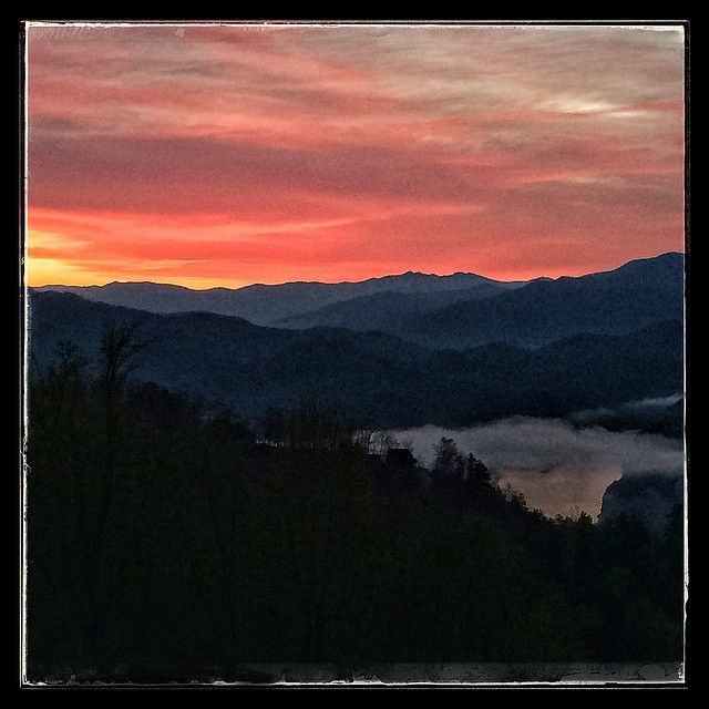
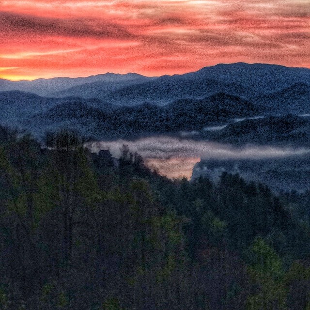
West View from Wesser Bald Observation Tower
Lake Nantahala sunset
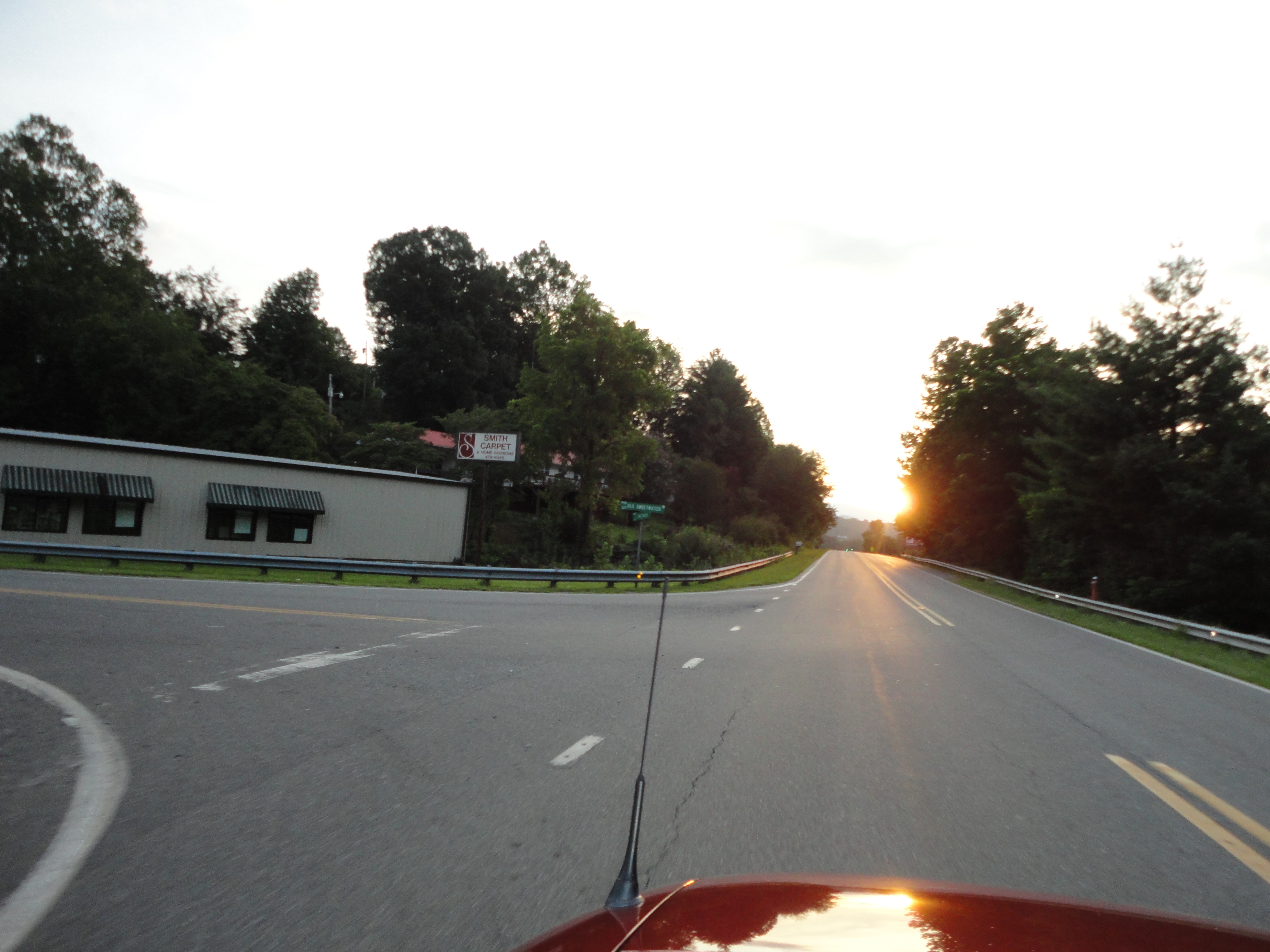
#sunset #train #northcarolina
Just Past the Falls
249/365

Sunset at Aquone Hiker Lodge
#sunrise #greatsmokeymountains #nationalpark #northcarolina

Lake Fontana Sunset
Sunset near Robbinsville

Sunset over Clingman's Dome
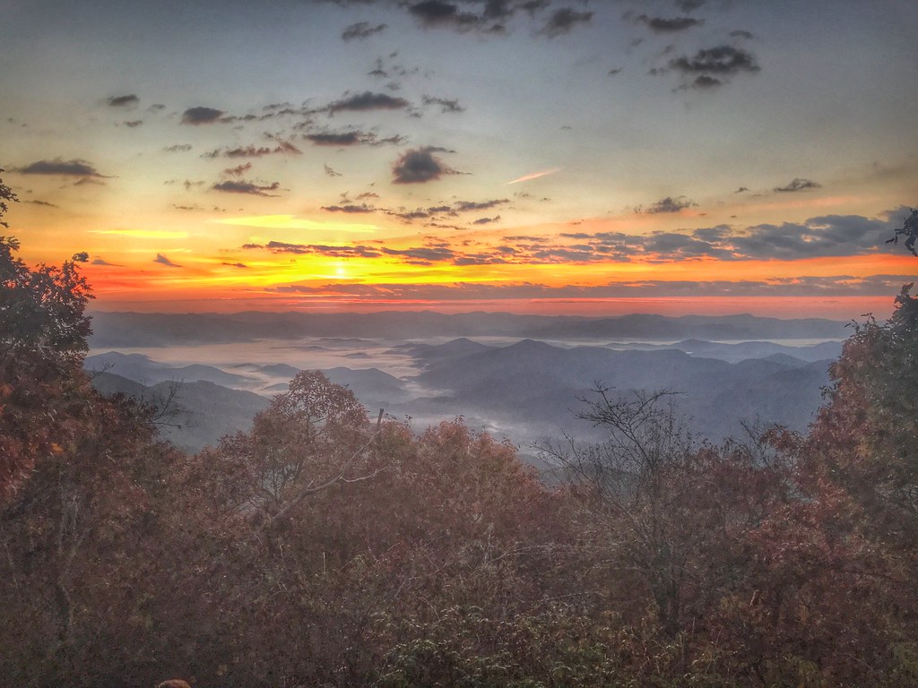
Dawn a Mile Up on the AT

#sunrise #greatsmokeymountains #northcarolina #roadtrip
#sunrise#greatsmokeymountains

Sunrise on the Appalachian Trail

Waiting for Sunrise on the AT
W Hwy 19, Topton, NC アメリカ合衆国Mystic Landsの地図
別の場所を検索
近所の場所
アメリカ合衆国 〒 ノース・カロライナ州 ナンタハラ
アメリカ合衆国 〒 ノース・カロライナ州 ナンタハラ クィーンズ・クリーク湖
Raymond Wilson Rd, Topton, NC アメリカ合衆国
Hidden Lakes Rd, Topton, NC アメリカ合衆国
49 Richter Dr, Topton, NC アメリカ合衆国
72 Moms Falls Rd, Topton, NC アメリカ合衆国
Fairview Ln, Topton, NC アメリカ合衆国
Winding Stairs Rd, Topton, NC アメリカ合衆国Winding Stairs Road
Fairview Ln, Topton, NC アメリカ合衆国
Hampton Branch Rd, Topton, NC アメリカ合衆国
Birdsong Trail, Topton, NC アメリカ合衆国
Winding Stairs Rd, Topton, NC アメリカ合衆国
Winding Stairs Rd, Topton, NC アメリカ合衆国
Winding Stairs Rd, Topton, NC アメリカ合衆国
Taylor Rd, Bryson City, NC アメリカ合衆国
Partridge Creek Rd, Topton, NC アメリカ合衆国
Wildcat Branch Rd, Nantahala, NC アメリカ合衆国ワイルドキャット・ブランチ・ロード
JP Grant Rd, Bryson City, NC アメリカ合衆国
Mt Tabor Rd, Topton, NC アメリカ合衆国
E Silvermine Rd, Bryson City, NC アメリカ合衆国
最近の検索
- アメリカ合衆国 アラスカ州 レッド・ドッグ・マイン日の出日の入り時間
- Am bhf, Borken, ドイツアム・バーンホーフ日の出日の入り時間
- 4th St E, Sonoma, CA, USA日の出日の入り時間
- Oakland Ave, Williamsport, PA アメリカ合衆国日の出日の入り時間
- Via Roma, Pieranica CR, イタリアローマ通り日の出日の入り時間
- クロアチア 〒 ドゥブロブニク GradClock Tower of Dubrovnik日の出日の入り時間
- アルゼンチン チュブ州 トレリュー日の出日の入り時間
- Hartfords Bluff Cir, Mt Pleasant, SC アメリカ合衆国日の出日の入り時間
- 日本、熊本県熊本市北区日の出日の入り時間
- 中華人民共和国 福州市 平潭県 平潭島日の出日の入り時間