Mud Hollow Ln, Tomahawk Township, AR アメリカ合衆国マッド・ホロー・レーン日の出日の入り時間
Location: アメリカ合衆国 > アーカンソー州 > サーシー > アメリカ合衆国 アーカンソー州 トマホーク >
時間帯:
America/Chicago
現地時間:
2025-06-20 06:27:51
経度:
-92.6642863
緯度:
36.0433949
今日の日の出時刻:
05:54:02 AM
今日の日の入時刻:
08:30:47 PM
今日の日長:
14h 36m 45s
明日の日の出時刻:
05:54:15 AM
明日の日の入時刻:
08:30:59 PM
明日の日長:
14h 36m 44s
すべて表示する
| 日付 | 日出 | 日没 | 日長 |
|---|---|---|---|
| 2025年01月01日 | 07:21:28 AM | 05:08:08 PM | 9h 46m 40s |
| 2025年01月02日 | 07:21:35 AM | 05:08:57 PM | 9h 47m 22s |
| 2025年01月03日 | 07:21:40 AM | 05:09:46 PM | 9h 48m 6s |
| 2025年01月04日 | 07:21:43 AM | 05:10:37 PM | 9h 48m 54s |
| 2025年01月05日 | 07:21:44 AM | 05:11:29 PM | 9h 49m 45s |
| 2025年01月06日 | 07:21:43 AM | 05:12:21 PM | 9h 50m 38s |
| 2025年01月07日 | 07:21:40 AM | 05:13:15 PM | 9h 51m 35s |
| 2025年01月08日 | 07:21:35 AM | 05:14:10 PM | 9h 52m 35s |
| 2025年01月09日 | 07:21:28 AM | 05:15:05 PM | 9h 53m 37s |
| 2025年01月10日 | 07:21:19 AM | 05:16:02 PM | 9h 54m 43s |
| 2025年01月11日 | 07:21:08 AM | 05:16:59 PM | 9h 55m 51s |
| 2025年01月12日 | 07:20:55 AM | 05:17:56 PM | 9h 57m 1s |
| 2025年01月13日 | 07:20:40 AM | 05:18:55 PM | 9h 58m 15s |
| 2025年01月14日 | 07:20:23 AM | 05:19:54 PM | 9h 59m 31s |
| 2025年01月15日 | 07:20:05 AM | 05:20:54 PM | 10h 0m 49s |
| 2025年01月16日 | 07:19:44 AM | 05:21:54 PM | 10h 2m 10s |
| 2025年01月17日 | 07:19:22 AM | 05:22:55 PM | 10h 3m 33s |
| 2025年01月18日 | 07:18:57 AM | 05:23:56 PM | 10h 4m 59s |
| 2025年01月19日 | 07:18:31 AM | 05:24:57 PM | 10h 6m 26s |
| 2025年01月20日 | 07:18:03 AM | 05:25:59 PM | 10h 7m 56s |
| 2025年01月21日 | 07:17:33 AM | 05:27:01 PM | 10h 9m 28s |
| 2025年01月22日 | 07:17:01 AM | 05:28:04 PM | 10h 11m 3s |
| 2025年01月23日 | 07:16:27 AM | 05:29:06 PM | 10h 12m 39s |
| 2025年01月24日 | 07:15:52 AM | 05:30:09 PM | 10h 14m 17s |
| 2025年01月25日 | 07:15:15 AM | 05:31:12 PM | 10h 15m 57s |
| 2025年01月26日 | 07:14:36 AM | 05:32:15 PM | 10h 17m 39s |
| 2025年01月27日 | 07:13:55 AM | 05:33:19 PM | 10h 19m 24s |
| 2025年01月28日 | 07:13:13 AM | 05:34:22 PM | 10h 21m 9s |
| 2025年01月29日 | 07:12:29 AM | 05:35:25 PM | 10h 22m 56s |
| 2025年01月30日 | 07:11:44 AM | 05:36:29 PM | 10h 24m 45s |
| 2025年01月31日 | 07:10:57 AM | 05:37:32 PM | 10h 26m 35s |
| 2025年02月01日 | 07:10:08 AM | 05:38:35 PM | 10h 28m 27s |
| 2025年02月02日 | 07:09:18 AM | 05:39:38 PM | 10h 30m 20s |
| 2025年02月03日 | 07:08:26 AM | 05:40:41 PM | 10h 32m 15s |
| 2025年02月04日 | 07:07:33 AM | 05:41:44 PM | 10h 34m 11s |
| 2025年02月05日 | 07:06:38 AM | 05:42:46 PM | 10h 36m 8s |
| 2025年02月06日 | 07:05:42 AM | 05:43:49 PM | 10h 38m 7s |
| 2025年02月07日 | 07:04:45 AM | 05:44:51 PM | 10h 40m 6s |
| 2025年02月08日 | 07:03:46 AM | 05:45:53 PM | 10h 42m 7s |
| 2025年02月09日 | 07:02:46 AM | 05:46:55 PM | 10h 44m 9s |
| 2025年02月10日 | 07:01:45 AM | 05:47:57 PM | 10h 46m 12s |
| 2025年02月11日 | 07:00:42 AM | 05:48:58 PM | 10h 48m 16s |
| 2025年02月12日 | 06:59:38 AM | 05:49:59 PM | 10h 50m 21s |
| 2025年02月13日 | 06:58:33 AM | 05:51:00 PM | 10h 52m 27s |
| 2025年02月14日 | 06:57:27 AM | 05:52:00 PM | 10h 54m 33s |
| 2025年02月15日 | 06:56:20 AM | 05:53:00 PM | 10h 56m 40s |
| 2025年02月16日 | 06:55:11 AM | 05:54:00 PM | 10h 58m 49s |
| 2025年02月17日 | 06:54:02 AM | 05:55:00 PM | 11h 0m 58s |
| 2025年02月18日 | 06:52:51 AM | 05:55:59 PM | 11h 3m 8s |
| 2025年02月19日 | 06:51:39 AM | 05:56:58 PM | 11h 5m 19s |
| 2025年02月20日 | 06:50:27 AM | 05:57:56 PM | 11h 7m 29s |
| 2025年02月21日 | 06:49:13 AM | 05:58:55 PM | 11h 9m 42s |
| 2025年02月22日 | 06:47:59 AM | 05:59:53 PM | 11h 11m 54s |
| 2025年02月23日 | 06:46:44 AM | 06:00:50 PM | 11h 14m 6s |
| 2025年02月24日 | 06:45:28 AM | 06:01:47 PM | 11h 16m 19s |
| 2025年02月25日 | 06:44:11 AM | 06:02:44 PM | 11h 18m 33s |
| 2025年02月26日 | 06:42:53 AM | 06:03:41 PM | 11h 20m 48s |
| 2025年02月27日 | 06:41:35 AM | 06:04:37 PM | 11h 23m 2s |
| 2025年02月28日 | 06:40:16 AM | 06:05:33 PM | 11h 25m 17s |
| 2025年03月01日 | 06:38:56 AM | 06:06:29 PM | 11h 27m 33s |
| 2025年03月02日 | 06:37:36 AM | 06:07:24 PM | 11h 29m 48s |
| 2025年03月03日 | 06:36:15 AM | 06:08:19 PM | 11h 32m 4s |
| 2025年03月04日 | 06:34:53 AM | 06:09:14 PM | 11h 34m 21s |
| 2025年03月05日 | 06:33:31 AM | 06:10:08 PM | 11h 36m 37s |
| 2025年03月06日 | 06:32:08 AM | 06:11:02 PM | 11h 38m 54s |
| 2025年03月07日 | 06:30:45 AM | 06:11:56 PM | 11h 41m 11s |
| 2025年03月08日 | 06:29:21 AM | 06:12:50 PM | 11h 43m 29s |
| 2025年03月09日 | 07:28:01 AM | 07:13:41 PM | 11h 45m 40s |
| 2025年03月10日 | 07:26:36 AM | 07:14:34 PM | 11h 47m 58s |
| 2025年03月11日 | 07:25:11 AM | 07:15:27 PM | 11h 50m 16s |
| 2025年03月12日 | 07:23:46 AM | 07:16:19 PM | 11h 52m 33s |
| 2025年03月13日 | 07:22:21 AM | 07:17:12 PM | 11h 54m 51s |
| 2025年03月14日 | 07:20:55 AM | 07:18:04 PM | 11h 57m 9s |
| 2025年03月15日 | 07:19:29 AM | 07:18:56 PM | 11h 59m 27s |
| 2025年03月16日 | 07:18:03 AM | 07:19:48 PM | 12h 1m 45s |
| 2025年03月17日 | 07:16:36 AM | 07:20:39 PM | 12h 4m 3s |
| 2025年03月18日 | 07:15:10 AM | 07:21:31 PM | 12h 6m 21s |
| 2025年03月19日 | 07:13:43 AM | 07:22:22 PM | 12h 8m 39s |
| 2025年03月20日 | 07:12:16 AM | 07:23:13 PM | 12h 10m 57s |
| 2025年03月21日 | 07:10:49 AM | 07:24:05 PM | 12h 13m 16s |
| 2025年03月22日 | 07:09:22 AM | 07:24:55 PM | 12h 15m 33s |
| 2025年03月23日 | 07:07:55 AM | 07:25:46 PM | 12h 17m 51s |
| 2025年03月24日 | 07:06:29 AM | 07:26:37 PM | 12h 20m 8s |
| 2025年03月25日 | 07:05:02 AM | 07:27:28 PM | 12h 22m 26s |
| 2025年03月26日 | 07:03:35 AM | 07:28:18 PM | 12h 24m 43s |
| 2025年03月27日 | 07:02:08 AM | 07:29:09 PM | 12h 27m 1s |
| 2025年03月28日 | 07:00:42 AM | 07:29:59 PM | 12h 29m 17s |
| 2025年03月29日 | 06:59:15 AM | 07:30:50 PM | 12h 31m 35s |
| 2025年03月30日 | 06:57:49 AM | 07:31:40 PM | 12h 33m 51s |
| 2025年03月31日 | 06:56:23 AM | 07:32:30 PM | 12h 36m 7s |
| 2025年04月01日 | 06:54:57 AM | 07:33:21 PM | 12h 38m 24s |
| 2025年04月02日 | 06:53:32 AM | 07:34:11 PM | 12h 40m 39s |
| 2025年04月03日 | 06:52:07 AM | 07:35:01 PM | 12h 42m 54s |
| 2025年04月04日 | 06:50:42 AM | 07:35:51 PM | 12h 45m 9s |
| 2025年04月05日 | 06:49:18 AM | 07:36:42 PM | 12h 47m 24s |
| 2025年04月06日 | 06:47:54 AM | 07:37:32 PM | 12h 49m 38s |
| 2025年04月07日 | 06:46:30 AM | 07:38:22 PM | 12h 51m 52s |
| 2025年04月08日 | 06:45:07 AM | 07:39:13 PM | 12h 54m 6s |
| 2025年04月09日 | 06:43:45 AM | 07:40:03 PM | 12h 56m 18s |
| 2025年04月10日 | 06:42:22 AM | 07:40:54 PM | 12h 58m 32s |
| 2025年04月11日 | 06:41:01 AM | 07:41:44 PM | 13h 0m 43s |
| 2025年04月12日 | 06:39:40 AM | 07:42:35 PM | 13h 2m 55s |
| 2025年04月13日 | 06:38:20 AM | 07:43:26 PM | 13h 5m 6s |
| 2025年04月14日 | 06:37:00 AM | 07:44:16 PM | 13h 7m 16s |
| 2025年04月15日 | 06:35:41 AM | 07:45:07 PM | 13h 9m 26s |
| 2025年04月16日 | 06:34:22 AM | 07:45:58 PM | 13h 11m 36s |
| 2025年04月17日 | 06:33:05 AM | 07:46:49 PM | 13h 13m 44s |
| 2025年04月18日 | 06:31:48 AM | 07:47:40 PM | 13h 15m 52s |
| 2025年04月19日 | 06:30:32 AM | 07:48:31 PM | 13h 17m 59s |
| 2025年04月20日 | 06:29:16 AM | 07:49:22 PM | 13h 20m 6s |
| 2025年04月21日 | 06:28:02 AM | 07:50:13 PM | 13h 22m 11s |
| 2025年04月22日 | 06:26:48 AM | 07:51:04 PM | 13h 24m 16s |
| 2025年04月23日 | 06:25:36 AM | 07:51:55 PM | 13h 26m 19s |
| 2025年04月24日 | 06:24:24 AM | 07:52:46 PM | 13h 28m 22s |
| 2025年04月25日 | 06:23:13 AM | 07:53:37 PM | 13h 30m 24s |
| 2025年04月26日 | 06:22:03 AM | 07:54:28 PM | 13h 32m 25s |
| 2025年04月27日 | 06:20:54 AM | 07:55:20 PM | 13h 34m 26s |
| 2025年04月28日 | 06:19:47 AM | 07:56:11 PM | 13h 36m 24s |
| 2025年04月29日 | 06:18:40 AM | 07:57:02 PM | 13h 38m 22s |
| 2025年04月30日 | 06:17:34 AM | 07:57:53 PM | 13h 40m 19s |
| 2025年05月01日 | 06:16:30 AM | 07:58:44 PM | 13h 42m 14s |
| 2025年05月02日 | 06:15:26 AM | 07:59:35 PM | 13h 44m 9s |
| 2025年05月03日 | 06:14:24 AM | 08:00:26 PM | 13h 46m 2s |
| 2025年05月04日 | 06:13:23 AM | 08:01:17 PM | 13h 47m 54s |
| 2025年05月05日 | 06:12:24 AM | 08:02:08 PM | 13h 49m 44s |
| 2025年05月06日 | 06:11:25 AM | 08:02:58 PM | 13h 51m 33s |
| 2025年05月07日 | 06:10:28 AM | 08:03:49 PM | 13h 53m 21s |
| 2025年05月08日 | 06:09:32 AM | 08:04:39 PM | 13h 55m 7s |
| 2025年05月09日 | 06:08:38 AM | 08:05:29 PM | 13h 56m 51s |
| 2025年05月10日 | 06:07:44 AM | 08:06:19 PM | 13h 58m 35s |
| 2025年05月11日 | 06:06:53 AM | 08:07:09 PM | 14h 0m 16s |
| 2025年05月12日 | 06:06:02 AM | 08:07:58 PM | 14h 1m 56s |
| 2025年05月13日 | 06:05:13 AM | 08:08:47 PM | 14h 3m 34s |
| 2025年05月14日 | 06:04:26 AM | 08:09:36 PM | 14h 5m 10s |
| 2025年05月15日 | 06:03:40 AM | 08:10:25 PM | 14h 6m 45s |
| 2025年05月16日 | 06:02:55 AM | 08:11:13 PM | 14h 8m 18s |
| 2025年05月17日 | 06:02:12 AM | 08:12:00 PM | 14h 9m 48s |
| 2025年05月18日 | 06:01:31 AM | 08:12:48 PM | 14h 11m 17s |
| 2025年05月19日 | 06:00:51 AM | 08:13:34 PM | 14h 12m 43s |
| 2025年05月20日 | 06:00:13 AM | 08:14:21 PM | 14h 14m 8s |
| 2025年05月21日 | 05:59:36 AM | 08:15:06 PM | 14h 15m 30s |
| 2025年05月22日 | 05:59:01 AM | 08:15:52 PM | 14h 16m 51s |
| 2025年05月23日 | 05:58:27 AM | 08:16:36 PM | 14h 18m 9s |
| 2025年05月24日 | 05:57:55 AM | 08:17:20 PM | 14h 19m 25s |
| 2025年05月25日 | 05:57:25 AM | 08:18:03 PM | 14h 20m 38s |
| 2025年05月26日 | 05:56:56 AM | 08:18:46 PM | 14h 21m 50s |
| 2025年05月27日 | 05:56:29 AM | 08:19:28 PM | 14h 22m 59s |
| 2025年05月28日 | 05:56:04 AM | 08:20:09 PM | 14h 24m 5s |
| 2025年05月29日 | 05:55:41 AM | 08:20:49 PM | 14h 25m 8s |
| 2025年05月30日 | 05:55:19 AM | 08:21:28 PM | 14h 26m 9s |
| 2025年05月31日 | 05:54:59 AM | 08:22:07 PM | 14h 27m 8s |
| 2025年06月01日 | 05:54:40 AM | 08:22:44 PM | 14h 28m 4s |
| 2025年06月02日 | 05:54:23 AM | 08:23:21 PM | 14h 28m 58s |
| 2025年06月03日 | 05:54:08 AM | 08:23:56 PM | 14h 29m 48s |
| 2025年06月04日 | 05:53:55 AM | 08:24:31 PM | 14h 30m 36s |
| 2025年06月05日 | 05:53:43 AM | 08:25:04 PM | 14h 31m 21s |
| 2025年06月06日 | 05:53:34 AM | 08:25:37 PM | 14h 32m 3s |
| 2025年06月07日 | 05:53:25 AM | 08:26:08 PM | 14h 32m 43s |
| 2025年06月08日 | 05:53:19 AM | 08:26:38 PM | 14h 33m 19s |
| 2025年06月09日 | 05:53:14 AM | 08:27:07 PM | 14h 33m 53s |
| 2025年06月10日 | 05:53:11 AM | 08:27:34 PM | 14h 34m 23s |
| 2025年06月11日 | 05:53:09 AM | 08:28:00 PM | 14h 34m 51s |
| 2025年06月12日 | 05:53:10 AM | 08:28:25 PM | 14h 35m 15s |
| 2025年06月13日 | 05:53:11 AM | 08:28:49 PM | 14h 35m 38s |
| 2025年06月14日 | 05:53:15 AM | 08:29:11 PM | 14h 35m 56s |
| 2025年06月15日 | 05:53:20 AM | 08:29:32 PM | 14h 36m 12s |
| 2025年06月16日 | 05:53:27 AM | 08:29:51 PM | 14h 36m 24s |
| 2025年06月17日 | 05:53:35 AM | 08:30:09 PM | 14h 36m 34s |
| 2025年06月18日 | 05:53:45 AM | 08:30:25 PM | 14h 36m 40s |
| 2025年06月19日 | 05:53:56 AM | 08:30:40 PM | 14h 36m 44s |
| 2025年06月20日 | 05:54:09 AM | 08:30:54 PM | 14h 36m 45s |
| 2025年06月21日 | 05:54:23 AM | 08:31:05 PM | 14h 36m 42s |
| 2025年06月22日 | 05:54:39 AM | 08:31:15 PM | 14h 36m 36s |
| 2025年06月23日 | 05:54:56 AM | 08:31:24 PM | 14h 36m 28s |
| 2025年06月24日 | 05:55:15 AM | 08:31:31 PM | 14h 36m 16s |
| 2025年06月25日 | 05:55:35 AM | 08:31:36 PM | 14h 36m 1s |
| 2025年06月26日 | 05:55:56 AM | 08:31:39 PM | 14h 35m 43s |
| 2025年06月27日 | 05:56:19 AM | 08:31:41 PM | 14h 35m 22s |
| 2025年06月28日 | 05:56:43 AM | 08:31:41 PM | 14h 34m 58s |
| 2025年06月29日 | 05:57:08 AM | 08:31:40 PM | 14h 34m 32s |
| 2025年06月30日 | 05:57:35 AM | 08:31:37 PM | 14h 34m 2s |
| 2025年07月01日 | 05:58:03 AM | 08:31:32 PM | 14h 33m 29s |
| 2025年07月02日 | 05:58:32 AM | 08:31:25 PM | 14h 32m 53s |
| 2025年07月03日 | 05:59:01 AM | 08:31:16 PM | 14h 32m 15s |
| 2025年07月04日 | 05:59:33 AM | 08:31:06 PM | 14h 31m 33s |
| 2025年07月05日 | 06:00:05 AM | 08:30:54 PM | 14h 30m 49s |
| 2025年07月06日 | 06:00:38 AM | 08:30:40 PM | 14h 30m 2s |
| 2025年07月07日 | 06:01:12 AM | 08:30:25 PM | 14h 29m 13s |
| 2025年07月08日 | 06:01:47 AM | 08:30:08 PM | 14h 28m 21s |
| 2025年07月09日 | 06:02:23 AM | 08:29:49 PM | 14h 27m 26s |
| 2025年07月10日 | 06:02:59 AM | 08:29:28 PM | 14h 26m 29s |
| 2025年07月11日 | 06:03:37 AM | 08:29:06 PM | 14h 25m 29s |
| 2025年07月12日 | 06:04:16 AM | 08:28:41 PM | 14h 24m 25s |
| 2025年07月13日 | 06:04:55 AM | 08:28:16 PM | 14h 23m 21s |
| 2025年07月14日 | 06:05:35 AM | 08:27:48 PM | 14h 22m 13s |
| 2025年07月15日 | 06:06:15 AM | 08:27:19 PM | 14h 21m 4s |
| 2025年07月16日 | 06:06:56 AM | 08:26:48 PM | 14h 19m 52s |
| 2025年07月17日 | 06:07:38 AM | 08:26:15 PM | 14h 18m 37s |
| 2025年07月18日 | 06:08:20 AM | 08:25:41 PM | 14h 17m 21s |
| 2025年07月19日 | 06:09:03 AM | 08:25:05 PM | 14h 16m 2s |
| 2025年07月20日 | 06:09:47 AM | 08:24:27 PM | 14h 14m 40s |
| 2025年07月21日 | 06:10:31 AM | 08:23:48 PM | 14h 13m 17s |
| 2025年07月22日 | 06:11:15 AM | 08:23:07 PM | 14h 11m 52s |
| 2025年07月23日 | 06:12:00 AM | 08:22:24 PM | 14h 10m 24s |
| 2025年07月24日 | 06:12:45 AM | 08:21:40 PM | 14h 8m 55s |
| 2025年07月25日 | 06:13:30 AM | 08:20:55 PM | 14h 7m 25s |
| 2025年07月26日 | 06:14:16 AM | 08:20:08 PM | 14h 5m 52s |
| 2025年07月27日 | 06:15:02 AM | 08:19:19 PM | 14h 4m 17s |
| 2025年07月28日 | 06:15:49 AM | 08:18:29 PM | 14h 2m 40s |
| 2025年07月29日 | 06:16:35 AM | 08:17:38 PM | 14h 1m 3s |
| 2025年07月30日 | 06:17:22 AM | 08:16:45 PM | 13h 59m 23s |
| 2025年07月31日 | 06:18:09 AM | 08:15:51 PM | 13h 57m 42s |
| 2025年08月01日 | 06:18:56 AM | 08:14:55 PM | 13h 55m 59s |
| 2025年08月02日 | 06:19:44 AM | 08:13:58 PM | 13h 54m 14s |
| 2025年08月03日 | 06:20:31 AM | 08:12:59 PM | 13h 52m 28s |
| 2025年08月04日 | 06:21:19 AM | 08:12:00 PM | 13h 50m 41s |
| 2025年08月05日 | 06:22:06 AM | 08:10:59 PM | 13h 48m 53s |
| 2025年08月06日 | 06:22:54 AM | 08:09:56 PM | 13h 47m 2s |
| 2025年08月07日 | 06:23:42 AM | 08:08:53 PM | 13h 45m 11s |
| 2025年08月08日 | 06:24:29 AM | 08:07:48 PM | 13h 43m 19s |
| 2025年08月09日 | 06:25:17 AM | 08:06:43 PM | 13h 41m 26s |
| 2025年08月10日 | 06:26:05 AM | 08:05:36 PM | 13h 39m 31s |
| 2025年08月11日 | 06:26:53 AM | 08:04:28 PM | 13h 37m 35s |
| 2025年08月12日 | 06:27:40 AM | 08:03:18 PM | 13h 35m 38s |
| 2025年08月13日 | 06:28:28 AM | 08:02:08 PM | 13h 33m 40s |
| 2025年08月14日 | 06:29:16 AM | 08:00:57 PM | 13h 31m 41s |
| 2025年08月15日 | 06:30:03 AM | 07:59:45 PM | 13h 29m 42s |
| 2025年08月16日 | 06:30:51 AM | 07:58:31 PM | 13h 27m 40s |
| 2025年08月17日 | 06:31:38 AM | 07:57:17 PM | 13h 25m 39s |
| 2025年08月18日 | 06:32:26 AM | 07:56:02 PM | 13h 23m 36s |
| 2025年08月19日 | 06:33:13 AM | 07:54:46 PM | 13h 21m 33s |
| 2025年08月20日 | 06:34:00 AM | 07:53:29 PM | 13h 19m 29s |
| 2025年08月21日 | 06:34:48 AM | 07:52:12 PM | 13h 17m 24s |
| 2025年08月22日 | 06:35:35 AM | 07:50:53 PM | 13h 15m 18s |
| 2025年08月23日 | 06:36:22 AM | 07:49:34 PM | 13h 13m 12s |
| 2025年08月24日 | 06:37:09 AM | 07:48:14 PM | 13h 11m 5s |
| 2025年08月25日 | 06:37:55 AM | 07:46:53 PM | 13h 8m 58s |
| 2025年08月26日 | 06:38:42 AM | 07:45:32 PM | 13h 6m 50s |
| 2025年08月27日 | 06:39:29 AM | 07:44:10 PM | 13h 4m 41s |
| 2025年08月28日 | 06:40:15 AM | 07:42:47 PM | 13h 2m 32s |
| 2025年08月29日 | 06:41:02 AM | 07:41:24 PM | 13h 0m 22s |
| 2025年08月30日 | 06:41:48 AM | 07:40:00 PM | 12h 58m 12s |
| 2025年08月31日 | 06:42:35 AM | 07:38:36 PM | 12h 56m 1s |
| 2025年09月01日 | 06:43:21 AM | 07:37:11 PM | 12h 53m 50s |
| 2025年09月02日 | 06:44:07 AM | 07:35:45 PM | 12h 51m 38s |
| 2025年09月03日 | 06:44:53 AM | 07:34:20 PM | 12h 49m 27s |
| 2025年09月04日 | 06:45:40 AM | 07:32:53 PM | 12h 47m 13s |
| 2025年09月05日 | 06:46:26 AM | 07:31:27 PM | 12h 45m 1s |
| 2025年09月06日 | 06:47:12 AM | 07:30:00 PM | 12h 42m 48s |
| 2025年09月07日 | 06:47:58 AM | 07:28:32 PM | 12h 40m 34s |
| 2025年09月08日 | 06:48:44 AM | 07:27:04 PM | 12h 38m 20s |
| 2025年09月09日 | 06:49:30 AM | 07:25:37 PM | 12h 36m 7s |
| 2025年09月10日 | 06:50:16 AM | 07:24:08 PM | 12h 33m 52s |
| 2025年09月11日 | 06:51:02 AM | 07:22:40 PM | 12h 31m 38s |
| 2025年09月12日 | 06:51:48 AM | 07:21:11 PM | 12h 29m 23s |
| 2025年09月13日 | 06:52:34 AM | 07:19:42 PM | 12h 27m 8s |
| 2025年09月14日 | 06:53:20 AM | 07:18:13 PM | 12h 24m 53s |
| 2025年09月15日 | 06:54:06 AM | 07:16:44 PM | 12h 22m 38s |
| 2025年09月16日 | 06:54:52 AM | 07:15:15 PM | 12h 20m 23s |
| 2025年09月17日 | 06:55:39 AM | 07:13:46 PM | 12h 18m 7s |
| 2025年09月18日 | 06:56:25 AM | 07:12:17 PM | 12h 15m 52s |
| 2025年09月19日 | 06:57:12 AM | 07:10:48 PM | 12h 13m 36s |
| 2025年09月20日 | 06:57:58 AM | 07:09:18 PM | 12h 11m 20s |
| 2025年09月21日 | 06:58:45 AM | 07:07:49 PM | 12h 9m 4s |
| 2025年09月22日 | 06:59:32 AM | 07:06:20 PM | 12h 6m 48s |
| 2025年09月23日 | 07:00:19 AM | 07:04:51 PM | 12h 4m 32s |
| 2025年09月24日 | 07:01:06 AM | 07:03:23 PM | 12h 2m 17s |
| 2025年09月25日 | 07:01:53 AM | 07:01:54 PM | 12h 0m 1s |
| 2025年09月26日 | 07:02:41 AM | 07:00:26 PM | 11h 57m 45s |
| 2025年09月27日 | 07:03:29 AM | 06:58:57 PM | 11h 55m 28s |
| 2025年09月28日 | 07:04:17 AM | 06:57:30 PM | 11h 53m 13s |
| 2025年09月29日 | 07:05:05 AM | 06:56:02 PM | 11h 50m 57s |
| 2025年09月30日 | 07:05:53 AM | 06:54:35 PM | 11h 48m 42s |
| 2025年10月01日 | 07:06:42 AM | 06:53:08 PM | 11h 46m 26s |
| 2025年10月02日 | 07:07:31 AM | 06:51:41 PM | 11h 44m 10s |
| 2025年10月03日 | 07:08:20 AM | 06:50:15 PM | 11h 41m 55s |
| 2025年10月04日 | 07:09:09 AM | 06:48:50 PM | 11h 39m 41s |
| 2025年10月05日 | 07:09:59 AM | 06:47:24 PM | 11h 37m 25s |
| 2025年10月06日 | 07:10:49 AM | 06:46:00 PM | 11h 35m 11s |
| 2025年10月07日 | 07:11:39 AM | 06:44:36 PM | 11h 32m 57s |
| 2025年10月08日 | 07:12:30 AM | 06:43:12 PM | 11h 30m 42s |
| 2025年10月09日 | 07:13:21 AM | 06:41:49 PM | 11h 28m 28s |
| 2025年10月10日 | 07:14:12 AM | 06:40:27 PM | 11h 26m 15s |
| 2025年10月11日 | 07:15:04 AM | 06:39:05 PM | 11h 24m 1s |
| 2025年10月12日 | 07:15:56 AM | 06:37:44 PM | 11h 21m 48s |
| 2025年10月13日 | 07:16:48 AM | 06:36:24 PM | 11h 19m 36s |
| 2025年10月14日 | 07:17:40 AM | 06:35:04 PM | 11h 17m 24s |
| 2025年10月15日 | 07:18:33 AM | 06:33:46 PM | 11h 15m 13s |
| 2025年10月16日 | 07:19:27 AM | 06:32:28 PM | 11h 13m 1s |
| 2025年10月17日 | 07:20:20 AM | 06:31:11 PM | 11h 10m 51s |
| 2025年10月18日 | 07:21:14 AM | 06:29:55 PM | 11h 8m 41s |
| 2025年10月19日 | 07:22:09 AM | 06:28:39 PM | 11h 6m 30s |
| 2025年10月20日 | 07:23:03 AM | 06:27:25 PM | 11h 4m 22s |
| 2025年10月21日 | 07:23:58 AM | 06:26:12 PM | 11h 2m 14s |
| 2025年10月22日 | 07:24:54 AM | 06:24:59 PM | 11h 0m 5s |
| 2025年10月23日 | 07:25:50 AM | 06:23:48 PM | 10h 57m 58s |
| 2025年10月24日 | 07:26:46 AM | 06:22:38 PM | 10h 55m 52s |
| 2025年10月25日 | 07:27:42 AM | 06:21:29 PM | 10h 53m 47s |
| 2025年10月26日 | 07:28:39 AM | 06:20:21 PM | 10h 51m 42s |
| 2025年10月27日 | 07:29:36 AM | 06:19:14 PM | 10h 49m 38s |
| 2025年10月28日 | 07:30:34 AM | 06:18:08 PM | 10h 47m 34s |
| 2025年10月29日 | 07:31:31 AM | 06:17:04 PM | 10h 45m 33s |
| 2025年10月30日 | 07:32:29 AM | 06:16:01 PM | 10h 43m 32s |
| 2025年10月31日 | 07:33:28 AM | 06:14:59 PM | 10h 41m 31s |
| 2025年11月01日 | 07:34:26 AM | 06:13:59 PM | 10h 39m 33s |
| 2025年11月02日 | 06:35:28 AM | 05:12:57 PM | 10h 37m 29s |
| 2025年11月03日 | 06:36:27 AM | 05:11:59 PM | 10h 35m 32s |
| 2025年11月04日 | 06:37:26 AM | 05:11:03 PM | 10h 33m 37s |
| 2025年11月05日 | 06:38:26 AM | 05:10:08 PM | 10h 31m 42s |
| 2025年11月06日 | 06:39:26 AM | 05:09:15 PM | 10h 29m 49s |
| 2025年11月07日 | 06:40:26 AM | 05:08:23 PM | 10h 27m 57s |
| 2025年11月08日 | 06:41:26 AM | 05:07:33 PM | 10h 26m 7s |
| 2025年11月09日 | 06:42:26 AM | 05:06:45 PM | 10h 24m 19s |
| 2025年11月10日 | 06:43:26 AM | 05:05:58 PM | 10h 22m 32s |
| 2025年11月11日 | 06:44:26 AM | 05:05:12 PM | 10h 20m 46s |
| 2025年11月12日 | 06:45:27 AM | 05:04:28 PM | 10h 19m 1s |
| 2025年11月13日 | 06:46:27 AM | 05:03:46 PM | 10h 17m 19s |
| 2025年11月14日 | 06:47:28 AM | 05:03:06 PM | 10h 15m 38s |
| 2025年11月15日 | 06:48:28 AM | 05:02:27 PM | 10h 13m 59s |
| 2025年11月16日 | 06:49:28 AM | 05:01:51 PM | 10h 12m 23s |
| 2025年11月17日 | 06:50:28 AM | 05:01:15 PM | 10h 10m 47s |
| 2025年11月18日 | 06:51:28 AM | 05:00:42 PM | 10h 9m 14s |
| 2025年11月19日 | 06:52:28 AM | 05:00:11 PM | 10h 7m 43s |
| 2025年11月20日 | 06:53:27 AM | 04:59:41 PM | 10h 6m 14s |
| 2025年11月21日 | 06:54:26 AM | 04:59:14 PM | 10h 4m 48s |
| 2025年11月22日 | 06:55:25 AM | 04:58:48 PM | 10h 3m 23s |
| 2025年11月23日 | 06:56:24 AM | 04:58:24 PM | 10h 2m 0s |
| 2025年11月24日 | 06:57:22 AM | 04:58:02 PM | 10h 0m 40s |
| 2025年11月25日 | 06:58:20 AM | 04:57:42 PM | 9h 59m 22s |
| 2025年11月26日 | 06:59:17 AM | 04:57:24 PM | 9h 58m 7s |
| 2025年11月27日 | 07:00:13 AM | 04:57:08 PM | 9h 56m 55s |
| 2025年11月28日 | 07:01:09 AM | 04:56:54 PM | 9h 55m 45s |
| 2025年11月29日 | 07:02:05 AM | 04:56:42 PM | 9h 54m 37s |
| 2025年11月30日 | 07:02:59 AM | 04:56:32 PM | 9h 53m 33s |
| 2025年12月01日 | 07:03:53 AM | 04:56:24 PM | 9h 52m 31s |
| 2025年12月02日 | 07:04:46 AM | 04:56:18 PM | 9h 51m 32s |
| 2025年12月03日 | 07:05:39 AM | 04:56:14 PM | 9h 50m 35s |
| 2025年12月04日 | 07:06:30 AM | 04:56:12 PM | 9h 49m 42s |
| 2025年12月05日 | 07:07:21 AM | 04:56:12 PM | 9h 48m 51s |
| 2025年12月06日 | 07:08:10 AM | 04:56:14 PM | 9h 48m 4s |
| 2025年12月07日 | 07:08:59 AM | 04:56:18 PM | 9h 47m 19s |
| 2025年12月08日 | 07:09:46 AM | 04:56:24 PM | 9h 46m 38s |
| 2025年12月09日 | 07:10:32 AM | 04:56:32 PM | 9h 46m 0s |
| 2025年12月10日 | 07:11:17 AM | 04:56:42 PM | 9h 45m 25s |
| 2025年12月11日 | 07:12:01 AM | 04:56:54 PM | 9h 44m 53s |
| 2025年12月12日 | 07:12:44 AM | 04:57:08 PM | 9h 44m 24s |
| 2025年12月13日 | 07:13:25 AM | 04:57:24 PM | 9h 43m 59s |
| 2025年12月14日 | 07:14:05 AM | 04:57:42 PM | 9h 43m 37s |
| 2025年12月15日 | 07:14:43 AM | 04:58:02 PM | 9h 43m 19s |
| 2025年12月16日 | 07:15:20 AM | 04:58:23 PM | 9h 43m 3s |
| 2025年12月17日 | 07:15:56 AM | 04:58:47 PM | 9h 42m 51s |
| 2025年12月18日 | 07:16:30 AM | 04:59:12 PM | 9h 42m 42s |
| 2025年12月19日 | 07:17:02 AM | 04:59:39 PM | 9h 42m 37s |
| 2025年12月20日 | 07:17:33 AM | 05:00:08 PM | 9h 42m 35s |
| 2025年12月21日 | 07:18:02 AM | 05:00:38 PM | 9h 42m 36s |
| 2025年12月22日 | 07:18:30 AM | 05:01:10 PM | 9h 42m 40s |
| 2025年12月23日 | 07:18:56 AM | 05:01:44 PM | 9h 42m 48s |
| 2025年12月24日 | 07:19:20 AM | 05:02:20 PM | 9h 43m 0s |
| 2025年12月25日 | 07:19:42 AM | 05:02:57 PM | 9h 43m 15s |
| 2025年12月26日 | 07:20:02 AM | 05:03:35 PM | 9h 43m 33s |
| 2025年12月27日 | 07:20:21 AM | 05:04:15 PM | 9h 43m 54s |
| 2025年12月28日 | 07:20:38 AM | 05:04:57 PM | 9h 44m 19s |
| 2025年12月29日 | 07:20:53 AM | 05:05:40 PM | 9h 44m 47s |
| 2025年12月30日 | 07:21:06 AM | 05:06:24 PM | 9h 45m 18s |
| 2025年12月31日 | 07:21:17 AM | 05:07:10 PM | 9h 45m 53s |
写真
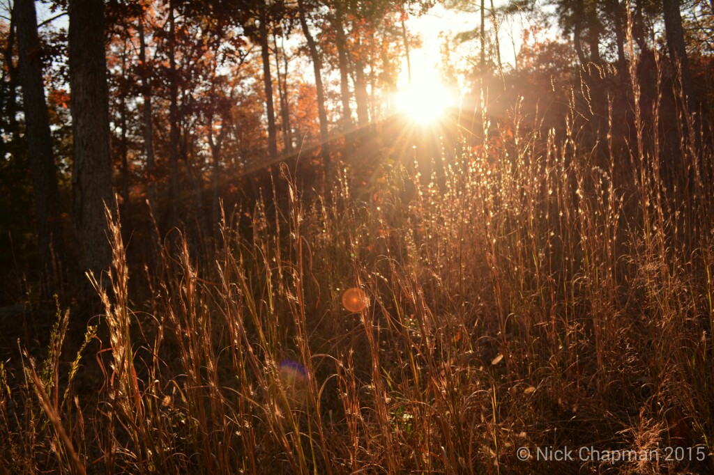
Fall in the forest. IG: moreboom7
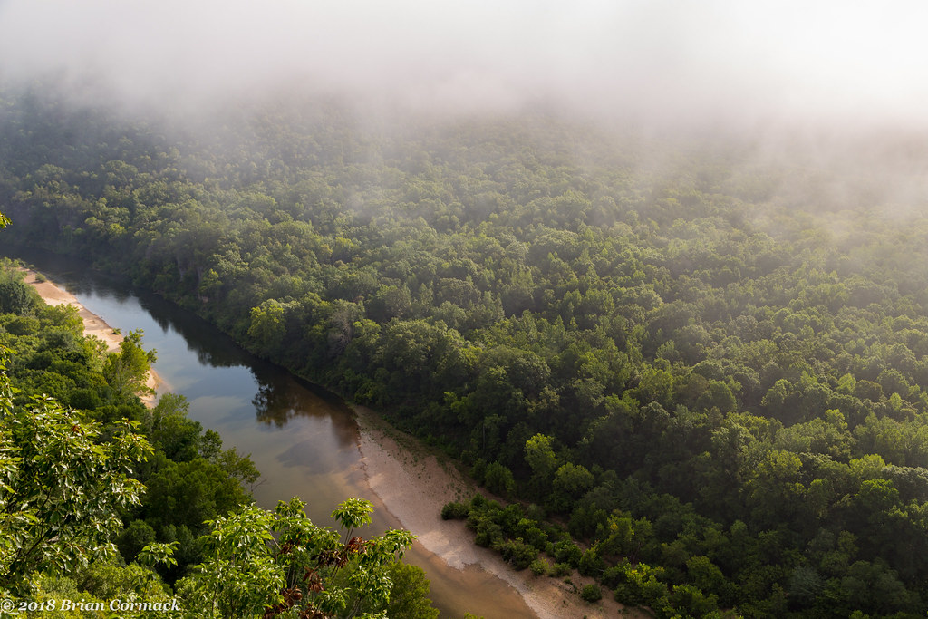
Buffalo River

Recreational bliss

The Smelter at Rush

Rush Creek

The Smelter at Rush

A Quick Morning Hike in Rush

Lichen the view

Along the Buffalo
Mud Hollow Ln, Tomahawk Township, AR アメリカ合衆国マッド・ホロー・レーンの地図
別の場所を検索
近所の場所
Yokum Trail, St Joe, AR アメリカ合衆国
アメリカ合衆国 アーカンソー州 トマホーク
36 Frost St, Gilbert, AR アメリカ合衆国
アメリカ合衆国 アーカンソー州 ギルバート
アメリカ合衆国 アーカンソー州 サーシー
Autumn Leaf Ln, Yellville, AR アメリカ合衆国
Wandas Mountain Dr, Yellville, AR アメリカ合衆国ワンダス・マウンテン・ドライブ
アメリカ合衆国 アーカンソー州 デ・ソート
Cozy Ln, Yellville, AR アメリカ合衆国
アメリカ合衆国 アーカンソー州 ベアー・クリーク No. 4 タウンシップ
アメリカ合衆国 〒 アーカンソー州 ベアー・クリーク No. 4 タウンシップ モーニング・スター
AR-, St Joe, AR アメリカ合衆国
Old Timers Dr, Rock Creek Township, AR アメリカ合衆国オールド・ティマーズ・ドライブ
Ranger Road, St Joe, AR アメリカ合衆国バッファロー・ナショナル・リバー
アメリカ合衆国 アーカンソー州 ウォーター・クリーク・タウンシップ
US-65, St Joe, AR アメリカ合衆国
Center St, Marshall, AR アメリカ合衆国
アメリカ合衆国 〒 アーカンソー州 マーシャル
Center St, Marshall, AR アメリカ合衆国
アメリカ合衆国 〒 アーカンソー州 セント・ジョー
最近の検索
- アメリカ合衆国 アラスカ州 レッド・ドッグ・マイン日の出日の入り時間
- Am bhf, Borken, ドイツアム・バーンホーフ日の出日の入り時間
- 4th St E, Sonoma, CA, USA日の出日の入り時間
- Oakland Ave, Williamsport, PA アメリカ合衆国日の出日の入り時間
- Via Roma, Pieranica CR, イタリアローマ通り日の出日の入り時間
- クロアチア 〒 ドゥブロブニク GradClock Tower of Dubrovnik日の出日の入り時間
- アルゼンチン チュブ州 トレリュー日の出日の入り時間
- Hartfords Bluff Cir, Mt Pleasant, SC アメリカ合衆国日の出日の入り時間
- 日本、熊本県熊本市北区日の出日の入り時間
- 中華人民共和国 福州市 平潭県 平潭島日の出日の入り時間