時間帯:アメリカ太平洋標準時
現地時間:2026年11月17日 火曜日 09:11
経度:-129.0563888
緯度:54.275
今日の日の出時刻:08:10:26
今日の日の入時刻:16:34:51
今日の日長:8時間24分24秒
明日の日の出時刻:08:12:20
明日の日の入時刻:16:33:24
明日の日長:8時間21分4秒

: すべて表示する

日付 日出 日没 日長
2026年1月1日 08:58:07 16:22:56 7時間24分48秒
2026年2月1日 08:27:08 17:14:43 8時間47分35秒
2026年3月1日 07:28:47 18:11:40 10時間42分53秒
2026年4月1日 07:12:06 20:10:54 12時間58分47秒
2026年5月1日 06:01:48 21:07:26 15時間5分38秒
2026年6月1日 05:11:36 21:59:10 16時間47分33秒
2026年7月1日 05:07:15 22:14:51 17時間7分35秒
2026年8月1日 05:48:05 21:39:32 15時間51分27秒
2026年9月1日 06:43:45 20:32:20 13時間48分35秒
2026年10月1日 07:37:42 19:17:07 11時間39分25秒
2026年11月1日 08:37:00 18:05:07 9時間28分6秒
2026年11月18日 08:10:26 16:34:51 8時間24分24秒
2026年11月19日 08:12:20 16:33:24 8時間21分4秒
2026年12月1日 08:33:18 16:19:33 7時間46分14秒

日の出と日の入りの写真

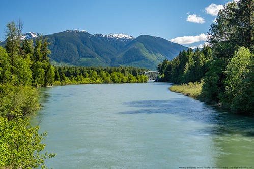
Skeena River Bend & Mount Jackman Panorama by MikoFox, 54.35892 / -129.16839

Western Canada, Section 3: Yellowhead Highway, Kitwanga to Prince Rupertsky m
Skeena River Bend & Mount Jackman Panorama by MikoFox
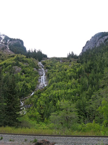
Calcpod Peak Waterfall - 7-shot Exposure Stacked by MikoFox, No idea what the locals call this waterfall which is runoff water from the snowfields around Calcpod
Calcpod Peak Waterfall - 7-shot Exposure Stacked by MikoFox
Skeena River Below Hudson Bay Flats by MikoFox, 
54.35892 / -129.16839

Western Canada, Section 3: Yellowhead Highway, Kitwanga to Prince Rupertsky
Skeena River Below Hudson Bay Flats by MikoFox
Calcpod Peak Waterfall - Detail Upper Fall by MikoFox, Single shot -1ev and that resulted in detail lost in the sky. GND filter would have been indicated h
Calcpod Peak Waterfall - Detail Upper Fall by MikoFox
More Mountains to Flow Past on the Way to the Pacific by MikoFox, Not sure which Peak is sticking out there, but could be Mount Bucey or Recumbent Peak.

Western Cana
More Mountains to Flow Past on the Way to the Pacific by MikoFox
Mount Jackman by MikoFox, 54.35892 / -129.16839

Western Canada, Section 3: Yellowhead Highway, Kitwanga to Prince Rupertcanad
Mount Jackman by MikoFox
Railroad Bridge Over Zymagotitz River by MikoFox, This bridge took me a while to locate again. The mountains in the background are the Nash Ridge and
Railroad Bridge Over Zymagotitz River by MikoFox
Calcpod Peak Waterfall - Detail by MikoFox, 
Western Canada, Section 3: Yellowhead Highway, Kitwanga to Prince Rupertcanada clouds mikofox mount
Calcpod Peak Waterfall - Detail by MikoFox
Skeena River Looking Downstream at Mt. Jackman by MikoFox, Western Canada, Section 3: Yellowhead Highway, Kitwanga to Prince Rupertmountain mountainside june l
Skeena River Looking Downstream at Mt. Jackman by MikoFox
Cheryl-Ann Byng canoeing the Exchamsiks River 2017 by david byng, A day of prestine wilderness exploration on the Exchamsiks River near its confluence with the Skeena
Cheryl-Ann Byng canoeing the Exchamsiks River 2017 by david byng
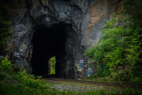
CN Tunnel Near Devil's Island by MikoFox, 54.28897 / -129.40822

Western Canada, Section 3: Yellowhead Highway, Kitwanga to Prince Rupertcanad
CN Tunnel Near Devil's Island by MikoFox
Snowflakes and Waterfall at Exstew by MikoFox, 54.38286 / -129.11308

Western Canada, Section 3: Yellowhead Highway, Kitwanga to Prince Rupertcanad
Snowflakes and Waterfall at Exstew by MikoFox
DSCF3912.jpg by david byng, Cheryl-Ann and Dave Byng canoeing the Exchamsiks River in northwestern British Columbia , Canada.sum
DSCF3912.jpg by david byng
DSCN2654 by schnellyss,
DSCN2654 by schnellyss
066A9770 by Trevor Sowers, documentary landscape autumn mist mountains
066A9770 by Trevor Sowers
Skeena River and Mountains by nisudapi, Between Terrace and Prince Rupert, British Columbia.canada mountains river britishcolumbia skeena vi
Skeena River and Mountains by nisudapi
Shames Mountain by Scott Duffus, View from the parking lot at the Shames Mount ski hill.blackandwhite mountain britishcolumbia valley
Shames Mountain by Scott Duffus
DSCN2666 by schnellyss,
DSCN2666 by schnellyss
DSCN2665 by schnellyss,
DSCN2665 by schnellyss
River of Ghosts by Rick Grant Writer - The Disaster Tourist, The Skeena River Valley in northwestern British Columbia is a brooding and disturbing place during t
River of Ghosts by Rick Grant Writer - The Disaster Tourist
X Creek by crawford.kent, X Creek | 2003 | Acrylic on boartd, 48" x 48" | Sold | This creek feeds the Exstew River t
X Creek by crawford.kent
valley by Scott Duffus, Looking down into the Valley from the Shames Mountain ski hill.mountain ski hill skeena valley shame
valley by Scott Duffus
Terrace to Prince Rupert by nisudapi, On the Skeena.canada mountains river britishcolumbia skeena viarail skeenariver
Terrace to Prince Rupert by nisudapi
The Valley Road by Scott Duffus, Shames Mountain Road.
The Valley Road by Scott Duffus
Waterfall by Lewis McLeod, waterfall gitnadoix gitnadoixriverrecreationarea gitnadoixriver gitnadoixvalley
Waterfall by Lewis McLeod
066A0975 by Trevor Sowers, documentary landscape autumn mist mountains rivers
066A0975 by Trevor Sowers
066A0976 by Trevor Sowers, documentary landscape autumn mist mountains rivers
066A0976 by Trevor Sowers
IMG_4052-IMG_4056-PANO by aventure accessible, Skeena River
IMG_4052-IMG_4056-PANO by aventure accessible
066A0973 by Trevor Sowers, documentary landscape autumn mist mountains rivers
066A0973 by Trevor Sowers
Mijn fotostream-460 by Kurt De Kimpe,
Mijn fotostream-460 by Kurt De Kimpe
Looking downstream on The River of Mist by Trevor Sowers, Skeena River East of Prince Rupert BCdocumentary landscape autumn mist mountains rivers
Looking downstream on The River of Mist by Trevor Sowers
066A0970 by Trevor Sowers, documentary landscape autumn mist mountains rivers
066A0970 by Trevor Sowers
066A0967 by Trevor Sowers, documentary landscape autumn mist mountains rivers
066A0967 by Trevor Sowers
066A0958 by Trevor Sowers, documentary landscape autumn mist mountains rivers
066A0958 by Trevor Sowers
20100504_194512 by tiredofit, canada geotagged bc britishcolumbia can na northamerica oldremo insidepassageandthequeencharlottesqu
20100504_194512 by tiredofit
20100504_193722 by tiredofit, canada geotagged bc britishcolumbia can na northamerica oldremo insidepassageandthequeencharlottesqu
20100504_193722 by tiredofit
20100504_193733 by tiredofit, canada geotagged bc britishcolumbia can na northamerica oldremo insidepassageandthequeencharlottesqu
20100504_193733 by tiredofit
066A0965 by Trevor Sowers, documentary landscape autumn mist mountains rivers
066A0965 by Trevor Sowers
20100504_193720 by tiredofit, canada geotagged bc britishcolumbia can na northamerica oldremo insidepassageandthequeencharlottesqu
20100504_193720 by tiredofit
River of Mist by Trevor Sowers, Skeena River just East of Prince Rupert BC. documentary landscape autumn mist mountains rivers
River of Mist by Trevor Sowers
20100504_191020 by tiredofit, canada geotagged bc britishcolumbia can na northamerica osland insidepassageandthequeencharlottesque
20100504_191020 by tiredofit
066A0496 by Trevor Sowers, documentary landscape autumn mist mountains rivers
066A0496 by Trevor Sowers
066A0969 by Trevor Sowers, documentary landscape autumn mist mountains rivers
066A0969 by Trevor Sowers
Beautiful drive from Prince Rupert to Terrace following the Skeena River! #TourismBC #NorthernBC #SkeenaRiver by Ricky&Anne, square squareformat iphoneography instagramapp uploaded:by=instagram
Beautiful drive from Prince Rupert to Terrace following the Skeena River! #TourismBC #NorthernBC #SkeenaRiver by Ricky&Anne
20100504_204751 by tiredofit, canada geotagged bc britishcolumbia can na northamerica kitimat oldremo geo:lat=5433278889 geo:lon=1
20100504_204751 by tiredofit
066A0957 by Trevor Sowers, documentary landscape autumn mist mountains rivers
066A0957 by Trevor Sowers
066A0964 by Trevor Sowers, documentary landscape autumn mist mountains rivers
066A0964 by Trevor Sowers
066A0963 by Trevor Sowers, documentary landscape autumn mist mountains rivers
066A0963 by Trevor Sowers
20100504_204738 by tiredofit, canada geotagged bc britishcolumbia can na northamerica kitimat oldremo geo:lat=5433278889 geo:lon=1
20100504_204738 by tiredofit
Mijn fotostream-743 by Kurt De Kimpe,
Mijn fotostream-743 by Kurt De Kimpe