アメリカ合衆国 〒 ワシントン州 チャレンジャー山日の出日の入り時間
Location: アメリカ合衆国 > ワシントン州 > ロックポート >
時間帯:
America/Los_Angeles
現地時間:
2025-06-27 11:58:51
経度:
-121.342354
緯度:
48.8356826
今日の日の出時刻:
05:04:48 AM
今日の日の入時刻:
09:12:51 PM
今日の日長:
16h 8m 3s
明日の日の出時刻:
05:05:22 AM
明日の日の入時刻:
09:12:41 PM
明日の日長:
16h 7m 19s
すべて表示する
| 日付 | 日出 | 日没 | 日長 |
|---|---|---|---|
| 2025年01月01日 | 07:58:26 AM | 04:20:45 PM | 8h 22m 19s |
| 2025年01月02日 | 07:58:18 AM | 04:21:48 PM | 8h 23m 30s |
| 2025年01月03日 | 07:58:07 AM | 04:22:53 PM | 8h 24m 46s |
| 2025年01月04日 | 07:57:53 AM | 04:24:01 PM | 8h 26m 8s |
| 2025年01月05日 | 07:57:36 AM | 04:25:11 PM | 8h 27m 35s |
| 2025年01月06日 | 07:57:16 AM | 04:26:22 PM | 8h 29m 6s |
| 2025年01月07日 | 07:56:53 AM | 04:27:36 PM | 8h 30m 43s |
| 2025年01月08日 | 07:56:27 AM | 04:28:51 PM | 8h 32m 24s |
| 2025年01月09日 | 07:55:58 AM | 04:30:08 PM | 8h 34m 10s |
| 2025年01月10日 | 07:55:26 AM | 04:31:27 PM | 8h 36m 1s |
| 2025年01月11日 | 07:54:52 AM | 04:32:48 PM | 8h 37m 56s |
| 2025年01月12日 | 07:54:15 AM | 04:34:10 PM | 8h 39m 55s |
| 2025年01月13日 | 07:53:35 AM | 04:35:33 PM | 8h 41m 58s |
| 2025年01月14日 | 07:52:52 AM | 04:36:58 PM | 8h 44m 6s |
| 2025年01月15日 | 07:52:06 AM | 04:38:24 PM | 8h 46m 18s |
| 2025年01月16日 | 07:51:18 AM | 04:39:51 PM | 8h 48m 33s |
| 2025年01月17日 | 07:50:28 AM | 04:41:20 PM | 8h 50m 52s |
| 2025年01月18日 | 07:49:35 AM | 04:42:50 PM | 8h 53m 15s |
| 2025年01月19日 | 07:48:39 AM | 04:44:20 PM | 8h 55m 41s |
| 2025年01月20日 | 07:47:41 AM | 04:45:52 PM | 8h 58m 11s |
| 2025年01月21日 | 07:46:40 AM | 04:47:25 PM | 9h 0m 45s |
| 2025年01月22日 | 07:45:37 AM | 04:48:58 PM | 9h 3m 21s |
| 2025年01月23日 | 07:44:32 AM | 04:50:32 PM | 9h 6m 0s |
| 2025年01月24日 | 07:43:24 AM | 04:52:07 PM | 9h 8m 43s |
| 2025年01月25日 | 07:42:14 AM | 04:53:42 PM | 9h 11m 28s |
| 2025年01月26日 | 07:41:02 AM | 04:55:18 PM | 9h 14m 16s |
| 2025年01月27日 | 07:39:48 AM | 04:56:55 PM | 9h 17m 7s |
| 2025年01月28日 | 07:38:32 AM | 04:58:32 PM | 9h 20m 0s |
| 2025年01月29日 | 07:37:14 AM | 05:00:09 PM | 9h 22m 55s |
| 2025年01月30日 | 07:35:53 AM | 05:01:47 PM | 9h 25m 54s |
| 2025年01月31日 | 07:34:31 AM | 05:03:25 PM | 9h 28m 54s |
| 2025年02月01日 | 07:33:07 AM | 05:05:04 PM | 9h 31m 57s |
| 2025年02月02日 | 07:31:41 AM | 05:06:42 PM | 9h 35m 1s |
| 2025年02月03日 | 07:30:13 AM | 05:08:21 PM | 9h 38m 8s |
| 2025年02月04日 | 07:28:44 AM | 05:10:00 PM | 9h 41m 16s |
| 2025年02月05日 | 07:27:12 AM | 05:11:39 PM | 9h 44m 27s |
| 2025年02月06日 | 07:25:40 AM | 05:13:18 PM | 9h 47m 38s |
| 2025年02月07日 | 07:24:05 AM | 05:14:57 PM | 9h 50m 52s |
| 2025年02月08日 | 07:22:29 AM | 05:16:36 PM | 9h 54m 7s |
| 2025年02月09日 | 07:20:51 AM | 05:18:15 PM | 9h 57m 24s |
| 2025年02月10日 | 07:19:12 AM | 05:19:55 PM | 10h 0m 43s |
| 2025年02月11日 | 07:17:32 AM | 05:21:33 PM | 10h 4m 1s |
| 2025年02月12日 | 07:15:50 AM | 05:23:12 PM | 10h 7m 22s |
| 2025年02月13日 | 07:14:07 AM | 05:24:51 PM | 10h 10m 44s |
| 2025年02月14日 | 07:12:22 AM | 05:26:30 PM | 10h 14m 8s |
| 2025年02月15日 | 07:10:36 AM | 05:28:08 PM | 10h 17m 32s |
| 2025年02月16日 | 07:08:49 AM | 05:29:46 PM | 10h 20m 57s |
| 2025年02月17日 | 07:07:01 AM | 05:31:24 PM | 10h 24m 23s |
| 2025年02月18日 | 07:05:12 AM | 05:33:02 PM | 10h 27m 50s |
| 2025年02月19日 | 07:03:21 AM | 05:34:39 PM | 10h 31m 18s |
| 2025年02月20日 | 07:01:30 AM | 05:36:17 PM | 10h 34m 47s |
| 2025年02月21日 | 06:59:37 AM | 05:37:54 PM | 10h 38m 17s |
| 2025年02月22日 | 06:57:44 AM | 05:39:30 PM | 10h 41m 46s |
| 2025年02月23日 | 06:55:50 AM | 05:41:07 PM | 10h 45m 17s |
| 2025年02月24日 | 06:53:54 AM | 05:42:43 PM | 10h 48m 49s |
| 2025年02月25日 | 06:51:58 AM | 05:44:19 PM | 10h 52m 21s |
| 2025年02月26日 | 06:50:01 AM | 05:45:55 PM | 10h 55m 54s |
| 2025年02月27日 | 06:48:04 AM | 05:47:30 PM | 10h 59m 26s |
| 2025年02月28日 | 06:46:05 AM | 05:49:05 PM | 11h 3m 0s |
| 2025年03月01日 | 06:44:06 AM | 05:50:40 PM | 11h 6m 34s |
| 2025年03月02日 | 06:42:06 AM | 05:52:15 PM | 11h 10m 9s |
| 2025年03月03日 | 06:40:06 AM | 05:53:49 PM | 11h 13m 43s |
| 2025年03月04日 | 06:38:05 AM | 05:55:23 PM | 11h 17m 18s |
| 2025年03月05日 | 06:36:03 AM | 05:56:57 PM | 11h 20m 54s |
| 2025年03月06日 | 06:34:01 AM | 05:58:30 PM | 11h 24m 29s |
| 2025年03月07日 | 06:31:58 AM | 06:00:04 PM | 11h 28m 6s |
| 2025年03月08日 | 06:29:55 AM | 06:01:37 PM | 11h 31m 42s |
| 2025年03月09日 | 07:27:56 AM | 07:03:06 PM | 11h 35m 10s |
| 2025年03月10日 | 07:25:52 AM | 07:04:38 PM | 11h 38m 46s |
| 2025年03月11日 | 07:23:48 AM | 07:06:10 PM | 11h 42m 22s |
| 2025年03月12日 | 07:21:43 AM | 07:07:42 PM | 11h 45m 59s |
| 2025年03月13日 | 07:19:38 AM | 07:09:14 PM | 11h 49m 36s |
| 2025年03月14日 | 07:17:33 AM | 07:10:46 PM | 11h 53m 13s |
| 2025年03月15日 | 07:15:27 AM | 07:12:17 PM | 11h 56m 50s |
| 2025年03月16日 | 07:13:22 AM | 07:13:49 PM | 12h 0m 27s |
| 2025年03月17日 | 07:11:16 AM | 07:15:20 PM | 12h 4m 4s |
| 2025年03月18日 | 07:09:10 AM | 07:16:51 PM | 12h 7m 41s |
| 2025年03月19日 | 07:07:03 AM | 07:18:22 PM | 12h 11m 19s |
| 2025年03月20日 | 07:04:57 AM | 07:19:52 PM | 12h 14m 55s |
| 2025年03月21日 | 07:02:51 AM | 07:21:23 PM | 12h 18m 32s |
| 2025年03月22日 | 07:00:44 AM | 07:22:53 PM | 12h 22m 9s |
| 2025年03月23日 | 06:58:38 AM | 07:24:23 PM | 12h 25m 45s |
| 2025年03月24日 | 06:56:32 AM | 07:25:53 PM | 12h 29m 21s |
| 2025年03月25日 | 06:54:25 AM | 07:27:23 PM | 12h 32m 58s |
| 2025年03月26日 | 06:52:19 AM | 07:28:53 PM | 12h 36m 34s |
| 2025年03月27日 | 06:50:13 AM | 07:30:23 PM | 12h 40m 10s |
| 2025年03月28日 | 06:48:07 AM | 07:31:53 PM | 12h 43m 46s |
| 2025年03月29日 | 06:46:02 AM | 07:33:23 PM | 12h 47m 21s |
| 2025年03月30日 | 06:43:56 AM | 07:34:52 PM | 12h 50m 56s |
| 2025年03月31日 | 06:41:51 AM | 07:36:22 PM | 12h 54m 31s |
| 2025年04月01日 | 06:39:46 AM | 07:37:52 PM | 12h 58m 6s |
| 2025年04月02日 | 06:37:41 AM | 07:39:21 PM | 13h 1m 40s |
| 2025年04月03日 | 06:35:37 AM | 07:40:51 PM | 13h 5m 14s |
| 2025年04月04日 | 06:33:33 AM | 07:42:20 PM | 13h 8m 47s |
| 2025年04月05日 | 06:31:30 AM | 07:43:50 PM | 13h 12m 20s |
| 2025年04月06日 | 06:29:27 AM | 07:45:19 PM | 13h 15m 52s |
| 2025年04月07日 | 06:27:24 AM | 07:46:49 PM | 13h 19m 25s |
| 2025年04月08日 | 06:25:22 AM | 07:48:18 PM | 13h 22m 56s |
| 2025年04月09日 | 06:23:21 AM | 07:49:47 PM | 13h 26m 26s |
| 2025年04月10日 | 06:21:20 AM | 07:51:17 PM | 13h 29m 57s |
| 2025年04月11日 | 06:19:19 AM | 07:52:46 PM | 13h 33m 27s |
| 2025年04月12日 | 06:17:20 AM | 07:54:16 PM | 13h 36m 56s |
| 2025年04月13日 | 06:15:21 AM | 07:55:45 PM | 13h 40m 24s |
| 2025年04月14日 | 06:13:23 AM | 07:57:14 PM | 13h 43m 51s |
| 2025年04月15日 | 06:11:25 AM | 07:58:44 PM | 13h 47m 19s |
| 2025年04月16日 | 06:09:28 AM | 08:00:13 PM | 13h 50m 45s |
| 2025年04月17日 | 06:07:32 AM | 08:01:42 PM | 13h 54m 10s |
| 2025年04月18日 | 06:05:37 AM | 08:03:11 PM | 13h 57m 34s |
| 2025年04月19日 | 06:03:43 AM | 08:04:41 PM | 14h 0m 58s |
| 2025年04月20日 | 06:01:50 AM | 08:06:10 PM | 14h 4m 20s |
| 2025年04月21日 | 05:59:58 AM | 08:07:39 PM | 14h 7m 41s |
| 2025年04月22日 | 05:58:06 AM | 08:09:08 PM | 14h 11m 2s |
| 2025年04月23日 | 05:56:16 AM | 08:10:37 PM | 14h 14m 21s |
| 2025年04月24日 | 05:54:27 AM | 08:12:05 PM | 14h 17m 38s |
| 2025年04月25日 | 05:52:39 AM | 08:13:34 PM | 14h 20m 55s |
| 2025年04月26日 | 05:50:52 AM | 08:15:02 PM | 14h 24m 10s |
| 2025年04月27日 | 05:49:06 AM | 08:16:30 PM | 14h 27m 24s |
| 2025年04月28日 | 05:47:22 AM | 08:17:59 PM | 14h 30m 37s |
| 2025年04月29日 | 05:45:39 AM | 08:19:26 PM | 14h 33m 47s |
| 2025年04月30日 | 05:43:57 AM | 08:20:54 PM | 14h 36m 57s |
| 2025年05月01日 | 05:42:16 AM | 08:22:21 PM | 14h 40m 5s |
| 2025年05月02日 | 05:40:37 AM | 08:23:48 PM | 14h 43m 11s |
| 2025年05月03日 | 05:38:59 AM | 08:25:15 PM | 14h 46m 16s |
| 2025年05月04日 | 05:37:23 AM | 08:26:41 PM | 14h 49m 18s |
| 2025年05月05日 | 05:35:49 AM | 08:28:07 PM | 14h 52m 18s |
| 2025年05月06日 | 05:34:15 AM | 08:29:33 PM | 14h 55m 18s |
| 2025年05月07日 | 05:32:44 AM | 08:30:57 PM | 14h 58m 13s |
| 2025年05月08日 | 05:31:14 AM | 08:32:22 PM | 15h 1m 8s |
| 2025年05月09日 | 05:29:46 AM | 08:33:46 PM | 15h 4m 0s |
| 2025年05月10日 | 05:28:20 AM | 08:35:09 PM | 15h 6m 49s |
| 2025年05月11日 | 05:26:55 AM | 08:36:32 PM | 15h 9m 37s |
| 2025年05月12日 | 05:25:32 AM | 08:37:54 PM | 15h 12m 22s |
| 2025年05月13日 | 05:24:11 AM | 08:39:15 PM | 15h 15m 4s |
| 2025年05月14日 | 05:22:52 AM | 08:40:36 PM | 15h 17m 44s |
| 2025年05月15日 | 05:21:35 AM | 08:41:55 PM | 15h 20m 20s |
| 2025年05月16日 | 05:20:20 AM | 08:43:14 PM | 15h 22m 54s |
| 2025年05月17日 | 05:19:07 AM | 08:44:32 PM | 15h 25m 25s |
| 2025年05月18日 | 05:17:56 AM | 08:45:49 PM | 15h 27m 53s |
| 2025年05月19日 | 05:16:47 AM | 08:47:05 PM | 15h 30m 18s |
| 2025年05月20日 | 05:15:41 AM | 08:48:19 PM | 15h 32m 38s |
| 2025年05月21日 | 05:14:36 AM | 08:49:33 PM | 15h 34m 57s |
| 2025年05月22日 | 05:13:34 AM | 08:50:45 PM | 15h 37m 11s |
| 2025年05月23日 | 05:12:34 AM | 08:51:57 PM | 15h 39m 23s |
| 2025年05月24日 | 05:11:36 AM | 08:53:06 PM | 15h 41m 30s |
| 2025年05月25日 | 05:10:41 AM | 08:54:15 PM | 15h 43m 34s |
| 2025年05月26日 | 05:09:48 AM | 08:55:22 PM | 15h 45m 34s |
| 2025年05月27日 | 05:08:58 AM | 08:56:27 PM | 15h 47m 29s |
| 2025年05月28日 | 05:08:10 AM | 08:57:31 PM | 15h 49m 21s |
| 2025年05月29日 | 05:07:24 AM | 08:58:33 PM | 15h 51m 9s |
| 2025年05月30日 | 05:06:42 AM | 08:59:34 PM | 15h 52m 52s |
| 2025年05月31日 | 05:06:01 AM | 09:00:33 PM | 15h 54m 32s |
| 2025年06月01日 | 05:05:23 AM | 09:01:30 PM | 15h 56m 7s |
| 2025年06月02日 | 05:04:48 AM | 09:02:25 PM | 15h 57m 37s |
| 2025年06月03日 | 05:04:15 AM | 09:03:18 PM | 15h 59m 3s |
| 2025年06月04日 | 05:03:45 AM | 09:04:10 PM | 16h 0m 25s |
| 2025年06月05日 | 05:03:18 AM | 09:04:59 PM | 16h 1m 41s |
| 2025年06月06日 | 05:02:53 AM | 09:05:46 PM | 16h 2m 53s |
| 2025年06月07日 | 05:02:32 AM | 09:06:31 PM | 16h 3m 59s |
| 2025年06月08日 | 05:02:12 AM | 09:07:14 PM | 16h 5m 2s |
| 2025年06月09日 | 05:01:56 AM | 09:07:54 PM | 16h 5m 58s |
| 2025年06月10日 | 05:01:42 AM | 09:08:33 PM | 16h 6m 51s |
| 2025年06月11日 | 05:01:31 AM | 09:09:09 PM | 16h 7m 38s |
| 2025年06月12日 | 05:01:23 AM | 09:09:42 PM | 16h 8m 19s |
| 2025年06月13日 | 05:01:17 AM | 09:10:13 PM | 16h 8m 56s |
| 2025年06月14日 | 05:01:14 AM | 09:10:42 PM | 16h 9m 28s |
| 2025年06月15日 | 05:01:14 AM | 09:11:08 PM | 16h 9m 54s |
| 2025年06月16日 | 05:01:16 AM | 09:11:31 PM | 16h 10m 15s |
| 2025年06月17日 | 05:01:22 AM | 09:11:52 PM | 16h 10m 30s |
| 2025年06月18日 | 05:01:29 AM | 09:12:10 PM | 16h 10m 41s |
| 2025年06月19日 | 05:01:40 AM | 09:12:26 PM | 16h 10m 46s |
| 2025年06月20日 | 05:01:53 AM | 09:12:39 PM | 16h 10m 46s |
| 2025年06月21日 | 05:02:09 AM | 09:12:49 PM | 16h 10m 40s |
| 2025年06月22日 | 05:02:27 AM | 09:12:57 PM | 16h 10m 30s |
| 2025年06月23日 | 05:02:48 AM | 09:13:02 PM | 16h 10m 14s |
| 2025年06月24日 | 05:03:11 AM | 09:13:04 PM | 16h 9m 53s |
| 2025年06月25日 | 05:03:37 AM | 09:13:03 PM | 16h 9m 26s |
| 2025年06月26日 | 05:04:06 AM | 09:13:00 PM | 16h 8m 54s |
| 2025年06月27日 | 05:04:36 AM | 09:12:54 PM | 16h 8m 18s |
| 2025年06月28日 | 05:05:09 AM | 09:12:45 PM | 16h 7m 36s |
| 2025年06月29日 | 05:05:45 AM | 09:12:33 PM | 16h 6m 48s |
| 2025年06月30日 | 05:06:22 AM | 09:12:18 PM | 16h 5m 56s |
| 2025年07月01日 | 05:07:02 AM | 09:12:01 PM | 16h 4m 59s |
| 2025年07月02日 | 05:07:44 AM | 09:11:41 PM | 16h 3m 57s |
| 2025年07月03日 | 05:08:28 AM | 09:11:18 PM | 16h 2m 50s |
| 2025年07月04日 | 05:09:14 AM | 09:10:53 PM | 16h 1m 39s |
| 2025年07月05日 | 05:10:03 AM | 09:10:25 PM | 16h 0m 22s |
| 2025年07月06日 | 05:10:53 AM | 09:09:54 PM | 15h 59m 1s |
| 2025年07月07日 | 05:11:45 AM | 09:09:20 PM | 15h 57m 35s |
| 2025年07月08日 | 05:12:39 AM | 09:08:44 PM | 15h 56m 5s |
| 2025年07月09日 | 05:13:34 AM | 09:08:05 PM | 15h 54m 31s |
| 2025年07月10日 | 05:14:32 AM | 09:07:24 PM | 15h 52m 52s |
| 2025年07月11日 | 05:15:31 AM | 09:06:40 PM | 15h 51m 9s |
| 2025年07月12日 | 05:16:31 AM | 09:05:53 PM | 15h 49m 22s |
| 2025年07月13日 | 05:17:33 AM | 09:05:04 PM | 15h 47m 31s |
| 2025年07月14日 | 05:18:37 AM | 09:04:13 PM | 15h 45m 36s |
| 2025年07月15日 | 05:19:42 AM | 09:03:19 PM | 15h 43m 37s |
| 2025年07月16日 | 05:20:48 AM | 09:02:22 PM | 15h 41m 34s |
| 2025年07月17日 | 05:21:56 AM | 09:01:24 PM | 15h 39m 28s |
| 2025年07月18日 | 05:23:05 AM | 09:00:23 PM | 15h 37m 18s |
| 2025年07月19日 | 05:24:15 AM | 08:59:19 PM | 15h 35m 4s |
| 2025年07月20日 | 05:25:26 AM | 08:58:14 PM | 15h 32m 48s |
| 2025年07月21日 | 05:26:39 AM | 08:57:06 PM | 15h 30m 27s |
| 2025年07月22日 | 05:27:52 AM | 08:55:56 PM | 15h 28m 4s |
| 2025年07月23日 | 05:29:06 AM | 08:54:44 PM | 15h 25m 38s |
| 2025年07月24日 | 05:30:21 AM | 08:53:29 PM | 15h 23m 8s |
| 2025年07月25日 | 05:31:37 AM | 08:52:13 PM | 15h 20m 36s |
| 2025年07月26日 | 05:32:54 AM | 08:50:55 PM | 15h 18m 1s |
| 2025年07月27日 | 05:34:12 AM | 08:49:35 PM | 15h 15m 23s |
| 2025年07月28日 | 05:35:30 AM | 08:48:13 PM | 15h 12m 43s |
| 2025年07月29日 | 05:36:49 AM | 08:46:49 PM | 15h 10m 0s |
| 2025年07月30日 | 05:38:08 AM | 08:45:23 PM | 15h 7m 15s |
| 2025年07月31日 | 05:39:28 AM | 08:43:55 PM | 15h 4m 27s |
| 2025年08月01日 | 05:40:49 AM | 08:42:26 PM | 15h 1m 37s |
| 2025年08月02日 | 05:42:10 AM | 08:40:55 PM | 14h 58m 45s |
| 2025年08月03日 | 05:43:32 AM | 08:39:22 PM | 14h 55m 50s |
| 2025年08月04日 | 05:44:54 AM | 08:37:48 PM | 14h 52m 54s |
| 2025年08月05日 | 05:46:16 AM | 08:36:12 PM | 14h 49m 56s |
| 2025年08月06日 | 05:47:39 AM | 08:34:35 PM | 14h 46m 56s |
| 2025年08月07日 | 05:49:02 AM | 08:32:56 PM | 14h 43m 54s |
| 2025年08月08日 | 05:50:25 AM | 08:31:15 PM | 14h 40m 50s |
| 2025年08月09日 | 05:51:48 AM | 08:29:34 PM | 14h 37m 46s |
| 2025年08月10日 | 05:53:12 AM | 08:27:50 PM | 14h 34m 38s |
| 2025年08月11日 | 05:54:36 AM | 08:26:06 PM | 14h 31m 30s |
| 2025年08月12日 | 05:56:00 AM | 08:24:20 PM | 14h 28m 20s |
| 2025年08月13日 | 05:57:24 AM | 08:22:33 PM | 14h 25m 9s |
| 2025年08月14日 | 05:58:49 AM | 08:20:45 PM | 14h 21m 56s |
| 2025年08月15日 | 06:00:13 AM | 08:18:56 PM | 14h 18m 43s |
| 2025年08月16日 | 06:01:38 AM | 08:17:06 PM | 14h 15m 28s |
| 2025年08月17日 | 06:03:03 AM | 08:15:14 PM | 14h 12m 11s |
| 2025年08月18日 | 06:04:27 AM | 08:13:22 PM | 14h 8m 55s |
| 2025年08月19日 | 06:05:52 AM | 08:11:28 PM | 14h 5m 36s |
| 2025年08月20日 | 06:07:17 AM | 08:09:34 PM | 14h 2m 17s |
| 2025年08月21日 | 06:08:42 AM | 08:07:38 PM | 13h 58m 56s |
| 2025年08月22日 | 06:10:06 AM | 08:05:42 PM | 13h 55m 36s |
| 2025年08月23日 | 06:11:31 AM | 08:03:45 PM | 13h 52m 14s |
| 2025年08月24日 | 06:12:56 AM | 08:01:47 PM | 13h 48m 51s |
| 2025年08月25日 | 06:14:21 AM | 07:59:48 PM | 13h 45m 27s |
| 2025年08月26日 | 06:15:46 AM | 07:57:48 PM | 13h 42m 2s |
| 2025年08月27日 | 06:17:11 AM | 07:55:48 PM | 13h 38m 37s |
| 2025年08月28日 | 06:18:35 AM | 07:53:47 PM | 13h 35m 12s |
| 2025年08月29日 | 06:20:00 AM | 07:51:45 PM | 13h 31m 45s |
| 2025年08月30日 | 06:21:25 AM | 07:49:43 PM | 13h 28m 18s |
| 2025年08月31日 | 06:22:50 AM | 07:47:40 PM | 13h 24m 50s |
| 2025年09月01日 | 06:24:14 AM | 07:45:37 PM | 13h 21m 23s |
| 2025年09月02日 | 06:25:39 AM | 07:43:33 PM | 13h 17m 54s |
| 2025年09月03日 | 06:27:04 AM | 07:41:28 PM | 13h 14m 24s |
| 2025年09月04日 | 06:28:28 AM | 07:39:23 PM | 13h 10m 55s |
| 2025年09月05日 | 06:29:53 AM | 07:37:18 PM | 13h 7m 25s |
| 2025年09月06日 | 06:31:18 AM | 07:35:12 PM | 13h 3m 54s |
| 2025年09月07日 | 06:32:42 AM | 07:33:06 PM | 13h 0m 24s |
| 2025年09月08日 | 06:34:07 AM | 07:31:00 PM | 12h 56m 53s |
| 2025年09月09日 | 06:35:32 AM | 07:28:53 PM | 12h 53m 21s |
| 2025年09月10日 | 06:36:56 AM | 07:26:46 PM | 12h 49m 50s |
| 2025年09月11日 | 06:38:21 AM | 07:24:39 PM | 12h 46m 18s |
| 2025年09月12日 | 06:39:46 AM | 07:22:32 PM | 12h 42m 46s |
| 2025年09月13日 | 06:41:11 AM | 07:20:24 PM | 12h 39m 13s |
| 2025年09月14日 | 06:42:36 AM | 07:18:16 PM | 12h 35m 40s |
| 2025年09月15日 | 06:44:01 AM | 07:16:08 PM | 12h 32m 7s |
| 2025年09月16日 | 06:45:26 AM | 07:14:00 PM | 12h 28m 34s |
| 2025年09月17日 | 06:46:51 AM | 07:11:52 PM | 12h 25m 1s |
| 2025年09月18日 | 06:48:16 AM | 07:09:44 PM | 12h 21m 28s |
| 2025年09月19日 | 06:49:41 AM | 07:07:36 PM | 12h 17m 55s |
| 2025年09月20日 | 06:51:07 AM | 07:05:28 PM | 12h 14m 21s |
| 2025年09月21日 | 06:52:33 AM | 07:03:20 PM | 12h 10m 47s |
| 2025年09月22日 | 06:53:58 AM | 07:01:12 PM | 12h 7m 14s |
| 2025年09月23日 | 06:55:24 AM | 06:59:05 PM | 12h 3m 41s |
| 2025年09月24日 | 06:56:50 AM | 06:56:57 PM | 12h 0m 7s |
| 2025年09月25日 | 06:58:17 AM | 06:54:50 PM | 11h 56m 33s |
| 2025年09月26日 | 06:59:43 AM | 06:52:42 PM | 11h 52m 59s |
| 2025年09月27日 | 07:01:10 AM | 06:50:35 PM | 11h 49m 25s |
| 2025年09月28日 | 07:02:37 AM | 06:48:29 PM | 11h 45m 52s |
| 2025年09月29日 | 07:04:04 AM | 06:46:22 PM | 11h 42m 18s |
| 2025年09月30日 | 07:05:31 AM | 06:44:16 PM | 11h 38m 45s |
| 2025年10月01日 | 07:06:59 AM | 06:42:10 PM | 11h 35m 11s |
| 2025年10月02日 | 07:08:26 AM | 06:40:05 PM | 11h 31m 39s |
| 2025年10月03日 | 07:09:54 AM | 06:38:00 PM | 11h 28m 6s |
| 2025年10月04日 | 07:11:23 AM | 06:35:56 PM | 11h 24m 33s |
| 2025年10月05日 | 07:12:51 AM | 06:33:52 PM | 11h 21m 1s |
| 2025年10月06日 | 07:14:20 AM | 06:31:49 PM | 11h 17m 29s |
| 2025年10月07日 | 07:15:49 AM | 06:29:46 PM | 11h 13m 57s |
| 2025年10月08日 | 07:17:19 AM | 06:27:44 PM | 11h 10m 25s |
| 2025年10月09日 | 07:18:48 AM | 06:25:42 PM | 11h 6m 54s |
| 2025年10月10日 | 07:20:19 AM | 06:23:41 PM | 11h 3m 22s |
| 2025年10月11日 | 07:21:49 AM | 06:21:41 PM | 10h 59m 52s |
| 2025年10月12日 | 07:23:19 AM | 06:19:41 PM | 10h 56m 22s |
| 2025年10月13日 | 07:24:50 AM | 06:17:42 PM | 10h 52m 52s |
| 2025年10月14日 | 07:26:22 AM | 06:15:44 PM | 10h 49m 22s |
| 2025年10月15日 | 07:27:53 AM | 06:13:47 PM | 10h 45m 54s |
| 2025年10月16日 | 07:29:25 AM | 06:11:51 PM | 10h 42m 26s |
| 2025年10月17日 | 07:30:57 AM | 06:09:56 PM | 10h 38m 59s |
| 2025年10月18日 | 07:32:29 AM | 06:08:01 PM | 10h 35m 32s |
| 2025年10月19日 | 07:34:02 AM | 06:06:08 PM | 10h 32m 6s |
| 2025年10月20日 | 07:35:35 AM | 06:04:16 PM | 10h 28m 41s |
| 2025年10月21日 | 07:37:08 AM | 06:02:24 PM | 10h 25m 16s |
| 2025年10月22日 | 07:38:42 AM | 06:00:34 PM | 10h 21m 52s |
| 2025年10月23日 | 07:40:16 AM | 05:58:45 PM | 10h 18m 29s |
| 2025年10月24日 | 07:41:50 AM | 05:56:57 PM | 10h 15m 7s |
| 2025年10月25日 | 07:43:24 AM | 05:55:11 PM | 10h 11m 47s |
| 2025年10月26日 | 07:44:58 AM | 05:53:25 PM | 10h 8m 27s |
| 2025年10月27日 | 07:46:33 AM | 05:51:41 PM | 10h 5m 8s |
| 2025年10月28日 | 07:48:07 AM | 05:49:59 PM | 10h 1m 52s |
| 2025年10月29日 | 07:49:42 AM | 05:48:18 PM | 9h 58m 36s |
| 2025年10月30日 | 07:51:17 AM | 05:46:38 PM | 9h 55m 21s |
| 2025年10月31日 | 07:52:53 AM | 05:44:59 PM | 9h 52m 6s |
| 2025年11月01日 | 07:54:28 AM | 05:43:23 PM | 9h 48m 55s |
| 2025年11月02日 | 06:56:07 AM | 04:41:43 PM | 9h 45m 36s |
| 2025年11月03日 | 06:57:42 AM | 04:40:10 PM | 9h 42m 28s |
| 2025年11月04日 | 06:59:17 AM | 04:38:38 PM | 9h 39m 21s |
| 2025年11月05日 | 07:00:53 AM | 04:37:08 PM | 9h 36m 15s |
| 2025年11月06日 | 07:02:28 AM | 04:35:40 PM | 9h 33m 12s |
| 2025年11月07日 | 07:04:03 AM | 04:34:13 PM | 9h 30m 10s |
| 2025年11月08日 | 07:05:37 AM | 04:32:49 PM | 9h 27m 12s |
| 2025年11月09日 | 07:07:12 AM | 04:31:26 PM | 9h 24m 14s |
| 2025年11月10日 | 07:08:46 AM | 04:30:05 PM | 9h 21m 19s |
| 2025年11月11日 | 07:10:20 AM | 04:28:46 PM | 9h 18m 26s |
| 2025年11月12日 | 07:11:54 AM | 04:27:30 PM | 9h 15m 36s |
| 2025年11月13日 | 07:13:27 AM | 04:26:15 PM | 9h 12m 48s |
| 2025年11月14日 | 07:15:00 AM | 04:25:03 PM | 9h 10m 3s |
| 2025年11月15日 | 07:16:32 AM | 04:23:53 PM | 9h 7m 21s |
| 2025年11月16日 | 07:18:03 AM | 04:22:45 PM | 9h 4m 42s |
| 2025年11月17日 | 07:19:34 AM | 04:21:39 PM | 9h 2m 5s |
| 2025年11月18日 | 07:21:05 AM | 04:20:36 PM | 8h 59m 31s |
| 2025年11月19日 | 07:22:34 AM | 04:19:35 PM | 8h 57m 1s |
| 2025年11月20日 | 07:24:03 AM | 04:18:36 PM | 8h 54m 33s |
| 2025年11月21日 | 07:25:31 AM | 04:17:40 PM | 8h 52m 9s |
| 2025年11月22日 | 07:26:57 AM | 04:16:47 PM | 8h 49m 50s |
| 2025年11月23日 | 07:28:23 AM | 04:15:56 PM | 8h 47m 33s |
| 2025年11月24日 | 07:29:48 AM | 04:15:08 PM | 8h 45m 20s |
| 2025年11月25日 | 07:31:11 AM | 04:14:22 PM | 8h 43m 11s |
| 2025年11月26日 | 07:32:33 AM | 04:13:40 PM | 8h 41m 7s |
| 2025年11月27日 | 07:33:54 AM | 04:13:00 PM | 8h 39m 6s |
| 2025年11月28日 | 07:35:14 AM | 04:12:22 PM | 8h 37m 8s |
| 2025年11月29日 | 07:36:32 AM | 04:11:48 PM | 8h 35m 16s |
| 2025年11月30日 | 07:37:48 AM | 04:11:16 PM | 8h 33m 28s |
| 2025年12月01日 | 07:39:03 AM | 04:10:47 PM | 8h 31m 44s |
| 2025年12月02日 | 07:40:16 AM | 04:10:22 PM | 8h 30m 6s |
| 2025年12月03日 | 07:41:28 AM | 04:09:59 PM | 8h 28m 31s |
| 2025年12月04日 | 07:42:37 AM | 04:09:39 PM | 8h 27m 2s |
| 2025年12月05日 | 07:43:45 AM | 04:09:22 PM | 8h 25m 37s |
| 2025年12月06日 | 07:44:51 AM | 04:09:08 PM | 8h 24m 17s |
| 2025年12月07日 | 07:45:54 AM | 04:08:57 PM | 8h 23m 3s |
| 2025年12月08日 | 07:46:56 AM | 04:08:49 PM | 8h 21m 53s |
| 2025年12月09日 | 07:47:55 AM | 04:08:44 PM | 8h 20m 49s |
| 2025年12月10日 | 07:48:52 AM | 04:08:43 PM | 8h 19m 51s |
| 2025年12月11日 | 07:49:46 AM | 04:08:44 PM | 8h 18m 58s |
| 2025年12月12日 | 07:50:39 AM | 04:08:48 PM | 8h 18m 9s |
| 2025年12月13日 | 07:51:28 AM | 04:08:56 PM | 8h 17m 28s |
| 2025年12月14日 | 07:52:16 AM | 04:09:06 PM | 8h 16m 50s |
| 2025年12月15日 | 07:53:00 AM | 04:09:20 PM | 8h 16m 20s |
| 2025年12月16日 | 07:53:42 AM | 04:09:36 PM | 8h 15m 54s |
| 2025年12月17日 | 07:54:22 AM | 04:09:56 PM | 8h 15m 34s |
| 2025年12月18日 | 07:54:58 AM | 04:10:19 PM | 8h 15m 21s |
| 2025年12月19日 | 07:55:32 AM | 04:10:44 PM | 8h 15m 12s |
| 2025年12月20日 | 07:56:03 AM | 04:11:13 PM | 8h 15m 10s |
| 2025年12月21日 | 07:56:32 AM | 04:11:44 PM | 8h 15m 12s |
| 2025年12月22日 | 07:56:57 AM | 04:12:18 PM | 8h 15m 21s |
| 2025年12月23日 | 07:57:19 AM | 04:12:56 PM | 8h 15m 37s |
| 2025年12月24日 | 07:57:39 AM | 04:13:36 PM | 8h 15m 57s |
| 2025年12月25日 | 07:57:56 AM | 04:14:18 PM | 8h 16m 22s |
| 2025年12月26日 | 07:58:09 AM | 04:15:04 PM | 8h 16m 55s |
| 2025年12月27日 | 07:58:20 AM | 04:15:52 PM | 8h 17m 32s |
| 2025年12月28日 | 07:58:27 AM | 04:16:42 PM | 8h 18m 15s |
| 2025年12月29日 | 07:58:32 AM | 04:17:35 PM | 8h 19m 3s |
| 2025年12月30日 | 07:58:34 AM | 04:18:31 PM | 8h 19m 57s |
| 2025年12月31日 | 07:58:32 AM | 04:19:29 PM | 8h 20m 57s |
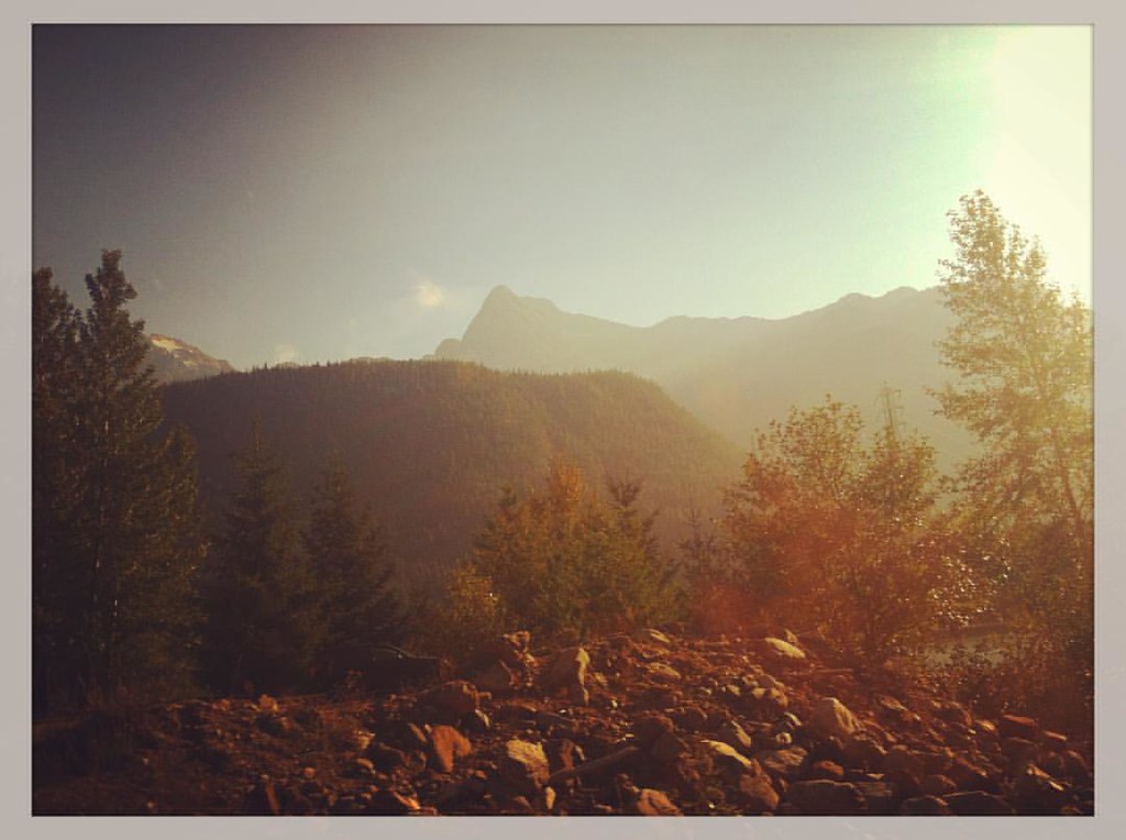
写真

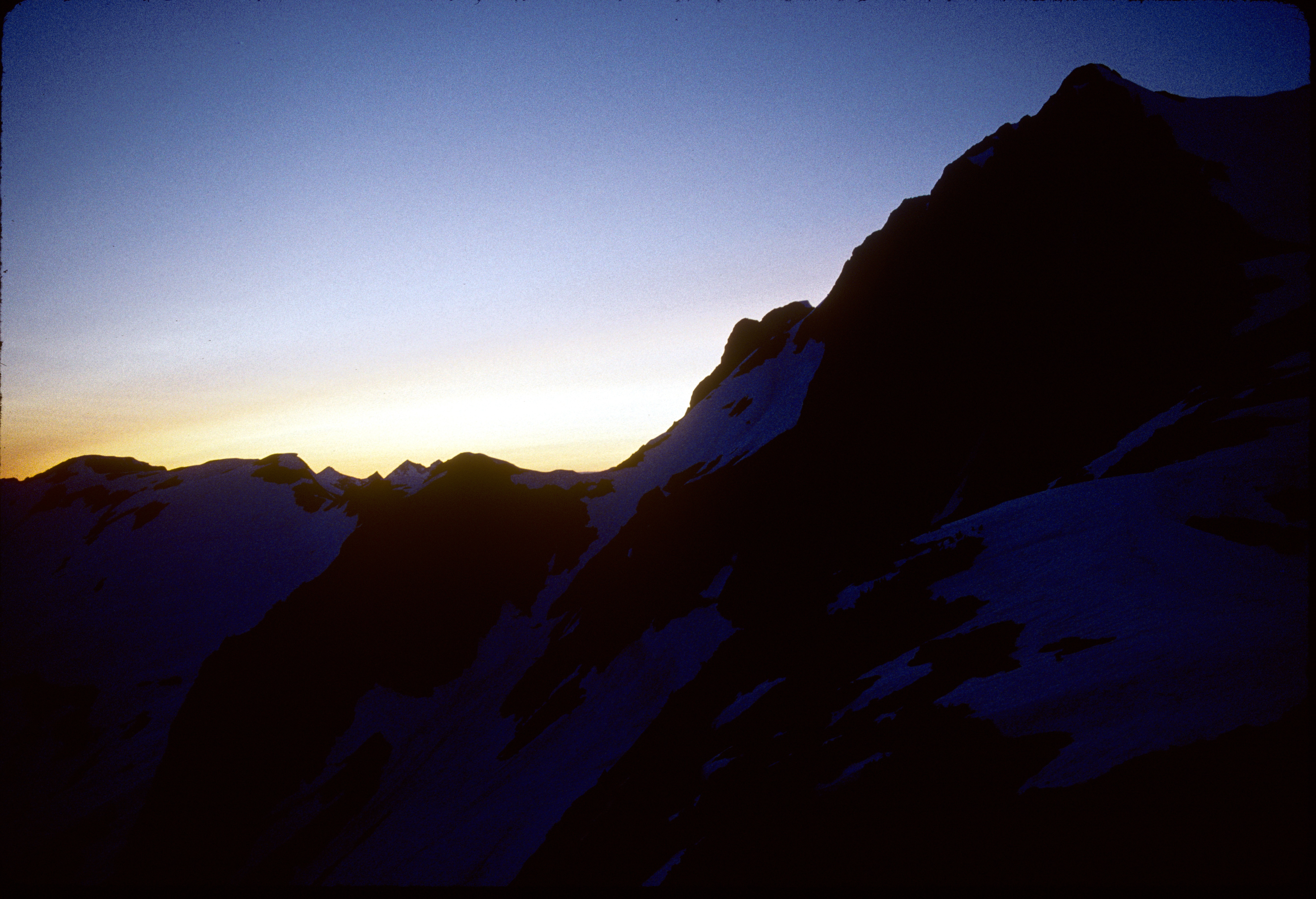
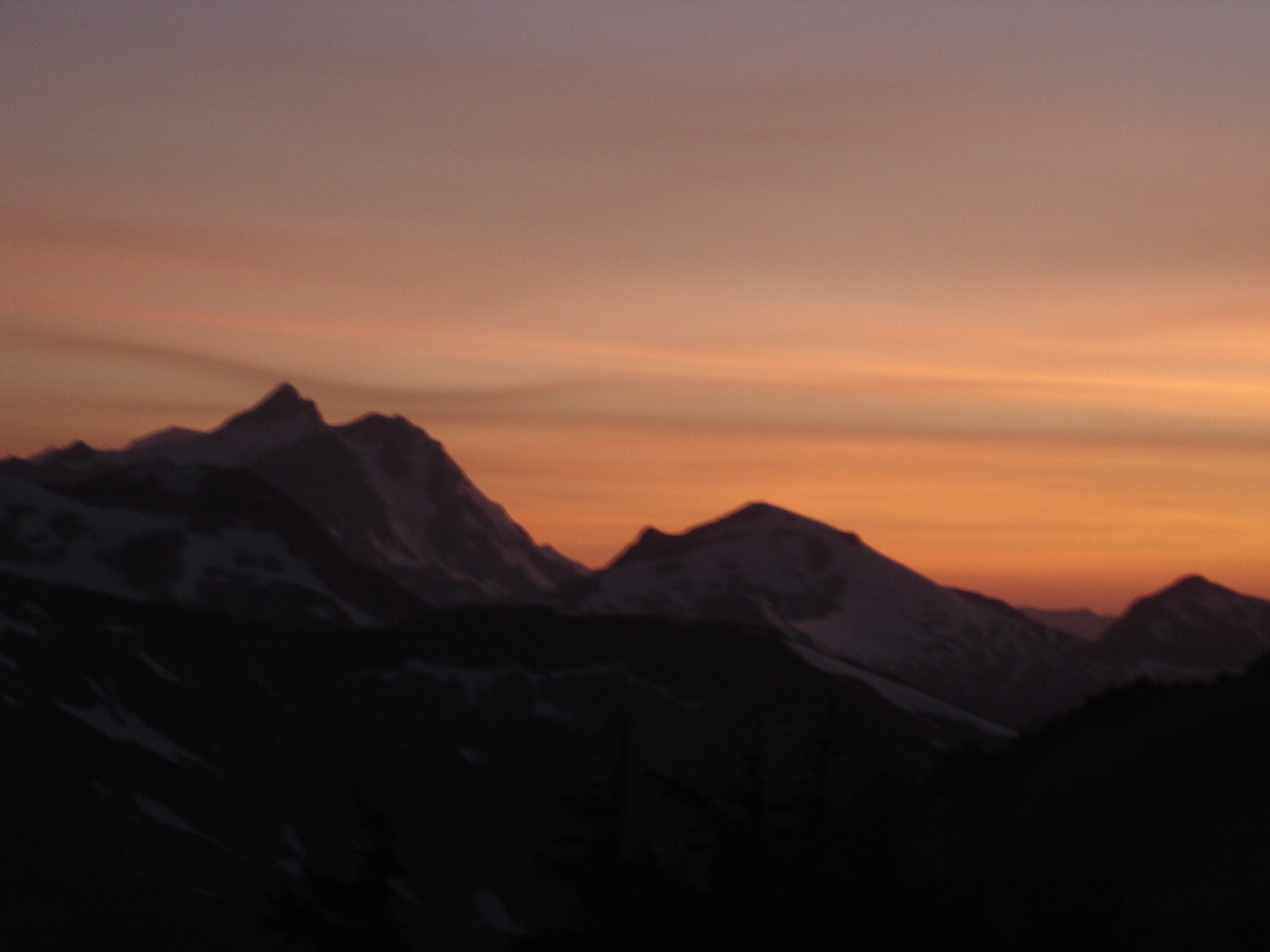
Sunset From Hannegan Peak
91-208_Mt_Whatcom_at_sunset_from_Perfect_Pass_Mt_Challenger_North_Cascades_National_Park_WA
91-272_Mt_Whatcom_at_sunset_from_Perfect_Pass_Mt_Challenger_North_Cascades_National_Park_WA
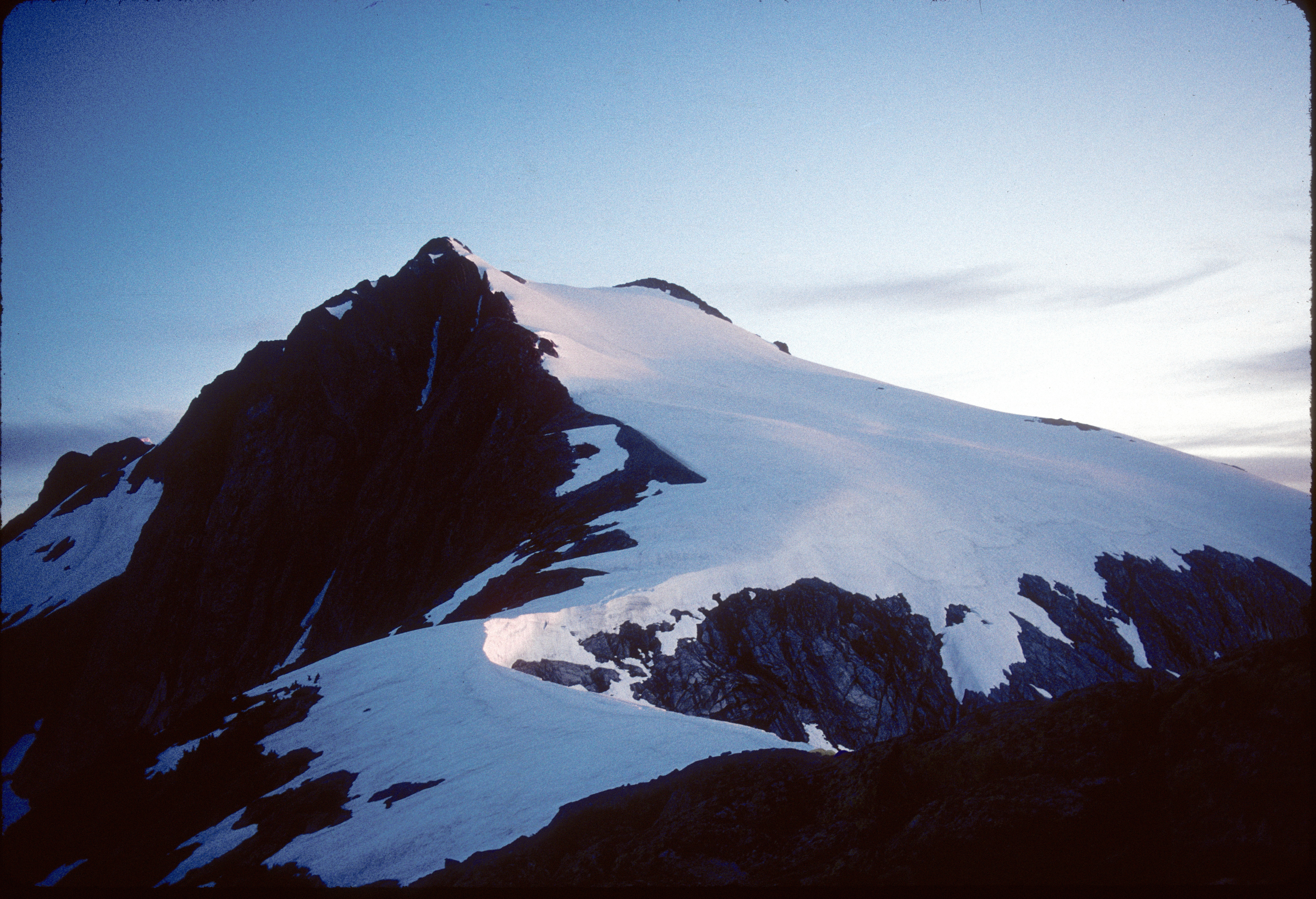
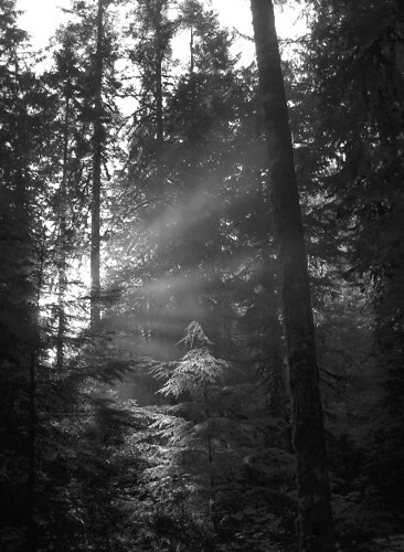
Morning on the Mountain
91-209_Mt_Baker_Mt_Shuksan_at_sunset_from_Perfect_Pass_Mt_Challenger_North_Cascades_National_Park_WA
Sunset behind Shuksan
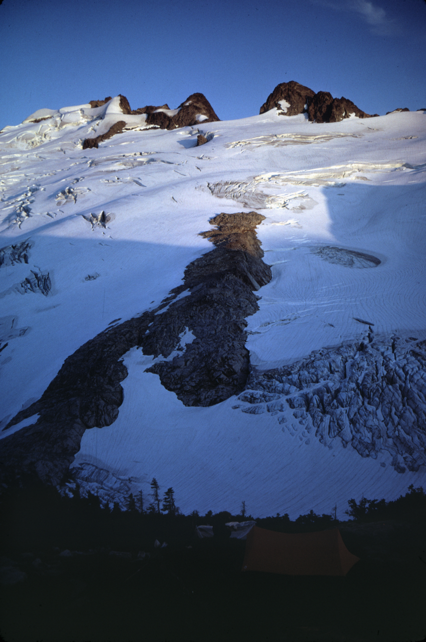
Image-65-714
North Cascade National Park
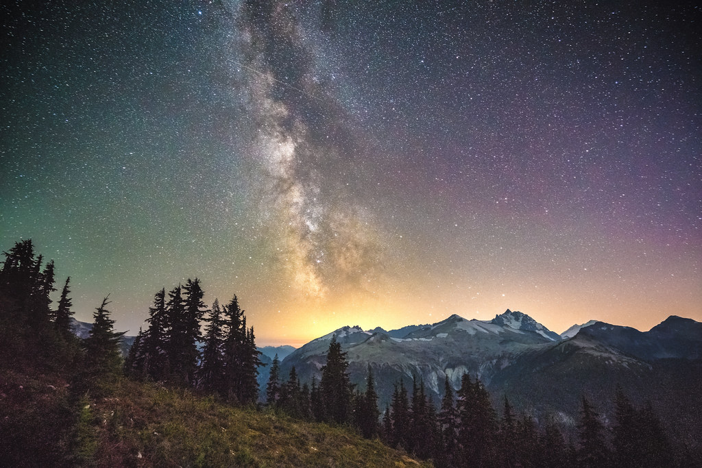
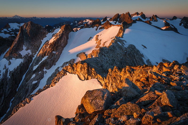
Milky Way over Easy Ridge
#svickinawesome
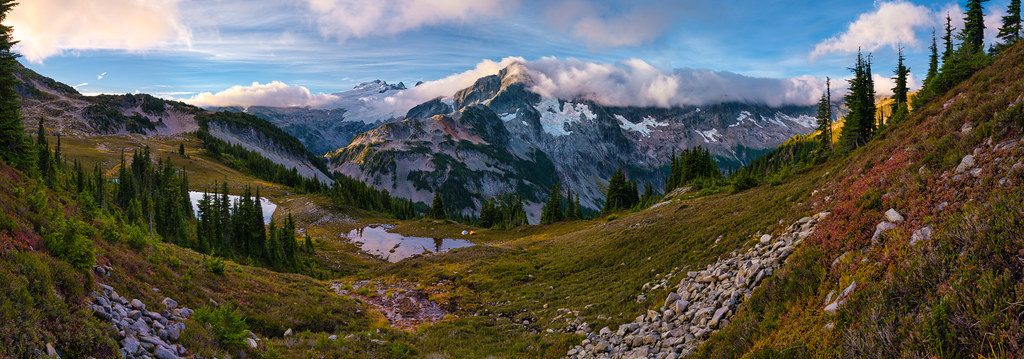
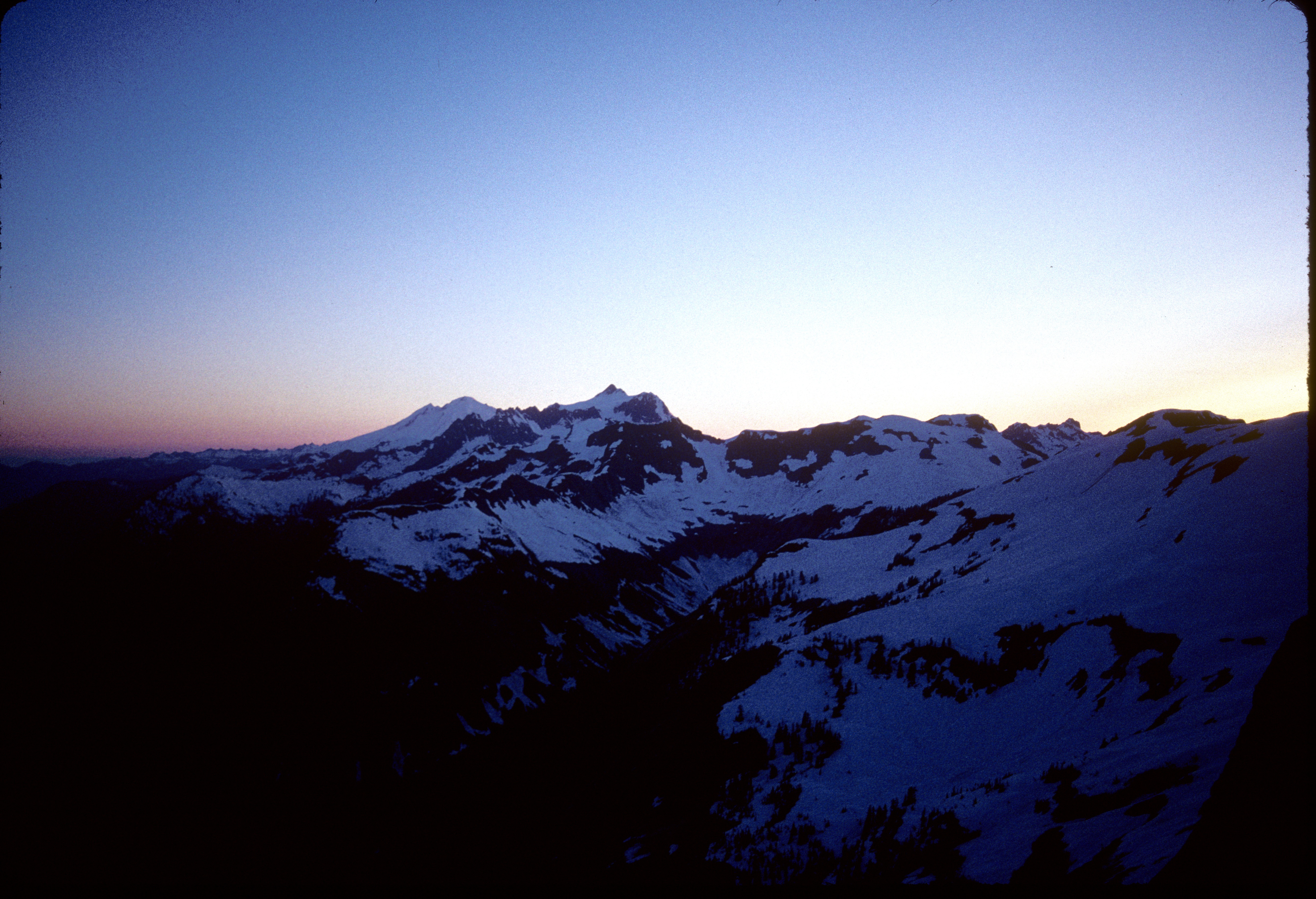
Sunrise over Tapto Lakes & Whatcom Peak
アメリカ合衆国 〒 ワシントン州 チャレンジャー山の地図
別の場所を検索
近所の場所
アメリカ合衆国 〒 ワシントン州 クルックド・サム・ピーク
アメリカ合衆国 〒 ワシントン州 フューリー山
アメリカ合衆国 〒 ワシントン州 クラウダー山
アメリカ合衆国 〒 ワシントン州 ワットクーム・ピーク
Rockport, WA アメリカ合衆国ワットクーム・キャンプグランド
アメリカ合衆国 〒 ワシントン州 レッド・フェイス山
アメリカ合衆国 〒 ワシントン州 パイオニア・リッジ
アメリカ合衆国 〒 ワシントン州 ウェスト・ツイン・ニードル
アメリカ合衆国 〒 ワシントン州 ルナ・ピーク
アメリカ合衆国 〒 ワシントン州 イージー・ピーク
アメリカ合衆国 〒 ワシントン州 テラー山
アメリカ合衆国 ワシントン州ノース・カスケード国立公園
アメリカ合衆国 〒 ワシントン州 インディアン山
Rockport, WA アメリカ合衆国グレイビール・キャンプグランド
アメリカ合衆国 〒 ワシントン州 マクミラン・スパイア
Rockport, WA アメリカ合衆国スティルウェル・キャンプグランド
アメリカ合衆国 〒 ワシントン州 ベアー山
Rockport, WA アメリカ合衆国インディアン・クリーク・キャンプグランド
Washington, アメリカ合衆国U.S. キャビン・キャンプグランド
アメリカ合衆国 ワシントン州 ミネラル山
最近の検索
- アメリカ合衆国 アラスカ州 レッド・ドッグ・マイン日の出日の入り時間
- Am bhf, Borken, ドイツアム・バーンホーフ日の出日の入り時間
- 4th St E, Sonoma, CA, USA日の出日の入り時間
- Oakland Ave, Williamsport, PA アメリカ合衆国日の出日の入り時間
- Via Roma, Pieranica CR, イタリアローマ通り日の出日の入り時間
- クロアチア 〒 ドゥブロブニク GradClock Tower of Dubrovnik日の出日の入り時間
- アルゼンチン チュブ州 トレリュー日の出日の入り時間
- Hartfords Bluff Cir, Mt Pleasant, SC アメリカ合衆国日の出日の入り時間
- 日本、熊本県熊本市北区日の出日の入り時間
- 中華人民共和国 福州市 平潭県 平潭島日の出日の入り時間