アメリカ合衆国 アーカンソー州 ミル・クリーク日の出日の入り時間
Location: アメリカ合衆国 > アーカンソー州 > スコット >
時間帯:
America/Chicago
現地時間:
2025-07-10 03:35:49
経度:
-94.0899911
緯度:
34.7277359
今日の日の出時刻:
06:11:49 AM
今日の日の入時刻:
08:31:54 PM
今日の日長:
14h 20m 5s
明日の日の出時刻:
06:12:25 AM
明日の日の入時刻:
08:31:34 PM
明日の日長:
14h 19m 9s
すべて表示する
| 日付 | 日出 | 日没 | 日長 |
|---|---|---|---|
| 2025年01月01日 | 07:23:47 AM | 05:17:15 PM | 9h 53m 28s |
| 2025年01月02日 | 07:23:54 AM | 05:18:02 PM | 9h 54m 8s |
| 2025年01月03日 | 07:24:00 AM | 05:18:50 PM | 9h 54m 50s |
| 2025年01月04日 | 07:24:05 AM | 05:19:40 PM | 9h 55m 35s |
| 2025年01月05日 | 07:24:07 AM | 05:20:30 PM | 9h 56m 23s |
| 2025年01月06日 | 07:24:07 AM | 05:21:22 PM | 9h 57m 15s |
| 2025年01月07日 | 07:24:06 AM | 05:22:14 PM | 9h 58m 8s |
| 2025年01月08日 | 07:24:02 AM | 05:23:07 PM | 9h 59m 5s |
| 2025年01月09日 | 07:23:57 AM | 05:24:01 PM | 10h 0m 4s |
| 2025年01月10日 | 07:23:49 AM | 05:24:55 PM | 10h 1m 6s |
| 2025年01月11日 | 07:23:40 AM | 05:25:51 PM | 10h 2m 11s |
| 2025年01月12日 | 07:23:29 AM | 05:26:47 PM | 10h 3m 18s |
| 2025年01月13日 | 07:23:16 AM | 05:27:43 PM | 10h 4m 27s |
| 2025年01月14日 | 07:23:01 AM | 05:28:41 PM | 10h 5m 40s |
| 2025年01月15日 | 07:22:45 AM | 05:29:38 PM | 10h 6m 53s |
| 2025年01月16日 | 07:22:26 AM | 05:30:36 PM | 10h 8m 10s |
| 2025年01月17日 | 07:22:06 AM | 05:31:35 PM | 10h 9m 29s |
| 2025年01月18日 | 07:21:43 AM | 05:32:34 PM | 10h 10m 51s |
| 2025年01月19日 | 07:21:19 AM | 05:33:33 PM | 10h 12m 14s |
| 2025年01月20日 | 07:20:53 AM | 05:34:33 PM | 10h 13m 40s |
| 2025年01月21日 | 07:20:26 AM | 05:35:33 PM | 10h 15m 7s |
| 2025年01月22日 | 07:19:56 AM | 05:36:33 PM | 10h 16m 37s |
| 2025年01月23日 | 07:19:25 AM | 05:37:33 PM | 10h 18m 8s |
| 2025年01月24日 | 07:18:52 AM | 05:38:33 PM | 10h 19m 41s |
| 2025年01月25日 | 07:18:18 AM | 05:39:34 PM | 10h 21m 16s |
| 2025年01月26日 | 07:17:41 AM | 05:40:34 PM | 10h 22m 53s |
| 2025年01月27日 | 07:17:03 AM | 05:41:35 PM | 10h 24m 32s |
| 2025年01月28日 | 07:16:24 AM | 05:42:36 PM | 10h 26m 12s |
| 2025年01月29日 | 07:15:43 AM | 05:43:36 PM | 10h 27m 53s |
| 2025年01月30日 | 07:15:00 AM | 05:44:37 PM | 10h 29m 37s |
| 2025年01月31日 | 07:14:15 AM | 05:45:37 PM | 10h 31m 22s |
| 2025年02月01日 | 07:13:30 AM | 05:46:38 PM | 10h 33m 8s |
| 2025年02月02日 | 07:12:42 AM | 05:47:38 PM | 10h 34m 56s |
| 2025年02月03日 | 07:11:53 AM | 05:48:38 PM | 10h 36m 45s |
| 2025年02月04日 | 07:11:03 AM | 05:49:38 PM | 10h 38m 35s |
| 2025年02月05日 | 07:10:11 AM | 05:50:38 PM | 10h 40m 27s |
| 2025年02月06日 | 07:09:18 AM | 05:51:38 PM | 10h 42m 20s |
| 2025年02月07日 | 07:08:24 AM | 05:52:37 PM | 10h 44m 13s |
| 2025年02月08日 | 07:07:28 AM | 05:53:36 PM | 10h 46m 8s |
| 2025年02月09日 | 07:06:31 AM | 05:54:35 PM | 10h 48m 4s |
| 2025年02月10日 | 07:05:32 AM | 05:55:33 PM | 10h 50m 1s |
| 2025年02月11日 | 07:04:33 AM | 05:56:32 PM | 10h 51m 59s |
| 2025年02月12日 | 07:03:32 AM | 05:57:30 PM | 10h 53m 58s |
| 2025年02月13日 | 07:02:30 AM | 05:58:27 PM | 10h 55m 57s |
| 2025年02月14日 | 07:01:27 AM | 05:59:25 PM | 10h 57m 58s |
| 2025年02月15日 | 07:00:23 AM | 06:00:22 PM | 10h 59m 59s |
| 2025年02月16日 | 06:59:17 AM | 06:01:19 PM | 11h 2m 2s |
| 2025年02月17日 | 06:58:11 AM | 06:02:15 PM | 11h 4m 4s |
| 2025年02月18日 | 06:57:03 AM | 06:03:11 PM | 11h 6m 8s |
| 2025年02月19日 | 06:55:55 AM | 06:04:07 PM | 11h 8m 12s |
| 2025年02月20日 | 06:54:46 AM | 06:05:02 PM | 11h 10m 16s |
| 2025年02月21日 | 06:53:35 AM | 06:05:57 PM | 11h 12m 22s |
| 2025年02月22日 | 06:52:24 AM | 06:06:52 PM | 11h 14m 28s |
| 2025年02月23日 | 06:51:12 AM | 06:07:46 PM | 11h 16m 34s |
| 2025年02月24日 | 06:49:59 AM | 06:08:40 PM | 11h 18m 41s |
| 2025年02月25日 | 06:48:46 AM | 06:09:34 PM | 11h 20m 48s |
| 2025年02月26日 | 06:47:31 AM | 06:10:27 PM | 11h 22m 56s |
| 2025年02月27日 | 06:46:16 AM | 06:11:20 PM | 11h 25m 4s |
| 2025年02月28日 | 06:45:00 AM | 06:12:13 PM | 11h 27m 13s |
| 2025年03月01日 | 06:43:44 AM | 06:13:05 PM | 11h 29m 21s |
| 2025年03月02日 | 06:42:26 AM | 06:13:57 PM | 11h 31m 31s |
| 2025年03月03日 | 06:41:09 AM | 06:14:49 PM | 11h 33m 40s |
| 2025年03月04日 | 06:39:50 AM | 06:15:41 PM | 11h 35m 51s |
| 2025年03月05日 | 06:38:31 AM | 06:16:32 PM | 11h 38m 1s |
| 2025年03月06日 | 06:37:12 AM | 06:17:23 PM | 11h 40m 11s |
| 2025年03月07日 | 06:35:52 AM | 06:18:13 PM | 11h 42m 21s |
| 2025年03月08日 | 06:34:32 AM | 06:19:04 PM | 11h 44m 32s |
| 2025年03月09日 | 07:33:14 AM | 07:19:51 PM | 11h 46m 37s |
| 2025年03月10日 | 07:31:53 AM | 07:20:41 PM | 11h 48m 48s |
| 2025年03月11日 | 07:30:31 AM | 07:21:31 PM | 11h 51m 0s |
| 2025年03月12日 | 07:29:10 AM | 07:22:20 PM | 11h 53m 10s |
| 2025年03月13日 | 07:27:47 AM | 07:23:09 PM | 11h 55m 22s |
| 2025年03月14日 | 07:26:25 AM | 07:23:58 PM | 11h 57m 33s |
| 2025年03月15日 | 07:25:02 AM | 07:24:47 PM | 11h 59m 45s |
| 2025年03月16日 | 07:23:39 AM | 07:25:36 PM | 12h 1m 57s |
| 2025年03月17日 | 07:22:16 AM | 07:26:24 PM | 12h 4m 8s |
| 2025年03月18日 | 07:20:53 AM | 07:27:12 PM | 12h 6m 19s |
| 2025年03月19日 | 07:19:29 AM | 07:28:00 PM | 12h 8m 31s |
| 2025年03月20日 | 07:18:06 AM | 07:28:48 PM | 12h 10m 42s |
| 2025年03月21日 | 07:16:42 AM | 07:29:36 PM | 12h 12m 54s |
| 2025年03月22日 | 07:15:18 AM | 07:30:24 PM | 12h 15m 6s |
| 2025年03月23日 | 07:13:55 AM | 07:31:11 PM | 12h 17m 16s |
| 2025年03月24日 | 07:12:31 AM | 07:31:59 PM | 12h 19m 28s |
| 2025年03月25日 | 07:11:08 AM | 07:32:46 PM | 12h 21m 38s |
| 2025年03月26日 | 07:09:44 AM | 07:33:33 PM | 12h 23m 49s |
| 2025年03月27日 | 07:08:21 AM | 07:34:20 PM | 12h 25m 59s |
| 2025年03月28日 | 07:06:57 AM | 07:35:08 PM | 12h 28m 11s |
| 2025年03月29日 | 07:05:34 AM | 07:35:55 PM | 12h 30m 21s |
| 2025年03月30日 | 07:04:11 AM | 07:36:42 PM | 12h 32m 31s |
| 2025年03月31日 | 07:02:49 AM | 07:37:29 PM | 12h 34m 40s |
| 2025年04月01日 | 07:01:26 AM | 07:38:16 PM | 12h 36m 50s |
| 2025年04月02日 | 07:00:04 AM | 07:39:03 PM | 12h 38m 59s |
| 2025年04月03日 | 06:58:42 AM | 07:39:50 PM | 12h 41m 8s |
| 2025年04月04日 | 06:57:21 AM | 07:40:37 PM | 12h 43m 16s |
| 2025年04月05日 | 06:55:59 AM | 07:41:24 PM | 12h 45m 25s |
| 2025年04月06日 | 06:54:39 AM | 07:42:12 PM | 12h 47m 33s |
| 2025年04月07日 | 06:53:18 AM | 07:42:59 PM | 12h 49m 41s |
| 2025年04月08日 | 06:51:58 AM | 07:43:46 PM | 12h 51m 48s |
| 2025年04月09日 | 06:50:39 AM | 07:44:33 PM | 12h 53m 54s |
| 2025年04月10日 | 06:49:20 AM | 07:45:20 PM | 12h 56m 0s |
| 2025年04月11日 | 06:48:02 AM | 07:46:08 PM | 12h 58m 6s |
| 2025年04月12日 | 06:46:44 AM | 07:46:55 PM | 13h 0m 11s |
| 2025年04月13日 | 06:45:27 AM | 07:47:43 PM | 13h 2m 16s |
| 2025年04月14日 | 06:44:10 AM | 07:48:30 PM | 13h 4m 20s |
| 2025年04月15日 | 06:42:54 AM | 07:49:18 PM | 13h 6m 24s |
| 2025年04月16日 | 06:41:39 AM | 07:50:06 PM | 13h 8m 27s |
| 2025年04月17日 | 06:40:24 AM | 07:50:53 PM | 13h 10m 29s |
| 2025年04月18日 | 06:39:11 AM | 07:51:41 PM | 13h 12m 30s |
| 2025年04月19日 | 06:37:58 AM | 07:52:29 PM | 13h 14m 31s |
| 2025年04月20日 | 06:36:45 AM | 07:53:17 PM | 13h 16m 32s |
| 2025年04月21日 | 06:35:34 AM | 07:54:05 PM | 13h 18m 31s |
| 2025年04月22日 | 06:34:23 AM | 07:54:53 PM | 13h 20m 30s |
| 2025年04月23日 | 06:33:14 AM | 07:55:41 PM | 13h 22m 27s |
| 2025年04月24日 | 06:32:05 AM | 07:56:29 PM | 13h 24m 24s |
| 2025年04月25日 | 06:30:57 AM | 07:57:17 PM | 13h 26m 20s |
| 2025年04月26日 | 06:29:50 AM | 07:58:06 PM | 13h 28m 16s |
| 2025年04月27日 | 06:28:44 AM | 07:58:54 PM | 13h 30m 10s |
| 2025年04月28日 | 06:27:39 AM | 07:59:42 PM | 13h 32m 3s |
| 2025年04月29日 | 06:26:36 AM | 08:00:30 PM | 13h 33m 54s |
| 2025年04月30日 | 06:25:33 AM | 08:01:19 PM | 13h 35m 46s |
| 2025年05月01日 | 06:24:31 AM | 08:02:07 PM | 13h 37m 36s |
| 2025年05月02日 | 06:23:31 AM | 08:02:55 PM | 13h 39m 24s |
| 2025年05月03日 | 06:22:31 AM | 08:03:43 PM | 13h 41m 12s |
| 2025年05月04日 | 06:21:33 AM | 08:04:31 PM | 13h 42m 58s |
| 2025年05月05日 | 06:20:36 AM | 08:05:19 PM | 13h 44m 43s |
| 2025年05月06日 | 06:19:41 AM | 08:06:07 PM | 13h 46m 26s |
| 2025年05月07日 | 06:18:46 AM | 08:06:55 PM | 13h 48m 9s |
| 2025年05月08日 | 06:17:53 AM | 08:07:43 PM | 13h 49m 50s |
| 2025年05月09日 | 06:17:01 AM | 08:08:30 PM | 13h 51m 29s |
| 2025年05月10日 | 06:16:10 AM | 08:09:18 PM | 13h 53m 8s |
| 2025年05月11日 | 06:15:21 AM | 08:10:05 PM | 13h 54m 44s |
| 2025年05月12日 | 06:14:33 AM | 08:10:52 PM | 13h 56m 19s |
| 2025年05月13日 | 06:13:47 AM | 08:11:38 PM | 13h 57m 51s |
| 2025年05月14日 | 06:13:02 AM | 08:12:25 PM | 13h 59m 23s |
| 2025年05月15日 | 06:12:18 AM | 08:13:11 PM | 14h 0m 53s |
| 2025年05月16日 | 06:11:36 AM | 08:13:57 PM | 14h 2m 21s |
| 2025年05月17日 | 06:10:55 AM | 08:14:42 PM | 14h 3m 47s |
| 2025年05月18日 | 06:10:16 AM | 08:15:27 PM | 14h 5m 11s |
| 2025年05月19日 | 06:09:38 AM | 08:16:11 PM | 14h 6m 33s |
| 2025年05月20日 | 06:09:02 AM | 08:16:56 PM | 14h 7m 54s |
| 2025年05月21日 | 06:08:28 AM | 08:17:39 PM | 14h 9m 11s |
| 2025年05月22日 | 06:07:54 AM | 08:18:22 PM | 14h 10m 28s |
| 2025年05月23日 | 06:07:23 AM | 08:19:05 PM | 14h 11m 42s |
| 2025年05月24日 | 06:06:53 AM | 08:19:47 PM | 14h 12m 54s |
| 2025年05月25日 | 06:06:25 AM | 08:20:28 PM | 14h 14m 3s |
| 2025年05月26日 | 06:05:58 AM | 08:21:09 PM | 14h 15m 11s |
| 2025年05月27日 | 06:05:33 AM | 08:21:49 PM | 14h 16m 16s |
| 2025年05月28日 | 06:05:09 AM | 08:22:28 PM | 14h 17m 19s |
| 2025年05月29日 | 06:04:47 AM | 08:23:07 PM | 14h 18m 20s |
| 2025年05月30日 | 06:04:27 AM | 08:23:45 PM | 14h 19m 18s |
| 2025年05月31日 | 06:04:08 AM | 08:24:21 PM | 14h 20m 13s |
| 2025年06月01日 | 06:03:51 AM | 08:24:58 PM | 14h 21m 7s |
| 2025年06月02日 | 06:03:36 AM | 08:25:33 PM | 14h 21m 57s |
| 2025年06月03日 | 06:03:22 AM | 08:26:07 PM | 14h 22m 45s |
| 2025年06月04日 | 06:03:10 AM | 08:26:40 PM | 14h 23m 30s |
| 2025年06月05日 | 06:03:00 AM | 08:27:13 PM | 14h 24m 13s |
| 2025年06月06日 | 06:02:51 AM | 08:27:44 PM | 14h 24m 53s |
| 2025年06月07日 | 06:02:44 AM | 08:28:14 PM | 14h 25m 30s |
| 2025年06月08日 | 06:02:38 AM | 08:28:43 PM | 14h 26m 5s |
| 2025年06月09日 | 06:02:34 AM | 08:29:11 PM | 14h 26m 37s |
| 2025年06月10日 | 06:02:32 AM | 08:29:38 PM | 14h 27m 6s |
| 2025年06月11日 | 06:02:31 AM | 08:30:03 PM | 14h 27m 32s |
| 2025年06月12日 | 06:02:32 AM | 08:30:27 PM | 14h 27m 55s |
| 2025年06月13日 | 06:02:35 AM | 08:30:50 PM | 14h 28m 15s |
| 2025年06月14日 | 06:02:38 AM | 08:31:12 PM | 14h 28m 34s |
| 2025年06月15日 | 06:02:44 AM | 08:31:32 PM | 14h 28m 48s |
| 2025年06月16日 | 06:02:51 AM | 08:31:51 PM | 14h 29m 0s |
| 2025年06月17日 | 06:03:00 AM | 08:32:09 PM | 14h 29m 9s |
| 2025年06月18日 | 06:03:09 AM | 08:32:25 PM | 14h 29m 16s |
| 2025年06月19日 | 06:03:21 AM | 08:32:40 PM | 14h 29m 19s |
| 2025年06月20日 | 06:03:34 AM | 08:32:53 PM | 14h 29m 19s |
| 2025年06月21日 | 06:03:48 AM | 08:33:05 PM | 14h 29m 17s |
| 2025年06月22日 | 06:04:04 AM | 08:33:15 PM | 14h 29m 11s |
| 2025年06月23日 | 06:04:21 AM | 08:33:24 PM | 14h 29m 3s |
| 2025年06月24日 | 06:04:39 AM | 08:33:31 PM | 14h 28m 52s |
| 2025年06月25日 | 06:04:59 AM | 08:33:37 PM | 14h 28m 38s |
| 2025年06月26日 | 06:05:20 AM | 08:33:41 PM | 14h 28m 21s |
| 2025年06月27日 | 06:05:42 AM | 08:33:43 PM | 14h 28m 1s |
| 2025年06月28日 | 06:06:05 AM | 08:33:44 PM | 14h 27m 39s |
| 2025年06月29日 | 06:06:30 AM | 08:33:43 PM | 14h 27m 13s |
| 2025年06月30日 | 06:06:56 AM | 08:33:40 PM | 14h 26m 44s |
| 2025年07月01日 | 06:07:23 AM | 08:33:36 PM | 14h 26m 13s |
| 2025年07月02日 | 06:07:50 AM | 08:33:30 PM | 14h 25m 40s |
| 2025年07月03日 | 06:08:19 AM | 08:33:23 PM | 14h 25m 4s |
| 2025年07月04日 | 06:08:49 AM | 08:33:14 PM | 14h 24m 25s |
| 2025年07月05日 | 06:09:20 AM | 08:33:03 PM | 14h 23m 43s |
| 2025年07月06日 | 06:09:52 AM | 08:32:50 PM | 14h 22m 58s |
| 2025年07月07日 | 06:10:25 AM | 08:32:36 PM | 14h 22m 11s |
| 2025年07月08日 | 06:10:59 AM | 08:32:20 PM | 14h 21m 21s |
| 2025年07月09日 | 06:11:33 AM | 08:32:03 PM | 14h 20m 30s |
| 2025年07月10日 | 06:12:08 AM | 08:31:44 PM | 14h 19m 36s |
| 2025年07月11日 | 06:12:44 AM | 08:31:23 PM | 14h 18m 39s |
| 2025年07月12日 | 06:13:21 AM | 08:31:00 PM | 14h 17m 39s |
| 2025年07月13日 | 06:13:59 AM | 08:30:36 PM | 14h 16m 37s |
| 2025年07月14日 | 06:14:37 AM | 08:30:10 PM | 14h 15m 33s |
| 2025年07月15日 | 06:15:16 AM | 08:29:42 PM | 14h 14m 26s |
| 2025年07月16日 | 06:15:55 AM | 08:29:13 PM | 14h 13m 18s |
| 2025年07月17日 | 06:16:35 AM | 08:28:42 PM | 14h 12m 7s |
| 2025年07月18日 | 06:17:15 AM | 08:28:10 PM | 14h 10m 55s |
| 2025年07月19日 | 06:17:56 AM | 08:27:36 PM | 14h 9m 40s |
| 2025年07月20日 | 06:18:38 AM | 08:27:01 PM | 14h 8m 23s |
| 2025年07月21日 | 06:19:19 AM | 08:26:23 PM | 14h 7m 4s |
| 2025年07月22日 | 06:20:01 AM | 08:25:45 PM | 14h 5m 44s |
| 2025年07月23日 | 06:20:44 AM | 08:25:04 PM | 14h 4m 20s |
| 2025年07月24日 | 06:21:27 AM | 08:24:23 PM | 14h 2m 56s |
| 2025年07月25日 | 06:22:10 AM | 08:23:40 PM | 14h 1m 30s |
| 2025年07月26日 | 06:22:54 AM | 08:22:55 PM | 14h 0m 1s |
| 2025年07月27日 | 06:23:37 AM | 08:22:09 PM | 13h 58m 32s |
| 2025年07月28日 | 06:24:21 AM | 08:21:21 PM | 13h 57m 0s |
| 2025年07月29日 | 06:25:05 AM | 08:20:32 PM | 13h 55m 27s |
| 2025年07月30日 | 06:25:50 AM | 08:19:42 PM | 13h 53m 52s |
| 2025年07月31日 | 06:26:34 AM | 08:18:50 PM | 13h 52m 16s |
| 2025年08月01日 | 06:27:19 AM | 08:17:57 PM | 13h 50m 38s |
| 2025年08月02日 | 06:28:03 AM | 08:17:02 PM | 13h 48m 59s |
| 2025年08月03日 | 06:28:48 AM | 08:16:07 PM | 13h 47m 19s |
| 2025年08月04日 | 06:29:33 AM | 08:15:09 PM | 13h 45m 36s |
| 2025年08月05日 | 06:30:18 AM | 08:14:11 PM | 13h 43m 53s |
| 2025年08月06日 | 06:31:03 AM | 08:13:12 PM | 13h 42m 9s |
| 2025年08月07日 | 06:31:48 AM | 08:12:11 PM | 13h 40m 23s |
| 2025年08月08日 | 06:32:33 AM | 08:11:09 PM | 13h 38m 36s |
| 2025年08月09日 | 06:33:18 AM | 08:10:06 PM | 13h 36m 48s |
| 2025年08月10日 | 06:34:03 AM | 08:09:02 PM | 13h 34m 59s |
| 2025年08月11日 | 06:34:48 AM | 08:07:57 PM | 13h 33m 9s |
| 2025年08月12日 | 06:35:32 AM | 08:06:51 PM | 13h 31m 19s |
| 2025年08月13日 | 06:36:17 AM | 08:05:43 PM | 13h 29m 26s |
| 2025年08月14日 | 06:37:02 AM | 08:04:35 PM | 13h 27m 33s |
| 2025年08月15日 | 06:37:47 AM | 08:03:26 PM | 13h 25m 39s |
| 2025年08月16日 | 06:38:31 AM | 08:02:15 PM | 13h 23m 44s |
| 2025年08月17日 | 06:39:16 AM | 08:01:04 PM | 13h 21m 48s |
| 2025年08月18日 | 06:40:00 AM | 07:59:52 PM | 13h 19m 52s |
| 2025年08月19日 | 06:40:45 AM | 07:58:39 PM | 13h 17m 54s |
| 2025年08月20日 | 06:41:29 AM | 07:57:25 PM | 13h 15m 56s |
| 2025年08月21日 | 06:42:13 AM | 07:56:10 PM | 13h 13m 57s |
| 2025年08月22日 | 06:42:57 AM | 07:54:55 PM | 13h 11m 58s |
| 2025年08月23日 | 06:43:41 AM | 07:53:39 PM | 13h 9m 58s |
| 2025年08月24日 | 06:44:25 AM | 07:52:22 PM | 13h 7m 57s |
| 2025年08月25日 | 06:45:09 AM | 07:51:04 PM | 13h 5m 55s |
| 2025年08月26日 | 06:45:52 AM | 07:49:46 PM | 13h 3m 54s |
| 2025年08月27日 | 06:46:36 AM | 07:48:27 PM | 13h 1m 51s |
| 2025年08月28日 | 06:47:19 AM | 07:47:07 PM | 12h 59m 48s |
| 2025年08月29日 | 06:48:03 AM | 07:45:47 PM | 12h 57m 44s |
| 2025年08月30日 | 06:48:46 AM | 07:44:27 PM | 12h 55m 41s |
| 2025年08月31日 | 06:49:29 AM | 07:43:05 PM | 12h 53m 36s |
| 2025年09月01日 | 06:50:12 AM | 07:41:44 PM | 12h 51m 32s |
| 2025年09月02日 | 06:50:55 AM | 07:40:21 PM | 12h 49m 26s |
| 2025年09月03日 | 06:51:38 AM | 07:38:59 PM | 12h 47m 21s |
| 2025年09月04日 | 06:52:21 AM | 07:37:36 PM | 12h 45m 15s |
| 2025年09月05日 | 06:53:04 AM | 07:36:12 PM | 12h 43m 8s |
| 2025年09月06日 | 06:53:47 AM | 07:34:48 PM | 12h 41m 1s |
| 2025年09月07日 | 06:54:30 AM | 07:33:24 PM | 12h 38m 54s |
| 2025年09月08日 | 06:55:13 AM | 07:32:00 PM | 12h 36m 47s |
| 2025年09月09日 | 06:55:56 AM | 07:30:35 PM | 12h 34m 39s |
| 2025年09月10日 | 06:56:38 AM | 07:29:10 PM | 12h 32m 32s |
| 2025年09月11日 | 06:57:21 AM | 07:27:44 PM | 12h 30m 23s |
| 2025年09月12日 | 06:58:04 AM | 07:26:19 PM | 12h 28m 15s |
| 2025年09月13日 | 06:58:47 AM | 07:24:53 PM | 12h 26m 6s |
| 2025年09月14日 | 06:59:30 AM | 07:23:28 PM | 12h 23m 58s |
| 2025年09月15日 | 07:00:13 AM | 07:22:02 PM | 12h 21m 49s |
| 2025年09月16日 | 07:00:56 AM | 07:20:36 PM | 12h 19m 40s |
| 2025年09月17日 | 07:01:39 AM | 07:19:10 PM | 12h 17m 31s |
| 2025年09月18日 | 07:02:22 AM | 07:17:44 PM | 12h 15m 22s |
| 2025年09月19日 | 07:03:05 AM | 07:16:18 PM | 12h 13m 13s |
| 2025年09月20日 | 07:03:49 AM | 07:14:52 PM | 12h 11m 3s |
| 2025年09月21日 | 07:04:32 AM | 07:13:26 PM | 12h 8m 54s |
| 2025年09月22日 | 07:05:16 AM | 07:12:00 PM | 12h 6m 44s |
| 2025年09月23日 | 07:06:00 AM | 07:10:35 PM | 12h 4m 35s |
| 2025年09月24日 | 07:06:44 AM | 07:09:09 PM | 12h 2m 25s |
| 2025年09月25日 | 07:07:28 AM | 07:07:44 PM | 12h 0m 16s |
| 2025年09月26日 | 07:08:12 AM | 07:06:19 PM | 11h 58m 7s |
| 2025年09月27日 | 07:08:57 AM | 07:04:54 PM | 11h 55m 57s |
| 2025年09月28日 | 07:09:41 AM | 07:03:29 PM | 11h 53m 48s |
| 2025年09月29日 | 07:10:26 AM | 07:02:05 PM | 11h 51m 39s |
| 2025年09月30日 | 07:11:12 AM | 07:00:41 PM | 11h 49m 29s |
| 2025年10月01日 | 07:11:57 AM | 06:59:17 PM | 11h 47m 20s |
| 2025年10月02日 | 07:12:43 AM | 06:57:54 PM | 11h 45m 11s |
| 2025年10月03日 | 07:13:29 AM | 06:56:31 PM | 11h 43m 2s |
| 2025年10月04日 | 07:14:15 AM | 06:55:08 PM | 11h 40m 53s |
| 2025年10月05日 | 07:15:01 AM | 06:53:46 PM | 11h 38m 45s |
| 2025年10月06日 | 07:15:48 AM | 06:52:25 PM | 11h 36m 37s |
| 2025年10月07日 | 07:16:35 AM | 06:51:04 PM | 11h 34m 29s |
| 2025年10月08日 | 07:17:23 AM | 06:49:44 PM | 11h 32m 21s |
| 2025年10月09日 | 07:18:10 AM | 06:48:24 PM | 11h 30m 14s |
| 2025年10月10日 | 07:18:58 AM | 06:47:05 PM | 11h 28m 7s |
| 2025年10月11日 | 07:19:47 AM | 06:45:46 PM | 11h 25m 59s |
| 2025年10月12日 | 07:20:35 AM | 06:44:29 PM | 11h 23m 54s |
| 2025年10月13日 | 07:21:24 AM | 06:43:12 PM | 11h 21m 48s |
| 2025年10月14日 | 07:22:14 AM | 06:41:55 PM | 11h 19m 41s |
| 2025年10月15日 | 07:23:04 AM | 06:40:40 PM | 11h 17m 36s |
| 2025年10月16日 | 07:23:54 AM | 06:39:25 PM | 11h 15m 31s |
| 2025年10月17日 | 07:24:44 AM | 06:38:11 PM | 11h 13m 27s |
| 2025年10月18日 | 07:25:35 AM | 06:36:58 PM | 11h 11m 23s |
| 2025年10月19日 | 07:26:26 AM | 06:35:46 PM | 11h 9m 20s |
| 2025年10月20日 | 07:27:18 AM | 06:34:35 PM | 11h 7m 17s |
| 2025年10月21日 | 07:28:10 AM | 06:33:24 PM | 11h 5m 14s |
| 2025年10月22日 | 07:29:02 AM | 06:32:15 PM | 11h 3m 13s |
| 2025年10月23日 | 07:29:55 AM | 06:31:07 PM | 11h 1m 12s |
| 2025年10月24日 | 07:30:48 AM | 06:30:00 PM | 10h 59m 12s |
| 2025年10月25日 | 07:31:41 AM | 06:28:54 PM | 10h 57m 13s |
| 2025年10月26日 | 07:32:35 AM | 06:27:49 PM | 10h 55m 14s |
| 2025年10月27日 | 07:33:29 AM | 06:26:45 PM | 10h 53m 16s |
| 2025年10月28日 | 07:34:24 AM | 06:25:43 PM | 10h 51m 19s |
| 2025年10月29日 | 07:35:19 AM | 06:24:41 PM | 10h 49m 22s |
| 2025年10月30日 | 07:36:14 AM | 06:23:41 PM | 10h 47m 27s |
| 2025年10月31日 | 07:37:09 AM | 06:22:42 PM | 10h 45m 33s |
| 2025年11月01日 | 07:38:05 AM | 06:21:45 PM | 10h 43m 40s |
| 2025年11月02日 | 06:39:03 AM | 05:20:46 PM | 10h 41m 43s |
| 2025年11月03日 | 06:39:59 AM | 05:19:51 PM | 10h 39m 52s |
| 2025年11月04日 | 06:40:56 AM | 05:18:58 PM | 10h 38m 2s |
| 2025年11月05日 | 06:41:53 AM | 05:18:06 PM | 10h 36m 13s |
| 2025年11月06日 | 06:42:50 AM | 05:17:16 PM | 10h 34m 26s |
| 2025年11月07日 | 06:43:47 AM | 05:16:27 PM | 10h 32m 40s |
| 2025年11月08日 | 06:44:44 AM | 05:15:39 PM | 10h 30m 55s |
| 2025年11月09日 | 06:45:42 AM | 05:14:53 PM | 10h 29m 11s |
| 2025年11月10日 | 06:46:39 AM | 05:14:09 PM | 10h 27m 30s |
| 2025年11月11日 | 06:47:37 AM | 05:13:26 PM | 10h 25m 49s |
| 2025年11月12日 | 06:48:35 AM | 05:12:45 PM | 10h 24m 10s |
| 2025年11月13日 | 06:49:32 AM | 05:12:05 PM | 10h 22m 33s |
| 2025年11月14日 | 06:50:30 AM | 05:11:28 PM | 10h 20m 58s |
| 2025年11月15日 | 06:51:28 AM | 05:10:52 PM | 10h 19m 24s |
| 2025年11月16日 | 06:52:26 AM | 05:10:17 PM | 10h 17m 51s |
| 2025年11月17日 | 06:53:24 AM | 05:09:45 PM | 10h 16m 21s |
| 2025年11月18日 | 06:54:21 AM | 05:09:14 PM | 10h 14m 53s |
| 2025年11月19日 | 06:55:19 AM | 05:08:45 PM | 10h 13m 26s |
| 2025年11月20日 | 06:56:16 AM | 05:08:17 PM | 10h 12m 1s |
| 2025年11月21日 | 06:57:13 AM | 05:07:52 PM | 10h 10m 39s |
| 2025年11月22日 | 06:58:10 AM | 05:07:28 PM | 10h 9m 18s |
| 2025年11月23日 | 06:59:06 AM | 05:07:07 PM | 10h 8m 1s |
| 2025年11月24日 | 07:00:02 AM | 05:06:47 PM | 10h 6m 45s |
| 2025年11月25日 | 07:00:58 AM | 05:06:29 PM | 10h 5m 31s |
| 2025年11月26日 | 07:01:53 AM | 05:06:13 PM | 10h 4m 20s |
| 2025年11月27日 | 07:02:48 AM | 05:05:59 PM | 10h 3m 11s |
| 2025年11月28日 | 07:03:42 AM | 05:05:46 PM | 10h 2m 4s |
| 2025年11月29日 | 07:04:35 AM | 05:05:36 PM | 10h 1m 1s |
| 2025年11月30日 | 07:05:28 AM | 05:05:28 PM | 10h 0m 0s |
| 2025年12月01日 | 07:06:21 AM | 05:05:21 PM | 9h 59m 0s |
| 2025年12月02日 | 07:07:12 AM | 05:05:17 PM | 9h 58m 5s |
| 2025年12月03日 | 07:08:03 AM | 05:05:14 PM | 9h 57m 11s |
| 2025年12月04日 | 07:08:53 AM | 05:05:14 PM | 9h 56m 21s |
| 2025年12月05日 | 07:09:42 AM | 05:05:15 PM | 9h 55m 33s |
| 2025年12月06日 | 07:10:31 AM | 05:05:18 PM | 9h 54m 47s |
| 2025年12月07日 | 07:11:18 AM | 05:05:24 PM | 9h 54m 6s |
| 2025年12月08日 | 07:12:04 AM | 05:05:31 PM | 9h 53m 27s |
| 2025年12月09日 | 07:12:50 AM | 05:05:40 PM | 9h 52m 50s |
| 2025年12月10日 | 07:13:34 AM | 05:05:51 PM | 9h 52m 17s |
| 2025年12月11日 | 07:14:17 AM | 05:06:03 PM | 9h 51m 46s |
| 2025年12月12日 | 07:14:59 AM | 05:06:18 PM | 9h 51m 19s |
| 2025年12月13日 | 07:15:39 AM | 05:06:35 PM | 9h 50m 56s |
| 2025年12月14日 | 07:16:18 AM | 05:06:53 PM | 9h 50m 35s |
| 2025年12月15日 | 07:16:56 AM | 05:07:13 PM | 9h 50m 17s |
| 2025年12月16日 | 07:17:33 AM | 05:07:35 PM | 9h 50m 2s |
| 2025年12月17日 | 07:18:08 AM | 05:07:59 PM | 9h 49m 51s |
| 2025年12月18日 | 07:18:42 AM | 05:08:24 PM | 9h 49m 42s |
| 2025年12月19日 | 07:19:14 AM | 05:08:52 PM | 9h 49m 38s |
| 2025年12月20日 | 07:19:45 AM | 05:09:20 PM | 9h 49m 35s |
| 2025年12月21日 | 07:20:14 AM | 05:09:51 PM | 9h 49m 37s |
| 2025年12月22日 | 07:20:42 AM | 05:10:23 PM | 9h 49m 41s |
| 2025年12月23日 | 07:21:08 AM | 05:10:57 PM | 9h 49m 49s |
| 2025年12月24日 | 07:21:32 AM | 05:11:32 PM | 9h 50m 0s |
| 2025年12月25日 | 07:21:55 AM | 05:12:08 PM | 9h 50m 13s |
| 2025年12月26日 | 07:22:16 AM | 05:12:46 PM | 9h 50m 30s |
| 2025年12月27日 | 07:22:35 AM | 05:13:26 PM | 9h 50m 51s |
| 2025年12月28日 | 07:22:52 AM | 05:14:07 PM | 9h 51m 15s |
| 2025年12月29日 | 07:23:08 AM | 05:14:49 PM | 9h 51m 41s |
| 2025年12月30日 | 07:23:22 AM | 05:15:33 PM | 9h 52m 11s |
| 2025年12月31日 | 07:23:34 AM | 05:16:17 PM | 9h 52m 43s |
写真
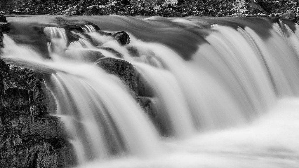
Waterfall on Mill Creek
Waterfall on Mill Creek
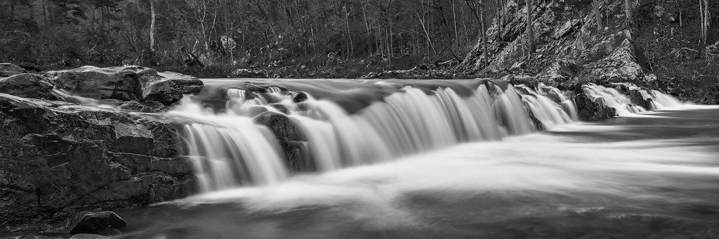
Falls on Mill Creek
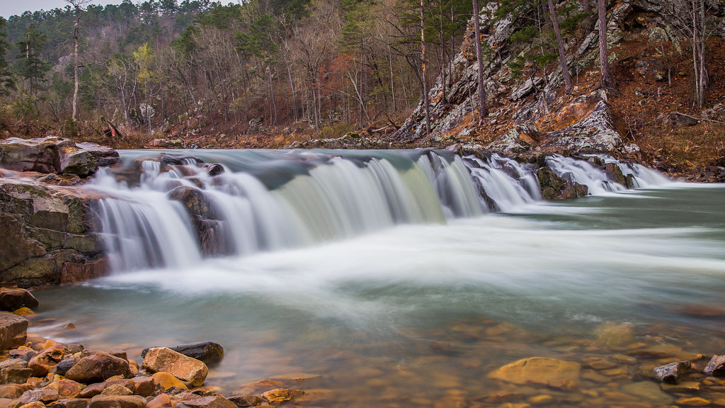
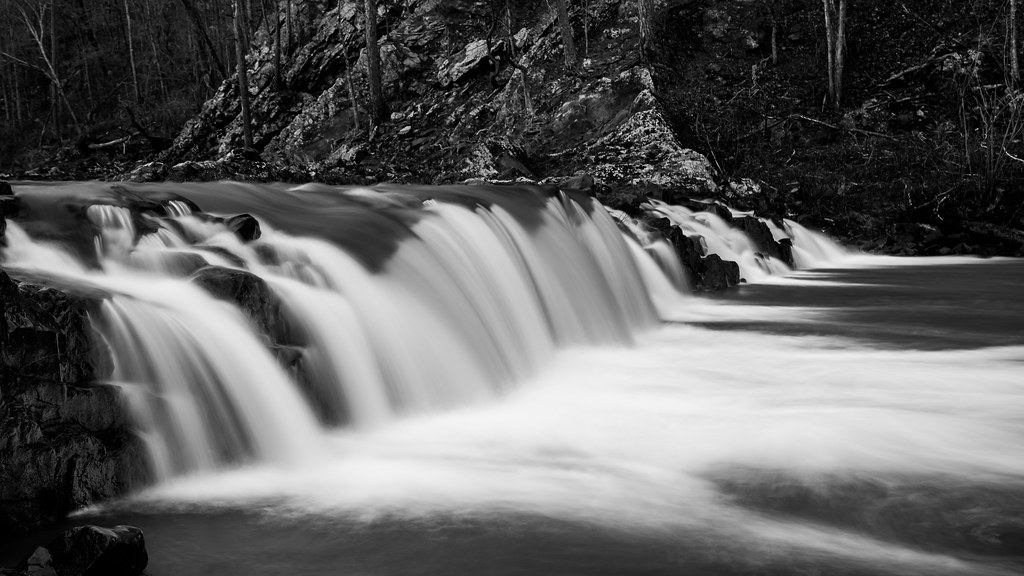
Waterfall on Mill Creek
Waterfall on Mill Creek
The “new” levee

I can hear her heartbeat, for a thousand miles and the heavens open up every time she smiles!!!

June 2: 4:00pm
PANO-1
PANO-2

Pano-3
North Approach-Ouachita River Relief
Bridge End -Ouachita River Relief

South Approach-Ouachita River Relief

APR_0118.jpg

APR_0117.jpg

Fall rainy day
アメリカ合衆国 アーカンソー州 ミル・クリークの地図
別の場所を検索
近所の場所
US-, Boles, AR アメリカ合衆国
アメリカ合衆国 アーカンソー州 マウンテン・タウンシップ
Stone Ln, Mena, AR アメリカ合衆国
アメリカ合衆国 〒 アーカンソー州 ウォシタ・タウンシップ
Polk Rd 73, Mena, AR アメリカ合衆国
Nella Rd, Arkansas, アメリカ合衆国ネラ・ロード
US-71 BUS, Waldron, AR アメリカ合衆国
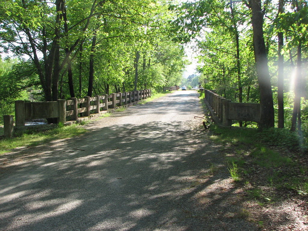
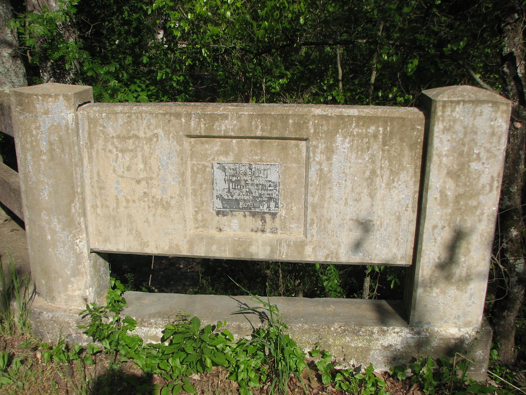
アメリカ合衆国 〒 アーカンソー州 ボールズMill Creek Bridge
US-71, Mena, AR アメリカ合衆国
Primrose Ln, Waldron, AR アメリカ合衆国
アメリカ合衆国 〒 アーカンソー州 ウェルドロン
アメリカ合衆国 〒 アーカンソー州 ヒックマン
Polk Rd 85, Mena, AR アメリカ合衆国
アメリカ合衆国 アーカンソー州 スコット
AR-8, Mena, AR アメリカ合衆国
アメリカ合衆国 〒 アーカンソー州 ウェルドロン
Ransom Rd, Mena, AR アメリカ合衆国
Greenridge Rd, Waldron, AR アメリカ合衆国
AR-8, Mena, AR アメリカ合衆国
アメリカ合衆国 アーカンソー州 ポーク
最近の検索
- アメリカ合衆国 アラスカ州 レッド・ドッグ・マイン日の出日の入り時間
- Am bhf, Borken, ドイツアム・バーンホーフ日の出日の入り時間
- 4th St E, Sonoma, CA, USA日の出日の入り時間
- Oakland Ave, Williamsport, PA アメリカ合衆国日の出日の入り時間
- Via Roma, Pieranica CR, イタリアローマ通り日の出日の入り時間
- クロアチア 〒 ドゥブロブニク GradClock Tower of Dubrovnik日の出日の入り時間
- アルゼンチン チュブ州 トレリュー日の出日の入り時間
- Hartfords Bluff Cir, Mt Pleasant, SC アメリカ合衆国日の出日の入り時間
- 日本、熊本県熊本市北区日の出日の入り時間
- 中華人民共和国 福州市 平潭県 平潭島日の出日の入り時間