Lower Burningtown Rd, Franklin, NC アメリカ合衆国日の出日の入り時間
Location: アメリカ合衆国 > ノース・カロライナ州 > メーコン > アメリカ合衆国 〒 ノース・カロライナ州 フランクリン > >
時間帯:
America/New_York
現地時間:
2025-07-10 20:57:19
経度:
-83.4720028
緯度:
35.2656086
今日の日の出時刻:
06:28:32 AM
今日の日の入時刻:
08:50:30 PM
今日の日長:
14h 21m 58s
明日の日の出時刻:
06:29:09 AM
明日の日の入時刻:
08:50:07 PM
明日の日長:
14h 20m 58s
すべて表示する
| 日付 | 日出 | 日没 | 日長 |
|---|---|---|---|
| 2025年01月01日 | 07:42:40 AM | 05:33:20 PM | 9h 50m 40s |
| 2025年01月02日 | 07:42:48 AM | 05:34:08 PM | 9h 51m 20s |
| 2025年01月03日 | 07:42:53 AM | 05:34:57 PM | 9h 52m 4s |
| 2025年01月04日 | 07:42:57 AM | 05:35:47 PM | 9h 52m 50s |
| 2025年01月05日 | 07:42:59 AM | 05:36:38 PM | 9h 53m 39s |
| 2025年01月06日 | 07:42:59 AM | 05:37:30 PM | 9h 54m 31s |
| 2025年01月07日 | 07:42:57 AM | 05:38:22 PM | 9h 55m 25s |
| 2025年01月08日 | 07:42:53 AM | 05:39:16 PM | 9h 56m 23s |
| 2025年01月09日 | 07:42:47 AM | 05:40:10 PM | 9h 57m 23s |
| 2025年01月10日 | 07:42:39 AM | 05:41:06 PM | 9h 58m 27s |
| 2025年01月11日 | 07:42:29 AM | 05:42:02 PM | 9h 59m 33s |
| 2025年01月12日 | 07:42:18 AM | 05:42:58 PM | 10h 0m 40s |
| 2025年01月13日 | 07:42:04 AM | 05:43:56 PM | 10h 1m 52s |
| 2025年01月14日 | 07:41:49 AM | 05:44:54 PM | 10h 3m 5s |
| 2025年01月15日 | 07:41:31 AM | 05:45:52 PM | 10h 4m 21s |
| 2025年01月16日 | 07:41:12 AM | 05:46:51 PM | 10h 5m 39s |
| 2025年01月17日 | 07:40:51 AM | 05:47:50 PM | 10h 6m 59s |
| 2025年01月18日 | 07:40:28 AM | 05:48:50 PM | 10h 8m 22s |
| 2025年01月19日 | 07:40:03 AM | 05:49:50 PM | 10h 9m 47s |
| 2025年01月20日 | 07:39:36 AM | 05:50:51 PM | 10h 11m 15s |
| 2025年01月21日 | 07:39:08 AM | 05:51:52 PM | 10h 12m 44s |
| 2025年01月22日 | 07:38:38 AM | 05:52:53 PM | 10h 14m 15s |
| 2025年01月23日 | 07:38:06 AM | 05:53:54 PM | 10h 15m 48s |
| 2025年01月24日 | 07:37:32 AM | 05:54:55 PM | 10h 17m 23s |
| 2025年01月25日 | 07:36:56 AM | 05:55:57 PM | 10h 19m 1s |
| 2025年01月26日 | 07:36:19 AM | 05:56:58 PM | 10h 20m 39s |
| 2025年01月27日 | 07:35:40 AM | 05:58:00 PM | 10h 22m 20s |
| 2025年01月28日 | 07:35:00 AM | 05:59:02 PM | 10h 24m 2s |
| 2025年01月29日 | 07:34:18 AM | 06:00:03 PM | 10h 25m 45s |
| 2025年01月30日 | 07:33:34 AM | 06:01:05 PM | 10h 27m 31s |
| 2025年01月31日 | 07:32:48 AM | 06:02:07 PM | 10h 29m 19s |
| 2025年02月01日 | 07:32:02 AM | 06:03:08 PM | 10h 31m 6s |
| 2025年02月02日 | 07:31:13 AM | 06:04:10 PM | 10h 32m 57s |
| 2025年02月03日 | 07:30:23 AM | 06:05:11 PM | 10h 34m 48s |
| 2025年02月04日 | 07:29:32 AM | 06:06:12 PM | 10h 36m 40s |
| 2025年02月05日 | 07:28:39 AM | 06:07:13 PM | 10h 38m 34s |
| 2025年02月06日 | 07:27:45 AM | 06:08:14 PM | 10h 40m 29s |
| 2025年02月07日 | 07:26:49 AM | 06:09:14 PM | 10h 42m 25s |
| 2025年02月08日 | 07:25:52 AM | 06:10:15 PM | 10h 44m 23s |
| 2025年02月09日 | 07:24:54 AM | 06:11:15 PM | 10h 46m 21s |
| 2025年02月10日 | 07:23:55 AM | 06:12:15 PM | 10h 48m 20s |
| 2025年02月11日 | 07:22:54 AM | 06:13:14 PM | 10h 50m 20s |
| 2025年02月12日 | 07:21:52 AM | 06:14:13 PM | 10h 52m 21s |
| 2025年02月13日 | 07:20:49 AM | 06:15:12 PM | 10h 54m 23s |
| 2025年02月14日 | 07:19:44 AM | 06:16:11 PM | 10h 56m 27s |
| 2025年02月15日 | 07:18:39 AM | 06:17:09 PM | 10h 58m 30s |
| 2025年02月16日 | 07:17:32 AM | 06:18:07 PM | 11h 0m 35s |
| 2025年02月17日 | 07:16:25 AM | 06:19:05 PM | 11h 2m 40s |
| 2025年02月18日 | 07:15:16 AM | 06:20:02 PM | 11h 4m 46s |
| 2025年02月19日 | 07:14:07 AM | 06:20:59 PM | 11h 6m 52s |
| 2025年02月20日 | 07:12:56 AM | 06:21:56 PM | 11h 9m 0s |
| 2025年02月21日 | 07:11:45 AM | 06:22:52 PM | 11h 11m 7s |
| 2025年02月22日 | 07:10:32 AM | 06:23:48 PM | 11h 13m 16s |
| 2025年02月23日 | 07:09:19 AM | 06:24:44 PM | 11h 15m 25s |
| 2025年02月24日 | 07:08:05 AM | 06:25:39 PM | 11h 17m 34s |
| 2025年02月25日 | 07:06:50 AM | 06:26:34 PM | 11h 19m 44s |
| 2025年02月26日 | 07:05:34 AM | 06:27:29 PM | 11h 21m 55s |
| 2025年02月27日 | 07:04:18 AM | 06:28:23 PM | 11h 24m 5s |
| 2025年02月28日 | 07:03:01 AM | 06:29:17 PM | 11h 26m 16s |
| 2025年03月01日 | 07:01:43 AM | 06:30:11 PM | 11h 28m 28s |
| 2025年03月02日 | 07:00:24 AM | 06:31:05 PM | 11h 30m 41s |
| 2025年03月03日 | 06:59:05 AM | 06:31:58 PM | 11h 32m 53s |
| 2025年03月04日 | 06:57:46 AM | 06:32:50 PM | 11h 35m 4s |
| 2025年03月05日 | 06:56:26 AM | 06:33:43 PM | 11h 37m 17s |
| 2025年03月06日 | 06:55:05 AM | 06:34:35 PM | 11h 39m 30s |
| 2025年03月07日 | 06:53:44 AM | 06:35:27 PM | 11h 41m 43s |
| 2025年03月08日 | 06:52:22 AM | 06:36:19 PM | 11h 43m 57s |
| 2025年03月09日 | 07:51:03 AM | 07:37:08 PM | 11h 46m 5s |
| 2025年03月10日 | 07:49:41 AM | 07:37:59 PM | 11h 48m 18s |
| 2025年03月11日 | 07:48:18 AM | 07:38:50 PM | 11h 50m 32s |
| 2025年03月12日 | 07:46:55 AM | 07:39:41 PM | 11h 52m 46s |
| 2025年03月13日 | 07:45:31 AM | 07:40:31 PM | 11h 55m 0s |
| 2025年03月14日 | 07:44:07 AM | 07:41:22 PM | 11h 57m 15s |
| 2025年03月15日 | 07:42:43 AM | 07:42:12 PM | 11h 59m 29s |
| 2025年03月16日 | 07:41:19 AM | 07:43:02 PM | 12h 1m 43s |
| 2025年03月17日 | 07:39:55 AM | 07:43:51 PM | 12h 3m 56s |
| 2025年03月18日 | 07:38:30 AM | 07:44:41 PM | 12h 6m 11s |
| 2025年03月19日 | 07:37:05 AM | 07:45:30 PM | 12h 8m 25s |
| 2025年03月20日 | 07:35:40 AM | 07:46:19 PM | 12h 10m 39s |
| 2025年03月21日 | 07:34:15 AM | 07:47:09 PM | 12h 12m 54s |
| 2025年03月22日 | 07:32:50 AM | 07:47:58 PM | 12h 15m 8s |
| 2025年03月23日 | 07:31:25 AM | 07:48:46 PM | 12h 17m 21s |
| 2025年03月24日 | 07:30:00 AM | 07:49:35 PM | 12h 19m 35s |
| 2025年03月25日 | 07:28:36 AM | 07:50:24 PM | 12h 21m 48s |
| 2025年03月26日 | 07:27:11 AM | 07:51:13 PM | 12h 24m 2s |
| 2025年03月27日 | 07:25:46 AM | 07:52:01 PM | 12h 26m 15s |
| 2025年03月28日 | 07:24:21 AM | 07:52:50 PM | 12h 28m 29s |
| 2025年03月29日 | 07:22:57 AM | 07:53:38 PM | 12h 30m 41s |
| 2025年03月30日 | 07:21:33 AM | 07:54:26 PM | 12h 32m 53s |
| 2025年03月31日 | 07:20:09 AM | 07:55:15 PM | 12h 35m 6s |
| 2025年04月01日 | 07:18:45 AM | 07:56:03 PM | 12h 37m 18s |
| 2025年04月02日 | 07:17:21 AM | 07:56:52 PM | 12h 39m 31s |
| 2025年04月03日 | 07:15:58 AM | 07:57:40 PM | 12h 41m 42s |
| 2025年04月04日 | 07:14:35 AM | 07:58:28 PM | 12h 43m 53s |
| 2025年04月05日 | 07:13:13 AM | 07:59:17 PM | 12h 46m 4s |
| 2025年04月06日 | 07:11:51 AM | 08:00:05 PM | 12h 48m 14s |
| 2025年04月07日 | 07:10:29 AM | 08:00:54 PM | 12h 50m 25s |
| 2025年04月08日 | 07:09:08 AM | 08:01:42 PM | 12h 52m 34s |
| 2025年04月09日 | 07:07:47 AM | 08:02:31 PM | 12h 54m 44s |
| 2025年04月10日 | 07:06:27 AM | 08:03:19 PM | 12h 56m 52s |
| 2025年04月11日 | 07:05:07 AM | 08:04:08 PM | 12h 59m 1s |
| 2025年04月12日 | 07:03:48 AM | 08:04:57 PM | 13h 1m 9s |
| 2025年04月13日 | 07:02:29 AM | 08:05:45 PM | 13h 3m 16s |
| 2025年04月14日 | 07:01:12 AM | 08:06:34 PM | 13h 5m 22s |
| 2025年04月15日 | 06:59:54 AM | 08:07:23 PM | 13h 7m 29s |
| 2025年04月16日 | 06:58:38 AM | 08:08:12 PM | 13h 9m 34s |
| 2025年04月17日 | 06:57:22 AM | 08:09:01 PM | 13h 11m 39s |
| 2025年04月18日 | 06:56:07 AM | 08:09:50 PM | 13h 13m 43s |
| 2025年04月19日 | 06:54:52 AM | 08:10:39 PM | 13h 15m 47s |
| 2025年04月20日 | 06:53:39 AM | 08:11:28 PM | 13h 17m 49s |
| 2025年04月21日 | 06:52:26 AM | 08:12:18 PM | 13h 19m 52s |
| 2025年04月22日 | 06:51:14 AM | 08:13:07 PM | 13h 21m 53s |
| 2025年04月23日 | 06:50:03 AM | 08:13:56 PM | 13h 23m 53s |
| 2025年04月24日 | 06:48:53 AM | 08:14:46 PM | 13h 25m 53s |
| 2025年04月25日 | 06:47:44 AM | 08:15:35 PM | 13h 27m 51s |
| 2025年04月26日 | 06:46:36 AM | 08:16:24 PM | 13h 29m 48s |
| 2025年04月27日 | 06:45:29 AM | 08:17:14 PM | 13h 31m 45s |
| 2025年04月28日 | 06:44:23 AM | 08:18:03 PM | 13h 33m 40s |
| 2025年04月29日 | 06:43:18 AM | 08:18:53 PM | 13h 35m 35s |
| 2025年04月30日 | 06:42:14 AM | 08:19:42 PM | 13h 37m 28s |
| 2025年05月01日 | 06:41:11 AM | 08:20:32 PM | 13h 39m 21s |
| 2025年05月02日 | 06:40:09 AM | 08:21:21 PM | 13h 41m 12s |
| 2025年05月03日 | 06:39:09 AM | 08:22:10 PM | 13h 43m 1s |
| 2025年05月04日 | 06:38:09 AM | 08:23:00 PM | 13h 44m 51s |
| 2025年05月05日 | 06:37:11 AM | 08:23:49 PM | 13h 46m 38s |
| 2025年05月06日 | 06:36:14 AM | 08:24:38 PM | 13h 48m 24s |
| 2025年05月07日 | 06:35:19 AM | 08:25:27 PM | 13h 50m 8s |
| 2025年05月08日 | 06:34:24 AM | 08:26:15 PM | 13h 51m 51s |
| 2025年05月09日 | 06:33:31 AM | 08:27:04 PM | 13h 53m 33s |
| 2025年05月10日 | 06:32:39 AM | 08:27:52 PM | 13h 55m 13s |
| 2025年05月11日 | 06:31:49 AM | 08:28:40 PM | 13h 56m 51s |
| 2025年05月12日 | 06:31:00 AM | 08:29:28 PM | 13h 58m 28s |
| 2025年05月13日 | 06:30:12 AM | 08:30:16 PM | 14h 0m 4s |
| 2025年05月14日 | 06:29:26 AM | 08:31:03 PM | 14h 1m 37s |
| 2025年05月15日 | 06:28:42 AM | 08:31:50 PM | 14h 3m 8s |
| 2025年05月16日 | 06:27:58 AM | 08:32:37 PM | 14h 4m 39s |
| 2025年05月17日 | 06:27:17 AM | 08:33:23 PM | 14h 6m 6s |
| 2025年05月18日 | 06:26:36 AM | 08:34:09 PM | 14h 7m 33s |
| 2025年05月19日 | 06:25:58 AM | 08:34:55 PM | 14h 8m 57s |
| 2025年05月20日 | 06:25:21 AM | 08:35:40 PM | 14h 10m 19s |
| 2025年05月21日 | 06:24:45 AM | 08:36:24 PM | 14h 11m 39s |
| 2025年05月22日 | 06:24:11 AM | 08:37:08 PM | 14h 12m 57s |
| 2025年05月23日 | 06:23:39 AM | 08:37:52 PM | 14h 14m 13s |
| 2025年05月24日 | 06:23:08 AM | 08:38:35 PM | 14h 15m 27s |
| 2025年05月25日 | 06:22:38 AM | 08:39:17 PM | 14h 16m 39s |
| 2025年05月26日 | 06:22:11 AM | 08:39:58 PM | 14h 17m 47s |
| 2025年05月27日 | 06:21:45 AM | 08:40:39 PM | 14h 18m 54s |
| 2025年05月28日 | 06:21:21 AM | 08:41:19 PM | 14h 19m 58s |
| 2025年05月29日 | 06:20:58 AM | 08:41:58 PM | 14h 21m 0s |
| 2025年05月30日 | 06:20:37 AM | 08:42:37 PM | 14h 22m 0s |
| 2025年05月31日 | 06:20:17 AM | 08:43:14 PM | 14h 22m 57s |
| 2025年06月01日 | 06:20:00 AM | 08:43:51 PM | 14h 23m 51s |
| 2025年06月02日 | 06:19:44 AM | 08:44:27 PM | 14h 24m 43s |
| 2025年06月03日 | 06:19:29 AM | 08:45:02 PM | 14h 25m 33s |
| 2025年06月04日 | 06:19:17 AM | 08:45:36 PM | 14h 26m 19s |
| 2025年06月05日 | 06:19:06 AM | 08:46:08 PM | 14h 27m 2s |
| 2025年06月06日 | 06:18:56 AM | 08:46:40 PM | 14h 27m 44s |
| 2025年06月07日 | 06:18:49 AM | 08:47:11 PM | 14h 28m 22s |
| 2025年06月08日 | 06:18:43 AM | 08:47:40 PM | 14h 28m 57s |
| 2025年06月09日 | 06:18:38 AM | 08:48:09 PM | 14h 29m 31s |
| 2025年06月10日 | 06:18:35 AM | 08:48:36 PM | 14h 30m 1s |
| 2025年06月11日 | 06:18:34 AM | 08:49:02 PM | 14h 30m 28s |
| 2025年06月12日 | 06:18:35 AM | 08:49:26 PM | 14h 30m 51s |
| 2025年06月13日 | 06:18:37 AM | 08:49:50 PM | 14h 31m 13s |
| 2025年06月14日 | 06:18:40 AM | 08:50:12 PM | 14h 31m 32s |
| 2025年06月15日 | 06:18:46 AM | 08:50:32 PM | 14h 31m 46s |
| 2025年06月16日 | 06:18:52 AM | 08:50:51 PM | 14h 31m 59s |
| 2025年06月17日 | 06:19:01 AM | 08:51:09 PM | 14h 32m 8s |
| 2025年06月18日 | 06:19:10 AM | 08:51:26 PM | 14h 32m 16s |
| 2025年06月19日 | 06:19:22 AM | 08:51:40 PM | 14h 32m 18s |
| 2025年06月20日 | 06:19:35 AM | 08:51:54 PM | 14h 32m 19s |
| 2025年06月21日 | 06:19:49 AM | 08:52:06 PM | 14h 32m 17s |
| 2025年06月22日 | 06:20:04 AM | 08:52:16 PM | 14h 32m 12s |
| 2025年06月23日 | 06:20:21 AM | 08:52:25 PM | 14h 32m 4s |
| 2025年06月24日 | 06:20:40 AM | 08:52:32 PM | 14h 31m 52s |
| 2025年06月25日 | 06:21:00 AM | 08:52:37 PM | 14h 31m 37s |
| 2025年06月26日 | 06:21:21 AM | 08:52:41 PM | 14h 31m 20s |
| 2025年06月27日 | 06:21:43 AM | 08:52:44 PM | 14h 31m 1s |
| 2025年06月28日 | 06:22:06 AM | 08:52:44 PM | 14h 30m 38s |
| 2025年06月29日 | 06:22:31 AM | 08:52:43 PM | 14h 30m 12s |
| 2025年06月30日 | 06:22:57 AM | 08:52:41 PM | 14h 29m 44s |
| 2025年07月01日 | 06:23:24 AM | 08:52:36 PM | 14h 29m 12s |
| 2025年07月02日 | 06:23:53 AM | 08:52:30 PM | 14h 28m 37s |
| 2025年07月03日 | 06:24:22 AM | 08:52:22 PM | 14h 28m 0s |
| 2025年07月04日 | 06:24:52 AM | 08:52:13 PM | 14h 27m 21s |
| 2025年07月05日 | 06:25:23 AM | 08:52:02 PM | 14h 26m 39s |
| 2025年07月06日 | 06:25:56 AM | 08:51:49 PM | 14h 25m 53s |
| 2025年07月07日 | 06:26:29 AM | 08:51:34 PM | 14h 25m 5s |
| 2025年07月08日 | 06:27:03 AM | 08:51:18 PM | 14h 24m 15s |
| 2025年07月09日 | 06:27:38 AM | 08:51:00 PM | 14h 23m 22s |
| 2025年07月10日 | 06:28:14 AM | 08:50:40 PM | 14h 22m 26s |
| 2025年07月11日 | 06:28:51 AM | 08:50:19 PM | 14h 21m 28s |
| 2025年07月12日 | 06:29:28 AM | 08:49:56 PM | 14h 20m 28s |
| 2025年07月13日 | 06:30:06 AM | 08:49:31 PM | 14h 19m 25s |
| 2025年07月14日 | 06:30:45 AM | 08:49:04 PM | 14h 18m 19s |
| 2025年07月15日 | 06:31:24 AM | 08:48:36 PM | 14h 17m 12s |
| 2025年07月16日 | 06:32:04 AM | 08:48:06 PM | 14h 16m 2s |
| 2025年07月17日 | 06:32:45 AM | 08:47:35 PM | 14h 14m 50s |
| 2025年07月18日 | 06:33:26 AM | 08:47:02 PM | 14h 13m 36s |
| 2025年07月19日 | 06:34:08 AM | 08:46:27 PM | 14h 12m 19s |
| 2025年07月20日 | 06:34:50 AM | 08:45:51 PM | 14h 11m 1s |
| 2025年07月21日 | 06:35:33 AM | 08:45:13 PM | 14h 9m 40s |
| 2025年07月22日 | 06:36:16 AM | 08:44:34 PM | 14h 8m 18s |
| 2025年07月23日 | 06:36:59 AM | 08:43:53 PM | 14h 6m 54s |
| 2025年07月24日 | 06:37:43 AM | 08:43:10 PM | 14h 5m 27s |
| 2025年07月25日 | 06:38:27 AM | 08:42:26 PM | 14h 3m 59s |
| 2025年07月26日 | 06:39:11 AM | 08:41:41 PM | 14h 2m 30s |
| 2025年07月27日 | 06:39:56 AM | 08:40:54 PM | 14h 0m 58s |
| 2025年07月28日 | 06:40:41 AM | 08:40:05 PM | 13h 59m 24s |
| 2025年07月29日 | 06:41:26 AM | 08:39:15 PM | 13h 57m 49s |
| 2025年07月30日 | 06:42:11 AM | 08:38:24 PM | 13h 56m 13s |
| 2025年07月31日 | 06:42:57 AM | 08:37:31 PM | 13h 54m 34s |
| 2025年08月01日 | 06:43:42 AM | 08:36:37 PM | 13h 52m 55s |
| 2025年08月02日 | 06:44:28 AM | 08:35:42 PM | 13h 51m 14s |
| 2025年08月03日 | 06:45:14 AM | 08:34:45 PM | 13h 49m 31s |
| 2025年08月04日 | 06:46:00 AM | 08:33:47 PM | 13h 47m 47s |
| 2025年08月05日 | 06:46:46 AM | 08:32:48 PM | 13h 46m 2s |
| 2025年08月06日 | 06:47:32 AM | 08:31:47 PM | 13h 44m 15s |
| 2025年08月07日 | 06:48:18 AM | 08:30:45 PM | 13h 42m 27s |
| 2025年08月08日 | 06:49:04 AM | 08:29:42 PM | 13h 40m 38s |
| 2025年08月09日 | 06:49:50 AM | 08:28:38 PM | 13h 38m 48s |
| 2025年08月10日 | 06:50:36 AM | 08:27:33 PM | 13h 36m 57s |
| 2025年08月11日 | 06:51:22 AM | 08:26:27 PM | 13h 35m 5s |
| 2025年08月12日 | 06:52:08 AM | 08:25:20 PM | 13h 33m 12s |
| 2025年08月13日 | 06:52:54 AM | 08:24:11 PM | 13h 31m 17s |
| 2025年08月14日 | 06:53:40 AM | 08:23:02 PM | 13h 29m 22s |
| 2025年08月15日 | 06:54:26 AM | 08:21:51 PM | 13h 27m 25s |
| 2025年08月16日 | 06:55:12 AM | 08:20:40 PM | 13h 25m 28s |
| 2025年08月17日 | 06:55:58 AM | 08:19:27 PM | 13h 23m 29s |
| 2025年08月18日 | 06:56:43 AM | 08:18:14 PM | 13h 21m 31s |
| 2025年08月19日 | 06:57:29 AM | 08:17:00 PM | 13h 19m 31s |
| 2025年08月20日 | 06:58:14 AM | 08:15:45 PM | 13h 17m 31s |
| 2025年08月21日 | 06:59:00 AM | 08:14:29 PM | 13h 15m 29s |
| 2025年08月22日 | 06:59:45 AM | 08:13:13 PM | 13h 13m 28s |
| 2025年08月23日 | 07:00:30 AM | 08:11:55 PM | 13h 11m 25s |
| 2025年08月24日 | 07:01:15 AM | 08:10:37 PM | 13h 9m 22s |
| 2025年08月25日 | 07:02:00 AM | 08:09:18 PM | 13h 7m 18s |
| 2025年08月26日 | 07:02:45 AM | 08:07:59 PM | 13h 5m 14s |
| 2025年08月27日 | 07:03:30 AM | 08:06:39 PM | 13h 3m 9s |
| 2025年08月28日 | 07:04:15 AM | 08:05:18 PM | 13h 1m 3s |
| 2025年08月29日 | 07:05:00 AM | 08:03:57 PM | 12h 58m 57s |
| 2025年08月30日 | 07:05:44 AM | 08:02:35 PM | 12h 56m 51s |
| 2025年08月31日 | 07:06:29 AM | 08:01:12 PM | 12h 54m 43s |
| 2025年09月01日 | 07:07:13 AM | 07:59:49 PM | 12h 52m 36s |
| 2025年09月02日 | 07:07:57 AM | 07:58:26 PM | 12h 50m 29s |
| 2025年09月03日 | 07:08:42 AM | 07:57:02 PM | 12h 48m 20s |
| 2025年09月04日 | 07:09:26 AM | 07:55:37 PM | 12h 46m 11s |
| 2025年09月05日 | 07:10:10 AM | 07:54:13 PM | 12h 44m 3s |
| 2025年09月06日 | 07:10:54 AM | 07:52:47 PM | 12h 41m 53s |
| 2025年09月07日 | 07:11:38 AM | 07:51:22 PM | 12h 39m 44s |
| 2025年09月08日 | 07:12:22 AM | 07:49:56 PM | 12h 37m 34s |
| 2025年09月09日 | 07:13:07 AM | 07:48:30 PM | 12h 35m 23s |
| 2025年09月10日 | 07:13:51 AM | 07:47:04 PM | 12h 33m 13s |
| 2025年09月11日 | 07:14:35 AM | 07:45:37 PM | 12h 31m 2s |
| 2025年09月12日 | 07:15:19 AM | 07:44:11 PM | 12h 28m 52s |
| 2025年09月13日 | 07:16:03 AM | 07:42:44 PM | 12h 26m 41s |
| 2025年09月14日 | 07:16:47 AM | 07:41:17 PM | 12h 24m 30s |
| 2025年09月15日 | 07:17:32 AM | 07:39:50 PM | 12h 22m 18s |
| 2025年09月16日 | 07:18:16 AM | 07:38:22 PM | 12h 20m 6s |
| 2025年09月17日 | 07:19:00 AM | 07:36:55 PM | 12h 17m 55s |
| 2025年09月18日 | 07:19:45 AM | 07:35:28 PM | 12h 15m 43s |
| 2025年09月19日 | 07:20:29 AM | 07:34:00 PM | 12h 13m 31s |
| 2025年09月20日 | 07:21:14 AM | 07:32:33 PM | 12h 11m 19s |
| 2025年09月21日 | 07:21:59 AM | 07:31:06 PM | 12h 9m 7s |
| 2025年09月22日 | 07:22:44 AM | 07:29:39 PM | 12h 6m 55s |
| 2025年09月23日 | 07:23:29 AM | 07:28:12 PM | 12h 4m 43s |
| 2025年09月24日 | 07:24:14 AM | 07:26:45 PM | 12h 2m 31s |
| 2025年09月25日 | 07:25:00 AM | 07:25:18 PM | 12h 0m 18s |
| 2025年09月26日 | 07:25:45 AM | 07:23:52 PM | 11h 58m 7s |
| 2025年09月27日 | 07:26:31 AM | 07:22:26 PM | 11h 55m 55s |
| 2025年09月28日 | 07:27:17 AM | 07:21:00 PM | 11h 53m 43s |
| 2025年09月29日 | 07:28:03 AM | 07:19:34 PM | 11h 51m 31s |
| 2025年09月30日 | 07:28:50 AM | 07:18:09 PM | 11h 49m 19s |
| 2025年10月01日 | 07:29:36 AM | 07:16:44 PM | 11h 47m 8s |
| 2025年10月02日 | 07:30:23 AM | 07:15:19 PM | 11h 44m 56s |
| 2025年10月03日 | 07:31:11 AM | 07:13:55 PM | 11h 42m 44s |
| 2025年10月04日 | 07:31:58 AM | 07:12:31 PM | 11h 40m 33s |
| 2025年10月05日 | 07:32:46 AM | 07:11:08 PM | 11h 38m 22s |
| 2025年10月06日 | 07:33:34 AM | 07:09:45 PM | 11h 36m 11s |
| 2025年10月07日 | 07:34:22 AM | 07:08:23 PM | 11h 34m 1s |
| 2025年10月08日 | 07:35:11 AM | 07:07:01 PM | 11h 31m 50s |
| 2025年10月09日 | 07:36:00 AM | 07:05:40 PM | 11h 29m 40s |
| 2025年10月10日 | 07:36:49 AM | 07:04:19 PM | 11h 27m 30s |
| 2025年10月11日 | 07:37:39 AM | 07:03:00 PM | 11h 25m 21s |
| 2025年10月12日 | 07:38:29 AM | 07:01:41 PM | 11h 23m 12s |
| 2025年10月13日 | 07:39:19 AM | 07:00:22 PM | 11h 21m 3s |
| 2025年10月14日 | 07:40:10 AM | 06:59:04 PM | 11h 18m 54s |
| 2025年10月15日 | 07:41:01 AM | 06:57:48 PM | 11h 16m 47s |
| 2025年10月16日 | 07:41:52 AM | 06:56:32 PM | 11h 14m 40s |
| 2025年10月17日 | 07:42:44 AM | 06:55:16 PM | 11h 12m 32s |
| 2025年10月18日 | 07:43:36 AM | 06:54:02 PM | 11h 10m 26s |
| 2025年10月19日 | 07:44:29 AM | 06:52:48 PM | 11h 8m 19s |
| 2025年10月20日 | 07:45:21 AM | 06:51:36 PM | 11h 6m 15s |
| 2025年10月21日 | 07:46:15 AM | 06:50:24 PM | 11h 4m 9s |
| 2025年10月22日 | 07:47:08 AM | 06:49:14 PM | 11h 2m 6s |
| 2025年10月23日 | 07:48:02 AM | 06:48:04 PM | 11h 0m 2s |
| 2025年10月24日 | 07:48:56 AM | 06:46:56 PM | 10h 58m 0s |
| 2025年10月25日 | 07:49:51 AM | 06:45:49 PM | 10h 55m 58s |
| 2025年10月26日 | 07:50:46 AM | 06:44:42 PM | 10h 53m 56s |
| 2025年10月27日 | 07:51:41 AM | 06:43:37 PM | 10h 51m 56s |
| 2025年10月28日 | 07:52:37 AM | 06:42:33 PM | 10h 49m 56s |
| 2025年10月29日 | 07:53:33 AM | 06:41:31 PM | 10h 47m 58s |
| 2025年10月30日 | 07:54:29 AM | 06:40:29 PM | 10h 46m 0s |
| 2025年10月31日 | 07:55:26 AM | 06:39:29 PM | 10h 44m 3s |
| 2025年11月01日 | 07:56:23 AM | 06:38:30 PM | 10h 42m 7s |
| 2025年11月02日 | 06:57:22 AM | 05:37:30 PM | 10h 40m 8s |
| 2025年11月03日 | 06:58:20 AM | 05:36:34 PM | 10h 38m 14s |
| 2025年11月04日 | 06:59:17 AM | 05:35:40 PM | 10h 36m 23s |
| 2025年11月05日 | 07:00:15 AM | 05:34:47 PM | 10h 34m 32s |
| 2025年11月06日 | 07:01:13 AM | 05:33:55 PM | 10h 32m 42s |
| 2025年11月07日 | 07:02:11 AM | 05:33:05 PM | 10h 30m 54s |
| 2025年11月08日 | 07:03:10 AM | 05:32:16 PM | 10h 29m 6s |
| 2025年11月09日 | 07:04:08 AM | 05:31:29 PM | 10h 27m 21s |
| 2025年11月10日 | 07:05:07 AM | 05:30:43 PM | 10h 25m 36s |
| 2025年11月11日 | 07:06:06 AM | 05:29:59 PM | 10h 23m 53s |
| 2025年11月12日 | 07:07:05 AM | 05:29:17 PM | 10h 22m 12s |
| 2025年11月13日 | 07:08:04 AM | 05:28:36 PM | 10h 20m 32s |
| 2025年11月14日 | 07:09:02 AM | 05:27:57 PM | 10h 18m 55s |
| 2025年11月15日 | 07:10:01 AM | 05:27:20 PM | 10h 17m 19s |
| 2025年11月16日 | 07:11:00 AM | 05:26:45 PM | 10h 15m 45s |
| 2025年11月17日 | 07:11:59 AM | 05:26:11 PM | 10h 14m 12s |
| 2025年11月18日 | 07:12:57 AM | 05:25:39 PM | 10h 12m 42s |
| 2025年11月19日 | 07:13:56 AM | 05:25:09 PM | 10h 11m 13s |
| 2025年11月20日 | 07:14:54 AM | 05:24:41 PM | 10h 9m 47s |
| 2025年11月21日 | 07:15:52 AM | 05:24:14 PM | 10h 8m 22s |
| 2025年11月22日 | 07:16:49 AM | 05:23:50 PM | 10h 7m 1s |
| 2025年11月23日 | 07:17:47 AM | 05:23:27 PM | 10h 5m 40s |
| 2025年11月24日 | 07:18:43 AM | 05:23:06 PM | 10h 4m 23s |
| 2025年11月25日 | 07:19:40 AM | 05:22:47 PM | 10h 3m 7s |
| 2025年11月26日 | 07:20:36 AM | 05:22:30 PM | 10h 1m 54s |
| 2025年11月27日 | 07:21:31 AM | 05:22:15 PM | 10h 0m 44s |
| 2025年11月28日 | 07:22:26 AM | 05:22:02 PM | 9h 59m 36s |
| 2025年11月29日 | 07:23:21 AM | 05:21:51 PM | 9h 58m 30s |
| 2025年11月30日 | 07:24:15 AM | 05:21:42 PM | 9h 57m 27s |
| 2025年12月01日 | 07:25:08 AM | 05:21:35 PM | 9h 56m 27s |
| 2025年12月02日 | 07:26:00 AM | 05:21:29 PM | 9h 55m 29s |
| 2025年12月03日 | 07:26:51 AM | 05:21:26 PM | 9h 54m 35s |
| 2025年12月04日 | 07:27:42 AM | 05:21:25 PM | 9h 53m 43s |
| 2025年12月05日 | 07:28:32 AM | 05:21:25 PM | 9h 52m 53s |
| 2025年12月06日 | 07:29:21 AM | 05:21:28 PM | 9h 52m 7s |
| 2025年12月07日 | 07:30:08 AM | 05:21:33 PM | 9h 51m 25s |
| 2025年12月08日 | 07:30:55 AM | 05:21:39 PM | 9h 50m 44s |
| 2025年12月09日 | 07:31:41 AM | 05:21:48 PM | 9h 50m 7s |
| 2025年12月10日 | 07:32:26 AM | 05:21:58 PM | 9h 49m 32s |
| 2025年12月11日 | 07:33:09 AM | 05:22:11 PM | 9h 49m 2s |
| 2025年12月12日 | 07:33:51 AM | 05:22:25 PM | 9h 48m 34s |
| 2025年12月13日 | 07:34:32 AM | 05:22:41 PM | 9h 48m 9s |
| 2025年12月14日 | 07:35:12 AM | 05:22:59 PM | 9h 47m 47s |
| 2025年12月15日 | 07:35:50 AM | 05:23:19 PM | 9h 47m 29s |
| 2025年12月16日 | 07:36:27 AM | 05:23:40 PM | 9h 47m 13s |
| 2025年12月17日 | 07:37:02 AM | 05:24:04 PM | 9h 47m 2s |
| 2025年12月18日 | 07:37:36 AM | 05:24:29 PM | 9h 46m 53s |
| 2025年12月19日 | 07:38:09 AM | 05:24:56 PM | 9h 46m 47s |
| 2025年12月20日 | 07:38:40 AM | 05:25:25 PM | 9h 46m 45s |
| 2025年12月21日 | 07:39:09 AM | 05:25:55 PM | 9h 46m 46s |
| 2025年12月22日 | 07:39:37 AM | 05:26:27 PM | 9h 46m 50s |
| 2025年12月23日 | 07:40:03 AM | 05:27:01 PM | 9h 46m 58s |
| 2025年12月24日 | 07:40:27 AM | 05:27:36 PM | 9h 47m 9s |
| 2025年12月25日 | 07:40:50 AM | 05:28:13 PM | 9h 47m 23s |
| 2025年12月26日 | 07:41:11 AM | 05:28:51 PM | 9h 47m 40s |
| 2025年12月27日 | 07:41:30 AM | 05:29:30 PM | 9h 48m 0s |
| 2025年12月28日 | 07:41:47 AM | 05:30:12 PM | 9h 48m 25s |
| 2025年12月29日 | 07:42:02 AM | 05:30:54 PM | 9h 48m 52s |
| 2025年12月30日 | 07:42:16 AM | 05:31:38 PM | 9h 49m 22s |
| 2025年12月31日 | 07:42:28 AM | 05:32:23 PM | 9h 49m 55s |
写真

Smoky Mountains

West View from Wesser Bald Observation Tower

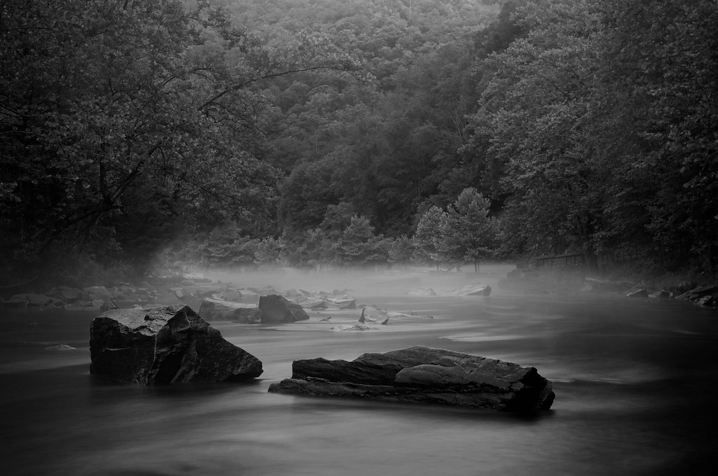
The mists of Nantahala Gorge
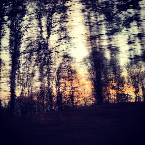
Sunset thru the trees

Misty mountain sunset

Our sunset view from the Parsons' cabin in #brysoncity #northcarolina #ttot #nofilter
Topiary garden

Hope versus Despair

Up At SunSet

The Golden Hour

Sun Dogs

Double Cheeseburger & Onion Rings

BLT & Onion Rings

Fruit Salad Plate

Sunset Restaurant

Finally, Rest From Hiking

Sun’s pyre across the Nantahala Mountains.

Sunset Pano Topaz

Strawberry Pie

Clouds On Fire - Great Smoky Mountains
Just Past the Falls

last snow
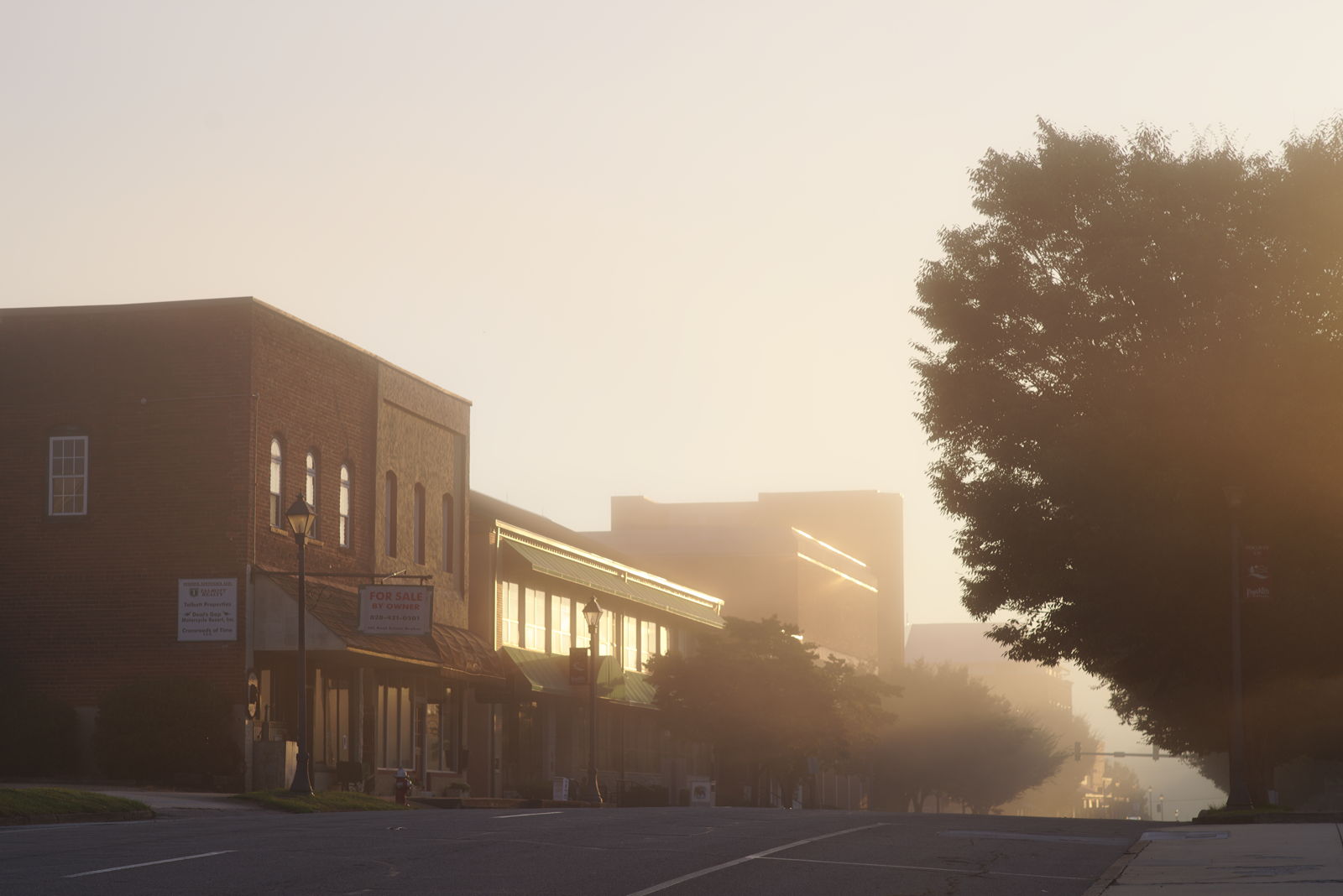
Morning on Main Street

#sunrise #greatsmokeymountains #northcarolina #roadtrip

Sunrise on the Appalachian Trail
Lower Burningtown Rd, Franklin, NC アメリカ合衆国の地図
別の場所を検索
近所の場所
Lower Burningtown Rd, Franklin, NC アメリカ合衆国
Welch Rd, Franklin, NC アメリカ合衆国
Ridgetop Rd, Franklin, NC アメリカ合衆国
Welch Rd, Franklin, NC アメリカ合衆国
Kelly Cove Rd, Franklin, NC アメリカ合衆国ケリー・コーブ・ロード
Ridgetop Rd, Franklin, NC アメリカ合衆国
Ridgetop Rd, Franklin, NC アメリカ合衆国
Carnes Rd, Franklin, NC アメリカ合衆国
44 Clint Cole Rd, Franklin, NC アメリカ合衆国
Queen Branch Rd, Franklin, NC アメリカ合衆国
Bonfire Dr, Franklin, NC アメリカ合衆国ボンファイヤー・ドライブ
Penny Ln, Franklin, NC アメリカ合衆国
Mountain Whispers Dr, Franklin, NC アメリカ合衆国
16 McGaha Rd, Franklin, NC アメリカ合衆国
Rodeo Rd, Franklin, NC アメリカ合衆国
Mystic Mountain Ridge, Franklin, NC アメリカ合衆国
Hidden Acres Trail, Franklin, NC アメリカ合衆国ヒドゥン・エイカーズ・トレイル
Woodpecker Ln, Franklin, NC アメリカ合衆国
Queen Branch Rd, Franklin, NC アメリカ合衆国
Austin Welch Rd, Franklin, NC アメリカ合衆国オースティン・ウェルチ・ロード
最近の検索
- アメリカ合衆国 アラスカ州 レッド・ドッグ・マイン日の出日の入り時間
- Am bhf, Borken, ドイツアム・バーンホーフ日の出日の入り時間
- 4th St E, Sonoma, CA, USA日の出日の入り時間
- Oakland Ave, Williamsport, PA アメリカ合衆国日の出日の入り時間
- Via Roma, Pieranica CR, イタリアローマ通り日の出日の入り時間
- クロアチア 〒 ドゥブロブニク GradClock Tower of Dubrovnik日の出日の入り時間
- アルゼンチン チュブ州 トレリュー日の出日の入り時間
- Hartfords Bluff Cir, Mt Pleasant, SC アメリカ合衆国日の出日の入り時間
- 日本、熊本県熊本市北区日の出日の入り時間
- 中華人民共和国 福州市 平潭県 平潭島日の出日の入り時間